Progress in Marine Ecosystem Classification, Mapping and Targets: Testing the Boundaries
|
|
|
- Christal Bond
- 5 years ago
- Views:
Transcription


1 Progress in Marine Ecosystem Classification, Mapping and Targets: Testing the Boundaries Kerry Sink 1, Natasha Karenyi 1,2 and Tamsyn Livingstone 3 1 South African National Biodiversity Institute 2 University of Cape Town 3 Ezemvelo KZN Wildlife
2
")
3 16 Pelagic habitats Pelagic habitat maps Mean & variability in ocean variables (productivity, nutrients, SST, depth, fronts & eddies) Lagabrielle 2009
4 Unconsolidated Mixed Consolidated Deep


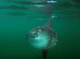
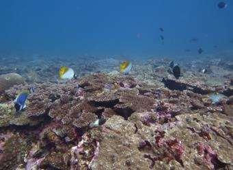
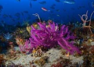
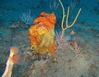
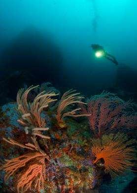
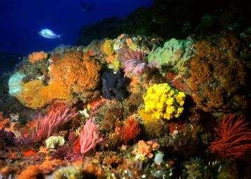
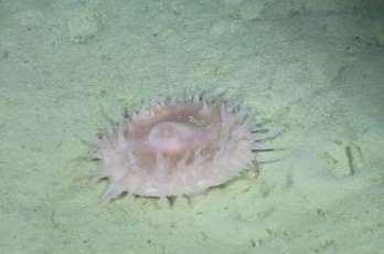
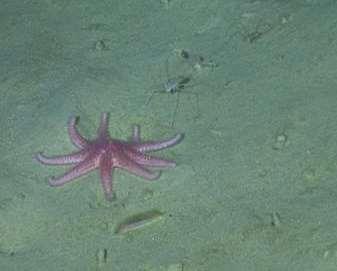
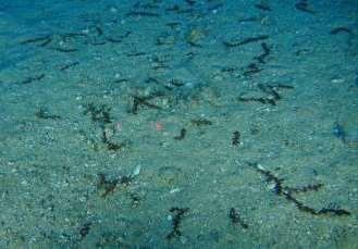
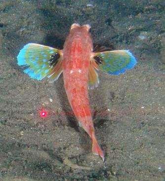
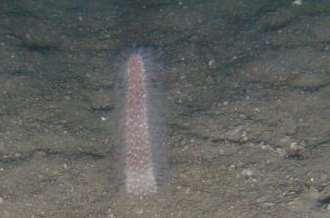
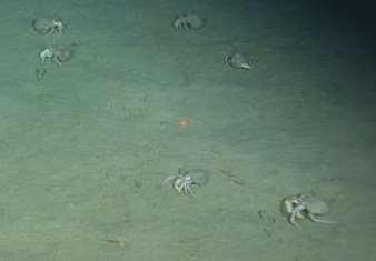
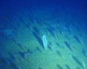
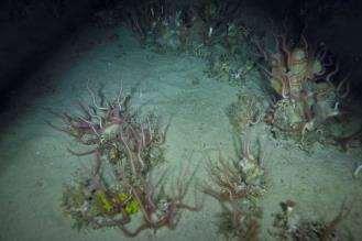
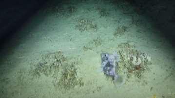
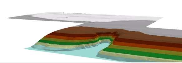
5 Black Rock, isimangaliso Wetland Park Protea Seamount, South east Atlantic Protea Banks KZN Pondoland shelf edge Leven Canyon, KZN


6 KZN & Eastern Cape South Coast & False Bay Atlantic
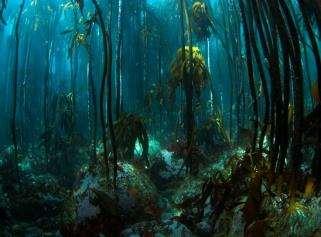
7 BIOREGIONS (inshore) BIOREGIONS (offshore) Namaqua South-western Cape Agulhas Natal Delagoa Atlantic Indo-Pacific South-west Indian West Indian Prince Edward Islands TIDAL ZONES Supratidal Tidal Subtidal TOPOGRAPHIC ZONES Riverine Terrestrial/ Marine interface Estuarine Marine Shelf Slope Abyss DEPTH STRATA SUBSTRATUM TYPES ECOSYSTEMS Plains 1. Back beach 2. Beach 3. Subtidal plain 4. Sediment slope 5. Abyssal plain Coastal fringe (has zones) Unconsolidated Intertidal (has zones) Mixed Shallow photic Deep photic Sub photic Upper slope Consolidated Lower slope Abyss Peaks 1. Dune 2. n/a 3. Subtidal dune 4. Submerged delta 5. Abyssal delta Plains 1. Mixed back beach 2. Mixed shore 3. Scattered reef 4. Mixed slope 5. Mixed abyssal plain Plains 1. Rocky coast 2. Rocky shore 3. Rocky ledge 4. Rocky slope 5. Abyssal rock Peaks 1. Coastal cliff 2. Intertidal cliff 3. Reef 4. Slope reef 5. Seamount Valleys 1. River 2. Estuary 3. n/a 4. Canyon 5. Trench HABITATS (examples) DEPTH STRATUM: Intertidal (2) SUBSTRATUM TYPE: Consolidated DEPTH STRATUM: Deep photic (3) SUBSTRATUM TYPE: Consolidated DEPTH STRATUM: Sub photic (3) SUBSTRATUM TYPE: Unconsolidated ECOSYTEM: Plains - Rocky shore ECOSYTEM: Peaks Reef ECOSYTEM: Peaks Subtidal dune HABITATS: sheltered, semi-exposed, exposed, very exposed HABITATS: kelp reef, coral reef HABITAT: East Coast dunes BIOTOPES (examples) e.g. zooanthid/barnacle community e.g. sponge/hard coral community SPECIES (examples) Seaweeds Invertebrates Fish Birds Marine mammals
8 COASTAL OFFSHORE Coast type 500m Coastline -5m Inshore Shelf inland inner outer -30m Shelf break or 350 m Separate pelagic classification Lagabrielle et al Offshore benthic Shelf edge Upper bathyal Deepsea Lower bathyal Abyss terrestrial connectivity broad-scale topography substrate & geology depth wave exposure (coastal) biogeography 14 broad ecosystem types -500m -1300m -3500m 120 benthic ecosystem types

 Offshore benthic 23")

9 Coastal & offshore habitats Coastal 37 coast types, 17 inshore, 3 islands,1 lagoon (58) Offshore benthic 23 rocky, 39 unconsolidated shelf, shelf edge & deepsea (62)
 o 2015 Harris, Livingstone (EKZNW)- testing national versus provincial maps 2014/5 Atkinson (SAEON) Benthic trawl experiment 2014 SeaKeys citizen science work")
10 Progress since Linda Harris Phd 2013 (NNMU) coastal mapping 2014 Karenyi (UCT/SANBI) unconsolidated sediments African Coelacanth Ecosystem Program Projects & theses o 2015 Heyns (SAEON)- Tsitsikamma (shallow versus deep reefs) o 2015 Harris, Livingstone (EKZNW)- testing national versus provincial maps 2014/5 Atkinson (SAEON) Benthic trawl experiment 2014 SeaKeys citizen science work 2015 DAFF /De Wett New bathy data 2015 Sink (SANBI) Childs bank Survey 2015 New information from Phakisa (cold water corals, seamounts, bathymetry) 2015 Sink- Natal canyon survey Sponge beds, m, isimangaliso

11 Linda Harris 2013
12 Linda Harris 2013
13 Depth HWM LWM m Seascapes Seascape 1 (Beach and Inshore North) Seascape 2 (Beach and Inshore South + 1 shallow sandy inner shelf Port Nolloth ) Seascape 4 (Sandy Shelf South) Seascape 7 (Muddy Shelf Middle) Seascape 5 (Sandy Outer Shelf) Seascape 8 (Org-enrich Outer Shelf) Seascape 3 (Beach and Inshore Central ) Seascape 6 (Muddy Shelf North) MECC habitats SB Diss. beach SB Diss-Int beach SB Int. beach Namaqua Inshore SWC Inshore Namaqua Muddy Inner Shelf Namaqua Sandy Inner Shelf SWC Sandy Inner Shelf Outer Shelf SB Sandy Shelf Edge SB Muddy Shelf Edge Biotopes Sandy Beach Sandy Inner Shelf Muddy River-influenced Middle Shelf Sand Outer Shelf Mud Organicallyenriched Middle Shelf Shelf Edge Sandy Middle Shelf Karenyi et al. in review

14 Surrogate comparison: unconsolidated sediment Physical Expert-derived Biological and physical % % 98 %

15 Species-area curve targets 100% of species 75% data from benthic macrofauna survey target 2-15% 100% of area By comparison veg type targets range from 16% to 36% of the original extent of each veg type

 0.9, (0.6-1.9) 7.7, (5.7-10.")
 Sandy and Muddy Shelf Edge 12.4, (10.0-14.")
16 Species-Area Relationship based habitat-specific targets Habitat Target % Southern Benguela Sandy Coast Muddy River- Influenced Middle Shelf Muddy Organicallyenriched Middle Shelf 7.8, ( ) 0.9, ( ) 7.7, ( ) Sandy Middle Shelf 7.9, ( ) Sandy Outer Shelf 8.5, ( ) Sandy and Muddy Shelf Edge 12.4, ( )
17
18
19
20
21

22 Mapula Makwela and Makalobe Mabotja ACEP MSc students Work underway ACEP students Karenyi post doc rocky shores & DEA rocky shore surveys New ACEP projects (Phakisa link) Sink- Deep Secrets- cold water corals, potential seeps and Agulhas shelf edge/ slope Barlow sister project in adjacent area Kerwath Agulhas canyons, deep reefs, muds and fluvial fans Green uthukela banks, KZN priority areas
23
24 Broad ecosystem group Offshore pelagic Seamount Deepsea sediment Rocky shelf edge Unconsolidated shelf edge Rocky shelf Unconsolidated shelf Sandy inshore Rocky inshore Lagoon Island Mixed shore Rocky coast Sandy coast CR En Vu LT Number of habitat types per threat catego
25 This presentation summarises the approach taken in the mapping and classification of marine ecosystems in South Africa and the first work in setting quantitative biodiversity targets for unconsolidated marine ecosystem types. The inaccessible, three dimensional, dynamic ocean environment poses many challenges which have been addressed through a range of approaches including biophysical seascape and biotope classifications, research to understand marine biodiversity surrogates, citizen science to map reefs and the use of species area curves to develop the first local biodiversity targets. The data-informed, expert-derived classification and map used in 2011 was reasonably well supported since fish, macrofauna and eipfauna data showed support for the divisions involved and yielded better results that a purely physical data based approach. Progress since 2012 is reviewed and proposed methods, data sources and research opportunities to advance this work are identified. These include new approaches in habitat mapping, testing surrogacy through collaborative research cruises, co-operative work with offshore industries, and inclusion of data from the fisheries and petroleum government agencies. Priority habitat types for further work are discussed.
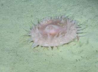
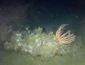
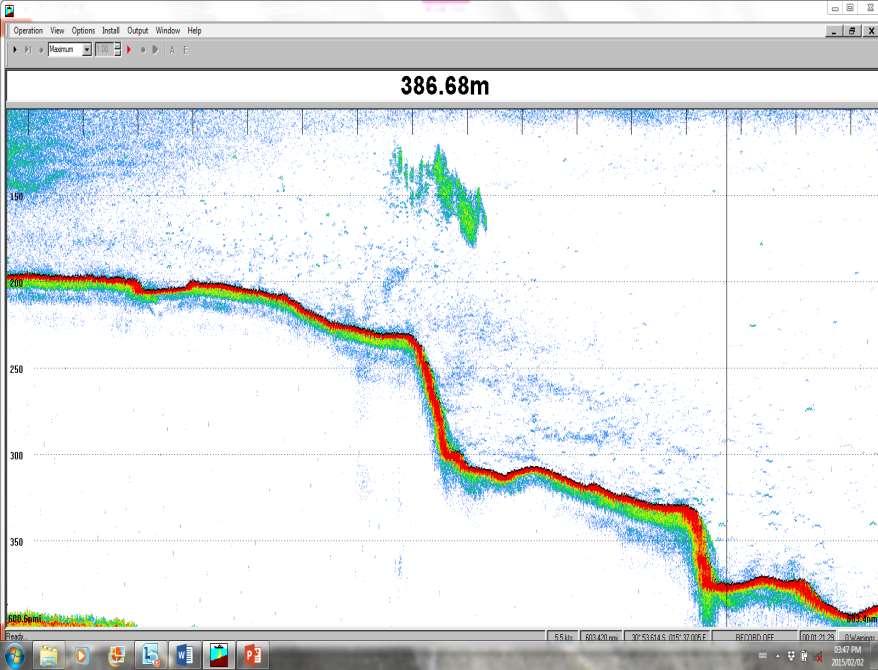
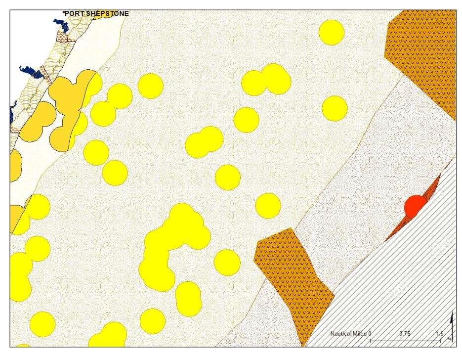
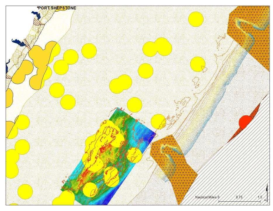
1. Orange Shelf Edge. Along Namibian border 1960 km m 1500 m. Anemone, Anthosactis capensis 480m, west coast
 1 1. Orange Shelf Edge Along Namibian border 1960 km 2 250 m 1500 m Only un-trawled sandy shelf edge in Benguela ecoregion Threatened seabed habitats in good condition Sensitive ecosystems (hard grounds)
Marine Environments. Copyright 2011 LessonSnips
 Marine Environments I must go down to the seas again, for the call of the running tide Is a wild call and a clear call that may not be denied Excerpt from a poem by John Masefield Continents and islands
Questions # 4 7 refer to Figure # 2 (page 321, Fig )
") Shoreline Community College OCEANOGRAPHY 101 Fall 2006 Sample Exam # 3 Instructor: Linda Khandro Questions # 1 3 refer to Figure # 1 (page 284, Fig 11.7) 1. At which position is the moon in its new moon
Shoreline Community College OCEANOGRAPHY 101 Fall 2006 Sample Exam # 3 Instructor: Linda Khandro Questions # 1 3 refer to Figure # 1 (page 284, Fig 11.7) 1. At which position is the moon in its new moon
Dr. Prakash N. Mesta
 Coastal Wetland Monitoring Dr. Prakash N. Mesta prakashhonavar@gmail.com Coastal Ecosystem is diverse in nature Most of the world human population p settled in Coastal region. Cities & Industries established
Overview. What are Corals?
 Overview Coral Reefs extend back over 500 m.y. Grow in tropical seas with normal salinity Support a great variety of plant and animal life Cover less than 0.2% of sea floor Contain about 25% of marine
Warm-up # 7 A day 5/17 - B day 5/18 UPDATE YOUR TABLE OF CONTENTS
 Warm-up # 7 A day 5/17 - B day 5/18 UPDATE YOUR TABLE OF CONTENTS Question: List all examples of surface water on Earth. Answer: Rivers and streams, lakes and reservoirs, (ponds) wetlands, estuaries and
CHAPTER 11.1 THE WORLD OCEAN MARINE BIOMES NOTES
 CHAPTER 11.1 THE WORLD OCEAN MARINE BIOMES NOTES 1. The world ocean can be divided into zones both and. The,, and zones that apply to large lakes also apply to the ocean. 2. In addition to the depth zones,
Marginal Marine Environments
 Marginal Marine Environments Delta: discrete shoreline protuberances formed where rivers enter oceans, semi-enclosed seas, lakes or lagoons and supply sediment more rapidly than it can be redistributed
Habitat Fact Sheets. Rocky habitats are dominated by seaweeds and often mussels, which rely on the rocks for attachment.
 Habitat Fact Sheets Habitats in the Gulf of Maine serve many important roles for the environment and for humans as well. These include: cycling nutrients, filtering pollution, trapping sediments, storing
Definitions. The environment is the biological, chemical, physical, and social conditions that surround organisms.
 Marine Ecosystems Definitions An ecosystem is a geographically specified system of organisms (including humans), the environment, and the processes that control its dynamics. The environment is the biological,
Oceans and Coasts. Chapter 18
 Oceans and Coasts Chapter 18 Exploring the oceans The ocean floor Sediments thicken and the age of the seafloor increases from ridge to shore The continental shelf off the northeast United States Constituent
SOUTH ATLANTIC FISHERY MANAGEMENT COUNCIL
 1 SOUTH ATLANTIC FISHERY MANAGEMENT COUNCIL ONE SOUTHPARK CIRCLE, SUITE 306 CHARLESTON, SOUTH CAROLINA 29407-4699 TEL 843/571-4366 or FAX 843/769-4520 Toll Free 1-866/SAFMC-10 E-mail: safmc@safmc.net Web
East Central Florida Region Matt Culver, Brevard County James Gray, Indian River County Jim Oppenbourn, St. Lucie County Kathy Fitzpatrick, Martin
 James Gray, Indian River County January 14, 2015 East Central Florida Region Matt Culver, Brevard County James Gray, Indian River County Jim Oppenbourn, St. Lucie County Kathy Fitzpatrick, Martin County
Marine Ecosystems. Aquatic Ecosystems Section 2
 Marine Ecosystems Marine ecosystems are located mainly in coastal areas and in the open ocean. Organisms that live in coastal areas adapt to changes in water level and salinity. Organisms that live in
 ROV Transects of Deep Sea Coral Communities Habitat Type, Species Abundance and Diversity The teacher may choose to explore species abundance and diversity in deep sea coral communities in several different
Essential Fish Habitat
 Pacific Fishery Management Council Fact sheet: Essential Fish Habitat Habitat is the environment where an animal lives, feeds, and reproduces. Identifying fish habitat is complex because fish move through
Significant Ecological Marine Area Assessment Sheet
 Significant Ecological arine Area Assessment Sheet Name: ouhora arbour arine Values Summary: The entrance subtidal channel, tidal flats, seagrass mangrove and saltmarsh habitats of ouhora arbour have given
WHAT ARE ECOSYSTEMS? Dr. V. N. Nayak Professor of Marine Biology (Retd)
") WHAT ARE ECOSYSTEMS? Dr. V. N. Nayak Professor of Marine Biology (Retd) An ECOSYSTEM is an interacting system of plant, animals, and humans and the surrounding environment. An ecosystem contains living
WHAT ARE ECOSYSTEMS? Dr. V. N. Nayak Professor of Marine Biology (Retd) An ECOSYSTEM is an interacting system of plant, animals, and humans and the surrounding environment. An ecosystem contains living
Significant Ecological Marine Area Assessment Sheet
 Significant Ecological Marine Area Assessment Sheet Name: Parengarenga arbour Marine Values Parengarenga arbour is as an outstanding example of a northern estuary with a true tropical and subtropical influence
Overview. Beach Features. Coastal Regions. Other Beach Profile Features. CHAPTER 10 The Coast: Beaches and Shoreline Processes.
 Overview CHAPTER 10 The Coast: Beaches and Shoreline Processes Coastal regions constantly change. The beach is a dominant coastal feature. Wave activity continually modifies the beach and coastal areas.
Marine Character Areas MCA 23 SOUTH PEMBROKESHIRE OPEN WATERS. Location and boundaries
 Marine Character Areas MCA 23 SOUTH PEMBROKESHIRE OPEN WATERS Location and boundaries This Marine Character Area (MCA) encompasses the waters surrounding the southern coast the Pembrokeshire Peninsula.
Species Conclusions Table
 Conclusions Table Project Name: Chesapeake Landing HOA- Breakwaters (NAO-14-0283) Date: February 25, 2014 /Resource Name Loggerhead sea turtle (Caretta caretta) Conclusion ESA Section 7 / Eagle Act Determination
A process based approach to understand WA s complex coastline Jeff Hansen Ryan Lowe Graham Symonds Laura Segura Gundula Winter
 A process based approach to understand WA s complex coastline Jeff Hansen Ryan Lowe Graham Symonds Laura Segura Gundula Winter WA s coastline is highly variable due to offshore and shore-attached coral
Coastal management has lagged behind the growth in population leading to problems with pollution
 Fifty percent of the population of the industrialized world lives within 100 km of a coast. Coastal management has lagged behind the growth in population leading to problems with pollution and natural
Bay of Fundy Estuary Profile
 s The is a sub-basin of the Bay of Fundy along the northwestern shore of Nova Scotia and at the western end of the Annapolis Valley. The Annapolis River is the major water source flowing into the estuary.
Project Webpage:
 Project Webpage: http://nature.ly/marinesatlanticbightera Coastal Data and Full Metadata: http://easterndivision.s3.amazonaws.com/marine/sab MA/SABMACoastalEcosystems.zip Coastal Chapter: http://easterndivision.s3.amazonaws.com/marine/sab
Lecture Outlines PowerPoint. Chapter 15 Earth Science, 12e Tarbuck/Lutgens
 Lecture Outlines PowerPoint Chapter 15 Earth Science, 12e Tarbuck/Lutgens 2009 Pearson Prentice Hall This work is protected by United States copyright laws and is provided solely for the use of instructors
Essential Fish Habitat OCNMS Advisory Council July 13, 2013
 Essential Fish Habitat OCNMS Advisory Council July 13, 2013 John Stadler Habitat Conservation Division NMFS Northwest Region Essential Fish Habitat (EFH) What is it, where did it come from, and what does
Case Study 3. Case Study 3: Cebu Island, Philippines MPA Network 10
 Case studies of mpa networks Case Study 3: Cebu Island, Philippines MPA Network 10 Location and background Cebu Island in the Philippines lies in the center of the Visayan Islands, known as an area high
Shorelines Earth - Chapter 20 Stan Hatfield Southwestern Illinois College
 Shorelines Earth - Chapter 20 Stan Hatfield Southwestern Illinois College The Shoreline A Dynamic Interface The shoreline is a dynamic interface (common boundary) among air, land, and the ocean. The shoreline
Chapter 10 Lecture Outline. The Restless Oceans
 Chapter 10 Lecture Outline The Restless Oceans Focus Question 10.1 How does the Coriolis effect influence ocean currents? The Ocean s Surface Circulation Ocean currents Masses of water that flow from one
Essential Fish Habitat Description Atlantic cod (Gadus morhua)
") Description Atlantic cod (Gadus morhua) In its Report to Congress: Status of the Fisheries of the United States (September 1997), NMFS determined the Gulf of Maine stock of cod is considered overfished,
Description Atlantic cod (Gadus morhua) In its Report to Congress: Status of the Fisheries of the United States (September 1997), NMFS determined the Gulf of Maine stock of cod is considered overfished,
Delegation of Australia
 SC-03-06.3.2 (10) 3 rd Meeting of the Southern Indian Ocean Fisheries Agreement (SIOFA) Scientific Committee 20-24 March 2017, Saint Denis, La Reunion Proposal for designation of the MIDDLE OF WHAT (MOW)
Chapter - Oceans and Coasts
 Chapter - Oceans and Coasts Discussion: What do oceans contribute to the environment of Earth? How do Earth s major systems relate to the oceans? Oceans and Coasts Oceans are important - Thermal regulation
What happened to the South Coast El Niño , squid catches? By M J Roberts Sea Fisheries Research Institute, Cape Town
 What happened to the South Coast El Niño 1997-98, squid catches? By M J Roberts Sea Fisheries Research Institute, Cape Town Introduction FROM ALL ACCOUNTS, the intense 1997-98 c impacted most regions in
Essential Fish Habitat
 Backgrounder: Essential Fish Habitat This fact sheet answers the following questions: What is essential fish habitat (EFH)? What is the Habitat Committee? Do I need to do an EFH consultation for my project?
Evolution of Deepwater Coral Protection in the Southeast U.S
 Evolution of Deepwater Coral Protection in the Southeast U.S Tina Udouj, Florida Fish and Wildlife Conservation Commission Roger Pugliese, South Atlantic Fishery Management Council Overview Deepwater Corals
The South African and Namibian horse mackerel fisheries Prepared by Dave Japp and Melanie Smith. The South African horse mackerel
 The South African and Namibian horse mackerel fisheries Prepared by Dave Japp and Melanie Smith The South African horse mackerel Status of the Fishery and Management Until recently the South African fishery
CONCEPT DOCUMENT: RE-ZONING WITHIN THE ROBBERG MARINE PROTECTED AREA (MPA) IN THE INTERESTS OF BIODIVERSITY PROTECTION AND THE VALUE OF THE MPA
 IN THE INTERESTS OF BIODIVERSITY PROTECTION AND THE VALUE OF THE MPA") CONCEPT DOCUMENT: RE-ZONING WITHIN THE ROBBERG MARINE PROTECTED AREA (MPA) IN THE INTERESTS OF BIODIVERSITY PROTECTION AND THE VALUE OF THE MPA BACKGROUND Plettenberg Bay and the Robberg Peninsula have
CONCEPT DOCUMENT: RE-ZONING WITHIN THE ROBBERG MARINE PROTECTED AREA (MPA) IN THE INTERESTS OF BIODIVERSITY PROTECTION AND THE VALUE OF THE MPA BACKGROUND Plettenberg Bay and the Robberg Peninsula have
Essential Fish Habitat Description Atlantic herring (Clupea harengus)
") Description Atlantic herring (Clupea harengus) In its Report to Congress: Status of the Fisheries of the United States (September 1997), NMFS determined Atlantic herring is not currently overfished. This
Description Atlantic herring (Clupea harengus) In its Report to Congress: Status of the Fisheries of the United States (September 1997), NMFS determined Atlantic herring is not currently overfished. This
RI Regulatory Setbacks & Buffers: Coastal Management Issues
 RI Regulatory Setbacks & Buffers: Coastal Management Issues New England Onsite Wastewater Training Program @ URI OWT 155 - November 29, 2012 James Boyd - Coastal Policy Analyst Photo: October 30, 2012
Citizen Science Based Survey GBR Far North Dive Trip 2016 April 18-26
 Citizen Science Based Survey GBR Far North Dive Trip 2016 April 18-26 Chris Roelfsema Karen Johnson Douglas Stetner Trevor Baerenger Peran Brady May 2016 GBR Far North Citizen Science Trip 5 May 2016 1
Peninsular Florida Landscape Conservation Cooperative. Priority Resources Marine/Estuarine
 Peninsular Florida Landscape Conservation Cooperative Priority Resources Marine/Estuarine Draft Priority Resources Sub Resources Salt Marsh Mangrove Coral Seagrass Selected Classification systems Cooperative
CHAPTER 8 ASSESSMENT OF COASTAL VULNERABILITY INDEX
 124 CHAPTER 8 ASSESSMENT OF COASTAL VULNERABILITY INDEX 8.1 INTRODUCTION In order to assess the vulnerability of the shoreline considered under this study against the changing environmental conditions,
TO GO TO ANY OF THE PAGES LISTED BELOW, CLICK ON ITS TITLE
 TO GO TO ANY OF THE PAGES LISTED BELOW, CLICK ON ITS TITLE CHAPTER 10 The Oceans 1 10-1 What is the world ocean? 2 10-2 How are the oceans explored? 3 Measuring Ocean Properties Enrichment Activity for
Deep-sea coral protection zones and management measures
 Deep-sea coral protection zones and management measures This presentation was originally provided to the New England Fishery Management Council on April 26, 2012 in Mystic, CT. Recent updates related to
Essentials of Oceanography Eleventh Edition
 Chapter Chapter 1 10 Clickers Lecture Essentials of Oceanography Eleventh Edition The Coast: Beaches and Shoreline Processes Alan P. Trujillo Harold V. Thurman Chapter Overview Coastal regions have distinct
Coastal Environments Oceanographic and Engineering Expertise
 Coastal Environments Oceanographic and Engineering Expertise Coastal Environments La Jolla, CA www.coastalenvironments.com 14 May 2004 CE Ref. No. 04-05 EcoSystems Management Associates, Inc. Carlsbad,
Zoogeography part 3. Royal Museum for Central Africa (RMCA Tervuren)
") Zoogeography part 3 Fish distribution FAO Areas The FAO Areas are defined by the FAO to record fisheries catches. 01. Africa 02. North America 03. South America 04. Asia 05. Europe / Russia (07) 06. Australia
Zoogeography part 3 Fish distribution FAO Areas The FAO Areas are defined by the FAO to record fisheries catches. 01. Africa 02. North America 03. South America 04. Asia 05. Europe / Russia (07) 06. Australia
14.0 MARINE ENVIRONMENT
 14.0 MARINE ENVIRONMENT 14.1 INTRODUCTION This Chapter provides an assessment of the physical and ecological effects of the proposed marine facilities in Rupert s Bay. The proposed works at Rupert s Bay
Significant Ecological Marine Area Assessment Sheet
 Significant Ecological Marine Area Assessment Sheet Name: Whangarei arbour Marine Values Summary: Whangarei arbour as a whole estuarine system has an important array of ecological values. It plays an important
New York District Briefing Template
 New York District Briefing Template New York District US Army Corps of Engineers Insert Text Here Dredging Windows Workshop November 30, 2011 Aquatic Biological Survey Winter Flounder Jenine Gallo & Kate
Rapid assessment of SSF gear impact on bycatch and habitat
 Rapid assessment of SSF gear impact on bycatch and habitat Background and objectives: Fisheries sustainability requires, among other things, mitigation of ecosystem impacts of fishing gears. Scientific
GONE! Coastal Erosion Happens During Storms! Why Worry About Coastal Setbacks? Goals for Today
 RI Regulatory Setbacks & Buffers: Coastal Zone Management Issues New England Onsite Wastewater Training Program @ URI OWT 155 November 21, 2013 Goals for Today Understand the impacts of storms, coastal
SCI-5 MES_Lamb_Oceans Exam not valid for Paper Pencil Test Sessions
 SCI-5 MES_Lamb_Oceans Exam not valid for Paper Pencil Test Sessions [Exam ID:53S2JF 1 Two children are swimming and jumping in the waves at the beach. On which part of the ocean are they standing? A Abyssal
Puget Sound Shorelines. Waves and coastal processes. Puget Sound shorelines: Effects of beach armoring
 Puget Sound Shorelines Puget Sound shorelines: Effects of beach armoring Waves and coastal processes Factors affecting wave energy hitting the coast Processes transporting sediment along coastlines What
Habitat Development: Habitat Boulders Lawson Pier Foreshore Enhancement
 Habitat Development: Habitat Boulders Improve the existing habitat by stabilising beach sediments. Increase biodiversity by creating new habitats and colonisation opportunities. Loose cobble is unstable;
Appendix Template for Submission of Scientific Information To Describe Ecologically or Biologically Significant Marine Areas
 Appendix Template for Submission of Scientific Information To Describe Ecologically or Biologically Significant Marine Areas Abstract (in less than 150 words) Coastal and marine areas: Africa Somalia has
Oceans Humans both depend on it and threaten it with their activities
 Oceans Humans both depend on it and threaten it with their activities Oceans Water covers nearly ¾ of the Earth s surface More than 50% of the world s population lives within an hour of the coast Oceans
Restoration of the Nisqually River Delta and increased rearing opportunities for salmonids
 Western Washington University Western CEDAR Salish Sea Ecosystem Conference 2014 Salish Sea Ecosystem Conference (Seattle, Wash.) May 2nd, 8:30 AM - 10:00 AM Restoration of the Nisqually River Delta and
Chapter 12: Coasts (after a brief review of Tides)
") Chapter 12: Coasts (after a brief review of Tides) 1 Questions from previous classes: What happens when a wave meets a current? wave = people walking current = bus If wave goes with the current, the wave
Chapter 12: Coasts (after a brief review of Tides) 1 Questions from previous classes: What happens when a wave meets a current? wave = people walking current = bus If wave goes with the current, the wave
Zoogeography Chpt 16 part 17;
 Chpt 16 part 17; Number of species - Marine (58% w/ 71% of water) v Freshwater (41%) Freshwater Primary (33%) v Secondary (8.1%) v Diadromous (.6%); Lakes/rivers (
EVALUATING THE EFFECTS OF BIVALVE SHELLFISH AQUACULTURE AND ITS ECOLOGICAL ROLE IN THE ESTUARINE ENVIRONMENT IN THE UNITED STATES
 EVALUATING THE EFFECTS OF BIVALVE SHELLFISH AQUACULTURE AND ITS ECOLOGICAL ROLE IN THE ESTUARINE ENVIRONMENT IN THE UNITED STATES Brett Dumbauld USDA Agricultural Research Service, Hatfield Marine Science
Submission on summary of the Draft Convention on Biological Diversity National Report
 23 November 2018 Submission on summary of the Draft Convention on Biological Diversity National Report The New Zealand Marine Sciences Society (NZMSS) is a professional society affiliated to the Royal
OECS Regional Engineering Workshop September 29 October 3, 2014
 B E A C H E S. M A R I N A S. D E S I G N. C O N S T R U C T I O N. OECS Regional Engineering Workshop September 29 October 3, 2014 Coastal Erosion and Sea Defense: Introduction to Coastal Dynamics David
Essential Fish Habitat Description White hake (Urophycis tenuis)
") Description White hake (Urophycis tenuis) In its Report to Congress: Status of the Fisheries of the United States (September 1997), NMFS determined white hake is not currently overfished, but it is approaching
Description White hake (Urophycis tenuis) In its Report to Congress: Status of the Fisheries of the United States (September 1997), NMFS determined white hake is not currently overfished, but it is approaching
Domain (island) wide estimates of mutton snapper (Lutjanus analis) abundance for three US Caribbean Islands based on habitat-derived densities
 wide estimates of mutton snapper (Lutjanus analis) abundance for three US Caribbean Islands based on habitat-derived densities") Domain (island) wide estimates of mutton snapper (Lutjanus analis) abundance for three US Caribbean Islands based on habitat-derived densities SEDAR REPORT # SEDAR14-AW2 Prepared May 2007 by Christopher
Domain (island) wide estimates of mutton snapper (Lutjanus analis) abundance for three US Caribbean Islands based on habitat-derived densities SEDAR REPORT # SEDAR14-AW2 Prepared May 2007 by Christopher
Chapter 15 : Fisheries and Aquaculture
 Chapter 15 : Fisheries and Aquaculture identify the importance of marine ecosystems to Newfoundland and Labrador. Include: Note - oceans and greenhouse gas control : oceans surface (photic zone) abundant
INTRODUCTION SEAS AND OCEANS: A PRECIOUS RESOURCE KEY FACTS
 6 ~ SEAS FOR LIFE INTRODUCTION SEAS AND OCEANS: A PRECIOUS RESOURCE We all benefit from our seas and oceans. In addition to the more traditional uses like transport, fishing, aquaculture, tourism and recreation,
Section 1: The Current Situation
 Section 1: The Current Situation 32 This section sets out some key information held by the Ministry of Fisheries on the current situation of key shellfish fisheries on the west coast of the North Island.
The Case of the Disappearing Shoreline
 Name The Case of the Disappearing Shoreline Humans change the earth's climate in many ways. One change is the increase of carbon dioxide in the atmosphere. As we burn more fossil fuels, we release more
NATIVE OYSTER RESTORATION AT ELKHORN SLOUGH, CALIFORNIA Summary of Elkhorn Slough National Estuarine Research Reserve and Elkhorn Slough Foundation
 NATIVE OYSTER RESTORATION AT ELKHORN SLOUGH, CALIFORNIA Summary of Elkhorn Slough National Estuarine Research Reserve and Elkhorn Slough Foundation partnership project Pain%ng by Cory and Catska Ench,
Biological Oceanography: Benthos
 Biological Oceanography: Benthos Dr Rhian G. Waller MSB 610 rwaller@hawaii.edu x67822 Biological Oceanography: Benthos Benthic Generalizations, Introduction Sediments and Biogeochemistry Deposit Feeding
Formation and characteristics of different types of beaches
 Activity Title: Formation and characteristics of different types of beaches Focusing questions What different types of beaches are there in New Zealand? How are estuaries different to open coastal sandy
Examples of estuaries include bays, sounds, salt marshes, mangrove forests, mud flats, swamps, inlets, and sloughs.
 An estuary is a partially enclosed body of water where incoming seawater is mixed with fresh water coming from the land. Examples of estuaries include bays, sounds, salt marshes, mangrove forests, mud
Assessing the effectiveness of surrogates for conserving biodiversity in the Port Stephens-Great Lakes Marine Park
 Assessing the effectiveness of surrogates for conserving biodiversity in the Port Stephens-Great Lakes Marine Park Vanessa Owen B Env Sc, B Sc (Hons) School of the Environment University of Technology
IFM Specialist Conference 2018
 IFM Specialist Conference 2018 Managing Fisheries in Estuarine and Coastal Waters Mandy Knott Senior Scientist 23rd May 2018 Photo: Oystercatchers feeding on Foulney mussel bed December 2015 - NWIFCA What
United Kingdom names three Ramsar sites for World Wetlands Day
 United Kingdom names three Ramsar sites for World Wetlands Day 30 March 2005 Three offshore Ramsar sites in the Channel Islands The United Kingdom's Department of Environment, Food, and Rural Affairs (defra)
COASTAL ENVIRONMENTS. 454 lecture 12
 COASTAL ENVIRONMENTS Repeated movement of sediment & water constructs a beach profile reflecting the balance between average daily or seasonal wave forces and resistance of landmass to wave action Coasts
ESSENTIAL FISH HABITAT HABITAT AREAS OF PARTICULAR CONCERN (EFH-HAPC) AND CORAL HABITAT AREAS OF PARTICULAR CONCERN (C-HAPC)
 AND CORAL HABITAT AREAS OF PARTICULAR CONCERN (C-HAPC)") ESSENTIAL FISH HABITAT HABITAT AREAS OF PARTICULAR CONCERN () AND CORAL HABITAT AREAS OF PARTICULAR CONCERN (C-HAPC) Shrimp Sargassum All coastal inlets, all statedesignated habitats of particular importance
ESSENTIAL FISH HABITAT HABITAT AREAS OF PARTICULAR CONCERN () AND CORAL HABITAT AREAS OF PARTICULAR CONCERN (C-HAPC) Shrimp Sargassum All coastal inlets, all statedesignated habitats of particular importance
Ecology. Professor Andrea Garrison Biology 3A Illustrations 2014 Cengage Learning unless otherwise noted
 Ecology Professor Andrea Garrison Biology 3A Illustrations 2014 Cengage Learning unless otherwise noted Ecology Ecology (oikos = house) is the study of where an organism lives and all the interactions
Lecture Benthic Ecology
 Lecture Benthic Ecology Benthos Unlike the drifting plankton and swimming nekton, benthic organisms commonly referred to as benthos live on or near the ocean bottom A benthic habitat may be shallow or
COASTAL SYSTEMS WAVE ENERGY
 WAVE ENERGY The energy of a wave determines its ability to erode and transport material on the coast Wave energy depends on the fetch, the distance the wind has blown the wave Wind strength and wind duration
Estuaries: Life on the Interface
 Material adapted from: Estuaries: Interface between sea and land & Sea Margin Diversity, The Water Sourcebook Grades 9-12, EPA http://www.epa.gov/safewater/kids/wsb/ Introduction: Some of the most dynamic
3. Haystack Rock (Cannon Beach)
") 3. Haystack Rock (Cannon Beach) Site Description: 0.4 miles of intertidal habitat and offshore rocks at Cannon Beach. Haystack Rock is located at approximately 45.8845 N, 123.9680 W, next to (and accessible
3. Haystack Rock (Cannon Beach) Site Description: 0.4 miles of intertidal habitat and offshore rocks at Cannon Beach. Haystack Rock is located at approximately 45.8845 N, 123.9680 W, next to (and accessible
O U T D O O R E D U C A T I O N :
 O U T D O O R E D U C A T I O N : Jonginenge offers safe, exciting and educational experiences for schools. Learners work in small groups and participate in practical tasks, environmental education and
Animals of the Benthic Environment II
 Animals of the Benthic Environment II Anticipation Guide Name: Section: 1. he shallow offshore ocean floor extends from the spring low tide shoreline to the seaward edge of the continental shelf. 2. he
The Malaspina Okeover
 Unit 7 Theodosia Inlet Marine Area Substrate Exposure Current Roughness Shoreline Slope Depth Benthic Summer Temp 2.0 sq km Mud 12.5 km Flat Shallow-Photic Warm DESCRIPTION: Theodosia Inlet is the most
Our Council s Own: Oceanography Cadette/Senior/Ambassador Badge
 Our Council s Own: Oceanography Cadette/Senior/Ambassador Badge Oceanography: The science that deals with oceans, the delimitation of their extent and depth, the physics and chemistry of their water, marine
Types of Estuaries and Mixing Patterns. Mrs. Stahl Marine Science Honors
 Types of Estuaries and Mixing Patterns Mrs. Stahl Marine Science Honors Coastal Plain Form between glacial periods, when water from melting glaciers raises the sea level and floods coastal plains and low
National Oceanic and Atmospheric Administration (NOAA)/ Mulberry Phosphate Trustee Council September 12, 2013
/ Mulberry Phosphate Trustee Council September 12, 2013") OYSTER REEF CREATION PROJECT DESIGN AND IMPLEMENTATION IN HILLSBOROUGH BAY, FLORIDA TAMPA BAY REGIONAL PLANNING COUNCIL AGENCY ON BAY MANAGEMENT MEETING National Oceanic and Atmospheric Administration
OYSTER REEF CREATION PROJECT DESIGN AND IMPLEMENTATION IN HILLSBOROUGH BAY, FLORIDA TAMPA BAY REGIONAL PLANNING COUNCIL AGENCY ON BAY MANAGEMENT MEETING National Oceanic and Atmospheric Administration
SALINITY. It's the amount of dissolved salts the water contains.
 AQUATIC ECOSYSTEMS SALINITY The types of organisms in an aquatic ecosystem depend upon the water s Salinity. It's the amount of dissolved salts the water contains. Salinity determines the two main aquatic
CROSS-SHORE SEDIMENT PROCESSES
 The University of the West Indies Organization of American States PROFESSIONAL DEVELOPMENT PROGRAMME: COASTAL INFRASTRUCTURE DESIGN, CONSTRUCTION AND MAINTENANCE A COURSE IN COASTAL DEFENSE SYSTEMS I CHAPTER
CenSeam developing a global baseline and synthesis of seamount biodiversity data. Malcolm Clark, Ash Rowden, Karen Stocks, Mireille Consalvey
 CenSeam developing a global baseline and synthesis of seamount biodiversity data Malcolm Clark, Ash Rowden, Karen Stocks, Mireille Consalvey This afternoon General introduction to seamounts and the CenSeam
Site The fieldwork should be completed at a localised site on the Victorian coast (or elsewhere).
.") Coastal fieldwork Studying the coast provides the opportunity to conduct fieldwork in coastal regions. This fieldwork could investigate the geographic characteristics of the coast and how they change over
Coastal fieldwork Studying the coast provides the opportunity to conduct fieldwork in coastal regions. This fieldwork could investigate the geographic characteristics of the coast and how they change over
1.5 Understand how ocean waves and currents change the face of coastal areas. (Chapter 3)
") 1.5 Understand how ocean waves and currents change the face of coastal areas. (Chapter 3) 1. Hydraulic Action/Pressure - air being forced into crack in rocks. 2. Corrosion (Solution) Minerals such as calcium
1.5 Understand how ocean waves and currents change the face of coastal areas. (Chapter 3) 1. Hydraulic Action/Pressure - air being forced into crack in rocks. 2. Corrosion (Solution) Minerals such as calcium
Reading Material. Inshore oceanography, Anikouchine and Sternberg The World Ocean, Prentice-Hall
 Reading Material Inshore oceanography, Anikouchine and Sternberg The World Ocean, Prentice-Hall BEACH PROCESSES AND COASTAL ENVIRONMENTS COASTAL FEATURES Cross section Map view Terminology for Coastal
Site B Waitaki Coastal: Support the extension option to increase protection for little blue penguin and Hector s dolphin habitat
 Date : 19/12/2016 7:43:10 PM From : "Nicole Miller (President)" To : "sempf" Subject : Submission on South-East Coast Marine Protection Forum proposals via www.fishforever.org.nz To: sempf@doc govt nz
5/8/2018. Estuaries are classified by: > Mode of formation e.g. glaciers, deposition, sea level rise. > Patterns of water circulation
 Prepared by Diana Wheat-LBCC Compare and contrast the various types of estuaries, including their origin, size, shape, and general location on earth. Distinguish and describe the different types of habitats
AGENCY/ORGANIZATION OFFICE/DIVISION SECTION/SUBSECTION ACTIONS (Related to Coral Reefs) Natural Resources Planning and Management Division
 Natural Resources Planning and Management Division") AGENCY/ORGANIZATION OFFICE/DIVISION SECTION/SUBSECTION ACTIONS (Related to Coral Reefs) Broward County Environmental Protection and Growth Department Natural Resources Planning and Division Broward County
AGENCY/ORGANIZATION OFFICE/DIVISION SECTION/SUBSECTION ACTIONS (Related to Coral Reefs) Broward County Environmental Protection and Growth Department Natural Resources Planning and Division Broward County