natural low-water ' conditionson tamed Mississippi, new life springs, up Vl ' V ' ' - "
|
|
|
- Roland Greene
- 5 years ago
- Views:
Transcription

1 When an experiment mimics natural low-water ' conditionson tjhe tamed Mississippi, new life springs, up in the \ backwaters. Vl ' V ' ' - "

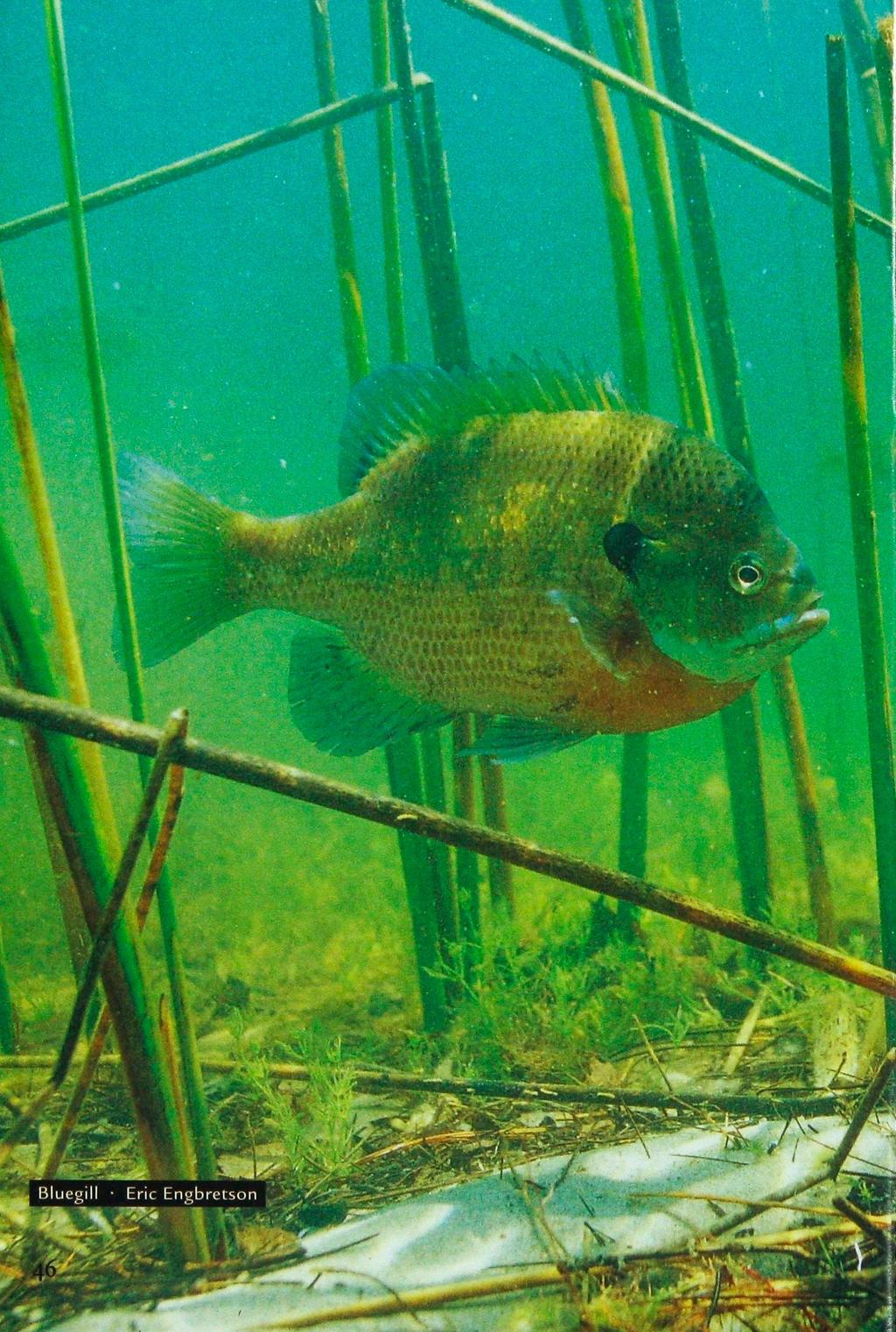
2 y *.»* ' ' ' - ' ' by JASON ABRAHAM Common map turtle Mississippi River, pool 8 drawdown Allen Blake Sheldon
3

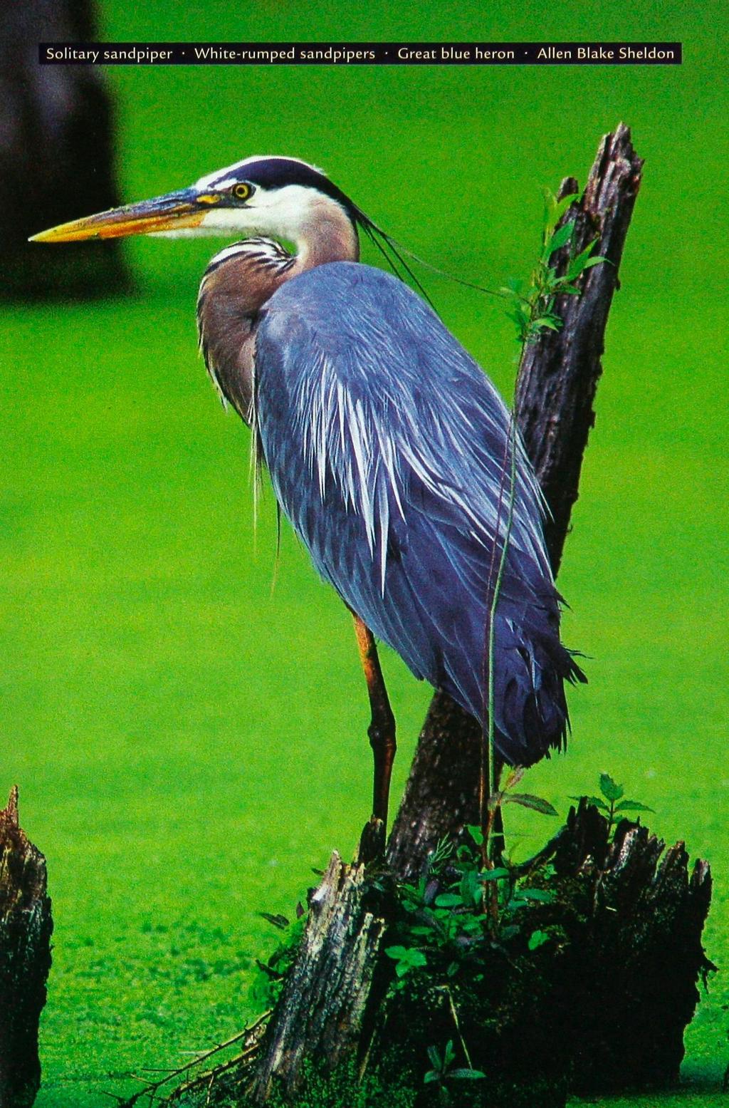
4 LUE-WINGED TEAL ROSE FROM new stands of arrowhead. Sandpipers and avocets winged across emerging bulrush. Tim Schlagenhaft liked what he saw on the Mississippi River south of La Crescent late last summer. The Department of Natural Resources Mississippi River and blufflands coordinator was checking the progress of an experiment that uses the Mississippi River's lock and dam system to mimic seasonal low-water conditions that occurred naturally before the river was impounded. Construction of locks and dams in the 1930s stabilized water levels for commercial shipping and transformed the river into a series of navigable pools. Seasonally flooded backwaters where river bulrush, soft-stem bulrush, arrowhead, and other aquatic vegetation once thrived became permanently inundated. Without annual drying of the plant beds, the vegetation began to disappear. And, over time, so did the fish and wildlife that relied on the plants to provide food, shelter, and dissolved oxygen. Several years ago Schlagenhaft and his counterparts from the Wisconsin DNR, U.S. Geological Survey, U.S. Fish and Wildlife Broad-leaved arrowhead blooms > M Richard Haug Backwater arrowhead Allen Blake Sheldon

5 Service, and U.S. Army Corps of Engineers began looking at temporarily reducing water levels in pools along the Mississippi River. They wanted to replicate periods of natural drying to rejuvenate native vegetation and boost fish and wildlife habitat, without disrupting commercial navigation. After years of planning and a series of public meetings, the group known as the Water Level Management Task Force chose navigation pool 8 (between La Crescent and Genoa, Wis.) for the experiment. For 45 days in 2001 and 90 days in 2002, the corps lowered the water in pool 8 by allowing increased flow through the dam gates at the downstream end. This action exposed about 2,000 acres of river bottom to air and sunlight for the first time in decades. Although analysis is still in progress, the experiment is showing promise. Arrowhead, rice cutgrass, nutgrass, bulrush, and cattail sprouted from seeds deposited by the river in exposed areas. These native plants slow erosion and furnish high-quality food for wildlife such as tundra swans, which favor arrowhead tubers. "We're not going to be able to turn back time to pre-lock-and-dam days," Schlagenhaft said. "But 1 think it is possible to greatly improve vegetation growth and habitat by using waterlevel management." With some dredging of the channel in 2001, barges continued navigating with little difficulty despite low water, said Kent Pehler, vice president of Brennan Marine, a barge shipping and fleeting company. No additional dredging was required during the 2002 drawdown. "Some pools can be managed at lower levels without significant negative impact on Jason Abraham is a DNR staff writer and a contributing editor of the Volunteer.
6
7

8 navigation," Pehler said. "But each pool has to be evaluated on an individual basis. In this case everyone came to the table, and it was very successful." The corps also dredged some areas away from the main navigation channel to ensure access to marinas and boat ramps during low water. The corps and riverside communities worked out a cost-sharing agreement for the additional dredging. Because water levels were lowered gradually, fish, turtles, and other aquatic animals were able to move to deeper water without being trapped. In 2001 volunteers helped relocate mussels in danger of being left dry. The effort was called off during the 2002 drawdown because volunteers found that sels were in danger of drying. on a plan approved by naturrces agencies and the transportation industry, jugh public comment the corps will main- 1 8 at its usual high level. By keeping this level for several summers, researchers hope to learn how often the water must be drawn down to sustain emergent vegetation. USGS research wildlife biologist Kevin Kenow said the plants that sprouted during low water could persist for up to five years. "Waterlevel reductions for wildlife management have been used for years on small lakes and ponds," he said. "In those cases we generally see benefits that last for five to seven years. It's difficult to say what will happen with water-level reduction of this size on a river." In the meantime, the task force is exploring options for periodic drawdowns to revitalize other Mississippi pools and backwaters. Q
FACT SHEET MCGREGOR LAKE RESTORATION HABITAT PROJECT POOL 10, UPPER MISSISSIPPI RIVER, WISCONSIN ENVIRONMENTAL MANAGEMENT PROGRAM
 FACT SHEET MCGREGOR LAKE RESTORATION HABITAT PROJECT POOL 10, UPPER MISSISSIPPI RIVER, WISCONSIN ENVIRONMENTAL MANAGEMENT PROGRAM LOCATION McGregor Lake is located within a mid-river island in Pool 10
FACT SHEET I. LOCATION
 STEAMBOAT ISLAND HABITAT REHABILITATION AND ENHANCEMENT PROJECT (HREP) SCOTT COUNTY, IOWA, UPPER MISSISSIPPI RIVER RESTORATION-ENVIRONMENTAL MANAGEMENT PROGRAM ROCK ISLAND DISTRICT FACT SHEET I. LOCATION
Water Resources Report RKLD Annual Meeting July 30, 2016
 Water Resources Report RKLD Annual Meeting 2016 July 30, 2016 Topics Hydrology Report Indianford Dam trash rack cleanout performance Experimental Project update Review of PAS project Twin floods- 1 to
ST. LOUIS SECTION PROJECT OF THE YEAR AWARD
 ST. LOUIS SECTION PROJECT OF THE YEAR AWARD Originality and Innovation The St. Louis Harbor Project is located in the Upper Mississippi River between the entrance to the Chain of Rocks Canal at River
CORPS FACTS. Harbor Dredging U.S. ARMY CORPS OF ENGINEERS BUILDING STRONG
 CORPS FACTS Harbor Dredging U.S. ARMY CORPS OF ENGINEERS BUILDING STRONG Disaster Response Sedimentation in the channel is caused by the normal cycle of silt movement, erosion from high water or heavy
Illinois Lake Management Association Conference March 23, 2018 By Trent Thomas Illinois Department of Natural Resources Division of Fisheries
 Illinois Lake Management Association Conference March 23, 2018 By Trent Thomas Illinois Department of Natural Resources Division of Fisheries Sources of Habitat Impairment Sedimentation Channelization
GOAL: Collect product flowing over Onalaska spillway to protect downstream resources C&C 250 Y Y. Looking upstream at spillway
 GOAL: Collect product flowing over Onalaska spillway to protect downstream resources BR5 Black n/a Onalaska Spillway Carry- In C&C 250 Y Y Looking upstream at spillway Implementation (Go to Aerial View)
DALE HOLLOW LAKE TROOPER ISLAND IMPROVEMENT PROJECT Proposal for Reservoir Fisheries Habitat Partnership (RFHP)
") DALE HOLLOW LAKE TROOPER ISLAND IMPROVEMENT PROJECT Proposal for Reservoir Fisheries Habitat Partnership (RFHP) A. Applicant Information: US Army Corps of Engineers, Dale Hollow Lake POC: Gregg Nivens
DALE HOLLOW LAKE TROOPER ISLAND IMPROVEMENT PROJECT Proposal for Reservoir Fisheries Habitat Partnership (RFHP) A. Applicant Information: US Army Corps of Engineers, Dale Hollow Lake POC: Gregg Nivens
Emergent Sandbar Habitat Program Middle Missouri River
 Emergent Sandbar Habitat Program Middle Missouri River Jeremiah Szynskie, P.E. Hydrologic Engineering Branch Introduction Main Stem System Dam Closures Fort Peck 1937 Fort Randall 1952 Garrison - 1953
MISSISSIPPI MAKEOVER A Plan for Restoration, Just Around the Bend
 MISSISSIPPI MAKEOVER A Plan for Restoration, Just Around the Bend Interim Report Card 2013 Project coordinated by the Dakota County Soil and Water Conservation District and sponsored by the Minnesota Pollution
Estimated on-the-ground start and end dates: 1 June October 2018
 A. Applicant Information Name of Organization: U.S. Army Corps of Engineers, Carlyle Lake 801 Lake Road, Carlyle, IL 62231 Contact Information: Robert Wilkins, Operations Manager, (618) 594-2484, Robert.Wilkins@usace.army.mil
ATTACHMENT F. Minnesota Department of Natural Resources. Marsh Lake Ecosystem Restoration Project
 ATTACHMENT F Minnesota Department of Natural Resources Marsh Lake Ecosystem Restoration Project Mussel Rescue and Translocation Plan for Pomme de Terre River Restoration (Prepared June, 2016) Attachment
Information for File # SEW
 Information for File #2014-02744-SEW Applicant: Minnesota Department of Transportation (MnDOT), District 3; c/o Mr. Robert Nibbe Corps Contact: Sarah Wingert, U.S. Army Corps of Engineers, 180 5 th Street
Name of Applicant Phone Number # Mailing Address. City State Zip
 VIRGINIA DEPARTMENT OF GAME AND INLAND FISHERIES EXOTIC SPECIES APPLICATION/PERMIT TO IMPORT CERTIFIED TRIPLOID GRASS CARP FOR AQUATIC VEGETATION CONTROL IN PRIVATE PONDS (Under Authority of 4 VAC 15-30-40
Regulations. Grabbling season May 1 July 15; only wooden structures allowed.
 Arkabutla Reservoir 219 REEL FACTS Keith Meals, Arthur Dunn, Stanley Turner Fisheries Biologists keithm@wfp.ms.gov, ArthurD@wfp.ms.gov, StanleyT@wfp.ms.gov General Information: Arkabutla Reservoir is one
Mississippi National River and Recreation Area (MNRRA) National Park Service
 National Park Service") Mississippi National River and Recreation Area (MNRRA) National Park Service Trapped by History Will the Past Anchor the Mississippi River s Future? America s Inner Coast Summit, June 22-24, 2010 John
Mississippi National River and Recreation Area (MNRRA) National Park Service Trapped by History Will the Past Anchor the Mississippi River s Future? America s Inner Coast Summit, June 22-24, 2010 John
Sebec Lake Fisheries Management Plan 2012
 Sebec Lake Fisheries Management Plan 2012 Sebec Lake is a 6,800-acre oligotrophic lake located in northwestern Maine. It has popular fisheries for landlocked salmon, lake trout, and smallmouth bass. Other
Natural Shoreline Restoration for High Energy Shorelines. Brian Majka Restoration Ecologist 3/7/2019
 Natural Shoreline Restoration for High Energy Shorelines Brian Majka Restoration Ecologist 3/7/2019 Today we ll discuss: High energy shorelines Restoration techniques for high energy shorelines Project
Fish Community. Fish Habitat, Streams and Rivers
 Clear, Ston(e)y and White Lake Plan Fish Community The lakes support a cool/warm water fishery including muskellunge, walleye, largemouth and smallmouth bass, yellow perch, pumpkinseed, rockbass, blue
2014 Island Lake Survey June 13 th, 2014 Andrew Plauck District Fisheries Biologist Report Prepared 4 March 2015
 2014 Island Lake Survey June 13 th, 2014 Andrew Plauck District Fisheries Biologist Report Prepared 4 March 2015 BACKGROUND - A fish survey was requested due to a moderately severe winterkill in Island
SALINITY AND DISSOLVED OXYGEN IN THE MISSISSIPPI RIVER GULF OUTLET NAVIGATION CHANNEL AND IN ADJACENT SURFACE WATERS,
 SALINITY AND DISSOLVED OXYGEN IN THE MISSISSIPPI RIVER GULF OUTLET NAVIGATION CHANNEL AND IN ADJACENT SURFACE WATERS, 2008-2012 Southeast Louisiana Flood Protection Authority-East Coastal Advisory Committee
FINAL Caples Lake Fisheries Management Plan. Version 4.0
 FINAL Caples Lake Fisheries Management Plan Version 4.0 August 15, 2008 Purpose The Caples Lake Fisheries Management Plan (Plan) outlines the stocking plan to reestablish a sport fishery in Caples Lake
Pickwick Lake 2018 REEL FACTS Trevor Knight Fisheries Biologist (662)
") Pickwick Lake 218 REEL FACTS Trevor Knight Fisheries Biologist trevork@mdwfp.state.ms.us (662) 84-5176 General Information: Covering 43,1 acres, Pickwick Lake, which borders Alabama, Tennessee, and Mississippi,
Pickwick Lake 218 REEL FACTS Trevor Knight Fisheries Biologist trevork@mdwfp.state.ms.us (662) 84-5176 General Information: Covering 43,1 acres, Pickwick Lake, which borders Alabama, Tennessee, and Mississippi,
Rhode Island Department of Environmental Management Division of Fish and Wildlife American Shad Habitat Plan for the Pawcatuck River
 Rhode Island Department of Environmental Management Division of Fish and Wildlife American Shad Habitat Plan for the Pawcatuck River Prepared by: Phil Edwards, Rhode Island Department of Environmental
Big Spring Creek Habitat Enhancement and Fishery Management Plans
 Big Spring Creek Habitat Enhancement and Fishery Management Plans November 5, 2012 Big Spring Events and Activities Center Newville, PA Charlie McGarrell Regional Habitat Biologist Pennsylvania Fish and
Kerr Lake Vegetation Survey. October November Report submitted by NC State University. Background
 Kerr Lake Vegetation Survey October November 2012 Report submitted by NC State University Background Hydrilla (Hydrilla verticillata) is a non-native invasive submersed aquatic plant. This plant was first
MARTINDALE POND Wayne County 2004 Fish Management Report. Christopher C. Long Assistant Fisheries Biologist
 MARTINDALE POND Wayne County 2004 Fish Management Report Christopher C. Long Assistant Fisheries Biologist Fisheries Section Indiana Department of Natural Resources Division of Fish and Wildlife I.G.C.
Dry Creek Project. The Dry Creek Habitat Enhancement Project provides a. Slowing velocity, creating refuge are key to habitat project
 Dry Creek Habitat Enhancement Bulletin The Dry Creek Habitat Enhancement Project provides a unique opportunity for the Sonoma County Water Agency (Water Agency) and landowners to protect endangered fish
MARSH DEGRADATION AT THE MOUTH OF MOORE CREEK
 MARSH DEGRADATION AT THE MOUTH OF MOORE CREEK Hunter Winstanley, Department of Earth Sciences, University of South Alabama, Mobile, AL 36688. E-Mail: hcw501@jaguar1.usouthal.edu. Moore Creek is located
Columbia Lake Dam Removal Project
 Columbia Lake Dam Removal Project The Columbia Lake dam located 1/4 mile upstream of the Paulins Kill River's confluence with the Delaware River in Knowlton Township, Warren County has been proposed for
LAKE TANEYCOMO 2011 ANNUAL LAKE REPORT
 LAKE TANEYCOMO 211 ANNUAL LAKE REPORT Shane Bush Fisheries Management Biologist Missouri Department of Conservation Southwest Region March 1, 212 EXECUTIVE SUMMARY Lake Taneycomo was formed by the construction
NURSERY POND Fish Management Report. Jason C. Doll Assistant Fisheries Biologist
 NURSERY POND 2004 Fish Management Report Jason C. Doll Assistant Fisheries Biologist FISHERIES SECTION INDIANA DEPARTMENT OF NATURAL RESOURCES DIVISION OF FISH AND WILDLIFE I.G.C. South, Room W273 402
Appendix E Habitat Evaluation Procedure
 Appendix E Habitat Evaluation Procedure Appendix E Habitat Benefits Evaluation Marsh Lake Ecosystem Restoration Project Introduction An ecosystem restoration measure is a feature or activity that addresses
PROJECT TO INSTALL LARGE WOOD HABITAT STRUCTURES IN THE CARMEL RIVER USING CALIFORNIA DEPARTMENT OF FISH AND GAME GRANT FUNDS
 PROJECT TO INSTALL LARGE WOOD HABITAT STRUCTURES IN THE CARMEL RIVER USING CALIFORNIA DEPARTMENT OF FISH AND GAME GRANT FUNDS The Monterey Peninsula Water Management District (MPWMD), in cooperation with
Categorical Exclusion Portage Lake Aquatic Organism Passage Project 1
 Letter- Comment Number Date Received Name/ Address Comment Response 1-1 2/7/2012 Bob Maurer 85 Blackmarr Rd. NE No comments N/A 2-1 2/8/2012 Judy Blackmarr 89 Blackmarr Rd. NE 2-2 2/8/2012 Judy Blackmarr
Lake Texoma Advisory Committee
 Lake Texoma Authorized by Flood Control Act of 1938 Construction of dam completed in 1944 89,000 surface acres Largest lake in capacity in the Tulsa District Operated by the U.S. Army Corps of Engineers
Lake Seminole. and Waters Bordering Georgia and Alabama
 Lake Seminole and Waters Bordering Georgia and Alabama LAKE SEMINOLE Site Description Lake Seminole is a 37,500-acre reservoir located at the juncture of the Florida, Georgia, and Alabama state lines.
DRIPPING SPRINGS LAKE 5 YEAR LAKE MANAGEMENT PLAN
 DRIPPING SPRINGS LAKE 5 YEAR LAKE MANAGEMENT PLAN FISHERIES DIVISION CENTRAL REGION OKLAHOMA DEPTMENT OF WILDLIFE CONSERVATION PREPARED BY: DANNY BOWEN OCTOBER 2013 1 Background Dripping Springs Lake impounds
Pool drawdown provides unique opportunity By Charlene Carmack, biologist There have been very few recent surveys of mussel populations in the Marseill
 Pool drawdown provides unique opportunity By Charlene Carmack, biologist There have been very few recent surveys of mussel populations in the Marseilles Pool even though several federal and state listed
MINNESOTA DEPARTMENT OF NATURAL RESOURCES DIVISION OF FISHERIES AND WILDLIFE. Gamefish Assessment Report
 Minnesota DNR F-29-R(P) Area F312 February 1, 2013 MINNESOTA DEPARTMENT OF NATURAL RESOURCES DIVISION OF FISHERIES AND WILDLIFE Gamefish Assessment Report Spring Gamefish Assessment on the Mississippi
Crawford Reservoir. FISH SURVEY AND MANAGEMENT INFORMATION Eric Gardunio, Fish Biologist Montrose Service Center
 FISH SURVEY AND MANAGEMENT INFORMATION General Information: Crawford Reservoir is a popular fishery that provides angling opportunity for yellow perch, channel catfish, northern pike, rainbow trout, black
Cat Island Chain Restoration
 Cat Island Chain Restoration 1820s Fox River Military Road Map to Fort Howard 1845 Chart of Green Bay & Fox River Cat Island Chain - 1938 Cat Island Brown County Aerial Photography, 1938 Historic Western
The Spey Catchment Initiative
 The Spey Catchment Initiative Introducing the Spey Catchment Initiative The Spey Catchment Initiative is a new project which aims to help deliver the objectives of the River Spey Catchment Management Plan
Brook Trout in Massachusetts: A Troubled History, A Hopeful Future
 Brook Trout in Massachusetts: A Troubled History, A Hopeful Future Brook trout are one of the most beautiful and beloved fish in the Eastern United States. In Massachusetts, anglers prize opportunities
Part 9 Specific Land Uses - Foreshore & Waterway Development
 7 FORESHORE AND WATERWAY DEVELOPMENT This section applies to the following development uses proposed within the foreshore area (defined by LM LEP 2014), and contains Council s specific requirements for
Little Calumet River Rapid Response Fish Identification and Enumeration Branch Summary Report
 Little Calumet River Rapid Response Fish Identification and Enumeration Branch Summary Report Introduction A rotenone rapid response was completed on a 2.6-mile section of the Little Calumet River immediately
Alewife Brook, Cape Elizabeth, River Herring Monitoring Summary 2015
 University of Southern Maine USM Digital Commons Publications Casco Bay Estuary Partnership (CBEP) 2-3-2016 Alewife Brook, Cape Elizabeth, River Herring Monitoring Summary 2015 Matt Craig University of
Restoring the Iconicc Lower Cache River
 Restoring the Iconicc Lower Cache River A new chapter holds promise of revitalizing cherished waters and woods The story of conservation in the lower Cache River and surrounding Big Woods of eastern Arkansas
Tunica Cutoff 2018 REEL FACTS Keith Meals Fisheries Biologist
 Tunica Cutoff 218 REEL FACTS Keith Meals Fisheries Biologist keithm@mdwfp.state.ms.us General Information: Tunica Cutoff was created by the US Army Corps of Engineers (COE) in 1942 when a bend in the Mississippi
Species and Habitat Studies: Amphibian and Other Aquatic Species Research Update
 Species and Habitat Studies: Amphibian and Other Aquatic Species Research Update Marc Hayes 21 September 2016 Amphibian and Other Aquatic Species Research Update HABITATS ASSEMBLAGE 1 Chehalis Floodplain
Dredging Keeping Our Underwater Highways Open
 Dredging Keeping Our Underwater Highways Open Sedimentation Material that falls to the bottom of a liquid is called sediment. If enough sediment deposits to build a shallow spot on the river or ocean bottom,
Willett Ave. Pond & Bullocks Cove Riverside, RI. Ed Serowik Pilgrim High School
 Willett Ave. Pond & Bullocks Cove Riverside, RI Ed Serowik Pilgrim High School A quote to begin Follow the river and you will find the sea French Proverb A Threatened Subwatershed Point and non-point
HARRY AND LAURA NOHR CHAPTER OF TROUT UNLIMITED
 HARRY AND LAURA NOHR CHAPTER OF TROUT UNLIMITED BLUE RIVER HABITAT IMPROVEMENT PROJECT 2017 Report Prepared by the Project Committee Harry and Laura Nohr Chapter of Trout Unlimited 1 Sponsorship and Partners
THE RIVER ALUN (aka ALYN)
") THE RIVER ALUN (aka ALYN) Advisory Visit Report Undertaken On behalf of the Wild Trout Trust By Ron Holloway MIFM 22 nd April 2002-04-25 The River Alun The Rossett & Gresford Fly Fishing Club R H Associates
THE RIVER ALUN (aka ALYN) Advisory Visit Report Undertaken On behalf of the Wild Trout Trust By Ron Holloway MIFM 22 nd April 2002-04-25 The River Alun The Rossett & Gresford Fly Fishing Club R H Associates
Regulations. Grabbling season May 1 July 15; only wooden structures allowed.
 Enid Reservoir 218 REEL FACTS Keith Meals, Arthur Dunn, Stanley Turner Fisheries Biologists keithm@mdwfp.state.ms.us, ArthurD@mdwfp.state.ms.us, StanleyT@mdwfp.state.ms.us General Information: Enid Reservoir
Mississippi River's Pool 2 is a waterway in peril
 Mississippi River's Pool 2 is a waterway in peril By Bob Shaw bshaw@pioneerpress.com Posted: 07/28/2012 12:01:00 AM CDT Updated: 07/29/2012 12:43:05 PM CDT When Kevin Chapdelaine boats on the Mississippi
LCCMR Work Program Final Report. Total Biennial Project Budget
 Overall Report Page 81 of 208 2H:Fish Habitat - MN DNR - Division of Fisheries Project Manager: Affiliation: Address: Phone: Fax: E-mail: Linda Erickson-Eastwood MN DNR - Division of Fisheries 500 Lafayette
Proposed Changes to Bag and Size Limits Minnesota/Wisconsin Border Waters of the Mississippi River
 Proposed Changes to Bag and Size Limits Minnesota/Wisconsin Border Waters of the Mississippi River The Minnesota and Wisconsin DNRs are jointly reviewing fishing regulations on Pools 3-9 of the Mississippi
Stevens Creek Corridor
 O F F I C E O F T H E D I R E C T O R O F P U B L I C W O R K S Stevens Creek Corridor Creek Restoration Project Volume Three Project Update: Creek Photos, Before & After BY GAIL SEEDS - PROJECT MANAGER,
SUMMARY REPORT FOR LAKE ST. MALO FISHERIES ASSESSMENT. Prepared for the St. Malo and District Wildlife Association
 SUMMARY REPORT FOR LAKE ST. MALO FISHERIES ASSESSMENT Prepared for the St. Malo and District Wildlife Association Presented by August 25, 2014 Study dates thus far: Date Tasks February 16 Fishing derby;
Willamette River Oregon Chub
 Willamette River Oregon Chub Interim Risk Assessment Oregon chub (Oregonichthys crameri), small minnows endemic to the Willamette Valley, were federally listed as endangered under the Endangered Species
FINAL REPORT. Yonkers Creek Migration Barrier Removal Project Wonderstump Road Del Norte County. Submitted By:
 FINAL REPORT Yonkers Creek Migration Barrier Removal Project Wonderstump Road Del Norte County Submitted By: Del Norte County Community Development Department Yonkers Creek Migration Barrier Removal Project
NEVADA DEPARTMENT OF WILDLIFE STATEWIDE FISHERIES MANAGEMENT
 NEVADA DEPARTMENT OF WILDLIFE STATEWIDE FISHERIES MANAGEMENT FEDERAL AID JOB PROGRESS REPORTS F-20-52 2016 RYE PATCH RESERVOIR WESTERN REGION NEVADA DEPARTMENT OF WILDLIFE, FISHERIES DIVISION ANNUAL PROGRESS
Upper/Lower Owl Creek Reservoir
 Upper/Lower Owl Creek Reservoir Schuylkill County 2018 Largemouth Bass Survey Upper Owl Creek Reservoir and Lower Owl Creek Reservoir are 67-acre and 26-acre impoundments, respectively, created by two
2010 Fishing Opener Prognosis. Central Region
 2010 Fishing Opener Prognosis Central Region Hinckley PINE COUNTY Pokegama, Cross, Island, Oak and North and South Big Pine Lakes are typically the best lakes for targeting walleye in Pine County. They
SKIATOOK LAKE MANAGEMENT PLAN
 SKIATOOK LAKE MANAGEMENT PLAN Background Skiatook Lake impounds Hominy Creek, 5 miles west of Skiatook in Osage County, Oklahoma (Figure 1). Skiatook Lake covers 10,540 surface acres and was constructed
FINAL HARRIS CHAIN OF LAKES RESTORATION COUNCIL SITE VISIT SUMMARY. of the. Projects Tour March 3, 2006
 FINAL HARRIS CHAIN OF LAKES RESTORATION COUNCIL SITE VISIT SUMMARY of the Projects Tour March 3, 2006 The regular meeting of the Harris Chain of Lakes Restoration Council (Council) was cancelled to facilitate
CLAIBORNE LOCK AND DAM PERTINENT DATA
 CLAIBORNE LOCK AND DAM PERTINENT DATA GENERAL Location Clarke, Monroe, & Wilcox Counties, Alabama; Alabama River, river mile 72.5 Drainage area Millers Ferry to Claiborne sq. mi. 836 Total drainage area
LITTLE WHITE OAK Knox County 2006 Fish Management Report. Debbie King Assistant Fisheries Biologist
 LITTLE WHITE OAK Knox County 2006 Fish Management Report Debbie King Assistant Fisheries Biologist Fisheries Section Indiana Department of Natural Resources Division of Fish and Wildlife I.G.C.-South,
Frequently Asked Questions About Revised Critical Habitat and Economic Analysis for the Endangered Arroyo Toad
 Q Frequently Asked Questions About Revised Critical Habitat and Economic Analysis for the Endangered Arroyo Toad Q. What is the arroyo toad? The arroyo toad (Bufo californicus) is a small, light greenish-grey
SOONER LAKE MANAGEMENT PLAN
 SOONER LAKE MANAGEMENT PLAN Background Lake Sooner impounds Greasy Creek, 15 miles south of Ponca City in Noble and Pawnee Counties, Oklahoma (Figure 1). The Grease Creek basin that Sooner Lake impounds
TABLE ROCK LAKE 2014 ANNUAL LAKE REPORT. Shane Bush Fisheries Management Biologist Missouri Department of Conservation Southwest Region
 TABLE ROCK LAKE 14 ANNUAL LAKE REPORT Shane Bush Fisheries Management Biologist Missouri Department of Conservation Southwest Region March 1, 15 EXECUTIVE SUMMARY Table Rock Lake is a 43,1 acre reservoir
Eelgrass and Macroalgae Presence/Absence Preliminary Surveys BHP Proposed Grays Harbor Potash Export Facility A Task 400
 Memorandum 40600-HS-MEM-55036 Revision 0 Date: 26 July 2018 Subject: Eelgrass and Macroalgae Presence/Absence Preliminary Surveys BHP Proposed Grays Harbor Potash Export Facility A17.0202.00 Task 400 INTRODUCTION
Aquatic Plant Management and Importance to Sport Fisheries
 Aquatic Plant Management and Importance to Sport Fisheries Presentation to Michigan Inland Lakes Convention May 2014 Mike Maceina Professor Emeritus School of Fisheries, Aquaculture, and Aquatic Sciences
EcoLogic Memorandum. TO: Ben Brezell; EDR FROM: Mark Arrigo RE: Possible Impacts of Dredging Snooks Pond DATE: 6/4/07
 EcoLogic Memorandum TO: Ben Brezell; EDR FROM: Mark Arrigo RE: Possible Impacts of Dredging Snooks Pond DATE: 6/4/07 Background EDR P.C. (EDR) has been contracted by a landowner to assess the feasibility
Information about the Walleye Stocking in Douglas Lake June 27, /09/2018
 Date: August 9, 2018 To: From: Subject: Douglas Lake Improvement Association members Holly Gedert, President, DLIA 2018 Walleye Stocking in Douglas Lake Douglas Lake Improvement Association (DLIA) likes
River Restoration: Culvers Island weir removals and river naturalisation project.
 River Restoration: Culvers Island weir removals and river naturalisation project. Background Chalk streams are an incredibly rare habitat on a global scale, and owing to their international importance,
AN ANALYSIS OF FISHING EFFORT AT INDIAN LAKE
 AN ANALYSIS OF FISHING EFFORT AT INDIAN LAKE LOWELL E. BINKLEY.i Section of Fish Management and Propagation, Ohio Division of Conservation and Natural Resources, Columbus, Ohio Although the study of natural
An Assessment of the Fish Community in Lake Acworth
 An Assessment of the Fish Community in Lake Acworth By John Damer Fisheries Biologist Georgia Department of Natural Resources Wildlife Resources Division Fisheries Section Calhoun, GA 30701 July 2008 Introduction
River-Lab Grade 3 (RL3) Route Green & Yellow Deep River Pool Trail Guide
 Route Green & Yellow Deep River Pool Trail Guide") River-Lab Grade 3 (RL3) Route Green & Yellow Deep River Pool Trail Guide Route Green & Yellow Deep River Pool Trail Route Sequence Deep Pool Habitat Observation Marsh Habitat Observation Riffles Habitat
River-Lab Grade 3 (RL3) Route Green & Yellow Deep River Pool Trail Guide Route Green & Yellow Deep River Pool Trail Route Sequence Deep Pool Habitat Observation Marsh Habitat Observation Riffles Habitat
Management Plan for the Obey River Trout Fishery
 Management Plan for the Obey River Trout Fishery 28-214 By: James Travis Scott Jack Swearengin Walter Scott Webb D.W. Young Tennessee Wildlife Resources Agency January 28 Management Plan for the Obey River
Addressing the Threat of Asian Carp in the Great Lakes/Midwest Region
 Addressing the Threat of Asian Carp in the Great Lakes/Midwest Region Mike Weimer U.S. Fish and Wildlife Service Co-chair, Asian Carp Regional Coordinating Committee Asian Carp Regional Coordinating Committee
STRUCTURAL STABILITY ASSESSMENT
 STRUCTURAL STABILITY ASSESSMENT CFR 257.73(d) Fly Ash Reservoir II Cardinal Plant Brilliant, Ohio October, 2016 Prepared for: Cardinal Operating Company Cardinal Plant Brilliant, Ohio Prepared by: Geotechnical
U.S. Army Corps of Engineers
 A. U.S. Army Corps of Engineers Kevin Parsons, Natural Resources Specialist 500 Resource Management Drive West Point, GA 31833 706-645-2937 Kevin.M.Parsons@usace.army.mil B. Underwater Structure Enhancement
Below the Surface: Aquatic Invasives
 Below the Surface: Aquatic Invasives DATE AND TIME SPEAKER(S) Thursday, 25 February 2010 / 10AM-1130AM Doug Keller Aquatic Invasive Species Coordinator Indiana DNR, Division of Fish and Wildlife 402 W.
Lake Drawdown. Drawdowns, Do They Really Work? LAKE CATHERINE Start Nov. 18, 2002 End Nov. 24, ' (Return to Normal Lake Levels) March, 2003
 March, 2003") August 2002 Lake Drawdown This winter Lake Hamilton will be lowered by nine feet beginning November 4. Lake Catherine will be lowered five feet beginning November 18. Entergy will lower Lake Hamilton s
August 2002 Lake Drawdown This winter Lake Hamilton will be lowered by nine feet beginning November 4. Lake Catherine will be lowered five feet beginning November 18. Entergy will lower Lake Hamilton s
UNDERSTANDING YOUR ESTUARY Level IA- ESTUARY SEARCH
 UNDERSTANDING YOUR ESTUARY Level IA- ESTUARY SEARCH Kakagon/Bad River Sloughs, a Lake Superior estuary located on the Bad River Reservation near Ashland, WI. GOAL Select one Wisconsin estuary to study
MIDDLE FORK RESERVOIR Wayne County 2004 Fish Management Report. Christopher C. Long Assistant Fisheries Biologist
 MIDDLE FORK RESERVOIR Wayne County 2004 Fish Management Report Christopher C. Long Assistant Fisheries Biologist FISHERIES SECTION INDIANA DEPARTMENT OF NATURAL RESOURCES DIVISION OF FISH AND WILDLIFE
Fish Texas AQUATIC ECOSYSTEMS
 27 Additionally, healthy aquatic communities in Texas rivers, reservoirs and estuaries provide unparalleled recreational opportunities to millions of Texans. Our fresh and saltwater environments vary from
Regulations. Grabbling season May 1 July 15; only wooden structures allowed.
 Grenada Reservoir 218 REEL FACTS Keith Meals, Arthur Dunn, Stanley Turner Fisheries Biologists keithm@mdwfp.state.ms.us, ArthurD@mdwfp.state.ms.us, StanleyT@mdwfp.state.ms.us General Information: Grenada
Better Fishing Means. Less Carping. At Bowman-Haley Reservoir. North Dakota Outdoors - June 1995 By Joe Bonneau, Dennis Scarnecchia, and Emil Berard
 Better Fishing Means Less Carping At Bowman-Haley Reservoir North Dakota Outdoors - June 1995 By Joe Bonneau, Dennis Scarnecchia, and Emil Berard Although the word origins of the fish called carp and the
Asian Carp and Round Goby Status
 Asian Carp and Round Goby Status Participants will learn the current status of Asian carp and Round Goby in the region and Wisconsin, and what federal and state agencies are doing to prevent their expansion.
The Dynamic Coast. Right Place Resources. A presentation about the interaction between the dynamic coast and people
 The Dynamic Coast Houses threatened by coastal erosion in California Right Place Resources A presentation about the interaction between the dynamic coast and people For the rest of the presentations in
Regulations. Grabbling season May 1 July 15; only wooden structures allowed.
 Sardis Reservoir 218 REEL FACTS Keith Meals, Arthur Dunn, Stanley Turner Fisheries Biologists keithm@mdwfp.state.ms.us, ArthurD@mdwfp.state.ms.us, StanleyT@mdwfp.state.ms.us General Information: Sardis
las vegas wash coordination committee
 las vegas wash coordination committee lvwash.org Proposal to Conduct a Small Mammal Study in the Las Vegas Wash, Nevada March 2009 Proposal to Conduct a Small Mammal Study in the Las Vegas Wash, Nevada
Warm-up # 7 A day 5/17 - B day 5/18 UPDATE YOUR TABLE OF CONTENTS
 Warm-up # 7 A day 5/17 - B day 5/18 UPDATE YOUR TABLE OF CONTENTS Question: List all examples of surface water on Earth. Answer: Rivers and streams, lakes and reservoirs, (ponds) wetlands, estuaries and
Creation of Fish and Wildlife Habitat on the Closed Salmon Harbour Mine in Minto, NB
 Creation of Fish and Wildlife Habitat on the Closed Salmon Harbour Mine in Minto, NB M. Coleman 1, R. Rutherford 2, RA Currie 3 1 NB Power 2 Thaumas Environmental Consultants Ltd 3 RA Currie Ltd. Location
CHAPTER 6 10/29/2018 Clean Version REGULATING PIERS, WHARVES, MOORING BUOYS, SWIMMING RAFTS AND INFLATABLES ON ROCK LAKE
 1 2 3 4 5 6 7 8 9 10 11 12 13 14 15 16 17 18 19 20 21 22 23 24 25 26 27 28 29 30 31 32 33 34 35 36 37 38 39 40 41 42 43 44 45 46 CHAPTER 6 10/29/2018 Clean Version REGULATING PIERS, WHARVES, MOORING BUOYS,
CITY OF MADISON PROPOSED PROJECT. Wingra Park Shoreline Repair
 CITY OF MADISON PROPOSED PROJECT Wingra Park Shoreline Repair Wingra Park Current Shoreline Wingra Shoreline Wingra Shoreline Wingra Shoreline Wingra Shoreline Wingra Shoreline Concrete Abutment + Wooden
watersafety.usace.army.mil Brochure created by CEMVR IM-I
 watersafety.usace.army.mil Brochure created by CEMVR IM-I Introduction We hope you find this information useful for boating on the Upper Mississippi River and Illinois Waterway. The purpose of this booklet