The Endurance Array. September 27, 2016
|
|
|
- Christopher Marshall
- 5 years ago
- Views:
Transcription
, Jon Fram (Systems Engineer), Bob Collier")
 Chris Wingard, Craig Risien, Linda Fayler, Walt")

 colleagues barth@coas.oregonstate.edu jfram@coas.oregonstate.edu edever@coas.")
1 September 27, 2016 The Endurance Array Jack Barth (Project Scien-st), Ed Dever (Project Manager/Principal Inves-gator), Jon Fram (Systems Engineer), Bob Collier (former Project Manager/Principal Inves-gator, cyberinfrastructure), Tom Kearney (Opera-ons and Management) Chris Wingard, Craig Risien, Linda Fayler, Walt Waldorf, Tully Rohrer, Stuart Pearce, David Neiman, Russ Desiderio, Kent Fletcher, Jeff Woods, Ian Black in collabora-on with our WHOI (buoys, design, etc.), UW (cabled infrastructure: Deb Kelley, Orest Kawka) and Rutgers/Raytheon (cyberinfrastructure) colleagues

2 Endurance Array Science drivers Array design Instruments & sampling Deploy, recover, deploy, Present status 2


3 UW CEV Graphics OOI Science Themes A1 Global Biogeochemistry and Carbon Cycling A2 Ocean-Atmosphere Exchange A3 Ocean Circula-on, Mixing and Ecosystems A7 Climate Variability and Ecosystems A9 Coastal Ocean Dynamics and Ecosystems - Hypoxia on Con-nental Shelves A10 Coastal Ocean Dynamics and Ecosystems Shelf/Slope Exchange.


4 OOI in the Pacific Northwest Endurance Grays Harbor Axial Mid Plate Portland CyberPOP Endurance Newport Hydrate Ridge 0 Meters 3500 Endurance Array and Cabled Array Primary Node Low Voltage Node Coastal Mooring

5 5 Endurance and Cabled Array off Oregon
6 Endurance Array Cross-shelf mooring lines at Newport and Grays Harbor (N & S of Columbia River) Oregon Line connected to the Cabled Array 6 deployed gliders yearround 500 km 20 plaeorms: EA ~240 sensors Cabled EA ~39 sensors 125 km Loca-ons chosen based on exis-ng long-term data 6
7 As designed: Full water column Cross-shelf resolu-on Endurance Array: Oregon Line High power, high bandwidth via cable to 80 & 500m Benthic plaeorms 500m = Slope poleward undercurrent boundary mixing vertical migration 80m = Middle Shelf upwelling jets/fronts sand/mud bottom hypoxia wind stress curl 25m = Inner Shelf waves link to nearshore river-driven flows

8 As designed: Full water column Cross-shelf resolu-on Endurance Array: Oregon Line High power, high bandwidth via cable to 80 & 500m Benthic plaeorms Endurance Oregon Offshore Endurance Oregon Shelf Endurance Oregon Inshore
9 Endurance Array: Washington Line Endurance Washington Offshore Endurance Washington Shelf Endurance Washington Inshore 9

10 10 Cabled Array off central Oregon


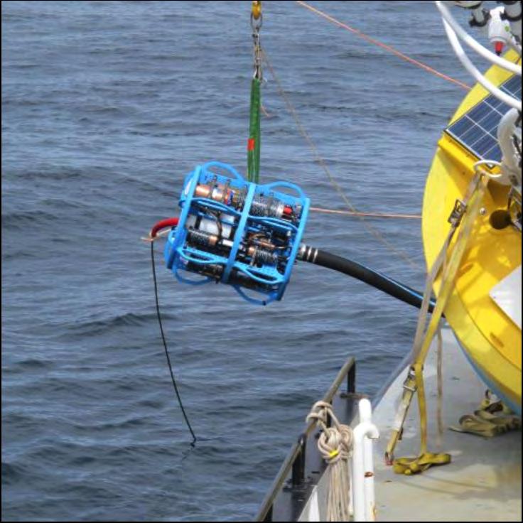
11 Cabled Benthic Experiment Package Designed & Built at OSU Opera-ng since summer 2014 Kent Fletcher 11 Instruments CTD, O 2, ph, pco 2 Chl-a, OBS, CDOM ADCP, fast point velocity, hydrophone Opt. Aien. & Absorp. Mul--frequency bioacous-cs (on nearby plaeorm)

12 Endurance Array: Washington Line BIG BUOYs wind, rain, humidity air pressure & temperature, long & short wave radia-on wave spectra, air-sea pco 2 surface CT & velocity GLIDERs CTD, O 2, PAR Chl-a, OBS, CDOM velocity 7m on MOORINGs CTD, O 2, Chl-a, OBS, CDOM point velocity Spec. Irrad., NO 3, Opt. Aien. & Absorp. ph, pco 2, ADCP SURFACE PIERCING PROFILERS CTD, O 2, PAR Chl-a, OBS, CDOM point velocity Spec. Irrad., NO 3, Opt. Aien. & Absorp. WIRE FOLLOWING PROFILER CTD, O 2, PAR Chl-a, OBS, CDOM point velocity MOORING ANCHORs CTD, O 2, Chl-a, OBS, CDOM Fast point velocity Opt. Aien. & Absorp. ph, pco 2, ADCP Bioacous-c sonar, camera, Integrated pressure Many instrument types See oceanobservatories.org Stretch hoses à bandwidth & power 12

13 Design & Build Started 1-Sep year build. All Endurance plaeorms and sensors have been deployed Operate and Maintain OOI s Timeline 13
14 Default Sampling Strategy Big Surface Moorings Burst interval 15 min to 1 hour, depending on sensor Mooring powered by wind & solar. Some instruments with baieries. Inshore Surface Moorings Burst interval 15 min to 1 hour, depending on sensor Mooring powered by lithium baieries. Some instruments with baieries. Wire Following Profiler 3 profiles per day 25 cm ver-cal resolu-on Coastal Surface Piercing Profiler 2-3 profiles per day, depending on depth & sea state 25 cm ver-cal resolu-on (1.5 cm for CTD, 300 cm for nitrate) Cabled Infrastructure Always on except for reagent or lamp-limited sensors Bioacous-c sonar and camera share power source Gliders Details in document posted to oceanobservatories.org Uncabled plaeorms telemeter decimated data at least twice a day 14


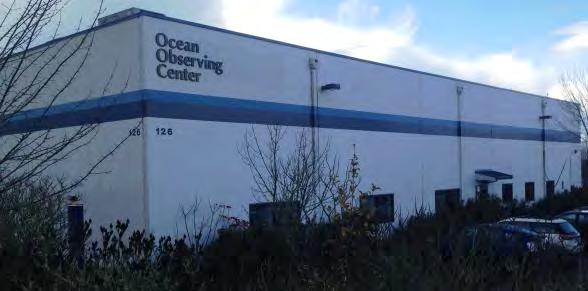
15 Mooring Integra-on Ocean Observing Center Collabora-on with WHOI on mooring design 15


16 Shipping & Dockside Reassembly OOC Parking lot 16

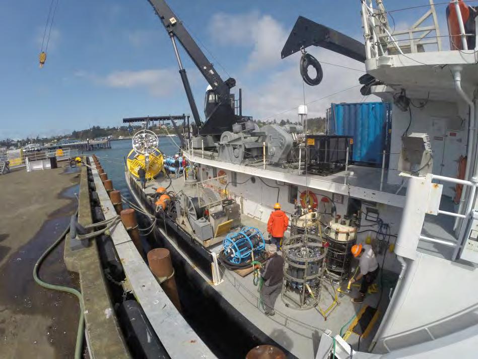
17 17 Packed Deck

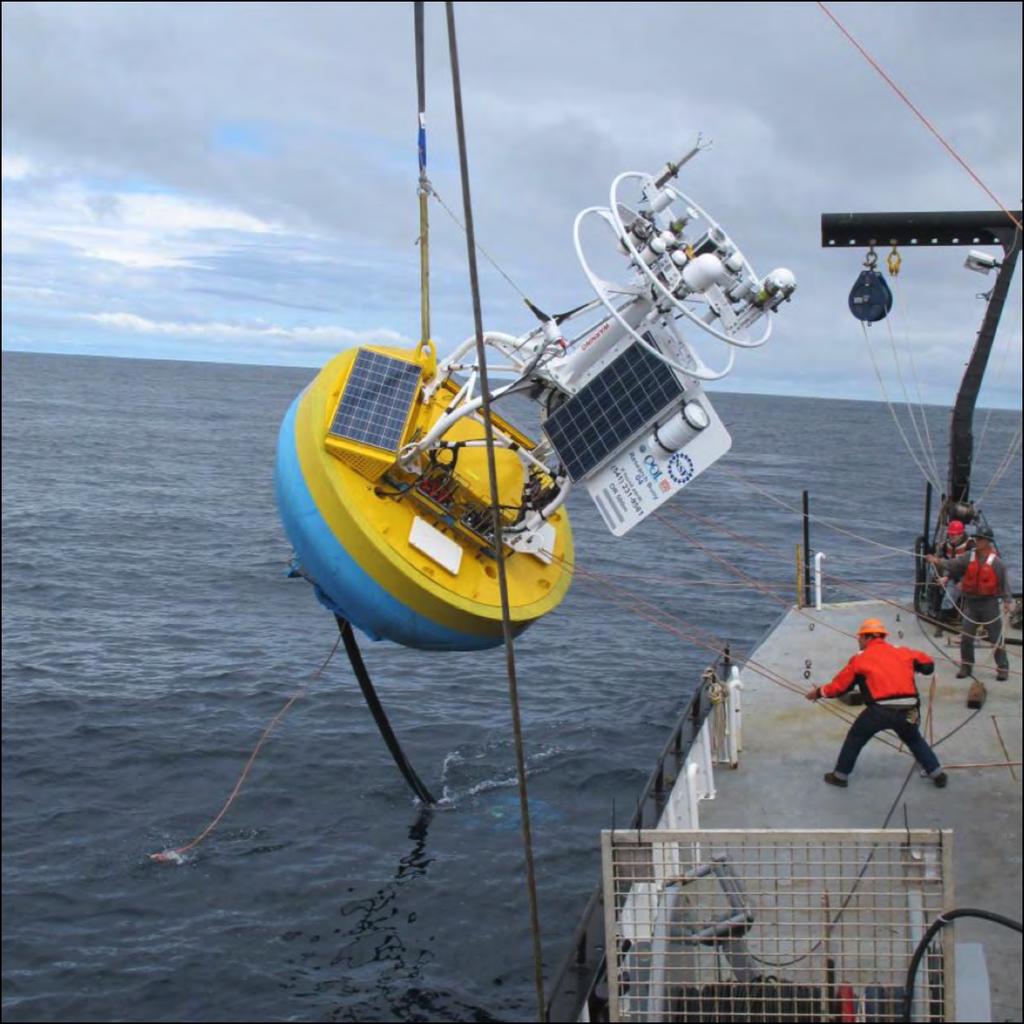
18 18 Deploy
19 2016 Opera-onal Schedule 2016 January February March April May June July August September October November December Argentine Basin Shipment Refurb Palmer Cruise 55 South Shipment Palmer Cruise Irminger Armstrong Cruise Papa Brown Cruise Jun- Jul Pioneer Endurance RSN -Glider Cruise - Ship out fm WHOI - Reseed Gliders -1/19 Quarterly Info Days - 2/1 Quarterly Info Days Thompson Cruise Apr- May Armstrong Cruise -Reseed gliders via Armstrong - Ship out fm WHOI - Reseed Gliders Sikuliaq Cruise Jul- Aug Armstrong Cruise Atlan-s Cruise CI Software - Build 8 - Build 9 OL / Governance / Work Shops 19-1/3-5 OOI Coastal Workshop - 1/25 NSF Review -2/21-26 Ocean Sciences (New Orleans) -3/9-10 Line P Workshop - Science Self- Assessment - OOI Workshop - Science Plan - OOI Workshop -NSF Review AWP - OOI Workshop -12/12-16 AGU (San Francisco)


20 Endurance Array Gliders Lithium baieriesà3 month deployments 20 km per day CTD, O 2, PAR, Chl-a, OBS, CDOM, velocity 20

 Science bay")
21 Endurance Array Glider Coverage 6 planned, 2 averaged ADCP some-mes off (baiery, electronics) Science bay some-mes off (baiery)
22 Endurance Array Plaeorm Regular Data Collec-on 10/14- Start Dates 10/14-8/15-8/16-8/14-4/14-8/14-

23 Washington Offshore Wire Following Profiler: 2 years of success CTD Oxygen Velocity PAR FLORT

24 Coastal Surface Piercing Profiler Cabled à uncabled conversion
25 Endurance Array Plaeorm Regular Data Collec-on 10/14- Start Dates 10/14- Cabled Endurance: when plaeorms on, instruments worked except CAMDS, some-mes ZPLSC & OPTAA CAMDS Digital s-ll camera Kongsberg OPTAA Op-cal aienua-on & absorp-on WET Labs ac-s ZPLSC Zooplankton sonar, coastal Simrad EK60 8/15-8/16-8/14-4/14-8/14-
26 Surface Mooring Instrument Data Summary CAMDS Digital still camera Very little data, software incomplete, frequent hardware failures, late procurement & poor quality OPTAA Optical attenuation and absorption No battery, so turns off if mooring fails. Long service interval so often not deployed. Significant biofouling. FDCHP Air-sea Flux direct covariance Frequent instrument hardware failures, late procurement NUTNR Dissolved nitrate Frequent instrument hardware failures, significant biofouling PCO2W Aqueous partial pressure carbon dioxide Finicky instrument, so major setup problems, now OK VEL3D High-frequency 3D point velocity Mooring software was unable to operate sensor until recently ZPLSC Zooplankton sonar Late procurement, occasional hardware or configuration failure, calibration under development PCO2A Air and sea partial pressure carbon dioxide Significant fouling on buoys, but now mitigated PHSEN ph Finicky instrument, so some setup problems, now OK ADCPT/S Acoustic Doppler current profiler Occasional instrument hardware failure or battery miscalculation CTDBP Conductivity, temperature, pressure Occasional battery miscalculation Some biofouling DOSTA Dissolved Oxygen, stable (vs. fast DOFST) Significant biofouling FLORT METBK Florescence (chlorophyll-a, optical backscatter, CDOM) Bulk meteorology (short & long wave radiation, air pressure, temperature, relative humidity, wind, rain) No battery, so turns off if mooring fails Some biofouling Occasional instrument hardware failure PRESF Bottom pressure No problems SPKIR Spectral irradiance No battery, so turns off if mooring fails Some biofouling VELPT Mean 3D point velocity Occasional instrument hardware failure or battery miscalculation


27 Buoy sensors covered (PCO2A, METBK-CT) Biofouling CSPP pain-ng shows mi-ga-on measures can work
28 Endurance Array Summary operate, maintain, deliver data, improve, make efficient, collaborate, work transparently, share Opportuni-es Use data Add instruments Change sampling Ancillary projects Join a cruise Talk with us 500 km 125 km 28
29
30 Subsurface Instruments have oqen become 10/14- autonomous 10/14- Stretch hoses WA Shelf & Offshore surface moorings hoses send power and data Inshore mooring and WFP hoses send data Revised hoses succeeded on latest Pioneer deployment Mooring Electronics Custom & complex, so many failure points beier each -me Long build & service intervals being fixed Connectors on all subsea controllers upgraded to -tanium 8/14-8/15-8/16-8/14-4/14-
NSF's Ocean Observatories Initiative: Building Research Infrastructure for the Pacific Northwest and the Broader Community
 Agenda Item B.3.b Supplemental OOI PowerPoint April 2013 Ocean Observatories Initiative NSF's Ocean Observatories Initiative: Building Research Infrastructure for the Pacific Northwest and the Broader
Ocean Observatories Initiative (OOI) Moorings: New Capabilities for Seagoing Science
 Moorings: New Capabilities for Seagoing Science") Ocean Observatories Initiative Ocean Observatories Initiative (OOI) Moorings: New Capabilities for Seagoing Science presented by Ed Dever and Walt Waldorf November 20, 2014 OOI Science Themes Coastal and
Ocean Observatories Initiative Ocean Observatories Initiative (OOI) Moorings: New Capabilities for Seagoing Science presented by Ed Dever and Walt Waldorf November 20, 2014 OOI Science Themes Coastal and
Axial Base (PN3A) Medium-Power (MP) J-box
 Medium-Power (MP) J-box") Axial Base (PN3A) Medium-Power (MP) J-box Location: 46.1 N, 129.6 W Depth of Water Column: 2654 m This node supports geophysical instruments at the base of Axial Seamount. Instrument Name/Description Data
Axial Base (PN3A) Medium-Power (MP) J-box Location: 46.1 N, 129.6 W Depth of Water Column: 2654 m This node supports geophysical instruments at the base of Axial Seamount. Instrument Name/Description Data
Pioneer Array Micro-siting Public Input Process Frequently Asked Questions
 Pioneer Array Micro-siting Public Input Process Frequently Asked Questions The National Science Foundation (NSF) has completed the micro-siting of the moored array of the Ocean Observatories Initiative
MAPCO2 Buoy Metadata Report Project Title:
 MAPCO2 Buoy Metadata Report Project Title: Autonomous Multi-parameter Measurements from a Drifting Buoy During the SO GasEx Experiment Funding Agency: NOAA Global Carbon Cycle program PI(s): Christopher
The Wave Glider: A Mobile Buoy Concept for Ocean Science. 009 Liquid Robotics Inc.
 The Wave Glider: A Mobile Buoy Concept for Ocean Science 009 Liquid Robotics Inc. J. Manley & T. Richardson: Liquid Robotics Inc. DBCP XXV Paris September 28, 2009 1 Wave Glider Overview Unique Two Part
An IOOS Operational Wave Observation Plan Supported by NOAA IOOS Program & USACE
 An IOOS Operational Wave Observation Plan Supported by NOAA IOOS Program & USACE R.E. Jensen, W.A. Birkemeier and W. Burnett JCOMM-Workshop on Wave Measurements from Buoys Wave Information to Application
Mooring Modifications for the Reduction of Losses to Vandalism
 Mooring Modifications for the Reduction of Losses to Vandalism H. Paul Freitag Chris Meinig Andrew J. Shepherd Pacific Marine Environmental Laboratory Seattle, Washington, USA Linda D. Stratton JISAO/University
Autonomous Environmental Profiling Moorings for Coastal Monitoring
 Autonomous Environmental Profiling Moorings for Coastal Monitoring Jeffrey W. Book Naval Research Laboratory, Stennis Space Center, MS Introduction There are many reasons to monitor coastal environments
PRELIMINARY CRUISE REPORT, W9909C R/V WECOMA, September 1999 GLOBEC/ENSO Long-Term Observations off Oregon
 Submitted by Jane Fleischbein College of Oceanic & Atmospheric Sciences Oregon State University Corvallis, Oregon 97331-553 flei@oce.orst.edu, 541.737.5698 FILING DATE: 1 October 1999 PRELIMINARY CRUISE
Application for Consent to Conduct Marine Scientific Research. F Internal Waves in Straits (IWISE) Institution Contact Information Director
 Institution Contact Information Director") 1. General Information 1.1 Reference ID: Application for Consent to Conduct Marine Scientific Research Application number: Project name: F2010-111 Internal Waves in Straits (IWISE) 1.2 Sponsoring institution(s):
1. General Information 1.1 Reference ID: Application for Consent to Conduct Marine Scientific Research Application number: Project name: F2010-111 Internal Waves in Straits (IWISE) 1.2 Sponsoring institution(s):
CMORE HOE DYLAN October 2012 Draft cruise plan
 CMORE HOE DYLAN 11 1 4 October 2012 Draft cruise plan Cruise ID: KM12-21 Vessel: R/V KILO MOANA University of Hawaii Master of the Vessel: Captain Gray Drewry Chief Scientist: Tara Clemente (UH) OTG Marine
Atmospheric Forcing and the Structure and Evolution of the Upper Ocean in the Bay of Bengal
 DISTRIBUTION STATEMENT A. Approved for public release; distribution is unlimited. Atmospheric Forcing and the Structure and Evolution of the Upper Ocean in the Bay of Bengal J. Thomas Farrar and Robert
Well, Well, Well. BACKGROUND Seasonal upwelling is a very important process in the coastal ocean of the Pacific Northwest.
 Well, Well, Well SUMMARY In this activity students investigate the relationship between winds, surface currents, sea surface temperature and upwelling and downwelling off the coast of OR and WA. Students
Compiled by Uwe Dornbusch. Edited by Cherith Moses
 REPORT ON WAVE AND TIDE MEASUREMENTS Compiled by Uwe Dornbusch. Edited by Cherith Moses 1 Aims...1 2 Summary...1 3 Introduction...1 4 Site selection...1 5 Wave recorder settings...2 6 Results...2 6.1 Water
Cruise Plan Coastal Pioneer 4 Deployment Leg 1: R/V Atlantis Cruise AT April - 5 May 2015 Leg 2: R/V Atlantis Cruise AT-27 7 May - 14 May 2015
 Cruise Plan Coastal Pioneer 4 Deployment Leg 1: R/V Atlantis Cruise AT-27 28 April - 5 May 2015 Leg 2: R/V Atlantis Cruise AT-27 7 May - 14 May 2015 Control Number: Version: 0-03 Author: A. Plueddemann
How well do CMIP5 climate models reproduce Southern Ocean bottom temperature? Model climatology
 How well do CMIP5 climate models reproduce Southern Ocean bottom temperature? Model climatology (colours) plus August (dashed) & February (solid) sea ice edge. Heuzé et al. (2013, GRL) Autosub autonomous
The GCOOS Mooring Plan Element Draft, 19 February 2011
 The GCOOS Mooring Plan Element Draft, 19 February 2011 1. Introduction In order to proceed with the establishment of a regional coastal ocean observing system for the Gulf of Mexico, it is essential to
The Next Generation Easy-to-Deploy (ETD) Tsunami Assessment Buoy
 Tsunami Assessment Buoy") The Next Generation Easy-to-Deploy (ETD) Tsunami Assessment Buoy R.A. Lawson and D. Graham Science Applications International Corporation 4025 Hancock Street San Diego, CA 92110 USA S. Stalin, C. Meinig,
The Next Generation Easy-to-Deploy (ETD) Tsunami Assessment Buoy R.A. Lawson and D. Graham Science Applications International Corporation 4025 Hancock Street San Diego, CA 92110 USA S. Stalin, C. Meinig,
Potential applications of AUVs and Gliders in Offshore Windfarm Site Surveys
 Potential applications of AUVs and Gliders in Offshore Windfarm Site Surveys Dr James Hunt (National Oceanography Centre, Southampton) MREKE Internship in partnership with MARS at NOCS Introduction to
Columbia River Plume 2006 OSU Ocean Mixing Nash, Kilcher, Moum et al. CR05 Cruise Report (RISE Pt. Sur, May )
") CR05 Cruise Report (RISE Pt. Sur, May 21-31 2006) Group Summary: Participants: Pt. Sur Ocean Mixing Group: Jonathan Nash, Levi Kilcher, Alexander Perlin, Greg Avicola; Pt. Sur UW: Emily Spahn (Alex Horner-Devine;
CR05 Cruise Report (RISE Pt. Sur, May 21-31 2006) Group Summary: Participants: Pt. Sur Ocean Mixing Group: Jonathan Nash, Levi Kilcher, Alexander Perlin, Greg Avicola; Pt. Sur UW: Emily Spahn (Alex Horner-Devine;
"Real-Time Vertical Temperature, and Velocity Profiles from a Wave Glider"
 DISTRIBUTION STATEMENT A. Approved for public release; distribution is unlimited. "Real-Time Vertical Temperature, and Velocity Profiles from a Wave Glider" Luca Centurioni Scripps Institution of Oceanography
CRUISE REPORT FOR UW BERING STRAIT MOORING PROJECT 2005 Rebecca Woodgate, University of
 CRUISE REPORT FOR UW BERING STRAIT MOORING PROJECT 2005 Rebecca Woodgate, University of Washington,woodgate@apl.washington.edu CCGC Sir Wilfrid Laurier 2005-05 Kodiak, 8 th July 2005 Barrow, 22nd July
Understanding the Dynamics of Shallow-Water Oceanographic Moorings
 Understanding the Dynamics of Shallow-Water Oceanographic Moorings Mark A. Grosenbaugh Department of Applied Ocean Physics & Engineering Woods Hole Oceanographic Institution Woods Hole, MA 02543 phone:
South Bay Coastal Ocean Observing System California Clean Beaches Initiative
 South Bay Coastal Ocean Observing System California Clean Beaches Initiative Quarterly Report September 2003 to City of Imperial Beach Eric Terrill 1 1 Scripps Institution of Oceanography, University of
Effects of Offshore Forcing in the Nearshore Environment
 Effects of Offshore Forcing in the Nearshore Environment Geno Pawlak Department of Ocean and Resources Engineering University of Hawaii at Manoa 2540 Dole St., Holmes Hall 402 Honolulu, HI 96822 phone:
Oceanographic Research With The LiquID Station
 Oceanographic Research With The LiquID Station Application Note OCEANOGRAPHIC RESEARCH The field of oceanography relies on knowing the precise physical, chemical, and biological state of seawater at different
Deep SOLO. Nathalie Zilberman, Dean Roemmich, and SIO float lab. 1. Deep SOLO float characteristics. 2. Deep SOLO float Deployment
 Deep SOLO Nathalie Zilberman, Dean Roemmich, and SIO float lab 1. Deep SOLO float characteristics 2. Deep SOLO float Deployment 3. Deep SOLO temperature and salinity Deep SOLO Float deployment, R/V Tangaroa
Noise Experiment #2. Marine Physical Laboratory Scripps Institution of Oceanography La Jolla, CA February 22 February 2010
 Noise Experiment #2 Marine Physical Laboratory Scripps Institution of Oceanography La Jolla, CA 92093-0701 16 February 22 February 2010 1. Objective The objective of the noise experiment is to observe
Wave energy converter effects on wave and sediment circulation
 Wave energy converter effects on wave and sediment circulation Grace Chang and Craig Jones Integral Consulting Inc. cjones@integral-corp.com; gchang@integral-corp.com Jesse Roberts, Kelley Ruehl, and Chris
Welcome to PolarConnect
 Welcome to PolarConnect with Lisa Seff and the Oceanographic Conditions of Bowhead Whale Habitat 2012 PolarTREC Expedition Friday 7 September 2012 7:15 a.m. AKDT (8:15 am PDT, 9:15 am MDT, 10:15 am CDT,
Surface Tracking Feature
 TELEDYNE RD INSTRUM ENTS A Teledyne Technologies Company Application Note FSA-022 (June 2008) Surface Tracking Feature 1 Introduction The following Application Note serves as a guide of how to use the
NWEI. Fred.Olsen. Columbia Power
 U.S. Marine Corps Base Hawaii, Kaneohe 30m, 60m, 80m berths in place, grid-connected First device deployed, second Jan 2016, third Sep 2016 HNEI role Funded by DOE, US Navy, ONR, State of Hawaii Acoustic,
High Frequency Acoustical Propagation and Scattering in Coastal Waters
 High Frequency Acoustical Propagation and Scattering in Coastal Waters David M. Farmer Graduate School of Oceanography (educational) University of Rhode Island Narragansett, RI 02882 phone: (401) 874-6222
Wave Glider: Liege Colloquium. Colloquium April 27
 The The Wave Wave Glider: Glider: Enabling Enabling aa New New Approach Approach to to Persistent Persistent Ocean Ocean Observation Observation and and Research Research nd Liege 42 42nd Liege Colloquium
ATON System Workshop
 ATON System Workshop ATON System: Real-time current measurements from Coast Guard navigation buoys in ports, bays and the coastal ocean Aid-to-Navigation = ATON ATON System Workshop Outline: Overview of
WEBB RESEARCH CORPORATION
 Use spacebar or arrow keys to advance slide show WEBB RESEARCH CORPORATION Falmouth, MA APEX Profiler SLOCUM Glider Rev: 06/22/08 WEBB RESEARCH CORPORATION Specialists in neutrally buoyant drifters and
High Ping Rate Profile Water Mode 12
 Application Note FSA-014 (October 2008) Revised October 2008 High Ping Rate Profile Water Mode 12 Introduction Water Mode 12 is the result of the continued evolution of the signal processing within our
Current observations at the Jan Mayen Ridge
 Current observations at the Jan Mayen Ridge Kjell Arne Mork 1, Ken Drinkwater 1, Steingrimur Jónsson 2, Hédinn Valdimarsson 2 1 Institute of Marine Research and Bjerknes Centre for Climate Research, Bergen,
BACKGROUND TO STUDY CASE
 BACKGROUND TO STUDY CASE German Aerospace Center (DLR) is using Andøya Rocket Range for a sounding rocket campaign. On 27th October 2005 a 300 kg payload (SHEFEX) was launched Due do a technical problems
RR10106 Cruise Plan ITOP Mooring Recovery and PhilSea10 Seaglider Operation (R/V Revelle November 6-26, 2010)
") RR10106 Cruise Plan ITOP Mooring Recovery and PhilSea10 Seaglider Operation (R/V Revelle November 6-26, 2010) Chief Scientist: Ren-Chieh Lien, Applied Physics Lab, University of Washington Co-Chief Scientist:
RR10106 Cruise Plan ITOP Mooring Recovery and PhilSea10 Seaglider Operation (R/V Revelle November 6-26, 2010) Chief Scientist: Ren-Chieh Lien, Applied Physics Lab, University of Washington Co-Chief Scientist:
Vertical in situ profiles of nitrate and oxygen in the northern Japan Sea
 Vertical in situ profiles of nitrate and oxygen in the northern Japan Sea Dmitry D. Kaplunenko, Vyacheslav B. Lobanov, Pavel Ya. Tishchenko and Maria G. Shvetsova V.I.Il'ichev Pacific Oceanological Institute,
WHOTS Mooring Subsurface Instrumentation
 UH Contributions to WHOTS-13 Cruise Report by Fernando Santiago-Mandujano, Daniel McCoy, Jefrey Snyder, R. Walter Deppe, Kellen Rosburg, Glenn Carter, Katrina Berry, and Roger Lukas WHOTS Mooring Subsurface
Regional Analysis of Extremal Wave Height Variability Oregon Coast, USA. Heidi P. Moritz and Hans R. Moritz
 Regional Analysis of Extremal Wave Height Variability Oregon Coast, USA Heidi P. Moritz and Hans R. Moritz U. S. Army Corps of Engineers, Portland District Portland, Oregon, USA 1. INTRODUCTION This extremal
BUYER S GUIDE AQUAlogger 520
 OCEAN & ENVIRONMENTAL BUYER S GUIDE AQUAlogger 520 Mini Temperature and Pressure Logger AQUAlogger 520 Aquatec s primary temperature and depth model, the AQUAlogger 520, combines years of product development
The MEDUSA Deep Sea and FUSION AUVs:
 1 The MEDUSA Deep Sea and FUSION AUVs: When Research and business get together EMRA 2017, Girona, Spain 15 May 2017 Bruno Cardeira/IST Deep Ocean Exploration -Why the effort? Portugal Exclusive Economic
The Wave Glider: A Persistent Platform for Ocean Science
 The Wave Glider: A Persistent Platform for Ocean Science Justin Manley and Scott Willcox Liquid Robotics - Sunnyvale, CA justin.manley@liquidr.com, http://www.liquidr.com Abstract The Wave Glider is an
National Report of China
 National Report of China Yu Ting (NMDIS), State Oceanic Administration (SOA), China DBCP 29, 27 Sep. 2013, Paris, France Contents 1 Current program status 2 Future deployment plan 3 Technical development
COMPARISON OF CONTEMPORANEOUS WAVE MEASUREMENTS WITH A SAAB WAVERADAR REX AND A DATAWELL DIRECTIONAL WAVERIDER BUOY
 COMPARISON OF CONTEMPORANEOUS WAVE MEASUREMENTS WITH A SAAB WAVERADAR REX AND A DATAWELL DIRECTIONAL WAVERIDER BUOY Scott Noreika, Mark Beardsley, Lulu Lodder, Sarah Brown and David Duncalf rpsmetocean.com
South Bay Coastal Ocean Observing System California Clean Beaches Initiative
 South Bay Coastal Ocean Observing System California Clean Beaches Initiative Quarterly Report March 2004 to City of Imperial Beach Eric Terrill 1 1 Scripps Institution of Oceanography, University of California,
The Evolution of Vertical Spatial Coherence with Range from Source
 The Evolution of Vertical Spatial Coherence with Range from Source Peter H. Dahl Applied Physics Laboratory and Mechanical Engineering Dept. University of Washington Research sponsored by U.S. Office of
MOTUS Wave Buoys. Powered By the Aanderaa MOTUS Directional Wave Sensor
 MOTUS Wave Buoys Powered By the Aanderaa MOTUS Directional Wave Sensor Two Buoys, One Brain The Aanderaa MOTUS directional wave sensor factory calibrated and currently available on two proven buoy platforms:
JCOMM Technical Workshop on Wave Measurements from Buoys
 JCOMM Technical Workshop on Wave Measurements from Buoys Val Swail Chair, JCOMM Expert Team on Wind Waves and Storm Surges Neville Smith Vincent Cardone Peter Janssen Gerbrand Komen Peter Taylor WIND WAVES
Observations of Near-Bottom Currents with Low-Cost SeaHorse Tilt Current Meters
 DISTRIBUTION STATEMENT A. Approved for public release; distribution is unlimited. Observations of Near-Bottom Currents with Low-Cost SeaHorse Tilt Current Meters Vitalii A. Sheremet, Principal Investigator
US Navy Wave Energy Test Site. Kaneohe, HI
 US Navy Wave Energy Test Site Kaneohe, HI Presented by: Luis A. Vega Ph.D., HNEI, University of Hawaii September 24, 2014 MHK Testing in Hawaii (excluding OTEC) What do you do to support/facilitate testing?
Mini-Pro CO2 Sensor User s Manual - ANALOG MODEL -
 Mini-Pro CO2 Sensor User s Manual - ANALOG MODEL - Table of Contents 1. Introduction 3 2. Instrument Setup 4 2.1 Instrument Checklist 4 2.2 Optional Accessories 4 2.3 Gas Concentration Ranges Available
Long-Term Performance of an AWAC Wave Gage, Chesapeake Bay, VA
 Long-Term Performance of an AWAC Wave Gage, Chesapeake Bay, VA P. T. Puckette G. B. Gray Evans-Hamilton, Inc. 3319 Maybank Highway Johns Is, SC 29455 USA Abstract- Evans-Hamilton, Inc. deployed a Nortek
Draft of OKMC Cruise Plan (R/V Revelle June 1-14, 2012 RR1205)
") Draft of OKMC Cruise Plan (R/V Revelle June 1-14, 2012 RR1205) Ren-Chieh Lien and Thomas B Sanford 1. Objectives In the RR1205 cruise, we will deploy five subsurface moorings, one surface mooring (TBD),
Draft of OKMC Cruise Plan (R/V Revelle June 1-14, 2012 RR1205) Ren-Chieh Lien and Thomas B Sanford 1. Objectives In the RR1205 cruise, we will deploy five subsurface moorings, one surface mooring (TBD),
State Estimation of the California Current System Using 4DVar Ocean Data Assimilation
 State Estimation of the California Current System Using 4DVar Ocean Data Assimilation Hajoon Song, Arthur J. Miller and Bruce Cornuelle Scripps Institution of Oceanography, UCSD International Workshop
The Great Coastal Gale of 2007 from Coastal Storms Program Buoy 46089
 The Great Coastal Gale of 2007 from Coastal Storms Program Buoy 46089 Richard L. Crout, Ian T. Sears, and Lea K. Locke NOAA National Data Buoy Center 1007 Balch Blvd. Stennis Space Center, MS 39529 USA
Ocean Observatories Initiative. Coastal & Global Scale Nodes. Hydrogen Safety. OOI Surface Mooring Hydrogen Safety Review
 Ocean Observatories Initiative Coastal & Global Scale Nodes Hydrogen Safety CP01 Mooring Timeline: 21 November 2013: CP01CNSM was deployed and transitioned to shore controlled operations. 17 Feb. 2014:
N. Robinson and A. Pyne
 ISSN 0375 8192 March 2004 Antarctic Data Series No 26 WATER COLUMN CURRENT PROFILE ANALYSIS FROM BENEATH THE MCMURDO ICE SHELF AT WINDLESS BIGHT AND UNDER THE SEA ICE IN GRANITE HARBOUR, ANTARCTICA N.
NORCOWE met-ocean measurement campaigns
 NORCOWE met-ocean measurement campaigns Kumer V.-M., Reuder J., Furevik B.,, Båserud L., Svardal B., Sæter C., Flügge M., Bakhoday Paskyabi M., Eecen P. University of Bergen, Norway, CMR, Norway, Meteorological
Country report - India NATIONAL INSTITUTE OF OCEAN TECHNOLOGY 07/10/2010
 Country report - India NATIONAL INSTITUTE OF OCEAN TECHNOLOGY 07/10/2010 XXVI DBCP meeting 28 September 2010 Department of Civil Engineering, NIT Trichy 2 FOCUS 1/5 of world population 50 % living along
CRUISE REPORT FOR UW/UAF BERING STRAIT MOORING PROJECT 2006 Rebecca Woodgate, University of
 CRUISE REPORT FOR UW/UAF BERING STRAIT MOORING PROJECT 2006 Rebecca Woodgate, University of Washington,woodgate@apl.washington.edu CCGS Sir Wilfrid Laurier SWL2006-01 Victoria, 1 st July 2006 Dutch Harbor,
An Investigation of Atmospheric Stability and Its Impact on Scatterometer Winds Across the Gulf Stream
 An Investigation of Atmospheric Stability and Its Impact on Scatterometer Winds Across the Gulf Stream Jim Edson University of Connecticut Doug Vandemark & Amanda Plagge University of New Hampshire CLIMODE
Global Surface Piercing Profiler Specification. Specification REVISIONS REV DESCRIPTION DATE APPROVAL
 REVISIONS REV DESCRIPTION DATE APPROVAL 1-00 Initial Release 13 October 2008 1-01 Amend sensor list 25 October 2008 1-02 Format and Review 31 October 2008 2-00 Revisions per ECR 1303-00039 19 May 2010
R3M: The 2.0 Ocean Observation Strategy for the Macaronesian region
 R3M: The 2.0 Ocean Observation Strategy for the Macaronesian region OUTLINE Where? Who? What? Why? What else? Where? Where? Where? European Station for Time-series in the OCean (ESTOC). Since 1992 60 Nm
A Wind Profiling Platform for Offshore Wind Measurements and Assessment. Presenter: Mark Blaseckie AXYS Technologies Inc.
 A Wind Profiling Platform for Offshore Wind Measurements and Assessment Presenter: Mark Blaseckie AXYS Technologies Inc. Any Sensor, Any Telemetry, Any Environment Founded in 1974 Part of the AXYS Group
Ocean Observatories Initiative Cabled Array Observatory Extension Cables/Connectors
 Ocean Observatories Initiative Cabled Array Observatory Extension Cables/Connectors Mike Harrington mikeh@apl.washington.edu Infrastructure Cable Laying Problem: Get to the interesting stuff. Laying interconnection
ENVIRONMENTAL DATA BUOYS
 ENVIRONMENTAL DATA BUOYS COMPACT. VERSATILE. POWERFUL NexSens CB-Series Data Buoys are designed for deployment in lakes, rivers, coastal waters, harbors, estuaries and other freshwater or marine environments.
Long-Term Autonomous Measurement of Ocean Dissipation with EPS-MAPPER
 Long-Term Autonomous Measurement of Ocean Dissipation with EPS-MAPPER Neil S. Oakey Bedford Institute of Oceanography Dartmouth, Nova Scotia Canada B2Y 4A2 phone: (902) 426-3147 fax: (902) 426-7827 e-mail:
CONSTRUCTION OF LNG RECEIVING TERMINAL ON THE SAINT LAWRENCE TIDAL CURRENT CONDITIONS IN THE LEVIS AREA
 RABASKA PROJECT CONSTRUCTION OF LNG RECEIVING TERMINAL ON THE SAINT LAWRENCE TIDAL CURRENT CONDITIONS IN THE LEVIS AREA FINAL REPORT MARCH 2006 N/Réf. : 24237.360 3075, ch. des Quatre-Bourgeois Sainte-Foy
Fine-Scale Survey of Right and Humpback Whale Prey Abundance and Distribution
 DISTRIBUTION STATEMENT A. Approved for public release; distribution is unlimited. Fine-Scale Survey of Right and Humpback Whale Prey Abundance and Distribution Joseph D. Warren School of Marine and Atmospheric
COMPARISON OF DEEP-WATER ADCP AND NDBC BUOY MEASUREMENTS TO HINDCAST PARAMETERS. William R. Dally and Daniel A. Osiecki
 COMPARISON OF DEEP-WATER ADCP AND NDBC BUOY MEASUREMENTS TO HINDCAST PARAMETERS William R. Dally and Daniel A. Osiecki Surfbreak Engineering Sciences, Inc. 207 Surf Road Melbourne Beach, Florida, 32951
A Diver-Operated Optical and Physical Profiling System
 1421 A Diver-Operated Optical and Physical Profiling System J. RONALD V. ZANEVELD AND EMMANUEL BOSS School of Oceanic and Atmospheric Sciences, Oregon State University, Corvallis, Oregon CASEY M. MOORE
Survey design and acquisition of a 4-C ocean-bottom seismometer survey over the White Rose oilfield, offshore Newfoundland
 White Rose OBS, 2002 Survey design and acquisition of a 4-C ocean-bottom seismometer survey over the White Rose oilfield, offshore Newfoundland Kevin W. Hall and Robert R. Stewart ABSTRACT CREWES, in conjunction
CROSS-SHORE SEDIMENT PROCESSES
 The University of the West Indies Organization of American States PROFESSIONAL DEVELOPMENT PROGRAMME: COASTAL INFRASTRUCTURE DESIGN, CONSTRUCTION AND MAINTENANCE A COURSE IN COASTAL DEFENSE SYSTEMS I CHAPTER
Archimer
 Please note that this is an author-produced PDF of an article accepted for publication following peer review. The definitive publisher-authenticated version is available on the publisher Web site Sea Technology
Deploying the TCM-1 Tilt Current Meter in an Inverted (Hanging) Orientation By: Nick Lowell, Founder & President
 Orientation By: Nick Lowell, Founder & President") Lowell Instruments Application Note #TCMA Deploying the TCM-1 Tilt Current Meter in an Inverted (Hanging) Orientation By: Nick Lowell, Founder & President 1 Introduction The TCM-1 Tilt Current Meter (TCM)
Lowell Instruments Application Note #TCMA Deploying the TCM-1 Tilt Current Meter in an Inverted (Hanging) Orientation By: Nick Lowell, Founder & President 1 Introduction The TCM-1 Tilt Current Meter (TCM)
Long term observations of internal waves with shore based video cameras. Ata Suanda and John A. Barth
 Long term observations of internal waves with shore based video cameras Ata Suanda and John A. Barth Internal wave? What is an internal wave? Interior oscillations What is an internal wave? Interior oscillations
Does Depth Matter? Examining Factors that could Influence the Acoustic Identification of Odontocete Species on Bottom-Moored Recorders
 DISTRIBUTION STATEMENT A. Approved for public release; distribution is unlimited. Does Depth Matter? Examining Factors that could Influence the Acoustic Identification of Odontocete Species on Bottom-Moored
Application for Consent to Conduct Marine Scientific Research in Japan. Date: 18 December 2009 Revised 1/7/ General Information
 Application for Consent to Conduct Marine Scientific Research in Japan Date: 18 December 2009 Revised 1/7/10 1. General Information 1.1 Project name and/or #: Impact of Typhoons on the Pacific: Glider
U.S. Marine Corps Base Hawaii, Kaneohe 30m berth in place (~1km offshore) 60, 80m berths completed in 2015 (~2km offshore) Grid connected
 60, 80m berths completed in 2015 (~2km offshore) Grid connected") U.S. Marine Corps Base Hawaii, Kaneohe 30m berth in place (~1km offshore) 60, 80m berths completed in 2015 (~2km offshore) Grid connected HNEI Research at the US Navy Wave Energy Test Site Patrick Cross
U.S. Marine Corps Base Hawaii, Kaneohe 30m berth in place (~1km offshore) 60, 80m berths completed in 2015 (~2km offshore) Grid connected HNEI Research at the US Navy Wave Energy Test Site Patrick Cross
Cooperative Navigation for Autonomous Underwater Vehicles. Navigare 2011, 4 May 2011, Bern
 Cooperative Navigation for Autonomous Underwater Vehicles Navigare 2011, 4 May 2011, Bern Distributed Intelligent Systems and Algorithms Laboratory disal.epfl.ch Alexander Bahr Land, atmosphere and sea
Air-Sea Interaction Spar Buoy Systems
 DISTRIBUTION STATEMENT A: Distribution approved for public release; distribution is unlimited Air-Sea Interaction Spar Buoy Systems Hans C. Graber CSTARS - University of Miami 11811 SW 168 th Street, Miami,
Probing the subsurface ocean processes using ocean LIDARS
 Probing the subsurface ocean processes using ocean LIDARS Authors: Robert Arnone (1), Sergio Derada (1), Sherwin Ladner (1), and Charles Trees (2) (1) NRL, Oceanography Division, Stennis Space Center,
Quality control of data streams at ANFOG
 Quality control of data streams at ANFOG Christine Hanson & Claire Gourcuff Australian National Facility for Ocean Gliders (ANFOG), School of Environmental Systems Engineering (SESE) and UWA Oceans Institute
IX. Upper Ocean Circulation
 IX. Upper Ocean Circulation World Ocean Covers 71% of Earth s surface Contains 97% of surface water Arctic Ocean NH: 61% ocean, 39% land Pacific Ocean Atlantic Ocean Southern Ocean Indian Ocean SH: 81%
volvooceanrace.com Volvo Ocean Race Science programme Preliminary results Legs 10 and 11 Cardiff - Gothenburg - The Hague
 Volvo Ocean Race Science programme Preliminary results Legs 10 and 11 Cardiff - Gothenburg - The Hague Volvo Ocean Race 2017-2018 Preliminary results Legs 10 and 11 Compiled using data provided by Dr Toste
Imprints of Coastal Mountains on Ocean Circulation and Variability
 Imprints of Coastal Mountains on Ocean Circulation and Variability Shang-Ping Xie 1 with C.-H. Chang 1, W. Zhuang 2, N. Schneider 1, J. Small 3, B. Taguchi 4, and H. Sasaki 4 1 IPRC, University of Hawaii
Radar Remote Sensing of Waves and Episodic Flow Events
 DISTRIBUTION STATEMENT A. Approved for public release; distribution is unlimited. Radar Remote Sensing of Waves and Episodic Flow Events PI: Merrick C. Haller 220 Owen Hall Oregon State University Corvallis,
Acoustic Focusing in Shallow Water and Bubble Radiation Effects
 Acoustic Focusing in Shallow Water and Bubble Radiation Effects Grant B. Deane Marine Physical Laboratory, Scripps Institution of Oceanography UCSD, La Jolla, CA 92093-0238 Phone: (858) 534-0536 fax: (858)
Adaptation to climate variation in a diversified fishery:
 Adaptation to climate variation in a diversified fishery: The West Coast groundfish trawl fishery Lisa Pfeiffer Northwest Fisheries Science Center, NOAA Fisheries Seattle, Washington USA The West Coast
Eric J. Aronchick, B.S. Oceanographic Field Technician
 , B.S. Oceanographic Field Technician EXPERTISE Experienced in conducting offshore shallow, mid, and deep water deployment and recovery operations of oceanographic instrumentation and equipment. Skilled
What s UP in the. Pacific Ocean? Learning Objectives
 What s UP in the Learning Objectives Pacific Ocean? In this module, you will follow a bluefin tuna on a spectacular migratory journey up and down the West Coast of North America and back and forth across
RV Southern Surveyor. program. voyagesummaryss02/2010
 2009 RV Southern Surveyor program voyagesummaryss02/2010 SS02/2010 IMOS-Southern Ocean Time Series Facility Voyage period Start: 16/03/2010 End: 22/03/2010 Port of departure: Hobart, Tasmania, Australia
Coastal Wave Studies FY13 Summary Report
 DISTRIBUTION STATEMENT A. Approved for public release; distribution is unlimited. Coastal Wave Studies FY13 Summary Report Jeffrey L. Hanson US Army Corps of Engineers, Field Research Facility 1261 Duck
Ocean Conditions, Salmon, and Climate Change
 Ocean Conditions, Salmon, and Climate Change John Ferguson 1 NOAA Fisheries Northwest Fisheries Science Center Seattle, Washington 1 Talk represents work by dozens of scientists at NWFSC and OSU Today
Nortek Technical Note No.: TN-021. Chesapeake Bay AWAC Evaluation
 Nortek Technical Note No.: TN-021 Title: Chesapeake Bay AWAC Evaluation Last Edited: October 5, 2004 Authors: Eric Siegel-NortekUSA, Chris Malzone-NortekUSA, Torstein Pedersen- Number of Pages: 12 Chesapeake