years, as liquid water and vapor, and I know Lake Okeechobee very
|
|
|
- Roger Mitchell Higgins
- 6 years ago
- Views:
Transcription


1


2 V E R Y EAR LY Y HI H STO R Y HI FRIENDS. MY NAME IS WAYNE DROP. I KNOW, YOU MAY THINK IT S RAIN DROP, BUT NO, IT S WAYNE. I HAPPEN TO BE A WATER DROP WHO LIKES to tell stories, particularly about my favorite topic: south Florida s fascinating natural environment. I have been asked by the U.S. Army Corps of Engineers to tell you about Lake Okeechobee. Why me? Simple! I ve been around for thousands of years, as liquid water and vapor, and I know Lake Okeechobee very well. Through my unique abilities to travel through time and transform myself, I see things from different perspectives. You could say I view life from a birds-eye point of view. I may be able to show you some things about the lake and Herbert Hoover Dike that you may not learn about otherwise. Of course, it requires a little imagination to pay attention to a water drop, but believe me, the story is pretty interesting! I ve been around for thousands of years, as liquid water and vapor, and I know Lake Okeechobee very well. Lake Okeechobee and its littoral zone


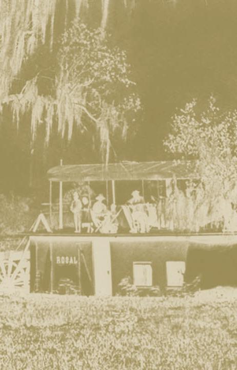
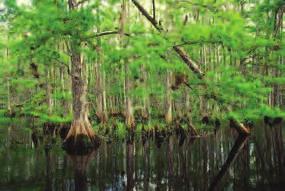
3 LAKE OKEECHOBEE has a RICH and INTERESTING PAST 1 TO UNDERSTAND this remarkable resource that we call Lake Okeechobee, we have to travel back in time. Like the Everglades, Lake Okeechobee is approximately 6,000 years old. In the history of the Earth, this is a relatively young ecosystem. It emerged when the seas receded, revealing the state of Florida and a shallow depression that became the lake. Lake Okeechobee has always been the liquid heart of south Florida. The lake was very shallow, but still, it could hold a lot of water. Each year, it captured billions of gallons of rainwater. During the summers, the lake often overflowed its southern rim, sending a miles-wide sheet of fresh water to the south. This pattern of sending abundant fresh water south helped create the Everglades, which originally covered 4 million acres. During the summers, the lake often overflowed its southern rim, sending a miles-wide sheet of fresh water to the south. Dense vegetation once Some of Florida s surrounded the lake. earliest inhabitants lived near Lake Okeechobee. There is evidence that Native American tribes settled close to the lake 4,000 years ago. More recently, the Seminoles named it Okeechobee, which means Big Water in their native language. Like much of south Florida, Lake Okeechobee presented a difficult and challenging environment. The lake had no natural outlets such as rivers or streams and was surrounded by dense vegetation that kept people from getting to it. Some early explorers never saw it so they refused to believe it even existed. The lake first appeared on maps in 1837, but remained largely unknown to European-descendent settlers until the late 1800s.


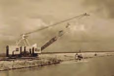
4 2 THE LAKE has Changed DRAMATICALLY M O D E R N HI H STO R Y The first canal draining water from Lake Okeechobee was built in the 1880s. These canals later allowed successful steamboat travel on the lake and associated rivers. LAKE OKEECHOBEE HAS changed dramatically in the past 120 years, as has most of Florida. The historic lake was 25 percent larger than it is today, was deeper averaging 20 to 21 feet and had a wide vegetation area that covered the place where the shore and the water met. A vegetated area that circles a lake s shoreline is called a littoral zone. Lake Okeechobee s original littoral zone is now completely gone. The lake had a sandy bottom and its waters were probably very clear and clean. The lake has changed over time for many reasons, most of which were caused by people. Early settlers wanted to make Florida a nice place to live. However, Florida is low, it has many wetlands, and it floods frequently. Early pioneers wanted to drain floodwaters from Florida as quickly as possible. All eyes looked to frequently flooded Lake Okeechobee as the biggest problem to tackle. Hamilton Disston, a wealthy Philadelphia industrialist, felt the best way to drain floodwaters north of the lake was to create outlets in the lake. Like removing the stopper from a basin, outlets would allow water from north of the lake to flow through the lake and out to sea. This would open up thousands of acres for cattle ranching, farming and urban development north of the lake. Disston made the first attempt to drain floodwaters by connecting the Caloosahatchee River to Lake Okeechobee. By 1882, steamboats were sailing from Fort Myers to Orlando! Continuing with these early efforts, from 1907 to 1927 the state s Everglades Drainage District dredged four large canals In all, 440 miles of drainage canals were built by south of the lake to the Atlantic Ocean and one east to the St. Lucie estuary all in an effort to drain water to sea. In all, 440 miles of canals and levees had been built by 1927 in an attempt to make this difficult state easier to live and grow crops in. However, these early drainage efforts were no match against Mother Nature. In 1926 and 1928, two hurricanes swept through south Florida, killing an estimated 3,000 people and leaving another 40,000 homeless. Hurricane force winds pushed water to the north part of the lake and then the water sloshed back to the south. The hurricane waters destroyed 21 miles of a small earthen dam that had been built on the south side of the lake. The floodwaters destroyed almost everything in its path and killed many people. Moore Haven, Belle Glade, South Bay and Okeechobee were among the cities that flooded. Flooded areas in 1928.


5 3 Following the storm of 1928, residents were terrified by the thought that the lake could overflow again. The federal government was asked to increase efforts to drain south Florida and make sure Lake Okeechobee never overflowed again. The U.S. Army Corps of Engineers built a huge earthen dike around Lake Okeechobee. The dike was constructed from sand, muck and other earthen materials piled up from the lake basin. The dike, at its base, was as wide as a football field. It was about three stories tall and shielded the most vulnerable areas along the southern rim of the lake. The dike was considered an impressive flood control structure. As most people who have lived in Florida for any length of time can tell you, the state is a land of weather extremes. In the 1930s and 1940s, Florida then experienced a very severe drought, lasting about 15 years. During this time, wildfires raged out of control in the Everglades, made worse by the four large drainage canals which had artificially lowered groundwater levels. Early residents were having a difficult time living in this land of extremes. Hurricanes presented many challenges to early settlers. Early flood control efforts were no match against two hurricanes in Then, in 1947, an event happened that changed the course of history in Florida. Two back-to-back hurricanes hit, causing widespread flooding from Orlando to Miami. Though floodwaters did not recede for months, there was little loss of life associated with the storms. Economic losses were huge, however. Agricultural crops and beef and dairy cattle industries suffered millions of dollars of damage. Life came to a standstill for many. Northern visitors were reluctant to spend winters in this unpredictable state. Residents of Florida had enough! In 1948, the state asked Congress for help. The Florida Legislature asked for a flood control project that would tame the wild swings of nature and allow the state to grow and prosper. Congress authorized the Central & Southern Florida Flood Control Project. Over the next 20 years, the U.S. Army Corps of Engineers designed and built an engineering marvel. The C&SF Project consisted of 1,000 miles of canals and 720 miles of levees. The dike around Lake Okeechobee was strengthened, completed and was renamed the Herbert Hoover Dike in The C&SF Project safely routed water throughout central and south Florida, allowing the region to grow to more than 7 million people today and support one of the nation s most productive agricultural areas. However, water management efforts took a toll on the natural environment. A world class flood control project was started in the early 1950s to effectively drain floodwaters from Florida and protect its residents. This dragline is shown in Construction of the project continued into the 1970s.


6 4 Managed for MULTIPLE and CONFLICTING PURPOSES THE E LA L K E TO T D AY NOW, LAKE OKEECHOBEE IS VERY DIFFERENT FROM THE HISTORIC lake. The lake has been reduced to 730 square miles still great enough to be the largest lake in the southeastern United States and secondlargest freshwater lake fully in the continental United States (far behind those of the Great Lakes, though). It also is much shallower today, averaging 9 feet deep. Today, Lake Okeechobee is a completely managed water body. About 60 percent of its water comes from five rivers and tributaries north of the lake and the remaining 40 percent comes from rainfall directly over the lake. Trillions of gallons of water are stored in the lake. All outflows are controlled by federal and state water managers through an intricate series of canals, locks and pump stations. Perhaps one of the biggest challenges is the fact that the lake now has multiple purposes. No longer does it function as a natural lake, but it must serve many often-conflicting goals. FLOOD CONTROL Water that was historically stored in wetlands in Florida many of which now are gone is stored in the lake. This has allowed the growth of cities and farms in its basin. The Herbert Hoover Dike allows for the storage of large amounts of water in the lake and prevents flooding from the lake. WATER SUPPLY The lake serves as a water supply source for farms in the Everglades Agricultural Area to the south of the lake and as a back-up water supply source for east coast urban areas. NATURAL ENVIRONMENT The lake provides habitat for plants, fish, waterfowl and other wildlife. Endangered and threatened species live in its watershed area. Impacts to its ecology can have significant effects many miles away. NAVIGATION The Okeechobee Waterway allows boat travel from Fort Myers to the St. Lucie River. FISHING, RECREATION AND TOURISM Lake Okeechobee offers some of the best sport fishing for largemouth bass and black crappie in the world, and is visited by anglers from around the nation. Other recreation in the lake and its basin includes bicycling, bird-watching, boating, camping, hiking and photography.
 C A N A L C A L O O S A H A T C H E E R Legend I V E R ( C -4 3 ) Herbert Hoover Dike Lake Okeechobee Waterway Littoral Zone MOORE HAVEN C A N A L N")

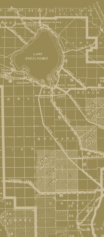
7 r HIGHLANDS COUNTY OKEECHOBEE 5 GLADES COUNTY LAKEPORT LAKE OKEECHOBEE MARTIN COUNTY. S T L U C I E PORT MAYACA ( C ) C A N A L C A L O O S A H A T C H E E R Legend I V E R ( C -4 3 ) Herbert Hoover Dike Lake Okeechobee Waterway Littoral Zone MOORE HAVEN C A N A L N CLEWISTON HENDRY COUNTY CANAL POINT PAHOKEE BELLE GLADE SOUTH BAY PALM BEACH COUNTY F i s h e a t i n g C r e e k Indian P rairie C anal Harney P ond C anal Lakeport Moore Haven K is s i mmee R i v e r Okeechobee Lake Okeechobee R oute 1 R oute 2 Pahokee Port Mayaca Canal Point Indiantown West Palm Beach C anal S t. L u c e i C a l a n Stuart Lake O C a l o o s a h a t c h e e R Fort Myers i v e r La Belle Clewiston Miami C anal South Bay North New R iver C anal Belle Glade Hillsboro Canal West Palm Beach

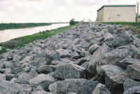
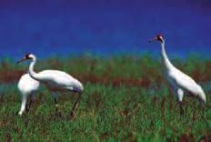
8 6 H E R B E R T HO H OVE R DI D K E Huge DIKE Provides Safety IT IS IMPOSSIBLE TO WRITE ABOUT LAKE OKEECHOBEE WITHOUT addressing the Herbert Hoover Dike. The dike has a profound impact on the lake, its health, and water management activities miles away. The U.S. Army Corps of Engineers designed and built the dike and is responsible for its maintenance today. The dike was originally built in the 1930s. It is constructed of earthen materials found on site: limestone, gravel, sand, rock and shell. This design was good at the time. Today, it would not be built this way. The dike was largely constructed from 1932 to It was strengthened and completed by The dike has not failed in its 70 years. The dike has not failed in its 70 years. It is 144 miles around and completely encircles the lake. However, because the dike is built of earthen materials, it is subject to internal erosion. Water can seep through the dike in a process called piping, in which small tunnels or pipes are formed which carry water and materials. The dike leaks during times of high water levels. It is very doubtful water would ever overtop the dike; the concern is leaking at its base. These issues have been well-known for years. In 2000, the Corps of Engineers completed a study of the conditions and decided to do a major repair to strengthen the dike. That same year, Congress approved a dike-strengthening program. Construction began on the strengthening project. However, after Hurricane Katrina in New Orleans in 2005, an Independent Technical Panel of experts reviewed the current construction plans and recommended more measures to strengthen the dike. The dike protects 60,000 people who live near the lake.
9 7 The dike can leak during times of high water levels. The Corps of Engineers is strengthening the dike in sections to prevent this. The Corps agrees with the findings and is implementing the panel s advice as quickly as possible. The plan cost an estimated $856 million in The new plan involves land acquisition, an expensive step not taken in the first plan. The South Florida Water Management District is assisting with the purchase of these lands. In addition, the Corps and state of Florida carefully regulate water levels in the lake, keeping the level lower, when possible, to maintain the safety of the dike and health of the lake. While the dike has never failed, it is always a prudent idea for people living near the lake to have a plan to prepare for and respond to hurricanes, as should all residents of Florida and other coastal areas of the United States.
10 8 Are VERY Carefully Managed TODAY WA TER R LEV E LS WATER LEVELS IN LAKE OKEECHOBEE ARE MANAGED by the Corps of Engineers and its state partner, the South Florida Water Management District. The Corps sets the water level based on the Lake Okeechobee Regulation Schedule, which takes many factors into consideration including the current level, rainfall, climate conditions and time of year. Each spring, the water level is lowered in anticipation of the summer rainy season. From June to November, the lake level is expected to rise as it captures rain falling directly on the lake and in the Kissimmee basin to its north. In the winter, during Florida s dry season, water from the lake is often used to augment water flows to the historic Everglades and to the Caloosahatchee and St. Lucie estuaries. It can also serve as the back-up water supply for cities east of the Everglades. The lake level tends to peak in the late summer and fall, and decline to a low point in the late spring. This level is carefully controlled by water managers, when possible. Lake Okeechobee s water level is the subject of a great deal of discussion as it has a huge impact on the health of the lake, water supplies for south Florida cities and farms, coastal estuaries, navigation and the safety of the dike. There is rarely one level that pleases all groups. The final level is balanced to take many factors into consideration. The Corps of Engineers revises the lake regulation schedule periodically based on new conditions and information. Lake Okeechobee Water Level Cycle The lake s level rises during Florida s abundant rainy season in the summer and fall and falls in the dry winter and spring months.
 of the lake, nature has most of the influence.")


11 Are INFLUENCED by Flood and DROUGHT 9 Mother Nature has a huge effect on Lake Okeechobee. Despite the best efforts of people to manage the water levels (and health) of the lake, nature has most of the influence. Too much water a flood causes water managers to send excess water to tide, harming the estuaries. The lake level can rise very quickly up to 4 feet in several weeks but then it takes months to release this amount of water. High lake levels harm wildlife and put added pressure on the dike. The other extreme a drought provides its own set of worries. As the lake level falls and miles of lake bed are exposed, recreation, boating and the local economy are affected. Water supplies are a very large concern, as south Florida depends on the lake as a back-up water supply source. Florida's historic 2007 drought wreaked havoc on natural ecosystems, including Lake Okeechobee. The only remedy for a drought is to 1) not make releases from the lake, 2) impose water use restrictions, 3) develop more long-term programs to conserve south Florida s water resources, and 4) develop additional places to store rainwater, to send it later to the lake and other natural systems as needed. In 2007, the lake fell to a record-breaking low of 8.82 feet above sea level in early July, as a drought affected the southeast United States. The drought continued into early Excess water from Lake Okeechobee is sent to sea -- in this case through the C-24 canal to the east coast. The U.S. Army Corps of Engineers and South Florida Water Management District plan seasons and years in advance to deal with these swings of nature in south Florida.


12 10 Faces Many CHALLENGES L A K E OK O E E C H O B E E THE MANY CHALLENGES FACED BY LAKE OKEECHOBEE INCLUDE OVERenrichment from phosphorus, spread of non-native plants and unnaturally high water levels. PHOSPHORUS. A byproduct of agricultural and urban activities, phosphorus has been flowing into the lake for more than 60 years. Today, it comes from agricultural operations largely north of the lake as well as urban fertilizer runoff. Phosphorus is embedded in the soil, is picked up in water, and then flows into the lake with water. The hurricanes of 2004 and 2005 worsened the situation, by sending additional phosphorus-enriched water into the lake and stirring up phosphorus on the lake bottom. Over-enrichment causes many problems, including upsetting the native plant balance, causing blue-green algal blooms and clouding water. It can affect fish and wildlife populations. Lastly, the polluted water then flows out to the estuaries, harming them too. NON-NATIVE PLANTS. Thousands of acres of Melaleuca, torpedo grass, cattail, and other invasive plant species have infested the lake. Federal and state governments have been successful in removing a great deal of the Melaleuca. Other non-natives are being tackled through aquatic spraying and biological measures. It is an ongoing battle, though, to remove these nuisance plants that crowd out natural vegetation and wildlife and interfere with navigation. HIGH WATER LEVELS. Unnaturally high water levels are harmful to the lake and dike. The Herbert Hoover Dike allows for the storage of vast amounts of water more than is healthy for the lake. Until recently, federal and state policy allowed for higher lake levels and more storage of water. However, high water levels drown the natural plant area that is essential to the health of the lake called the littoral zone. The littoral zone occupies up to 25 percent of the lake area, under certain circumstances. It provides habitat, oxygen, and a food source for aquatic life. In addition, shallow water levels encourage more light penetration into the lake, also beneficial. Lastly, high water levels put added pressure on the dike itself, which is not desirable. Managing the lake is a very complex undertaking.


13 11 LAKE OKEECHOBEE Water can Help or Hurt Coastal Estuaries Coastal estuaries can be greatly affected by changes in water flow. Pictured is the Indian River Lagoon. HISTORICALLY, water from the lake slowly drifted south to the Everglades. However, in an effort to provide flood control in Florida, and allow for the development of agriculture south of the lake, these discharges were sent west and east through the Caloosahatchee and St. Lucie estuaries. The result is that the estuaries are getting a source of water they did not receive historically. Estuaries are accustomed to brackish conditions, which is a mixture of fresh and saltwater less salty than sea water. Too much fresh or saltwater can be harmful. Estuaries provide many important functions, including serving as nurseries for juvenile marine life, so their good health is essential. Today, water discharges from Lake Okeechobee can be very harmful to the estuaries. Huge amounts of fresh water, often polluted, wreak havoc on these delicate environments. On rare occasions, though, lake discharges can help such as during droughts when saltwater is intruding and fresh water is needed. The estuaries depend on low flows from the lake in drought to keep saltwater from moving to them and into associated St. Lucie and Caloosahatchee rivers.


14 12 Programs are Under Way to Help Both the LAKE and its ASSOCIATED DIKE THE E FUTU F UTUR E THE U.S. ARMY CORPS OF Engineers and the South Florida Water Management District have important programs under way to protect Lake Okeechobee, the coastal estuaries, and the dike. The South Florida Water Management District and other state partners are working to improve the health of the lake and associated coastal estuaries through the Lake Okeechobee and Estuary Recovery (LOER) Program. This includes setting aside land for additional water storage, constructing Stormwater Treatment Areas to clean water prior to discharge to the lake (and later estuaries), identifying additional water storage areas, and identifying improved land use practices north of the lake to reduce fertilizer and urban runoff. In 2007, the Florida Legislature passed the Northern Everglades Protection Act, providing additional benefits to the lake and estuaries. In all seasons, the lake is beautiful.

15 13 The Comprehensive Everglades Restoration Plan (CERP) and other ecosystem restoration projects will help improve the health of Lake Okeechobee. CERP is a longterm $10.5 billion program to restore the greater Everglades ecosystem that includes Lake Okeechobee. CERP will benefit Lake Okeechobee directly by building many new water storage areas north of and around the lake to capture billions of gallons of water that would normally flow into the lake. This will keep the lake level 1 foot lower than it is today. This will improve the lake s ecology, prevent tons of phosphorus from entering the lake, and benefit the coastal estuaries by reducing unwanted discharges. CERP is a project of the U.S. Army Corps of Engineers in partnership with the state of Florida. Other efforts to benefit the lake include ongoing programs to remove and control non-native weeds, periodic updates of the Lake Okeechobee Regulation Schedule, and the U.S. Army Corps of Engineers Herbert Hoover Dike Rehabilitation Project. The goal of these programs is to keep the lake s water level lower, improve water quality, and properly maintain the dike. Lake Okeechobee is a critical resource to the state of Florida. It provides water supply, recreation, environmental and economic benefits and is truly the liquid heart of south Florida. While it has changed tremendously in the past century, these federal and state efforts costing billions of dollars will improve the lake s water quality and ecology and protect public safety, allowing future generations to enjoy and benefit from it. From left: Lake Okeechobee, the Herbert Hoover Dike, the rim canal, and the shoreline. The goal of these programs is to keep the lake s water level lower, improve water quality, and properly maintain the dike.

16 1-877-CERP-USA RECYCLED
Indian River Lagoon: Lessons, Challenges and Opportunities
 Indian River Lagoon: Lessons, Challenges and Opportunities Upper Chain of Lakes Lake Kissimmee Kissimmee River Indian River Lagoon Caloosahatchee Estuary Lake Okeechobee St. Lucie Estuary Mark Perry, Executive
Collaborative. City of Stuart. September 7, Mark Perry, Executive Director Oceanographic Society. Upper Chain of Lakes
 Lake Okeechobee Collaborative Upper Chain of Lakes Lake Kissimmee Indian River Lagoon City of Stuart September 7, 2016 Kissimmee River Caloosahatchee Estuary Lake Okeechobee St. Lucie Estuary Everglades
Kissimmee River Channelization
 Environmental Restoration ti Update Phil Flood, South Florida Water Management District Presentation Overview Kissimmee River Restoration Everglades Stormwater Treatment Areas Comprehensive Everglades
Warm-up # 7 A day 5/17 - B day 5/18 UPDATE YOUR TABLE OF CONTENTS
 Warm-up # 7 A day 5/17 - B day 5/18 UPDATE YOUR TABLE OF CONTENTS Question: List all examples of surface water on Earth. Answer: Rivers and streams, lakes and reservoirs, (ponds) wetlands, estuaries and
SALINITY. It's the amount of dissolved salts the water contains.
 AQUATIC ECOSYSTEMS SALINITY The types of organisms in an aquatic ecosystem depend upon the water s Salinity. It's the amount of dissolved salts the water contains. Salinity determines the two main aquatic
US Sugar Land Purchase, River of Grass Project, SugarHill Sector Plan, Amendment 1
 US Sugar Land Purchase, River of Grass Project, SugarHill Sector Plan, Amendment 1 Rivers Coalition September 24, 2014 Upper Chain of Lakes Lake Kissimmee Kissimmee River Caloosahatchee Estuary Lake Okeechobee
Impacts of Freshwater Releases from Lake Okeechobee on Sanibel Island and the Coastal Waters of Lee County
 Photo by Sanibel Captiva Conservation Foundation The freshwater plume extends out of Redfish Pass into the Gulf of Mexico on July 10, 2013. The freshwater plume is clearly visible in the Gulf of Mexico
Dear Future Leaders, Your help is greatly appreciated, Mary Ann Conrad Jensen Beach Elementary School Teacher
 TEACHER S EDITION Dear Future Leaders, As you carefully look at the cover of this book, you will realize how fortunate we are to live in such a beautiful place surrounded with rivers, oceans, and lakes.
Isaac's rains mean Lake Okeechobee may need lowering
 PLACE AN AD HOME DELIVERY JOBS CARS AUTOS A-Z REAL ESTATE RENTALS MERCHANDISE CLASSIFIED PUBLIC NOTICES Home News Broward Palm Beach Sports Entertainment Travel Lifestyle Business Health Opinion Video
Historical and planned changes in the south Florida ecosystem 1
 FA127 Historical and planned changes in the south Florida ecosystem 1 Alex Score and Charles Jacoby 2 The core of the south Florida ecosystem is a unique watershed, the Kissimmee Okeechobee Everglades
Plan 6 Project. Stop the destructive discharges to the Northern Estuaries and Restore the River of Grass. Upper Chain of Lakes.
 Upper Chain of Lakes Plan 6 Project Lake Kissimmee Kissimmee River Indian River Lagoon Stop the destructive discharges to the Northern Estuaries and Restore the River of Grass Caloosahatchee Estuary Lake
Caloosahatchee River Citizen s Association
 Caloosahatchee River Citizen s Association www.caloosahatchee.org Autumn 2002 Caloosahatchee Regional Park Plan Revised! Public Participation Pays off! Last fall the Lee County Parks & Recreation Department
HERBERT HOOVER DIKE REHABILITATION PROJECT
 HERBERT HOOVER DIKE REHABILITATION PROJECT Update to the Broward County Water Advisory Board 19 September 2013 Ingrid Bon, PE Project Manager Forward Initial Levees Along Lake Okeechobee Authorized by
Florida s Freshwater Fisheries. Mike S. Allen Mark W. Rogers Galen Kaufman. Chris M. Horton
 Evaluating Effects of Climate Change on Florida s Freshwater Fisheries Mike S. Allen Mark W. Rogers Galen Kaufman Chris M. Horton Methods Two parts: 1. Literature review to evaluate nationwide implications
Marine Ecosystems. Aquatic Ecosystems Section 2
 Marine Ecosystems Marine ecosystems are located mainly in coastal areas and in the open ocean. Organisms that live in coastal areas adapt to changes in water level and salinity. Organisms that live in
MARSH DEGRADATION AT THE MOUTH OF MOORE CREEK
 MARSH DEGRADATION AT THE MOUTH OF MOORE CREEK Hunter Winstanley, Department of Earth Sciences, University of South Alabama, Mobile, AL 36688. E-Mail: hcw501@jaguar1.usouthal.edu. Moore Creek is located
NYS Coastal Waters. Water Resources of NYS: THE NATURE of the COASTAL ZONE. NYS Coastal Waters. NYS Coastal Atlas. Coastal Zone Management 10/10/2014
 Water Resources of NYS: THE NATURE of the COASTAL ZONE NYS Coastal Waters NYS is the only state to border the Atlantic Ocean and the Great Lakes (Lakes Erie and Ontario). Great Lakes shoreline: 577 miles
Texas Water Resources Institute
 Texas Water Resources Institute November/December 1982 Volume 8 No. 6 A Precise Environment By Lou Ellen Ruesink, Editor, Texas Water Resources Aquarium enthusiasts know just how particular fish are about
INDEPENDENCE SEAPORT MUSEUM ACTIVITY PACKET
 INDEPENDENCE SEAPORT MUSEUM ACTIVITY PACKET Grades 6-8 Dear Teacher: We are so excited that you scheduled a visit to the Independence Seaport Museum with your class! To complement your students visit to
CHAPTER 11.1 THE WORLD OCEAN MARINE BIOMES NOTES
 CHAPTER 11.1 THE WORLD OCEAN MARINE BIOMES NOTES 1. The world ocean can be divided into zones both and. The,, and zones that apply to large lakes also apply to the ocean. 2. In addition to the depth zones,
This is America: The Potomac River Flows Through Cities, History
 This is America: The Potomac River Flows Through Cities, History Today we tell about the Potomac River. The Potomac is one of America s most historic waterways. It flows more than 600 kilometers, from
Canada s Natural Systems. Canadian Geography 1202
 Canada s Natural Systems Canadian Geography 1202 Canada s Natural Systems Natural System: A system found in nature Here are the four natural systems that we will explore in the next few weeks 1. Canada
located Let s go fishing Hydrilla
 Our Lake of the Month for November is Lake August (set your GPS to 27.2750-81.4136). The elevation of Lake August is 102.5. Lake August is a 52 acre dredge hole lake (man-made from a former wetland; see
Communications Report August 2016
 Communications Report August 2016 Facebook 1,457 total likes, 71 new likes 15 CBBEP Facebook posts about our projects and staff achievements Most successful post reached 26,000 people, 26,000! (PSA to
Oceans Humans both depend on it and threaten it with their activities
 Oceans Humans both depend on it and threaten it with their activities Oceans Water covers nearly ¾ of the Earth s surface More than 50% of the world s population lives within an hour of the coast Oceans
Vocabulary: Headwaters, watershed, tributaries, estuary, replica, point source pollution, nonpoint source pollution, amd river miles.
 From Source To Sea: Lesson Plan Concepts: 1. Understanding the path the Hudson River takes from the headwaters in the Adirondacks to the New York Harbor 2. Identifying the Hudson River watershed area,
Informational Text Assessment 3
 Local ssessment Item ank Reading Grade 5 Informational Text ssessment 3 Student Name: ate: This assessment is designed to provide information about reading comprehension skills. It contains a reading passage
Section 2: Biodiversity at Risk
 Section 2: Biodiversity at Risk Preview Classroom Catalyst Objectives Biodiversity at Risk Current Extinctions Species Prone to Extinction How Do Humans Cause Extinctions? Habitat Destruction and Fragmentation
Frequently Asked Questions About Revised Critical Habitat and Economic Analysis for the Endangered Arroyo Toad
 Q Frequently Asked Questions About Revised Critical Habitat and Economic Analysis for the Endangered Arroyo Toad Q. What is the arroyo toad? The arroyo toad (Bufo californicus) is a small, light greenish-grey
Integrated Pest Management Program Final Report
 Integrated Pest Management Program Final Report Shoreline Stewardship Program: Be a Lake Pan Pal Joan Bradshaw Specialized Regional Programs for Natural Resource Citrus, Hernando, Pasco and Sumter Counties
FLORIDA BAY: AN ECOSYSTEM ON THE BRINK
 E V E R G L A D E S R E S T O R A T I O N F A C T S H E E T FLORIDA BAY: AN ECOSYSTEM ON THE BRINK Background T he Florida Bay estuary is located at the southern edge of the Everglades ecosystem at the
IZAAK WALTON LEAGUE OF AMERICA. Strategic Plan
 IZAAK WALTON LEAGUE OF AMERICA Strategic Plan 2014-2019 At the turn of the 20th century, uncontrolled discharges of industrial waste and raw sewage, unrestricted logging, and soil erosion threatened to
f Agricultural S c i e n c SMALL EARTH DAMS LLOYD N. BROWN ^ CALIFORNIA AGRICULTURAL CIRCULAR 467 \ Experiment Station Extension Service
 f Agricultural S c i e n c SMALL EARTH DAMS LLOYD N. BROWN ^ CALIFORNIA AGRICULTURAL \ Experiment Station Extension Service CIRCULAR 467 Crest of dam Dry face slope 2 to 1 Downstream toe About 10,000 small
COMMUNITY WATERSHED PROJECT
 SABINE RED RIVER COMMUNITY WATERSHED PROJECT A Watershed Approach to Aquatic Resources Do you have a stake in the water, the wildlife, the use of the land? Help us do for fish what was done for ducks*.
Okeechobee Waterway Speed Restrictions
 Okeechobee Waterway Speed Restrictions Rulemaking Authority 327.46 FS. Law Implemented 327.46 FS. History New 9-18-88, Amended 12-7-89, Formerly 16N-24.010, Amended 10-1- 96, Formerly 62N-24.010, Amended
Searsville Dam Removal
 Searsville Dam Removal A unique opportunity for all Presented by the Beyond Searsville Dam Coalition San Francisquito Creek flows into the San Francisco Bay near the Palo Alto Airport and Golf Course seen
Adapting to Climate Change In Coastal Environments
 Adapting to Climate Change In Coastal Environments Peter Nimmrichter, P.Eng. AMEC Earth and Environmental, Mississauga, Ontario 19/11/2007 1 The Great Lakes Watershed The Great Lakes cover an area of 244,160
Geology of the Hawaiian Islands
 Geology of the Hawaiian Islands Class 24 8 April 2004 Any Questions? Rise and fall of sea level and its effect on Hawai`i Sea level Has fluctuated up and down many times in the geologic past Evidence?
Cat Island Chain Restoration
 Cat Island Chain Restoration 1820s Fox River Military Road Map to Fort Howard 1845 Chart of Green Bay & Fox River Cat Island Chain - 1938 Cat Island Brown County Aerial Photography, 1938 Historic Western
Case Study: Merritt Island National Wildlife Refuge
 Case Study: Merritt Island National Wildlife Refuge Read the case study below. As you read, complete the Case Study Notetaking worksheet. Geography Cape Canaveral is on the east coast of Florida, roughly
SKIATOOK LAKE MANAGEMENT PLAN
 SKIATOOK LAKE MANAGEMENT PLAN Background Skiatook Lake impounds Hominy Creek, 5 miles west of Skiatook in Osage County, Oklahoma (Figure 1). Skiatook Lake covers 10,540 surface acres and was constructed
1. Distribute the activity sheet, and allow 20 minutes for the first use.
 A LOCAL WAY OF LEARNING Title: MISSING MANGROVE MESSAGE Author: Eulalie R. Rivera Elementary School Environmental Education Team Grade Level: 4-6 Concepts: 2.Ecosystem 6.Resources 9.Change Disciplines:
Huntington District. For More Information Contact (304)
") Zoar Levee & Diversion Dam are located in the Muskingum River Basin highlighted in green to left. The Muskingum River Basin is the site of Ohio s first multiple purpose water management and land conservation
Zoar Levee & Diversion Dam are located in the Muskingum River Basin highlighted in green to left. The Muskingum River Basin is the site of Ohio s first multiple purpose water management and land conservation
The Chesapeake Bay as an Estuary: An introduction. Istvan A. Urcuyo Gettysburg College
 The Chesapeake Bay as an Estuary: An introduction. Istvan A. Urcuyo Gettysburg College The Chesapeake Bay -Native Americans resided on its shores since 8000 B.C. The Chesapeake Bay -Original Native American
ELIZABETH RIVER FACTS
 ELIZABETH RIVER FACTS How is she different from inland rivers? The Elizabeth River is an estuary a tidal finger of the Chesapeake Bay, rather than a freshwater river with a spring as origin. The Elizabeth
 Hubbard Hart Steamboat entrepreneur of the late 19 th century Ocklawaha River DeBow s Review Sept 1856 1, 3 New York Times- 1/3/1936 Sinking of the GulfAmerica off Jacksonville Beach
Montserrat. Wise practices for coping with. i b bea n Se a
 Wise practices for coping with Montserrat Car i b bea n Se a Fisheries Division, Montserrat Physical Planning Department, Montserrat University of Puerto Rico, Sea Grant College Program Caribbean Development
TRCP National Sportsmen s Survey Online/phone survey of 1,000 hunters and anglers throughout the United States
 #17144 TRCP National Sportsmen s Survey Online/phone survey of 1,000 hunters and anglers throughout the United States Methodology Public Opinion Strategies conducted a national survey of N =1,000 voters
Chagrin River TMDL Appendices. Appendix F
 Appendix F The following are excerpts from the Eastern Brook Trout Joint Venture s Conservation Strategy (Working Draft v.6), Conserving the Eastern Brook Trout: Strategies for Action Found at: http://www.easternbrooktrout.org/constrategy.html
The Blue Heron Slough Conservation Bank
 1 The Blue Heron Slough Conservation Bank CONSERVATION BANKING July 19-23, 2010 CASE STUDY SERIES The Blue Heron Slough Conservation Bank (Washington) I. OVERVIEW & BACKGROUND: Location: Snohomish River
Our foundation introduce Nature and conservation in Lake Izunuma Uchinuma.
 Our foundation introduce Nature and conservation in Lake Izunuma Uchinuma. The photo shows morning flight of greater white fronted geese. The geese leave their roosts for foraging at rice fields in the
UNDERSTANDING YOUR ESTUARY Level IA- ESTUARY SEARCH
 UNDERSTANDING YOUR ESTUARY Level IA- ESTUARY SEARCH Kakagon/Bad River Sloughs, a Lake Superior estuary located on the Bad River Reservation near Ashland, WI. GOAL Select one Wisconsin estuary to study
Fish Texas AQUATIC ECOSYSTEMS
 27 Additionally, healthy aquatic communities in Texas rivers, reservoirs and estuaries provide unparalleled recreational opportunities to millions of Texans. Our fresh and saltwater environments vary from
Hooray for Barnegat Bay!
 Hooray for Barnegat Bay! Subject Areas: Science, Social Studies Setting: Classroom Duration: One class period Skills: critical thinking, discussing, listing, comparing, listening, interviewing Vocabulary:
RESTORING 400 ACRES OF TIDAL MARSH IN THE SNOHOMISH RIVER DELTA
 RESTORING 400 ACRES OF TIDAL MARSH IN THE SNOHOMISH RIVER DELTA Marya Moses, Danny Moses, Neil Moses, and Robert Moses fish on Tulalip Bay, near the mouth of the Snohomish River Estuary. QWULOOLT IS A
WFC 50 California s Wild Vertebrates Jan. 11, Inland Waters (Lakes and Streams) Lisa Thompson
 Lisa Thompson") Inland Waters: Lakes and Streams WFC 50 11 January 2011 Lisa Thompson Fisheries Extension Specialist Wildlife, Fish, & Conservation Biology Department University of California, Davis Take home messages
Inland Waters: Lakes and Streams WFC 50 11 January 2011 Lisa Thompson Fisheries Extension Specialist Wildlife, Fish, & Conservation Biology Department University of California, Davis Take home messages
Controlling Coastal erosion
 Controlling Coastal erosion Coastal Erosion Rates in the U.S. Coastal Erosion and Stabilization Economic pressures demanding the stabilization of beaches and coastlines are immense Coastal Erosion and
FACT SHEET MCGREGOR LAKE RESTORATION HABITAT PROJECT POOL 10, UPPER MISSISSIPPI RIVER, WISCONSIN ENVIRONMENTAL MANAGEMENT PROGRAM
 FACT SHEET MCGREGOR LAKE RESTORATION HABITAT PROJECT POOL 10, UPPER MISSISSIPPI RIVER, WISCONSIN ENVIRONMENTAL MANAGEMENT PROGRAM LOCATION McGregor Lake is located within a mid-river island in Pool 10
Marine Environments. Copyright 2011 LessonSnips
 Marine Environments I must go down to the seas again, for the call of the running tide Is a wild call and a clear call that may not be denied Excerpt from a poem by John Masefield Continents and islands
Everything a Lake Should Be
 Everything a Lake Should Be It's not what we do that sets us apart. It's how and why we do it so well. RESPONSIBLE LAKE MANAGEMENT Since 1977, Aquatic Systems has been solving difficult waterway management
Aquatic Plant Management and Importance to Sport Fisheries
 Aquatic Plant Management and Importance to Sport Fisheries Presentation to Michigan Inland Lakes Convention May 2014 Mike Maceina Professor Emeritus School of Fisheries, Aquaculture, and Aquatic Sciences
Okanagan Sockeye Reintroduction
 Okanagan Sockeye Reintroduction Backgrounder Elders accounts, and other forms of Traditional Ecological Knowledge (TEK) tell us that many species of salmon once came into the Okanagan Valley and tell us
Parts and Pieces The Story of Chicago and Lake Michigan
 Parts and Pieces The Story of Chicago and Lake Michigan You may draw pictures to show what each part of this history might have looked like. Draw your pictures next to the words. You also may cut these
Where Animals and Plants Are Found
 About Animals and Plants What I Need to Know Many different animals and plants live on Earth. The animals and plants live in different places and make up parts of different ecosystems. In an ecosystem,
Regulations. Grabbling season May 1 July 15; only wooden structures allowed.
 Sardis Reservoir 218 REEL FACTS Keith Meals, Arthur Dunn, Stanley Turner Fisheries Biologists keithm@mdwfp.state.ms.us, ArthurD@mdwfp.state.ms.us, StanleyT@mdwfp.state.ms.us General Information: Sardis
Environmental Protection on the Gold Coast of Queensland, Australia. 1. What is the appeal of the Gold Coast to tourists?
 Environmental Protection on the Gold Coast of Queensland, Australia Sections 1. What is the appeal of the Gold Coast to tourists? 2. How are Gold Coast visitor trends changing? 3. How can the impacts of
Unit 11 Lesson 2 How Does Ocean Water Move? Copyright Houghton Mifflin Harcourt Publishing Company
 Unit 11 Lesson 2 How Does Ocean Water Move? Catch a Wave A wave is the up-and-down movement of surface water. Catch a Wave Catch a Wave (wave effects) Surface waves are caused by wind pushing against
Ups and Downs in an Estuary
 Ups and Downs in an Estuary Whooping Crane Dilemma Modified from Texas Aquatic Science and Estuaries in the Balance Curriculum TEKS 6.2 E; 6.3 C; 6.12 E; 7.2 E; 7.3 C; 7.5 A; 7.8 A; 7.13 A; 8.2 E; 8.3
Newswire. Friends of. Istokpoga
 Friends of Newswire Istokpoga Are the Lake Okeechobee Projects Going to Help Lake Istokpoga? By Bill Dwinell There are two Lake Okeechobee projects that could potentially help Lake Istokpoga, the Lake
The Surge of the Storm By Margaret Olsen and Katie Greganti
 The Surge of the Storm By Margaret Olsen and Katie Greganti Grade Level: 5-12 Type of Activity: Hands on Focus Question: How does a hurricane s storm surge of a hurricane affect the low-lying areas along
Fighting for Life in French Creek
 Fighting for Life in French Creek Created By: An original Creek Connections activity created by David Hall, Creek Connections staff. Creek Connections, Allegheny College, Meadville, Pennsylvania, 16335
Crisis for America s Wetlands
 Crisis for America s Wetlands Ken Archer Our nation s wetlands face their greatest risk in over 35 years, and federal legislation that would protect them needs your support CRISIS Our nation s wetlands
Fish Community. Fish Habitat, Streams and Rivers
 Clear, Ston(e)y and White Lake Plan Fish Community The lakes support a cool/warm water fishery including muskellunge, walleye, largemouth and smallmouth bass, yellow perch, pumpkinseed, rockbass, blue
Three point plan to addressing land use and habitat loss impacts on Chesapeake Bay tidal fish and shellfish
 Three point plan to addressing land use and habitat loss impacts on Chesapeake Bay tidal fish and shellfish 1. Establish Principles for Protection of Chesapeake Bay Fish and Shellfish The Fisheries GIT
Your web browser (Safari 7) is out of date. For more security, comfort and the best experience on this site: Update your browser Ignore
 is out of date. For more security, comfort and the best experience on this site: Update your browser Ignore") Your web browser (Safari 7) is out of date. For more security, comfort and the best experience on this site: Update your browser Ignore ANIMAL FARM Costa Rican cattle ranch turns to ecotourism For the
Your web browser (Safari 7) is out of date. For more security, comfort and the best experience on this site: Update your browser Ignore ANIMAL FARM Costa Rican cattle ranch turns to ecotourism For the
Summer Visitors Play in Martha's Vineyard and Nantucket
 Summer Visitors Play in Martha's Vineyard and Nantucket Welcome to This Is America with VOA Learning English. This week on our program, we tell you about two islands in Massachusetts, in the New England
Nevis. Wise practices for coping with
 Wise practices for coping with Nevis Caribbean Sea Nevis Historical and Conservation Society Department of Physical Planning, Natural Resources and Environment, Fisheries Division University of Puerto
Students questions regarding the future of the Zoar Levee and the town of Zoar in Black
 Mason Elementary, Akron Public Schools, Grade 4 Students Zoar Village Visit, Thursday, May 17, 2012 Students questions regarding the future of the Zoar Levee and the town of Zoar in Black U.S. Army Corps
BAYKEEPER. Utilizing Volunteers in Baykeeper s Oyster Restoration Program
 NY/NJ BAYKEEPER Utilizing Volunteers in Baykeeper s Oyster Restoration Program Meredith Comi, Oyster Restoration Program Director Hooked on our Waters October 19, 2013 Baykeeper s Mission PROTECT, PRESERVE,
9-1 What Role Do Humans Play in the Premature Extinction of Species?
 9-1 What Role Do Humans Play in the Premature Extinction of Species? The Natural World is everywhere disappearing before our eyes cut to pieces, mowed down, plowed under, gobbled up, replaced by human
DALE HOLLOW LAKE TROOPER ISLAND IMPROVEMENT PROJECT Proposal for Reservoir Fisheries Habitat Partnership (RFHP)
") DALE HOLLOW LAKE TROOPER ISLAND IMPROVEMENT PROJECT Proposal for Reservoir Fisheries Habitat Partnership (RFHP) A. Applicant Information: US Army Corps of Engineers, Dale Hollow Lake POC: Gregg Nivens
DALE HOLLOW LAKE TROOPER ISLAND IMPROVEMENT PROJECT Proposal for Reservoir Fisheries Habitat Partnership (RFHP) A. Applicant Information: US Army Corps of Engineers, Dale Hollow Lake POC: Gregg Nivens
VENICE LOCAL COASTAL PROGRAM UPDATE: COASTAL HAZARDS WELCOME
 VENICE LOCAL COASTAL PROGRAM UPDATE: COASTAL HAZARDS WELCOME 1 Introducing the Team Hosted by the Department of City Planning and grant funded in part by the California Coastal Commission 2 Workshop Purpose
CHAPTER 4 DESIRED OUTCOMES: VISION, GOALS, AND OBJECTIVES
 CHAPTER 4 DESIRED OUTCOMES: VISION, GOALS, AND OBJECTIVES Vision One of the first steps in developing this Plan was articulating a vision - a clear statement of what the Plan strives to achieve and what
Rookery Bay National Estuarine Research Reserve. Team OCEAN at Rookery Bay
 Rookery Bay National Estuarine Research Reserve Team OCEAN at Rookery Bay What is Team OCEAN? Why have it at Rookery Bay? How is it implemented? Partnership + + National Estuarine Research Reserves Partnership
Conservation and Restoration Florida s Coastal Marshes: An Overview of MESS. Jeff Beal, Kent Smith, Erin McDevitt, Maria Merrill
 Conservation and Restoration Florida s Coastal Marshes: An Overview of MESS Jeff Beal, Kent Smith, Erin McDevitt, Maria Merrill FWC s MESS: -Marine/Estuarine Subsection -within Aquatic Habitat Conservation
UNIT 1: WATER SYSTEMS ON EARTH CHAPTER 3
 UNIT 1: WATER SYSTEMS ON EARTH CHAPTER 3 HEAT CAPACITY HEAT CAPACITY (SPECIFIC HEAT CAPACITY) IS THE AMOUNT OF HEAT THAT A SUBSTANCE CAN HOLD WATER HAS A HIGH HEAT CAPACITY IT CAN TAKE IN A LARGE AMOUNT
VIDEO AUDIO Slide 1. Slide 2 Old timey 18 th century map of east coast
 VIDEO AUDIO Slide 1 1A Welcome to the Cooper River Rediversion Project at St. Stephen, Montage of exteriors of facility, South Carolina! Since 1985, this boating, fish runs, fishing, facility has served
GONE! Coastal Erosion Happens During Storms! Why Worry About Coastal Setbacks? Goals for Today
 RI Regulatory Setbacks & Buffers: Coastal Zone Management Issues New England Onsite Wastewater Training Program @ URI OWT 155 November 21, 2013 Goals for Today Understand the impacts of storms, coastal
What was the historic coaster fishery like?
 1 of 6 1/30/2012 12:25 PM Home About Topics Contact Us Fishing Calendar Fish ID Tips FAQs Hack Noyes Research Vessel Is it a unique strain long lost from Wisconsin's shoreline? Fisheries Reports Tributaries
WHAT ARE ECOSYSTEMS? Dr. V. N. Nayak Professor of Marine Biology (Retd)
") WHAT ARE ECOSYSTEMS? Dr. V. N. Nayak Professor of Marine Biology (Retd) An ECOSYSTEM is an interacting system of plant, animals, and humans and the surrounding environment. An ecosystem contains living
WHAT ARE ECOSYSTEMS? Dr. V. N. Nayak Professor of Marine Biology (Retd) An ECOSYSTEM is an interacting system of plant, animals, and humans and the surrounding environment. An ecosystem contains living
Estimated on-the-ground start and end dates: 1 June October 2018
 A. Applicant Information Name of Organization: U.S. Army Corps of Engineers, Carlyle Lake 801 Lake Road, Carlyle, IL 62231 Contact Information: Robert Wilkins, Operations Manager, (618) 594-2484, Robert.Wilkins@usace.army.mil
Florida Seagrass Integrated Mapping and Monitoring Program
 Florida Seagrass Integrated Mapping and Monitoring Program - 2004 The following document is composed of excerpts taken from the 2011 publication, Seagrass Integrated Mapping and Monitoring for the State
Regulations. Grabbling season May 1 July 15; only wooden structures allowed.
 Arkabutla Reservoir 219 REEL FACTS Keith Meals, Arthur Dunn, Stanley Turner Fisheries Biologists keithm@wfp.ms.gov, ArthurD@wfp.ms.gov, StanleyT@wfp.ms.gov General Information: Arkabutla Reservoir is one
The Great Calusa Blueway
 The Great Calusa Blueway February 10-16, 2018 Start: Koreshan State Historic Site End: Pine Island Total Distance: 57 miles Trip Fee: Includes camping, meals, and shuttle. $700/adults $675/seniors (65+)
California Steelhead: Management, Monitoring and Recovery Efforts
 California Steelhead: Management, Monitoring and Recovery Efforts Jonathan Nelson Steelhead Restoration & Management Program Oncorhynchus mykiss irideus California Steelhead Distinct Population Segments
1. What is the National Wildlife Refuge System? 2. Who started the National Wildlife Refuge System? When?
 Honors Biology ANWR Scored Discussion Prep Handout 1 Source: US Fish and Wildlife Service / ANWR Name: Purpose: The purpose of this handout is to help you research some of the basic facts regarding the
Geology. Key Factors. Overfishing. Great Lakes Fishes. Historical Fishing. About 10,000 years since last glacial retreat very young ecologically
 Great Lakes Fishes Geology About 10,000 years since last glacial retreat very young ecologically Largest surface freshwater system on earth 21% of world s supply 84% of North America s supply Five unique
U.S. Army Corps of Engineers (USACE) P.O. Box 428 Smithville, MO
 P.O. Box 428 Smithville, MO") Applicant Information United States Army Corps of Engineers Kansas City District Principal Contact: Derek Dorsey, Natural Resource Manager U.S. Army Corps of Engineers P.O. Box 428 Smithville, MO 64089
Applicant Information United States Army Corps of Engineers Kansas City District Principal Contact: Derek Dorsey, Natural Resource Manager U.S. Army Corps of Engineers P.O. Box 428 Smithville, MO 64089
For Creative Minds. Salt Marsh Plants and Animals
 For Creative Minds The For Creative Minds educational section may be photocopied or printed from our website by the owner of this book for educational, non-commercial uses. Cross-curricular teaching activities,
Finding the Way Home
 Finding the Way Home Adapted from: Activity 27 The Great Anadromous Fish Game Living in Water. The National Aquarium in Baltimore, 1997. Migration Grade Level: Intermediate Duration: 1-2 class periods