Nainital India Memories of the tourists that do not forget..
|
|
|
- Chrystal Welch
- 6 years ago
- Views:
Transcription


1 Nainital India Memories of the tourists that do not forget.. By : Khaled Aldhababi, Inida City Tourism In the Uttranchal, district of Nainital lies in the Kumaun division. To it's north is Almora district and to its south lies the Udham Singh Nagar district. Champawat district flanks it in the east and district of Pauri Gahwal is in the west. It is located approximately in between 80º14' and 78º80' east longitude and 29º00' and 29º05' north latitude. On the northern side lies the Himalayan ranges while on the southern side lies the plains

2

3 making the resultant climate of the district enjoyable one. The total geographical area is 3422 Kms. Geographically the district is divided in to 2 zones viz. Hilly and Bhabar. The hilly region in outer Himalayas is known to geologist as Krol. The highest peak of the district is Baudhansthali 2623 m high near Binayak adjoining Nainital town. The hilly region of the district used to have big & small lakes. Bhimtal, Sattal, Naukuchiatal, Khurpatal, Nainital, Malwatal, Harishtal, Lokhamtal etc. are known lakes of bigger size. The foothill area of the district is known as Bhabhar. The name Bhabhar is derived from a tall growing grass growing in the region. The underground water level is very deep in this region. Kosi is the main river of the district. River Kosi arising out of Koshimool near Kausani flows on the western side of the district. There are number of smaller rivulets like Gaula, Bhakra, Dabka, Baur etc.
 is a popular hill station in the Indian state of Uttarakhand and headquarters of")
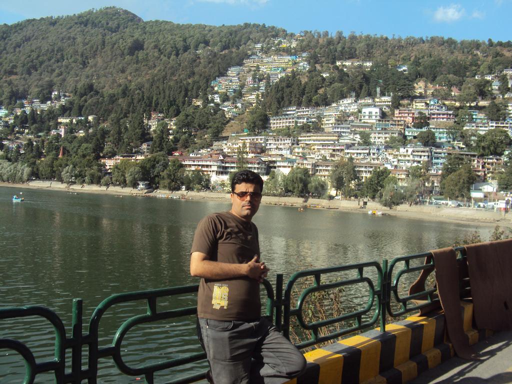
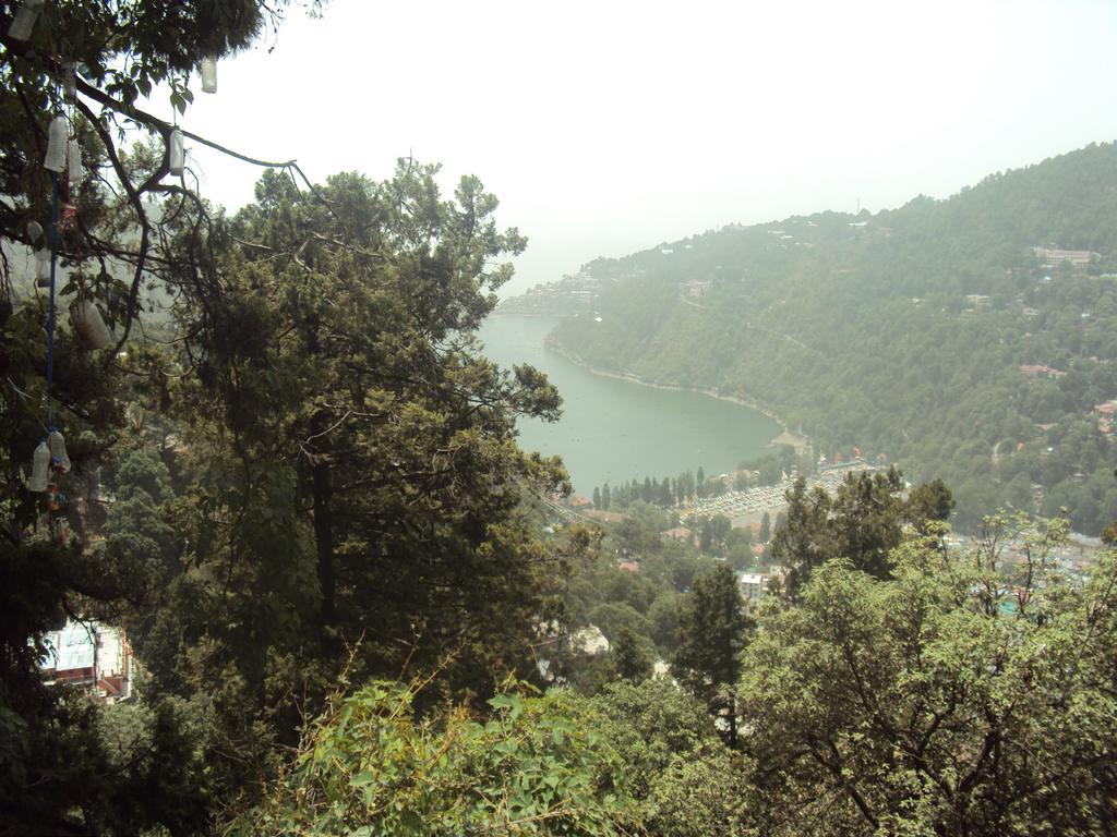
4 Most of these have been dammed for irrigation purposes. River Ramganga originates from the Doodha Tauli ranges in district Pauri Garhwal. It enters into district Nainital, before re-entering into district Pauri Garhwal Nainital pronunciation (help info) is a popular hill station in the Indian state of Uttarakhand and headquarters of Nainital district in the Kumaon foothills of the outer Himalayas. Situated at an altitude of 2,084 metres (6,837 ft) above sea level, Nainital is set in a valley containing a pear-shaped lake, approximately two miles in circumference, and surrounded by mountains, of which the highest are Naina (2,615 m (8,579 ft)) on the north, Deopatha (2,438 m (7,999 ft)) on the west, and Ayarpatha (2,278 m (7,474 ft)) on the south. From the tops of the higher peaks, "magnificent views can be obtained of the vast plain to the south, or of the mass of
; minimum temperature 7 C (45 F), during which its population increases more than fivefold with an annual influx of tourists")
5 tangled ridges lying north, bounded by the great snowy range which forms the central axis of the Himalayas.". Climate: Nainital has temperate summers, maximum temperature 27 C (81 F); minimum temperature 7 C (45 F), during which its population increases more than fivefold with an annual influx of tourists predominantly from the plains of Northern India. In the winter, Nainital receives snowfall between December and February with the temperatures varying between a maximum of 15 C (59 F) and a minimum of 3 C (27 F). History: Early Construction The Kumaon Hills came under British rule after the Anglo- Nepalese War ( ), but the hill station town of Naini Tal was founded only in 1841, with the construction of the first European house (Pilgrim Lodge) by P. Barron, a sugar trader from

6 Shahjahanpur. In his memoir, he wrote: "It is by far the best site I have witnessed in the course of a 1,500 miles (2,400 km) trek in the Himalayas."[6] In 1846, when a Captain Madden of the Bengal Artillery visited Naini Tal, he recorded that "houses were rapidly springing up in most parts of the settlement: some towards the crest of the limitary ranges were nearly 7,500 ft (2,300 m) above sea level: the rugged and woody Anyarpatta (Anyar-patt - in Kumaoni means - complete blackout. The reason for this nomenclature by the localites was because there were minimal sun rays due to its location and dense forests) was being gradually planted and that the favourite sites were on the undulating tract of forest land which stretched back from the head of the lake to the base of China and Deopatta (Camel's Hump). The Church, St. John in the Wilderness, had been built,..."[7] Soon, the town became

7

8 a health resort favoured both by British soldiers and by colonial officials and their families trying to escape the heat of the plains. Later, the town also became the summer residence of the Governor of the United Provinces. The Landslip of 1880 A general view of the north end of Naini Tal before and after the Landslip of In September 1880 a landslide (the Landslip of 1880) occurred at the north end of the town, burying 151 people. The first known landslide had occurred in 1866, and in 1879 there was a larger one at the same spot, Alma Hill, but "the great slip occurred in the following year, on Saturday 18 September 1880."[7] "Two days preceding the slip there was heavy rain, inches (510 mm) to 35 in (890 mm) fell during the 40 hours ending on Saturday morning, and the downpour still lasted and continued for hours after the slip.
 temple were scenes of labour with a view to diverting streams.")
9 This heavy fall naturally brought down streams of water from the hill side, some endangering the Victoria Hotel,... (which) was not the only building threatened... Bell's shop, the Volunteer Orderly Room and the Hindu (Naina Devi) temple were scenes of labour with a view to diverting streams. At a quarter to two the landslip occurred burying those in and around the buildings mentioned above." The total number of dead and missing were 108 Indian and 43 British nationals. (See poem by Hannah Battersby on the page Literary references to Nainital). The Assembly Rooms and the Naina Devi Temple were both destroyed in the disaster. A recreation area known as 'The Flats' was later built on the site and a new temple was also erected. To prevent further disasters, storm water drains were constructed and building bylaws were made stricter How to reach Nainital? By Road:

10


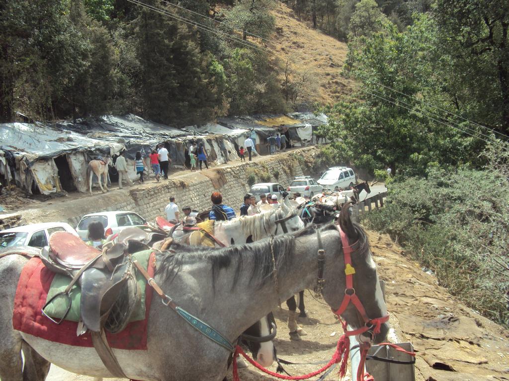
11 Nainital is connected to all the major national / State Highyways. Paddle rickshaw Horses are available for local transport. By Air: Nearest airport is at Panangar. By Train: The nearest Railway station is kathgodam ( 35 Kms) connected to Lucknow, Agra, Delhi.
Amazing Uttaranchal/ 8N-9D
 Amazing Uttaranchal/ 8N-9D 2 Night Mussoorie 1 Night Haridwar 3 Night Nainital 2 Night Kausani Overview Uttarakhand, a state in northern India crossed by the Himalayas, is known for its Hindu pilgrimage
MESMERIZING UTTARAKHAND - 6 DAYS / 5 NIGHTS
 MESMERIZING UTTARAKHAND - 6 DAYS / 5 NIGHTS PLACES COVERED: DELHI NAINITAL JIM CORBETT NATIOAL PARK MUSSOORIE DELHI. DAY 01: AM : ARRIVE DELHI NAINITAL: DISTANCE 300 KMS, DURATION: 7½ HRS Arrive Delhi
Majestic Uttarakhand ( Nainital-Ranikhet-Corbett-Mussoorie )
") Majestic Uttarakhand ( Nainital-Ranikhet-Corbett-Mussoorie ) Day 01: Delhi Nainital (310kms/7-8Hrs) Arrive Delhi, proceed to Nainital the beautiful lake district of Kumaon. Check-in to your hotel and freshen
Majestic Uttarakhand ( Nainital-Ranikhet-Corbett-Mussoorie ) Day 01: Delhi Nainital (310kms/7-8Hrs) Arrive Delhi, proceed to Nainital the beautiful lake district of Kumaon. Check-in to your hotel and freshen
Kumaon Unlimited (Corbett Ranikhet Kausani Binsar - Nainital )
") Kumaon Unlimited (Corbett Ranikhet Kausani Binsar - Nainital ) Day 01: Delhi Corbett (280kms/7-8hr) Arrive Delhi, drive to Corbett. The park was named after Jim Corbett, the legendary hunternaturalist
Kumaon Unlimited (Corbett Ranikhet Kausani Binsar - Nainital ) Day 01: Delhi Corbett (280kms/7-8hr) Arrive Delhi, drive to Corbett. The park was named after Jim Corbett, the legendary hunternaturalist
The Land Where Continents Collided. Physical Geography and Climate of South Asia
 The Land Where Continents Collided Physical Geography and Climate of South Asia South Asia Countries include: 1. Pakistan 2. India 3. Nepal 4. Bhutan 1 2 3 5 4 5. Bangladesh 6. Sri Lanka 7. Maldives 7
Chapter 13 Geography and the Early Settlement of India. How did geography affect early settlement in India?
 Chapter 13 Geography and the Early Settlement of India How did geography affect early settlement in India? Section 13.1 - Introduction The Art Archive / Collection Antonovich / Gianni Dagli Orti This stone
STUDY GUIDE. Physical Features. The Land. Chapter 23, Section 1. Landforms. Rivers. Natural Resources. Terms to Know DRAWING FROM EXPERIENCE
 For use with textbook pages 569 574. The Land Terms to Know subcontinent A landmass that is large and distinct but joined to a continent (page 569) alluvial plain An area of fertile soil deposited by river
MT - GEOGRAPHY - (73) - SEMI PRELIM - II : PAPER - 6
 - SEMI PRELIM - II : PAPER - 6") 208 00 MT MT - GEOGRAPHY - (7) - SEMI PRELIM - II : PAPER - 6 Time : 2 Hours (Model Answer Paper) Max. Marks : 0 A.. Fill in the blank choosing the correct alternative : (a) The Barren Island is the only
208 00 MT MT - GEOGRAPHY - (7) - SEMI PRELIM - II : PAPER - 6 Time : 2 Hours (Model Answer Paper) Max. Marks : 0 A.. Fill in the blank choosing the correct alternative : (a) The Barren Island is the only
CHAPTER 2 DIVERSITY OF HONEYBEES IN TAMIL NADU, INDIA
 CHAPTER 2 DIVERSITY OF HONEYBEES IN TAMIL NADU, INDIA 2.1 INTRODUCTION Tamil Nadu is the extreme southern state of India, bounded by Andhra Pradesh on the North, Karnataka and Kerala on the west, Indian
Profiles Of Survey Maps 45/D7 and 45/D10
 Profiles Of Survey Maps 45/D7 and 45/D10 PROFILE OF SURVEY MAP 45 D/7DESCRIPTION of the Area covered by Survey Sheet No. 45 D/7 (Gujarat and Rajasthan) District : Banas Kantha and Sirohi Location: Latitude
CHUKA AND THE SARDA Tour F 9 DAYS
 Please note, all prices are per person, and assume 2 persons sharing the same room. Please contact us for single occupancy/itinerary prices. The walks described at Camp Corbett and Mountain Quail Camp
Influences on Weather and Climate Weather and Climate. Coriolis Effect
 Influences on Weather and limate Weather and limate oriolis Effect 1 limate is defined as the common weather conditions in one area over a long period of time. Temperature, humidity, rainfall, and wind
Monitoring of Glacial Lakes & Water Bodies in the Himalayan Region of Indian River Basins for June, 2017
 Monitoring of Glacial Lakes & Water Bodies in the Himalayan Region of Indian River Basins for June, 2017 Morphology and Climate Change Directorate Central Water Commission Ministry of Water Resources,
Urban Development in the Lake Region: A Historical Perspective
 Urban Development in the Lake Region: A Historical Perspective The process of urbanization is a complex phenomenon that is affected by the physical, cultural, social and economic structure of the region.
Continental Drift Theory
 Chapter 24: Physical Geography of South Asia: The Land Where Continents Collided South Asia India, Pakistan, Nepal, Sri Lanka & Bangladesh South Asia s major landforms, including the massive Himalayan
Monitoring of Glacial Lakes & Water Bodies in the Himalayan Region of Indian River Basins for 2017
 Monitoring of Glacial Lakes & Water Bodies in the Himalayan Region of Indian River Basins for Morphology and Climate Change Directorate Central Water Commission Ministry of Water Resources, River Development
Deserts. Locations of deserts WORDS
 1 WORDS certain =special cover =here: make up create = make cut off =separate little = not very much rise = go up surface =the top layer of an object trade wind = a tropical wind that blows to the equator
2. The phrases on the left in the following box occur in the text. Match each of them with a phrase on the right. (i) an endless stretch of sand
 an endless stretch of sand") A desert is generally without water and vegetation. A green patch with fresh water and green trees in the middle of a vast desert is a beautiful sight. A desert may be too hot or too cold. THOSE of us
A desert is generally without water and vegetation. A green patch with fresh water and green trees in the middle of a vast desert is a beautiful sight. A desert may be too hot or too cold. THOSE of us
Local Winds & Microclimates. Unit 2- Module 1
 Local Winds & Microclimates Unit 2- Module 1 Objectives Overview of local winds (sea & land breezes, valley winds) Overview of microclimates (valley, urban, woodland) Local Winds Local Winds Local winds
JIM CORBETT S MAN-EATERS, TOUR E 14 DAYS
 Please note, all prices are per person, and assume 2 persons sharing the same room. Please contact us for single occupancy/itinerary prices. The walks described at Camp Corbett and Mountain Quail Camp
Monitoring of Glacial Lakes & Water Bodies in the Himalayan Region of Indian River Basins for September, 2016
 Monitoring of Glacial Lakes & Water Bodies in the Himalayan Region of Indian River Basins for September, 2016 Climate &IAD Directorate Central Water Commission Ministry of Water Resources, River Development
HYDROSPHERE, OCEANS AND TIDES
 HYDROSPHERE, OCEANS AND TIDES Revision 10x10learning.com 1 Chapter 12. In the Earth s Atmosphere On surface of the Earth Under the ground Hydrosphere comprises of ALL WATER Water Vapour = 0.001% Is very
SINGALILA RIDGE, INDIA
 SINGALILA RIDGE, INDIA On the Singalila Ridge India Ann Foulkes, trekmountains Land-only duration: 13 days Grade: Gentle / Moderate Trekking days: 6 days Max altitude: 3636m Price: contact us We can run
DOWNLOAD OR READ : GEOGRAPHY OF JAMMU KASHMIR PDF EBOOK EPUB MOBI
 DOWNLOAD OR READ : GEOGRAPHY OF JAMMU KASHMIR PDF EBOOK EPUB MOBI Page 1 Page 2 geography of jammu kashmir geography of jammu kashmir pdf geography of jammu kashmir Geography of Jammu & Kashmir State by
For more information and to buy this book click here ISBN: CICERONE. Guides for walkers, trekkers, mountaineers, climbers and cyclists
 For more information and to buy this book click here ISBN: 9781852844189 CICERONE Guides for walkers, trekkers, mountaineers, climbers and cyclists www.cicerone.co.uk THE TREKS NEPAL Everest has a magic
Report on Winter Tourism Centre of Konaklı Village, Erzurum
 NORTHEAST ANATOLIA DEVELOPMENT AGENCY Report on Winter Tourism Centre of Konaklı Village, Erzurum Tourism Reports No:2 Süleyman TOY Emine Bilgen EYMİRLİ Murat KARAPINAR Erzurum 2010 Northeast Anatolia
Natural Regions of the World
 Natural Regions of the World Revision for Competitive Exams 10x10learning.com 1 Concept of Natural Regions provides a framework for understanding the diversity of physical and biological environment Taiga
MONSOONS. Summer Monsoon
 MONSOONS A monsoon is a seasonal change in the direction of the prevailing, or strongest, winds of a region. Monsoons cause wet and dry seasons throughout much of the tropics. Monsoons are most often associated
Geography. Reading Passage. Unit
 Unit 1 Geography Word Bank separate v. measure v. roughly adv. make up (of) range n. in length landslide n. poisonous a. glimpse n. Taiwan Blue Magpie encounter v. active a. extinct a. dormant a. soak
CLIMATE Q. 1. Explain the term Weather and Climate. Q. 2. What are the elements of weather and climate? Q.3. What is meant by seasons?
 CLIMATE Q. 1. Explain the term Weather and Climate. Weather refers to the condition of the atmosphere like, temperature, atmospheric pressure, wind, humidity and precipitation over an area at any point
Final Report August 2005
 2.0 REGIONAL STUDY AREA 2.1 Regional Setting 2.1.1 Topography The Los Angeles Region is located within the western portion of the Transverse Ranges Geomorphic Province. The San Andreas transform fault
Fish Diversity in a Kumaun Himalayan River, Kosi, at Almora Uttarakhand. India.
 International Journal of Scientific Research and Management (IJSRM) Volume 06 Issue 0 Pages B-018-05-08 018 Website: www.ijsrm.in ISSN (e): 31-3418 Index Copernicus value (015): 57.47, (016):93.67, DOI:
THE NATIVE AMERICANS
 THE NATIVE AMERICANS Native American Diversity By the year 1500, Native Americans had divided into hundreds of cultural groups who perhaps spoke up to 2,000 different languages. Each group adapted to its
Ama Dablam Base Camp Trek
 Ama Dablam Base Camp Trek Walk-in to Tok Tok & on to Ama Dablam Day 1 Depart London Heathrow on overnight flight to Kathmandu Depart London Heathrow this evening for o/nt flight to Delhi, arriving early
A Brief Activity Report. Chairman
 IYB-2010 and Countdown 2010 Celebration A Brief Activity Report By Santosh Kumar Sahoo, Ph.D. Chairman Conservation Himalayas 977/2, Sector 41-A, Chandigarh, U.T.India Tel.: +91 90 23 36 51 04 / +91 17
Transport Infrastructure for Smart Cities in Hilly States
 Transport Infrastructure for Smart Cities in Hilly States Dr. Pawan Kumar, Associate TCP Town and Country Planning Organization, MoHUA,New Delhi E mail: pawan612@gmail.com 1 Introduction Smart City : i.
Nepal. Mt. Everest Base Camp Trek
 Nepal Mt. Everest Base Camp Trek TRIP SUMMARY Mt. Everest base camp is a magical place. It s nestled deep in the Himalayan mountain range, 30 miles up the Khumbu valley. Its elevation is over 17,000 feet.
Latitude Altitude (Elevation) Proximity to large bodies of water Ocean Currents. larger. concentrated. direct. heating. heating.
 Proximity to large bodies of water Ocean Currents. larger. concentrated. direct. heating. heating.") Climographs Climographs Climographs Roles of Temperature and Precipitation on Climate Roles of Temperature and Precipitation on Climate : Altitude (Elevation) Proximity to large bodies of water Ocean Currents
Climographs Climographs Climographs Roles of Temperature and Precipitation on Climate Roles of Temperature and Precipitation on Climate : Altitude (Elevation) Proximity to large bodies of water Ocean Currents
3rd GRADE MINIMUM CONTENTS UDI 2: WHERE WE LIVE (6)
") 3rd GRADE MINIMUM CONTENTS UDI 2: WHERE WE LIVE (6) POPULATION Population means all the people, or inhabitants of a village, a city or a whole country. The population of a place increases when: a. More
3rd GRADE MINIMUM CONTENTS UDI 2: WHERE WE LIVE (6) POPULATION Population means all the people, or inhabitants of a village, a city or a whole country. The population of a place increases when: a. More
DELHI PUBLIC SCHOOL TAPI
 DELHI PUBLIC SCHOOL TAPI CLASS VII Learning Partnership 5 (KEY) Water : LESSON 5: Water (KEY) Writing Task: W.B (pp-136) 1. What are the 3 main process involved in the water cycle. Evaporation, Condensation,
Pingtan covers a total area of 371 square kilometers. It is. becoming China s largest free trade zone and one of
 INTRODUCTION OF PINGTAN Pingtan covers a total area of 371 square kilometers. It is becoming China s largest free trade zone and one of China s fastest growing regions. Much local traditional architecture
Lesson-2 The Northern Mountains
 Long Answers Lesson-2 The Northern Mountains Q1. Describe the northern mountains. A1. Northern mountains are made up of two mountain ranges Himalaya Mountains Karakorum Ranges 1. These mountains stretch
Chhomrong Report
 Chhomrong Report 23.05. 06.06.2014 AIMS/OBJECTIVES The aim of this field trip was to assess the viability of the area around the village of Chhomrong as the potential release site for a common leopard.
CXC geo Question 6 Economic Development
 CXC geo 2015 Question 6 Economic Development Define the term secondary industry and give one example of a secondary industry that you have studied. 3marks Secondary industries are those industries which
The earliest kingdoms in Southern Africa *
 OpenStax-CNX module: m22722 1 The earliest kingdoms in Southern Africa * Siyavula Uploaders This work is produced by OpenStax-CNX and licensed under the Creative Commons Attribution License 3.0 1 SOCIAL
Wednesday, September 15, 2010 Coriolis force, 3 dimensions (p 65)
") Wednesday, September 15, 2010 Coriolis force, 3 dimensions (p 65) Weather fronts (p 63) General circulation on a rotating Earth (p 65) Geostrophy force balance (p 66) Local effects (no coriolis force)
Wednesday, September 15, 2010 Coriolis force, 3 dimensions (p 65) Weather fronts (p 63) General circulation on a rotating Earth (p 65) Geostrophy force balance (p 66) Local effects (no coriolis force)
9-1: What Causes Climate. 6 th Grade Earth Science
 6 th Grade Earth Science What is Climate? 9-1: What Causes Climate Climate is the long-term average conditions of temperature, precipitation, winds, and clouds in an area. Examples of Climate The Mojave
BLACK FOREST GOLF COURSE
 FOR SALE SPECIAL PURPOSE BLACK FOREST GOLF COURSE 6500 Nicklaus Drive Gaylord, MI 49735 PRESENTED BY: FRANK JERMUSEK, JD Executive Director 952.820.1615 frank.jermusek@svn.com CAMERON PETERSON Managing
Report on Severe Weather Events for the Period July-September 2017
 Report on Severe Weather Events for the Period July-September 2017 (Reported by Dr. K. Sathi Devi and Smt. Sunitha Devi, NWFC, IMD, New Delhi) 1. Introduction As per the classification of the year into
Module 2 Narration What is a watershed?
 Module 2 Narration What is a watershed? Timing Key Narrative Snapshots a) 00:10 Every living thing relies on water to exist. But where does our water come from? The most natural place to look is upstream
CLIMB EVEREST WITH RICH!
 CLIMB EVEREST WITH RICH! CLIMB EVEREST WITH RICH! raise money with our sponsorship form or online! choose richardparks737challenge on just giving! Raising funds in aid of: In December 2010 former Wales
Ninh Chu Bay. MGT Management Consulting
 An Introduction to Ninh Chu Bay MGT Management Consulting INTRODUCTION Ninh Chu Bay is a rapidly growing tourism destination offering a tremendous opportunity for resort and entertainment investment. Tourism
Crook Ranch. Tehama County, California. Proudly Offered By
 Crook Ranch Tehama County, California Proudly Offered By 707 Merchant Street, Suite 100, Vacaville, Ca 95688 (707) 455-4444 Office (707) 455-0455 Fax info@caoutdoorproperties.com www.californiaoutdoorproperties.com
Section 3: Atmospheric Circulation
 Section 3: Atmospheric Circulation Preview Key Ideas The Coriolis Effect Global Winds Local Winds Maps in Action Key Ideas Explain the Coriolis effect. Describe the global patterns of air circulation,
Patton Ranch. Colorado - Fremont County - Cañon City
 The Patton Ranch is a classic 10,000-acre Colorado cattle and hunting ranch (1,088 acres fee ownership, just over 9,000 acres BLM leases plus some private leased land) that is available for purchase for
Which Countries Received the Most Medals per Population at the 2008 Summer Olympics? By W. W. Munroe August 2008
 1 Which Countries Received the Most Medals per Population at the 2008 Summer Olympics? By W. W. Munroe August 2008 The USA, China, and Russia were the big winners at the 2008 Summer Olympics in Beijing,
Before the Canterbury Regional Council and the Ashburton District Council. In the matter of the Resource Management Act 1991
 Before the Canterbury Regional Council and the Ashburton District Council In the matter of the Resource Management Act 1991 And In the matter of The Rangitata Diversion Race Management Limited Consents
Boulder River Stage Stop
 BOULDER RIVER STAGE STOP Boulder River Stage Stop McLeod, Montana $1,900,000. Offered Exclusively By: Sonny Todd Real Estate 301 W First, PO Box 788 Big Timber, MT 59011 Office: (406) 932-1031 Toll Free:
Beaver Valley Ranch Steamboat Springs, Colorado
 Beaver Valley Ranch Steamboat Springs, Colorado Introduction Hidden in the heart of one of Colorado s last unspoiled mountain valleys, Beaver Valley Ranch is tailor-made for hunting and fishing of exceptional
Weather Unit Study Guide
 Weather Unit Study Guide - 2018 Weather vs Climate What does weather measure? The condition of the earth's atmosphere at a particular time and place. How are climate and weather different? Climate is the
SPOTLIGHT ON BOISE WELCOME TO BOISE, IDAHO. Contents
 WELCOME TO BOISE, IDAHO Boise is the capital and most populous city of the U.S. state of Idaho, as well as the county seat of Ada County. Located on the Boise River in southwestern Idaho, the population
AERO Standards: c c.
 AERO Standards: 4.1.5.c. Identify cause and effect relationships in history. 4.3.5.c. Apply concepts such as location, distance, direction, scale, movement and region. Northeast plains Also known as the
3/8/2016 Oregon Wallowa Mountains Published by Michael Hatch (Wallowa Avalanche Center) and Scott Savage (on behalf of USFS National Avalanche Center)
 and Scott Savage (on behalf of USFS National Avalanche Center)") Location: Place Chief Joseph Peak, Wallowa Mountains State Oregon Date 3/8/2016 Time 1630 hrs Summary 1 skier partially buried and killed Number: Caught 1 Fully Buried 0 Injured 0 Killed 1 Avalanche Details:
Location: Place Chief Joseph Peak, Wallowa Mountains State Oregon Date 3/8/2016 Time 1630 hrs Summary 1 skier partially buried and killed Number: Caught 1 Fully Buried 0 Injured 0 Killed 1 Avalanche Details:
NYS Coastal Waters. Water Resources of NYS: THE NATURE of the COASTAL ZONE. NYS Coastal Waters. NYS Coastal Atlas. Coastal Zone Management 10/10/2014
 Water Resources of NYS: THE NATURE of the COASTAL ZONE NYS Coastal Waters NYS is the only state to border the Atlantic Ocean and the Great Lakes (Lakes Erie and Ontario). Great Lakes shoreline: 577 miles
6 day trek from Cathedral Peak to Champagne Castle, Central Drakensberg, South Africa
 6 day trek from Cathedral Peak to Champagne Castle, Central Drakensberg, South Africa Vultures retreat near Champagne Castle, looking north to Cathedral Peak and the Devil s tooth This 6-day trek crosses
Grade 5 Term Geography
 Grade 5 Term 2 2016 Geography 1 High places and low places on a physical map in South Africa Land, on a map, is shown in a different colour to the sea. The sea is always shown in the colour blue. On a
Terms to Know. archipelago tsunami loess
 Chapter Objectives Identify East Asia s varied landforms, water systems, and natural resources. Explain the factors that influence East Asia s diverse climates and vegetation. The Land Section 1 Objectives
Grade 5 Geography Term 2
 1 Grade 5 Geography Term 2 Contents High places and low places on a physical map in South Africa... 2 Coastal plains, escarpment and plateaus... 2 Activity 1... 3 The location of the Highveld, Lowveld,
Identification of homogeneous rainfall regimes in parts of Western Ghats region of Karnataka
 Identification of homogeneous rainfall regimes in parts of Western Ghats region of Karnataka BVenkatesh and Mathew K Jose National Institute of Hydrology, Hanuman Nagar, Belgaum 590 001, Karnataka, India.
The Pre War Artillery Revolution
 Slide 1 Slide 2 The Pre War Artillery Revolution The war of 1914-18 was an artillery war. Artillery was the battle winner, artillery was what caused the greatest loss of life, the most dreadful wounds
CLIMATES IN SOUTH AFRICA
 CLIMATES IN SOUTH AFRICA South Africa has various climates throughout the country. It is in the Southern Hemisphere and is surrounded by ocean except for at its Northern borders. South Africa s climates
Historical and Current Climate in the Rio Grande National Forest Area. Peter Goble Nolan Doesken 10/19/2016
 Historical and Current Climate in the Rio Grande National Forest Area Peter Goble Nolan Doesken 10/19/2016 Geographic Orientation Geographic Orientation Geographic Orientation Rio Grande National Forest
ELA & Science Grades 4 nd to 9 th Created by Piyush & Ilaxi
 ELA & Science Grades 4 nd to 9 th Created by Piyush & Ilaxi 2014 Brilliant Classes by Piyush Page 1 Directions to use Climate Scavenger Hunt Purpose : At the end of this scavenger hunt on climate students
TWO HORSE CANYON RANCH
 TWO HORSE CANYON RANCH Big Timber, MT $2.75M 620± Acres (406) 589-4160 TWO HORSE CANYON RANCH County: Sweet Grass Location: Big Timber, MT Price: $2.75M On this 620 acre Crazy Mountain front door location,
Nepal - Pokhara - Jomsom - Muktinath Mountain Biking Tour (2017) Guided 11 days / 10 nights
 Guided 11 days / 10 nights") Nepal - Pokhara - Jomsom - Muktinath Mountain Biking Tour (2017) Guided 11 days / 10 nights Pokhara is situated at about 827 meters from sea level, and is located about 200 km west of Kathmandu and can
Nepal - Pokhara - Jomsom - Muktinath Mountain Biking Tour (2017) Guided 11 days / 10 nights Pokhara is situated at about 827 meters from sea level, and is located about 200 km west of Kathmandu and can
Everest: tourism and climate change provide new challenges
 1 Key words Fill the gaps in the sentences using these key words from the text. stunning booming intemperate stricken soil erosion trekker coverage contaminated glacier landfill site 1. is the attention
Section 2- Migration
 Section 2- Migration Today, most scientists agree that the first people in North America came from Asia. This migration is estimated to have taken place during the last ice age, at least 12,500 years ago.
Manila-Quezon City. My City Initiative Delhi. A Safety Analysis. a project by World Vision India
 Manila-Quezon City A Safety Analysis My City Initiative Delhi a project by World Vision India Safetipin, in collaboration with World Vision India, conducted safety audits in Lalbagh and Madanpur Khadar.
How to Have Breakfast 18,000 Feet Up Mount Everest
 Luxury Travel How to Have Breakfast 18,000 Feet Up Mount Everest It s the easiest way to see the world s most famous mountain. By Nikki Ekstein 05 April 2017 09:01 In December, chefs from Noma and London
Write answers on your own paper. A. the Sun B. the Moon C. Earth s gravity D. Earth s rotation
 The tmosphere Write answers on your own paper 1. What is the primary energy source that drives all weather events, including precipitation, hurricanes, and tornados?. the Sun. the Moon C. Earth s gravity
STUDY GUIDE. The Land. Physical Geography of Europe. Chapter 11, Section 1. Terms to Know DRAWING FROM EXPERIENCE ORGANIZING YOUR THOUGHTS
 For use with textbook pages 271 276. The Land Terms to Know dikes Large banks of earth and stone that hold back water (page 272) polder Drained area of land (page 272) glaciation The process in which glaciers
ICF WILDWATER WORLD CUP 2009
 ICF WILDWATER WORLD CUP 2009 TASMANIA, AUSTRALIA www.tas.canoe.org.au The Proposal October 19-23 Free Practice Upper Mersey October 24 World Cup 1 ( classic) Upper Mersey October 25 World Cup 2 (rapid
ISLAND PEAK CLIMBING 21 days
 ISLAND PEAK CLIMBING 21 days Trip route: Lukla Namche EBC - Island Peak summit - Lukla Activities: Trekking, Rock climbing, Sightseeing, Climbing & Expedition Difficulty: Adventurous to challenging Max
Advanced Hydrology Prof. Ashu Jain Department of Civil Engineering Indian Institute of Technology, Kanpur. Lecture 12
 Advanced Hydrology Prof. Ashu Jain Department of Civil Engineering Indian Institute of Technology, Kanpur Lecture 12 Good morning and welcome to the next lecture of this video course on advanced hydrology.
Unit 2 World Climate Patterns
 Unit 2 World Climate Patterns Weather the day to day or short term conditions of the atmosphere. Weather includes variables such as temperature, precipitation, humidity, cloud cover, wind, and air pressure.
Pre-Application Document Kaweah Project (FERC Project No. 298)
") TABLE OF CONTENTS Page 3.12 Aesthetic Resources... 3.12-1 3.12.1 Information Sources... 3.12-1 3.12.2 Setting... 3.12-1 3.12.3 Project Facilities... 3.12-2 3.12.4 Previous Visual Resources Assessment...
TABLE OF CONTENTS Page 3.12 Aesthetic Resources... 3.12-1 3.12.1 Information Sources... 3.12-1 3.12.2 Setting... 3.12-1 3.12.3 Project Facilities... 3.12-2 3.12.4 Previous Visual Resources Assessment...
3 Global Winds and Local Winds
 CHAPTER 15 3 Global Winds and Local Winds SECTION The Atmosphere BEFORE YOU READ After you read this section, you should be able to answer these questions: What causes wind? What is the Coriolis effect?
Golf Course Designed by Mr. José María Olazabal.
 www.lamonacillagolf.com Golf Course Designed by Mr. José María Olazabal. Phone: +34 959 100 093 OnlineBooking:info@lamonacillagolf.com Urbanización La Monacilla Avda. de los Pirineos S/N 21122 Aljaraque
Table of Contents. The Effects Above Water Glossary Chapter One Disaster Strikes Chapter Two The Effects Under Water...
 By Victoria Fortune Table of Contents Chapter One Disaster Strikes... 1 Chapter Two The Effects Under Water... 2 Chapter Three The Effects Above Water... 4 Glossary... 6 2009 2012 Wireless Generation,
What Causes Different Weather?
 What Causes Different Weather? Table of Contents What causes weather?...3 What causes it to rain or snow?...4 What causes flooding?...5 What causes hail?...6 What causes the seasons?...7-8 What causes
BANGLADESH: TRANSBOUNDARY RIVERS PROBLEMS AND PROSPECTS
 BANGLADESH: TRANSBOUNDARY RIVERS PROBLEMS AND PROSPECTS by Md. Jahid Hossain Jahangir Executive Engineer Joint Rivers Commission, Bangladesh Presented at the Expert Scoping Workshop on quantifying the
Shop No.89, 1 st floor, Old Rajinder Nagar, New Delhi DAY REVISION PROGRAM DAY-23
 IAS BEE Shop No.89, 1 st floor, Old Rajinder Nagar, New Delhi 110060 91-7330833391 40- DAY REVISION PROGRAM DAY-23 1. Consider the following statements with reference to structure and composition of atmosphere:
ROAN CREEK RANCH De Beque, Colorado - Garfield County
 ROAN CREEK RANCH De Beque, Colorado - Garfield County This 120-acre ranch located in a private valley northeast of Grand Junction, Colorado, features gorgeous views, lush irrigated meadows, good water
There are some nice views on the way up the back of falls but the nicest view is the sign for Trapyard drinks and the knowledge that the worst is
 Peaks Challenge Falls Creek 2016 - was a sweet ride. We had a ball from the first cup of black tea at Cairns Airport until we picked up our bike bags in the same location 3 days later. For me peaks challenge
Kashmir With Leh Ladakh
 Kashmir With Leh Ladakh (9 s and 8 Nights) Ladakh Ladhak is the largest province in the state of Jammu and Kashmir between Karakoram and Himalayan mountains. Ladakh can be best described as a high altitude
1.3: CLIMATE GEOGRAPHY. pgs
 1.3: CLIMATE GEOGRAPHY pgs. 76-89 INTRODUCTION WEATHER: Is the combination of temperature, precipitation, cloud cover and wind that we experience EACH DAY. Example: 22 0 C and clear skies. CLIMATE: The
EVEREST BASE CAMP TREK (16 DAYS))
)") EVEREST BASE CAMP TREK (16 DAYS)) Everest Base Camp (EBC) Trek is one of the most challenging mountain treks of the world. Located in Khumbu region of Nepal, this trek has been a very popular destination
EVEREST BASE CAMP TREK (16 DAYS)) Everest Base Camp (EBC) Trek is one of the most challenging mountain treks of the world. Located in Khumbu region of Nepal, this trek has been a very popular destination
PAGE 44 THE HIMALAYAN ADVENTURE COMPANY. Climbing
 44 Climbing PAGE 45 Nepal is a favourite destination for mountaineers with over 600 expeditions each year to Everest and other peaks resulting from an increasing popularity for mountaineering along with
UCI PARA-CYCLING ROAD WORLD CHAMPIONSHIPS INFORMATION FOR ORGANISERS
 UCI PARA-CYCLING ROAD WORLD CHAMPIONSHIPS INFORMATION FOR ORGANISERS 1.FOREWORD To organise the UCI Para-cycling Road World Championships is to organise the discipline s leading annual event. For the vast
snow-forecast.com the 2007 Calendar
 snow-forecast.com the 2007 Calendar Aconcagua, Argentina: High winds blow snow off the summit of the highest mountain in the Americas (6962m). Here, climbers on the Polish Glacier route are moving on from