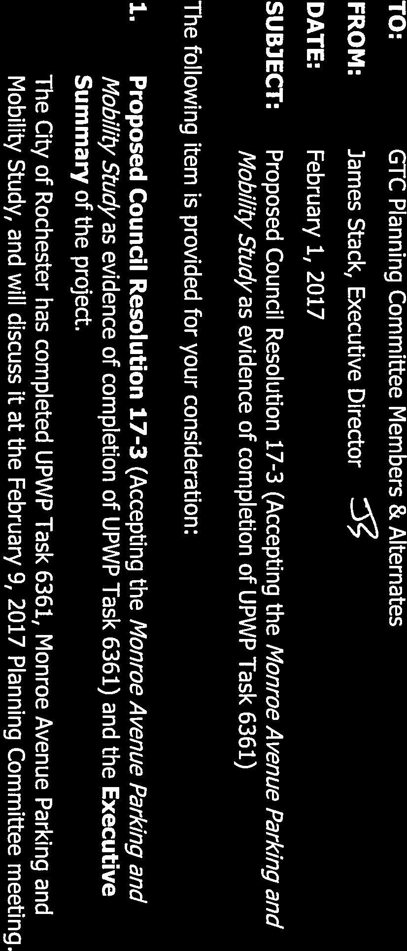
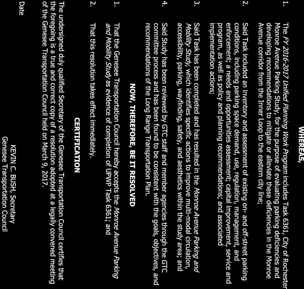
EXECUTIVE SUMMARY. A Executive Summary
|
|
|
- Kathlyn Briggs
- 5 years ago
- Views:
Transcription
1

2

3 EXECUTIVE SUMMARY The Monroe Avenue Parking and Mobility Study was initiated to provide a comprehensive assessment of existing parking and mobility conditions along the Monroe Avenue corridor from the former Inner Loop to Culver Road in the City of Rochester in order to improve and enhance the overall mobility options, parking availability, walkability and transportation choices available to the public within the study area. The impetus for the study related to concerns expressed by local residents, business owners, and visitors of the corridor over the last several years. These stakeholder concerns focused on a number of parking and mobility issues, including the perceived lack of available parking supply, current parking enforcement practices and the competition between area residents and business patrons for on-street parking spaces. The City of Rochester determined that a comprehensive analysis was necessary to identify the origin of those concerns and whether they were caused by a shortage of parking and mobility options or were the result of other factors. Financial assistance for the preparation of this report was provided by the Federal Highway Administration and Federal Transit Administration through the Genesee Transportation Council (GTC) as a part of the Unified Planning Work Program (UPWP). This study provides a comprehensive assessment of existing parking and mobility conditions, guided by extensive outreach to the public and stakeholders. It also includes an inventory of parking and mobility conditions, assessment of current/future parking demand, assessment of needs and opportunities, recommendations for improving parking and mobility conditions, and an implementation action plan. Public and Stakeholder Engagement To more clearly define the concerns expressed by the community and to guide the study s recommendations and implementation action plan, a thorough online/print survey was developed. The survey resulted in more than 400 responses and included insight into the modes, experiences, concerns, and suggestions for improvements for both vehicular and alternative modes of transportation. Key findings from the public survey included: Most visitors to the corridor are coming for dining, bars/entertainment and shopping. Vehicular trips account for the highest mode of travel, followed by walking and cycling. A majority of respondents are in favor of shared-use parking throughout the corridor. Metered/Pay stations was the least desirable solution. Location, personal safety and convenience were the top three answers with regards to where the survey respondents decided to park. Meigs Street to Interstate 490 is an area with the highest difficulty in finding a parking spot. A Executive Summary

4 As part of this study a Project Advisory Committee (PAC) was formed and included members of several public agencies and non-governmental organizations to participate and provide input and guidance throughout the Study. PAC representatives included several departments from the City of Rochester, Genesee Transportation Council, Rochester Regional Transportation Authority, Monroe County Department of Transportation, New York State Department of Transportation, Upper Monroe Neighborhood Association, Monroe Village Taskforce and Monroe Avenue Merchants Association. Stakeholders identified by the City and the PAC were also interviewed to provide greater insight into the needs and opportunities within the corridor and supplement the survey results. Feedback from these stakeholders included four key elements: enforcement, parking supply and utilization, maintenance of parking and mobility infrastructure, and signage. Key themes from stakeholders included: lack of parking turnover in front of commercial businesses, shortage of parking enforcement and unclear signage within the study area. In addition to the public survey, two public outreach sessions and two public meetings were held during the study process to present data/findings and gather feedback and input. The first public outreach session was held with the Monroe Avenue Merchants Association and the second session was held during the Spokes & Ink Bike and Poster Festival. These sessions provided input on future public engagement opportunities, allowed for stakeholder input on the existing conditions analysis, and solicited feedback on issues, concerns and solutions affecting parking and mobility within the corridor. The two public meetings, one held at the Monroe Square Trillium Health Facility on Monroe Avenue and the other at the Park Avenue Festival, provided additional opportunities for stakeholders to learn about the study s findings and weigh in on its recommendations and implementation action plan. The second public meeting offered members of the community the opportunity to vote on potential study recommendations. Examples of these recommendations included; shift to a customer friendly approach for parking fines (incremental parking fines), define on-street spaces with tick pavement markings and review/expand transit frequency throughout the corridor. Parking and Mobility Inventory To provide a foundation of information needed for a comprehensive analysis of parking and mobility, an inventory was conducted that included a review of past planning studies, existing land use and development patterns, City Zoning Code parking requirements, and documentation of vehicular, transit, and bicycle/pedestrian conditions. Documented vehicular conditions included parking supply, ownership, rates, regulatory signage, destination and wayfinding signage, road markings, traffic circulation/volumes, road geometry, and parking enforcement. Documented transit conditions included the available services, routes, and stops. Documented bicycle/pedestrian conditions included bicycle routes/markings, bicycle parking, and the condition and availability of crosswalks and sidewalks. The assessment of the parking B Executive Summary

5 and mobility inventory is presented in the needs and opportunities assessment section. Inconsistent/confusing on-street regulatory signage and unbalanced parking supply and demand were two examples that resulted from the inventory phase. Study Area A project study area was established and extended from the former Inner Loop on the northwest to Culver Road on the south-east, and approximately 500 feet on either side of Monroe Avenue. This 500-foot offset was based on input from City of Rochester s Bureau of Planning and Zonings and precedents from similar corridor parking/mobility studies. Four sub-areas within the study were noted and reviewed in greater detail with regards to parking and mobility. These sub-areas included the Marshall Street, South Goodman Street, Canterbury Road and Belmont Street intersections. Parking Supply and Demand Parking supply within the study area was documented for location, capacity, and regulation through information collected during field visits and through geographic information system data. (See parking supply and ownership table below). Parking demand (utilization) was also observed to document and analyze hourly and daily trends. Several time periods of the day and days of the week were chosen to provide comparable data. Counting times were chosen for two periods during the weekday daytime, weekday evening time, weekend daytime, and weekend evening time. C Executive Summary

6 Parking Supply + Ownership Private & Parking Spaces Publicly Available City-Owned Non-Profit On-Street 1,591 27% 1, % 1, % - 0% Off-Street 4,402 73% 3,293 75% 179 4% 4,223 96% Total 5, % 4,884 81% 1,770 30% 4,223 70% The analysis of parking utilization counts included several different levels of assessment, from the macro scale at the study area level to the micro scale at the street-by-street level. To assess if utilization was too high, a utilization threshold of 85% for on-street parking and 90% for offstreet parking was used. Key observations include: Study area: Overall, on-street parking is lowest during the weekday day time, and highest during the weekend evening time. Both on-street weekend evening counting periods reached 75% utilization. Off-street utilization is highest during the weekday daytime, but was observed far below the threshold of 90% utilization. Subareas: Four subareas were defined that represent 5-minute walking distances from major intersections with clustered development. Similar to the evaluation at the study area level, all four subareas showed on-street utilization highest during the weekend evening counting periods. The highest on-street utilization occurred within the South Goodman Street and Monroe Avenue Subarea during both weekend evening counting periods, at just above 80%. The highest off-street utilization occurred within the Canterbury Road and Monroe Avenue Subarea, as indicated in red on the heat map below. Six out of the eight counting periods showed observed utilization above 40%. However, all subareas across all counting periods showed utilization significantly below the threshold of 90%. Street-by-street: When examined at the study area and subarea levels, parking utilization never exceeded the thresholds of 85% (on-street) or 90% (off-street) utilization. However, observed data showed that across counting periods some roads and off-street parking lots exceeded their respective thresholds. The highest utilization for on-street parking was during the weekend evening counting periods. Several streets throughout the study area showed utilization above 85% and some streets over capacity (illegally parked vehicles). However, these streets and areas had available parking within a 1-3 block walk. D Executive Summary
7 The following two graphs illustrate on-street and off-street utilization profiles created to evaluate parking demand. 100% Study Area: On-Street Utilization 90% 80% % 70% 60% 50% 40% 30% Available Utilized 20% 10% 0% Monday 8am- Thursday Tuesday 4pm- Thursday Saturday Sunday 10am- Friday 6pm- Saturday 9pm- 10am 11am-2pm 7pm 4pm-7pm 11am-2pm 1pm 9pm 12am Weekday - Day Weekday - Evening Weekend - Day Weekend - Evening 100% Study Area: Off-Street Utilization 90% 90% 80% 70% 60% 50% 40% 30% 20% 10% , ,553 3, , , , , ,100 Available Utilized 0% Monday 8am- Thursday Tuesday 4pm- Thursday Saturday Sunday 10am- Friday 6pm- Saturday 9pm- 10am 11am-2pm 7pm 4pm-7pm 11am-2pm 1pm 9pm 12am Weekday - Day Weekday - Evening Weekend - Day Weekend - Evening The parking supply and demand analysis also included a future parking analysis. The analysis was completed to determine the extent to which the study area could accommodate potential future infill development. The analysis utilized existing zoning guidelines and the evaluation for infill development potential in order to create a series of concepts. The concepts show that through careful planning and development, additional development and parking facilities could be accommodated within the corridor. This parking represents an additional 350+/- off-street E Executive Summary

8 parking spaces to support the infill development. See below for an example of infill development sketch in the Marshall Street subarea. Needs and Opportunities Assessment Utilizing information from the parking and mobility inventory and the parking supply and demand analysis, a needs and opportunities assessment was completed to identify the internal and external factors impacting parking and mobility. This assessment, in part, was used as the basis for developing a series of recommendations. A SWOT (Strength, Weaknesses, Opportunities, Threats) analysis was completed that utilized information from the public and stakeholders, previous planning studies, data collected during the parking and mobility inventory, and results from the parking supply and demand analysis. Based on the SWOT analysis, a series of assessments provided a concise framework for the development of recommendations needed to improve parking and mobility and encourage the use of alternative transportation. The following assessments represent the key internal and external factors affecting parking and mobility within the study area. 1. On-street regulatory signage is confusing, inconsistent, and incomplete 2. Destination/Wayfinding signage is needed to direct and inform drivers 3. ADA accessibility is insufficient 4. Street geometries and markings are excessive or worn 5. Parking enforcement is unbalanced 6. Transit stop amenities can be expanded F Executive Summary

9 7. Bicycle facility availability is unbalanced with vehicular facilities 8. Parking supply and demand is unbalanced 9. Wadsworth Square parking lot is underutilized 10. Parking turnover is inhibiting visitors and patrons 11. Mixed perceptions on City Zoning Code parking requirements and their impact on business expansion / new development Parking and Mobility Recommendations & Implementation Action Plan Through careful data collection, analysis, public input, and stakeholder feedback, a series of comprehensive recommendations that seek to address the concerns noted by the public and the findings of the study were developed. The recommendations are grouped by management of existing facilities, demand, and capacity, as follows: Existing Facilities Management Short-term 1. Reduce variety of time limit and time span regulations so drivers can quickly understand regulatory signage. 2. Install additional signage to cover areas with missing or incomplete signage so drivers can readily see parking requirements. An example of simplified on-street signage from the City of Los Angeles can be viewed to the left. 3. Install wayfinding and destination signs for public parking facilities to direct vehicles to these facilities and provide or clarify applicable regulations and restrictions. 4. Update the City s parking website to include public parking facilities within the study area. 5. Shift parking enforcement to a customer-friendly approach. Mid-term 6. Streamline alternating parking regulations to be more user friendly. 7. Install parking technology in high demand commercial- retail areas. 8. Create a neighborhood parking benefit district to reinvest meter and enforcement funds. Long-term 9. Expand parking technology. Demand Management Short-term 10. Improve transit users experience and comfort through added amenities at each transit stop. 11. Improve pedestrian access, safety, and experience that promotes walking and encourages users to seek parking beyond adjacent facilities. 12. Expand bicycle facilities to accommodate current users and encourage future users. Mid-term 13. Expand transit service routes and access to accommodate current users and encourage more transit trips. 14. Evaluate the impact and effectiveness of the county-wide Bus Stop Optimization effort on the Monroe Avenue Corridor. 15. Add a neighborhood shuttle service. Long-term 16. Expand High-Capacity Transit (HTC) options as demand increases. G Executive Summary
10 Capacity Management Short-term 17. Continue parking utilization counts to track progress and fluctuations. Mid-term Long-term 18. Expand on-street parking access for mobility impaired users. 19. Facilitate the creation of shared-parking lots. 20. Expand availability of public off-street parking. 21. Adjust travel lane geometry and remove unnecessary lanes (where feasible). 22. Evaluate parking-related requirements and restrictions within the City Code. 23. Explore acquisition of private lots for the conversion to public lots. 24. Convert existing parking lots to structured or stacked parking. As the study indicates, the implementation of these recommendations would best be accomplished through a coordinated effort, spearheaded by the City of Rochester in cooperation with other public agency stakeholders. As a first step in implementing these recommendations, a committee should be created to be responsible for coordinating implementation activities and evaluating the effectiveness of the short, mid and long-term strategies. The action plan provides timeframes and responsible party/technical resources for each recommendation. Immediate action items include the following; install way finding signs and destination signs at public parking facilities, continue to add bicycle amenities (additional lanes, sharrows, bicycle parking and bicycle shelters) along the corridor and change/modify and install new on-street signage. In conclusion, the study encompasses a series of implementable recommendations and strategies developed to improve the quality of parking and mobility facilities for area residents, businesses and visitors while encouraging the use of alternative transportation. These recommendations, when implemented, will help alleviate the parking and mobility pressures felt within the corridor while embracing Monroe Avenues highly desirable, vibrant and eclectic sense of place. H Executive Summary
Implementation Matrix
 Downtown Delaware Parking Study Short Term Mid Term Long Term = Within one year = Within three years = More than three years The highlighted proposed enhancements will require a substantial amount of input
Proposed. City of Grand Junction Complete Streets Policy. Exhibit 10
 Proposed City of Grand Junction Complete Streets Policy Exhibit 10 1 City of Grand Junction Complete Streets Policy Vision: The Complete Streets Vision is to develop a safe, efficient, and reliable travel
University of Victoria Campus Cycling Plan Terms of Reference. 1.0 Project Description
 University of Victoria Campus Cycling Plan Terms of Reference 1.0 Project Description The Campus Cycling Plan, a first for the University, will provide a comprehensive and coordinated approach to support
Tonight is for you. Learn everything you can. Share all your ideas.
 Strathcona Neighbourhood Renewal Draft Concept Design Tonight is for you. Learn everything you can. Share all your ideas. What is Neighbourhood Renewal? Creating a design with you for your neighbourhood.
MASTER BICYCLE AND PEDESTRIAN PLAN
 VILLAGE OF NORTHBROOK MASTER BICYCLE AND PEDESTRIAN PLAN DRAFT PLAN OPEN HOUSE May 2, 2018 AGENDA 1. Community Engagement 2. Vision and Goals 3. General Structure of Plan 4. Recommendations Overview 5.
EUCLID AVENUE PARKING STUDY CITY OF SYRACUSE, ONONDAGA COUNTY, NEW YORK
 EUCLID AVENUE PARKING STUDY CITY OF SYRACUSE, ONONDAGA COUNTY, NEW YORK CITY OF SYRACUSE DEPARTMENT OF PUBLIC WORKS 1200 CANAL STREET EXTENSION SYRACUSE, NEW YORK 13210 DRAFT REPORT DATE: November 13,
North Shore Transportation Improvement Strategy
 North Shore Transportation Improvement Strategy Preliminary, Near-term Recommendation 2016 April Transportation Improvement Strategy (TIS) Comprehensive and Analytical A multi-modal transportation strategy
STONY PLAIN ROAD STREETSCAPE
 Jasper Place Revitalization Strategy: Vision The people involved in the Jasper Place Revitalization Strategy envision: Goal 1: Feeling safe in our community Create a community where feeling safe is common--where
Rochester Area Bike Sharing Program Study
 roc bike share Rochester Area Bike Sharing Program Study Executive Summary ~ January 2015 JANUARY 2015 8484 Georgia Avenue, Suite 800 Silver Spring, MD 20910 3495 Winton Pl., Bldg E, Suite 110 Rochester,
Bikeway action plan. Bicycle Friendly Community Workshop March 5, 2007 Rochester, MN
 Bikeway action plan Summary The was held on March 5, 2007 at the Rochester Mayo Civic Center. The workshop was hosted by Rochester-Olmsted County Planning Department in collaboration with the League of
Chapter 2. Bellingham Bicycle Master Plan Chapter 2: Policies and Actions
 Chapter 2 Bellingham Bicycle Master Plan Chapter 2: Policies and Actions Chapter 2: Policies and Actions The Bicycle Master Plan provides a road map for making bicycling in Bellingham a viable transportation
Exhibit 1 PLANNING COMMISSION AGENDA ITEM
 Exhibit 1 PLANNING COMMISSION AGENDA ITEM Project Name: Grand Junction Circulation Plan Grand Junction Complete Streets Policy Applicant: City of Grand Junction Representative: David Thornton Address:
CITY OF BLOOMINGTON COMPLETE STREETS POLICY
 CITY OF BLOOMINGTON COMPLETE STREETS POLICY POLICY OBJECTIVE: The City of Bloomington will enhance safety, mobility, accessibility and convenience for transportation network users of all ages and abilities,
WALKNBIKE DRAFT PLAN NASHVILLE, TENNESSEE EXECUTIVE SUMMARY NASHVILLE, TENNESSEE
 NASHVILLE, TENNESSEE EXECUTIVE SUMMARY Executive Summary A world-class multi-modal transportation system is essential to a vibrant city and better quality of life. -Mayor Barry The WalknBike plan aims
Corpus Christi Metropolitan Transportation Plan Fiscal Year Introduction:
 Introduction: The Safe, Accountable, Flexible, Efficient Transportation Equity Act: A Legacy for Users (SAFETEA-LU) has continued the efforts started through the Intermodal Surface Transportation Efficiency
Solana Beach Comprehensive Active Transportation Strategy (CATS)
") Solana Beach Comprehensive Active Transportation Strategy (CATS) 3.0 Goals & Policies The Solana Beach CATS goals and objectives outlined below were largely drawn from the Solana Beach Circulation Element
Solana Beach Comprehensive Active Transportation Strategy (CATS) 3.0 Goals & Policies The Solana Beach CATS goals and objectives outlined below were largely drawn from the Solana Beach Circulation Element
CAMPUS PARKING STUDY Analysis and Alternatives Executive Summary
 S A L E M S T A T E U N I V E R S I T Y CAMPUS PARKING STUDY Analysis and Alternatives Executive Summary M a y 2 2 0 1 8 C a m p u s C o m m u n i t y S S U N e i g h b o r h o o d A d v i s o r y C o
Environment and Public Works Committee Presentation
 Mixed Use Centers Complete Streets Guidelines Project Environment and Public Works Committee Presentation December 10, 2008 Project Objectives: Conduct an inter-departmental and agency process to study
CHAPTER 3: Vision Statement and Goals
 Davidson Walks & Rolls: Active Transportation Master Plan CHAPTER 3 Contents: Overview Vision Statement Measurable Goals Public Outreach CHAPTER 3: Vision Statement and Goals Overview The vision statement
Telegraph Avenue Complete Streets DRAFT Recommendations. Oakland Public Works Department September 11 and 13, 2014 Open Houses
 Telegraph Avenue Complete Streets DRAFT Recommendations Oakland Public Works Department September 11 and 13, 2014 Open Houses Presentation Overview What are complete streets? What problem are we trying
A CHANGING CITY. of Edmonton, it is essential that it reflects the long-term vision of the City.
 A CHANGING CITY By the year 2040, Edmonton will be home to more than 1 million people. To accommodate growth and support a healthy and compact city, we need a new approach to development/redevelopment
S T A T I O N A R E A P L A N
 The Circulation and Access Plan describes vehicle, pedestrian, and transit improvements recommended within the Concept Plan. In order to create and sustain a vibrant business district that provides pedestrian-friendly
Pocatello Regional Transit Master Transit Plan Draft Recommendations
 Pocatello Regional Transit Master Transit Plan Draft Recommendations Presentation Outline 1. 2. 3. 4. What is the Master Transit Plan? An overview of the study Where Are We Today? Key take-aways from existing
AGENDA ITEM G-2 Public Works
 AGENDA ITEM G-2 Public Works STAFF REPORT City Council Meeting Date: 12/6/2016 Staff Report Number: 16-214-CC Regular Business: Approve the Oak Grove University Crane Bike Improvement Concept Plan, authorize
Living Streets Policy
 Living Streets Policy Introduction Living streets balance the needs of motorists, bicyclists, pedestrians and transit riders in ways that promote safety and convenience, enhance community identity, create
Ann Arbor Downtown Street Plan
 1 Ann Arbor Downtown Street Plan Public Workshop #1 We know that. 2 Public right-of-way (streets, sidewalks, and alleys) make up 30% of the total District area of downtown. Streets need to provide mobility
Outreach Approach RENEW SF served as the primary liaison with the North Beach community; the Chinatown. Executive Summary
 Executive Summary Executive Summary The Columbus Avenue Neighborhood Transportation Study s objective is to identify changes to transportation infrastructure and policies that could enhance the livability
2. Vision & Goals. Vision. Santa Rosa is a community where walking and bicycling are comfortable and convenient for people of all ages and abilities.
 2. Vision & Goals Overview The goals of the Santa Rosa Bicycle and Pedestrian Master Plan Update reflect the priorities expressed by the community throughout the public outreach phase of this Plan Update.
Bicycle Master Plan Goals, Strategies, and Policies
 Bicycle Master Plan Goals, Strategies, and Policies Mobilizing 5 This chapter outlines the overarching goals, action statements, and action items Long Beach will take in order to achieve its vision of
Goodlettsville Bicycle and Pedestrian Plan Executive Summary
 Goodlettsville Bicycle and Pedestrian Plan July 2010 In Cooperation with the Nashville Area Metropolitan Planning Executive Organization Summary Introduction Progressive and forward thinking communities
Hennepin County Bicycle and Pedestrian Planning
 Hennepin County Bicycle and Pedestrian Planning 1 Value of bicycle and sidewalk systems Safety Livability Mobility Health Personal Finances Economic Sustainability Clean Air Recreation Parking and congestion
In station areas, new pedestrian links can increase network connectivity and provide direct access to stations.
 The Last Mile Planning for Pedestrians Planning around stations will put pedestrians first. Making walking to stations safe and easy is important; walking will be a part of every rapid transit Accessible
CITY OF LOS ANGELES INTER-DEPARTMENTAL MEMORANDUM
 CITY OF LOS ANGELES INTER-DEPARTMENTAL MEMORANDUM Date: April 1, 219 To: Honorable City Council c/o City Clerk, Room 395, City Hall Attention: Honorable Mike Bonin, Chair, Transportation Committee From:
Pennsylvania Avenue (CR 484) Design Alternatives Study
 Design Alternatives Study") MEMORANDUM Pennsylvania Avenue (CR 484) Design Alternatives Study Prepared for: APRIL 2016 Prepared By TABLE OF CONTENTS Project Background... 2 Previous Concept... 2 Existing Conditions... 4 New Alternatives...
MEMORANDUM Pennsylvania Avenue (CR 484) Design Alternatives Study Prepared for: APRIL 2016 Prepared By TABLE OF CONTENTS Project Background... 2 Previous Concept... 2 Existing Conditions... 4 New Alternatives...
Data Analysis February to March Identified safety needs from reported collisions and existing travel patterns.
 Welcome! Thank you for participating in today s Valencia Bikeway Improvements workshop. Data Analysis February to March Identified safety needs from reported collisions and existing travel patterns. Initial
Chapter VISION, MISSION, AND GOALS AND OBJECTIVES. Vision. Mission. Goals and Objectives CONNECTING COMMUNITIES ACROSS THE ST.
 VISION, MISSION, AND GOALS AND OBJECTIVES Chapter 3 The Plan s vision, mission, and goals and objectives were developed through a series of interactive exercises with the Citizens Advisory Committee (CAC)
Key objectives of the survey were to gain a better understanding of:
 3 COMMUNITY INPUT Community input is an essential part of corridor studies. For the SR 87 corridor study, VTA staff conducted an extensive online survey of people living and commuting along the corridor.
Chapter 5. Complete Streets and Walkable Communities.
 Chapter 5. Complete Streets and Walkable Communities. 5.1 Description of Complete Streets. Cities throughout the world, and specifically the United States, are coming to embrace a new transportation and
Memorandum. Sunday, July 13, Saturday, July 19, 2014
 Memorandum To: David Lowin, Brooklyn Bridge Park Corporation From: Daniel Schack, AICP, PTP Date: Re: Brooklyn Bridge Park Pier 5/6 Loop Road Traffic Study Project No: 14-01-2407 At the request of Brooklyn
5. Pedestrian System. Accomplishments Over the Past Five Years
 5. Pedestrian System Accomplishments Over the Past Five Years The Alamo Area Metropolitan Planning Organization (MPO) and its partner agencies recognize the importance of improving pedestrian mobility.
NM-POLICY 1: Improve service levels, participation, and options for non-motorized transportation modes throughout the County.
 Transportation PRINCE WILLIAM COUNTY 2008 COMPREHENSIVE PLAN NON-MOTORIZED PLAN CONTENTS Goals, Policies, and Action Strategies Table 4 (Bike Facility Classifications and Descriptions) Table 5 (Bike Facility
CHAPTER 4: SIGNAGE AND WAYFINDING
 CHAPTER 4: SIGNAGE AND WAYFINDING A new wayfinding sign system in and around Uptown is recommended. This new wayfinding system will provide a number of benefits to the Uptown area including: Visitors to
City of Charlottesville Bicycle and Pedestrian Master Plan Update
 City of Charlottesville Bicycle and Pedestrian Master Plan Update September 17, 2014 I. Welcome and meeting overview II. Project status update III. Network overview IV. Break-out groups Pedestrian Network
Data Analysis February to March Identified safety needs from reported collisions and existing travel patterns.
 Welcome! Thank you for participating in today s Valencia Bikeway Improvements workshop. Data Analysis February to March Identified safety needs from reported collisions and existing travel patterns. Initial
PEDESTRIAN ACTION PLAN
 ATTACHMENT 2 CITY OF SANTA MONICA PEDESTRIAN ACTION PLAN CITY OF SANTA MONICA PEDESTRIAN ACTION PLAN This page intentionally left blank EXECUTIVE SUMMARY CHAPTER 1 EXECUTIVE SUMMARY Setting the Stage
CITY OF COCOA BEACH 2025 COMPREHENSIVE PLAN. Section VIII Mobility Element Goals, Objectives, and Policies
 CITY OF COCOA BEACH 2025 COMPREHENSIVE PLAN Section VIII Mobility Element Goals, Objectives, and Policies Adopted August 6, 2015 by Ordinance No. 1591 VIII MOBILITY ELEMENT Table of Contents Page Number
Standing Committee on Policy and Strategic Priorities. Mount Pleasant Industrial Area Parking Strategy and Access Improvements
 POLICY REPORT Report Date: April 23, 2018 Contact: Lon LaClaire Contact No.: 604.873.7722 RTS No.: 9944 VanRIMS No.: 08-2000-20 Meeting Date: May 16, 2018 TO: FROM: SUBJECT: Standing Committee on Policy
Public Works Committee Meeting Richard E. Mastrangelo Council Chamber November 20, 2017
 Public Works Committee Meeting Richard E. Mastrangelo Council Chamber November 20, 2017 Purpose of Meeting Why are we here? Project Recap/Updates Project Limits/Segments Road Diet Concept Lessons Learned
NEWMARKET UPHAM S CORNER
 SOUTH STATION Planning Initiative NEWMARKET UPHAM S CORNER COLUMBIA ROAD (P) FOUR CORNERS/GENEVA Working Advisory Group (WAG) Meeting #5 TALBOT AVENUE MORTON STREET BLUE HILL AVE/CUMMINS HWY (P) RIVER
City of Memphis On-Street Parking Modification Guidelines
 City of Memphis Effective Date: December 1, 2013 Bicycle/Pedestrian Program 125 N. Main Street Memphis, TN 38103 (901) 576-6710 www.bikepedmemphis.com City of Memphis Executive Summary It is current practice
TRAVEL PLAN: CENTRAL EUROPEAN UNIVERSITY CAMPUS REDEVELOPMENT PROJECT TRAVEL PLAN. Central European University Campus Redevelopment Project.
 TRAVEL PLAN Central European University Campus Redevelopment Project Page 1 Table of Contents Introduction... 3 Background... 7 Building Users... 7 Transportation in Community Consultation... 7 Summary
Executive Summary Route 30 Corridor Master Plan
 Route Corridor Master Plan Project Overview The Route Corridor Master Plan is a coordinated multimodal transportation and land use plan for the entire stretch of Route through East Whiteland Township,
TRANSPORTATION & MOBILITY
 TRANSPORTATION & MOBILITY ROADWAY SYSTEM There are approximately 40 miles of roadways in Manitou Springs. For planning purposes, roadways are typically assigned a functional classification which defines
WELCOME TO OPEN HOUSE # 1 June 14, 2017
 Langstaff Road Weston Road to Highway 7 Class Environmental Assessment Study WELCOME TO OPEN HOUSE # 1 June 14, 2017 Please sign in and join our mailing list Purpose of Open House #1 & Study Area York
Grove Hall Business District Parking Analysis
 Grove Hall Business District Parking Analysis February 2014 Prepared for The Roxbury Great Neighborhoods Partnership Nuestra Comunidad Development Corporation Dudley Square Main Streets Greater Grove Hall
Byron Avenue. Public Meeting. Thursday June 16, Traffic Calming Design Sherbourne Road to Island Park Drive
 Byron Avenue Traffic Calming Design Sherbourne Road to Island Park Drive Public Meeting Thursday June 16, 2016 Our Lady of Fatima Parish 153 Woodroffe Avenue 6 9pm 1 Project Summary Area Projects Background
Active Transportation Infrastructure Investment A Business Case
 Active Transportation Infrastructure Investment A Business Case In 2016, the Real Estate Foundation awarded the Capital Regional District a $50,000 grant for Shifting Gears: Land Use Change through Active
Lincoln Avenue Road Diet Trial
 Lincoln Avenue Road Diet Trial Data Collection Report June 1, 2015 Department of Transportation Table of Contents I. Introduction...... 3 II. Data Collection Methodology & Results...... 5 A. Traffic Volume
COMPLETE STREETS PLANNER S PORTFOLIO
 COMPLETE STREETS PLANNER S PORTFOLIO ISSUE 3 APRIL 2016 PLANNER S PORTFOLIO COMPLETE STREETS 1 2 6 10 14 OVERVIEW MATURE NEIGHBORHOODS GROWING SUBURBS CENTRAL PLACES ACTIVITY CORRIDORS Planner s Portfolio
Hamilton Transportation Master Plan Public Consultation. Public Information Centre One Summary
 Hamilton Transportation Master Plan Public Consultation Public Information Centre One Summary Table of Contents Introduction 1 Purpose 2 What Was Presented 2 Who Came to the Meeting 2 The Breakout Sessions
Monroe Street Reconstruction Business Focus Group Notes July 18, 2016, HotelRED
 Monroe Street Reconstruction Business Focus Group Notes July 18, 2016, HotelRED Total participants: 31 Focus Group Conversation #1: During this exercise, participants talked in small table groups in response
Kelowna On the Move. Pedestrian and Bicycle Master Plan
 Kelowna On the Move Pedestrian and Bicycle Master Plan Executive Summary April 2016 Purpose of the Plan The Pedestrian and Bicycle Master Plan identifies infrastructure, planning, and policy requirements
NACTO Designing Cities Conference Project Evaluation: Tools for Measuring Success and Building Support. October 29, 2015
 NACTO Designing Cities Conference Project Evaluation: Tools for Measuring Success and Building Support October 29, 2015 The case for evaluation: Have a social contract with City Council, staff and community
Non-Motorized Transportation 7-1
 Non-Motorized Transportation 7-1 Transportation facilities no longer mean just accommodating a vehicle powered by a combustion engine. Pedestrian and non-motorized facilities are important modes of travel
Montford Drive Parking & Circulation Study
 Montford Drive Parking & Circulation Study Parking & Circulation Study Follow up to the Area Plan based on what we heard Purpose 1 2 3 4 To look closer and evaluate parking and network related issues (including
City of Novi Non-Motorized Master Plan 2011 Executive Summary
 City of Novi Non-Motorized Master Plan 2011 Executive Summary Prepared by: February 28, 2011 Why Plan? Encouraging healthy, active lifestyles through pathway and sidewalk connectivity has been a focus
RESOLUTION NO ?? A RESOLUTION OF THE CITY OF NEPTUNE BEACH ADOPTING A COMPLETE STREETS POLICY
 RESOLUTION NO. 2018-?? A RESOLUTION OF THE CITY OF NEPTUNE BEACH ADOPTING A COMPLETE STREETS POLICY WHEREAS, safe, convenient, and accessible transportation for all users is a priority of the City of Neptune
Complete Streets. Designing Streets for Everyone. Sarnia
 Complete Streets Designing Streets for Everyone Sarnia Complete Streets ~ Sarnia ~ 2018 Introduction Our City is made up of a network of streets that we use to go for a walk, cycle to work, drive to the
Vision: Traditional hamlet with an attractive business/pedestrian friendly main street connected to adjacent walkable neighborhoods
 N D. Focus Area II Vision: Traditional hamlet with an attractive business/pedestrian friendly main street connected to adjacent walkable neighborhoods Transit Road Focus Area II is located in the Hamlet
HYATTSVILLE TRANSPORTATION PLAN. City Council Update March 19, 2018
 HYATTSVILLE TRANSPORTATION PLAN City Council Update March 19, 2018 AGENDA PROJECT GOALS DATA COLLECTION WHAT WE LEARNED NEXT STEPS PROJECT GOALS Identify bicycle and pedestrian needs of the city Evaluate
PUBLIC REALM MASTER PLAN
 WESTSHORE BUSINESS DISTRICT PUBLIC REALM MASTER PLAN MASTER PLAN COMMITTEE MEETING MARCH 20, 2013 WESTSHORE BUSINESS DISTRCT PUBLIC REALM MASTER PLAN MACRO-SCALE CONCEPT: A PUBLIC REALM FRAMEWORK DEFINED
5.0 Roadway System Plan
 Southwest Boise Transportation Study Page 16 5.0 Roadway System Plan The Roadway System Plan outlines roadway improvements in the Initial Study Area. It forecasts future deficiencies on the arterial system,
Nanaimo Transportation Master Plan. Phase 1 Consultation Summary
 Nanaimo Transportation Master Plan Phase 1 Consultation Summary Transportation Advisory Committee Meeting Wednesday December 12, 2012 Agenda Study Update Phase 1 Consultation Process Phase 1 Consultation
Safe Streets. City of Lake Forest Park. March 21, 2017
 Safe Streets City of Lake Forest Park March 21, 2017 1 01 WELCOME 2 Agenda WELCOME WHAT IS THIS PROJECT? CONTEXT DRAFT CITYWIDE PROJECTS EXERCISE INTRODUCTION 3 02 WHAT IS THIS PROJECT? 4 WHAT IS THIS
Illustrated Principles of Good Planning
 Illustrated Principles of Good Planning The Miami 21 Zoning Code incorporates time-tested planning principles into the zoning regulations of our City. These are principles that make for better neighborhoods,
CAMPUS MASTER PLAN UPDATE
 FLORIDA INTERNATIONAL UNIVERSITY CAMPUS MASTER PLAN UPDATE 2010-2020 Work Session #2 FOCUS GROUP 6 2 Group 6 Transportation Typical items to be discussed at each Focus Group Provide overview of Campus
BETHEL ROAD AND SEDGWICK ROAD CORRIDOR STUDY
 DRAFT PLAN City Council Meeting August 14, 2017 STUDY AREA Sedgwick Corridor State Route 160, principal arterial with Class 3 access management designation, commuter and freight route, connection to SR
PRINCE GEORGE S PLAZA METRO AREA PEDESTRIAN PLAN
 PRINCE GEORGE S PLAZA METRO AREA PEDESTRIAN PLAN May 28, 2008 Agenda Welcome and introductions Project overview and issue identification Planning context and strengths Design challenges and initial recommendations
MAG Town of Cave Creek Bike Study Task 6 Executive Summary and Regional Significance Report
 Page 1 MAG Town of Cave Creek Bike Study Task 6 Executive Summary and Regional Significance Report August 1, 2012 MAG Project #481 Page 2 Task 6 Executive Summary and Regional Significance Report Introduction
TOWN OF IRONDEQUOIT ACTIVE TRANSPORTATION PLAN
 TOWN OF IRONDEQUOIT March 2017 FINAL DRAFT: EXECUTIVE SUMMARY PREPARED FOR SUBMITTED BY IN ASSOCIATION WITH Town of Barton & Loguidice, DPC Sprinkle Consulting, Inc. 1280 Titus Avenue Rochester, New York
Perryville TOD and Greenway Plan
 Perryville TOD and Greenway Plan Greenway Glossary Pathway: A bicycle and pedestrian path separated from motorized vehicular traffic by an open space, barrier or curb. Multi-use paths may be within the
Agenda. Overview PRINCE GEORGE S PLAZA METRO AREA PEDESTRIAN PLAN
 PRINCE GEORGE S PLAZA METRO AREA PEDESTRIAN PLAN May 28, 2008 Agenda Welcome and introductions Project overview and issue identification Planning context and strengths Design challenges and initial recommendations
West Capitol Avenue Road Rehabilitation and Safety Enhancement Project
 West Capitol Avenue Road Rehabilitation and Safety Enhancement Project Stakeholder Focus Group Meeting #2 Tuesday, August 28, 2018 7:00 8:00 a.m. West Sacramento City Hall 1110 West Capitol Avenue, West
APPENDIX A. Outreach Summary
 APPENDIX A Outreach Summary COUNTYWIDE TRANSPORTATION PLAN Summary of Public Outreach and Engagement To gather an understanding of the transportation issues and priorities throughout the county, and inform
Shore Drive Safety Task Force. Report to the SDAC
 Shore Drive Safety Task Force Report to the SDAC April 20, 2006 Table of Contents Introduction... 3 Section I Safety Recommendations... 5 Section II Communication/Public Involvement Plan... 14 Section
SAFE ROUTES TO SCHOOL (SR2S)
") SAFE ROUTES TO SCHOOL (SR2S) In partnership with Burbank Unified School District (BUSD) & City of Burbank George Washington Elementary School Thomas Jefferson Elementary School John Muir Middle School
SAFE ROUTES TO SCHOOL (SR2S) In partnership with Burbank Unified School District (BUSD) & City of Burbank George Washington Elementary School Thomas Jefferson Elementary School John Muir Middle School
Data Analysis February to March 2018 Identified safety needs from reported collisions and existing travel patterns. SFMTA Board of
 Welcome! Thank you for participating in today s Valencia Data Analysis February to March 2018 Identified safety needs from reported collisions and existing travel patterns. First Community Event(s) July
HARRISON STREET/OAKLAND AVENUE COMMUNITY TRANSPORTATION PLAN
 HARRISON STREET/OAKLAND AVENUE Community Workshop #4: Draft Plan Review December 3, 2009 D E S I G N, C O M M U N I T Y & E N V I R O N M E N T INTRODUCTIONS Key Project Staff: Alisa Shen, Project Manager,
Welcome. Background. Goals. Vision
 Welcome The formal Public Information Centre (PIC) for the Transportation Master Plan How We GO will be held in early 2017. At that time we will present the recommended transportation system for Niagara
Sistrunk Corridor DOTMOCRACY SUMMARY
 DOTMOCRACY SUMMARY The TOUCH initiative is a true collaborative working with multi- sector community organizations and agencies to reduce tobacco use and exposure to secondhand smoke, improve access to
Walkability Audit Cities of Olympia, Tumwater and Lacey, Washington. Next Steps Memorandum September FINAL
 Walkability Audit Cities of Olympia, Tumwater and Lacey, Washington Memorandum September 2012 - FINAL 1. INTRODUCTION The U.S. Environmental Protection Agency (EPA) selected the Thurston Regional Planning
Section 9. Implementation
 Section 9. Implementation The transportation system is just one of many aspects that must be carefully planned to maintain and enhance the quality of living in Cecil County. The Cecil County Bicycle Plan
BIKE PLAN CONTENTS GATEWAY
 CONTENTS Acknowledgments...vii Great Rivers Greenway District Board of Directors... vii Great Rivers Greenway District Staff... vii Project Consultants... vii Committees... viii Citizens Advisory Committee
Downtown Naples Mobility and Connectivity Study. Naples City Council Presentation January 2017
 Downtown Naples Mobility and Connectivity Study Naples City Council Presentation January 2017 Agenda 1. Introduction 2. Scope Review 3. Project Schedule 4. Existing Conditions 5. Public Charrette 6. Mobility
Age Friendly Communities Idea Exchange
 Englewood: Englewood is a small, comfortable community just south of Denver with a diverse population of 30,255. Englewood's central location in the Denver Metropolitan area and handy access via highways
9/25/2018. Multi-Modal Level of Service (MMLOS) Bianca Popescu, Transportation Planner
 Bianca Popescu, Transportation Planner") Multi-Modal Level of Service (MMLOS) Bianca Popescu, Transportation Planner 1 What is MMLOS? Is this a nice place to walk? Is this a nice place to bike? Is transit convenient? Bottom line - Are there options
Multi-Modal Level of Service (MMLOS) Bianca Popescu, Transportation Planner 1 What is MMLOS? Is this a nice place to walk? Is this a nice place to bike? Is transit convenient? Bottom line - Are there options
Harbord Street and Hoskin Avenue Bicycle Lane Upgrades
 STAFF REPORT ACTION REQUIRED and Bicycle Lane Upgrades Date: April 22, 2014 To: From: Wards: Reference Number: Public Works and Infrastructure Committee General Manager, Transportation Services 19 and
Mayor s Bicycle Advisory Council. Wednesday, December 13 th, 2017
 Mayor s Bicycle Advisory Council Wednesday, December 13 th, 2017 Bicyclist Fatalities, Year to Date (January 1 November 30, 2017) - MBAC Briefing Bicyclist Fatality Statistics Year to date total, 2017
Paoli Road Improvement Feasibility Study
 Paoli Road Improvement Feasibility Study & Public Participation Project March 24, 2015 Prepared for: Tredyffrin Township Prepared by: McMahon Associates, Inc. with Town Planning Partnership, LLC Glackin
Prince George s County plans, policies, and projects
 Prince George s County plans, policies, and projects Over 250 projects for trails, bikeways, designated bike lanes and sidewalk construction Trail projects that improve access to Metro Sidewalk and trail