Pullman National Monument. TAC/CAC August 22, 2016
|
|
|
- Thomas Watson
- 6 years ago
- Views:
Transcription
1 Pullman National Monument TAC/CAC August 22, 2016
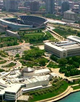
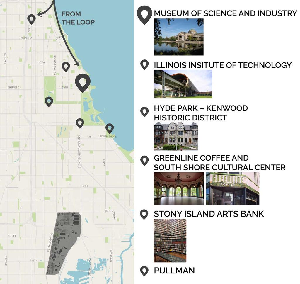
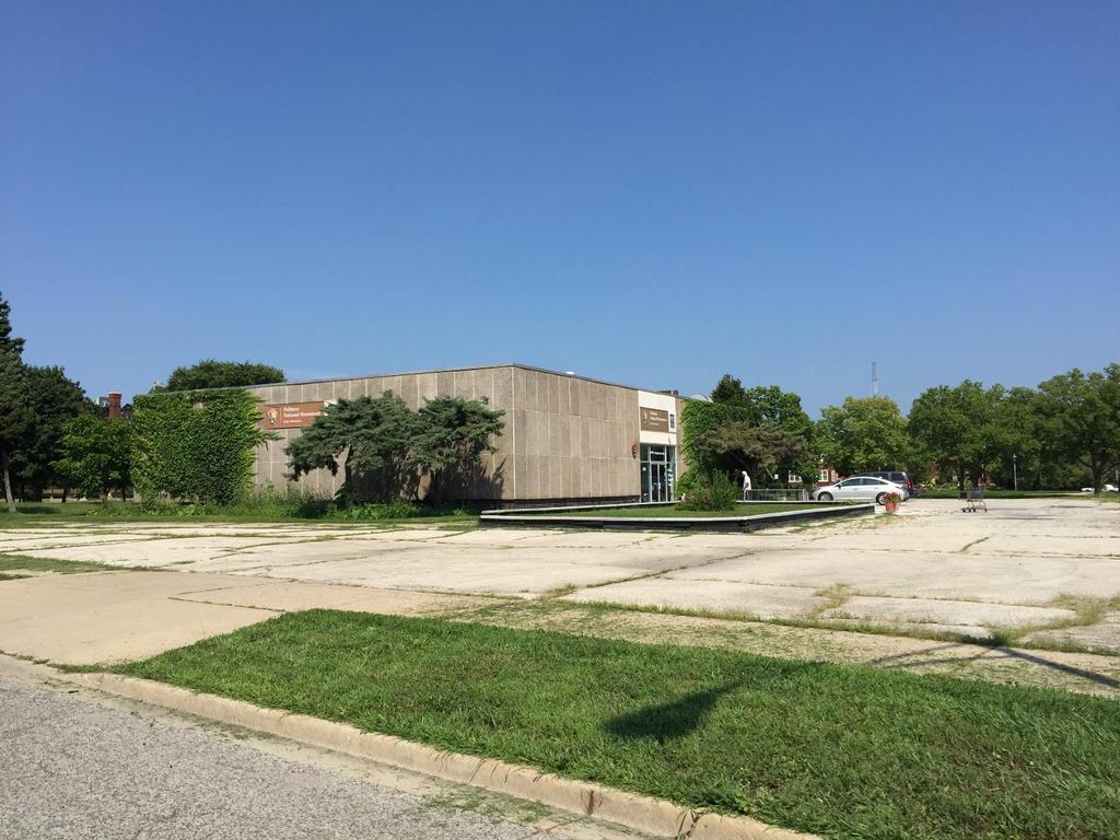
 The Pullman State Historic Site: Opportunities for the Future (1993) Pullman")
 The Pullman State Historic Site (2011) Image from Positioning Pullman (2015)")
2 Getting to Pullman Purpose and Need Past Planning Initiatives Positioning Pullman (2015) The Pullman State Historic Site: Opportunities for the Future (1993) Pullman Market Hall and Market Community Assistance Panel (1996) Pullman Factory Task Force (2000) The Pullman State Historic Site (2011) Image from Positioning Pullman (2015)

3 Existing Conditions Report Recap Part 1 Getting to Pullman
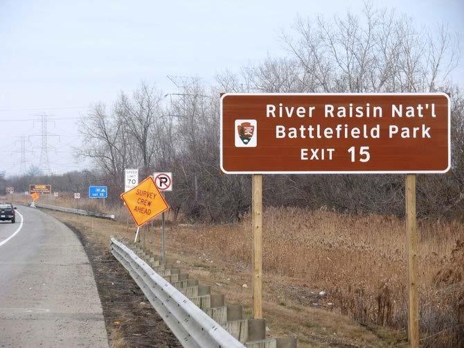
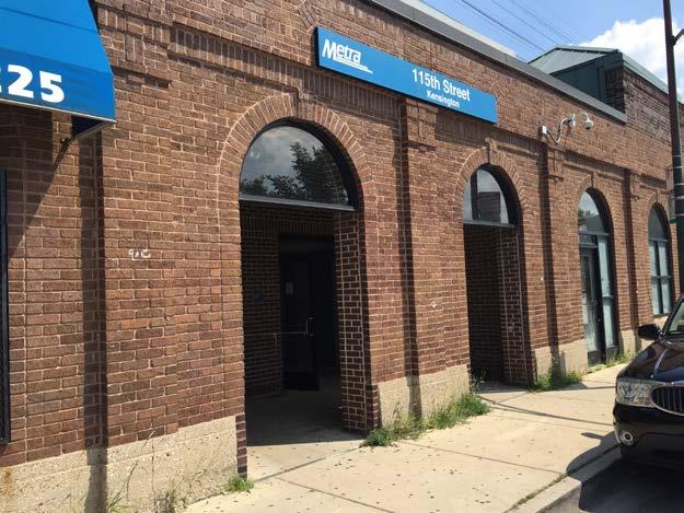
4 Part 1 Conclusions Getting to Pullman The number of visitors to Pullman will increase. Visitors will access Pullman via all modes. Pullman is well positioned to take advantage of multi-modal connections already existing in the area. Each mode has important trade-offs. Major barrier for visitors is navigation of an unfamiliar transit system. A significant majority of Pullman Metra Ridership is concentrated at 115 th Street/ Kensington Station. Many Pullman resident work downtown, most drive to get there. Most workers in Pullman come from the South, and Southwest sides of Chicago, and close to the Illinois/Indiana border. Truck circulation has a major impact on Langley/Ellis intersection.

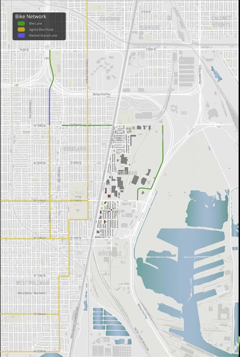
5 Existing Conditions Report Recap Getting around within Pullman
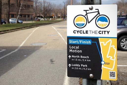
6 Part 2: Conclusions Getting around within Pullman The scale of the Monument and neighborhood lends itself to walking and biking. Discrete safety concerns existing, most relate to pedestrian access and infrastructure. Opportunities exist to better connect Pullman to the surrounding neighborhood destinations. Bike network in the area is not connected. Crossing 111 th Street is challenging for pedestrians Questions?
7 Pullman National Monument Transportation and Access Plan Planning Principles 24
8 Planning Principles 1. Create benefits for the local community 2. Establish an actionable plan, with optimistic vision 3. All information about Pullman should include directions 4. Make getting to Pullman a part of the Pullman experience 5. Anticipate differing visitor types, needs and desires 6. Focus effort improving the transition to walking from all modes 7. Build on what s working in other National Parks 25
9 1 Create benefits for the local community Ensure local Pullman neighborhood residents and businesses benefit from activity generated by Pullman visitors; anticipate and mitigate challenges early.
10 Context sensitivity Short term Sidewalk improvements Bus stop improvements Improved crossings Growth of on-street bike network Near term Metra improvements Tour bus parking Vehicle Parking Long term Increasing Metra Service and improving infrastructure. More foot traffic to local businesses Growth of regional bike trail network
11 Establish an actionable plan, 2 with optimistic vision
12 3 All information about Pullman should include directions Pullman visitors will benefit most if information about how to access the site is as easy to find as information about the site itself.

13 Getting to Pullman Regional Attractions & Traveler Amenities
14 4 Make getting to Pullman a part of the Pullman Experience The visitor s experience getting to and exploring the Pullman Historic Site and surrounding neighborhood should be an integral part of Pullman s appeal as a unique Chicago destination.
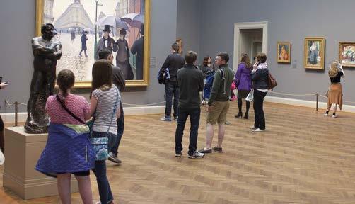
15 Traditional Museum Experience
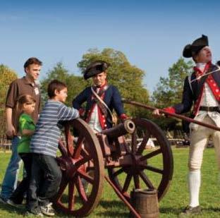
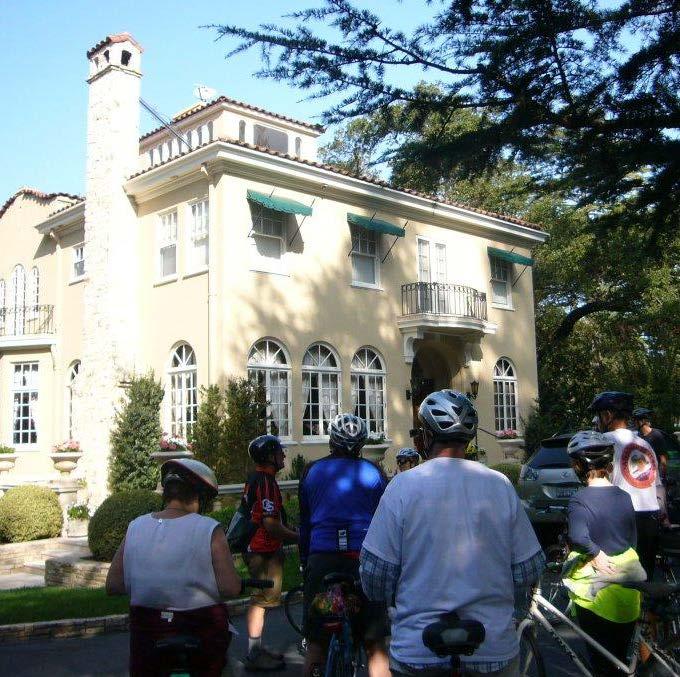
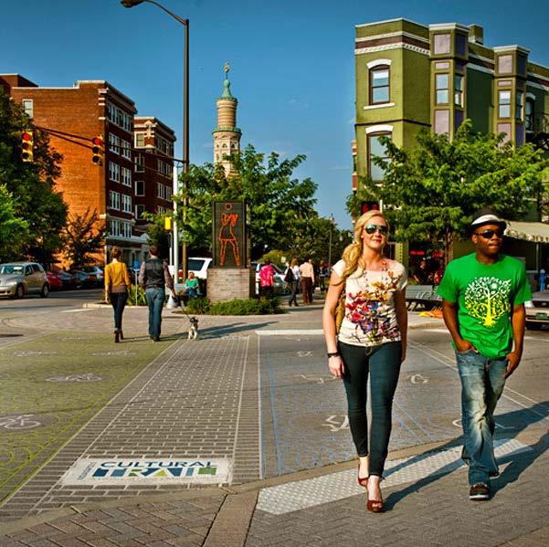
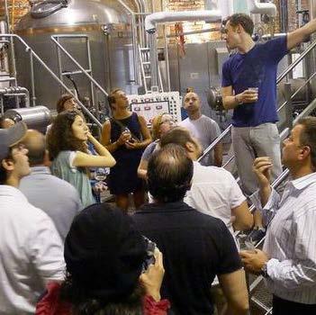
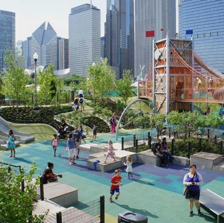
16 Active-Learning Sites Colonial Williamsburg Indianapolis Cultural Trail Brewery Tour Boston Freedom Trail Bike Tour Charlotte, NC Maggie Daley Park

17 Integrating Technology Google Maps QR Reader Pokemon Go Field Trip
18 5 Anticipate differing visitor types, needs, and desires Systems and infrastructure supporting navigation to/through the Pullman site should be flexible to meet the needs and desires of different visitor types and adaptable over time.
19 Visitor types Level of Planning Structured Visit Thought out every step of the way. Sort of thought out how to get there Spur of the moment visit Duration of Stay Part of a multistop day trip Single destination, longer stay Stopping by or passing through Modes Train Bus Bike Drive Rideshare Taxi Walk
20 Visitor Types Unique recreational destination National Park Visitor Interest in outdoor activity Opportunistic visitor Local interest Spur of the moment Structured visit Tours Classes Student groups Part of a multidestination tourism Destination categories Nearby destinations on Chicago s South Side

21 How do we plan for different visitor types? outline desire lines consider logical day-trips
22 Mapping Desire-Lines 1. Identify origins and destination point(s) 2. Identify pathways 3. Outline the most logical existing pathways 4. Identify potential connections that do not exist 5. Identify existing barriers
23 Mapping Desire-Lines 1. Identify origins and destination point(s) 2. Identify pathways 3. Outline the most logical existing pathways 4. Identify potential connections that do not exist 5. Identify existing barriers
24 Multi-Point Trips

25 Multi-Point Trips Rideshare Wait time: 5-10 minutes Trip: minutes CTA Bus Wait time: up to15 minutes Trip: 6 miles, 30 minutes Metra Wait time: Up to1 hour Trip: 7.5 miles, 25 minutes


26 Major Taylor Trail Head at 105 th St Burnham Greenway Trail Head at State St in Calumet City
27
28 6 Improve the transition to walking from all modes Anticipate and enhance the transition to walking from all modes. Develop wayfinding as part of a wider strategy to remove the physical and mental barriers.

29 47 Gateways


30 Getting around within Pullman 48
31
32
33 51
34 52
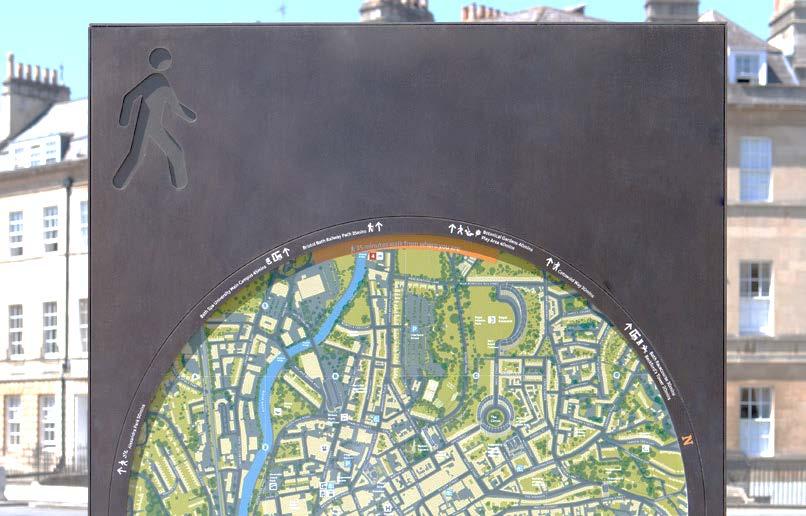
35 Wayfinding isn t one-size fits all.


36 Pedestrian Scale Wayfinding Examples City of Bath Wayfinding PearsonLloyd Springvale Wayfinding Signage Studio Binocular Legible London

37 Pedestrian Scale Wayfinding Examples Legible London
38 Pedestrian Scale Wayfinding Examples Legible London
39 Planning Principles Questions? 1. Establish an actionable plan, with optimistic vision 2. Create benefits for the local community 3. All information about Pullman should include directions 4. Make getting to Pullman a part of the Pullman experience 5. Anticipate differing visitor types, needs and desires 6. Focus effort improving the transition to walking from all modes 7. Build on what s working in other National Parks 57
40 Build on what s working in other 7 National Parks

41 Next Steps 59
42 Thank you QUESTIONS


43 New York Newark Chicago Hoffman Estates Tampa Washington D.C. L.A.
City of Novi Non-Motorized Master Plan 2011 Executive Summary
 City of Novi Non-Motorized Master Plan 2011 Executive Summary Prepared by: February 28, 2011 Why Plan? Encouraging healthy, active lifestyles through pathway and sidewalk connectivity has been a focus
Exhibit 1 PLANNING COMMISSION AGENDA ITEM
 Exhibit 1 PLANNING COMMISSION AGENDA ITEM Project Name: Grand Junction Circulation Plan Grand Junction Complete Streets Policy Applicant: City of Grand Junction Representative: David Thornton Address:
CITY OF COCOA BEACH 2025 COMPREHENSIVE PLAN. Section VIII Mobility Element Goals, Objectives, and Policies
 CITY OF COCOA BEACH 2025 COMPREHENSIVE PLAN Section VIII Mobility Element Goals, Objectives, and Policies Adopted August 6, 2015 by Ordinance No. 1591 VIII MOBILITY ELEMENT Table of Contents Page Number
Vision: Traditional hamlet with an attractive business/pedestrian friendly main street connected to adjacent walkable neighborhoods
 N D. Focus Area II Vision: Traditional hamlet with an attractive business/pedestrian friendly main street connected to adjacent walkable neighborhoods Transit Road Focus Area II is located in the Hamlet
NM-POLICY 1: Improve service levels, participation, and options for non-motorized transportation modes throughout the County.
 Transportation PRINCE WILLIAM COUNTY 2008 COMPREHENSIVE PLAN NON-MOTORIZED PLAN CONTENTS Goals, Policies, and Action Strategies Table 4 (Bike Facility Classifications and Descriptions) Table 5 (Bike Facility
Public Meeting #1 January 30, 2018
 Public Meeting #1 January 30, 2018 Meeting Outline Mayor s Introduction Presentation Q&A Group Activities Wrap-up Presentation Outline Introduction Existing Conditions Market Assessment Break-out Setup
CONCERNS / CHALLENGES
 CONCERNS / CHALLENGES Time frame Transit Pedestrian Access & Comfort Bicycle Access & Comfort Neighborhood Spillover Public Info & Signange Connection to Downtown Physical Contraints of site 0-5 years
In station areas, new pedestrian links can increase network connectivity and provide direct access to stations.
 The Last Mile Planning for Pedestrians Planning around stations will put pedestrians first. Making walking to stations safe and easy is important; walking will be a part of every rapid transit Accessible
Intermodal Connections with Light Rail in Phoenix, AZ Wulf Grote, P.E. Director, Planning & Development
 Intermodal Connections with Light Rail in Phoenix, AZ Wulf Grote, P.E. Director, Planning & Development 12th National LRT Conference Salt Lake City, UT November 12, 2012 Outline METRO Light Rail Overview
University of Victoria Campus Cycling Plan Terms of Reference. 1.0 Project Description
 University of Victoria Campus Cycling Plan Terms of Reference 1.0 Project Description The Campus Cycling Plan, a first for the University, will provide a comprehensive and coordinated approach to support
Walkable Community Workshops
 Presented by: Larry McAuliffe Manager, Research Unit, Planning Division New York Metropolitan Transportation Council NYSMPO Conference 2008 Walkable Community Workshops Discussion Topics: I. NYMTC in the
Draft MOBILITY ELEMENET. Community Meeting May 22, 2013
 Draft MOBILITY ELEMENET Community Meeting May 22, 2013 Agenda Presentation Ira Brown New Mobility Paradigm Movement of People Implementation Q&A Ira Brown and Dave Roseman Small Group Discussion at Each
Transportation Master Plan Advisory Task Force
 Transportation Master Plan Advisory Task Force Network Alternatives & Phasing Strategy February 2016 BACKGROUND Table of Contents BACKGROUND Purpose & Introduction 2 Linking the TMP to Key Council Approved
CONNECTING PEOPLE TO PLACES
 CONNECTING PEOPLE TO PLACES 82 EAST BENCH MASTER PLAN 07 Introduction The East Bench transportation system is a collection of slow moving, treelined residential streets and major arteries that are the
MASTER BICYCLE AND PEDESTRIAN PLAN
 VILLAGE OF NORTHBROOK MASTER BICYCLE AND PEDESTRIAN PLAN DRAFT PLAN OPEN HOUSE May 2, 2018 AGENDA 1. Community Engagement 2. Vision and Goals 3. General Structure of Plan 4. Recommendations Overview 5.
TRANSPORTATION & MOBILITY VISIONING MEETING. August 23 24, 2017
 TRANSPORTATION & MOBILITY VISIONING MEETING August 23 24, 2017 Project Team 1999 South Lakefront Framework Plan In 1999, the Chicago Park District authorized framework plans for three historic parks: Jackson,
PRINCE GEORGE S PLAZA METRO AREA PEDESTRIAN PLAN
 PRINCE GEORGE S PLAZA METRO AREA PEDESTRIAN PLAN May 28, 2008 Agenda Welcome and introductions Project overview and issue identification Planning context and strengths Design challenges and initial recommendations
Ajax: The Road to Complete Streets
 Ajax: The Road to Complete Streets Hubert Ng, Senior Transportation Planner Elysia Leung, Transportation Demand Management Coordinator Complete Streets Forum October 1, 2015 Overview 1 2 Introduction to
Chapter 5 Future Transportation
 Chapter 5 Future Transportation The Future Land Use Plan identifies the desired land use designations. The land uses desired for Crozet depend, in large part, on the success of the transportation system,
North Coast Corridor:
 North Coast Corridor: Connecting People, Transportation & Environment Legislative Hearing: 11.8.10 1 North Coast Corridor Region s Lifeline A Regional Strategy Mobility, Economy & Environment North Coast
Ann Arbor Downtown Street Plan
 1 Ann Arbor Downtown Street Plan Public Workshop #1 We know that. 2 Public right-of-way (streets, sidewalks, and alleys) make up 30% of the total District area of downtown. Streets need to provide mobility
TRANSPORTATION & MOBILITY
 TRANSPORTATION & MOBILITY ROADWAY SYSTEM There are approximately 40 miles of roadways in Manitou Springs. For planning purposes, roadways are typically assigned a functional classification which defines
Corridor Vision Workshop Summary James Madison Elementary February 22,2018
 Corridor Vision Workshop Summary James Madison Elementary February 22,2018 WHY DEVELOP THIS STUDY? Ogden City is planning for better connectivity and access to jobs and housing. Working with area partners,
Vision. Goals and Objectives. Walking
 Vision Walking and biking is an accepted and valued part of everyday life in Portsmouth. People of all ages and abilities include walking and biking as part of their daily activities which helps to make
PEDESTRIAN ACTION PLAN
 ATTACHMENT 2 CITY OF SANTA MONICA PEDESTRIAN ACTION PLAN CITY OF SANTA MONICA PEDESTRIAN ACTION PLAN This page intentionally left blank EXECUTIVE SUMMARY CHAPTER 1 EXECUTIVE SUMMARY Setting the Stage
Shifting Gears for a Healthier City
 Shifting Gears for a Healthier City Mississauga s Cycling Master Plan is an ambitious strategy that sets out to transform Mississauga into a city that is conducive to cycling for daily transportation needs.
Appendix C 3. Bicycle / Pedestrian Planning
 Appendix C 3. Bicycle / Pedestrian Planning BICYCLE/PEDESTRIAN PLANNING 2005 Master Plan GOAL: Provide for safe and convenient bicycle and pedestrian circulation throughout the City. Develop a city-wide
VAN AKEN DISTRICT CONNECTIONS PLAN COMMUNITY MEETING #1 June 20, 2016 SMITHGROUP JJR WSP PARSONS BRINCKERHOFF STUDIO GRAPHIQUE
 VAN AKEN DISTRICT CONNECTIONS PLAN COMMUNITY MEETING #1 June 20, 2016 SMITHGROUP JJR WSP PARSONS BRINCKERHOFF STUDIO GRAPHIQUE 01 02 03 04 05 06 Project Overview + Goals RMS Development District-wide Connections
Chapter 7. Transportation. Transportation Road Network Plan Transit Cyclists Pedestrians Multi-Use and Equestrian Trails
 Chapter 7 Transportation Transportation Road Network Plan Transit Cyclists Pedestrians Multi-Use and Equestrian Trails 7.1 TRANSPORTATION BACKGROUND The District of Maple Ridge faces a number of unique
FOCUS AREA 1 - Alberta Avenue Pocket Park 3 (121 Ave and 92 St)
") FOCUS AREA 1 - Alberta Avenue Pocket Park 3 (121 Ave and 92 St) New benches Plant evergreen trees Widen existing sidewalk from 1.5m to 1.8m Marked crosswalk 1.8m wide sidewalk Add pedestrian oriented lights
FOCUS AREA 1 - Alberta Avenue Pocket Park 3 (121 Ave and 92 St) New benches Plant evergreen trees Widen existing sidewalk from 1.5m to 1.8m Marked crosswalk 1.8m wide sidewalk Add pedestrian oriented lights
EXECUTIVE SUMMARY. Vision
 Vision Walking and bicycling in Salt Lake City will be safe, convenient, comfortable, and viable transportation options that connect people to places, foster recreational and economic development opportunities,
Bicycle-Pedestrian Master Plan Update
 Bicycle-Pedestrian Master Plan Update Planning & Zoning Commission November 29, 2017 Overview Project Purpose & Scope Project History Plan Vision & Goals Chapter 5: Making Connections-Beyond the Path Next
Tonight is for you. Learn everything you can. Share all your ideas.
 Strathcona Neighbourhood Renewal Draft Concept Design Tonight is for you. Learn everything you can. Share all your ideas. What is Neighbourhood Renewal? Creating a design with you for your neighbourhood.
JOINT PARTNERSHIPS: Working Together To Support Light Rail in Santa Monica
 JOINT PARTNERSHIPS: Working Together To Support Light Rail in Santa Monica ITY OF ANTA MONICA RAIL-VOLUTION / OCTOBER 17, 2012 SARAH LEJEUNE, PRINCIPAL PLANNER, STRATEGIC + TRANSPORTATION PLANNING DIVISION
Welcome. Background. Goals. Vision
 Welcome The formal Public Information Centre (PIC) for the Transportation Master Plan How We GO will be held in early 2017. At that time we will present the recommended transportation system for Niagara
CITY OF SEATTLE RESOLUTION. WHEREAS, the Washington State Department of Transportation (WSDOT) led the Seattle
 led the Seattle") SDOT SR0 Design Refinements RES August, 0 Version #D 0 CITY OF SEATTLE RESOLUTION..title A RESOLUTION relating to the State Route 0, Interstate to Medina Bridge Replacement and High Occupancy Vehicle Project;
SDOT SR0 Design Refinements RES August, 0 Version #D 0 CITY OF SEATTLE RESOLUTION..title A RESOLUTION relating to the State Route 0, Interstate to Medina Bridge Replacement and High Occupancy Vehicle Project;
Hennepin County Bicycle and Pedestrian Planning
 Hennepin County Bicycle and Pedestrian Planning 1 Value of bicycle and sidewalk systems Safety Livability Mobility Health Personal Finances Economic Sustainability Clean Air Recreation Parking and congestion
Plant City Walk-Bike Plan
 Plant City Walk-Bike Plan Plant City Commute Mode Share 2.2% 1.4% 2.9% Drove alone 10.2% Carpooled Public transportation (0.1%) Walked Used a Bike (0.4%) 82.9% Taxicab, motorcycle, or other means Worked
Perryville TOD and Greenway Plan
 Perryville TOD and Greenway Plan Greenway Glossary Pathway: A bicycle and pedestrian path separated from motorized vehicular traffic by an open space, barrier or curb. Multi-use paths may be within the
NEWMARKET UPHAM S CORNER
 SOUTH STATION Planning Initiative NEWMARKET UPHAM S CORNER COLUMBIA ROAD (P) FOUR CORNERS/GENEVA Working Advisory Group (WAG) Meeting #5 TALBOT AVENUE MORTON STREET BLUE HILL AVE/CUMMINS HWY (P) RIVER
SCARBOROUGH CENTRE TRANSPORTATION MASTER PLAN (SCTMP)
") SCARBOROUGH CENTRE TRANSPORTATION MASTER PLAN (SCTMP) Public Consultation Meeting #2 May 10 th, 2017 Presentation Outline 1 Project Schedule and Background 2 Draft Evaluation of Alternatives 3 Preliminary
SCARBOROUGH CENTRE TRANSPORTATION MASTER PLAN (SCTMP) Public Consultation Meeting #2 May 10 th, 2017 Presentation Outline 1 Project Schedule and Background 2 Draft Evaluation of Alternatives 3 Preliminary
DRAFT. System Components. Greenway Trails. Introduction. Trail Types. Zebulon Greenway Master Plan
 5 System Components Wakefield Street Photo Simulation showing Sharrows Introduction The Master Plan identifies various system components that, together, create a comprehensive greenway system. These components
Performance Criteria for 2035 Long Range Transportation Plan
 Minimizing Impacts on Natural, Historic, Cultural or Archeological Resources 2035 LRTP Weighting Factor: 7% Objective 1.1: Use appropriate planning and design criteria to protect and enhance the built
CITY OF BLOOMINGTON COMPLETE STREETS POLICY
 CITY OF BLOOMINGTON COMPLETE STREETS POLICY POLICY OBJECTIVE: The City of Bloomington will enhance safety, mobility, accessibility and convenience for transportation network users of all ages and abilities,
Agenda. Overview PRINCE GEORGE S PLAZA METRO AREA PEDESTRIAN PLAN
 PRINCE GEORGE S PLAZA METRO AREA PEDESTRIAN PLAN May 28, 2008 Agenda Welcome and introductions Project overview and issue identification Planning context and strengths Design challenges and initial recommendations
Encouragement. Chapter 4. Education Encouragement Enforcement Engineering & Facilities Evaluation & Planning. Encouragement Chapter 4
 Encouragement Education Encouragement Enforcement Engineering & Facilities Evaluation & Planning Photo above: Children show off their ribbons at the Tour de Virginia Beach. Virginia Beach Bikeways and
Typical Rush Hour Commute. PennyforTransportation.com
 Typical Rush Hour Commute In the News Overview of the Plan Collaborative plan with projects in every community Prioritizing connectivity and congestion relief Dedicated transportation-specific funding;
Transportation Assessment
 Transportation Assessment Midtown Open House February 10, 2018 Overview Midtown in Focus Overview & Purpose of Today Transportation Assessment overview Summary of Transportation work to date Review & Analysis
Shifting Gears for a Healthier City.
 Shifting Gears for a Healthier City. Mississauga s Cycling Master Plan is an ambitious strategy that sets out to transform Mississauga into a city that is conducive to cycling for daily transportation
7 Complete Streets & Roadway Aesthetics
 7 Complete Streets & Roadway Aesthetics 7.1 OVERVIEW Our streets lay the foundation for how we interface with travel needs, physical exercise, social exchanges and access to goods and services. They are
City of Birmingham Draft Multi-modal Transportation Plan
 City of Birmingham Draft Multi-modal Transportation Plan City Commission Public Hearing Monday, November 25, 2013 7:30 pm Norman Cox, PLA, ASLA The Greenway Collaborative, Inc. Ann Arbor, Michigan The
Proposed. City of Grand Junction Complete Streets Policy. Exhibit 10
 Proposed City of Grand Junction Complete Streets Policy Exhibit 10 1 City of Grand Junction Complete Streets Policy Vision: The Complete Streets Vision is to develop a safe, efficient, and reliable travel
DOWNTOWN TENINO. Goal: Get more People in Downtown. A Pamphlet of Concepts for
 A Pamphlet of Concepts for DOWNTOWN TENINO The Tenino Planning Commission believes that the highest potential for economic development and business development in the City of Tenino (in the short-term)
Solana Beach Comprehensive Active Transportation Strategy (CATS)
") Solana Beach Comprehensive Active Transportation Strategy (CATS) 3.0 Goals & Policies The Solana Beach CATS goals and objectives outlined below were largely drawn from the Solana Beach Circulation Element
Solana Beach Comprehensive Active Transportation Strategy (CATS) 3.0 Goals & Policies The Solana Beach CATS goals and objectives outlined below were largely drawn from the Solana Beach Circulation Element
About the Active Transportation Alliance
 About the Active Transportation Alliance Chicagoland s voice for better biking, walking and transit Founded 1985 7,000 members, ~33 full time staff Serve Chicago metro region 1 More Cars, More Driving
Welcome! Public Open House on UBC s Transportation Plan
 1 Welcome! Public Open House on UBC s Transportation Plan Public open house hours: to When it comes to on-campus transportation, what do you think is working well and what are some opportunities for improvement?
Chapter VISION, MISSION, AND GOALS AND OBJECTIVES. Vision. Mission. Goals and Objectives CONNECTING COMMUNITIES ACROSS THE ST.
 VISION, MISSION, AND GOALS AND OBJECTIVES Chapter 3 The Plan s vision, mission, and goals and objectives were developed through a series of interactive exercises with the Citizens Advisory Committee (CAC)
Introduction. Using the Checklist. TDM-Supportive Development Design and Infrastructure Checklist Version 1.0 (30 June 2017) City of Ottawa
 City of Ottawa") Introduction The s Transportation Impact Assessment (TIA) Guidelines (specifically Module 4.1 Development Design) requires proponents of qualifying developments to use the City s TDM-Supportive Development
Introduction The s Transportation Impact Assessment (TIA) Guidelines (specifically Module 4.1 Development Design) requires proponents of qualifying developments to use the City s TDM-Supportive Development
Characteristics from these programs were used to compare to and evaluate existing conditions in Howard County.
 EXECUTIVE SUMMARY Bike share is a mobility option that allows users to access a fleet of public bicycles throughout a community. Bike share systems have successfully been implemented in communities throughout
Montco 2040 Implementation Grant Program Award Summary
 Municipality Montco 2040 Implementation Grant Program - 2017 Award Summary Support Downtowns Walk/Bike Montco Name of Project Business Parks Total Project Cost Grant Award Schwenksville Main Street Pedestrian
TOWN OF WILLIAMSTON, SC BICYCLE AND PEDESTRIAN MASTER PLAN TOWN OF WILLIAMSTON, SC BICYCLE AND PEDESTRIAN MASTER PLAN
 TOWN OF WILLIAMSTON, SC BICYCLE AND PEDESTRIAN MASTER PLAN Americans Want Choices 55% of Americans would rather drive less & walk more. Transit use is growing faster than population or highway travel.
Plant City Bicycle and Pedestrian Master Plan. Project Update March 2, 2017
 Plant City Bicycle and Pedestrian Master Plan Project Update March 2, 2017 NOV Project Kickoff DEC/ JAN FEB/ MAR Plan Review/Field Work Public Meeting/Coordination Meetings Develop Draft Plan APR/ MAY
CITY OF GRAND JUNCTION URBAN TRAILS COMMITTEE 2017 ANNUAL REPORT
 CITY OF GRAND JUNCTION URBAN TRAILS COMMITTEE 2017 ANNUAL REPORT INTRODUCTION INTRODUCTION Resolution No. 48 94 created the Grand Junction Trails Board in 1994 as a subcommittee of the Riverfront Commission
ONE SIZE DOESN T FIT ALL RECONCILING OVERLAPPING TRANSPORT NETWORKS IN A CONSTRAINED URBAN ENVIRONMENT
 One Size Doesn t Fit All S Corbett, C Chenery Page 1 ONE SIZE DOESN T FIT ALL RECONCILING OVERLAPPING TRANSPORT NETWORKS IN A CONSTRAINED URBAN ENVIRONMENT Authors/Presenters: Sam Corbett, Principal Transport
Elon Bicycle, Pedestrian and Lighting Plan. Pedestrian Rail Crossings Study
 Elon Bicycle, Pedestrian and Lighting Plan Pedestrian Rail Crossings Study Project Overview The Town of Elon, Elon University and the Twin Lakes Retirement Community began a comprehensive bicycle, pedestrian
Eliminate on-street parking where it will allow for a dedicated bus only lane %
 Traffic Dashboard Priorities Survey Responses Introduction 1) Are you familiar with bus rapid transit (BRT)? a. No, BRT is new to me. 597 23.5% b. I ve heard of BRT, but I don t know much about it. 1,136
NOTES FROM JUNIOR COUNCIL ORIENTATION SESSION HELD ON MONDAY, JANUARY 22, 2018, AT 3:30 PM IN COUNCIL CHAMBERS, CITY HALL
 CITY OF KAMLOOPS Junior Council Meeting Agenda March 12, 2018, at 3:30 pm in Council Chambers, 7 Victoria Street West, Kamloops, BC Page 1. APPROVAL OF THE AGENDA 2. MINUTES Attachment Recommendation:
CHAPTER 3: Vision Statement and Goals
 Davidson Walks & Rolls: Active Transportation Master Plan CHAPTER 3 Contents: Overview Vision Statement Measurable Goals Public Outreach CHAPTER 3: Vision Statement and Goals Overview The vision statement
o n - m o t o r i z e d transportation is an overlooked element that can greatly enhance the overall quality of life for the community s residents.
 N o n - m o t o r i z e d transportation is an overlooked element that can greatly enhance the overall quality of life for the community s residents. 84 Transportation CHAPTER 11 INTRODUCTION Transportation
WELCOME. Purpose of the Open House. Update you on the project. Present a draft recommended plan. Receive your input
 WELCOME Purpose of the Open House The Town of Smiths Falls has initiated the Beckwith Street Redevelopment Plan that includes the preparation of a streetscape functional design for the renewal of Beckwith
Transportation Planning Division
 Transportation Planning Division Presentation Outline Study Tasks Recap of Previous Meeting Stakeholder Interviews Data Collection Design Principles Tool Box Recommendations Schedule Moving Forward North
CONNECTIVITY PLAN. Adopted December 5, 2017 City of Virginia Beach
 CONNECTIVITY PLAN Adopted December 5, 2017 City of Virginia Beach CONTENTS 1.0 Background & Purpose... 2 2.0 Existing Inventory & Analysis... 3 ViBe District Existing Walking Conditions... 4 3.0 ViBe District
Castro Valley Municipal Advisory Council March 19, 2018
 Castro Valley Municipal Advisory Council March 19, 2018 1 Background 2 Draft Bicycle Vision and Pedestrian Networks 3 Next Steps 4 Updates Agenda 2 PROJECT AREA: Unincorporated Areas of Alameda County
Montford Drive Parking & Circulation Study
 Montford Drive Parking & Circulation Study Parking & Circulation Study Follow up to the Area Plan based on what we heard Purpose 1 2 3 4 To look closer and evaluate parking and network related issues (including
Active Transportation Access to Transit
 Active Transportation Access to Transit Introduction COMO Connect customers access transit service in many ways, including walking, bicycling, riding in a car and being dropped off, and directly boarding
Bicycle-Pedestrian Master Plan: Chapters 3 and 4 Distribution
 Bicycle-Pedestrian Master Plan: Chapters 3 and 4 Distribution Finksburg Planning and Citizens Council March 22, 2018 Overview Progress Citizen Outreach Vision Chapter 3 - Existing Conditions Chapter 4
Case Study: Transportation Plan Environmental Impact Statement. National Park Service U.S. Department of the Interior
 National Park Service U.S. Department of the Interior Grand Teton National Park Wyoming Case Study: Transportation Plan Environmental Impact Statement November 2010 Brian T. Alward CRP 5540: Introduction
CLOSED. The draft concept design has been broken down into 5 categories for the purpose of this survey:
 Old Strathcona s neighbourhood renewal process is now at the draft concept design phase. Over the last several months, the city has been gathering local knowledge and resident input that has been used
Toronto Complete Streets Guidelines
 88 90 5.1 Cycling Design Principles 92 5.2 Context-sensitive Cycling Facilities 96 5.3 Key Cycling Elements Cycling infrastructure provides choice in how people are able to move around the city. Cyclists
Goal 3: Foster an environment of partnerships and collaboration to connect our communities and regions to one another.
 Non-Motorized Transportation Plan (NMTP) Draft Vision, Goal and,, Tri-County Regional Planning Commission (TCRPC) Purpose The purpose of the Tri-County Regional Planning Commission (TCRPC) Non-Motorized
Lake to Lake LAKE YORK. CYCLING ROUTE and WALKING TRAIL FEASIBILITY and DESIGN STUDY LAKE. CITY of REGION ONTARIO SIMCOE TORONTO
 LAKE SIMCOE Lake to Lake CYCLING ROUTE and WALKING TRAIL FEASIBILITY and DESIGN STUDY YORK REGION Overview Report JUNE 2013 CITY of TORONTO LAKE ONTARIO Table of Contents Study background 2 Study Background............................
East Burke Transportation, Safety and Capacity Improvements
 East Burke Transportation, Safety and Capacity Improvements The purpose of this project is to increase mobility and improve safety for pedestrians, cyclists, and motor vehicles along VT Route 114 in the
Kelowna On the Move. Pedestrian and Bicycle Master Plan
 Kelowna On the Move Pedestrian and Bicycle Master Plan Executive Summary April 2016 Purpose of the Plan The Pedestrian and Bicycle Master Plan identifies infrastructure, planning, and policy requirements
Chapter 2. Bellingham Bicycle Master Plan Chapter 2: Policies and Actions
 Chapter 2 Bellingham Bicycle Master Plan Chapter 2: Policies and Actions Chapter 2: Policies and Actions The Bicycle Master Plan provides a road map for making bicycling in Bellingham a viable transportation
TRANSPORTATION and MOBILITY
 TRANSPORTATION and MOBILITY AT A GLANCE Effective Mobility Getting Around the Region Getting Around Bentonville Getting Around the Neighborhood As Bentonville s population and urban footprint grow, the
TRANSPORTATION and MOBILITY
 TRANSPORTATION and MOBILITY AT A GLANCE Effective Mobility Getting Around the Region Getting Around Bentonville Getting Around the Neighborhood As Bentonville s population and urban footprint grow, the
Safe Streets. City of Lake Forest Park. March 21, 2017
 Safe Streets City of Lake Forest Park March 21, 2017 1 01 WELCOME 2 Agenda WELCOME WHAT IS THIS PROJECT? CONTEXT DRAFT CITYWIDE PROJECTS EXERCISE INTRODUCTION 3 02 WHAT IS THIS PROJECT? 4 WHAT IS THIS
Obey Creek PEDESTRIAN CIRCULATION EAST WEST PARTNERS PEDESTRIAN CIRCULATION CREEK SIDE LANE SLIP STREET SCOTT MURRAY MAIN STREETS EAST/WEST
 THE VILLAGE AT PEDESTRIAN CIRCULATION MAIN STREETS NORTH/SOUTH MAIN STREETS EAST/WEST SLIP STREET CREEK SIDE LANE PEDESTRIAN CIRCULATION DESCRIPTION: Circulation through the downtown of is organized by
2.0 Existing Conditions
 20 2.0 Existing Conditions 2.1 Land Use, Future Growth Patterns, Physical Barriers Geographic Overview Sutter County s land use pattern is characterized by extensive agricultural areas, significant natural
EXECUTIVE SUMMARY... vii 1 STUDY OVERVIEW Study Scope Study Area Study Objectives
 Contents EXECUTIVE SUMMARY... vii 1 STUDY OVERVIEW... 1-1 1.1 Study Scope... 1-1 1.2 Study Area... 1-1 1.3 Study Objectives... 1-3 2 EXISTING CONDITIONS... 2-1 2.1 Existing Freeway Conditions... 2-4 2.1.1
Regional Alternatives Analysis. Downtown Corridor Tier 2 Evaluation
 Regional Alternatives Analysis Downtown Corridor Tier 2 Evaluation September 19, 2011 EVALUATION PROCESS REVIEW OF EVALUATION PROCESS Tier 1: Screen Seven Alignment Options into a Short List Tier 2: Evaluate
Point Defiance Park. Master Plan
 Point Defiance Park Master Plan Public Participation 1/29, 2/26, 3/26 & 4/23 Owen Beach Ferry Zoo Fort Nisqually Mildred Street Pearl Street Triangle Hare & Hare Master Plan - 1911 2008 Concept Plan Comments
2018 New York Bike Summit
 2018 New York Bike Summit -Education: Beyond the Rules of the Road- Set at the historic Gideon Putnam Hotel in beautiful Saratoga, New York, The 2018 New York State Bike Summit is bigger than ever! This
MCTC 2018 RTP SCS and Madera County RIFP Multi-Modal Project Eval Criteria GV13.xlsx
 MCTC 8 RTP SCS and Madera County RIFP Multi-Modal Project Eval Criteria GV.xlsx Madera County Transportation Commission Regional Transportation Plan / Sustainable Communities Strategy Multi-Modal Project
Executive Summary Leadership Cincinnati Class 34. Project: Cinci Bikes
 Executive Summary Leadership Cincinnati Class 34 Project: Cinci Bikes Team Members: Martha Schickledorrf, Jim Kee, Brian Sullivan, Nancy Strassel, Scott Isenhart, Valerie Landell Concept The Cinci Bikes
Providence Downtown Transit Connector STAKEHOLDER MEETING #2. Stakeholder Meeting #1 October 24, 2016
 Providence Downtown Transit Connector STAKEHOLDER MEETING #2 Stakeholder Meeting #1 October 24, 2016 February 2017 1 AGENDA 1 DTC Goals and Expectations 2 Street Design Concepts 3 Potential Benefits and
Winnipeg Walk Bike Projects Downtown Tire Talk - Summary
 Winnipeg Walk Bike Projects Downtown Tire Talk - Summary Downtown Projected Bike Lane System Connecting The Forks to the Exchange District (Fort Street, Garry Street & The Forks to Assiniboine Connection)
West Village Mobility & Integration
 West Village Mobility & Integration PRESENTED TO TOPCA Town Hall November 9, 2017 [7189-21] Port Credit 2 West Village + Mobility AWalkable Community A CompleteCommunity A SustainableCommunity 3 Mobility
95 th Street Corridor Transportation Plan. Steering Committee Meeting
 95 th Street Corridor Transportation Plan Steering Committee Meeting August 11, 2014 PROJECT OBJECTIVES Develop a Transportation and Economic Plan for the 95 th Street Corridor Improve public transit efficiency
SANTA CLARA COUNTYWIDE BICYCLE PLAN August 2008
 SANTA CLARA COUNTYWIDE BICYCLE PLAN August 2008 To assist VTA and Member Agencies in the planning, development and programming of bicycle improvements in Santa Clara County. Vision Statement To establish,