95 th Street Corridor Transportation Plan. Steering Committee Meeting
|
|
|
- Janice Johns
- 5 years ago
- Views:
Transcription

1 95 th Street Corridor Transportation Plan Steering Committee Meeting August 11, 2014
2 PROJECT OBJECTIVES Develop a Transportation and Economic Plan for the 95 th Street Corridor Improve public transit efficiency and connectivity throughout the corridor Support working towards the fulfillment of goals set forth in the Pace Vision 2020 Plan
3 PURPOSE OF THE MEETING Introduce Steering Committee to project Review existing conditions in the corridor Discuss transportation and other concerns Explain our approach and future work for the project

4 PROJECT TIME LINE

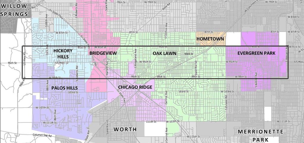
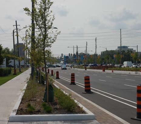
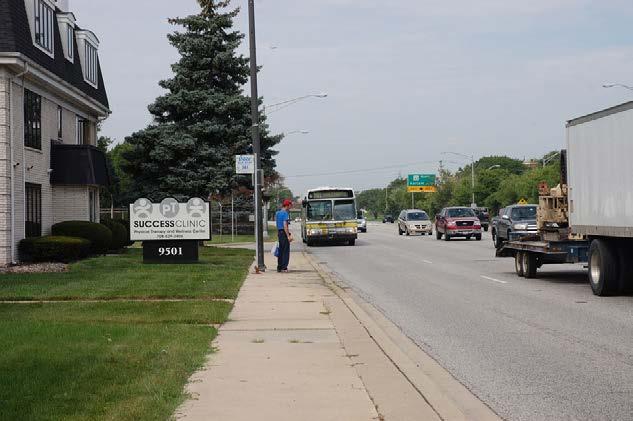
5 STUDY AREA - CORRIDOR


6 STUDY AREA - COMMUNITIES Corridor Communities Evergreen Park Hometown Oak Lawn Chicago Ridge Bridgeview Hickory Hills Palos Hills


7 KEY DESTINATIONS Oak Lawn High School Oak Lawn City Hall Advocate Christ Medical Center Target & Home Depot Meijer Walmart Hill Creek hopping Center Hickory Hills Golf Course Hickory Palos Shopping Center Chicago Ridge Mall Oak Lawn Shopping Center Little Company of Mary Hospital Evergreen Plaza


8 POSITIVE CORRIDOR ATTRIBUTES Established transit routes and connections to other services Well-established transit routes and connection to other PACE, Metra and CTA services


9 POSITIVE CORRIDOR ATTRIBUTES Diverse community destinations Well-established transit routes and connection to other PACE, Metra and CTA services


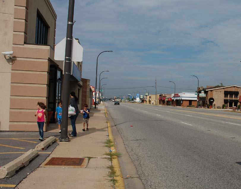
10 POSITIVE CORRIDOR ATTRIBUTES Mix of land uses across the corridor
 with access to")
11 POSITIVE CORRIDOR ATTRIBUTES Wide transportation corridor (7 lane cross section) with access to I-294


12 IMPROVEMENT AREAS Enhance streetscape, pedestrian and cycling environments Priority for transit (signal priority, queue jump)


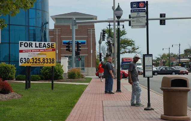
13 IMPROVEMENT AREAS Transit operations improve on-time performance, designated stops, and amenities Improve sidewalk connectivity and accessibility to community destinations


14 IMPROVEMENT AREAS Combine multiple driveways to properties along 95 th Street where possible to reduce pedestrian/auto conflicts Improve crossings at intersections and provide screening between the sidewalk and travel lanes

15 PACE ARTERIAL RAPID TRANSIT (ART) Combination of Transit Signal Priority (TSP) and roadway improvements including queue jump lanes 95 th Street is part of the short-term network development


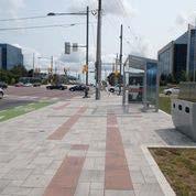
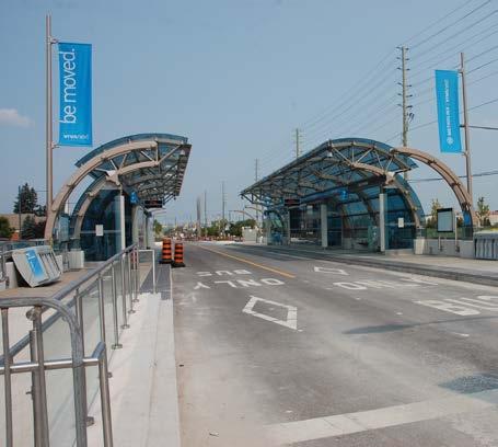
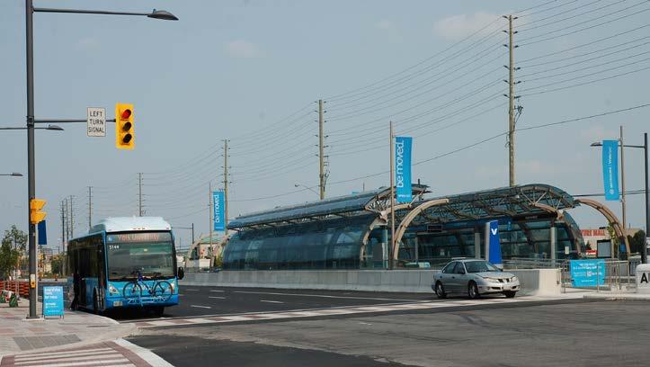
16 VIVA - YORK REGION TRANSIT

17 VIVA - YORK REGION TRANSIT
18 EXISTING CONDITIONS
19 MARKET AND ECONOMIC ENVIRONMENT
20 POPULATION 14,100 16,450 56,700 4,350 19,850 17,450 14,100 Estimated 20% of the population, or 28,600 people live within the study area

21 MEDIAN HOUSEHOLD INCOME Evergreen Park Oak Lawn Chicago Ridge Bridgeview Hickory Hills Palos Hills $0 $10,000 $20,000 $30,000 $40,000 $50,000 $60,000 $70,000
22 HOUSING STOCK Percent of total Single Family Detahced Single Family Attached 2-4 units 5-9 Units More than 20 Units

23 EMPLOYMENT 1,600 11,300 19, ,350 5,900 4,500
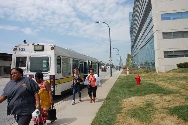
24 COMMERCIAL-USE MIX VS. OCCUPANCY LEVELS 26.9% 51.3% Retail Space Office Space Industrial Space 90.6% 92.4% Retail Space Office Space 21.8% 97.4% Industrial Space
25 RETAIL SPACE BY COMMUNITY 9% 24% 29% 38% Oak Lawn Evergreen Park Chicago Ridge Hickory Hills
26 INDUSTRIAL & OFFICE SPACE BY COMMUNITY 80.0% 70.0% 60.0% Percent of Total 50.0% 40.0% 30.0% Office Space Industrial Space 20.0% 10.0% 0.0% Evergreen Park Oak Lawn Hickory Hills Bridge View Palos Hills
27 TRANSPORTATION

28 TRAFFIC VOLUMES 17,300 19,000 45,100 35,600 39,500 25,800 v Vehicles/day
29 INTERSECTION PERFORMANCE Minimal or low levels of delay and queuing Intermittent waiting through more than one signal, occasional backups Intersection fills to, or may exceed capacity, may have long queues, delays, and traffic Traffic generally flows well through the corridor Busiest intersections are Western, Cicero, and Ridgeland Experience most delays for left turns and through traffic Train crossings to the north and east of Cicero affect traffic flow

30 ACCESS v info here
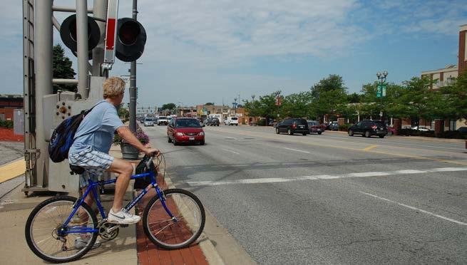
31 BIKE AND PEDESTRIAN

32 TRANSIT To UPS (Hodgkins) via I-294 Oak Lawn Metra To Metra and CTA Stations Moraine College Busiest Pace Bus Stops Pace Route 381 Limited Trips Pace Route 395 Pace routes crossing 95 th St Two main routes along 95 th Street Busiest stops have about 80% of total ridership Current stop operation is flag stop Many stops have little to no passenger activity Few amenities and information for customers Oak Lawn Metra is a key transportation hub with good multi-modal access

33 TRANSIT RIDERSHIP 11% 40% 48% Western to CTA Moraine College Pace Route 381 Limited Trips Pace Route 395 Route 381 Estimated Daily Ridership: 4,400 Route 395 Estimated Daily Ridership: 500
34 TIME OF DAY RIDES Boarding Start-9am Midday 3-7pm 7pm-Finish Total Westbound ,091 Eastbound ,992 Total 888 1, ,083 Alighting Start-9am Midday 3-7pm 7pm-Finish Total Westbound ,917 Eastbound ,839 Total 830 1, ,756
35 ADDITIONAL PACE SERVICES Dial a Ride Paratransit Service Vanpools Employer Shuttle

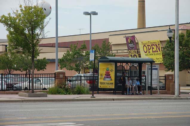
36 TRANSIT STOPS
37 OTHER STUDIES

38 HARLEM AVENUE CORRIDOR Harlem Avenue Corridor Plan A Complete Streets approach was applied to balance the needs of all users Conversion of existing clover leaf interchange with a more efficient singlepoint urban diamond Enhanced pedestrian accessibility along Harlem Ave across 95th Street and to adjacent redevelopment areas Potential transit center and park and ride lot for Pace service Interchange Concept for Harlem Avenue and 95 th Street


39 RIDGELAND AVENUE CORRIDOR Enhanced bike and pedestrian network that includes various typologies for bike facilities and crossing New two-way multi-use path is along the entire corridor requiring lane width reductions Pace bus stops to be located on the far side of intersections and to improve signage and amenities. Suggested Transportation Improvements for Ridgeland Avenue and 95 th Street
40 OAK LAWN 95 TH STREET CORRIDOR Develop a roadway median plan Enhance signalized intersections to improve pedestrian safety Support Pace s Arterial Rapid Transit (ART) plan Develop a roadway median plan, enhance signalized intersections to improve pedestrian safety, support Pace s Arterial Rapid Transit (ART) plan, enhance street parking with landscaping, and promote bike use Enhance street parking with landscaping Promote bike use

41 OAK LAWN 95 TH STREET CORRIDOR Development Concept for Downtown Oak Lawn along 95 th Street

42 OAK LAWN 95 TH STREET CORRIDOR Development Concept for Beatty Lumber Yard

43 OAK LAWN 95 TH STREET CORRIDOR Intersection Improvements for Cicero and 95 th Street Concept
44 COMMUNITY & STAKEHOLDER ENGAGEMENT
45 COMMUNITY ENGAGEMENT Public Survey: Website: Key Person Interviews: Stay Informed: Online at Survey ends October 11, Go to Planning Initiatives Then to 95 th Street Corridor Plan Chambers of Commerce, Emergency Services, Public Works, Pace Southwest Division Project website and Newsletter
46 FUTURE WORK Community Outreach Program Public participation Steering Committee Meeting #2 Transit and Roadway Recommended Improvements Final Transportation Improvement Plan
47 DISCUSSION Comments & Questions
95 th Street Corridor Transportation Plan. Steering Committee Meeting #2
 95 th Street Corridor Transportation Plan Steering Committee Meeting #2 February 18, 2015 PURPOSE OF THE MEETING Update Steering Committee Present Community/Stakeholder Survey Results Present Transportation
Lawrence Avenue Streetscape Concepts August 30, 2011
 Lawrence Avenue Streetscape Concepts August 30, 2011 Neighborhood Context Phase II: River to Western Ave. Phase I: Western Ave. to Clark St. Key Map Lawrence Ave. Existing Streetscape Conditions East of
Corridor Advisory Group and Task Force Meeting #10. July 27, 2011
 Corridor Advisory Group and Task Force Meeting #10 July 27, 2011 1 Agenda Recap CAG/TF #9 Public Meeting #2 Summary Single Mode Alternatives Evaluation Results Next Steps 2 3 CAG/TF #9 Recap CAG /TF #9
CONNECTING PEOPLE TO PLACES
 CONNECTING PEOPLE TO PLACES 82 EAST BENCH MASTER PLAN 07 Introduction The East Bench transportation system is a collection of slow moving, treelined residential streets and major arteries that are the
Chapter 5: Transportation Framework
 Chapter 5: Transportation Framework Framework Purpose The purpose of the Transportation Framework Plan is to identify improvements that balance the transportation assets of the Corridor. The Framework
Road Diets FDOT Process
 Florida Department of TRANSPORTATION Road Diets FDOT Process Humberto Castillero, PE, PTOE Roadway Design Office Purpose of Guide Develop a statewide lane elimination review process Balance state & local
A CHANGING CITY. of Edmonton, it is essential that it reflects the long-term vision of the City.
 A CHANGING CITY By the year 2040, Edmonton will be home to more than 1 million people. To accommodate growth and support a healthy and compact city, we need a new approach to development/redevelopment
UNIVERSITY AVENUE CORRIDOR REDESIGN. January 8, 2017 PUBLIC OPEN HOUSE
 January 8, 2017 PUBLIC OPEN HOUSE COLLABORATIVE COMMUNITY-BASED DESIGN IS THE FOUNDATION TO A SUCCESSFUL PROJECT AGENDA FOR TONIGHT 1 INTRODUCTIONS 2 WHY ARE WE HERE PROJECT NEED 3 SCHEDULE & GOALS 4 OPEN
Southwest Bus Rapid Transit (SW BRT) Functional Planning Study - Executive Summary January 19 LPT ATTACHMENT 2.
 Functional Planning Study - Executive Summary January 19 LPT ATTACHMENT 2.") Southwest Bus Rapid Transit (SW BRT) Functional Planning Study - Executive Summary 2011 January 19 1 of 19 Introduction This executive summary presents the results of the Southwest Bus Rapid Transit (SW
Southwest Bus Rapid Transit (SW BRT) Functional Planning Study - Executive Summary 2011 January 19 1 of 19 Introduction This executive summary presents the results of the Southwest Bus Rapid Transit (SW
DON MILLS-EGLINTON Mobility Hub Profile
 Mobility Hub Profile Dundas Don Mills-Eglinton West-Bloor Anchor Hub Gateway Hub N MOBILITY HUBS: Places of connectivity between regional and rapid transit services, where different modes of transportation
City of Wausau Wausau Center Urban Design and Transportation Master Plan. Design Workshop // October 18, 2018
 City of Wausau Wausau Center Urban Design and Transportation Master Plan Design Workshop // October 18, 2018 Design Workshops // October 15-18 Workshop Study Evaluate circulation and parking patterns around
In station areas, new pedestrian links can increase network connectivity and provide direct access to stations.
 The Last Mile Planning for Pedestrians Planning around stations will put pedestrians first. Making walking to stations safe and easy is important; walking will be a part of every rapid transit Accessible
Classification Criteria
 SCHEDULE D TO RECOMMENDED OFFICIAL PLAN AMENDMENT NO. 40 SCHEDULE C-4 Road Criteria Criteria Traffic Service Objective Land Service/Access Typical Daily Traffic Volume Flow characteristics Travel Speed
NEWMARKET CENTRE Mobility Hub Profile
 Mobility Hub Profile Dundas Newmarket West-Bloor Centre Anchor Hub Gateway Hub N MOBILITY HUBS: Places of connectivity between regional and rapid transit services, where different modes of transportation
Public Meeting #1 January 30, 2018
 Public Meeting #1 January 30, 2018 Meeting Outline Mayor s Introduction Presentation Q&A Group Activities Wrap-up Presentation Outline Introduction Existing Conditions Market Assessment Break-out Setup
Bus Rapid Transit Plans
 Twin Cities Region Bus Rapid Transit Plans ULI Minnesota Workshop Connecting Bus Rapid Transit to the Community December 15, 2009 John Levin Director of Service Development Metro Transit Metropolitan Area
Typical Rush Hour Commute. PennyforTransportation.com
 Typical Rush Hour Commute In the News Overview of the Plan Collaborative plan with projects in every community Prioritizing connectivity and congestion relief Dedicated transportation-specific funding;
C C C
 C-012-001 Thank you for your support for the creation of new public space and nonmotorized access between downtown and the waterfront through the Overlook Walk, the East-West Connections, and the Promenade.
Purpose and Need. Chapter Introduction. 2.2 Project Purpose and Need Project Purpose Project Need
 Chapter 2 Purpose and Need 2.1 Introduction The El Camino Real Bus Rapid Transit (BRT) Project (Project) would make transit and other transportation improvements along a 17.6-mile segment of the El Camino
9/25/2018. Multi-Modal Level of Service (MMLOS) Bianca Popescu, Transportation Planner
 Bianca Popescu, Transportation Planner") Multi-Modal Level of Service (MMLOS) Bianca Popescu, Transportation Planner 1 What is MMLOS? Is this a nice place to walk? Is this a nice place to bike? Is transit convenient? Bottom line - Are there options
Multi-Modal Level of Service (MMLOS) Bianca Popescu, Transportation Planner 1 What is MMLOS? Is this a nice place to walk? Is this a nice place to bike? Is transit convenient? Bottom line - Are there options
Tonight is for you. Learn everything you can. Share all your ideas.
 Strathcona Neighbourhood Renewal Draft Concept Design Tonight is for you. Learn everything you can. Share all your ideas. What is Neighbourhood Renewal? Creating a design with you for your neighbourhood.
Beyond First First Last Last Mile Strategies. APA National Conference April 3, 2016 Chelsea Richer, AICP Fehr & Peers
 Beyond First First Last Last Mile Strategies APA National Conference April 3, 2016 Chelsea Richer, AICP Fehr & Peers 1 Beyond First Last Mile Strategies APA National Conference Jeremy Klop, AICP, Fehr
APPENDIX A: Complete Streets Checklist DRAFT NOVEMBER 2016
 APPENDIX A: Complete Streets Checklist DRAFT NOVEMBER 2016 Complete Streets Checklist MetroPlan Orlando s Complete Streets Checklist is an internal planning tool for staff to further implementation of
Executive Summary Route 30 Corridor Master Plan
 Route Corridor Master Plan Project Overview The Route Corridor Master Plan is a coordinated multimodal transportation and land use plan for the entire stretch of Route through East Whiteland Township,
FOCUS AREA 1 - Alberta Avenue Pocket Park 3 (121 Ave and 92 St)
") FOCUS AREA 1 - Alberta Avenue Pocket Park 3 (121 Ave and 92 St) New benches Plant evergreen trees Widen existing sidewalk from 1.5m to 1.8m Marked crosswalk 1.8m wide sidewalk Add pedestrian oriented lights
FOCUS AREA 1 - Alberta Avenue Pocket Park 3 (121 Ave and 92 St) New benches Plant evergreen trees Widen existing sidewalk from 1.5m to 1.8m Marked crosswalk 1.8m wide sidewalk Add pedestrian oriented lights
DON MILLS-SHEPPARD Mobility Hub Profile
 DON MILLS-SHEPPARD Mobility Hub Profile Dundas Don Mills-Sheppard West-Bloor Anchor Hub Gateway Hub N MOBILITY HUBS: Places of connectivity between regional and rapid transit services, where different
Managed Lanes. Steve Schilke, P.E. Major Projects Unit Head District 1. Illinois Traffic Engineering and Safety Conference October 2016
 Managed Lanes Steve Schilke, P.E. Major Projects Unit Head District 1 Illinois Traffic Engineering and Safety Conference October 2016 Agenda Managed Lanes Projects I-55 (Stevenson Expressway) Express Toll
Austell Road Access Management Plan Public Meeting February 17, 2009
 Austell Road Access Management Plan Public Meeting February 17, 2009 Laraine Vance: Dan Cohen: Cobb DOT Project Manager Pond & Company Planning Director 1 Access Management What is Access Management? The
Main-McVay Transit Study: Phase 2 Options Definition and High Level Constraints Evaluation
 Main-McVay Transit Study: Phase 2 Options Definition and High Level Constraints Evaluation APRIL 2016 A collaborative study between: For Additional Information or to Comment If you would like additional
Centennial Neighbourhoods Transportation Management Plan Summary of Phase 1 Consultation. Overview of Issues
 1 Centennial Neighbourhoods Transportation Management Plan Summary of Phase 1 Consultation The Centennial Neighbourhoods Transportation Management Plan (CNTMP) is being undertaken to support the Secondary
City of Hamilton s Transportation Master Plan (TMP) Public Consultation 3 December 2015
 Public Consultation 3 December 2015") City of Hamilton s Transportation Master Plan (TMP) Public Consultation 3 December 2015 McPhail Transportation Planning Services Ltd. AGENDA 6:00 7:00 pm Viewing Boards / Q & A with the Team 7:00 7:50
City of Hamilton s Transportation Master Plan (TMP) Public Consultation 3 December 2015 McPhail Transportation Planning Services Ltd. AGENDA 6:00 7:00 pm Viewing Boards / Q & A with the Team 7:00 7:50
Complete Streets in Constrained Corridors: Chicago s Central Loop BRT
 Complete Streets in Constrained Corridors: Chicago s Central Loop BRT NACTO Designing Cities Conference October 24, 2012 Luann Hamilton, Deputy Commissioner What is BRT? Bus-based system that improves
Chapter 5 Future Transportation
 Chapter 5 Future Transportation The Future Land Use Plan identifies the desired land use designations. The land uses desired for Crozet depend, in large part, on the success of the transportation system,
Planning Study SR 976. Project Advisory Team Meeting May 24, 2017
 ` SR 976 BIRD ROAD/SW 40TH STREET FROM SR 821/HEFT TO SR 5/US-1 Miami-Dade County, Florida FPID No.: 434845-4-22-01 Planning Study Project Advisory Team Meeting May 24, 2017 1 Agenda Introductions Project
Providence Downtown Transit Connector STAKEHOLDER MEETING #2. Stakeholder Meeting #1 October 24, 2016
 Providence Downtown Transit Connector STAKEHOLDER MEETING #2 Stakeholder Meeting #1 October 24, 2016 February 2017 1 AGENDA 1 DTC Goals and Expectations 2 Street Design Concepts 3 Potential Benefits and
Downtown BRT Corridor Alternatives Review: 1 st, 2 nd, 3 rd and 4 th Avenue. Bus Rapid and Conventional Transit Planning and Design Services
 Downtown BRT Corridor Alternatives Review: 1 st, 2 nd, 3 rd and 4 th Avenue Bus Rapid and Conventional Transit Planning and Design Services City of Saskatoon February 2018 Project Team HDR Corporation
Transportation Corridor Studies: Summary of Recommendations
 Transportation Corridor Studies: Summary of Recommendations Route 4 Corridor Study: Route 10 Corridor Study: Route 44 Corridor Study: Route 175 Corridor Study: Route 5/15 Corridor Study: Rentschler Field
WELCOME! Please complete a comment sheet as we value your feedback. 4 pm to 8 pm. September 15, Hosted by: AECOM on behalf of City of Calgary
 WELCOME! Thank you for attending our open house. There will be no formal presentation today so please take the time to read the boards. If you have any questions, please do not hesitate to approach one
MASONIC AVENUE STREET DESIGN STUDY Community Workshop 2. Masonic Ave Street Design Study Community Workshop 2 August 10, 2010
 Masonic Ave Street Design Study Community Workshop 2 August 10, 2010 Introduction MASONIC AVENUE STREET DESIGN STUDY Community Workshop 2 SF Municipal Transportation Agency Javad Mirabdal, Project Manager
Eliminate on-street parking where it will allow for a dedicated bus only lane %
 Traffic Dashboard Priorities Survey Responses Introduction 1) Are you familiar with bus rapid transit (BRT)? a. No, BRT is new to me. 597 23.5% b. I ve heard of BRT, but I don t know much about it. 1,136
Major Bike Routes 102 Avenue Workshop April 21, 2015
 Major Bike Routes 102 Avenue Workshop April 21, 2015 Our Purpose Today Provide context on how Major Bike Routes fit into Edmonton s future Share information on what we heard in our last phase, and how
Public Information Meeting. Warren County Pathway Corridor Project September 27, 2018
 Public Information Meeting Warren County Pathway Corridor Project September 27, 2018 Why are we here? Introduce Study Hear concerns and Ideas Obtain input on preliminary Alternatives Previous Study (2008)
Transportation Improvement Plan SECTION2
 The transportation improvement plan, in combination with the land use concept plan, provides the framework for development in Romeoville s East Side TOD Area. Components included in this plan address:
Appendix A-K Public Information Centre 2 Materials
 Appendix A-K Public Information Centre 2 Materials Our Rapid Transit Initiative Make an impact on the future of transit Join the discussion on Rapid Transit in London You re invited to a Public Information
STUDY ADVISORY COMMITTEE. October 8, 2015
 STUDY ADVISORY COMMITTEE October 8, 2015 Study Purpose evaluate the long-term transportation strategies and investments needed to sustain the county s economic health and quality of life in the coming
Cycle Track Design Best Practices Cycle Track Sections
 Design Best Practices Sections It is along street segments where the separation and protection methods of cycle tracks offer more comfort than conventional bicycle lanes, and are more attractive to a wide
STONY PLAIN ROAD STREETSCAPE
 Jasper Place Revitalization Strategy: Vision The people involved in the Jasper Place Revitalization Strategy envision: Goal 1: Feeling safe in our community Create a community where feeling safe is common--where
I-105 Corridor Sustainability Study (CSS)
") I-105 Corridor Sustainability Study (CSS) Metro Streets and Freeways Subcommittee March 21, 2019 Gary Hamrick Cambridge Systematics, Inc. I-105 CSS Project History & Background Funded by Caltrans Sustainable
I-105 Corridor Sustainability Study (CSS) Metro Streets and Freeways Subcommittee March 21, 2019 Gary Hamrick Cambridge Systematics, Inc. I-105 CSS Project History & Background Funded by Caltrans Sustainable
TRANSPORTATION & MOBILITY VISIONING MEETING. August 23 24, 2017
 TRANSPORTATION & MOBILITY VISIONING MEETING August 23 24, 2017 Project Team 1999 South Lakefront Framework Plan In 1999, the Chicago Park District authorized framework plans for three historic parks: Jackson,
Performance Criteria for 2035 Long Range Transportation Plan
 Minimizing Impacts on Natural, Historic, Cultural or Archeological Resources 2035 LRTP Weighting Factor: 7% Objective 1.1: Use appropriate planning and design criteria to protect and enhance the built
Canada s Capital Region Delegation to the Velo-City Global 2010 Conference
 Canada s Capital Region Delegation to the Velo-City Global 2010 Conference Report of Findings from Visits, Meetings & Presentations In Amsterdam-Den Haag, Utrecht, Berlin & Copenhagen The Itinerary Copenhagen
A COMPREHENSIVE APPROACH TO TRANSPORTATION AT SUNTRUST PARK AND THE BATTERY ATLANTA
 A COMPREHENSIVE APPROACH TO TRANSPORTATION AT SUNTRUST PARK AND THE BATTERY ATLANTA Overview The Atlanta Braves strategically selected the location for SunTrust Park to provide an environment rich in transportation
Pocatello Regional Transit Master Transit Plan Draft Recommendations
 Pocatello Regional Transit Master Transit Plan Draft Recommendations Presentation Outline 1. 2. 3. 4. What is the Master Transit Plan? An overview of the study Where Are We Today? Key take-aways from existing
Maywood Town Hall Meeting. May 4, 2016
 Maywood Town Hall Meeting May 4, 2016 1 AGENDA Overall I-290 Study Background Maywood Advisory Working Group (AWG) findings to date Noise Wall Update Next Steps 2 Questions? Study team members also available
Central Harlem Avenue Corridor Study
 Attendees Central Harlem Avenue Corridor Study Steering Committee Meeting #2 Corridor Tour February 27, 2018 First Name Last Name Organization Jacob Connor CTA Nicole Campbell City of Berwyn Tomohiko Music
Comprehensive Collection of Stakeholder Alternatives by Mode
 2011 Illinois Department of Transportation Comprehensive Collection of Stakeholder Alternatives by Mode October 2009 January 2011 www.dot.il.gov www.eisenhowerexpressway.com FILEY RD FILEY RD IHB RR 2
El Camino Real Specific Plan. TAC/CAC Meeting #2 Aug 1, 2018
 El Camino Real Specific Plan TAC/CAC Meeting #2 Aug 1, 2018 Land Use Alternatives Goals and Tradeoffs Parks & open space Housing Retail & services Civic spaces Parking Community gathering spaces 3 Alternatives
MCTC 2018 RTP SCS and Madera County RIFP Multi-Modal Project Eval Criteria GV13.xlsx
 MCTC 8 RTP SCS and Madera County RIFP Multi-Modal Project Eval Criteria GV.xlsx Madera County Transportation Commission Regional Transportation Plan / Sustainable Communities Strategy Multi-Modal Project
City of Gainesville Transportation/Roadway Needs PROJECT SUMMARY
 A1 Roadway Resurfacing $23,846,000 TYPE: Preservation of existing system Roadway resurfacing A2 Signal Replacement $6,000,000 TYPE: Preservation of existing system Replace traffic signals. B1 W 6th St
CITY OF COCOA BEACH 2025 COMPREHENSIVE PLAN. Section VIII Mobility Element Goals, Objectives, and Policies
 CITY OF COCOA BEACH 2025 COMPREHENSIVE PLAN Section VIII Mobility Element Goals, Objectives, and Policies Adopted August 6, 2015 by Ordinance No. 1591 VIII MOBILITY ELEMENT Table of Contents Page Number
WELCOME. Stakeholder Involvement Group Meeting #2 Round Lake Public Works October 24, 2018
 WELCOME Stakeholder Involvement Group Meeting #2 Round Lake Public Works October 24, 2018 MEETING AGENDA 1. Welcome and Introductions 2. Study Progress Update 3. Problem Statement 4. Technical Analysis
Downtown Naples Mobility and Connectivity Study. Naples City Council Presentation January 2017
 Downtown Naples Mobility and Connectivity Study Naples City Council Presentation January 2017 Agenda 1. Introduction 2. Scope Review 3. Project Schedule 4. Existing Conditions 5. Public Charrette 6. Mobility
M Street SW-Southeast Federal Center
 Section 1 M Street SW-Southeast Federal Center 1 2 M Street SW M Street SW and the Southeast Federal Center, located in Southeast and Southwest Washington, DC, comprise an activity center area that is
US 278 Corridor Concept Presentation. Avondale Estates Intersection Improvement/Roundabout and Road Diet Feasibility Study March 19, 2015
 US 278 Corridor Concept Presentation Avondale Estates Intersection Improvement/Roundabout and Road Diet Feasibility Study March 19, 2015 Thanks to our Partners Atlanta Regional Commission Georgia Department
NEWMARKET UPHAM S CORNER
 SOUTH STATION Planning Initiative NEWMARKET UPHAM S CORNER COLUMBIA ROAD (P) FOUR CORNERS/GENEVA Working Advisory Group (WAG) Meeting #5 TALBOT AVENUE MORTON STREET BLUE HILL AVE/CUMMINS HWY (P) RIVER
HENDERSON DEVELOPMENT 213, 217, 221, 221 ½, 223 HENDERSON AVENUE and 65 TEMPLETON STREET OTTAWA, ONTARIO TRANSPORTATION OVERVIEW.
 HENDERSON DEVELOPMENT 213, 217, 221, 221 ½, 223 HENDERSON AVENUE and 65 TEMPLETON STREET OTTAWA, ONTARIO TRANSPORTATION OVERVIEW Prepared for: 2294170 Ontario Inc. February 2, 2017 117-652 Report_1.doc
SANTA CLARA COUNTYWIDE BICYCLE PLAN August 2008
 SANTA CLARA COUNTYWIDE BICYCLE PLAN August 2008 To assist VTA and Member Agencies in the planning, development and programming of bicycle improvements in Santa Clara County. Vision Statement To establish,
Bikeway action plan. Bicycle Friendly Community Workshop March 5, 2007 Rochester, MN
 Bikeway action plan Summary The was held on March 5, 2007 at the Rochester Mayo Civic Center. The workshop was hosted by Rochester-Olmsted County Planning Department in collaboration with the League of
Report. Typical Sections. City of Middleton, WI
 Report Typical Sections City of Middleton, WI December 2006 Report for City of Middleton, Wisconsin Typical Sections repared by: Traffic Associates LLC and STRAND ASSOCIATES, INC. 910 West Wingra Drive
Appendix A-2: Screen 1 Alternatives Report
 Appendix A-2: Screen 1 Alternatives Report SCREEN 1 ALTERNATIVES REPORT Western & Ashland Corridors Bus Rapid Transit (BRT) Project Prepared for Chicago Transit Authority 567 West Lake Street Chicago,
Better Market Street Project Update. Urban Forestry Council September 17, 2014
 Better Market Street Project Update Urban Forestry Council September 17, 2014 Project Area Limits Better Market Street Schedule Market Street City s busiest transit corridor Over 85 buses per hour 14 surface
WELCOME TO OPEN HOUSE # 1 June 14, 2017
 Langstaff Road Weston Road to Highway 7 Class Environmental Assessment Study WELCOME TO OPEN HOUSE # 1 June 14, 2017 Please sign in and join our mailing list Purpose of Open House #1 & Study Area York
Baseline Road Rapid Transit: Bayshore Station to Prince of Wales Drive
 Baseline Road Rapid Transit: Bayshore Station to Prince of Wales Drive Planning and Environmental Assessment Study Consultation Group Meetings May 2014 Presentation Agenda Study Overview Study Progress
INNER LOOP EAST. AIA Rochester Annual Meeting November 13, 2013 TRANSFORMATION PROJECT. Bret Garwood, NBD Erik Frisch, DES
 INNER LOOP EAST TRANSFORMATION PROJECT AIA Rochester Annual Meeting November 13, 2013 Bret Garwood, NBD Erik Frisch, DES Why? We are building a city that encourages walking, biking and enjoying the outdoor
I-290 Phase I Study Area OAK PARK AVE AUSTIN BLVD. Reconstruction Area (9 miles) Oak Park RIDGELAND AVE CENTRAL AVE HARLEM AVE. Cicero.
 Oak Park RIDGELAND AVE CENTRAL AVE HARLEM AVE. Cicero.") RIDGELAND AVE OAK PARK AVE AUSTIN BLVD UP-RR BRC-RR ASHLAND AVE Study Area Map I-290 Phase I Study Area 294 UP RR Metra UP-W Illinois Prairie Path 38 Berkeley WOLF RD Hillside MANNHEIM RD Bellwood 290
RIDGELAND AVE OAK PARK AVE AUSTIN BLVD UP-RR BRC-RR ASHLAND AVE Study Area Map I-290 Phase I Study Area 294 UP RR Metra UP-W Illinois Prairie Path 38 Berkeley WOLF RD Hillside MANNHEIM RD Bellwood 290
Project Goal and Description. Why Broadway? Broadway SFMTA.COM/BROADWAY. The goal of the Broadway Safety Improvement
 PROJECT OVERVIEW Project Goal and Description The goal of the Broadway Safety Improvement d St Van Ness Ave Project is to improve safety and comfort for all who Franklin St Hyde St Octavia St Gough St
Physical Implications of Complete Streets Policies
 Presentation Overview Physical Implications of Complete Norm Cox, ASLA, LLA Landscape Architect Ann Arbor, Michigan, 10:45 to Noon What Are Complete Streets? What Matters to Bicyclists and Pedestrians
Scope of the Transit Priority Project
 Transit Planning Committee #1 March 19, 2015 Scope of the Transit Priority Project Review of the 2010 plan Analysis of Transit Priority Measures Preliminary plans for rapid transit Recommendations for
North Shore Transportation Improvement Strategy
 North Shore Transportation Improvement Strategy Preliminary, Near-term Recommendation 2016 April Transportation Improvement Strategy (TIS) Comprehensive and Analytical A multi-modal transportation strategy
Commerce Street Complete Street Project from Good Latimer Expressway to Exposition Avenue
 Commerce Street Complete Street Project from Good Latimer Expressway to Exposition Avenue T A N Y A B R O O K S A S S I S T A N T D I R E C T O R M O B I L I T Y P L A N N I N G M O B I L I T Y A N D S
2014/2015 BIKE ROUTE PLAN 83 AVENUE PROTECTED BIKE LANE
 About the Project The City of Edmonton is planning a major bike route on the southside of Edmonton. The Strathcona Bike Route will connect the communities of Strathcona, Garneau and the University area,
Central Harlem Avenue Corridor Study
 Central Harlem Avenue Corridor Study Steering Committee Meeting #1 January 18, 2018 Berwyn Public Library First Name Last Name Organization Cindy Cambray CMAP Tony Manno CMAP Jacob Connor CTA Nicole Campbell
Vision. Goals and Objectives. Walking
 Vision Walking and biking is an accepted and valued part of everyday life in Portsmouth. People of all ages and abilities include walking and biking as part of their daily activities which helps to make
4 DISRUPTION MANAGEMENT PLAN HIGHWAY 7 RAPIDWAY CONSTRUCTION BETWEEN BAYVIEW AVENUE AND WARDEN AVENUE TOWNS OF MARKHAM AND RICHMOND HILL
 4 DISRUPTION MANAGEMENT PLAN HIGHWAY 7 RAPIDWAY CONSTRUCTION BETWEEN BAYVIEW AVENUE AND WARDEN AVENUE TOWNS OF MARKHAM AND RICHMOND HILL The Transportation Services Committee recommends the adoption of
Chapter 6 Transportation Plan
 Chapter 6 Transportation Plan Transportation Plan Introduction Chapter 6 Transportation Plan Transportation Plan Introduction This chapter describes the components of Arvada s transportation system, comprised
Technical Working Group November 15, 2017
 Technical Working Group November 15, 2017 Welcome and Introductions Project Partners Regional Transportation District (RTD) Colorado Department of Transportation (CDOT) Denver Regional Council of Governments
Enhancing Downtown
 Enhancing Downtown 2014-2015 Process Masterplan reviewed TIF scope, fund availability, and timing Conceptual cost estimate stage things may change with full engineering Sequencing Coordination with businesses
DUNDAS WEST-BLOOR Mobility Hub Profile
 Mobility Hub Profile Dundas West-Bloor Anchor Hub Gateway Hub N MOBILITY HUBS: Places of connectivity between regional and rapid transit services, where different modes of transportation come together
Community Task Force November 15, 2017
 Community Task Force November 15, 2017 Welcome and Introductions Project Partners Regional Transportation District (RTD) Colorado Department of Transportation (CDOT) Denver Regional Council of Governments
Roadways. Roadways III.
 Introduction 97 Roadway Design Principles 98 Safe Speeds 99 Optimizing of Street Space 00 Minimum Lane Widths in the City of Boston 02 Design Features that Reduce Operating Speeds 05 Travel Lanes Transit
54 th Avenue North Complete Streets Concept Plan
 54 th Avenue North Complete Streets Concept Plan June 2018 TABLE OF CONTENTS Introduction and Purpose...1 Existing Conditions...5 Stakeholder and Public Outreach...15 Preferred Options West Segment...19
PURPOSE AND NEED SUMMARY 54% Corridor Need 1. Corridor Need 2. Corridor Need 3. Corridor Need 4. Corridor Need 5
 SUMMARY PURPOSE AND NEED Chapel Hill Transit ridership has increased Buses operate every 4 minutes and have standing room only Exceeding seated capacity by 12% Corridor Need 1 by more than 20 percent between
Agenda. Overview PRINCE GEORGE S PLAZA METRO AREA PEDESTRIAN PLAN
 PRINCE GEORGE S PLAZA METRO AREA PEDESTRIAN PLAN May 28, 2008 Agenda Welcome and introductions Project overview and issue identification Planning context and strengths Design challenges and initial recommendations
ACTIVE TRANSPORTATION
 ACTIVE TRANSPORTATION Mobility 2040 Supported Goals Improve the availability of transportation options for people and goods. Support travel efficiency measures and system enhancements targeted at congestion
San Jose Transportation Policy
 San Jose Transportation Policy Protected Intersections in LOS Policies to Support Smart Growth Presented by: Manuel Pineda City of San Jose Department of Transportation Bay Area Map San Francisco Oakland
City of Wilsonville 5 th Street to Kinsman Road Extension Project
 City of Wilsonville 5 th Street to Kinsman Road Walking Tour & Neighborhood Workshop Summary Report Public Outreach Overview On July 18 th, 2017, the City of Wilsonville hosted a neighborhood walking tour
Monterey Road Complete Streets
 Monterey Road Complete Streets Complete Street Objectives Improve livability and economic vitality Enhance pedestrian environment Accommodate bicyclists safely Reduce noise and air pollution Create attractive,
S T A T I O N A R E A P L A N
 The Circulation and Access Plan describes vehicle, pedestrian, and transit improvements recommended within the Concept Plan. In order to create and sustain a vibrant business district that provides pedestrian-friendly
Building a Liveable Ottawa 2031 Backgrounder 4: Kanata/Stittsville
 Building a Liveable Ottawa 2031 Backgrounder 4: Kanata/Stittsville Wards 4, 6 and 23 Official Plan Transportation Master Plan Cycling Plan Pedestrian Plan October 2013 ottawa.ca/liveableottawa Building
Thank you for attending
 Improving mobility safety comfort WELCOME Thank you for attending The purpose of this meeting is to: Learn about the project Prioritize potential walking and biking improvements on Snelling Ave Gather