Routes in North and East Bristol Walk 2 - Durdham Down
|
|
|
- Melina Hampton
- 6 years ago
- Views:
Transcription

1 Walking Bristol Routes in North and East Bristol Walk 2 - Durdham Down
2 Bristol Group Ramblers As members of the Ramblers we promote walking, protect the rights of way, campaign for access to open country and the coastline and defend the beauty of the countryside. We have regular walks of varying distance and difficulty on Saturday mornings, Sundays and Wednesdays. In the Spring and Summer we have shorter walks on Tuesday and Thursday evenings. Our walks on Wednesdays and Tuesday evenings are usually accessible by public transport. Non-members are most welcome. After a few walks they will be invited to join the Bristol Ramblers Group. We have a membership of almost 1000 walkers in Bristol and over 2000 in the West of England area. For details of membership and our walks programme visit Then just choose a walk to suit your ability and contact the walk leader to introduce yourself and obtain further details. Even though these walks are within the city, suitable footwear and a waterproof are still advised. All of the walks are accessible by public transport. The times for buses and trains can be checked at We have done our best to provide accurate and up to date information, but services are liable to alteration at short notice. Whilst every effort has been made to check the routes in this book, mistakes do happen and the city is subject to changes, so neither Bristol City Council or the Ramblers can accept responsibility for any inconvenience this may cause. To advise of mistakes or recommend new walks for future editions contact Bristol City Council at transport.plan@bristol.gov.uk or Neither Bristol City Council or the Ramblers necessarily endorse the opinions expressed by the authors of the walks. All rights reserved. No parts of this publication may be reproduced, stored in a retrieval system, or transmitted in any form or by any means, electronic, mechanical, photocopying, recording or otherwise, without the prior permission of the publishers.
3 Introduction Walking is the simplest and cheapest form of travel and also one of the best forms of exercise. It helps you to feel good, reduces stress, increases your energy levels, reduces blood pressure and helps you to sleep better at night. It is a very good way to help you to lose weight. Walking also helps you to appreciate the city that you live in. Other forms of transport race you past those lovely views or small points of historic interest. They make it more difficult to pop in to that small shop or stop off for a drink and a bite to eat. Walking lets you appreciate all of these at a leisurely pace. In 2002 Bristol City Council and Bristol Group Ramblers collaborated to produce a delightful publication called Bristol Backs Discovering Bristol on Foot. This book contained 27 walks around the city, all over varying length and all taking in various features of this great city. The book was intended to be sold, as it had been lovingly produced to a high quality. Unfortunately, this meant that when stocks began to run low, the cost of re-production proved to be prohibitive. It seemed a real shame that access to these walks could be denied to so many people, so it was decided to re-produce a selection of these in a smaller format. The beauty of this new publication is that it will be free for all to enjoy. Trying to decide which walks to exclude was very difficult and this led us to producing two booklets, one for the north and east of the city and the other for the south and central. You may wish to pick up the one that is local to you or both of them to explore other parts of the city. Although a number of walks are in or close to the city centre a conscious effort has been made to take these walks to the majority of the population out in the suburbs. There are some little gems in the most unexpected of places. So please, go out and walk around your city and enjoy its little hidden pleasures and explore those alleys and lanes that you might not have known existed and if it means that you occasionally leave the car at home, it will have all been worth it.
4 Golf Course SYLVAN W R IVERLEAZE THE Durdham Down Crabtree Slip Wood T PARADE ST EDYTHS ROAD TRY M CRESCENT SH IREHAMPTON ROAD B ROOKLEAZE PORTWAY FA I L A N D EAST PARADE C R ES SIDE River Trym A Start Sea Mills Station COMBE MEADWAY TRYM C RO S S R D. SEA MI LLS LAN E S I D E TRYM B RANSCOMB E RD ROMAN WAY Footbridge DALE G L E N AVO N SEA MI LLS L A N E DRUI D STOKE AVE NUE PA R K COOMBE B ELL LYN DALE AVE. AVON WAY B R A MBLE DRIVE O L D S NEED BARN R OA D C H EYN E R D STOKE PADDOC K R D PA R K WOODLAND GR. OL D MA R I N ERS DRIVE CH URCH EBEN EZER LANE SH I R E H AMPTON ROAD C E D AR PAR K School Playing Fields DRU I D STOKE AVEN U E OLD SNEED SNEED ROAD ROAD G LEN AV EN U E DRI VE DRU I D R D. CO OMB E LAN E SOUT H DEN E WEST DEN E DRU I D H I LL STOKE HILL P SU N NYSI DE ITCH C ROSS E L M S L A PAR RYS C OTE PA R R Y S K E WSTOKE RO A D EASTMEAD R E E D L EY R OAD LTLE. STOKE RD. L A NE STOKE PARK ORMER OD R D. ROAD R EEDLEY ROAD B RAMB L E L A. KNOLL H I LL HAZELW O O D GO ODEVE RD. R O A D SEAWA LLS R D. TH E AVEN U E IVYWELL ROAD AN D PAY LANE STOKE G ROVE LANE PARK E C LO S B I R BECKRD Hall of Residence ABB EY R O A D STOKE LAN E HO LLYB U S H LANE STOKE HILL GR EAT BARLEYC ROFT Halls of Residence E L M L EA AVE. D O WNS COTE DRIVE B ROCKER I DGE ROAD TH E DELL PA R RYS LA N E DALE SAVI LLE ROAD R OA D DOWNS COTE CO T E Durdham Down AV E Badminton School LANE Red Maids School WESTBURY ROAD WESTBU RY ROAD D OWNS PARK WEST NORTH V WESTBU RY PARK ROAD I E W STOKE ROAD Bishops Knoll D D O W N L EAZE B Water Tower Hosp. RO C KLEAZE STOKE ROAD N PORTWAY R I V E R A V O N C C I RCU LAR ROAD LADI ES MI LE UPPER B ELGRAVE ROAD BLACKBOY HIL L WO R RAL L ROAD
5 Durdham Down -Walk 2 Description: This walk starts from Sea Mills Railway Station, follows a series of footpaths along the River Trym, climbs up to Durdham Down along little used paths and returns along a footpath by the River Avon. The walk can also start at The Water Tower on Durdham Downs Length: Approx 5 miles circular. (2.5 to 3 hours) Refreshments: The Mill House. Ice cream vans. Café at Water Tower Transport: Trains on the Severn Beach Branch. Bus routes: 902 Park and Ride bus from City Centre to Roman Way and head for the station or Sea Mills station on the Severn Beach line. Leave Sea Mills Railway Station turn right and cross over the road towards the small harbour at the mouth of the River Trym. A Roman ferry station known as Portus Abonae A was situated here and has been considered the distribution centre for the lead and silver mined in the Mendip Hills, though this theory has lost favour. The site of the Roman harbour became one of the earliest wet docks in the country, constructed by Joshua Franklyn of Bristol in The name Sea Mills may derive from the cloth mills on the Trym which manufactured a rough serge cloth. The Trym was navigable by ships up to Westbury-on-Trym until 1099 when shifts in the land reduced it to a stream. Pass under the A4 Portway road bridge. Do not cross the footbridge over the river. Cross over the Trym Cross Road, keeping to the right of the river, and walk up the river basin to the far end. The path comes out opposite The Mill House in Shirehampton Road. Take care crossing the
6 busy Shirehampton Road (Use Zebra Crossing )and go down the footpath running behind the pub car park or from round the back of the pub in Bell Barn Road. Follow the path round to the right and after 200 yards turn right to follow a small wooded valley up on the right. (If you cross the footbridge over the River Trym you have gone too far). The path leads up steps to Bell Barn Road again. Cross the road, walk left for a few paces past the unmade Cheyne Road and then turn right into a signed footpath between the houses, called Ebenezer Lane. This comes out on a sharp bend in Parry s Lane. Cross over Cross Elms Lane, then over Parry s Lane, at the bollards, turning left to follow Parry s Lane again. After yards, where Parry s Lane bends round to the right and opposite Stoke Lane, turn right into a signed footpath which weaves right, then left, between the houses and gardens. Go down some steps and turn left at a footpath junction and follow this next footpath down a gentle slope. Keep straight ahead, ignoring left and right turns and pass by Sunnyside Cottages. Cross Kewstoke Road and go up the lane ahead called Hollybush Lane. Follow this all the way up to Saville Road on Durdham Down. Cross over the road and head towards the line of trees and water tower where there is a Cafe with toilets on the far side. Directions for walk from Water Tower Start Here:- The drinking fountain B was erected in 1877 by the Bath and West Agricultural Society to commemorate the 1874 show. The water tower was built in feet above sea level, it holds 600,000 gallons. The reservoir below, dating from 1848, holds another 720,000 gallons. Water was delivered by gravity from Barrow to Whiteladies Road and pumped up to the Downs. The company levied a supplementary rate on property more than 200 feet above Bristol Bridge. Go across the road in front of the water tower and head half-right and
7 cross Ladies Mile, a tree-lined road across The Downs, so named after the well-to-do ladies who used to ride along it but later frequented by ladies of the night. Continue towards the far right end of the Downs which has fine views overlooking the Avon Gorge and as far as Wales on a clear day. This is known as Sea Walls C. There is often an ice-cream van here. There are more toilets in the corner to the right. The drinking fountain to the right by the wall was erected and presented to the inhabitants of Bristol by William Hird in The house with a hexagonal tower, Towerhirst, should not be taken for Cook s Folly, which stood for centuries a little further along the cliff. The traditional story is that Cook imprisoned himself in it to escape death by snake bite. This stratagem failed when an adder was delivered in the firewood. In dull fact it was built as an ornament. John Wallis constructed a wall to stop people falling off the edge of the gorge. Unlike the prison-camp fencing now used, it did not spoil the view. Let Cook and Norton tow ring Follies raise Thy wisdom, Wallis, will I sing and praise Let heroes and Prime Ministers of State Smile when they re called ironically, great; Superior merit shall my muse employ, Since better tis to save than to destroy. Baker, the Sneyd Park property developer, claimed as his own a strip of land at Sea Walls which the public had always enjoyed. This, coupled with similar designs by one of the Worralls, caused such indignation the Corporation set in train the process which protects the Downs for the citizens of Bristol. Before Sneyd Park became too genteel, there was a pub at Cook s Folly. Because it had better beer than the one in the quarry hamlet on the site of Bridge Valley Road, one of the workers sent his nine year old daughter, Melinda, across the Downs with a jug. On the way back she was brutally murdered. The criminal was never caught. Go to the right of the toilets and house and leave The Downs through the kissing gate in a gap in the wall on the left. Go along the lane ahead and into Seawalls Road and down Knoll Hill and finally Bramble Lane.


8 Where this turns sharply right into Bramble Drive there is a Woodland Trust nature reserve named Bishops Knoll D, and the entrance to a house named Casa Mia. The route is down the footpath to the right of this house but, if you feel adventurous and wish to make your own way through the nature reserve first and come out later on the footpath, carefully study the map in the entrance which clearly shows the way. Alternatively, go down the footpath and cross over the Severn Beach Line railway bridge. Turn left and follow the footpath between the railway embankment and playing fields until it comes out on the A4 Portway. Take extreme care crossing this busy road which carries heavy traffic from Bristol to Avonmouth. Turn left towards Bristol a short distance and go down onto a footpath and turn right alongside the River Avon. Keep on this path until it eventually turns right to arrive at Sea Mills Railway Station. If going on to The Water Tower, follow the footpath to the left under the railway bridge and continue as indicated at the start. Walk devised by Alan Burton, Bristol Ramblers Climbing on the Sea Walls A Sea Mills Station


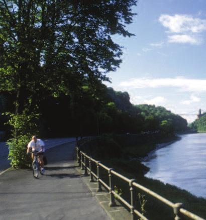
9 Sea Mills Harbour River Avon Autumn on the Downs Durdham Downs Portway B Water Tower
2-3 miles - up to 90 minutes walks
 SHIREHAMPTON COMMUNITY ACTION FORUM Walkie-Talkies Issue 17 Free Walks Programme From January 2017, due to changes in the way that LinkAge operates, there will no longer be a Health Walks Coordinator in
Shirehampton Walkie-Talkies
 Issue 14 Shirehampton Walkie-Talkies Free Walks Programme Photo taken by Ruth Morris 2-3 miles - up to 90 minutes walks The Walks are led by qualified volunteer walk leaders, who have undergone the National
Dorridge & District Residents Association A Walk Along The Green Belt From Dorridge to Catherine-de-Barnes
 Dorridge & District Residents Association A Walk Along The Green Belt From Dorridge to Carine-de-Barnes The starting section of this walk through open fields would be destroyed by building of motorway
There are toilets at Manningtree Station, Flatford (close to the hump back bridge) and in Dedham.
 and in Dedham.") Arriving by Train Main Features of the Walk Outline Route Employs particularly attractive paths, many of which offer impressive views across Dedham Vale. Includes a section along the tidal section of the
Arriving by Train Main Features of the Walk Outline Route Employs particularly attractive paths, many of which offer impressive views across Dedham Vale. Includes a section along the tidal section of the
Shirehampton Nomads Level 4 Walking Group
 Issue 8 Shirehampton Nomads Level 4 Walking Group Free Walks Programme Aug - Oct 2014 Shirehampton Nomads Walking Group Autumn walks programme in association with LinkAge and Walking for Health Bristol.
Walk Description. Directions
 Title: Saffron Trail: Battlesbridge to Chelmsford Distance: 14¾ miles Time taken: 6 hours Start Point: Outside the Barge Inn, Battlesbridge OS Explorer Map: 175 & 183 Grid Ref.: TQ 780 947 Transport: Rail:-
The Mendip Way. Route Directions and Maps Wells to Frome
 The Mendip Way Route Directions and Maps Wells to Frome Website: www.mendiphillsaonb.org.uk Email: mendip@mendiphillsaonb.org.uk Facebook & Twitter: @MendipHillsAONB Phone: 01761462338 1 Wells to Shepton
Beautiful Walks from the Blue Ball Inn
 Walk No. 7 COAST AND VALLEY WALK Countisbury, Glenthorne, County Gate, Brendon, Rockford and Wilsham 10 MILES APPROX. Walking time 5 hours approx. (not including breaks)> OS Sheet 64/74 Lynton and Lynmouth.
Welsh Newton and Woodland
 Welsh Newton and Woodland This is a 8.2km miles (approx) walk which will take about 2.5 hours at a relaxed and leisurely pace. There are a few hills but no steep inclines. Start at Llangrove bus stop and
Lincolnshire Walks. Grainthorpe. Three circular walks of 2 ¾, 9 and 9 ½ km (1 ¾, 5 ½ and 6 miles)
") Lincolnshire Walks Grainthorpe Three circular walks of ¾, 9 and 9 ½ km (1 ¾, ½ and 6 miles) Introduction Explore the coastal marshes, arable hinterland, Louth Navigation canal and the village of Grainthorpe
Lincolnshire Walks Grainthorpe Three circular walks of ¾, 9 and 9 ½ km (1 ¾, ½ and 6 miles) Introduction Explore the coastal marshes, arable hinterland, Louth Navigation canal and the village of Grainthorpe
9.5 km Circular 3 hours
 MEDIEVAL WAVERLEY Challenging Terrain A 6 mile (9.5km) undulating circular walk from Tilford village passing close to The Sands village and the historic ruins of Waverley Abbey. From the top of Crooksbury
9.5 km Circular 3 hours
 RANMORE CIRCULAR A 6 mile (9.5km) circular walk from Boxhill and Westhumble Station in the village of Westhumble, passing through part of the Polesden Lacey Estate, Ranmore Common and Denbies Vineyard.
Thornton le Dale Walks
 Thornton le Dale Walks A collection of circular walks in, and around, the village www.visitthorntonledale.co.uk Thornton-le-Dale Traders Forum and Thornton le Dale Parish Council 1 Thornton le Dale Circular
Thornton le Dale Walks
 Thornton le Dale Walks A collection of walks in and around the village Thornton le Dale Traders Forum www.visitthorntonledale.co.uk Thornton le Dale Walks Walk 1: Beck Isle Cottage and All Saints Church
RILLINGTON TO MALTON by Tania Dickinson
 RILLINGTON TO MALTON by Tania Dickinson This walk takes you from the Vale of Pickering up on to the Wold scarp, before dropping down again through the pretty village of Settrington and joining the Centenary
10 Miles Circular 5 hours
 VISIT RYEDALE PICKERING AND CAWTHORN CAMPS 10 Miles Circular 5 hours Moderate Terrain 120616 A 10 mile (16km) there and back walk from the market town of Pickering in Ryedale. The route heads north through
The Hundred Parishes
 The Hundred Parishes Walks from railway stations number 9 6.4 miles (10kms) from Bishop s Stortford to Stansted Mountfitchet Start: Bishop s Stortford station (Grid Reference TL492209) (ample parking and
Walk 7: Watchet to washford
 Walk 7: Watchet to washford Length: Moderate - 7.5 miles / 12 km Good For: Theme: History Duration: 2-3 hours depending on speed of walking Notes: This is a moderate to difficult walk in places, with steps,
Lincolnshire Limewoods Walks. Woodhall Spa. A circular walk of 13km (8 miles)
") Lincolnshire Limewoods Walks Woodhall Spa A circular walk of 13km (8 miles) Introduction The Lincolnshire Limewoods is an area between Wragby, Bardney and Woodhall Spa. It is a fantastic place to explore
Lincolnshire Limewoods Walks Woodhall Spa A circular walk of 13km (8 miles) Introduction The Lincolnshire Limewoods is an area between Wragby, Bardney and Woodhall Spa. It is a fantastic place to explore
Sandilands to Huttoft Bank
 Coastal Country Park Walks Sandilands to Huttoft Bank A CIRCULAR WALK OF 11KM (7 MILES) INTRODUCTION The Lincolnshire Coastal Country Park lies between Sandilands, Chapel St Leonards and Huttoft on the
8 Miles Circular 4 hours
 VISIT RYEDALE HELMSLEY AND RICCAL DALE 8 Miles Circular 4 hours 090616 Challenging Terrain An 8 mile (13km) circular walk from the market town of Helmsley in Ryedale. The route heads out across sheep pastures
BALCOMBE AND ARDINGLY RESERVOIR, WEST SUSSEX
 BALCOMBE AND ARDINGLY RESERVOIR, WEST SUSSEX 7 miles Circular 4 hours 080816 Challenging Terrain Hi, I'm Luke and this is my West Sussex Weekends walk It's a 7 mile loop from Balcombe rail station, taking
Harlington - Sharpenhoe - Pulloxhill
 Harlington - Sharpenhoe - Pulloxhill ID: 3676, Distance: 8 miles, Height gain: 140 Metres, Map: Explorer 193 Luton & Stevenage, Contributor: Dennis Jeanes Duration: 3 Hours 27 Mins Features Church,Great
Key Information. Self-Guided Walk Exploring Sedbergh
 Self-Guided Walk Exploring Sedbergh A great short walk - ideal for an early evening in summer. This is a lovely circuit of Sedbergh visiting some of the historic buildings as well as ambling by the river
Dyrham and Hinton Parish Walks
 Dyrham and Hinton Parish Walks A series of five walks in the parish, exploring most of the public footpaths. By John Miller Each walk is described in detail, with a complete map, to provide a handy guide
Lincolnshire Walks. Ancaster. Three cir cular walks of2 3/4,4or 6km (11/3, 21/2 or 33/4 miles)
") Lincolnshire Walks Ancaster Three cir cular walks of2 3/4,4or 6km (11/3, 21/2 or 33/4 miles) Introduction These walks are set in the attractive countryside around the historic town of Ancaster. The town
Lincolnshire Walks Ancaster Three cir cular walks of2 3/4,4or 6km (11/3, 21/2 or 33/4 miles) Introduction These walks are set in the attractive countryside around the historic town of Ancaster. The town
Approximate distance: 5.5 miles For this walk we ve included OS grid references should you wish to use them. Start. End
 Approximate distance: 5.5 miles For this walk we ve included OS grid references should you wish to use them. End 4 1 Start 3 2 N W E S Reproduced by permission of Ordnance Survey on behalf of HMSO. Crown
Weatherman Walking. Approximate distance: 5.5 miles For this walk we ve included OS grid references should you wish to use them. Start.
 Approximate distance: 5.5 miles For this walk we ve included OS grid references should you wish to use them. 4 1 Start End 3 2 N W E S Reproduced by permission of Ordnance Survey on behalf of HMSO. Crown
The North Pennines from near Langwathby
 3.6 Langwathby to Armathwaite Map panel?? Distance 12.7 miles (20.5 km) Terrain farm, woodland and riverside paths; some potentially muddy tracks; a few short sections of road Grade gently undulating Food
A circular walk of or km (2 1 4 or miles)
") Grantham A circular walk of 3 3 4 or 5 3 4 km (2 1 4 or 3 1 2 miles) Introduction This relatively short circular walk, which starts in the middle of Grantham, offers plenty of variety. The route takes
Grantham A circular walk of 3 3 4 or 5 3 4 km (2 1 4 or 3 1 2 miles) Introduction This relatively short circular walk, which starts in the middle of Grantham, offers plenty of variety. The route takes
Green Man Ultra Route Directions 2018
 Green Man Ultra Route Directions 2018 Start-CP1 (9 miles) Community Forest Path (CFP) Frome Valley Way (FVW) From the starting line cross the playing fields diagonally to the metal gates in the hedge lined
This walk description is from happyhiker.co.uk
 This walk description is from happyhiker.co.uk Pendle Hill Walk From Barley Starting point and OS Grid reference Ordnance Survey map Distance Traffic light rating Barley village honesty box car park OS
Although the majority of these walks are around country lanes you should still follow the Country Code:-
 With the update of the Parish Plan was a request for details of any Walks around Pillaton The following pages give several walks that I and my wife have done for many years. Please be aware that NONE OF
Walk: NOC 08 Location: Cym Glyn near Brecon
 33 Walk: NOC 08 Location: Cym Glyn near Brecon Directions: Not easy to find at all. Go to Libanus, then head towards Brecon on the A470. Take minor C road single track lane first right as you come out
NEWLANDS CORNER AND ST MARTHAS
 NEWLANDS CORNER AND ST MARTHAS 10k CIRCULAR ROUTE 2½-3HRS GU4 8SE From Newlands Corner on the North Downs just outside Guildford, you can enjoy one of the most beautiful panoramas of quintessential English
LOCAL CIRCUIT EM1: EAST MALLING & BARMING HEATH. N 2m ROADS: Significant roads PATHS: Starting direction Barming Longsole Mission Church
 Ditton Church Scott Close LOCAL CIRCUIT EM1: EAST MALLING & BARMING HEATH 6 Community Centre F Open fields (see 'Introductory Notes') 1m 88 Direction label (as in the walk notes) East Malling Church -
Shepherdswell - Dover
 Shepherdswell - Dover The North Downs Way > Shepherdswell to Dover Introduction This part of the path is slightly different in character from most other parts of the path since it spends much of the time
Walk Description. Directions
 Title: East Hanningfield Distance: 8 miles / 9 miles Time taken: 3-3½ hours Location: 5 miles south east of Chelmsford Parking: Free car park off The Tye, East Hanningfield, next to the primary school
Husthwaite to Byland Abbey
 Husthwaite to Byland Abbey This walk begins with a loop round the village of Husthwaite and continues towards Coxwold along a disused railway line, which is now a right of way. It passes through Coxwold
Saltash, Cornwall - Railways, Rivers & Castles
 Saltash, Cornwall - Railways, Rivers & Castles Starts at St Stephen's Church, Saltash, Cornwall 2 hours 45 minutes 5.5miles 8.9km Easy ID: 0.2532 Developed by: Peter Clements Checked by: Kevin Connor www.ramblersroutes.org
Follow the Lantern Way clockwise from Dursley Town Hall through Cam & Coaley to Uley and back to Dursley (about 14 miles)
") According to the Rev Kilvert's diary of 1873, couples on their way to evening services in winter followed a practical though unusual local tradition: "My Mother says that at Dursley, when ladies and gentlemen
According to the Rev Kilvert's diary of 1873, couples on their way to evening services in winter followed a practical though unusual local tradition: "My Mother says that at Dursley, when ladies and gentlemen
holly tree Wellhill Farm Woodyard Bramham House red kites Round House ha-ha
 This 6.4 mile walk around the magnificent Bramham Park Estate has been made possible with the active support of the owner of the Estate, Nick Lane Fox, with funding from Natural England, as part of Defra
F R E E R E s E R v o i R WA L K s REsERvoiR WALKs To BLoW AWAY THE CoBWEBs BRougHT To You BY
 F R E E r e s e r v o i r WALKS reservoir WALKS TO BLOW AWAY THE COBWEBS Brought to you by Only available in Yorkshire. We look after 72,000 acres of land in Yorkshire, spanning the North York Moors, the
July 2018 to June 2019
 July 2018 to June 2019 FREE walks led by trained volunteers www.adur-worthing.gov.uk/sport-and-leisure/ play-a-sport/walking Note: The routes of many walks may vary due to ongoing river defence work. Level
& r al. Two circular walks of 8 km (5 miles) wal k
 wal k") & Ru r al Two circular walks of 8 km (5 miles) s ford Riv m a t S er wal k Introduction Stamford is noted as being one of the finest stone towns in the country. The stone being local limestone and Collyweston
& Ru r al Two circular walks of 8 km (5 miles) s ford Riv m a t S er wal k Introduction Stamford is noted as being one of the finest stone towns in the country. The stone being local limestone and Collyweston
Ovington and Itchen Stoke
 Trail Activity Type Terrain Author Distance Ascent Location : HAMPTR0057 : Walk : Pub : Towpaths and Cycle Tracks : Peter Carne : 1.4 miles / 2.2 kms : 62 feet / 19 metres : SU560318 / SO24 0RE Bush Inn,
THE WELLDIGGERS ARMS, HESWORTH AND FITTLEWORTH TRAIL
 THE WELLDIGGERS ARMS, HESWORTH AND FITTLEWORTH TRAIL 5.5 miles Circular 3 hours 041017 Challenging Terrain A 300-year-old pub turned country-inn on the edge of the South Downs National Park, The Welldiggers
Danbury Words and pictures by Laurie Page of the Public Rights of Way team at Essex County Council.
 Danbury Words and pictures by Laurie Page of the Public Rights of Way team at Essex County Council. An undulating walk from Danbury village to the bluebells at the National Trust property of Blakes Wood.
HARDMOORS 26.2 WHITE HORSE HALF ROUTE DESCRIPTION - 018
 HARDMOORS 26.2 WHITE HORSE HALF ROUTE DESCRIPTION - 018 Follow Cleveland Way, keeping to the left hand path (right path is a bike trail) Ignoring any turnings to the left or right At path junction (after
Morgans Creek to Padstow
 Morgans Creek to Padstow 2 hrs 45 mins 8 km One way Moderate track 3 144m This pleasant walk starts from the Morgans Creek park, at Henry Lawsons Drive, and follows the Georges River past the Boomerang
ST. AGNES. you cannot put a time limit on beauty.
 ST. AGNES CIRCULAR WALKS AROUND There are many enjoyable and picturesque walks around St. Agnes most are signposted and are featured on the St. Agnes Mini-guide map. Because most of our footpaths are in
For more information and to buy this book click here ISBN: CICERONE. Guides for walkers, trekkers, mountaineers, climbers and cyclists
 For more information and to buy this book click here ISBN: 9781852845377 CICERONE Guides for walkers, trekkers, mountaineers, climbers and cyclists www.cicerone.co.uk WALK 5 Ouston and Urpeth Distance
No. 1 By River Ribble & Brungerley Park 3¼ Miles,
 RVRNEWS 102 No. 1 By River Ribble & Brungerley Park 3¼ Miles, Approx 2 Hours This walk starts at the gate on platform 2 of Clitheroe station. Leaving the station turn left making towards Kirkmoor Rd and
July 2017 to June 2018
 July 2017 June 2018 FREE walks led by trained volunteers www.adur-worthing.gov.uk/sport-and-leisure/ play-a-sport/walking Level 1 (30 minutes 1 hour) gentler walks. A very pleasant walk along the seafront
Short and healthy walks AROUND BEDALE. with Hambleton Strollers. North Yorkshire County Council
 Short and healthy walks AROUND BEDALE with Hambleton Strollers North Yorkshire County Council Bedale Strollers Why walk? Being active is good for our physical and mental health. Just 30 minutes of moderate
Bedminster and Southville
 Issue 51 Bedminster and Southville Free Walks Programme - Sept to Nov 2016 & Photo taken by Ruth Mor- Between 30-60 minute walks Between 2-3 miles - up to 90 minute walks The Walks are led by qualified
Discover Shropshire. Walks and Strolls around Bridgnorth
 Discover Shropshire Walks and Strolls around Bridgnorth An Introduction to Bridgnorth Bridgnorth is made up of two towns; the High Town and the Low Town. The Low Town was once a thriving port along the
SUMMER WALK 10. The Chairmakers, Worlds End
 SUMMER WALK 10 The Chairmakers, Worlds End Tuesday 10 th June 7.30pm This is a very short walk made so due to the majority of the footpaths in the area around the Chairmakers being overrun with high nettles
Other useful information Nearest Refreshments: In the Victoria Inn or the Lugger Inn, in Chickerell OS Explorer Map: OL15 (Purbeck and South Dorset)
") they find the diamond, and then to Holland, where they try to sell it, finding themselves in worse trouble than ever as a result. It is ten years before John returns to Moonfleet, fortuitously being shipwrecked
they find the diamond, and then to Holland, where they try to sell it, finding themselves in worse trouble than ever as a result. It is ten years before John returns to Moonfleet, fortuitously being shipwrecked
Christchurch to Hengistbury Head
 Last checked 6 June 2018 Document last updated: 13 July 2018 This document and information herein are copyrighted to Saturday Walkers Club. If you are interested in printing or displaying any of this material,
NETTLESTEAD & YALDING
 NETTLESTEAD & YALDING ULL CIRCUIT - Sheet 1 (first and last sections) Open fields (see 'Introductory Notes') 88 Direction label (as in the walk notes) ROADS: 81 10m Significant roads Redhill arm North
Hunters Hill to Epping Road
 Hunters Hill to Epping Road 2 hrs 30 mins 5.5 km One way Moderate track 154m An enjoyable walk through lower sections of the Lane Cove National Park, this walk features plenty of mangroves next to the
Chapel Point to Anderby Creek
 Coastal Country Park Walks Chapel Point to Anderby Creek A CIRCULAR WALK OF 8.5 OR 6 KM (5.3 OR 3.75 MILES) INTRODUCTION The Lincolnshire Coastal Country Park lies between Sandilands, Chapel St Leonards
LDWA SOUTH DOWNS MARATHON 13 th MAY 2018
 AHD ahead SDW South Downs Way BL/BR bear left/bear right TL/TR turn left/turn right X cross LEG 1 - EAST DEAN to WP1 NORTON GR 470019. Open 1030 to 1300. 9.7 miles. 1.1 From village hall TL and walk to
Loch Ness Shores Club Site
 Loch Ness Shores Club Site Camping and Caravanning Falls of Foyers Route Summary A strenuous walk from Loch Ness Shores Club Site. The route climbs through forest to The Upper Foyers Waterfall and then
Oldbury & Littleton, South Gloucestershire
 Oldbury & Littleton, South Gloucestershire Starts at Church Lane, Oldbury. BS35 1QF 2 hours 0 minutes 5.2miles 8.4km Easy ID: 0.2468 Developed by: GEOFF MULLETT Checked by: Marion Stone www.ramblersroutes.org
WALK WELL IN TAUNTON AND WELLINGTON WINTER 2017/18
 WALK WELL IN TAUNTON AND WELLINGTON WINTER 2017/18 www.walkwellwithtone.btck.co.uk Walk Well Taunton Deane WHAT IS A HEALTH WALK? It s a brisk walk done on a regular basis for well-being. It can help you
Bonnie Prince Charlie Walk
 Bonnie Prince Charlie Walk A waymarked route from Ashbourne to Derby to celebrate the 60th anniversary (1995) of the formation of the Ramblers' Association. This route follows the general direction of
I #. Short and healthy walks. AROUND Bedale. With Hambleton Strollers
 I #. Short and healthy walks AROUND Bedale With Hambleton Strollers Why walk? Being active is good for our physical and mental health. Just 30 minutes of moderate activity, such as brisk walking, 5 times
Waterhead Pier to Orrest Head, Windermere and Bowness
 Waterhead Pier to Orrest Head, Windermere and Bowness A 4 1 2 hour walk through Woodlands and the Troutbeck Valley with spectacular Lake and Mountain views and a lakeshore path. Walk 10 Walk 11 Walk 12
GENERAL INFORMATION PLEASE FOLLOW THE COUNTRYSIDE CODE:
 KNIGHTON CIRCULAR WALKS The East Radnor Group of the Ramblers Association invites you to enjoy these walks around Knighton. Knighton is an excellent centre for walks in the lovely unspoilt mid-wales countryside
EAST GRINSTEAD AND THE HIGH WEALD, WEST SUSSEX
 EAST GRINSTEAD AND THE HIGH WEALD, WEST SUSSEX 7 miles Circular 3.5 hours 301015 Challenging Terrain Hi, I'm Tom and this is my West Sussex Weekends walk. I live and work in London but often head out of
Walk 3 - Woodbridge and Melton A Walk Round Waldringfield by Sue and Jim Stacey. Woodbridge. shopping centre, cafes, toilets etc. tide mill.
 Walk 3 - Woodbridge and Melton A Walk Round Waldringfield by Sue and Jim Stacey. road with roundabout church railway with station walk route showing description direction track, wide path, bridlepath footpath
Walk NOC 03 Location: Llyn y Fan (the lake) and Fan Brycheinog (the mountain) off Trecastle Road
 and Fan Brycheinog (the mountain) off Trecastle Road") 8 Walk NOC 03 Location: Llyn y Fan (the lake) and Fan Brycheinog (the mountain) off Trecastle Road Directions: Distance (miles): Time (hours): Length of Walk: Turn right out of the castle, take first left
8 Walk NOC 03 Location: Llyn y Fan (the lake) and Fan Brycheinog (the mountain) off Trecastle Road Directions: Distance (miles): Time (hours): Length of Walk: Turn right out of the castle, take first left
AMAZING WALKS RIGHT ON YOUR DOORSTEP AT WALLOPS WOOD COTTAGES!
 Wallops Wood Cottages Sheardley Lane, Droxford, Hampshire, SO32 3QY emma@wallopswoodcottages.co.uk T: 01489 878888 Sign-up to our NEWSLETTER for special offers and news. You can also follow us on social
6.5 km Circular 2 hours
 REIGATE MILLS AND PILLBOXES A 4 mile (6.5km) enjoyable circular walk from Reigate Heath, passing Reigate Heath windmill, Wonham Mill and pillboxes built during the Second World War. 6.5 km Circular 2 hours
Slindon Folly - South Downs, West Sussex
 Slindon Folly - South Downs, West Sussex Starts at Park road-side near entrance to Slindon College 2 hours 15 minutes 4.5miles 7.2km Easy ID: 0.1598 Developed by: Chris Mumford Checked by: Rockpit www.ramblersroutes.org
Walk 2: Beamsley Beacon and Bolton Abbey
 Walk 2: Beamsley Beacon and Bolton Abbey Start and Finish: The Memorial Hall, Main Street, Addingham, LS29 0LZ, SE 079 497 The shortest walk is about 5½ miles (8.8km) The medium Walk is about 8¼ miles
10 km Circular 3 hours
 FRIMLEY AND FRIMLEY GREEN 10 km Circular 3 hours Easy Terrain 250716 A 10km (6 mile) circular walk exploring the canal towpath, riverside path, woodland, heath and small settlements around Frimley in Surrey.
East Lulworth Ride Route 5
 East Lulworth Ride Route 5 Out of ar Experience - ycling in Purbeck ircular route from Wareham to Lulworth - 18 miles + Lulworth ove oombe Keynes River Frome Time needed: 3-4 hours + Grading: Moderate
Skyline 10km Series Race Information Saturday 12th Jan, 18:00 University of Bath, Bath, BA2 7JY.
 Skyline 10km Series Race Information Saturday 12th Jan, 18:00 University of Bath, Bath, BA2 7JY. On the Day Registrations Assuming we have not sold out, on the night prices will be follows. 5km - 17 all
Skyline 10km Series Race Information 15th November, 6th December, 17th January, 14th February 11:00am Start University of Bath, Bath, BA2 7JY.
 Skyline 10km Series Race Information 15th November, 6th December, 17th January, 14th February 11:00am Start University of Bath, Bath, BA2 7JY. Important Notices New Location We are now in West Car Park!
East Devon Way Circulars
 East Devon Way s A new series of circular walks developed by the East Devon Ramblers to help you explore the wildlife, heritage and places of interest just off the East Devon Way. h. i. l. g. k. b. c.
Approximate distance: 10 miles For this walk we ve included OS grid references should you wish to use them. Start. End
 Approximate distance: 10 miles For this walk we ve included OS grid references should you wish to use them. 2 3 Start End 1 N W E S Reproduced by permission of Ordnance Survey on behalf of HMSO. Crown
Hammer Vale and Linchmere Common
 point your feet on a new path Hammer Vale and Linchmere Common Distance: 9 km=5½ miles or 6 km=3¾ miles easy walking with one steep section Region: Hampshire, West Sussex Author: Botafuego Refreshments:
De Burgs Bridge to Thornleigh station
 De Burgs Bridge to Thornleigh station 3 hrs 45 mins 9.7 km One way Hard track 4 363m This walk follows a section of the Great North Walk, starting from De Burghs bridge. The walk winds north west, through
Cleeve Common Self-Guided Walk 1 Family Circular
 Cleeve Common Self-Guided Walk 1 Family Circular Start point: Quarry Car Park Nearest postcode: GL52 3PW please note this is for the golf club. To find the quarry car park drive past the golf club car
Hexham Abbey to the Racecourse Road
 Hexham Abbey to the Racecourse Road The Yarridge Road, or Racecourse Road as it is often known, runs along the ridge line to the south of Hexham and provides wonderful views of the river valley and fells
Walks in Chellow Dene
 City of Bradford Metropolitan District Council Leisure Services a breath of fresh air Walks in Chellow Dene In association with the Fairweather Green and Daisy Hill Action groups Chellow Dene Chellow Dene
Walk 2: doniford to east quantoxhead
 Walk 2: doniford to east quantoxhead Length: 9 ¼ miles / 15km Good For: Difficulty: Moderate Theme: Nature Notes: This walk is tidal - please check tide times before setting off. Dogs are welcome but need
THE DOG AND DUCK HAREWOODS ESTATE TRAIL. 6 Miles Circular 3 hours. Getting there. Walk Sections
 THE DOG AND DUCK HAREWOODS ESTATE TRAIL Moderate Terrain A 6 mile circular pub walk from the Dog and Duck in Outwood, Surrey. The Dog and Duck is a delightful pub where everyone is made welcome. From walkers
WALK WELL IN TAUNTON AND WELLINGTON WINTER 2018/2019
 WALK WELL IN TAUNTON AND WELLINGTON WINTER 2018/2019 walkwellwithtone.btck.co.uk Walk Well Taunton Deane WHAT IS A HEALTH WALK? It s a brisk walk done on a regular basis for well-being. It can help you
t ie s Wal k A circular walk of 7 or 91 2 km (41 2 or 6 miles)
") ford Fou m a t S r Co un t ie s Wal k A circular walk of 7 or 91 2 km (41 2 or 6 miles) Introduction This walk is set in attractive countryside on the edge of Stamford in the south-west corner of Lincolnshire.
ford Fou m a t S r Co un t ie s Wal k A circular walk of 7 or 91 2 km (41 2 or 6 miles) Introduction This walk is set in attractive countryside on the edge of Stamford in the south-west corner of Lincolnshire.
Tinneyhall Wood, Cornwall - About 9 ½ acres, 59,000
 Tinneyhall Wood, Cornwall - About 9 ½ acres, 59,000 Tinney Hall is a hamlet close by the small hilltop village of Lewannick, which is centred around a crossroads. This is unusual for Cornwall, where the
Currie Rd to Davidson Park
 Currie Rd to Davidson Park 3 hrs 7.2 km One way Moderate track 28m Starting at Currie Rd in Forestville, this walk follows Middle Harbour to Davidson Park, under Roseville Bridge. There are two optional
Lacock Road Races - 18th June 2017, from 09:00 Lacock Playing Fields, Lacock, SN15 2LG.
 Lacock Road Races - 18th June 2017, from 09:00 Lacock Playing Fields, Lacock, SN15 2LG. Important Notices This is a Closed Roads event. As always, an event never occurs in isolation, and we must work with
Woolwich Wharf to Boronia Park
 Woolwich Wharf to Boronia Park 2 hrs 5.8 km One way Moderate track 175m Going through the streets of Hunters Hill, this walk is on the first segment of the Great North Walk. The majority of the walk is
Skyline Day Race Information Sunday 13th Jan, from 10:00am University of Bath, Bath, BA2 7JY.
 Skyline Day Race Information Sunday 13th Jan, from 10:00am University of Bath, Bath, BA2 7JY. On the Day Registrations Assuming we have not sold out, on the day prices will be follows. 500m - 5 (Even if
How to get there. Respect - Protect - Enjoy
 How to get there Driving: Postcode is OX10 6AD with a car park for customers. Nearest station: Goring & Streatley station is 5.6 miles away. We re delighted to present three circular walks all starting
Redesdale Arms. A Trio of Walks
 Redesdale Arms A Trio of Walks Welcome to The Redesdale Arms Hotel The award winning 34 bedroom Redesdale Arms Hotel sits at the gateway to the Cotswolds in the High Street of the historic town of Moreton-in-Marsh.