CITY COUNCIL AGENDA BILL City Council Regular Meeting - 17 Apr OTHER COUNCIL MEETINGS Nov. 21, 2016; Feb. 21, 2017; Mar.
|
|
|
- Bruce Ford
- 5 years ago
- Views:
Transcription

1 CITY COUNCIL AGENDA BILL City Council Regular Meeting - 17 Apr 2017 UPDATED AB Regular Business Gilman Lofts (Three Trails) Development Agreement Proposed Council Action: Approve Resolution DEPARTMENT OF COUNCIL COMMITTEE LIAISON Development Services, Keith Niven Councilmember Goodman OTHER COUNCIL MEETINGS Nov. 21, 2016; Feb. 21, 2017; Mar. 20, 2017 EXHIBITS A. Request Letter B. Land & Shore Committee presentation C. Draft Development Agreement (provided as part of Exhibit D) D. Proposed Resolution E. Plaza Diagram (new) F. Traffic Memo, March 28 (new) G. Level of Service Table (new) H. Applicant Letter (new) POLICY & BUDGET INFO Comp Plan Policy Nos. LU-A13, LU-C2, LU-J5, EV- A2, EV-A5, EV-B3, EV-B4, T- A3, T-B3, T-B4, T-B5, T-C1, T- C4, T-C5, T-I1, T-I2, T-I6, T-J2, T-L6 Consistent: Yes Expenditure Required $ 375,000 Amount Budgeted Other Policies n/a $ 0 SUMMARY STATEMENT Due to the development moratorium enacted by the Council on September 6, 2016, the applicant, Gilman Point, Issaquah Studio Lofts, LLC (Seacon), has requested a development agreement with the City (Exhibit A) for the purpose of proceeding with a planned development to include a 4-story, mixed-use building on a site located immediately west of Pogacha's restaurant on Gilman Blvd. Development agreements are exempt from the City's development moratorium (Ord. 2778). The proposal would include 3,700 square feet of ground-floor retail and 44,000 square feet of commercial space. The proposal would also include the addition of a traffic signal on Gilman Blvd at the Three Trails Crossing. This agenda bill seeks Council input to determine if the City should explore a potential development agreement for the Gilman Lofts project in response to the above request. State law authorizes a city to enter into a development agreement to establish the development standards and other provisions that will apply to, govern and vest the use, development and related mitigation of the property for the duration specified in the agreement (RCW 36.70B.170). Development agreements must also be consistent with the city s applicable development regulations. The Administration recommends pursuing a development agreement for the Gilman Lofts project at this time to: 1. Provide a development that meets the City's vision for this property as part of the Central Issaquah Plan as well as the developer's vision for a positive redevelopment of the property; and,
2 2. Allow for the development of a vertically-mixed use project (commercial over retail) in lieu of a single-story, big-box retail building that has already been permitted; and, 3. Establish the terms for partnering with the City for the construction of a signalized intersection at the Three Trails location. If the Council is supportive of the Administration working on a development agreement with the applicant, this process would commence in January 2017 and be brought to the City Council by March 2017 for action. Consistency With Comprehensive Plan: LU Policy A13 Use innovative land use tools such as Transit-Oriented Development, Transfer of Development Rights, Development Agreements, Inclusionary Housing, Form-Based Code etc., to optimize community benefits. LU Policy C2 Focus future growth in: a. areas with no or minimal environmentally critical areas; b. vacant platted lots in areas with existing public facilities; c. areas where infill and redevelopment can occur with less environmental impacts due to the degree of existing development; and d. areas where clustering development can protect environmentally critical lands and preserve and protect remaining forested hillsides. LU Policy J5 Design and create trails, sidewalks, bikeways and paths to increase connectivity for people by providing comfortable, direct or convenient links between: a. Residential neighborhoods b. Schools c. Recreation facilities and parks d. Employment centers e. Shopping and service designations f. Community gardens, and g. Transit EV Policy A2 Pursue transportation and mobility solutions, as addressed in the Transportation element. EV Policy A5 Facilitate economic development by encouraging public/private partnerships, and consider procedural incentives and financial tools in order to leverage private resources where there is a compelling community benefit. EV Policy B3 Work to attract businesses that create a diverse economic base, providing high quality employment opportunities and provide goods and services desired by the community. A diverse economic base includes businesses that provide goods and services for the everyday needs of Issaquah residents, businesses and visitors; and, a variety of income opportunities that allow residents and job seekers to find advancement employment opportunities within our community. EV Policy B4 Encourage private investment through development and redevelopment that uses land efficiently and contributes positively to economic vitality. T Policy A3 Support multi-modal transportation solutions including general purpose lanes, High Capacity Transit, HOV lanes, transit and nonmotorized improvements that implement the Roadway, Transit and Nonmotorized 20- year plans (Figures T-2, T-10 and T-4). Use the best available technologies when implementing these projects. T Policy B3 Foster a mobility system that reduces the negative effects of transportation infrastructure and operation on the climate and natural environment. T Policy B4 Seek the development and implementation of transportation modes and technologies that are energy-efficient and improve system performance. T Policy B5 Develop a mobility system that minimizes negative impacts to human health. T Policy C1 Use a system-based concurrency management system to fund growth s share of impacts to the City transportation system and support the City s preferred land use pattern and vision. T Policy C4 Increase the City's multi-modal usage by 2035 by supporting, expanding and implementing transportation choices including High Capacity Transit, HOV lanes, transit and nonmotorized improvements, and other Transportation Demand Management solutions. Use the best available technologies when implementing these projects. T Policy C5 Provide a seamless multimodal system that maintains the City s adopted Level of Service as defined in the Land Use Code. T Policy I1 Use the Nonmotorized Improvements Maps (Figures T-4 and T-5) to guide the design, construction
3 and maintenance of pedestrian and bicycle facilities by public and private parties, including the preparation of design standards and elements that promote a pleasant and safe traveling environment. T Policy I2 Direct nonmotorized resources towards those modes that have the least environmental impact and the greatest contribution to livability. T Policy I6 Use impact and mitigation fees, grants, and other revenue to construct and maintain nonmotorized projects identified on the Nonmotorized Map (Figure T-4) that are not otherwise included in roadway projects. T Policy J2 Monitor and find ways to reduce the number of nonmotorized collisions. T Policy L6 Require new or redeveloping properties to design and build bicycle/ pedestrian corridors that maximize the use of nonmotorized transportation alternatives. Administration's Recommendation: The Administration recommends moving forward with exploration of a potential the development agreement with Seacon Issaquah Studio Lofts, LLC for the Gilman Lofts project; and approval of the resolution as presented. Update: Update 1 (February 21, 2017): The proposal to enter into a development agreement with Issaquah Studio Lofts, LLC was discussed at the Council Land & Shore Committee on the following dates: December 1, 2016 January 5, 2017 January 18, 2017 February 2, 2017 The conversations at Committee focused on two primary parts of the proposal: 1) what is the community benefit to enter into a development agreement; and, 2) whether the Council will allow this project to move forward during the moratorium. Community Benefit The 3-trails crossing was identified on the City's non-motorized mobility plan as a number of trail users are not using the pedestrian signal located west of the trail alignment. The plan calls for a signalized intersection and lists the cost at $1.4 million. By partnering with the developer on this improvement through approval of the proposed development agreement, the City would save taxpayers approximately $1 million. Without a development agreement, the developer would be required to finance the installation of a "C" curb on Gilman due to the increased traffic expected on the site. The "C" curb would turn the driveway to Pogacha into right-in/right-out only driveway. This revision to Gilman would have a significant negative impact to the businesses along the north side of Gilman from 3-Trails to Front Street due to the reduced access. Exhibit B provides a visual comparison of the "C" curb versus the signalized intersection. The Committee discussed the southern leg of this proposed intersection. Although a final design for the Juniper/Rainier leg has not been completed, the Committee believes the benefits of this proposal are worth moving forward. Moratorium The proposal is for a mixed-use (retail and office) project with structured parking and connectivity to the adjacent regional trail. In looking through the six moratorium work items, the proposal could be altered by the outcomes of the two below work items: Architectural Fit & Urban Design - The applicant has agreed to allow the Development Commission to use any draft guidelines created by the City's consultant in their project review. District Vision - It is likely the Gilman neighborhood will still desire office development as part of the vision. This proposal would add jobs to this neighborhood.
4 Note, there is a timing issue for the developer as construction will occur on Gilman this summer to install water main connections. Allowing the traffic signal conduit to be installed at the same time will provide an essential cost benefit to the developer. Budget The financial commitment from the City to partner with the developer on the signalization is $375,000. As this project is listed on the non-motorized TIP, it could qualify to use monies from the Pedestrian/Bike Mitigation Fund, which currently has a balance of $107, The recommendation from Administration is to use $75,000 from said fund, and $300,000 from the General Fund ending fund balance. Council Land & Shore Committee Recommendation At the February 2, 2017 meeting, the Committee recommended (2-1) authorizing the Mayor to enter into and execute a development agreement with Issaquah Studio Lofts, LLC. The Committee further recommended the following additions to the signalization project be included in the draft development agreement: Bus stop in project vicinity Project interface with the trail, providing an attractive edge These changes, as well as additional revisions recommended by the City Attorney, are included in the draft development agreement, attached as Exhibit C. Next Steps 1. Schedule and conduct a public hearing. 2. Make a decision on the proposed development agreement. 3. Direct the Finance Director to include $375,000 in the next 2017 budget amendment. Update 2 (March 20, 2017): At the Council meeting of Feb. 21, 2017, staff presented: 1. The Applicant's proposal to partner regarding the construction of a signalized intersection at Gilman and Juniper. 2. A development agreement that would allow the project to move forward in advance of the lifting of the moratorium. Following deliberation, Council directed the Administration to prepare a resolution seeking approval of the proposed development agreement (Exhibit D); and schedule the related public hearing for the March 20, 2017 City Council meeting. The development agreement being requested by the applicant is for two purposes: 1) to allow for the project to move forward during the current development Moratorium; and, 2) to partner with the City on the construction of the 3-trails traffic signal. Although the IMC specifically identifies Cluster Housing and "Transfer of Development Rights Development Agreements as Level 5 Reviews, a development agreement that does not grant an increase in entitlement or a modification to existing standards is not identified in the Table of Reviews (IMC ) and; therefore, does not have an adopted noticing process. Pursuant to IMC , the Development Services Director is given the authority to interpret IMC Chapter 18, where necessary. It has been determined adequate noticing for this hearing has occurred, which included posting of the subject property and publication in the newspaper of record. At Monday's meeting, staff will provide a brief presentation. Council action is anticipated to occur following the hearing. Update 3 (April 17, 2017): At the March 20, 2017 Council meeting, staff provided a presentation and the required public hearing was conducted (opened and closed). The following individuals spoke in support of the proposal: Steve King, Pogacha Restaurant Sarah Barnes, Pogacha Restaurant Rob Henderson, Rob's Transmission Shop
5 Ed Evans David Kappler, 255 SE Andrews St. Victor Saleman, TSI Solutions Bob Powers, Issaquah Studio Lofts Steve Pereira, 170 NE Dogwood Place, questioned the community benefit of the proposal. Following Council discussion, it was moved by Goodman, seconded by Pauly to: Approve Resolution No , approving the Gilman Lofts (Three Tails) Development Agreement; and, direct the Finance Director to include $375,000 in a subsequent 2017 budget amendment, utilizing $75,000 from the Mitigation Fund and $300,000 from the General Fund ending fund balance. Further questions and conversation ensued, however, rather than voting on the motion to approve the development agreement, Council unanimously postponed the motion to the Council meeting of April 17, The Administration was tasked with providing more information specifically regarding the project s relationship to the adjacent trail; and, vehicular impacts for N.W. Gilman Blvd., Rainier Blvd N. and N.W. Juniper Street. In response to Council's request, the following information has been provided: Trail Connectivity The applicant provided Exhibit E illustrating an enlarged view of the proposed project and the connection to the East Lake Sammamish trail. Decorative paving, trees and benches could be added to create an inviting connection between the trail and the proposed project s plaza area. The final design of this plaza would be reviewed by the Development Commission as part of the permitting process. Traffic Evaluation In order to respond to the questions raised by Council, staff requested CH2MHill evaluate: 1. The impact and function of the intersection with the installation of the proposed signal. 2. The proposal for a 5 Legged signalized intersection. In response, a memo summarizing intersection traffic options and data table showing the intersection's level of service for both current and future traffic volumes have been provided (Exhibits F, G). This information demonstrates the signalized intersection would have the following level of service impacts: The Proposed Signal option creates an intersection operating above City standards in 2017 and The 5 Legged signalized option would meet level of service standards for the City in In the future, if no other improvements were made, this option would fall below the City's currents level of service standards. Additionally, either signalized intersection will be safer and easier to cross for pedestrians and cyclists. Currently, pedestrians and cyclists are required to cross several hundred feet west at a location that does not directly align with the existing trail system. Signalizing the intersection will provide the opportunity to more directly connect the trail system and provide a more logical crossing point on Gilman. Signalizing this intersection will give all users clear guidance on when to make turns so the overall performance of the intersection will function more safely. Strip Retail and C Curb Without a development agreement, the Currently Permitted alternative ("C" curb) would be installed. If this installation were to occur, the Juniper leg of this intersection would fall below Council-adopted level of service standard sometime between 2017 and The City received a letter from the applicant on April 5 (Exhibit H). The letter indicates that if the parties cannot agree on the terms of a development agreement and allow the Lofts project to move forward in advance of lifting the moratorium, the owner will be forced to pursue a single-story, surfaced parked, retail project on this site, and
6 installation of a "C" curb. Next Steps At Monday s meeting, the motion to approve the development agreement (Resolution No ) is before Council. Other action may be taken, e.g. amending the motion, withdrawing the motion, or further postponing the motion to a date a time certain. Staff will be present to answer questions. Alternative(s): Do not commence negotiations enter into a development agreement with Seacon Issaquah Studio Lofts, LLC. [Impact: Seacon Developer may move forward with the construction of a single-story, big box retail building; and/or, retreating from their proposal to cost share a signalized improvement of Gilman Blvd at the 3-trails crossing.] RECOMMENDATION Council Land & Shore Committee / Stacy Goodman, Chair: MOVE TO: Refer AB 7219 to the Dec. 1, 2016 and Jan. 5, 2017 Council Land & Shore Committee meetings for review and recommendation, returning to the full Council on Jan. 17, MOVE TO: Direct Administration to prepare a resolution approving the proposed development agreement; and schedule the related public hearing for the March 20, 2017 City Council meeting. MOTION ON THE FLOOR AS MOVED BY GOODMAN, SECONDED BY PAULY: Approve Resolution No , approving the Gilman Lofts (Three Tails) Development Agreement; and, direct the Finance Director to include $375,000 in a subsequent 2017 budget amendment, utilizing $75,000 from the Mitigation Fund and $300,000 from the General Fund.
7 ISSAQUAHSTUDIO LOFTS LLC 165 NE Juniper St, Suite Issaquah, WA Telephonei (425) Fax: (425) /27/2016 City of Issaquah Development Services Avenue NW Issaquah, WA Attn: Mr. Keith Niven Economic Development & Development Services Director Ref: Development Agreement Issaquah Studio Lofts Dear Keith, This letter serves as our formal request to enter into a Development Agreement with the City of Issaquah for the purposes of constructing the Studio Loft Project depicted in the attached drawings. As a condition of constructing this project, Issaquah Studio Lofts LLCproposes to construct voluntary improvements to the intersection of Gilman Blvd and Rainier/Juniper Avenue under a Cost Sharing Agreement. This Agreement would follow the scope, terms and conditions referenced in the attached Partnering Agreement. Please let me know what additional information you may require to fully consider our request. Respe tfu I Robert W. Power Member


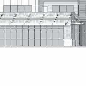
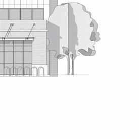
8 UNDESIRABLE PRECEDENTS AND REASONING THESE BUILDINGS LACK HUMAN SCALE, MATERIAL VARIATION, OR MODULATED MASSING THAT WOULD PROVIDE VISUAL INTEREST. NO ATTENTION TO CONTEXT OR REGIONAL CHARACTER ARE DISPLAYED. THE BULK AND PRESENCE OF BUILDINGS WITH DO NOT FIT WITHIN THE ISSAQUAH CITY CONTEXT AND DO NOT CONTRIBUTE TO A POSITIVE URBAN ENVIRONMENT FOR PEDESTRIANS, OCCUPANTS OR PEOPLE PASSING BY. ISSAQUAH STUDIO LOFTS 180 NW GILMAN BOULEVARD, ISSAQUAH, WASHINGTON, SCHEMATIC DESIGN - MASSING STUDY DESIRABLE PRECEDENTS, AND REASONING THESE TYPES OF DESIGN AESTHETICS ARE TO BE AVOIDED VARIATION OF MATERIAL AND MASSING GROUND FLOOR PEDESTRIAN USE WITH RICH ROOF TOP PATIOS WITH SEATING, WITH CLEAR BASE, MIDDLE, AND TOP MATERIALS AND TEXTURES. UPPER MASS IS PLANTINGS ABOVE GRADE PLANE STEPPED BACK TO GIVE GROUND FLOOR VISUAL PROMINENCE. 4 LEVELS 3,755 SF OF RETAIL 43,632 SF OF STUDIOS 173 STUDIO/WORKLOFT UNITS 18,340 SF GROUND FLOOR PARKING WELL DEFINED TOP, FEATURING CORNICE OR ROOF EAVE. POTENTIAL MATERIAL / COLOR PALETTE BUILDING MASS DIVIDED INTO SMALLER PORTIONS THROUGH BUILDING MODULATION. CENTER COURTYARD PROVIDES LIGHT, AND VISUAL DEPTH TOP FLOOR DIFFERENTIATED FROM MIDDLE SECTION WITH EITHER MATERIAL CHANGE OR STEP BACK AT FOUR FLOOR SIDE WALK CAFE PROVIDING PEDESTRIAN ACTIVITY, ALONG WITH PLANTINGS AT BOTH GROUND AND TOP OF FIRST STORY SOFTEN FACADE. CLEAR BUILDING BASE ARTICULATED WITH BOTH MATERIALS AND MASSING. LARGE FIRST STORY FOR PEDESTRIAN / RETAIL USES. UPPER STORIES RECEDE FROM THE PEDESTRIAN RIGHT OF WAY. MASSING IS MODULATED TO APPEAR AS A CLUSTER OF SMALLER BUILDINGS BELLY BAND AT MATERIAL TRANSITION BETWEEN THIRD AND FORTH FLOOR PLANTERS AT 2ND FLOOR ROOF DECKS PROVIDE OPPORTUNITY FOR CASCADING VEGETATION TO ENRICH GROUND FLOOR PEDESTRIAN EXPERIENCE FACADE STEPS BACK FROM GROUND FLOOR LEVEL AT LEVEL 2 PROVIDING ROOF DECK SPACES AND VISUAL SETBACK FROM THE STREET WALL. CONSISTENT STREET WALL, AND WEATHER PROTECTION, BIKE PARKING, AND MAXIMIZED GROUND FLOOR TRANSPARENCY ALONG PEDESTRIAN RIGHT OF WAY.
9
10
11
12


13


14
15

16 Existing C-curb Signal
17 Gilman Boulevard Alterations Additional modifications to Gilman Boulevard will be necessary based upon findings of the SEPA MDNS (Attachment 4) and the Traffic Impact Study dated March 9, 2015 by Transportation Solutions Inc. Changes to Gilman Boulevard are summarized below: - Driveway access from Gilman Boulevard shall be restricted to rightin/right-out turning movements only. This will be achieved through the use of C-curbs which must be installed on NW Gilman Boulevard. - Access to the site by trucks and trailers 35 feet and longer shall be restricted to the hours between 10:00pm and 6:00am in order to limit the impact of traffic flow on NW Gilman Boulevard.
18 RESOLUTION NO A RESOLUTION OF THE CITY COUNCIL OF THE CITY OF ISSAQUAH, WASHINGTON, APPROVING THE GILMAN LOFTS (THREE TRAILS) DEVELOPMENT AGREEMENT. WHEREAS, Issaquah Studio Lofts, LLC has requested a development agreement with the City for the purpose of proceeding with a planned development to include a 4-story, mixed use building on a site located on Gilman Boulevard; and WHEREAS, the proposal would include 3,700 square feet of ground-floor retail and 44,000 square feet of commercial space, as well as the addition of a traffic signal on Gilman Boulevard at the Three Trails Crossing; and WHEREAS, the Three Trails Crossing was identified on the City s non-motorized mobility plan as a number of trail users are not using the pedestrian signal located west of the trail alignment, and partnering with Issaquah Studio Lofts on this improvement will save the taxpayers of the City significant expenditure and provide a community benefit; and WHEREAS, the City Administration recommended approval of the development agreement; and WHEREAS, the Issaquah City Council s Land & Shore Committee reviewed the request and recommended that the development agreement with Issaquah Studio Lofts, LLC be approved and that the Mayor be authorized to execute the same; and WHEREAS, the Issaquah City Council held a public hearing on the proposed development agreement on March 20, 2017 and, after considering all public testimony received and the recommendations of the City Administration and the Council s Land & Shore {JEH DOCX;1/ / } - 1 -
19 Committee, decided to approve the development agreement and authorize the Mayor to execute it; NOW, THEREFORE, THE CITY COUNCIL OF THE CITY OF ISSAQUAH, WASHINGTON, HEREBY RESOLVES AS FOLLOWS: Section 1. Development Agreement Approved - Authority to Execute. The proposed development agreement with Issaquah Studio Lofts, LLC for the Gilman Lofts (Three Trails) is hereby approved. The Mayor is hereby authorized to execute the development agreement in the form attached as Exhibit A and incorporated herein by this reference as if set forth in full. Section 2. Recording. As provided in RCW 36.70B.190, a signed original of the development agreement shall be recorded in the real property records of King County, Washington and shall be binding on the parties and their successors in interest and assigns for the term of the development agreement. Section 3. Effective Date. This resolution shall be effective immediately upon passage. PASSED by the City Council this 17th day of April, STACY GOODMAN, COUNCIL PRESIDENT APPROVED by the Mayor this 17th day of April, FRED BUTLER, MAYOR {JEH DOCX;1/ / } - 2 -
20 ATTEST: CHRISTINE EGGERS, CITY CLERK APPROVED AS TO FORM: JAMES E. HANEY, CITY ATTORNEY RESOLUTION NO: AGENDA BILL NO: 7219 DATE PASSED: April 17, 2017 Exhibit A: Development Agreement {JEH DOCX;1/ / } - 3 -


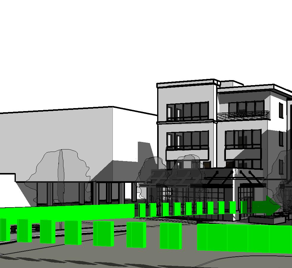


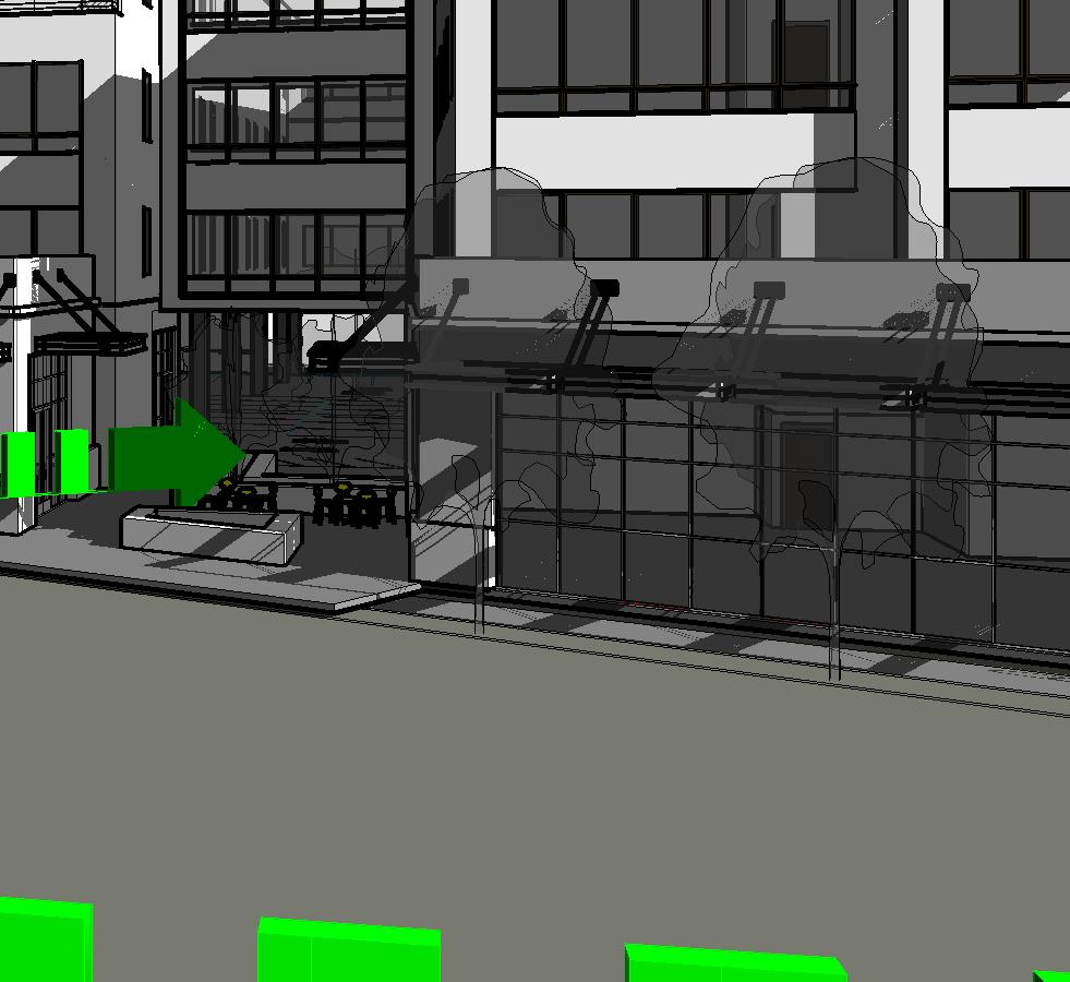


21 4/3/2017 8:46:24 AM C:\Users\steven.bohlman\Documents\160705_16003_ISSAQUAH STUDIO LOFTS_Steven.Bohlman.rvt GREEN ARROW INDICATES FLOW OF PEDESTRIAN MOVEMENT. EAST LAKE SAMMAMISH TRAIL MEETING NODE. TO BE DESIGNED WITH PEDESTRIAN AMENITIES Automobile Prespective Entrance Pedestrian Prespective Across Gillman Looking East Pedestrian Prespective Across Gillman Looking West PROJECT NORTH 5 PROPERTY LINE PROPERTY LINE EXISTING BUILDING PROPERTY LINE BENCH 13,323 SQ. FT. SITE PLAN, PEDESTRIAN NODE DIAGRAM 1" = 40'-0" AMENITIES LEGEND CONCRETE PLANTING PAVEMENT WAYFINDING SIGNAGE EAST LAKE SAMMAMISH TRAIL PROJECT NORTH 4 DIRECT CONNECTION TO GROUND FLOOR RETAIL 4 OR1.00 EAST LAKE SAMMAMISH TRAIL MEETING NODE. ENLARGED PLAN, PEDESTRIAN NODE DIAGRAM 1" = 20'-0" JACKSON MAIN A R C H I T E C T U R E SEACON GENERAL CONTRACTORS ISSAQUAH STUDIO LOFTS DATE NO. DESCRIPTION 311 FIRST AVENUE SOUTH SEATTLE, WA t PROJECT NO.: PROJECT MGR.: DRAWN BY: CHECKED BY: 180 NW GILMAN BOULEVARD ISSAQUAH, WASHINGTON SITE AND PED. CONNECTIONS Designer Author Checker OR1.00 JACKSON MAIN ARCHITECTURE P.S. 2015
22 CH2M th Avenue NE Suite 500 Bellevue, Washington United States, Keith Niven City of Issaquah Economic Development Director P.O. Box 1307 Issaquah, WA March 28, 2017 Subject: Gilman Blvd/Juniper St Intersection Dear Keith, Below is a summary of traffic operations at the Gilman/Juniper intersection that you had requested using the 2013 Concurrency model: Existing Conditions: Based on the 2013 model, the intersection is stop-controlled for only the Juniper and driveway legs of the intersection. Gilman is free flow, so those vehicles have no delay associated with the Juniper. The Juniper leg of the intersection operates at LOS D, with about 30 seconds of delay on average. The intersection processes about 1,800 vehicles during the p.m. peak hour. Existing Conditions, Signalized, No Other Improvements: If we were to drop a signal on that intersection with no other significant capacity improvements, the OVERALL intersection would operate at LOS B, with about 10 seconds of delay per vehicle experienced on average. The Juniper leg of the intersection would improve slightly to 25 seconds of delay and LOS C. Gilman Blvd. vehicles would now have to stop every once in a while, so the LOS would range between A and B with delays between 4 and 10 seconds depending on which movement (left, right, through). Still about 1800 vehicles traveling through the intersection during the p.m. peak hour. So not a huge improvement, but drivers would at least know they will eventually have an opportunity to exit SAFELY from Juniper. Existing Conditions, Signalized, 5-Leg Intersection: If a separate approach were created at the intersection for Rainier Blvd, as shown in the graphic below, the OVERALL intersection would operate at LOS C with about 20 seconds of delay per vehicle on average. However, some turn restrictions are assumed: no turns from Gilman Blvd onto Rainier Blvd, only to Juniper St, no right turn on red from Juniper St or Rainier Blvd. Juniper St and the Driveway would get a green light at the same time; therefore, left turns from each approach would have to yield to through vehicles. Rainier Blvd would have a separate green light phase. Future Conditions, No Signal: If we did nothing to the intersection, by 2030 the LOS would be so bad, our models won t even calculate the expected delay for the Juniper leg. Once it exceeds like a 150 seconds of delay, the model stops reporting the number because it s basically breakdown conditions, and very unpredictable. Also, by 2030, there are about 500 more vehicles trying to get through the intersections, so about 2,300 vehicles during the p.m. peak hour.


23 Page 2 March 23, 2017 Future Conditions, Signalized, No Other Improvements: By 2030, if a signal were installed there, the intersection would operate at LOS D overall, with about 54 seconds of delay. The Juniper leg of the intersection would operate at LOS D, with 46 seconds of delay, while eastbound Gilman Blvd. would operate at LOS E (77 seconds of delay) and westbound Gilman would operate at LOS D (38 seconds of delay). Future Conditions, Signalized, 5-Leg Intersection: By 2030, if a separate approach were created at the intersection for Rainier Blvd, as shown in the graphic above, the OVERALL intersection would operate at LOS E with about 66 seconds of delay per vehicle on average. Again, some turn restrictions are assumed: no turns from Gilman Blvd onto Rainier Blvd, only to Juniper St, no right turn on red from Juniper St or Rainier Blvd. Juniper St and the Driveway would get a green light at the same time; therefore, left turns from each approach would have to yield to through vehicles. Rainier Blvd would have a separate green light phase. The operations of the OVERALL intersection would improve to LOS D if the Juniper St leg of the intersection were to be widened at the intersection with a separate left turn pocket. Hope this helps you. If there is any other information you need/want, please let me know. Regards, CH2M Torsten Lienau Sr. Transporation Engineer
24 Overall Intersection Control Analysis Year Scenario LOS Delay (sec/veh) v/c 2014 Existing PM 2030 Action PM Northbound - Juniper Control LOS Delay (sec/veh) v/c Gilman & Juniper/Rainier Eastbound - Gilman Southbound - Driveway Westbound - Gilman Northeastbound - Rainier LOS Control Delay (sec/veh) v/c LOS Control Delay (sec/veh) v/c LOS Control Delay (sec/veh) v/c LOS Control Delay (sec/veh) Unsignalized D D A n/a n/a n/a A n/a n/a n/a Signalized B C B E A n/a n/a n/a 5-Leg Signalized C C C C B C Unsignalized F > 150 > 1.50 F > 150 > 1.50 A F > 150 > 1.50 A n/a n/a n/a Signalized D D E B B n/a n/a n/a 5-Leg Signalized E F E D D F v/c
25
26
Exhibit 1 PLANNING COMMISSION AGENDA ITEM
 Exhibit 1 PLANNING COMMISSION AGENDA ITEM Project Name: Grand Junction Circulation Plan Grand Junction Complete Streets Policy Applicant: City of Grand Junction Representative: David Thornton Address:
Corpus Christi Metropolitan Transportation Plan Fiscal Year Introduction:
 Introduction: The Safe, Accountable, Flexible, Efficient Transportation Equity Act: A Legacy for Users (SAFETEA-LU) has continued the efforts started through the Intermodal Surface Transportation Efficiency
Solana Beach Comprehensive Active Transportation Strategy (CATS)
") Solana Beach Comprehensive Active Transportation Strategy (CATS) 3.0 Goals & Policies The Solana Beach CATS goals and objectives outlined below were largely drawn from the Solana Beach Circulation Element
Solana Beach Comprehensive Active Transportation Strategy (CATS) 3.0 Goals & Policies The Solana Beach CATS goals and objectives outlined below were largely drawn from the Solana Beach Circulation Element
APPROVE A RESOLUTION ADOPTING A COMPLETE STREETS POLICY
 STAFF REPORT MEETING DATE: September 13, 2016 TO: FROM: City Council Bob Brown, Community Development Director Russ Thompson, Public Works Director Patrick Filipelli, Management Analyst 922 Machin Avenue
Proposed. City of Grand Junction Complete Streets Policy. Exhibit 10
 Proposed City of Grand Junction Complete Streets Policy Exhibit 10 1 City of Grand Junction Complete Streets Policy Vision: The Complete Streets Vision is to develop a safe, efficient, and reliable travel
Environment and Public Works Committee Presentation
 Mixed Use Centers Complete Streets Guidelines Project Environment and Public Works Committee Presentation December 10, 2008 Project Objectives: Conduct an inter-departmental and agency process to study
Executive Summary Route 30 Corridor Master Plan
 Route Corridor Master Plan Project Overview The Route Corridor Master Plan is a coordinated multimodal transportation and land use plan for the entire stretch of Route through East Whiteland Township,
BUSINESS OF THE CITY COUNCIL CITY OF MERCER ISLAND, WA
 BUSINESS OF THE CITY COUNCIL CITY OF MERCER ISLAND, WA AB 4087 May 1, 2006 Regular Business PEAK PROJECT UPDATE - CITY RELATED ISSUES Proposed Council Action: Receive update. No action required. DEPARTMENT
CONNECTING PEOPLE TO PLACES
 CONNECTING PEOPLE TO PLACES 82 EAST BENCH MASTER PLAN 07 Introduction The East Bench transportation system is a collection of slow moving, treelined residential streets and major arteries that are the
San Jose Transportation Policy
 San Jose Transportation Policy Protected Intersections in LOS Policies to Support Smart Growth Presented by: Manuel Pineda City of San Jose Department of Transportation Bay Area Map San Francisco Oakland
RESOLUTION NO A RESOLUTION OF THE CITY COUNCIL OF THE CITY OF MENLO PARK ADOPTING A COMPLETE STREETS POLICY
 RESOLUTION NO. 6123 A RESOLUTION OF THE CITY COUNCIL OF THE CITY OF MENLO PARK ADOPTING A COMPLETE STREETS POLICY WHEREAS, the term Complete Streets describes a comprehensive, integrated transportation
Bicycle Master Plan Goals, Strategies, and Policies
 Bicycle Master Plan Goals, Strategies, and Policies Mobilizing 5 This chapter outlines the overarching goals, action statements, and action items Long Beach will take in order to achieve its vision of
HIGHBURY AVENUE/HAMILTON ROAD INTERSECTION IMPROVEMENTS PUBLIC INFORMATION CENTRE 1 MAY 14, 2015
 HIGHBURY AVENUE/HAMILTON ROAD INTERSECTION IMPROVEMENTS Municipal Class Environmental Assessment PUBLIC INFORMATION CENTRE 1 MAY 14, 2015 ACCESSIBILITY Under the Accessibility Standards 2015 for Customer
Transportation Master Plan Advisory Task Force
 Transportation Master Plan Advisory Task Force Network Alternatives & Phasing Strategy February 2016 BACKGROUND Table of Contents BACKGROUND Purpose & Introduction 2 Linking the TMP to Key Council Approved
CITY OF VAUGHAN EXTRACT FROM COUNCIL MEETING MINUTES OF OCTOBER 30, 2012
 CITY OF VAUGHAN EXTRACT FROM COUNCIL MEETING MINUTES OF OCTOBER 30, 2012 Item 31, Report No. 39, of the Committee of the Whole, which was adopted without amendment by the Council of the City of Vaughan
CITY OF BLOOMINGTON COMPLETE STREETS POLICY
 CITY OF BLOOMINGTON COMPLETE STREETS POLICY POLICY OBJECTIVE: The City of Bloomington will enhance safety, mobility, accessibility and convenience for transportation network users of all ages and abilities,
Vision: Traditional hamlet with an attractive business/pedestrian friendly main street connected to adjacent walkable neighborhoods
 N D. Focus Area II Vision: Traditional hamlet with an attractive business/pedestrian friendly main street connected to adjacent walkable neighborhoods Transit Road Focus Area II is located in the Hamlet
CITY OF COCOA BEACH 2025 COMPREHENSIVE PLAN. Section VIII Mobility Element Goals, Objectives, and Policies
 CITY OF COCOA BEACH 2025 COMPREHENSIVE PLAN Section VIII Mobility Element Goals, Objectives, and Policies Adopted August 6, 2015 by Ordinance No. 1591 VIII MOBILITY ELEMENT Table of Contents Page Number
RESOLUTION NO ?? A RESOLUTION OF THE CITY OF NEPTUNE BEACH ADOPTING A COMPLETE STREETS POLICY
 RESOLUTION NO. 2018-?? A RESOLUTION OF THE CITY OF NEPTUNE BEACH ADOPTING A COMPLETE STREETS POLICY WHEREAS, safe, convenient, and accessible transportation for all users is a priority of the City of Neptune
APPENDIX G: INTERSECTION NEEDS AT OKEECHOBEE BOULEVARD
 APPENDIX G: INTERSECTION NEEDS AT OKEECHOBEE BOULEVARD INTERSECTION NEEDS AT SR 7 and OKEECHOBEE BOULEVARD SR 7 Extension Project Development and Environment (PD&E) Study From Okeechobee Boulevard (SR
WHEREAS delivery trucks also pass through the Narrows, into the northern parking lot, to loading docks in the back of the building.
 CEDAR-ISLES-DEAN NEIGHBORHOOD ASSOCIATION ( CIDNA ) RESOLUTION OPPOSING A DRUG STORE DRIVE THRU, AND COMMENDING DORAN COMPANIES FOR PROPOSING MITIGATING AMENITIES INCLUDING NEW LANDSCAPING AND A DEDICATED
May 12, 2016 Metro Potential Ballot Measure Issue Brief: Local Return
 Summary: Local return is an important revenue source for cities to maintain their local transportation infrastructure. Most cities use their local return to operate small bus systems and repave streets,
CITY OF SEATTLE RESOLUTION. WHEREAS, the Washington State Department of Transportation (WSDOT) led the Seattle
 led the Seattle") SDOT SR0 Design Refinements RES August, 0 Version #D 0 CITY OF SEATTLE RESOLUTION..title A RESOLUTION relating to the State Route 0, Interstate to Medina Bridge Replacement and High Occupancy Vehicle Project;
SDOT SR0 Design Refinements RES August, 0 Version #D 0 CITY OF SEATTLE RESOLUTION..title A RESOLUTION relating to the State Route 0, Interstate to Medina Bridge Replacement and High Occupancy Vehicle Project;
4. ENVIRONMENTAL IMPACT ANALYSIS 9. TRANSPORTATION AND TRAFFIC
 4. ENVIRONMENTAL IMPACT ANALYSIS 9. TRANSPORTATION AND TRAFFIC 4.9.1 INTRODUCTION The following section addresses the Proposed Project s impact on transportation and traffic based on the Traffic Study
Ann Arbor Downtown Street Plan
 1 Ann Arbor Downtown Street Plan Public Workshop #1 We know that. 2 Public right-of-way (streets, sidewalks, and alleys) make up 30% of the total District area of downtown. Streets need to provide mobility
NM-POLICY 1: Improve service levels, participation, and options for non-motorized transportation modes throughout the County.
 Transportation PRINCE WILLIAM COUNTY 2008 COMPREHENSIVE PLAN NON-MOTORIZED PLAN CONTENTS Goals, Policies, and Action Strategies Table 4 (Bike Facility Classifications and Descriptions) Table 5 (Bike Facility
In station areas, new pedestrian links can increase network connectivity and provide direct access to stations.
 The Last Mile Planning for Pedestrians Planning around stations will put pedestrians first. Making walking to stations safe and easy is important; walking will be a part of every rapid transit Accessible
City of Novi Non-Motorized Master Plan 2011 Executive Summary
 City of Novi Non-Motorized Master Plan 2011 Executive Summary Prepared by: February 28, 2011 Why Plan? Encouraging healthy, active lifestyles through pathway and sidewalk connectivity has been a focus
Agenda. Overview PRINCE GEORGE S PLAZA METRO AREA PEDESTRIAN PLAN
 PRINCE GEORGE S PLAZA METRO AREA PEDESTRIAN PLAN May 28, 2008 Agenda Welcome and introductions Project overview and issue identification Planning context and strengths Design challenges and initial recommendations
SAN FRANCISCO MUNICIPAL TRANSPORTATION AGENCY
 THIS PRINT COVERS CALENDAR ITEM NO. : 11 DIVISION: Sustainable Streets BRIEF DESCRIPTION: SAN FRANCISCO MUNICIPAL TRANSPORTATION AGENCY Approving traffic modifications on Twin Peaks Boulevard between Christmas
ARLINGTON COUNTY, VIRGINIA
 ARLINGTON COUNTY, VIRGINIA County Board Agenda Item Meeting of October 15, 2016 DATE: October 7, 2016 SUBJECT: Adoption of amendments to the Master Transportation Plan (MTP) to create a new Pedestrian
APPENDIX A: Complete Streets Checklist DRAFT NOVEMBER 2016
 APPENDIX A: Complete Streets Checklist DRAFT NOVEMBER 2016 Complete Streets Checklist MetroPlan Orlando s Complete Streets Checklist is an internal planning tool for staff to further implementation of
Los Altos Hills Town Council - June 18, 2015 Palo Alto City Council June 22, AGENDA ITEM #2.B Presentation
 Los Altos Hills Town Council - June 18, 2015 Palo Alto City Council June 22, 2015 AGENDA ITEM #2.B Presentation Previous Presentations Los Altos Hills Town Council in May 2014 and February 2015 Palo Alto
Tonight is for you. Learn everything you can. Share all your ideas.
 Strathcona Neighbourhood Renewal Draft Concept Design Tonight is for you. Learn everything you can. Share all your ideas. What is Neighbourhood Renewal? Creating a design with you for your neighbourhood.
Complete Streets Workshop Follow-up. April 27, 2011 Rockledge City Hall
 Complete Streets Workshop Follow-up April 27, 2011 Rockledge City Hall Agenda Complete Streets draft briefing presentation and sample policy language Share your Complete Streets projects and post workshop
City of Wilsonville 5 th Street to Kinsman Road Extension Project
 City of Wilsonville 5 th Street to Kinsman Road Walking Tour & Neighborhood Workshop Summary Report Public Outreach Overview On July 18 th, 2017, the City of Wilsonville hosted a neighborhood walking tour
Improving Cyclist Safety at the Dundas Street West and Sterling Road Intersection
 STAFF REPORT ACTION REQUIRED Improving Cyclist Safety at the Dundas Street West and Sterling Road Intersection Date: August 17, 2012 To: From: Wards: Reference Number: Public Works and Infrastructure Committee
Bay to Bay Boulevard Complete Streets Project
 Bay to Bay Boulevard Complete Streets Project Dale Mabry Highway to Bayshore Boulevard February 08, 2018 Photo Source: Tampa Bay Times Alessandra Da Pra Meeting Format Introduction Resurfacing Information
A CHANGING CITY. of Edmonton, it is essential that it reflects the long-term vision of the City.
 A CHANGING CITY By the year 2040, Edmonton will be home to more than 1 million people. To accommodate growth and support a healthy and compact city, we need a new approach to development/redevelopment
5858 N COLLEGE, LLC N College Avenue Traffic Impact Study
 5858 N COLLEGE, LLC nue Traffic Impact Study August 22, 2016 Contents Traffic Impact Study Page Preparer Qualifications... 1 Introduction... 2 Existing Roadway Conditions... 5 Existing Traffic Conditions...
This chapter describes the proposed circulation system and transportation alternatives associated with
 5.0 Circulation 5.1 OVERVIEW This chapter describes the proposed circulation system and transportation alternatives associated with West Landing, and summarize the information contained in the Existing
ATTACHMENT 4 - TDM Checklist. TDM Checklist Overview
 ATTACHMENT 4 - TDM Checklist TDM Checklist Overview The proposed checklist rates developments on the degree to which they are TDM and transit supportive. Points are assigned based on the level of transit
COUNCIL POLICY NAME: COUNCIL REFERENCE: 06/119 06/377 09/1C 10llC 12/1C INDEX REFERENCE: POLICY BACKGROUND
 COUNCIL POLICY NAME: COUNCIL ADVISORY COMMITTEES - TERMS OF REFERENCE ISSUED: APRIL 3, 2006 AMENDED: NOVEMBER 27, 2006 NOVEMBER 23, 2009 JANUARY 11, 2010 DECEMBER 17, 2012 POLICY COUNCIL REFERENCE: 06/119
GLEN EIRA CITY COUNCIL. MURRUMBEENA Transforming our neighbourhood together our concepts based on your ideas
 GLEN EIRA CITY COUNCIL MURRUMBEENA Transforming our neighbourhood together our concepts based on your ideas 1 WHAT HAVE WE HEARD? WHAT NOW? Stage one Tell us what you love about your shopping strip November
Implementing Complete Streets in Ottawa. Project Delivery Process and Tools Complete Streets Forum 2015 October 1, 2015
 Implementing Complete Streets in Ottawa October 1, 2015 The Essentials Complete Streets Implementation Framework will become part of the routine delivery of City transportation projects Approach uses every
GOAL 2A: ESTABLISH AND MAINTAIN A SAFE, CONVENIENT, AND EFFICIENT MULTI-MODAL TRANSPORTATION SYSTEM TO MOVE PEOPLE AND GOODS THROUGHOUT THE CITY.
 2. TRANSPORTATION ELEMENT The purpose of this element is to assist in establishing an adequate transportation system within the City and to plan for future motorized and non-motorized traffic circulation
Performance Criteria for 2035 Long Range Transportation Plan
 Minimizing Impacts on Natural, Historic, Cultural or Archeological Resources 2035 LRTP Weighting Factor: 7% Objective 1.1: Use appropriate planning and design criteria to protect and enhance the built
Goal 3: Foster an environment of partnerships and collaboration to connect our communities and regions to one another.
 Non-Motorized Transportation Plan (NMTP) Draft Vision, Goal and,, Tri-County Regional Planning Commission (TCRPC) Purpose The purpose of the Tri-County Regional Planning Commission (TCRPC) Non-Motorized
Bicycle and Pedestrian Advisory Committee (BPAC) November 21, 2013
 November 21, 2013") Bicycle and Pedestrian Advisory Committee (BPAC) November 21, 2013 OVERALL LAND USE CONCEPT Overall Broadway Valdez District: 95.5 acres (35.1 acres right-of ways + 60.4 acres developable land) Plan Subareas:
Bicycle and Pedestrian Advisory Committee (BPAC) November 21, 2013 OVERALL LAND USE CONCEPT Overall Broadway Valdez District: 95.5 acres (35.1 acres right-of ways + 60.4 acres developable land) Plan Subareas:
Duwamish Way-finding and CTR Report
 V. North Tukwila When the North Tukwila Manufacturing and Industrial Center was designated in 1992 as part of the region s land use and transportation plan, the plan called for the area to set a light-rail
CITY OF HAMILTON PLANNING AND ECONOMIC DEVELOPMENT DEPARTMENT Transportation Planning and Parking Division
 CITY OF HAMILTON PLANNING AND ECONOMIC DEVELOPMENT DEPARTMENT Transportation Planning and Parking Division TO: Chair and Members Public Works Committee COMMITTEE DATE: June 18, 2018 SUBJECT/REPORT NO:
MARTIN LUTHER KING JR. WAY
 OCTOBER 2011 40 Vision and Goals The Martin Luther King, Jr. Way Illustrative Master Plan that follows has been developed through a process of community involvement. It expresses a long term vision for
Safe Streets. City of Lake Forest Park. March 21, 2017
 Safe Streets City of Lake Forest Park March 21, 2017 1 01 WELCOME 2 Agenda WELCOME WHAT IS THIS PROJECT? CONTEXT DRAFT CITYWIDE PROJECTS EXERCISE INTRODUCTION 3 02 WHAT IS THIS PROJECT? 4 WHAT IS THIS
ACTIVE TRANSPORTATION
 ACTIVE TRANSPORTATION Mobility 2040 Supported Goals Improve the availability of transportation options for people and goods. Support travel efficiency measures and system enhancements targeted at congestion
Shockoe Bottom Preliminary Traffic and Parking Analysis
 Shockoe Bottom Preliminary Traffic and Parking Analysis Richmond, Virginia August 14, 2013 Prepared For City of Richmond Department of Public Works Prepared By 1001 Boulders Pkwy Suite 300, Richmond, VA
o n - m o t o r i z e d transportation is an overlooked element that can greatly enhance the overall quality of life for the community s residents.
 N o n - m o t o r i z e d transportation is an overlooked element that can greatly enhance the overall quality of life for the community s residents. 84 Transportation CHAPTER 11 INTRODUCTION Transportation
Michael Parmer, Management Aide, City Manager's Office
 P139 STAFF REPORT f CITY NL- NAGER' S OFFICE RANCHO Date: C;UCAMONGA To: From: Subject: Mayor and Members of the City Council John R. Gillison, City Manager Michael Parmer, Management Aide, City Manager's
RECOMMENDED MOTION: I MOVE TO PASS SECOND READING AND ADOPT ORDINANCE 556, TO REMOVE NE 173RD STREET FROM THE DESIGNATED PEDESTRIAN-ORIENTED STREETS.
 CITY OF WOODINVILLE, WA REPORT TO THE CITY COUNCIL 17301 133rd Avenue NE, Woodinville, WA 98072 wvvw.ci.woodinville.wa.us To: Honorable City Council Date: 02/05/2013 From: Richard A. Leahy, City Manager
Clackamas County Comprehensive Plan
 ROADWAYS The County s road system permits the movement of goods and people between communities and regions, using any of a variety of modes of travel. Roads provide access to virtually all property. They
Moving Cambridge. City of Cambridge Transportation Master Plan Public Consultation Centre. March 7, :00 8:00 PM.
 City of Cambridge Transportation Master Plan Public Consultation Centre March 7, 2018 5:00 8:00 PM Region of Waterloo City of Cambridge Transportation Master Plan Public Consultation Centre March 7, 2018
Community Meeting February 27, 2007 Dorchester Avenue Transportation & Streetscape Improvements Action Plan February 27, 2007
 Community Meeting Tonight s Agenda 6:00 Introductions South Boston/Dot Ave Improvement Study Background 6:15 Consultant Introductions Review of Scope and Schedule Review of Proposed Corridor Wide Guidelines
University of Victoria Campus Cycling Plan Terms of Reference. 1.0 Project Description
 University of Victoria Campus Cycling Plan Terms of Reference 1.0 Project Description The Campus Cycling Plan, a first for the University, will provide a comprehensive and coordinated approach to support
C C C
 C-012-001 Thank you for your support for the creation of new public space and nonmotorized access between downtown and the waterfront through the Overlook Walk, the East-West Connections, and the Promenade.
Perryville TOD and Greenway Plan
 Perryville TOD and Greenway Plan Greenway Glossary Pathway: A bicycle and pedestrian path separated from motorized vehicular traffic by an open space, barrier or curb. Multi-use paths may be within the
Omaha s Complete Streets Policy
 Omaha s Complete Streets Policy (Adopted August 2015) VISION To create great places and enhance our quality of life, the City of Omaha will provide safe, accessible streets for all users. Complete Streets
Purpose: Financial Implications and Impact Statement: It is estimated that the cost to implement:
 Various Modifications Lower Jarvis Street and Lake Shore Boulevard East; Lower Jarvis Street, east side, between Lake Shore Boulevard East and The Esplanade - 45-77 Lower Jarvis Street; and Lower Jarvis
Chapter 2: Standards for Access, Non-Motorized, and Transit
 Standards for Access, Non-Motorized, and Transit Chapter 2: Standards for Access, Non-Motorized, and Transit The Washtenaw County Access Management Plan was developed based on the analysis of existing
MAG Town of Cave Creek Bike Study Task 6 Executive Summary and Regional Significance Report
 Page 1 MAG Town of Cave Creek Bike Study Task 6 Executive Summary and Regional Significance Report August 1, 2012 MAG Project #481 Page 2 Task 6 Executive Summary and Regional Significance Report Introduction
PRINCE GEORGE S PLAZA METRO AREA PEDESTRIAN PLAN
 PRINCE GEORGE S PLAZA METRO AREA PEDESTRIAN PLAN May 28, 2008 Agenda Welcome and introductions Project overview and issue identification Planning context and strengths Design challenges and initial recommendations
Street Paving and Sidewalk Policy
 City Commission Policy 600 Street Paving and Sidewalk Policy DEPARTMENT: Public Works DATE ADOPTED: June 7, 1995 DATE OF LAST REVISION: December 10, 2014 Policy No. 600.01 AUTHORITY: PASS City of Tallahassee-Leon
Public Information Centre
 WELCOME Public Information Centre Father Tobin Road Lougheed Middle School - Library Wednesday November 7, 2012 7:00 p.m.to 9:00 p.m. Please sign in Neighbourhood Traffic Calming Guide Background The City
Harbord Street and Hoskin Avenue Bicycle Lane Upgrades
 STAFF REPORT ACTION REQUIRED and Bicycle Lane Upgrades Date: April 22, 2014 To: From: Wards: Reference Number: Public Works and Infrastructure Committee General Manager, Transportation Services 19 and
Roadway Classification Design Standards and Policies. Pueblo, Colorado November, 2004
 Roadway Classification Design Standards and Policies Pueblo, Colorado November, 2004 Table of Contents Page Chapter 1. General Provisions 1.1 Jurisdiction 3 1.2 Purpose and Intent 3 1.3 Modification 3
City Council Agenda Item #6-A CITY OF ALAMEDA Memorandum. To: Honorable Mayor and Members of the City Council. John A. Russo City Manager
 CITY OF ALAMEDA Memorandum To: From: Honorable Mayor and Members of the City Council John A. Russo City Manager Date: January 14, 2013 Re: Adopt a Resolution Approving a Complete Streets Policy, in Accordance
Preliminary Transportation Analysis
 Preliminary Transportation Analysis Goals of a Robust, Multimodal Transportation Network Safe Accessible/Connected Efficient Comfortable Context-Sensitive Motor Vehicle: Continue to analyze the data to
Living Streets Policy
 Living Streets Policy Introduction Living streets balance the needs of motorists, bicyclists, pedestrians and transit riders in ways that promote safety and convenience, enhance community identity, create
Giles Run Connector Road
 Giles Run Connector Road Laurel Hill Adaptive Reuse Area to Laurel Crest Drive South County Federation Meeting June 14, 2016 History Connector road included in the Laurel Hill Comprehensive Plan amendment
CITY OF OTTAWA ROADWAY MODIFICATION APPROVAL UNDER DELEGATED AUTHORITY
 RMA-2015-ATM-038 CITY OF OTTAWA ROADWAY MODIFICATION APPROVAL UNDER DELEGATED AUTHORITY DATE: April 22, 2015 SUBJECT Approval of Roadway Modifications Recommended through an Area Traffic Management Study
Chapter 7. Transportation. Transportation Road Network Plan Transit Cyclists Pedestrians Multi-Use and Equestrian Trails
 Chapter 7 Transportation Transportation Road Network Plan Transit Cyclists Pedestrians Multi-Use and Equestrian Trails 7.1 TRANSPORTATION BACKGROUND The District of Maple Ridge faces a number of unique
/ ARLINGTON COUNTY, VIRGINIA
 / ARLINGTON COUNTY, VIRGINIA County Board Agenda Item Meeting of September 24, 2016 DATE: August 11, 2016 SUBJECT: Amendment of the Master Transportation Plan (MTP) Streets Element to include new local
MEETING Agenda. Introductions. Project Overview. Key Study Components. Alternative Station Concepts. Preferred Station Concept. Next Steps.
 City GARLAND Council ROADVISION Briefing STUDY VISION STUDY Dallas, TX April 8, 2010 1 1 MEETING Agenda Introductions Project Overview Key Study Components Alternative Station Concepts Preferred Station
Circulation in Elk Grove includes: Motor vehicles, including cars and trucks
 Circulation, as it is used in this General Plan, refers to the many ways people and goods move from place to place in Elk Grove and the region. Circulation in Elk Grove includes: Motor vehicles, including
Route 7 Corridor Study
 Route 7 Corridor Study Executive Summary Study Area The following report analyzes a segment of the Virginia State Route 7 corridor. The corridor study area, spanning over 5 miles in length, is a multi
REGIONAL BICYCLE AND PEDESTRIAN DESIGN GUIDELINES
 REGIONAL BICYCLE AND PEDESTRIAN DESIGN GUIDELINES November 16, 2011 Deb Humphreys North Central Texas Council of Governments Bicycle and Pedestrian Advisory Committee Snapshot of the Guide 1. Introduction
Transportation Planning Division
 Transportation Planning Division Presentation Outline Study Tasks Recap of Previous Meeting Stakeholder Interviews Data Collection Design Principles Tool Box Recommendations Schedule Moving Forward North
CITY OF BURIEN, WASHINGTON MEMORANDUM
 DATE: November 2, 2011 CITY OF BURIEN, WASHINGTON MEMORANDUM TO: FROM: SUBJECT: Burien Planning Commission Charles W. Chip Davis, AICP, Senior Planner Recommendation on Revised Comprehensive Plan Transportation
Mainstreet Master Plan Land Use
 Mainstreet Master Plan 04 Land Use Top Recommendations Active Uses: Promote active ground-floor uses such as retail, restaurants, galleries and personal services with interactive storefronts for Mainstreet
Lawrence Avenue Streetscape Concepts August 30, 2011
 Lawrence Avenue Streetscape Concepts August 30, 2011 Neighborhood Context Phase II: River to Western Ave. Phase I: Western Ave. to Clark St. Key Map Lawrence Ave. Existing Streetscape Conditions East of
TRAFFIC IMPACT STUDY And A TRAFFIC SIGNAL WARRANT ANALYSIS FOR A SENIOR LIVING AND APARTMENT DEVELOPMENT
 TRAFFIC IMPACT STUDY And A TRAFFIC SIGNAL WARRANT ANALYSIS FOR A SENIOR LIVING AND APARTMENT DEVELOPMENT DEERFIELD TOWNSHIP, WARREN COUNTY, OHIO Nantucket Circle and Montgomery Road () Prepared for: ODLE
Capital Improvement Project Application: Bike Racks, Bus Stop Shelters, Sidewalks in Kings Canyon/Ventura Corridor Page 1 of 10
 Bike Racks, Bus Stop Shelters, Sidewalks in Kings Canyon/Ventura Corridor Page 1 of 10 Project Summary 1. Project Title: Bike Racks, Bus Stop Shelters, Sidewalks in Kings Canyon/Ventura Corridor 2. Project
S T A T I O N A R E A P L A N
 The Circulation and Access Plan describes vehicle, pedestrian, and transit improvements recommended within the Concept Plan. In order to create and sustain a vibrant business district that provides pedestrian-friendly
 Time of Change We Are Growing We Are An Attractive Place To Live We Are Age Diverse + Living Longer 50000 40000 30000 20000 10000 0 2010 Census Job Density Housing Sheds Transit Sheds The Project FUNDING
Marina Loft (DRC 51-R-12)
") Marina Loft (DRC 51-R-12) traffic study prepared for: Cymbal Development OCtober 2012 Traf Tech October 1, 2012 Mr. Asi Cymbal - President Cymbal Development 3470 North Miami Avenue Upper Suite Miami,
Marina Loft (DRC 51-R-12) traffic study prepared for: Cymbal Development OCtober 2012 Traf Tech October 1, 2012 Mr. Asi Cymbal - President Cymbal Development 3470 North Miami Avenue Upper Suite Miami,
WELCOME Public Information Centre
 WELCOME Public Information Centre Fernforest Drive Brampton Soccer Centre Community Room #2 Tuesday January 19, 2016 6:30 p.m.to 9:00 p.m. Please sign in Neighbourhood Traffic Calming Guide Background
Citizen Advisory Group Meeting #8 May 5, Welcome. Today s meeting will focus on: Land Use & Transportation CHARLOTTEPLANNING.
 Citizen Advisory Group Meeting #8 May 5, 2010 Welcome. Today s meeting will focus on: Land Use & Transportation CHARLOTTEPLANNING.ORG Meeting Agenda Handouts: o Meeting Agenda o Summary of East Seventh
Basalt Creek Transportation Refinement Plan Recommendations
 Basalt Creek Transportation Refinement Plan Recommendations Introduction The Basalt Creek transportation planning effort analyzed future transportation conditions and evaluated alternative strategies for
Public Event 1 Community Workshops
 Public Event 1 Community Workshops Nov. 24 & Dec. 3, 2016 Welcome Workshop Purpose We re looking to you for ideas and insights to help guide future transportation infrastructure planning in the Park Lawn
2. TRANSPORTATION ELEMENT.
 2. TRANSPORTATION ELEMENT. The purpose of this element is to assist in establishing an adequate transportation system within the City and to plan for future motorized and non-motorized traffic circulation
Improve the livability of our streets by
 Pedestrian and Traffic Calming Policy March 2018 2 of 6 Neighborhood Traffic Calming Policy The City of Aspen continually strives to protect multimodal function while maintaining a high standard of safety.
Non-Motorized Transportation 7-1
 Non-Motorized Transportation 7-1 Transportation facilities no longer mean just accommodating a vehicle powered by a combustion engine. Pedestrian and non-motorized facilities are important modes of travel