TRANSPORTATION IMPACT ANALYSIS
|
|
|
- Hillary Summers
- 5 years ago
- Views:
Transcription
1 TRANSPORTATION IMPACT ANALYSIS CAROLINA NORTH DEVELOPMENT May 7, 2009 Kumar Neppalli Engineering Services Manager Town of Chapel Hill Christopher Conklin, PE Principal VHB/Vanasse Hangen Brustlin, Inc.
2 Introduction A Transportation Impact Analysis (TIA) has been completed by VHB on behalf of the Town: The Scope was developed The Consultant was selected The University funded the TIA effort The University participated in the development of the TIA The TIA will be finalized after this review period Two reports are available on the Town website Draft TIA Executive Summary (+/- 50 pages) Draft TIA Main Report (+/- 300 pages)
3 Introduction Future Scenario Definition Two development scenarios were defined by the University: An 800,000 square foot scenario for early phase analysis (2015) A 3,000,000 square foot scenario as a longer-term phase of development (2025) These horizon years were selected testing of impacts, but are not predictions of specific development levels for these two years.
4 Introduction Issues addressed by the TIA Existing and future conditions assessment (without the project) Trip generation, mode split, and trip distribution Assessment of parking supply on transportation impacts Traffic impacts (traffic operations and neighborhood impacts) Transit impacts Pedestrian and bicycle facility needs Review of crash history near Carolina North Potential mitigation measures Air quality and greenhouse gas analysis
5 TIA DEVELOPMENT PLAN 2025 TIA Phase 2 (3 million square foot program)
6 TRANSPORTATION IMPACT ANALYSIS (TIA) CAROLINA NORTH DEVELOPMENT TIA DEVELOPMENT PLAN Total TIA Short-Term Longer Term Development Land Use (2015) Increment (2025) Academic 410, ,000 1,280,000 Private* 180, , ,000 Civic/Retail 10,000 60,000 70,000 Housing** 200, , ,000 Health Care 0 200, ,000 Total 800,000 2,200,000 3,000,000 * Includes Innovation Center approved at 85,000 sf ** 1,000 gsf/unit results in 200 units for Short-Term and 750 total housing units
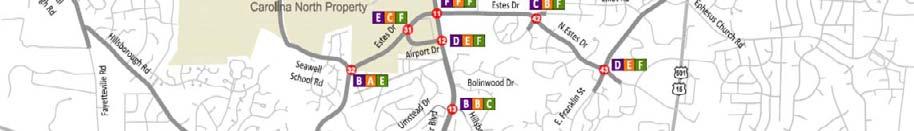
7
 Estes")


 Piney Mountain Road +/- 2,900")
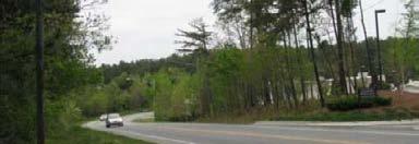
8 Existing Traffic Volumes Martin Luther King, Jr. Blvd. +/- 28,000 vpd (near Homestead Road) Estes Drive +/-13,000 vpd (near Caswell Road) Homestead Road +/- 9,500 vpd (west of Martin Luther King, Jr. Blvd) Hillsborough Street +/- 7,800 vpd (east of Martin Luther King, Jr. Blvd) Seawell School Road +/- 4,500 vpd (west of Martin Estes Drive) Piney Mountain Road +/- 2,900 vpd (east of Martin Luther King, Jr. Blvd)
9 Existing Traffic Operations


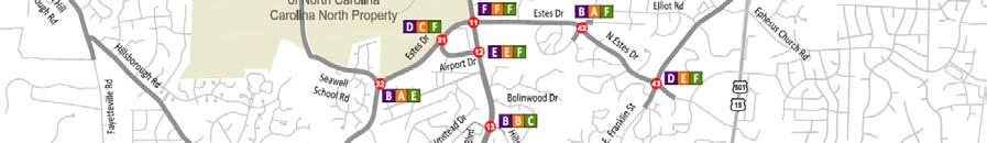
10 Eubanks 2. Martin Luther King, Jr. 3. Martin Luther King, Jr. Northwoods Dr 4. Weaver Dairy Timberlyne Road 5. N. Estes Halifax Road 6. N. Estes Airport Drive 7. Estes Drive Seawell School Road 8. Hillsborough Rosemary Street 9. Homestead Seawell School Road Existing Conditions: Links Exceeding Town Threshold Capacity
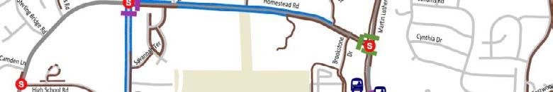
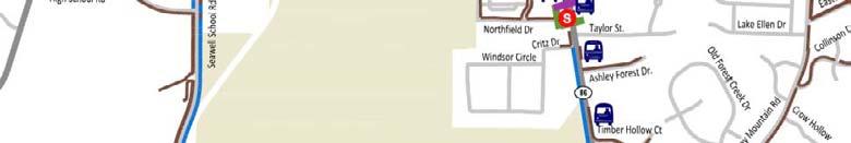
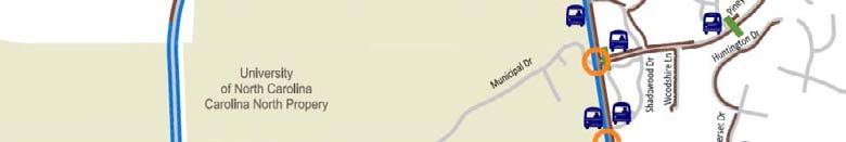
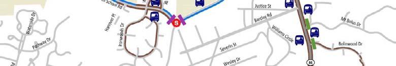
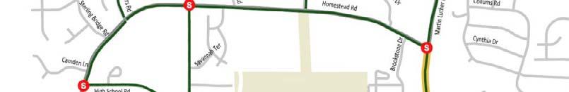
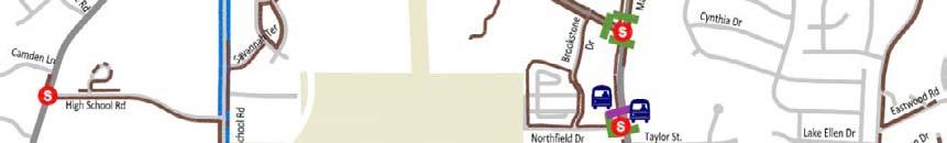
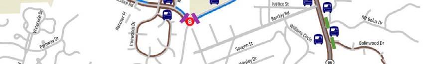
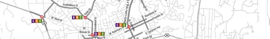
11 Existing Chapel Hill Transit Routes near Carolina North
12 Morning Peak Hour Existing Available Transit Capacity to & from Carolina North to CN* from CN* Northbound: Southbound: Midday Northbound: Southbound: Evening Peak Hour Northbound: Southbound: Southbou und to Carolina North Estes Drive *C Combined Capacity of six routes serving Carolina North South bound fro om Eubanks P &R Northbound from Piney Mtn. Rd. rtin Luther Kin ng, Jr. Blvd Ma Downtown/ Main Campus Northbo ound to


13 Pedestrian & Bicycle Conditions i

14 Pedestrian Facilities
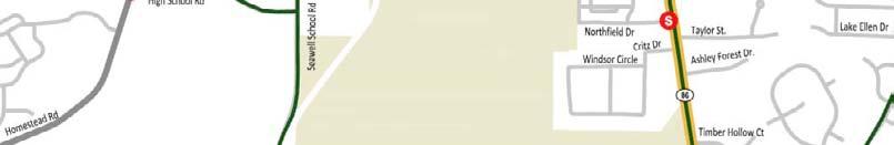


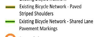
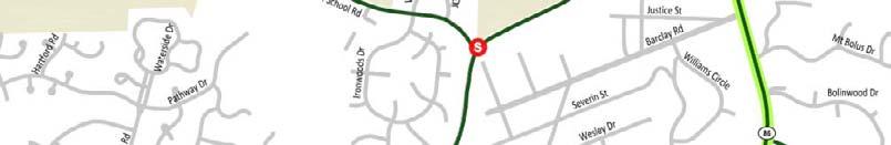
15 Bicycle Facilities
16 Impact Assessment Travel Forecasting Methodology Traffic Impacts Transit Impacts Pedestrian and Bicycle Facility Needs Potential Mitigation Measures
17 TRIP GENERATION METHODOLOGY
18 TRIP DISTRIBUTION METHODOLOGY
19 MODE SPLIT METHODOLOGY
20 2015 (800,000 sf) Parking Ratios Use Early Phase Baseline -10 % University/ Employee 0.65/ employee 0.50/ employee 0.45/ employee University/ Student 0.33/student 0.25/student 0.23/student University/ Visitors 0.20/1,000 sf 0.20/1,000 sf 0.18/1,000 sf Private R&D 2.65/1,000 sf 2.50/1,000 sf 2.25/1,000 sf Housing 1.25/unit 1.25/unit 1.13/unit Civic/Retail 1.50/1,000 sf 1.50/1,000 sf 1.35/1,000 sf Fields 35/field 35/field 32/field Total Spaces 1,743 1,526 1,373
21 2025 (3,000,000 sf) Parking Ratios Use Baseline -10 % Ratio -20 % Ratio University/ Employee 0.50/employee 0.45/employee 0.40/employee University/ Student 0.25/student 0.23/student 0.20/student University/ Visitors 0.20/1,000 sf 0.18/1,000 sf 0.16/1,000 sf Private R&D 2.50/1,000 sf 2.25/1,000 sf 2.0/1,000 sf Housing 1.25/ unit 1.13/unit13/unit 1.00/unit Civic/Retail 1.50/ 1,000 sf 1.35/1,000 sf 1.20/1,000 sf Medical/Employee 0.50/employee 0.45/employee 0.40/employee Medical/Patient -Visitor 2.50/1,000 sf 2.25/1,000 sf 2.00/1,000 sf Fields 35/field 32/field 28/field Total Spaces 5,834 5,254 4,668
22 Mode Split 2007 University it and Town-wide wide Data Mode Univ. Employee Univ. Student Other Drive to Site 67 % 36 % 92 % Transit 9 % 32 % 3 % Park & Ride 15 % 9 % 4 % Walk/Bike 9% 23 % 1% Total 100 % 100 % 100 %
23 Trip Generation

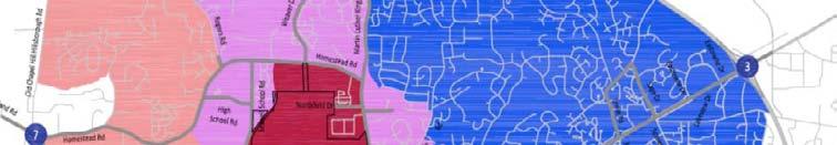

24 Trip Distribution 40 % within Chapel Hill Carrboro 60 % external to Chapel Hill - Carrboro
25 Employee Trip Distribution


26 2015 Build Intersection Level-of of-service
27 2015 Intersection Impacts and Potential Mitigation
28 2025 Build Intersection Level-of of-service
29 2025 Intersection Impacts and Potential Mitigation


30 Streets Evaluated for Traffic Calming Implementation Carolina North Traffic Expected Piney Mountain Road Hillsborough Street (Chapel Hill) Seawell School Road North Elliott/Curtis/Caswell Roads Carolina North Traffic Possible Northwoods oods Road North Lakeshore Drive Barclay Road
31 Transit Impacts 2015 (800,000 SF) Phase 1 Route NS reaches capacity 2 additional vehicles needed 400 to 500 additional park & ride spaces needed Other service adjustments may be needed


32 Transit Impacts 2025 (3,000,000, SF) Phase 2 More service needed on Routes NS, A, T, G +/- 10 additional vehicles needed d Approximately 1,500 additional park & ride spaces Route structure may need to change


33 Pedestrian Facility Needs


34 Bicycle Facility Needs
35 Sensitivity Analysis Different Parking Ratios TIA Phase 1 (800,000 sf) Early Phase Ratios (15 % more parking) Constrained Ratios (10 % less parking) TIA Phase 2 (3,000,000 sf) Constrained Ratios (A) 10 % less parking Constrained Ratios (B) 20 % less parking
36 Sensitivity Analysis Different Parking Ratios TIA Phase 1 (800,000 sf) No substantial change in traffic findings Fewer park & ride spaces (reduced from 460 to 290) with early phase parking ratios More park & ride spaces (increased from 460 to 570) with 10 % reduction in on-site parking One additional bus needed
37 Sensitivity Analysis Different Parking Ratios TIA Phase 2 (3,000,000 sf) Site-generated volumes are reduced through study area intersections, but does not change mitigation measures More park & ride spaces needed Increased from 1,520 to 2,030 with 10 % reduction in on-site parking Increased from 1,520 to 2,540 with 20 % reduction in on-site parking More transit service needed 14 additional buses in service with 10 % reduction 20 additional buses in service with 20 % reduction
38 2015 Mitigation Summary Traffic Mitigation Lane designation and signal system changes Additional turn lane at Martin Luther King, Jr. Blvd and Estes Drive Signalize Martin Luther King, Jr. Blvd and Airport Drive (for transit connection) Signalized site access from Estes Drive aligned with Airport Drive Traffic Calming Further exploration with neighborhoods on roadways expected to carry Carolina North traffic
39 2015 Mitigation Summary Pedestrian and Bicycle Facilities Complete sidewalk network near Carolina North Provide more crossing opportunities Complete bicycle lane network near Carolina North Transit Route adjustments to provide stops within the site Fleet increases to support additional ridership and longer travel times Signal priority & potential bus lanes on Martin Luther King, Jr. Blvd. Park & ride increases
40 2025 Mitigation Summary Traffic Mitigation Reconstruct Martin Luther King, Jr. Blvd from north of Piney Mountain Road to south of Airport Drive Reconstruct Estes Drive from west of Airport Drive to east of Martin Luther King, Jr. Blvd Evaluate potential signalization/roundabout at: Homestead Road at Weaver Dairy Road Extension Homestead Road at Rogers Road Turn lane additions at several other intersections (see map) Traffic Calming Monitor traffic conditions in residential neighborhoods for traffic calming implementation
41 2025 Mitigation Summary Pedestrian and Bicycle Facilities Provide improved pedestrian and bicycle facilities with reconstruction of Martin Luther King, Jr. Blvd and Estes Drive Transit Additional route adjustments to provide stops within the site Additional fleet increases to support additional ridership and longer travel times Additional park & ride increases Potential route restructuring to provide more direct routes to Carolina North

42 Concept Plan Review
43 TRANSPORTATION IMPACT ANALYSIS CAROLINA NORTH DEVELOPMENT Question and Comments
44

45 2015 No-Build Intersection Level-of of-service
46 2025 No-Build Intersection Level-of of-service
47 Air Quality/Greenhouse Gas 1
Transportation, Parking & Roads
 Transportation, Parking & Roads Design Carolina North as a walkable community Design the transportation system and development patterns (i.e., urban design elements such as density, building design, mix
TRAFFIC IMPACT STUDY CRITERIA
 Chapter 6 - TRAFFIC IMPACT STUDY CRITERIA 6.1 GENERAL PROVISIONS 6.1.1. Purpose: The purpose of this document is to outline a standard format for preparing a traffic impact study in the City of Steamboat
Preliminary Transportation Analysis
 Preliminary Transportation Analysis Goals of a Robust, Multimodal Transportation Network Safe Accessible/Connected Efficient Comfortable Context-Sensitive Motor Vehicle: Continue to analyze the data to
Creating the Future Bruce B Downs Blvd
 Creating the Future Bruce B Downs Blvd How things look today May not be how things look in the future. Bruce B Downs PD&E Study 2003 Construction programmed 2009, Palm Springs to Pebble Creek Tampa Rail
Detailed Evaluation of Alternatives Report FINAL April 20, North-South Corridor Study
 Detailed Evaluation of Alternatives Report FINAL April 20, 2016 North-South Corridor Study i Table of Contents 1. Introduction... 4 1.1 Overview of Evaluation Process... 4 1.1 Results of the Tier 1 Analysis...
Project Kickoff Meeting February 15, 2018
 Project Kickoff Meeting February 15, 2018 Scope of Work: Study Area Project Goals Develop traffic calming alternatives to the Vine Street local right of way, to mitigate speeding. Develop concept plans
Town of Bethlehem. Planning Assessment. Bethlehem Town Board
 Town of Bethlehem US 9W Corridor Transportation Planning Assessment Presented e to: Bethlehem Town Board June 2009 Overview Study Background Route 9W Corridor Conditions and Improvements Selkirk Bypass
Magnolia Place. Traffic Impact Analysis. Prepared for: City of San Mateo. Prepared by: Hexagon Transportation Consultants, Inc.
 Magnolia Place Traffic Impact Analysis Prepared for: City of San Mateo Prepared by: Hexagon Transportation Consultants, Inc. Updated January 4, 2010 Table of Contents 1. Introduction...1 2. Existing Conditions...6
Appendix C. NORTH METRO STATION AREA TRAFFIC IMPACT STATEMENT 88th Avenue Station
 Appendix C NORTH METRO STATION AREA TRAFFIC IMPACT STATEMENT 88th Avenue Station Prepared for: Regional Transportation Department and URS Corporation as part of the North Metro EIS David Evans and Associates,
BETHEL ROAD AND SEDGWICK ROAD CORRIDOR STUDY
 DRAFT PLAN City Council Meeting August 14, 2017 STUDY AREA Sedgwick Corridor State Route 160, principal arterial with Class 3 access management designation, commuter and freight route, connection to SR
Los Altos Hills Town Council - June 18, 2015 Palo Alto City Council June 22, AGENDA ITEM #2.B Presentation
 Los Altos Hills Town Council - June 18, 2015 Palo Alto City Council June 22, 2015 AGENDA ITEM #2.B Presentation Previous Presentations Los Altos Hills Town Council in May 2014 and February 2015 Palo Alto
Date: September 7, Project #: Re: Spaulding Youth Center Northfield, NH Property. Traffic Impact Study
 To: Ms. Susan C. Ryan Spaulding Youth Center 72 Spaulding Road Northfield, NH 03276 Date: September 7, 2017 Project #: 52455.00 From: Robin Bousa Director of Transportation Systems Re: Spaulding Youth
SF Transportation Plan Update
 SF Transportation Plan Update CAC Meeting #11 Existing Conditions and Future Baseline Needs Revised, Part I www.sfcta.org/movesmartsf twitter.com/sanfranciscota www.facebook.com/movesmartsf January 30,
Gateway Transportation Study
 Gateway Transportation Study Amherst, Massachusetts SUBMITTED TO University of Massachusetts Amherst Town of Amherst SUBMITTED BY Vanasse Hangen Brustlin, Inc. Watertown, Massachusetts March 213 Back of
Balancing Operation & Safety for Motorized and Non-Motorized Traffic
 Balancing Operation & Safety for Motorized and Non-Motorized Traffic Brian Willham, PE, PTOE Iowa Director - MOVITE June 30, 2014 Learning Objectives: When & Why should we measure the performance of complete
INNER LOOP EAST. AIA Rochester Annual Meeting November 13, 2013 TRANSFORMATION PROJECT. Bret Garwood, NBD Erik Frisch, DES
 INNER LOOP EAST TRANSFORMATION PROJECT AIA Rochester Annual Meeting November 13, 2013 Bret Garwood, NBD Erik Frisch, DES Why? We are building a city that encourages walking, biking and enjoying the outdoor
MEMORANDUM. Earl Haugen and UND Transportation and Traffic Coordination Committee
 SRF No. 7766 MEMORANDUM TO: FROM: Earl Haugen and UND Transportation and Traffic Coordination Committee Rick Lane, P.E. DATE: November 26, 2013 SUBJECT: UNIVERSITY AVE REVIEW Our review of the University
University Hill Transportation Study Technical Memorandum Alternatives Modeling and Analysis May 2007
 Technical Memorandum May 2007 Syracuse Metropolitan Transportation Council Edwards and Kelcey with Wallace Roberts and Todd Alta Planning and Design CONTENTS SECTION ONE- INTRODUCTION...1 SECTION TWO-
Scottsdale Road/Rural Road Alternatives Analysis (AA) Study. Arizona ITE/IMSA Spring Conference March 7, 2012
 Study. Arizona ITE/IMSA Spring Conference March 7, 2012") Scottsdale Road/Rural Road Alternatives Analysis (AA) Study Arizona ITE/IMSA Spring Conference March 7, 2012 Study Location and Duration Primary Study Corridor (major focus of effort) Rural Road and Scottsdale
Scottsdale Road/Rural Road Alternatives Analysis (AA) Study Arizona ITE/IMSA Spring Conference March 7, 2012 Study Location and Duration Primary Study Corridor (major focus of effort) Rural Road and Scottsdale
5858 N COLLEGE, LLC N College Avenue Traffic Impact Study
 5858 N COLLEGE, LLC nue Traffic Impact Study August 22, 2016 Contents Traffic Impact Study Page Preparer Qualifications... 1 Introduction... 2 Existing Roadway Conditions... 5 Existing Traffic Conditions...
Public Works and Infrastructure Committee. General Manager, Transportation Services
 STAFF REPORT ACTION REQUIRED Extending the Bay Street Bicycle Lanes Date: May 16, 2013 To: From: Public Works and Infrastructure Committee General Manager, Transportation Services Wards: Toronto Centre
Project Description Form 8EE
 Project Description Form 8EE Basic Project Information Submitting Jurisdiction/Agency: Town of Dumfries Project Title: Route 1 (Fraley Blvd) Widening: Brady's Hill Road to Dumfries Road Project Location:
Corridor Advisory Group and Task Force Meeting #10. July 27, 2011
 Corridor Advisory Group and Task Force Meeting #10 July 27, 2011 1 Agenda Recap CAG/TF #9 Public Meeting #2 Summary Single Mode Alternatives Evaluation Results Next Steps 2 3 CAG/TF #9 Recap CAG /TF #9
5.0 Roadway System Plan
 Southwest Boise Transportation Study Page 16 5.0 Roadway System Plan The Roadway System Plan outlines roadway improvements in the Initial Study Area. It forecasts future deficiencies on the arterial system,
SAN FRANCISCO MUNICIPAL TRANSPORTATION AGENCY
 THIS PRINT COVERS CALENDAR ITEM NO. : 11 DIVISION: Sustainable Streets BRIEF DESCRIPTION: SAN FRANCISCO MUNICIPAL TRANSPORTATION AGENCY Approving traffic modifications on Twin Peaks Boulevard between Christmas
King Soopers #116 Thornton, Colorado
 Traffic Impact Study King Soopers #116 Thornton, Colorado Prepared for: Galloway & Company, Inc. 1.0 EXECUTIVE SUMMARY King Soopers #116, a grocery marketplace anchored commercial development, is proposed
1609 E. FRANKLIN STREET HOTEL TRAFFIC IMPACT STUDY EXECUTIVE SUMMARY
 1609 E. FRANKLIN STREET HOTEL TRAFFIC IMPACT STUDY EXECUTIVE SUMMARY Prepared for: The Town of Chapel Hill Public Works Department Traffic Engineering Division Prepared by: HNTB North Carolina, PC 343
Project Goals Project Limits Boston Bikes Data Existing Conditions Proposed Options Discussion
 COMMERCIAL STREET/ ATLANTIC AVENUE BICYCLE FACILITIES Toole Design Group Nick Jackson Michelle Langone Danila, P.E., PTOE April 28, 2011 Presentation Outline Project Goals Project Limits Boston Bikes Data
Providence Downtown Transit Connector STAKEHOLDER MEETING #2. Stakeholder Meeting #1 October 24, 2016
 Providence Downtown Transit Connector STAKEHOLDER MEETING #2 Stakeholder Meeting #1 October 24, 2016 February 2017 1 AGENDA 1 DTC Goals and Expectations 2 Street Design Concepts 3 Potential Benefits and
TRAFFIC IMPACT ANALYSIS
 TRAFFIC IMPACT ANALYSIS FOR THE CHAMPAIGN UNIT#4 SCHOOL DISTRICT PROPOSED HIGH SCHOOL (SPALDING PARK SITE) IN THE CITY OF CHAMPAIGN Final Report Champaign Urbana Urbanized Area Transportation Study 6/24/2014
Setting the Stage for Complete Streets
 Setting the Stage for Complete Streets The Carrboro Experience North Carolina Complete Streets Summit Charlotte, North Carolina Town of Carrboro Planning Department July 23, 2014 Overview Location and
LANE ELIMINATION PROJECTS
 PRESENTATION OUTLINE Lane Elimination Considerations Districts 4 & 7 Draft Lane Elimination Processes FDOT Lane Elimination Guidelines Example Projects D4 Case Study: SR A1A (Ft. Lauderdale) D7 Case Study:
Southwest Bus Rapid Transit (SW BRT) Functional Planning Study - Executive Summary January 19 LPT ATTACHMENT 2.
 Functional Planning Study - Executive Summary January 19 LPT ATTACHMENT 2.") Southwest Bus Rapid Transit (SW BRT) Functional Planning Study - Executive Summary 2011 January 19 1 of 19 Introduction This executive summary presents the results of the Southwest Bus Rapid Transit (SW
Southwest Bus Rapid Transit (SW BRT) Functional Planning Study - Executive Summary 2011 January 19 1 of 19 Introduction This executive summary presents the results of the Southwest Bus Rapid Transit (SW
Priority 1: Ala Wai Pedestrian and Bicycle Safety and Mobility Project
 Priority 1: Ala Wai Pedestrian and Bicycle Safety and Mobility Project The full application can be found here: http://www.oahumpo.org/wp-content/uploads/2015/05/alawai_application.pdf Description The Ala
4. ENVIRONMENTAL IMPACT ANALYSIS 9. TRANSPORTATION AND TRAFFIC
 4. ENVIRONMENTAL IMPACT ANALYSIS 9. TRANSPORTATION AND TRAFFIC 4.9.1 INTRODUCTION The following section addresses the Proposed Project s impact on transportation and traffic based on the Traffic Study
Route 29 Solutions Projects
 Route 29 Solutions Route 29 Solutions Projects www.route29solutions.org October 10, 2014 Route 29 Widening to Six Lanes Albemarle County This project will widen a 1.8-mile segment of Route 29 from four
TAKOMA METRO STATION
 TKOM METRO STTION Traffic nalysis Technical Memorandum Station Planning in Support of Joint evelopment Job No. 13-FQ165-LN-2 November 213 WSHINGTON METROPOLITN RE TRNSIT UTHORITY (WMT) Takoma Metro Station
Intermodal Connections with Light Rail in Phoenix, AZ Wulf Grote, P.E. Director, Planning & Development
 Intermodal Connections with Light Rail in Phoenix, AZ Wulf Grote, P.E. Director, Planning & Development 12th National LRT Conference Salt Lake City, UT November 12, 2012 Outline METRO Light Rail Overview
Figure 1: East West Connector Alignment Alternatives Concept Drawing
 Page 2 of 9 Figure 1: East West Connector Alignment Alternatives Concept Drawing The Montebello Drive extension will run north south and connect Wilsonville Road to the Boones Ferry Road to Brown Road
PURPOSE AND NEED SUMMARY 54% Corridor Need 1. Corridor Need 2. Corridor Need 3. Corridor Need 4. Corridor Need 5
 SUMMARY PURPOSE AND NEED Chapel Hill Transit ridership has increased Buses operate every 4 minutes and have standing room only Exceeding seated capacity by 12% Corridor Need 1 by more than 20 percent between
Interim Transit Ridership Forecast Results Technical Memorandum
 Interim Transit Ridership 401 South Jackson Street Seattle, WA 98104-2826 September 2012 Table of Contents 1 INTRODUCTION... 1-1 1.1 Project Background... 1-1 2 RIDERSHIP FORECASTS... 2-1 2.1 System Ridership
Board of Supervisors February 27, 2017
 : Traffic Analysis Results & Draft Conceptual Plan Board of Supervisors February 27, 2017 Transportation Solutions Building Better Communities Presentation Overview Background Summary of Traffic Analysis
Welcome to the Quebec Alternatives Analysis Public Meeting
 Welcome to the Public Meeting Please sign in. Public Comment Please fill out a comment card and tell us what you think. Check back or comment any time at: www.quebecalternatives.com Project Area Technical
Feasibility Study of Pedestrian Crossings Along Route 7, East of Cascades Parkway and West of Dranesville Road. October 3, 2017
 Feasibility Study of Pedestrian Crossings Along Route 7, East of Cascades Parkway and West of Dranesville Road October 3, 2017 Study Area (area within a ¼-mile radius of the study intersections) Route
Wiehle Avenue/Reston Parkway Station Access Management Plans
 Wiehle Avenue/Reston Parkway Station Access Management Plans Final Report Executive Summary Submitted to Fairfax County, Department of Transportation Submitted by Vanasse Hangen Brustlin, Inc. April 15,
City of Gainesville Transportation/Roadway Needs PROJECT SUMMARY
 A1 Roadway Resurfacing $23,846,000 TYPE: Preservation of existing system Roadway resurfacing A2 Signal Replacement $6,000,000 TYPE: Preservation of existing system Replace traffic signals. B1 W 6th St
Northbound San Jose Avenue & I-280 Off-Ramp Road Diet Pilot Project
 Project Overview Fed by a two-lane Interstate-280 (I-280) off-ramp, high vehicular volumes and speeds are longstanding issues along San Jose Avenue. Residents in the surrounding neighborhoods have expressed
Lincoln Avenue Road Diet Trial
 Lincoln Avenue Road Diet Trial Data Collection Report June 1, 2015 Department of Transportation Table of Contents I. Introduction...... 3 II. Data Collection Methodology & Results...... 5 A. Traffic Volume
In station areas, new pedestrian links can increase network connectivity and provide direct access to stations.
 The Last Mile Planning for Pedestrians Planning around stations will put pedestrians first. Making walking to stations safe and easy is important; walking will be a part of every rapid transit Accessible
List of Exhibits...ii
 One Brickell Traffic Study TABLE OF CONTENTS List of Exhibits...ii EXECUTIVE SUMMARY...1 1. INTRODUCTION...2 1.1 Study Area...2 1.2 Study Objective...5 2. EXISTING TRAFFIC CONDITIONS...6 2.1 Data Collection...6
Giles Run Connector Road
 Giles Run Connector Road Laurel Hill Adaptive Reuse Area to Laurel Crest Drive South County Federation Meeting June 14, 2016 History Connector road included in the Laurel Hill Comprehensive Plan amendment
Road Conversion Study Plumas Street
 Plumas Street Phase I Submitted to The Regional Transportation Commission of Washoe County Submitted by Zong Tian, Ph.D., P.E. Saeedeh Farivar Haiyuan Li, Ph.D. Center for Advanced Transportation Education
City of White Rock. Strategic Transportation Plan. May 16, 2005
 City of White Rock Strategic Transportation Plan May 16, 2005 1 Outline Scope of Plan & Approach Council input and direction Key issues based on existing conditions Range of strategies to consider? Next
Decision on North Waterloo Routing
 Next Steps Decision on North Waterloo Routing Two route variations remain in north Waterloo. The final preferred route will include only one of the two variations. Please consider these two variations
Reference number /VP. Lafayette Downtown Congestion Study - Additional Traffic Analysis
 To James Hinkamp and Tony Coe, City of Lafayette Date January 19, 2017 Copies Reference number 243381/VP From Michael Iswalt and Vanessa Peers File reference 4-05 Subject Lafayette Downtown Congestion
Eliminate on-street parking where it will allow for a dedicated bus only lane %
 Traffic Dashboard Priorities Survey Responses Introduction 1) Are you familiar with bus rapid transit (BRT)? a. No, BRT is new to me. 597 23.5% b. I ve heard of BRT, but I don t know much about it. 1,136
Terwillegar Drive Expressway Draft Concept Plan
 Terwillegar Drive Expressway Draft Concept Plan Anthony Henday Drive to Whitemud Drive November 28 5:00-8:00 p.m. December 1 10:00 a.m. - 3:00 p.m. Let s Talk Today you can: Learn about the new direction
West Village Mobility & Integration
 West Village Mobility & Integration PRESENTED TO TOPCA Town Hall November 9, 2017 [7189-21] Port Credit 2 West Village + Mobility AWalkable Community A CompleteCommunity A SustainableCommunity 3 Mobility
State Road 54/56 Tampa Bay s Northern Loop. The Managed Lane Solution Linking I-75 to the Suncoast Parkway
 State Road 54/56 Tampa Bay s Northern Loop The Managed Lane Solution Linking I-75 to the Suncoast Parkway SUNCOAST PARKWAY Both I 75 and the Suncoast Parkway are planning, or in the process of constructing,
MEMORANDUM. Charlotte Fleetwood, Transportation Planner
 MEMORANDUM Date: Updated August 22, 2017 To: Organization: Charlotte Fleetwood, Transportation Planner Boston Transportation Department From: Jason DeGray, P.E., PTOE, Regional Director of Engineering
Seattle Transit Master Plan
 Seattle Transit Master Plan Seattle City Council Transportation Committee Briefing July 26, 2011 Seattle Department of Transportation In Association with: URS Corporation SVR DKS Associates The Underhill
INNOVATIVE INTERSECTION DESIGN
 INNOVATIVE INTERSECTION DESIGN J. Eddie Valtier, P.E. ELP TP&D Director Introduction Why Do We Need To Start Looking For Innovative Intersection Designs? Congestion is worsening and traffic volumes and
THIS PAGE LEFT BLANK INTENTIONALLY
 GA SR 25 Spur at Canal Road Transportation Impact Analysis PREPARED FOR GLYNN COUNTY, GEORGIA 1725 Reynolds Street, Suite 300 Brunswick, Georgia 31520 PREPARED BY 217 Arrowhead Boulevard Suite 26 Jonesboro,
MEMORANDUM INTRODUCTION/PURPOSE/OVERALL FINDINGS
 MEMORANDUM Date: To: From: Subject: Steve, City of Tacoma Dan Grayuski and Will Lisska, Fehr & Peers Schuster Corridor Trail Project SE12-0265.00 INTRODUCTION/PURPOSE/OVERALL FINDINGS The City of Tacoma
Walmart (Store # ) 60 th Street North and Marion Road Sioux Falls, South Dakota
 60 th Street North and Marion Road Sioux Falls, South Dakota") Walmart (Store #4865-00) 60 th Street North and Marion Road Sioux Falls, South Dakota Prepared for: Wal-Mart Stores, Inc. Bentonville, Arkansas Prepared by: Kimley-Horn and Associates, Inc. ã2013 Kimley-Horn
Walmart (Store #4865-00) 60 th Street North and Marion Road Sioux Falls, South Dakota Prepared for: Wal-Mart Stores, Inc. Bentonville, Arkansas Prepared by: Kimley-Horn and Associates, Inc. ã2013 Kimley-Horn
EXECUTIVE SUMMARY OF CALEDON TRANSPORTATION NEEDS STUDY
 EXECUTIVE SUMMARY OF CALEDON TRANSPORTATION NEEDS STUDY The Caledon Transportation Needs Study has been undertaken as a joint project by the Town of Caledon and the Region of Peel to determine the existing
TRAFFIC ACTION PLAN. North Central Neighborhood CITY OF SAN MATEO
 TRAFFIC ACTION PLAN North Central Neighborhood CITY OF SAN MATEO Draft February 2017 Table of Contents Introduction... 1 The Traffic Forum Process... 4 Neighborhood Traffic Issues... 6 Neighborhood Recommendations
MnPASS System Today and the Future
 MnPASS System Today and the Future April 2010 By Nick Thompson Minnesota Department of Transportation Topics Minnesota s Current and Future MnPASS High Occupancy Toll Systems Overview of the MnPASS System
Complete Street Analysis of a Road Diet: Orange Grove Boulevard, Pasadena, CA
 Complete Street Analysis of a Road Diet: Orange Grove Boulevard, Pasadena, CA Aaron Elias, Bill Cisco Abstract As part of evaluating the feasibility of a road diet on Orange Grove Boulevard in Pasadena,
Bay to Bay Boulevard Complete Streets Project
 Bay to Bay Boulevard Complete Streets Project Dale Mabry Highway to Bayshore Boulevard February 08, 2018 Photo Source: Tampa Bay Times Alessandra Da Pra Meeting Format Introduction Resurfacing Information
Appendix 3.2 D. Ridership Errata Sheet
 Appendix 3.2 D Ridership Errata Sheet January 14, 2010 Since the release of the Alternatives Description for the South Coast Rail project, the Massachusetts Department of Transportation has identified
METHODOLOGY. Signalized Intersection Average Control Delay (sec/veh)
") Chapter 5 Traffic Analysis 5.1 SUMMARY US /West 6 th Street assumes a unique role in the Lawrence Douglas County transportation system. This principal arterial street currently conveys commuter traffic
Chapter 5 Traffic Analysis 5.1 SUMMARY US /West 6 th Street assumes a unique role in the Lawrence Douglas County transportation system. This principal arterial street currently conveys commuter traffic
Telegraph Avenue Complete Streets DRAFT Recommendations. Oakland Public Works Department September 11 and 13, 2014 Open Houses
 Telegraph Avenue Complete Streets DRAFT Recommendations Oakland Public Works Department September 11 and 13, 2014 Open Houses Presentation Overview What are complete streets? What problem are we trying
Memorandum. Purpose: To update the MPO CTAC on the status of the LRTP scenario evaluation process.
 Charlottesville-Albemarle Metropolitan Planning Organization POB 1505, 401 E. Water St, Charlottesville, VA 22902 www.tjpdc.org (434) 979-7310 phone info@tjpdc.org email Memorandum To: MPO CTAC From: Wood
DRAFT BUENA VISTA 2020 TRANSPORTATION PLAN
 DRAFT BUENA VISTA 2020 TRANSPORTATION PLAN DEVELOPED BY THE TRANSPORTATION PLANNING DIVISION OF THE VIRGINIA DEPARTMENT OF TRANSPORTATION IN COOPERATION WITH THE U.S. DEPARTMENT OF TRANSPORTATION, FEDERAL
WELCOME! Please complete a comment sheet as we value your feedback. 4 pm to 8 pm. September 15, Hosted by: AECOM on behalf of City of Calgary
 WELCOME! Thank you for attending our open house. There will be no formal presentation today so please take the time to read the boards. If you have any questions, please do not hesitate to approach one
Geneva-Harney Bus Rapid Transit Feasibility Study
 Geneva-Harney Bus Rapid Transit Feasibility Study Community Advisory Committee Meeting #6 Alternatives Update Baseline Concepts www.genevabrt.org Baseline Assumptions - Update Candlestick Point/Hunters
Mission Street Medical Office Development
 reet Medical Office Development Traffic Impact Analysis Prepared for: Palo Alto Medical Foundation February 23, 2012 Hexagon Office: 7888 Wren Avenue, Suite B121 Gilroy, CA 95020 Hexagon Job Number: 11RD11
1609 E. FRANKLIN STREET HOTEL
 1609 E. FRANKLIN STREET HOTEL TRAFFIC IMPACT STUDY Prepared for: The Town of Chapel Hill Public Works Department Traffic Engineering Division Prepared by: HNTB North Carolina, PC 343 East Six Forks Road
I-35W Solutions Alliance Project Update July 13, 2017
 Title I-35W Solutions Alliance Project Update July 13, 2017 Evaluating the potential for Bus Rapid Transit and MnPASS Express Lanes in the southwest Metro, Investigating options for improved bus service
Appendix B. Environmental Resource Technical Memorandum. Assessment on Travel Pattern and Access Impacts
 Appendix B Environmental Resource Technical Memorandum Assessment on Travel Pattern and Access Impacts TECHNICAL MEMORANDUM ENVIRONMENTAL RE-EVALUATION FOR UNION STATION TO OAK CLIFF DALLAS STREETCAR To:
122 Avenue: 107 Street to Fort Road
 : 107 Street to Fort Road November 24, 2015 4:30 8:00 p.m. Meeting Purpose Summarize project work completed to date Share results of public input from Phase 1 Share the draft concept plan and proposed
Hennepin Avenue Reconstruction Washington Avenue to 12 th Street
 CITY OF MINNEAPOLIS Hennepin Avenue Reconstruction Washington Avenue to 12 th Street April 2016 1 Upcoming Opportunities Public Meeting #2 April 25, 2016 Minneapolis Central Library Doty Board Room Repeat
MORRISVILLE TRANSPORTATION PLAN TOWN COUNCIL WORK SESSION AUGUST 8, 2017
 TOWN COUNCIL WORK SESSION AUGUST 8, 2017 ENGAGEMENT SUMMARY OPEN HOUSE #2 OPEN HOUSE #2 31 ATTENDEES! TRANSPORTATION RECOMMENDATIONS 2040 E+C MODELED CONGESTION Committed Projects Aviation Parkway Widening
Technical Memorandum TRAFFIC IMPACT STUDY. RIDLEY ROAD CONVENIENCE STORE Southampton County, VA. Prepared for: Mr. David Williams.
 Technical Memorandum TRFFIC IMPCT STUDY RIDLEY ROD CONVENIENCE STORE Southampton County, V Prepared for: Mr. David Williams By: Charles Smith, P.E., PTOE EPR Charlottesville, V July 2014 1 TBLE OF CONTENTS
COMMUNITY MEETING AGENDA
 COMMUNITY MEETING AGENDA Welcome and Introductions SAFE Presentation Project Presentation Priorities Feedback Next Steps Q&A Santa Cruz Avenue Corridor Study 1 Santa Cruz Avenue Corridor Study Community
2045 Long Range Transportation Plan. Summary of Draft
 2045 Long Range Transportation Plan Summary of Draft Fredericksburg Area Metropolitan Planning Organization The George Washington Region includes the City of Fredericksburg and the counties of Caroline,
Indicator: BICYCLE ACTIVITY. Why and How. Results. Measurement: Bicycle Counts Data: 12-Hour Directional Counts
 Indicator: BICYCLE ACTIVITY Measurement: Bicycle Counts Data: 12-Hour Directional Counts Why and How Bicycle activity is measured by the number of cyclists observed at various locations throughout the
Rhode Island Moving Forward Long-Range Transportation Plan 2040 Municipal Roundtable Providence County
 Rhode Island Moving Forward Long-Range Transportation Plan 2040 Municipal Roundtable Providence County www.planri.com PlanRI2040@gmail.com Municipal Roundtable Meeting Summary Date/time: Location: Tuesday,
MCTC 2018 RTP SCS and Madera County RIFP Multi-Modal Project Eval Criteria GV13.xlsx
 MCTC 8 RTP SCS and Madera County RIFP Multi-Modal Project Eval Criteria GV.xlsx Madera County Transportation Commission Regional Transportation Plan / Sustainable Communities Strategy Multi-Modal Project
Chapel Hill Transit: Short-Range Transit Plan. State of the System Report
 : Short-Range Transit Plan State of the System Report November 217 CHAPEL HILL TRANSIT SHORT-RANGE TRANSIT PLAN Table of Contents Executive Summary... ES-1 Summary of Findings... ES-1 1 Introduction...
Transportation Advisory Board Date: February 21, :30 pm 301 W Main Street, Room 109
 Transportation Advisory Board Date: February 21, 2019 7:30 pm 301 W Main Street, Room 109 Meeting called by: Rob Dow, Chair Facilitator: Zach Hallock, Transportation Planner Attendees: Carrboro Transportation
Transportation Planning Division
 Transportation Planning Division Presentation Outline Study Tasks Recap of Previous Meeting Stakeholder Interviews Data Collection Design Principles Tool Box Recommendations Schedule Moving Forward North
Congestion Reducing Activities. Toby Carr GDOT Director of Planning April 10, 2014
 Congestion Reducing Activities Toby Carr GDOT Director of Planning April 10, 2014 GDOT Performance Dashboard Congestion Congestion Relief Strategies 511 HEROS RTOP Highway Emergency Response Operators
Memorandum. Fund Allocation Fund Programming Policy/Legislation Plan/Study Capital Project Oversight/Delivery Budget/Finance Contract/Agreement Other:
 Memorandum Date: November 20, 2017 To: Transportation Authority Board From: Eric Cordoba Deputy Director Capital Projects Subject: 12/5/17 Board Meeting: San Francisco Freeway Corridor Management Study
Downtown BRT Corridor Alternatives Review: 1 st, 2 nd, 3 rd and 4 th Avenue. Bus Rapid and Conventional Transit Planning and Design Services
 Downtown BRT Corridor Alternatives Review: 1 st, 2 nd, 3 rd and 4 th Avenue Bus Rapid and Conventional Transit Planning and Design Services City of Saskatoon February 2018 Project Team HDR Corporation
About the Wilmington Downtown Circulation Study
 About the Wilmington Downtown Circulation Study Part of the Wilmington i Initiatives partnership Wilmington Area Planning Council City of Wilmington Delaware Department of Transportation Delaware Transit
Traffic Impact Analysis (TIA) Process and Procedures Manual. September 2017
 Process and Procedures Manual. September 2017") Traffic Impact Analysis (TIA) Process and Procedures Manual Post Office Box 664 101 Huntersville-Concord Road Huntersville, NC 28070 Phone 704-766-2220 Fax 704-992-5528 www.huntersville.org (c) 2017, Town
Traffic Impact Analysis (TIA) Process and Procedures Manual Post Office Box 664 101 Huntersville-Concord Road Huntersville, NC 28070 Phone 704-766-2220 Fax 704-992-5528 www.huntersville.org (c) 2017, Town
El Camino Real Specific Plan. TAC/CAC Meeting #2 Aug 1, 2018
 El Camino Real Specific Plan TAC/CAC Meeting #2 Aug 1, 2018 Land Use Alternatives Goals and Tradeoffs Parks & open space Housing Retail & services Civic spaces Parking Community gathering spaces 3 Alternatives
TRANSPORTATION & MOBILITY
 TRANSPORTATION & MOBILITY ROADWAY SYSTEM There are approximately 40 miles of roadways in Manitou Springs. For planning purposes, roadways are typically assigned a functional classification which defines