First and Last Mile Strategic Plan. CASTA Annual Meeting 2018
|
|
|
- Richard Gilbert
- 5 years ago
- Views:
Transcription


1 First and Last Mile Strategic Plan CASTA Annual Meeting 2018

2 Agenda Study Status Purpose and goals Project update Project timeline Recap: 15 stations and typologies Existing conditions analysis process and example Public Engagement Online map Pop-up events Partnering events Workshop FLM Recommendation Application S. Federal Blvd and W. Alameda Ave. Iliff LRT Station US 36 and Broomfield PnR Next steps


3 Project Purpose To define strategies and policies that improve multimodal transportation and connectivity to RTD services and facilities with the ultimate goal of making RTD more accessible to more people.

4 Update since last meeting Since last meeting: Completed existing conditions analysis for all 15 stations Launched online comments map, survey, undertaken numerous partnering and pop-up events. Begun developing toolkit of recommendations and applications at each station and typology.
5 Project Schedule 12 Month Project Jan Feb Mar Apr May June July Aug Sept Oct Nov Dec Project Management and Stakeholder/Public Outreach Existing Cond./Problem ID First/Last Mile Station Typologies Selection of Rep. Stations Toolbox of Solutions Station/Typology Recommendations Final Report / Pilot Projects Jan Feb Mar Apr May June July Aug Sept Oct Nov Dec

6 Recap of representative stations and typologies
7 Selected 15 representative stations Final approved 15 stations are as follows: 1. Arapahoe at Village Center Station 2. Englewood Pkwy (Englewood Station to Broadway) 3. Havana St and 17th Ave 4. US 36 & Table Mesa PnR 5. Iliff Station 6. Clear Creek - Federal Station 7. 72nd Ave Station 8. Wheat Ridge - Ward Road Station 9. 40th & Colorado Station 10. US 36 & Broomfield Station 11. 8th and Coffman PnR 12. Wagon Road PnR 13. Sheridan Station 14. S Federal Blvd & Alameda Ave 15. S Colorado Blvd & Florida Number of locations meeting overlays Overlay Count Vulnerable Populations 8 Accessibility Needs 6 High Shift 5 High Visitor 3 High Parking Utilization 1 High Propensity to Change 9 Stations with no overlays 2 Number of typologies Typology Count Urban 4 Suburban Mixed 6 Suburban Residential 5

.")
8 FLM analysis process Data request to each jurisdiction Undertake field visits Key analysis themes: Travel patterns and demographics Active Transportation (including micro-mobility e.g. e-scooters) Shared Mobility analysis: Bike share Car share Micro-transit Existing TDM programs Curbside management (I.e. TNC p/u and d/o zones). Land ownership Transit service levels

9 Station analysis example Arapahoe at Village Center Travel patterns and demographics Very high employment levels Large event space nearby Very high drive alone rates in the area Many transit users walk to the station Most commuters arrive from the north 54% of people commute less than 10 miles Existing TDM programs Station within the Denver South TMA area Currently no TDM initiatives above and beyond those provided by DRCOG. Existing shared mobility Two Zipcar vehicles available at Fiddlers Green

10 Active and micromobility transportation Full site analysis including bicycle parking Two mile buffer for analysis Identification of two priority routes to access the station by walking, cycling and micromobility Work with individual jurisdictions to identify the routes, to avoid duplication of local efforts Connect key employment and residential areas to the station for both first and last mile connections Highlight a current comfort level for each route, showing which sections should be prioritized for improvement

11 Curbside Management and Parking Includes documentation of all surrounding parking Provides current average weekday utilization of RTD park and ride facilities Analysis provides the bases to produce a robust curbside management and parking strategy

12 Land ownership Land ownership analysis is important to understand where FLM improvements can be made Where public owned land exists, understanding which agency owns the land helps with implementation of FLM strategies In areas with different ownership of right of way can also impact FLM recommendations


13 Recommendations overview Recommendations will be taken from the FLM recommendations toolkit, examples include: Programmatic Improvements and reuse of existing infrastructure Transportation Services New infrastructure improvements First and Last Mile Guidelines (all stations and locations)


14 Example application of recommendations Arapahoe at Village Center: Programmatic Identified issue: Our outreach suggests many employers are unaware of the Ecopass program. Example recommendation: Recommend a marketing campaign targeting businesses within 1 mile from the station regarding the Ecopass program. Improvements and reuse of existing infrastructure Identified issue: Currently no designated space for TNCs, or other drop off/pick up services. Example recommendation: Provide a specific location for pick ups and drop offs in close proximity to the station, working with the City of Greenwood Village. Transportation Services Identified issue: No shared micromobility options at the station location. Example recommendation: Work with City of Greenwood Village to allow a pilot of shared scooters or bikes within 3 miles of the station. Provide guidance towards management of shared systems. New infrastructure improvements Identified issue: Lack of wayfinding for pedestrians and cyclists to the station. Example recommendation: Provide improved wayfinding to the station, up to 1 mile for pedestrian signage, and 2 miles for bicycle signage. Include a map at the station showing major destinations surrounding the station and time taken to walk and bike.
15 Outreach and events Four main methods of outreach: Partnering events Pop-up events Online comments map Webpage feedback


16 Partnering events


17 Pop-up events Arapahoe at Village Center Sept 12 th US36 and Table Mesa P&R Sept 13 th Wagon Road P&R Sept 18 th Iliff Station Sept 20 th 40 th and Colorado Sept 24 th

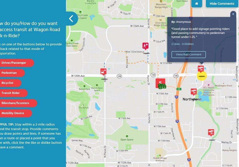
18 Online comments map


19 General Online Comments - FLM webpage comment form - Social Media Posts
20 Workshop FLM Recommendation Application Using the existing conditions maps, work in groups to provide FLM recommendations to the following locations: S. Federal and Alameda Ave High transit corridor Urban Historically vulnerable population US 36 and Broomfield Station P&R Station Suburban-mixed Event space (1 st Bank Center) High propensity to change Iliff LRT Station LRT Station Suburban-residential High accessibility requirements (Medical Center of Aurora) High number of shift workers

21 S. Federal Blvd and W. Alameda Ave Issues: S. Federal Boulevard is the most dangerous street in Colorado. Crossing conditions are less than desirable. Low income population. Poor pedestrian conditions. Opportunities: Good network structure for active transportation access. Included within Denver s dockless pilot program. S. Federal Blvd is a source of particular attention by the City. Will be within a new TMA area in 2019 (West Corridor TMA).


22

23

24 Iliff Station Issues: Highway 225 creates a barrier to the west. High drive alone mode share. Generally low density. Opportunities: Access to Aurora Medical Facility. Younger people tend to be more open to new modes. Space to work with. New higher density housing being built.


25
 Opportunities: Mixed uses surrounding the station, including some areas of density.")
26 US 36 and Broomfield PnR Issues: Long crossing distances difficult active transportation and micromobility conditions. Park and Ride usually under capacity (63%). US36 acts as a barrier to non-vehicular modes. 1 st Bank Center is a major attractor (also an opportunity) Opportunities: Mixed uses surrounding the station, including some areas of density. Space to work with. Commuting Solutions is an active TMA. Congestion on US 36 results in more people being open to transit.


27
28 Examples of FLM tools New infrastructure: New pedestrian and ADA infrastructure New biking and micromobility infrastructure Provide free, informal bike parking Provide bike repair station Provide high quality, secure bike parking (Basic) Provide high quality, secure bike parking (Advanced) Provide parking spaces for on-site vehicle share vehicles, prioritizing peer-to-peer shared vehicles Food kiosks and other on-location amenities Multimodal wayfinding signage Artwork/ place making Improvements and reuse of existing infrastructure Right-size parking/parking management Curbside management Reallocation of parking spaces to: Carpool only parking Bike and micromobility parking Shared mobility First and Last Mile Policies (all stations and locations) Prioritize and diversify a mix of mode access Bring pedestrian environment ½ mile around the station to ADA compliance Provide incentives for shared use and micromobility providers to operate at the station. Transportation Services Implement shared bicycle service Implement shared micromobility service Autonomous transit Microtransit service Point to point car share Short term car share Peer to peer car share Programmatic (differentiated by applicability to either residential (first mile) or employment/destination based (last mile): Unbundle parking from all tenant leases TNC to transit subsidies Provide discounted car share memberships to employees within 1/2 mile Transit welcome packages to new residents and employees Provide subsidized transit passes to residents and employees within 1/2 mile Microtransit/dynamic transit service (no set route) Bike share Bike maintenance Develop transit access specific carpool matching service Develop access marketing plan (if no TMA present) Integrated fares Videos showing how to access station from major destinations using 360 camera Co-ordinate with local TMA
29 Next steps Produce toolkit of FLM recommendations Develop recommendations for each of the 15 stations Begin pilot project identification process
30 Thank you! Questions and Answers
31 Station Typologies Typology Examples Land use Density Employment density Residential density Accessibility/ Service levels Urban Core Downtown Denver and Downtown Boulder Very high Very high High Very high Urban Suburban Mixed Downtown Arvada/Belmar/Longmont, areas of Broadway, Federal and Colfax in Denver, DU campus, Anschutz campus, Denver neighborhoods Northglenn Marketplace Mall, US 36 and Sheridan Park-n-Ride area, Broomfield Plaza, Colorado Marketplace Shopping Center (Thornton) High High High High Medium High Medium Medium Suburban Residential Residential areas of Lone Tree, Highlands Ranch, Northglenn, Thornton, Aurora, Littleton, Parker, Lakewood, Brighton, etc. Low Low Medium Low/Med Rural Western US Hwy 285 corridor, I-70 Corridor, front range communities (except Golden), plains communities Very low Very low Very low Very Low


32 Urban High land use density Mix of high employment and residential Many destinations Good levels of transit access Relatively high multimodal share Good scope of first and last mile solutions


33 Suburban Mixed Medium land use density Mix of office parks, shopping malls, event spaces and industrial areas Medium-high employment Numerous destinations Medium levels of transit access Relatively high SOV share Good scope of first and last mile solutions


34 Suburban Residential Low density Residential Few destinations Low/Med levels of transit access High SOV share Low scope of first and last mile solutions
35 Typology Overlays Two (2) types of overlays include: 1. Prioritization overlay: The function of this overlay is to help prioritize locations that may require FLM solutions more than others. Historically vulnerable populations High accessibility needs 2. Recommendation overlay: The function of the recommendation overlays is to help tailor the recommendations at specific locations with certain attributes. High shift/visitor variability High visitor trips High propensity to change Parking utilization
36 Representative Stations Aim of the representative stations is to provide a broad range of stations that can be replicated across the RTD service area. Recommendations from the 15 stations can then be re-used and support decision making in other parts of the district to emphasize the impact of the FLM project. All criteria used to select the stations was informed by input from both the PPAC and IWG groups. We offered 20 stations to advisory groups and culled to the top 15 stations that represent a diverse range of the typologies and overlays.
37 Criteria to Select Representative Stations Low income/transit dependent communities Mode specific (i.e. a variety of BRT, rail and local bus) Service level (i.e. ridership, frequency, parking availability, stations with high ridership vs stations with relatively low ridership and/or stations within Call-n-Ride service areas) Stations with potential to change, or changes in the near future (i.e. stations within jurisdictions that have completed groundwork or are supportive of first and last mile solutions) Jurisdictional/geographical distribution (i.e. stations selected in diverse political boundaries) Access (i.e. ease of access by various modes) Density (i.e. a variety of different land use densities)
Beyond First First Last Last Mile Strategies. APA National Conference April 3, 2016 Chelsea Richer, AICP Fehr & Peers
 Beyond First First Last Last Mile Strategies APA National Conference April 3, 2016 Chelsea Richer, AICP Fehr & Peers 1 Beyond First Last Mile Strategies APA National Conference Jeremy Klop, AICP, Fehr
Technical Working Group November 15, 2017
 Technical Working Group November 15, 2017 Welcome and Introductions Project Partners Regional Transportation District (RTD) Colorado Department of Transportation (CDOT) Denver Regional Council of Governments
Community Task Force November 15, 2017
 Community Task Force November 15, 2017 Welcome and Introductions Project Partners Regional Transportation District (RTD) Colorado Department of Transportation (CDOT) Denver Regional Council of Governments
University of Victoria Campus Cycling Plan Terms of Reference. 1.0 Project Description
 University of Victoria Campus Cycling Plan Terms of Reference 1.0 Project Description The Campus Cycling Plan, a first for the University, will provide a comprehensive and coordinated approach to support
ATTACHMENT 4 - TDM Checklist. TDM Checklist Overview
 ATTACHMENT 4 - TDM Checklist TDM Checklist Overview The proposed checklist rates developments on the degree to which they are TDM and transit supportive. Points are assigned based on the level of transit
Rochester Area Bike Sharing Program Study
 roc bike share Rochester Area Bike Sharing Program Study Executive Summary ~ January 2015 JANUARY 2015 8484 Georgia Avenue, Suite 800 Silver Spring, MD 20910 3495 Winton Pl., Bldg E, Suite 110 Rochester,
Characteristics from these programs were used to compare to and evaluate existing conditions in Howard County.
 EXECUTIVE SUMMARY Bike share is a mobility option that allows users to access a fleet of public bicycles throughout a community. Bike share systems have successfully been implemented in communities throughout
Access BART: TOD and Improved Connections. October 29, 2008
 Access BART: TOD and Improved Connections October 29, 2008 1 Access BART Study Goals Evaluate at the system-level land use and access scenarios to optimize ridership Identify station clusters that provide
MASTER BICYCLE AND PEDESTRIAN PLAN
 VILLAGE OF NORTHBROOK MASTER BICYCLE AND PEDESTRIAN PLAN DRAFT PLAN OPEN HOUSE May 2, 2018 AGENDA 1. Community Engagement 2. Vision and Goals 3. General Structure of Plan 4. Recommendations Overview 5.
Moving Cambridge. City of Cambridge Transportation Master Plan Public Consultation Centre. March 7, :00 8:00 PM.
 City of Cambridge Transportation Master Plan Public Consultation Centre March 7, 2018 5:00 8:00 PM Region of Waterloo City of Cambridge Transportation Master Plan Public Consultation Centre March 7, 2018
Pocatello Regional Transit Master Transit Plan Draft Recommendations
 Pocatello Regional Transit Master Transit Plan Draft Recommendations Presentation Outline 1. 2. 3. 4. What is the Master Transit Plan? An overview of the study Where Are We Today? Key take-aways from existing
Regional Bicycle System Master Study. Preliminary Results Update
 Regional Bicycle System Master Study Preliminary Results Update Transportation Committee October 21, 2013 Introduction Study Goals Guiding Principles Bicycle Study System Elements Analysis Approach Proposed
EXECUTIVE SUMMARY... vii 1 STUDY OVERVIEW Study Scope Study Area Study Objectives
 Contents EXECUTIVE SUMMARY... vii 1 STUDY OVERVIEW... 1-1 1.1 Study Scope... 1-1 1.2 Study Area... 1-1 1.3 Study Objectives... 1-3 2 EXISTING CONDITIONS... 2-1 2.1 Existing Freeway Conditions... 2-4 2.1.1
CHAPTER 3: Vision Statement and Goals
 Davidson Walks & Rolls: Active Transportation Master Plan CHAPTER 3 Contents: Overview Vision Statement Measurable Goals Public Outreach CHAPTER 3: Vision Statement and Goals Overview The vision statement
WALKNBIKE DRAFT PLAN NASHVILLE, TENNESSEE EXECUTIVE SUMMARY NASHVILLE, TENNESSEE
 NASHVILLE, TENNESSEE EXECUTIVE SUMMARY Executive Summary A world-class multi-modal transportation system is essential to a vibrant city and better quality of life. -Mayor Barry The WalknBike plan aims
 MEMORANDUM - CITY OF PASADENA Department Of Transportation DATE: OCTOBER 21, 2008 TO: ENVIRONMENTAL ADVISORY COMMISSION FROM: ~ FRED C. DOCK, DIRECTOR OF TRANSPORTATION SUBJECT: UPDATE ON DEPT. OF TRANSPORTATION
 Time of Change We Are Growing We Are An Attractive Place To Live We Are Age Diverse + Living Longer 50000 40000 30000 20000 10000 0 2010 Census Job Density Housing Sheds Transit Sheds The Project FUNDING
Arlington County 10-Year Transit Development Plan & Premium Transit Network Briefing. May 2016
 Arlington County 10-Year Transit Development Plan & Premium Transit Network Briefing May 2016 Overview 10-Year Transit Development Plan Premium Transit Network Columbia Pike service concept Premium amenities
Planning Transit Operations and Bike Sharing Denver RTD. Bill Van Meter, Assistant General Manager, Planning March 23, 2012
 Planning Transit Operations and Bike Sharing Denver RTD Bill Van Meter, Assistant General Manager, Planning March 23, 2012 1 Overview RTD Background RTD Bike-n-Ride Program RTD - Bike Share Coordination:
TRANSIT RIDERSHIP IMPROVEMENT PROGRAM CAPITAL PROJECTS OPERATING PLANS - NEXT NETWORK TRANSIT INFORMATION TECHNOLOGY
 TRANSIT RIDERSHIP IMPROVEMENT PROGRAM CAPITAL PROJECTS OPERATING PLANS - NEXT NETWORK TRANSIT INFORMATION TECHNOLOGY VTA S NEXT NETWORK CONNECT TO BART STATIONS INCREASE RIDERSHIP IMPROVE FAREBOX RECOVERY
Exhibit 1 PLANNING COMMISSION AGENDA ITEM
 Exhibit 1 PLANNING COMMISSION AGENDA ITEM Project Name: Grand Junction Circulation Plan Grand Junction Complete Streets Policy Applicant: City of Grand Junction Representative: David Thornton Address:
Arterial Transitway Corridors Study. Ave
 Arterial Transitway Corridors Study Ave January 2012 Arterial Transitway Corridors Study Overview Corridor Features and Demographics 11 study corridors, 95 route miles 86,000 daily rides and half of existing
Chapter 2. Bellingham Bicycle Master Plan Chapter 2: Policies and Actions
 Chapter 2 Bellingham Bicycle Master Plan Chapter 2: Policies and Actions Chapter 2: Policies and Actions The Bicycle Master Plan provides a road map for making bicycling in Bellingham a viable transportation
 Community and Business Outreach November 2015 Goal #1: Improve safety in the corridor Goal #2: Make a more livable corridor Goal #3: Improve mobility for all Data Collection Alternatives Recommendations
PEDESTRIAN ACTION PLAN
 CITY OF SANTA MONICA PEDESTRIAN ACTION PLAN DRAFT OCTOBER 2015 Safe Streets Santa Monica, December 3, 2015 Beth Rolandson, AICP Principal Transportation Planner Strategic + Transportation Planning, Planning
West Village Mobility & Integration
 West Village Mobility & Integration PRESENTED TO TOPCA Town Hall November 9, 2017 [7189-21] Port Credit 2 West Village + Mobility AWalkable Community A CompleteCommunity A SustainableCommunity 3 Mobility
Corridor Vision Workshop Summary James Madison Elementary February 22,2018
 Corridor Vision Workshop Summary James Madison Elementary February 22,2018 WHY DEVELOP THIS STUDY? Ogden City is planning for better connectivity and access to jobs and housing. Working with area partners,
Sustainable Transportation Initiatives and Plans in Caledon
 Sustainable Transportation Initiatives and Plans in Caledon Arash Olia, P.Eng., PhD. Coordinator, Transportation Development Finance & Infrastructure Services Town of Caledon Eric Chan, P.Eng., PMP Manager,
ADOT Statewide Bicycle and Pedestrian Program Summary of Phase IV Activities APPENDIX B PEDESTRIAN DEMAND INDEX
 ADOT Statewide Bicycle and Pedestrian Program Summary of Activities APPENDIX B PEDESTRIAN DEMAND INDEX May 24, 2009 Pedestrian Demand Index for State Highway Facilities Revised: May 29, 2007 Introduction
Age Friendly Communities Idea Exchange
 Englewood: Englewood is a small, comfortable community just south of Denver with a diverse population of 30,255. Englewood's central location in the Denver Metropolitan area and handy access via highways
5. Pedestrian System. Accomplishments Over the Past Five Years
 5. Pedestrian System Accomplishments Over the Past Five Years The Alamo Area Metropolitan Planning Organization (MPO) and its partner agencies recognize the importance of improving pedestrian mobility.
MONTGOMERY COUNTY PLANNING DEPARTMENT THE MARYLAND-NATIONAL CAPITAL PARK AND PLANNING COMMISSION
 MONTGOMERY COUNTY PLANNING DEPARTMENT THE MARYLAND-NATIONAL CAPITAL PARK AND PLANNING COMMISSION MCPB Item No. 4 Date: 09-10-15 Scope of Work for the Bicycle Master Plan David Anspacher, Planner/Coordinator,
ACTIVE TRANSPORTATION
 ACTIVE TRANSPORTATION Mobility 2040 Supported Goals Improve the availability of transportation options for people and goods. Support travel efficiency measures and system enhancements targeted at congestion
Climate Change Action Plan: Transportation Sector Discussion Paper: Cycling
 Climate Change Action Plan: Transportation Sector Discussion Paper: Cycling ontario.ca/climatechange Contents 1. Minister of Transportation s message... 3 2. Introduction... 5 3. Sector Overview and Support
Bicycle Friendly Niagara Falls
 Bicycle Friendly Niagara Falls STAKEHOLDER COMMITTEE MEETING 2 SUPPORTED BY THE OATH COMMUNITY FUND AT THE COMMUNITY FOUNDATION FOR GREATER BUFFALO Develop a Bicycle Master Plan to document the city s
Rail Station Fact Sheet CentrePort/DFW Airport Station
 Rail Station Fact Sheet CentrePort/DFW Airport Station Station Overview CentrePort/DFW Airport Station is located by Statler Boulevard at Breezewood Drive in Fort Worth. Free shuttles connect the station
Welcome. Background. Goals. Vision
 Welcome The formal Public Information Centre (PIC) for the Transportation Master Plan How We GO will be held in early 2017. At that time we will present the recommended transportation system for Niagara
City of Davenport CitiBus Public Transportation Study. April 2015
 City of Davenport CitiBus Public Transportation Study April 2015 Overview Project Background Key Findings CitiBus Service Allocation Policy Discussion 2 Project Background 3 About CitiBus Operates 17 routes
Ann Arbor Downtown Street Plan
 1 Ann Arbor Downtown Street Plan Public Workshop #1 We know that. 2 Public right-of-way (streets, sidewalks, and alleys) make up 30% of the total District area of downtown. Streets need to provide mobility
Cherry Creek Transportation and Land Use Forum September 25, 2013 Meeting Summary
 Cherry Creek Transportation and Land Use Forum September 25, 2013 Meeting Summary I. LEAD-IN TO SMALL GROUP DISCUSSION, POLLING AND STEERING COMMITTEE/TECHNICAL TASK FORCE DISCUSSION The meeting began
CITY OF ABBOTSFORD TRANSPORTATION AND TRANSIT MASTER PLAN
 CITY OF ABBOTSFORD TRANSPORTATION AND TRANSIT MASTER PLAN EXECUTIVE COMMITTEE MONDAY, OCTOBER 2, 2017 TRANSPORTATION & TRANSIT AGENDA 1. Plan Overview 2. Shaping Influences 3. Existing Conditions and What
2010 Pedestrian and Bicyclist Special Districts Study Update
 2010 Pedestrian and Bicyclist Special Districts Study Update Pedestrian and Bicyclist Special Districts Program Overview H-GAC s Special Districts Program aims to provide strategic investments in pedestrian
WELCOME. City of Greater Sudbury. Transportation Demand Management Plan
 WELCOME City of Greater Sudbury Transportation Demand Management Plan Public Consultation Session St. Andrew s Place, Activity Hall 111 Larch Street Wednesday September 13, 2017 6:00 to 8:00 pm Welcome
Community Task Force July 25, 2017
 Community Task Force July 25, 2017 Welcome and Introductions Project Partners Regional Transportation District (RTD) Colorado Department of Transportation (CDOT) Denver Regional Council of Governments
APPENDIX B. TDM Existing Conditions
 APPENDIX B TDM Existing Conditions SCARBOROUGH CENTRE TMP TRANSPORTATION DEMAND MANAGEMENT INTRODUCTION Scarborough Centre has grown into a mixed-use hub for population, transportation, and employment
Denver Moves: Pedestrian and Trails Task Force Meeting 3 Notes November 16, :00 11:00 am
 Denver Moves: Pedestrian and Trails Task Force Meeting 3 Notes November 16, 2016 9:00 11:00 am Public Comment Meeting not on the Denveright calendar please add future Task Force meetings to calendar October
City of Charlottesville Bicycle and Pedestrian Master Plan Update
 City of Charlottesville Bicycle and Pedestrian Master Plan Update September 17, 2014 I. Welcome and meeting overview II. Project status update III. Network overview IV. Break-out groups Pedestrian Network
BID Strategy Group and Stakeholders Meeting. April 17, 2018
 BID Strategy Group and Stakeholders Meeting April 17, 2018 Agenda Meeting Objectives Background Short-Term Improvements Long-Term Study Goals Data Review Schedule & Next Steps Open House April 17, 2018
Bus Rapid Transit Plans
 Twin Cities Region Bus Rapid Transit Plans ULI Minnesota Workshop Connecting Bus Rapid Transit to the Community December 15, 2009 John Levin Director of Service Development Metro Transit Metropolitan Area
Travel Planning WC & NWCD Cycling Group. Thursday 2 nd July Amanda Holden
 Travel Planning WC & NWCD Cycling Group Thursday 2 nd July Amanda Holden 1 Today s workshop What is Travel Planning? University Travel Plan NWCD Travel Plan Targets Cycling Initiatives Other Travel Plan
Chapter 7. Transportation. Transportation Road Network Plan Transit Cyclists Pedestrians Multi-Use and Equestrian Trails
 Chapter 7 Transportation Transportation Road Network Plan Transit Cyclists Pedestrians Multi-Use and Equestrian Trails 7.1 TRANSPORTATION BACKGROUND The District of Maple Ridge faces a number of unique
Stakeholder Meeting Handouts. January 2013
 January 2013 Stakeholder Meeting Handouts The Case FOR Parking Minimum Requirements Reduce street congestion around the development site Avoid parking spillover Create orderly development patterns Anticipate
Bicycle Master Plan Goals, Strategies, and Policies
 Bicycle Master Plan Goals, Strategies, and Policies Mobilizing 5 This chapter outlines the overarching goals, action statements, and action items Long Beach will take in order to achieve its vision of
PEDESTRIAN ACTION PLAN
 ATTACHMENT 2 CITY OF SANTA MONICA PEDESTRIAN ACTION PLAN CITY OF SANTA MONICA PEDESTRIAN ACTION PLAN This page intentionally left blank EXECUTIVE SUMMARY CHAPTER 1 EXECUTIVE SUMMARY Setting the Stage
Central Oregon Intergovernmental Council
 Central Oregon Intergovernmental Council Regional Transit Master Plan (RTMP) Technical Advisory Committee Kick-Off Meeting May 16, 2012 Meeting Agenda Project Orientation Presentation of Survey Results
BUILDING THE CASE FOR TRAVEL OPTIONS IN WASHING TON COUNTY. Image: Steve Morgan. Image: Steve Morgan
 BUILDING THE CASE FOR TRAVEL OPTIONS IN WASHING TON COUNTY Image: Steve Morgan Image: Steve Morgan Image: TriMet Image: TriMet WHAT ARE TRAVEL OPTIONS PROGRAMS? Travel options programs encourage residents,
The Nexus between Transportation Demand Your sub title Management (TDM), Transit Station Access, and Internal Station Circulation
, Transit Station Access, and Internal Station Circulation") YOUR LINKING TITLE THE LINKS The Nexus between Transportation Demand Your sub title Management (TDM), Transit Station Access, and Internal Station Circulation Presentation Makeover Montgomery Location
YOUR LINKING TITLE THE LINKS The Nexus between Transportation Demand Your sub title Management (TDM), Transit Station Access, and Internal Station Circulation Presentation Makeover Montgomery Location
Moving Ahead. (Community Engagement) Chapter Three
 Chapter Three") 3 Community Chapter Three Moving Ahead (Community Engagement) engagement provided an exciting opportunity to engage Redwood City residents, workers, and business owners people who walk, bike, take transit,
3 Community Chapter Three Moving Ahead (Community Engagement) engagement provided an exciting opportunity to engage Redwood City residents, workers, and business owners people who walk, bike, take transit,
Hamilton Transportation Master Plan Public Consultation. Public Information Centre One Summary
 Hamilton Transportation Master Plan Public Consultation Public Information Centre One Summary Table of Contents Introduction 1 Purpose 2 What Was Presented 2 Who Came to the Meeting 2 The Breakout Sessions
Everett Transit Action Plan. Community Open House November 16, 2015
 Everett Transit Action Plan Community Open House Everett has a great location, but getting around the city and into surrounding communities is a problem for all ages Many Voices, One Future: The Everett
CONNECTING PEOPLE TO PLACES
 CONNECTING PEOPLE TO PLACES 82 EAST BENCH MASTER PLAN 07 Introduction The East Bench transportation system is a collection of slow moving, treelined residential streets and major arteries that are the
Transportation Assessment
 Transportation Assessment Midtown Open House February 10, 2018 Overview Midtown in Focus Overview & Purpose of Today Transportation Assessment overview Summary of Transportation work to date Review & Analysis
Agenda. Overview PRINCE GEORGE S PLAZA METRO AREA PEDESTRIAN PLAN
 PRINCE GEORGE S PLAZA METRO AREA PEDESTRIAN PLAN May 28, 2008 Agenda Welcome and introductions Project overview and issue identification Planning context and strengths Design challenges and initial recommendations
Town of Superior. Superior Trails Plan
 Part 1 Base Information 1. Project Title US 36 Bikeway Extension 2. Project Start/End points or Geographic Area Provide a map with submittal, as appropriate 3. Project Sponsor (entity that will construct/
Tulsa Metropolitan Area LONG RANGE TRANSPORTATION PLAN
 Tulsa Metropolitan Area LONG RANGE TRANSPORTATION PLAN Indian Nations Council of Governments August 2005 CONTACTING INCOG In developing the Destination 2030 Long Range Transportation Plan, INCOG s Transportation
Moraga Pedestrian and Bicycle Master Plan Update and Wayfinding Plan. Citizens Advisory Committee Meeting July 21, 2015
 Moraga Pedestrian and Bicycle Master Plan Update and Wayfinding Plan Citizens Advisory Committee Meeting July 21, 2015 Planning process Inventory of existing conditions 2 of 21 Planning process Inventory
4 Ridership Growth Study
 Clause 4 in Report No. 15 of Committee of the Whole was adopted, without amendment, by the Council of The Regional Municipality of York at its meeting held on November 16, 2017. 4 Ridership Growth Study
Capital and Strategic Planning Committee. Item III - B. April 12, WMATA s Transit-Oriented Development Objectives
 Capital and Strategic Planning Committee Item III - B April 12, 2018 WMATA s Transit-Oriented Development Objectives Page 24 of 76 Washington Metropolitan Area Transit Authority Board Action/Information
Plant City Walk-Bike Plan
 Plant City Walk-Bike Plan Plant City Commute Mode Share 2.2% 1.4% 2.9% Drove alone 10.2% Carpooled Public transportation (0.1%) Walked Used a Bike (0.4%) 82.9% Taxicab, motorcycle, or other means Worked
Rhode Island Moving Forward Long-Range Transportation Plan 2040 Municipal Roundtable Newport County
 Rhode Island Moving Forward Long-Range Transportation Plan 2040 Municipal Roundtable Newport County www.planri.com PlanRI2040@gmail.com Municipal Roundtable Meeting Summary Date/time: Location: Wednesday,
Berkeley Strategic Transportation Plan A-76
 Berkeley Strategic Transportation Plan A-76 Appendices 1. A Team Effort 2. Where We ve Been A-11 Berkeley Strategic Transportation Plan Alameda County Transportation Plan Alameda County will be served
TRANSPORTATION MANAGEMENT PLAN MAY 2018 DRAFT
 TRANSPORTATION MANAGEMENT PLAN MAY 2018 DRAFT TABLE OF CONTENTS Introduction... 1 History/Context... 4 Performance Goals... 6 TMP Framework... 7 Transit... 8 Pedestrian...10 Bicycle...12 General Purpose
KEARNY MESA COMMUNITY PLAN UPDATE
 KEARNY MESA COMMUNITY PLAN UPDATE January 18, 2018 SUBCOMMITTEE MEETING Mobility Concepts and Urban Design Presentation Outline Mobility Concepts: Multimodal Planning Toolbox Presentation and Activities
Complete Streets: Planning, Policy & Performance
 Complete Streets: Planning, Policy & Performance Tell Us About Your CS Experiences Successes Hardships Funding Politics Safety Not every street needs to be complete, but every mode needs a complete network.
Agency Advisory Group Meeting #3 and Walk Audit Anchorage Non-Motorized Plan
 Agency Advisory Group Meeting #3 and Walk Audit Anchorage Non-Motorized Plan Friday, May 18 th Walk Audit 10:00-11:30 AM Meeting 11:30 AM 1:00 PM Municipal Planning Department, 4700 Elmore Road, Training
Goals, Objectives, and Policies
 Goals, Objectives, and Policies ADVISORY GROUP INPUT PUBLIC INPUT SNS PREVIOUS STUDIES RBPP Goals Vision Statement Southern Nevada will develop a safe, connected, and convenient walking and bicycling system
February 4, Community Meeting August 2, :30 6:10 Presentation
 5:30 6:10 Presentation OSU-Cascades Long Range Development Plan Bend, Oregon Community Meeting August 2, 2016 6:10 6:55 Group Exercise 6:55 7:10 Report Back 7:10-7:25 Public Comment 7:25-7:30 Next Steps
Hennepin County Bicycle and Pedestrian Planning
 Hennepin County Bicycle and Pedestrian Planning 1 Value of bicycle and sidewalk systems Safety Livability Mobility Health Personal Finances Economic Sustainability Clean Air Recreation Parking and congestion
Proposed White Flint Separated Bike Lane Network September 2015
 Proposed White Flint Separated Bike Lane Network September 2015 Abstract This report includes a proposed separated bike lane network for the White Flint Sector Plan area. Separated bike lanes create a
Proposed. City of Grand Junction Complete Streets Policy. Exhibit 10
 Proposed City of Grand Junction Complete Streets Policy Exhibit 10 1 City of Grand Junction Complete Streets Policy Vision: The Complete Streets Vision is to develop a safe, efficient, and reliable travel
CITY OF COCOA BEACH 2025 COMPREHENSIVE PLAN. Section VIII Mobility Element Goals, Objectives, and Policies
 CITY OF COCOA BEACH 2025 COMPREHENSIVE PLAN Section VIII Mobility Element Goals, Objectives, and Policies Adopted August 6, 2015 by Ordinance No. 1591 VIII MOBILITY ELEMENT Table of Contents Page Number
Appendix A-K Public Information Centre 2 Materials
 Appendix A-K Public Information Centre 2 Materials Our Rapid Transit Initiative Make an impact on the future of transit Join the discussion on Rapid Transit in London You re invited to a Public Information
o n - m o t o r i z e d transportation is an overlooked element that can greatly enhance the overall quality of life for the community s residents.
 N o n - m o t o r i z e d transportation is an overlooked element that can greatly enhance the overall quality of life for the community s residents. 84 Transportation CHAPTER 11 INTRODUCTION Transportation
A Selection Approach for BRT Parking Lots Nicolls Road Corridor Parking Study
 A Selection Approach for BRT Parking Lots Nicolls Road Corridor Parking Study Chirantan Kansara, P.E. Engineering Construction Design Planning 2018 ITE Northeastern District Annual Meeting Lake George,
Rail Station Fact Sheet CityLine/Bush Station
 Rail Station Fact Sheet CityLine/Bush Station Station Overview CityLine/Bush Station is located just south of the President George Bush Turnpike and east of US 75 in Richardson. The station opened in 00
MASTER BICYCLE AND PEDESTRIAN PLAN
 WELCOME! PLEASE FEEL FREE TO REVIEW THE EXHIBITS THE PRESENTATION WILL BEGIN AT 6:00 PM VILLAGE OF NORTHBROOK MASTER BICYCLE AND PEDESTRIAN PLAN DRAFT EXISTING CONDITIONS REPORT AND PUBLIC MEETING WELCOME!
Chapter 5 Future Transportation
 Chapter 5 Future Transportation The Future Land Use Plan identifies the desired land use designations. The land uses desired for Crozet depend, in large part, on the success of the transportation system,
Lakewood will support connectivity through a variety of transportation options and inspire residents to utilize multiple transportation modes.
 Chapter 6 Lakewood will support connectivity through a variety of transportation options and inspire residents to utilize multiple transportation modes. Lakewood 2025: Moving Forward Together Multi-Modal
PEDESTRIAN ACTION PLAN
 CITY OF SANTA MONICA PEDESTRIAN ACTION PLAN DRAFT OCTOBER 2015 City Council, February 23, 2016 Beth Rolandson, AICP Principal Transportation Planner Mobility Division, Planning and Community Development
2016 Northwest Metro Region Mobility Report. July 2018
 2016 Northwest Metro Region Mobility Report July 2018 Table of Contents Executive Summary... 6 US 36 Express Lanes Project... 6 2015 US 36 Communities Transportation Mode Share... 7 Preliminary Outcomes
The study area for this project is the entire County of Oxford including both the urban centres and rural areas.
 INTRODUCTION In July 2013 Oxford County initiated a study to develop a long term Trails Master Plan. The study is now being undertaken collaboratively with the County, the consultant team from MMM Group
CPC Parking Lot Riverside Drive. Transportation Rationale
 CPC Parking Lot Transportation Rationale Prepared By: NOVATECH Suite 200, 240 Michael Cowpland Drive Ottawa, Ontario K2M 1P6 September 2015 Novatech File: 114093 Ref: R-2015-153 Table of Contents 1.0 INTRODUCTION...
NOTES FROM JUNIOR COUNCIL ORIENTATION SESSION HELD ON MONDAY, JANUARY 22, 2018, AT 3:30 PM IN COUNCIL CHAMBERS, CITY HALL
 CITY OF KAMLOOPS Junior Council Meeting Agenda March 12, 2018, at 3:30 pm in Council Chambers, 7 Victoria Street West, Kamloops, BC Page 1. APPROVAL OF THE AGENDA 2. MINUTES Attachment Recommendation:
Northside Livable Centers Study
 Northside Livable Centers Study Advisory Committee Meeting #2 Preferred Conceptual Plan March 2, 2010 AGENDA FOR ADVISORY COMMUNITY WORKSHOP #1 Project Overview and Timeline Planning Area Overview Workshop
University of Leeds Travel Plan
 University of Leeds Travel Plan 2015-2018 Contents 1: Introduction 1.1 What is a Travel Plan? 1.2 Why do we need one? 1.3 Sustainability Strategy 2: Overview 2.1 The bigger picture 2.2 The City scale 2.3
Westside Transportation Access Needs Assessment - Short and Long Term Improvements
 ABSTRACT The Los Angeles County Metropolitan Transportation Authority (MTA) adopted the 2001 Long Range Transportation Plan (LRTP), which sets out the County s transportation investments for the next 20-25
APPENDIX A. Outreach Summary
 APPENDIX A Outreach Summary COUNTYWIDE TRANSPORTATION PLAN Summary of Public Outreach and Engagement To gather an understanding of the transportation issues and priorities throughout the county, and inform
Transportation. Our Parker community. will develop and sustain. a safe, convenient and. efficient transportation. system incorporating
 VISION Our Parker community will develop and sustain a safe, convenient and efficient transportation system incorporating and integrating various modes of travel including automobiles, public transportation,
DRAFT MOVING FORWARD RHODE ISLAND BICYCLE MOBILITY PLAN 2018 PREPARED FOR PREPARED BY IN ASSOCIATION WITH
 RHODE ISLAND MOVING FORWARD BICYCLE MOBILITY PLAN 2018 PREPARED FOR PREPARED BY IN ASSOCIATION WITH T AF CHAPTER 1 D R INTRODUCTION CHAPTER 3 ARTICULATES VISION Bicycling is safe, fun and practical in
Rail Station Fact Sheet Downtown Carrollton Station
 Rail Station Fact Sheet Downtown Carrollton Station Station Overview Downtown Carrollton Station is located at East Belt Line Road and Broadway Street near the historic Downtown Carrollton Square. The