1 of 5 7/28/ :05 AM. plotaroute.com - KU Campus - Sidewalk (4.947 km)
|
|
|
- Harold Horn
- 5 years ago
- Views:
Transcription


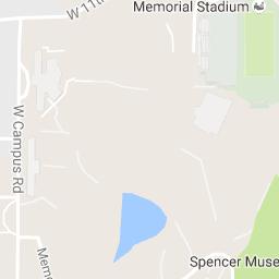
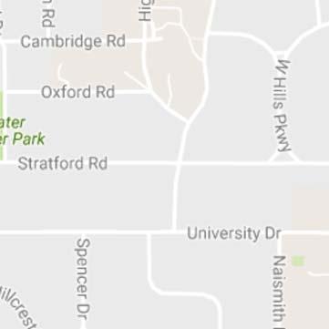


1 1 of 5 7/28/ :05 AM plotaroute.com - KU Campus - Sidewalk (4.947 km)
2 2 of 5 7/28/ :05 AM
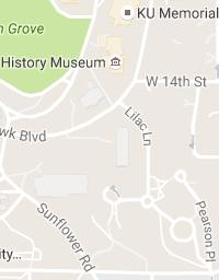
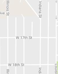
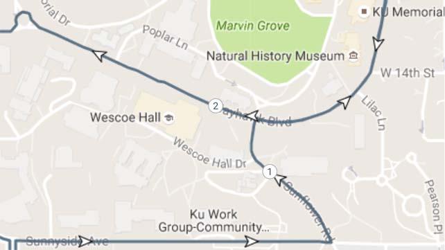
3 3 of 5 7/28/ :05 AM Start near Naismith Dr, Lawrence, KS 66045, USA Head north on Naismith Dr Head north on Naismith Dr Head north on Naismith Dr toward Sunnyside Ave Turn right onto Sunnyside Ave Head east on Sunnyside Ave Head east on Sunnyside Ave Head east on Sunnyside Ave toward Illinois St Head east on Sunnyside Ave toward Sunflower Rd Head east on Sunnyside Ave toward Sunflower Rd Turn left at the 1st cross street onto Sunflower Rd Head northwest on Sunflower Rd Head northwest on Sunflower Rd Head northwest on Sunflower Rd toward Wescoe Hall Dr Head northwest on Sunflower Rd toward Wescoe Hall Dr Head north on Sunflower Rd toward Jayhawk Blvd Head north on Sunflower Rd toward Jayhawk Blvd Turn right onto Jayhawk Blvd Head east on Jayhawk Blvd Head east on Jayhawk Blvd Head northeast on Jayhawk Blvd Head northeast on Jayhawk Blvd Head northeast on Jayhawk Blvd toward Lilac Ln Head northeast on Jayhawk Blvd toward W 14th St Head north on Jayhawk Blvd Head north on Jayhawk Blvd Head south on Jayhawk Blvd Head south on Jayhawk Blvd Head south on Jayhawk Blvd toward W 14th St Head southwest on Jayhawk Blvd toward Lilac Ln Head southwest on Jayhawk Blvd Head west on Jayhawk Blvd Head west on Jayhawk Blvd toward Sunflower Rd Head west on Jayhawk Blvd Head northwest on Jayhawk Blvd Head northwest on Jayhawk Blvd
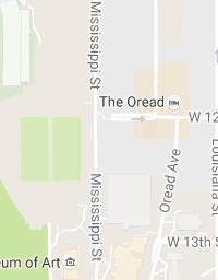
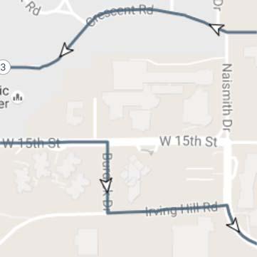
4 4 of 5 7/28/ :05 AM Head northwest on Jayhawk Blvd Head northwest on Jayhawk Blvd toward Poplar Ln Head northwest on Jayhawk Blvd Head northwest on Jayhawk Blvd Head west on Jayhawk Blvd Head northwest on Jayhawk Blvd At the traffic circle, take the 2nd exit onto Crescent Rd Head west on Crescent Rd toward Naismith Dr Head west on Crescent Rd toward Naismith Dr Head northwest on Crescent Rd toward Strong Ave Head west on Crescent Rd toward Strong Ave Head west on Crescent Rd toward Hillcrest Rd Head west on Crescent Rd toward Hillcrest Rd Head southwest on Crescent Rd toward Hillcrest Rd Head southwest on Crescent Rd toward Engel Rd Head southwest on Crescent Rd toward Engel Rd Head west on Crescent Rd toward Engel Rd Head west on Crescent Rd toward Engel Rd Head west on Crescent Rd toward Engel Rd Head west on Crescent Rd toward Engel Rd Head west on Crescent Rd toward Engel Rd Turn left onto Engel Rd Head south on Engel Rd Head south on Engel Rd toward W 15th St Head south on Engel Rd toward W 15th St Turn left onto W 15th St Head east on W 15th St Head east on W 15th St Head east on W 15th St Head east on W 15th St toward W Learned Hall Rd Head east on W 15th St toward Burdick Dr Turn right onto Burdick Dr Head south on Burdick Dr Head south on Burdick Dr toward Irving Hill Rd Head east on Irving Hill Rd Head east on Irving Hill Rd
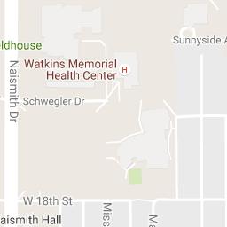
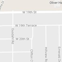
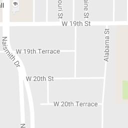
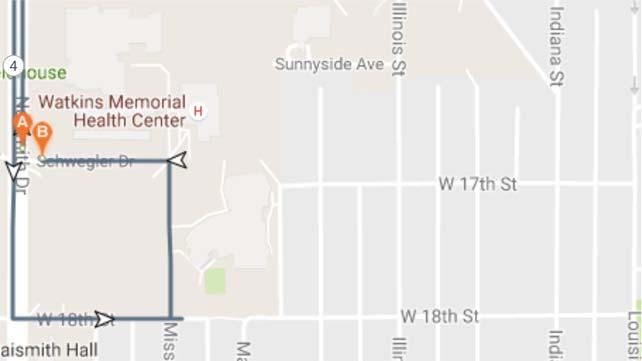
5 5 of 5 7/28/ :05 AM Head east on Irving Hill Rd Head east on Irving Hill Rd Head east on Irving Hill Rd toward Naismith Dr Turn right onto Naismith Dr Head southeast on Naismith Dr Head southeast on Naismith Dr Head southeast on Naismith Dr Head east on Naismith Dr Turn right to stay on Naismith Dr Head south on Naismith Dr Head south on Naismith Dr Head south on Naismith Dr toward Schwegler Dr Head south on Naismith Dr Head south on Naismith Dr Head south on Naismith Dr toward W 18th St Head south on Naismith Dr toward W 18th St Turn left onto W 18th St Head east on W 18th St toward Arkansas St Head east on W 18th St toward Missouri St Head east on W 18th St toward Missouri St Head west on W 18th St toward Missouri St Turn right at the 1st cross street at Missouri St Continue straight onto Watkins Center Dr Head north on Watkins Center Dr toward Schwegler Dr Head north on Watkins Center Dr toward Schwegler Dr Head west on Schwegler Dr Head west on Schwegler Dr Head west on Schwegler Dr toward Naismith Dr
ROUTE 30 Bob Billings & Kasold to KU SERVICE DESIGN
 ROUTE EVALUATION ROUTE 3 ROUTE 3 Bob Billings & Kasold to KU SERVICE DESIGN Route 3 is a route that operates between the Kansas Union and the intersection of 14 th Street and Apple Lane. The route travels
ROUTE 11 Downtown to KU to 31 st and Iowa SERVICE DESIGN
 ROUTE EVALUATION ROUTE 11 s ROUTE 11 Downtown to KU to 31 st and Iowa SERVICE DESIGN Route 11 is a route coordinated between Lawrence Transit and KU on Wheels that operates between the Downtown Transit
Elden Tefft's Walking Tour of Lawrence
 Elden Tefft's Walking Tour of Lawrence This work is licensed under a Creative Commons Attribution-NonCommercial- ShareAlike 4.0 International License. Craig Voorhees 2011 1 When Elden Tefft retired as
The University of Kansas KU Bike Plan Executive Summary and Recommendations LAWRENCE CAMPUS
 The University of Kansas KU Bike Plan Executive Summary and Recommendations LAWRENCE CAMPUS 1 KU BIKE PLAN 2016 EXECUTIVE SUMMARY Compact, sustainable, and good for your health, bicycles provide benefits
Topock, Oatman, Kingman. Bullhead- Nice day ride. Map data 2015 Google. Bullhead City, AZ. Take Bullhead Pkwy to AZ-95 S. 11 min (7.
 Bullhead City, AZ to Bullhead Area Chamber of Commerce Topock, Oatman, Kingman. Bullhead- Nice day ride Drive 125 miles, 2 h 51 min Map data 2015 Google 10 mi Bullhead City, AZ Take Bullhead Pkwy to AZ-95
Lawrence Safe Routes to School. Community Meeting January 14, 2015
 Lawrence Safe Routes to School Community Meeting January 14, 2015 Safe Routes to School The 6 E s Education Encouragement Enforcement Engineering Evaluation Equity What are the elements of a SRTS plan?
Famous Idaho Potato Marathon Course Changes
 Starting Line at Sandy Point State Park, heading out of the park, heading west on Sandy Point Rd, enter onto HWY 21 heading west. Course from the start is on the road, enter HWY 21 heading west, staying
2013 MPSSAA Cross Country State Championships Information Packet
 2013 MPSSAA Cross Country State Championships Information Packet Contents Last Minute Bulletin State Championship Team Map of Facility Course Map Team Bus Directions Team Bus Maps ORGANIZED 1946 TELEPHONE:
JAHNGSOO POOME-SAE SIXTH DEGREE BLACK BELT
 -19-97 :00 pm Translates as "Long life." NEW STRIKES: Slow reverse reinforced punch. [17, 4] Circular low upset palm heel strike. [22, 2, 0, 4] NE E SE NEW BLOCKS: Fist side high nine block. [8, ] Knifehand
PEDESTRIAN SAFETY ASSESSMENT SR 934/NORMANDY DRIVE AND 71 Street
 PEDESTRIAN SAFETY ASSESSMENT SR 934/NORMANDY DRIVE AND 71 Street PRESENTED BY MISLEIDYS LEON TRAFFIC SAFETY PROGRAM ENGINEER FLORIDA DEPARTMENT OF TRANSPORTATION (FDOT) BACKGROUND In response to citizen
JR. GENIUS EDUCATIONAL SERVICES INC.
 1 Name: 1. Multiple Choice: 25 marks Copy to Scantron Card after finding the answer on the sheet. Fill in the Scantron card in the last 5 min. of the test. Do Short section first. 1. You are riding your
Boxing the Compass, by Perri Lynch and David Stutz
 Boxing the Compass, by Perri Lynch and David Stutz "Boxing the Compass" is an asynchrous, non-deterministic, automaton to be performed in any circular space, by any number of people. The participants should
CLT Continued Aircraft Operations Evaluations
 CLT Continued Aircraft Operations Evaluations Airport Community Roundtable Presentation August 15, 2018 ACR Requests of the CLT Technical Consultant Continued review of open ACR motions Increase Base Leg
Meadow Woods Elementary School
 Drag and drop pic and stretch/crop to the limits of the blue rectangle (delete this text box) Meadow Woods Elementary School Drag and drop pic and stretch/crop to the limits of the blue rectangle (delete
DIRECTION TO NCCS ATHLETIC EVENTS Updated 9/2017
 DIRECTION TO NCCS ATHLETIC EVENTS Updated 9/2017 Berkeley South High School, 201 Brotherton Lane, Ferguson, MO 63135. Make left onto Dunn Rd., from NCCS. Right onto New Florissant Rd., Right onto Brotherton
No step, left vertical punch to southeast middle section.. No step, simultaneous left knifehand high block, right upset knifehand strike to ea
 10--99 Translates as Crest of Granite Mountain. Interpretation is You will live comfortably and in peace. NEW STANCES: Long stance. [11, ] Knee stance. [5, 8] NEW BLOCKS: High-low palm heel block. [] "C"
Walkability Study Prepared by
 Walkability Study Prepared by Joanna Figart Byron Greiner Dale Jones Sally Kammann Rick Shearin Vicki Blanche-Young Byron Greiner Introductory Notes Urgent/Dangerous Important, Not Urgent Not Urgent In
Driving Direction to the Christine Center W8303 Mann Road, Willard, WI (715) or
 or") Please note: The Christine Center is in an area blessed with abundant wildlife. When traveling, use caution, most especially at dawn and dusk. Slow down, actively watch for deer, wild turkeys and other
Please note: The Christine Center is in an area blessed with abundant wildlife. When traveling, use caution, most especially at dawn and dusk. Slow down, actively watch for deer, wild turkeys and other
100% All Bike DC Loop Ride!
 100% All Bike DC Loop Ride! Ride Leader: Chris Roell Cell Number: 202-607-5565 Ride Social Media Hashtags: #bikedcloop #dcloop #bikedc #exploredc #washingtondc #thedistrict #dc #4thofjulybikeride #4thofjuly
Kettering Middle School [KMS] - Court 1 & 2 AND INDIAN RIFFLE ELEM
![Kettering Middle School [KMS] - Court 1 & 2 AND INDIAN RIFFLE ELEM](/thumbs/95/126121575.jpg "Kettering Middle School [KMS] - Court 1 & 2 AND INDIAN RIFFLE ELEM") Kettering Middle School [KMS] - Court 1 & 2 AND INDIAN RIFFLE ELEM From the North/South: Take I-675 north/south to exit #10 Indian Ripple Road. At the end of the exit ramp go west (turn left). Go to Stroop
Kettering Middle School [KMS] - Court 1 & 2 AND INDIAN RIFFLE ELEM From the North/South: Take I-675 north/south to exit #10 Indian Ripple Road. At the end of the exit ramp go west (turn left). Go to Stroop
1 of :57
 1 of 8 20-4-2012 10:57 Directions to Johannesburg, South Africa 2,080 km about 1 day 6 hours Loading... 2012 Google - Map data 2012 AfriGIS (Pty) Ltd, Google, Tele Atlas - 2 of 8 20-4-2012 10:57 Johannesburg,
STAGE #3 TRANSITION 1 at Camp Keystone
 STAGE #3 SWIM STAGE #3 TRANSITION 1 at Camp Keystone Mount bike AFTER bump T1 Changing Tent STAGE #3 Camp Keystone to Marineland 68 MILE BIKE STAGE #3 68 MILE BIKE Mile 0-10 SAG 0.0 Turn RIGHT out of T1.
Formula Ford Championship
 Formula Ford Championship Ford (FF), Club Ford (CF) and Post Club Ford (PCF) Sponsored by SVRA The Formula Ford Championship is designed to celebrate the history of these great affordable open wheel cars.
We look forward to hosting you and your team this season!
 Enclosed please find the Visiting Spirit Group Questionnaire to be completed and returned at your earliest convenience for your visit to Darrell K Royal-Texas Memorial Stadium. Once your questionnaire
SAFE ROUTES TO SCHOOL
 SAFE ROUTES TO SCHOOL Edgewood Elementary School Existing Conditions and ACTION PLAN > Oak Creek - Franklin Joint School District Table of Contents CONTEXT Enrollment Boundaries Enrollment
Fox Hollow Lane. Big Hollow Rd. Bellefonte Central Rail Trail. IST Bridge. Golf Course Path. Blue Course Path. Bristol Rd Path
 23 Mile Ride Map. Ride starts at 12:30 and is guided. Colonade Blvd Lane Marjorie Mae Bike Path/St to Vario Blvd Path to Aaron Dr to Curtain St.to Clinton Ave to McKee Path Orchard Road Bike Lane Spring
FW: 3/5 Agend Item 7 - Schwegler Neigborhood Association Response to Staff Report
 Amanda Sahin From: Sent: To: Subject: David Cronin Monday, March 05, 2018 8:06 AM Amanda Sahin FW: 3/5 Agend Item 7 - Schwegler Neigborhood Association Response to Staff Report David P. Cronin, P.E., City
Movement Chart for Bassai Dai Page 1 of 7
 Movement Chart for Bassai Dai Page 1 of 7 Kata available on video and DVD from your sensei. tart 1 Ichi 2 i tart in parallel stance facing north. Move your left leg in towards your right and bring your
SAN FRANCISCO MUNICIPAL TRANSPORTATION AGENCY Order # 5068 FOR PUBLIC HEARING
 The Sustainable Streets Division of the San Francisco Municipal Transportation Agency will hold a public hearing on Friday, March 8, 2013, at 10:00 AM, in Room 416 (Hearing Room 4), City Hall, 1 Dr. Carlton
COURSE MAP
 CHICAGO 2012 URBANATHLON COURSE MAP 1. Plastic Barricades and Police Barricade Combo 2. Cargo Net and Traffic Cones with Poles Combo 3. Police Barricades and Tire Stutter Step Combo 4. Subaru Crawl, Marine
Tommy Briggs Cougar Stadium
 Tommy Briggs Cougar Stadium General Guidelines/Info. 2018-19 The Colony High School 4301 Blair Oaks Dr. The Colony,TX 75056 469-713-5178 The City of The Colony has had some recent construction in the area
Safe Routes to School
 Safe Routes to School Kansas Department of Transportation Safe Routes to School Program Grant Application For City of Lawrence July 1, 2014 Table of Contents INTRODUCTION... 3 CURRENT CONDITIONS... 3 SITE
An Atlas of Oceanic Internal Solitary Waves (February 2004) by Global Ocean Associates Prepared for Office of Naval Research Code 322 PO
 by Global Ocean Associates Prepared for Office of Naval Research Code 322 PO") Overview The is located in the western Pacific Ocean north of the Indonesian Island of Celebes and south of the Sulu Sea and the Philippines (Figure 1). It is a deep-water sea, roughly circular with several
Overview The is located in the western Pacific Ocean north of the Indonesian Island of Celebes and south of the Sulu Sea and the Philippines (Figure 1). It is a deep-water sea, roughly circular with several
Overview. Updated pictures of the intersection are shown in Exhibits 1 thru 4, and the aerial photo provided by Google Maps is shown in Exhibit 5.
 Overview The (here in after referred to as the Village ) is submitting the follow up interim RLRC Safety Report for the intersection of Lincoln Highway (US 30) at Orchard Drive. Additional reports, as
THE BLOCK MUSEUM IS OPEN DURING CONSTRUCTION!
 THE BLOCK MUSEUM IS OPEN DURING CONSTRUCTION! DRIVING DIRECTIONS From the south: Arts Circle Drive is closed due to a construction project on Northwestern s south campus. The following information tells
Chapter STOP AND YIELD INTERSECTIONS AND RAILROADS
 Chapter 10-09 STOP AND YIELD INTERSECTIONS AND RAILROADS Sections: 10-09-01 THROUGH STREETS DESIGNATED 10-09-02 REPEALED 10-09-03 REPEALED 10-09-04 STOP SIGNS 10-09-05 YIELD SIGNS: 10-09-06 EMERGING AND
SAFE ROUTES TO SCHOOL
 SAFE ROUTES TO SCHOOL Forest Ridge Elementary School Existing Conditions and ACTION PLAN > Oak Creek - Franklin Joint School District Table of Contents CONTEXT Enrollment Boundaries
EXHIBIT B-1 PROJECT DESCRIPTION. Phase 1 of the Preferred Alternative
 EXHIBIT B-1 PROJECT DESCRIPTION Phase 1 of the Preferred Alternative The Transform 66 Public-Private Partnership (P3) Project (the Project ) means the Phase 1 of the Preferred Alternative components of
Single Family Multi-Map Summary
 Single Family Multi-Map Summary 3201 43rd Ave NE, Seattle MLS #: 1313441 1 Price: $11,750,000 Fin SF: 8,562 2 Baths: 6 3661 Hunts Point Road, Hunts Point MLS #: 1310174 3 Price: $16,800,000 Fin SF: 6,570
Wisconsin 511 Traveler Information Annual Usage Summary January 3, Wisconsin 511 Phone Usage ( )
") Wisconsin 511 Traveler Information 211 Annual Usage Summary January 3, 212 Overall to-date Summary 36 months of operation 1,16,63 total calls the 1 Million mark was passed on December 3, 212 3,627,527
Wisconsin 511 Traveler Information 211 Annual Usage Summary January 3, 212 Overall to-date Summary 36 months of operation 1,16,63 total calls the 1 Million mark was passed on December 3, 212 3,627,527
I-35 COMAL COUNTY OPERATIONAL IMPROVEMENTS
 I- COMAL COUNTY OPERATIONAL IMPROVEMENTS OPEN HOUSE The environmental review, consultation, and other actions required by applicable Federal environmental laws for this project are being, or have been,
5. MODIFICATIONS AT JEANNE D ARC BOULEVARD/REGIONAL ROAD 174 INTERCHANGE INTERSECTION - PUBLIC HEARING COMMITTEE RECOMMENDATION
 5. MODIFICATIONS AT JEANNE D ARC BOULEVARD/REGIONAL ROAD 174 INTERCHANGE INTERSECTION - PUBLIC HEARING COMMITTEE RECOMMENDATION Having held a public hearing, that Council approve the preliminary designs
Forest Hills Improvement Initiative
 Forest Hills Improvement Initiative Transportation Action Plan Short Term Recommendations ONLY Final Draft as of April 30, 2008 For Community Review and Feedback Prepared for: The City of Boston Boston
HAPPY HALLOWEEN. The St. Charles Park District is proud to present the 13 th Annual 2011 BEST IN ST. CHARLES Gallery of Ghoulish Home Tour
 HAPPY HALLOWEEN The St. Charles Park District is proud to present the 13 th Annual 2011 BEST IN ST. CHARLES Gallery of Ghoulish Home Tour This free tour guide will provide the information you need to drive
Geography Week Which continent is your state closest to: Asia, South America, or Europe?
 Geography Week 24 1. Which continent is your state closest to: Asia, South America, or Europe? 2. Which state would have the coolest weather: Montana, Georgia, or Oklahoma? 3. What are the only two continents
Street resurfacing 45WARD
 45 WARD Street Resurfacing Resurfacing is necessary to address streets that have deteriorated, are safety hazards and are generally in poor condition. Residents, businesses and visitors to the 45th Ward
FY 2017 FY 2021 PRIORITY PROJECT LIST ADOPTION. June 26, 2015
 FY 2017 FY 2021 PRIORITY PROJECT LIST ADOPTION June 26, 2015 s (PPLs) RMP Roadways PPL RMP Bicycle and Pedestrian PPL RMP Strategic Intermodal System (SIS) PPL Transportation Systems Management (TSM) PPL
Traffic Impact Memorandum. May 22, 2018
 BISHOP PROFESSIONAL DEVELOPMENT BUILDING Proposed Land-use Change & Parking Modification 3601 SW 31st Street Topeka, Kansas 66614 CFS Project No. 185077 Traffic Impact Memorandum May 22, 2018 Prepared
Directions to Competition Venues:
 Directions to Competition Venues: VILLANOVA UNIVERSITY LDR/W, Powerlifting, Soccer (Individual Skills, 7v7, 11v11), Volleyball 800 Lancaster Avenue, Villanova, PA, 19085 From the West Take the Pennsylvania
NOTICES OF SHERIFF'S SALE
 Updated: 01/11/19 at 1:18 AM NOTICES OF SHERIFF'S SALE Date & Time of Sale: Wed, Dec 12, 2018 at 1:00 pm Sheriff Sale File number: 14-18-0025-SS Judgment to be Satisfied: $38,582.48 Cause Number: 14C01-1712-MF-000589
Typical Cross Section: DOWNTOWN (Observer Highway - 8th Street)
") Typical Cross Section: DOWNTOWN (Observer Highway - 8th Street) DRAFT SEPTEMBER 23, 14 1 Washington Street Typical Block Downtown Typical Block: DOWNTOWN (Observer Highway - 8th Street) New crosswalks
Typical Cross Section: DOWNTOWN (Observer Highway - 8th Street) DRAFT SEPTEMBER 23, 14 1 Washington Street Typical Block Downtown Typical Block: DOWNTOWN (Observer Highway - 8th Street) New crosswalks
Quiet Zones: Silencing Train Horns at Railroad Crossings
 Quiet Zones: Silencing Train Horns at Railroad Crossings Council Transportation and Environment Committee Prepared by Public Works and Transportation Transportation Programs - Planning January 12, 2009
Start times: Event Details: Course Updates:
 Hello! Thank you for registering for the upcoming Vallejo Waterfront Weekend Bridge to Bridge Endurance Events. This packet is to help you get ready for this weekend and update everyone on a few things.
Parking & Transportation Update Spring Parking
 Parking & Transportation Update Spring 2018 As the beginning of the Spring 2018 semester rapidly approaches, Mason students, faculty and staff are reminded that traffic on and around the Fairfax campus
Scoping and Design Considerations for APS and ADA Curb Ramps. Adam Tyra, PE INDOT Greenfield District Traffic
 Scoping and Design Considerations for APS and ADA Curb Ramps Adam Tyra, PE INDOT Greenfield District Traffic Background and Perspective Scoping and Asset Management for traffic signals for INDOT s Greenfield
2015 Summer Kickoff June 12-14, 2015
 8 th Grade Boys Pool A W L Pool B W L Pool C W L 1. KS- Wichita Magic 1 III 5. AR- WCA Jaguars 2 II I 9. KS- NLHA Orange 2 II I 2. CO- Hornets 4 III 6. NE- Mid Nebraska 4 III 10. CO- Boykins BB 1 III 3.
Welcome and Purpose of Meeting
 Welcome and Purpose of Meeting Waterfront Trail Connection Lake Shore Cycling Improvements There is a gap in the Waterfront trail along Lake Shore Blvd West between Norris and First St We are looking at
Napa Hot Air Balloon Adventure
 Napa Hot Air Balloon Adventure * August 24 Lunch at The Grill at Silverado Golf Course * August 24-1 night stay at Napa River Inn * August 24 - Celadon's Restaurant - Napa River Mill Complex * August 25
BOARD OF REGENTS BRIEFING PAPER. 1. Agenda Item Title: Tropicana Ave. Improvements Right of Way
 BOARD OF REGENTS BRIEFING PAPER 1. Agenda Item Title: Tropicana Ave. Improvements Right of Way 2. BACKGROUND & POLICY CONTEXT OF ISSUE: The UNLV Master Plan approved by the Regents in March 2004 called
James Williams Middle School 915 Acacia Lane
 James Williams Middle School 915 Acacia Lane Grades Served: 6 th -8 th Student Geography According to an address analysis of students, 36.7% of students attending JWMS live within 2 miles of school (see
NORAM CUP RACE SERIES
 NORAM CUP RACE SERIES Friday, 7 December Saturday, 8 December 2007 at West Yellowstone Biathlon Range West Yellowstone, Montana, USA Hosted by: Montana National Guard, WYSEF and the National Guard Sports
2015 Summer Kickoff June 12-14, 2015
 6 th Grade Boys Pool A W L Pool B W L Pool C W L 1. MO- KC Premiere 4 III 5. OK- Southern OK Warriors 4 III 9. KS- Oz Elite 1 III 2. KS - Wichita Wizards 2 II I 6. KS- River City Thunder 3 I II 10. TX-
Col. Marvin J. Harris Communications Award Contest
 Col. Marvin J. Harris Communications Award Contest MOAA councils and chapters competed in the 2016 Col. Marvin J. Harris Communications Award Contest in two categories of competition: print and e-newsletters
HRC EVENTS. Club Date of Event Type of Event Report Received. January 2014: Carolina Boykin HRC January 4 & 5, 2014 Upland 1/20/2014
 HRC EVENTS Club Date of Event Type of Event Report Received January 2014: Carolina Boykin HRC January 4 & 5, 2014 Upland 1/20/2014 February 2014: Essex HRC February 1, 2014 Upland CANCELLED Fox River Valley
Summary: Mercer County Princeton Avenue & Spruce Street Study January 2009
 Summary: Several recent studies have assessed potential development and redevelopment opportunities in the Mercer Crossing area of Trenton, Ewing, and Lawrence. This Princeton Avenue and Spruce Street
VISITORS INFORMATION GUIDE
 WEIGHT ROOM POLICIES GEORGIA GWINNETT GRIZZLIES 2013-2014 VISITORS INFORMATION GUIDE GRIZZLY ATHLETICS OFFICE OF ATHLETICS STAFF DIRECTORY ADMINISTRATION Director of Athletics Dr. Darin S. Wilson (678)
Orange Center Elementary School
 Drag and drop pic and stretch/crop to the limits of the blue rectangle (delete this text box) Orange Center Elementary School Drag and drop pic and stretch/crop to the limits of the blue rectangle (delete
University Avenue & Farley Avenue/University Bay Drive Area Scenario Base Conditions Multiple concerns
 ped at signalized East of U-Bay North of Campus on Farley Ave./ U-Bay & Westbound Campus North of on Farley Ave./ U-Bay Near VA on MB1: Dual Eastbound Left-Turn Lanes Generally compatible with BRT and
A partnership of Christchurch City Council, New Zealand Transport Agency and Environment Canterbury Keeping Christchurch Moving
 A partnership of Christchurch City Council, New Zealand Transport Agency and Environment Canterbury Keeping Christchurch Moving DRAFT: Transport Efficiency and Impact Guide April 2018 GUIDELINE DEVELOPMENT
TB Screening Locations Chicago
 TB Screening Locations Chicago This information was last updated October 2017. Please call the location of your choice to verify the information is correct. Thank you. Far North Side Northwest Side North
Consider rescinding the 35 MPH SPEED LIMIT on 4 th Street between McDonald Drive & Michigan Street.
 AGENDA TSC 3/1/10 ITEM NO. 2: Consider rescinding the 35 MPH SPEED LIMIT on 4 th Street between McDonald Drive & Michigan Street. Facts: 1. At the April 6, 2009 Traffic Safety Commission meeting, the Commission
TRAFFIC MANAGEMENT PLAN
 292 84 140440 TRAFFIC MANAGEMENT PLAN The purpose of the Traffic Management Plan (TMP) is to have established procedures for traffic flow and circulation around the elementary school related to student
Activity Report Printed on October 24, 2016
 Activity Report Printed on October 24, 2016 Parking Complaint 10/22/16 23:56 CR201607662 TULANE ST / W JACKSON BLVD, SPEARFISH, SD 57783 Trespassing 10/22/16 22:57 CR201607661 645 N MAIN ST, SPEARFISH,
MONTGOMERY METROPOLITAN PLANNING ORGANIZATION (MPO) BICYCLE AND PEDESTRIAN PLAN
 BICYCLE AND PEDESTRIAN PLAN") MONTGOMERY METROPOLITAN PLANNING ORGANIZATION (MPO) BICYCLE AND PEDESTRIAN PLAN May 22, 2012 TIMELINE May 1 May 15: Bicycle and Pedestrian Subcommittee Review of Draft Bicycle and Pedestrian Plan May 24:
MONTGOMERY METROPOLITAN PLANNING ORGANIZATION (MPO) BICYCLE AND PEDESTRIAN PLAN May 22, 2012 TIMELINE May 1 May 15: Bicycle and Pedestrian Subcommittee Review of Draft Bicycle and Pedestrian Plan May 24:
Air Capital Corvette Club
 Wichita, Kansas Calendar January Wichita Kansas 1 2 3 4 New Years Day 5 6 7 8 9 10 11 12 13 14 15 16 17 18 19 20 21 22 23 24 25 Starbird-Devlin Rod & Customs Charities Car Show, Wichita, Kansas. 26 27
APPENDIX D COST SUMMARY TABLES
 APPENDIX D COST SUMMARY TABLES Section 1 Between Route 50 and Evergreen Mills Road 3850 linear feet of one 12 foot wide additional lane in southbound direction of Rte 606; from north side of Rte 50 to
Hidden Oaks Elementary School
 Hidden Oaks Elementary School SCHOOL ROUTE PLAN For HIDDEN OAKS ELEMENTARY SCHOOL LOCATION 13 ORANGE COUNTY Prepared for: ORANGE COUNTY SCHOOL ASSESSMENT PROGRAM ORANGE COUNTY PUBLIC WORKS Traffic Engineering
Copyright 2014 Gleim Publications, Inc. and/or Gleim Internet, Inc. All rights reserved. Duplication prohibited.
 Page 1 of 6 Page 2 of 6 STUDY UNIT 2 UPDATE QUESTION Subunit 2.3: Airspeed Indicators 16. caution (PHAK Chap 7) DISCUSSION: 17. speed (PHAK Chap 7) DISCUSSION: 18. flap (PHAK Chap 7) DISCUSSION: 21. maximum
From: Jamie Shew Sent: Monday, January 25, :05 PM To: Subject: Inverness Project
 From: Jamie Shew [mailto:jamieshew@gmail.com] Sent: Monday, January 25, 2016 1:05 PM To: denney1@sunflower.com Subject: Inverness Project Jim, I hope the visit the other day was useful, I was not aware
TB Screening Locations Chicago
 TB Screening Locations Chicago This information was last updated February 2017. Please call the location of your choice to verify the information is correct. Thank you. Far North Side Evanston-Rogers Park:
BEAR CREEK PARK AND RIDE
 BEAR CREEK PARK AND RIDE 7760 178th Pl NE, Redmond, WA 98052 700 Average weekday transit boardings 283 Parking spaces Owned by King County Metro Served by Sound Transit and King County Metro Bear Creek
Action Recommendation: Budget Impact:
 City of Fayetteville Staff Review Form Submitted By 2018 0473 Legistar File ID 9/18/2018 City Council Meeting Date Agenda Item Only N/A for Non Agenda Item Matt Mihalevich 8/28/2018 DEVELOPMENT SERVICES
Existing LBJ Traffic Conditions and Motorist Travel Characteristics
 JOSEY LN WEBBS CHAPEL RD MARSH LN TOLLWAY Existing LBJ Traffic Conditions and Motorist Travel Characteristics This Chapter summarizes data collected pertaining to existing traffic counts and travel characteristics
Results of Borehole Vibration Propagation Tests for Westside Subway Extension June 21, 2011 Page 39
 Page 39 3.7 Site G-165 3.7.1 Site Description This site was on-campus at Beverly Hills High School and was the only test site where the borehole location permitted meaningful indoor measurements. Testing
Draft North Industrial Area-Wide Traffic Plan
 Summary of North Industrial and Hudson Bay Industrial Recommended Improvements Table 1. Summary of s Item Location 1 2 3 4 5 6 7 8 9 10 11 12 Millar Ave north of 51st St Super 8 Motel back lane 400 Block
NOTICE OF PROPOSED REGULATION AMENDMENT
 Date: July 21, 2017 NOTICE OF PROPOSED REGULATION AMENDMENT REGULATION TITLE: REGULATION NO.: Use of University Facilities by the Campus Community; Campus UCF-4.0293 Demonstrations and Other Outdoor Events;
NOTICES OF SHERIFF'S SALE
 Updated: 03/27/18 at 1:36 AM NOTICES OF SHERIFF'S SALE Date & Time of Sale: Thu, Jan 25, 2018 at 1:00 pm Sheriff Sale File number: 65-18-0001-SS Judgment to be Satisfied: $87,311.82 Cause Number: 65D01-1705-MF-000163
TC City Owned Property SF-8.4. Keller Assisted Living Facility - Site Plan Bear Creek Parkway. Aerial dated: March, 2010 PRESCOTT ST FOWLER ST
 DALTON ST COUNTRY BROOK DR VERSAILLES LN 4 8 16 14 104 100 131 13 104 108 11 116 104 108 116 135 139 11 147 151 155 100 104 108 11 116 14 101 105 109 113 180 14 FOWLER ST PRESCOTT ST 100 101 104 105 108
SAN FRANCISCO MUNICIPAL TRANSPORTATION AGENCY Order # 5194 FOR PUBLIC HEARING
 The Sustainable Streets Division of the San Francisco Municipal Transportation Agency will hold a public hearing on Friday, December 6, 2013, at 10:00 AM, in Room 416 (Hearing Room 4), City Hall, 1 Dr.
Doug s Corner. Contractor s Weekly Update. In this issue: NORTHWEST EXTENSION-19TH AVENUE-BETHANY HOME TO DUNLAP SSWJV SAFETY QUALITY COURTEOUS
 Contractor s Weekly Update NORTHWEST EXTENSION-19TH AVENUE-BETHANY HOME TO DUNLAP April 21, 2014 Volume 2, Issue 65 Doug s Corner SSWJV SAFETY QUALITY COURTEOUS RESPONSIVE DEPENDABLE In this issue: Doug
Memorial Day Ride - Lincoln's DC Civil War Forts!
 Memorial Day Ride - Lincoln's DC Civil War Forts! Ride Leader: Chris Roell Mobile Phone: 202-607-5565 Ride Social Media Hashtags: #dccivilwarforts #lincolnsforts #bspacerides #bikedc #nps #findyourpark
Corydon-Osborne Neighbourhood Plan Recommendations
 Corydon-Osborne Neighbourhood Plan Recommendations November 12, 2013 Plan Boundaries The current boundaries of Stafford Street to the west and Donald Street to the east ignore two key cycling routes; Harrow
Twirler Day Coordinated by Ashley Moss VISIT BANDS.UARK.EDU FOR REGISTRATION MATERIALS UNIVERSITY OF ARKANSAS TWIRLER INSTRUCTOR
 Twirler Day 2016 ARKANSAS VS. TEXAS STATE SEPTEMBER 17, 2016 Coordinated by Ashley Moss UNIVERSITY OF ARKANSAS TWIRLER INSTRUCTOR VISIT BANDS.UARK.EDU FOR REGISTRATION MATERIALS REGISTRATION DUE BY AUGUST
***Caution***Crossing over Hwy 96 Cross traffic at 65mph Look both ways,cross over, pull ahead and wait
 Hurts Donut Co 301 Park Central W, Springfield, MO 65806 Mileage 1. Start out going west on Park Central W toward N Campbell Ave. 0.05 2. Park Central W becomes W College St. At 1.7mi Watch for Shamrock
Bicycling Perceptions and Experiences in Oregon and Southwest Washington. Presented By: The Inavero Institute September 8, 2009
 Bicycling Perceptions and Experiences in Oregon and Southwest Washington Presented By: The Inavero Institute September 8, 2009 404 NW 10th Ave Suite 201 Portland, OR 97209 P 800.921.2640 www.inavero.com
To Ames Middle School from Fort Dodge: 3915 Mortensen Road Ames, Iowa 50514
 To Ames Middle School from Fort Dodge: 3915 Mortensen Road Ames, Iowa 50514 Taking Hwy. 35 heading south, take the exit 111B, US 30 towards Ames. Take the South Dakota Avenue exit, Exit 144, toward Kelley.
What are the transportation needs in the
 University of Illinois Campus Area Transportation Study Executive Summary A. BACKGROUND What are the transportation needs in the University of Illinois campus area? How should travel be accommodated among
OKEECHOBEE CLOSURE: WHAT YOU NEED TO KNOW
 OKEECHOBEE CLOSURE: WHAT YOU NEED TO KNOW All Aboard Florida will close Okeechobee Boulevard in both directions at the FEC (Quadrille Blvd) RR tracks from Friday, May 13th at 8:00pm until Tuesday, May
Doug s Corner. Contractor s Weekly Update. In this issue: NORTHWEST EXTENSION-19TH AVENUE-BETHANY HOME TO DUNLAP SSWJV. Page 1-2.
 Contractor s Weekly Update NORTHWEST EXTENSION-19TH AVENUE-BETHANY HOME TO DUNLAP May 27th 2013 Volume 2, Issue 18 Doug s Corner SSWJV SAFETY QUALITY COURTEOUS RESPONSIVE DEPENDABLE In this issue: Page
Ridership Data - User s Manual
 Ridership Data - User s Manual Background: In the summer of 2006, the San Francisco Municipal Transportation Agency (SFMTA) installed Automatic Passenger Counter (APC) devices on approximately 10 percent