Countermeasure Strategies for Pedestrian Safety. Road Diets. Matthew Ridgway Fehr and Peers. October 6, 2015
|
|
|
- Edward Gibson
- 5 years ago
- Views:
Transcription

1 Countermeasure Strategies for Pedestrian Safety Road Diets Matthew Ridgway Fehr and Peers October 6, 2015
2 Today s Presentation Introduction and housekeeping Audio issues? Dial into the phone line instead of using mic & speakers PBIC Trainings and Webinars Registration and Archives at pedbikeinfo.org/webinars PBIC News and updates on Facebook Questions at the end
3 Countermeasure Strategies for Pedestrian Safety Webinar Series Upcoming Webinars Marked Crosswalks Thursday, October 15 (1:00 2:30 PM Eastern Time) Curb Extensions Tuesday, October 27 (1:00 2:30 PM Eastern Time) Rectangular Rapid Flashing Beacons Thursday, November 5 (1:00 2:30 PM Eastern Time) To view the full series and register for the webinars, visit

4 ROAD DIET / LANE REDUCTION DPS 201
5 WHY
6 WHY
7 WHY

8 PEDESTRIAN BENEFITS Components of road diet projects associated with increased pedestrian safety: Decreases number of vehicle lanes to cross Reduces the multiple-threat situation Provides room for a pedestrian crossing island Improves speed limit compliance and decrease crash severity Creates a buffer between pedestrians and vehicular traffic through addition of onstreet bike lanes or on-street parking.
9 S a n Fr a n c i s c o, CA CASE STUDY: ROAD DIET (SAN FRANCISCO, CA) Why a Road Diet? Community recognized need to accommodate other road users Large number of pedestrian attractors led to conflicts Bicycle community wanted dedicated bicycle lanes

10 CASE STUDY: ROAD DIET (SAN FRANCISCO, CA) S a n Fr a n c i s c o, CA Problem/Background Valencia Street part of San Francisco s Mission District 1.8 miles long 4-lane road with 22,000 ADT High pedestrian, bicycle, bus activity but lacked supporting infrastructure Before Total width = 62 6


11 CASE STUDY: ROAD DIET (SAN FRANCISCO, CA) S a n Fr a n c i s c o, CA Details In 1999, 4 lanes restriped to 2 lanes + bicycle lanes and center turn-lane Trial basis Speed limit lowered from 30 to 25 mph Signal timing altered to minimize loss of capacity Made permanent after year trial Initial cost: $130,000 Paint and sign work, & labor spent writing an impact report Before After


12 CASE STUDY: ROAD DIET (SAN FRANCISCO, CA) S a n Fr a n c i s c o, CA Results Success No real change in ADT Large increase in cycling & pedestrian activity Reduction in collisions Aided revitalization of area Four years after, a survey of business owners along Valencia Street found general support* 65% felt bicycle lanes had positive impact on their business, only 4% said it had negative impact 65% would support more traffic calming *Source: Emily Drennen, Economic Effects of Traffic Calming on Urban Small Business


13 CASE STUDY: ROAD DIET (SAN FRANCISCO, CA) S a n Fr a n c i s c o, CA Results City implemented more changes in 2010: sidewalks and bikelanes widened bulb outs, streets trees, lighting, and public art added Became place to try new treatments such as bicycle green wave and bicycle bays Sign indicating the street is set for green wave speeds Sign illustrating a bicycle bay
14 ROAD DIET / LANE REDUCTION: SAFETY Narrowing the roadway cross section from four lanes to three lanes (two through lanes with center turn lane) has been associated with a 29% decrease in all crashes. Research Harkey, D., Srinivasan, R., Baek, J., Council, F. M., Eccles, K., Lefler, N.,... & Bonneson, J. A. (2008). Crash Reduction Factors for Traffic Engineering and ITS Improvements. Final Report National Cooperative Highway Research Program (NCHRP) Project,
15 ROAD DIET / LANE REDUCTION: SAFETY Converting roadway cross-section from four lanes to three lanes (two through lanes with center turn lane) has been associated with a 37% decrease in all crashes. Urban areas Research Gates, T. J., Noyce, D. A., Talada, V., and Hill, L., "The Safety and Operational Effects of "Road Diet" Conversion in Minnesota." 2007 TRB 86th Annual Meeting: Compendium of Papers CD -ROM, Vol. TRB# , Washington, D.C., (2007)
 has been associated with a 53% decrease in all crashes.")

16 ROAD DIET / LANE REDUCTION: SAFETY Converting roadway cross-section from four lanes to three lanes (two through lanes with center turn lane) has been associated with a 53% decrease in all crashes. Suburban roadways Research Persaud, B., Lana, B., Lyon, C., and Bhim, R. "Comparison of empirical Bayes and full Bayes approaches for before after road safety evaluations." Accident Analysis & Prevention, Vol. 42, Issue 1, pp (2010)
17 COLLISION REDUCTIONS FROM SEATTLE ROAD DIETS
18 WHEN The roadway has a moderately high density of driveways and other uncontrolled access Crash severities are high Speeding contributes to safety problems Pedestrians and others crossing/accessing the main corridor are affected by the higher exposure of crossing Multiple lanes exist on each approach No center turn lane exists Frequent crash types exist that are most amenable to reduction through a road diet (opposing left-turn, sideswipe, pedestrian, rear-end) Complete streets policy direction with focus on active transportation comfort
19 ROAD DIET IMPLEMENTATION CONSIDERATIONS
20 CITY OF SEATTLE
21 RESEARCH Road Diet Conversions: A Synthesis of Safety Research May 2013 Libby Thomas, Senior Associate, UNC HSRC FHWA DTFH61-11-H Each potential road diet should be vetted on a case by case basis. Case study and modeling results suggest Caution warranted when volumes approach 1,700 vehicles in the peak hour or range of 20,000 to 24,000 ADT (HSIS, 2010; Knapp and Giese, 2001; Welch, 1999).

22 GUIDELINES
23 ROAD DIET HANDBOOK: SETTING TRENDS FOR LIVABLE STREETS Jennifer A. Rosales, P.E. A comprehensive guide for planners, engineers, & designers to help make decisions on applicability of road diets. Contains information on: Planning Analysis Design Implementation Results of previous research Significant gaps in the field Analyses of safety and traffic operations Livability considerations Case study evaluations Lessons learned from experience Guidelines for identifying & evaluating potential road diet sites & typical crosssections Overall guidelines for implementation.

24 KENTUCKY TRANSPORTATION CENTER GUIDELINES FOR ROAD DIET CONVERSIONS Looks at operational and safety aspects to assist in preliminary determination whether a road diet is appropriate Cross-section designs Transition to and from the road diet section Flow chart for determining appropriate action Identified gap in Rosales Road Diet guidelines Did not provide specific guidance regarding volumes or left-turn percentages indicating when such a project could result in improved operational and safety conditions


25 KENTUCKY TRANSPORTATION CENTER GUIDELINES FOR ROAD DIET CONVERSIONS Typically, road diet conversions will operate at acceptable levels as long as the signalized intersections do not present any operational problems (Welch 1999)
26 KENTUCKY TRANSPORTATION CENTER GUIDELINES FOR ROAD DIET CONVERSIONS DELAY COMPARISON 3-4 LANES WITH SIDE STREET VPH
27 KENTUCKY TRANSPORTATION CENTER GUIDELINES FOR ROAD DIET CONVERSIONS MAIN STREET SIDE STREET SIGNALIZED INTERSECTION GUIDELINES
28 KENTUCKY TRANSPORTATION CENTER GUIDELINES FOR ROAD DIET CONVERSIONS QUEUE DIFFERENCE 3-4 LANES WITH SIDE STREET VPH
29 ROAD DIET CANDIDATE GUIDELINES ADT (Road Diet Candidate) 20,000 or less 1 23,000 or less 2 Peak hourly volume (Road Diet Candidate) 1,700 or less 1 1, or less depending on 2 : Percentage of left turns at intersection VPH on side street Case with higher ADT Lake Washington Blvd. Kirkland, WA 3 Initial volume of 23,000 vehicles per day Increased nearly 26,000 after conversion During one period about 30,000 vehicles per day 1. Rosales 2. Kentucky 3. Burden and Lagerwey (1999)
30 CONSIDERATIONS What are the non-intersection turning volumes and patterns Driveway density Left turns in and out Are there frequent-stop and slow-moving vehicles? Buses Mail Double parked vehicles Buggies Delivery trucks Agriculture Is there a lot of weaving? What are the speeds?


31 INTERSECTIONS Signal timing or phasing changes at intersections to optimize operations and safety benefits Roundabouts
32 SIMULATION SOFTWARE CORridor SIMulation (CORSIM) VISSIM Safety Surrogate Assessment Model (SSAM)
33 DESIGN CONSIDERATIONS
34 WIDER LANES = HIGHER SPEEDS Source: Design Factors That Affect Driver Speed on Suburban Streets, TRR 1751 (2000)
35 CROSS SECTIONS 48 FEET 48 feet curb-tocurb with no parking Sidewalks buffered in the Road Diet Space for pedestrian island Before (12 ft) (12 ft) (12 ft) (12 ft) After (6 ft) (12 ft) (12 ft) (12 ft) (6 ft)
36 CROSS SECTIONS 60 FEET Before (6ft) (12ft) (12ft) (12ft) (12ft) (6ft) After (5.5ft) (8ft) (11ft) (11ft) (11ft) (8ft) (5.5ft)
37 CROSS SECTIONS 70 FEET Before After (5ft) (12ft) (12ft) (12ft) (12ft) (12ft) (5ft) (5ft)(3ft) (9ft) (12ft) (12ft) (12ft) (9ft) (3ft)(5ft) (14ft) (8ft) (11ft) (11ft) (11ft) (6ft) (9ft)

38 TYPICAL INTERSECTION TREATMENTS
39 OPPORTUNITY TO ENHANCE CROSSWALKS


40 OPPORTUNITY TO WIDEN SIDEWALKS Although higher cost sidewalks can be widened Before After Washington D.C Sherman Ave. NW Lower cost option NYC Low Cost sidewalk widening with delineator posts


41 BIKE FEATURES Warning: Check traffic control against the MUTCD
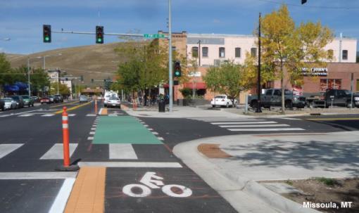
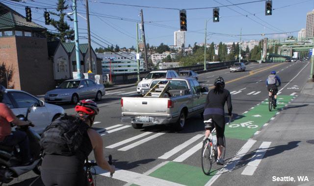
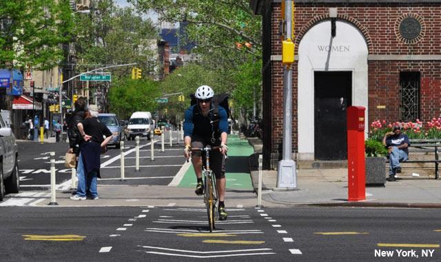
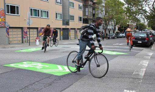
42 INTERSECTION CROSSING MARKINGS


43 TWO-STAGE TURN QUEUE BOXES Parking Lane Configuration

44 BACK IN ANGLED PARKING
45 BACK-IN ANGLE PARKING Pros Better visibility getting back into traffic See cars and bicyclists More vehicle parking spaces than parallel Open car door(s) lead kids to sidewalk Loading items into trunk is safer Cons Some people will need practice Furniture zone items might get hit Exhaust from running cars at sidewalk Consider outdoor café s

46 BACK-IN ANGLED PARKING PUBLIC EDUCATION AUSTIN TX

47 COST Road diets can be low cost if planned in conjunction with reconstruction or simple overlay projects, since a road diet mostly consists of restriping May involve other costs such as signal head relocation
48 BEST PRACTICE Know well in advance of when road reconstruction and overlay projects will be initiated to evaluate for Road Diet. Obtain input from the community stakeholders, and ensure the appropriate elements are included in the project. Classic four-to-three-lane Road Diet is very compatible with single-lane roundabouts
49 CASE STUDY

50 CASE STUDY NICKERSON STREET, SEATTLE, WA
51 PROJECT GOALS Improve pedestrian safety Add marked crosswalks Reduce exposure to multiple threat collisions Increase driver compliance with the posted speed limit Reduce speed
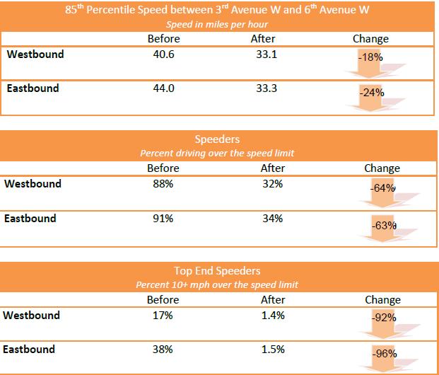
52 SPEED


53 COLLISIONS Two new marked crosswalks at Dravus St & 11th Ave W Preliminary collision statistics show a substantial reduction in collisions after the project was completed

54 ADT 2009 (Before) Approximately 18,500 vehicles per weekday between 3rd Ave W and 6th Ave W. August 2011 (After) Approximately 18,300 vehicles recorded in at the same location
55 FREIGHT USE Freight vehicles of all types on Nickerson St rose slightly after the Road Diet Trucks still account for about 5% of vehicles Large trucks account for about 2% of total traffic Some large trucks continue to use Nickerson St both as a through route and to access the Queen Anne neighborhood via 3rd Ave W
56 QUESTIONS / RESOURCES Road Diet Handbook: Setting Trends for Livable Streets (Rosales) Guidelines for Road Diet Conversions Kentucky Transportation Center Road Diet Information Guide FHWA (Anticipated to be released October 2014) PEDSAFE Case Studies AASHTO Guide for the Development of Bicycle Facilities (2012 Edition) NACTO Urban Bikeway Design Guide
57 Thank You! Archive at Downloadable/streaming recording and presentation slides Questions?
Pedestrian Safety at Roundabouts
 Countermeasure Strategies for Pedestrian Safety Pedestrian Safety at Roundabouts Hillary Isebrands Federal Highway Administration January 6, 2016 Today s Presentation Introduction and housekeeping Audio
Pedestrian Safety at Interchanges
 Countermeasure Strategies for Pedestrian Safety Pedestrian Safety at Interchanges Meghan Mitman Fehr and Peers December 10, 2015 Today s Presentation Introduction and housekeeping Audio issues? Dial into
Road Diets: Reconfiguring Streets for Multi-Modal Travel
 Road Diets: Reconfiguring Streets for Multi-Modal Travel Tom Grant, P.E., PTOE What is a Road Diet? Reconfiguration of travel lanes to benefit all roadway users (i.e., Complete Street) Reclaiming the space
Road Diets: Improving Safety for All Road Users
 Road Diets: Improving Safety for All Road Users Tamara Redmon, Federal Highway Administration Brian Chandler, Leidos Keith Knapp, Iowa Local Technical Assistance Program March 3, 2015 Today s Presentation
Bicycle Safety Guide and Countermeasure Selection System (BIKESAFE) Webinar
 Webinar") PBIC Webinar Bicycle Safety Guide and Countermeasure Selection System (BIKESAFE) Webinar [IMAGE] Tamara Redmon, FHWA Office of Safety Carl Sundstrom, UNC Highway Safety Research Center Dan Nabors, Vanasse
PBIC Webinar Bicycle Safety Guide and Countermeasure Selection System (BIKESAFE) Webinar [IMAGE] Tamara Redmon, FHWA Office of Safety Carl Sundstrom, UNC Highway Safety Research Center Dan Nabors, Vanasse
Crossing Islands and Raised Medians
 Countermeasure Strategies for Pedestrian Safety Crossing Islands and Raised Medians Demian Miller Tindale Oliver and Associates October 1, 2015 Today s Presentation Introduction and housekeeping Audio
Designing for Pedestrian Safety in Washington, DC
 Designing for Pedestrian Safety in Washington, DC February 25, 2014 George Branyan Pedestrian Program Coordinator District Department of Transportation DC Journey to work mode split: 2012 Means of Transportation
FHWA Bikeway Selection Guide
 FHWA Bikeway Selection Guide Tamara Redmon Federal Highway Administration Bill Schultheiss Toole Design Lauren Blackburn VHB March 26, 2019 PBIC Webinar pedbikeinfo.org @pedbikeinfo Housekeeping Problems
Active Transportation Facility Glossary
 Active Transportation Facility Glossary This document defines different active transportation facilities and suggests appropriate corridor types. Click on a facility type to jump to its definition. Bike
LTAP Fact Sheet. Abuzz word among transportation professionals. Kansas. Smarter, Safer Roadways: Road Diets for Rural Communities.
 Spring 2009 Kansas LTAP Fact Sheet A Service of Kansas University Transportation Center for Road, Street & Bridge Agencies Smarter, Safer Roadways: Road Diets for Rural Communities By Mehrdad Givechi,
Road Diets FDOT Process
 Florida Department of TRANSPORTATION Road Diets FDOT Process Humberto Castillero, PE, PTOE Roadway Design Office Purpose of Guide Develop a statewide lane elimination review process Balance state & local
A paper prepared for the 2012 TRB Annual meeting
 1 1 1 1 1 1 1 1 0 1 0 1 GUIDELINES FOR ROAD DIET CONVERSIONS By Nikiforos Stamatiadis, PhD, PE Professor Department of Civil Engineering University of Kentucky 1 Raymond Building Lexington KY 00 E-mail:
APPENDIX A: Complete Streets Checklist DRAFT NOVEMBER 2016
 APPENDIX A: Complete Streets Checklist DRAFT NOVEMBER 2016 Complete Streets Checklist MetroPlan Orlando s Complete Streets Checklist is an internal planning tool for staff to further implementation of
Pedestrian & Bicycle Safety Innovations & Applications
 Pedestrian & Bicycle Safety Innovations & Applications County Engineers Association of Maryland Spring, 2017 Conference May 25, 2017 George Branyan Pedestrian Program Coordinator District Department of
CURB EXTENSIONS BULB OUTS DPS 201 NECKDOWNS
 CURB EXTENSIONS BULB OUTS DPS 201 NECKDOWNS WHY WHEN & WHERE When Limited Sight Distance Pedestrians & Vehicles Vehicles and Signs Want to put two curb ramps in Discourage High speed turning High number
Off-road Trails. Guidance
 Off-road Trails Off-road trails are shared use paths located on an independent alignment that provide two-way travel for people walking, bicycling, and other non-motorized users. Trails specifically along
PBIC Webinar. How to Create a Bicycle Safety Action Plan: Planning for Safety [IMAGE] Oct. 2, 2014, 2 pm
![PBIC Webinar. How to Create a Bicycle Safety Action Plan: Planning for Safety [IMAGE] Oct. 2, 2014, 2 pm](/thumbs/86/93953441.jpg "PBIC Webinar. How to Create a Bicycle Safety Action Plan: Planning for Safety [IMAGE] Oct. 2, 2014, 2 pm") PBIC Webinar How to Create a Bicycle Safety Action Plan: Planning for Safety [IMAGE] Bill Schultheiss, Vice President, Toole Design Peter Lagerwey, Regional Director, Toole Design Oct. 2, 2014, 2 pm Today
PBIC Webinar How to Create a Bicycle Safety Action Plan: Planning for Safety [IMAGE] Bill Schultheiss, Vice President, Toole Design Peter Lagerwey, Regional Director, Toole Design Oct. 2, 2014, 2 pm Today
Rectangular Rapid Flashing Beacons
 Countermeasure Strategies for Pedestrian Safety Rectangular Rapid Flashing Beacons Mike Cynecki Lee Engineering November 5, 2015 Today s Presentation Introduction and housekeeping Audio issues? Dial into
Making Signals Work for Bicyclists and Pedestrians
 Making Signals Work for Bicyclists and Pedestrians Peter Koonce, PE Portland, OR October 18, 2017 PBIC Webinar pedbikeinfo.org @pedbikeinfo Housekeeping Problems with audio? Dial into the phone line instead
On Road Bikeways Part 1: Bicycle Lane Design
 On Road Bikeways Part 1: Bicycle Lane Design Presentation by: Nick Jackson Bill Schultheiss, P.E. September 04, 2012 FOLLOW THE CONVERSATION ON TWITTER Toole Design Group is live tweeting this webinar
Rightsizing Streets: The Seattle Experience
 Rightsizing Streets: The Seattle Experience April 30, 2013 Brian Dougherty Seattle Department of Transportation Complete Streets 16% of households do not have a car Seniors Youth Transit riders Safety
Planning Guidance in the 2012 AASHTO Bike Guide
 Planning Guidance in the 2012 AASHTO Bike Guide Presentation by: RJ Eldridge Peter Lagerwey August 22, 2012 WEBINAR 2: PLANNING GUIDANCE IN THE 2012 AASHTO BIKE GUIDE Today s Webinar Significant Updates
Dear Mr. Tweed: Sincerely, Min Zhou, P.E. Vice President
 December 17, 2012 Mr. Steve Tweed City of Long Beach, Department of Public Works Traffic & Transportation Bureau, 10 th Floor City Hall 333 West Ocean Boulevard Long Beach, CA 90802 Subject: Broadway and
Acknowledgements. Mr. David Nicol 3/23/2012. Daniel Camacho, P.E. Highway Engineer Federal Highway Administration Puerto Rico Division
 Daniel Camacho, P.E. Highway Engineer Federal Highway Administration Puerto Rico Division Acknowledgements Mr. David Nicol Director, FHWA Office of Safety FHWA Office of Safety http://safety.fhwa.dot.gov/provencountermeasures/
TODAY S WEBINAR AGENDA
 TODAY S WEBINAR AGENDA 3:00 pm: Introduction 3:05 pm: Presentation 3:45 pm: Questions 4:00 pm: Webinar Ends For technical assistance during the webinar: 1-800-263-6317 Choose these prompts: 1, 1, 1 CONTINUING
PEDESTRIAN ACCOMMODATIONS DPS 201 AT INTERCHANGES
 PEDESTRIAN ACCOMMODATIONS DPS 201 AT INTERCHANGES UNDERSTANDING THE ISSUES Intersections of freeway ramp terminals at crossroads are the most critical components of an interchange Challenge: balance mobility
Road Diets A Proven Safety Countermeasure
 The Road Diet Cross Section Conversion: Information Guide Summary Efficiency through technology and collaboration Keith Knapp, Ph.D., P.E. Iowa LTAP (Thanks Project Team Member & FHWA!) Road Diets A Proven
Bay to Bay Boulevard Complete Streets Project
 Bay to Bay Boulevard Complete Streets Project Dale Mabry Highway to Bayshore Boulevard February 08, 2018 Photo Source: Tampa Bay Times Alessandra Da Pra Meeting Format Introduction Resurfacing Information
FHWA Resources for Pedestrian and Bicycle Professionals
 FHWA Resources for Pedestrian and Bicycle Professionals Charlie Zegeer, UNC Highway Safety Research Center/PBIC Libby Thomas, UNC Highway Safety Research Center Dan Nabors, Vanasse Hangen Brustlin (VHB)
Protected Bike Lanes in San Francisco Mike Sallaberry SFMTA NACTO Workshop - Chicago IL
 Protected Bike Lanes in San Francisco Mike Sallaberry SFMTA 10 14 2011 NACTO Workshop - Chicago IL San Francisco 2 nd Highest Density in the U.S. 47 square miles Mild Climate Market Population ~810,000
REGIONAL BICYCLE AND PEDESTRIAN DESIGN GUIDELINES
 REGIONAL BICYCLE AND PEDESTRIAN DESIGN GUIDELINES November 16, 2011 Deb Humphreys North Central Texas Council of Governments Bicycle and Pedestrian Advisory Committee Snapshot of the Guide 1. Introduction
Incorporating Bicycle Networks into Resurfacing Projects
 Incorporating Bicycle Networks into Resurfacing Projects Becky Crowe Federal Highway Administration Peter Lagerwey Toole Design Group Jeremy Chrzan Toole Design Group Wednesday, May 10, 2017 PBIC Webinar
Access Location, Spacing, Turn Lanes, and Medians
 Design Manual Chapter 5 - Roadway Design 5L - Access Management 5L-3 Access Location, Spacing, Turn Lanes, and Medians This section addresses access location, spacing, turn lane and median needs, including
TOWN OF PORTLAND, CONNECTICUT COMPLETE STREETS POLICY
 TOWN OF PORTLAND, CONNECTICUT COMPLETE STREETS POLICY I. VISION, GOALS & PRINCIPLES VISION To improve the streets of Portland making them safer and more accessible for all users including pedestrians,
IMPROVING PEDESTRIAN SAFETY AT UNCONTROLLED CROSSINGS. Guidelines for Marked Crosswalks
 IMPROVING PEDESTRIAN SAFETY AT UNCONTROLLED CROSSINGS Presented by Nazir Lalani P.E. Traffex Engineers Inc. N_lalani@hotmail.com Guidelines for Marked Crosswalks Source: FHWA, Safety Effects of Marked
How Much Do You Lose When Your Road Goes on a Diet?
 Huang, Stewart, Zegeer, and Tan Esse 1 How Much Do You Lose When Your Road Goes on a Diet? *Herman F. Huang, *J. Richard Stewart, *Charles V. Zegeer, and **Carol H. Tan Esse herman_huang@unc.edu jstewart@claire.hsrc.unc.edu
CITY OF LOS ANGELES INTER-DEPARTMENTAL MEMORANDUM
 CITY OF LOS ANGELES INTER-DEPARTMENTAL MEMORANDUM Date: April 1, 219 To: Honorable City Council c/o City Clerk, Room 395, City Hall Attention: Honorable Mike Bonin, Chair, Transportation Committee From:
2018 AASHTO BIKE GUIDE
 2018 AASHTO BIKE GUIDE Your presenter Rob Burchfield, PE NW Regional Engineering Director 35 years of experience in traffic engineering and bicycle facility design Toole Design Group Toole Design Group
Walk Friendly Communities Engineering Strategies. Carl Sundstrom Walk Friendly Communities Workshop Grandview, MO June 2015
 Walk Friendly Communities Carl Sundstrom Walk Friendly Communities Workshop Grandview, MO June 2015 Module Overview Topics Background and purpose Sidewalks Crossings Traffic calming www.pedbikeimages.org
Urban Four-Lane Undivided to Three-Lane Roadway Conversion Guidelines
 Urban Four-Lane Undivided to Three-Lane Roadway Conversion Guidelines Keith K. Knapp Engineering Professional Development University of Wisconsin-Madison 432 North Lake Street #713 Madison, WI 53706 knapp@epd.engr.wisc.edu
2018 AASHTO BIKE GUIDE
 2018 AASHTO BIKE GUIDE Your presenters Jessica Fields, PE Denver Office Director Sagar Onta, PE, PTOE Denver Engineering Director 35 years of combined experience street design, transportation planning,
Caltrans Sloat Boulevard Pedestrian Safety Project Response to Community Questions, Comments & Concerns
 Caltrans Sloat Boulevard Pedestrian Safety Project Response to Community Questions, Comments & Concerns Revised: May 10, 2016 The California Department of Transportation (Caltrans) is planning various
Lessons Learned from Cycle Tracks (Class IV Bikeways) Design Practice
 Design Practice") Lessons Learned from Cycle Tracks (Class IV Bikeways) Design Practice By: Min Zhou, P.E., Principal/Vice President KOA Corporation 1 What is a Cycle Track (Class IV) TYPICAL BIKEWAY CLASSIFICATION CLASS
Lessons Learned from Cycle Tracks (Class IV Bikeways) Design Practice By: Min Zhou, P.E., Principal/Vice President KOA Corporation 1 What is a Cycle Track (Class IV) TYPICAL BIKEWAY CLASSIFICATION CLASS
Designing for Bicyclist Safety at Crossings and Intersections
 Designing for Bicyclist Safety at Crossings and Intersections Brooke Struve Federal Highway Administration Greg Bakos VHB April 27, 2017 Housekeeping Problems with audio? Dial into the phone line instead
PEDESTRIAN ACCOMMODATIONS DPS 201 AT ROUNDABOUTS
 PEDESTRIAN ACCOMMODATIONS DPS 201 AT ROUNDABOUTS WHY THEY WORK FOR PEDESTRIANS IF DESIGNED CORRECTLY Separated sidewalks direct peds to crosswalks Splitter island Slow speed exit Truck apron Crosswalk
Telegraph Avenue Complete Streets DRAFT Recommendations. Oakland Public Works Department September 11 and 13, 2014 Open Houses
 Telegraph Avenue Complete Streets DRAFT Recommendations Oakland Public Works Department September 11 and 13, 2014 Open Houses Presentation Overview What are complete streets? What problem are we trying
Safety Benefits of Raised Medians and Pedestrian Refuge Areas. FHWA Safety Program.
 Safety Benefits of Raised Medians and Pedestrian Refuge Areas FHWA Safety Program http://safety.fhwa.dot.gov There s a signal up the block, but looking left there s a gap in traffi c. Looking right there
Dr. M.L. King, Jr. Street North Complete Streets Resurfacing Opportunities HOUSING, LAND USE, AND TRANSPORTATION COMMITTEE MARCH 22, 2018
 Dr. M.L. King, Jr. Street North Complete Streets Resurfacing Opportunities HOUSING, LAND USE, AND TRANSPORTATION COMMITTEE MARCH 22, 2018 What s Happening The City plans to mill and resurface Dr. M.L.
MEMORANDUM. Charlotte Fleetwood, Transportation Planner
 MEMORANDUM Date: Updated August 22, 2017 To: Organization: Charlotte Fleetwood, Transportation Planner Boston Transportation Department From: Jason DeGray, P.E., PTOE, Regional Director of Engineering
The DC Pedestrian Master Plan
 The DC Pedestrian Master Plan September 28, 2010 George Branyan Pedestrian Program Coordinator District Department of Transportation Presentation Agenda Scope of the Plan Methodology Recommendations Implementation
ROAD DIETS. Michael Ronkin. New Partners for Smart Growth Los Angeles, February Designing Streets for Pedestrians and Bicyclists
 ROAD DIETS Michael Ronkin Designing Streets for Pedestrians and Bicyclists New Partners for Smart Growth Los Angeles, February 10 2007 1 Classic Road Diet Two-way street: 4 travel lanes 2 + CTL 2 Portland
Public Information Centre
 WELCOME Public Information Centre Father Tobin Road Lougheed Middle School - Library Wednesday November 7, 2012 7:00 p.m.to 9:00 p.m. Please sign in Neighbourhood Traffic Calming Guide Background The City
Richmond-Adelaide Cycle Tracks
 Public Drop-In Event Richmond-Adelaide Cycle Tracks June 25, 2018 12:00 p.m. 3:00 p.m. 4:30 p.m. 7:30 p.m. Metro Hall, Rotunda 55 John Street 1 Purpose of Event In Scope Communicate an update about the
Converting Four-Lane Undivided Roadways to a Three-Lane Cross Section: Factors to Consider By: Keith K. Knapp, Thomas M. Welch, and John A.
 Converting Four-Lane Undivided Roadways to a Three-Lane Cross Section: Factors to Consider By: Keith K. Knapp, Thomas M. Welch, and John A. Witmer INTRODUCTION There are a large number of four-lane undivided
CURBSIDE ACTIVITY DESIGN
 5 CURBSIDE ACTIVITY DESIGN This chapter provides design guidance for separated bike lanes adjacent to curbside activities including parking, loading and bus stops. Typical configurations are presented
Report. Typical Sections. City of Middleton, WI
 Report Typical Sections City of Middleton, WI December 2006 Report for City of Middleton, Wisconsin Typical Sections repared by: Traffic Associates LLC and STRAND ASSOCIATES, INC. 910 West Wingra Drive
C/CAG. Sunnybrae Elementary School Walking and Bicycling Audit. San Mateo-Foster City School District JUNE 2013
 Sunnybrae Elementary School Walking and Bicycling Audit JUNE 2013 San Mateo-Foster City School District C/CAG City/County Association of Governments of San Mateo County SUNNYBRAE ELEMENTARY SCHOOL WALKING
Pedestrian Safety and the Highway Safety Improvement Program
 Pedestrian Safety and the Highway Safety Improvement Program Karen Scurry, FHWA Office of Safety Kohinoor Kar, Arizona Department of Transportation David Cohen, FHWA California Division March 13, 2014
City of Albert Lea Policy and Procedure Manual 4.10 ALBERT LEA CROSSWALK POLICY
 4.10 ALBERT LEA CROSSWALK POLICY PURPOSE: Pedestrian crosswalks are an integral part of our transportation infrastructure. To be effective and promote safety, marked crosswalks must be installed after
DOWNTOWN TUPELO MAIN STREET: ROAD DIET STUDY
 DOWNTOWN TUPELO MAIN STREET: ROAD DIET STUDY Since mid-2009, RPM Transportation Consultants (RPM) has worked with the Downtown Tupelo Main Street Association to evaluate traffic conditions and potential
Access Management in the Vicinity of Intersections
 Access Management in the Vicinity of Intersections FHWA-SA-10-002 Technical Summary Photo: Ralph Bentley (used with permission) 0 Access Management is: The design, implementation and management of entry
DEPARTMENT OF ENVIRONMENTAL SERVICES. North Harrison Street (Lee Highway to Little Falls Road) Comparative Analysis. Prepared for:
 Comparative Analysis. Prepared for:") DEPARTMENT OF ENVIRONMENTAL SERVICES North Harrison Street (Lee Highway to Little Falls Road) Comparative Analysis Prepared for: Arlington County Department of Environmental Services 2100 Clarendon Boulevard,
DEPARTMENT OF ENVIRONMENTAL SERVICES North Harrison Street (Lee Highway to Little Falls Road) Comparative Analysis Prepared for: Arlington County Department of Environmental Services 2100 Clarendon Boulevard,
Simulation Analysis of Intersection Treatments for Cycle Tracks
 Abstract Simulation Analysis of Intersection Treatments for Cycle Tracks The increased use of cycle tracks also known as protected bike lanes has led to investigations of how to accommodate them at intersections.
Designing for Pedestrian Safety
 Designing for Pedestrian Safety Treatments at Unsignalized Pedestrian Crossings Presented by: Charlie Zegeer PBIC Director August 17, 2010 Crossing Crashes Part 1: General Principles 3 2 Why do people
Pedestrian Treatments by
 Pedestrian Treatments by Kay Fitzpatrick Texas A&M Transportation Institute TxDOT Short Course October 15-16, 2013 Recent Research Efforts FHWA Studies Crosswalk markings Driver yielding (DY) at rectangular
STEP. Proactively Addressing Crash Risk with Systemic Safety Analysis. Safe Transportation for Every Pedestrian
 STEP Safe Transportation for Every Pedestrian Proactively Addressing Crash Risk with Systemic Safety Analysis Rebecca Sanders, Toole Design Chris Svolopoulos, Seattle Department of Transportation Offer
Complete Street Analysis of a Road Diet: Orange Grove Boulevard, Pasadena, CA
 Complete Street Analysis of a Road Diet: Orange Grove Boulevard, Pasadena, CA Aaron Elias, Bill Cisco Abstract As part of evaluating the feasibility of a road diet on Orange Grove Boulevard in Pasadena,
CITY OF SARATOGA SPRINGS PEDESTRIAN CROSSING TOOLBOX
 CITY OF SARATOGA SPRINGS PEDESTRIAN CROSSING TOOLBOX This toolbox is to be used to guide pedestrian crossing improvements within the City of Saratoga Springs. Details for each crossing type are provided.
Why Zone In on Speed Reduction?
 Learn it. Do it. Live it! SPEED REDUCTION IN THE ZONE Why Zone In on Speed Reduction? Speeding is a serious issue that plays a major role in the risk of serious injury and pedestrian fatality in a crash.
TOWN OF MORAGA MORAGA WAY AND CAMINO PABLO/CANYON ROAD IMPROVEMENTS Town Council Meeting March 13, 2019
 TOWN OF MORAGA MORAGA WAY AND CAMINO PABLO/CANYON ROAD IMPROVEMENTS Town Council Meeting March 13, 2019 1 Edric Kwan, Public Works Director Josh Peterman, Principal, Fehr and Peers Shawn Knapp, Senior
WELCOME Public Information Centre
 WELCOME Public Information Centre Fernforest Drive Brampton Soccer Centre Community Room #2 Tuesday January 19, 2016 6:30 p.m.to 9:00 p.m. Please sign in Neighbourhood Traffic Calming Guide Background
Omaha s Complete Streets Policy
 Omaha s Complete Streets Policy (Adopted August 2015) VISION To create great places and enhance our quality of life, the City of Omaha will provide safe, accessible streets for all users. Complete Streets
NJDOT Complete Streets Checklist
 Background The New Jersey Department of Transportation s Complete Streets Policy promotes a comprehensive, integrated, connected multi-modal network by providing connections to bicycling and walking trip
PEDESTRIAN SAFETY IMPROVEMENT EVALUATION GUIDELINE FOR UNCONTROLLED CROSSINGS
 PEDESTRIAN SAFETY IMPROVEMENT EVALUATION GUIDELINE FOR UNCONTROLLED CROSSINGS Traffic Safety Engineering Division Updated: April 2018 EXECUTIVE SUMMARY NDOT Traffic Safety Engineering Division developed
Albany Shaker Road Corridor Study Public Meeting # 2
 Albany Shaker Road Corridor Study Public Meeting # 2 Scope / Meeting Purpose This project is a CDTC Linkage Study. The Linkage Program is designed to implement the adopted planning and investment principles
Toolbox of Countermeasures and Their Potential Effectiveness to Make Intersections Safer
 8 Toolbox of Countermeasures and Their to Make Intersections Safer Introduction Studies included in the NCHRP 17-18 (3), Guidance for Implementation of the AASHTO Strategic Highway Safety Plan, as well
2.0 LANE WIDTHS GUIDELINE
 2.0 LANE WIDTHS GUIDELINE Road Engineering Design Guidelines Version 2.0.1 May 2018 City of Toronto, Transportation Services City of Toronto Page 0 Background In early 2014, Transportation Services initiated
Street Design Workshop. Existing cross section Traffic volumes Examine adjacent land uses You design future improvements
 Street Design Workshop Existing cross section Traffic volumes Examine adjacent land uses You design future improvements Primary Tools for Street Redesign Road diets Bike lanes Cycle tracks Trails Crosswalks
Water Street Promenade. Engineering and Design Services. Public Information Meeting No. 2. Education / Infrastructure / Innovation. Maplewood Avenue &
 Public Information Meeting No. 2 Water Street Promenade Maplewood Avenue & Engineering and Design Services Adjacent Areas July 16,2014Portsmouth, NH May 10, 2016 Education / Infrastructure / Innovation
25th Avenue Road Diet Project A One Year Evaluation. Transportation Fund for Clean Air Project #05R07
 25th Avenue Road Diet Project A One Year Evaluation Transportation Fund for Clean Air Project #05R07 Submitted by: The San Francisco Municipal Transportation Agency Dan Provence May 22, 2009 EXECUTIVE
Creating Complete Streets to Accommodate All Users
 Creating Complete Streets to Accommodate All Users Peter Lagerwey, Toole Design Group plagerwey@tooledesign.com Brian Dougherty, Seattle DOT brian.dougherty@seattle.gov International Conference on Urban
Potential Bicycle Facility on Bayou Street Mobile, Alabama
 Potential Bicycle Facility on Bayou Street Mobile, Alabama By Richard A. Hall, P.E. Prepared For Mobile Downtown Alliance Hall Planning & Engineering, Inc. March 28, 2018 Introduction Review of the February
Northbound San Jose Avenue & I-280 Off-Ramp Road Diet Pilot Project
 Project Overview Fed by a two-lane Interstate-280 (I-280) off-ramp, high vehicular volumes and speeds are longstanding issues along San Jose Avenue. Residents in the surrounding neighborhoods have expressed
Broad Street Bicycle Boulevard Design Guidelines
 Broad Street Bicycle Boulevard Design Guidelines Building from the strategies introduced in the 2013 Bicycle Transportation Plan and community input received thus far, City Transportation Staff have identified
STANLEY STREET December 19, 2017
 STANLEY STREET December 19, 2017 Welcome Mike Wiza, Mayor Scott Beduhn, Director of Public Works Agenda 1. Introduction 2. Existing Roadway Conditions 3. Current Alternative Improvements 4. Summary of
Proven Safety Countermeasures. FHWA Office of Safety January 12, :00 p.m. to 2:00 p.m. Eastern Time
 Proven Safety Countermeasures FHWA Office of Safety January 12, 2012 1:00 p.m. to 2:00 p.m. Eastern Time Introduction and Background While States should still be considering the application of all of the
STATUS OF 2009 PEDESTRIAN MASTER PLAN (AS OF DECEMBER 2013)
") Appendix P.1 STATUS OF 2009 PEDESTRIAN MASTER PLAN (AS OF DECEMBER 2013) The 2009 Pedestrian Master Plan establishes 21 core recommendations in three goal areas to improve pedestrian transportation in
Appendix P.1 STATUS OF 2009 PEDESTRIAN MASTER PLAN (AS OF DECEMBER 2013) The 2009 Pedestrian Master Plan establishes 21 core recommendations in three goal areas to improve pedestrian transportation in
6.4 RECOMMENDED IMPROVEMENTS
 6.4 RECOMMENDED IMPROVEMENTS 6.4.1 Williston Road Recommendations While all alternatives would be an improvement over existing conditions, Alternative 3B is recommended over the others because it provides
MEMORANDUM. Date: 9/13/2016. Citywide Crosswalk Policy
 MEMORANDUM Date: 9/13/2016 Re: Citywide Crosswalk Policy Foreword Through the s Circulation Element and Complete Streets Policy, it is the City s goal to promote walking trips and provide safe facilities
EXECUTIVE SUMMARY. Vision
 Vision Walking and bicycling in Salt Lake City will be safe, convenient, comfortable, and viable transportation options that connect people to places, foster recreational and economic development opportunities,
Borough of Danville, PA Traffic Calming Program Guidelines
 Borough of Danville, PA Traffic Calming Program Guidelines Adopted by Borough Council on 1 INTRODUCTION Speeding Traffic is a major concern in the Borough of Danville because of its detrimental impacts
Balancing Operation & Safety for Motorized and Non-Motorized Traffic
 Balancing Operation & Safety for Motorized and Non-Motorized Traffic Brian Willham, PE, PTOE Iowa Director - MOVITE June 30, 2014 Learning Objectives: When & Why should we measure the performance of complete
PBIC Webinar. Improving Multimodal Outcomes through Performance Measurement and Design Flexibility. November 14, 2016
 PBIC Webinar Improving Multimodal Outcomes through Performance Measurement and Design Flexibility Dan Goodman, Federal Highway Administration Michelle Danila, Toole Design Group Conor Semler, Kittelson
In 2014, the number of traffic fatalities in the United States reached its lowest level at. Bicycle Collisions. Effective in Reducing
 CASE STUDY Pierre Aden/shutterstock.com Countermeasures Prove Effective in Reducing Bicycle Collisions By Nazir Lalani, P.E. and Kristopher Gunterson In 2014, the number of traffic fatalities in the United
The 2012 AASHTO Bike Guide: An Overview
 The 2012 AASHTO Bike Guide: An Overview Presentation by: Jennifer Toole, AICP, ASLA Peter Lagerwey August 10, 2012 {Enter Module Name on Master Slide} WEBINAR #1: OVERVIEW OF 2012 AASHTO BIKE GUIDE Today
UNCONTROLLED PEDESTRIAN CROSSING GUIDELINES
 City and County of Denver UNCONTROLLED PEDESTRIAN CROSSING GUIDELINES Prepared for: Prepared by: Adopted September 2016 This page is intentionally left blank. Contents for Denver Uncontrolled Pedestrian
Welcome! San Jose Avenue Open House August 25, 2015
 Welcome! San Jose Avenue Open House August 25, 2015 Vision Zero The City and County of San Francisco adopted Vision Zero San Francisco Vision Zero High Injury Network as a policy in 2014, committing an
BETHEL ROAD AND SEDGWICK ROAD CORRIDOR STUDY
 DRAFT PLAN City Council Meeting August 14, 2017 STUDY AREA Sedgwick Corridor State Route 160, principal arterial with Class 3 access management designation, commuter and freight route, connection to SR
City of Seattle Edward B. Murray, Mayor
 City of Seattle Edward B. Murray, Mayor Department of Transportation Scott Kubly, Director Eastlake Community Council 117 E Louisa St. #1 Seattle, WA 98102-3278 January 28, 2016 RE: Roosevelt to Downtown
Outreach Approach RENEW SF served as the primary liaison with the North Beach community; the Chinatown. Executive Summary
 Executive Summary Executive Summary The Columbus Avenue Neighborhood Transportation Study s objective is to identify changes to transportation infrastructure and policies that could enhance the livability