Technical. BACKGROUND corridor from. The Castle Rock. To: RE: SH 86-Founders. results and. as high volumes. This. no formal. intersection.
|
|
|
- Bonnie Henderson
- 5 years ago
- Views:
Transcription

1


2
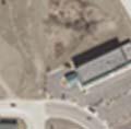
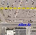
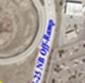
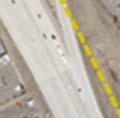
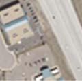
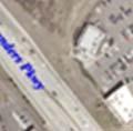
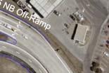
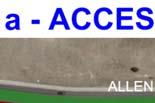
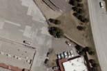
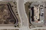
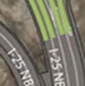
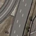
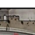
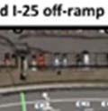
3 Technical Memorandum To: The Castle Rock Town Council and Public Works Commission From: CDOT Region 1 Traffic Operations Unit RE: SH 86-Founders Pkwy/Allen Way Intersection Assessment of Alternatives INTRODUCTION Because of numerous public complaints, CDOT hass begun the design to replace the pavement on Founders Pkwy from I-25 east to Woodlands Blvd. The pavement is in extremely poor condition and requires higher than normal maintenance from CDOT staff. In conjunction with this pavement re-construction project, CDOT is proposing improvements to SH 86 (Founders Pkwy) that will address the current safety and operational concerns at the Founders and Allen Way intersection. The information provided in the following pages summarizes the result of the traffic, access and safety analyses. This information is being provided to give the Town of Castle Rock staff the opportunity to review the results and subsequent comparison of the alternatives. BACKGROUND CDOT adopted the Meadows/Founders corridor from the Town of Castle Rock in 2006 in its present configuration. The Meadows/Fo ounders corridor is within the Town of Castle Rock and is a high volume roadway that serves numerous commercial and retail interests, as well as high volumes of commuter traffic to and from I-25. Due to continued, rapid development in the area, the Founders/Allen Way intersection is currently failing to support the amount of traffic demand that occurs during the peak hour periods. EXISTING CONDITION The Founders Pkwy/Allen Way intersection is a full movement, signalized intersection located approximately 320 feet east of the signalized I-25 northbound off-ramp intersection. Because of this close intersection spacing and the high demand of traffic along Founders Pkwy, the operation and safety of these intersections is poor, and continues to degrade as time passes. This intersectionn spacing is significantly below the requirements of the State Highway Access Code, which requires a minimumm of 550 feet. Because of surrounding retail development, relocating the Allen Way intersection is not feasible. There is no formal Access Permit currently in place for Allen Way. 1
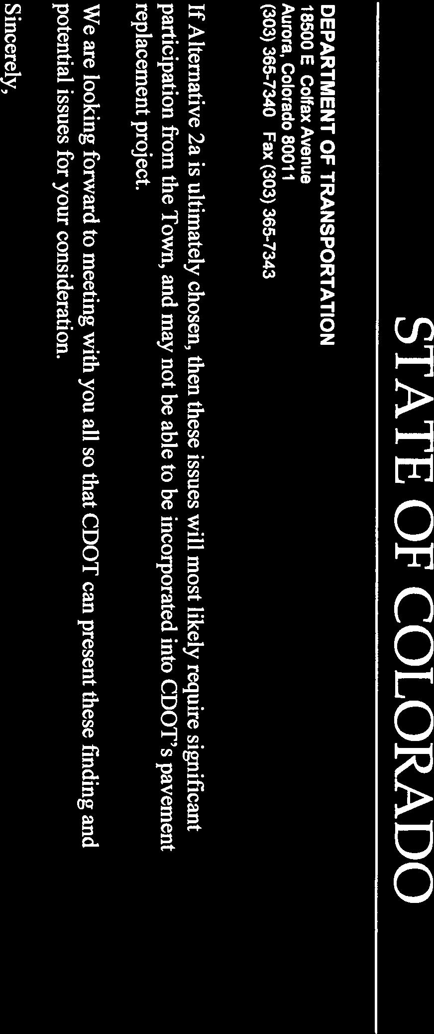
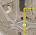
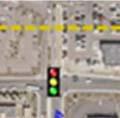
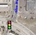
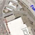
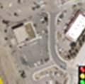
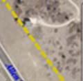
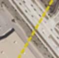
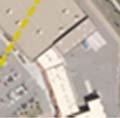
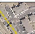
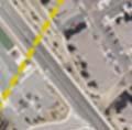
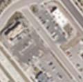
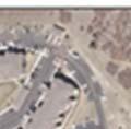
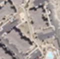
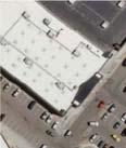
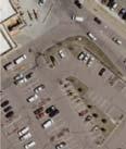
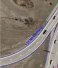
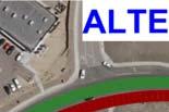
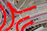
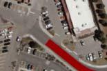
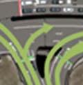
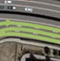
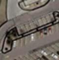
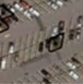
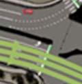
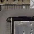
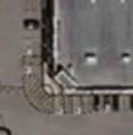
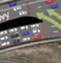
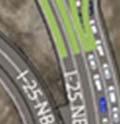
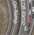
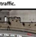
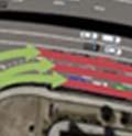
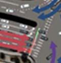
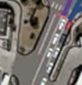
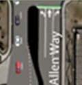
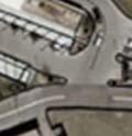
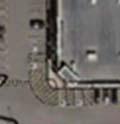
4 Technical Memorandum ALTERNATIVES DEVELOPMENT A Traffic Study of the Meadows/Founders corridor was completed in July Working with the results of the study, and with the Town of Castle Rock, two alternatives were developed to improve the operation and safety of the Founders/Allen Way intersection. These alternatives have been further refined and evaluated using a VISSIM traffic simulation model. Common to both alternatives is; The addition of a 3 rd eastbound through lanee from I-25 to Allen Way, Adding a 2 nd lane to the I-25 westbound to northbound on-ramp, Adding a 2 nd right turn lane on the I-25 northbound off-ramp, Adding a 2 nd southbound right turn lane on Allen Way, and Adding a westbound right turn lane on Founders Pkwy at Allen Way. The two refined alternatives are described below. Alternative 1a This alternative applies access control by restricting the northbound and southbound through and left turning traffic on Allen Way and re-directing this traffic to the east to the Front Street intersection (See Figures 1 and 7). Alternative 2a This alternative retains full movement operation at Allen Way and improves intersection operation by providing a 2 nd lane for the eastbound to northbound left turn movement and hence, more intersection capacity than the current condition (Seee Figure 2). The alternatives were evaluated based on 3 main categories; Traffic Operations Safety Access Since Alternativee 1a involves diversion of traffic at Allen Way, The Alternatives were evaluated and compared to each other based on NETWORK performance that included ALL affected intersections. 2
5 18500 E. Colfax Avenue (303) Fax (303) Figure 1 - Alternative 1a 3
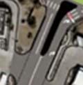
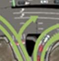
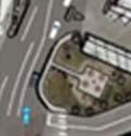
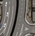
6 18500 E. Colfax Avenue (303) Fax (303) Figure 2 - Alternative 2a 4


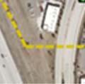
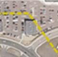


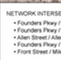
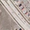

7 ALTERNATIVES COMPARISON A comparison of the alternatives was performed using the VISSIM traffic simulation model to better understand the pros and cons of each. The entire corridor was modeled from US 85/Meadows intersection to the Founders/Crowfoott Valley intersection. The modeling focus areaa and subsequent resultss of the VISSIM analysiss includes the following intersections and is hereby referred to as the NETWORK. Figure 3 the VISSIM Evaluation NETWORK The analysis focused on two different peak hour periods, the PM peak hour and the Weekend (WE) peak hour. These were the highest traffic use periods within the area of study. The VISSIM models incorporated the impactss of traffic diversion in the Alternative 1a assessment and subsequent increase in traffic at the Founders Pkwy/Front St and Front St/ Milestone Ave intersections, and are incorporated inn the NETWORK measures of effectiveness presented here. 5
8 Traffic Operations Alternative 1a This alternative showss significant improvement to traffic flow on both Founders Pkwy and the I-25 northbound off-ramp. Because of the restricted movements, signal operation can be changed at Allen Way from 8-phase to 2-phase operation. This affords a significant operational improvement by providing more green time to Founders Pkwy and for traffic coming from the I-25 off-ramp intersection. Alternative 2a This alternative showss improvement to the Allen Way intersection operation because the eastbound left turn requires shorter green times to and subsequently, gives more green time to the other intersection movements. However, the operation of the I-25 northbound off-ramp remains hampered, mostly because the Founders/Allen Way intersection retains 8-phase operation and subsequently restricts the amount of green time that can be given at the Founders Pkwy/Allen Way intersection. This is especially true during the PM peak hour. Subsequent analysis shows that significant vehicle stacking will eventually occur on the I-25 northbound off-ramp. The NETWORK delay comparison is shown in Figure 4 for both alternatives. The NETWORK vehicle Stops comparison is shown in Figure 5. Vehicle Stops and Delay within the Alternative 1a NETWORK is notably lower than the Alternative 2a NETWORK during the peak hour periods. 6
9 Figure 4 - Vehicle Delay Improvement over the No-Build Alternative 100% 90% 80% 70% 60% 50% 40% Alternative 1a Alternative 2a 30% 20% 10% 0% PM Peak Hour Weekend Peak Hourr Note: Table shows percent improvement when compared to the No-Action Alternative The NETWORK delay comparison shows a significant difference in performance. Alternative 1a, with access control, clearly outperforms Alternative 2a. 7
10 Figure 5 Vehicle Stops Comparison within the Network 140% 120% 100% 80% 60% Alternative 1a Alternative 2a 40% 20% 0% PM Peak Hour Weekend Peak Hour Note: Table shows percent improvement when compared to the No-Action Alternative At Year 2030, Alternative 1a provides 50 percent fewer NETWORK stops during the PM peak, and approximately 80 percent fewer NETWORK stops during the weekend peak hour. The NETWORK vehicle stops comparison shows a significant difference in performance. Alternative 1a, with access control, clearly outperforms Alternative 2a. 8
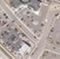
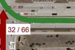
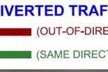
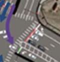
11 ACCESS CONTROL Figure 6 shows the impacts of access control and subsequent diversion of traffic. The effects of the diverted traffic on Founders Pkwy andd Allen Way are; An average of 74 percent of all the Allen Way intersection traffic is still being served even with access control. 100 percent of all traffic from Founders Pkwy to Allen Way is still being served. An average of 26 percent of the total traffic currently using the Allen Way intersection will be diverted. An average of 19 percent of the total traffic currently using the Allen Way intersection that is being divertedd is forced to travel out-of-direction. One significant reason why the NETWORK performance of alternative 1a is better than Alternative 2a is because only a relatively small percentage of the total traffic is being diverted. In order to better serve the traffic diverted to Front Street for Alternative 1a, several modifications were required at both the Founders/Front St, and at the Front St/Milestone Ave intersections. These modifications are; Change the signal phasing and lane assignments at the Founders/Front St intersection to allow 3 northbound left turn lanes. Change the signal phasing and lane assignments at the Front St/Milestone Ave intersection to allow 2 eastbound left turn lanes. Regardless of access control, The Milestone Shopping Center site layout currently offers marginal efficiency in terms of vehicle circulation. 9


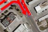


12 DEPARTMENT OF TRANSPORTATION E. Colfax Avenue Figure 6 10


13 SAFETY The Founders Pkwy/Allen Way intersection is one of the highest accident locations in the corridor. A 5-year breakdown of the intersection accident types from 2008 to 2012 is provided in Figure 7 below. Figure 7 Source: CDOT Accident Database Alternative 1a access control eliminates the northbound and southbound through and left turn movements, reducing approach turn accidents by 17 percent and eliminating northbound/southbound broadside accidents. Tablee 4 shows a comparison of the number of stops between each of the alternatives. Based on the total number of intersection stops, Alternative 1a has a total average of 24 percent fewer stopss than Alternative 2a. This can be directly correlated to a 24 percent reduction in rear-end accidents. The total anticipated reduction in all accident types is approximately 35 percent with access control as provided in Alternative 1a. 11


14 Figure 8 highlights the safety benefits of access control by significantly reducing the number of conflict points and crossing conflict points. The safety improvement provided in Alternative 1a would only have 8 conflict points withh 2 crossing conflict points while Alternative 2a would maintain the existing 32 conflict points plus 16 crossing conflict points. Figure 8 Conflict Point Diagram 12


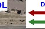
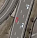
15 Vehicle Stacking (Queuing) One of the largest concerns CDOT has resulting from the operational analyses of thesee alternatives is the vehicle queuing on the I-25 northbound off ramp. This is best illustrated in Figure 9 and Figure 10. vehicle stacking queues shown for Alternative 2a are getting close to blocking traffic on I-25. Figure 9: Alternative 1a Access Control 13


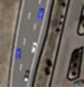


16 Figure 10: Alternative 2a Full Movement Alternative 1a has lower levels of delay and significantly fewer vehicle stops. This is because Alternative 1a can provide significantly more green time to the Founders Pkwy eastbound movement. This analysis shows that Alternative 2a will eventually generatee excessive vehicle queuing and threatens the operation of I-25. Queuing estimates from the model shows that queuing will be in excess of 1500 feet. Further rampp lengthening is restricted by adjacent development. 14
17 SUMMARY The following is a summary of the conditions and findings presented in this memorandum. Description; Alternative 1a applies access control by restricting the northbound and southbound through and left turning traffic on Allen Way and re-directing this traffic to the east to the Front Street intersection (Seee Figures 1 and 6). Alternative 2a retains full movement operation and improves intersection operation by providing a 2 nd lane for the eastbound to northbound left turn movement and hence, more intersection capacity (See Figure 2). Traffic Operations; Alternative 1a NETWORK performs at a higher level of operational efficiency than Alternative 2a even with traffic diversion. Alternative 1a NETWORK has lower levels of delay and significantly fewer vehicle stops. This is because Alternative 1a can provide significantly more green time to the Founders Pkwy eastbound through movement. Alternative 2a generates excessive vehicle queuing on the I-25 northbound off-ramp and threatens the operation and safety off I-25. By the year 2030, the Alternativee 1a NETWORK clearly outperforms the Alternative 2a NETWORK. The VISSIM aggregate Performance Indices show that by the year 2030, Alternative 1a outperforms Alternativee 2a by an average of 32 percent. Access Control; The Founders Pkwy intersectionn spacing between the I-25 northbound off-ramp and Allen Way is significantly below the requirements of the State Highway Access Code, which requires a minimum of 550 feet. Becausee of the surrounding development, relocating the Allen Way intersectionn is not feasible. The change in access essentially shifts the delay experienced at the Allen Way intersection to the intersections of Founders/Front St, and Front/Milestone Ave intersections. An average of 74 percent of all the intersection traffic is still being served with access control in Alternative 1a. 100 percent of all traffic accessing Allen Way from Founders Pkwy is still being served. Diverting traffic from Allen Way to Front Street basically y relocates portions of the total NETWORK delay from Allen Way to Front St and subsequently lowers the total NETWORK delay. Safety; Due to access control at the Founders/Allenn Way intersection, Alternative 1a provides a much higher level of safety. The reduction in accidents is estimated at 35 percent. 15
18 Reducing the number of accidents has the additional benefit of reducing the subsequent high delays due to accidents. The reduction in the number of intersection Conflict Points at Founders/Allen Way is significantly lower for Alternativee 1a than Alternative 2a. Alternative 2a generates excessive vehicle queuing on the I-25 northbound off-ramp and threatens the safety of I-25. Criteria Network Traffic Operations Alternatives Evaluation Matrix No Action Alternative 1a (Leave as is) (Uses Access Control) Alternative 2a (Retains Full Movement) Travel Time Delay (Seconds per Vehicle) PM Peak Weekend Peak PM Peak Weekend Peak PM Peak Weekend Peak Year Year Year Number of Vehicle Stops PM Peak Weekend Peak PM Peak Weekend Peak PM Peak Weekend Peak Year Year Year Safety Expected Accident Reduction at Allen Way None 35% 18% Number of Conflict Points at Allen Way Access Percent of Diverted Traffic from Allen Way None 26% None Percent of Out-of-Direction Traffic None 18% None 16
19 CDOT POSITION STATEMENT The history and current condition of the traffic congestion on Founders Pkwy and Allen Way weree born from the lack of coordination between land use and subsequent transportation needs. Specifically, CDOT and the Town have been unfair to the adjacent Allen Way businesss owners by allowing their development to take place without planning a transportation system that would adequately servee these business ownerss and also the residential communities to the east. CDOT is now put in the unenviable position of needing to fix a difficult situation that should have been mitigated long beforee today. It is a well-established fact that an efficient transportation system promotes economic health. Given that, the Town s concern s over lost tax revenue due to access restriction, in the eyes of CDOT, has not been adequately established. The State Highway Access Code states, for proven reasons, that the minimum separation between signalized intersections be 550 feet. The separation between Founders/Allen Way and the Founders/I-25 northbound off-ramp intersections, with the proposed improvements, will be approximately 250 feet. This, in essence, is the crux of the issue. Without the proposed access control at Allen Way, Founders Pkwy cannot reasonably and safely sustain the anticipated future traffic demands. Based on the findings contained in this memorandum, CDOT believes that Alternative 2a does not adequately address the operational and safety improvements for Founders Pkwy and therefore Alternative 2a will require, if chosen; That the Town assumes responsibility for operating all of the traffic signals on Meadows/Founders Pkwy through a Senatee Bill 8 contract agreement. CDOT would also equire that when safety degrades and queuing levels begin to back onto I-25, that access control in the same fashion as Alternative 1a be implemented. CDOT s position asserts that Alternativee 1a is the clear choice in terms of both traffic operation and public safety, has a notably longer design life, and is overall better suited to serve the traveling public and future economic development. 17
20 Public Open House Attendence Sign in Sheet Number of Attendees Resident 36 Business Owner 25 Public Agency 8 Total 69 Public Open House Questionaire Summary Out of Direction Travel Required? Preference Yes No 1a 2a Neither Where approximately do you live? Meadows Castle Pines 1 1 West Wolfensburger 1 1 Glovey 1 1 Crowfoot 1 1 Sapphine Point Plainsong 1 1 Woodlands/Blackfeather 2 2 Colorado Springs Elizabeth 1 1 Metzler Ranch 1 1 Diamond Ridge 1 1 Silver Heights 3 3 Red Hawk 1 1 Happy Canyon 1 1 Parker 2 2 Founders East 1 1 Totals Do you use Founders Parkway to get to and from work? Do you sometimes avoid shopping in this area due to current traffic congestion? Would the proposed access changes in Alternative 1a affect your shopping habits? Would you still continue to shop at the same stores in the area as you do now? Yes No No Response
3.0 Future Conditions
 3.0 Future Conditions In order to be able to recommend appropriate improvements to the transportation system of the Town, it is important to first understand the nature and volume of traffic that is expected
MoPac South: Impact on Cesar Chavez Street and the Downtown Network
 MoPac South: Impact on Cesar Chavez Street and the Downtown Network Prepared by: The University of Texas at Austin Center for Transportation Research Prepared for: Central Texas Regional Mobility Authority
Reference number /VP. Lafayette Downtown Congestion Study - Additional Traffic Analysis
 To James Hinkamp and Tony Coe, City of Lafayette Date January 19, 2017 Copies Reference number 243381/VP From Michael Iswalt and Vanessa Peers File reference 4-05 Subject Lafayette Downtown Congestion
Project Report. South Kirkwood Road Traffic Study. Meadows Place, TX October 9, 2015
 Meadows Place, TX October 9, 2015 Contents 1 Introduction... 1 2 Data Collection... 1 3 Existing Roadway Network... 2 4 Traffic Volume Development... 2 5 Warrant Analysis... 3 6 Traffic Control Alternative
Appendix C. NORTH METRO STATION AREA TRAFFIC IMPACT STATEMENT 88th Avenue Station
 Appendix C NORTH METRO STATION AREA TRAFFIC IMPACT STATEMENT 88th Avenue Station Prepared for: Regional Transportation Department and URS Corporation as part of the North Metro EIS David Evans and Associates,
LSC TRANSPORTATION CONSULTANTS, INC. 516 North Tejon Street Colorado Springs, CO (719) FAX (719)
 FAX (719)") LSC TRANSPORTATION CONSULTANTS, INC. 516 North Tejon Street Colorado Springs, CO 80903 (719) 633-2868 FAX (719) 633-5430 E-mail: lsc@lsccs.com May 15, 2009 Mr. Davis Farrar Western Slope Consulting, LLC
LSC TRANSPORTATION CONSULTANTS, INC. 516 North Tejon Street Colorado Springs, CO 80903 (719) 633-2868 FAX (719) 633-5430 E-mail: lsc@lsccs.com May 15, 2009 Mr. Davis Farrar Western Slope Consulting, LLC
MEMORANDUM. Our project study area included the following locations:
 MEMORANDUM Date: To: From: Subject: Najib O. Habesch Nick M. Fomenko, PE, PTOE Bushnell Park North Traffic Assessment BETA Project #: 4461 As part of our contract to undertake the design of the Bushnell
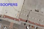
King Soopers #116 Thornton, Colorado
 Traffic Impact Study King Soopers #116 Thornton, Colorado Prepared for: Galloway & Company, Inc. 1.0 EXECUTIVE SUMMARY King Soopers #116, a grocery marketplace anchored commercial development, is proposed
Shockoe Bottom Preliminary Traffic and Parking Analysis
 Shockoe Bottom Preliminary Traffic and Parking Analysis Richmond, Virginia August 14, 2013 Prepared For City of Richmond Department of Public Works Prepared By 1001 Boulders Pkwy Suite 300, Richmond, VA
Traffic Impact Analysis Chatham County Grocery Chatham County, NC
 Chatham County Grocery Chatham County, NC TABLE OF CONTENTS 1. INTRODUCTION... 1 1.1. Location and Study Area... 1 1.2. Proposed Land Use and Access... 2 1.3. Adjacent Land Uses... 2 1.4. Existing ways...
2012 TOWN OF CASTLE ROCK MOTOR VEHICLE ACCIDENT FACTS PREPARED BY THE PUBLIC WORKS DEPARTMENT
 ATTACHMENT A 2012 TOWN OF CASTLE ROCK MOTOR VEHICLE ACCIDENT FACTS PREPARED BY THE PUBLIC WORKS DEPARTMENT ACKNOWLEDGEMENTS This report was assembled from data provided by the Castle Rock Police Department
Traffic Impact Analysis Walton Acres at Riverwood Athletic Club Clayton, NC
 Traffic Impact Analysis Walton Acres at Riverwood Athletic Club Clayton, NC 1. TABLE OF CONTENTS INTRODUCTION...1 1.1. Site Location and Study Area...1 1.2. Proposed Land Use and Site Access...2 1.3.
3.0 PROJECT DESCRIPTION
 The following section of the Draft EIR contains a description of the proposed Elk Grove Boulevard/SR 99 Interchange Modification project, consistent with the requirements of CEQA Guidelines Section 15124.
4. ENVIRONMENTAL IMPACT ANALYSIS 9. TRANSPORTATION AND TRAFFIC
 4. ENVIRONMENTAL IMPACT ANALYSIS 9. TRANSPORTATION AND TRAFFIC 4.9.1 INTRODUCTION The following section addresses the Proposed Project s impact on transportation and traffic based on the Traffic Study
M-58 HIGHWAY ACCESS MANAGEMENT STUDY Mullen Road to Bel-Ray Boulevard. Prepared for CITY OF BELTON. May 2016
 M-58 HIGHWAY ACCESS MANAGEMENT STUDY Prepared for CITY OF BELTON By May 2016 Introduction Missouri State Highway 58 (M-58 Highway) is a major commercial corridor in the City of Belton. As development has
CITY OF LOS ANGELES INTER-DEPARTMENTAL MEMORANDUM
 CITY OF LOS ANGELES INTER-DEPARTMENTAL MEMORANDUM Date: April 1, 219 To: Honorable City Council c/o City Clerk, Room 395, City Hall Attention: Honorable Mike Bonin, Chair, Transportation Committee From:
Traffic Circulation Study for Neighborhood Southwest of Mockingbird Lane and Airline Road, Highland Park, Texas
 ARIZONA TEXAS NEW MEXICO OKLAHOMA February 13, 2015 Mr. Meran Dadgostar P.E., R.S. Town of Highland Park 4700 Drexel Dr. Highland Park, Texas 75205 Re: Traffic Circulation Study for Neighborhood Southwest
HIGHBURY AVENUE/HAMILTON ROAD INTERSECTION IMPROVEMENTS PUBLIC INFORMATION CENTRE 1 MAY 14, 2015
 HIGHBURY AVENUE/HAMILTON ROAD INTERSECTION IMPROVEMENTS Municipal Class Environmental Assessment PUBLIC INFORMATION CENTRE 1 MAY 14, 2015 ACCESSIBILITY Under the Accessibility Standards 2015 for Customer
TRAFFIC IMPACT STUDY CRITERIA
 Chapter 6 - TRAFFIC IMPACT STUDY CRITERIA 6.1 GENERAL PROVISIONS 6.1.1. Purpose: The purpose of this document is to outline a standard format for preparing a traffic impact study in the City of Steamboat
Focused Traffic Analysis for the 200 Nellen Avenue Project
 March 13, 2017 Mr. Phil Boyle Town of Corte Madera 300 Tamalpais Drive Corte Madera, CA 94976-0159 Focused Traffic Analysis for the 200 Nellen Avenue Project Dear Mr. Boyle; W-Trans has completed a focused
Chapter 4 Traffic Analysis
 Chapter 4 Traffic Analysis PURPOSE The traffic analysis component of the K-68 Corridor Management Plan incorporates information on the existing transportation network, such as traffic volumes and intersection
TRAFFIC IMPACT STUDY And A TRAFFIC SIGNAL WARRANT ANALYSIS FOR A SENIOR LIVING AND APARTMENT DEVELOPMENT
 TRAFFIC IMPACT STUDY And A TRAFFIC SIGNAL WARRANT ANALYSIS FOR A SENIOR LIVING AND APARTMENT DEVELOPMENT DEERFIELD TOWNSHIP, WARREN COUNTY, OHIO Nantucket Circle and Montgomery Road () Prepared for: ODLE
Existing Conditions. Date: April 16 th, Dan Holderness; Coralville City Engineer Scott Larson; Coralville Assistant City Engineer
 Date: April 16 th, 2015 To: From: Re: Dan Holderness; Coralville City Engineer Scott Larson; Coralville Assistant City Engineer Darian Nagle-Gamm, Traffic Engineering Planner Highway 6 (2 nd Street) /
Description: Widen I-64 to 6 lanes from I-265 to the KY 53 interchange in Shelby County.
 I-64 KIPDA ID # 350 Project Type: ROADWAY CAPACITY Description: Widen I-64 to 6 lanes from I-265 to the KY 53 interchange in Shelby County. Purpose: Project will improve capacity and address safety concerns.
133 rd Street and 132 nd /Hemlock Street 132 nd Street and Foster Street MINI ROUNDABOUTS. Overland Park, Kansas
 133 rd Street and 132 nd /Hemlock Street 132 nd Street and Foster Street MINI ROUNDABOUTS Overland Park, Kansas September 1, 2017 TABLE OF CONTENTS 1. INTRODUCTION... 1 2. LITERATURE REVIEW... 1 3. CONCEPT
Harrah s Station Square Casino
 Transportation Analysis Harrah s Station Square Casino Pittsburgh, Pennsylvania Submitted To: City of Pittsburgh and Pennsylvania Gaming Control Board Prepared By: DKS Associates GAI Consultants December
APPENDIX E Evaluation of Improvement Alternatives
 APPENDIX E Evaluation of Improvement Alternatives Table E-1 Preliminary Comparison of Design Alternatives, Concord Table E-2 Preliminary Comparison of Route 2 Improvement Packages, Acton and Concord TABLE
University Hill Transportation Study Technical Memorandum Alternatives Modeling and Analysis May 2007
 Technical Memorandum May 2007 Syracuse Metropolitan Transportation Council Edwards and Kelcey with Wallace Roberts and Todd Alta Planning and Design CONTENTS SECTION ONE- INTRODUCTION...1 SECTION TWO-
PRELIMINARY DRAFT WADDLE ROAD / I-99 INTERCHANGE PROJECT ALTERNATIVE ANALYSIS FINAL TRAFFIC SUMMARY REPORT
 PRELIMINARY DRAFT WADDLE ROAD / I-99 INTERCHANGE PROJECT ALTERNATIVE ANALYSIS FINAL TRAFFIC SUMMARY REPORT Prepared by: In Association with: November 2013 EXECUTIVE SUMMARY Patton Township, in partnership
TRAFFIC ASSESSMENT River Edge Colorado
 TRAFFIC ASSESSMENT River Edge Colorado Submitted by: Fehr & Peers 621 17th Street, Ste. 231 Denver, CO 8293 (33) 296-43 December, 21 App. M-2 Traffic Assessment River Edge Colorado December 21 TABLE OF
WISCONSIN AVENUE EXTENSION SECOND PUBLIC INFORMATION MEETING. March 28, 2017
 WISCONSIN AVENUE EXTENSION SECOND PUBLIC INFORMATION MEETING March 28, 2017 STUDY AREA N MEETING AGENDA Introductions Study Background Alternatives Studied Recommended Alternative Discussion STUDY BACKGROUND
ORANGE COUNTY PUBLIC WORKS TRAFFIC INVESTIGATIONS
 ORANGE COUNTY PUBLIC WORKS TRAFFIC INVESTIGATIONS STAFF REPORT OF: January 6, 2019 SUPERVISORIAL DISTRICT: 5 SUBJECT: LOCATION: INVESTIGATOR: O Neill Drive at Roanoke Drive; Ladera Ranch; TB 922-E6 Clever
INNOVATIVE INTERSECTION DESIGN
 INNOVATIVE INTERSECTION DESIGN J. Eddie Valtier, P.E. ELP TP&D Director Introduction Why Do We Need To Start Looking For Innovative Intersection Designs? Congestion is worsening and traffic volumes and
Appendix B: Forecasting and Traffic Operations Analysis Framework Document
 Existing Conditions Report - Appendix Appendix B: Forecasting and Traffic Operations Analysis Framework Document This document defines the methodology and assumptions that will be used in the traffic forecasting
Highway 49, Highway 351 and Highway 91 Improvements Feasibility Study Craighead County
 Highway 49, Highway 351 and Highway 91 Improvements Feasibility Study Craighead County Executive Summary March 2015 Highway 49, Highway 351 and Highway 91 Improvements Feasibility Study Craighead County
5858 N COLLEGE, LLC N College Avenue Traffic Impact Study
 5858 N COLLEGE, LLC nue Traffic Impact Study August 22, 2016 Contents Traffic Impact Study Page Preparer Qualifications... 1 Introduction... 2 Existing Roadway Conditions... 5 Existing Traffic Conditions...
WEST AND SOUTH WEST RING ROAD DOWNSTREAM TRAFFIC IMPACTS
 Page 1 of 9 EXECUTIVE SUMMARY Alberta Transportation ( AT ) is preparing to construct the final sections of the Calgary Ring Road. This includes the South West Ring Road ( SWRR ) (from Lott Creek Blvd
#!! "$% ##! &! # '#! % $ #!
 Executive Summary US Highway 16 (US 16) is the primary corridor connecting Rapid City to the Black Hills region. It serves a growing population of commercial and residential traffic, as well as seasonal
Chapter 16: Traffic and Parking A. INTRODUCTION
 Chapter 6: Traffic and Parking A. ITRODUCTIO This chapter examines the potential traffic and parking impacts of the proposed Fresh Kills Park roads. The analysis of transit and pedestrians is presented
Northbound San Jose Avenue & I-280 Off-Ramp Road Diet Pilot Project
 Project Overview Fed by a two-lane Interstate-280 (I-280) off-ramp, high vehicular volumes and speeds are longstanding issues along San Jose Avenue. Residents in the surrounding neighborhoods have expressed
Appendix B. Environmental Resource Technical Memorandum. Assessment on Travel Pattern and Access Impacts
 Appendix B Environmental Resource Technical Memorandum Assessment on Travel Pattern and Access Impacts TECHNICAL MEMORANDUM ENVIRONMENTAL RE-EVALUATION FOR UNION STATION TO OAK CLIFF DALLAS STREETCAR To:
J Street and Folsom Boulevard Lane Conversion Project (T ) Before and After Traffic Evaluation
 Before and After Traffic Evaluation") J Street and Folsom Boulevard Lane Conversion Project (T15125400) Before and After Traffic Evaluation Prepared by Transportation Division June 2014 Executive Summary On February 12, 2013, the City of Sacramento
J Street and Folsom Boulevard Lane Conversion Project (T15125400) Before and After Traffic Evaluation Prepared by Transportation Division June 2014 Executive Summary On February 12, 2013, the City of Sacramento
FRONT RANGE CROSSINGS TRAFFIC IMPACT STUDY
 FRONT RANGE CROSSINGS TRAFFIC IMPACT STUDY Prepared for: City of Thornton And Colorado Department of Transportation Prepared by: 11 Blake Street, Suite 2 Denver, Colorado 822 Contact: Brian Bern, PE, PTOE
TRAFFIC IMPACT ANALYSIS
 TRAFFIC IMPACT ANALYSIS FOR THE CHAMPAIGN UNIT#4 SCHOOL DISTRICT PROPOSED HIGH SCHOOL (SPALDING PARK SITE) IN THE CITY OF CHAMPAIGN Final Report Champaign Urbana Urbanized Area Transportation Study 6/24/2014
4.0 Recommended Transportation Plan
 4.0 Recommended Transportation Plan The Town wants to provide a multi modal transportation system for its residents in order to provide them with options when making trips. The automobile has always been
APPENDIX F SUPPLEMENTAL TRAFFIC DATA
 APPENDIX F SUPPLEMENTAL TRAFFIC DATA Environmental and Planning Consultants 440 Park Avenue South 7th Floor New York, NY 10016 tel: 212 696-0670 fax: 212 213-3191 www.akrf.com Draft Memorandum To: Michael
4.0 Recommended Transportation Plan
 4.0 Recommended Transportation Plan The Town wants to provide a multi modal transportation system for its residents in order to provide them with options when making trips. The automobile has always been
METHODOLOGY. Signalized Intersection Average Control Delay (sec/veh)
") Chapter 5 Traffic Analysis 5.1 SUMMARY US /West 6 th Street assumes a unique role in the Lawrence Douglas County transportation system. This principal arterial street currently conveys commuter traffic
Chapter 5 Traffic Analysis 5.1 SUMMARY US /West 6 th Street assumes a unique role in the Lawrence Douglas County transportation system. This principal arterial street currently conveys commuter traffic
REPORT CONCURRENCE. City Manager. The General Manager concurs with the recommendation of this report.
 COUNCIL REPORT Report No. ENG 08-018 Executive Committee Date: May 0, 018 File No: 5400-1 To: From: Subject: Mayor and Council Purvez Irani, Senior Transportation Engineer Bluejay Street Road Improvements
Intersection of Massachusetts Avenue and Maple Street in Lexington Signalized Intersection and Roundabout Comparison
 Intersection of Massachusetts Avenue and Maple Street in Lexington Signalized Intersection and Roundabout Comparison Michael Wallwork, Roundabout Expert, Orange Park, Florida Tom Bertulis (MS, PE, PTOE),
NO BUILD TRAFFIC OPERATIONS
 3. 23 NO BUILD TRAFFIC OPERATIONS This section addresses the operations of the transportation system and details how it would be expected to function under year 23 No Build conditions with the projected
Waterford Lakes Small Area Study
 Waterford Lakes Small Area Study Existing Traffic Conditions PREPARED FOR: ORANGE COUNTY PUBLIC WORKS DEPARTMENT TRAFFIC ENGINEERING DIVISION ORLANDO, FLORIDA PREPARED WITH: INWOOD CONSULTING ENGINEERS
New Seward and 36 th Avenue Intersection Conceptual Design
 University of Alaska Anchorage New Seward and 36 th Avenue Intersection Conceptual Design Prepared By: Zaid S. Hussein Dana Menendez Galen Jones Civil Engineering Department Prof. Osama Abaza CE A404 Highway
Glenn Avenue Corridor Traffic Operational Evaluation
 Glenn Avenue Corridor Traffic Operational Evaluation PREPARED FOR: THE CITY OF AUBURN PREPARED BY: DECEMBER 2007 Glenn Avenue Corridor Study--Auburn, Alabama TABLE OF CONTENTS Introduction... 1 Background
Approximately 360 trail users cross during a typical summer weekday and 420 cross during a typical summer
 5. PARKR ROAD AT MISSISSIPPI AVN CROSSIN xisting Conditions The High ine Canal trail crosses Parker Road near the Mississippi Avenue intersection (crossing location #3 on Figure 1). South of Parker, the
Subject: Solberg Avenue / I-229 Grade Separation: Traffic Analysis
 MEMORANDUM Transportation Bill Troe, AICP Jason Carbee, AICP 12120 Shamrock Plaza Suite 300 Omaha, NE 68154 (402) 334-8181 (402) 334-1984 (Fax) To: Project File Date: Subject: Solberg Avenue / I-229 Grade
7 th Street Bike Lane Traffic Impact Study
 7 th Street Bike Lane Traffic Impact Study Submitted by: San Francisco Department of Parking and Traffic Michael Sallaberry June 11, 2001 EXECUTIVE SUMMARY This report presents the Department of Parking
Route 7 (East Market Street) Interchange at Battlefield Parkway Town of Leesburg Project No: UPC Presentation to Town Council
 Interchange at Battlefield Parkway Town of Leesburg Project No: UPC Presentation to Town Council") Route 7 (East Market Street) Interchange at Battlefield Parkway Town of Leesburg Project No: 0007-253-109 UPC 106573 Presentation to Town Council June 26, 2017 Council Decisions East Market Street / Battlefield
Route 7 (East Market Street) Interchange at Battlefield Parkway Town of Leesburg Project No: 0007-253-109 UPC 106573 Presentation to Town Council June 26, 2017 Council Decisions East Market Street / Battlefield
2016 Church Street Access Study. 100 Clinton Square 126 North Salina Street, Suite 100 Syracuse, NY
 2016 Church Street Access Study 100 Clinton Square 126 North Salina Street, Suite 100 Syracuse, NY 13202 www.smtcmpo.org Syracuse Metropolitan Transportation Council Final Report February 23, 2016 This
RM 620 FEASIBILITY STUDY
 RM 620 FEASIBILITY STUDY Sections 5 & 6 December 7, 2015 STUDY PROCESS Study Purpose and Goals The RM 620 Feasibility Study was launched by the Texas Department of Transportation (TxDOT) to analyze transportation
Purpose and Need. Chapter Introduction. 2.2 Project Purpose and Need Project Purpose Project Need
 Chapter 2 Purpose and Need 2.1 Introduction The El Camino Real Bus Rapid Transit (BRT) Project (Project) would make transit and other transportation improvements along a 17.6-mile segment of the El Camino
Brian McHugh, Buckhead Community Improvement District. SUBJECT: Wieuca Road at Phipps Boulevard Intersection Improvements Project
 MEMO TO: FROM: Brian McHugh, Buckhead Community Improvement District Jagan Kaja, AICP, WSP Parsons Brinckerhoff SUBJECT: Wieuca Road at Phipps Boulevard Intersection Improvements Project DATE: October
Iowa Highway 58 Corridor Improvement Study
 1 Iowa Highway 58 Corridor Improvement Study Public Informational Meeting May 6, 2014 2 Welcome and Introductions Randy Lorenzen, City of Cedar Falls Engineer 3 Outline of Presentation Review of Project
Lincoln Avenue Road Diet Trial
 Lincoln Avenue Road Diet Trial Data Collection Report June 1, 2015 Department of Transportation Table of Contents I. Introduction...... 3 II. Data Collection Methodology & Results...... 5 A. Traffic Volume
CHAPTER 3 STUDY AREA OPERATIONAL OVERVIEW
 HPTER 3 STUY RE OPERTIONL OVERVIEW This chapter describes the overall traffic operations within the study area under existing and future conditions and focuses on individual intersections not directly
Report Purpose To seek Council s approval of the Wye Road Functional Planning Study (January 2015).
.") COUNCIL MEETING Meeting Date: March 10, 2015 Agenda Item #: 13.1 Wye Road Functional Planning Study (January 2015) Report Purpose To seek Council s approval of the Wye Road Functional Planning Study (January
COUNCIL MEETING Meeting Date: March 10, 2015 Agenda Item #: 13.1 Wye Road Functional Planning Study (January 2015) Report Purpose To seek Council s approval of the Wye Road Functional Planning Study (January
WELCOME. Stakeholder Involvement Group Meeting #2 Round Lake Public Works October 24, 2018
 WELCOME Stakeholder Involvement Group Meeting #2 Round Lake Public Works October 24, 2018 MEETING AGENDA 1. Welcome and Introductions 2. Study Progress Update 3. Problem Statement 4. Technical Analysis
Figure 1: East West Connector Alignment Alternatives Concept Drawing
 Page 2 of 9 Figure 1: East West Connector Alignment Alternatives Concept Drawing The Montebello Drive extension will run north south and connect Wilsonville Road to the Boones Ferry Road to Brown Road
SECTION 7 INVENTORY OF SELECTED INTERSECTIONS AND RECOMMENDATIONS FOR FURTHER STUDY
 SECTION 7 INVEY OF SELECTED INTERSECTIONS AND RECOMMENDATIONS FOR FURTHER STUDY The study corridor includes a total of 19 signalized intersections. Through consultation with Campbell County and the KYTC,
7.0 FREEWAYS CONGESTION HOT SPOT PROBLEM & IMPROVEMENT PROJECT ANALYSIS & DEFINITION
 7.0 FREEWAYS CONGESTION HOT SPOT PROBLEM & IMPROVEMENT PROJECT ANALYSIS & DEFINITION 7.1 INTRODUCTION & METHODOLOGY FEASIBILITY REPORT Congestion hot spot problem locations have been assessed using the
City of Scotts Valley CITY COUNCIL STAFF REPORT
 DATE: April 19, 2017 City of Scotts Valley CITY COUNCIL STAFF REPORT AGENDA ITEM 2 DATE: 4-19-2017 TO: FROM: APPROVED: SUBJECT: Honorable Mayor and City Council Scott Hamby, Public Works Director Jenny
CITY OF ALPHARETTA DOWNTOWN MASTER PLAN TRAFFIC EVALUATION
 CITY OF ALPHARETTA DOWNTOWN MASTER PLAN TRAFFIC EVALUATION June 2015 CITY OF ALPHARETTA DOWNTOWN MASTER PLAN TRAFFIC EVALUATION Introduction The Alpharetta Downtown Master Plan was developed in the fall
Summary: Mercer County Princeton Avenue & Spruce Street Study January 2009
 Summary: Several recent studies have assessed potential development and redevelopment opportunities in the Mercer Crossing area of Trenton, Ewing, and Lawrence. This Princeton Avenue and Spruce Street
DUNBOW ROAD FUNCTIONAL PLANNING
 DUNBOW ROAD FUNCTIONAL PLANNING Final Report August 3, 216 #31, 316 5th Avenue NE Calgary, AB T2A 6K4 Phone: 43.273.91 Fax: 43.273.344 wattconsultinggroup.com Dunbow Road Functional Planning Final Report
TECHNICAL MEMORANDUM
 TECHNICAL MEMORANDUM DATE: January 17, 2005 TO: Ted Idlof, URS FROM: Jeff Clark, Fehr & Peers RE: U.S. 50 Interchange Planning Study 1042-2011 This memorandum describes conceptual improvements for the
Highway 111 Corridor Study
 Highway 111 Corridor Study June, 2009 LINCOLN CO. HWY 111 CORRIDOR STUDY Draft Study Tea, South Dakota Prepared for City of Tea Sioux Falls Metropolitan Planning Organization Prepared by HDR Engineering,
Draft North Industrial Area-Wide Traffic Plan
 Summary of North Industrial and Hudson Bay Industrial Recommended Improvements Table 1. Summary of s Item Location 1 2 3 4 5 6 7 8 9 10 11 12 Millar Ave north of 51st St Super 8 Motel back lane 400 Block
Abrams Associates. Transportation Impact Analysis. City of Rocklin. Prepared for: David Mohlenbrok City of Rocklin 4081 Alvis Court Rocklin, CA 95677
 Transportation Impact Analysis Sierra College Boulevard Commercial Project City of Rocklin Prepared for: David Mohlenbrok City of Rocklin 081 Alvis Court Rocklin, CA 95677 Prepared by: 1875 Olympic Boulevard,
91
 90 91 92 93 94 95 96 97 98 99 100 101 102 103 104 105 106 As previously depicted in Exhibit 4-J, vehicular accidents are shown along Forrester Road. The contributing factors may be due to its current two
Los Altos Hills Town Council - June 18, 2015 Palo Alto City Council June 22, AGENDA ITEM #2.B Presentation
 Los Altos Hills Town Council - June 18, 2015 Palo Alto City Council June 22, 2015 AGENDA ITEM #2.B Presentation Previous Presentations Los Altos Hills Town Council in May 2014 and February 2015 Palo Alto
MINERAL AVENUE CORRIDOR ASSESSMENT STUDY IMPLEMENTATION STRATEGY
 MINERAL AVENUE CORRIDOR ASSESSMENT STUDY IMPLEMENTATION STRATEGY INTRODUCTION City Personnel Sign-in Sheet Comment Forms Please Write Down Any Feedback INTRODUCTION List of Topics for Presentation Study
Welcome! San Jose Avenue Open House August 25, 2015
 Welcome! San Jose Avenue Open House August 25, 2015 Vision Zero The City and County of San Francisco adopted Vision Zero San Francisco Vision Zero High Injury Network as a policy in 2014, committing an
Toronto and East York Community Council. Director, Transportation Services, Toronto and East York District
 No Turn on Red Regulations STAFF REPORT ACTION REQUIRED Date: June 1, 2010 To: From: Toronto and East York Community Council Director, Transportation Services, Toronto and East York District Wards: Trinity
REVIEW OF LOCAL TRAFFIC FLOW / LONG RANGE PLANNING SOLUTIONS STUDY
 ITEM Town of Atherton TRANSPORTATION COMMITTEE STAFF REPORT TO: FROM: MEMBERS OF THE COMMITTEE ROBERT OVADIA, PUBLIC WORKS DIRECTOR DATE: FEBRUARY 12, 2019 SUBJECT: REVIEW OF LOCAL TRAFFIC FLOW / LONG
Figure 1: Vicinity Map of the Study Area
 ARIZONA TEXAS NEW MEXICO OKLAHOMA May 5, 2016 Mr. Anthony Beach, P.E. BSP Engineers 4800 Lakewood Drive, Suite 4 Waco, Texas 76710 Re: Intersection and Access Analysis along Business 190 in Copperas Cove
Michael A. Werthmann, PE, PTOE Principal
 9575 West Higgins Road, Suite 400 Rosemont, Illinois 60018 p: 847-518-9990 f: 847-518-9987 MEMORANDUM TO: FROM: Brian Lorenc GHB-630, LLC Michael A. Werthmann, E, TOE rincipal Luay R. Aboona, E rincipal
Include autoturn exhibits of WB-67 trucks at each roundabout.
 1 Along the through path, the desired relationship is R1>R2
Introduction Roundabouts are an increasingly popular alternative to traffic signals for intersection control in the United States. Roundabouts have a
 HIGH-CAPACITY ROUNDABOUT INTERSECTION ANALYSIS: GOING AROUND IN CIRCLES David Stanek, PE and Ronald T. Milam, AICP Abstract. Roundabouts have become increasingly popular in recent years as an innovative
Highway 217 Corridor Study. Phase I Overview Report
 Highway 217 Corridor Study Phase I Overview Report November 3, 24 BACKGROUND AND OVERVIEW Study purpose The Highway 217 Corridor Study is developing multi-modal transportation solutions for traffic problems
ENHANCED PARKWAY STUDY: PHASE 2 CONTINUOUS FLOW INTERSECTIONS. Final Report
 Preparedby: ENHANCED PARKWAY STUDY: PHASE 2 CONTINUOUS FLOW INTERSECTIONS Final Report Prepared for Maricopa County Department of Transportation Prepared by TABLE OF CONTENTS Page EXECUTIVE SUMMARY ES-1
NORTH TURNAROUND. Recommended Design: Expand the existing transit terminal
 NORTH TURNAROUND Recommended Design: Expand the existing transit terminal Feedback from stakeholders and the public: Make it easy to transfer between local and Rapid Transit service Why is this design
Roundabouts Near At-Grade Railroad Crossings
 Roundabouts Near At-Grade Railroad Crossings May 12, 2008 1,592 Words Alex J. Ariniello LSC Transportation Consultants, Inc., 1889 York Street Denver, CO 80206 Phone: 303-333-1105 FAX: 303-333-1107 email:
Operational Comparison of Transit Signal Priority Strategies
 Operational Comparison of Transit Signal Priority Strategies Revision Submitted on: November, 0 Author: Adriana Rodriguez, E.I Assistant Engineer Parsons Brinckerhoff 0 South Orange Avenue, Suite 00 Orlando,
State Road 54/56 Tampa Bay s Northern Loop. The Managed Lane Solution Linking I-75 to the Suncoast Parkway
 State Road 54/56 Tampa Bay s Northern Loop The Managed Lane Solution Linking I-75 to the Suncoast Parkway SUNCOAST PARKWAY Both I 75 and the Suncoast Parkway are planning, or in the process of constructing,
FINAL DESIGN TRAFFIC TECHNICAL MEMORANDUM
 FINAL DESIGN TRAFFIC TECHNICAL MEMORANDUM July 2014 FINAL (SR 43) Project Development and Environment Study From State Road 60 (Adamo Drive) to I-4 (SR 400) Hillsborough County, Florida Work Program Item
Roundabout Feasibility Memorandum
 Roundabout Feasibility Memorandum To From Gwen Pipkin Bill Howell Date June 18, 2013 Subject Roundabout Feasibility Study SR 29 PD&E Study From Oil Well Road to SR 82 Collier County, FL FPID 417540-1-22-01
6.0 PEDESTRIAN AND BICYCLE FACILITIES 6.1 INTRODUCTION 6.2 BICYCLE DEMAND AND SUITABILITY Bicycle Demand
 6.0 PEDESTRIAN AND BICYCLE FACILITIES 6.1 INTRODUCTION Bicycle and pedestrian travel along and in the vicinity of the corridor is part of the vision of Somerset and Hunterdon counties and the integrated
DOWNTOWN TUPELO MAIN STREET: ROAD DIET STUDY
 DOWNTOWN TUPELO MAIN STREET: ROAD DIET STUDY Since mid-2009, RPM Transportation Consultants (RPM) has worked with the Downtown Tupelo Main Street Association to evaluate traffic conditions and potential
Traffic Impact Study. Roderick Place Columbia Pike Thompson s Station, TN. Transportation Group, LLC Traffic Engineering and Planning
 F i s c h b a c h Transportation Group, LLC Traffic Engineering and Planning Traffic Impact Study Roderick Place Columbia Pike Thompson s Station, TN Prepared March 2016 Ms. Gillian L. Fischbach, P.E.,
Transportation Corridor Studies: Summary of Recommendations
 Transportation Corridor Studies: Summary of Recommendations Route 4 Corridor Study: Route 10 Corridor Study: Route 44 Corridor Study: Route 175 Corridor Study: Route 5/15 Corridor Study: Rentschler Field