APPENDIX B: CAMBRIDGE NORTH WEST TRANSPORT STUDY
|
|
|
- Jordan Parrish
- 5 years ago
- Views:
Transcription
1 APPENDIX B: CAMBRIDGE NORTH WEST TRANSPORT STUDY Appendices not included due to size Whole report including appendices can be found here: reas/northwest/
2 Cambridge North West Final Report JOB NUMBER: DOCUMENT REF: Final Report E.doc E Final Report (Final Revision) RC CPG AR CPG July 2007 D Final Report (2nd Revision) RC CPG AR CPG June 2007 C Final Report (Revised) RC CPC SH CPG Feb 2007 B Final Report RC CPG SH CPG Dec 2006 A Draft Report for Comment RJ CPG SH CPG Sept 2006 O Draft Report Rev O RJ CPG SH CPG Aug 2006 Originated Checked Reviewed Authorised Date Revision Purpose Description
3
4 Contents Section Page 1. Introduction 1-1 Introduction 1-1 Background 1-1 Proposed Development 1-2 Aims and Objectives of this Study 1-4 Structure of this Report Setting the Scene 2-1 Regional Planning Policy 2-1 Local Planning Policy 2-1 Supplementary Planning Guidance 2-3 Other Relevant Studies 2-3 Summary North West Cambridge Today 3-1 Accessibility 3-1 Transport Networks 3-2 Existing Travel Patterns 3-10 Key Issues and Opportunities Methodology 4-1 Philosophy 4-1 Process 4-1 Traffic Modelling Strategic Options 5-1 Promoting Sustainable Travel 5-1 Strategic Highway Options Highway Option Testing 6-1 Strategic Traffic Modelling Assessment 6-1 Local Junction Capacity Assessments 6-7 Summary i Final Report E.doc
5 7. The Preferred Transport Option 7-1 The Preferred Transport Option 7-1 Cost of Delivery of the Preferred Transport Option 7-5 Phasing of the Transport Preferred Transport Option 7-9 Summary Summary 8-1 Fundamental Principles of the 8-1 Elements of the Preferred Transport Option 8-1 Delivering the Preferred Transport Option 8-2 Recommendations for Further Study 8-3 List of Tables Table Cambridge North West Development Levels 1-3 Table Cambridge Railway Station Services 3-3 Table Mode Share: Castle Ward 3-10 Table Cambridge North West Development: Key Issues 3-12 Table Cambridge North West Development: Key Opportunities 3-13 Table CNW Car Driver Trip Rates 4-4 Table Total Vehicles Base 2003 and Base Table Total Vehicles Base 2025 and 2025 with Development 6-4 Table Option Transport Modelling Summary 6-5 Table Huntingdon Road/University Site Access Preferred Highway Option 6-8 Table Orbital Road/Huntingdon Road Preferred Highway Option 6-9 Table Madingley Road/University Site Access Preferred Highway Option 6-9 Table Histon Road/NIAB Site Access Preferred Highway Option 6-10 Table Histon Road Base TRANSYT 6-11 Table Histon Road Preferred Highway Option TRANSYT 6-12 Table Land Use 7-1 Table New bus route service frequencies (Buses per hour peak and off peak) 7-2 Table New Route costs per annum (Low Public Transport Enhancements) 7-6 Table New Route Costs (High Public Transport Enhancements) 7-6 Table Estimation of Extra Bus Revenue (Low Land Use Scenario) 7-7 Table Estimation of Extra Bus Revenue (High Land Use Scenario) 7-7 Table Summary of Operating Costs and Revenues 7-8 Table Operating Subsidy Required (negative indicates surplus produced) 7-8 Table Preferred Transport Option Cost Estimate ii Final Report E.doc
6 List of Figures Figure Site Location 1-6 Figure CNW Site Accessibility 3-15 Figure Public transport access isochrones: 640 Metres Distance 3-16 Figure Existing Cycle Network 3-17 Figure Existing Highway Network 3-18 Figure Existing Traffic Flows Vehicles (2003): AM Peak Hour Hours 3-19 Figure Origin of Workplace Trips: Castle Ward 3-20 Figure Modal Share: Cambridge, Barhill and Castle Ward 3-20 Figure Method of Approach 4-6 Figure Public Transport Strategy 5-7 Figure Walking Strategy 5-8 Figure Cycling Strategy 5-9 Figure Strategic Highway Option A 5-10 Figure Strategic Highway Option B 5-11 Figure Base Model Q/S: Local Area 6-14 Figure Base Model Q/S: Wider Area 6-15 Figure Base Model Q/S: Local Area 6-16 Figure Base Model Q/S: Wider Area 6-17 Figure with Development: Highway Option A Approved Land Use: Local Area 6-18 Figure with Development: Highway Option A Approved Land Use: Wider Area 6-19 Figure with Development: Highway Option A Sensitivity Test Land Use: Local Area 6-20 Figure with Development: Highway Option A Sensitivity Test Land Use: Wider Area 6-21 Figure with Development: Highway Option B Approved Land Use: Local Area 6-22 Figure with Development: Highway Option B Approved Land Use: Wider Area 6-23 Figure with Development: Highway Option B Sensitivity Test Land Use: Local Area 6-24 Figure with Development: Highway Option B Sensitivity Test Land Use: Wider Area 6-25 Figure Preferred Highway Option Land Use Scenario 1: Local Area 6-26 Figure 6.14 Preferred Highway Option Land Use Scenario 1: Wider Area 6-27 Figure Preferred Highway Option Land Use Scenario 2: Local Area 6-28 Figure Preferred Highway Option Land Use Scenario 2: Wider Area 6-29 Figure Preferred Highway Option 6-30 Figure Typical Cross Section of Orbital Road 7-11 Figure Proposed Phasing of the Preferred Transport Option iii Final Report E.doc
7 List of Appendices Appendix A - Planning Policy Note Appendix B - Public Transport Assessment Appendix C - Initial Option Evaluation Appendix D - Trip Rate Assessment Appendix E - SATURN Modelling Results Appendix F - LINSIG Printouts Appendix G - TRANSYT Results A B C D E F G iv Final Report E.doc
8 1. Introduction INTRODUCTION 1.1 Atkins has been commissioned by Cambridgeshire County Council (CCC) to undertake a for a development site to the north west of Cambridge City Centre, known as Cambridge North West (CNW). The study has been managed by CCC and steered by representatives from the relevant local planning authorities, namely Cambridge City Council (CCiC) and South Cambridgeshire District Council (SCDC). 1.2 This report presents the analysis undertaken as part of the for CNW. It also details the transport schemes, measures and proposals associated with the Preferred Transport Option for the CNW site. The Preferred Transport Option has been developed in consultation with the following parties: Strategic Steering Group: composed of Officers from CCC, CCiC and SCDC; CNW Joint Member Reference Group: composed of Officers and Council Members from the same three parties; A Technical Group: composed of developers with interests in the area and their transport consultants along with representatives from Cambridgeshire Horizons (CH); and The Highways Agency (HA). BACKGROUND 1.3 The Cambridgeshire and Peterborough Structure Plan (2003) identified the need for 47,500 new dwellings in the Cambridge sub-region during the period A key policy aim of the Structure Plan (Policy P1/1 Approach to Development and Policy P8/1 Sustainable Development: Links between Land Use and Transport) is to locate as much new housing as possible either within or on the edge of Cambridge, close to existing services, facilities and established public transport networks. 1.5 To this end, a major area for new development has been identified in CNW on land between Madingley Road and Histon Road. Part of this land is within the Cambridge City boundary and has been allocated for development within the Cambridge City Local Plan, whilst the remainder of the site is within the District of South Cambridgeshire and is currently being considered as part of the SCDC Local Development Framework. 1.6 CCC and the local planning authorities recognise that development of the CNW site will generate significant travel demands in an area of Cambridge where radial routes, particularly Huntingdon Road, already experience congestion in peak periods. In addition planning policy guidance dictates that all new development in Cambridgeshire (including CNW) must promote sustainable travel, providing travel choices by walking, cycling and public transport, whilst discouraging travel by the Final Report D.doc
9 private car. This study has therefore been commissioned to inform development at the site, ensuring that an appropriate level of highway capacity is available whilst promoting travel within the site and to surrounding areas by modes of travel other than the private car. PROPOSED DEVELOPMENT Site Location 1.7 CNW consists of two distinct land parcels as follows: Parcel A (also known as the University site): Land between Madingley Road and Huntingdon Road which has been identified for University related uses, meeting the long term housing needs of the University up to This land includes land within Cambridge City and South Cambridgeshire District. The land will be the subject of a Joint Area Action Plan as described in Section 2.14 of this report; and Parcel B (also known as the NIAB Site): Land between Huntingdon Road and Histon Road (B1049) which has been identified for housing on land within Cambridge City and other uses on South Cambridge District land. A masterplan will be prepared for the site to take forward City Local Plan and South Cambridgeshire Local Development Framework proposals for the area. 1.8 The location of CNW and its two constituent land parcels is shown in Figure Land within Parcel B is defined as land between Huntingdon Road and Histon Road (B1049). When Histon Road is used in this report it refers to the B1049 between its junctions with the A14 and Victoria Road. It is recognised that this section of road actually has two names: Histon Road towards its junction with Victoria Road and Cambridge Road towards its junction with the A14. Development Land Use Options 1.10 In order to provide a robust assessment of the transport impacts of the development of CNW, two development options have been considered for the site The first development scenario (Scenario 1) is the allocated development level. This includes the development allocations outlined in policies P9/7 and P9/8 of the City Local Plan (for development within the City boundary) The second development scenario (Scenario 2) is the sensitivity development level. This includes the allocated development level plus all extra development that developers would like to provide on the site. For the land between Madingley Road and Huntingdon Road these levels have been agreed with Cambridge University. For the land between Huntingdon Road and Histon Road the levels have been agreed with David Wilson Estates who recently submitted (December 2006) a planning application for the land within Cambridge City. It should be noted that these development levels will be used to provide a worst case assessment of the transport implications of maximum development at the site Final Report D.doc
10 1.13 The Scenario 1 and Scenario 2 development levels have been agreed with the CNW Steering Group. The agreed development levels are shown in Table 1.1. Table Cambridge North West Development Levels Scenario 1: Allocated Development NIAB Land Scenario 2: Sensitivity Development NIAB Land Land Use Quantity Unit Land Use Quantity Unit Residential 1780 Dwellings Residential 2800 Dwellings Primary School 2.3 Hectares Primary School 4.6 Hectares Local centre 1 Hectare Local centre 1.6 Hectares Secondary school 8 Hectares Secondary school 8 Hectares Scenario 1: Allocated Development University Land Scenario 2: Sensitivity Development University Land Land Use Quantity Unit Land Use Quantity Unit Primary School 2.3 Hectares Primary School 3.8 Hectares Residential 1150 Dwellings Residential 2500 Dwellings (Key worker 50%) 575 (Key worker 50%) 1250 (Private/Market 50%) 575 (Private/Market 50%) 1250 Higher Education 14 Hectares Earth Science Faculty Hectares University Related Research 6 Hectares University Related Research Total 100,000 sq.m (Academic Faculty) (50,000) (Commercial) (50,000) Local Centre 1 Hectare Local Centre 2.2 Hectares Student Housing 2,000 Units 1.14 The agreed development levels are based upon the following: The exact location of the secondary school has not yet been agreed. It has been placed on land between Huntingdon Road and Histon Road to provide a worst case assessment in terms of planning/educational impact; The eight hectare secondary school will accommodate eight forms of entry; It has been assumed that each site must provide for its own needs for primary education; Final Report D.doc
11 A primary school of 2.3 hectares will accommodate two forms of entry, a primary school of 3.8 hectares will accommodate three forms of entry and a primary school of 4.6 hectares will accommodate four forms of entry; Local centres are comprised of retail (A1, A2 and A3) uses; Local centre size increases in proportion to the number of houses; and The University s aspirations for research development are 100,000 sq.m. Half of this is assumed to be academic and the remaining half commercial space The agreed development levels have provided the basis for the assessment of the transport impact of the proposed development as part of this study. AIMS AND OBJECTIVES OF THIS STUDY 1.16 The primary aim of the study is to prepare a Preferred Transport Option for the CNW site which promotes sustainable development and integrates this major growth area into Cambridge City and its surrounding areas The study and its findings will provide support to SCDC and CCiC in the Local Development Process. The will also provide the Steering Group with information to review forthcoming planning applications The objectives of the study include: To promote sustainable travel within the site and to surrounding areas (Structure Plan P8/1, P8/3); To cover all modes of travel and include the full range of transport schemes, measures and improvements required to facilitate implementation of the Joint Area Action Plan including those for public transport, cycling, walking and highways; To have regard to local planning policy guidance and the Long Term Transport Strategy (see Section 2.24); To integrate the site into the surrounding transport networks whilst minimising the impact on these networks; To provide a comprehensive network of safe and convenient walk and cycle routes (Structure Plan P8/8, P8,9); To provide a network of High Quality Public Transport services (Structure Plan P8/6); Ensure an appropriate level of highway capacity; Link to local and national highways networks; Be consistent with CCC s objectives of promoting alternative travel modes to the car, minimising the need to travel and minimising the traffic impact on the wider highway networks (Structure Plan P8/1, P8/2); and Establish key principles for access linking the two development areas Final Report D.doc
12 What the CNW is and isn t 1.19 The CNW is a strategic study which aims to assess the impacts of potential growth in CNW upon the existing transport infrastructure in the vicinity of the development and across the wider Cambridgeshire area. From this assessment the study will outline what new infrastructure and services would need to be put into place to address any adverse transport impacts arising from the development The CNW is a local study and proposes new infrastructure and services to meet the immediate needs of development of the site only. It does not provide a full scale review for the Cambridgeshire area as a whole as this is covered by the Long Term Transport Strategy (LTTS) which considers the impact of a number of developments taking place across Cambridgeshire As stated in Section 1.16, the CNW will inform Members of CCiC and SCDC as the planning process for the site progresses. In particular the study will enable Members to consider the transport impact of development of the whole of the CNW site despite the fact that planning applications for different parts of the site may come forward separately and at different times. In a similar manner the study will allow developers to consider the cumulative impact of the development of the whole of the CNW site of which their development may only form a part. STRUCTURE OF THIS REPORT 1.22 This report contains seven further sections. Section 2 summarises the planning policy context. Section 3 describes the existing transport situation for the site and its surrounding area and identifies the issues and opportunities associated with the site. Section 4 describes the methodology followed during the CNW Transport Study. Section 5 describes the strategic options developed in consultation with stakeholders and the CNW Steering Group which have been analysed as part of this study. Section 6 summarises the results of this analysis. Section 7 presents the Preferred Transport Option for the CNW site and finally Section 8 presents our conclusions Final Report D.doc


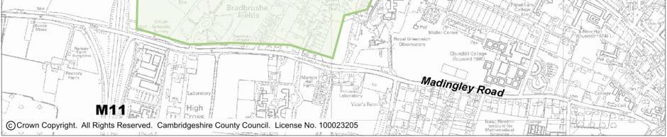
13 Figure Site Location Final Report D.doc
14 2. Setting the Scene 2.1 The for CNW has been undertaken with regard to regional and local planning policy guidance (see Section 1.18). It also considers the results of previous studies carried out in the area, including the Long Term Transport Strategy (LTTS). A detailed review of the relevant planning policy guidance and other relevant studies is provided in Appendix A of this report and summarised below. REGIONAL PLANNING POLICY Regional Planning Guidance Note 6 (RPG6): Regional Planning Guidance for East Anglia to 2016 (November 2000) 2.2 Adopted Regional Planning Policy Guidance in East Anglia is currently described in Regional Planning Guidance (RPG) Note 6 (November 2000). The sustainable strategy for development presented in RPG6 informs local development plans including the Cambridge and Peterborough Structure Plan, Cambridge City Local Plan, SCDC Local Plan and emerging Local Development Frameworks. 2.3 RPG6 makes clear the preferred locations for development in the Cambridge subregion, including the City itself (subject to capacity reviews) and on the periphery of the built up area (subject to Green Belt review). The CNW development site is located on the periphery of the built up area. East of England Plan 2.4 The East of England Plan is a draft spatial strategy to guide development in the East of England for the next 20 years. The Plan has been developed as a revision to RPG6 and is expected to be published as an adopted document in Policy H1 of the Plan outlines the number of new houses local development documents should provide for, including 14,700 new homes to be located in Cambridge between 2001 and This will include new homes built on the CNW site. 2.6 Following a process of review by the Secretary of State, a number of amendments to the draft East of England Plan have been proposed (Secretary of State s Proposed Changes to the Draft Revision to the Regional Spatial Strategy for the East of England and Statement of Reasons, December 2006). The proposed changes to Policy H1 state that 19,000 new homes should be provided in Cambridge between 2001 and This is a potential increase of 4,300 homes compared to the draft East of England Plan figure (detailed in Section 2.5). LOCAL PLANNING POLICY Cambridge and Peterborough Structure Plan The Cambridge and Peterborough Structure Plan was adopted by CCC and Peterborough District Council in October 2003 and provides the strategic policy Final Report D.doc
15 framework for planning and development that will take place locally during the period The Plan informs the development of local plans for neighbouring areas, including the Cambridge Redeposit Local Plan, SCDC Local Plan and emerging Local Development Documents. 2.8 The Structure Plan indicates that 47,500 new homes should be provided in the Cambridge sub-region between 1999 and 2016 (Policy P9/1), including 8,000 located on the edge of Cambridge subject to a review of the Green Belt boundary. These should be located in areas which are or can be made to be highly accessible by public transport and will also provide opportunities for travel choice (Policy P8/1). 2.9 The Structure Plan also outlines the schemes which will be sought to be implemented over the Plan period, including Chesterton Interchange and the Guided Busway between Huntingdon and Cambridge. Cambridge Redeposit Local Plan 2.10 The Cambridge Redeposit Local Plan was formally adopted in July The Local Plan sets out the policies and proposals for future development and land use up to The Local Plan sets out housing provision within the City, including for CNW within policies P9/7 (University site) and P8/7 (NIAB site). The policies include statements on land use and accessibility which will inform the for CNW. South Cambridgeshire Local Plan (2004) 2.12 The South Cambridgeshire Local Plan sets out the detailed policies and proposals for the control of development in the District up to The Local Plan does not include land use allocations for the South Cambridgeshire District land within the CNW development site, which is classified as Green Belt. Local Development Framework for South Cambridgeshire 2.14 SCDC are currently preparing a Local Development Framework (LDF) to replace the existing Local Plan under new government legislation for development plans. The LDF will set out the policies and proposals for the use of land in the District for the period to The LDF is comprised of Local Development Documents, Area Action Plans (AAP) and Supplementary Planning Guidance. A Joint AAP is currently being prepared for CNW by SCDC and CCiC. The AAP Issues and Options report will draw upon the findings of this and will be published in April/May The final LDF document is proposed to be adopted in Final Report D.doc
16 SUPPLEMENTARY PLANNING GUIDANCE Northern Corridor Area Transport Plan (NCATP) 2003 and Western Corridor Area Transport Plan (WCATP) The NCATP and WCATP form Supplementary Planning Guidance to the Cambridge Local Plan and South Cambridgeshire Local Plan The NCAPT covers an area including north Cambridge and bordering parishes in South Cambridgeshire District whose transport issues are intrinsically linked to those of the City. The NCATP includes the northern half of the NIAB site The WCAPT covers an area including west Cambridge and bordering parishes in South Cambridgeshire District (SCD) whose transport issues are intrinsically linked to those of the City. The WCATP includes the southern half of the NIAB site and all of the University Site A number of schemes are to be secured for these areas through developer contributions. These include: Contributions to real time passenger information; Extensions/amended frequency on Citi 2, 4 and 6 bus routes; Cycle improvements/routes: Kings Hedges riverside; Histon Interchange; Histon Road Trumpington Road; Huntingdon Road Barton Road; Madingley Road; and Bus priority measures at A1303/Madingley Road Many of these improvements will be associated with development outside the CNW site; however they will improve facilities for residents of the CNW site. OTHER RELEVANT STUDIES Cambridge to Huntingdon Multi- Modal Study 2001 (CHUMMS) 2.21 CHUMMS was undertaken on behalf of the Department of Transport, Local Government and the Regions (DTLR) by a consortium of consultants. The findings of the study have informed development of regional and local planning policy The study recommends the following infrastructure schemes to support development: Cambridgeshire Guided Busway; A14 widening (Ellington Fen Ditton) with parallel local roads; Full consideration of non-motorised travellers in the design of new schemes; and Demand management to stabilise traffic entering Cambridge and promote public transport These recommendations have been further considered by the LTTS Final Report D.doc
17 Long Term Transport Strategy (LTTS) 2.24 Alongside the Cambridge Re-deposit Local Plan, CCC in partnership with the District Councils commissioned consultants to prepare a Long Term Transport Strategy (LTTS) for Cambridgeshire covering the period The LTTS will examine the implications of development growth planned across the whole of Cambridgeshire, including the CNW development, at a strategic level The aim of the LTTS is to ensure that the scale of development in Cambridge can be accommodated in a sustainable manner. The LTTS will also inform the development of regional strategies, Local Plans and Local Development Frameworks and will provide CCC with a solid base from which to bid for Government funding for transport schemes related to development A high-level summary of the LTTS has been published by CCC. This contains measures proposed for: rural areas; strategic corridors; market towns and their hinterland; and Cambridge City The LTTS recognises that growth in Cambridge City will need to be accompanied by a substantial increase in walking, cycling and public transport use. Measures suggested include: Smarter Choices: Workplace travel plans and personal journey planning; Walking and Cycling: Reallocation of roadspace and provision of a walk/cycle infrastructure integrated with the public realm; Public Transport: Town centre shuttle buses, new/enhanced bus interchange facilities, bus priority measures and links to development areas; Demand Management: Parking policy controls, physical roadspace controls; and Highway Improvements: Traffic management schemes to reduce impacts, integrated safety improvements, improved/new access to development The main recommendation of the study is that a package of measures is required to ensure that the scale of development proposed in Cambridge can be accommodated in a sustainable manner. This package of measures will include improvements to public transport and walking and cycling facilities along with demand management measures to control growth in travel by car in Cambridge Work is continuing through further studies such as the Cambridge Area Transport Strategy, to determine the exact package of public transport, walking and cycling measures and most appropriate form of demand management for Cambridge. The for the CNW site will employ the principles of the LTTS in terms of promoting sustainable travel and using a demand management approach to the private car. Additional public transport, walking, cycling and demand management measures implemented as part of the LTTS should serve to enhance those implemented as part of the CNW development Final Report D.doc
18 SUMMARY 2.30 Regional and Local Planning Policy Guidance suggests that 8,000 new homes will be built on the edge of Cambridge between 1999 and These will include homes built in CNW Policy Guidance also dictates that all new development must promote sustainable travel by walking, cycling and public transport whilst managing demand for travel by the private car. These will form the main principles for development of transport options for the CNW site as part of this study In addition planning policy and other studies carried out in Cambridgeshire suggest that the following major infrastructure improvements will be required during the period to support ongoing development: Huntingdon to Cambridge Guided Busway; A14 widening (Ellington to Fen Ditton); and Chesterton Station Interchange The impact of these infrastructure improvements on the CNW site will be considered as part of the CNW Final Report D.doc
19 3. North West Cambridge Today 3.1 This section of the report describes the existing transport situation in the vicinity of CNW. ACCESSIBILITY 3.2 In order to predict the potential travel demand patterns generated by the CNW site it is useful to consider the likely main trip attractors for residents of the development. 3.3 Figure 3.1 shows the proximity of CNW in relation to key trip attractors in Cambridge including: Employment: Cambridge Science Park; University West site; Cambridge City Centre; Newmarket Road Retail Park; and Addenbrooke s Hospital. Education: Primary and secondary schools; Further education colleges; and University colleges. Retail: Cambridge City Centre; and Newmarket Road Retail Park. Leisure: Open spaces; and Cambridge City Centre. 3.4 Figure 3.1 shows isochrones for 15 minute walking distance (1.2 kilometres) and 15 minutes cycling distance (5 kilometres) from the centre of the CNW site. These isochrones identify the key trip attractors within walking and cycling distance of the site: Walking: University West; and Primary schools. Cycling: City Centre; Primary and secondary schools and further education college; Open spaces; and Cambridge Science Park Final Report D.doc
20 3.5 All remaining trip attractors, including Addenbrooke s Hospital and Cambridge Railway Station are considered to be beyond reasonable walking or cycling distance from the site and are therefore only accessible by public transport or the private car. This analysis is based upon the assumption that the majority of residents of the new development would not travel beyond the nationally recognised standards for maximum walking and cycling distances (as outlined in Planning Policy Guidance Note 13). It is noted that there is a strong cycling culture in Cambridge and the surrounding area which means that some residents of the city are likely to be willing to cycle distances beyond these nationally recognised standards. In particular, our public consultation during the latter stages of this project identified that residents of Girton and Histon cycle to Cambridge Railway Station. Although this pattern is likely to be replicated by some residents of the proposed development it is likely that the majority of residents would not be prepared to travel further than the nationally recognised standards used in this study. TRANSPORT NETWORKS Public Transport Network 3.6 The existing public transport networks in the vicinity of the site are described in the public transport note presented in Appendix B of this report and summarised below. Rail 3.7 Cambridge Railway Station is located approximately four kilometres to the south west of the development site on the opposite side of Cambridge City Centre, beyond reasonable walking or cycling distance from the CNW site. 3.8 Vehicular access between the development site and the station is not possible across the City Centre which is pedestrianised. Vehicular traffic is required to route along Huntingdon Road to join the ring road. Traffic must then route either clockwise or anticlockwise around the City Centre to reach the station. The shortest distance between the development site and the station via the ring road is approximately 5.5 kilometres. 3.9 The approximate frequency of services operating from Cambridge Railway Station are shown in Table Final Report D.doc
21 Table Cambridge Railway Station Services Service First Train from Cambridge (hours) Peak Frequency (Trains per hour) Off Peak Frequency (Trains per hour) Last Train to Cambridge (hours) Cambridge, Bishops Stortford and Harlow Town to Liverpool Street Peterborough, Cambridge and Stowmarket to Ipswich and London Liverpool Street Norwich to Cambridge and Peterborough Cambridge to London Liverpool Street Cambridge to Ely Peterborough and Cambridge to London Kings Cross Future Improvements to the Rail Network 3.10 CCC propose to redevelop Chesterton Sidings to provide a new interchange including a rail station. This could serve as an alternative to Cambridge Station for residents north of Cambridge City Centre, particularly if routes to Chesterton Interchange are less congested then those to Cambridge Station. However it is important to note that Chesterton Interchange would be a similar distance from the site as the existing Cambridge Rail Station and would not be considered accessible by foot. However the potential to encourage cycling trips between the CNW development site and Chesterton Interchange should be considered as part of the The inspectors report for the Guided Busway (see Section 3.17) suggested that the busway should not be built without other improvements to transport infrastructure, including Chesterton Station Interchange. However plans for Chesterton Station Interchange are still being developed. Bus 3.12 Existing bus services operate on Histon Road, Huntingdon Road and Madingley Road in the vicinity of the CNW site Final Report D.doc
22 3.13 The bus services can be subdivided into three broad categories: Citi services operated by Stagecoach primarily to serve the City of Cambridge, typically operating at a frequency of 3 buses per hour in the peak hour; Local and rural services provided by one of a number of bus operators connecting Cambridge with surrounding towns and villages at a variety of frequencies; and Park and Ride (P&R) services a service operates to the Madingley Road P&R site, to the southwest of the University Land development site Detail on the routing and frequencies of existing bus services is provided in Appendix B of this report. The total number of buses per hour along roads in the vicinity of the site are as follows: Madingley Road: approximately 12 buses per hour (including the Park & Ride service); Huntingdon Road: approximately 12 buses per hour; and Histon Road: approximately 5 buses per hour Routes to the City Centre from the CNW site are generally good. However bus links to areas to the south and east of Cambridge from the CNW site are generally poor. In particular, there are no bus links between the site and Queens Road which is a major destination for Cambridge University students due to the high number of faculties and colleges in the area. There are also no direct bus links to Addenbrooke s Hospital or Cambridge Railway Station from Huntingdon Road - bus passengers must interchange in Cambridge City Centre. Some bus passengers may walk between the City Centre and Cambridge Railway Station rather than interchanging Although existing interchange facilities for bus passengers travelling between the site and Cambridge Railway Station are available at Cambridge Bus Station, the bus station is at capacity and new services may be required to interchange at an alternative location. Future Improvements to Bus Services 3.17 The government has agreed to fund a Guided Busway service running from Huntingdon to Cambridge. This will provide a high quality, reliable and frequent public transport service Buses using the Guided Busway will travel along the disused railway line stretching from St. Ives to the Cambridge Science Park. They will then travel on existing roads through Cambridge City Centre to Cambridge Railway Station. At the railway station buses will rejoin the railway line and travel onto Addenbrooke s Hospital and Trumpington Park & Ride The Guided Busway route links the following destinations: Hinchingbrooke Hospital; Huntingdon town centre; Final Report D.doc
23 St Ives - including a new Park & Ride site; Swavesey; A new Park & Ride site in Longstanton; Northstowe - Cambridgeshire's new town; Oakington; Histon & Impington; Cambridge Regional College; Arbury Park; Cambridge Science Park; Cambridge city centre; Cambridge Railway Station; Addenbrooke's Hospital; and Trumpington Park & Ride Within Cambridge the Guided Busway buses will run along Histon Road and Milton Road to the east of the CNW site Early proposals for the Guided Busway included a link to Chesterton Interchange. This is not included in the approved alignment for the Guided Busway, although there is potential that this link could be added in the future CCC have begun construction of the Guided Busway route. It is expected that the first buses will be running on the Busway in late Public Transport Accessibility 3.23 In order to quantify the level of public transport accessibility for the CNW site Public Transport Accessibility Levels (PTALs) have been calculated. PTALs are commonly expressed in terms of a numbered band between 1 and 6 (1 indicates very poor accessibility, 6 indicates excellent accessibility) and provide a simple means to compare public transport accessibility between different locations Peak and inter-peak accessibility levels have been calculated at 100 metres and metres from two nominal points on each of the bus corridors proximate to the development sites (Madingley Road, Huntingdon Road and Histon Road). The areas covered by this analysis are shown in Figure The results of the PTAL analysis are detailed in Appendix B. The analysis indicates the following: Existing developments parallel to Madingley Road, Huntingdon Road and Histon Road achieve low PTALs between 1a-2; and Existing developments within maximum walking distance (640 metres) from Madingley Road, Huntingdon Road and Histon Road achieve very low PTALs between 1a and 1b. 1 The PTAL calculation uses a maximum walk distance to a bus stop of 640 metres Final Report D.doc
24 Walking Network 3.26 There is an existing network of footways and crossing facilities in the vicinity of the CNW site. Footpaths are provided on both sides of Histon Road, Huntingdon Road and Madingley Road which are of adequate width and condition. In addition signalised crossings are available at key pedestrian desire lines crossing all three roads Travelling toward Cambridge City Centre, Huntingdon Road, Histon Road and Madingley Road provide access to a comprehensive network of footpaths serving Cambridge, including pedestrianised areas in the City Centre. Nearing the City Centre itself some of these routes are particularly busy and footway capacity can be a problem. This is difficult to overcome given the historic nature of the buildings and road layout in the City Centre. In particular, capacity problems were observed on Northampton Street and Bridge Street during the baseline site visit. Upon reaching the pedestrianised City Centre, pedestrian priority is increased and capacity problems are reduced A number of side streets on Histon Road, Huntingdon Road and Madingley Road link to the development site offering the potential to increase the permeability of the site. In particular Storey s Way offers a route between the University site and Cambridge City Centre whilst Windsor Road, Blackhall Road and Brownlow Road offer routes between the NIAB site and Histon Road and Howes Place offers a route between the NIAB site and Huntingdon Road. A footpath links Whitehouse Lane with Histon Road along the CCiC/SCDC boundary Travelling away from Cambridge and toward the strategic road network (M11 and A14) footways become discontinuous, with no footways provided on the strategic road network. Continuous footways are available to Histon although this is considered beyond reasonable walking distance of the site Due to the fact that the land within the CNW site is largely undeveloped there are no existing walking routes across the site except the route linking Whitehouse Lane with Histon Road along the CCiC/SCDC boundary. Future Improvements 3.31 No significant future improvements are planned for the walking network in the vicinity of the site. Cycling Network 3.32 There is an extensive existing network of cycle routes in the vicinity of CNW. These are shown in Figure 3.3. Cycling routes in the area of CNW are generally radial, not orbital this is not surprising because the land is undeveloped Many cyclists, such as commuters, prefer to use main roads for convenience and speed. Advisory and mandatory cycle lanes are already provided on Madingley Road, Huntingdon Road and Histon Road, although the latter does not go all the way into the city Final Report D.doc
25 3.34 Mandatory cycle lanes on Huntingdon Road are fairly narrow given the nature of the road. In addition cyclists wishing to access Girton from the City Centre are required to negotiate a hazardous junction at Huntingdon Road/Girton Road. This is composed of two right turn facilities (one for right turning traffic from Huntingdon Road to Girton Road and another for right turning traffic from Girton Road to Huntingdon Road) which cross one another Cycle connections to the City Centre from Histon Road, Huntingdon Road and Madingley Road are generally good and include advanced cycle stop reservoirs at key junctions. However connections for cyclists from the CNW development using the inner ring road to access University buildings along Queens Road, the station or other areas to the south of Cambridge are less adequate in some areas including: The one way section between Huntingdon Road and Madingley Road (via Lady Margaret Road) which has sharp bends; The right turn from Castle Street into Northampton Street. This junction has traffic lights however right turning traffic (including cyclists) must give way to oncoming traffic); and At the Northampton Street/Queens Road/Madingley Road roundabout which has no facilities for cyclists despite being an important link between cycle routes on Huntingdon Road and Queens Road. Future Improvements to the Cycle Network 3.36 CCiC have published guidelines for the future development of the cycle network in Protection and Funding for the Future Expansion of the City Cycle Network (2004). This document highlights the potential for new cycle routes through the site in the following locations: NIAB Site: An orbital route running along the eastern edge of the NIAB site; An orbital route running along the western edge of the NIAB site; A radial route joining the two orbital routes and running towards the City Centre along Windsor Road; University Site: An orbital route running through the eastern part of the development site; An orbital route running through the western part of the development site linking Huntingdon Road to the Madingley Road Park & Ride; and A radial link through the site to Storey s Way For the University site the orbital routes should be linked to those servicing the University West site and subsequently the existing footpath to Coton. It is proposed that many of the new routes will be funded by developers of the CNW site The indicative routes are shown on Figure Final Report D.doc
26 Highway Network 3.39 CNW is ideally placed for access to the strategic road network, with the A14 and M11 adjacent to it, as shown on Figure 3.4. However, at present there are capacity problems on the A14. These are being addressed by the HA (see Section 3.48). Local Highway Network 3.40 There are three main radial routes serving the site; Madingley Road, Huntingdon Road and Histon Road. There is a Park and Ride site with approximately 500 spaces serving the former. All three roads are single carriageway. Figure 3.4 shows that junctions on all three roads are generally signalised or priority: the only roundabout is Histon Interchange at Junction 32 of the A Existing traffic flows in the vicinity of the site during the AM Peak Hour ( hours) have been taken from the HA/CCC 2003 Ellington to Fen Ditton SATURN model and are illustrated in Figure 3.5. Flows on radial routes into Cambridge City Centre are high and congestion is an issue Huntingdon Road and Histon Road carry approximately 1,800 vehicles per hour (two-way flow), comprising around 1,000 eastbound vehicles and 800 westbound vehicles during the AM Peak Hour. In comparison the maximum capacity of an Urban All-Purpose 2 road (such as Histon Road or Huntingdon Road) suggested in the Design Manual for Roads and Bridges is 1550 vehicles per hour per direction 2. This suggests that both roads are approaching capacity. Histon Road has even higher flows between Junction 32 and Kings Hedges Road (almost 4000 vehicles per hour in the morning peak) although additional lanes are provided in this location. Madingley Road has the lowest flows of the three routes, although congestion has been reported in the A428 corridor study west of the CNW site, particularly on the approach to M11 Junction 13. In particular congestion was noted in the following areas during the baseline site visit: Along Huntingdon Road during peak hours, particularly at its junctions with Girton Road, Victoria Road and Castle Hill. This queuing appears to be a result of the capacity of the junctions (particularly Huntingdon Road/Victoria Road) and high traffic volumes accessing the City Centre; Along Northampton Street during peak hours on the approach to the Northampton Street/Queens Road/Madingley Road and Northampton Street/Chesterton Road junctions; Along The Fen Causeway which provides access from Queens Road to Trumpington Road; Along Victoria Road which connects Huntingdon Road and Histon Road to Mitchams Corner and east of the City Centre; and At Mitchams Corner itself which is a circulatory between Chesterton Road, Victoria Road, the A1303 and Victoria Avenue. 2 Design Manual for Roads and Bridges, TA 79/99 Traffic Capacity of Urban Roads. Table 1 Types of Urban Roads and the features that distinguish them and Table 2 Capacities of Urban Roads One-way hourly flows in each direction Final Report D.doc
27 3.43 The areas of congestion are concentrated along the Inner Ring Road. Traffic entering the City Centre from Histon Road, Huntingdon Road and Madingley Road with destinations to the south and west of the City Centre is likely to route via Queens Road and The Fen Causeway. This may include access to the station (accessed from The Fen Causeway via Trumpington Road, Brooklands Avenue and Hills Road or via Lensfield Road and Hills Road) and Addenbrooke s Hospital. Traffic entering the City Centre from Histon Road, Huntingdon Road and Madingley Road and requiring destinations to the south and east of the city centre is likely to route via Victoria Road and Mitchams Corner to access Victoria Avenue, Elizabeth Way and subsequently Newmarket Road and East Road. The station can also be accessed via this route from East Road/Gonville Place and Hills Road. Wider Highway Network 3.44 The local highway network in the vicinity of the site provides access to the strategic highway network including the A14 and M11. The A14 is accessed from either Histon Interchange for traffic with destinations to the east of Cambridge or Girton Interchange for traffic with destinations to the west of Cambridge. Traffic exiting the site along Huntingdon Road and using Girton Interchange cannot route south onto the A14/M11 towards London Junction 12 of the M11 is accessed from Madingley Road. Traffic using this junction from Madingley Road is able to turn south onto the M11 towards London. However traffic cannot turn northwards towards the A14 to access areas to the northwest of Cambridge The M11 provides a motorway link between Cambridge and London. At the M25 junction traffic is able to route east to access the southeast of England or west to access the southwest The A14 provides a link to Huntingdon to the northwest of Cambridge and the East Anglian coast to the east. At Huntingdon, the A14 links to the A1 trunk road providing access to the east midlands and the north. From the A1 the A14 at Kettering can be used to access the M1 which provides access to the West Midlands and the north. Future Improvements 3.48 During the consultation carried out as part of this study concern was raised about congestion on the A14, particularly as a result of the cumulative impact of developments outside the City such as Cambourne Capacity improvements to the A14 between Ellington and Fen Ditton are planned by the HA and are scheduled to start by 2010, subject to Public Inquiry. These improvements will include a new dual carriageway to the south of Huntingdon between Ellington and Fen Drayton and widening of the A14 to three lanes in either direction between Fen Drayton and Fen Ditton. Local access roads will also be provided alongside the A14 to separate local and strategic traffic Capacity improvements to the A14 will accommodate future increases in traffic in Cambridgeshire associated with new development Final Report D.doc
28 3.51 As stated in Section 3.17, further highway infrastructure improvements associated with the proposed Cambridge Guided Busway between Huntingdon and Cambridge will also be provided in the vicinity of the CNW development site. EXISTING TRAVEL PATTERNS 3.52 The existing 2001 census data for the Castle Ward has been investigated as part of this study. Approximately 40 percent of the population of Castle Ward are full time students. This makes this data particularly relevant to the University sector In order to gain an understanding of the existing travel patterns in the vicinity of CNW, data from the 2001 census has been analysed. The census provides statistics on the origins and destinations of workplace travel trips. The destinations of workplace trips originating from the Castle Ward (the ward covering the CNW site) is shown in Figure As Figure 3.6 shows, approximately 50 percent of the workplace trips originating from the Castle Ward have destinations within Cambridge. A further 35 percent have destinations within Cambridgeshire, particularly to the north of the City. The remaining 15 percent of trips have destinations outside Cambridgeshire to regions across the UK. Only 3 percent of workplace trips originating from the Castle Ward have destinations within Greater London Table 3.2 shows the modal share of existing workplace trips originating from the Castle Ward. Table Mode Share: Castle Ward Mode of Travel % of Trips Final Report D.doc Private Car 35% Cycle 27% Walk 16% Home 11% Car Passenger 3% Bus 3% Train 3% Motorcycle 1% Other 1% 3.56 The modal share for the Castle ward displayed in Table 3.2 above is compared with the average situation in Cambridge as a whole in Figure The data shown in Figure 3.7 suggests that the main mode of travel for workplace trips from the Castle Ward and Cambridge as a whole is the private car. The modal share for the Castle ward is slightly lower than that across Cambridge as a whole and this is likely to be due to the high percentage of students in the Castle Ward.
29 3.58 Modal shares for walking and cycling are slightly higher for the Castle Ward than across Cambridge as a whole which may also be a result of the high number of students (40 percent) in the ward The modal share for bus trips from the Castle Ward is relatively low compared to Cambridge as a whole. This is partly as result of higher percentages of trips made by walking and cycling. However it is likely that potential exists to improve the number of trips made by this mode of travel Figure 3.7 also shows the modal share for workplace trips from Barhill. These figures are taken from the 2001 CCC Housing Trip Rates Report which suggests that all new housing developments in Cambridge should use Barhill trip rates as a basis. As Figure 3.7 shows, the modal share for car trips within the Castle Ward is around half that of Barhill, whilst the modal share for walking and cycling trips are considerably higher than that for Barhill. This suggests that the Barhill trip rates should not be used to predict the number of trips generated by the CNW site without further consideration of the particular characteristics of the site. This is further discussed in Section 5 of this report. KEY ISSUES AND OPPORTUNITIES 3.61 The reviews of the relevant planning policy and guidance, the existing transport situation in the vicinity of the site and initial stakeholder consultation has highlighted a number of key issues and opportunities associated with the proposed development of the CNW site. These are summarised in Tables 3.3 (key issues) and 3.4 (key opportunities) The main issue for development in CNW is existing highway congestion in the vicinity of the site. Peak hour congestion on radial routes such as Huntingdon Road and at key junctions is likely to be exacerbated by further development in the area. The must consider the traffic impact of development at CNW on these routes and include measures to mitigate this where appropriate Another issue for development in CNW is the location of Cambridge Railway Station some 4km from the site. This reduces the opportunities for trips to be made by public transport, particularly for long distance travel to destinations such as London. However there is potential to encourage more cycling and public transport trips to the station. This will be considered as part of the and measures to promote sustainable travel to the station will be suggested Final Report D.doc
30 Table Cambridge North West Development: Key Issues Issue Description Cause Impact on Congestion on radial routes Peak hour congestion particularly on Huntingdon Road, Histon Road and Madingley Road. Only routes available to traffic accessing Cambridge City Centre during peak hours from areas in northwest Cambridgeshire. Vehicular accesses to the development site is only available from these roads. Transport options for CNW must ensure that development trips can be managed to avoid undue impact on traffic conditions on these routes. Capacity of junctions Signalised junctions including Huntingdon Road/Victoria Road and Histon Roundabout are operating close to/at capacity. High traffic flows from radial routes. Vehicular access to the development sites will impact further on the capacity of these junctions. Transport options for CNW must ensure that development trips can be managed to avoid undue impact. Public transport Few bus priority on radial routes into Cambridge. Buses are caught in peak hour congestion. Leads to unreliable bus journey times. Lack of roadspace for bus priority. Public transport improvements will be necessary to promote sustainable development at the site. Bus priority measures and new routes will be considered. Cycle network Some facilities for cyclists on all radial routes. Facilities and safety could be improved. Lack of roadspace. Cycle improvements will be necessary to promote sustainable travel to the development site and capitalise on existing cycling culture. New facilities and safety improvements will need to be considered. Pedestrian network Some instances where pedestrian routes do not serve desire lines. Historical road layout. Pedestrian improvements will be necessary to promote sustainable travel to the development site. New facilities and safety improvements will be considered. These should be incorporated into masterplans for the development site. Accessibility of Cambridge Railway Station Station is located on the opposite side of town some 4km from the development site, beyond reasonable walking distance. Historical layout of the town. Direct bus links between the development site and the station will be considered. Better cycle links between the site and station will also be considered Final Report D.doc
31 Table Cambridge North West Development: Key Opportunities Issue Description Timescale Impact on Guided Busway Chesterton Interchange Guided Busway between Huntingdon and Cambridge will provide travel choice for residents of areas to the northwest of Cambridge. On road proposals for the Guided Busway on Histon Road. New railway station proposed for Chesterton to the east of the development site. Offers a potential alternative to Cambridge station On road proposals on Histon Road may offer opportunities to improve bus priority which could be beneficial to public transport accessibility to the development site. 2011? Opportunities to access this proposed rail station will be considered. Orbital movement is required to access the station. Park and Cycle Opportunities for Park and Cycle facilities at the existing Madingley Road Park & Ride site or at other locations within the development. n/a Opportunities for Park & Cycle will be considered as part of the. Orbital Movements Location of development site on both sides of Huntingdon Road offers the potential to develop an orbital movement between Madingley Road and Histon Road. n/a Orbital movement will be considered as part of the transport Study. M11 northbound slips Northbound slips on the M11 will increase accessibility to the development site by the private car. n/a M11 northbound slips may reduce the traffic impact of the proposed development by offering alternative routes but may conversely open up a new radial movement into Cambridge and increase congestion. The impact of slips will be considered as part of the Final Report D.doc
32 3.64 Although a number of issues are associated with development of the CNW site a number of opportunities also exist that could serve to facilitate development. In particular, proposals for the Cambridgeshire Guided Busway which will run along Histon Road will improve public transport accessibility for some residents of CNW The location of the CNW site on both sides of Huntingdon Road also creates the opportunity to develop an orbital route between Madingley Road and Histon Road. Cambridge City has a general lack of orbital routes and stakeholder consultation suggests that such a route would be particularly welcome. This will be further considered as part of the The issues and opportunities for development in CNW have formed the basis of development of strategic options for the, as outlined in Section 5 of this report Final Report D.doc
33 Figure CNW Site Accessibility Key: Development Sites Education Retail Other 15 minute walk (1200m) from site 15 minute cycle (3000m) from site Final Report D.doc
34 Figure Public transport access isochrones: 640 Metres Distance Final Report D.doc
35 Figure Existing Cycle Network Key: Development sites Cycle Route Cycle route proposed by Cambridge City Council Final Report D.doc


36 Figure Existing Highway Network Final Report D.doc
37 Figure Existing Traffic Flows Vehicles (2003): AM Peak Hour Hours A14 Girton Road 8,600 1,300 1, ,800 A14 A ,800 1,700 5,600 Huntingdon Road Histon Road A1303 1,300 Madingley 1,700 Road M11 City Centre Key M11 Road name 1,300 Approximate two-way traffic flow vehicl Final Report D.doc
38 Figure Origin of Workplace Trips: Castle Ward 60% Percentage of Trips from Castle Ward 50% 40% 30% 20% 10% 0% Cambridge Internal Southeast Southwest Northeast Northwest Southeast Southwest Northeast Northwest Greater London Cambridgeshire Other Regions Destination Figure Modal Share: Cambridge, Barhill and Castle Ward Percentage of Trips Castle Cambridge Average 0 Home Underground Train Bus Motorcycle Car Driver Car Passenger Taxi Cycle Walk Other Bar Hill Mode of Travel Final Report D.doc
39 4. Methodology PHILOSOPHY 4.1 Planning policy from the Cambridge and Peterborough Structure Plan and Cambridge Re-Deposit Local Plan (see Section 2) sets various transport objectives that are themes of this study. The need for direct walking and cycling routes (Policy P1/3), good access by public transport (P1/3) and managed access for private cars that reduces the need to travel (P1/3; P8/1) are particularly relevant. 4.2 The is therefore based on a predict, provide and promote approach to walking, cycling and public transport infrastructure; but a demand management approach to travel by private car. 4.3 Clearly some additional car trips will result from development in Cambridge North West even when travel is minimised and other modes of travel are available. The approach is to manage these trips by providing only infrastructure to mitigate these trips; rather than to provide additional infrastructure to stimulate car travel. PROCESS 4.4 Figure 4.1 illustrates the process followed during the study. The work was split into three stages: Stage 1: Baseline review of information; Stage 2: Option generation and evaluation; and Stage 3: Development of the Preferred Transport Option. Stage 1: Baseline Review 4.5 During the baseline review information was collected on the background to the study and existing situation in the vicinity of the site as follows: Planning policy guidance review (see Section 2); Review of other relevant studies (e.g. CHUMMS and LTTS); Review of the HA/CCC Ellington to Fen Ditton SATURN model; and Site visits to determine the existing situation in the vicinity of the site. 4.6 Initial consultation was also undertaken at this stage of the study in order to understand the main aims and objectives for future development of the site from key partners and facilitators. Consultees included: Officers from CCC, CCiC and SCDC; Members from CCC, CCiC and SCDC; Cambridgeshire Horizons; The HA; Final Report D.doc
40 Transport consultants for NIAB; and Transport consultants for Cambridge University. Stage 2: Option Generation and Evaluation 4.7 Options for different land uses and supporting transport infrastructure were analysed in Stage Two. The main steps were: Generate options: Two land use scenarios were created based on the planning policy review and consultation: allocated development levels and sensitivity test development levels (as described in Table 1.1). For transport, three traffic infrastructure options were generated. Walking, cycling and public transport strategies were found to be interchangeable between traffic options. Initial assessments: A review of the three traffic options was carried out using the Webtag impact checklist. Impacts were assigned to each option using engineering judgement on a seven point scale. A broad prediction of public transport demand was also calculated. From this work, two traffic infrastructure options were selected for detailed evaluation. Further details of this process are included in Appendix C. Evaluate options: The two traffic infrastructure scenarios were permutated with the two land use scenarios and modelled using various traffic modelling packages as described below. 4.8 Further consultation with the key partners and stakeholders outlined in Section 4.6 was carried out at this stage of the study to ascertain their views on the strategic options developed as part of the. The findings of the consultation informed the choice of the Preferred Transport Option. Stage 3: Development of the Preferred Transport Option 4.9 In Stage Three, the Preferred Transport Option was elaborated upon to provide more details on delivery, such as costs, phasing and timescales. Consultation 4.10 The approach to consultation was to work with key stakeholders to achieve consensus during the process. Public exhibitions on the draft took place as part of the Area Action Plan process on Friday 6, Tuesday 10 and Monday 23 October 2006, offering the opportunity for comments. TRAFFIC MODELLING 4.11 There are three strategic multi-modal models which have recently been used to forecast transport conditions in the Cambridge / Huntingdon area. These are: County Model maintained by CCC; CHUMMS Model developed for the CHUMMS study; and The HA s A14 Ellington to Fen Ditton Model Final Report D.doc
41 4.12 The three models are similar in that they operate on the basis of conventional four-stage transport models and use the same land-use model for trip generation and distribution (MENTOR) The HA model was selected for three main reasons. Firstly, it has a separate local highway model which has been adjusted to reflect observed trips, unlike the other models so it should be the most accurate. Secondly, it was accepted by the HA as appropriate for modelling the A14. Finally it is also being used for the nearby Cambridge East study There was very little modelling information available to use for assessing individual junctions and several new junctions are proposed as part of the transport options for the CNW site that could not have been modelled previously. For these reasons, new LINSIG models were built to model the signalised junctions. This was considered reasonable as the junctions were sufficiently far apart that independent signal timings be appropriate. The only exception was at the Histon Road interchange where a TRANSYT model was supplied by WSP (on behalf of Gallaghers) to model the interaction of the proposed site access, Kings Hedges Road and the roundabout above Junction 32 of the A14. This TRANSYT model has been reviewed and signed off by the HA It was agreed with CCC that the method for determining traffic flows from the development should be the same as that used for Cambridge East. The model includes some development within the CNW area between 2003 and As the trip rates for this development cannot be ascertained these trips have been left in the model. Trips generated by the additional development required to bring the CNW area up to the two land use scenarios detailed in Table 1.1 (i.e. land use within the model subtracted from allocated/sensitivity land use) have been predicted using the TRICS database. These additional trips have been added to the relevant zones of the model The trip rates used for additional development are detailed in Appendix D of this report. Residential trips were predicted using the Barhill trip rates outlined in CCC Housing Trip Rates, Comparison of Surveys (October 2001) which were determined from survey data. These trip rates are to be used as a starting point for all new developments in Cambridge. New trips for other land uses were calculated using selected sites from the TRICS database as a first estimate Initial modelling carried out using the Barhill vehicular trip rate for the CNW site suggested that this trip rate was not suitable for accurately assessing the impact of the development (see Section 3.60). As a result the original trip rates used were reviewed. The full review is included in Appendix D of this report. The results indeed suggest that the Barhill trip rates are not suitable for assessing the trips generated by the residential elements of the CNW development as a higher proportion of trips are made by car than within Cambridge. A new trip rate was therefore derived using a range of data, as shown in Table This trip rate was further reviewed to account for the package of measures to encourage use of sustainable modes of travel associated with the Preferred Transport Option for CNW (see Section 7). The methodology for generating this reduced vehicular trip rate is outlined in Appendix D of this report. The reduced trip rate is also shown in Table Final Report D.doc
42 Table CNW Car Driver Trip Rates Source In Out Total Barhill Survey Suggested CNW Reduced CNW The nodes and links in the A14 Ellington to Fen Ditton model were revised locally to reflect the two traffic infrastructure strategies (Options A and B) The A14 Ellington to Fen Ditton model was run for the following scenarios (all AM Peak Hour): 2003 Base; 2025 Base; 2025 Approved Land Use; 2025 Sensitivity Land Use; 2025 Approved Land Use, Highway Option A; 2025 Sensitivity Land Use, Highway Option A; 2025 Approved Land Use, Highway Option B; 2025 Sensitivity Land Use, Highway Option B; and 2025 Preferred Highway Option (Approved Land Use, Highway Option A) The base and land use/infrastructure models were run using the Barhill trip rate as a worst case scenario. The Preferred Highway Option was run using the reduced CNW trip rates to reflect the range of measures included within the Preferred Transport Option to promote sustainable development (see Section 7) Initial estimates of likely junction layouts, staging patterns and intergreen times were made to feed into the A14 Ellington to Fen Ditton model. These were manually adjusted a number of times once the model had been run to generate the most realistic results. This was undertaken as the SATURN model does not have the ability to optimise signal timings Road characteristics were adjusted using speed restrictions to simulate the effect of more torturous alignments: for example, development access roads designed not to represent through traffic routes In order to carry out local junction assessments the output traffic flows and junction designs (where applicable) from the A14 Ellington to Fen Ditton Model were then input into the LINSIG models. For the TRANSYT model the base flows within the model were growthed up according to the percentage change between base and future scenarios as predicted by the SATURN model for each development option. This process was agreed with CCC and the HA Final Report D.doc
43 Key Assumptions 4.25 A number of key assumptions are inherent in the modelling work. These include: That the A14 Ellington to Fen Ditton SATURN model network is representative of the highway network in Cambridgeshire (this is the view of the HA); That the development included in the A14 model used suitable trip rates and distribution (the model was validated against observed flows); That trip distribution for CNW will be the same as for existing zones in the model (i.e. the pattern of origins and destinations will be the same); That Bar Hill and TRICS trip rates are a suitable proxy for new development at CNW (as agreed with CCC); That the sustainable trip rates proposed are suitable for the site and can be achieved through a package of sustainable measures included in the Preferred Transport Option; Modal share will be the same for all options, and will not change with time (all options have similar objectives, and this simplification helps to make relative comparisons of performance); Future land use patterns will reflect CCC s structure plan review; and Traffic growth in Cambridge between 2003 and 2016 is included in the model Final Report D.doc


44 Figure Method of Approach Final Report D.doc
45 5. Strategic Options 5.1 This section of the report outlines the strategic options which have been developed as part of the. These are based on the issues and opportunities identified during the baseline analysis. This section of the report first describes the options explored for promoting sustainable travel for the site and then the two strategic highway options. These highway options have been developed to reduce the impact of vehicular access to the site on the surrounding highway network, whilst ensuring a demand management approach to travel by the private car. 5.2 As stated in Section 4, the strategic options have been developed with consideration to the following: Issues and opportunities identified during the baseline review; Aims and objectives of this study; Planning policy guidance; and Land use assumptions. PROMOTING SUSTAINABLE TRAVEL 5.3 A number of strategies have been developed to promote sustainable travel for the CNW development. These are based upon: Predicting both the demand for trips and the likely destinations for trips by each mode of travel; Promoting the use of sustainable travel by meeting or exceeding the predicted requirements; and Providing ensuring that all the measures identified are provided within the Preferred Transport Option. Public Transport 5.4 The PTAL analysis described in Section 3.23 indicated that existing public transport accessibility near to and within the proposed CNW development site is low. The Public Transport Strategy for the development aims to improve this situation and achieve higher levels of accessibility than generally exist in Cambridge. 5.5 The Public Transport Strategy achieves this by bringing higher public transport service levels to the greatest possible site area. Routes through the sites have been developed in conjunction with the highway and walking/cycling strategies while the bus service options proposed, aim to maximise accessibility of the sites Final Report D.doc
46 University Land 5.6 It is proposed that the Public Transport Strategy for the University land site should make use of an east-west road through the heart of the development. The main features of this are: Connection to Madingley Road in the southeast of the site to allow a new bus service to operate through the whole development and then continue in to the City Centre with possible onward connection to the Cambridge Railway Station and Addenbrooke s Hospital; Connection to Huntingdon Road in the northwest of the site. This provides the facility for existing bus service on Huntingdon Road to divert into the site, thereby taking advantage of bus priority facilities that could be provided; and Direct connection is also provided to a possible future P&R site in the northwest corner of the development. 5.7 In addition a north-south spine road is envisaged, connecting Madingley Road with Huntingdon Road and the NIAB site. An additional connection could be provided to the northeast corner of the Madingley Road P&R site to allow bus services to operate into the University West area and/or onwards to the NIAB site. 5.8 The proposed new/amended routings are shown in Figure 5.1. NIAB Land 5.9 Within the NIAB land site it is proposed that a north-south road is provided, connecting with the same from the University land site at Huntingdon Road and also with Histon Road in the northeast corner of the site, forming an orbital public transport route through the sites. The road will enable: A new bus service to operate though the NIAB site, continuing on to the City Centre and potentially beyond via either Huntingdon Road or through the University land site and Madingley Road; and An orbital route to continue from the University land site through the NIAB land site (via a direct link between the two sites to minimise delay and maximise journey time reliability and legibility of route) and then north-eastwards along King s Hedges Road to the Science Park Unlike the University land site the new spine road is unlikely to offer a journey time saving to existing services in the area (for example, those on Histon Road to the east of the NIAB site). Furthermore, diverting services away from Histon Road would reduce the public transport accessibility of the already developed Arbury area of the City The public transport link between the two sites should be direct to minimise delay and maximise journey time reliability and legibility of the route. This is best achieved through a crossroads arrangement with public transport priority measures as necessary The proposed new/amended routings are shown in Figure Final Report D.doc
47 Walking Strategy 5.13 The proposed Walking Strategy is shown in Figure It is recognised that the majority of walking trips generated by the development will be internal to the development site. Nevertheless opportunities also exist for walking trips to be made to existing schools and colleges in the vicinity of the site, the University West site and Cambridge City Centre. Many of these destinations are considered beyond reasonable walking distance; however it is likely that some people will find the distance acceptable especially given the level and nature of routes The Walking Strategy is based around a grid system of walking routes within the development sites, providing maximum permeability to destinations within the development. In particular these will provide access to the local centres. As for the Public Transport Strategy, pedestrian links between the development sites should be direct The grid system will connect to existing walking routes on Histon Road, Huntingdon Road and Madingley Road. It is recommended that as many connections as possible are provided between the development sites and these routes. Existing opportunities for connections are available at the following locations: Histon Road: Development access; Brownlow Road; Windsor Road; Blackhall Road; Huntingdon Road: Development access; Whitehouse Lane; Oxford Road (served from Windsor Road); Howes Place; Hoadly Road/Eachard Road/Sherlock Road/Sherlock Court; Accesses to University buildings; Madingley Road: Park and Ride access; Development access; Storey s Way; and Accesses to University buildings Where feasible these links should be in the form of separate cycle and footpath links It is also important that the Walking Strategy complements the Public Transport Strategy detailed above Final Report D.doc
48 Cycling Strategy 5.19 The proposed Cycling Strategy is shown in Figure The main destinations for trips made by cycle are likely to be Cambridge City Centre, Cambridge Science Park and Cambridge Railway Station. This suggests that the Cycling Strategy must provide for radial movements toward the City Centre and orbital movements around the edge of the City The Cycling Strategy includes a new orbital route that would link eastwards to Histon Road (connecting to an existing route serving the Science Park) and southwards to Coton path. This will form part of a wider orbital route around the outside of the City as outlined in Protection and Funding for the Future Expansion of the City Cycle Network (2004). This route has the potential to reach Chesterton Interchange, providing a direct and convenient cycle route between the sites and the new station. From Coton Path, the University buildings located on Queens Road can be accessed The orbital route will be connected at the new junction on Huntingdon Road which will provide access to both development parcels. Dedicated cycle facilities should be provided at this junction in the form of cycle lanes and cycle stop reservoirs. Wherever possible it is recommended that the cycle lane is segregated from the carriageway. The new junction should provide direct connections for public transport, cyclists and pedestrians Links will also be provided to Park and Ride interchange sites and into existing networks via Windsor Road and Storey s Way. The overall aim is to link to existing cycle paths where available Radial cycle routes will also be provided between the orbital cycle route and Histon Road and the orbital cycle route and Storey s Way. These will provide alternatives to the existing mandatory cycle route on Huntingdon Road which should be widened where possible. For the University site, the opportunity exists to provide an alternative cycle route to Huntingdon Road stretching from the northeastern part of Huntingdon Road right through the site and emerging at Storey s Way. This would improve accessibility to Cambridge Rail Station for residents of the University site and surrounding areas Within the development itself, it is recommended that excellent facilities are provided for cyclists including: A network of segregated cycle lanes within the development providing maximum permeability for cyclists to the surrounding cycle network and to the local centre; Cycle parking spaces at the local centres of both parts of the development; Cycle storage for all dwellings located in both parts of the development; and Cycling schemes and information published through community schemes and schools It is also recommended that the developers of the CNW site should consider including improvements to cycle parking and other facilities in Cambridge City Centre and at Cambridge Station. In addition suitable provision should be made Final Report D.doc
49 for future cycle parking at Chesterton Interchange, which may be secured by investment from the developers as appropriate. The needs of local cyclists should also be considered through appropriate negotiation with local cycle groups. STRATEGIC HIGHWAY OPTIONS 5.27 Strategic alternatives for the highway network in the vicinity of the site aim to provide some traffic capacity to serve the new development whilst assuming for nil detriment to the overall highway network in the vicinity of the site. The approach is one of demand management which will complement the walking, cycling and public transport strategies Two strategic highway options have been developed as detailed below. Both highway options encompass the public transport, walking and cycling strategies described above and have been the subject of testing using the SATURN model. Option A: Orbital Link 5.29 Highway Option A is shown in Figure 5.4. It includes an orbital link road between Madingley Road and Histon Road running through each of the development sites. This road will provide access to the development but will also create additional highway capacity. This additional capacity presents the opportunity to divert trips from existing radial routes (such as Huntingdon Road, Histon Road and Madingley Road). The capacity created on radial routes from diverted trips could subsequently be used for bus priority or pedestrian/cycle measures It is not intended that this option should encourage additional vehicular trips on the network. As such the additional capacity created will be equal to the additional demand created by development and the capacity removed from radial routes and given over to bus priority or pedestrian/cycle measures. Option B: M11 Slip Roads and Extended Park & Ride 5.31 Highway Option B is shown in Figure 5.5 and is based around providing northern slip roads at M11 Junction 11. As for Option A, these would provide additional highway capacity to accommodate development; however they would also open up a new route into the development site and the City Centre. It is likely that this proposal would relieve traffic pressure on Huntingdon Road and possibly alleviate congestion at Histon Interchange by opening up an alternative route into the City Centre. Any spare capacity generated here could be used for bus priority or pedestrian/cycle measures In addition to the M11 slips an orbital link would be provided between Madingley Road and Histon Road running through each of the development sites. However this route will be tortuous with a high number of bends and/or associated traffic management discouraging through traffic from using this route. This would enable development traffic to reach the existing highway network in the vicinity of the site whilst preventing non-development traffic from rat-running Highway Option B would also include an extension to the Madingley Road Park & Ride to accommodate the additional demand created by opening up a new route Final Report D.doc
50 into the City Centre. An additional capacity restraint may also be required downstream of the P&R to achieve this aim As for Option A, it is not intended that this option should encourage additional trips on the network. As such the additional capacity created will be equal to the development traffic plus the capacity removed from radial routes. WEBTAG Assessment 5.35 A strategic transport appraisal of the two highway options had been carried out based on the Webtag framework ( This is fully detailed in Appendix C of this report and summarised below In order to carry out the assessment a reference case is required. This was taken as the new development with a tortuous orbital route to prevent rat-running of nondevelopment related traffic, as outlined for highway Option B. No other highway measures are included in the reference case A standard seven point rating system has been used with the potential range of scores for the total of 22 sub-objectives being +/ The results of the assessment are as follows: Option A: The overall score is -3, which means that Highway Option A scores slightly lower than the reference case; Option B: The overall score is -5, which means that Highway Option B scores slightly lower than the base case and also slightly lower than Highway Option A The Webtag assessment suggests that there is little difference in the impact of the two highway options. However the assessment does not allow for weighting of the criteria, nor for considering deliverability The results of the assessment will be quantified with further testing, as described in Section 6 of this report Final Report D.doc

51 Figure Public Transport Strategy Histon Road Huntingdon Road NIAB Site University Site Madingley Road Final Report D.doc

52 Figure Walking Strategy Huntingdon Road NIAB Site Histon Road University Site Madingley Road Final Report D.doc

53 Figure Cycling Strategy Histon Road Huntingdon Road NIAB Site University Site Madingley Road Final Report D.doc
54 Figure Strategic Highway Option A Huntingdon Road NIAB Site Histon Road Key 1 Orbital link road University Site 2 Radial link road and potential public transport route for existing services Madingley Road 3 Reduced highway capacity space to be given to public transport, walking and cycling Final Report D.doc
55 Figure Strategic Highway Option B Huntingdon Road Histon Road NIAB Site Key 1 New slip roads on M11 University Site 2 - Sinuous route for development traffic only Madingley Road 3 Reduced highway capacity space to be given to public transport, walking and cycling 4 Expanded Madingley Road Park & Ride Final Report D.doc
56 6. Highway Option Testing 6.1 This section of the report summarises the results of our traffic impact assessments of the strategic highway options developed as part of the. The modelling work has been undertaken using the methodology outlined in Section 4 of this report. The full modelling results are included in Appendix E of this report. STRATEGIC TRAFFIC MODELLING ASSESSMENT 6.2 As described in Section 4.20, the A14 Ellington to Fen Ditton SATURN model was used to assess the following scenarios (all for the AM Peak Hour hours): 2003 Base; 2025 Base; 2025 Approved Land Use; 2025 Sensitivity Land Use; 2025 Approved Land Use, Highway Option A; 2025 Sensitivity Land Use, Highway Option A; 2025 Approved Land Use, Highway Option B; 2025 Sensitivity Land Use, Highway Option B; and 2025 Preferred Option (Approved Land Use, Highway Option A) Base 6.3 The 2003 Base model represents the highway network in the vicinity of the site three years ago. This model has been used as a base against which to assess the impact of traffic growth within Cambridge between the present day and 2025 (the development design year). 6.4 The 2003 Base model results are presented in the form of Queue/Saturation (or Q/S) plots in Figures 6.1 and 6.2. Q/S plots provide a visual representation of the queues that are predicted under a given modelling scenario with the queues shown as a bar alongside the link. Figure 6.1 shows the 2003 base model Q/S plot for the highway network in the immediate vicinity of the CNW development site, whilst Figure 6.2 shows the 2003 base model Q/S plot for the wider area. 6.5 As Figure 6.1 shows there is not a significant amount of queuing in the vicinity of the development site under the existing situation. Queuing is focused upon the main junctions on Huntingdon Road, Histon Road and Madingley Road. No significant queuing is predicted on the radial routes, which is in slight contrast to the findings of the baseline study, although SATURN results are based upon predicting average or typical conditions. Further investigation of the SATURN delay plots (see Appendix E) suggests that vehicles are delayed when travelling toward the City Centre on radial routes, particularly on Huntingdon Road Final Report D.doc
57 6.6 As Figure 6.2 shows there are no lengthy queues in the wider area (covering Cambridge City, South Cambridgeshire District, Huntingdonshire, East Cambridgeshire District and Fenland District) under the existing situation. Any queuing which does exist appears to be concentrated at the main junctions along the strategic road network, particularly Histon Interchange and Milton Interchange. Base The 2025 Base model represents the forecast highway network in the vicinity of the site under year 2025 traffic conditions but without any development or related infrastructure at CNW. This model has been used as the base against which to assess the impact of the proposed development of CNW and the effectiveness of the strategic highway options. The 2003 Base model has also been compared with the 2025 Base model to assess the impact of traffic growth over this time period. 6.8 The A14 Ellington to Fen Ditton SATURN model includes the following infrastructure and land use assumptions: 2016 Structure Plan land use assumptions; Guided Busway Scheme; A14 Ellington to Fen Ditton Infrastructure Improvements; A428 Dualling to Caxton Gibbet; and Papworth Bypass. 6.9 These assumptions, along with the assumed traffic growth between 2003 and 2025, account for the increase in congestion in the vicinity of the development The 2025 base model results are presented in the form of Q/S plots in Figures 6.3 and In order to quantify the impact of background traffic growth and committed development in Cambridgeshire between 2003 and 2025 the total number of vehicles in the 2003 Base and 2025 Base models has been compared, as shown in Table 6.1. Table Total Vehicles Base 2003 and Base 2025 Vehicle Type 2003 Base 2025 Base % Increase LGV* 72,565 91,689 26% HGV 3,741 5,249 40% Total 73,306 96,938 32% * Includes cars 6.12 As Table 6.1 shows, there is a 32 percent increase in traffic levels in the SATURN model between 2003 and This is a significant increase in traffic levels which will have a significant impact on the patterns of congestion and delay in the County. Development of the CNW site is likely to have a localised impact which is relatively minor in comparison with this overall background traffic growth Final Report D.doc
58 6.13 As Figure 6.3 shows, traffic growth and committed development occurring in Cambridgeshire between 2003 and 2025 will result in significant queuing on radial routes into Cambridge City Centre. In particular traffic queues are predicted to form in the following locations: Huntingdon Road; Histon Interchange; and A1303 on approach to Junction 11 of the M Increased congestion would have environmental impacts on these locations, particularly in terms of increased noise pollution and poorer air quality. This could include increased noise levels in the immediate vicinity of the queue and local increases in pollution levels (such as carbon dioxide, nitrogen oxide, particulates, carbon monoxide and hydrocarbons). Detailed assessment of the impact of increased congestion on noise levels and air quality is beyond the scope of this These results suggest that background traffic growth between 2003 and 2025 will significantly increase pressure on radial routes, particularly the main routes into the City, for a large proportion of development within Cambridgeshire. This includes Huntingdon Road, which serves trips between the City Centre and villages between Cambridge and St. Ives including the planned Northstowe development and the A1303 Madingley Road which serves trips between the City Centre and the new development at Cambourne As Figure 6.4 shows, background traffic growth between 2003 and 2025 will increase the number of locations experiencing queuing on the wider road network (covering Cambridge City, South Cambridgeshire District, Huntingdonshire, East Cambridgeshire District and Fenland District). In particular, increased queuing is predicted at interchanges with the strategic road network, including Milton and Histon Interchange and Junctions 11 and 12 on the M11. Queuing is also predicted to occur at a greater number of junctions within the City Centre by 2025 and at junctions where queues currently occur these are predicted to become longer with Development: Option Testing 6.17 The 2025 with development models represent the forecast highway network in the vicinity of the site in 2025 with development traffic added assuming typical trip rates without the benefit of a package of measures to encourage use of more sustainable modes of travel. These development models have been run for the following scenarios: 2025 Approved Land Use, Highway Option A (Figures 6.5 and 6.6); 2025 Sensitivity Land Use, Highway Option A (Figures 6.7 and 6.8); 2025 Approved Land Use, Highway Option B (Figures 6.9 and 6.10); and 2025 Sensitivity Land Use, Highway Option B (Figure 6.11 and 6.12) The 2025 with development model results are presented in the form of Q/S plots in Figures 6.5 to 6.12 as listed above Final Report D.doc
59 6.19 In order to quantify the impact of the development at CNW in comparison to the predicted 2025 background traffic flows the total number of vehicles in the 2025 Base and 2025 with development models has been compared for both land use scenarios, as shown in Table 6.2. Table Total Vehicles Base 2025 and 2025 with Development Vehicle Type 2025 Base 2025 with Approved Land Use % Increase 2025 with Sensitivity Land Use % Increase LGV* 91,700 93,700 2% 95,100 4% HGV 5,200 5,300 1% 5,300 1% Total 96,900 99,000 2% 100,400 4% * Includes cars 6.20 As Table 6.2 shows, development of the CNW site under the Approved Land Use Scenario will result in a 2 percent increase in traffic levels in the County, whilst development of the site under the Sensitivity Land Use Scenario will result in a 4 percent increase in traffic levels. Comparison of Options 6.21 The results of the modelling of all four 2025 with development options are remarkably similar to the 2025 Base results. This can be accounted for by the fact that the development only results in a small increase in trips compared with the 2025 Base Scenario (a 2 percent increase for the Approved Land Use Scenario across the County and 4 percent increase for the Sensitivity Land Use Scenario). Similarities across all four models include: A small increase in queuing on Huntingdon Road in comparison to the 2025 Base. This is concentrated at accesses to the development and also extends onto the A14 at the A14/Huntingdon Road junction; A similar pattern of queuing at Histon Interchange as in the 2025 Base; A similar pattern of queuing on Madingley Road at the development access junction and Storey s Way. This is not in the 2025 Base; and Queuing at Milton Interchange, Junction 12 of the M11 and in the City Centre as displayed in the 2025 Base There are some subtle differences in the queuing patterns for each of the development options: Increased queuing across Huntingdon Road, Histon Road and Madingley Road under the Approved Land Use Scenario compared to the Sensitivity Land Use Scenario for both Highway Options A and B; Slight reduction in queuing on Huntingdon Road under Highway Option B compared to Highway Option A under both land use scenarios; Slight reduction in queuing on the development orbital road under Highway Option B compared to Highway Option A under both land use scenarios; and Final Report D.doc
60 Slight reduction in queuing on Histon Road and at Histon Interchange under Highway Option B compared to Highway Option A under both land use scenarios The SATURN model summary statistics for each of the option tests are shown in Table 6.3. Table Option Transport Modelling Summary Statistic 2025 Base 2025 Approved Option A 2025 Sensitivity Option A 2025 Approved Option B 2025 Sensitivity Option B Total Vehicles (pcu) 96,900 99, ,400 99, ,400 Transient Queued Time (pcu hrs) Overcapacity Queued Time (pcu hrs) Total Travel Time (pcu hrs) Average speed (km/hr) 4,000 4,300 4,500 4,300 4,500 6,000 7,300 7,900 7,800 8,000 66,000 68,100 69,000 68,700 69, The results shown in Table 6.3 are consistent with the Q/S plots for each option. The general stress on the highway network as a result of traffic growth and committed development between 2003 and 2025 causes the Approved Land Use Scenario development option to perform better than the Sensitivity Land Use Scenario development option under both Highway Options In general, Highway Option B performs better than Highway Option A under both land use development scenarios, however the results for these two options are very similar, with the Highway Option B offering very little improvement compared to the Highway A option. It appears that the choice of an orbital road rather than a sinuous route through the sites also has very little impact on network performance The decision on the preferred highway option cannot focus purely on success of each development option in terms of the impact on existing highway capacity. The environmental impact and cost impact of each of the options must also be considered. Comparison of the likely costs of the Option A and Option B highway options suggests that the slight improvement in congestion gained by highway option B would not outweigh the negative cost impact of building slip roads onto the M As a result the preferred option chosen for further assessment (Preferred Highway Option) is Option A with the Approved Land Use Scenario development level but with a sinuous route through the NIAB site. Given that the choice of an orbital road rather than a sinuous route through the sites has very little impact on the performance of the highway option, a sinuous route has been chosen through this part of the development in line with Planning Policy Guidance to avoid encouraging through traffic and generating entirely new trips Final Report D.doc
61 2025 Preferred Highway Option 6.28 The highway network for the Preferred Option can be summarised as follows: New access junction on Huntingdon Road close to the A14 slip road to serve as an access to University land; New radial route through the University site between the Huntingdon Road access and orbital road; Sinuous orbital road through the NIAB development site to discourage through traffic; Direct orbital road through the University development site to discourage existing rat-running on Storey s way and offer an alternative access to the strategic road network; New crossroads on Huntingdon Road serving the orbital road and providing access to University and NIAB land; New access junction to the University land on Madingley Road: and New access junction on Histon Road close to Histon Interchange serving as an access to the NIAB land As stated in Section 4.17, the vehicular trip rates used during the option modelling process were felt to be significantly higher than those which would be generated by the development, particularly as a package of measures to promote sustainable travel will be included in the Preferred Transport Option. As a result the trip rates were reviewed and an alternative reduced mode share and vehicular trip rate estimated for the site The Preferred Highway Option was modelled using these modified trip rates. The results are shown in the form of Q/S plots in Figures 6.13 and 6.14 for Land Use Scenario 1 and Figure 6.15 and 6.16 for Land Use Scenario The Preferred Highway Option is shown in Figure Land Use Scenario As Figure 6.13 shows under the Preferred Highway Option with Land Use Scenario 1 queuing is predicted in the local area at the following locations: Huntingdon Road, principally at access points to the developments and on the A14 slip road; Madingley Road at the development access; and Histon Interchange When compared with the 2025 Base situation presented in Figure 6.3 it is clear that there are only two changes in queuing patterns associated with the CNW Preferred Highway Option development proposals. Firstly, within South Cambridgeshire the queue on the A1303 to the west of Junction 11 of the M11 in the 2025 Base scenario is reduced and increased queuing is predicted on Madingley Road to the west of the Junction 11 instead. Secondly, the single section of queuing predicted on Huntingdon Road in the 2025 Base scenario is Final Report D.doc
62 split into a number of locations along Huntingdon Road in the Preferred Highway Option scenario (largely as a result of the new access junction) In summary, development of the CNW site under the Preferred Highway Option will not have a significant impact on the local road network in the vicinity of the site. Increased queuing is however predicted for Huntingdon Road, Madingley Road and Histon Interchange which is a result of traffic growth and development in the area. The impact upon these junctions has been assessed using local junction capacity assessments as described in Section As Figure 6.14 shows, under the Preferred Highway Option with land use Scenario 1 queuing is predicted in the wider area at the following locations: Milton Interchange (South Cambridgeshire); Junction 12 of the M11 (South Cambridgeshire); and A number of locations across the City Centre (Cambridge City) When compared with the 2025 Base situation presented in Figure 6.4 it is clear that the queuing patterns predicted in the Preferred Highway Option are remarkably similar to those predicted in the 2025 Base scenario. The CNW development will therefore not have an undue impact on the wider strategic highway network in the vicinity of the site. Land Use Scenario As Figure 6.15 shows under the Preferred Highway Option with Land Use Scenario 2, queuing is predicted in the local area in the same locations as for Land Use Scenario 1 (see Section 6.32). However the length in queuing is predicted to increase in some areas in response in to the higher level of car trips associated with increased development levels on the CNW site As Figure 6.16 shows under the Preferred Highway Option with Land Use Scenario 2 queuing is predicted in the wider area in similar locations as for Land Use Scenario 1 (see Section 6.35). However the length of queuing is predicted to increase in response to the higher level of car trips associated with increased development levels on the CNW site. LOCAL JUNCTION CAPACITY ASSESSMENTS 6.39 As outlined in Section 6.25 above, the Preferred Highway Option compares well with the Base 2025 situation in terms of queuing on the highway network in the local and wider area. However the SATURN assessment does not undertake a detailed assessment of the performance of key junctions in the vicinity of the CNW site This section of the report describes the results of local junction capacity assessments undertaken using TRANSYT and LINSIG. The four new junctions serving as access points to the development sites have been assessed, together with Histon Interchange which is located adjacent to the northernmost site access point and SATURN modelling has shown to be sensitive to traffic growth and development traffic Final Report D.doc
63 6.41 The assessments have been carried out for Land Use Scenario 1 only. Huntingdon Road/University Site Access 6.42 The Huntingdon Road/University Site Access junction has been assessed using the LINSIG program based on a cycle time of 96 seconds. The assessment has been carried out for the future year 2025 with development, under Land Use Scenario 1. The assumed configuration of the junction, suggested signal staging and modelling assumptions are presented in Appendix F of this report The LINSIG results for the Preferred Highway Option are shown in Table 6.4. The results are expressed in terms of Degree of Saturation (DoS) in percent and Mean Maximum Queue (Q) in passenger car units (pcu). A junction with a DoS higher than 85 percent is predicted to be approaching its capacity, whilst a junction with a DoS over 100 percent is predicted to exceed its capacity. Table Huntingdon Road/University Site Access Preferred Highway Option Link no. Link name DoS (%) Q (pcu) 1/1 Huntingdon Road N Right /2 Huntingdon Road N Ahead /1 Huntingdon Road S Ahead Left /1 University Access Left /2 University Access Right As Table 6.4 shows, the Huntingdon Road/University Site Access operates within but approaching capacity under the Preferred Highway Option. The maximum queuing predicted is on Huntingdon Road with a DoS of 84 percent and associated queue of 12 pcus. Orbital Road/Huntingdon Road Crossroads 6.45 The Orbital Road/Huntingdon Road Crossroads junction has been modelled using LINSIG with a cycle time of 88 seconds. The assessment has been carried out for the future year 2025 with development, under Land Use Scenario 1. The assumed configuration of the junction, suggested signal staging and modelling assumptions are presented in Appendix F of this report The LINSIG modelling results for the Preferred Highway Option are shown in Table Final Report D.doc
64 Table Orbital Road/Huntingdon Road Preferred Highway Option Link no. Link name DoS (%) Q (pcu) 1/1 NIAB Access Left Ahead /2 NIAB Access Ahead Right /1 Huntingdon Road SE Right Ahead Left /2 Huntingdon Road SE Right /1 University Access Ahead Left /2 University Access Ahead Right /1 Huntingdon Road NW Right Ahead Left /2 Huntingdon Road NW Right As Table 6.5 shows, the Orbital Road/Huntingdon Road Crossroads operates within capacity under the Preferred Highway Option. The maximum queuing predicted is on Huntingdon Road north with a DoS of 68 percent and associated queue of 17 pcus. Madingley Road/University Site Access 6.48 The Madingley Road/University Site Access junction has been modelled using LINSIG using a cycle time of 60 seconds. The assessment has been carried out for the future year 2025 with development, under Land Use Scenario 1. The assumed configuration of the junction, suggested signal staging and modelling assumptions are presented in Appendix F of this report The LINSIG modelling results for the Preferred Option are shown in Table 6.6. Table Madingley Road/University Site Access Preferred Highway Option Link no. Link name DoS (%) Q (pcu) 1/1 Madingley Road E Left Ahead /1 University Access Right Left /1 Madingley Road W Ahead /2 Madingley Road W Right As Table 6.6 shows, the Madingley Road/University Access Road junction operates within but approaching capacity under the Preferred Highway Option. The maximum queuing predicted is on the University Access Road with a DoS of 86 percent and associated queue of 12 pcus Final Report D.doc
65 Histon Road/ NIAB Site Access 6.51 The Histon Road/NIAB Site Access junction has been modelled using LINSIG using a cycle time of 100 seconds. The assessment has been carried out for the future year 2025 with development, under Land Use Scenario 1. The assumed configuration of the junction, suggested signal staging and modelling assumptions are presented in Appendix F of this report The LINSIG modelling results for the Preferred Highway Option are shown in Table 6.7. Table Histon Road/NIAB Site Access Preferred Highway Option Link no. Link name DoS (%) Q (pcu) 1/1 Histon Road S Left Ahead /1 NIAB Access Right /2 NIAB Access Left /1 Histon Road N Right /2 Histon Road N Ahead As Table 6.7 shows, the Histon Road/NIAB Site Access Road junction operates within capacity under the Preferred Highway Option. The maximum queuing predicted is on NIAB Access Road with a DoS of 69 percent and associated queue of 14 pcus. Histon Interchange 6.54 Due to budgetary constraints we have not undertaken new counts at Histon Interchange; instead we have relied on a previous TRANSYT model A TRANSYT model of Histon Interchange has been obtained from WSP. This model represents the future situation at the junction when Arbury Camp, a development of 900 homes located adjacent to the junction, has been completed. The TRANSYT does not account for any single future year, as traffic flows for separate roads have been increased to represent different capacities and years. The TRANSYT model has been signed-off by the HA and relevant local authorities. Base TRANSYT 6.56 The Base TRANSYT has been taken to be the model provided by WSP Consultants. This includes the committed development at Arbury Camp. The Base model results are included in Appendix G and summarised in Table 6.8 for links with DoS over 85 percent. The results are expressed in terms of Degree of Saturation (DoS) in percent and Mean Maximum Queue (Q) in passenger car units (pcus). As for the LINSIG assessments a link with a DoS higher than Final Report D.doc
66 percent is approaching its capacity, whist a link with a DoS over 100 percent has exceeded its capacity. Table Histon Road Base TRANSYT Link no. Link name DoS (%) Q (pcu) 11 Histon Rd S from Histon A14 off-slip Westbound nearside A14 off-slip Westbound offside A14 off-slip Eastbound nearside A14 off-slip Eastbound offside Histon Rd S at Kings Hedges Histon Rd N at Kings Hedges Histon Rd N from A14 to Histon Bridge Rd Histon Histon Rd S to Kings Hedges As Table 6.8 shows a number of links within Histon Interchange are predicted to exceed their capacity under the Base scenario. These include: Histon Road southbound from Histon; A14 westbound off-slips; Histon Road northbound at Kings Hedges; and Bridge Road Histon These overcapacity links have been agreed with the HA on the basis that they are of nil detriment to the strategic highway network. Long queues at the junction are pushed onto local roads, particularly those towards Histon. The Preferred Highway Option must also seek nil detriment for the strategic road network The needs of the local highway authority will be dealt with by more detailed work carried out as part of transport assessments that accompany the relevant planning applications. Preferred Highway Option TRANSYT 6.60 In order to model the Preferred Highway Option at Histon Interchange the Base TRANSYT flows have been factored up according to the percentage increase in flows predicted by the SATURN model between 2025 Base and 2025 Preferred Highway Option scenarios. This process is described in Appendix G and has been agreed with then HA In addition a new junction has been added into the Preferred Highway Option TRANSYT to represent the NIAB site access located on Histon Road immediately south of the junction with Kings Hedges Road Final Report D.doc
67 6.62 The Preferred Highway Option TRANSYT results are included in Appendix G of this report and summarised in Table 6.9. Table Histon Road Preferred Highway Option TRANSYT Link no. Link name DoS (%) Q (pcu) 11 Histon Rd S from Histon A14 off-slip Westbound nearside A14 off-slip Westbound offside A14 off-slip Eastbound nearside A14 off-slip Eastbound offside Circulatory W nearside Circulatory W nearside Histon Rd S at Kings Hedges Histon Rd N at Kings Hedges Histon Rd N from A14 to Histon Bridge Rd Histon Histon Rd S to Kings Hedges As Table 6.9 shows a number of links within Histon Interchange continue to exceed their capacity under the Preferred Highway Option scenario. These include: Histon Road southbound from Histon; A14 westbound off-slips; Histon Road northbound at Kings Hedges; Histon Road northbound from A14 to Histon; and Bridge Road Histon These overcapacity links continue to cause nil detriment to the strategic highway network. Long queues at the junction are pushed onto local roads, particularly those towards Histon. Queing at the Histon Interchange junction is not significantly increased under the Preferred Highway Option in comparison to the 2025 Base scenario. SUMMARY 6.65 This section of the report describes the highway options which have been tested as part of the. The impact assessments have led to the generation of a Preferred Highway Option for development which includes a sinuous route for development traffic through the NIAB site, direct route for development traffic through the University site and new access junctions at a number of locations. Impact assessments undertaken for the Preferred Highway Final Report D.doc
68 Option suggest that this option could accommodate the vehicular traffic generated by the CNW site. It should be noted that the SATURN model predicts significant areas of congestion for the 2025 Preferred Highway Option although these are similar in nature to the 2025 Base. This option has therefore been adopted as the highway element of the Preferred Transport Option. Specific Impact on South Cambridgeshire 6.66 The SATURN modelling described in this section of the report has considered the impact of the development proposals upon the local highway network in the vicinity of the site (Huntingdon Road, Histon Road, Madingley Road and their junctions) and the wider highway network (including South Cambridgeshire District, Huntingdonshire, East Cambridgeshire District and Fenland District) As outlined in Section 6.6, under the Base 2003 Model Scenario there are no lengthy queues in the South Cambridgeshire area. Queues which are predicted are concentrated around Histon and Girton Interchanges on the A14. In 2025, the Base 2025 Model Scenario predicts increased queuing at Milton and Histon Interchange and at Junctions 11 and 12 on the M11 (see Section 6.15) when compared to This is in response to committed development within Cambridgeshire and general traffic growth between 2003 and Under the Preferred Highway Option (Section ), the pattern and location of queuing in South Cambridgeshire is similar to the 2025 Base. This suggests that the impact of the development proposals on the highway network in the wider South Cambridgeshire area is small compared to the impact of traffic growth between 2003 and Final Report D.doc
69 Figure Base Model Q/S: Local Area A14 A14 Histon Road Huntingdon Road M11 Madingley Road City Centre Final Report D.doc
70 Figure Base Model Q/S: Wider Area Longstanton A14 Histon A428 City Centre M11 A Final Report D.doc
71 Figure Base Model Q/S: Local Area A14 A14 Histon Road Huntingdon Road M11 Madingley Road City Centre Final Report D.doc
72 Figure Base Model Q/S: Wider Area Longstanton A14 Histon A428 M11 City Centre A Final Report D.doc
73 Figure with Development: Highway Option A Approved Land Use: Local Area A14 A14 Histon Road Huntingdon Road M11 Madingley Road City Centre Final Report D.doc
74 Figure with Development: Highway Option A Approved Land Use: Wider Area Longstanton A14 Histon A428 City Centre M11 A Final Report D.doc
75 Figure with Development: Highway Option A Sensitivity Test Land Use: Local Area A14 A14 Histon Road M11 Huntingdon Road Madingley Road City Centre Final Report D.doc
76 Figure with Development: Highway Option A Sensitivity Test Land Use: Wider Area Longstanton A14 Histon A428 City Centre M11 A Final Report D.doc
77 Figure with Development: Highway Option B Approved Land Use: Local Area A14 A14 Histon Road Huntingdon Road M11 Madingley Road City Centre Final Report D.doc
78 Figure with Development: Highway Option B Approved Land Use: Wider Area Longstanton A14 Histon A428 M11 City Centre A Final Report D.doc
79 Figure with Development: Highway Option B Sensitivity Test Land Use: Local Area A14 A14 Histon Road M11 Huntingdon Road Madingley Road City Centre Final Report D.doc
80 Figure with Development: Highway Option B Sensitivity Test Land Use: Wider Area Longstanton Histon A14 A428 M11 City Centre A Final Report D.doc
81 Figure Preferred Highway Option Land Use Scenario 1: Local Area A14 A14 Histon Road M11 Huntingdon Road Madingley Road City Centre Final Report D.doc
82 Figure 6.14 Preferred Highway Option Land Use Scenario 1: Wider Area Longstanton A14 Histon A428 M11 City Centre A Final Report D.doc
83 Figure Preferred Highway Option Land Use Scenario 2: Local Area A14 A14 Histon Road Huntingdon Road M11 Madingley Road City Centre Final Report D.doc
84 Figure Preferred Highway Option Land Use Scenario 2: Wider Area Longstanton A14 Histon A428 City Centre M Final Report D.doc
85 Figure Preferred Highway Option 1 Huntingdon Road 3 NIAB Site Histon Road University Site 4 2 Madingley Road Key 1 - Sinuous route designed to accommodate development traffic only 2 - Orbital Link Road 3 - Radial link road and potential public transport route for existing services 4 - Reduced highway capacity space to be given to public transport, walking and cycling Final Report D.doc
86 7. The Preferred Transport Option Introduction 7.1 This Section of the report summarises the Preferred Transport Option to accompany development of the CNW site. This is based upon the public transport, walking and cycling strategies set out in Section 5 of this report and the Preferred Highway Option described in Section The proposed land use for the Preferred Transport Option is the Approved Land Use as identified in Section 1 of this report and summarised in Table 7.1. Table Land Use NIAB Land University Land Land Use Quantity Unit Land Use Quantity Unit Residential 1780 Dwellings Primary School 2.3 Hectares Primary School 2.3 Hectares Residential (Key worker 50%) (Private/Market 50%) Dwellings Local centre 1 Hectare Higher Education 14 Hectares Secondary school 8 Hectares Research 6 Hectares Local Centre 1 Hectare THE PREFERRED TRANSPORT OPTION Public Transport Strategy 7.3 The proposed Public Transport Strategy is described in Section 5 of this report. The strategy includes diverted and new bus routes passing through the CNW development site. Measures to be provided as part of this strategy include: Diversion of existing bus services along Huntingdon Road from Bar Hill (the 15/15A, 1A/5, 151 and City 5) through the University land, continuing in to the City along Madingley Road; Bus priority measures within the NIAB and University land, including dedicated bus lanes; A new bus service from the northwest corner of the site, exiting on to the wider highway network at the junction with Madingley Road in the southwest corner of the site, continuing to the City Centre with a possible extension to the rail station and/or Addenbrooke s Hospital; Final Report D.doc
87 A new bus route to broaden the destinations served directly by bus and thereby enhance the public transport mode share of trips to/from the development site. This route would be orbital in nature starting in either the Madingley Road P&R site or at the potential new Huntingdon Road P&R site in the northwest of the development and continuing northeast through the site, crossing directly across Huntingdon Road and travelling on to the NIAB land site and continuing to the Science Park via King s Hedges Road; and A new bus service to the City Centre and beyond to Cambridge Railway Station and Addenbrooke s Hospital starting from the north of the development site and exits on to Huntingdon Road at the new signalised junction, continuing via the University land site if this offers a journey time advantage. 7.4 The new routes have been assessed for two different levels of service frequency. A Lower Public Transport Enhancement giving a PTAL of 2-3 across the development site and a Higher Public Transport Enhancement giving a PTAL of at least 3 across much of the development site. The frequency of service for each enhancement option is presented in Table 7.2. Table New bus route service frequencies (Buses per hour peak and off peak) Low PT enhancements High PT enhancements University area land to City Centre 2 6 NIAB land to City Centre 4 6 Orbital route 2 4 Guided Busway The proposed Public Transport Strategy is shown in Figure 5.1. A detailed cross section of the bus corridor is shown in Figure In order to achieve the reduced trip rates for car drivers suggested in Section 7.11 below, the higher level of Public Transport Enhancement should be achieved as part of the Transport Strategy. Walking Strategy 7.7 The proposed Walking Strategy is described in Section 5 and shown in Figure 5.2. Measures to be provided as part of this Strategy include: A grid system of walking routes within the development sites, providing maximum permeability to destinations within the development; Connections to existing walking routes on Histon Road, Huntingdon Road and Madingley Road. It is recommended that as many connections as possible are provided between the development sites and these routes. Opportunities for connections are available at the following locations: Histon Road: Development access, Bronlow Road and Windsor Road; Huntingdon Road: Development access, Whitehouse Lane, Oxford Road (served from Windsor Road) and Accesses to University buildings; Final Report D.doc
88 Madingley Road: Park and Ride access, Development access, Storey s Way and Accesses to University buildings; and New pedestrian crossings at all new highway access points and several new pedestrian access points. 7.8 Where feasible these links should be in the form of segregated footpath/cycle links. Cycling Strategy 7.9 The proposed Cycling Strategy is described in Section 5 and shown in Figure 5.3. Measures to be provided as part of this strategy include: A new orbital route that would link eastwards to Histon Road (connecting to an existing route serving the Science Park) and southwards to Coton path forming part of a wider orbital route around the outside of the City as outlined in Protection and Funding for the Future Expansion of the City Cycle Network (2004). From Coton Path, University buildings located on Queens Road can be accessed. This route also has the potential to reach Chesterton Interchange, providing a direct and convenient cycle route between the sites and the new station; Widened cycle lanes on Huntingdon Road to improve safety; Links to Madingley Road Park and Ride, Windsor Road and Storey s Way; A radial route between the orbital cycle route and Histon Road; A radial route between the orbital cycle route and Storey s Way, providing a link between the development site and Cambridge Station; A network of segregated cycle/footway lanes within the development providing maximum permeability for cyclists to the surrounding cycle network and to the local centre; Cycle parking spaces at the local centres of both parts of the development; Cycle storage in all dwellings on both developments either as extended garages or in a separate covered location; and Cycling schemes and information published through community schemes and schools It is also recommended that the developers of the CNW site should consider including improvements to cycle parking and other facilities in Cambridge City Centre and at Cambridge bus and rail stations. In addition suitable provision should be made for future cycle parking at Chesterton Interchange, which may be secured by investment from the developers as appropriate. Highway Strategy 7.11 The Preferred Highway Option is described in Section 6 and shown in Figure This Preferred Highway Option is based upon a reduced trip rate for car trips, as outlined in Section 4.18 of this report and further detailed in Appendix D. The reduced trip rate is based upon the following modal shift being achieved by the Preferred Transport Option: Final Report D.doc
89 Modal share for trips made on foot to be increased by 2 percent from 24 percent to 26 percent; Modal share for trips made by cycle to be increased by 2 percent from 16 percent to 18 percent; Modal share for rail made by train to be increased by 1 percent from 2 percent to 3 percent; and Modal share for trips made by bus to be increased by 3 percent from 4 percent to 7 percent These changes in mode share allow an 8 percent reduction to be made in the mode share for journey by car (reducing the mode share from 45 percent to 37 percent). This corresponds to a reduction in the AM two-way trip rate from 0.37 trips per household to 0.31 trips per household The modal shift suggested in Section 7.10 above is based upon the measures inherent within the Preferred Transport Option to increase the number of trips made by public transport, walking and cycling. However, the modal shift is also based upon the following being achieved within the development sites: A high level of public transport accessibility, giving an average PTAL level of 3 across the CNW development site; A direct bus service being provided between the CNW development and Cambridge Railway Station; Continued growth in cycling mode share in the ward. This should be encouraged by providing good levels of safe, secure and well lit cycle parking within the development site for residents and visitors; Parking management being enforced within the CNW development site, with levels of parking provision which are below those outlined in the Cambridgeshire and Peterborough Structure Plan; Car sharing facilities being available within the development, through the use of car clubs or other similar measures; Residential travel planning, including personal journey to work travel planning for residents of the development; Good levels of service provision within local centres on the CNW site, to encourage trips to be internalised within the site; Implementation of the Huntingdon to Cambridge Guided Busway; Implementation of A14 widening (Ellington to Fen Ditton) scheme; and Implementation of Chesterton Station Interchange Measures to be provided as part of the CNW Preferred Transport Option include: New access junction on Huntingdon Road close to the A14 slip road to serve as an access to University land; New radial route through the University site between the Huntingdon Road access and orbital road; and Sinuous orbital road through the NIAB development site to discourage through traffic; Final Report D.doc
90 Direct orbital road through the University development site to discourage existing rat-running on Storey s Way and offer an alternative access to the strategic road network; New crossroads on Huntingdon Road serving the orbital road and providing access to University and NIAB land; New access junction to the University land on Madingley Road; New access junction on Histon Road close to Histon Interchange serving as an access to the NIAB land; and Car parking within the development to be restricted to a level below the maximum parking standards set out by CCC to deter car usage, with appropriate car park management measures This highway network will provide for the necessary vehicular trips associated with the development and provide a structure to accommodate the public transport, walking and cycling strategies. COST OF DELIVERY OF THE PREFERRED TRANSPORT OPTION Public Transport Service Costs 7.16 For costing purposes it is assumed that the proposed new bus services operate with the following service characteristics: Operating hours: Morning peak period: hours; Inter peak period: hours; Evening peak period: hours; Operating days: Weekdays: 252 days; Saturday service (75% of weekday service): 55 days; and Sunday service (50% of weekday service): 55 days The route length for the University service is 6.4km (based on a route through the site to the City Centre and rail station); for the NIAB service 6.1km (based on a route through the site to the City Centre and rail station) and for the orbital service 6.9km (based on a route starting in the University site and continuing to the Science Park). During peak periods an operating speed of 18kmh is assumed; this provides journey times comparable with existing timetables along the corridors in question Using the service parameters described above, and industry standard unit cost rates, an estimate has been made of the cost of providing these new services. This exercise provides a guideline operating cost for a local bus company to operate the service. The combined cost of the lower level of public transport service enhancements is 729,000 (Table 7.3), while the higher level of enhancements costs 1,426,000 (Table 7.4) Final Report D.doc
91 Table New Route costs per annum (Low Public Transport Enhancements) Cost element University Route NIAB Route Orbital Route Drivers 84, , ,000 Other direct 25,000 41,000 30,000 Depreciation 23,000 34,000 23,000 Engineering 22,000 38,000 29,000 Total direct 153, , ,000 Indirect 16,000 25,000 16,000 Depot overhead 10,000 15,000 10,000 Head office overhead 5,000 8,000 5,000 Total indirect & overheads 32,000 47,000 32,000 Total 185, , ,000 Table New Route Costs (High Public Transport Enhancements) Cost element University Route NIAB Route Orbital Route Drivers 323, , ,000 Other direct 87,000 85,000 60,000 Depreciation 68,000 68,000 46,000 Engineering 82, ,000 Total direct 560, , ,000 Indirect 49,000 49,000 33,000 Depot overhead 31,000 31,000 20,000 Head office overhead 15,000 15,000 10,000 Total indirect & overheads 95,000 95,000 63,000 Total 654, , , The lower frequency of the orbital route results in the lower operating cost around 450,000 while the two routes to the City Centre each cost around 650,000 per year. The combined operating cost of the services described is thus around 1,750,000. Operating Revenues 7.20 Based on the forecast public transport trip generation rates provided in Table 2.4 of Appendix B, additional operating revenues have been estimated for the services proposed as shown in Table 7.5 and 7.6. Daily demands have been estimated by analysing the relationships between all day demand and morning peak hour demand on the existing bus route 553/4/5, and then annualised using the same estimates as detailed for the costing exercise above. Revenue per trip has been calculated from Final Report D.doc
92 an assumed charge of 0.28 per kilometre. This charging level is in line with the current Stagecoach ticket price between Girton Corner and the City Centre It should be noted that the forecast revenues relate only to trips with an origin or destination in at least one of the development sites. As the proposed bus services extend beyond these sites to the City Centre, rail station and Science Park, it would be expected that additional bus trips would be generated. In addition, as the existing bus routes on Histon Road, Huntingdon Road and Madingley Road all serve parts of the sites, some of the additional revenue forecast would be captured by these services. Table Estimation of Extra Bus Revenue (Low Land Use Scenario) Route Trips Revenue Peak hour Weekday Weekend Year Per trip Per year University , ,000 NIAB , , ,000 Orbital , ,000 Combined 746,000 Table Estimation of Extra Bus Revenue (High Land Use Scenario) Route Trips Revenue Peak hour Weekday Weekend Year Per trip Per year University , , ,000 NIAB 197 1,108 1, , ,000 Orbital , ,000 Combined 1,085,000 Net Operating Costs 7.22 A comparison of the costs and revenues for the two development scenarios and the two public transport options reveals that only the Lower Public Transport Enhancements are able to operate without subsidy in the long term (Table 7.7). With the Higher Public Transport Enhancements (Table 7.8) an ongoing operating subsidy would be required, even with the higher development intensity scenario (Land Use Scenario 2) Final Report D.doc
93 Table Summary of Operating Costs and Revenues Development scenario PT enhancement Cost Revenue Subsidy required Surplus produced Low High Low 729, ,000-17,000 High 1,426, , ,000 - Low 729,000 1,085, ,000 High 1,426,000 1,085, , An investigation of the estimated costs and revenues for individual routes (Table 7.8) reveals that the orbital route requires the greatest subsidy it is only under Land Use Scenario 2 and Low Public Transport Enhancement option that it comes close to being a self supporting route. Table Operating Subsidy Required (negative indicates surplus produced) Development scenario Low High PT Route enhancement University NIAB Orbital Low - 89,000 1,000 71,000 High 242, , ,000 Low - 231, ,000 2,000 High 100,000 14, , As noted earlier, additional revenue can be expected from bus trips not related to the development sites. However, some trips will be made on the existing bus routes past the sites and thus revenue will be lost to these services As stated in Section 7.6, in order to achieve the reduced trip rates for car drivers suggested in Section 7.11, the higher level of Public Transport Enhancement should be achieved as part of the Preferred Transport Option. Walking 7.26 Walking facilities within the development site and connections to the existing walking network should be wholly funded by the developer. It is predicted that the walking elements of the Preferred Transport Option would cost approximately 750,000 to deliver. Cycling 7.27 Cycling facilities within the development site and connections to the cycling walking network should be wholly funded by the developer. It is predicted that the cycling elements of the Preferred Transport Option would cost approximately 500,000 to deliver Final Report D.doc
94 Highway 7.28 A basic estimate of the cost of the proposed highway improvements and other improvements associated with the Preferred Transport Option is shown in Table 7.9. Table Preferred Transport Option Cost Estimate Proposed Measure Off site highway improvements to Histon Interchange Estimated Cost 1,500,000 Extension to Madingley Road Park and Ride 750,000 New Huntingdon Road Park & Ride 1,250,000 Ten year operating subsidy for Bus Routes 20,000-2,960,000 Bus priority Measures 500,000 Pedestrian measures 750,000 Cycle Measures 500,000 TOTAL* 5,270,000 8,210,000 * the approximate cost estimate does not include statutory diversions or compulsory purchase of land or design fees As Table 7.9 shows the Preferred Transport Option highway network would cost approximately 5,270,000-8,210,000 to deliver. It is recommended that this is sought through developer funding. PHASING OF THE TRANSPORT PREFERRED TRANSPORT OPTION 7.30 Development of the CNW site is likely to take place in a phased manner. This will partly be determined by the method of construction and individual needs of developers of the site, as well as restrictions placed on development by local authorities. However a suggested method of phasing delivery of the development and associated Preferred Transport Option is shown in Figure 7.2 and summarised below. Phase 1 ( ): development of section of NIAB land accessed from Huntingdon Road. Once a set level of development has been reached (to be agreed with the local authority) construction of the entire link road between Huntingdon Road and Histon Road should be completed before further development can proceed. Once the entire link road has been developed all new bus services should be provided at a reduced frequency as agreed with the local authority.; Phase 2 ( ): development of the remainder of the NIAB land. Once the development is complete all new bus services should be provided at full frequency. Development of a section of University land accessed from Huntingdon Road and Madingley Road. Once a set level of development has been reached (to be agreed with the local authority) construction of the entire link road between Huntingdon Road and Madingley Road should be completed Final Report D.doc
95 before further development can proceed Once the entire link road has been developed all new bus services should be provided at a reduced frequency as agreed with the local authority;; Phase 3 ( ): development of the remainder of the University land. Part of the land may be accessed from the link road between Huntingdon Road and Madingley Road, however once a set level of development has been reached (to be agreed with the local authority) construction of the entire link road between Huntingdon Road the link road should be completed before further development can proceed Once the development is complete all new bus services should be provided at full frequency; and Phase 4 ( ): Development of remainder of University Site and Huntingdon Road Park & Ride It should be noted that this phasing has been developed for the purposes of delivering the Preferred Transport Option only and is subject to change as a result of negotiations between the development and local authorities regarding the construction of the development. SUMMARY 7.32 The Preferred Transport Option for the CNW site includes the following elements: A Public Transport Strategy; A Walking Strategy; A Cycling Strategy; and A Highway Strategy These elements all need to be delivered in order for the Preferred Transport Option to operate effectively Approximate cost estimates for the measures included in the Preferred Transport Option suggest that it will cost million to deliver. It is recommended that this is sought through developer funding Final Report D.doc

96 Figure Typical Cross Section of Orbital Road Final Report D.doc
97 Figure Proposed Phasing of the Preferred Transport Option Key 1 Phase 1 ( ) 2 Phase 2 ( ) 3 Phase 3 ( ) 4 Phase 4 ( ) Final Report D.doc
98 8. Summary 8.1 This report presents the findings of a study undertaken to develop a Preferred Transport Option for a proposed development site in north-west Cambridge named Cambridge North West. 8.2 The proposed development site includes two parcels of land as follows: NIAB Land: located between Huntingdon Road and Histon Road; and University Land: located between Huntingdon Road and Madingley Road. 8.3 Two land use scenarios have been included in the study. The first includes allocated development on both land parcels, whilst the second is a sensitivity test reflecting higher development levels on both sites. 8.4 This study has been steered by Officers from CCC, CCiC and SCDC. Consultation has taken place with Members of CCC, CCiC and SCDC, developers of the land parcels, the HA and Cambridge Horizons. FUNDAMENTAL PRINCIPLES OF THE TRANSPORT STUDY 8.5 This is guided by two main principles, which have been identified to fulfil the overall aims and objectives of the study. These principles include: A predict, provide and promote Study for trips by public transport, cycling and foot; and A demand management approach for trips by the private car. 8.6 These principles will allow for sustainable development of the site. ELEMENTS OF THE PREFERRED TRANSPORT OPTION 8.7 A number of strategic alternatives were developed during the study based on the fundamental principles outlined above. These strategic alternatives were subject to a series of revisions based on the findings of traffic impact modelling using SATURN, LINSIG and TRANSYT. The refined strategic alternatives form four strategies which make up the overall Preferred Transport Option: A Public Transport Strategy designed to promote the use of buses for trips to key destinations in the vicinity of the site, including Cambridge Rail Station; A Walking Strategy designed to maximise the permeability of the site and encourage short distance trips to be made by this mode of travel; A Cycling Strategy designed to provide direct cycle routes to the Science Park, Station and future Chesterton Interchange; and A Highway Strategy designed to provide for the necessary vehicular trips associated with the development whilst managing the need to travel using the private car and promoting the use of other modes of travel as outlined above Final Report D.doc
99 8.8 The Preferred Transport Option depends on all four of these strategies being implemented within the development site. The Public Transport, Walking and Cycling strategies are based upon a direct link (crossroads) being achieved across Huntingdon Road between the development sites. 8.9 The Preferred Transport Option is based upon an 8 percent reduction in the mode share for journey by car being achieved at the site. This mode shift is based upon the measures inherent in the Preferred Transport Option to increase the number of trips made by public transport, walking and cycling. However, the modal shift is also based upon the following being achieved within the development sites: A high level of Public Transport enhancement, giving an average PTAL level of 3 across the CNW development site; A direct bus service being provided between the CNW development and Cambridge Railway Station; Continued growth in cycling mode share in the ward; Parking management being enforced within the CNW development site, with levels of parking provision which are below those outlined in the Cambridgeshire and Peterborough Structure Plan; Car sharing facilities being available within the development, through the use of car clubs or other similar measures; Residential travel planning, including personal journey to work travel planning for residents of the development; Good levels of service provision within local centres on the CNW site, to encourage trips to be internalised within the site; Implementation of the Huntingdon to Cambridge Guided Busway; Implementation of A14 widening (Ellington to Fen Ditton) scheme; and Implementation of Chesterton Station Interchange. DELIVERING THE PREFERRED TRANSPORT OPTION 8.10 Development of the CNW site is likely to take place in a phased manner. This will partly be determined by the method of construction and individual needs of developers of the site, however it is suggested that the Preferred Transport Option is delivered in the following stages: Phase 1 ( ): development of the Huntingdon Road to Histon Road link and new bus services serving the site at reduced frequency ; Phase 2 ( ): new bus services serving the site at full frequency; Phase 3 ( ): development of the Huntingdon Road to Madingley Road link and new bus services serving the site at reduced frequency; and Phase 4 ( ); new bus services serving the site at full frequency It should be noted that this phasing has been developed for the purposes of delivering the Preferred Transport Option only and is subject to change as a result of negotiations between the development and local authorities regarding the construction of the development Final Report D.doc
100 8.12 It is estimated that the cost of implementing the Preferred Transport Option is approximately million. It is recommended that this is sought through developer funding. RECOMMENDATIONS FOR FURTHER STUDY 8.13 This is strategic in nature and the analysis carried out as part of the study does not provide a detailed assessment of the impact of development of the CNW site. Developers of the site will need to undertake further assessment in the form of Transport Assessment Reports to meet the needs of the planning application process. These Transport Assessments will need to include analysis of the transport impact of development of the site all day and for all modes of travel in line with CCC guidance. Travel plans will also be required Final Report D.doc
101
102 APPENDIX A Planning Policy Note APPENDIX.doc
103
104 TRANSPORT STUDY TECHNICAL NOTE OCTOBER 2006 Planning Policy Review 1. INTRODUCTION 1.1 This technical note outlines the planning policy and guidance relevant to the Cambridge North West. 1.2 The note deals first with planning policy and guidance at a regional scale, including the draft East of England Plan and Regional Planning Guidance 6. The note then deals with more local guidance including: The Cambridge and Peterborough Structure Plan (2003) Cambridge Redeposit Local Plan 1.3 For each policy document the overall aims and objectives of the guidance are summarised and the main policies relevant to for Cambridge North West are described. The aim of the note is to ensure that the Transport Study is consistent with planning policy guidance. 2. REGIONAL PLANNING 2.1 Adopted Regional Planning Guidance in East Anglia is currently described in Regional Planning Guidance (RPG) note 6 (November 2000). This sets out the longer term future in East Anglia up to 2016 covering the counties of Cambridgeshire, Norfolk and Suffolk. 2.2 In April 2001 the area covered by RPG 6 was combined with part of the south eastern region covered by RPG 9 to form a new region: East of England. Planning guidance for the East of England has been published in draft format and will eventually replace RPG 6 and part of RPG Both documents are relevant to the Cambridge North West and are considered in more detail below. East of England Plan 2.4 The East of England Plan is a draft spatial strategy to guide development in the East of England in the next 20 years. The plan is designed as a revision to Appendix A1.DOC
105 the existing Regional Spatial Strategy for the East of England. The Plan will cover: Bedfordshire; Luton; Cambridgeshire; Peterborough; Hertfordshire; Essex; Southend-on-sea; Thurrock; Norfolk; and Suffolk (currently covered by RPG6 and RPG9). 2.5 The draft East of England Plan has been produced by the East of England Regional Assembly (EERA), a voluntary organisation comprising all 54 county, unitary and district/borough councils in the region, along with a wide cross-section of stakeholders. 2.6 The East of England Plan is currently not a statutory document. The draft Plan was the subject of an Examination in Public from September 2005 to early The Panel Report from this Examination in Public has been published and the Secretary of State has recently proposed changes. It is expected that the final East of England Plan will be published in Spring Aims and Objectives 2.7 The spatial planning vision for the East of Anglia is to sustain and improve the quality of life for all people who live in, work in, or visit the region, by developing a more sustainable, prosperous and outward-looking region, while respecting its diversity and enhancing its assets. Policies Relevant to the Cambridge North West 2.8 Chapter 8 of the draft plan presents the Regional Transport Strategy for the East of England. Many of the policies within this chapter are also included in more local planning policy including the Cambridge and Peterborough Structure Plan and are therefore explored in more detail in the relevant sections of this note. Policy CSR2: scale of housing provision and its distribution 2.9 Local development documents should provide for 46,800 homes in the (Cambridge) sub-region between 2001 and 1016, 15,000 new homes will be required between 2016 and Cambridge built up area 8,000 1, Appendix A1.DOC
106 Edge of Cambridge 8,000 5,500 Regional Planning Guidance Note 6 (RPG6): Regional Planning Guidance for East Anglia to 2016 (November 2000) 2.10 The existing Regional Planning Guidance note for East Anglia had been provided by the Secretary of State for the Environment, Transport and the Regions and covers the period up to 2016, setting out the framework for the longer term future. The purpose of the guidance is to set out the regional framework for development plans in East Anglia and the RPG is a material consideration which must be taken into account, where relevant, in decisions on planning applications. Aims and Objectives 2.11 The vision for East Anglia is one of development set within a sustainable development framework. The RPG includes a number of objectives to achieve this vision, including to locate new development to maximise access to facilities in town and city centres. Policies Relevant to the Cambridge North West 2.12 The RPG provides a sustainable strategy for the location and scale of development across the whole region. This strategy follows through to more local development plans, including the Cambridgeshire and Peterborough Structure Plan, Local Transport Plans and Local Development Frameworks and is explored in more detail in the relevant sections of this note. Policy 22: Location of Housing and Related Development Development Plans should identify locations for housing and related development for services, schools, community facilities etc. in the following order of preference: i. within the built up area of Cambridge, subject to capacity and environmental considerations; ii. on the periphery of the built up area of Cambridge, subject to a review of the Green Belt Appendix A1.DOC
107 Policy 8: Housing Provision Provision should be made in development plans for the following net increases in dwellings (annual averages): Cambridgeshire 4,000 (2,800 in the part of Cambridgeshire within the Cambridge sub-region 1,200 in the rest of the county). 3. CAMBRIDGESHIRE & PETERBOROUGH STRUCTURE PLAN 2003: PLANNING FOR SUCCESS 3.1 The Cambridgeshire and Peterborough Structure Plan (2003) was adopted by Cambridgeshire County Council and Peterborough District Council in October 2003 and provides the strategic policy framework for planning and development that will take place locally. The plan covers the period The Structure Plan ensures that provision for development is consistent with national and regional planning policy and informs the development of local plans for neighbouring areas, thereby ensuring that they are consistent. 3.3 New planning legislation which came into operation in 2004 will result in the gradual replacement of structure plans and local plans by regional spatial strategies (East of England Plan) and Local Development Documents. Until these documents have been approved (and in some cases for three years after for saved policies) the Structure Plan remains in force. Aims and Objectives 3.4 The Structure Plan is intended to improve the quality of life for everyone who lives, works and spends time in Cambridgeshire and Peterborough. The Structure Plan does not set out specific objectives for realising this aim, however it is implicit within the document that the main objectives relate to providing for new development in a sustainable manner. Policies Relevant to the Cambridge North West 3.5 The policies within the Structure Plan which are directly relevant to the for Cambridge North West are explored in detail below Appendix A1.DOC
108 Sustainable Development Policy P1/3 Sustainable Design in Built Environment A high standard of design and sustainability for new development will be required which: Minimises the need to travel and reduces car dependence providing; An appropriate mix of land uses and accessible services and facilities ; A safe and people-friendly environment; Direct walking and cycling routes; Good access by public transport; Managed access for private car and other motor vehicles; Infrastructure for modern telecommunication and information technology The Cambridge North West must be developed with regard to this policy. The study will propose include strategic measures to minimise the need to travel and reduce car dependence and will also provide walking and cycling strategies designed to predict, provide and promote for these modes of travel. Places for Work Policy P2/3 Strategic Employment Locations Strategic employment sites in Cambridgeshire and Peterborough will be provided where there are good transport links, a locally available labour supply and the potential for business and industrial expansion. Locations are as follows: On land to be released from the Green Belt on the edge of Cambridge in accordance with Policy P9/2c, at locations between Madingley Road and Huntingdon Road for mixed use development including the expansion of educations and research facilities Appendix A1.DOC
109 3.6 The Cambridge North West development includes the potential for employment on the University land between Madingley Road and Huntingdon Road. Further negotiations between Cambridge City Council and South Cambridgeshire District Council (as part of the Area Action Plan for the site) are required to determine the exact nature of this employment. In order to provide a robust review of the strategic impact of development of the North West site, the will consider development at both allocated and aspirational development levels. Where we Live Policy P5/3 Density Densities of 40 dwellings per hectare should be sought in locations close to a good range of existing or potential services and facilities and where there is, or there is the potential for, good public transport accessibility. 3.7 The Cambridge North West will include strategic measures to reduce the need to travel and reliance on the private car. This will include measures to link the site to key destinations in Cambridge and the surrounding area by public transport, walking and cycling. 3.8 The study will inform masterplanning for the sites and will promote higher density development close to local centres and public transport routes. Supporting Development Policy P6/1 Development Related Provision Development will only be permitted where the additional infrastructure and community requirements generated by the proposals can be secured, which may be conditional or legal agreement or undertaking. Transport Policy P8/1 Sustainable Development Links between Land use and Transport Local Planning Authorities should include policies in their Local Plans to ensure that new development: Is located in areas that are, or can be made, highly accessible to public transport, cycle and foot; Appendix A1.DOC
110 Is designed to reduce the need to travel, particularly by car; Provides opportunities for travel choice; Provides for the needs of pedestrians, cyclists and public transport users; Provides appropriate access from the highway network that does not compromise safety. 3.9 This policy builds upon Policy P1/3. The principle aim of the Cambridge North West is to integrate the development with existing transport networks and promote sustainable development which is designed to promote travel choice and reduce the need to travel by the private car. Policy P8/2 Implementing Sustainable Transport for New Development New development will be required to make provision for integrated and improved transport infrastructure to increase the ability to move by cycle, public transport and on foot. Travel Plans will be required to accompany new non residential developments and expansion of existing non residential developments as a means of reducing car dependency and promoting alternative modes of travel These policies build upon Policy P1/3. The principle aim of the Transport Study is to integrate the development with existing transport networks and promote sustainable development which is designed to promote travel choice and reduce the need to travel by the private car. Policy P8/5 Provision of Parking Parking standards for all new development will be expressed as maximum standards and will be set in Local Plans. Lower levels of parking provision may be required: Where means of travel other than the private car are available or can be provided; Where the need for high density development associated with central facilitates limits the potential for car parking. Parking standards for non-residential development should not exceed the standards specified in PPG13. In Cambridge, Peterborough and the Market Appendix A1.DOC
111 Towns parking standards for non-residential development below PPG13 standards should be achieved where shared parking is possible The Cambridge North West is strategic in nature and will not include parking standards for the development. However improved public transport, walking and cycling facilities proposed as part of the Preferred Transport Option should enable the development to achieve lower levels of parking provision than those set in PPG13. Policy P8/10 Transport Investment Priorities Implementation of the following transport schemes will be sought over the Structure Plan period to meet strategic requirements and the needs of major developments: A rapid transit network to serve key centres in the Cambridge Subregion, initially between Cambridge and Huntingdon utilising the former St. Ives railway line between Trumpington and Cambridge City centre. Provision of improved travel information across the Structure Plan area including real time information; Bus priorities on key radial routes into Cambridge, Peterborough and the Market Towns; Bus routes which cater for an orbital movement around Cambridge; East West Rail route through Cambridge. Major improvement to Cambridge station including additional platforms and passenger facilities; Chesterton rail station and interchange including link to the rapid transit system utilising the former St. Ives railway line; Addenbrooke s rail station; Completion of Sustrans long distance cycle network The schemes detailed above will influence existing travel patterns in Cambridge and are likely to impact upon the Cambridge North West site. The Appendix A1.DOC
112 will consider each of the proposals and the constraints and opportunities created by them. In particular the study will investigate whether orbital bus movement through the site should be promoted. 4. CAMBRIDGE REDEPOSIT LOCAL PLAN 4.1 Following a process of review which began in 2001, Cambridge City Council anticipates that the Cambridge Redeposit Local Plan will be adopted during Until such time it remains a material consideration when planning decisions are made. The Local Plan sets out the policies and proposals for future development and land use up to Aims and Objectives 4.2 The Vision for Cambridge presented in the plan is of a compact, dynamic City with a thriving historic core surrounded by attractive and accessible green spaces. The Local Plan seeks to guide and facilitate growth in a sensitive and sustainable manner. Policies Relevant to the Cambridge North West 4.3 The policies within the Local Pan which are directly relevant to the Cambridge North West are explored in detail below. Policy 5/1 Housing Provision Provision is made for an increase of 12,500 dwellings (net) over the period This will comprise approximately 6,500 dwellings within the urban area and 6,000 in the urban extensions. 4.4 The provision of dwellings detailed in this policy includes the dwellings proposed for the Cambridge North West site. Policy 9/8 Land between Huntingdon Road and Histon Road The principal land uses will be: (a) around 40 hectares of housing, indicative capacity 1,280 dwellings; (b) complementary mixed uses including 1.5 hectares for a primary school; (c) open space (the existing Christ s & Sidney Sussex Sports Ground should be retained unless adequate provision can be made elsewhere) Appendix A1.DOC
113 4.5 The allocated development level tested as part of the Cambridge North West includes the level of development included in this policy. Proposals should: (d) provide and open space buffer in order to respect the setting of Girton and avoid development which causes coalescence with the City. This development should link with the strategic gap which straddles Huntingdon Road between Girton College and Cambridge Accessibility (e) main vehicular access will be from Huntingdon Road, but some limited vehicle access may be possible form Histon Road providing it does not adversely affect the proposed Cambridgeshire Guided Bus route running on Histon Road; (f) no vehicular access from Windsor Road; (g) give priority to public transport, cycling and walking links between Histon Road and Huntingdon Road; (h) give priority to walking and cycling within the development and link the development with the surrounding walking and cycling network and orbital routes; (i) build part of the link identified in the western cycle network (this is an orbital route linking Huntingdon Road to Histon Road and extending to Girton and Impington); (j) strengthen and expand public transport along Huntingdon Road and Histon Road with potential opportunity for bus stops within the development. Create an orbital bus route across the site; (k) provide easy access to the Cambridgeshire Guided bus station stop on Histon Road. 4.6 The proposals for accessibility included in the Preferred Transport Option developed as part of the Cambridge North West will be in accordance with the above policy. Policy 9/7 Land between Madingley Road and Huntingdon Road Land between Madingely Road and Huntingdon Road is reserved for predominately Cambridge University related uses. In considering what is appropriate development, regard will be had to the Structure Plan and other Local Plan policies and to wheteher Cambridge University can show a clear need for the land to be released. In respect of collegiate development for staff Appendix A1.DOC
114 Proposals should: (g) provide an open space buffer in order to respect the setting of Girton and avoid development which causes coalescence with the City. This should link with the strategic gap (part of which is designated Green Belt) which straddles Huntingdon Road betweengirton and Cambridge; (h) Provide a radial green corridor into Cambridge; (i) Provide an open space buffer adjacent to the M11 to protect Cambridge s setting, reinforce the new Green Belt edge and for public amenity; (j) Undertake on-site strategic landscaping to an agreed framework early in the development of the site so that this will become established as development proceeds; (k) Provide open space within the development for amenity, recreation and landscaping purposes, linking to the existing network of open space in the City and linking the urban area to the open countryside; (l) Include a landscape framework which protects the SSSI at the Travellers Rest Pit. Accessibility (m) vehicular access from Huntingdon Road and Madingley Road; (n) the number of vehicular access points to the site should be minimised, especially from Huntingdon Road, and there should be no vehicular access from Storey s Way; (o) give priority to walking and cycling within the development and link the development with the surrounding walking and cycling network and orbital routes; (p) Facilitate the strengthening and expansion of public transport services along Madingley Road and Huntingdon Road; (q) provide stops and create an orbital public transport route across the site. 4.8 The proposals for accessibility included in the Preferred Transport Option developed as part of the Cambridge North West will be in accordance with the above policy. 5. SOUTH CAMBRIDGESHIRE LOCAL PLAN (2004) 5.1 The South Cambridgeshire Local Plan sets out the detailed policies and proposals for the control of development in the District up to Appendix A1.DOC
115 Aims and Objectives 5.2 The strategy for the South Cambridgeshire Local Plan is based upon meeting the needs of the people of South Cambridgeshire up to the year The strategy includes locating new development in areas which provide the opportunity for more people to satisfy their day-to-day needs locally or in locations from which modes of transport in addition to the private motor car can be realistically provided. The strategy also includes maintaining and enhancing the character and diversity of the built and natural environment. Policies Relevant to the Cambridge North West 5.3 The policies within the Local Pan which are directly relevant to the Cambridge North West are explored in detail below. Policy TP1 The Council will seek, through its decisions on planning applications, to promote more sustainable transport choices, to improve access to major trip generators by non-car modes, and to reduce the need to travel, especially by car. 5.4 The location of the Cambridge North West development close to Cambridge City Centre allows the principles set out in Policy TP1 to be met. 6. LOCAL DEVELOPMENT FRAMEWORK FOR SOUTH CAMBRIDGESHIRE 6.1 South Cambridgeshire District Council are currently preparing a Local Development Framework (LDF) to replace the existing Local Plan under new government legislation for development plans. The LDF will set out the policies and proposals for the use of land in the District for the period to The LDF is comprised of Local Development Documents, Area Action Plans (AAP) and Supplementary Planning Guidance. A Joint AAP is currently being prepared for Cambridge North West by South Cambridgeshire District Council and Cambridge City Council. The AAP Issues and Options report will draw upon the findings of this and will be published in April/May The final LDF document is proposed to be adopted in Appendix A1.DOC
116 and student accommodation and University academic faculty development, such evidence will also need to show that there is no available alternative land allocated for these uses elsewhere in Cambridge. Land not required for development until after 2016 will be safeguarded fir the uses set out in this policy. Development will take place over an extended period of time and phasing will be established through the Area Action Plan and a site-wide Masterplan. Sites 9.12, 9.15 and 9.16 can be bought forward at an early stage for development consistent with the emerging masterplan. Development of sites 9.07 and 9.08 should only take place when the University can show a clear need on a project by project basis for the land to be released (as defined above). The principal land uses will be: (a) up to 26 hectares of housing, of which 70% must be key worker housing for University or College staff, indicative capacity 1,150 dwellings. This housing mix will be required in each phase of development. The provision of key worker housing for University or College staff will satisfy the affordable housing requirement of Policy 5/5. Where it is not possible to develop enough key worker housing to satisfy the key worker target percentage, the affordable housing shortfall should be made up to the affordable housing target set by Policy 5/5 through the provision of other types of affordable housing; (b) up to 14 hectares for higher education, including new collegiate provision, academic faculty development, student accommodation,university conference centre; (c) all or part of a site for education including up to 1.5 hectares for a primary school; (d) up to 6 hectares for University related sui generic research institutes and commercial research uses within Use Class B1(b); (e) all or part of a site for a local centre to include a mix of uses within Classes A1, A2 and A3, of an appropriate scale to its location taking into account other local and district centres; (f) public open space. 4.7 The allocated development level tested as part of the Cambridge North West includes the level of development included in this policy Appendix A1.DOC
117
118 APPENDIX B Public Transport Assessment APPENDIX.doc
119
120 Cambridge North West Public Transport JOB NUMBER: DOCUMENT REF: PT Note3 2 Revised and expanded draft PWH RJ CPG CPG Aug 06 1 Draft PT Note PWH May 06 Originated Checked Reviewed Authorised Date Revision Purpose Description
121 TRANSPORT STUDY Public Transport Contents Section Page 1. Existing situation 1-1 Bus Routes 1-1 Bus Patronage 1-3 Modal Share 1-7 Public Transport Accessibility Future situation 2-1 Trip Generation & Distribution 2-1 Other local issues Public transport strategy 3-1 University Land Public Transport Corridors 3-1 NIAB Land Public Transport Corridors 3-3 Service Proposals 3-3 Public Transport Accessibility 3-4 Financial Assessment Summary of Analysis 4-10 List of Tables Table 1.1 Bus Services Along Madingley Road 1-2 Table 1.2 Bus Services Along Huntingdon Road 1-3 Table 1.3 Bus Services Along Histon Road 1-3 Table 1.4 Average Occupancy per Bus Madingley Road 1-4 Table 1.5 Maximum Bus Occupancy Madingley Road 1-4 Table 1.6 Number of Services Surveyed Madingley Road 1-5 Table 1.7 Average Occupancy per Bus Huntingdon Road 1-5 Table 1.8 Maximum Bus Occupancy Huntingdon Road 1-6 Table 1.9 Number of Services Surveyed Huntingdon Road 1-6 Table 1.10 Average Occupancy per Bus Histon Road 1-6 Table 1.11 Maximum Bus Occupancy Histon Road 1-7 Table 1.12 Number of Services Surveyed Histon Road 1-7 Table 1.13 PTAL Bands 1-9 Table 1.14 Existing Public Transport Accessibility Levels (PTALs) 1-10 Table 2.1 Public Transport Morning Peak Hour Trip Generation Allocated Development Level 2-1 Table 2.2 Public Transport Morning Peak Hour Trip Generation Sensitivity Test Development Level i Appendix B1.doc
122 TRANSPORT STUDY Public Transport Table 2.3 Distribution of Trips 2-1 Table 2.4 Morning Peak Hour Public Transport Trips by Destination 2-2 Table 3.1 New Bus Route Service Frequencies (peak and off peak) 3-5 Table 3.2 Do Minimum and New Development Site PTALs (Peak Periods) 3-5 Table 3.3 Do Minimum and New Development Site PTALs (Inter Peak Period) 3-5 Table 3.4 New route costs per annum (Allocated PT enhancements) 3-7 Table 3.5 New route costs per annum (Sensitivity Test PT enhancements) 3-7 Table 3.6 Estimation of Extra Bus Revenue (Allocated development scenario) 3-8 Table 3.7 Estimation of Extra Bus Revenue (Sensitivity Test development scenario) 3-8 Table 3.8 Summary of Operating Costs and Revenues 3-8 Table 3.9 Operating Subsidy Required (negative indicates surplus produced) 3-9 List of Figures Figure 1.1 Histon, Huntingdon & Madingley Road bus services 1-1 Figure 1.2 Travel to Work Mode Shares 1-8 Figure 1.3 Public Transport Access Isochrones 1-9 Figure 2.1 Cambridge Guided Busway 2-3 Figure 3.1 Public Transport Corridors ii Appendix B1.doc
123 TRANSPORT STUDY Public Transport 1. Existing situation BUS ROUTES 1.1 A number of existing bus services operate close to the two development sites along Histon Road, Huntingdon Road and Madingley Road as indicated in Figure 1.1. Figure 1.1 Histon, Huntingdon & Madingley Road bus services Appendix B1.doc Source: Cambridgeshire County Council
124 TRANSPORT STUDY Public Transport 1.2 These bus services can be subdivided into three broad categories: Citi services operated by Stagecoach these exist primarily to serve the City of Cambridge, typically operating at a frequency of 3 buses per hour in the peak hour. Local services provided by one of a number of bus operators these connect Cambridge with surrounding towns and villages at a variety of frequencies. Park and Ride services a service operates to the Madingley Road P&R site, to the southwest of the University Land development site. 1.3 Detail on the frequencies and hours of operation of the existing bus services are provided in Table 1.1, Table 1.2 and Table 1.3 below. Table 1.1 Bus Services Along Madingley Road Route number Operator Route description Operating hours Morning peak Hourly bus frequency Inter peak Evening peak Days of operation P&R Stagecoach Mad. Rd P&R- Cambridge- New. Rd P&R Mon-Sun Citi 4 Stagecoach Mad. Rd P&R- Cambridge Mon-Fri 14 Stagecoach 1 Whippet 1 Whippet 2 Whippet 8 Whippet Cambourne- Coton- Cambridge St. Ives-Coton- Cambridge St. Ives-Coton- Cambridge Caldecote- Coton- Cambridge Papworth Everard- Coton- Cambridge Mon-Sun Mon-Sat return services per day Sun return services per day Mon-Fri return services per day Mon-Sat 77 Stagecoach Dry Drayton- Coton- Cambridge (inbound only) - 1 (outbound only) Mon-Fri X5 Stagecoach Oxford-Mad. Rd P&R- Cambridge Mon-Sun Appendix B1.doc
125 TRANSPORT STUDY Public Transport Table 1.2 Bus Services Along Huntingdon Road Route number Operator Route description Operating hours Morning peak Hourly bus frequency Inter peak Evening peak Days of operation 553/4/5 Huntingdon & District Huntingdon- Girton Cnr.- Cambridge Mon-Sat 15/15A Stagecoach St. Ives-Bar Hill-Cambridge Mon-Sat 15 Huntingdon & District St. Ives-Bar Hill-Cambridge evening services Mon-Sat 1A/5 Whippet Huntingdon- Bar Hill- Cambridge Mon-Sun 151 Huntingdon & District Huntingdon- Bar Hill- Cambridge evening services Mon-Sat Citi 5 Stagecoach Bar Hill- Cambridge Mon-Sat Citi 6 Stagecoach Oakington- Girton- Cambridge Mon-Sat 2 Huntingdon & District Oakington- Girton- Cambridge- Rail Stn Sun Table 1.3 Bus Services Along Histon Road Route number Operator Route description Operating hours Morning peak Hourly bus frequency Inter peak Evening peak Days of operation Citi 7 Stagecoach Cottenham- Cambridge- Duxford Mon-Sat 14 Whippet 104 Myalls Kings Hedges- Arbury- Cambridge Cottenham- Histon- Cambridge Mon-Sat Sun BUS PATRONAGE 1.4 Existing bus patronage data has been obtained for all non-stagecoach services data for Stagecoach services is collected independently of other operators and it has not been possible to obtain this data. The data presented below is taken from surveys conducted during October and November The surveys have been conducted over 3 or 4 days, though in many cases the sample in any particular Appendix B1.doc
126 TRANSPORT STUDY Public Transport period and direction can be very small as indicated by the tables of services surveyed. Madingley Road Services 1.5 Table 1.4 indicates that bus occupancy on non-stagecoach services is generally low with average peak period bus occupancies of less than 20 passengers per bus. Maximum bus occupancies (Table 1.5) are also low indicating that spare capacity for development generated trips may be available on these services. As noted above, when disaggregating results in to individual routes and time periods the sample sizes become very low for clarity Table 1.6 shows the number of services surveyed in each category. Table 1.4 Average Occupancy per Bus Madingley Road Direction Service Number AM Peak Inter Peak PM Peak Total Towards Cambridge All From Cambridge All Both All Table 1.5 Maximum Bus Occupancy Madingley Road Direction Service Number AM Peak Inter Peak PM Peak Total Towards Cambridge All From Cambridge All Both All Appendix B1.doc
127 TRANSPORT STUDY Public Transport Table 1.6 Number of Services Surveyed Madingley Road Direction Service Number AM Peak Inter Peak PM Peak Total Towards Cambridge All From Cambridge All Both All Huntingdon Road Services 1.6 Peak period occupancies on Huntingdon Road bus services are higher than on Madingley Road services inbound (towards Cambridge) average morning peak occupancies on the route 1A/5 are 27 while on the 553/4/5 they are 29 (Table 1.7). Both of these numbers are derived from larger sample size (Table 1.9). Maximum bus occupancies (Table 1.8) indicate that some buses on routes 1A/5 and 553/4/5 are likely to be loaded to capacity, and thereby offer little spare capacity for additional development generated trips. Table 1.7 Average Occupancy per Bus Huntingdon Road Direction Service Number AM Peak Inter Peak PM Peak Total 15A Towards Cambridge 1A/ /4/ All A From Cambridge 1A/ /4/ All Both All Appendix B1.doc
128 TRANSPORT STUDY Public Transport Table 1.8 Maximum Bus Occupancy Huntingdon Road Direction Service Number AM Peak Inter Peak PM Peak Total 15A Towards Cambridge 1A/ /4/ All A From Cambridge 1A/ /4/ All Both All Table 1.9 Number of Services Surveyed Huntingdon Road Direction Service Number AM Peak Inter Peak PM Peak Total 15A Towards Cambridge 1A/ /4/ All A From Cambridge 1A/ /4/ All Both All Histon Road Services 1.7 Data on bus occupancies along Histon Road is very sparse the only figures available concern the X14 (see Table 1.10 to Table 1.12). As the X14 is an express service it does not stop close to the development sites. Table 1.10 Average Occupancy per Bus Histon Road Direction Service Number AM Peak Inter Peak PM Peak Towards Cambridge X From Cambridge X Appendix B1.doc
129 TRANSPORT STUDY Public Transport Table 1.11 Maximum Bus Occupancy Histon Road Direction Service Number AM Peak Inter Peak PM Peak Towards Cambridge X From Cambridge X Table 1.12 Number of Services Surveyed Histon Road Direction Service Number AM Peak Inter Peak PM Peak Towards Cambridge X From Cambridge X MODAL SHARE 1.8 Census 2001 travel to work mode shares have been obtained to place public transport modes within the context of existing travel patterns in Cambridge. While at 5 percent bus mode shares for travel to work in Cambridge are higher than in other urban areas in Cambridgeshire, they are lower than the averages for England and Wales as a whole (Figure 1.2). However, car mode shares (37 percent for car driver ) are substantially lower than those displayed within other Cambridgeshire urban areas and England and Wales averages, with walking and, in particular, cycling mode shares correspondingly high at 14 percent and 26 percent respectively. 1.9 This modal split analysis indicates that the sustainable travel priorities for the development sites should be focused on cycling and walking. However, there are reasons why a public transport strategy will also be important to the developments, namely: The 2 development sites are on the edge of the existing Cambridge urban area and thus the journey distance to the City Centre is likely to be greater than the existing City wide average. This may result in less walking and cycling trips and thus a greater need for public transport. The congested nature of much of the highway network around the development sites indicates that there will be a need for a large proportion of new trips to travel by modes other than private car. The census data only indicates mode shares for travel to work while there will be a need to ensure good levels of accessibility to the sites by all modes throughout the day Appendix B1.doc
130 TRANSPORT STUDY Public Transport Figure 1.2 Travel to Work Mode Shares 60.0% 50.0% 40.0% 37% 30.0% 26% 20.0% 4% 5% 3% 2% 14% 10.0% 9% 0.0% Car driver Car passenger Bus Train Bike On foot Work from home England & Wales E&W Urban areas Cambs. Urban areas Cambridge City Other PUBLIC TRANSPORT ACCESSIBILITY 1.10 In order to quantify the level of accessibility within the development sites Public Transport Accessibility Levels (PTALs) have been calculated. Accessibility indices are calculated for individual sites using public transport service frequencies and walk times to the points of access (rail stations and bus stops). The accessibility indices are converted to PTALs using the ranges shown in Table Appendix B1.doc
131 TRANSPORT STUDY Public Transport Table 1.13 PTAL Bands PTAL Range of index Description 1a (Low) Very poor 1b Very poor Poor Moderate Good Very good 6a Excellent 6b (High) Excellent 1.11 Peak and inter-peak accessibility levels have been calculated at 100 metres and metres from two nominal points on each of the bus corridors proximate to the development sites (Madingley Road, Huntingdon Road and Histon Road). The areas covered by this analysis are shown in Figure 1.3. Figure 1.3 Public Transport Access Isochrones 1 The PTAL calculation uses a maximum walk distance to a bus stop of 640 metres Appendix B1.doc
132 TRANSPORT STUDY Public Transport 1.12 The results of this analysis (shown in Table 1.14) indicate that existing developments parallel to these bus corridors (within 100 metres) only achieve PTALs of between 1a and 2. Further from the bus corridors at 640 metres PTALs are very low at 1a (Histon Road corridor, peak hours) or 1b (Huntingdon Road and Madingley Road corridors). These accessibility levels are described as Poor and Very poor. The current bus mode share in this area 5 percent is thus achieved with only low levels of public transport provision. Table 1.14 Existing Public Transport Accessibility Levels (PTALs) Corridor Metres from corridor Morning peak Accessibility PTAL index Inter peak Accessibility PTAL index Madingley Road Huntingdon Road Histon Road b b b b a b a a Appendix B1.doc
133 TRANSPORT STUDY Public Transport 2. Future situation TRIP GENERATION & DISTRIBUTION 2.1 Two sets of site trip generation figures have been produced for public transport modes. These represent the two development density scenarios proposed for the NIAB and University land sites. These are known as the allocated and sensitivity test development levels. Table 2.1 Public Transport Morning Peak Hour Trip Generation Allocated Development Level Route Rail Bus Total In Out In Out In Out Combined NIAB land University land Total Table 2.2 Public Transport Morning Peak Hour Trip Generation Sensitivity Test Development Level Route Rail Bus Total In Out In Out In Out Combined NIAB land University land Total As neither development site is served directly by a rail station, all rail trips will require another mode of site access. For the purposes of this assessment it is nominally assumed that 25 percent of the rail trips actually travel to and from the sites by bus, with the remainder travelling by other modes. 2.3 The distribution of trips has been based on existing travel patterns from Castle ward, as shown in the table below. Trips to zones external to Cambridgeshire have been included in the City Centre zone it is assumed that passengers would interchange on to longer distance coach services or change mode to rail. Similarly trips to destinations within Cambridge that are likely to be made via the City Centre are shown as to the City Centre zone. Table 2.3 Distribution of Trips Zone Proportion of trips City Centre 78% Northeast (e.g. Science Park) 10% Local trips 13% Appendix B1.doc
134 TRANSPORT STUDY Public Transport 2.4 Applying the trip distribution proportions to the trip rates provides a matrix of trips to and from the development sites. Table 2.4 Morning Peak Hour Public Transport Trips by Destination Destination Allocated development University NIAB land land Sensitivity development University NIAB land land City Centre Northeast (e.g. Science Park) Local trips OTHER LOCAL ISSUES Guided Bus 2.5 The Cambridgeshire Guided Busway is planned to be an express public transport corridor between Cambridge and St. Ives. When completed buses will be able to travel on a guideway along the disused railway line from St Ives to Cambridge. They will continue through Cambridge on normal roads and rejoin the guideway at Cambridge Railway Station to travel through to Addenbrooke's Hospital and Trumpington Park & Ride. On the Cambridge City roads the buses will stop at normal bus stops. 2.6 The scheme has been approved following a public enquiry and the government has agreed to provide 92.5 million funding necessary for construction. The remainder of the million funding required will be provided by developers of sites along the route. The Council plans to start construction of the busway in January 2007 and open the busway at the end of One of the two City Centre on-road routes passes close to the NIAB land development site on Histon Road (see 2.7 Figure 2.1). Although this section of the route is not shown as including Guideway stops, it is expected that Guided Bus route services will call at the normal bus stops while running on City Centre roads, and thus parts of the NIAB site will be served by the new service Appendix B1.doc

135 TRANSPORT STUDY Public Transport Figure 2.1 Cambridge Guided Busway Source; Cambridgeshire County Council 2.8 The Guided Bus Statement of Case provided for the Public Enquiry indicates a range of potential service frequencies over the City Centre sections of the route. For the purposes of the new development site PTAL assessment in the sections below the mid point assessment of 20 buses in each direction during the peak hour has been assumed. However, as two City Centre routes exist it is assumed that only half this service frequency will occur on Histon Road Appendix B1.doc
136 TRANSPORT STRATEGY Public Transport 3. Public transport strategy 3.1 The PTAL analysis reported above indicated that existing public transport accessibility within the two development sites is very low. New and modified bus routes will be required to achieve public transport accessibility levels similar to those in existing developed areas surrounding the sites. Furthermore, highway modelling of the possible trip generation of the sites has indicated severe congestion problems on parts of the network, and therefore a public transport strategy that aims to achieve higher levels of accessibility than generally exist in Cambridge is required. 3.2 The strategy described below aims to bring higher public transport service levels to the greatest possible site area. Routes through the sites have been developed in conjunction with the highway and walking/cycling strategies while the bus service options proposed aim to maximise accessibility of the sites. UNIVERSITY LAND PUBLIC TRANSPORT CORRIDORS 3.3 It is proposed that the public transport strategy for the University land site should make use of an east-west spine road through the heart of the development (see Figure 3.1). The main features of this are: Connection to Madingley Road in the southeast of the site to allow a new bus service to operate through the whole development, and then continue in to the City Centre with possible onward connection to the rail station and Addenbrooke s hospital. Connection to Huntingdon Road in the northwest of the site. This provides the facility for existing bus service on Huntingdon Road to divert in to the site, thereby taking advantage of bus priority facilities that could be provided. Connection is also provided to a possible future (e.g ) P&R site in the northwest corner of the development. 3.4 In addition a north-south spine road is envisaged, connecting Madingley Road with Huntingdon Road and the NIAB site. An additional connection could be provided in to the northeast corner of the Madingley Road P&R site to allow bus services to operate into the University West area and/or onwards to the NIAB site Appendix B1.doc

137 TRANSPORT STRATEGY Public Transport Figure 3.1 Public Transport Corridors Appendix B1.doc
138 TRANSPORT STRATEGY Public Transport NIAB LAND PUBLIC TRANSPORT CORRIDORS 3.5 Within the NIAB land site it is proposed that a north-south spine road is provided, connecting with the same from the University land site at Huntingdon Road and also with Histon Road in the northeast corner of the site. The road will enable: A new bus service to operate though the NIAB site, continuing on to the City Centre and potentially beyond via either Huntingdon Road or through the University land site and Madingley Road. An orbital route to continue from the University land site through the NIAB land site and then north-eastwards along King s Hedges Road to the Science Park. 3.6 Unlike the University land site the new spine road is unlikely to offer a journey time saving to existing services in the area (for example, those on Histon Road to the east of the NIAB site). Furthermore, diverting services away from Histon Road would reduce the public transport accessibility of the already developed Albury area of the City. SERVICE PROPOSALS 3.7 For the purposes of this study a possible public transport service pattern has been proposed. It is accepted that as urban bus services in Great Britain operate predominantly on a commercial basis the actual service pattern that operates may differ. However, the proposals contained within this section indicate a recommended strategic level approach for the development sites that can be tested in terms of the PTAL analysis method described earlier. University Land Site 3.8 It is proposed that the existing bus services along Huntingdon Road from Bar Hill (the 15/15A, 1A/5, 151 and City 5) divert via the east-west spine road, continuing in to the City along Madingley Road. Greater opportunities exist to provide bus priority within the University land site than on the existing Huntingdon Road. This route diversion could improve journey times and reliability for existing bus passengers as well as improving public transport accessibility within the site. The higher density of development proposed within the University land site, compared with that which currently exists along Huntingdon Road, justifies the switch in routes in terms of best meeting passengers needs. As the bus services to Girton (553/4/5, City 6 and 2) remain on Huntingdon Road, existing bus boarders along this corridor are still served by 7 buses per hour through the day. 3.9 A new bus service from the northwest corner of the site, exiting on to the wider highway network at the junction with Madingley Road in the southwest corner of the site, is proposed: This would pass through the whole of the development site ensuring the greatest possible area is brought within walking distance of the bus service Appendix B1.doc
139 TRANSPORT STRATEGY Public Transport The service would continue to the City Centre with a possible extension to the rail station and/or Addenbrooke s hospital. The new route would be able to serve the possible future P&R site in the northwest corner of the site A second new bus route is recommended in order to broaden the destinations served directly by bus and thereby enhance the public transport mode share of trips to/from the development site. This route would be orbital in nature: There is an option for the orbital route to start in either the Madingley Road P&R site or at the potential new Huntingdon Road P&R site in the northwest of the development. The route would continue northeast through the site, crossing Huntingdon Road and travelling on to the NIAB land site For the purposes of this analysis it is assumed that the route starts at a new Huntingdon Road P&R site. NIAB Land Site 3.12 As noted earlier it is not recommended that any of the existing bus routes are diverted through the NIAB land site there is unlikely to be any journey time advantage on offer and the reduction in public transport accessibility in the Arbury area is unlikely to be acceptable It is proposed that the orbital route described in the University land section continues through the NIAB site and continues to the Science Park via King s Hedges Road. This route would be accessible to the whole of the development site, while its route through a new development would enable the introduction of bus priority measures to ensure attractive journey times and high levels of reliability are provided As the bus service frequencies on Histon Road are relatively low, and walk distances to this corridor are at the limit of accessibility guidelines for much of the development site, a new bus service to the City Centre and potentially beyond to the rail station and Addenbrooke s Hospital is proposed. It is suggested that the route starts from the north of the development site and exits on to Huntingdon Road at the new signalised junction. From this point the route could continue via the University land site if this offers a journey time advantage, though for the purposes of this assessment it is shown as continuing in to the City along Huntingdon Road (Figure 3.1). PUBLIC TRANSPORT ACCESSIBILITY 3.15 Service frequencies (described as Low PT enhancements in Table 3.1) for the new routes have been proposed that ensure a PTAL of at least 2, with the higher accessibility PTAL 3 at the central hub area of the University land site. The impact of a higher level of service provision (described as High PT enhancements in Table 3.1) has also been tested in order to ascertain whether it is possible to achieve a PTAL of 3 across a wider area of the development sites. The PTAL analysis also includes the impact of the Guided bus along Histon Road, which is assumed to be operating at a frequency of 10 buses per hour Appendix B1.doc
140 TRANSPORT STRATEGY Public Transport Table 3.1 New Bus Route Service Frequencies (peak and off peak) Low PT enhancements High PT enhancements University area land to City Centre 2 6 NIAB land to City Centre 4 6 Orbital route 2 4 Guided bus The impact on public transport accessibility levels of the proposed changes in bus services has been tested for two locations within each development site. The tables below indicate the improvements in PTALs within the sites as a result of the service enhancements for peak and off peak periods The tables compare the predicted PTALs with service enhancements against a do minimum scenario which is based on the existing pattern of services with the addition of the Guided Bus along Histon Road. PTALs are calculated for the lowest accessible point within a 100 metre radius of the point shown in Figure 3.1. Table 3.2 Do Minimum and New Development Site PTALs (Peak Periods) Site Location Do minimum Accessibility PTAL index Low PT enhancements Accessibility PTAL index High PT enhancements Accessibility PTAL index University land NIAB Central (U1) NW (U2) b South (N1) North (N2) b Table 3.3 Do Minimum and New Development Site PTALs (Inter Peak Period) Site Location Do minimum Accessibility index PTAL Low PT enhancements Accessibility PTAL index High PT enhancements Accessibility PTAL index University land NIAB Central (U1) NW (U2) b South (N1) b North (N2) b It can be seen that the new bus services have resulted in accessibility indices higher than those that exist at present both within the sites (Table 3.2 and Table 3.3) and on the surrounding roads (compare with Table 1.14). While the higher level of public transport enhancements result in higher accessibility levels, at the locations tested (100 metre radius around the locations shown in Figure 3.1), the PTALs remain Appendix B1.doc
141 TRANSPORT STRATEGY Public Transport unchanged. The higher accessibility levels will, however, result in a greater area of the development sites being covered by PTALs of 2 and The higher accessibility indices in the University land site, particularly in the central area around the intersection of the 2 proposed new routes, suggests that this site and area should receive the highest density of development. Areas remote from the public transport corridors proposed within the sites should be developed to lower densities. FINANCIAL ASSESSMENT Service Costs 3.20 For costing purposes it is assumed that the proposed new bus services operate with the following service characteristics: Operating hours Morning peak: hours; Inter peak: hours; Evening peak: hours; Operating days Weekdays: 252 days Saturday service (75% of weekday): 55 days Sunday service (50% of weekday): 55 days 3.21 The route length for the University service is 4.6 km (based on a route through the site to the City Centre); for the NIAB service 4.3 km (based on a route through the site to the City Centre) and for the orbital service 6.9 km (based on a route starting in the University site and continuing to the Science Park). During peak periods an operating speed of 18 kmh is assumed; this provides journey times comparable with existing timetables along the corridors in question Using the service parameters described above, and industry standard unit cost rates, estimates have been made of the costs of providing these new services (Table 3.4 and Table 3.5). This exercise provides a guideline operating cost for a local bus company to operate the service. The combined cost of the allocated level of public transport service enhancements is 729,000, while the sensitivity test level of enhancements costs 1,426, Appendix B1.doc
142 TRANSPORT STRATEGY Public Transport Table 3.4 New route costs per annum (Allocated PT enhancements) Cost element University Route NIAB Route Orbital Route Drivers 84, , ,000 Other direct 25,000 41,000 30,000 Depreciation 23,000 34,000 23,000 Engineering 22,000 38,000 29,000 Total direct 153, , ,000 Indirect 16,000 25,000 16,000 Depot overhead 10,000 15,000 10,000 Head office overhead 5,000 8,000 5,000 Total indirect & overheads 32,000 47,000 32,000 Total 185, , ,000 Table 3.5 New route costs per annum (Sensitivity Test PT enhancements) Cost element University Route NIAB Route Orbital Route Drivers 251, , ,000 Other direct 68,000 58,000 60,000 Depreciation 57,000 46,000 46,000 Engineering 61,000 55,000 58,000 Total direct 437, , ,000 Indirect 41,000 33,000 33,000 Depot overhead 25,000 20,000 20,000 Head office overhead 13,000 10,000 10,000 Total indirect & overheads 79,000 63,000 63,000 Total 516, , ,000 Operating Revenues 3.23 Based on the forecast public transport trip generation rates provided in Table 2.4, additional operating revenues have been estimated (Table 3.6 and Table 3.7). Daily demands have been estimated by analysing the relationships between all day demand and morning peak hour demand on the existing bus route 553/4/5, and then annualised using the same estimates as detailed for the costing exercise above. Revenue per trip has been calculated from an assumed charge of 0.28 per kilometre. This charging level is in line with the current Stagecoach ticket price between Girton Corner and the City Centre Appendix B1.doc
143 TRANSPORT STRATEGY Public Transport 3.24 It should be noted that the revenues forecast relate only to trips with an origin or destination in at least one of the development sites. As the proposed bus services extend beyond these sites to the City Centre, rail station and Science Park, it would be expected that additional bus trips would be generated. In addition, as the existing routes on Histon Road, Huntingdon Road and Madingley Road all serve parts of the sites, some of the additional revenue forecast would be captured by these services. Table 3.6 Estimation of Extra Bus Revenue (Allocated development scenario) Route Trips Revenue Peak hour Weekday Weekend Year Per trip Per year University , ,000 NIAB , , ,000 Orbital , ,000 Combined 746,000 Table 3.7 Estimation of Extra Bus Revenue (Sensitivity Test development scenario) Route Trips Revenue Peak hour Weekday Weekend Year Per trip Per year University , , ,000 NIAB 197 1,108 1, , ,000 Orbital , ,000 Combined 1,085,000 Net Operating Costs 3.25 A comparison of the costs and revenues for the two development scenarios and the two public transport options reveals that only the lower level of bus enhancements is able to operate without subsidy in the long term (Table 3.8). With the higher level of bus enhancement proposed an ongoing operating subsidy would be required, even with the sensitivity test development intensity scenario. Table 3.8 Summary of Operating Costs and Revenues Development scenario PT enhancement Cost Revenue Subsidy required Surplus produced Allocated Sensitivity Low 729, ,000-17,000 High 1,426, , ,000 - Low 729,000 1,085, ,000 High 1,426,000 1,085, , An investigation of the estimated costs and revenues for individual routes (Table 3.9) reveals that the orbital route requires the greatest subsidy it is only under the Appendix B1.doc
144 TRANSPORT STRATEGY Public Transport sensitivity development scenario and low public transport cost option that it comes close to being a self supporting route. Table 3.9 Operating Subsidy Required (negative indicates surplus produced) Development scenario Allocated Sensitivity PT Route enhancement University NIAB Orbital Low - 89,000 1,000 71,000 High 242, , ,000 Low - 231, ,000 2,000 High 100,000 14, , As noted earlier, additional revenue can be expected from bus trips not related to the development sites. However, some trips will be made on the existing bus routes past the sites and thus revenue will be lost to these services Appendix B1.doc
145 TRANSPORT STRATEGY Public Transport 4. Summary of Analysis 4.1 An investigation of existing public transport services in the vicinity of the two development sites revealed bus services to the south and east of the development area, as well as along Huntingdon Road between the two sites. The existing routes operate at frequencies up to 6 buses per hour but the PTALs along the route corridors and within the development sites are all low (between 1a and 2). These low PTALs are reflected in the low bus mode shares recorded in Cambridge. 4.2 Demand forecasts for the sites were produced using two development scenarios and based on assumed household trip rates and mode shares. These forecasts were used to indicate the number and direction of trips made from the development sites by bus. 4.3 A public transport strategy was developed that sees the diversion of some bus routes away from their existing corridor and into the University land development. Three new routes are also proposed: A radial bus route from the University land site in to the City Centre; A radial bus route from the NIAB site in to the City Centre; and An orbital route from the University land site to the Science Park via the NIAB site. 4.4 Using proposed service frequencies a PTAL analysis of the sites was undertaken; this showed the core areas of both development sites achieved a PTAL of 2 or 3. These PTALs are higher than those typically achieved within existing developments in this part of Cambridge. 4.5 A comparison of estimated costs and revenues shows that the overall strategy can operate without an on-going subsidy. However, this conclusion does rely on cross subsidies between the radial routes and the orbital route taking place. An enhanced level of bus service provision was tested while this increased accessibility indices it was not sufficient to increase PTALs and could not be provided without on-going operating subsidies Appendix B1.doc
146 APPENDIX C Initial Option Evaluation APPENDIX.doc
147
148 TECHNICAL NOTE 26 MAY 2006 Alternatives 1. INTRODUCTION 1.1 Transport opportunities and constraints have been reviewed for the Cambridge North West and a joint working group meeting has been held to create an agreed understanding of the issues. This concludes consultation for the baseline review. 1.2 Stage Two of the project is to generate and evaluate transport alternatives. The first stage of this process is to identify alternatives that could meet the aims of stakeholders and objectives of the Re-Deposit Local Plan. A Webtag evaluation process is presented to narrow down the options to two preferred alternative strategies. Details of the necessary transport modelling to test these are discussed. Finally, a bottom up vision of how some elements of different transport strategies might be combined and integrated with site masterplans is presented to provoke further debate and questioning. Appendix C1_V2.DOC 1
149 2. TRANSPORT OBJECTIVES 2.1 Objectives of the follow planning policy from the Cambridge and Peterborough Structure Plan and Cambridge Re-Deposit Local Plan. Full details are in a separate Technical Note. 2.2 The most relevant overarching objectives are to facilitate: Direct walking and cycling routes (Policy P1/3). Good access by public transport (P1/3). Managed access for private car and other motor vehicles that reduces the need to travel, particularly by car, and provides opportunities for travel choice (P1/3; P8/1). 2.3 The is therefore based on a predict and provide approach to walking, cycling and public transport infrastructure; but a demand management approach to travel by private car. 2.4 Clearly some additional car trips will result from development in North West Cambridge even when travel is minimised and other modes of travel are available. The will aim to manage these trips by providing only infrastructure to mitigate these trips; rather than to provide additional infrastructure to stimulate car travel. Appendix C1_V2.DOC 2
150 3. POSSIBLE TRANSPORT SOLUTIONS General planning requirements 3.1 The general investment priorities for Cambridge that are sought in planning policy are: Bus priority on key radial routes. Bus routes which cater for an orbital movement. Reallocation of roadspace to be used by public transport, pedestrians and cyclists. Restrictions on access by the private car. 3.2 These are described in more detail for the North West Cambridge sites, as below: Land between Huntingdon Road and Histon Road Vehicular access; from Huntingdon Road, and possibly from Histon Road; none from Windsor Road. An orbital cycle link. Strengthened and expanded public transport along Huntingdon Road and Histon Road and an orbital bus route across the site. Walking and cycling access, particularly to guided bus stops on Histon Road. Land between Madingley Road and Huntingdon Road Vehicular access; from Huntingdon Road and Madingley Road (but with limited vehicle access points, particularly from the former); none from Storey s Way. Strengthened and expanded public transport along Huntingdon Road and Madingley Road and an orbital bus route across the site. Appendix C1_V2.DOC 3
151 Walking and cycling access. Key Constraints 3.3 The planning recommendations have been reviewed in the light of opportunities and constraints. The most important constraints seem to be: Congestion on the local highway network severely constraining space for development traffic. Insufficient demand for public transport to generate the desired quality and frequency of routes. 3.4 A cause and effect analysis has been undertaken to try and establish the range of transport measures that could unlock these constraints. Each constraint has been traced back to a potential solution that could accord with planning policy. Solutions that result in an increase in traffic capacity need to be limited to that needed by the development, which may involve reducing traffic capacity elsewhere. Table 3.1 summarises all the solutions. 3.5 Some potential solutions have been discarded at this stage, because they do not meet planning policy, have severe impacts or are outside the scope of the study: Additional road space for traffic, such as extra lanes at junctions only justified where necessary to mitigate the development, not for existing traffic. Road tolls outside the scope of the study. Limiting access points for traffic environmental and land ownership constraints already limit the number of access points lower than would normally be sought, and to further limit these would cause congestion at access points. Also, a minimum level of accessibility is necessary for some through trips into the site to support local facilities that will in turn encourage walking and cycling trips. A major access road parallel to the M11 (and possibly A14) the environmental impact would be too severe. Appendix C1_V2.DOC 4
152 Table 3.1 Constraints and solutions analysis Constraints Congestion on the local highway network severely constraining space for development traffic Insufficient demand for public transport to enerate the desired quality and frequency of routes Bus priority lanes Bus detection at signals Solutions Direct connected walking network New orbital and improved radial cycle routes New outer orbital road, with reallocation of road space from traffic to buses on radial routes on the city side of the road link New J13 slip roads, with reallocation of road space from traffic to buses on Huntingdon Road Gate traffic inside development using signal control (manages demand closer to the source) Park & Ride with reallocation of road space from traffic to buses on radial routes downstream New radial bus routes flanked by high density development to increase patronage (University site) Integrated land use and transport planning to maximise internalised trips Discussion of Potential Solutions 3.6 Many of the solutions are common to different transport strategies and simply represent best practice, particularly walking, cycling and public transport improvements and an integrated approach to transport and masterplanning to reduce the need to travel. An early view on a possible integrated strategy is set out in Section Initial work by Atkins on public transport demand suggests that there may be problems with the viability of orbital bus services, and it is presumed that improvements to radial services will remain the focus. However, the radial routes in the Study Area are characterised by low density development and congestion, whereas the ideal conditions for public transport are high density development and low congestion. There is a particular opportunity on the University land to create a new fast high density corridor parallel to Huntingdon Road to support buses; and this could link into a park and ride strategy. Appendix C1_V2.DOC 5
153 3.8 It is in the approaches to traffic management that the main differences in the solutions emerge. Effectively there are three different proposal packages, based on park and ride or orbital movement, which form the strategic alternatives. These are identified and evaluated in Section 4. Appendix C1_V2.DOC 6

 is based around a new orbital road link between Madingley Road and Histon Road. This would: Provide additional highway capacity.")

154 4. STRATEGIC ALTERNATIVES 4.1 All the strategic alternatives aim to provide some traffic capacity for the development to achieve nil detriment impact overall. Option A Orbital Road Link 4.2 Highway Option A (Figure 4.1) is based around a new orbital road link between Madingley Road and Histon Road. This would: Provide additional highway capacity. Provide access for the development. Provide the opportunity for reducing traffic capacity on radial routes on the city side of the road link (for example with increased bus priority). Figure 4.1 Highway Option A 4.3 The aim would be to refine the design so that no additional road trips are induced, i.e. Capacity needed for development trips = Additional capacity from orbital road Capacity removed from radial roads Appendix C1_V2.DOC 7


155 4.4 A number of public transport strategies would be consistent with this option, including orbital and radial services. Highway Option B Motorway Slip Roads and Park and Ride extension at Madingley Road 4.5 Highway Option B (Figure 4.2) is based around new motorway slip roads off the M11 at Junction 13. This would: Provide additional highway capacity. Reduce traffic on Huntingdon Road. Provide improved access to the Park & Ride site at Madingley Road for trips from the north. Provide the opportunity for reducing traffic capacity on Huntingdon Road (for example with increased bus priority). Figure 4.2 Highway Option B 4.6 The Park & Ride site at Madingley Road is assumed to be extended to cater for the additional demand. Appendix C1_V2.DOC 8

156 4.7 The aim would be to refine the design so that no additional road trips are induced, i.e. Capacity needed for development trips = Additional capacity from motorway slip roads + Capacity generated by removing traffic from Huntingdon Road Capacity removed from Huntingdon Road 4.8 A number of public transport strategies would be consistent with this option, including orbital and radial services. Highway Option C Park and Ride on Huntingdon Road 4.9 Highway Option C (Figure 4.3) is based around a new Park & Ride site at Huntingdon Road. This would: Reduce traffic on Huntingdon Road. Provide the opportunity for reducing traffic capacity on Huntingdon Road (for example with increased bus priority). Figure 4.3 Highway Option C 4.10 The aim would be to refine the design so that no additional road trips are induced, i.e. Appendix C1_V2.DOC 9
North West Non-Technical Summary of the Transport Assessment September 2011
 North West Non-Technical Summary of the Transport Assessment September 2011 Introduction This is a Non-Technical Summary of the findings of the Transport assessment work undertaken for the proposed North
Map 1 shows the two roads, and how they fit into the public transport network in and around Cambridge.
 Milton Road and Histon Road corridors bus priority infrastructure 1. Purpose The County Council would like to understand in more detail, the options to deliver the most effective corridor-based public
Transport Workshop Dearbhla Lawson Head of Transport & Infrastructure Policy & Funding University of the Third Age.
 Transport Workshop Dearbhla Lawson Head of Transport & Infrastructure Policy & Funding University of the Third Age 30 th March 2015 1 Presentation Overview Roles and responsibilities Snapshot of Key Challenges
MILTON ROAD LLF PROJECT UPDATE
 Greater Cambridge City Deal MILTON ROAD LLF PROJECT UPDATE 9 th May 2017 Project objectives Comprehensive priority for buses in both directions wherever practicable; Additional capacity for sustainable
Design Workshops Summary of all Feedback January 2017
 Histon Road Corridor Design Workshops Summary of all Feedback January 2017 CITY DEAL AND GROWTH Commitment to Growth: Government, County, City and District Emerging Local Plans: 33,000 new homes 45,000
HISTON ROAD Have your say on better public transport, cycling and walking journeys
 HISTON ROAD Have your say on better public transport, cycling and walking journeys Have your say: Please complete the survey inside this leaflet or online at www.greatercambridge.org.uk/histonconsultation
1.5 On this basis it is fundamental that the Transport Strategy for the site focuses on the following key criteria,
 1.0 Introduction 1.1 The Transport Assessment has been prepared on behalf of Eon and Roger Bullivant Ltd in respect of the proposed mixed use sustainable urban extension of Drakelow Park. 1.2 The methodology
Technical note. 1. Introduction
 Project: A428 study - Phase 2 To: Adrian Shepherd Subject: Park & Ride site locations From: Atkins Date: Jun 3, 2016 cc: Ashley Heller 1. Introduction 1.1. Purpose of Technical Note The purpose of this
March Maidstone Integrated Transport Strategy Boxley Parish Council Briefing Note. Context. Author: Parish Clerk 2 March 2016
 Context. Author: Parish Clerk 2 The Draft Integrated Transport Policy (DITS) sets out a vision and objectives, and identifies a detailed programme of interventions to support the Maidstone Borough Local
CSRM Modelling Summary Report for Cambridge and South Cambridgeshire Local Plans July 2013
 CSRM Modelling Summary Report for Cambridge and South Cambridgeshire Local Plans July 2013 Prepared by WSP Group and Atkins EXECUTIVE SUMMARY This Summary Report outlines the work undertaken by WSP Group
The Greater Cambridge City Deal
 The Greater Cambridge City Deal Submission concerning the Histon Road initial consultation on better bus, cycling and walking trips. From: Carina O Reilly, Charlotte Perry and Mike Todd-Jones, City Councillors,
CAMBRIDGE EAST SUSTAINABLE TRANSPORT STUDY
 CAMBRIDGE EAST SUSTAINABLE TRANSPORT STUDY Study Report Final November 2006 Prepared for: Cambridge East Transport Topic Group c/o Cambridgeshire County Council Castle Court Cambridge CB3 0AP Prepared
Appendix N(b): Portishead Station Outline Travel Plan
: Portishead Station Outline Travel Plan") Portishead Branch Lane (MetroWest Phase 1): Environment Impact Assessment Appendix N(b): Portishead Station Outline Travel Plan Prepared for West of England Councils September 2017 1 The Square Temple
Portishead Branch Lane (MetroWest Phase 1): Environment Impact Assessment Appendix N(b): Portishead Station Outline Travel Plan Prepared for West of England Councils September 2017 1 The Square Temple
MILTON ROAD ~ MITCHAM'S CORNER PARAMICS MODEL INITIAL OPTION TESTING
 MILTON ROAD ~ MITCHAM'S CORNER PARAMICS MODEL INITIAL OPTION TESTING NOVEMBER 216 MILTON ROAD ~ MITCHAM'S CORNER PARAMICS MODEL INITIAL OPTION TESTING Cambridgeshire County Council Type of document (version)
Progress update on the Sustainable Movement Corridor scheme Guildford Borough Council, June 2016
 Progress update on the Sustainable Movement Corridor scheme Guildford Borough Council, June 2016 1. Introduction The concept of the Sustainable Movement Corridor (hereafter the SMC ) was first developed
1.2. South Cambridgeshire Local Plan Proposed Submission, July 2013
 Project: A428 Corridor Study To: Subject: Planning Policy Context From: Date: 2 May 2014 cc: 1. Introduction The aim of this note is to provide a brief overview of the national and local policy relating
Greater Cambridge City Deal Executive Board & Joint Assembly
 Greater Cambridge City Deal Executive Board & Joint Assembly Welcome to the Call for Evidence on tackling congestion in Cambridge Launch Event 11 th November 2015 Bob Menzies Service Director: Strategy
9. Parking Supporting Statement
 9. Parking Supporting Statement Content 1. Setting the Scene 2. Vision 3. Parking and the Shared Priorities 4. Issues 5. Delivery Programme in the first Plan Period 2001/02 2005/06 6. Good Practice 7.
Chapter 12 TRAFFIC AND TRANSPORT
 Chapter 12 TRAFFIC AND TRANSPORT 12 12 Traffic and transport Introduction 12.1 Alan Baxter Ltd undertook the traffic and transport assessment. The findings of the assessment are summarised in this chapter
PERSONALISED TRAVEL PLANNING IN MIDLETON, COUNTY CORK
 PERSONALISED TRAVEL PLANNING IN MIDLETON, COUNTY CORK Elaine Brick Principal Transport Planner AECOM Abstract Smarter Travel funding was awarded to the Chartered Institute of Highways and Transportation
Report to: Greater Cambridge Partnership Executive Board 4 July Transport Strategy - Future Public Transport Requirements
 Report to: Greater Cambridge Partnership Executive Board 4 July 2018 Lead officer: Peter Blake GCP Transport Director Transport Strategy - Future Public Transport Requirements 1. Purpose 1.1. This paper
Phone: Ref No: 06/2018/0884
 Development Directorate Preston City Council Town Hall Lancaster Road Preston PR1 2RL FAO Ben Sandover Phone: 01772 533855 Email: david.allen@lancashire.gov.uk Ref No: 06/2018/0884 Date: 20 September 2018
TRANSPORT AND MOVEMENT
 TRANSPORT AND MOVEMENT Movement Strategy Public Transport Cycling and Walking Road Network Parking Standards Transport Impact Assessments Traffic Management Policies DRAFT POOLBEG PLANNING SCHEME Movement
Greater Cambridge City Deal. Initial consultation on better bus, cycling and walking trips. Milton Road
 Greater Cambridge City Deal Initial consultation on better bus, cycling and walking trips Milton Road Response by Kings Hedges, East and West Chesterton Labour Parties The Greater Cambridge City Deal has
Cambridge Access and Capacity Study
 Report To: Greater Cambridge City Deal Executive Board 9 June 2016 Lead Officer: Graham Hughes, Executive Director, Economy and Environment, Cambridgeshire County Council Cambridge Access and Capacity
A1307 Haverhill to Cambridge: Approval to consult on transport improvement concepts
 Report To: Greater Cambridge City Deal Executive Board 3 March 2016 Lead Officer: Graham Hughes, Executive Director of Economy, Transport and Environment, Cambridgeshire County Council A1307 Haverhill
Cambridgeshire Local Transport Plan Policies and Strategy
 Cambridgeshire Local Transport Plan 2011 2026 Policies and Strategy John Onslow Acting Executive Director of Environment Services Cambridgeshire County Council Shire Hall Castle Hill Cambridge CB3 0AP
Douglas Land Use and Transportation Strategy (DLUTS) Summary. August 2013
 Summary. August 2013") Douglas Land Use and Transportation Strategy (DLUTS) Summary August 2013 Background Douglas is a large and popular residential suburb of approximately 30,000 persons on the periphery of Cork City along
Douglas Land Use and Transportation Strategy (DLUTS) Summary August 2013 Background Douglas is a large and popular residential suburb of approximately 30,000 persons on the periphery of Cork City along
National Transport Awards Cambridge Park & Ride
 National Transport Awards Cambridge Park & Ride What Cambridgeshire has achieved q An award winning scheme focussed on quality. q Four sites, with a fifth site due to be built later this year. q 950,000
London Cycle Network Annual Report 2000
 London Cycle Network Annual Report 2000 A cycle network for London by 2005 A cycle network for London by 2005 The London Cycle Network will: provide local links between residential neighbourhoods, railway
Transportation Master Plan Advisory Task Force
 Transportation Master Plan Advisory Task Force Network Alternatives & Phasing Strategy February 2016 BACKGROUND Table of Contents BACKGROUND Purpose & Introduction 2 Linking the TMP to Key Council Approved
4 & 4A Oaklands Road, Bromley, BR1 3SL TRANSPORT ASSESSMENT
 4 & 4A Oaklands Road, Bromley, BR1 3SL TRANSPORT ASSESSMENT Oaklands January 2015 4 & 4A Oaklands Road, Bromley, BR1 3SL TRANSPORT ASSESSMENT Oaklands January 2015 Registered Company Address: Mansion House
Roads and public rights of way
 Roads and public rights of way This factsheet outlines how the effects of the Proposed Scheme on roads and public rights of way (PRoW) along the line of route would be managed. Version 1.0 Last updated:
SCHEME DESIGN AND ENGINEERING
 THE NORTH SOMERSET COUNCIL (SOUTH BRISTOL LINK CLASSIFIED ROAD) SIDE ROADS ORDER 2013 THE NORTH SOMERSET COUNCIL (SOUTH BRISTOL LINK) COMPULSORY PURCHASE ORDER 2013 THE NORTH SOMERSET COUNCIL (SOUTH BRISTOL
Cambourne to Cambridge Better Bus Journeys Cambridge City Centre - Potential Bus Priority Greater Cambridge Partnership. July 2017
 Cambourne to Cambridge Better Bus Journeys Cambridge City Centre - Potential Bus Priority Greater Cambridge Partnership July 2017 Notice This document and its contents have been prepared and are intended
Nottingham Cycle City Frequently Asked Questions
 Nottingham Cycle City Frequently Asked Questions About the scheme How much money is to be spent on cycling? And where is the money from? We have 6.1 million in Growth Fund which we will be investing directly
IMPACT OF THE BERMUDA CONNECTIVITY PROJECT ON CYCLING
 IMPACT OF THE BERMUDA CONNECTIVITY PROJECT ON CYCLING BBAG BRIEFING NOTE EMAIL: BERMUDABRIDGEAGP@BTINTERNET.COM WWW.FACEBOOK.COM/GROUPS/BERMUDABRIDGEAG TWITTER @BERMUDABRIDGEAG CYCLING BBAG BRIEFING NOTE
High frequency bus services operating to Little Island; Creation of a new Park and Ride site and train station at North Esk;
 Cork County Council 7 th December 2018 Dear Adrian O Neill (aoneill@jbbarry.ie) The Transport and Mobility Forum, Cork (TMF) is a representative group of organisations who have a common interest in sustainable
GD 0043/18 ACTIVE TRAVEL STRATEGY
 GD 0043/18 ACTIVE TRAVEL STRATEGY 2018-2021 May 2018 Minister s Introduction There is strong evidence that regular physical activity reduces the risk of a range of health conditions. The best way to increase
1 This technical note considers the issues associated with the use of tidal flow bus lanes on key public transport corridors in Cambridge.
 TECHNICAL NOTE: TIDAL FLOW BUS LANE OPTION ASSESSMENT Purpose 1 This technical note considers the issues associated with the use of tidal flow bus lanes on key public transport corridors in Cambridge.
Western Orbital Study Options Report Cambridge City Deal Partnership. September 2015
 Cambridge City Deal Partnership September 2015 Notice This document and its contents have been prepared and are intended solely for Cambridge City Deal Partnership s information and use in relation to
4. Guided Bus Explained
 4. Guided Bus Explained Contents 1 INTRODUCTION... 2 Structure of this report... 2 2 KERB GUIDED BUS... 3 Overview... 3 Kerb guidance... 3 Figures Figure 2.1 Figure 2.2 Figure 2.3 Figure 2.4 Figure 2.5
Madingley Road / A428 Corridor Study Options Appraisal Report Cambridgeshire County Council. 20 June 2014
 Cambridgeshire County Council 20 June 2014 Notice This document and its contents have been prepared and are intended solely for Cambridgeshire County Council s information and use in relation to the Madingley
2. Context. Existing framework. The context. The challenge. Transport Strategy
 Transport Strategy Providing quality connections Contents 1. Introduction 2. Context 3. Long-term direction 4. Three-year priorities 5. Strategy tree Wellington City Council July 2006 1. Introduction Wellington
IAN WHITE ASSOCIATES. Crawley Station Gateway Public Realm
 IAN WHITE ASSOCIATES Crawley Station Gateway Public Realm contents 1. objectives & client brief 2. site appraisal 3. best practice guidance 4. design concept 1. objectives & client brief Crawley Train
E4 Cycle Route Exeter University to Redhayes Bridge. - Recommendations from Exeter Cycling Campaign
 E4 Cycle Route Exeter University to Redhayes Bridge - Recommendations from Exeter Cycling Campaign 1.0 Introduction Exeter Cycling Campaign has prepared this report to provide recommendations for Devon
University of Victoria Campus Cycling Plan Terms of Reference. 1.0 Project Description
 University of Victoria Campus Cycling Plan Terms of Reference 1.0 Project Description The Campus Cycling Plan, a first for the University, will provide a comprehensive and coordinated approach to support
I write in response to the current consultation. I am copying this to Derrick Ashley and I will be posting this online.
 Dear John Draft Local Transport Plan 2050 I write in response to the current consultation. I am copying this to Derrick Ashley and I will be posting this online. East Herts is a largely rural area, with
Update June 2018 OUR 2017 PUBLIC ENGAGEMENT
 Update June 2018 Hi, Let s Get Wellington Moving (LGWM) is developing a Recommended Programme of Investment (RPI) that meets our programme objectives and supports the city s and region s growth. As part
Joint Response to the Department for Transport Consultation on the Station Champions Report on Better Rail Stations. February 2010
 Joint Response to the Department for Transport Consultation on the Station Champions Report on Better Rail Stations Joint Response to the Better Rail Stations Consultation This response has been prepared
A127/A130 Fairglen Interchange Improvement Schemes. Information Leaflet February 2017
 A127/A130 Fairglen Interchange Improvement Schemes Information Leaflet February 2017 1 2 Foreword By Councillor Kevin Bentley Essex is continuing to grow as a vibrant economic hub and as a fantastic place
Principles. 4biii. Good Urban Design
 Principles Good Urban Design The Sherford approach to the hierarchy of travel modes is fostered and encouraged by a combination of influences. These are as follows, described in further detail below: Town
Developing a Birmingham Transport Space Allocation policy. David Harris Transport Policy Manager Economy Directorate Birmingham City Council
 Developing a Birmingham Transport Space Allocation policy David Harris Transport Policy Manager Economy Directorate Birmingham City Council Birmingham s Sustainable Urban Mobility Plan Birmingham Connected
Loughborough University Travel Planning
 Document Ti tle Client Name Loughborough University Travel Planning Loughborough University Travel Plan Executive Summary 2015-2020 23 December 2015 Loughborough University Travel Planning Project no:
Part 3: Active travel and public transport planning in new housing developments
 1 Linking active travel and public transport to housing growth and planning Part 3: Active travel and public transport planning in new housing developments Active Travel Toolkit Slide Pack July 2017 Linking
Berwick Health and Education Precinct: Casey Amendment C207 (Part 1) Submission to Planning Panels Victoria
 Submission to Planning Panels Victoria") Berwick Health and Education Precinct: Casey Amendment C207 (Part 1) Submission to Planning Panels Victoria August 2018 CONTENTS 1 Executive summary... 1 2 Summary of the amendment... 2 3 Submission...
Berwick Health and Education Precinct: Casey Amendment C207 (Part 1) Submission to Planning Panels Victoria August 2018 CONTENTS 1 Executive summary... 1 2 Summary of the amendment... 2 3 Submission...
Speed Limit Policy Isle of Wight Council
 APPENDIX B Speed Limit Policy Isle of Wight Council 2009 Contents Section 1 Introduction 1.1 Links with the Local Transport Plan Section 2 Speed Limits on Urban Roads and Residential Areas 2.1 20mph Limits
Frascati Road and Temple Hill Route Improvements. Outline Design Report to Accompany Public consultation
 Frascati Road and Temple Hill Route Improvements Outline Design Report to Accompany Public consultation September 2013 Background: Dún Laoghaire-Rathdown is committed to providing high quality pedestrian
Cycle network linking Wolverhampton city centre and Bilston town centre with employment sites and residential areas:
 Context and Problems Corridor length 12.3 km; Population within 800m 59,922; Jobs within 800m 59,100; Unemployment 11%; Average Index of Multiple Deprivation 46; Households with no car 45%; Proportion
5 Highways and Transport Assessment
 5 Highways and Transport Assessment INTRODUCTION 5.1 This chapter identifies and assesses the potential effects that the development, as described in Chapter 3 may have on the traffic, transport and access
To: The results of these surveys have been analysed and are summarised within this Technical Note.
 Technical Note Project: Histon Road / Milton Road, Cambridge Parking Surveys To: Andy Harrison Subject: Survey Report v1.6 From: Jonathan Barlow Date: 18 th February 2016 cc: Richard Jones / Dave Boddy
WELCOME TO YOUR NEW HOME TRAVEL INFORMATION RAIL CYCLING PARKING SERVICES FACILITIES CAR SHARING BUS WALKING SERVICES
 WELCOME TO YOUR NEW HOME TRAVEL INFORMATION PARKING CYCLING RAIL SERVICES FACILITIES BUS SERVICES CAR SHARING WALKING CONTENTS 01 PUBLIC TRANSPORT Bus Services Rail Services 02 WALKING AND CYCLING Walking
Amendments to Essex Highway Maintenance Strategy Maintenance Policy and Standards April 2008
 Amendments to Essex Highway Maintenance Strategy Maintenance Policy and Standards April 2008 The following amendments to the wording of the maintenance strategy apply following the revised maintenance
Cabinet Member for Highways & Streetscene. Highway Infrastructure Manager
 LONDON BOROUGH OF RICHMOND UPON THAMES DATE: AUGUST 2015 DECISION MAKER: LEAD OFFICER: SUBJECT: WARDS: Cabinet Member for Highways & Streetscene Highway Infrastructure Manager PROPOSED CYCLING IMPROVEMENTS
Cambridge Metro: High quality transport infrastructure for the Cambridge City Deal
 Cambridge Metro: High quality transport infrastructure for the Cambridge City Deal City Deal Cambridge is currently assessing how to invest the initial City Deal funding of 100m which is available for
DESIGN CODE. Enterprise West Harlow London Road North Design Code 21
 DESIGN CODE Enterprise West Essex @ Harlow London Road North Design Code 21 4 MAXIMUM BUILDING HEIGHTS 4.1 Table 4A sets out maximum building height standards for each character area within the LDO boundary.
Public Consultation on Braintree Integrated Transport Package (ITP) HAVE YOUR. Consultation open from 24 September to 5 November 2018 SAY
 HAVE YOUR. Consultation open from 24 September to 5 November 2018 SAY") Public Consultation on Braintree Integrated Transport Package (ITP) HAVE YOUR SAY Consultation open from 24 September to 5 November 2018 Contents Introduction 3 Background 4 Springwood Drive Roundabout
Public Consultation on Braintree Integrated Transport Package (ITP) HAVE YOUR SAY Consultation open from 24 September to 5 November 2018 Contents Introduction 3 Background 4 Springwood Drive Roundabout
CAMBOURNE TO CAMBRIDGE BETTER PUBLIC TRANSPORT PROJECT PHASE 2 PUBLIC CONSULTATION MADINGLEY MULCH ROUNDABOUT TO CAMBOURNE
 CAMBOURNE TO CAMBRIDGE BETTER PUBLIC TRANSPORT PROJECT PHASE 2 PUBLIC CONSULTATION MADINGLEY MULCH ROUNDABOUT TO CAMBOURNE Have your say on proposals for a new public transport link and Park & Ride facility
MILTON ROAD CONSULTATION REPORT THE GREATER CAMBRIDGE CITY DEAL
 MILTON ROAD CONSULTATION REPORT THE GREATER CAMBRIDGE CITY DEAL MAY 2016 MILTON ROAD CONSULTATION REPORT THE GREATER CAMBRIDGE CITY DEAL Cambridgeshire County Council Consultation Report Project no: 70012012
Section 2 Strategic Alignment. Contents
 Section 2 Strategic Alignment Contents 2 Strategic Alignment... 2 2.1 General... 2 2.2 SmartGrowth Strategy and Implementation Plan... 2 2.3 Walking and Cycling Strategy... 3 2.4 Built Environment Strategy...
Additional Policies & Objectives for Local Area Plans Ashbourne LAP. Ashbourne
 Ashbourne Strategic Policies SP 1 To operate an Order of Priority for the release of residential lands in compliance with the requirements of CS OBJ 6 of the County Development Plan as follows: i) The
Report to Cabinet. 18 May 2016
 Agenda Item 8 Report to Cabinet 18 May 2016 Subject: Presenting Cabinet Member: Proposed CCTV Enforcement of Traffic Contraventions in a Bus Lane (Key Decision Ref. No. HE030) Highways and Environment
Active Travel Towns Funding Scheme Project Proposal. Sligo. Sligo Local Authorities
 Active Travel Towns Funding Scheme 2014-2016 Project Proposal for Sligo by Sligo Local Authorities Introduction Over the last two years, Sligo Local Authorities have implemented years 1 & 2 of their 5
Cycle Routes. Traffic Advisory Leaflet 3/95 March Introduction. Implementation. Project aims. Design
 Traffic Advisory Leaflet 3/95 March 1995 Cycle Routes Introduction The leaflet summarises the findings of the Cycle Routes Programme. This research was undertaken for the Department of Transport by the
CAMBRIDGE SOUTH WEST PARK & RIDE
 CAMBRIDGE SOUTH WEST PARK & RIDE Have your say on: Extra Park & Ride spaces to the south west of Cambridge Bus priority measures into the city centre CREATING MORE PARK & RIDE SPACES The existing Park
Cycle traffic and the Strategic Road Network. Sandra Brown, Team Leader, Safer Roads- Design
 Cycle traffic and the Strategic Road Network Sandra Brown, Team Leader, Safer Roads- Design Highways England A Government owned Strategic Highways Company Department for Transport Road Investment Strategy
Chapter 7. Transportation. Transportation Road Network Plan Transit Cyclists Pedestrians Multi-Use and Equestrian Trails
 Chapter 7 Transportation Transportation Road Network Plan Transit Cyclists Pedestrians Multi-Use and Equestrian Trails 7.1 TRANSPORTATION BACKGROUND The District of Maple Ridge faces a number of unique
The Cabinet Member for Highways & Streetscene. Aurang Zeb - Head of Highways & Transport
 LONDON BOROUGH OF RICHMOND UPON THAMES Cabinet Member Decision DATE: January 2012 REPORT OF: LEAD OFFICER: SUBJECT: WARDS: The Cabinet Member for Highways & Streetscene Aurang Zeb - Head of Highways &
21.07 TRANSPORT CONNECTIVITY AND INFRASTRUCTURE
 21.07 TRANSPORT CONNECTIVITY AND INFRASTRUCTURE 21.07-1 Connectivity and Choice Transport connectivity and mode choice are critical to achieving productive, sustainable and socially just cities. Travel
Land at Chesterton, Cirencester
 Land at Chesterton, Cirencester Transport Update 22 October 2014 By Mark Gimingham BA (Hons) BTP CMILT MCIHT, Partner, i-transport LLP Purpose To provide an update on progress with the development of the
APPENDIX 2 LAKESHORE ROAD TRANSPORTATION REVIEW STUDY EXECUTIVE SUMMARY
 APPENDIX 2 LAKESHORE ROAD TRANSPORTATION REVIEW STUDY EXECUTIVE SUMMARY Appendix 2 City of Mississauga Lakeshore Road FINAL REPORT Transportation Review Study December 2010 EXECUTIVE SUMMARY Study Purpose
The existing site constraints which may be encountered for the A428 scheme proposals are divided into sections as follows.
 Project: A428 Study To: Cambridgeshire County Council Subject: Tidal Bus lane Review From: Atkins Date: 24 May 2016 cc: Introduction As part of the A428 Corridor Study to improve the bus journey time between
Response to further information request Ministry of Education Notice of Requirement (200 & 252 Park Estate Road)
") 21 Pitt Street PO Box 6345, Auckland 1141, New Zealand T: +64 9 300 9000 // F: +64 9 300 9300 E: info@beca.com // www.beca.com Auckland Council Private Bag 92300 Victoria Street West Auckland 1142 15 August
21 Pitt Street PO Box 6345, Auckland 1141, New Zealand T: +64 9 300 9000 // F: +64 9 300 9300 E: info@beca.com // www.beca.com Auckland Council Private Bag 92300 Victoria Street West Auckland 1142 15 August
Living Streets response to the Draft London Plan
 Living Streets response to the Draft London Plan Contents Living Streets response to the Draft London Plan... 1 About Living Streets... 2 Summary... 2 Consultation response... 3 Chapter 1: Planning London
44biii. Introduction. 182 Movement and Transport
 44biii movement and transport Introduction The Movement and Transport Strategy for Sherford is an essential component of the vision for a sustainable town. The demand for travel that will arise from the
Determining bicycle infrastructure preferences A case study of Dublin
 *Manuscript Click here to view linked References 1 Determining bicycle infrastructure preferences A case study of Dublin Brian Caulfield 1, Elaine Brick 2, Orla Thérèse McCarthy 1 1 Department of Civil,
Rural Travel Hubs. Feasibility Study Report. November 2017
 November 2017 This page is intentionally blank Rural Travel Hubs Cambridgeshire County Council November 2017 This document and its contents have been prepared and are intended solely for Cambridgeshire
TIP Scheme List Huntingdonshire
 Scheme List 2018 - Huntingdonshire C = cycling, W = walking, P = public transport, T = traffic and highway, S = safety 265 T A1096 junction capacity enhancements Highway Capacity Improvements LTTS around
APPELLANT S STATEMENT OF CASE
 TOWN & COUNTRY PLANNING ACT 1990 (AS AMENDED) APPEAL BY FOCUS INTERNATIONAL CHRISTIAN CENTRE (FICC) AGAINST REFUSAL OF PLANNING PERMISSION BY THE LONDON BOROUGH OF HILLINGDON PLANNING PERMISSION IS SOUGHT
CUERDEN TRANSPORT PROPOSALS
 1 CUERDEN TRANSPORT PROPOSALS The transport assessment, submitted with the Cuerden development planning application, looks at access to the site and the impact on the local road network in detail. This
Transit boulevard: A new road type for Sydney s Growth Centres
 Transit boulevard: A new road type for Sydney s Growth Centres Cleaver, M. A., de Roos, M. P., NSW Centre for Road Safety, Roads and Traffic Authority, NSW Collins, G., Network Services, Roads and Traffic
EXECUTIVE SUMMARY Callan Park accommodates travel from a wide range of transport modes, including walking, cycling, bus and light rail.
 TRANSPORT AND ACCESS EXECUTIVE SUMMARY Callan Park accommodates travel from a wide range of transport modes, including walking, cycling, bus and light rail. Whilst there are some walking facilities within
Cycle City Ambition Grants
 Cycle City Ambition Grants Guidance on the Application Process is published alongside this application form on the Department s website. Please include all relevant information with your completed application
AMETI PANMURE: A SUSTAINABLE TRANSPORT SOLUTION - OR NOT? Phil Harrison, Opus International Consultants
 IPWEA Conference: 7 June 11 June 2015 Abstract AMETI PANMURE: A SUSTAINABLE TRANSPORT SOLUTION - OR NOT? Phil Harrison, Opus International Consultants The AMETI project is a package of multi-modal transport
Exhibit 1 PLANNING COMMISSION AGENDA ITEM
 Exhibit 1 PLANNING COMMISSION AGENDA ITEM Project Name: Grand Junction Circulation Plan Grand Junction Complete Streets Policy Applicant: City of Grand Junction Representative: David Thornton Address:
Comments on the Hailsham to Eastbourne Sustainable Transport Corridor
 Comments on the Hailsham to Eastbourne Sustainable Transport Corridor Version 1.1 25/01/2015 Paul Humphreys 1 Table of Contents Version Control... 2 Summary... 2 Rationale provided by ESCC... 3 The ESCC
A1307 HAVERHILL TO CAMBRIDGE CORRIDOR
 REPORT N O 70012014-003 A1307 HAVERHILL TO CAMBRIDGE CORRIDOR DRAFT CONCEPTS REPORT PUBLIC JANUARY 2016 A1307 HAVERHILL TO CAMBRIDGE CORRIDOR DRAFT CONCEPTS REPORT Cambridgeshire County Council Public
Advanced Stop Lines. Advanced Stop Lines are a low-cost but highly-effective way of helping cyclists at junctions,
 Cambridge Cycling Campaign Advanced Stop Lines 1 Advanced Stop Lines Advanced Stop Lines are a low-cost but highly-effective way of helping cyclists at junctions, and are becoming increasingly common in
City Deal Public Consultation Response - Cambourne to Cambridge Better Bus Journeys A428/A1303 Improvements
 Cambridge Past, Present & Future Wandlebury Ring, Gog Magog Hills Babraham, Cambridge CB22 3AE www.cambridgeppf.org Phone 01223 243830 City Deal Public Consultation Response - Cambourne to Cambridge Better
Strategy for Walking & Cycling Action Plan
 Strategy for Walking & Cycling Action Plan To achieve higher levels of walking and cycling activity, the destinations which people access have to be available within suitable distances and designed to