Updated June 12, 2017
|
|
|
- Juliana Parsons
- 5 years ago
- Views:
Transcription
1
2 Updated June 12, 2017 American Association of State Highway and Transportation Officials An Application from the State Highway or Transportation Department of for: Elimination of a U.S. (Interstate) Route Establishment of a U.S. (Interstate) Route AASHTO Use Only Extension of a U.S. (Interstate)Route Relocation of a U.S. (Interstate) Route Establishment of a U.S. Alternate Route Establishment of a Temporary U.S. Route **Recognition of a Business Route on U.S. (Interstate) Route **Recognition of a By-Pass Route on U.S. Route Between and The following states or states are involved: ** Recognition of A local vicinity map needed on page 3. On page 6 a short statement to the effect that there are no deficiencies on proposed routing, if true, will suffice. If there are deficiencies, they should be indicated in accordance with page 5 instructions. All applications requesting Interstate establishment or changes are subject to concurrence and approval by the FHWA DATE SUBMITTED: SUBMIT APPLICATION ELECTRONICALLY TO usroutes@aashto.org *Bike Routes: this form is not applicable for US Bicycle Route System
3 The purpose of the United States (U.S.) Numbered Highway System is to facilitate travel on the main interstate highways, over the shortest routes and the best available roads. A route should form continuity of available facilities through two or more states that accommodate the most important and heaviest motor traffic flow in the area. The routes comprising the National System of Interstate and Defense Highways will be marked with its own distinctive route marker shield and will have a numbering system that is separate and apart from the U.S. Numbered Highway System. For the convenience of the motorist, there must be continuity and a uniform pattern of marking and numbering these Interstate routes without regard to state lines. The U.S. Numbered System was established in 1926 and the Interstate Numbered System was established in Both have reached the period of review, revision, and consolidation. They now need perfecting rather than expansion. Therefore, any proposed alteration in the established systems should be extremely meritorious and thoroughly, though concisely, explained in order that the Special Committee on U.S. Route Numbering and the Standing Committee on Highways of the Association may give prompt and proper consideration to each and every request made by a member department. Explanation and Reasons for the Request: (Keep concise and pertinent.) Date facility available to traffic Does the petition propose a new routing over a portion of an existing U.S. Route? Does the petition propose a new routing over a portion of an existing Interstate Route? If so, where? If so, where? 2
4 Map of state, or portion thereof, indicating proposed addition or change in the U.S. Numbered or Interstate Numbered System: Send your PDF color map to with this application. (Indicate termini and control points on the map for the route, and number them in sequence. Use the same numbers in column 1 tabulation, page 6, when listing mileage. Towns, cities, major highway intersections and state lines to be used as control points. The top of column 1, page 6, will be one terminus, and column 1 will give the log of the route as needed to describe the route in the Association publication U.S. Numbered Highways if the application is approved by the Standing Committee on Highways.) 3

5
6 The State agrees and pledges its good faith that it will not erect, remove, or change any U.S. or Interstate Route Markers on any road without the authorization, consent, or approval of the Standing Committee on Highways of the American Association of State Highway and Transportation Officials, not withstanding the fact that the changes proposed are entirely within this State. The weighted average daily traffic volume along the proposed route, as shown on the map on page 3, is compared to for the year for all other U.S. Numbered Routes in the State. as The Purpose and Policy in the Establishment and Development of the United States Numbered Highways, as Retained from October 3, 1991 or the Purpose and Policy in the Establishment of a Marking System of the Routes Comprising the National System of Interstate and Defense Highways as Retained from August 10, 1973 has been read and is accepted. In our opinion, this petition complies with the above applicable policy. (Signature) Chief Executive Officer (Member Department) This petition is authorized by official action of under date of as follows: (Copy excerpt from minutes.) All applications must be endorsed by the member department CEO. A letter from your Chief Executive Officer with the CEO s signature is sufficient when submitting your application, if you choose not to include the signature on this form. 4
7 Instructions for Preparation of Page 6 Column 1: Control Points and Mileage. Top of column is one terminus of road. Indicate control points by identical number as shown on map on page 3. Show mileage between control points in miles and tenths. Column 2: Pavement Type. Code High type, heavy duty H Intermediate type I Low type, dustless L (show in red) Not paved N (show in red) Column 3: Pavement Condition Code Excellent E Good G Fair F (show in red) Poor P (show in red) NOTE: In columns 2 and 3, where pavements types and conditions change, the location of the change shall be indicated by a short horizontal line at the proper place opposite the mileage log and the proper code letter (shown above) shall be entered in the respective column between the locations so indicated. Column 4: Columns 5 & 6 Columns 7 & 8 Column 9: Column 10: Column 11 Traffic. Indicate average daily traffic volumes in this column. Points of changes in these data to be indicated by short horizontal lines opposite the appropriate mileage point on the mileage log. Any existing main line rail crossing that is not separated shall be indicated at the appropriate mileage point by RXR - black if signalized - red if not protected by signals. Pavement Width and Shoulder Width. These columns to be completed by comparing standards of highway involved with applicable AASHTO standards. Entries that fall to the right of the tolerance lines (dashed) should be shaded in red. If there are no deficiencies indicate by use of the word NONE. Major Structures. Show in these columns those structures that do not meet AASHTO standards. Show by horizontal line sufficiently long to indicate percentage of deficiency. Portion on right of tolerance line shall be shown in red. Indicate length of structure in feet immediately under the line. Any sub-standard highway underpass structure shall be shown opposite the appropriate mileage point by the designation LP with the vertical clearance in feet following and shown in red. If there are no deficiencies indicate by the use of the word NONE. Vertical Sight Distance. Items to be shown in this column as a horizontal line, the length of which will indicate the deficiency as determined in accordance with comparisons with comparable AASHTO standards. Portions of the line past the tolerance line shall be shown in red. Horizontal Curvature. Curves in excess of AASHTO applicable standards to be shown in this column by a short horizontal line with degree of curve shown immediately above the line. To be shown in red. Percent Grades. Show by horizontal lines opposite proper mileage point on mileage log. Show percent of grade above the line and length of grade in feet immediately below. To be shown in red. What follows is an Excel worksheet that you can open by right clicking your mouse and select Worksheet Object you can then Edit, Open or Convert but you must first unlock the form as show when inserting maps. 5
8 0 Mileage Control Points and Mileage Pavement Type Pavement Condition Traffic ADT Pavement Width Deficiency Percent Comparison to Applicable AASHTO Design Standards Shoulder Width Deficiency Percent 40 Major Structures Roadway Width Deficiency Percent H - Loading Deficiency Percent Vertical Sight Distance Deficiency Percent Show When In Excess of Standard Horizontal Curvature Percent Grade Degree Length H E NONE NONE NONE NONE NONE N/A N/A Attach additional sheet here if necessary
9 Contact Information: Name Telephone Number Address The following description will be provided to the AASHTO Highways Special Committee on U. S. Route Number (USRN). Where does the route begin? Where is it going? What type of facility is it traveling over? Explain the direction (north, east, south, and west) Name the focal point city or cities Total number of miles the route will cover Where does it end? Begin your description here in unformatted single spaced paragraph format: 7
10 United States Route 84 Mile Log Point US Route Number State Type Intersection to Point Accumulated Remarks 84 Alabama Regular State Line Alabama Regular Jct. E. Dothan US 84 Bus. begins and leaves; joins US Route begins and leaves US 84, Alabama Business Jct. E. Dothan 0 0 US Alabama Business Dothan 2 2 Crosses US 231 Bus., US 431 Bus. 84 Alabama Business Jct. W. Dothan 2 4 Route ends and rejoins US Alabama Regular Jct. NE. Dothan 3 25 Leaves US 431, Jct. US 431 Bus. 84 Alabama Regular Jct. N. Dothan 2 27 Joins US 231, US 231 Bus. 84 Alabama Regular Jct. W. Dothan 2 29 Leaves US 231, Jct. US 84 Bus. 84 Alabama Regular Jct. E. Enterprise US 84 Bus. begins and leaves 84 Alabama Business Jct. E. Enterprise 0 0 Route begins and leaves US Alabama Business Enterprise Alabama Business Jct. W. Enterprise 2 3 Route end and rejoins US Alabama Regular Jct. W. Enterprise 3 57 US 84 Bus. rejoins and ends 84 Alabama Regular Elba Alabama Regular Opp Joins US Alabama Regular Opp 6 92 Leaves US Alabama Regular Andalusia Joins US Alabama Regular Andalusia Leaves US Alabama Regular Jct. E. Evergreen Joins US Alabama Regular Evergreen Alabama Regular Jct. W. Evergreen Leaves US Alabama Regular Jct. W. Evergreen Crosses I Alabama Regular Jct. S. Grove Hill Joins US Alabama Regular Grove Hill Leaves US Alabama Regular Coffeeville Alabama Regular State Line
11
12 American Association of State Highway and Transportation Officials An Application from the State Highway or Transportation Department of Arkansas for: Elimination of a U.S. (Interstate) Route Establishment of a U.S. (Interstate) Route Extension of a U.S. (Interstate)Route Relocation of a U.S. (Interstate) Route US 82 Establishment of a U.S. Alternate Route Establishment of a Temporary U.S. Route **Recognition of a Business Route on U.S. (Interstate) Route **Recognition of a By-Pass Route on U.S. Route AASHTO Use Only Action taken by SCOH: Between U.S. Highway 82 Business west of the City of Montrose and The following state or states are involved: Arkansas U.S. Highway 82 Business east of the City of Montrose ** Recognition of A local vicinity map needed on page 3. On page 6 a short statement to the effect that there are no deficiencies on proposed routing, if true, will suffice. If there are deficiencies, they should be indicated in accordance with page 5 instructions. All applications requesting Interstate establishment or changes are subject to concurrence and approval by the FHWA DATE SUBMITTED: SUBMIT APPLICATION ELECTRONICALLY TO usroutes@aashto.org *Bike Routes: this form is not applicable for US Bicycle Route System
13 The purpose of the United States (U.S.) Numbered Highway System is to facilitate travel on the main interstate highways, over the shortest routes and the best available roads. A route should form continuity of available facilities through two or more states that accommodate the most important and heaviest motor traffic flow in the area. The routes comprising the National System of Interstate and Defense Highways will be marked with its own distinctive route marker shield and will have a numbering system that is separate and apart from the U.S. Numbered Highway System. For the convenience of the motorist, there must be continuity and a uniform pattern of marking and numbering these Interstate routes without regard to state lines. The U.S. Numbered System was established in 1926 and the Interstate Numbered System was established in Both have reached the period of review, revision, and consolidation. They now need perfecting rather than expansion. Therefore, any proposed alteration in the established systems should be extremely meritorious and thoroughly, though concisely, explained in order that the Special Committee on U.S. Route Numbering and the Standing Committee on Highways of the Association may give prompt and proper consideration to each and every request made by a member department. Explanation and Reasons for the Request: (Keep concise and pertinent.) The Arkansas Department of Transportation has constructed a new location facility that bypasses the City of Montrose, Arkansas. This roadway segment is designated as U.S. Highway 82. This request is to relocate U.S. Highway 82 to this new location. A separate application is being submitted to redesignate the bypassed portion of U.S. Highway 82 as U.S. Highway 82 Business. Date facility available to traffic 1952 Does the petition propose a new routing over a portion of an existing U.S. Route? No If so, where? Does the petition propose a new routing over a portion of an existing Interstate Route? No If so, where? 2
14 Map of state, or portion thereof, indicating proposed addition or change in the U.S. Numbered or Interstate Numbered System: Send your PDF color map to with this application. (Indicate termini and control points on the map for the route, and number them in sequence. Use the same numbers in column 1 tabulation, page 6, when listing mileage. Towns, cities, major highway intersections and state lines to be used as control points. The top of column 1, page 6, will be one terminus, and column 1 will give the log of the route as needed to describe the route in the Association publication U.S. Numbered Highways if the application is approved by the Standing Committee on Highways.) 3
15 % STATE OF ARKANSAS PROPOSED CHANGE TO THE U.S. HIGHWAY SYSTEM VICINITY OF MONTROSE ASHLEY COUNTY TO DERMOTT MONTROSE 82 K L 82 I J H 82 K L 82 K L 167 K L % TO PORTLAND Proposed Designation U.S. 82 BUS U.S. 82 Existing U.S. Highways Other State Highways 0 % TO LAKE VILLAGE TO HAMBURG 167 K L Mile SYSTEM INFORMATION & RESEARCH DIVISION I %
16 The State agrees and pledges its good faith that it will not erect, remove, or change any U.S. or Interstate Route Markers on any road without the authorization, consent, or approval of the Standing Committee on Highways of the American Association of State Highway and Transportation Officials, not withstanding the fact that the changes proposed are entirely within this State. The weighted average daily traffic volume along the proposed route, as shown on the map on page 3, is 1,700 as compared to 3,100 for the year 2017 for all other U.S. Numbered Routes in the State. The Purpose and Policy in the Establishment and Development of the United States Numbered Highways, as Retained from October 3, 1991 or the Purpose and Policy in the Establishment of a Marking System of the Routes Comprising the National System of Interstate and Defense Highways as Retained from August 10, 1973 has been read and is accepted. In our opinion, this petition complies with the above applicable policy. (Signature) Chief Executive Officer (Member Department) This petition is authorized by official action of under date of as follows: (Copy excerpt from minutes.) All applications must be endorsed by the member department CEO. A letter from your Chief Executive Officer with the CEO s signature is sufficient when submitting your application, if you choose not to include the signature on this form. 4
17 Instructions for Preparation of Page 6 Column 1: Control Points and Mileage. Top of column is one terminus of road. Indicate control points by identical number as shown on map on page 3. Show mileage between control points in miles and tenths. Column 2: Pavement Type. Code High type, heavy duty H Intermediate type I Low type, dustless L (show in red) Not paved N (show in red) Column 3: Pavement Condition Code Excellent E Good G Fair F (show in red) Poor P (show in red) NOTE: In columns 2 and 3, where pavements types and conditions change, the location of the change shall be indicated by a short horizontal line at the proper place opposite the mileage log and the proper code letter (shown above) shall be entered in the respective column between the locations so indicated. Column 4: Columns 5 & 6 Columns 7 & 8 Column 9: Column 10: Column 11 Traffic. Indicate average daily traffic volumes in this column. Points of changes in these data to be indicated by short horizontal lines opposite the appropriate mileage point on the mileage log. Any existing main line rail crossing that is not separated shall be indicated at the appropriate mileage point by RXR - black if signalized - red if not protected by signals. Pavement Width and Shoulder Width. These columns to be completed by comparing standards of highway involved with applicable AASHTO standards. Entries that fall to the right of the tolerance lines (dashed) should be shaded in red. If there are no deficiencies indicate by use of the word NONE. Major Structures. Show in these columns those structures that do not meet AASHTO standards. Show by horizontal line sufficiently long to indicate percentage of deficiency. Portion on right of tolerance line shall be shown in red. Indicate length of structure in feet immediately under the line. Any sub-standard highway underpass structure shall be shown opposite the appropriate mileage point by the designation LP with the vertical clearance in feet following and shown in red. If there are no deficiencies indicate by the use of the word NONE. Vertical Sight Distance. Items to be shown in this column as a horizontal line, the length of which will indicate the deficiency as determined in accordance with comparisons with comparable AASHTO standards. Portions of the line past the tolerance line shall be shown in red. Horizontal Curvature. Curves in excess of AASHTO applicable standards to be shown in this column by a short horizontal line with degree of curve shown immediately above the line. To be shown in red. Percent Grades. Show by horizontal lines opposite proper mileage point on mileage log. Show percent of grade above the line and length of grade in feet immediately below. To be shown in red. What follows is an Excel worksheet that you can open by right clicking your mouse and select Worksheet Object you can then Edit, Open or Convert but you must first unlock the form as show when inserting maps. 5
18 Mileage Control Points and Mileage Pavement Type Pavement Condition Traffic ADT Pavement Width Deficiency Percent Comparison to Applicable AASHTO Design Standards Shoulder Width Deficiency Percent Major Structures Roadway Width Deficiency Percent H - Loading Deficiency Percent Vertical Sight Distance Deficiency Percent 10 Show When In Excess of Standard Horizontal Curvature 11 Percent Grade Degree Length NONE NONE NONE NONE NONE NONE End 2.20 H F 1, Attach additional sheet here if necessary 6
19 Contact Information: Name Brad McCaleb Telephone Number (501) Address The following description will be provided to the AASHTO Highways Special Committee on U. S. Route Number (USRN). Where does the route begin? Where is it going? What type of facility is it traveling over? Explain the direction (north, east, south, and west) Name the focal point city or cities Total number of miles the route will cover Where does it end? Begin your description here in unformatted single spaced paragraph format: The route begins at the western intersection of U.S. Highway 82 and U.S. Highway 82 Business west of the City of Montrose, Arkansas and travels east. The facility is a two-lane undivided roadway on new location traversing Arkansas in an easterly direction. The focal city is Montrose, Arkansas. The route is 2.20 miles long ending at the eastern intersection of U.S. Highway 82 and U.S. Highway 82 Business east of the City of Montrose, Arkansas. 7
20 U.S. 82 Point to Point US Route Number State Type Intersection Point to Point Accumulated Remarks 82 Arkansas Regular Texarkana 0 0 NONE 82 Arkansas Regular Texarkana 1 1 Crosses U.S Arkansas Regular Texarkana 1 2 Leaves U.S Arkansas Regular Jct. N. of Magnolia Crosses U.S Arkansas Regular Jct. N.E. of Magnolia 2 56 Joins U.S Arkansas Regular Jct. S.E. of Magnolia 2 58 Leaves U.S Arkansas Business Magnolia 0 0 Route begins 82 Arkansas Business Magnolia 1 1 Route ends, rejoins U.S Arkansas Regular W. of El Dorado Crosses U.S. 82 Business 82 Arkansas Business Eldorado 0 0 Route begins; Leaves U.S Arkansas Business Eldorado 2 2 Crosses U.S. 167 Business 82 Arkansas Business Eldorado 2 4 Crosses U.S Arkansas Business Eldorado 1 5 Route ends; rejoins U.S Arkansas Regular S.E. of El Dorado 5 94 Crosses U.S Arkansas Regular E. of El Dorado 1 95 Crosses U.S. 82 Business 82 Arkansas Regular E. of Crossett Joins U.S Arkansas Regular Hamburg Leaves U.S Arkansas Regular W. of Montrose Crosses U.S. 82 Business 82 Arkansas Business W. of Montrose 0 0 Route begins; leaves U.S Arkansas Business Montrose 1 1 Crosses U.S Arkansas Business E. of Montrose 1 2 Route ends; rejoins U.S Arkansas Regular Montrose Crosses U.S Arkansas Regular E. of Montrose Crosses U.S. 82 Business 82 Arkansas Regular Lake Village Joins U.S, Arkansas Regular S.E. of Lake Village Leaves U.S Arkansas Regular State Line NONE
21 US Route Number State Type Intersection Point to Point Accumulated Remarks 82 Arkansas Regular State Line 0 0 NONE new bridge new mileage? 82 Arkansas Regular Jct. S.E. Lake Village 6 6 Joins U.S Arkansas Regular Lake Village 5 11 Leaves U.S Arkansas Regular Montrose Crosses U.S Arkansas Regular Hamburg NONE 82 Arkansas Regular Crossett NONE 82 Arkansas Regular El Dorado Crosses U.S Arkansas Regular Jct. E. of Magnolia 36 Joins U.S. 79; U.S. 82 Bus. begins and 137 leaves 82 Arkansas Business Jct. E. of Magnolia 0 0 Route begins, leaves U.S. 82, U.S Arkansas Business Magnolia 2 2 NONE 82 Arkansas Business Jct. N. of Magnolia 2 4 Route ends, rejoins U.S Arkansas Regular Jct. N.E. of Magnolia Leaves U.S Arkansas Regular Jct. N. of Magnolia U.S. 82 Bus. rejoins and ends X routes considered part of main road? 82 Arkansas Regular Texarkana Joins U.S. 67 I think so. 82 Arkansas Regular Texarkana Crosses U.S. 71; State Line
22
23 American Association of State Highway and Transportation Officials An Application from the State Highway or Transportation Department of Arkansas for: Elimination of a U.S. (Interstate) Route Establishment of a U.S. (Interstate) Route Extension of a U.S. (Interstate)Route Relocation of a U.S. (Interstate) Route Establishment of a U.S. Alternate Route Establishment of a Temporary U.S. Route **Recognition of a Business Route on U.S. (Interstate) Route **Recognition of a By-Pass Route on U.S. Route U.S. 82 Business AASHTO Use Only Action taken by SCOH: Between U.S. Highway 82 east of the City of Montrose and The following state or states are involved: Arkansas U.S. Highway 82 west of the City of Montrose ** Recognition of A local vicinity map needed on page 3. On page 6 a short statement to the effect that there are no deficiencies on proposed routing, if true, will suffice. If there are deficiencies, they should be indicated in accordance with page 5 instructions. All applications requesting Interstate establishment or changes are subject to concurrence and approval by the FHWA DATE SUBMITTED: SUBMIT APPLICATION ELECTRONICALLY TO usroutes@aashto.org *Bike Routes: this form is not applicable for US Bicycle Route System
24 The purpose of the United States (U.S.) Numbered Highway System is to facilitate travel on the main interstate highways, over the shortest routes and the best available roads. A route should form continuity of available facilities through two or more states that accommodate the most important and heaviest motor traffic flow in the area. The routes comprising the National System of Interstate and Defense Highways will be marked with its own distinctive route marker shield and will have a numbering system that is separate and apart from the U.S. Numbered Highway System. For the convenience of the motorist, there must be continuity and a uniform pattern of marking and numbering these Interstate routes without regard to state lines. The U.S. Numbered System was established in 1926 and the Interstate Numbered System was established in Both have reached the period of review, revision, and consolidation. They now need perfecting rather than expansion. Therefore, any proposed alteration in the established systems should be extremely meritorious and thoroughly, though concisely, explained in order that the Special Committee on U.S. Route Numbering and the Standing Committee on Highways of the Association may give prompt and proper consideration to each and every request made by a member department. Explanation and Reasons for the Request: (Keep concise and pertinent.) The Arkansas Department of Transportation has constructed a new location facility that bypasses the City of Montrose, Arkansas. This roadway segment is designated as U.S. Highway 82. A separate request has been submitted to relocate U.S. Highway 82 to this new location. It is requested that U.S. Highway 82, through the City of Montrose, Arkansas, be redesignated as U.S Highway 82 Business. Date facility available to traffic NA Does the petition propose a new routing over a portion of an existing U.S. Route? Yes If so, where? Through the City of Montrose, Arkansas Does the petition propose a new routing over a portion of an existing Interstate Route? No If so, where? 2
25 Map of state, or portion thereof, indicating proposed addition or change in the U.S. Numbered or Interstate Numbered System: Send your PDF color map to with this application. (Indicate termini and control points on the map for the route, and number them in sequence. Use the same numbers in column 1 tabulation, page 6, when listing mileage. Towns, cities, major highway intersections and state lines to be used as control points. The top of column 1, page 6, will be one terminus, and column 1 will give the log of the route as needed to describe the route in the Association publication U.S. Numbered Highways if the application is approved by the Standing Committee on Highways.) 3
26 % TO LAKE VILLAGE STATE OF ARKANSAS PROPOSED CHANGE TO THE U.S. HIGHWAY SYSTEM VICINITY OF MONTROSE ASHLEY COUNTY TO DERMOTT KL 167 TO HAMBURG % MONTROSE KL 82 IJ 82 H KL 82 1% At-Grade RxR Crossing KL 82 % 2 % % KL 167 TO PORTLAND % Proposed Designation # Control Point U.S. 82 BUS U.S. 82 Existing U.S. Highways Mile SYSTEM INFORMATION & RESEARCH DIVISION I
27 The State agrees and pledges its good faith that it will not erect, remove, or change any U.S. or Interstate Route Markers on any road without the authorization, consent, or approval of the Standing Committee on Highways of the American Association of State Highway and Transportation Officials, not withstanding the fact that the changes proposed are entirely within this State. The weighted average daily traffic volume along the proposed route, as shown on the map on page 3, is 400 as compared to 3,100 for the year 2017 for all other U.S. Numbered Routes in the State. The Purpose and Policy in the Establishment and Development of the United States Numbered Highways, as Retained from October 3, 1991 or the Purpose and Policy in the Establishment of a Marking System of the Routes Comprising the National System of Interstate and Defense Highways as Retained from August 10, 1973 has been read and is accepted. In our opinion, this petition complies with the above applicable policy. (Signature) Chief Executive Officer (Member Department) This petition is authorized by official action of under date of as follows: (Copy excerpt from minutes.) All applications must be endorsed by the member department CEO. A letter from your Chief Executive Officer with the CEO s signature is sufficient when submitting your application, if you choose not to include the signature on this form. 4
28 Instructions for Preparation of Page 6 Column 1: Control Points and Mileage. Top of column is one terminus of road. Indicate control points by identical number as shown on map on page 3. Show mileage between control points in miles and tenths. Column 2: Pavement Type. Code High type, heavy duty H Intermediate type I Low type, dustless L (show in red) Not paved N (show in red) Column 3: Pavement Condition Code Excellent E Good G Fair F (show in red) Poor P (show in red) NOTE: In columns 2 and 3, where pavements types and conditions change, the location of the change shall be indicated by a short horizontal line at the proper place opposite the mileage log and the proper code letter (shown above) shall be entered in the respective column between the locations so indicated. Column 4: Columns 5 & 6 Columns 7 & 8 Column 9: Column 10: Column 11 Traffic. Indicate average daily traffic volumes in this column. Points of changes in these data to be indicated by short horizontal lines opposite the appropriate mileage point on the mileage log. Any existing main line rail crossing that is not separated shall be indicated at the appropriate mileage point by RXR - black if signalized - red if not protected by signals. Pavement Width and Shoulder Width. These columns to be completed by comparing standards of highway involved with applicable AASHTO standards. Entries that fall to the right of the tolerance lines (dashed) should be shaded in red. If there are no deficiencies indicate by use of the word NONE. Major Structures. Show in these columns those structures that do not meet AASHTO standards. Show by horizontal line sufficiently long to indicate percentage of deficiency. Portion on right of tolerance line shall be shown in red. Indicate length of structure in feet immediately under the line. Any sub-standard highway underpass structure shall be shown opposite the appropriate mileage point by the designation LP with the vertical clearance in feet following and shown in red. If there are no deficiencies indicate by the use of the word NONE. Vertical Sight Distance. Items to be shown in this column as a horizontal line, the length of which will indicate the deficiency as determined in accordance with comparisons with comparable AASHTO standards. Portions of the line past the tolerance line shall be shown in red. Horizontal Curvature. Curves in excess of AASHTO applicable standards to be shown in this column by a short horizontal line with degree of curve shown immediately above the line. To be shown in red. Percent Grades. Show by horizontal lines opposite proper mileage point on mileage log. Show percent of grade above the line and length of grade in feet immediately below. To be shown in red. What follows is an Excel worksheet that you can open by right clicking your mouse and select Worksheet Object you can then Edit, Open or Convert but you must first unlock the form as show when inserting maps. 5
29 Mileage 0 1 Control Points and Mileage Pavement Type Pavement Condition Traffic ADT Pavement Width Deficiency 10 Percent Comparison to Applicable AASHTO Design Standards Shoulder Width Deficiency Percent Major Structures Roadway Width Deficiency Percent H - Loading Deficiency Percent Vertical Sight Distance Deficiency Percent Show When In Excess of Standard Horizontal Curvature Degree Percent Grade Length NONE NONE NONE NONE % % 62% 52⁰ 71⁰ 45' 6% 115' % End 2.10 H P % Attach additional sheet here if necessary 6
30 Contact Information: Name Brad McCaleb Telephone Number (501) Address The following description will be provided to the AASHTO Highways Special Committee on U. S. Route Number (USRN). Where does the route begin? Where is it going? What type of facility is it traveling over? Explain the direction (north, east, south, and west) Name the focal point city or cities Total number of miles the route will cover Where does it end? Begin your description here in unformatted single spaced paragraph format: The route begins at the western intersection of U.S. Highway 82 and U.S. Highway 82 Business west of the City of Montrose, Arkansas and travels east. The facility is a two-lane undivided roadway on existing location traversing Arkansas in an easterly direction. The focal city is Montrose, Arkansas. The route is 2.10 miles long ending at the eastern intersection of U.S. Highway 82 and U.S. Highway 82 Business east of the City of Montrose, Arkansas. 7
31 U.S. 82 Point to Point US Route Number State Type Intersection Point to Point Accumulated Remarks 82 Arkansas Regular Texarkana 0 0 NONE 82 Arkansas Regular Texarkana 1 1 Crosses U.S Arkansas Regular Texarkana 1 2 Leaves U.S Arkansas Regular Jct. N. of Magnolia Crosses U.S Arkansas Regular Jct. N.E. of Magnolia 2 56 Joins U.S Arkansas Regular Jct. S.E. of Magnolia 2 58 Leaves U.S Arkansas Business Magnolia 0 0 Route begins 82 Arkansas Business Magnolia 1 1 Route ends, rejoins U.S Arkansas Regular W. of El Dorado Crosses U.S. 82 Business 82 Arkansas Business Eldorado 0 0 Route begins; Leaves U.S Arkansas Business Eldorado 2 2 Crosses U.S. 167 Business 82 Arkansas Business Eldorado 2 4 Crosses U.S Arkansas Business Eldorado 1 5 Route ends; rejoins U.S Arkansas Regular S.E. of El Dorado 5 94 Crosses U.S Arkansas Regular E. of El Dorado 1 95 Crosses U.S. 82 Business 82 Arkansas Regular E. of Crossett Joins U.S Arkansas Regular Hamburg Leaves U.S Arkansas Regular W. of Montrose Crosses U.S. 82 Business 82 Arkansas Business W. of Montrose 0 0 Route begins; leaves U.S Arkansas Business Montrose 1 1 Crosses U.S Arkansas Business E. of Montrose 1 2 Route ends; rejoins U.S Arkansas Regular Montrose Crosses U.S Arkansas Regular E. of Montrose Crosses U.S. 82 Business 82 Arkansas Regular Lake Village Joins U.S, Arkansas Regular S.E. of Lake Village Leaves U.S Arkansas Regular State Line NONE
32 US Route Number State Type Intersection Point to Point Accumulated Remarks 82 Arkansas Regular State Line 0 0 NONE new bridge new mileage? 82 Arkansas Regular Jct. S.E. Lake Village 6 6 Joins U.S Arkansas Regular Lake Village 5 11 Leaves U.S Arkansas Regular Montrose Crosses U.S Arkansas Regular Hamburg NONE 82 Arkansas Regular Crossett NONE 82 Arkansas Regular El Dorado Crosses U.S Arkansas Regular Jct. E. of Magnolia 36 Joins U.S. 79; U.S. 82 Bus. begins and 137 leaves 82 Arkansas Business Jct. E. of Magnolia 0 0 Route begins, leaves U.S. 82, U.S Arkansas Business Magnolia 2 2 NONE 82 Arkansas Business Jct. N. of Magnolia 2 4 Route ends, rejoins U.S Arkansas Regular Jct. N.E. of Magnolia Leaves U.S Arkansas Regular Jct. N. of Magnolia U.S. 82 Bus. rejoins and ends X routes considered part of main road? 82 Arkansas Regular Texarkana Joins U.S. 67 I think so. 82 Arkansas Regular Texarkana Crosses U.S. 71; State Line
33
34 American Association of State Highway and Transportation Officials An Application from the State Highway or Transportation Department of Arkansas for: Elimination of a U.S. (Interstate) Route Establishment of a U.S. (Interstate) Route Extension of a U.S. (Interstate)Route Relocation of a U.S. (Interstate) Route US 165 Establishment of a U.S. Alternate Route Establishment of a Temporary U.S. Route **Recognition of a Business Route on U.S. (Interstate) Route **Recognition of a By-Pass Route on U.S. Route AASHTO Use Only Action taken by SCOH: Between U.S. Highway 165 Business in the City of Gillett and The following state or states are involved: Arkansas U.S. Highway 165 Business in the City of Gillett ** Recognition of A local vicinity map needed on page 3. On page 6 a short statement to the effect that there are no deficiencies on proposed routing, if true, will suffice. If there are deficiencies, they should be indicated in accordance with page 5 instructions. All applications requesting Interstate establishment or changes are subject to concurrence and approval by the FHWA DATE SUBMITTED: SUBMIT APPLICATION ELECTRONICALLY TO usroutes@aashto.org *Bike Routes: this form is not applicable for US Bicycle Route System
35 The purpose of the United States (U.S.) Numbered Highway System is to facilitate travel on the main interstate highways, over the shortest routes and the best available roads. A route should form continuity of available facilities through two or more states that accommodate the most important and heaviest motor traffic flow in the area. The routes comprising the National System of Interstate and Defense Highways will be marked with its own distinctive route marker shield and will have a numbering system that is separate and apart from the U.S. Numbered Highway System. For the convenience of the motorist, there must be continuity and a uniform pattern of marking and numbering these Interstate routes without regard to state lines. The U.S. Numbered System was established in 1926 and the Interstate Numbered System was established in Both have reached the period of review, revision, and consolidation. They now need perfecting rather than expansion. Therefore, any proposed alteration in the established systems should be extremely meritorious and thoroughly, though concisely, explained in order that the Special Committee on U.S. Route Numbering and the Standing Committee on Highways of the Association may give prompt and proper consideration to each and every request made by a member department. Explanation and Reasons for the Request: (Keep concise and pertinent.) The Arkansas Department of Transportation has constructed a new location facility that bypasses the City of Gillett, Arkansas. This roadway segment is designated as U.S. Highway 165. This request is to relocate U.S. Highway 165 to this new location. A separate application is being submitted to redesignate the bypassed portion of U.S. Highway 165 as U.S. Highway 165 Business. Date facility available to traffic 1982 Does the petition propose a new routing over a portion of an existing U.S. Route? No If so, where? Does the petition propose a new routing over a portion of an existing Interstate Route? No If so, where? 2
36 % TO GILLETT STATE OF ARKANSAS PROPOSED CHANGE TO THE U.S. HIGHWAY SYSTEM VICINITY OF GILLETT ARKANSAS COUNTY KL 165 % GILLETT IJ H 165 KL 165 KL 165 TO DUMAS Proposed Designation U.S. 165 BUS U.S. 165 Existing U.S. Highways Mile SYSTEM INFORMATION & RESEARCH DIVISION I
37 Map of state, or portion thereof, indicating proposed addition or change in the U.S. Numbered or Interstate Numbered System: Send your PDF color map to with this application. (Indicate termini and control points on the map for the route, and number them in sequence. Use the same numbers in column 1 tabulation, page 6, when listing mileage. Towns, cities, major highway intersections and state lines to be used as control points. The top of column 1, page 6, will be one terminus, and column 1 will give the log of the route as needed to describe the route in the Association publication U.S. Numbered Highways if the application is approved by the Standing Committee on Highways.) 3
38 The State agrees and pledges its good faith that it will not erect, remove, or change any U.S. or Interstate Route Markers on any road without the authorization, consent, or approval of the Standing Committee on Highways of the American Association of State Highway and Transportation Officials, not withstanding the fact that the changes proposed are entirely within this State. The weighted average daily traffic volume along the proposed route, as shown on the map on page 3, is 2,300 as compared to 4,400 for the year 2017 for all other U.S. Numbered Routes in the State. The Purpose and Policy in the Establishment and Development of the United States Numbered Highways, as Retained from October 3, 1991 or the Purpose and Policy in the Establishment of a Marking System of the Routes Comprising the National System of Interstate and Defense Highways as Retained from August 10, 1973 has been read and is accepted. In our opinion, this petition complies with the above applicable policy. (Signature) Chief Executive Officer (Member Department) This petition is authorized by official action of under date of as follows: (Copy excerpt from minutes.) All applications must be endorsed by the member department CEO. A letter from your Chief Executive Officer with the CEO s signature is sufficient when submitting your application, if you choose not to include the signature on this form. 4
39 Instructions for Preparation of Page 6 Column 1: Control Points and Mileage. Top of column is one terminus of road. Indicate control points by identical number as shown on map on page 3. Show mileage between control points in miles and tenths. Column 2: Pavement Type. Code High type, heavy duty H Intermediate type I Low type, dustless L (show in red) Not paved N (show in red) Column 3: Pavement Condition Code Excellent E Good G Fair F (show in red) Poor P (show in red) NOTE: In columns 2 and 3, where pavements types and conditions change, the location of the change shall be indicated by a short horizontal line at the proper place opposite the mileage log and the proper code letter (shown above) shall be entered in the respective column between the locations so indicated. Column 4: Columns 5 & 6 Columns 7 & 8 Column 9: Column 10: Column 11 Traffic. Indicate average daily traffic volumes in this column. Points of changes in these data to be indicated by short horizontal lines opposite the appropriate mileage point on the mileage log. Any existing main line rail crossing that is not separated shall be indicated at the appropriate mileage point by RXR - black if signalized - red if not protected by signals. Pavement Width and Shoulder Width. These columns to be completed by comparing standards of highway involved with applicable AASHTO standards. Entries that fall to the right of the tolerance lines (dashed) should be shaded in red. If there are no deficiencies indicate by use of the word NONE. Major Structures. Show in these columns those structures that do not meet AASHTO standards. Show by horizontal line sufficiently long to indicate percentage of deficiency. Portion on right of tolerance line shall be shown in red. Indicate length of structure in feet immediately under the line. Any sub-standard highway underpass structure shall be shown opposite the appropriate mileage point by the designation LP with the vertical clearance in feet following and shown in red. If there are no deficiencies indicate by the use of the word NONE. Vertical Sight Distance. Items to be shown in this column as a horizontal line, the length of which will indicate the deficiency as determined in accordance with comparisons with comparable AASHTO standards. Portions of the line past the tolerance line shall be shown in red. Horizontal Curvature. Curves in excess of AASHTO applicable standards to be shown in this column by a short horizontal line with degree of curve shown immediately above the line. To be shown in red. Percent Grades. Show by horizontal lines opposite proper mileage point on mileage log. Show percent of grade above the line and length of grade in feet immediately below. To be shown in red. What follows is an Excel worksheet that you can open by right clicking your mouse and select Worksheet Object you can then Edit, Open or Convert but you must first unlock the form as show when inserting maps. 5
40 Mileage Control Points and Mileage Pavement Type Pavement Condition Traffic ADT Pavement Width Deficiency Percent Comparison to Applicable AASHTO Design Standards Shoulder Width Deficiency Percent Major Structures Roadway Width Deficiency Percent H - Loading Deficiency Percent Vertical Sight Distance Deficiency Percent Horizontal Curvature Degree Show When In Excess of Standard Percent Grade Length NONE NONE NONE NONE NONE NONE END 0.80 H F 2, Attach additional sheet here if necessary 6
41 Contact Information: Name Brad McCaleb Telephone Number (501) Address The following description will be provided to the AASHTO Highways Special Committee on U. S. Route Number (USRN). Where does the route begin? Where is it going? What type of facility is it traveling over? Explain the direction (north, east, south, and west) Name the focal point city or cities Total number of miles the route will cover Where does it end? Begin your description here in unformatted single spaced paragraph format: The route begins at the southern intersection of U.S. Highway 165 and U.S. Highway 165 Business in the City of Gillett, Arkansas and travels north and then east. The facility is a two-lane undivided roadway on new location traversing Arkansas in a northerly direction. The focal city is Gillett, Arkansas. The route is 0.80 miles long ending at the northern intersection of U.S. Highway 165 and U.S. Highway 165 Business near the eastern city limits of Gillett, Arkansas. 7
42 U.S. 165 Point to Point US Route Number State Type Intersection Point to Point Accumulated Remarks 165 Arkansas Regular State Line 0 0 NONE 165 Arkansas Regular Wilmot 5 5 NONE 165 Arkansas Regular S. of Montrose Crosses U.S Arkansas Regular Montrose 0 22 Crosses U.S. 82 Business 165 Arkansas Regular E. of Dermott Joins U.S Arkansas Regular S. of McGehee 4 45 Crosses U.S Arkansas Regular Dumas Leaves U.S Arkansas Regular S.E. of Gillett Crosses U.S. 165 Business 165 Arkansas Business Gillett 0 0 Route begins; leaves U.S Arkansas Business Gillett 1 1 Route ends; joins U.S Arkansas Regular N.E. of Gillett 1 86 Crosses U.S. 165 Business 165 Arkansas Regular Dewitt NONE 165 Arkansas Regular N.E. of Stuttgart Crosses U.S Arkansas Regular N. of Stuttgart Crosses U.S Arkansas Regular S.E. of North Little Rock Crosses I Arkansas Regular North Little Rock Route ends, Jct. U.S. 70
43 US Route Number State Type Intersection Point to Point Accumulated Remarks 165 Arkansas Regular North Little Rock 0 0 Route begins, Jct. U.S Arkansas Regular Jct. E. North Little Rock 3 3 Crosses I Arkansas Regular England NONE 165 Arkansas Regular W. Stuttgart Joins U.S. 79 Description changes 165 Arkansas Regular E. Stuttgart 1 48 Leaves U.S. 79 Description changes 165 Arkansas Regular Dewitt NONE 165 Arkansas Regular Dumas Joins U.S Arkansas Regular McGehee NONE 165 Arkansas Regular Jct. S. McGehee Leaves U.S Arkansas Regular Montrose Crosses U.S Arkansas Regular Wilmot NONE 165 Arkansas Regular State Line NONE
44 US Route Number State Type Intersection Point to Point Accumulated Remarks 165 Arkansas Regular North Little Rock 0 0 Route begins, Jct. U.S Arkansas Regular Jct. E. North Little Rock 3 3 Crosses I Arkansas Regular England NONE 165 Arkansas Regular W. Stuttgart Joins U.S. 79 Description changes 165 Arkansas Regular E. Stuttgart 1 48 Leaves U.S. 79 Description changes 165 Arkansas Regular Dewitt NONE 165 Arkansas Regular Dumas Joins U.S Arkansas Regular McGehee NONE 165 Arkansas Regular Jct. S. McGehee Leaves U.S Arkansas Regular Montrose Crosses U.S Arkansas Regular Wilmot NONE
45 165 Arkansas Regular State Line NONE
46
47 American Association of State Highway and Transportation Officials An Application from the State Highway or Transportation Department of Arkansas for: Elimination of a U.S. (Interstate) Route Establishment of a U.S. (Interstate) Route Extension of a U.S. (Interstate)Route Relocation of a U.S. (Interstate) Route Establishment of a U.S. Alternate Route Establishment of a Temporary U.S. Route **Recognition of a Business Route on U.S. (Interstate) Route **Recognition of a By-Pass Route on U.S. Route U.S. 165 Business AASHTO Use Only Action taken by SCOH: Between U.S. Highway 165 in the City of Gillett and The following state or states are involved: Arkansas U.S. Highway 165 in the City of Gillett ** Recognition of A local vicinity map needed on page 3. On page 6 a short statement to the effect that there are no deficiencies on proposed routing, if true, will suffice. If there are deficiencies, they should be indicated in accordance with page 5 instructions. All applications requesting Interstate establishment or changes are subject to concurrence and approval by the FHWA DATE SUBMITTED: SUBMIT APPLICATION ELECTRONICALLY TO usroutes@aashto.org *Bike Routes: this form is not applicable for US Bicycle Route System
48 The purpose of the United States (U.S.) Numbered Highway System is to facilitate travel on the main interstate highways, over the shortest routes and the best available roads. A route should form continuity of available facilities through two or more states that accommodate the most important and heaviest motor traffic flow in the area. The routes comprising the National System of Interstate and Defense Highways will be marked with its own distinctive route marker shield and will have a numbering system that is separate and apart from the U.S. Numbered Highway System. For the convenience of the motorist, there must be continuity and a uniform pattern of marking and numbering these Interstate routes without regard to state lines. The U.S. Numbered System was established in 1926 and the Interstate Numbered System was established in Both have reached the period of review, revision, and consolidation. They now need perfecting rather than expansion. Therefore, any proposed alteration in the established systems should be extremely meritorious and thoroughly, though concisely, explained in order that the Special Committee on U.S. Route Numbering and the Standing Committee on Highways of the Association may give prompt and proper consideration to each and every request made by a member department. Explanation and Reasons for the Request: (Keep concise and pertinent.) The Arkansas Department of Transportation has constructed a new location facility that bypasses the City of Gillett, Arkansas. This roadway segment is designated as U.S. Highway 165. A separate request has been submitted to relocate U.S. Highway 165 to this new location. It is requested that U.S. Highway 165, through the City of Gillett, Arkansas, be redesignated as U.S Highway 165 Business. Date facility available to traffic NA Does the petition propose a new routing over a portion of an existing U.S. Route? Yes If so, where? Through the City of Gillett, Arkansas Does the petition propose a new routing over a portion of an existing Interstate Route? No If so, where? 2
49 Map of state, or portion thereof, indicating proposed addition or change in the U.S. Numbered or Interstate Numbered System: Send your PDF color map to with this application. (Indicate termini and control points on the map for the route, and number them in sequence. Use the same numbers in column 1 tabulation, page 6, when listing mileage. Towns, cities, major highway intersections and state lines to be used as control points. The top of column 1, page 6, will be one terminus, and column 1 will give the log of the route as needed to describe the route in the Association publication U.S. Numbered Highways if the application is approved by the Standing Committee on Highways.) 3
50 % 3% TO GILLETT STATE OF ARKANSAS PROPOSED CHANGE TO THE U.S. HIGHWAY SYSTEM VICINITY OF GILLETT ARKANSAS COUNTY KL 165 % GILLETT IJ H 165 KL % % 1 KL 165 TO DUMAS Proposed Designation # Control Point U.S. 165 BUS U.S. 165 Existing U.S. Highways Mile SYSTEM INFORMATION & RESEARCH DIVISION I
51 The State agrees and pledges its good faith that it will not erect, remove, or change any U.S. or Interstate Route Markers on any road without the authorization, consent, or approval of the Standing Committee on Highways of the American Association of State Highway and Transportation Officials, not withstanding the fact that the changes proposed are entirely within this State. The weighted average daily traffic volume along the proposed route, as shown on the map on page 3, is 700 as compared to 4,400 for the year 2017 for all other U.S. Numbered Routes in the State. The Purpose and Policy in the Establishment and Development of the United States Numbered Highways, as Retained from October 3, 1991 or the Purpose and Policy in the Establishment of a Marking System of the Routes Comprising the National System of Interstate and Defense Highways as Retained from August 10, 1973 has been read and is accepted. In our opinion, this petition complies with the above applicable policy. (Signature) Chief Executive Officer (Member Department) This petition is authorized by official action of under date of as follows: (Copy excerpt from minutes.) All applications must be endorsed by the member department CEO. A letter from your Chief Executive Officer with the CEO s signature is sufficient when submitting your application, if you choose not to include the signature on this form. 4
52 Instructions for Preparation of Page 6 Column 1: Control Points and Mileage. Top of column is one terminus of road. Indicate control points by identical number as shown on map on page 3. Show mileage between control points in miles and tenths. Column 2: Pavement Type. Code High type, heavy duty H Intermediate type I Low type, dustless L (show in red) Not paved N (show in red) Column 3: Pavement Condition Code Excellent E Good G Fair F (show in red) Poor P (show in red) NOTE: In columns 2 and 3, where pavements types and conditions change, the location of the change shall be indicated by a short horizontal line at the proper place opposite the mileage log and the proper code letter (shown above) shall be entered in the respective column between the locations so indicated. Column 4: Columns 5 & 6 Columns 7 & 8 Column 9: Column 10: Column 11 Traffic. Indicate average daily traffic volumes in this column. Points of changes in these data to be indicated by short horizontal lines opposite the appropriate mileage point on the mileage log. Any existing main line rail crossing that is not separated shall be indicated at the appropriate mileage point by RXR - black if signalized - red if not protected by signals. Pavement Width and Shoulder Width. These columns to be completed by comparing standards of highway involved with applicable AASHTO standards. Entries that fall to the right of the tolerance lines (dashed) should be shaded in red. If there are no deficiencies indicate by use of the word NONE. Major Structures. Show in these columns those structures that do not meet AASHTO standards. Show by horizontal line sufficiently long to indicate percentage of deficiency. Portion on right of tolerance line shall be shown in red. Indicate length of structure in feet immediately under the line. Any sub-standard highway underpass structure shall be shown opposite the appropriate mileage point by the designation LP with the vertical clearance in feet following and shown in red. If there are no deficiencies indicate by the use of the word NONE. Vertical Sight Distance. Items to be shown in this column as a horizontal line, the length of which will indicate the deficiency as determined in accordance with comparisons with comparable AASHTO standards. Portions of the line past the tolerance line shall be shown in red. Horizontal Curvature. Curves in excess of AASHTO applicable standards to be shown in this column by a short horizontal line with degree of curve shown immediately above the line. To be shown in red. Percent Grades. Show by horizontal lines opposite proper mileage point on mileage log. Show percent of grade above the line and length of grade in feet immediately below. To be shown in red. What follows is an Excel worksheet that you can open by right clicking your mouse and select Worksheet Object you can then Edit, Open or Convert but you must first unlock the form as show when inserting maps. 5
53 Mileage 0 Control Points and Mileage 1 2 Pavement Type Pavement Condition Traffic ADT Pavement Width Deficiency Percent Major Structures Percent Percent NONE Comparison to Applicable AASHTO Design Standards Shoulder Width Deficiency Percent NONE Roadway Width Deficiency NONE H - Loading Deficiency NONE Vertical Sight Distance Deficiency Percent NONE Show When In Excess of Standard Horizontal Curvature Degree 103⁰ Percent Grade Length 6% 105' END 1.30 H P ⁰ Attach additional sheet here if necessary 6
54 Contact Information: Name Brad McCaleb Telephone Number (501) Address The following description will be provided to the AASHTO Highways Special Committee on U. S. Route Number (USRN). Where does the route begin? Where is it going? What type of facility is it traveling over? Explain the direction (north, east, south, and west) Name the focal point city or cities Total number of miles the route will cover Where does it end? Begin your description here in unformatted single spaced paragraph format: The route begins at the southern intersection of U.S. Highway 165 and U.S. Highway 165 Business in the City of Gillett, Arkansas and travels west, north and then east. The facility is a two-lane undivided roadway on existing location traversing Arkansas in a northerly direction. The focal city is Gillett, Arkansas. The route is 1.30 miles long ending at the northern intersection of U.S. Highway 165 and U.S. Highway 165 Business near the eastern city limits of Gillett, Arkansas. 7
55 U.S. 165 Point to Point US Route Number State Type Intersection Point to Point Accumulated Remarks 165 Arkansas Regular State Line 0 0 NONE 165 Arkansas Regular Wilmot 5 5 NONE 165 Arkansas Regular S. of Montrose Crosses U.S Arkansas Regular Montrose 0 22 Crosses U.S. 82 Business 165 Arkansas Regular E. of Dermott Joins U.S Arkansas Regular S. of McGehee 4 45 Crosses U.S Arkansas Regular Dumas Leaves U.S Arkansas Regular S.E. of Gillett Crosses U.S. 165 Business 165 Arkansas Business Gillett 0 0 Route begins; leaves U.S Arkansas Business Gillett 1 1 Route ends; joins U.S Arkansas Regular N.E. of Gillett 1 86 Crosses U.S. 165 Business 165 Arkansas Regular Dewitt NONE 165 Arkansas Regular N.E. of Stuttgart Crosses U.S Arkansas Regular N. of Stuttgart Crosses U.S Arkansas Regular S.E. of North Little Rock Crosses I Arkansas Regular North Little Rock Route ends, Jct. U.S. 70
56 US Route Number State Type Intersection Point to Point Accumulated Remarks 165 Arkansas Regular North Little Rock 0 0 Route begins, Jct. U.S Arkansas Regular Jct. E. North Little Rock 3 3 Crosses I Arkansas Regular England NONE 165 Arkansas Regular W. Stuttgart Joins U.S. 79 Description changes 165 Arkansas Regular E. Stuttgart 1 48 Leaves U.S. 79 Description changes 165 Arkansas Regular Dewitt NONE 165 Arkansas Regular Dumas Joins U.S Arkansas Regular McGehee NONE 165 Arkansas Regular Jct. S. McGehee Leaves U.S Arkansas Regular Montrose Crosses U.S Arkansas Regular Wilmot NONE 165 Arkansas Regular State Line NONE
57 US Route Number State Type Intersection Point to Point Accumulated Remarks 165 Arkansas Regular North Little Rock 0 0 Route begins, Jct. U.S Arkansas Regular Jct. E. North Little Rock 3 3 Crosses I Arkansas Regular England NONE 165 Arkansas Regular W. Stuttgart Joins U.S. 79 Description changes 165 Arkansas Regular E. Stuttgart 1 48 Leaves U.S. 79 Description changes 165 Arkansas Regular Dewitt NONE 165 Arkansas Regular Dumas Joins U.S Arkansas Regular McGehee NONE 165 Arkansas Regular Jct. S. McGehee Leaves U.S Arkansas Regular Montrose Crosses U.S Arkansas Regular Wilmot NONE
58 165 Arkansas Regular State Line NONE
59
60 American Association of State Highway and Transportation Officials An Application from the State Highway or Transportation Department of Arkansas for: Elimination of a U.S. (Interstate) Route Establishment of a U.S. (Interstate) Route Extension of a U.S. (Interstate)Route Relocation of a U.S. (Interstate) Route US 167 Establishment of a U.S. Alternate Route Establishment of a Temporary U.S. Route **Recognition of a Business Route on U.S. (Interstate) Route **Recognition of a By-Pass Route on U.S. Route AASHTO Use Only Action taken by SCOH: Between U.S. Highway 167 Business south of the City of Thornton and The following state or states are involved: Arkansas U.S. Highway 79 east of the City of Thornton ** Recognition of A local vicinity map needed on page 3. On page 6 a short statement to the effect that there are no deficiencies on proposed routing, if true, will suffice. If there are deficiencies, they should be indicated in accordance with page 5 instructions. All applications requesting Interstate establishment or changes are subject to concurrence and approval by the FHWA DATE SUBMITTED: SUBMIT APPLICATION ELECTRONICALLY TO usroutes@aashto.org *Bike Routes: this form is not applicable for US Bicycle Route System
61 The purpose of the United States (U.S.) Numbered Highway System is to facilitate travel on the main interstate highways, over the shortest routes and the best available roads. A route should form continuity of available facilities through two or more states that accommodate the most important and heaviest motor traffic flow in the area. The routes comprising the National System of Interstate and Defense Highways will be marked with its own distinctive route marker shield and will have a numbering system that is separate and apart from the U.S. Numbered Highway System. For the convenience of the motorist, there must be continuity and a uniform pattern of marking and numbering these Interstate routes without regard to state lines. The U.S. Numbered System was established in 1926 and the Interstate Numbered System was established in Both have reached the period of review, revision, and consolidation. They now need perfecting rather than expansion. Therefore, any proposed alteration in the established systems should be extremely meritorious and thoroughly, though concisely, explained in order that the Special Committee on U.S. Route Numbering and the Standing Committee on Highways of the Association may give prompt and proper consideration to each and every request made by a member department. Explanation and Reasons for the Request: (Keep concise and pertinent.) The Arkansas Department of Transportation has constructed a new location facility that bypasses the City of Thornton, Arkansas. This roadway segment is designated as U.S. Highway 167. This request is to relocate U.S. Highway 167 to this new location. A separate application is being submitted to redesignate the bypassed portion of U.S. Highway 167 as U.S. Highway 167 Business. Date facility available to traffic 1968 Does the petition propose a new routing over a portion of an existing U.S. Route? No If so, where? Does the petition propose a new routing over a portion of an existing Interstate Route? No If so, where? 2
62 Map of state, or portion thereof, indicating proposed addition or change in the U.S. Numbered or Interstate Numbered System: Send your PDF color map to with this application. (Indicate termini and control points on the map for the route, and number them in sequence. Use the same numbers in column 1 tabulation, page 6, when listing mileage. Towns, cities, major highway intersections and state lines to be used as control points. The top of column 1, page 6, will be one terminus, and column 1 will give the log of the route as needed to describe the route in the Association publication U.S. Numbered Highways if the application is approved by the Standing Committee on Highways.) 3
63 STATE OF ARKANSAS PROPOSED CHANGE TO THE U.S. HIGHWAY SYSTEM VICINITY OF THORNTON CALHOUN COUNTY % TO FORDYCE KL 79 AB 205 KL 167 IJ H 79 THORNTON % TO BEARDEN IJ H 167 % TO HAMPTON Proposed Designation U.S. 167 BUS U.S. 167 Existing U.S. Highways Other State Highways Miles SYSTEM INFORMATION & RESEARCH DIVISION I
64 The State agrees and pledges its good faith that it will not erect, remove, or change any U.S. or Interstate Route Markers on any road without the authorization, consent, or approval of the Standing Committee on Highways of the American Association of State Highway and Transportation Officials, not withstanding the fact that the changes proposed are entirely within this State. The weighted average daily traffic volume along the proposed route, as shown on the map on page 3, is 3,300 as compared to 4,000 for the year 2017 for all other U.S. Numbered Routes in the State. The Purpose and Policy in the Establishment and Development of the United States Numbered Highways, as Retained from October 3, 1991 or the Purpose and Policy in the Establishment of a Marking System of the Routes Comprising the National System of Interstate and Defense Highways as Retained from August 10, 1973 has been read and is accepted. In our opinion, this petition complies with the above applicable policy. (Signature) Chief Executive Officer (Member Department) This petition is authorized by official action of under date of as follows: (Copy excerpt from minutes.) All applications must be endorsed by the member department CEO. A letter from your Chief Executive Officer with the CEO s signature is sufficient when submitting your application, if you choose not to include the signature on this form. 4
65 Instructions for Preparation of Page 6 Column 1: Control Points and Mileage. Top of column is one terminus of road. Indicate control points by identical number as shown on map on page 3. Show mileage between control points in miles and tenths. Column 2: Pavement Type. Code High type, heavy duty H Intermediate type I Low type, dustless L (show in red) Not paved N (show in red) Column 3: Pavement Condition Code Excellent E Good G Fair F (show in red) Poor P (show in red) NOTE: In columns 2 and 3, where pavements types and conditions change, the location of the change shall be indicated by a short horizontal line at the proper place opposite the mileage log and the proper code letter (shown above) shall be entered in the respective column between the locations so indicated. Column 4: Columns 5 & 6 Columns 7 & 8 Column 9: Column 10: Column 11 Traffic. Indicate average daily traffic volumes in this column. Points of changes in these data to be indicated by short horizontal lines opposite the appropriate mileage point on the mileage log. Any existing main line rail crossing that is not separated shall be indicated at the appropriate mileage point by RXR - black if signalized - red if not protected by signals. Pavement Width and Shoulder Width. These columns to be completed by comparing standards of highway involved with applicable AASHTO standards. Entries that fall to the right of the tolerance lines (dashed) should be shaded in red. If there are no deficiencies indicate by use of the word NONE. Major Structures. Show in these columns those structures that do not meet AASHTO standards. Show by horizontal line sufficiently long to indicate percentage of deficiency. Portion on right of tolerance line shall be shown in red. Indicate length of structure in feet immediately under the line. Any sub-standard highway underpass structure shall be shown opposite the appropriate mileage point by the designation LP with the vertical clearance in feet following and shown in red. If there are no deficiencies indicate by the use of the word NONE. Vertical Sight Distance. Items to be shown in this column as a horizontal line, the length of which will indicate the deficiency as determined in accordance with comparisons with comparable AASHTO standards. Portions of the line past the tolerance line shall be shown in red. Horizontal Curvature. Curves in excess of AASHTO applicable standards to be shown in this column by a short horizontal line with degree of curve shown immediately above the line. To be shown in red. Percent Grades. Show by horizontal lines opposite proper mileage point on mileage log. Show percent of grade above the line and length of grade in feet immediately below. To be shown in red. What follows is an Excel worksheet that you can open by right clicking your mouse and select Worksheet Object you can then Edit, Open or Convert but you must first unlock the form as show when inserting maps. 5
66 Mileage Control Points and Mileage Pavement Type Pavement Condition Traffic ADT Pavement Width Deficiency Percent Comparison to Applicable AASHTO Design Standards Shoulder Width Deficiency Percent Major Structures Roadway Width Deficiency Percent H - Loading Deficiency Percent Vertical Sight Distance Deficiency Percent 10 Show When In Excess of Standard Horizontal Curvature 11 Percent Grade Degree Length NONE NONE NONE NONE NONE NONE End 2.50 H P 3, Attach additional sheet here if necessary 6
67 Contact Information: Name Brad McCaleb Telephone Number (501) Address The following description will be provided to the AASHTO Highways Special Committee on U. S. Route Number (USRN). Where does the route begin? Where is it going? What type of facility is it traveling over? Explain the direction (north, east, south, and west) Name the focal point city or cities Total number of miles the route will cover Where does it end? Begin your description here in unformatted single spaced paragraph format: The route begins at the southern intersection of U.S. Highway 167 and U.S. Highway 167 Business south of the City of Thornton, Arkansas and travels north. The facility is a two-lane undivided roadway on new location traversing Arkansas in a northerly direction. The focal city is Thornton, Arkansas. The route is 2.50 miles long ending at the northern intersection of U.S. Highway 79 and U.S. Highway 167 east of the City of Thornton, Arkansas. 7
68 U.S. 167 Point to Point US Route Number State Type Intersection Point to Point Accumulated Remarks 167 Arkansas Regular Junction City 0 0 State Line 167 Arkansas Regular S.E. of El Dorado Crosses U.S Arkansas Regular E. of El Dorado 1 15 Crosses U.S. 82 Business 167 Arkansas Regular E. of El Dorado 1 16 Crosses U.S Arkansas Regular N.E. of El Dorado 3 19 Crosses U.S. 167 Business 167 Arkansas BusinessEl Dorado 0 0 Route begins 167 Arkansas BusinessN. of El Dorado 4 4 Route ends; joins U.S Arkansas Regular Hampton Crosses U.S Arkansas Regular S. of Thornton Crosses U.S. 167 Business 167 Arkansas BusinessS. of Thornton 0 0 Route begins, leaves U.S Arkansas BusinessThornton 2 2 Route ends 167 Arkansas Regular N.E. of Thornton 2 54 Joins U.S Arkansas Regular W. of Fordyce 2 56 Crosses U.S. 79 Business 167 Arkansas Regular Fordyce 3 59 Leaves U.S Arkansas Regular S. of Sheridan Crosses U.S. 167 Business 167 Arkansas BusinessS. of Sheridan 0 0 Route begins, leaves U.S Arkansas BusinessSheridan 4 4 Crosses U.S Arkansas BusinessN. of Sheridan 3 7 Route ends, rejoins U.S Arkansas Regular W. of Sheridan 5 94 Crosses U.S Arkansas Regular N. of Sheridan 3 97 Crosses U.S. 167 Business 167 Arkansas Regular E. of East End Joins I Arkansas Regular S. of Little Rock Joins I Arkansas Regular S.E. of North Little Rock Crosses U.S Arkansas Regular E. of North Little Rock Crosses U.S Arkansas Regular E. North Little Rock Joins I Arkansas Regular North Little Rock Leaves I-40; joins U.S Arkansas Regular W. of Beebe Crosses U.S Arkansas Regular N. of Beebe Crosses 67 Business 167 Arkansas Regular S. of Searcy Crosses U.S. 67 C (South Searcy) 167 Arkansas Regular N. of Searcy Crosses U.S. 67 C (North Searcy) 167 Arkansas Regular Bald Knob Leaves U.S Arkansas Regular Batesville NONE 167 Arkansas Regular Ash Flat Route ends; Jct. U.S. 62 and U.S. 412
69
 Route Extension of a U.S. (Interstate)Route Relocation of a U.S. (Interstate) Route Establishment of a U.S. Alternate Route Establishment of a Temporary U.S. Route **Recognition of a Business Route on U.")

70 American Association of State Highway and Transportation Officials An Application from the State Highway or Transportation Department of Arkansas for: Elimination of a U.S. (Interstate) Route Establishment of a U.S. (Interstate) Route Extension of a U.S. (Interstate)Route Relocation of a U.S. (Interstate) Route Establishment of a U.S. Alternate Route Establishment of a Temporary U.S. Route **Recognition of a Business Route on U.S. (Interstate) Route **Recognition of a By-Pass Route on U.S. Route U.S. 167 Business AASHTO Use Only Action taken by SCOH: Between U.S. Highway 167 south of the City of Thornton and The following state or states are involved: Arkansas U.S. Highway 79 Business in the City of Thornton ** Recognition of A local vicinity map needed on page 3. On page 6 a short statement to the effect that there are no deficiencies on proposed routing, if true, will suffice. If there are deficiencies, they should be indicated in accordance with page 5 instructions. All applications requesting Interstate establishment or changes are subject to concurrence and approval by the FHWA DATE SUBMITTED: SUBMIT APPLICATION ELECTRONICALLY TO usroutes@aashto.org *Bike Routes: this form is not applicable for US Bicycle Route System
71 The purpose of the United States (U.S.) Numbered Highway System is to facilitate travel on the main interstate highways, over the shortest routes and the best available roads. A route should form continuity of available facilities through two or more states that accommodate the most important and heaviest motor traffic flow in the area. The routes comprising the National System of Interstate and Defense Highways will be marked with its own distinctive route marker shield and will have a numbering system that is separate and apart from the U.S. Numbered Highway System. For the convenience of the motorist, there must be continuity and a uniform pattern of marking and numbering these Interstate routes without regard to state lines. The U.S. Numbered System was established in 1926 and the Interstate Numbered System was established in Both have reached the period of review, revision, and consolidation. They now need perfecting rather than expansion. Therefore, any proposed alteration in the established systems should be extremely meritorious and thoroughly, though concisely, explained in order that the Special Committee on U.S. Route Numbering and the Standing Committee on Highways of the Association may give prompt and proper consideration to each and every request made by a member department. Explanation and Reasons for the Request: (Keep concise and pertinent.) The Arkansas Department of Transportation has constructed a new location facility that bypasses the City of Thornton, Arkansas. This roadway segment is designated as U.S. Highway 167. A separate request has been submitted to relocate U.S. Highway 167 to this new location. It is requested that U.S. Highway 167, through the City of Thornton, Arkansas, be redesignated as U.S Highway 167 Business. Date facility available to traffic NA Does the petition propose a new routing over a portion of an existing U.S. Route? Yes If so, where? Through the City of Thornton, Arkansas Does the petition propose a new routing over a portion of an existing Interstate Route? No If so, where? 2
72 Map of state, or portion thereof, indicating proposed addition or change in the U.S. Numbered or Interstate Numbered System: Send your PDF color map to with this application. (Indicate termini and control points on the map for the route, and number them in sequence. Use the same numbers in column 1 tabulation, page 6, when listing mileage. Towns, cities, major highway intersections and state lines to be used as control points. The top of column 1, page 6, will be one terminus, and column 1 will give the log of the route as needed to describe the route in the Association publication U.S. Numbered Highways if the application is approved by the Standing Committee on Highways.) 3
73 STATE OF ARKANSAS PROPOSED CHANGE TO THE U.S. HIGHWAY SYSTEM VICINITY OF THORNTON CALHOUN COUNTY % TO FORDYCE KL 79 IJ H 79 AB 205 KL 167 % THORNTON % TO BEARDEN At-Grade RxR Crossing IJ H % % TO HAMPTON Proposed Designation # Control Point U.S. 167 BUS U.S. 167 Existing U.S. Highways Other State Highways Miles SYSTEM INFORMATION & RESEARCH DIVISION I
74 The State agrees and pledges its good faith that it will not erect, remove, or change any U.S. or Interstate Route Markers on any road without the authorization, consent, or approval of the Standing Committee on Highways of the American Association of State Highway and Transportation Officials, not withstanding the fact that the changes proposed are entirely within this State. The weighted average daily traffic volume along the proposed route, as shown on the map on page 3, is 250 as compared to 4,000 for the year 2017 for all other U.S. Numbered Routes in the State. The Purpose and Policy in the Establishment and Development of the United States Numbered Highways, as Retained from October 3, 1991 or the Purpose and Policy in the Establishment of a Marking System of the Routes Comprising the National System of Interstate and Defense Highways as Retained from August 10, 1973 has been read and is accepted. In our opinion, this petition complies with the above applicable policy. (Signature) Chief Executive Officer (Member Department) This petition is authorized by official action of under date of as follows: (Copy excerpt from minutes.) All applications must be endorsed by the member department CEO. A letter from your Chief Executive Officer with the CEO s signature is sufficient when submitting your application, if you choose not to include the signature on this form. 4
75 Instructions for Preparation of Page 6 Column 1: Control Points and Mileage. Top of column is one terminus of road. Indicate control points by identical number as shown on map on page 3. Show mileage between control points in miles and tenths. Column 2: Pavement Type. Code High type, heavy duty H Intermediate type I Low type, dustless L (show in red) Not paved N (show in red) Column 3: Pavement Condition Code Excellent E Good G Fair F (show in red) Poor P (show in red) NOTE: In columns 2 and 3, where pavements types and conditions change, the location of the change shall be indicated by a short horizontal line at the proper place opposite the mileage log and the proper code letter (shown above) shall be entered in the respective column between the locations so indicated. Column 4: Columns 5 & 6 Columns 7 & 8 Column 9: Column 10: Column 11 Traffic. Indicate average daily traffic volumes in this column. Points of changes in these data to be indicated by short horizontal lines opposite the appropriate mileage point on the mileage log. Any existing main line rail crossing that is not separated shall be indicated at the appropriate mileage point by RXR - black if signalized - red if not protected by signals. Pavement Width and Shoulder Width. These columns to be completed by comparing standards of highway involved with applicable AASHTO standards. Entries that fall to the right of the tolerance lines (dashed) should be shaded in red. If there are no deficiencies indicate by use of the word NONE. Major Structures. Show in these columns those structures that do not meet AASHTO standards. Show by horizontal line sufficiently long to indicate percentage of deficiency. Portion on right of tolerance line shall be shown in red. Indicate length of structure in feet immediately under the line. Any sub-standard highway underpass structure shall be shown opposite the appropriate mileage point by the designation LP with the vertical clearance in feet following and shown in red. If there are no deficiencies indicate by the use of the word NONE. Vertical Sight Distance. Items to be shown in this column as a horizontal line, the length of which will indicate the deficiency as determined in accordance with comparisons with comparable AASHTO standards. Portions of the line past the tolerance line shall be shown in red. Horizontal Curvature. Curves in excess of AASHTO applicable standards to be shown in this column by a short horizontal line with degree of curve shown immediately above the line. To be shown in red. Percent Grades. Show by horizontal lines opposite proper mileage point on mileage log. Show percent of grade above the line and length of grade in feet immediately below. To be shown in red. What follows is an Excel worksheet that you can open by right clicking your mouse and select Worksheet Object you can then Edit, Open or Convert but you must first unlock the form as show when inserting maps. 5
76 Mileage Control Points and Mileage 1 Pavement Type Pavement Condition Traffic ADT Pavement Width Deficiency Percent Shoulder Width Deficiency Percent NONE Major Structures Roadway Width Deficiency Percent H - Loading Deficiency Percent Vertical Sight Distance Deficiency NONE Comparison to Applicable AASHTO Design Standards NONE NONE Percent 66% 64⁰ Show When In Excess of Standard Horizontal Curvature Degree Percent Grade Length NONE End 1.60 H F Attach additional sheet here if necessary 6
77 Contact Information: Name Brad McCaleb Telephone Number (501) Address The following description will be provided to the AASHTO Highways Special Committee on U. S. Route Number (USRN). Where does the route begin? Where is it going? What type of facility is it traveling over? Explain the direction (north, east, south, and west) Name the focal point city or cities Total number of miles the route will cover Where does it end? Begin your description here in unformatted single spaced paragraph format: The route begins at the southern intersection of U.S. Highway 167 and U.S. Highway 167 Business south of the City of Thornton, Arkansas and travels north. The facility is a two-lane undivided roadway on existing location traversing Arkansas in a northerly direction. The focal city is Thornton, Arkansas. The route is 1.60 miles long ending at the northern intersection of U.S. Highway 79 Business and U.S. Highway 167 Business in the City of Thornton, Arkansas. 7
78 U.S. 167 Point to Point US Route Number State Type Intersection Point to Point Accumulated Remarks 167 Arkansas Regular Junction City 0 0 State Line 167 Arkansas Regular S.E. of El Dorado Crosses U.S Arkansas Regular E. of El Dorado 1 15 Crosses U.S. 82 Business 167 Arkansas Regular E. of El Dorado 1 16 Crosses U.S Arkansas Regular N.E. of El Dorado 3 19 Crosses U.S. 167 Business 167 Arkansas BusinessEl Dorado 0 0 Route begins 167 Arkansas BusinessN. of El Dorado 4 4 Route ends; joins U.S Arkansas Regular Hampton Crosses U.S Arkansas Regular S. of Thornton Crosses U.S. 167 Business 167 Arkansas BusinessS. of Thornton 0 0 Route begins, leaves U.S Arkansas BusinessThornton 2 2 Route ends 167 Arkansas Regular N.E. of Thornton 2 54 Joins U.S Arkansas Regular W. of Fordyce 2 56 Crosses U.S. 79 Business 167 Arkansas Regular Fordyce 3 59 Leaves U.S Arkansas Regular S. of Sheridan Crosses U.S. 167 Business 167 Arkansas BusinessS. of Sheridan 0 0 Route begins, leaves U.S Arkansas BusinessSheridan 4 4 Crosses U.S Arkansas BusinessN. of Sheridan 3 7 Route ends, rejoins U.S Arkansas Regular W. of Sheridan 5 94 Crosses U.S Arkansas Regular N. of Sheridan 3 97 Crosses U.S. 167 Business 167 Arkansas Regular E. of East End Joins I Arkansas Regular S. of Little Rock Joins I Arkansas Regular S.E. of North Little Rock Crosses U.S Arkansas Regular E. of North Little Rock Crosses U.S Arkansas Regular E. North Little Rock Joins I Arkansas Regular North Little Rock Leaves I-40; joins U.S Arkansas Regular W. of Beebe Crosses U.S Arkansas Regular N. of Beebe Crosses 67 Business 167 Arkansas Regular S. of Searcy Crosses U.S. 67 C (South Searcy) 167 Arkansas Regular N. of Searcy Crosses U.S. 67 C (North Searcy) 167 Arkansas Regular Bald Knob Leaves U.S Arkansas Regular Batesville NONE 167 Arkansas Regular Ash Flat Route ends; Jct. U.S. 62 and U.S. 412
79 DEPARTMENT OF TRANSPORTATION STATE OF GEORGIA Abstract Designating the US Bicycle Route System has been the intention of the Georgia DOT since 1995 when the State Transportation Board adopted several goals to guide the development and implementation of a statewide bicycle and pedestrian system. The U.S. Bicycle Route System is a unique opportunity to bring the economic benefits of bicycle tourism to Georgia and to promote Georgia s cities and towns along the route. USBR 15 in particular will greatly increase regional connectivity by connecting Florida to South Carolina upon its completion. Please feel free to follow up with me with any questions. Thank you! Jack Anninos - JAnninos@dot.ga.gov,
80 APPLICATION FOR DESIGNATION OF A U.S. BICYCLE ROUTE (APRIL 20, 2018) Member State Submitting Application: Georgia USBR No. 15 Date: 04/11/2018 This is an application for (please check): Establishment of a new U.S. Bicycle Route or segment Realignment of an existing U.S. Bicycle Route Deletion of a U.S. Bicycle Route or segment Route Connects Fitzgerald, GA and Georgia-Florida Border (e.g., State Border, International Border, Existing US Bicycle Route, etc.) The following state or states are involved: Georgia (with concurrence from Florida DOT) Map and Route Log Attachment A: Map (PDF the map in color and attach to this form) Attachment B: Route Log Use the following form (or similarly formatted spreadsheet file labeled Attachment B and submitted with your application) for turn-by-turn details of the U.S. Bicycle Route you are proposing for designation. Starting Point of Route or Realignment Miles traveled on this facility Turn location and road name/ designation General Direction of Travel Turn by turn directions are attached in Appendix B: Route Log. Turn by turn directions are provided for USBR 15 in Georgia Terminus: Georgia- Florida Border Total Mileage: 91.2 Application, Page 1
81


82 Attachment A: Map Application, Page 3
83 Attachment B: Route Log Rt # Leg (mi) Notes Tot. Mi. County City Street Jurisdiction General Direction of Travel Start on North Main Street and continue onto South Main Street 0.0 Ben Hill Fitzgerald City Street South Continue on North Main Street / South Main Street 0.6 Ben Hill Fitzgerald City Street South Continue onto South Main Street 0.6 Ben Hill Fitzgerald City Street South Turn Right on West Roanoke Dr 1.2 Ben Hill Fitzgerald City Street West Turn left on Perry House Rd 1.6 Ben Hill Fitzgerald City Street South Continue on Perry House Rd 3.0 Ben Hill Fitzgerald City Street South Countinue on Perry House Rd 3.4 Ben Hill County Road South Countinue on Perry House Rd/Vo Tech Dr 5.2 Irwin County Road South Countinue on Vo Tech Dr/Almond St/First St 8.7 Irwin OCILLA City Street South Turn Right on Apricot Street 10.2 Irwin OCILLA City Street South Turn Right on Five Bridges Rd 10.5 Irwin OCILLA City Street Southwest Continue on Five Bridges Rd 11.2 Irwin County Road Southwest Continue on Five Bridges Rd/ Ferry Lake Rd 20.1 Tift County Road South Turn Left on Enigma Turner Church Rd 20.4 Tift County Road South Continue on Enigma Turner Church Rd/ Turner Church Rd 21.0 Berrien County Road South Continue on Turner Church Rd/ Norris St 24.0 Berrien Enigma City Street South Turn Right on Savannah Ave 24.9 Berrien Enigma City Street West Turn Left on Main St 25.0 Berrien Enigma City Street South Turn Left on Nashville Enigma Rd 25.1 Berrien Enigma City Street Southeast Application, Page 4
84 Continue on Nashville- Enigma Rd 26.1 Berrien County Road Southeast Continue on Nashville- Enigma Rd 39.7 Berrien Nashville City Street South Turn Left on GA Hwy GA State Berrien Nashville Route Southeast Turn Right on Dogwood Dr 40.5 Berrien Nashville City Street South Turn Right on GA Hwy GA State 76 & SR Berrien Route South Turn Left on S Dogwood Dr 41.5 Berrien Nashville City Street South Turn Right on Cecil Rd 41.9 Berrien Nashville City Street South Continue on Cecil Rd/ S Coffee Rd 42.2 Berrien County Road Southwest Turn Right on Futch's Ferry Rd 49.0 Berrien County Road Southwest Continue on Futch's Ferry Rd/Old Coffee Rd 49.5 Cook County Road Southwest Turn Left on Futch Rd 50.3 Cook County Road Southeast Continue on Futch Rd/Skipper Bridge Rd 55.1 Lowndes County Road Southeast Turn Left on Skipper Bridge Rd 61.3 Lowndes County Road South Continue on Skipper Bridge Rd 64.6 Lowndes Valdosta City Street South Turn Left on Bemiss Rd/ GA Hwy Lowndes Valdosta GA State Route Northeast Continue on Bemiss Rd/ GA Hwy Lowndes GA State Route Northeast Continue on Bemiss Rd/ GA Hwy Lowndes Valdosta GA State Route Northeast Continue on Bemiss Rd/ GA Hwy Lowndes GA State Route Northeast Continue on Bemiss Rd/ GA Hwy Lowndes Valdosta GA State Route Northeast Turn Right on Guest Rd 65.1 Lowndes Valdosta City Street East Continue on Guest Rd 65.2 Lowndes County Road East Turn Right on Bemiss Knights Academy Rd 66.5 Lowndes County Road South Turn Left on Knights Academy Rd 67.1 Lowndes County Road East Turn Left on Stallings Road 67.8 Lowndes County Road South Continue on Stallings Road 69.3 Lowndes Valdosta City Street South Turn Right on Mt. Zion Church Road 69.3 Lowndes Valdsota City Street West Continue on Mt. Zion Church Road 69.5 Lowndes County Road West Application, Page 5
85 Turn Left on Jaycee Shack Road 70.3 Lowndes County Road Southwest Continue on Jaycee Shack Road/ Baymeadows Dr 70.7 Lowndes Valdosta City Street Southwest Turn Right on E Moore St 72.9 Lowndes Valdosta City Street West Turn Left on N Forrest St 73.3 Lowndes Valdosta City Street South Turn Right on Woodlawn Dr 73.4 Lowndes Valdosta City Street West Turn Right on Vallontton Dr 74.0 Lowndes Valdosta City Street West Turn Left on the Paved Bike Trial (Azalea City City of Trail) 74.0 Lowndes Valdosta Valdosta Southwest Continue on the Azalea City Trail through VSU Campus to Albert Rd 75.0 Lowndes Valdosta City of Valdosta West Turn Right on Albert Rd 76.3 Lowndes Valdosta City Street West Turn Left on Melody Ln/ Lankford Dr Lowndes Valdosta City Street Southwest Continue on Melody Ln/ Lankford Dr Lowndes Valdosta City Street Southwest Turn Left on N St. Augustine Rd./ Ga Hwy GA State Lowndes Valdosta Route Southeast Continue on N St. Augustine Rd/ SR 133/ S St. Augustine Rd 78.0 Lowndes Valdosta City Street Southeast Continue on S St. Augustine Rd Lowndes County Road Southeast Continue on S St. Augustine Rd Lowndes County Road Southeast Continue on S St. Augustine Rd./ Old Clyattville Rd 79.3 Lowndes Valdosta City Street Southeast Continue on Old Clyattville Road 79.6 Lowndes Valdosta City Street Southeast Continue On Old Clyattville Road 80.3 Lowndes County Road Southwest Continue On Old Clyattville Road 81.8 Lowndes County Road Southwest Turn Left on Clyattville- Nakin Road/ Main Street 88.0 Lowndes County Road East Turn Right on Madison Highway GA Lowndes Continue on Madison Highway GA 31/ End at Florida State Line 92.3 Brooks GA - State Route GA - State Route South South Application, Page 6
86 Attachment C: Letters and Resolutions of Support Bleckley County City of Dublin City of Pineview City of Rochelle Laurens County Wilcox County Ben Hill County Brooks County City of Enigma City of Lakeland City of Ocilla City of Tifton City of Valdosta Irwin County Lanier County Lowndes County City of Nashville Berrien County City of Fitzgerald Cook County Tift County Application, Page 7
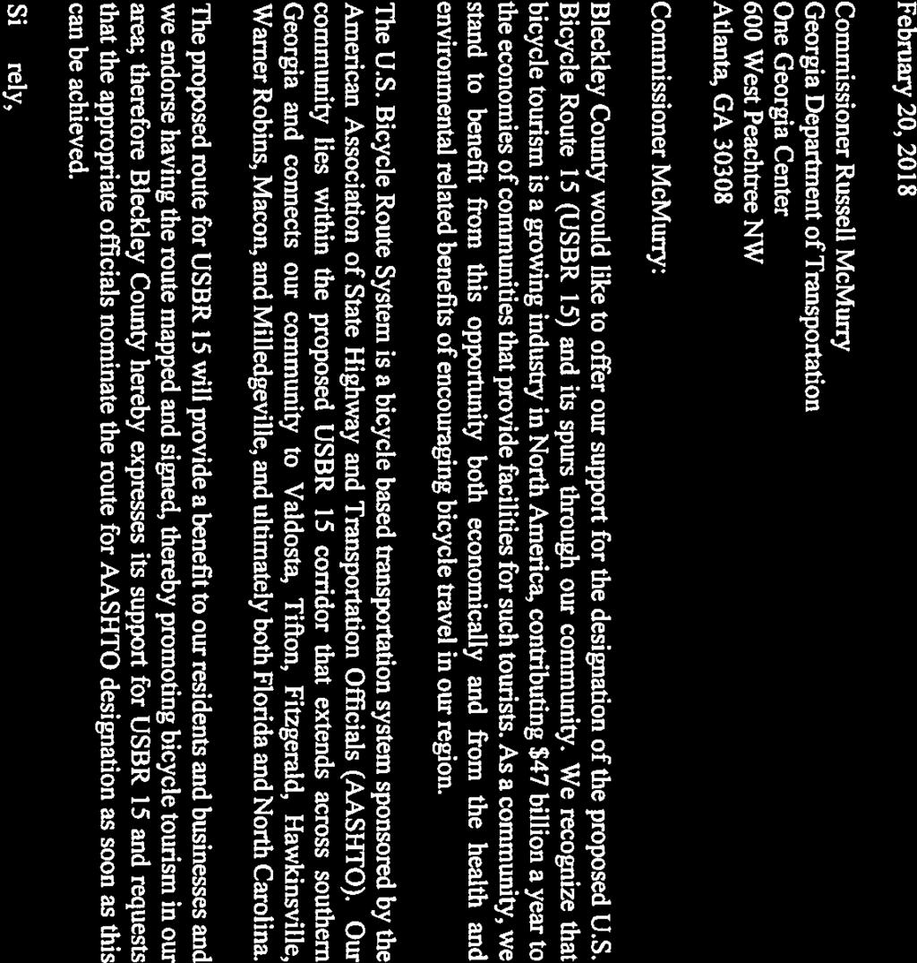


87


88
89

90

91

92

93
94
95


96


97

98
99
100 41 EJ CITY of VALDOSTA GEORGIA JGN John Gayle Mayor July Commissioner Russell McMurry Georgia Department of Transportation One Georgia Center 600 West Peachtree NW Atlanta GA Dear Commissioner McMurry The City of Valdosta Lowndes County would like to offer our support for the designation of the proposed U S Bicycle Route 15 USBR 15 and its spurs through our community We recognize that bicycle tourism is a growing industry in North America contributing 47 billion a year to the economies of communities that provide facilities for such tourists As a community we stand to benefit from this opportunity both economically and from the health and environmental related benefits of encouraging bicycle travel in our region The U S Bicycle Route System is a bicycle based transportation system sponsored by the American Association of State Highway and Transportation Officials AASHTO Our community lies within the proposed USBR 15 corridor that extends across southern Georgia and connects our community to Valdosta Tifton Warner Robins Macon and Milledgeville and ultimately both Florida and North Carolina The proposed route for USBR 15 will provide a benefit to our residents and businesses and we endorse having the route mapped and signed thereby promoting bicycle tourism in our area Therefore the City of Valdosta Lowndes County hereby expresses its support for USBR 15 and requests that the appropriate officials nominate the route for AASHTO designation as soon as this can be achieved Sincerely Joh Gayle or tsb cc Katelyn DiGioia GDOT Bicycle and Pedestrian Engineer P O Box E Central Ave Valdosta Georgia FAX An Equal Opportunity Employer Certified City of Ethics

101
102
103
104
105


106


107
108


109
110 DEPARTMENT OF TRANSPORTATION STATE OF GEORGIA Abstract Designating the US Bicycle Route System has been the intention of the Georgia DOT since 1995 when the State Transportation Board adopted several goals to guide the development and implementation of a statewide bicycle and pedestrian system. The U.S. Bicycle Route System is a unique opportunity to bring the economic benefits of bicycle tourism to Georgia and to promote Georgia s cities and towns along the route. The name changes proposed for the spurs on USBR 21 will update the naming convention to the proper standard. Please feel free to follow up with me with any questions. Thank you! Jack Anninos - JAnninos@dot.ga.gov,
111 APPLICATION FOR DESIGNATION OF A U.S. BICYCLE ROUTE (JUNE 12, 2017) Member State Submitting Application: Georgia USBR No. 221 Date: 02/08/2018 This is an application for (please check): Establishment of a new U.S. Bicycle Route or segment* Realignment of an existing U.S. Bicycle Route Deletion of a U.S. Bicycle Route or segment *NOTE: USBR 221 was originally designated as 321 in the 2015 USBR 21 application. This is a simple name change. Route Connects Chickamauga & Chattanooga National Military Park and Chickamauga (e.g., State Border, International Border, Existing US Bicycle Route, etc.) The following state or states are involved: Georgia (with concurrence from Tennessee DOT) Map and Route Log Attachment A: Map (PDF the map in color and attach to this form) Attachment B: Route Log Use the following form (or similarly formatted spreadsheet file labeled Attachment B and submitted with your application) for turn-by-turn details of the U.S. Bicycle Route you are proposing for designation. Starting Point of Route or Realignment Miles traveled on this facility Turn location and road name/ designation General Direction of Travel Turn by turn directions are attached in Appendix B: Route Log. Turn by turn directions are provided for USBR 221 in Georgia Terminus: Chickamauga Total Mileage: 12.6 Application, Page 1
112

113 Attachment A: Map Application, Page 3
114 Attachment B: Route Log Rt # Leg (mi) Notes Tot. Mi. County City Street Jurisdiction General Direction of Travel Deviate from USBR 21 at mile 6.9 from Chattooga Valley Road 0 Walker Turn left onto Happy Valley Rd 0.5 Walker County Road E Turn left to stay on Happy Valley Rd 2.2 Walker County Road N Turn right onto GA-2 GA - State E/Battlefield Pkwy 3 Walker Route E Turn right onto McFarland Ave 3.7 Walker County Road S Turn right 5.8 Walker County Road S Turn right 6.2 Walker County Road S Turn left 6.6 Walker County Road S Fort Oglethorpe - Chickamauga & Chattanooga Turn right onto Vittetoe Rd 7 Catoosa National Military Park NPS S Continue onto Vittetoe Chickamauga Rd 7.7 Walker Application, Page 4 Fort Oglethorpe - Chickamauga & Chattanooga National Military Park NPS S Slight left onto Lytle Rd 7.8 Walker Fort Oglethorpe - Chickamauga & Chattanooga National Military Park NPS S Continue onto Osburn Rd 9 Walker Chickamauga County Road S Turn right onto 5 Points Rd 10.8 Walker Chickamauga City Street S Turn left onto Hamel Dr 10.9 Walker Chickamauga City Street S Turn right onto Terri Ln 11.2 Walker Chickamauga City Street S Turn left onto Thomas Ave 11.3 Walker Chickamauga City Street W
115 221 0 Turn right onto 9th St 11.7 Walker Chickamauga City Street S Turn left onto Lee Ave 11.8 Walker Chickamauga GA - State Route S Continue onto Cove Rd 11.8 Walker Chickamauga GA - State Route S Turn left onto W 14th St/Glass Mill Rd 12.3 Walker Chickamauga City Street S Application, Page 5
116 DEPARTMENT OF TRANSPORTATION STATE OF GEORGIA Abstract Designating the US Bicycle Route System has been the intention of the Georgia DOT since 1995 when the State Transportation Board adopted several goals to guide the development and implementation of a statewide bicycle and pedestrian system. The U.S. Bicycle Route System is a unique opportunity to bring the economic benefits of bicycle tourism to Georgia and to promote Georgia s cities and towns along the route. The name changes proposed for the spurs on USBR 21 will update the naming convention to the proper standard. Please feel free to follow up with me with any questions. Thank you! Jack Anninos - JAnninos@dot.ga.gov,
: Establishment of a new U.S. Bicycle Route or segment* Realignment of an existing U.S. Bicycle Route Deletion of a U.S. Bicycle Route or segment *NOTE: USBR 421 was originally designated as 521 in the 2015 USBR 21 application.")
117 APPLICATION FOR DESIGNATION OF A U.S. BICYCLE ROUTE (JUNE 12, 2017) Member State Submitting Application: Georgia USBR No. 421 Date: 02/08/2018 This is an application for (please check): Establishment of a new U.S. Bicycle Route or segment* Realignment of an existing U.S. Bicycle Route Deletion of a U.S. Bicycle Route or segment *NOTE: USBR 421 was originally designated as 521 in the 2015 USBR 21 application. This is a simple name change. Route Connects Mountain Cove Farm and LaFayette (e.g., State Border, International Border, Existing US Bicycle Route, etc.) The following state or states are involved: Georgia (with concurrence from Tennessee DOT) Map and Route Log Attachment A: Map (PDF the map in color and attach to this form) Attachment B: Route Log Use the following form (or similarly formatted spreadsheet file labeled Attachment B and submitted with your application) for turn-by-turn details of the U.S. Bicycle Route you are proposing for designation. Starting Point of Route or Realignment Miles traveled on this facility Turn location and road name/ designation General Direction of Travel Turn by turn directions are attached in Appendix B: Route Log. Turn by turn directions are provided for USBR 421 in Georgia Terminus: Chickamauga Total Mileage: 38.8 Application, Page 1
118

119 Attachment A: Map Application, Page 3
120 Attachment B: Route Log Rt # Leg (mi) Notes Tot. Mi. County City Street Jurisdiction General Direction of Travel Deviate from USBR 21 at mile 11.6 from Old Grand Central road 0 x Slight left onto N Marble Top Rd 1.9 Walker County Road SW Turn right onto GA-136 GA - State W 6.2 Walker Route W Turn left onto GA-193 GA - State S 6.9 Walker Route S Turn right onto W Cove Rd 9.6 Walker County Road S W Cove Rd turns slightly right and becomes Dougherty Gap Rd 19.4 Walker County Road S Slight right onto Hog Jowl Rd 21 Walker County Road N Turn right to stay on Hog Jowl Rd 26.5 Walker County Road E Turn right onto GA-193 GA - State S 31.1 Walker Route E Turn left onto Shinbone Ridge Rd 35.1 Walker County Road NE Continue onto Shinebone Ridge Rd 37.1 Walker LaFayette County Road E Continue onto N Chattanooga St 37.2 Walker LaFayette City Street SE Turn left onto W Main GA - State St 38.5 Walker LaFayette Route E Turn right onto S Cherokee St 38.7 Walker LaFayette City Street S Application, Page 4
121 4/9/2018
122
123
124
125
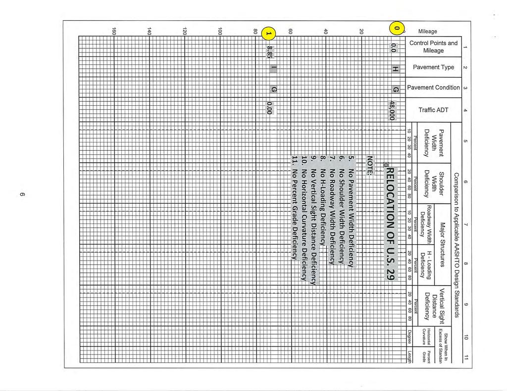
126
127
128
129
130
131
132
133

134
135
136
137
138

139
140
141

142
American Association of State Highway and Transportation Officials An Application from the State Highway or Transportation Department of
 American Association of State Highway and Transportation Officials An Application from the State Highway or Transportation Department of for: Elimination of a U.S. (Interstate) Route Establishment of a
Updated August 1, 2016
 Updated August 1, 2016 American Association of State Highway and Transportation Officials An Application from the State Highway or Transportation Department of North Carolina for: Elimination of a U.S.
Updated August 1, 2016
 5 Updated August 1, 2016 American Association of State Highway and Transportation Officials An Application from the State Highway or Transportation Department of Alabama for: Elimination of a U.S. (Interstate)
AASHTO Use Only Establishment of a U.S. (Interstate) Route IH 69 Action taken by SCOH: Extension of a U.S. (Interstate)Route
 Route IH 69 Action taken by SCOH: Extension of a U.S. (Interstate)Route") American Association of State Highway and Transportation Officials An Application from the State Highway or Transportation Department of Texas for: Elimination of a U.S. (Interstate) Route AASHTO Use Only
American Association of State Highway and Transportation Officials An Application from the State Highway or Transportation Department of Texas for: Elimination of a U.S. (Interstate) Route AASHTO Use Only
American Association of State Highway and Transportation Officials
 American Association of State Highway and Transportation Officials An Application from the State Highway or Transportation Department of FLORIDA for the Elimination of a U.S. (I) Route U.S. 98 Alternate
Application to AASHTO to recognize six suggested relocations of U.S. Bicycle Route 1 in the Northern Virginia District.
 September 7 th, 2007 Application to AASHTO to recognize six suggested relocations of U.S. Bicycle Route 1 in the Northern Virginia District. Acting District Administrator Mr. Morteza Salehi has endorsed
 U.S. 63 & U.S. 63 BUS US Route Number State Type Intersection Point to Point Accumulated Remarks 63 Arkansas Regular Mammoth Springs 0 0 Missouri State Line 63 Arkansas Regular Hardy 16 16 Crosses U.S.
American Association of State Highway and Transportation Officials. Virginia. for
 American Association of State Highway and Transportation Officials An Application from the State Highway or Transportation Department of Elimination of a U.S. (Interstate) Route Establishment of a U.S.
AASHTO is in receipt of the following member department interstate application.
 June 4, 2015 Mr. Greg adeau Deputy Administrator Federal ighway Administration 1200 ew Jersey Ave., S Washington, DC 20590 Dear Mr. adeau: AAST is in receipt of the following member department interstate
Geometric Design Tables
 Design Manual Chapter 5 - Roadway Design 5C - Geometric Design Criteria 5C-1 Geometric Design Tables A. General The following sections present two sets of design criteria tables - Preferred Roadway Elements
Who is Toole Design Group?
 2018 AASHTO Bike Guide Status Update NCHRP 15 60 Amalia Leighton Cody, PE, AICP & Kenneth Loen, PE Washington APWA October 4, 2018 Who is Toole Design Group? TDG is a full service engineering, planning
City of Roseville Section 13 Design Standards. _Bikeways January 2016 SECTION 13 BIKEWAYS
 SECTION 13 BIKEWAYS 13-1 GENERAL The City of Roseville bikeway standards are designed to insure that transportation and recreational bikeways are constructed in a manner that would provide a safe and comfortable
Act 47 Exception Application Process (Permitting Bicycle Travel on Freeways)
") Act 47 Exception Application Process (Permitting Bicycle Travel on Freeways) Attached is a revised application process to permit Pedalcycle travel on the shoulders of freeways within the Commonwealth.
Act 47 Exception Application Process (Permitting Bicycle Travel on Freeways) Attached is a revised application process to permit Pedalcycle travel on the shoulders of freeways within the Commonwealth.
Progress Report on the Design and Planning of an Infrastructure Improvement Project for the Sunnyside TIF District (Phase II)
") Presentation to the CNRC Board of Directors Regular Meeting March 11, 2015 1 Agenda Preferred Alternate Refinement for University Avenue, 3rd Street, and Beverly Avenue Intersection Improvements validate
Presentation to the CNRC Board of Directors Regular Meeting March 11, 2015 1 Agenda Preferred Alternate Refinement for University Avenue, 3rd Street, and Beverly Avenue Intersection Improvements validate
PERFORMANCE ACTIVITY 405 LIMB MANAGEMENT
 PERFORMANCE ACTIVITY 405 LIMB MANAGEMENT 405 LIMB MANAGEMENT ACTIVITY DESCRIPTION Cut and/or remove and/or grind tree limbs from the right-of-way. TRAFFIC CONTROL Utilize intermittent mobile operations
American Association of State Highway and Transportation Officials
 American Assciatin f State Highway and Transprtatin Officials Please save and send as a wrd file. Yu can attach a map in PDF r JPG with the applicatin t usrutes@aasht.rg (M.Vitale) An Applicatin frm the
Long Island Rail Road Expansion Project Floral Park to Hicksville
 Long Island Rail Road Expansion Project Floral Park to Hicksville Final Environmental Impact Statement Appendix 1-D Complete Streets Policy Checklist April 2017 0902ML PIN: Project Location: 18A-4 Floral
RULES OF TENNESSEE DEPARTMENT OF TRANSPORTATION PUBLIC TRANSPORTATION, WATERWAYS AND RAIL DIVISION CHAPTER RAILROAD GRADE CROSSING STANDARDS
 RULES OF TENNESSEE DEPARTMENT OF TRANSPORTATION PUBLIC TRANSPORTATION, WATERWAYS AND RAIL DIVISION CHAPTER 1680-9-1 RAILROAD GRADE CROSSING STANDARDS TABLE OF CONTENTS 1680-9-1-.01 Purpose 1680-9-1-.05
Designing with the Railroad
 Designing with the Railroad 23 CFR 646.214 (b)(2) requires that crossings be evaluated when they are within limits or near terminus of Federally Funded project. Some rough numbers for planning: Active
WYDOT DESIGN GUIDES. Guide for. NHS Arterial (Non-Interstate)
") WYDOT DESIGN GUIDES Guide for NHS Arterial (Non-Interstate) 2014 GUIDE FOR NATIONAL HIGHWAY SYSTEM (NHS) HIGHWAYS (NHS ARTERIALS, Non-Interstate) PRESERVATION REHABILITATION RECONSTRUCTION INTRODUCTION
WYDOT DESIGN GUIDES Guide for NHS Arterial (Non-Interstate) 2014 GUIDE FOR NATIONAL HIGHWAY SYSTEM (NHS) HIGHWAYS (NHS ARTERIALS, Non-Interstate) PRESERVATION REHABILITATION RECONSTRUCTION INTRODUCTION
American Association of State Highway and Transportation Officials
 American Assciatin f State Highway and Transprtatin Officials Seven (7) Page Frm An Applicatin frm the State Highway r Transprtatin Department f Oklahma fr (select ne f the fllwing): Eliminatin f a U.S.
WYDOT DESIGN GUIDES. Guide for. Non-NHS State Highways
 WYDOT DESIGN GUIDES Guide for Non-NHS State Highways 2014 GUIDE FOR Non-NATIONAL HIGHWAY SYSTEM (Non-NHS) STATE HIGHWAYS PRESERVATION REHABILITATION RECONSTRUCTION INTRODUCTION This Guide is directed to
CHAPTER 1 STANDARD PRACTICES
 CHAPTER 1 STANDARD PRACTICES OBJECTIVES 1) Functions and Limitations 2) Standardization of Application 3) Materials 4) Colors 5) Widths and Patterns of Longitudinal Pavement Marking Lines 6) General Principles
Sponsored by the Office of Traffic and Safety of the Iowa Department of Transportation NOVEMBER 2001 CTRE
 PAVED SHOULDERS ON PRIMARY HIGHWAYS IN IOWA: AN ANALYSIS OF SHOULDER SURFACING CRITERIA, COSTS, AND BENEFITS EXECUTIVE SUMMARY Sponsored by the Office of Traffic and Safety of the Iowa Department of Transportation
Off-road Trails. Guidance
 Off-road Trails Off-road trails are shared use paths located on an independent alignment that provide two-way travel for people walking, bicycling, and other non-motorized users. Trails specifically along
3-13 UFC - GENERAL PROVISIONS AND GEOMETRIC DESIGN FOR ROADS, STREETS, WALKS, AND OPEN
 maintenance, and erosion. Stability is required to maintain the integrity of the pavement structure, and a slope stability analysis should be conducted for cuts and fills greater than 15 feet. For lower
MANUAL ON UNIFORM TRAFFIC CONTROL DEVICES INTRODUCTION
 2011 Edition Page I-1 MANUAL ON UNIFORM TRAFFIC CONTROL DEVICES INTRODUCTION 01 Traffic control devices shall be defined as all signs, signals, markings, and other devices used to regulate, warn, or guide
Page 2D-10 Added the following language at the end of the paragraph under REFINING HORIZONTAL ALIGNMENT ; See Chapter 2A, Section 2A-6.
 ROAD DESIGN MANUAL REVISIONS January, 2017 CHAPTER 1B Page 1B-12 Added the following language (Definition); NORMAL CROWN - Undivided travel ways on tangents shall have a crown or high point in the middle
Appendix C. Bicycle Route Signage
 Appendix C Bicycle Route Signage This page intentionally left blank. APPENDIX C - BICYCLE ROUTE AND WAYFINDING SIGNAGE Bicycle route signs are wayfinding signs that guide bicyclists along preferred, designated
November 2012: The following Traffic and Safety Notes were revised:
 CHANGE LIST for MDOT Traffic and Safety, TRAFFIC AND SAFETY NOTES Located at http://mdotcf.state.mi.us/public/tands/plans.cfm JANUARY 2014: The following Traffic and Safety Note was added: Note 705A Angled
Roadway Design Manual
 Roadway Design Manual Revised December 2013 2013 by Texas Department of Transportation (512) 302-2453 all rights reserved Manual Notice 2013-1 From: Manual: Mark A. Marek, P.E Roadway Design Manual Effective
October 2004 REVISIONS (2) SUPERELEVATION DEVELOPMENT 11.3(2)
 SUPERELEVATION DEVELOPMENT 11.3(2)") October 2004 REVISIONS (2) Chapter 11 HORIZONTAL ALIGNMENT SUPERELEVATION DEVELOPMENT 11.3(2) Chapter 12 VERTICAL ALIGNMENT VERTICAL CURVES PASSING SIGHT DISTANCE 12.5(2) VERTICAL CURVES STOPPING SIGHT
October 2004 REVISIONS (2) Chapter 11 HORIZONTAL ALIGNMENT SUPERELEVATION DEVELOPMENT 11.3(2) Chapter 12 VERTICAL ALIGNMENT VERTICAL CURVES PASSING SIGHT DISTANCE 12.5(2) VERTICAL CURVES STOPPING SIGHT
US Hwy. 64/264 Pedestrian Crossing at the Little Bridge Alternatives Analysis Public Meeting
 Town of Nags Head US Hwy. 64/264 Pedestrian Crossing at the Little Bridge Alternatives Analysis Public Meeting Prepared by: Department of Public Works August 8, 2013 Where traffic-control signals are not
1609 E. FRANKLIN STREET HOTEL TRAFFIC IMPACT STUDY EXECUTIVE SUMMARY
 1609 E. FRANKLIN STREET HOTEL TRAFFIC IMPACT STUDY EXECUTIVE SUMMARY Prepared for: The Town of Chapel Hill Public Works Department Traffic Engineering Division Prepared by: HNTB North Carolina, PC 343
CHAPTER 6H. TYPICAL APPLICATIONS
 2006 Edition Page 6H-1 CHAPTER 6H. TYPICAL APPLICATIONS Section 6H.01 Typical Applications Support: Whenever the acronym TTC is used in this Chapter, it refers to temporary traffic control. Standard: The
CHAPTER 16 PEDESTRIAN FACILITIES DESIGN AND TECHNICAL CRITERIA TABLE OF CONTENTS
 CHAPTER 16 PEDESTRIAN FACILITIES DESIGN AND TECHNICAL CRITERIA TABLE OF CONTENTS Section Title Page 16.1 General... 16-1 16.1.1 AASHTO Reference... 16-1 16.1.2 ADA Requirements... 16-1 16.2 Sidewalks...
A plan for improved motor vehicle access on Railroad Avenue in Provincetown
 A plan for improved motor vehicle access on Railroad Avenue in Provincetown February 2011 A plan for improved motor vehicle access on Railroad Avenue in Provincetown INTRODUCTION AND PROBLEM IDENTIFICATION
DESIGN MEMORANDUM WITH DESIGN EXCEPTIONS SP SP
 DRAFT NOT FINAL (Note: document was not finalized due to an eastbound stopping site distance design issue that requires more detailed bridge and roadway design considerations. This discussion starts on
Roadway Design Manual
 Roadway Design Manual Manual Notice Archive by Texas Department of Transportation (512) 302-2453 all rights reserved Manual Notice 2009-1 From: Manual: Mark A. Marek, P.E Roadway Design Manual Effective
South Carolina Department of Transportation. Engineering Directive
 South Carolina Department of Transportation Engineering Directive Directive Number: ED-22 Effective: December 16, 2009 Subject: References: Purpose: This Directive Applies to: Considerations for Bicycle
APPENDIX B1. CROSS-REFERENCE GUIDE TO THE OHIO REVISED CODE
 Appendix B1. Cross-Reference Guide to the Ohio Revised Code Page B1-1 APPENDIX B1. CROSS-REFERENCE GUIDE TO THE OHIO REVISED CODE The Ohio Revised Code (O.R.C.) contains many laws which apply to the control
Section 3A.04 Colors. Section 3B.10 Approach Markings for Obstructions
 Section 3A.04 Colors Markings shall be yellow, white, red, or blue, or purple. The colors for markings shall conform to the standard highway colors. Black in conjunction with one of the above colors shall
CHAPTER 3A. GENERAL PAGE CHAPTER 3B. PAVEMENT AND CURB MARKINGS PAGE
 Virginia Supplement to the 2009 MUTCD Revision 1 Page TC-3-1 PART 3. MARKINGS CHAPTER 3A. GENERAL PAGE Section 3A.01 Functions and Limitations Section 3A.02 Standardization of Application Section 3A.03
TRAFFIC SIGNAL WARRANT STUDY
 TRAFFIC SIGNAL WARRANT STUDY 5 th STREET & ENCHANTED PINES DRIVE JANUARY 2013 TRAFFIC OPERATIONS ENGINEERING SERVICES/PUBLIC WORKS DEPARTMENT TABLE OF CONTENTS INTERSECTION LOCATION MAP ii INTRODUCTION
DRAFT. Corridor study. Honeysuckle Road. October Prepared for the City of Dothan, AL. Prepared by Gresham, Smith and Partners
 DRAFT Corridor study Honeysuckle Road October 2017 Prepared for the City of Dothan, AL Prepared by TABLE OF CONTENTS SECTION I... 1 STUDY SUMMARY... 1 INTRODUCTION... 1 CONCLUSIONS... 5 SECTION II... 7
Malvern Borough Local Traffic Calming
 Malvern Borough Local Traffic Calming Purpose: To address speeding and high volume cut-through traffic on Malvern Borough owned residential streets. Traffic Calming Measures: Traffic Calming Measures (TCM)
and Rural Multimodal Networks 2017 ALTA PLANNING + DESIGN
 Small Town and Rural Multimodal Networks 2017 ALTA PLANNING + DESIGN SMALL TOWN AND RURAL MULTIMODAL NETWORKS GUIDE Why a Rural and Small Town Focused Guide? ONE SIZE DOES NOT FIT ALL. The new FHWA-endorsed
American Railway Engineering and Maintenance of Way Association Letter Ballot. Draft
 American Railway Engineering and Maintenance of Way Association Letter Ballot 1. Committee and Subcommittee: Committee 5 Track Subcommittee 9 Road Crossings 2. Letter Ballot Number: 05-17-16 3. Assignment:
Route 47 (North Main Street) Reconstruction
 Reconstruction") TOWN OF SUNDERLAND Route 47 (North Main Street) Reconstruction Presented by Lou Rabito, P.E. Presented to Town of Sunderland June 11, 2018 Project Overview MassDOT Project No. 607245 Resurfacing and Related
TOWN OF SUNDERLAND Route 47 (North Main Street) Reconstruction Presented by Lou Rabito, P.E. Presented to Town of Sunderland June 11, 2018 Project Overview MassDOT Project No. 607245 Resurfacing and Related
TOWN OF PAYSON TRAFFIC CALMING MANUAL
 TOWN OF PAYSON TRAFFIC CALMING MANUAL APPROVED BY THE PAYSON TOWN COUNCIL SEPTEMBER 6, 2007 TOWN OF PAYSON TRAFFIC CALMING POLICY 1.0 Introduction Traffic Calming involves retrofitting physical devices
MARTIN LUTHER KING JR. WAY
 OCTOBER 2011 40 Vision and Goals The Martin Luther King, Jr. Way Illustrative Master Plan that follows has been developed through a process of community involvement. It expresses a long term vision for
REGIONAL BICYCLE AND PEDESTRIAN DESIGN GUIDELINES
 REGIONAL BICYCLE AND PEDESTRIAN DESIGN GUIDELINES November 16, 2011 Deb Humphreys North Central Texas Council of Governments Bicycle and Pedestrian Advisory Committee Snapshot of the Guide 1. Introduction
Oregon Supplement to the Manual on Uniform Traffic Control Devices. Adopted July 2005 by OAR
 Oregon Supplement to the Manual on Uniform Traffic Control Devices Adopted July 2005 by OAR 734-020-0005 2003 Edition Oregon Supplement to the MUTCD Page 2 INTRODUCTION Traffic control devices installed
FOR HISTORICAL REFERENCE ONLY
 To: From: Subject: Electronic Distribution Recipients MINNESOTA DEPARTMENT OF TRANSPORTATION Engineering Services Division Technical Memorandum No. 12-14-B-03 December 18, 2012 Jon M. Chiglo, P.E. Division
91
 90 91 92 93 94 95 96 97 98 99 100 101 102 103 104 105 106 As previously depicted in Exhibit 4-J, vehicular accidents are shown along Forrester Road. The contributing factors may be due to its current two
appendix b BLOS: Bicycle Level of Service B.1 Background B.2 Bicycle Level of Service Model Winston-Salem Urban Area
 appendix b BLOS: B.1 Background Winston-Salem Urban Area Bicycle Level of Service Level of Service (LOS) is a framework that transportation professionals use to describe existing conditions (or suitability)
Alberta Infrastructure HIGHWAY GEOMETRIC DESIGN GUIDE AUGUST 1999
 Alberta Infrastructure HIGHWAY GEOMETRIC DESIGN GUIDE AUGUST 1999,1'(; A ACCELERATION Data on acceleration from stop D-29 Effects of grade D-35 Intersections D-97, D-99 Lanes D-97, F-5, F-7, F-15, F-21,
NCHRP Task 350. U.S. Bicycle Route Signing
 NCHRP 20-07, Task 350: U.S. Bicycle Route Signing Page 1 of 25 NCHRP 20-07 Task 350 U.S. Bicycle Route Signing October, 2014 Transportation Research Board NAS-NRC Limited Use Document Transportation Research
Access Management in the Vicinity of Intersections
 Access Management in the Vicinity of Intersections FHWA-SA-10-002 Technical Summary Photo: Ralph Bentley (used with permission) 0 Access Management is: The design, implementation and management of entry
Section 9A.07 Meaning of Standard, Guidance, Option, and Support
 2012 Edition Page 895 PART 9. TRAFFIC CONTROLS FOR BICYCLE FACILITIES CHAPTER 9A. GENERAL Section 9A.01 Requirements for Bicyclist Traffic Control Devices 01 General information and definitions concerning
Off-Road Facilities Part 1: Shared Use Path Design
 Off-Road Facilities Part 1: Shared Use Path Design Presentation by: Eric Mongelli, P.E. Tom Huber October 9, 2012 FOLLOW THE CONVERSATION ON TWITTER Toole Design Group is live tweeting this webinar @tooledesign
Duwamish Way-finding and CTR Report
 V. North Tukwila When the North Tukwila Manufacturing and Industrial Center was designated in 1992 as part of the region s land use and transportation plan, the plan called for the area to set a light-rail
Roads that are intended to be included in the VDOT system of maintained roadways must meet the standards and specifications prescribed by the VDOT.
 SECTION 1 - GENERAL 1-1 Purpose This Manual has been prepared to promote uniform design procedures for designers and technicians in the development of property and roads in the County of Henrico, Virginia.
Residential Traffic Calming Program Guide. Town of Ashland, Virginia
 Residential Traffic Calming Program Guide Town of Ashland, Virginia August 1, 2006 TABLE OF CONTENTS A. INTRODUCTION... 1 B. GOALS... 1 C. CRITERIA... 1 D. IDENTIFYING NEIGHBORHOOD TRAFFIC CONCERNS...
Memorandum. Exhibit 60 SSDP To: Jenny Bailey, Senior Planner. From: Bill Schultheiss, P.E. (WA. P.E. #46108) Date: June 20, 2017
 Date: June 20, 2017") Memorandum To: Jenny Bailey, Senior Planner From: Bill Schultheiss, P.E. (WA. P.E. #46108) Date: June 20, 2017 Re: East Lake Sammamish Trail, Segment 2B Review King County has asked Toole Design Group
Memorandum To: Jenny Bailey, Senior Planner From: Bill Schultheiss, P.E. (WA. P.E. #46108) Date: June 20, 2017 Re: East Lake Sammamish Trail, Segment 2B Review King County has asked Toole Design Group
THE FUTURE OF THE TxDOT ROADWAY DESIGN MANUAL
 THE FUTURE OF THE TXDOT ROADWAY DESIGN MANUAL Kenneth Mora, P.E. (Design Division) 10/10/2017 Table of contents 1 2 Reduction in FHWA design controlling criteria Innovative Intersection Guidance 3-7 8-42
CURBSIDE ACTIVITY DESIGN
 5 CURBSIDE ACTIVITY DESIGN This chapter provides design guidance for separated bike lanes adjacent to curbside activities including parking, loading and bus stops. Typical configurations are presented
Circulation and Mobility
 SECTION 4 Circulation and Mobility OVERVIEW The first phase of the circulation analysis is to address specific concerns regarding the circulation system in the vicinity of the Gateway Specific Plan area
Gordon Proctor Director Policy on Accommodating Bicycle and Pedestrian Travel on ODOT Owned or Maintained Facilities
 Approved: Policy: 20-004(P) Responsible Office: Planning Gordon Proctor Director Policy on Accommodating Bicycle and Pedestrian Travel on ODOT Owned or Maintained Facilities I. POLICY STATEMENT: This policy
Attached for your reference please find project updates on ongoing VDOT construction projects in Southampton County.
 SOUTHAMPTON COUNTY BOARD OF SUPERVISORS Regular Session i July 25, 2016 6. HIGHWAY MATTERS A. PLAN PROJECT UPDATES Attached for your reference please find project updates on ongoing VDOT construction projects
Development of Guidelines for Bicycle Use of Controlled Access Facilities in Virginia
 Development of Guidelines for Bicycle Use of Controlled Access Facilities in Virginia VDOT Statewide Bicycle and Pedestrian Advisory Committee Fall Working Group Meeting October 30, 2013 Young-Jun Kweon,
2012 by the American Association of State Highway and Transportation Officials. All rights reserved. Duplication is a violation of applicable law.
 Table of Contents Chapter 1: Introduction... 1-1 1.1 Design Imperative... 1-1 1.2 Purpose... 1-1 1.3 Scope... 1-2 1.4 Definitions... 1-2 Chapter 2: Bicycle Planning... 2-1 2.1 Background... 2-1 2.2 Why
APPENDIXB. Traffic Operations Technical Memorandum
 APPENDIXB Traffic Operations Technical Memorandum Environmental Assessment - Lincoln County, SD 85 th Street: Sundowner Avenue to Louise Avenue November 2017 MEMORANDUM Transportation Jim Kollbaum, PE
Railroad Inspection Procedure Manual
 Railroad Inspection Procedure Manual Railroad Inspection Procedure Manual Table of Contents Introduction... 1 Inspection Report t For orm... 3 Instructions for Completing Inspection Report t For orms...
SECTION 12 ROAD MARKINGS AND DELINEATION
 SECTION 12 ROAD MARKINGS AND DELINEATION (Blank Page) MANUAL OF TRAFFIC SIGNS AND MARKINGS - Part III: Motorways and Expressways 12-1 12.1 GENERAL 12.1.1 INTRODUCTION The markings and delineation details
Design Criteria. Design Criteria
 F Design Criteria Design Criteria Ministry of Transportation Ministère des Transports DESIGN CRITERIA Page: 1 of 13 WORK PROJECT NO. N/A GO Bloomington Station TYPE OF PROJECT LOCATION Bloomington Road
RURAL HIGHWAY SHOULDERS THAT ACCOMMODATE BICYCLE AND PEDESTRIAN USE (TxDOT Project ) June 7, Presented by: Karen Dixon, Ph.D., P.E.
 June 7, Presented by: Karen Dixon, Ph.D., P.E.") RURAL HIGHWAY SHOULDERS THAT ACCOMMODATE BICYCLE AND PEDESTRIAN USE (TxDOT Project 0-6840) June 7, 2016 Presented by: Karen Dixon, Ph.D., P.E., TTI Team: Kay Fitzpatrick, Raul Avelar, & Subasish Das Project
RURAL HIGHWAY SHOULDERS THAT ACCOMMODATE BICYCLE AND PEDESTRIAN USE (TxDOT Project 0-6840) June 7, 2016 Presented by: Karen Dixon, Ph.D., P.E., TTI Team: Kay Fitzpatrick, Raul Avelar, & Subasish Das Project
DRAFT Sellwood Bridge Existing Roadway Deficiencies
 Technical Memorandum DRAFT Sellwood Bridge Existing Roadway Deficiencies Executive Summary Purpose Roadway design standards are developed to support safety and mobility goals. Roadway deficiencies have
Salem City Council November 9, 2009
 Salem City Council November 9, 2009 $1.212 million of the $100 million bond was set aside for Railroad Crossing Safety Improvement Projects Construct projects to improve both vehicular and pedestrian safety
Town of Orangetown Neighborhood Traffic Calming Program
 Town of Orangetown Neighborhood Traffic Calming Program Table of Contents I Introduction a. Purpose b. Key to successful projects c. What is Traffic Calming? II III IV V VI VII Definitions Street Classification
TRAFFIC AND SAFETY NOTE 608A. Spacing for Commercial Drives and Streets. To Promote a Uniform Practice in Determining Access Spacing
 TRAFFIC AND SAFETY NOTE 608A SUBJECT: PURPOSE: Spacing for Commercial Drives and Streets To Promote a Uniform Practice in Determining Access Spacing COORDINATING UNIT: Geometric Design Unit INFORMATION:
Intersection Traffic Control Feasibility Study
 Intersection Traffic Control Feasibility Study CSAH 9 at CSAH 60 (185th Avenue) Prepared For: Dakota County Transportation Department Western Service Center 14955 Galaxie Avenue, 3rd Floor Apple Valley,
City of Madison, East Johnson Street North Baldwin Street to First Street Local Street Dane County
 City of Madison, East Johnson Street North Baldwin Street to First Street Local Street Dane County Public Involvement Meeting Thursday, November 10, 2016 5:30 to 7 P.M. Festival Foods 810 E. Washington
TABLE OF CONTENTS. General... A. New Construction/Reconstruction (4R)...B. Resurfacing, Restoration and Rehabilitation (3R)...C
...B. Resurfacing, Restoration and Rehabilitation (3R)...C") - LOCAL AGENCY PROJECTS TABLE OF CONTENTS Section General... A New Construction/Reconstruction (4R)...B Resurfacing, Restoration and Rehabilitation (3R)...C Preventive Maintenance (PM)... D Design Exception...E
- LOCAL AGENCY PROJECTS TABLE OF CONTENTS Section General... A New Construction/Reconstruction (4R)...B Resurfacing, Restoration and Rehabilitation (3R)...C Preventive Maintenance (PM)... D Design Exception...E
Truck Climbing Lane Traffic Justification Report
 ROUTE 7 (HARRY BYRD HIGHWAY) WESTBOUND FROM WEST MARKET STREET TO ROUTE 9 (CHARLES TOWN PIKE) Truck Climbing Lane Traffic Justification Report Project No. 6007-053-133, P 101 Ι UPC No. 58599 Prepared by:
Annual Progress Report from VDOT on the Effect of the Aging Population on State Agencies
 Annual Progress Report from VDOT on the Effect of the Aging Population on State Agencies HB 110 (2006 GA Session) Report to the Governor and General Assembly of Virginia Virginia Department of Transportation
Active Transportation Facility Glossary
 Active Transportation Facility Glossary This document defines different active transportation facilities and suggests appropriate corridor types. Click on a facility type to jump to its definition. Bike
PERFORMANCE ACTIVITY 306 DRAINAGE PIPE WORK DESCRIPTION 4
 PERFORMANCE ACTIVITY 306 DRAINAGE PIPE WORK DESCRIPTION 1 WORK DESCRIPTION 2 WORK DESCRIPTION 3 WORK DESCRIPTION 4 Repair Install Remove Clean 306 DRAINAGE PIPE ACTIVITY DESCRIPTION Install, repair, clean,
Construction Specifications Manual
 Isle of Wight County Pedestrian and Bicycle Master Plan Construction Specifications Manual Adopted August 20, 2009 Introduction The Isle of Wight County Pedestrian and Bicycle Facilities Master Plan was
Complete Streets for Louisiana
 Complete Streets for Louisiana Louisiana Transportation Conference 2011 Ellen W. Soll, AICP Planner Burk-Kleinpeter, Inc esoll@bkiusa.com 504.486.5901 x143 What is a Complete Street? What are Complete
CHAPTER 2D. GUIDE SIGNS CONVENTIONAL ROADS Section 2D.01 Scope of Conventional Road Guide Sign Standards Standard:
 2011 Edition - Revision 2 Page 143 CHAPTER 2D. GUIDE SIGNS CONVENTIONAL ROADS Section 2D.01 Scope of Conventional Road Guide Sign Standards 01 The provisions of this Chapter shall apply to any road or
and older adults and people with disabilities still face barriers when using the pedestrian network and public transportation.
 Background Afterthe1980Olympics,theLakePlacid/NorthElbacommunityadoptedaneconomicstrategy ofdevelopingandmarketingeventstoincreaseareatourism.thisstrategyhasbeenvery successful.overrecentyearsthevolumeofvisitorshasincreased,andthelengthofthe
Levels, and Road Uses
 Tahoe Unsurfaced Roads Workshop UC Cooperative Extension / SAF / TRPA / LWQCB / CGS / USFS Road Standards, Maintenance Levels, and Road Uses Gordon R. Keller, PE, GE Geotechnical Engineer grkeller@fs.fed.us
Engineering Countermeasures for Transportation Safety. Adam Larsen Safety Engineer Federal Highway Administration
 Engineering Countermeasures for Transportation Safety Adam Larsen Safety Engineer Federal Highway Administration 360-619-7751 Adam.Larsen@DOT.GOV Countermeasure Selection Resources Manual for Selecting
What Engineering Can Do for You! Low Cost Countermeasures for Transportation Safety
 What Engineering Can Do for You! Low Cost Countermeasures for Transportation Safety Adam Larsen Safety Engineer Federal Highway Administration 360-619-7751 Adam.Larsen@DOT.GOV Adam Larsen TTP Safety Engineer
On Road Bikeways Part 1: Bicycle Lane Design
 On Road Bikeways Part 1: Bicycle Lane Design Presentation by: Nick Jackson Bill Schultheiss, P.E. September 04, 2012 FOLLOW THE CONVERSATION ON TWITTER Toole Design Group is live tweeting this webinar
GEOMETRIC DESIGN STANDARDS FOR NEW RESIDENTIAL SUBDIVISION STREETS TABLE 1A CG-6 CURB AND GUTTER SECTION
 TABLE 1A CG-6 CURB AND GUTTER SECTION HORIZONTAL AND VERTICAL CONTROLS CURB AND GUTTER ROADWAYS MAXIMUM 3:1 CUT OR FILL SLOPE CURVE DATA MIN. SIGHT DISTANCE PROJECTED TRAFFIC VOLUME (ADT) MIN. DESIGN SPEED
River Road - Proposed Implementation of Selected Road Safety Measures
 City of Richmond Report to Committee To: General Purposes Committee Date: April 3, 2018 From: Victor Wei, P. Eng. Director, Transportation File: 10-6450-09-01/2018- Vol 01 Re: River Road - Proposed Implementation
County of Spartanburg South Carolina
 County of Spartanburg South Carolina Traffic Calming Program June 2012 (Revised/Program on Hold) PURPOSE The potential negative impacts from vehicular traffic on residential roads have been a longstanding