Community Engagement Summary. Tahunanui Cycle Network Investigations
|
|
|
- Suzanna Knight
- 6 years ago
- Views:
Transcription
1 Community Engagement Summary Tahunanui Cycle Network Investigations
2 Community Engagement Summary Tahunanui Cycle Network Investigations Prepared by: Lea O Sullivan, Opus International Consultants Reviewed by: Joanne Chang, Opus International Consultants Approved for Release by: Kayleen Goldthorpe, Nelson City Council Date: 22 May 2015 Reference: 5-G Status: FINAL
3 Tahunanui Cycle Network Investigations Engagement Summary i Contents 1 Executive Summary Introduction Engagement Objectives Methods of Communication General Live Nelson Displays / Public Information Sites Brochure Information for Stakeholders Meetings Open Day Responses to Specific Individuals and Enquiries Web Page Further Communication Engagement Feedback General Public Feedback from Stakeholders, Organisations and Potentially Affected Parties Questionnaire Summary of Feedback Appendix A: Engagement Register... 7 Appendix B: Live Nelson Article... 8 Appendix C: Brochure including Questionnaire... 9 Appendix D: Summary of Feedback / Issues Raised Appendix E: Summary of feedback from Open Day Appendix F: Nelsust Three Route Solution Appendix G: School Community Officer / RIDE ON cycle training team practice journey for Year 6 Tahunanui School students Appendix H: Notes from Stakeholder Meeting 19 January
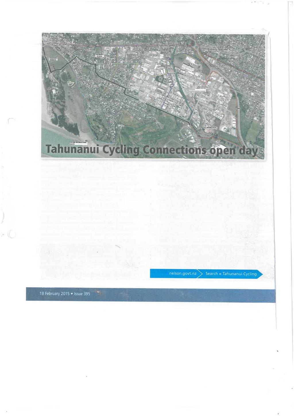
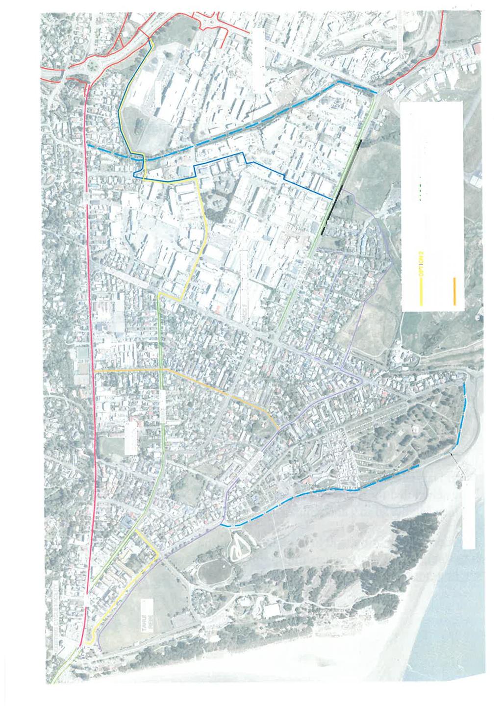
4 Tahunanui Cycle Network Investigations Engagement Summary ii 1 Executive Summary This report documents the community engagement undertaken as part of the project: Tahunanui Cycle Network Investigations. The brief for this work was aimed at finding a viable option to close the key missing link once the Rocks Rd walking and cycling facility is constructed. Currently there are no cycle facility connections between the southern terminus of the Rocks Rd on-road cycle path, the northern terminus of Railway Reserve and the northern terminus of the Whakatu Drive shared paths at Annesbrook roundabout nor the Richmond-Nelson coastal shared path ending at the Bolt Road/Quarantine Road roundabout. The community engagement involved: 1. An initial stakeholder workshop at Tahunanui School in March 2014 (information gathered and feedback obtained was detailed in this project s Delivery 1 report) 2. A follow up meeting with stakeholders in January 2015 (notes from this meeting forms Appendix H) 3. Published material in the Live Nelson paper, on the Nelson City Council (Council) website, and display sites at the Elma Turner Library, Nellie Nightingale Library and Tahunanui School Library 4. An open day at Tahunanui Library on 1st March (notes from the open day forms Appendix E) 5. A questionnaire linked to the Council website, and available at display sites and open day 6. One on one feedback (via telephone conversation or meeting) from local schools and the police. Within the wider investigations for this project the following categories of existing and potential cyclists have been considered: Confident commuter / sport School Recreational Less confident As each of these groups has different needs and desire lines, these categories were also utilised when collating feedback during community engagement. It was found that there is not one route that would serve the needs of all cyclists. Full analysis of the feedback in regards to each user group is included in Section 5.4. The main findings from this consultation in relation to each option are: Option 1 Feedback suggest that if built, Option 1 would attract the highest number of regular users (i.e. confident and commuter cyclist). Anecdotal evidence indicates that this route is already used by this group of cyclists. Feedback also suggests that school children are already using part of this route.
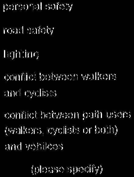
5 Tahunanui Cycle Network Investigations Engagement Summary 2 The key advantage of this route is that it is the most direct link from Stoke and beyond, into Nelson City. The key constraints include the physical limitations of the route (to provide space for a cycle facility parking may be reduced / earthworks required on the hill side), and the high traffic volume (including heavy vehicles) which is not appealing to the less confident or recreational cyclists. Option 2 This route would attract some commuters, but would cater more for students travelling to the schools in Stoke, and those who cycle for recreation. The key advantage of this route is that it provides a fairly direct link to the railway reserve which provides a pleasant off road environment, and a route to the schools in Stoke. The off road section over Jenkins Creek and behind the Mitre 10 site appealed to school students and the less confident cyclists who prefer to use off road facilities. One constraint is the use of Pascoe St. Many comments were made about the conflict between cyclists and the heavy industrial traffic along this road. Another potential issue was personal security around the industrial area / behind Mitre 10. Option 4 This route would be utilised by some commuters if it were more direct or recreational cyclists if it continued around Tahunanui Reserve, past the BMX track and onto Golf Rd (and ideally around the golf course). Advantages of this route include the width of Bolt Rd (potential for an off road facility), the low traffic volume along Roto St, and the use of existing facilities such as the shared path around the Tahunanui Reserve. The key constraint along this route is seen to be Beavens Way. This lane was repeatedly mentioned as being fit for purpose (serving mostly pedestrians and local school children), and that it shouldn t be included in a public cycle route due to the limited width, conflict between cyclists and pedestrians, and cyclists and vehicles. Another constraint was the number of dog-legs on the route, which led to the comments regarding the route being indirect. Option 6/6A There were many comments made that emphasised the general support for off road cycleways, and future recreational routes. This route would cater for the recreational and less confident cyclists who would be comfortable taking a less direct path. Key advantages of this route are the use of low traffic roads or off road facilities. Constraints include not utilising the existing shared path around the Tahunanui Reserve, modeller s pond and BMX track. Feedback suggested that as this route mainly catered for recreational cyclists who would prefer travelling off road where possible. Option 8 This route would cater to commuters travelling to the industrial area of Tahunanui. The northern section of the route would serve children travelling to Stoke schools, and recreational or less confident cyclists who prefer off road facilities.
6 Tahunanui Cycle Network Investigations Engagement Summary 3 The advantage of this route is that it (along with Option 2) caters for commuter cyclists working in the industrial area, and it also provides a link from the railway reserve to the north, to south and east Tahunanui, avoiding the main roads. There were some comments relating to the potential personal safety issues around the industrial area. This constraint would apply to this route, as well as Option 2. Option 9 This route is a cross-tahunanui link, and as such would cater for children travelling to school, or people using bicycles to get around the neighbourhood, rather than travelling though. The key advantage of this route is the low traffic environment, and the generous width of Green St. Generally, the feedback collated over the engagement period shows that the community would be supportive of improving cycling facilities in Tahunanui, provided that the routes were safe, there was no loss of parking, appropriate road crossing points were provided, and the routes avoided busy roads where possible.
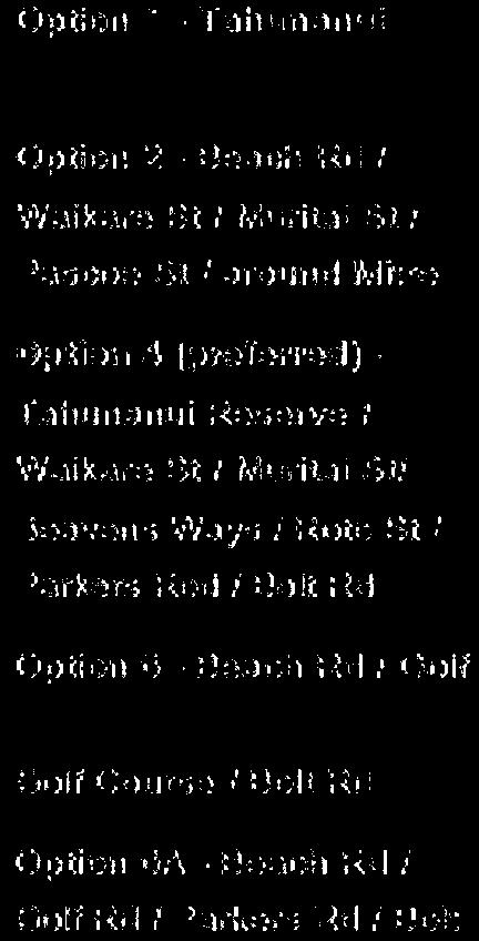
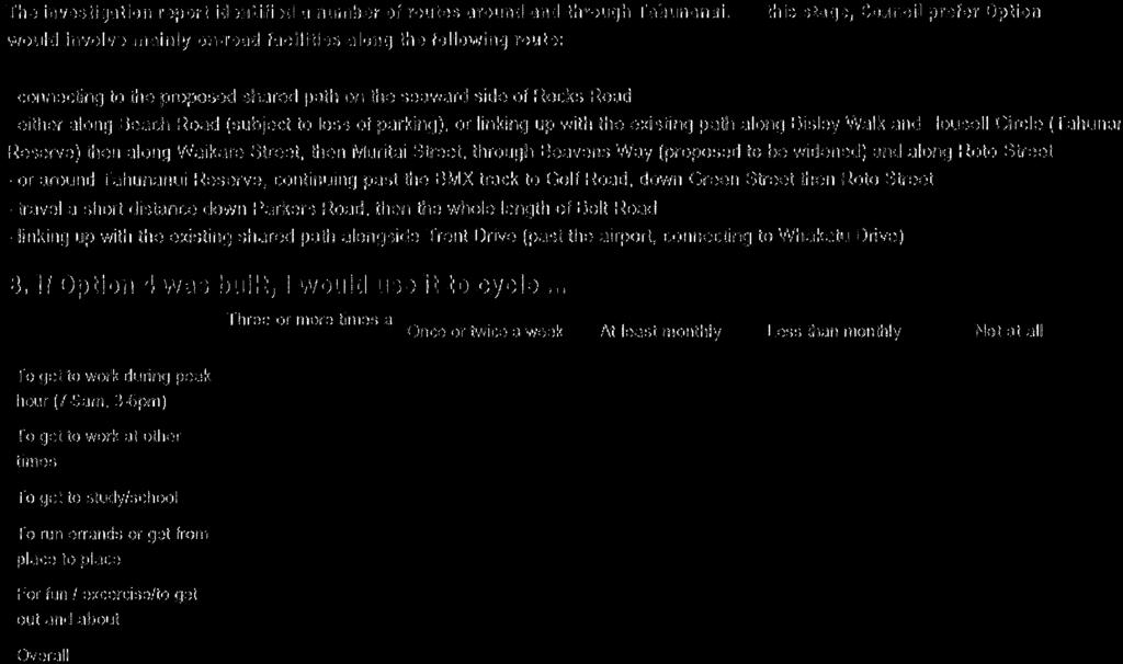
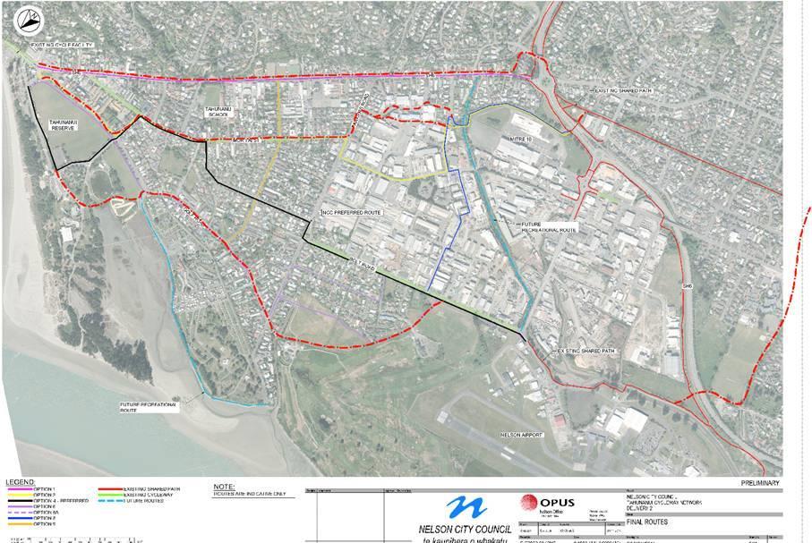
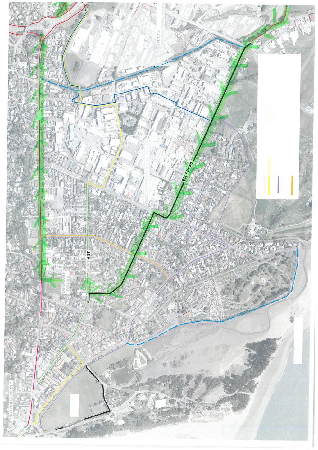
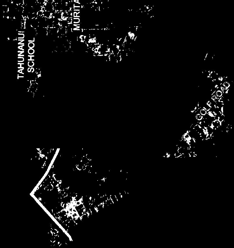
7 Tahunanui Cycle Network Investigations Engagement Summary 4 2 Introduction Council have undertaken an investigation to improve the cycling facilities through Tahunanui to link with the proposed Rocks Road walking and cycling facility to the north-east of the project area, the existing coastal shared path (by the airport / Whakatu Drive) to the south-east, and the existing railway reserve shared path to the north-east. At the beginning of the consultation period an additional aim of the project was added to include finding the best route through Tahunanui for those who want to feel safe about cycling to work or school. Opus International Consultants (Opus) have been commissioned to undertake this work on behalf of Council. In March 2014, a workshop was held with key stakeholders in order to identify destination points, desire lines, issues, pinch points and potential routes. This information contributed to the report produced by Opus in July 2014, (Delivery 2 of this project) which detailed the investigation of a long list of possible route options, and contained a refined short list of the options. Council sought to obtain the community s views before the project progressed any further. The short list of routes were put forward for public feedback, with particular focus on: Option 4 preferred by Council. Route via Tahunanui Reserve / Waikare Street / Muritai St / Beavens Way / Roto St / Parkers Rd / Bolt Rd / Airport (coastal shared path). Option 2 preferred by many stakeholders. Route via Beach Rd / Waikare St / Muritai St / Pascoe St / Merton Place / Blackwood St / Jenkins Creek / Mitre 10 site / Whakatu Dr underpass connecting to the railway reserve. Opus (with guidance from Council) outlined the proposed methods of communicating with, and gathering feedback from stakeholders and the community. This document (Engagement Summary) outlines how this methodology was carried out throughout the public engagement period. This report forms part of Delivery 3 of the project. 3 Engagement Objectives Engagement Objectives included: To communicate details of proposed options to the community To gain information that will help with the development and refinement of the project To receive public feedback on the options To engage with key stakeholders At the end of the investigation and reporting phase, to advise those consulted of the Council s decision.
8 Tahunanui Cycle Network Investigations Engagement Summary 5 4 Methods of Communication 4.1 General The four week engagement period commenced on 18 th February (the date of the Live Nelson article), with comments closing Monday 16 th March The engagement related to the investigation phase of this project. The purpose was to find out about the community s preferences for the options being considered, and identify issues and potential solutions relating to those options. Council continued to liaise with key stakeholders after the initial workshop was held in March 2014 and throughout the public engagement period. A second stakeholder meeting was held on 19 th January, and any queries from stakeholders or the wider public were directed to Council. Opus were engaged to carry out wider public engagement, collate the feedback from the open day, the questionnaire, and all correspondence from Council, to produce this report. 4.2 Live Nelson An article was published on 18 th February explaining that the study was underway, the public engagement period had commenced, details of the open day, and details of how to seek further information. 4.3 Displays / Public Information Sites Information was displayed in the Elma Turner Library (Nelson), Nellie Nightingale Library (Tahunanui) and the Tahunanui School Library. These public display sites also had hard copies of the brochure (see below) available to take away. 4.4 Brochure A brochure was available at the public information sites to accompany the display material. The brochure consisted of a summary of the project, a colour map with the route options, and a hard copy of the questionnaire. This document can be found in Appendix C. 4.5 Information for Stakeholders Key stakeholders were part of the initial investigation phase of this project by attending the workshop in March Further to this, all stakeholders were written to via on 5 th December 2014 to provide an update on the project, a link to the Tahunanui Cycling Connections web page, and another opportunity to provide comments. Council held a meeting with stakeholders on 19 January 2015 to gather feedback regarding the short list of options (notes from this meeting form Appendix H). Another was sent on 24 th February advising the commencement of the public engagement period, details of the open day, more information available on the web page, and encouragement to provide feedback.
9 Tahunanui Cycle Network Investigations Engagement Summary 6 Recipients of this correspondence are listed under the Engagement Register (Appendix A). Specific stakeholder feedback is documented in Section 5 below. More general public feedback has been collated and included in the Engagement Register. 4.6 Meetings Council held a meeting with key stakeholders on 19 th January Opus undertook face to face discussions with representatives from Tahunanui School and Tahunanui Community Centre. Opus also held telephone discussions with representatives from the NZ Police, Broadgreen Intermediate and Nayland College. 4.7 Open Day The open day was held at the Nellie Nightingale Library (Tahunanui) meeting room on Sunday 1 st March from 10am 2pm. Council and Opus staff were available to answer questions and gather feedback. A summary of feedback gathered from the open day is included as Appendix E. 4.8 Responses to Specific Individuals and Enquiries Questions were directed to Kayleen Goldthorpe at Council. All queries / communication is logged in the Engagement Register (Appendix A). 4.9 Web Page The web page within the Council website went live on 4 th December. The web page provided the following information: Introduction: Defining the project The Preliminary Investigation Report (Delivery 2) A map of the short list of routes Minutes from the Council Works and Infrastructure Committee meeting on 16 th October discussing this project Link to an online (survey monkey) version of the same questionnaire that featured in the brochure. This link was set up on 24 th February A Council contact to forward any queries Further Communication At the end of the investigation and reporting phase, those consulted and those who provided feedback will be advised of the Council s decision if, how and why the project will proceed.
10 Tahunanui Cycle Network Investigations Engagement Summary 7 5 Engagement Feedback 5.1 General Public Feedback from the general public via the open days and the questionnaire / comments was varied. In general, people were supportive of improving cycling facilities in and around Tahunanui, but did not see how one route could satisfy the needs of the varied users (e.g. school children, commuters, recreational and less confident cyclists). Recurring comments included: Support for a recreational route around the Tahunanui reserve, camp ground and golf course to link to the coastal shared path to complete the Great Taste Trail (once the Rocks Road walking and cycling facility was built) Beavans Way is currently fit for purpose serving the local community and school children. Increasing the use of the narrow lane (even if widened), especially by faster commuter cyclists was not supported Pascoe St should be avoided due to the heavy traffic and industrial nature of the area Concerns around the use of the crossing place near the Quarantine Rd / Nayland Rd roundabout Potential security issues associated with Option 2 (around the industrial area / behind Mitre 10) Concerns regarding using Tahunanui Dr (SH6) due to the conflict between heavy traffic and cyclists. 5.2 Feedback from Stakeholders, Organisations and Potentially Affected Parties Below is a summary of the feedback received from stakeholders, organisations and potentially affected parties. In order to get an overall picture of feedback, a table has been included in Appendix D summarising each submission in terms of preferred option (if any), and what issues were of most concern Feedback obtained from Opus via face to face or telephone discussions New Zealand Police School Community Officer John O Donovan provided detailed feedback regarding the proposed routes identified. John works in the Tahunanui and Stoke communities, with part of his role promoting road safety with the local school children. John sees the safety of children travelling (walking, cycling or scooting) between Tahunanui and the Stoke schools as a major priority, and is very interested in being involved and providing further input as this project progresses. Near the end of each school year, John (in partnership with the RIDE ON cycle training team ) guides the Year 6 children on a practice journey from Tahunanui School to Broadgreen Intermediate, where the majority of the students from Tahunanui will travel to the following year. John takes the children (on their bicycles only - not scooters), from the school grounds, crosses Tahunanui Drive at the school pedestrian
11 Tahunanui Cycle Network Investigations Engagement Summary 8 crossing, travels (on the road) along Tahunanui Drive connecting to the Annesbrook roundabout overpass and the railway reserve (this route forms part of Option 1). In order to improve the children s road safety skills, John returns to Tahunanui School via a different route. They travel via Nayland College playing fields, under the Whakatu Drive culvert, along the coastal shared path, Bolt Road, Roto Street and Beavans Way and back to Tahunanui School (this route forms part of Option 4). John uses the Green Street / Roto Street junction to practice intersection skills (further to intersection skills taught on the school grounds with a mock-up intersection). A map of this route is included as Appendix G. Ideally, children would travel to the Stoke schools via the railway reserve (i.e. away from vehicles), however the most direct route to the railway reserve (Tahunanui Dr) is very unsafe for young cyclists, with too much traffic. Option 1, although a good idea, is likely to cost a lot of money. In general, John would support the development of Option 4 as a priority for the following reasons: The route appears to be the most useful, and simple Bolt Road is wide, with potential to develop into an off road facility. Would also be ideal to link to the coastal path Roto Street is wide and has very little traffic The route would not require a great deal of work / cost as most of the route is either wide / quiet (Roto St), or already developed (Tahunanui Reserve shared path) Pascoe Street should be avoided, in particular the intersection with Parkers Road. Other comments relating to Option 4 include the need to significantly widen Beavans Way if it was to serve higher numbers of cyclists. The bridge near the airport may be too steep, however most children manage it as it is. John also sees merit in Option 2, and would prioritise this route over Option 4 if Pascoe Street and the Parkers Road / Pascoe St intersection could be avoided. If this route was developed, great care must be taken to make it safe for users, especially in the industrial area / around the back of Mitre 10 e.g. sufficient lighting, address security issues, needs to meet crime prevention through environmental design (CPTED) requirements etc. John does not encourage the school children to use Pascoe St because it is very busy with a lot of through traffic, high industrial use, heavy vehicles etc. He is aware that many school children use this route anyway, and will continue to use it unless a viable alternative is provided. In terms of a recreational route, Option 6 is seen as a good option. In order to make a route attractive and enjoyable for recreational cyclists (particularly less confident cyclists and family groups), there needs to be separation from vehicles. Any development of this route should get cyclists as far from vehicles as possible, ideally with a grassy strip creating both a physical and mental barrier from the motorised traffic (such as the Atawhai Drive shared path). A concrete / sealed separation strip would not achieve the same result.
12 Tahunanui Cycle Network Investigations Engagement Summary 9 Bolt Road appears to be wide enough to develop a two way cycle facility (possibly on the seaward side), with a green strip between the cyclists and the traffic lanes. Extra width could be achieved with the removal of the existing on-road cycle lanes. This could be applied to Option 4 and Option Tahunanui Primary School As part of this project, Jane Tambisari completed a whole school survey on Tuesday 1 st April 2014, and found that 5% cycled, 34% walked, 41% came in a car and 20% rode their scooters to school that day. Because the school is located centrally within the Tahunanui community (Rocks Road to the west, the Port Hills area to the north, the flat residential area to the south and Annesbrook to the east), students use many different routes depending on where they live. Jane is involved in the Year 6 practice journey to Broadgreen Intermediate with the Police representative and RIDE ON cycle training team. Although children are encouraged to travel via the railway reserve, Jane says that many students travel along Pascoe Street and along Nayland Road as it is seen as a more direct route, and a central location to meet friends from other parts of the neighbourhood. Jane would support the provision of safe cycling options away from the main thoroughfares, and would not support the reduction of any parking along Beach Rd near the Tahunanui Reserve, or Muritai St near the school. Jane would not support the use of Beavans Way for cyclists, even if it were widened Broadgreen Intermediate Paul Johnstone is Deputy Principal of Broadgreen Intermediate. Paul requested that all students cycling or scooting to school from Tahunanui meet as a group to gather feedback for this project. Around 25 students attended the meeting. The routes students currently took to school varied (dependant on where the student lived, who they were meeting on the way etc.). Approximately a third used Tahunanui Drive (mostly to link up with the railway reserve), a third used various routes from southern or western Tahunanui to link up with Nayland Rd, and a third used the central route via Pascoe St to link up with Nayland Rd or the railway reserve (via the Whakatu Dr underpass). Many of the Tahunanui students interviewed said that they find the shortest route (journey length generally outweighing safety), and Option 4 is not seen to be direct enough, so they were unlikely to use it. The students liked the idea of using off road alternatives (e.g. the back of Mitre 10 as part of Option 2), and would use that option even if it took a little longer. This route would also link up with the railway reserve which was preferable to Option 4 as it takes students closer to school. Paul stated that the students were reminded periodically to use the dedicated underpass (Whakatu Dr) rather than cross busy roads such as Quarantine Rd Nayland College Representatives from Nayland College distributed information about the project to the students. A link to the online survey was also distributed, however no students submitted a response.
13 Tahunanui Cycle Network Investigations Engagement Summary Opus International Consultants Andy High (Transportation Safety Manager) works as a consultant for the New Zealand Transport Agency, who maintain the State Highway network. In respect to this role, Andy supports the construction of a cycle facility away from Tahunanui Drive / SH6 for the following reasons: Due to the limited road width along this stretch of SH6, the construction of a cycle facility (either on road, or off road) would require a significant reduction of on road parking. Removal of parking and the widening of usable sealed areas can reduce the effects of side friction, increasing the speed of vehicles using this route, which in turn, could decrease safety for all road users. Numerous accesses and side roads, some intensively used, are not compatible with a cycle facility. There would be a large number of conflict points. There was some concern regarding how Option 1 (SH6) would link with Rocks Road to the north. The Bisley/Beach Rd traffic light intersection is not presently suitable for large numbers of cyclists and would require changes in line marking and possibly lights phasing. To the south, the Quarantine Rd roundabout is already a busy intersection (particularly at peak times) with a less than desirable crossing location, and any facility that takes cyclists / scooters / pedestrians away from this conflict point would be supported. Option 2 would encourage students to travel around the back of Mitre 10 and use the Whakatu Dr underpass, rather than travelling along the full length of Pascoe St and crossing near the Quarantine Rd roundabout Tahunanui Community Centre Although the centre s representative (Joy Shackleton) supports the provision of cycle facilities in Tahunanui, she notes serious concerns around the use of Beavens Way as part of Option 4. Beavens Way is thought to serve its purpose as a walkway for the local community and school children, but should not be used as part of a public cycle route Feedback obtained from Council via Tahunanui Kindergarten and Nelson / Tasman Kindergarten Association s were received from Trish Casey (CEO Nelson / Tasman Kindergarten Association) and Linda Hansen (Teacher at Tahunanui Kindergarten). Both would like to see minimum impact on residents and young families in the area, particularly in regards to the retention of parking along Beach Rd and Muritai Street, as both these areas are highly utilised at peak times. Muritai St already has limited parking for families (often with toddlers and babies in tow) using the school, Tahunanui Community Centre and Tahunanui Kindergarten, all of which are within 100m of each other with similar drop off / pick up times. Regarding Option 4, a widened shared path on the seaward side of Muritai St is recommended (between Waikare St and Beavens Way) to negate the need for crossing Muritai St (which is wide and busy) twice, if travelling south.
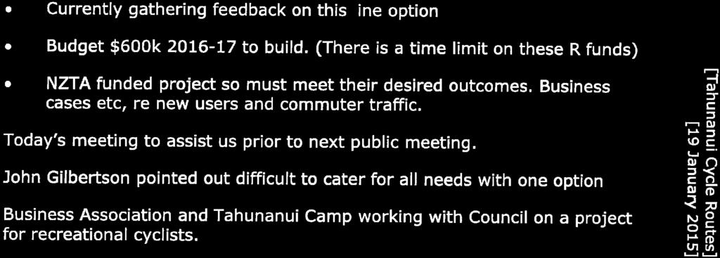
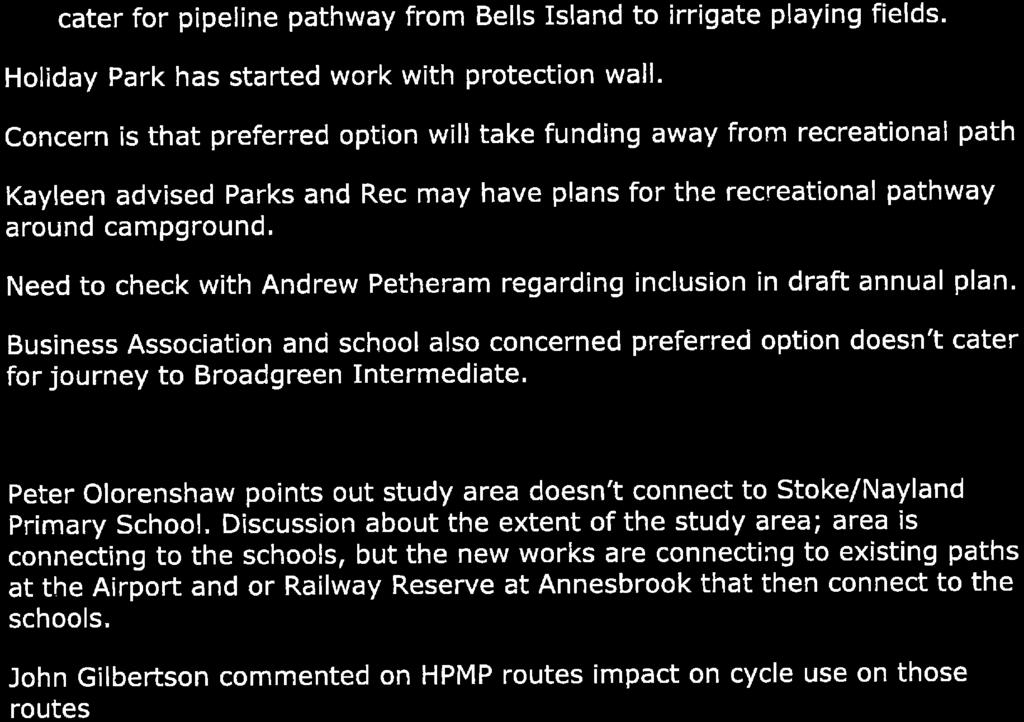
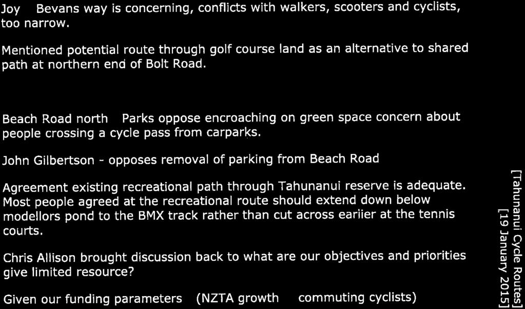
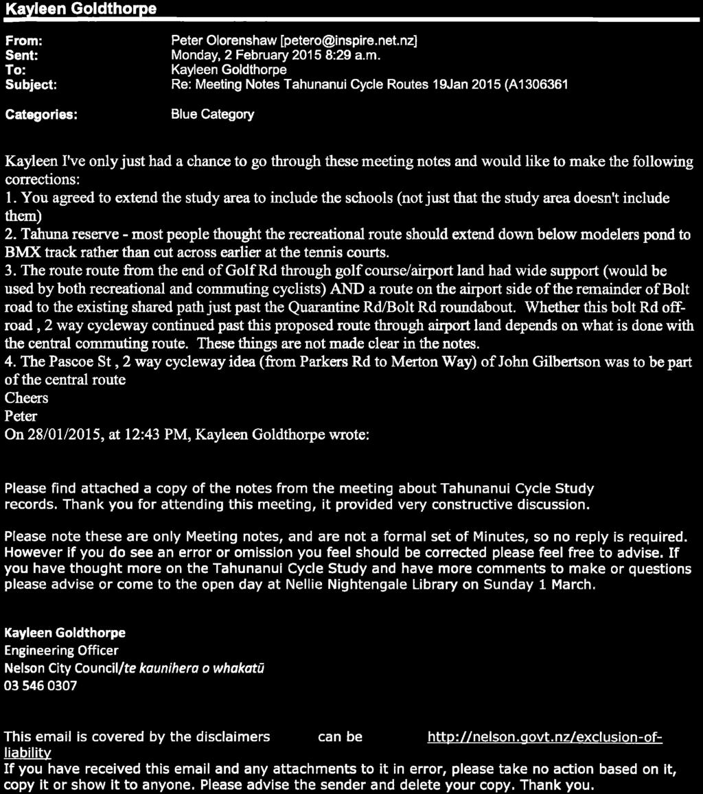
14 Tahunanui Cycle Network Investigations Engagement Summary Nelsust (Peter Olorenshaw) Nelsust (also known as the Nelson Transport Strategy Group), is a non-profit organisation and lobby group. Peter expressed the need to include the Stoke schools in to the study area as they are important destinations. Peter commented that a one route solution is not the answer, as the needs of school children travelling to school, recreational cyclists looking for a scenic route and others looking for a direct route off the highway, are all very different. Peter suggested a three route solution a) a two way cycle path running the full length along the hill side of Tahunanui Dr (same route as Option 1), b) a recreational route around the Tahunanui Reserve, past the BMX track, along Golf Rd, through the golf course and along Bolt Rd (modified Option 6), and c) a fairly direct route through the middle of Tahunanui linking the Whakatu Dr underpass (to railway reserve) to Rocks Rd via Bullen St, Muritai St and Beach Rd. A copy of this suggested solution forms Appendix F Automobile Association Concluded that Option 4 seemed to be the preferable route. Noted that sharrow markings could work for Green St and Roto St, however they would have reservations about the use of Muritai St and Pascoe St due to the volume and nature of motorised traffic mixing with the appreciable number of cyclists SBL Group Ltd Would like the potential impact on NBus route / bus stops to be taken into account, particularly as the two favoured options use Muritai St Other feedback Eight s were received by Council containing queries/feedback from the general public (see Engagement Register). The feedback was added to the questionnaire comments and collated as part of the summary below Feedback obtained from Council s stakeholder meeting on 19 th January 2015 Notes from this meeting are held in Appendix H. Feedback has been listed under each stakeholder below, where it was clear who placed the comment Bicycle Nelson Bays If a route were to be developed along Muritai St, it would be best to make it off road to serve the interested but concerned cyclists who would not use an on road facility. Suggested Council look into accessing additional funding, perhaps via the Urban Cycle Funding Nelson Motel Association / Tahunanui Business Association (John Gilbertson) / Tahuna Holiday Park Stated that it was difficult for one route to cater for all needs. Strongly opposed to removal of any parking along Beach Rd. Suggested using northern end of Pascoe St verge to develop a two way cycle facility (there are 11 accesses long this stretch) then follow Option 2 route.
15 Tahunanui Cycle Network Investigations Engagement Summary 12 Tahunanui Business Association (together with the campground) were working with Council to develop a recreational route through the campground. Work has already begun on a protection wall along the waterfront. There was concern that the Council project would take funding away from the proposed recreational path, but Council advised that funding was separate. There was some concern regarding the current heavy vehicle routes conflicting with the preferred cycle route (e.g. Bolt Rd and Parkers Rd) Great Taste Trail Trust For a cycle trail to be used as part of the Great Taste Trail, it must be off road. 5.3 Questionnaire Paper copies of the questionnaire were available at the open day, and public displays in the Nelson, Tahunanui and Tahunanui School libraries. The internet based, Survey Monkey questionnaire was also linked to the Council s Tahunanui Cycling Connections webpage. 46 questionnaires were completed (15 returned in a paper format and 31 completed via the online questionnaire). The questionnaire sought to obtain public opinion regarding the respondents existing cycling behaviour, what routes they would potentially use (how often and for what purpose), as well as more specific feedback regarding Option 4 (Council s preferred route) and Option 2 (popular with stakeholders). The questionnaire included 18 questions (inclusive of questions regarding demographics of the respondents), with multiple opportunities to insert comments. A total of 180 comments were made, spread over the ten text boxes within the questionnaire. Through analysing each individual comment, valuable information was gathered regarding the respondent s cycling behaviour, specific feedback regarding Options 2 and 4, and comments on the project in general. A summary of the comments is included in Appendix D Respondent Demographics Approximately 58% of the respondents were male, with 42% being female. Most of the respondents identified which age group they were from. Of those who answered, just over half of the respondents were from the age group. The over 65 age group made up 26%, with the remaining respondents spread out from the age groups and the age groups.
, and the surrounding neighbourhoods of Enner Glynn/Annesbrook/Wakatu and PortHills/Washington/Stepneyville/Britannia (23%).")
16 Tahunanui Cycle Network Investigations Engagement Summary 13 Figure 1: Age of respondent (note that only 39 of the 46 respondents answered this question) The majority of respondents live in Tahunanui (37%), and the surrounding neighbourhoods of Enner Glynn/Annesbrook/Wakatu and PortHills/Washington/Stepneyville/Britannia (23%). 20% of the respondents live in Stoke, with the remaining respondents living in Toi Toi/Victory, Central City, The Brook/Maitai Valley and Atawhai/Marybank. When asked what their association with Tahunanui was, 39% said that they were a Tahunanui resident, 25% said that they were not a resident, but travel to or through Tahunanui to get to work (and 9% to get to school/study). No respondents identified as being a Tahunanui business owner. There was an option to provide comments in a text box labelled other. The comments mostly referred to the respondent cycling for recreation, supporting cycleways in general, or using the recreational facilities in Tahunanui.

17 Tahunanui Cycle Network Investigations Engagement Summary Support for and use of Cycling Facilities Of the respondents, 91% strongly support the construction of cycleways, with the remaining responses either support or neutral. When asked whether they would use cycleways if they were available in and around Tahunanui, 58% of the respondents said they would definitely use them, 40% would use them if it was right for you, and 2% would never use them, no matter what. Figure 2: Whether respondents would use cycleways, if they were available in Tahunanui Cycling Behaviour in General Respondents were asked how often they cycled anywhere at all in the last year, and for what reason.
 said that getting to work or study / school was not applicable which may reflect the proportion of older / retired respondents.")
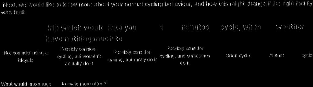
18 Tahunanui Cycle Network Investigations Engagement Summary 15 A high proportion (45%) of respondents said that they had cycled to get to work three or more times a week in the last year. Many other respondents (58%) said that getting to work or study / school was not applicable which may reflect the proportion of older / retired respondents. As can be seen in Figure 3, many of the respondents cycle regularly for recreation, or to get around to places other than work or school/study. Figure 3: Cycling behaviour in the last year (in general) The respondents were then asked about their current cycling behaviour in relation to a local trip which would take about minutes to cycle, when the weather is fine and you have nothing much to carry (Question 4). The majority (48%) would almost always cycle, with 14% would often cycle, and 26% would possibly consider cycling, and sometimes do it. Approximately 7% of the respondents would possibly consider cycling, but rarely do it, and 5% would not consider using a bicycle. These results align with Figure 3, with a high proportion of respondents using a bicycle to get around on a regular basis.
, followed closely by a cycling facility being away from")
19 Tahunanui Cycle Network Investigations Engagement Summary 16 Figure 4: Cycle use by respondents for local trips The respondents were then asked what would encourage them to cycle more often. Over half of the respondents placed a comment in response with the most common being the provision of off road cycle facilities (8 comments), followed closely by a cycling facility being away from the main road or trucks (5 comments), and cycling being made safer (5 comments). Other factors mentioned included providing a more direct cycling route (4 comments), avoiding Tahunanui Drive (2 comments), and making crossing points safer (2 comments) Cycling behaviour in relation to Tahunanui The respondents were asked about their cycling trips in and around Tahunanui over the last year (see Figure 5). Due in part, to the demographics of the survey pool (i.e. many respondents are over 65 and commented that they were retired, many respondents do not live or travel through Tahunanui), the majority of the respondents have not cycled in or through Tahunanui to work or study at all over the past year. 30% of the respondents cycled to work during peak hour over the past year three or more times per week, with none of the respondents travelling to work regularly outside of peak times. Many respondents cycled in or through Tahunanui for recreation, or as a means of getting to places other than work or school/study.
. The results can be seen in Figure 6 below (respondents were able to choose more than one option).")
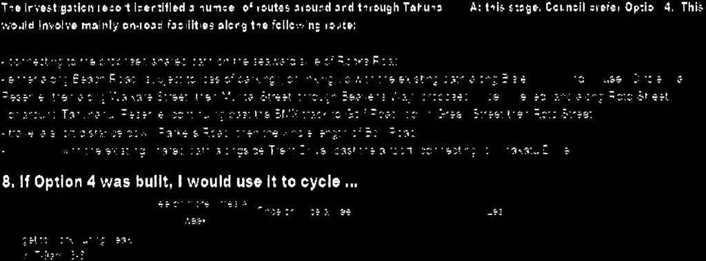
20 Tahunanui Cycle Network Investigations Engagement Summary 17 Figure 5: Cycling behaviour over the last year (in relation to Tahunanui) The next question asked what routes the respondents would use if a cycling network was built in Tahunanui (i.e. all routes on the map). The results can be seen in Figure 6 below (respondents were able to choose more than one option). 31% would use Option 1 three or more times a week, which suggests that the route would be used to commute to work. Options 1 and 2 were the most popular routes that respondents stated they would use regularly. 72% would use Option 1 at least monthly or more, and 73% would use Option 2 at least monthly or more often. Option 6 (and 6a) and 4 would attract fewer regular users. 59% would use option 6 (53% Option 6a) at least monthly or more, and 55% would use Option 4 at least monthly or more. Options 8 and 9 were less popular for regular use. Twenty respondents inserted comments after this question. The most common remark was that more recreational routes should be prioritised (4 comments).

21 Tahunanui Cycle Network Investigations Engagement Summary 18 Figure 6: Which route would the respondent use Feedback regarding Option 4 Respondents were asked how often they would use Option 4 if it was built. As can be seen in Figure 7, approximately 14% of respondents would use Option 4 to get to work during peak times at least three times a week. Combining the results of both peak time and other times travel, 22% using the route to get to work at least monthly, and 18% less than monthly. General comments regarding Option 4 included that it was too indirect to cater for commuters. Other comments included that if this route was to cater for recreational users, the route around the reserve, past the BMX track and onto Golf Rd (or around the campground) was preferable to Muritai St / Beavans Way. Others were concerned about any loss of parking, and the use of Beavans Way. When asked to identify specific issues, potential improvements and general comments regarding Option 4, the themes from the general comments above were repeated. This route was seen to be not direct enough for commuters (9 comments in total). The local community would like to see Beavens Way retained as it is, and would not support the use of this lane as a cycling thoroughfare (8 comments in total). Further analysis of comments regarding Beavens Way also indicated the following issues: Lane is too narrow (and the widening required to obtain good sight lines is not possible due to nearby houses) Conflict between cyclists and pedestrians (many of whom are children) Conflict between cyclists and vehicles at the Roto St end (lane leads to a right of way / driveway).

22 Tahunanui Cycle Network Investigations Engagement Summary 19 Figure 7: Predicted use of Option 4 Within the comments, there were suggestions for modifying the Option 4 route. Three respondents thought that using Beach Rd would be an improvement as it was more direct and would cater better for commuter cyclists, and would involve less conflict with pedestrians. One suggested travelling around Tahunanui reserve, past the BMX track, along Golf Rd, then use the driveway at 119 Golf Rd to link with the golf course and Bolt Rd Feedback regarding Option 2 Respondents were asked how often they would use Option 2 if it was built. As can be seen in Figure 8, approximately 20% of respondents would use Option 2 to get to work during peak times at least three times a week. Similar to Option 4, this route would be utilised regularly for recreation / to run errands. General comments regarding Option 2 included the need to avoid Pascoe St (6 comments), and to provide for the school children travelling to Stoke (2 comments). When asked to identify specific issues and potential improvements regarding Option 2, the use of Pascoe St was mentioned the most (8 comments). It was stated that Pascoe St was already used by school children, but it was much too busy with industry and heavy traffic and was not safe at present.

23 Tahunanui Cycle Network Investigations Engagement Summary 20 Figure 8: Predicted use of Option 2 Within the comments, there were suggestions for modifying the Option 2 route. Two respondents suggested that the path around Tahunanui Reserve should be used, and one suggested the use of Bullen St to connect with Jenkins Creek and continue around the back of Mitre Summary of Feedback Confident Commuter / Sport Cyclists Feedback suggests that confident commuter cyclists travelling through Tahunanui will use the most direct route (Option 1 - Tahunanui Dr / SH6) whether cycling facilities are provided or not. If Option 1 were developed, then it would provide a safer route for commuters, and would encourage more cycle commuters. Option 4 is generally seen as not direct enough for commuter cyclists, with too many dog-legs to make it suitable for cyclists travelling through the area School There is no easy fix for students, as they start from multiple locations throughout the hills and flat areas of Tahunanui, so providing a direct route is difficult. Ideally, any route provided would offer a safe link to the railway reserve which is well suited for children who walk, scoot or cycle. Option 2 is seen as a good fit for Broadgreen students as it is central, partly off road (around the back of Mitre 10) and links up with the Whakatu Dr underpass, thus avoiding crossing Quarantine Rd near the busy roundabout. However, Pascoe St repeatedly came up as an area not suitable for children or cyclists because of the conflict with the industrial environment and heavy traffic. Option 1 would also provide a direct link for those students living in the Port Hills area to the railway reserve through to the schools in Stoke. Option 4 may be appropriate for students
24 Tahunanui Cycle Network Investigations Engagement Summary 21 travelling from south western Tahunanui to the Stoke schools, however many people had concerns regarding using Beavans Way as a cycle route for the general public. It should be noted that students seem to favour scooters over bicycles, and many of them choose to walk to school. This means that on road cycling facilities would only serve some of the students Recreational Analysis of the questionnaire responses and comments, and feedback from the open day indicated that there is a high demand for recreational cycling facilities. Recreational users would use a more indirect route, ideally off road and scenic, for example around Tahunanui reserve, the Tahuna Holiday Park and golf course, and generally away from vehicles wherever possible. Option 6 caters for this group the best Less confident Feedback indicated that the greatest factor contributing to increase cycle use was the provision of off road cycle facilities, followed closely by a cycling facility being away from the main road or trucks, and cycling being made safer. Option 6 would cater best for this group as the route avoids busy roads and provides an off road facility around the golf course Overall Generally, the feedback collated over the engagement period shows that the community would be supportive of improving cycling facilities in Tahunanui, provided that the routes were safe, there was no loss of parking, appropriate road crossing points were provided, and the routes avoided busy roads where possible.
25 6 Appendix A: Engagement Register
26 Organisation (provided by Council at commencement of project) Contact Name Attended workshop March 2014? Attended Meeting 19 Jan 15? Provided feedback during public engagement period? Businesses and Agencies NZTA Andrew James Opus (NZTA Agent) Andy High Preferred option (if any) Comments NZ Automobile Alan Kneale 4 Association Nelson District Bicycle Nelson Bays John-Paul Pochin Nelson Tasman Cycle Trails Trust Stuart Hughes, Administrator Marika Kingan Bronwyn White 6 (variation of) Nelson Marlborough District Health Board Nelsust Peter Olorenshaw 3 routes suggested NZ Fire Graeme Daikee Did initial work on Tahuna school crossing etc. NZ Police John O'Donovan 4 Road Transport Derek Nees Association of NZ SBL Group Ltd Tony Cumming St John Ambulance Tahunanui Business Association and Motel Association Nelson Airport Ltd Matt Wilkenson John Gilbertson 2 Rob Stevenson Rob Evans Tahunanui Campground c/-andrew Petheram Nayland College Diane Holland Broadgreen Intermediate Paul Johnstone or Cate Gully 2 Nayland Primary Janice Gulbransen No response Tahunanui Primary Jane Tambisari Spoke to Jane w/c 2nd March 2015 Tahunanui Campground Ann Cumpstone, Attended open day. Geoff Barnes / Marcel Fekkes Nelson Golf Club Nelson City Council Marg Parfitt Reuben Peterson also to attend Nelson City Council Sue McAuley Attended open day. Nelson City Council Kayleen Goldthorpe Attended open day. Wakatū Incorporation Resident Groups Mike Ingram / Iain Sheves Tahunanui Residents Association Lee Corlett Lea to meet with Lee 19th March 2014 Youth Council Rach Large Carla Lindey to attend with 2 students Nelson Residents Ken Meredith Association Inc Tahunanui Community Joy Shackleton Centre Other groups Accessibility for All Sarah Downs Next A4A meeting 9th May Krista to attend workshop Positive Aging Forum Gail Collingwood Road Safety Nelson Mark Preston- Bays Inc Thomas Get Moving Chris Allison Next Road Safety Mtg 6th May 2014 Cycle Strategy Derek Shaw Iwi Barney Thomas May attend workshop Hugh Briggs
27 Tahunanui Cycle Study Consultation Register (Nelson City Council) ID Date Contact details Preferred Option Comments Feedback to them to date 1 13 March Linda Hansen Not possible 15 lindatahunanui@gmail.com 6 or 6a Pref -cycleway on playing field edge Beach Road No remove parking Beach Road Suggest make shared path Waikere St to Bevans Way west side Muritai St No cyclists cross Muritai Street 2x between Waikere St and Bevans Way to use cycle lanes Important keep parking outside Tahunanui School/Community Centre Important -reduce cyclist/parent/children conflicts Agree Possible Option above possible No plans to remove parking Agree 2 13 March March March March March 15 Katie Shaw Katie.shaw20@gmail.com Trish Casey (CEO Nelson/Tasman Kindergarten Trish.casey@ntk.org.nz Darrel Newton darrelnewton@rocketmail.com Ben Collis ben@dp.co.nz Jo Martin Jo.martin@ncc.govt.nz n/a Question use of Bevans Way (no specific preference mentioned) n/a -No -removal of parking on Muritai Street Important reduce cyclist/pedestrian/children conflicts 2 Pref connection to R.R, esp to go into Nelson CBD Suggest Tahunanui Drive (footpath)/parkers Road/Muritai Street/Tahunanui Dr (footpath)/rocks Road n/a No cyclists use of Bevans Way Important- reduce cyclist/parent/children conflicts 2 Pref connection to R.R, esp to go Nelson CBD/Beach Aware of parent/children/cyclists conflict issue with Bevans Way No plans to remove parking Agree Agree, others suggesting option 2 Route noted Notes Agree Agree, other suggesting option 2
28 7 5 March 15 Judy Burke Judyburke@kinect.co.nz 8 2 March 15 Sam Moss asmmoss@hotmail.com 9 12 Jan 15 Peter Olorenshaw petero@inspire.net.nz n/a Comment on congestion at Beach Noted to see about shifting coffee cart etc from beside cycle path, otherwise congestion might have to stay and cyclists use another route if frustrated n/a Lives by Bevans Way, keep in touch for noted options with Bevans Way n/a -area of study to include Nayland schools - A 1 route solution is wrong - study connects to existing paths at Annesbrook and Airport that go past Nayland Schools - agreed, but funding may need to be prioritised and network staged Dec 14 Allan Kneale(AA) Kneale@tasman.net - need routes to cater for Tahunanui Hillside cyclist, and many other suggestions 4 _Agree with option4 _ query dog leg around tahunanui Reserve _ concern for cyclist/vehicle mix on Muritai Street _reservations about use of Pascoe Street because of traffic Jan 15 Minutes of Meeting n/a Many comment see meeting notes Feb 15 Tony Cummings tony@nelsoncoachlines.co.nz n/a Concern for bus stops and bus conflict with cyclists on option 4 esp Muritai Street March Alec Woods n/a Have the students been surveyed for 15 Alexwoodsnz@gmail.com what they would use March 15 Rose Biss bissan@actrix.co.nz 4 Tahunanui Dr dangerous narrow in parts, and conflict with heavy traffic Alter Option 4 travel between Beach Rd and the Tahunanui reserve _ ok _background given _noted _noted Noted, and need to follow up Students encouraged to do on line surveys to respond their preferences _noted
29 7 Appendix B: Live Nelson Article

30
31 8 Appendix C: Brochure including Questionnaire

32

33

34


35


36


37


38

39


40


41


42
43
44 9 Appendix D: Summary of Feedback / Issues Raised
45 NZ Police Preferred Option Quarantine Rd roundabout / crossing area Concerns regarding Beavans Way Tahunanui Dr (SH6) too busy / dangerous now Pascoe St conflict with heavy traffic Muritai St conflict (e.g. buses, high traffic) Security issues industrial area / Mitre 10 Concerns - parking loss (Tahunanui reserve and Muritai St) Suggest shared path seaward side of Muritai St (option 4) Bolt Rd has potential (good width) Concerns around Pascoe St / Parkers Rd intersection 4 Tahunanui School Broadgreen Intermediate 2 Opus / NZTA 2 Tahunanui Kindergarten Nelson Tasman Kindergarten Association Nelsust Bicycle Nelson Bays AA Tahuna Business / Nelson Motel Associations Tahuna Holiday Park Tahunanui Community Centre Great Taste Trail SBL Group One route is not the answer Need off road cycling facilities Conflict with pedestrians around Tahunanui reserve Prefer to continue around BMX track (opt 4) 3 routes required recreational 6 (modified) 6 (modified) Support for recreational route (e.g. around campground/golf course) Open day comments Questionnaire See results comments (Option 4) Questionnaire See results comments (Option 2) Questionnaire comments (General) Other public comments See results 2, 2, 4
46 10 Appendix E: Summary of feedback from Open Day
47 Tahuna Cycling Connections Project Open Day Sunday 1 st March 10 2pm Nellie Nightingale Library Meeting Room Present: Kayleen Goldthorpe, Sue McAuley (Nelson City Council), Joanne Chang, Sam Allen, Lea O Sullivan (Opus International Consultants) 10 visitors left their names on the attendance register. Those who left their address were added to the interested parties list to be kept up to date with the progress of this project. A large map (A2) was placed on the wall, and the visitors were asked to provide feedback on the routes and comment on any issues that they identified, and ways to improve on the routes. The following feedback was received: Option 1 (SH6) Improve on-road cycling facilities along SH6 The area around the petrol station is a real pinch point where cyclists are vulnerable. Chose to get off bike and walk this section. Option 2 (Muritai St / Pascoe St) Improve safety of Pascoe St Kids are already using Pascoe St, but it doesn t feel safe Option 4 (Council preferred route) Residents concerned about increased use of Beavans Way (lighting, privacy issues) Keep Beavans Way as it is (serves its purpose as local / school route), re-route Opt 4 Waste of money to widen Beavans Way commuters wouldn t use it as it s not direct enough, and recreational users want a more scenic / off road route (e.g. around campground) Would be dangerous to add fast cyclists along Beavans Way dangerous. Would prefer to cycle around modellers pond / BMX track rather than travel down Waikare St Parkers Rd / Bolt Rd roundabout there is no room for cyclists with existing road markings Tahunanui Reserve is too busy to add more cyclists to the mix (especially in summer with many pedestrians, little children, sports crowds). Option 6/6A Better option to avoid Tahunanui Reserve shared path (don t want fast moving cyclists there) Future recreational routes Make a recreational link the priority (around campground, Parkers Rd, Bolt Rd) Already use campground as a recreational route Other Extend shared path between Blackwood St and Annesbrook roundabout Width of some shared paths are too narrow due to fences / other restrictions on each side Existing crossing point near Mitre 10 feels unsafe there is a lot of fast moving traffic here Humpback bridge near airport not easy to use. Steep and not much manoeuvre space at either end. The right turn from SH6 into Muritai St (southbound) is dangerous
48 11 Appendix F: Nelsust Three Route Solution
49
50 Tahunanui Cycle Network Investigation Engagement Summary Appendix G: School Community Officer / RIDE ON cycle training team practice journey for Year 6 Tahunanui School students


51
52 13 Appendix H: Notes from Stakeholder Meeting 19 January 2015


53
54


55
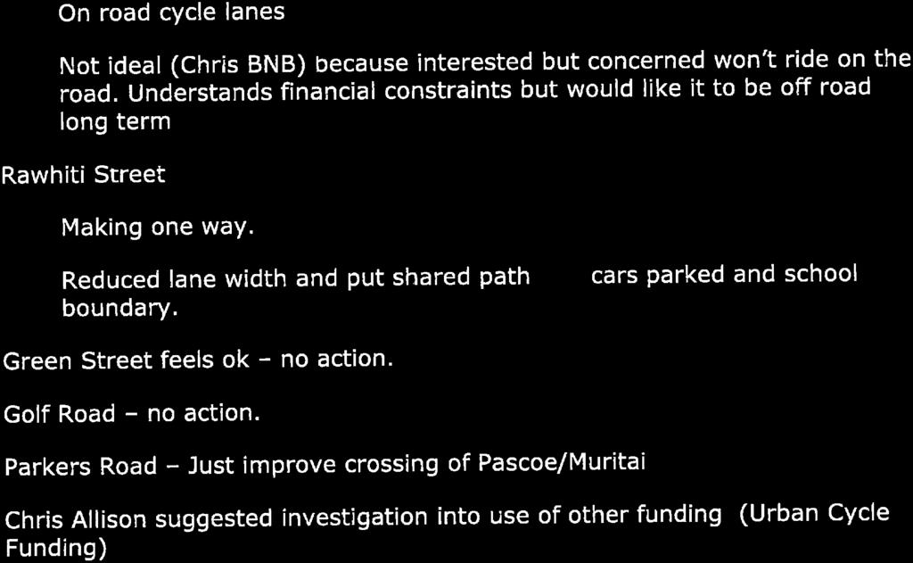

56

57
Nelson City Council Tahunanui Pathways 7 December 2017
 Nelson City Council Tahunanui Pathways 7 December 2017 For more information please contact: Jane Murray NMDHB Public Health Service Email: jane.murray@nmdhb.govt.nz Phone: (03) 543 7805 2 Submitter details
Appendix B Option 1 Design, Plans and Estimates
 19 Appendix B Option 1 Design, Plans and Estimates Opus International Consultants Ltd Design Details All options where designed using NZTA MOTSAM part 2, NCC Land development manual 2010 and Cycling
Regional Cycle Programme Update
 Agenda Item 10 (ii) Regional Cycle Programme Update Glossary Auckland Council Auckland Transport Cycle Action Auckland New Zealand Transport Agency Regional Cycle Network (AC) (AT) (CAA) (NZTA) (RCN) Executive
Winnipeg Walk Bike Projects Downtown Tire Talk - Summary
 Winnipeg Walk Bike Projects Downtown Tire Talk - Summary Downtown Projected Bike Lane System Connecting The Forks to the Exchange District (Fort Street, Garry Street & The Forks to Assiniboine Connection)
Update June 2018 OUR 2017 PUBLIC ENGAGEMENT
 Update June 2018 Hi, Let s Get Wellington Moving (LGWM) is developing a Recommended Programme of Investment (RPI) that meets our programme objectives and supports the city s and region s growth. As part
Baseline Survey of New Zealanders' Attitudes and Behaviours towards Cycling in Urban Settings
 Baseline Survey of New Zealanders' Attitudes and Behaviours towards Cycling in Urban Settings Highlights 67% of urban New Zealanders, 18 years of age or more own or have access to a bicycle that is in
6. BREENS/GARDINERS/HAREWOOD INTERSECTION - SAFETY IMPROVEMENT PROJECT
 6. BREENS/GARDINERS/HAREWOOD INTERSECTION - SAFETY IMPROVEMENT PROJECT General Manager responsible: Officer responsible: Author: Jane Parfitt General Manager City Environment DDI 941 8656 Michael Aitken
PAEKĀKĀRIKI HILL ROAD / BEACH ROAD / SH1 INTERSECTION PROGRESS REPORT
 Chairperson and Committee Members ENVIRONMENT AND COMMUNITY DEVELOPMENT COMMITTEE 6 DECEMBER 2011 Meeting Status: Public Purpose of Report: For Decision PAEKĀKĀRIKI HILL ROAD / BEACH ROAD / SH1 INTERSECTION
SH3 Waitara to Bell Block
 SH3 Waitara to Bell Block NZ Transport Agency August 2017 Community feedback report Copyright information This publication is copyright NZ Transport Agency. Material in it may be reproduced for personal
Active Travel Strategy Dumfries and Galloway
 Active Travel Strategy Dumfries and Galloway Our Active Travel Strategy The agreed Interventions for Dumfries and Galloway Council s Local Transport Strategy includes an action to Develop an Active Travel
Pattullo Bridge Replacement Project Community Connections Phase 2 Consultation. Appendix 3: Open House Display Boards
 Replacement Project Community Connections Phase 2 Consultation Appendix 3: Open House Display Boards November 2016 Welcome! Welcome to the Replacement Project Public Open House We Want to Hear from You
City of Perth Cycle Plan 2029
 Bicycling Western Australia s response City of Perth Cycle Plan 2029 2012-2021 More People Cycling More Often ABOUT BICYCLING WESTERN AUSTRALIA Bicycling Western Australia is a community based, not-for-profit
E4 Cycle Route Exeter University to Redhayes Bridge. - Recommendations from Exeter Cycling Campaign
 E4 Cycle Route Exeter University to Redhayes Bridge - Recommendations from Exeter Cycling Campaign 1.0 Introduction Exeter Cycling Campaign has prepared this report to provide recommendations for Devon
CUERDEN TRANSPORT PROPOSALS
 1 CUERDEN TRANSPORT PROPOSALS The transport assessment, submitted with the Cuerden development planning application, looks at access to the site and the impact on the local road network in detail. This
Frome Street Bicycle Route
 The Adelaide City Council invites engagement from the community about Frome Street Bicycle Route Project Summary Adelaide City Council is seeking feedback on design options to construct bicycle facilities
2014/2015 BIKE ROUTE PLAN 83 AVENUE PROTECTED BIKE LANE
 About the Project 2014/2015 BIKE ROUTE PLAN The City of Edmonton is planning a major bike route on the south side of Edmonton. This bike route is one part of a plan to provide citizens with transportation
What is the status of the CPR Yards Crossing Study?
 September 2015 Project Advisory Committee (PAC) Sectors RESIDENTS Centennial Community Improvement Association Dufferin Residents Association of Winnipeg William Whyte Residents Association LOCAL BUSINESS
BETHEL ROAD AND SEDGWICK ROAD CORRIDOR STUDY
 DRAFT PLAN City Council Meeting August 14, 2017 STUDY AREA Sedgwick Corridor State Route 160, principal arterial with Class 3 access management designation, commuter and freight route, connection to SR
Easton Safer Streets - Final Project Report BRISTOL
 - Final Project Report BRISTOL A Sustrans Community Street Design Project in partnership with Bristol City Council February 07 About Sustrans Sustrans makes smarter travel choices possible, desirable and
Devonport City Cycling Network Strategy
 Devonport City Cycling Network Strategy 2010-2013 Devonport City Cycling Network Strategy Introduction In February 2010 a draft master plan for cycleways was presented to the community. The feedback received
Comments on the Hailsham to Eastbourne Sustainable Transport Corridor
 Comments on the Hailsham to Eastbourne Sustainable Transport Corridor Version 1.1 25/01/2015 Paul Humphreys 1 Table of Contents Version Control... 2 Summary... 2 Rationale provided by ESCC... 3 The ESCC
MILTON ROAD LLF PROJECT UPDATE
 Greater Cambridge City Deal MILTON ROAD LLF PROJECT UPDATE 9 th May 2017 Project objectives Comprehensive priority for buses in both directions wherever practicable; Additional capacity for sustainable
St Elizabeth s Primary School
 St Elizabeth s Primary School 55 Effingham St, Tarrangindi QLD 4121 2 Table 1: School overview School Name: St Elizabeth s Primary School Address: 55 Effingham St, Tarragindi, QLD 4121 Grades at the school:
Lee s Summit Road Improvement Study Public Open House June 7, 2007 Summary of Comment Card Responses
 Lee s Summit Road Improvement Study Public Open House June 7, 2007 Summary of Comment Card Responses Introduction At the Lee s Summit Road Improvement Study Public Open House held Thursday, June 7, 2007
HAMILTON BIKING PLAN OUR VISION: A BIKE FRIENDLY CITY
 HAMILTON BIKING PLAN 2015-2045 OUR VISION: A BIKE FRIENDLY CITY INTRODUCTION Biking as a travel option is experiencing a resurgence internationally and in New Zealand, growing as a familyfriendly and healthy
14. PROPOSED PEDESTRIAN CROSSING IMPROVEMENTS IN MOORHOUSE AVENUE
 165 14. PROPOSED PEDESTRIAN CROSSING IMPROVEMENTS IN MOORHOUSE AVENUE General Manager responsible: General Manager City Environment, DDI 941-8528 Officer responsible: Transport and Greenspace Unit Manager
Cycling Master Plan Community Engagement Session WELCOME
 Cycling Master Plan Community Engagement Session WELCOME WHY COMMUNITIES PLAN Considering Short Term and Long Term Needs City of Lethbridge is committed to planning - to determine short term goals along
Design Workshops Summary of all Feedback January 2017
 Histon Road Corridor Design Workshops Summary of all Feedback January 2017 CITY DEAL AND GROWTH Commitment to Growth: Government, County, City and District Emerging Local Plans: 33,000 new homes 45,000
Community engagement guide May 2018
 Community engagement guide May 2018 Greater Wellington Regional Council (GWRC), Hutt City Council (HCC) and the New Zealand Transport Agency (NZTA) are working together to achieve some big improvements
12 RECOMMENDATIONS Road Improvements. Short Term (generally the next five years)
") 12 RECOMMENDATIONS Recommendations are based on the technical analysis of existing and future road and active transportation conditions, the results of the review of existing City policies and public feedback.
12 RECOMMENDATIONS Recommendations are based on the technical analysis of existing and future road and active transportation conditions, the results of the review of existing City policies and public feedback.
MARKHOUSE ROAD IMPROVEMENTS
 MARKHOUSE ROAD IMPROVEMENTS www.enjoywalthamforest.co.uk Waltham Forest is changing and we want you to be part of it. Thanks to a funding pot of 27million from Transport for London, we re delivering the
Ormond & McKinnon Walks Response to Draft Glen Eira Community Plan
 Response to Draft Glen Eira Community Plan We would like to take this opportunity to thank Glen Eira City Council for the opportunity to comment on the Glen Eira Draft Community Plan. Below is an outline
WELLS WAY GREEN PARK ROAD
 FOBP Discussion Document February 2015 WELLS WAY GREEN PARK ROAD Wells Way looking from Albany Road through Burgess Park Introduction Burgess Park provides much needed and loved recreational space for
Bulwell Cycling Consultation
 Bulwell Cycling Consultation Image 1 Bulwell Bogs (Sutton, 2015) As part of a final year research project, I am seeking feedback on proposals for cycling improvements in Bulwell. This consultation is not
Cycle traffic and the Strategic Road Network. Sandra Brown, Team Leader, Safer Roads- Design
 Cycle traffic and the Strategic Road Network Sandra Brown, Team Leader, Safer Roads- Design Highways England A Government owned Strategic Highways Company Department for Transport Road Investment Strategy
Improving Cyclist Safety at the Dundas Street West and Sterling Road Intersection
 STAFF REPORT ACTION REQUIRED Improving Cyclist Safety at the Dundas Street West and Sterling Road Intersection Date: August 17, 2012 To: From: Wards: Reference Number: Public Works and Infrastructure Committee
FAQ s Walsh Road / Ferguson Road Pilot Scheme
 FAQ s Walsh Road / Ferguson Road Pilot Scheme What is happening? Traffic calming measures are being installed as a pilot. Temporary Bollards will be installed to the east of 1 Ferguson Road and a Temporary
Rural Economy and Connectivity Committee. Restricted Roads (20mph Speed Limit) (Scotland) Bill: Key Themes Arising from the Online Survey
 (Scotland) Bill: Key Themes Arising from the Online Survey") Rural Economy and Connectivity Committee Restricted Roads (20mph Speed Limit) (Scotland) Bill: Key Themes Arising from the Online Survey Introduction On Friday 9 November 2018, the Rural Economy and Connectivity
Rural Economy and Connectivity Committee Restricted Roads (20mph Speed Limit) (Scotland) Bill: Key Themes Arising from the Online Survey Introduction On Friday 9 November 2018, the Rural Economy and Connectivity
Wanaka Community Board 16 November Report for Agenda Item: 1. Temporary Road Closure - Challenge Wanaka Triathlon Event 2017
 Wanaka Community Board 16 November 2016 Department: Property & Infrastructure Report for Agenda Item: 1 Temporary Road Closure - Challenge Wanaka Triathlon Event 2017 Purpose 1 The purpose of this report
Chelmsford City Growth Package
 Chelmsford City Growth Package Public Consultation Document Volume 2 West Chelmsford July - August 2017 Chelmsford City Growth Package Public Consultation Document - Volume 2 - West Chelmsford Contents
GLEN EIRA CITY COUNCIL. MURRUMBEENA Transforming our neighbourhood together our concepts based on your ideas
 GLEN EIRA CITY COUNCIL MURRUMBEENA Transforming our neighbourhood together our concepts based on your ideas 1 WHAT HAVE WE HEARD? WHAT NOW? Stage one Tell us what you love about your shopping strip November
University of Victoria Campus Cycling Plan Terms of Reference. 1.0 Project Description
 University of Victoria Campus Cycling Plan Terms of Reference 1.0 Project Description The Campus Cycling Plan, a first for the University, will provide a comprehensive and coordinated approach to support
IPENZ TRANSPORTATION GROUP CONFERENCE Technical Note. Cycle Skills Training improving safety of cycle journeys
 Cycle Skills Training improving safety of cycle journeys Author: Vicki Butterworth Page 0 IPENZ TRANSPORTATION GROUP CONFERENCE 2015 Technical Note Cycle Skills Training improving safety of cycle journeys
Strategic Director for Environment. Enclosures Appendix A - Option drawings. Jamie Blake- Strategic Director for Environment
 Chipping Barnet Area Committee 9 July 2018 Title Report of Wards Status Urgent Key Cromer Road Request for 20mph Zone Strategic Director for Environment High Barnet Public No No Enclosures Appendix A -
ENCOURAGING TAXI DRIVERS TO BEHAVE: GRAFTON BRIDGE TAXI AND BUS LANE TRIAL
 Encouraging Taxi Drivers to Behave Douglas-Jones, Segedin Page 1 ENCOURAGING TAXI DRIVERS TO BEHAVE: GRAFTON BRIDGE TAXI AND BUS LANE TRIAL Presenter: Rob Douglas-Jones, MEng, Traffic Operations Manager
SH6 Blenheim to Nelson
 SH6 Blenheim to Nelson November 2017 Community engagement report Copyright information This publication is copyright NZ Transport Agency. Material in it may be reproduced for personal or in-house use without
Public Consultation on Braintree Integrated Transport Package (ITP) HAVE YOUR. Consultation open from 24 September to 5 November 2018 SAY
 HAVE YOUR. Consultation open from 24 September to 5 November 2018 SAY") Public Consultation on Braintree Integrated Transport Package (ITP) HAVE YOUR SAY Consultation open from 24 September to 5 November 2018 Contents Introduction 3 Background 4 Springwood Drive Roundabout
Public Consultation on Braintree Integrated Transport Package (ITP) HAVE YOUR SAY Consultation open from 24 September to 5 November 2018 Contents Introduction 3 Background 4 Springwood Drive Roundabout
Walking and Cycling Action Plan Summary. A Catalyst for Change The Regional Transport Strategy for the west of Scotland
 Walking and Cycling Action Plan Summary A Catalyst for Change The Regional Transport Strategy for the west of Scotland 2007-2021 Strathclyde Partnership for Transport Contents Purpose...2 Issues, Constraints
EXECUTIVE SUMMARY. Vision
 Vision Walking and bicycling in Salt Lake City will be safe, convenient, comfortable, and viable transportation options that connect people to places, foster recreational and economic development opportunities,
2014/2015 BIKE ROUTE PLAN 83 AVENUE PROTECTED BIKE LANE
 About the Project The City of Edmonton is planning a major bike route on the southside of Edmonton. The Strathcona Bike Route will connect the communities of Strathcona, Garneau and the University area,
March Maidstone Integrated Transport Strategy Boxley Parish Council Briefing Note. Context. Author: Parish Clerk 2 March 2016
 Context. Author: Parish Clerk 2 The Draft Integrated Transport Policy (DITS) sets out a vision and objectives, and identifies a detailed programme of interventions to support the Maidstone Borough Local
6.1 Infrastructure and Safety
 6.0 PROPOSED ACTIONS Following is lists of projects identified to achieve the vision and objectives of the Strategy. Projects are listed under three categories - Infrastructure and Safety, Monitoring,
TYPES OF CYCLING. Figure 1: Types of Cycling by Gender (Actual) Figure 2: Types of Cycling by Gender (%) 65% Chi-squared significance test results 65%
 Figure 2: Types of Cycling by Gender (%) 65% Chi-squared significance test results 65%") TYPES OF CYCLING 1,980 responses were received to this question (multiple answers were allowed), 727 female (41%) and 1,242 (71%) from male respondents. The most common responses for both genders were
TYPES OF CYCLING 1,980 responses were received to this question (multiple answers were allowed), 727 female (41%) and 1,242 (71%) from male respondents. The most common responses for both genders were
Evaluation. Monitoring and 8.0
 8.0 Monitoring and Evaluation 8.1 Introduction The Cycling Strategy is a dynamic document that will evolve over the 10 year timeframe in line with the changing land-use and transport environment in Lake
WHANGAREI IMPROVEMENTS
 WHANGAREI IMPROVEMENTS PROJECT OVERVIEW The NZ Transport Agency (NZTA) is working with Whangarei District Council (WDC) to improve the state highway through Whangarei. In addition to the recently completed
Response to further information request Ministry of Education Notice of Requirement (200 & 252 Park Estate Road)
") 21 Pitt Street PO Box 6345, Auckland 1141, New Zealand T: +64 9 300 9000 // F: +64 9 300 9300 E: info@beca.com // www.beca.com Auckland Council Private Bag 92300 Victoria Street West Auckland 1142 15 August
21 Pitt Street PO Box 6345, Auckland 1141, New Zealand T: +64 9 300 9000 // F: +64 9 300 9300 E: info@beca.com // www.beca.com Auckland Council Private Bag 92300 Victoria Street West Auckland 1142 15 August
TO: Board Members Vancouver Park Board FROM: General Manager Parks and Recreation SUBJECT: Seaside Greenway Improvements
 Date: October 1, 2013 TO: Board Members Vancouver Park Board FROM: General Manager Parks and Recreation SUBJECT: Seaside Greenway Improvements RECOMMENDATION A. THAT the Board approve the new bike paths
ONE SIZE DOESN T FIT ALL RECONCILING OVERLAPPING TRANSPORT NETWORKS IN A CONSTRAINED URBAN ENVIRONMENT
 One Size Doesn t Fit All S Corbett, C Chenery Page 1 ONE SIZE DOESN T FIT ALL RECONCILING OVERLAPPING TRANSPORT NETWORKS IN A CONSTRAINED URBAN ENVIRONMENT Authors/Presenters: Sam Corbett, Principal Transport
GD 0043/18 ACTIVE TRAVEL STRATEGY
 GD 0043/18 ACTIVE TRAVEL STRATEGY 2018-2021 May 2018 Minister s Introduction There is strong evidence that regular physical activity reduces the risk of a range of health conditions. The best way to increase
Communiqué ABC Meeting #41 Cairns 2-3 August 2012
 Communiqué ABC Meeting #41 Cairns 2-3 August 2012 Esplanade shared path, Cairns Queensland The Australian Bicycle Council met in Cairns on 2-3 August 2012. Cairns Cycling Update Hellius Visser, Director
Auckland Council: Electric bicycle CBD trial
 Auckland Council: Electric bicycle CBD trial This business case has been written to support the purchase of electric bicycles (ebikes) as a trial for business travel by staff at Auckland Council s CBD
Active Travel Towns Funding Scheme Project Proposal. Sligo. Sligo Local Authorities
 Active Travel Towns Funding Scheme 2014-2016 Project Proposal for Sligo by Sligo Local Authorities Introduction Over the last two years, Sligo Local Authorities have implemented years 1 & 2 of their 5
Dowling/Beaty Cycling Route
 Public Meeting #2 Dowling/Beaty Cycling Route May 17, 2017 6:00 p.m. 8:00 p.m. Parkdale Public Library - Auditorium 1303 Queen Street West How to Participate Share your questions, ideas and concerns We
North Nelson to Brightwater Corridor Study
 North Nelson to Brightwater Corridor Study Stage 2: Issues, Options and Alternatives Paper November 2005 Feedback on Options The closing date for your feedback on this Information Document is Monday 5
A bicycle map depicts the local bicycle lane network. It also gives recommendations for routes,
 Promotion Give Cycling a Push PROMOTION/ INFORMATION BICYCLE MAPS Overview Bicycle maps are a must have component for promoting cycling. A bicycle map is more than simply a depiction of the local bicycle
Investment in Active Transport Survey
 Investment in Active Transport Survey KEY FINDINGS 3 METHODOLOGY 7 CYCLING INFRASTRUCTURE 8 Riding a bike 9 Reasons for riding a bike 9 Mainly ride on 10 Comfortable riding on 10 Rating of cycling infrastructure
AGENDA ITEM SUMMARY SPECIAL AGENDA ITEM NO. _1A_
 AGENDA ITEM SUMMARY AGENCY: City Council MEETING DATE: June 25, 2012 DEPARTMENT: Community Dev PREPARED BY: T Spade DEPT. DIR. APPROVAL: MJ CITY MGR. APPROVAL: LR PRESENTED BY: T Spade TITLE: RECEIVE REPORT
A127/A130 Fairglen Interchange Improvement Schemes. Information Leaflet February 2017
 A127/A130 Fairglen Interchange Improvement Schemes Information Leaflet February 2017 1 2 Foreword By Councillor Kevin Bentley Essex is continuing to grow as a vibrant economic hub and as a fantastic place
Nanaimo Transportation Master Plan. Phase 1 Consultation Summary
 Nanaimo Transportation Master Plan Phase 1 Consultation Summary Transportation Advisory Committee Meeting Wednesday December 12, 2012 Agenda Study Update Phase 1 Consultation Process Phase 1 Consultation
Nottingham Cycle City Frequently Asked Questions
 Nottingham Cycle City Frequently Asked Questions About the scheme How much money is to be spent on cycling? And where is the money from? We have 6.1 million in Growth Fund which we will be investing directly
Governance and Priorities Committee Report For the July 2, 2015 Meeting
 CITY OF VICTORIA For the July 2, 2015 Meeting To: Governance and Priorities Committee Date: From: Subject: Brad Dellebuur, A/Assistant Director, Transportation and Parking Services Executive Summary The
Bristol City Council has produced a draft Bristol Transport Strategy document.
 Bristol Transport Strategy Summary Document Introduction Bristol City Council has produced a draft Bristol Transport Strategy document. The Strategy fills a gap in transport policy for Bristol. We have
Active and Public Transport Plan
 Active and Public Transport Plan Palmerston North SMALL CITY BENEFITS, BIG CITY AMBITION 2018/21 Te Kaunihera o Papaioea Palmerston North City Council 2 Palmerston North City Council Active and Public
NZ Transport Agency Cycling Rules
 NZ Transport Agency Cycling Rules https://www.nzta.govt.nz/walking-cycling-and-public-transport/cycling/for-peopl e-involved-in-cycling-programmes-and-projects/cycling-resources-and-research/ General regulatory
Proposed Bridge Street East Bicycle Lanes Public Open House Thursday, April 27, 2017
 WELCOME Proposed Bridge Street East Bicycle Lanes Public Open House Thursday, April 27, 2017 Purpose of the Open House The purpose of this Open House is to gain public input on the bicycle lanes proposed
8 PROPOSED ROUNDABOUT DUFFERIN STREET AND KING VAUGHAN ROAD INTERSECTION CITY OF VAUGHAN
 8 PROPOSED ROUNDABOUT DUFFERIN STREET AND KING VAUGHAN ROAD INTERSECTION CITY OF VAUGHAN The Transportation Services Committee recommends the adoption of the recommendation contained in the following report
Hamilton Transportation Master Plan Public Consultation. Public Information Centre One Summary
 Hamilton Transportation Master Plan Public Consultation Public Information Centre One Summary Table of Contents Introduction 1 Purpose 2 What Was Presented 2 Who Came to the Meeting 2 The Breakout Sessions
Tonight is for you. Learn everything you can. Share all your ideas.
 Strathcona Neighbourhood Renewal Draft Concept Design Tonight is for you. Learn everything you can. Share all your ideas. What is Neighbourhood Renewal? Creating a design with you for your neighbourhood.
National Cycle Network Funding Scheme 2012/2012 Application Form. Waterford City Council. Paul Cleary, Executive Engineer. 3.2km 289, ,000
 National Cycle Network Funding Scheme 2012/2012 Application Form Section 1:Project Outline Name and Address of Local Authority Contact person/proposed project manager Waterford City Council Paul Cleary,
Auckland Transport s responses to feedback on proposed upgrades to the intersection of Mercari way and Don Mckinnon Drive
 s to feedback on proposed upgrades to the intersection of way and Don Mckinnon Drive Points raised through feedback process 1 Congestion The proposal will improve traffic flow through the intersection
COUNT ME IN PEDESTRIAN COUNTERS CASE STUDY ABOUT THIS CASE STUDY:
 COUNT ME IN PEDESTRIAN COUNTERS CASE STUDY ABOUT THIS CASE STUDY: Getting hold of good data on the number of pedestrians is invaluable to plan and prioritise walking-friendly streets. This case study explains
4.1 Introduction. 4.2 Aspects of walkable communities
 4 Community walkability Community walkability Making communities walkable Urban form Feeling secure 4.1 Introduction Walkability describes the extent to which the built environment is walking-friendly.
Downey Road. Transportation Improvement Study
 Downey Road Transportation Improvement Study Workshop 2 Participant Handbook Workshop 1 May 18 and 19, 2016 Workshop 2 June 23 and 28, 2016 Prepared By: City of Guelph Paradigm Transportation Solutions
Safe Speed programme ATTACHMENT 1. Randhir Karma, Group Manager Network Management and Safety
 Safe Speed programme ATTACHMENT 1 Randhir Karma, Group Manager Network Management and Safety 1 Why Safe Speeds? AT s strategic context National guidance AT has embraced Vision Zero principles and recognises
21.07 TRANSPORT CONNECTIVITY AND INFRASTRUCTURE
 21.07 TRANSPORT CONNECTIVITY AND INFRASTRUCTURE 21.07-1 Connectivity and Choice Transport connectivity and mode choice are critical to achieving productive, sustainable and socially just cities. Travel
Cyclists and Bikeways: What s your match? A guide to bikeway options for a variety of cyclists
 Cyclists and Bikeways: What s your match? guide to bikeway options for a variety of cyclists The workshop and this resource were made possible by funding from the Province of Ontario via the Ministry of
METROPOLITAN TRANSPORTATION PLAN OUTREACH: INTERACTIVE MAP SUMMARY REPORT- 10/03/14
 METROPOLITAN TRANSPORTATION PLAN OUTREACH: INTERACTIVE MAP SUMMARY REPORT- 10/03/14 INTRODUCTION This document summarizes the results of the online interactive mapping exercise implemented by MIG for the
Douglas Land Use and Transportation Strategy (DLUTS) Summary. August 2013
 Summary. August 2013") Douglas Land Use and Transportation Strategy (DLUTS) Summary August 2013 Background Douglas is a large and popular residential suburb of approximately 30,000 persons on the periphery of Cork City along
Douglas Land Use and Transportation Strategy (DLUTS) Summary August 2013 Background Douglas is a large and popular residential suburb of approximately 30,000 persons on the periphery of Cork City along
Westminster s Joint Health and Wellbeing Strategy
 Westminster s Joint Health and Wellbeing Strategy 2013 2016 Response from Sustrans General comments From a strategic perspective, Sustrans welcomes the Health and Wellbeing Strategy s focus on encouraging
THE PLANNING AND. Transport and the law Integrated transport planning Strategies Responsibilities of local government and road controlling authorities
 The planning and policy context Transport and the law Integrated transport planning Strategies Responsibilities of local government and road controlling authorities THE PLANNING AND POLICY CONTEXT Providing
20mph in Edinburgh. Phil Noble
 20mph in Edinburgh Phil Noble Structure of Presentation Where have we come from? South Edinburgh Pilot results Citywide 20 - strategy, consultation, implementation IMAGE? 2 20mph zones and pilot area (2012)
CITY OF SAINT JOHN TRAFFIC CALMING POLICY
 CITY OF SAINT JOHN TRAFFIC CALMING POLICY VERSION: 1.0 April 10, 2012 Pedestrians, Cyclists and Motorists Sharing Street Spaces CONTENTS INTRODUCTION... 3 POLICY GOAL... 3 POLICY OBJECTIVES... 3 GUIDING
City of Sammamish. Welcome. Issaquah-Fall City Road Improvements Project Phase I Design: 242nd Avenue SE to Klahanie Drive SE
 Welcome Welcome to the third community meeting for the Issaquah-Fall City Road Improvements Project. AGENDA 6:00 p.m. Welcome and sign-in 6:10 p.m. Presentation 6:50 p.m. Open house Learn about the roadway
WEST HATCH HIGH SCHOOL THE BEST THAT I CAN BE. School Travel Plan
 WEST HATCH HIGH SCHOOL THE BEST THAT I CAN BE School Travel Plan Policy reviewed June 2017 TABLE OF CONTENTS Context... 3 Purpose... 3 Scope... 3 1.0 Introduction... 4 2.0 Existing Conditions... 4 3.0
City of Wilsonville 5 th Street to Kinsman Road Extension Project
 City of Wilsonville 5 th Street to Kinsman Road Walking Tour & Neighborhood Workshop Summary Report Public Outreach Overview On July 18 th, 2017, the City of Wilsonville hosted a neighborhood walking tour
Travel Plan Monitoring Report. Bourton View, Wellingborough - Residential
 Travel Plan Monitoring Report Bourton View, Wellingborough - Residential Prepared by: Developer Eyes Property and Estate Management, Broughton Grange Business Centre, Headlands, Kettering, Northants, NN15
APPENDIX 2 LAKESHORE ROAD TRANSPORTATION REVIEW STUDY EXECUTIVE SUMMARY
 APPENDIX 2 LAKESHORE ROAD TRANSPORTATION REVIEW STUDY EXECUTIVE SUMMARY Appendix 2 City of Mississauga Lakeshore Road FINAL REPORT Transportation Review Study December 2010 EXECUTIVE SUMMARY Study Purpose
Understanding school road safety
 Understanding school road safety 1. The purpose of these guidelines The safety of students travelling to and from school is one of the most important issues for school communities. Road environments around
Local Government Road Safety Summit - 9 April 2018
 Local Government Road Safety Summit - 9 April 2018 Report on outcomes The Associate Minister of Transport, Hon Julie Anne Genter held the Local Government Road Safety Summit in Wellington on 9 April 2018.
DRAFT BUENA VISTA 2020 TRANSPORTATION PLAN
 DRAFT BUENA VISTA 2020 TRANSPORTATION PLAN DEVELOPED BY THE TRANSPORTATION PLANNING DIVISION OF THE VIRGINIA DEPARTMENT OF TRANSPORTATION IN COOPERATION WITH THE U.S. DEPARTMENT OF TRANSPORTATION, FEDERAL