Bicycle + Pedestrian Connectivity Gap Analysis
|
|
|
- Amos Boone
- 5 years ago
- Views:
Transcription

1 Accelerated Bridge Program Bicycle + Pedestrian Connectivity Gap Analysis Tuesday, October 11 Shriners Hospital, Boston 6:30-8:00 PM Thursday, October 13 Community Rowing, Brighton 6:30-8:00 PM Tuesday, October 18 Morse School, Cambridge 6:30-8:00 PM with HDR Engineering Alta Planning + Design

2 Introduction the story so far Existing conditions key plan

3 Pathways Existing characteristics S6 N6

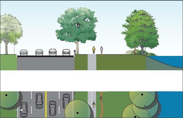
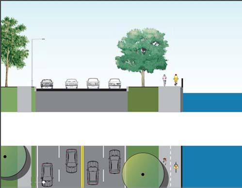
4 Bridges + Pathways Existing Conditions For latest data, log on to: mass.gov/massdot/ charlesriverbridges

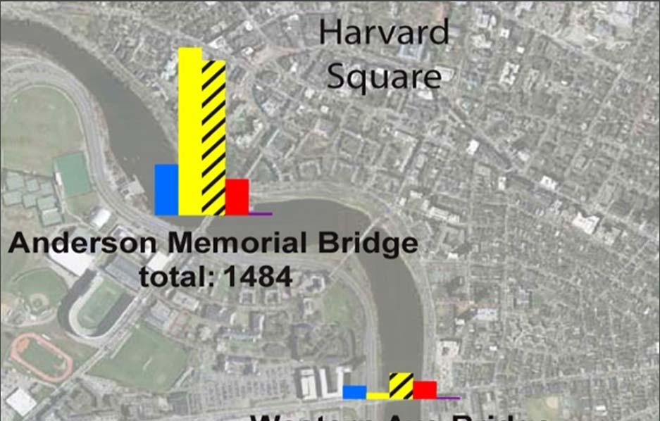
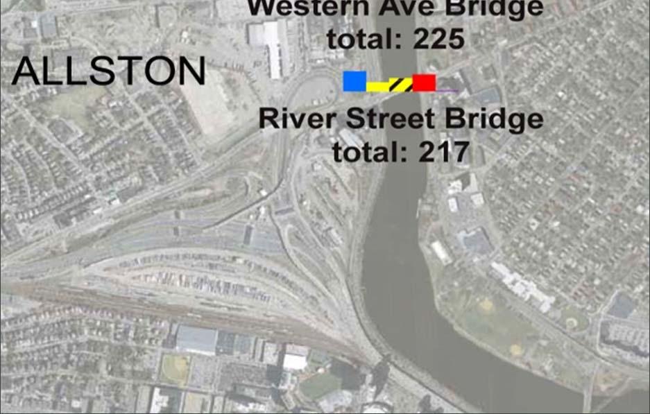
5 Pedestrian + Bicyclist User Counts 2009 Sep Wed + Sun 2010 May Tues + Sun Sep Sun + Tues 2011 May Wed + Sat Sep Tues + Sat


6 Pedestrian + Bicyclist User Counts Midweek 4:00-6:00 pm


7 Pedestrian + Bicyclist User Counts Saturday 12:00 noon 2:00 pm
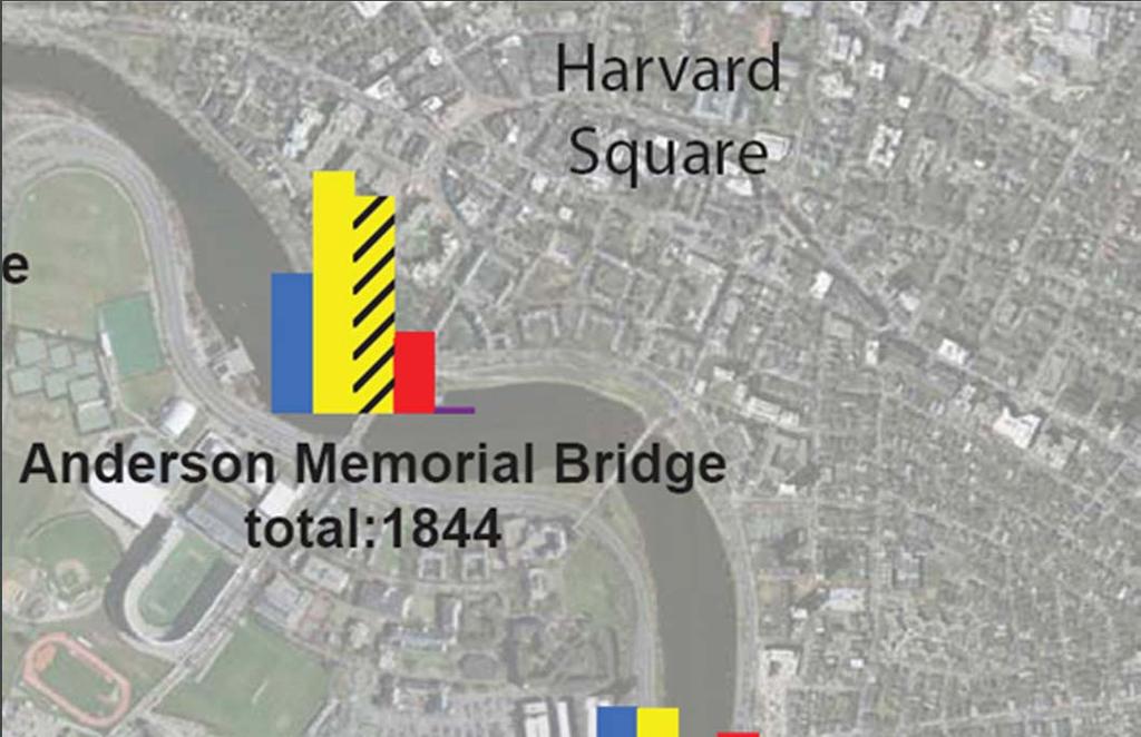
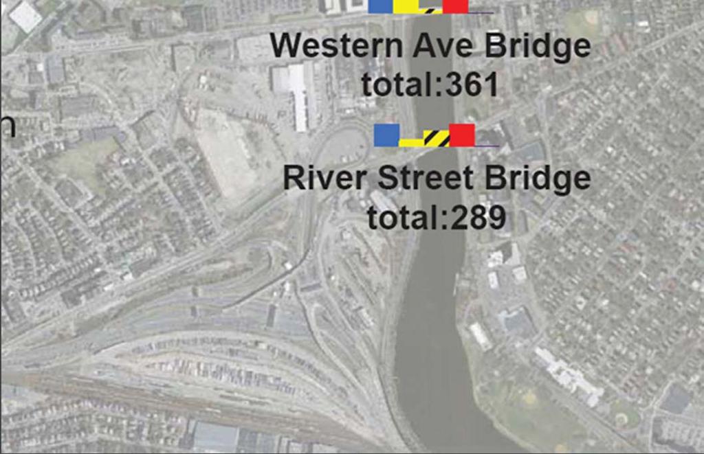
8 Pedestrian + Bicyclist User Counts Midweek 4:00-6:00 pm

9 Pedestrian + Bicyclist User Counts Saturday 12:00-2:00 pm

10 Pedestrian + Bicyclist User Counts Reports For latest data, log on to: mass.gov/massdot/ charlesriverbridges

11 Coordination w/ ABP Bridge Teams


12 Existing Conditions Analysis Existing Bicycle and Pedestrian Infrastructure


13 Existing Conditions Analysis * * Generators of Pedestrian and Bicycle Activity * Events along the River Charles River Basin Bicycle + Pedestrian Study P athways + Bridges
14 Connectivity Gap Analysis Focus Areas


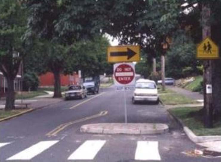
15 Connectivity Gap Analysis Lack of any crosswalks or other direct pedestrian connections across Charles River Road


16 Connectivity Gap Analysis Lack of traffic control on the Watertown side of the North Beacon Street Bridge

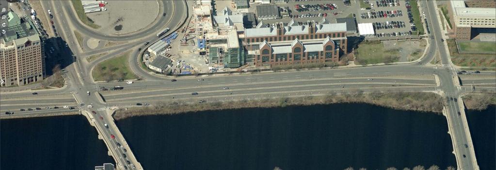
17 Connectivity Gap Analysis Lack of ped/bike connections to properties on other side of Soldier Field Road near N. Beacon Bridge


18 Connectivity Gap Analysis Free right turn lanes, poor crosswalk alignment and curb ramps that don t meet standards on Arsenal St Bridge

19 Connectivity Gap Analysis Narrow path along Greenough Boulevard


20 Connectivity Gap Analysis Lack of path connectivity and under-capacity roadway along Greenough Boulevard between Arsenal and Eliot bridges


21 Connectivity Gap Analysis Lack of connectivity from Herter Park to Smith Field and the rest of the Allston neighborhood


22 Connectivity Gap Analysis Difficult crossing from west end of Eliot Bridge to adjacent schools and neighborhoods in Cambridge

23 Connectivity Gap Analysis Difficult crossing of Memorial Drive at Hawthorne Street crosswalk


24 Connectivity Gap Analysis Poor connectivity to and from River St bridge to Allston and path system due to viaduct and pinch point


25 Connectivity Gap Analysis BU Bridge: no access to path system from Boston side
26 Connectivity Gap Analysis Charlesgate: No access to Emerald Necklace through on/off ramps


27 Connectivity Gap Analysis Charlesgate: No access to Emerald Necklace through on/off ramps


28 Connectivity Gap Analysis Lack of connectivity at each end of the Longfellow Bridge


29 Linear Connectivity Gap Analysis Overgrowth on paths Broken up pavement Goat paths
 Design for all users Traffic calming to increase safety Provide amenities to increase")
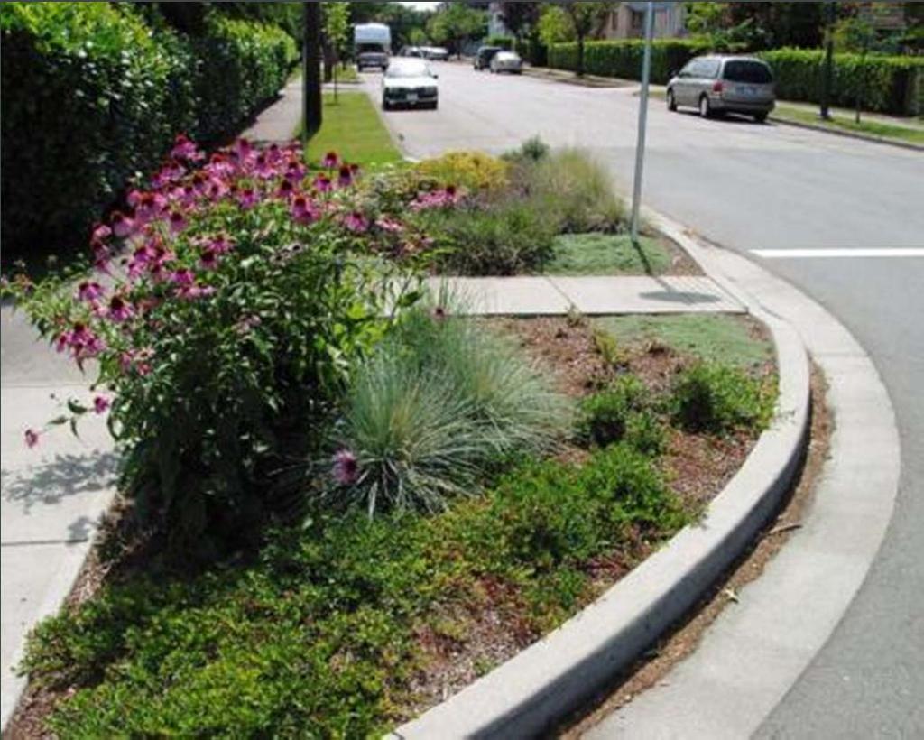
30 Toolbox of Pedestrian Facilities Increase connectivity Provide safe, high visibility crossings Provide accessible crossings (ADA) Design for all users Traffic calming to increase safety Provide amenities to increase attractiveness


31 Sidewalks and Paths Multi- Use Path Accessway Sidewalk Connectivity
32 Pedestrian Crossings Curb Radii Reduction Curb Cuts Bulbouts


33 Pedestrian Crossings Advanced Yield Line Advanced Stop Bar High Visibility Crosswalks
34 Pedestrian Crossings Flashing Beacon RRFB Signage HAWK


35 Median Refuge Islands Raised Crosswalk Porkchop


36 Pedestrian Crossing Signals Countdown Signal Push Button


37 Pedestrian Scale Lighting Midblock Intersections


38 Streetscape Landscaping Street Furniture and Pedestrian Scale Facades


39 Traffic Calming Chicanes / Chokers Speed Table Speed Feedback Sign
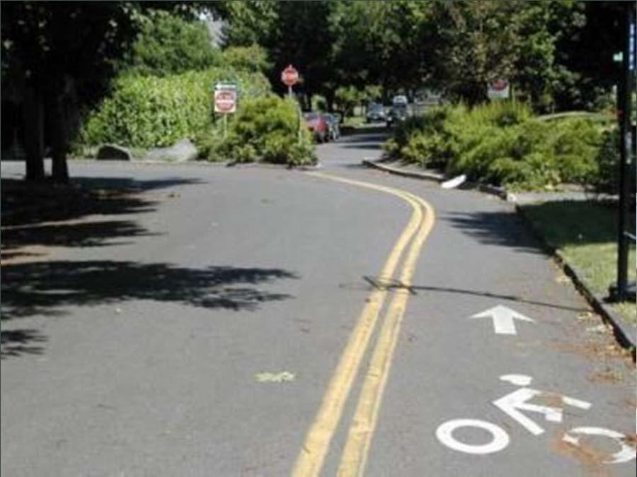
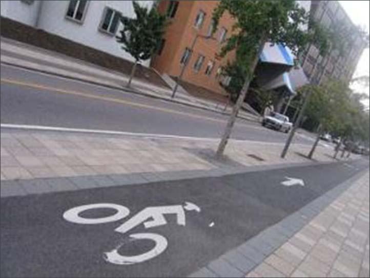
 Traffic volume Speed Traffic mix (e.")

40 Selecting the Right Bicycle Facilities Factors include: Road type (arterial, local street, etc ) Traffic volume Speed Traffic mix (e.g., truck %) Expected users skill, age, volume, destinations Road conditions, space, intersections, parking demand Safety and crash data


41 Bike Lanes Minimum of 3000 ADT for typical application Install with new roadway Pave shoulder/widen road Reduce travel lane or parking lane widths Remove travel lanes


42 Bike Lanes: Removing Travel Lanes Comm Ave: Today s conditions Comm Ave: Pre-2008 conditions


43 Bike Lanes: Removing Travel Lanes

44 BIKE LANES Narrowing Travel Lanes 12 23

45 BIKE LANES Narrowing Travel Lanes

46 BIKE LANES Minimum Dimensions 22 44
47 BIKE LANES Minimum Dimensions


48 SHARED LANE MARKINGS Charles or less River Basin Bicycle + Pedestrian Study Pathways + Bridges

49 Multi Use Paths Intended for use by pedestrians, bicyclists and other non-motorized users Width: 10 paved Roadway separation: 5 desired Separated bike and pedestrian paths desirable Overhead clearance: 8-10 Shy distance: 2-3
50 Bridge Transitions
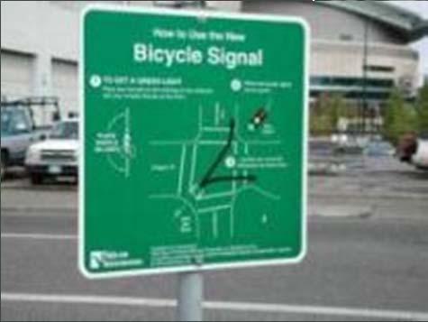
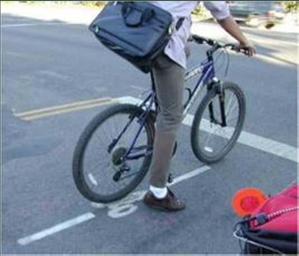
51 Intersection Design Loop Detector Refuge island Bike signal
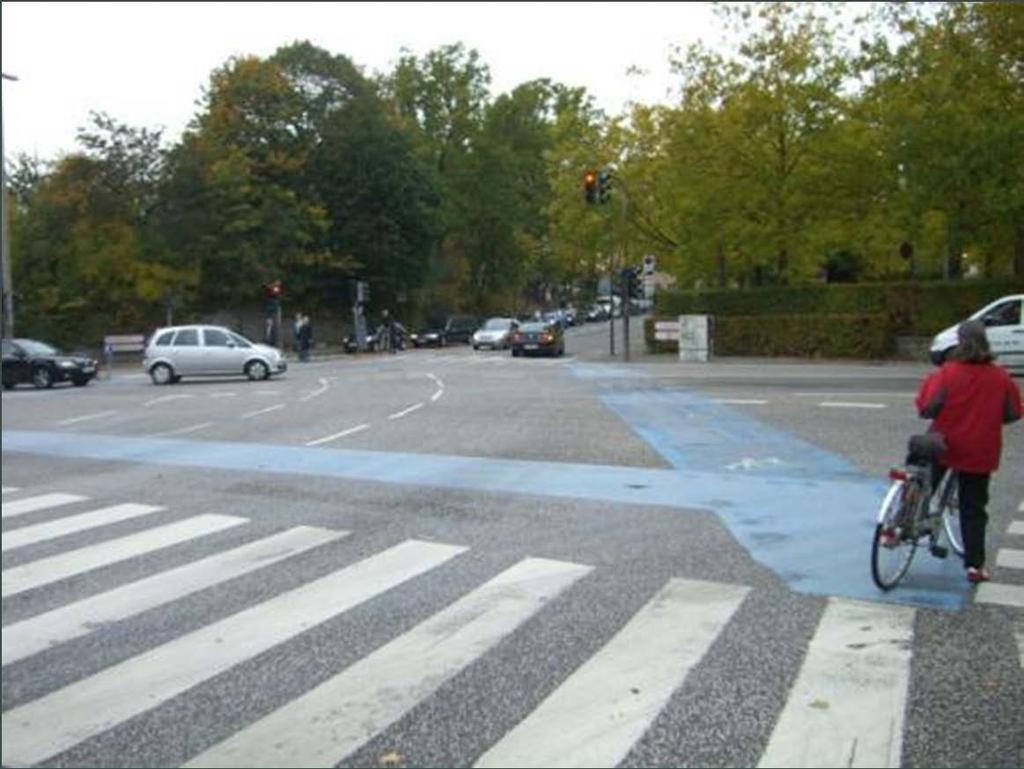
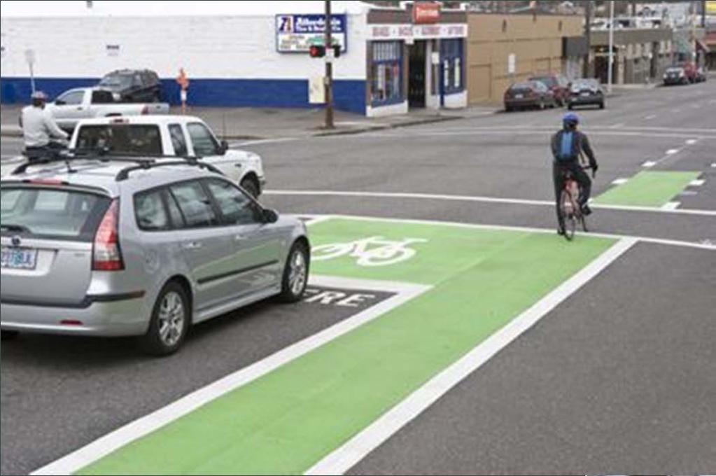
52 Intersection Design Crossing Markings Bike Box
53 Contra-flow Bike Lanes


54 Buffered Bike Lanes SW Start and Oak, Portland Herald Square, NYC Lafayette Street, NYC


55 Cycle Tracks Cambridge Amsterdam Paris New York

56 Bike Boulevards Local streets modified to act as through streets for bicyclists Traffic calming reduces speeds & motor vehicle through trips Traffic controls give priority to through bicycle movement Work best in a connected grid
57 Bike Boulevards Signage Pavement Markings Intersection Treatments Traffic Calming Traffic Diversion
58 Next Steps Public Meetings: Tuesday, October 11, Shriners Hospital, Boston, 6:30-8:00 PM Thursday, October 13, Community Rowing, Brighton, 6:30-8:00 PM Tuesday, October 18, Morse School Auditorium, Cambridge, 6:30-8:00 PM City and Stakeholder Meetings Field Work Draft Recommendations 2 nd Series of Public Meetings in Spring 2012 to Present Recommendations
59 Accelerated Bridge Program Bicycle + Pedestrian Connectivity Gap Analysis Tuesday, October 11 Shriners Hospital, Boston 6:30-8:00 PM Thursday, October 13 Community Rowing, Brighton 6:30-8:00 PM Tuesday, October 18 Morse School, Cambridge 6:30-8:00 PM with HDR Engineering Alta Planning + Design
Watertown Complete Streets Prioritization Plan. Public Meeting #1 December 14, 2017
 Watertown Complete Streets Prioritization Plan Public Meeting #1 December 14, 2017 Goals for Public Meeting Overview of MassDOT Complete Streets Funding Program Educate the community on Complete Streets
Active Transportation Facility Glossary
 Active Transportation Facility Glossary This document defines different active transportation facilities and suggests appropriate corridor types. Click on a facility type to jump to its definition. Bike
Broad Street Bicycle Boulevard Design Guidelines
 Broad Street Bicycle Boulevard Design Guidelines Building from the strategies introduced in the 2013 Bicycle Transportation Plan and community input received thus far, City Transportation Staff have identified
Bicycle Boulevards and Neighborhood Greenways
 Bicycle Boulevards and Neighborhood Greenways Traffic Safety is Improving for Everyone 90 80 70 60 50 40 30 20 10 0 PORTLAND: TOTAL TRAFFIC FATALITIES 1986-2008 1986 1987 1988 1989 1990 1991 1992 1993
APPENDIX A: Complete Streets Checklist DRAFT NOVEMBER 2016
 APPENDIX A: Complete Streets Checklist DRAFT NOVEMBER 2016 Complete Streets Checklist MetroPlan Orlando s Complete Streets Checklist is an internal planning tool for staff to further implementation of
Bicycle Facilities Planning
 Bicycle Facilities Planning Overview Types of Cyclists Purpose for Riding Types of Facilities Bike Lanes Bicycle Boulevards Cycle Tracks Intersections Signals Signing and Marking Discussion Types of Bicyclists
What Is a Complete Street?
 Session 5 Charleen Zimmer, AICP, Zan Associates May 5-7, 2010 What Is a Complete Street? May 2010 5-1 Not a Complete Street More of a Complete Street May 2010 5-2 Benefits of Complete Streets Safety for
REGIONAL BICYCLE AND PEDESTRIAN DESIGN GUIDELINES
 REGIONAL BICYCLE AND PEDESTRIAN DESIGN GUIDELINES November 16, 2011 Deb Humphreys North Central Texas Council of Governments Bicycle and Pedestrian Advisory Committee Snapshot of the Guide 1. Introduction
City of Albert Lea Policy and Procedure Manual 4.10 ALBERT LEA CROSSWALK POLICY
 4.10 ALBERT LEA CROSSWALK POLICY PURPOSE: Pedestrian crosswalks are an integral part of our transportation infrastructure. To be effective and promote safety, marked crosswalks must be installed after
NJDOT Complete Streets Checklist
 Background The New Jersey Department of Transportation s Complete Streets Policy promotes a comprehensive, integrated, connected multi-modal network by providing connections to bicycling and walking trip
Transportation Planning Division
 Transportation Planning Division Presentation Outline Study Tasks Recap of Previous Meetings Data Collected Focus Areas within Study Limits Design Principles Tool Box Recommended Concepts Schedule Moving
Agenda. Overview PRINCE GEORGE S PLAZA METRO AREA PEDESTRIAN PLAN
 PRINCE GEORGE S PLAZA METRO AREA PEDESTRIAN PLAN May 28, 2008 Agenda Welcome and introductions Project overview and issue identification Planning context and strengths Design challenges and initial recommendations
Cycle Track Design Best Practices Cycle Track Sections
 Design Best Practices Sections It is along street segments where the separation and protection methods of cycle tracks offer more comfort than conventional bicycle lanes, and are more attractive to a wide
City of Vallejo Traffic Calming Toolbox
 City of Vallejo Traffic Calming Toolbox June 1, 2013 Final Table of Contents Introduction... 1 Non-Physical Devices... 3 High-Visibility Crosswalk... 3 In Pavement Lighted Crosswalk... 4 Rapid Flashing
DRAFT Montgomery County Bicycle Master Plan Design Toolkit
 DRAFT Montgomery County Bicycle Master Plan Design Toolkit Fall 2016 Sidepaths Sidepaths are shared use paths located parallel to and within the road right-of-way providing twoway travel for walking, bicycling,
El Camino Real Specific Plan. TAC/CAC Meeting #2 Aug 1, 2018
 El Camino Real Specific Plan TAC/CAC Meeting #2 Aug 1, 2018 Land Use Alternatives Goals and Tradeoffs Parks & open space Housing Retail & services Civic spaces Parking Community gathering spaces 3 Alternatives
Chapter 5: Crossing the Street
 Chapter 5: Crossing the Street Whether walking or bicycling, a student s journey to school will more than likely require crossing one or more streets. Per the Safe Routes to School Guide, maintained by
Bridgewater Complete Streets Prioritization Plan and Pedestrian Safety Assessment
 Bridgewater Complete Streets Prioritization Plan and Pedestrian Safety Assessment Presented by Luciano Rabito Manager of Complete Streets Presented to Bridgewater, MA Wednesday, April 26, 2017 6:30 P.M.
Appendix C. TRAFFIC CALMING PROGRAM TOOLBOX
 Appendix C. TRAFFIC CALMING PROGRAM TOOLBOX PHASE I...2 Do Not Enter Sign...3 One-Way Sign...4 Turn Prohibition...5 Pavement Markings...6 Speed Monitoring Trailer...7 Neighborhood Speed Watch...8 Police
Guidance. ATTACHMENT F: Draft Additional Pages for Bicycle Facility Design Toolkit Separated Bike Lanes: Two-Way to One-Way Transitions
 ATTACHMENT F: Draft Additional Pages for Bicycle Facility Design Toolkit Separated Bike Lanes: Two-Way to One-Way Transitions This treatment provides a transition from two-way separated bike lanes to one-way
Bicycle and Pedestrian Connectivity Study. Old Colony Planning Council
 Bicycle and Pedestrian Connectivity Study Old Colony Planning Council Outline Why consider bike/peds in road designs? Why are measures needed? Connecting Land Use with Transportation Evaluation Tools:
Balancing Operation & Safety for Motorized and Non-Motorized Traffic
 Balancing Operation & Safety for Motorized and Non-Motorized Traffic Brian Willham, PE, PTOE Iowa Director - MOVITE June 30, 2014 Learning Objectives: When & Why should we measure the performance of complete
Pedestrian Project List and Prioritization
 To: Kyle Wagenschutz, City of Memphis CC: From: Anne Conlon and John Cock, Alta Planning + Design Date: December, 2014 Re: Project List Development (Task 3.1-3.2) and Project List Prioritization (Task
Walk Friendly Communities Engineering Strategies. Carl Sundstrom Walk Friendly Communities Workshop Grandview, MO June 2015
 Walk Friendly Communities Carl Sundstrom Walk Friendly Communities Workshop Grandview, MO June 2015 Module Overview Topics Background and purpose Sidewalks Crossings Traffic calming www.pedbikeimages.org
Physical Implications of Complete Streets Policies
 Presentation Overview Physical Implications of Complete Norm Cox, ASLA, LLA Landscape Architect Ann Arbor, Michigan, 10:45 to Noon What Are Complete Streets? What Matters to Bicyclists and Pedestrians
PRINCE GEORGE S PLAZA METRO AREA PEDESTRIAN PLAN
 PRINCE GEORGE S PLAZA METRO AREA PEDESTRIAN PLAN May 28, 2008 Agenda Welcome and introductions Project overview and issue identification Planning context and strengths Design challenges and initial recommendations
BETHEL ROAD AND SEDGWICK ROAD CORRIDOR STUDY
 DRAFT PLAN City Council Meeting August 14, 2017 STUDY AREA Sedgwick Corridor State Route 160, principal arterial with Class 3 access management designation, commuter and freight route, connection to SR
INTERSECTION DESIGN TREATMENTS
 Designing for Bicyclist Safety INTERSECTION DESIGN TREATMENTS LEARNING OUTCOMES Understand intersection design options and features Select appropriate design feature for a bikeway in a given context C1
Bicycle and Pedestrian Advisory Committee (BPAC) November 21, 2013
 November 21, 2013") Bicycle and Pedestrian Advisory Committee (BPAC) November 21, 2013 OVERALL LAND USE CONCEPT Overall Broadway Valdez District: 95.5 acres (35.1 acres right-of ways + 60.4 acres developable land) Plan Subareas:
Bicycle and Pedestrian Advisory Committee (BPAC) November 21, 2013 OVERALL LAND USE CONCEPT Overall Broadway Valdez District: 95.5 acres (35.1 acres right-of ways + 60.4 acres developable land) Plan Subareas:
Omaha s Complete Streets Policy
 Omaha s Complete Streets Policy (Adopted August 2015) VISION To create great places and enhance our quality of life, the City of Omaha will provide safe, accessible streets for all users. Complete Streets
Appendix 3 Roadway and Bike/Ped Design Standards
 Appendix 3 Roadway and Bike/Ped Design Standards OTO Transportation Plan 2040 4/20/2017 Page A3-1 Adopted Standards The adopted OTO Design Standards and Major Thoroughfare Plan are contained herein.
Downtown Naples Mobility and Connectivity Study. Naples City Council Presentation January 2017
 Downtown Naples Mobility and Connectivity Study Naples City Council Presentation January 2017 Agenda 1. Introduction 2. Scope Review 3. Project Schedule 4. Existing Conditions 5. Public Charrette 6. Mobility
Who is Toole Design Group?
 2018 AASHTO Bike Guide Status Update NCHRP 15 60 Amalia Leighton Cody, PE, AICP & Kenneth Loen, PE Washington APWA October 4, 2018 Who is Toole Design Group? TDG is a full service engineering, planning
New York City School Safety Engineering Program. Jackson Wandres The RBA Group June 09, 2005
 8,008,271 858,661 New York City School Safety Engineering Program Jackson Wandres The RBA Group June 09, 2005 Office of School Safety Engineering Project Goals 1) Improve traffic and pedestrian safety.
Chapter 4 TOOLBOX AND SAMPLE BIKE BOULEVARD LAYOUT
 Chapter 4 TOOLBOX AND SAMPLE BIKE BOULEVARD LAYOUT OVERVIEW This chapter describes a cohesive set of strategies to create a bicycle boulevard, namely to make streets safer and more efficient for bicycle
Duwamish Way-finding and CTR Report
 V. North Tukwila When the North Tukwila Manufacturing and Industrial Center was designated in 1992 as part of the region s land use and transportation plan, the plan called for the area to set a light-rail
CITY OF SARATOGA SPRINGS PEDESTRIAN CROSSING TOOLBOX
 CITY OF SARATOGA SPRINGS PEDESTRIAN CROSSING TOOLBOX This toolbox is to be used to guide pedestrian crossing improvements within the City of Saratoga Springs. Details for each crossing type are provided.
COMPLETE STREETS FUNDING PROGRAM
 COMPLETE STREETS FUNDING PROGRAM Prepared by: MassDOT Highway Division & Office of Transportation Planning Leading the Na 1 Complete Streets Funding Program 1. Background Complete Streets Defined Complete
 COMPLETE STREETS CHECKLIST City of Philadelphia The City of Philadelphia's Complete Streets policies are designed ensure that city streets are safe, comfortable and convenient for people of all ages and
PEDESTRIAN SAFETY IMPROVEMENT EVALUATION GUIDELINE FOR UNCONTROLLED CROSSINGS
 PEDESTRIAN SAFETY IMPROVEMENT EVALUATION GUIDELINE FOR UNCONTROLLED CROSSINGS Traffic Safety Engineering Division Updated: April 2018 EXECUTIVE SUMMARY NDOT Traffic Safety Engineering Division developed
PEDESTRIAN ACCOMMODATIONS DPS 201 AT INTERCHANGES
 PEDESTRIAN ACCOMMODATIONS DPS 201 AT INTERCHANGES UNDERSTANDING THE ISSUES Intersections of freeway ramp terminals at crossroads are the most critical components of an interchange Challenge: balance mobility
Houma-Thibodaux Metropolitan Planning Organization STP<200K Funding Application APPLICATION
 APPLICATION HOUMA-THIBODAUX METROPOLITAN PLANNING ORGANIZATION (HTMPO) FOR SURFACE TRANSPORTATION PROGRAM (STP
The DC Pedestrian Master Plan
 The DC Pedestrian Master Plan September 28, 2010 George Branyan Pedestrian Program Coordinator District Department of Transportation Presentation Agenda Scope of the Plan Methodology Recommendations Implementation
5. RUNNINGWAY GUIDELINES
 5. RUNNINGWAY GUIDELINES These guidelines should be considered collectively when making runningway decisions. A runningway is the linear component of the transit system that forms the right-of-way reserved
» Draft Recommendations» Discussion» Next Steps. Plan for Walking and Biking
 SAC Meeting Plan #3 for September Walking and 12, Biking 2018 » Draft Recommendations» Discussion» Next Steps Plan for Walking and Biking » Stakeholder and Public Outreach» Background data collection and
CURBSIDE ACTIVITY DESIGN
 5 CURBSIDE ACTIVITY DESIGN This chapter provides design guidance for separated bike lanes adjacent to curbside activities including parking, loading and bus stops. Typical configurations are presented
CURB EXTENSIONS BULB OUTS DPS 201 NECKDOWNS
 CURB EXTENSIONS BULB OUTS DPS 201 NECKDOWNS WHY WHEN & WHERE When Limited Sight Distance Pedestrians & Vehicles Vehicles and Signs Want to put two curb ramps in Discourage High speed turning High number
Citywide Sidewalk and Crosswalk Programs
 Citywide Sidewalk and Crosswalk Programs Council Meeting October 20, 2015 Presented by Rita Hu and Jamal Mahmoud Program Goals Implement the City s comprehensive plan. Provide pedestrian with safe walking
95 th Street Corridor Transportation Plan. Steering Committee Meeting #2
 95 th Street Corridor Transportation Plan Steering Committee Meeting #2 February 18, 2015 PURPOSE OF THE MEETING Update Steering Committee Present Community/Stakeholder Survey Results Present Transportation
Memo. Introduction. Memphis STP Pedestrian Sidewalk Project
 Memo Memphis STP Pedestrian Sidewalk Project To: Kyle Wagenshutz, City of Memphis From: Matthew Berkow, Collin Chesston, and Anne Eshleman, Alta Planning + Design Date: June 2014 Re: Photo Inventory Introduction
Prince George s County plans, policies, and projects
 Prince George s County plans, policies, and projects Over 250 projects for trails, bikeways, designated bike lanes and sidewalk construction Trail projects that improve access to Metro Sidewalk and trail
Town of Mooresville, North Carolina Neighborhood Traffic Calming and Control Device Policy
 Town of Mooresville, North Carolina Neighborhood Traffic Calming and Control Device Policy Adopted January 6, 2014 Town of Mooresville Development Services Department TOWN OF MOORESVILLE NEIGHBORHOOD TRAFFIC
MEMORANDUM. Date: 9/13/2016. Citywide Crosswalk Policy
 MEMORANDUM Date: 9/13/2016 Re: Citywide Crosswalk Policy Foreword Through the s Circulation Element and Complete Streets Policy, it is the City s goal to promote walking trips and provide safe facilities
Item to be Addressed Checklist Consideration YES NO N/A Required Description Complete Streets Guidelines
 Passaic County Complete Streets Checklist - Concept Development Project Name Item to be Addressed Checklist Consideration YES NO N/A Required Description Complete Streets Guidelines Existing Plans Have
C. Best Practice Pedestrian Treatment Toolbox
 C. Best Practice Pedestrian Toolbox The Best Practice Pedestrian Toolbox presents the recommended tools in striping, signalization, signage, geometry and other categories for improving both uncontrolled
TOWN OF MORAGA MORAGA WAY AND CAMINO PABLO/CANYON ROAD IMPROVEMENTS Town Council Meeting March 13, 2019
 TOWN OF MORAGA MORAGA WAY AND CAMINO PABLO/CANYON ROAD IMPROVEMENTS Town Council Meeting March 13, 2019 1 Edric Kwan, Public Works Director Josh Peterman, Principal, Fehr and Peers Shawn Knapp, Senior
KEARNY MESA COMMUNITY PLAN UPDATE
 KEARNY MESA COMMUNITY PLAN UPDATE January 18, 2018 SUBCOMMITTEE MEETING Mobility Concepts and Urban Design Presentation Outline Mobility Concepts: Multimodal Planning Toolbox Presentation and Activities
Addendum to SDDCTEA Pamphlet 55 17: Better Military Traffic Engineering Revision 1 Effective: 24 Aug Crosswalk Guidelines
 Addendum to SDDCTEA Pamphlet 55 17: Better Military Traffic Engineering Revision 1 Effective: 24 Aug 2017 Crosswalk Guidelines Warrants for Uncontrolled Crosswalk Locations Crosswalks at Midblock Locations
SRTS IMPLEMENTATION COSTS
 SRTS IMPLEMENTATION COSTS What Is a Estimate? A cost estimate establishes the anticipated budget required to implement the actions (the improvement projects and programs) identified in your School Travel
If a person walks within this focus area, these are examples of the places he or she could walk to or from:
 Portland Hillsdale Hillsdale Portland The Hillsdale focus area is located in the City of Portland. It is situated approximately three miles from the City of Portland s downtown, 5.5 miles from the City
4 GENERIC COST ESTIMATING TOOL
 4 GENERIC COST ESTIMATING TOOL Table 4-1 presents a generic cost estimating tools that can serve as a conceptual planning tool for local jurisdictions to estimate the costs of pedestrian improvements.
01. VICINITY OF GREENBRAE POC: EXISTING CONDITIONS
 01. VICINITY OF GREENBRAE POC: EXISTING CONDITIONS Existing Bus Stop Existing US101 On-ramp Existing POC Old Redwood Highway Rich Street City ROW Environmental Study Limit Industrial Way NO DESIGNATED
INTERSECTION DESIGN. Bicycle Facility Workshop Intersections 4-1
 INTERSECTION DESIGN 4-1 Intersections Avoid unusual conflicts Provide direct path for cyclists, close to that of motor vehicles Bicyclists should be visible; their movements should be predictable Simple
Off-road Trails. Guidance
 Off-road Trails Off-road trails are shared use paths located on an independent alignment that provide two-way travel for people walking, bicycling, and other non-motorized users. Trails specifically along
Houma-Thibodaux Metropolitan Planning Organization STP<200K Funding Application APPLICATION
 APPLICATION HOUMA-THIBODAUX METROPOLITAN PLANNING ORGANIZATION (HTMPO) FOR SURFACE TRANSPORTATION PROGRAM (STP
Hennepin County Pedestrian Plan Public Comment Report
 Hennepin County Pedestrian Plan Public Comment Report On May 31, 2013, the draft Hennepin County Pedestrian Plan was released for a 45-day public comment period ending July 15, 2013. The county received
Massachusetts Depa111nedt Of 7tar\spot&MiM. Highway Division. PUBLIC INFORMATION MEETING TUESDAY, OCTOBER 11, :30 to 8 PM AT
 Massachusetts Depanedt Of tar\spot&mim Highway Division PUBLIC INFORMATION MEETING TUESDAY, OCTOBER, 0 :0 to PM AT SHRINERS HOSPITALS FOR CHILDREN BLOSSOM STREET BOSTON, MASSACHUSETTS FOR THE PROPOSED
Washington County SW Beaverton-Hillsdale Hwy. & SW Scholls Ferry Rd.
 Washington County SW Beaverton-Hillsdale Hwy. & SW Scholls Ferry Rd. SW Beaverton-Hillsdale Hwy. & SW Scholls Ferry Rd. Washington County The SW Beaverton-Hillsdale Hwy & SW Scholls Ferry Rd. focus area
Tonight is for you. Learn everything you can. Share all your ideas.
 Strathcona Neighbourhood Renewal Draft Concept Design Tonight is for you. Learn everything you can. Share all your ideas. What is Neighbourhood Renewal? Creating a design with you for your neighbourhood.
TRAFFIC CALMING GUIDE FOR TORONTO CITY OF TORONTO TRANSPORTATION SERVICES DIVISION
 TRAFFIC CALMING GUIDE FOR TORONTO CITY OF TORONTO TRANSPORTATION SERVICES DIVISION CITY OF TORONTO TRANSPORTATION SERVICES DIVISION 2016 TRAFFIC CALMING GUIDE FOR TORONTO TABLE OF CONTENTS Introduction
TRANSPORTATION COMMISSION Agenda Staff Report
 TRANSPORTATION COMMISSION Agenda Staff Report Agenda Item No. 5.a DATE: JULY 31, 2014 TO: FROM: SUBJECT: TRANSPORTATION COMMISSION COMMUNITY DEVELOPMENT DEPARTMENT - PLANNING DRAFT OLYMPIC CORRIDOR PREFERRED
New Orleans Complete Streets Experience CITY OF NEW ORLEANS. Louis Haywood Department of Public Works January 19, 2016
 New Orleans Complete Streets Experience CITY OF NEW ORLEANS Louis Haywood Department of Public Works January 19, 2016 Complete Streets policies Ensure that the entire right-of-way is planned, designed,
9/21/2016 VIA . RE: The Knot (DR16-270)
") 9/21/2016 VIA EMAIL Garrett Norman, Assistant Planner City of Sacramento Community Development Department 300 Richards Boulevard, 3 rd Floor Sacramento, CA 95811 RE: The Knot (DR16-270) Dear Mr. Norman:
9/21/2016 VIA EMAIL Garrett Norman, Assistant Planner City of Sacramento Community Development Department 300 Richards Boulevard, 3 rd Floor Sacramento, CA 95811 RE: The Knot (DR16-270) Dear Mr. Norman:
Charles River Pathways
 Charles River Pathways Dr. Paul Dudley White Bike Path Museum of Science to Watertown Square Analysis of the South Shore with conceptual design Proposal Charles River Conservancy August 2006 Prepared by
Designing for Pedestrian Safety in Washington, DC
 Designing for Pedestrian Safety in Washington, DC February 25, 2014 George Branyan Pedestrian Program Coordinator District Department of Transportation DC Journey to work mode split: 2012 Means of Transportation
LANCASTER CITY BICYCLE NETWORK
 LANCASTER CITY BICYCLE NETWORK Downtown Merchants Meeting Wednesday, July 19, 2017 http://www.lancasteratp. DOWNTOWN WALKABILITY ANALYSIS What changes can be made, in the least amount of time, and for
COMPLETE STREETS PLANNER S PORTFOLIO
 COMPLETE STREETS PLANNER S PORTFOLIO ISSUE 3 APRIL 2016 PLANNER S PORTFOLIO COMPLETE STREETS 1 2 6 10 14 OVERVIEW MATURE NEIGHBORHOODS GROWING SUBURBS CENTRAL PLACES ACTIVITY CORRIDORS Planner s Portfolio
CONNECTIVITY PLAN. Adopted December 5, 2017 City of Virginia Beach
 CONNECTIVITY PLAN Adopted December 5, 2017 City of Virginia Beach CONTENTS 1.0 Background & Purpose... 2 2.0 Existing Inventory & Analysis... 3 ViBe District Existing Walking Conditions... 4 3.0 ViBe District
The Wiggle Route in Context
 The Wiggle Route in Context In a city of hills, the Wiggle is an important route because it winds its way along the flattest streets from Market to the Panhandle, bringing residents to local parks and
C C C
 C-012-001 Thank you for your support for the creation of new public space and nonmotorized access between downtown and the waterfront through the Overlook Walk, the East-West Connections, and the Promenade.
CONTRA COSTA Countywide Bicycle and Pedestrian Plan. Appendix C Best Practices: Pedestrian and Bicycle Treatments
 CONTRA COSTA Countywide Bicycle and Pedestrian Plan Appendix C Best Practices: Pedestrian and Bicycle Treatments The preparation of this report has been financed through a grant from the U.S. Department
COWETA HIGH SCHOOL AND EAST HIGHWAY 51
 COWETA HIGH SCHOOL AND EAST HIGHWAY 51 Lack of sidewalks along Ben Lumpkin Rd. Lack of crosswalks and ramps at intersection. Hwy 51 is wide to cross as a pedestrian. No ADA compliance or connection to
The Transformation of Portland into a Two-Wheeled Mecca. Mia Birk, Principal, Alta Planning + Design
 The Transformation of Portland into a Two-Wheeled Mecca Mia Birk, Principal, Alta Planning + Design Development of Portland s Bikeway Network 1990 Early 1990s Infrastructure Growing Public Support Growing
Designing Complete Streets: What you need to know
 Designing Complete Streets: What you need to know Getting from this to this. Continuous sidewalk Buffer w/trees Bicycle lane Raised median Buildings close to the street Flexibility in design Design and
A Matter of Fairness: ROCOG s Environmental Justice Protocol. What is Mobility Limitation?
 No Person Left Behind What is Mobility Limitation? What is the Access Limitation? Environmental Justice population should be provided adequate mobility & access to meet their needs; Identify acceptable
Pedestrian Safety at Interchanges
 Countermeasure Strategies for Pedestrian Safety Pedestrian Safety at Interchanges Meghan Mitman Fehr and Peers December 10, 2015 Today s Presentation Introduction and housekeeping Audio issues? Dial into
F L E T C H E R A V E N U E
 Jan. 29, 2014 Introduction F L E T C H E R A V E N U E FDOT Local Agency Program (LAP) Project FPN: 428214-1-58-01 CIP 63090 Hillsborough County, Traffic Engineering, PWD Stake holders and partners are
Chicago Safe Routes to School Safe Routes to High School (SRTS/SRTHS)
") Chicago Safe Routes to School Safe Routes to High School (SRTS/SRTHS) Marshall Community High School and Faraday Elementary School Recommended Improvements Agenda Goals Related Programs Project Location/Area
Chicago Safe Routes to School Safe Routes to High School (SRTS/SRTHS) Marshall Community High School and Faraday Elementary School Recommended Improvements Agenda Goals Related Programs Project Location/Area
Complete Streets Funding Program Project Prioritization Plan
 Funding Program Project Prioritization Plan Location and Type Needs South Street Crosswalk Installation Stripe a new formalized crosswalk across South Street at the Anne T. Dunphy School pedestrian path
This page intentionally left blank.
 This page intentionally left blank. COMMUNITY Coweta Community Overview Coweta Coweta, a residential community located in Wagoner County, is a suburb of Tulsa situated southeast of the metropolitan area
County of Greenville South Carolina. Traffic Calming Program Neighborhood Traffic Education Program and Speed Hump Program
 County of Greenville South Carolina Traffic Calming Program Neighborhood Traffic Education Program and Speed Hump Program (rev) August 2008 I. PURPOSE The potential negative impacts from vehicular traffic
Alternative Traffic Calming Methods
 Alternative Traffic Calming Methods In-street Pedestrian Crossing Sign Cost: approximately $300 per sign not including the installation cost Advantages of in-street pedestrian crossing signs 1. Typically
11/3/2014 VIA . WALKSacramento has reviewed the Stockton and T Mixed-Use project at 3675 T Street in the
 11/3/2014 VIA EMAIL Antonio Ablog Planning Department City of Sacramento 300 Richards Boulevard Sacramento, CA 95811 RE: Design Review for Stockton and T Mixed-Use (P14-042) Dear Mr. Ablog: WALKSacramento
City of Wilsonville 5 th Street to Kinsman Road Extension Project
 City of Wilsonville 5 th Street to Kinsman Road Walking Tour & Neighborhood Workshop Summary Report Public Outreach Overview On July 18 th, 2017, the City of Wilsonville hosted a neighborhood walking tour
11/28/2016 VIA
 11/28/2016 VIA EMAIL Ethan Meltzer, Assistant Planner City of Sacramento Community Development Department 300 Richards Blvd., 3 rd Floor Sacramento, Ca 95811 RE: Natomas Corporate Center Commercial Building
Freeway ramp intersection study
 Freeway ramp intersection study Supporting Vision Zero: Zero traffic deaths in San Francisco by 2024 Study Goals: Primary Improve Safety Improve Accessibility Secondary Provide Efficient Circulation Accommodate
Small Town & Rural Multimodal Networks
 Small Town & Rural Multimodal Networks Fred Young, PLA Andrea Clinkscales, AICP, PMP Alta Planning + Design Funding Partners Project Team Existing Design Guidance AASHTO Flexibility Guide 2004 AASHTO Bike
Toole Design Group is live tweeting this webinar
 On Road Bikeways Part I1: Non-Bike Lane Design Presentation by: Bill Schultheiss, P.E. Tina Fink, P.E. September18, 2012 FOLLOW THE CONVERSATION ON TWITTER Toole Design Group is live tweeting this webinar
8/1/2018 VIA . Darcy Goulart City of Rancho Cordova Planning Department 2729 Prospect Park Drive Rancho Cordova, CA 95670
 8/1/2018 VIA EMAIL Darcy Goulart City of Rancho Cordova Planning Department 2729 Prospect Park Drive Rancho Cordova, CA 95670 RE: Towne Place Suites by Marriott Hotel (DD9806) Dear Ms. Goulart: WALKSacramento
12/4/2016 VIA . RE: Grocery Outlet Del Paso (DR16-328)
") 12/4/2016 VIA EMAIL Ethan Meltzer, Assistant Planner City of Sacramento Community Development Department 300 Richards Blvd, 3 rd Floor Sacramento, CA 95811 RE: Grocery Outlet Del Paso (DR16-328) Dear Mr.
12/4/2016 VIA EMAIL Ethan Meltzer, Assistant Planner City of Sacramento Community Development Department 300 Richards Blvd, 3 rd Floor Sacramento, CA 95811 RE: Grocery Outlet Del Paso (DR16-328) Dear Mr.