Southcote Road Improvements Class Environmental Assessment Study
|
|
|
- Willis Knight
- 5 years ago
- Views:
Transcription


1 1 Southcote Road Improvements Class Environmental Assessment Study Public Information Centre #1 May 24, 2018
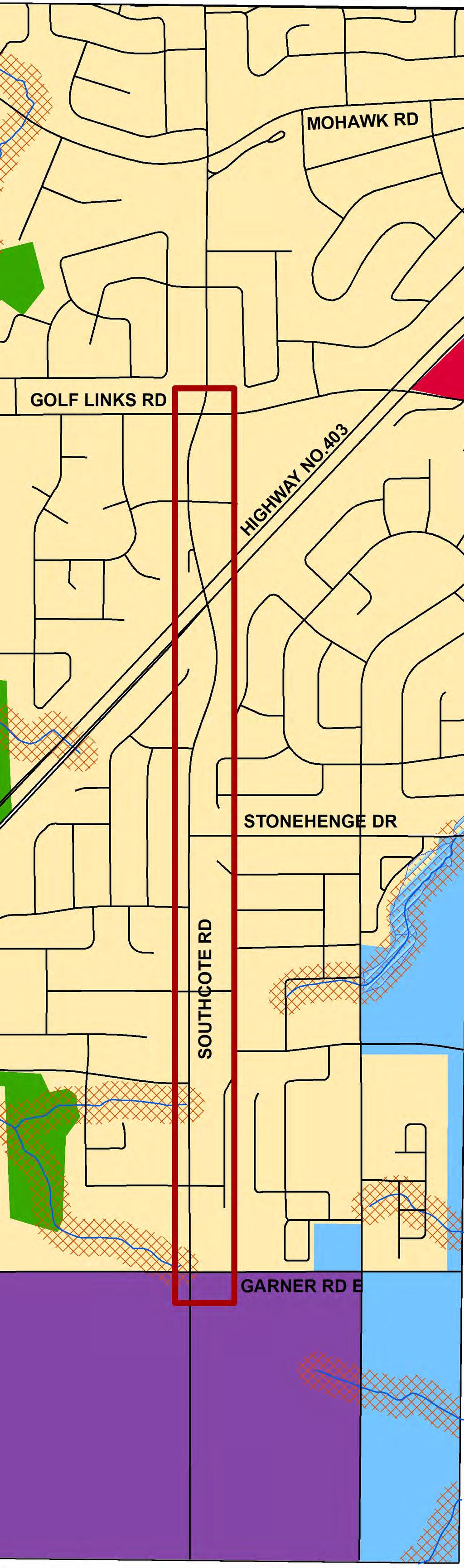
2 Study Area 2

3 3 Welcome The Ancaster Transportation Master Plan (2011) outlined a long range plan to address transportation issues in Ancaster. The Plan identified the opportunity to widen Southcote Road to three lanes with a two-way left turn lane. This study is assessing the need for traffic operations and safety improvements, and active transportation design features on Southcote Road. This project will: CONFIRM the need for improvements to Southcote Road SUMMARIZE existing/future engineering and environmental opportunities and constraints IDENTIFY options for the corridor improvements OBTAIN public/agency input CONFIRM the recommended design for improvements to Southcote Road.


 Phase 5: Implementation")


4 4 Class Environmental Assessment Process The Study is following the requirements of the Municipal Class Phase 1: Problem/ Opportunity Identify problems/ opportunities to be addressed in the planning and design process Confirm the need for improvements Prepare a Problem Statement Included in the Transportation Master Plan Environmental Assessment (EA) (as amended after 2015) for a Schedule C (major) project. The Class EA process ensures: Relevant engineering and environmental factors are considered in the planning and design process Public and agency input is integrated into the decision making process. Phase 2: Phase 3: Phase 4: Alternative Solutions Design Options for Preferred Solution Environmental Study Report (ESR) Phase 5: Implementation Develop alternative solutions for improving the roads Overview of existing and future conditions Consult with review agencies and the public Identify design options for the preferred solution Detailed overview of existing/future conditions Evaluate design options and select a preferred option Consult with review agencies and the public Complete an impact assessment of the preferred design Document the decision- making process in an ESR for a Schedule C project Public Information Centre #1 May 2018 Public Information Centre #2 Fall 2018 Make the ESR available for public and agency review and input Design and construction phase Project must be designed and constructed as outlined in the ESR

5 5 Ancaster Transportation Master Plan (TMP) Relevant recommendations include: Widen Southcote Rd to three lanes, with a centre two-way left turn lane Traffic collisions are not high enough to require mitigation, however the corridor should be further reviewed to identify operational issues Reduce speed limit to 50 km/h Community members recommended sidewalks be included along both sides of the roadway and pedestrian crossings be considered Shifting Gears Cycling Master Plan (2009) recommended a dedicated bike lane on Southcote Rd, from Golf Links Rd to Garner Rd E
6 Existing Conditions 6

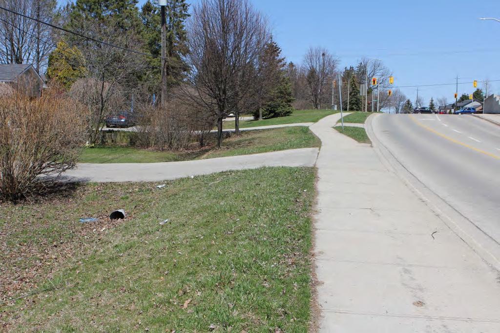
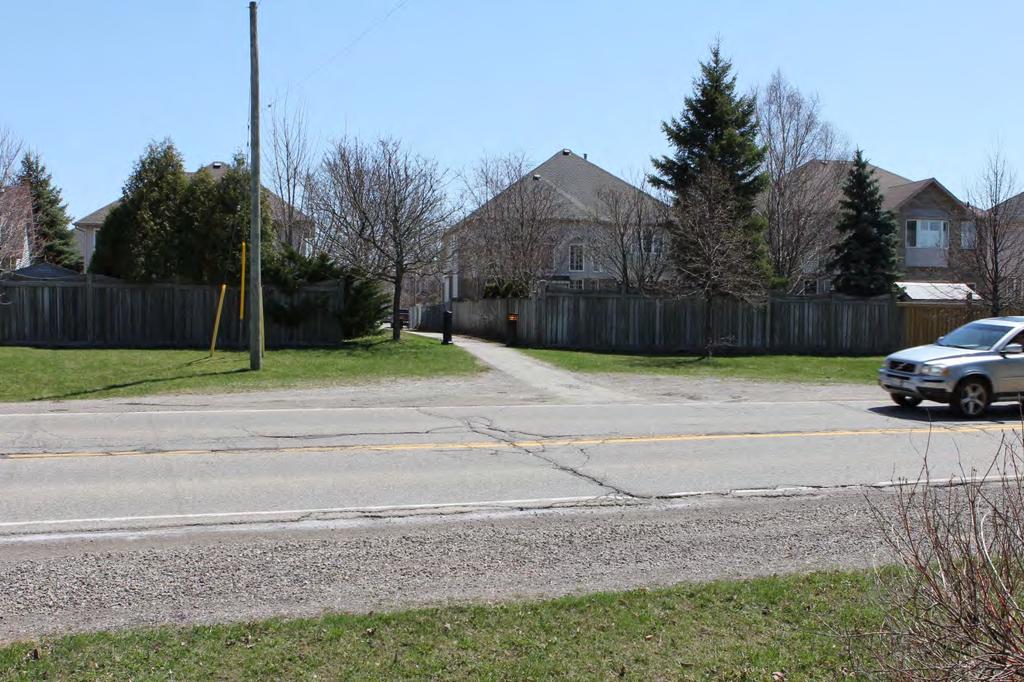
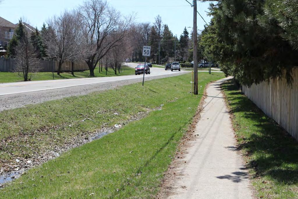
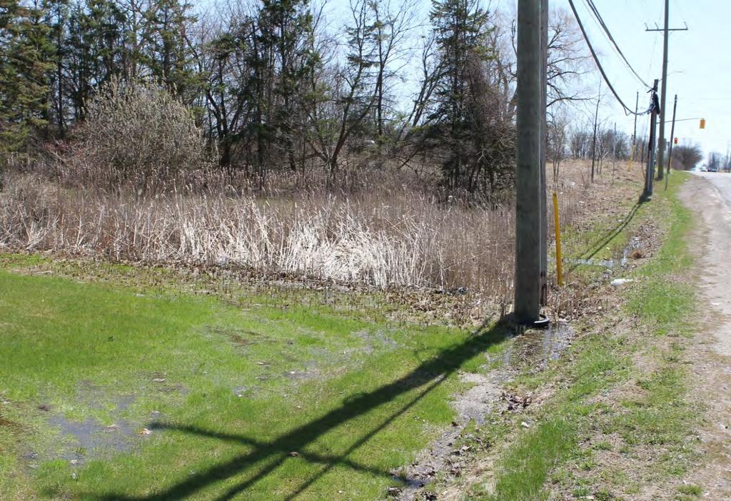
7 Existing Conditions 7 Roadway & Active Transportation Two-lane rural roadway has been posted at a speed of 50 km/h Designated Minor Arterial in the 1 Collision 1 Collision Official Plan 9 Collisions 9 Collisions Seven roadways access Southcote Rd along with several driveways 2 Collisions 1 Collision Signalized intersections at Golf Links Rd and Garner Rd Overpass bridge at Highway 403 Sidewalks not continuous throughout On-street shared cycling lanes (Sharrows) near Golf Links Rd. No other designated cycling facilities Collision data ( ) indicates there were 19 reported collisions, and the majority occurred at intersections in clear weather conditions during daylight hours


8 Phase 3 Design Options 8 Phase 3 of the Class EA process is currently underway and involves developing and evaluating design options to address the recommendations outlined in the Ancaster TMP. What would you like to see on Southcote Road? Place a dot on the examples below that are most important to you. On-road cycling lanes Off-road cycling lanes Multi-use path Sidewalks Transit Are there other features we should consider?
 features and on-road cycling lanes.")
 close to where the")
9 Phase 3 Design Options 9 Southcote Rd. will be rebuilt to an urban cross section (which includes curbs and gutters). We are reviewing the following design features: Sidewalks with on-road cycling lanes. Sidewalks with Low Impact Development (LID*) features and on-road cycling lanes. Sidewalks with a multi-use trail and off-road cycling lane. *Low Impact Development or LID is an innovative approach to land development that mimics the natural movement of water in order to manage stormwater (rainwater and urban runoff) close to where the rain falls. LID uses small, simple design techniques and landscape features that filter, infiltrate, store, evaporate, and detain rainwater and runoffs at the lot level. Benefits could include: flood reduction, water quality protection and improvement, increased property values, and climate change adaptation.


10 10 Phase 3 Design Options The following are artistic renderings of the current conditions & potential design options Two-way Centre Turn Lane Sidewalk Multi-use Path Current Conditions Concept 1 On-road Bike Lane On-road Bike Lane


11 11 Phase 3 Design Options The following are artist renditions of the current conditions & potential design options Two-way Centre Turn Lane Low Impact Development Feature Sidewalk Sidewalk Two-way Centre Turn Lane Sidewalk Low Impact Sidewalk Development Feature On-road Bike Lane Concept 2 On-road Bike Lane Off-road Bike Lane Concept 3 Off-road Bike Lane
12 Phase 3 Design Options 12 Input received Active Cultural Heritage Traffic Operations today will be used Transportation and Safety to finalize and evaluate the design options. The recommended Road Design Preferred Natural Heritage design will be Options Design Option presented at Public Information Centre #2. Land Uses & Public and Capital and Socio-Economic Agency Feedback Maintenance Environment Costs

13 Next Steps 13 Public Information Centre #2 is anticipated to be scheduled in Fall 2018 and will: Present the recommended for input Outline the proposed construction staging and timing Thank you for attending! Your input is important to the outcome of this project. Please complete a comment form and return it by: June 8, 2018 Personal information collected and recorded at the Public Information Centre or submitted in writing on this subject is collected under the authority of the Municipal Act, 2011 and will be used by members of Council and City of Hamilton staff in their review of this matter. With the exception of personal information, all comments will become part of the public record.
Welcome to the Open House
 Leslie Street Between 19 th Avenue and Stouffville Road Addendum to Class Environmental Assessment Study Welcome to the Open House Please sign in at the front desk. March 28, 2017 Richmond Green Sports
Municipal Class EA To Address Traffic Congestion On The Ontario Street Corridor (Grand Bend) Public Information Meeting June 4, 2018
 Public Information Meeting June 4, 2018") Municipal Class EA To Address Traffic Congestion On The Ontario Street Corridor (Grand Bend) Public Information Meeting June 4, 2018 Background Agenda Traffic Study Update Class EA Alternatives Bridge
Municipal Class EA To Address Traffic Congestion On The Ontario Street Corridor (Grand Bend) Public Information Meeting June 4, 2018 Background Agenda Traffic Study Update Class EA Alternatives Bridge
Welcome to the Public Meeting. Red Hill Business Park South Transportation Master Plan Addendum. December 4, :00 p.m. to 8:00 p.m.
 Welcome Welcome to the Transportation Master Plan Addendum December 4, 2012 6:00 p.m. to 8:00 p.m. Please sign-in Background PIC#1 Public Information Centre #1 (PIC#1) was held on June 25, 2012. Feedback
HIGHBURY AVENUE/HAMILTON ROAD INTERSECTION IMPROVEMENTS PUBLIC INFORMATION CENTRE 1 MAY 14, 2015
 HIGHBURY AVENUE/HAMILTON ROAD INTERSECTION IMPROVEMENTS Municipal Class Environmental Assessment PUBLIC INFORMATION CENTRE 1 MAY 14, 2015 ACCESSIBILITY Under the Accessibility Standards 2015 for Customer
Highway 56 Traffic Study Rymal Road to Cemetery Road
 January 31, 2018 6:00 pm 8:00 pm Highway 56 Traffic Study Rymal Road to Cemetery Road City of Hamilton Public Meeting 2 2 Purpose of Public Meeting To review and obtain public input and comments on the
Casablanca Boulevard & GO Station Access
 Casablanca Boulevard & GO Station Access Class Environmental Assessment STAKEHOLDER WORKSHOP Thursday September 27th, 2018 5:30PM 8:00PM 1 WORKSHOP PURPOSE Provide an overview of the Design Alternatives
List of Display Boards
 List of Display Boards Welcome Introduction Municipal Class Environmental Assessment (EA) Process Need and Justification for an Interchange Alternatives for Evaluation Vertical and Horizontal Alignments
APPENDIX L: COST ESTIMATING TOOLS
 APPENDIX L: COST ESTIMATING TOOLS Rural Arterial From LRE MOT * Mobilization * Subtotal Scope Contingency (25%) Total PE Design (15%) CEI (15%) Total Project ** New (2-Lane Roadway) with 5' Paved Shoulders
WELCOME TO OPEN HOUSE # 1 June 14, 2017
 Langstaff Road Weston Road to Highway 7 Class Environmental Assessment Study WELCOME TO OPEN HOUSE # 1 June 14, 2017 Please sign in and join our mailing list Purpose of Open House #1 & Study Area York
TRANSPORTATION NEEDS ASSESSMENT
 TRANSPORTATION NEEDS ASSESSMENT A travel demand analysis was carried out to determine the operational issues and the potential benefit that adding traffic capacity would have on the road network. All the
NOTES OF MEETING AIRPORT ROAD (KING STREET TO HUNTSMILL DRIVE) ENVIRONMENTAL ASSESSMENT (EA) COMMUNITY WORKING GROUP (CWG) ORIENTATION SESSION
 ENVIRONMENTAL ASSESSMENT (EA) COMMUNITY WORKING GROUP (CWG) ORIENTATION SESSION") NOTES OF MEETING AIRPORT ROAD (KING STREET TO HUNTSMILL DRIVE) ENVIRONMENTAL ASSESSMENT (EA) COMMUNITY WORKING GROUP (CWG) ORIENTATION SESSION Thursday, November 30, 2017 6:00 p.m. 8:00 p.m. Caledon Community
NOTES OF MEETING AIRPORT ROAD (KING STREET TO HUNTSMILL DRIVE) ENVIRONMENTAL ASSESSMENT (EA) COMMUNITY WORKING GROUP (CWG) ORIENTATION SESSION Thursday, November 30, 2017 6:00 p.m. 8:00 p.m. Caledon Community
Cyclists and Bikeways: What s your match? A guide to bikeway options for a variety of cyclists
 Cyclists and Bikeways: What s your match? guide to bikeway options for a variety of cyclists The workshop and this resource were made possible by funding from the Province of Ontario via the Ministry of
122 Avenue: 107 Street to Fort Road
 : 107 Street to Fort Road November 24, 2015 4:30 8:00 p.m. Meeting Purpose Summarize project work completed to date Share results of public input from Phase 1 Share the draft concept plan and proposed
WEST AND SOUTH WEST RING ROAD DOWNSTREAM TRAFFIC IMPACTS
 Page 1 of 9 EXECUTIVE SUMMARY Alberta Transportation ( AT ) is preparing to construct the final sections of the Calgary Ring Road. This includes the South West Ring Road ( SWRR ) (from Lott Creek Blvd
Zlatko Krstulich, P.Eng. City of O9awa
 Zlatko Krstulich, P.Eng. City of O9awa 1. Introduction to the Ontario Traffic Manual Series 2. What is OTM Book 18: Bicycle Facilities? 3. Study / Committee Team Members 4. Brief overview of the content
City of Hamilton s Transportation Master Plan (TMP) Public Consultation 3 December 2015
 Public Consultation 3 December 2015") City of Hamilton s Transportation Master Plan (TMP) Public Consultation 3 December 2015 McPhail Transportation Planning Services Ltd. AGENDA 6:00 7:00 pm Viewing Boards / Q & A with the Team 7:00 7:50
City of Hamilton s Transportation Master Plan (TMP) Public Consultation 3 December 2015 McPhail Transportation Planning Services Ltd. AGENDA 6:00 7:00 pm Viewing Boards / Q & A with the Team 7:00 7:50
County Road 2 Long Sault Improvements EA Study Schedule C Municipal Class Environmental Assessment. Environmental Study Report
 Study Schedule C Municipal Class Environmental Assessment Prepared By: BT Engineering 100 Craig Henry Drive, Suite 201 Ottawa, ON K2G 5W3 (613) 228-4813 (855) 228-4813 Toll free Executive Summary Executive
Terwillegar Drive Expressway Draft Concept Plan
 Terwillegar Drive Expressway Draft Concept Plan Anthony Henday Drive to Whitemud Drive November 28 5:00-8:00 p.m. December 1 10:00 a.m. - 3:00 p.m. Let s Talk Today you can: Learn about the new direction
Proposed Bridge Street East Bicycle Lanes Public Open House Thursday, April 27, 2017
 WELCOME Proposed Bridge Street East Bicycle Lanes Public Open House Thursday, April 27, 2017 Purpose of the Open House The purpose of this Open House is to gain public input on the bicycle lanes proposed
Chapter 3 DESIGN SPECIFICATIONS
 Brampton PathWays Planning and Design Guidelines 27 Chapter 3 DESIGN SPECIFICATIONS 3.1 CLASS 1 MULTI-USE PATH Off-road multi-use trails are the backbone of the Brampton PathWays Network. They are typically
Sustainable Transportation Initiatives and Plans in Caledon
 Sustainable Transportation Initiatives and Plans in Caledon Arash Olia, P.Eng., PhD. Coordinator, Transportation Development Finance & Infrastructure Services Town of Caledon Eric Chan, P.Eng., PMP Manager,
5 REQUEST FOR GRADE-SEPARATED PEDESTRIAN UNDERPASS CROSSINGS OF LESLIE STREET AND ST. JOHN S SIDEROAD TOWN OF AURORA
 5 REQUEST FOR GRADE-SEPARATED PEDESTRIAN UNDERPASS CROSSINGS OF LESLIE STREET AND ST. JOHN S SIDEROAD TOWN OF AURORA The Transportation Services Committee recommends the adoption of the recommendations
APPENDIX 2 LAKESHORE ROAD TRANSPORTATION REVIEW STUDY EXECUTIVE SUMMARY
 APPENDIX 2 LAKESHORE ROAD TRANSPORTATION REVIEW STUDY EXECUTIVE SUMMARY Appendix 2 City of Mississauga Lakeshore Road FINAL REPORT Transportation Review Study December 2010 EXECUTIVE SUMMARY Study Purpose
Thank you for attending the first Public Open House for the Thunder Bay Transportation Master Plan!
 Welcome Thank you for attending the first Public Open House for the Thunder Bay Transportation Master Plan! Please take this opportunity to learn about the study and to tell us your ideas and vision for
4. ALTERNATIVE DESIGN
 Chapter 4 Alternative Design 4. ALTERNATIVE DESIGN As noted in Chapters 1 and 2, Metrolinx Regional Transportation Plan (2008), The Big Move, a higher-order transit facility along Dundas Street between
Appendix O. Assessment of Bicycle Facility Alternatives
 Appendix O Assessment of Bicycle Facility Alternatives FINAL ASSESSMENT OF CROSS-SECTION ELEMENTS Lakeshore Road, from Mississaga Street to Dorval Drive Town of Oakville Submitted to: Town of Oakville
NORTH DOWNTOWN N EAST WEST
 ORTH DOWTOW CHURCH STREET ALTERATE o. 1 BIKE LAES, O-STREET PARKIG, SIDEWALK AD MULTI-USE PATH This alternate incorporates a 5-foot sidewalk along the eastern side of Church Street, a 10-foot Multi-Use
Durham Region Long Term Transit Strategy
 Durham Region Long Term Transit Strategy An adaptive, safe, reliable, frequent, accessible and desirable transit system that shapes and connects Durham Region and beyond in an economically and environmentally
Sixth Line Development - Transit Facilities Plan
 Memorandum Date: November 13, 2012 To: From: c.c. Subject: Rob Freeman (Freeman Planning) Kevin Phillips Sixth Line Development - Transit Facilities Plan 33016631 This memo was prepared to review the transit
TOWN OF WILLIAMSTON, SC BICYCLE AND PEDESTRIAN MASTER PLAN TOWN OF WILLIAMSTON, SC BICYCLE AND PEDESTRIAN MASTER PLAN
 TOWN OF WILLIAMSTON, SC BICYCLE AND PEDESTRIAN MASTER PLAN Americans Want Choices 55% of Americans would rather drive less & walk more. Transit use is growing faster than population or highway travel.
Pine Hills Road Pedestrian/Bicycle Safety Study Board of County Commissioners Work Session
 Pine Hills Road Pedestrian/Bicycle Safety Study Board of County Commissioners Work Session February 20, 2018 Meeting Agenda Study Overview Existing Conditions Access Management Potential Gateway Features
MAG Town of Cave Creek Bike Study Task 6 Executive Summary and Regional Significance Report
 Page 1 MAG Town of Cave Creek Bike Study Task 6 Executive Summary and Regional Significance Report August 1, 2012 MAG Project #481 Page 2 Task 6 Executive Summary and Regional Significance Report Introduction
Tonight is an opportunity to learn about the Study and ask questions of the Study Team members.
 Exhibit 1 Welcome Second Open House Tonight is an opportunity to learn about the Study and ask questions of the Study Team members. A first Public Open House was held on September 18th, 2013 which presented
HARRISON STREET/OAKLAND AVENUE COMMUNITY TRANSPORTATION PLAN
 HARRISON STREET/OAKLAND AVENUE Community Workshop #4: Draft Plan Review December 3, 2009 D E S I G N, C O M M U N I T Y & E N V I R O N M E N T INTRODUCTIONS Key Project Staff: Alisa Shen, Project Manager,
Classification Criteria
 SCHEDULE D TO RECOMMENDED OFFICIAL PLAN AMENDMENT NO. 40 SCHEDULE C-4 Road Criteria Criteria Traffic Service Objective Land Service/Access Typical Daily Traffic Volume Flow characteristics Travel Speed
Public Information Centre
 WELCOME Public Information Centre Father Tobin Road Lougheed Middle School - Library Wednesday November 7, 2012 7:00 p.m.to 9:00 p.m. Please sign in Neighbourhood Traffic Calming Guide Background The City
 Roundabout Pedestrian Use Pedestrians cross at designated locations on splitter island use the e sidewalks s de a s a and d ccrosswalks oss a s a around ou d the e ou outside s de o of the e roundabout
Dundas Street (Regional Road 5) Corridor Improvements Class EA. Welcome to Public Information Centre #3. Thursday, September 13, 2012
 Corridor Improvements Class EA. Welcome to Public Information Centre #3. Thursday, September 13, 2012") Dundas Street (Regional Road 5) Corridor Improvements Class EA Welcome to Public Information Centre #3 Thursday, September 13, 2012 Members of the Project Team are available to discuss the information
Dundas Street (Regional Road 5) Corridor Improvements Class EA Welcome to Public Information Centre #3 Thursday, September 13, 2012 Members of the Project Team are available to discuss the information
5. RUNNINGWAY GUIDELINES
 5. RUNNINGWAY GUIDELINES These guidelines should be considered collectively when making runningway decisions. A runningway is the linear component of the transit system that forms the right-of-way reserved
Atwood Avenue Fair Oaks Avenue Cottage Grove Road
 Atwood Avenue Fair Oaks Avenue Cottage Grove Road Agenda Purpose Review project scope & goals Present design alternatives Gather feedback Answer Questions Format Open House Presentation Q&A Open House
Solana Beach Comprehensive Active Transportation Strategy (CATS)
") Solana Beach Comprehensive Active Transportation Strategy (CATS) 3.0 Goals & Policies The Solana Beach CATS goals and objectives outlined below were largely drawn from the Solana Beach Circulation Element
Solana Beach Comprehensive Active Transportation Strategy (CATS) 3.0 Goals & Policies The Solana Beach CATS goals and objectives outlined below were largely drawn from the Solana Beach Circulation Element
Bicycle Master Plan Goals, Strategies, and Policies
 Bicycle Master Plan Goals, Strategies, and Policies Mobilizing 5 This chapter outlines the overarching goals, action statements, and action items Long Beach will take in order to achieve its vision of
Monroe Street Reconstruction
 Total participants: 45+ Monroe Street Reconstruction Cross Section Workshop Notes September 29, 2016, Wingra School Workshop Orientation, Technical and Functional Considerations: The workshop began with
General Plan Circulation Element Update Scoping Meeting April 16, 2014 Santa Ana Senior Center, 424 W. 3rd Street, Santa Ana, CA 92701
 General Plan Circulation Element Update Scoping Meeting April 16, 2014 Santa Ana Senior Center, 424 W. 3rd Street, Santa Ana, CA 92701 Meeting Agenda 1. Purpose of Scoping Meeting 2. Project Overview 3.
Service Business Plan
 Service Business Plan Service Name Transportation Planning Service Type Public Service Owner Name Kaylan Edgcumbe Budget Year 2019 Service Owner Title Service Description Manager of Transportation Planning
AIRPORT ROAD ENVIRONMENTAL ASSESSMENT
 WELCOME TO PUBLIC INFORMATION CENTRE #1 AIRPORT ROAD ENVIRONMENTAL ASSESSMENT From Braydon Boulevard/Stonecrest Drive to Countryside Drive November 23, 2017 6:30 PM 8:30 PM Please sign in and fill out
City of Sammamish. Welcome. Issaquah-Fall City Road Improvements Project Phase I Design: 242nd Avenue SE to Klahanie Drive SE
 Welcome Welcome to the third community meeting for the Issaquah-Fall City Road Improvements Project. AGENDA 6:00 p.m. Welcome and sign-in 6:10 p.m. Presentation 6:50 p.m. Open house Learn about the roadway
Transportation Assessment
 Transportation Assessment Midtown Open House February 10, 2018 Overview Midtown in Focus Overview & Purpose of Today Transportation Assessment overview Summary of Transportation work to date Review & Analysis
CITY OF SAINT JOHN TRAFFIC CALMING POLICY
 CITY OF SAINT JOHN TRAFFIC CALMING POLICY VERSION: 1.0 April 10, 2012 Pedestrians, Cyclists and Motorists Sharing Street Spaces CONTENTS INTRODUCTION... 3 POLICY GOAL... 3 POLICY OBJECTIVES... 3 GUIDING
INDEX. Geometric Design Guide for Canadian Roads INDEX
 Acceleration lane, see Lanes, Acceleration Access, 8.1 Access Management and Functional Classification 8.2 Access Management by Design Classification 8.3 Access Configuration 8.4 Building Set-Back Guidelines
Giles Run Connector Road
 Giles Run Connector Road Laurel Hill Adaptive Reuse Area to Laurel Crest Drive South County Federation Meeting June 14, 2016 History Connector road included in the Laurel Hill Comprehensive Plan amendment
BAYVIEW DRIVE & BIG BAY POINT ROAD
 BAYVIEW DRIVE & BIG BAY POINT ROAD City of Barrie DRAFT FINAL prepared by: C.C. Tatham & Associates Ltd. 41 King Street, Unit 4 Barrie, ON L4N 6B5 Tel: (705) 733-9037 Fax: (705) 733-1520 info@cctatham.com
Trans-Canada Highway 1 RW Bruhn Bridge Replacement
 Trans-Canada Highway 1 RW Bruhn Bridge Replacement May 2016 RW Bruhn Bridge Project Objectives Improve safety, traffic flow and movement of goods Improve safety for pedestrians and cyclists Replace the
Shifting Gears for a Healthier City
 Shifting Gears for a Healthier City Mississauga s Cycling Master Plan is an ambitious strategy that sets out to transform Mississauga into a city that is conducive to cycling for daily transportation needs.
Bank Street Widening Class EA Study Leitrim Road to Rideau Road. Gloucester South Seniors Centre, 4550 Bank Street
 AECOM 302 1150 Morrison Drive 613 820 8282 tel Ottawa, ON, Canada K2H 8S9 613 820 8338 fax www.aecom.com Minutes of Meeting Date of Meeting April 4, 2013 Start Time 6:30 p.m. Project Number 60246226 Project
Baseline Road Rapid Transit: Bayshore Station to Prince of Wales Drive
 Baseline Road Rapid Transit: Bayshore Station to Prince of Wales Drive Planning and Environmental Assessment Study Consultation Group Meetings May 2014 Presentation Agenda Study Overview Study Progress
Saskatchewan Drive Roadway Rehabilitation and Shared-Use Path Widening
 Saskatchewan Drive Roadway Rehabilitation and Shared-Use Path Widening We are here today to present the draft plan for the Saskatchewan Drive Roadway Rehabilitation and Shared-Use Path Widening project
Public Works and Infrastructure Committee. General Manager, Transportation Services
 STAFF REPORT ACTION REQUIRED Extending the Bay Street Bicycle Lanes Date: May 16, 2013 To: From: Public Works and Infrastructure Committee General Manager, Transportation Services Wards: Toronto Centre
Environmental Assessment Airport Road from King Street to Huntsmill Drive Community Working Group (CWG) Orientation November 30, 2017
 Orientation November 30, 2017") Environmental Assessment Airport Road from King Street to Huntsmill Drive Community Working Group (CWG) Orientation November 30, 2017 Agenda 1. Welcome and Introductions 2. Opening Remarks 3. Project Overview
Environmental Assessment Airport Road from King Street to Huntsmill Drive Community Working Group (CWG) Orientation November 30, 2017 Agenda 1. Welcome and Introductions 2. Opening Remarks 3. Project Overview
Dundas Street (Regional Road 5) Corridor Improvements Class EA Neyagawa Boulevard to Oak Park Boulevard. Welcome Public Information Centre
 Corridor Improvements Class EA Neyagawa Boulevard to Oak Park Boulevard. Welcome Public Information Centre") Dundas Street (Regional Road 5) Corridor Improvements Class EA Neyagawa Boulevard to Oak Park Boulevard Welcome Public Information Centre Wednesday, May 15, 2013 Members of the Project Team are available
Dundas Street (Regional Road 5) Corridor Improvements Class EA Neyagawa Boulevard to Oak Park Boulevard Welcome Public Information Centre Wednesday, May 15, 2013 Members of the Project Team are available
APPENDIX L. Design Criteria
 APPENDIX L Design Criteria DRAFT PRELIMINARY DESIGN CRITERIA Page 1 of 18 APPROVALS MANAGER, ENGINEERING CITY OF HAMILTON MANAGER, ENGINEERING REGION OF HALTON DATE This Design Criteria for the New East-West
Downey Road. Transportation Improvement Study
 Downey Road Transportation Improvement Study Workshop 2 Participant Handbook Workshop 1 May 18 and 19, 2016 Workshop 2 June 23 and 28, 2016 Prepared By: City of Guelph Paradigm Transportation Solutions
The District Municipality of Muskoka 70 Pine Street Bracebridge ON P1L 1N3
 Public Information Centre Summary Report Muskoka Road 15 (Santa s Village Road) Transportation Improvements from the Beaver Creek Bridge to the Entrance of Santa s Village The District Municipality of
Ocean Park Boulevard Green Street Project Alternatives & Trade Offs
 Planning Commission March 4, 2009 Ocean Park Boulevard Green Street Project Alternatives & Trade Offs Purpose of Tonight s Meeting Review concept plans and options Provide input on alternatives and trade-offs
8 PROPOSED ROUNDABOUT DUFFERIN STREET AND KING VAUGHAN ROAD INTERSECTION CITY OF VAUGHAN
 8 PROPOSED ROUNDABOUT DUFFERIN STREET AND KING VAUGHAN ROAD INTERSECTION CITY OF VAUGHAN The Transportation Services Committee recommends the adoption of the recommendation contained in the following report
City of Gainesville Transportation/Roadway Needs PROJECT SUMMARY
 A1 Roadway Resurfacing $23,846,000 TYPE: Preservation of existing system Roadway resurfacing A2 Signal Replacement $6,000,000 TYPE: Preservation of existing system Replace traffic signals. B1 W 6th St
Improving Cyclist Safety at the Dundas Street West and Sterling Road Intersection
 STAFF REPORT ACTION REQUIRED Improving Cyclist Safety at the Dundas Street West and Sterling Road Intersection Date: August 17, 2012 To: From: Wards: Reference Number: Public Works and Infrastructure Committee
AMERICANS WITH DISABILITIES ACT TRANSITION PLAN LEON COUNTY FOR CURB RAMPS AND SIDEWALKS DEPARTMENT OF PUBLIC WORKS. 1 P age
 AMERICANS WITH DISABILITIES ACT TRANSITION PLAN FOR CURB RAMPS AND SIDEWALKS 2015 LEON COUNTY DEPARTMENT OF PUBLIC WORKS 1 P age INTRODUCTION The goal of the Americans with Disabilities Act (ADA) Transition
Lake to Lake LAKE YORK. CYCLING ROUTE and WALKING TRAIL FEASIBILITY and DESIGN STUDY LAKE. CITY of REGION ONTARIO SIMCOE TORONTO
 LAKE SIMCOE Lake to Lake CYCLING ROUTE and WALKING TRAIL FEASIBILITY and DESIGN STUDY YORK REGION Overview Report JUNE 2013 CITY of TORONTO LAKE ONTARIO Table of Contents Study background 2 Study Background............................
102 Avenue Corridor Review
 February 26, 2015 102 Avenue Corridor Review Transportation Association of Canada Road Safety Engineering Award Submission for the City of Edmonton Introduction Transportation Association of Canada Road
Transportation Planning Division
 Transportation Planning Division Presentation Outline Study Tasks Recap of Previous Meeting Stakeholder Interviews Data Collection Design Principles Tool Box Recommendations Schedule Moving Forward North
Moving Cambridge. City of Cambridge Transportation Master Plan Public Consultation Centre. March 7, :00 8:00 PM.
 City of Cambridge Transportation Master Plan Public Consultation Centre March 7, 2018 5:00 8:00 PM Region of Waterloo City of Cambridge Transportation Master Plan Public Consultation Centre March 7, 2018
Colerain Avenue Roadway Improvements. Sponsored by Hamilton County Engineer
 Colerain Avenue Roadway Improvements Sponsored by Hamilton County Engineer Participants Lead Agency: Hamilton County Engineer Review and Approval: Ohio Department of Transportation Design Engineer: Edwards
CONNECTIVITY PLAN. Adopted December 5, 2017 City of Virginia Beach
 CONNECTIVITY PLAN Adopted December 5, 2017 City of Virginia Beach CONTENTS 1.0 Background & Purpose... 2 2.0 Existing Inventory & Analysis... 3 ViBe District Existing Walking Conditions... 4 3.0 ViBe District
WELCOME Public Information Centre
 WELCOME Public Information Centre Fernforest Drive Brampton Soccer Centre Community Room #2 Tuesday January 19, 2016 6:30 p.m.to 9:00 p.m. Please sign in Neighbourhood Traffic Calming Guide Background
Building Great Neighbourhoods BELLEVUE AND VIRGINIA PARK
 Building Great Neighbourhoods BELLEVUE AND VIRGINIA PARK This is Meeting 2 Unfortunately, some residents in Bellevue and Virginia Park received the wrong information for this public open house (Meeting
Corporate. Report COUNCIL DATE: June 26, 2006 NO: C012 COUNCIL-IN-COMMITTEE. TO: Mayor & Council DATE: June 22, 2006
 Corporate NO: C012 Report COUNCIL DATE: June 26, 2006 COUNCIL-IN-COMMITTEE TO: Mayor & Council DATE: June 22, 2006 FROM: General Manager, Engineering FILE: 0410-20(MoT/Gate) SUBJECT: Surrey Response on
Pine Hills Road Pedestrian/Bicycle Safety Study Community Meeting #1
 Pine Hills Road Pedestrian/Bicycle Safety Study Community Meeting #1 June 8, 2017 Meeting Agenda Study Overview Community Survey Existing Conditions Access Management Potential Safety Countermeasures Potential
COUNCIL POLICY NAME: COUNCIL REFERENCE: 06/119 06/377 09/1C 10llC 12/1C INDEX REFERENCE: POLICY BACKGROUND
 COUNCIL POLICY NAME: COUNCIL ADVISORY COMMITTEES - TERMS OF REFERENCE ISSUED: APRIL 3, 2006 AMENDED: NOVEMBER 27, 2006 NOVEMBER 23, 2009 JANUARY 11, 2010 DECEMBER 17, 2012 POLICY COUNCIL REFERENCE: 06/119
Lee s Summit Road Improvement Study Public Open House June 7, 2007 Summary of Comment Card Responses
 Lee s Summit Road Improvement Study Public Open House June 7, 2007 Summary of Comment Card Responses Introduction At the Lee s Summit Road Improvement Study Public Open House held Thursday, June 7, 2007
LANE ELIMINATION PROJECTS
 PRESENTATION OUTLINE Lane Elimination Considerations Districts 4 & 7 Draft Lane Elimination Processes FDOT Lane Elimination Guidelines Example Projects D4 Case Study: SR A1A (Ft. Lauderdale) D7 Case Study:
VIII. Project Prioritization & Implementation
 Transportation Plan 2030 July 2006 VIII. Project Prioritization & Implementation Public Transit Service Investigation into the development of a demand responsive service route system through a process
CTH M Reconstruction
 CTH M Reconstruction ID 5992 09 81 City of Madison, South Pleasant View Road (Cross Country Road Prairie Hill Road) CTH M Dane County Public Information Meeting Thursday, May 24, 2012 6 p.m. to 8 p.m.
Building Great Neighbourhoods QUEEN ALEXANDRA
 Building Great Neighbourhoods QUEEN ALEXANDRA We are here today to Explain how the City is investing in improving your neighbourhood and how your neighbourhood will be improved to meet current City standards.
City of Novi Non-Motorized Master Plan 2011 Executive Summary
 City of Novi Non-Motorized Master Plan 2011 Executive Summary Prepared by: February 28, 2011 Why Plan? Encouraging healthy, active lifestyles through pathway and sidewalk connectivity has been a focus
Executive Summary Route 30 Corridor Master Plan
 Route Corridor Master Plan Project Overview The Route Corridor Master Plan is a coordinated multimodal transportation and land use plan for the entire stretch of Route through East Whiteland Township,
Route 15 Congestion Report Findings
 Route 15 Congestion Report Findings Briefing To Loudoun County Board of Supervisors May 18, 2016 1 Overview: Previous Studies: Route 15 Corridor, Leesburg to Maryland Route 15 Congestion Report: Between
Cycle Track Design Best Practices Cycle Track Sections
 Design Best Practices Sections It is along street segments where the separation and protection methods of cycle tracks offer more comfort than conventional bicycle lanes, and are more attractive to a wide
Lawrence Avenue Streetscape Concepts August 30, 2011
 Lawrence Avenue Streetscape Concepts August 30, 2011 Neighborhood Context Phase II: River to Western Ave. Phase I: Western Ave. to Clark St. Key Map Lawrence Ave. Existing Streetscape Conditions East of
Broadway Complete Streets Project
 Broadway Complete Streets Project Megan Johnson, P.E. Associate Civil Engineer James Pangburn, P.E. Consultant Project Manager After the construction of the highway system, Broadway was cut off
Board of Supervisors February 27, 2017
 : Traffic Analysis Results & Draft Conceptual Plan Board of Supervisors February 27, 2017 Transportation Solutions Building Better Communities Presentation Overview Background Summary of Traffic Analysis
Major Bike Routes 102 Avenue Workshop April 21, 2015
 Major Bike Routes 102 Avenue Workshop April 21, 2015 Our Purpose Today Provide context on how Major Bike Routes fit into Edmonton s future Share information on what we heard in our last phase, and how
2.0 LANE WIDTHS GUIDELINE
 2.0 LANE WIDTHS GUIDELINE Road Engineering Design Guidelines Version 2.0.1 May 2018 City of Toronto, Transportation Services City of Toronto Page 0 Background In early 2014, Transportation Services initiated
City of Madison, East Johnson Street North Baldwin Street to First Street Local Street Dane County
 City of Madison, East Johnson Street North Baldwin Street to First Street Local Street Dane County Public Involvement Meeting Thursday, November 10, 2016 5:30 to 7 P.M. Festival Foods 810 E. Washington
TRAFFIC CALMING GUIDE FOR TORONTO CITY OF TORONTO TRANSPORTATION SERVICES DIVISION
 TRAFFIC CALMING GUIDE FOR TORONTO CITY OF TORONTO TRANSPORTATION SERVICES DIVISION CITY OF TORONTO TRANSPORTATION SERVICES DIVISION 2016 TRAFFIC CALMING GUIDE FOR TORONTO TABLE OF CONTENTS Introduction
Application of a Complete Street
 Application of a Complete Street Southbend to Prima Vista Update May 14, 2018 Meeting Agenda Perspective and History Public input received Typical sections being considered Presentation of the 2-lane master
Edenbrook Hill Drive Traffic Calming Study
 WELCOME Public Information Centre Edenbrook Hill Drive Traffic Calming Study Fletchers Meadow Secondary School Wednesday January 20, 2016 6:30 p.m.to 9:00 p.m. Please sign in Neighbourhood Traffic Calming
RESOLUTION NO ?? A RESOLUTION OF THE CITY OF NEPTUNE BEACH ADOPTING A COMPLETE STREETS POLICY
 RESOLUTION NO. 2018-?? A RESOLUTION OF THE CITY OF NEPTUNE BEACH ADOPTING A COMPLETE STREETS POLICY WHEREAS, safe, convenient, and accessible transportation for all users is a priority of the City of Neptune
Environment and Public Works Committee Presentation
 Mixed Use Centers Complete Streets Guidelines Project Environment and Public Works Committee Presentation December 10, 2008 Project Objectives: Conduct an inter-departmental and agency process to study
COMMITTEE RECOMMENDATIONS. That Council approve:
 4. MODIFICATIONS TO INNES ROAD (REGIONAL ROAD 30) AND TENTH LINE ROAD (REGIONAL ROAD 47) TO ACCOMMODATE THE DEVELOPMENT OF THE TRINITY COMMONS SHOPPING CENTRE COMMITTEE RECOMMENDATIONS That Council approve: