Integrated Waterway Management of the Danube in Austria
|
|
|
- Ralph Butler
- 6 years ago
- Views:
Transcription

1
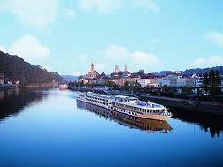
2 Integrated Waterway Management of the Danube in Austria Thomas Hartl / Senior Expert Waterway Management via donau Österreichische Wasserstraßen-Gesellschaft mbh Vienna, October 14, 2014

3 Page 3
4 Figures and facts Founded in 2005 on the legal basis of the Austrian Waterway Act 100% ownership by the Federal Ministry for Transport, Innovation and Technology 270 employees 4 Service Centres along the Danube, main office in Vienna 9 Danube lock facilities to operate Page 4


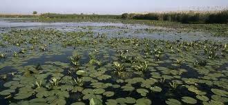
5 The Danube as a multifunctional system recreation transport ecology nature reserve agriculture Danube flood control tourism drinking water energy fishery Page 5
6 Our three company pillars Economy Environment Safety The integrative approach is inherent to the waterway system! Page 6

7 Three company pillars Economy Infrastructure management ensuring the availability of an efficient and reliable waterway infrastructure (maintenance and improvement) collection and provision of hydrographic and hydrological basic data Logistics and ports development of cost-effective logistics solutions on the Danube river in cooperation with private business

8 Three company pillars Environment Renaturation projects Free-flowing sections of the Danube: Wachau, east of Vienna Morava river Ship emission reduction improving the environmental performance of inland navigation Climate change development of potential adaptation strategies for climate change
 in Austria (DoRIS) supervision and traffic control at river")
9 Three company pillars Safety Flood control via donau ensures the safety of more than 500,000 people reconstruction of the flood control dyke on the Morava and the lower Thaya rivers Traffic management national provider of River Information Services (RIS) in Austria (DoRIS) supervision and traffic control at river locks
, Enns (2.70 km) and March (6.00 km) In sum, 378.")
10 Federal waterways in Austria Danube: km Danube Canal (Vienna): km Danube tributaries Traun (1.80 km), Enns (2.70 km) and March (6.00 km) In sum, km of public waterways Page 10
11 Nautical situation 75 % impounded 25 % free-flowing Wachau Lock Main office Service Centre east of Vienna 10 lock facilities with specific paramters (width and length) 2 free-flowing sections with fairway restrictions (depth and width) Page 11
 l = 188 m; b = 22.0 m; t max = 2.")
12 Infrastructure restrictions Usable lock dimensions on the Austrian Danube: 230 x 24 m = UNECE waterway class VIb (4-unit pushed convoy) maximum encounter case = two 4-unit pushed convoys Pushed convoy (pusher + 4 Europe II B lighters) l = 188 m; b = 22.0 m; t max = 2.7 m (6,800 t) Page 12
 Configuration of coupled convoys (motor cargo vessel + pushed lighters) at the Freudenau lock in 2012 (trips)")
13 Traffic per type of vessel Configuration of pushed convoys (pusher + pushed lighters) at the Freudenau lock in 2012 (trips) Configuration of coupled convoys (motor cargo vessel + pushed lighters) at the Freudenau lock in 2012 (trips) Page 13
14 Traffic per type of vessel 19 vessels per day on average (peak in summer from May to September due to passenger transport) Ratio of individual vessels to convoys = 52% : 48% 51.6% of all trips are performed by individual vessels 26.5% of all trips by pushed convoys with two barges 11.5% of all trips by coupled convoys with one barge Vessel/convoy type Melk 2012 Altenwörth 2012 share [%] Single vessels (1/2/3/4) ,6% Coupled convoy 1xbarge (5a) ,5% Coupled convoy 2xbarge (5b) ,5% Coupled convoy 3xBarge (5c) ,3% Pushed convoy 1xbarge (7a) ,3% Pushed convoy 2xbarge (7b) ,5% Pushed convoy 3xbarge (7c) ,2% Pushed convoy 4xbarge (7d) ,2% Total number vessels ,0% Page 14


15 Strategy: the fairway maintenance cycle Philosophy: "the whole is greater than the sum of its parts" Page 15


16 Customer-oriented waterway management Surveying Dredging Information Page 16

17 Riverbed surveying on the Austrian Danube Standard: twice per year complete surveying of free-flowing sections: March + October: east of Vienna April + November: Wachau 50 m standard profiles and 25 m profiles in sections with critical locations Equipment: single beam + multi beam Page 17

18 Riverbed surveying on the Austrian Danube Monitoring of critical locations: Additional surveying of critical locations according to catalogue of shallow sections in July each year prior to low-water period Additional monthly surveying of critical locations (prioritisation) Page 18

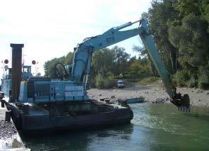
19 Riverbed surveying on the Austrian Danube Quality control of dredging works: Survey of dredging area prior to and after performance of dredging by assigned company supplementary claims, if necessary Equipment used: multi-beam Page 19

20 Multi-beam surveying Ford Rothenhof after dredging: km / April 2012 Page 20
21 Multi-beam surveying numerical depth values Ford Rothenhof after dredging: km / April 2012 Page 21

22 Multi-beam surveying published information Ford Rothenhof after dredging: km / April 2012 Page 22
23 Free-flowing sections of the Danube Wachau valley (river-km 2, to1,998.00): From river power plant Melk to the Port of Krems East of Vienna (river-km 1, to 1,872.70): From river power plant Freudenau to Austrian-Slovakian border Page 23
24 Critical locations on the Austrian Danube Identification of critical locations on the two free-flowing secions of the Austrian Danube in line with "caution areas" in Inland ECDIS charts Catalogue of fords and lateral accumulations in sum 36 critical locations of which 19 are critical Prioritisation according to urgency for intervention East of Vienna: 7 fords + 6 lat. accum. Wachau valleay: 5 fords + 1 lat. accum. lateral accumulation ford lateral accumulation Page 24

25 Wachau: critical locations Fords: Lateral accumulations: Page 25
26 East of Vienna: critical locations Fords: Lateral accumulations: Page 26 Page 26
 and average monthly load factor of vessels Exceedance frequency [%] JAN - FEB 40-45% MAR 20% APR - AUG 0-5% SEP 25% OCT - DEC")
27 Long-term frequency of low-water periods Exceedance of low navigation & regulation level (LNRL) metres ( ) and average monthly load factor of vessels Exceedance frequency [%] JAN - FEB 40-45% MAR 20% APR - AUG 0-5% SEP 25% OCT - DEC 50-55% Average monthly load factor [dm] Months Page 27
28 Prioritisation of measures Why prioritise? Waterway users need sufficient fairway depths in low-water periods need to remove critical locations as fast as possible and prior to low-water periods The weakest location on a specific stretch determines the possible draught loaded of a vessel Once the weakest spot has been eliminated, the second weakest spot determines the draught loaded etc. Determining factors: Limited dredging capacity on the market; suitability of equipment for free-flowing river; time needed for receiving official notifications (environmental, navigation law) Page 28
29 Optimisation of time frame for dredging Optimal timeframe for most urgent dredging works Dredging works for most critical shallow sections shall take place at the beginning Page 29 of autumn (starting from September) before the potential low water period!
 Beginning of Sept.")
30 Sample schedule for prioritised dredging (1) July 2013: Hydrographical survey of critical location in freeflowing sections (2) Beginning of Aug. 2013: Briefing for dredging works; prioritisation of measures (3) Beginning of Sept. 2013: Start of dredging works at priority locations in both freeflowing sections Page 30
31 Some facts on dredging Cubature: annually ~ 300,000 to 400,000 m 3 in both free-flowing sections taken together Dredged material: gravel (in fairway; mean gravel size = 26 mm; but up to 120 to 150 mm) fine sediments (in reservoirs, at berthing areas, in port access channels) Budget: annually ~ 4 to 6 million EUR Execution: contracting of private companies Page 31
32 Determining factors for dredging Discharge (in free-flowing section east of Vienna): LNQ = 980 m 3 /s MQ = 1,930 m 3 /s HQ = 10,400 m 3 /s Mean flow velocity (in free-flowing sections): ~ 7 km/h at low navigable water level ~ 12 km/h or more at higher water levels (MWL) Fairway width: between 100 and 120 m in straight sections (more in bend) Page 32
33 Levels of service as a strategy for prioritisation Identification of the width of the "traffic lane" needed by vessels/convoys for critical locations in the two free-flowing stretches of the Austrian Danube waterway in consideration of different curve radii on critical stretches of the waterway on the basis of three general traffic situations ("encounter cases" or "levels of service") Fairway depth of 2.5 m at LNWL (ENR) (= 343 days/year) Page 33
34 Levels of service: encounter cases Maximum encounter case: The critical encounter probability in oncoming traffic for two 4-unit pushed convoys is less than once a week Most probable encounter case: Individual vessel encountering a 2-unit pushed or coupled convoy Page 34
35 Fairway widths and vessel types Definition of fairway LoS in Austria is based on studies published by the DST Duisburg (Development Centre for Ship Technology and Transport Systems) The chart visualizes the assumed distances for the passing of two 4-unit convoys navigating through water at 14 km/h at a flow velocity of the river of 6 km/h Page 35
36 3 levels of service in fairway maintenance Traffic situation: Level 1 Convoy of max. dimension* going downstream in oneway traffic Level 2 Convoy of max. dimension* going downstream meets motor cargo vessel going upstream Level 3 Encounter of two convoys of max. dimension* Width of "traffic lane" according to curve radii: < 1,000 m 80 m 120 m 160 m 1,000-1,500 m 60 m 100 m 120 m > 1,500 m 40 m 80 m 100 m * According to waterway class foreseen for this stretch (UNECE / DC) Page 36

37 Principle of fairway continuity Establish the continuity of the fairway as fast as possible + prior to low-water periods (proactive maintenance) = LoS 1 Increase the availability of the fairway step by step, starting with the most critical location Provide the availability of the entire fairway width in a sequential manner = LoS 2 + LoS 3 Priority 3 Priority 2 Priority 1 Level of Service 1 Priority 6 Priority 5 Priority 4 Page 37
38 Example: Ford Regelsbrunn east of Vienna Page 38
39 Ford Regelsbrunn: LoS parameters Excerpt from the catalogue of critical locations: name kind position - right - centre - left curve radius - upstream - centre - downstream LoS 1-3 fairway width area of critical location Page 39
40 Ford Regelsbrunn: LoS 1 = 40 m width Page 40

41 Ford Regelsbrunn: LoS 2 = 80 m width Page 41
 and DoRIS mobile app for smart phones etc.")
42 Online information on critical locations Distribution via web service to different (online) media: DoRIS website (Donau River Information Services) and DoRIS mobile app for smart phones etc. Danube FIS portal (Fairway Information Services) Page 42

43 Online information on critical locations Page 43
 East of Vienna: 86% (50 /")
44 LoS for statistical purposes (LoS 1 in 2013) Availability of LoS 1 in free-flowing sections 2013: Wachau: 98% (6 / 365) East of Vienna: 86% (50 / 365) Page 44

45 Thank you for your attention Contact Mag. Thomas Hartl, MAS Senior Expert Waterway Management Phone Donau-City-Straße 1, 1220 Vienna, Austria Page 45
46
SPEECH. by Deputy Director-General of the Danube Commission s Secretariat. Mr. Pjotr Suvorov. (Linz, April 2013)
") SPEECH by Deputy Director-General of the Danube Commission s Secretariat Mr. Pjotr Suvorov on the 5 th Meeting of the Steering Group for Priority Area 1a of the EUSDR (Linz, 17-18 April 2013) At the 3
SPEECH by Deputy Director-General of the Danube Commission s Secretariat Mr. Pjotr Suvorov on the 5 th Meeting of the Steering Group for Priority Area 1a of the EUSDR (Linz, 17-18 April 2013) At the 3
Infrastructure measures
 Infrastructure measures Juha Schweighofer via donau Österreichische Wasserstraßen GmbH Second ECCONET Stakeholder Workshop Amsterdam, November 2 nd, 2011 Contents Objectives in ECCONET Weather related
Status of the Fairway Rehabilitation and Maintenance Master Plan for the Danube and its navigable tributaries (dated )
") Status of the Fairway Rehabilitation and Maintenance Master Plan for the Danube and its navigable tributaries (dated 23-11-2018) Key achievements since the endorsement of the Master Plan in 2014 The Fairway
Status of the Fairway Rehabilitation and Maintenance Master Plan for the Danube and its navigable tributaries (dated 23-11-2018) Key achievements since the endorsement of the Master Plan in 2014 The Fairway
Monitoring system on implementation of waterway maintenance declaration & short-term measures
 Monitoring system on implementation of waterway maintenance declaration & short-term measures Linz, 16 April 2013 Thomas Hartl Joint Technical Secretariat PAC 1a Slide No. 2 Status: April 2013 Slide No.
TRAFFIC MANAGEMENT, RELIABILITY AND ECONOMIC TRANSPORT ON THE INLAND WATERWAY DANUBE by
 TRAFFIC MANAGEMENT, RELIABILITY AND ECONOMIC TRANSPORT ON THE INLAND WATERWAY DANUBE by Markus Hoffmann 1, Alexander Haberl 1, Thomas Hartl 2, Christoph Konzel 2 and Markus Simoner 2 ABSTRACT The analysis
FAIRway Danube. a milestone for the realization of the Masterplan of the Danube and its navigable tributaries , Katja Rosner / viadonau
 FAIRway Danube a milestone for the realization of the Masterplan of the Danube and its navigable tributaries 15.11.2016, Katja Rosner / viadonau Agenda FAIRway Danube in a nutshell Developments in selected
Overview Vessel Types on the Danube
 Overview Vessel Types on the Danube 1. Introduction This document describes the most important vessel types for Danube IWT. In the first part of the document, various vessel types and their load capacities
National Action Plans
 Fairway Rehabilitation and Maintenance MASTER PLAN for the Danube and its navigable tributaries: National Action Plans Update October 2015 Version: final draft Date: 14.12.2015 Status: internal Disclaimer
Fairway Rehabilitation and Maintenance Master Plan for the Danube and its Navigable Tributaries
 Fairway Rehabilitation and Maintenance Master Plan for the Danube and its Navigable Tributaries PA1a Working Group Session, Vukovar, 28 October 2014 Gudrun Maierbrugger, Technical Secretariat Priority
Waterway management projects co-funded by CEF Programme rkm Danube section in Hungary -
 Waterway management projects co-funded by CEF Programme - 1811-1433 rkm Danube section in Hungary - PÁL KÖTÉL, KÁROLY GOMBÁS MSc in water engineering Fluvial flod protection, deputy department leader NORTH-TRANSDANUBIAN
ST. LOUIS SECTION PROJECT OF THE YEAR AWARD
 ST. LOUIS SECTION PROJECT OF THE YEAR AWARD Originality and Innovation The St. Louis Harbor Project is located in the Upper Mississippi River between the entrance to the Chain of Rocks Canal at River
applied to Port Development and Inland Waterway Transport
 applied to Port Development and Inland Waterway Transport Wytze de Boer March 12, 2018 w.d.boer@marin.nl CHALLINGING WIND AND WAVES applied to port development and inland waterway transport AGENDA 1. Introduction
READER THE DANUBE WATERWAY ECONOMIC GEOGRAPHY
 READER THE DANUBE WATERWAY ECONOMIC GEOGRAPHY Extract of relevant passages from the Manual of Danube Navigation, via donau (2012) and the Annual Report 2014 from via donau i Statistical data for the EU-27
SWISS reports stable load factors
 SWISS Corporate Communications Phone: +41 (0)848 773 773 Fax: +41 (0)44 564 2127 communications@swiss.com SWISS.COM Media release Zurich Airport, October 10, 2008 SWISS reports stable load factors SWISS
FEASIBILITY STUDY FOR A WATERWAY MAINTENANCE MANAGEMENT SYSTEM (WMMS) FOR THE DANUBE
 FOR THE DANUBE") NETWORK OF DANUBE WATERWAY ADMINISTRATIONS data & user orientation SOUTH EAST EUROPE TRANSNATIONAL COOPERATION PROGRAMME FEASIBILITY STUDY FOR A WATERWAY MAINTENANCE MANAGEMENT SYSTEM (WMMS) FOR THE DANUBE
NETWORK OF DANUBE WATERWAY ADMINISTRATIONS data & user orientation SOUTH EAST EUROPE TRANSNATIONAL COOPERATION PROGRAMME FEASIBILITY STUDY FOR A WATERWAY MAINTENANCE MANAGEMENT SYSTEM (WMMS) FOR THE DANUBE
Good Navigation Status
 Good Navigation Status Regional GNS workshop Strasbourg, 16 th September 2016 Agenda for today 9:00 Welcome and introduction 9:10 Session 1: Presentation of Good Navigation Status study Questions & answers
Study of river training measures to overcome inland navigation constraints due to future climate changes
 S. Wurms, P.M. Schroeder www.baw.de Outline Background and project aim The research programme KLIWAS Hydraulic bottlenecks under changing hydrological conditions River training options for adaptation to
15 th Meeting of the Steering Group for Priority Area 1a of the EUSDR Vienna, Austria 09 October 2018
 EU Strategy for the Danube Region Priority Area 1a To improve mobility and multimodality: Inland waterways 15 th Meeting of the Steering Group for Priority Area 1a of the EUSDR Vienna, Austria 09 October
CORPS FACTS. Harbor Dredging U.S. ARMY CORPS OF ENGINEERS BUILDING STRONG
 CORPS FACTS Harbor Dredging U.S. ARMY CORPS OF ENGINEERS BUILDING STRONG Disaster Response Sedimentation in the channel is caused by the normal cycle of silt movement, erosion from high water or heavy
INLAND WATERWAYS DESIGN CRITERIA AND ITS APPLICATIONS IN EGYPT
 Ninth International ater Technology Conference, ITC9 2005, Sharm El-Sheikh, Egypt 905 INLAND ATERAYS DESIGN CRITERIA AND ITS APPLICATIONS IN EGYPT Hossam El-Sersawy * and A.F. Ahmed ** * Doctor, Researcher,
Conclusions. on effective waterway infrastructure rehabilitation and maintenance on the Danube and its navigable tributaries. Danube Ministers Meeting
 Conclusions on effective waterway infrastructure rehabilitation and maintenance on the Danube and its navigable tributaries Danube Ministers Meeting Rotterdam 20 th June 2016 We, the Ministers and Heads
In this issue... Foreword
 volume 1 : issue 1 - January 2003 : page 1 volume 1 : issue 6 October 2003 In this issue... Particularities of navigation on inland waterways Foreword Gert-Jan Muilerman from via donau Inland navigation
7th meeting of Steering Group Priority Area 1a of the Danube Region Strategy on Inland Waterways
 7th meeting of Steering Group Priority Area 1a of the Danube Region Strategy on Inland Waterways Vienna 9 May 014 7th Steering Group meeting Priority Area 1a of the EUSDR Vienna, 9 May 014 Reinhard Vorderwinkler
CO 2 reduction due to "topography orientated" voyage-planning and navigation. -Prerequisites of ship handling simulators as training tool-
 reduction due to "topography orientated" voyage-planning and navigation -Prerequisites of ship handling simulators as training tool- Development Centre for Ship Technology and Transport Systems TopoNav
Table of. contents. Photos: viadonau, NEWADA duo, Haslinger, Zinner Layout: viadonau
 COMMON DANUBE REPORT 2015 Imprint NEWADA duo project consortium Network of Danube Waterway Administrations data and user orientation Information about the project consortium can be found on pp. 26-27 Photos:
Paper Environmental friendly solutions to improve the navigation fairway of the Danube in Serbia
 Paper 166 - Environmental friendly solutions to improve the navigation fairway of the Danube in Serbia ZUIJDERWIJK Michel, MUSKATIROVIC Jasna, MITROVIC Ivan, TJERRY Soren, ZANETTI Roberto Witteveen+Bos,
Economic and Social Council
 United Nations Economic and Social Council Distr.: General 4 August 2010 Original: English Economic Commission for Europe Inland Transport Committee Working Party on Inland Water Transport Fifty-fourth
Lower Coquitlam River Project Water Use Plan. Temperature Monitoring Lower Coquitlam River Project Year 2 Report
 Lower Coquitlam River Project Water Use Plan Temperature Monitoring Lower Coquitlam River Project Year 2 Report COQMON#6 Temperature Monitoring Study Lower Coquitlam River Study Period: Year 2-2007 Report
Centre Albert Borschette, 36 Rue Froissart - Room CCAB-0B, 1040 Brussels
 MINUTES 2nd Advisory Committee Meeting Date 13.12.2016 Time 14:00 17:00 Place Participants For the minutes Centre Albert Borschette, 36 Rue Froissart - Room CCAB-0B, 1040 Brussels See list of participants
Economic and Social Council
 UNITED NATIONS E Economic and Social Council Distr. GENERAL ECE/TRANS/SC.3/2006/8 7 July 2006 ENGLISH Original: RUSSIAN ECONOMIC COMMISSION FOR EUROPE INLAND TRANSPORT COMMITTEE Working Party on Inland
HELSINKI COMMISSION HELCOM SAFE NAV 4/2014 Group of Experts on Safety of Navigation Fourth Meeting Helsinki, Finland, 4 February 2014
 HELSINKI COMMISSION HELCOM SAFE NAV 4/2014 Group of Experts on Safety of Navigation Fourth Meeting Helsinki, Finland, 4 February 2014 Agenda Item 3 Accidents and ship traffic in the Baltic Sea Document
MARINE SAFETY PLAN
 PORT MARINE SAFETY CODE MARINE SAFETY PLAN 2015-2017 Introduction As required at article 3.20 of the Port Marine Safety Code (PMSC), the Port of London Authority (PLA) publishes its Marine Safety Plan
Auckland Transport Monthly Indicators Report 2018/19
 Attachment 1 Auckland Transport Monthly Indicators Report 218/19 August 218 Table of Contents Page 2. 1. Summary of indicators 1.1 SOI performance measures 1.2 AT Metro patronage breakdown 2. Monthly indicators
Properties. terc.ucdavis.edu 8
 Physical Properties 8 Lake surface level Daily since 1900 The lowest lake level on record was 6,220.26 feet on Nov. 30, 1992. Since 1900, lake level has varied by more than 10 feet. Lake level typically
THE PEP Partnership on Cycling
 THE PEP Partnership on Cycling Pan-European Master Plan for Cycling THE PEP Bureau Meeting, July 4 th /5 th, 2017 Robert Thaler Head of Division Mobility, Transport, Noise Austrian Federal Ministry of
Kentucky Lock Project Update Inland Waterways Users Board
 Kentucky Lock Project Update Inland Waterways Users Board Mr. Don Getty Project Manager Nashville District Great Lakes and Ohio River Division 1 March 2018 The views, opinions and findings contained in
Annex E Bridge Pier Protection Plan
 Annex E Bridge Pier Protection Plan Table E1 Bridge Types and Locations Table E2 Flow Conditions For River Sections Figure E1 Bridge Abutment Protection Figure E2 Bridge Pier Protection Figure E3 Central
Healthy and Environmental Friendly Transport in the City Region
 Healthy and Environmental Friendly Transport in the City Region Reindert Augustijn Team manager traffic and transport Arnhem Nijmegen City Region www.polisnetwork.eu/2014conference #polis14 Fact and figures
Congestion Evaluation Best Practices
 Congestion Evaluation Best Practices Todd Litman Victoria Transport Policy Institute Presented International Transportation and Economic Development Conference 10 April 2014 Congestion Indicators Indicator
Coquitlam/Buntzen Project Water Use Plan
 Coquitlam/Buntzen Project Water Use Plan Temperature Monitoring Lower Coquitlam River Project Year 3 Report Reference: COQMON#6 Study Period: March 2008 April 2009 Report Date: April 2009 Trow Associates
Active Travel Strategy Dumfries and Galloway
 Active Travel Strategy Dumfries and Galloway Our Active Travel Strategy The agreed Interventions for Dumfries and Galloway Council s Local Transport Strategy includes an action to Develop an Active Travel
Sediment management plans for the Dutch Rhine branches. Arjan Sieben Rijkswaterstaat Waterdienst
 zurück zum Inhaltsverzeichnis zur Kurzfassung Sediment management plans for the Dutch Rhine branches Arjan Sieben Waterdienst 8 oktober 2009 What happens downstream Lobith? Plans and trends Daily practice
A Government Service to State Owned Enterprise.
 Re-organization of Hydrographic Survey Operations in Finland A Government Service to State Owned Enterprise Kari Pohjola Hydro 2010, Rostock-Warnemuende, Germany, 02-05 November 2010 Re-organization of
1.3.4 CHARACTERISTICS OF CLASSIFICATIONS
 Geometric Design Guide for Canadian Roads 1.3.4 CHARACTERISTICS OF CLASSIFICATIONS The principal characteristics of each of the six groups of road classifications are described by the following figure
THE CHALLENGES OF A LARGE-AREA BATHYMETRIC SURVEY
 THE CHALLENGES OF A LARGE-AREA BATHYMETRIC SURVEY Agenda: - Introduction - Tender - Project Planning - Survey - Processing - Delivery - Conclusion 2 Introduction We know less of the oceans at our feet,
COMPARISON OF FIXED & VARIABLE RATES (25 YEARS) CHARTERED BANK ADMINISTERED INTEREST RATES - PRIME BUSINESS*
 CHARTERED BANK ADMINISTERED INTEREST RATES - PRIME BUSINESS*") COMPARISON OF FIXED & VARIABLE RATES (25 YEARS) Fixed Rates Variable Rates FIXED RATES OF THE PAST 25 YEARS AVERAGE RESIDENTIAL MORTGAGE LENDING RATE - 5 YEAR* (Per cent) Year Jan Feb Mar Apr May Jun Jul
COMPARISON OF FIXED & VARIABLE RATES (25 YEARS) Fixed Rates Variable Rates FIXED RATES OF THE PAST 25 YEARS AVERAGE RESIDENTIAL MORTGAGE LENDING RATE - 5 YEAR* (Per cent) Year Jan Feb Mar Apr May Jun Jul
The Herzliya Conference The Economic Dimension Prof. Rafi Melnick Provost, Interdisciplinary Center (IDC) Herzliya
 Herzliya") The Herzliya Conference The Economic Dimension 2009 Provost, Interdisciplinary Center (IDC) Herzliya The Big Issues The broken crystal ball A crisis that happens once in 100 years From a country oriented
The Herzliya Conference The Economic Dimension 2009 Provost, Interdisciplinary Center (IDC) Herzliya The Big Issues The broken crystal ball A crisis that happens once in 100 years From a country oriented
Bluetongue Disease (BT)
") Bluetongue Disease (BT) Analysis of ADNS data since 01/2018 Reporting period: 2018-01-01 2018-12-09 Data query: 2018-12-10 AGES DSR Austrian Agency for Health and Food Safety www.ages.at Parameters Data
Bluetongue Disease (BT) Analysis of ADNS data since 01/2018 Reporting period: 2018-01-01 2018-12-09 Data query: 2018-12-10 AGES DSR Austrian Agency for Health and Food Safety www.ages.at Parameters Data
STRUCTURE S-65 PURPOSE SPILLWAY OPERATION
 STRUCTURE S-65 This structure is a reinforced concrete, gated spillway with discharge controlled by three cable operated, vertical lift gates, and a reinforced concrete lock structure with two pairs of
Innovative Technologies for a Resilient Marine Transportation System
 Innovative Technologies for a Resilient Marine Transportation System Transportation Research Board MG John Peabody, P.E. Deputy Commanding General for Civil and Emergency Operations, U.S. Army Corps of
 THE PEP Workshop Batumi 30 Sept-1 Oct 2010 Investing in Cycling Saving Health Costs, Boosting Regional Economy and Green Jobs - Austrian Experience Robert Thaler Head of Division Transport, Mobility, Human
The District Cooling System in Hong Kong
 The District Cooling System in Hong Kong Mr. Raymond KY POON Electrical & Mechanical Services Department Hong Kong Special Administrative Region Government July 2018 1 Climate Change 2 Climate Change Carbon
SWISS Traffic Figures May 2004
 SWISS Traffic Figures May 2004 SWISS continues seat load factor improvement in May SWISS s load factor for May was 4.8 percentage points better than for the same period last year. Seat load factor for
Cycling and Health. The Austrian Masterplan on Cycling. Promoting Cycling for Health, Environment and Quality of Life
 Cycling and Health The Austrian Masterplan on Cycling Promoting Cycling for Health, Environment and Quality of Life Content Physical Inactivity as a result of changing travel behaviour Promoting Cycling
WINDING HOLES towards a specification for the ideal turning place
 WINDING HOLES towards a specification for the ideal turning place Introduction The term winding hole is normal in the narrow canal network, and on adjoining broad canals, for a space in which to turn a
Implementation of CEVNI Rev 5. Reinhard Vorderwinkler Austria
 Implementation of CEVNI Rev 5 Reinhard Vorderwinkler Austria SC.3 and SC.3/WP.3 History ITC 1956 sub-committee (SC) on IWT for preparation of international conventions in IWT renamed: principal working
VESSEL TRANSIT SCHEDULING AT THE PANAMA CANAL NUMBER AND ORDER OF VESSELS IN THE SCHEDULE
 VESSEL TRANSIT SCHEDULING AT THE PANAMA CANAL This document intends to provide our clients with a better understanding of vessel scheduling in the Panama Canal. For any questions not addressed in this
Innovative approaches on the Danube and its navigable tributaries
 EU Strategy for the Danube Region Innovative approaches on the Danube and its navigable tributaries Priority Area 1a on Inland Waterways Annual Forum Ulm 29 th October 2015 si Infrastructurii EU Strategy
Konstantin Glukhenkiy Economic Affairs Officer
 Konstantin Glukhenkiy Economic Affairs Officer Rapid growth of urban areas Very rapid increase in motorisation Substantial increases in traffic congestion Relative decline of public transport usage and
Dipl.-Ing. Thomas FISCHER Reggio Emilia, 22. October 2010
 Dipl.-Ing. Thomas FISCHER 2 Overview General data and statistics Planning principles Tempo 30/50 project Traffic Safety Activities 3 City of Graz European Cultural Capital City 2003 Area 127 km² ~ 255.000
Understanding the Impacts of Culvert Performance on Stream Health
 Understanding the Impacts of Culvert Performance on Stream Health Kristin Thomas Aquatic Ecologist Michigan Trout Unlimited Transportation and the Environment Conference 12/5/2018 Importance of adequately
Little Spokane River Stream Gage Report: Deadman Creek, Dragoon Creek, and the West Branch of the Little Spokane River
 Little Spokane River Stream Gage Report: Deadman Creek, Dragoon Creek, and the West Branch of the Little Spokane River June 2010 Spokane County Conservation District N. 210 Havana St. Spokane, WA 99202
Texas Department of Transportation s Gulf Intracoastal Waterway Capacity Study. GICA 112 th Annual Seminar July 28, 2017
 Texas Department of Transportation s Gulf Intracoastal Waterway Capacity Study GICA 112 th Annual Seminar July 28, 2017 Study Purpose Determine if current levels of vessel activity on the Texas segment
Regional Bus Priority
 Regional Bus Priority Recommendation(s) That the Board: i) Notes the systematic review for bus priority measures on the proposed Frequent Transit Network (FTN). Executive summary The New Network public
Modelling sailing time and cost for inland waterway transport
 EJTIR Issue 17(4), 2017 pp. 508-529 ISSN: 1567-7141 tlo.tbm.tudelft.nl/ejtir Robert G. Hekkenberg 1 Delft University of Technology, department of Maritime & Transport Technology, Delft, The Netherlands.
Laurier Segregated Bike Lane Pilot Project July 2013 update
 Laurier Segregated Bike Lane Pilot Project July 2013 update Presentation Overview Background Pilot Monitoring Results Mitigation Recommendations Next Steps Laurier 2 Background Laurier Avenue Segregated
Hydrological Condition Report including the issues of High Flow Fluctuation in Chiang Saen
 Hydrological Condition Report including the issues of High Flow Fluctuation in Chiang Saen Technical Symposium for ESCIR and MRC on Social Impact Assessment in River Basin Management Sothea KHEM, HENG
The Isar -Plan Project in Munich Great (Un) expectations.
 expectations.") The Isar -Plan Project in Great (Un) expectations. European River Restoration Conference Session 5- Enhancement of Multi-Use Landscapes 11-13 September 2013 The Isar-Plan Project: Basic Facts Approximate
The Isar -Plan Project in Great (Un) expectations. European River Restoration Conference Session 5- Enhancement of Multi-Use Landscapes 11-13 September 2013 The Isar-Plan Project: Basic Facts Approximate
Progress Report on the Design and Planning of an Infrastructure Improvement Project for the Sunnyside TIF District (Phase II)
") Presentation to the CNRC Board of Directors Regular Meeting March 11, 2015 1 Agenda Preferred Alternate Refinement for University Avenue, 3rd Street, and Beverly Avenue Intersection Improvements validate
Presentation to the CNRC Board of Directors Regular Meeting March 11, 2015 1 Agenda Preferred Alternate Refinement for University Avenue, 3rd Street, and Beverly Avenue Intersection Improvements validate
Austrian Road Safety Programme
 Austrian Road Safety Programme 2011 2020 Objectives Numerical targets: 50% Reduction of fatalities until 2020 (Basis: average of years 2008-2010) 40% Reduction of severe injuries until 2020 (Basis: average
LIST OF CORRECTIONS. 02 / January /052(T) - 07/125(T) - 08/136(T) - 08/137(T) - 12/177(T) - 15/212(T) - 18/232-22/285(T)
 - 07/125(T) - 08/136(T) - 08/137(T) - 12/177(T) - 15/212(T) - 18/232-22/285(T)") LIST OF CORRECTIONS 105 Chart Kanaal van Gent naar Terneuzen Edition 2016 Updated up to and including NMs 02 / 2018 18 January 2018 The last version of these corrections are available on www.vlaamsehydrografie.be
LIST OF CORRECTIONS 105 Chart Kanaal van Gent naar Terneuzen Edition 2016 Updated up to and including NMs 02 / 2018 18 January 2018 The last version of these corrections are available on www.vlaamsehydrografie.be
Work Package 4: Infrastructure
 PLATFORM FOR THE IMPLEMENTATION OF NAIADES II Work Package 4: Infrastructure Good Practice Manual on Inland Waterway Maintenance Focus: Fairway maintenance of free-flowing rivers Grant Agreement: (Sub)Work
Eulachon: State of the Science and Science to Policy Forum
 Eulachon: State of the Science and Science to Policy Forum August 27, 2015 Robert Anderson Eulachon Recovery Coordinator National Marine Fisheries Service FCRPS, Dams, and Water Management in the Columbia
Presentation Library for Inland ECDIS
 Edition 2.0 1.6.2006 Standard Electronic Chart Display and Information System for Inland Navigation Inland ECDIS for Inland ECDIS In addition to the IHO-S-52 Edition 2.0 IES 20-Section 3 PresLib.doc Page
MR. DAVID DALE, PE, PMP, SES DIRECTOR, Programs Great Lakes & Ohio River Division. 12 August Braddock Dam
 Locks and Dams 2, 3, and 4 Monongahela River, PA (Lower Mon Project) Inland Waterways Users Board MR. DAVID DALE, PE, PMP, SES DIRECTOR, Programs Great Lakes & Ohio River Division Braddock Dam 12 August
PORTS AUSTRALIA. PRINCIPLES FOR GATHERING AND PROCESSING HYDROGRAPHIC INFORMATION IN AUSTRALIAN PORTS (Version 1.5 November 2012)
") PORTS AUSTRALIA PRINCIPLES FOR GATHERING AND PROCESSING HYDROGRAPHIC INFORMATION IN AUSTRALIAN PORTS (Version 1.5 November 2012) PREFACE These Principles have been prepared by the Hydrographic Surveyors
PORTS AUSTRALIA PRINCIPLES FOR GATHERING AND PROCESSING HYDROGRAPHIC INFORMATION IN AUSTRALIAN PORTS (Version 1.5 November 2012) PREFACE These Principles have been prepared by the Hydrographic Surveyors
Port Sections Guide Section 01
 s Guide 01 Cow Bay Marina Date 10/1/2016 Position (lat / lon) Minimum controlled water depth Chart datum Range of water densities Tidal range alongside Bottom type Dredging regime Distance pilot station
Board Strategy Day. January 25, 2018
 Board Strategy Day January 25, 2018 Corporate Plan 2018-2022 & beyond Presentation to the board 2018 2022 & beyond 2 Building on the last five-year plan 2013 2017 21% reduction in subway delay minutes
Working Group 1 Waterway Infrastructure & Management
 Working Group 1 Waterway Infrastructure & Management Bucharest, 27 October 2011 Romeo Soare AFDJ River Administration of the Lower Danube River Administration of the Lower Danube autonomous state control
Encouraging Taxi Drivers to Behave: Grafton Bridge Taxi and Bus Lane Trial. Rob Douglas-Jones Tim Segedin, Edin Ltd.
 Encouraging Taxi Drivers to Behave: Grafton Bridge Taxi and Bus Lane Trial Rob Douglas-Jones Tim Segedin, Edin Ltd. 2.1km 12 mins Hospital 1.5km 9 mins To Newmarket 5 500 bikes per day 500 pedestrians
Greenup Lock Filling and Emptying System Study
 Fourth LACCEI International Latin American and Caribbean Conference for Engineering and Technology (LACCET 2006) Breaking Frontiers and Barriers in Engineering: Education, Research and Practice 21-23 June
Life in the Fast Lane
 Life in the Fast Lane www.barhondaf1.com David France, IT Director www.hondaracingf1.com This evening s presentation The Honda Racing F1 Team The Role of IT Managing Change Managing Parts Q&A 2 www.barhondaf1.com
LIFE HISTORY DIVERSITY AND RESILIENCE
 LIFE HISTORY DIVERSITY AND RESILIENCE SPRING CHINOOK IN THE WILLAMETTE RIVER BASIN Kirk Schroeder Brian Cannon Luke Whitman Paul Olmsted Oregon Department of Fish and Wildlife Corvallis Research Lab Thanks
The Tidal Elbe Concept Sustaining the Tidal River Seaport of Hamburg
 The Tidal Elbe Concept Sustaining the Tidal River Seaport of Hamburg 7 th international SedNet event 8. April 2011, Venice Wadden Sea North Sea MSFD Schleswig-Holstein Tidal Elbe Natura 2000 Lower Saxony
SUMP in Emilia Romagna Region and the national level»
 Local Public Transport and Sustainable Mobility Department SUMP in Emilia Romagna Region and the national level» Andrea Normanno Eleonora Tu SUMP in Europe: best practices and multi-level governance The
Fairway Rehabilitation and Maintenance Master Plan
 Fairway Rehabilitation and Maintenance Master Plan Danube and its navigable tributaries EU Strategy for the Danube Region, Priority Area 1a To improve mobility and multimodality: inland waterways Version
Comparative variant analysis in using ship handling simulators with special respect to assess ease quality and human factor
 Comparative variant analysis in using ship handling simulators with special respect to assess ease quality and human factor Iribarren, Jose R.; Cal, Carlos; Atienza, Raul; Verdugo, Ismael Siport21, Madrid,
Capacity of transport infrastructure networks
 Most infrastructure extension work is concentrated on roads. The total length of the motorway network has increased dramatically during the past two decades (about 3 % per year). Construction of the high-speed
Auckland Transport Monthly Indicators Report 2018/19
 Attachment 1 Auckland Transport Monthly Indicators Report 218/19 October 218 Table of Contents Page 2. 1. Summary of indicators 1.1 SOI performance measures 1.2 AT Metro patronage breakdown 2. Monthly
LIST OF CORRECTIONS. 14 / July /052(T) - 07/125(T) - 08/136(T) - 08/137(T) - 12/177(T) - 15/212(T) - 18/232-22/285(T)
 - 07/125(T) - 08/136(T) - 08/137(T) - 12/177(T) - 15/212(T) - 18/232-22/285(T)") LIST OF CORRECTIONS 105 Chart Kanaal van Gent naar Terneuzen Edition 2016 Updated up to and including NMs 14 / 2018 05 July 2018 The last version of these corrections are available on www.vlaamsehydrografie.be
LIST OF CORRECTIONS 105 Chart Kanaal van Gent naar Terneuzen Edition 2016 Updated up to and including NMs 14 / 2018 05 July 2018 The last version of these corrections are available on www.vlaamsehydrografie.be
North Carolina Transportation Issues
 North Carolina Transportation Issues David T. Hartgen, Ph.D., P.E. Emeritus Professor of Transportation Studies UNC Charlotte Remarks at the Shaftesbury Lecture John Locke Foundation Raleigh, North Carolina
Hard Shoulder Running is a valuable tool July 14, Dean H. Gustafson, PE, PTOE State Operations Engineer VDOT Operations Division
 Hard Shoulder Running is a valuable tool July 14, 2016 Dean H. Gustafson, PE, PTOE State Operations Engineer VDOT Operations Division Virginia 2 VDOT s Statewide Operations Program Operations Statistics
Micro Hydropower and Fish.
 Micro Hydropower and Fish. Garry O Neill. Senior Fisheries Officer. Inland Fisheries Branch. 1. Value of Fisheries. 2. Life cycle of the Salmon. 3. Potential impacts of Hydro s on Fish. 4. Fisheries Legislation.
CFE certification Bicycle-friendly Employer
 CFE certification Bicycle-friendly Employer EU-Project Bike2Work The manual was created as part of the EU project Bike2Work". The EU project focuses on the expansion and strengthening of the successful
Coastal Harbors and Waterways, NC (Shallow Draft Navigation) (O&M)
 (O&M)") Coastal Harbors and Waterways, NC (Shallow Draft Navigation) (O&M) Shallow draft coastal harbors include a subsistence harbor at Silver Lake CONGRESSIONAL DISTRICT: NC 3 and 7 DATE: 23 February 2015 1.
Coastal Harbors and Waterways, NC (Shallow Draft Navigation) (O&M) Shallow draft coastal harbors include a subsistence harbor at Silver Lake CONGRESSIONAL DISTRICT: NC 3 and 7 DATE: 23 February 2015 1.
Wisconsin 511 Traveler Information Annual Usage Summary January 3, Wisconsin 511 Phone Usage ( )
") Wisconsin 511 Traveler Information 211 Annual Usage Summary January 3, 212 Overall to-date Summary 36 months of operation 1,16,63 total calls the 1 Million mark was passed on December 3, 212 3,627,527
Wisconsin 511 Traveler Information 211 Annual Usage Summary January 3, 212 Overall to-date Summary 36 months of operation 1,16,63 total calls the 1 Million mark was passed on December 3, 212 3,627,527
African swine fever in domestic pigs and wild boar (ASF)
") African swine fever in domestic pigs and wild boar (ASF) Analysis of ADNS data since 01/2018 Reporting period: 2018-01-01 2018-12-09 Data query: 2018-12-10 AGES DSR Austrian Agency for Health and Food
African swine fever in domestic pigs and wild boar (ASF) Analysis of ADNS data since 01/2018 Reporting period: 2018-01-01 2018-12-09 Data query: 2018-12-10 AGES DSR Austrian Agency for Health and Food
STRUCTURE 65-B PURPOSE SPILLWAY OPERATION
 STRUCTURE 65-B This structure is a reinforced concrete, gated spillway with discharge controlled by three cable operated vertical lift gates and a reinforced concrete lock structure with two pairs of sector
A review of 2015 fatal collision statistics as of 31 December 2015
 A review of fatal collision statistics as of 31 December This report summarises the main trends in road fatalities that have emerged in. This has been prepared by the Road Safety Authority following analysis
ECRR and ARRN Technical Exchange Meeting / ARRN forum 2014 (29 Oct in Vienna, Austria)
") Study on ecological flow of Nanxi River (China) based on ecological conservation objective China Institute of Water Resources and Hydropower Research Beijing Runheng EEI CO., LTD October 29, 214 Overview
Study on ecological flow of Nanxi River (China) based on ecological conservation objective China Institute of Water Resources and Hydropower Research Beijing Runheng EEI CO., LTD October 29, 214 Overview