HUDSON, MA PUBLIC FEEDBACK SUMMARY First Public Meeting September 7, :30pm Registration - 7:00-8:30pm Event
|
|
|
- Melanie Barker
- 5 years ago
- Views:
Transcription
 Lower Level Meeting Room.")

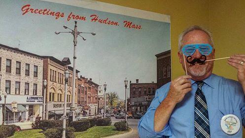
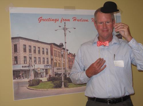
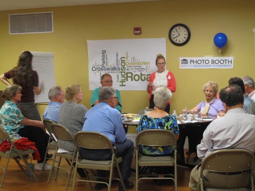
1 MAIN STREET ROTARY HUDSON, MA PUBLIC FEEDBACK SUMMARY First Public Meeting September 7, :30pm Registration - 7:00-8:30pm Event The First Public Meeting for the redesign of the Main Street Rotary was held on Wednesday, September 7 th, 2016, from 7:00 8:00pm at the Hudson Senior Center (29 Church Street) Lower Level Meeting Room. Publicity for the event included mailings, s, flyers, posters at downtown shops, word-of-mouth and social media postings on both Facebook and Instagram. The event was well attended with a final head count of 36 participants. State Representative, Kate Hogan, and Planning Director, Jack Hunter, were there to help kick off the forum. Throughout the event, public input was solicited through various activities engaging participants to share their views on what should and shouldn t be included in the redesign of the Main Street Rotary. Meeting Procedure Registration was held prior to the beginning of the meeting, kicking off the process of promoting attendees in sharing their thoughts and visions for Downtown Hudson. Attendees were encouraged to take photos in front of a Hudson themed photobooths and later share them on social media. At signing in, each participant was given two items to fill in. An index card was used to ask a participant to Use one word to describe Downtown Hudson. From the single word responses, a word cloud generated from the provided text, or a wordle, was produced recording the collective snapshot of shared opinions about Downtown Hudson. Below is the wordle generated from this exercise:
2 A half sheet of paper allowed participants to complete the sentence by responding to the following: Redesigning the Main Street Rotary is an opportunity to.... Once filled in, participants posted their response by placing them on a sticky wall for others to read. Provided below are the combined comments from general discussion at the public meeting from the sticky note exercise. Though some comments apply to more than one category, we have attempted to group them in their most logical fit. Materials and Markings - Write Route Number on pavement to help flow of traffic - Make direction/yielding more clear - Huge sign on 62 East saying Rotary Yield - Clear bypass lanes - Well marked in bold colors for pedestrians and cars - Cobblestone Rotary - Cobblestone rotary to slow people down - Connect it thematically at Washington St. roundabout Placemaking Placemaking - Gateway - Create memorable place at a defining element (sculpture?) - Create something permanent/historic - Recreate gateway to town center - Create a focal point that is appealing and welcoming to visitors, residents and business owners - Create an inviting and exciting gateway to Hudson - Welcome visitors to our town - Extend connection to downtown - Compliment downtown revitalization Placemaking - Attraction - Attract people to downtown - Make Hudson a destination - Create a good reputation for Hudson - Beautify the downtown area - Preserve the historical central part of Hudson - Improve downtown appearance - Showcase local talent or history - Display public art and attractive landscaping - Attractive - Preserve history and make clean and acceptable Placemaking - Seating - Places to stop and hang out (benches) - More benches to encourage people to sit and relax. - Expand areas for gathering and place to sit and enjoy town center
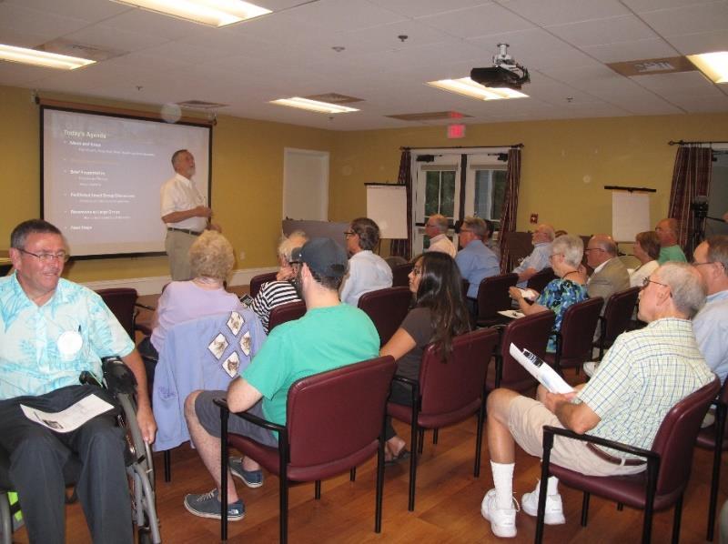
3 Placemaking - Landscaping - Replace trees - I miss the large evergreen trees would like to see more interest as far as seasonal flowers - Display public art and attractive landscaping - More trees/shade (nice to walk around, but gets really hot) Safety/Pedestrian Safety - Improve pedestrian safety (especially by Victors diner) - Improve safety - Provide a safer driving experience - Improve visibility - Improve safety for pedestrians - Better highlighting of pedestrian cross walks - Improve pedestrian crossing - More pedestrian friendly (cars never see you behind the parked cars) - Eye sight to see pedestrians from all cars low flowers, nothing else - It should not be high which could impede sight. Should be simple to avoid diverting attention of drivers. Traffic - Change the traffic flow for the better - Prevent future bottlenecks - Improve traffic flow - Perhaps recognize that the traffic flow is handles optimally with the present rotary configuration - Eliminate the bottleneck coming down Central Street - Improve traffic flow downtown - Speed up flow (less shopping faster vehicles) using 80 diameter and cut all shrubs much lower to be the center of a vibrant community - Any way to decrease traffic, down Main St and 62 (rush hour)? - Make traffic/merging obvious when coming east on Coolidge and exiting onto Washington - Slow the traffic coming into rotary Jack Hunter, Town of Hudson, opened the meeting by recognizing elected officials and providing an overview of how this project was initiated and what the Town expected to achieve though this planning and design process. Jef Fasser and Ale Echandi, BSC Group, then provided an overview of the work completed to date, public input received to date, and how the planning and design process would evolve into a Phase 1 construction project for the Spring of An emphasis was placed on the variety of initiatives that have and will take place to solicit public input and how this valuable public input would inform the final implemented design. Daphne Politis then described how the larger group would be divided into smaller discussion groups to give everyone an opportunity to provide input at this Public Workshop During. Each small discussion group was asked to provide comments prompted by three questions, and concluding the small group discussions, members were asked to indicate comments and issues most important to
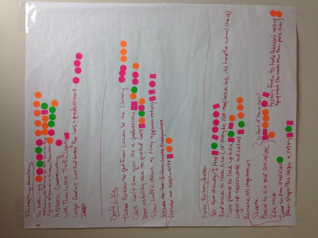
4 them using a stick dot prioritization approach, participants could up to three dots on an issue, or spread them among multiple comments/issues. 1. What are your favorite things about the rotary? (things you would want to make sure are preserved in the future). Prioritize the responses. Group ONE: - Do not make rotary smaller at least the same size or larger 6 dots - Keeping the Rotary as a gateway into Hudson 3 dots - Maintaining green in the rotary 2 dots - Maintain traditional appearance (trees, low shrubs) 1 dot - Keep the Rotary design simple 1 dot - Hudson Clock is iconic (possible relocating outside of Rotary) - Not obstructing building facades Group TWO: - No traffic lights 11 dots - Efficiency/at off times you don t have to make a full stop 5 dots - Symbol of downtown Hudson (Focal Point) 6 dots - Efficiency/at off times you don t have to make a full stop 5 dots - Larger radius worked better for cars and pedestrians 4 dots - Historic Gateway 1 dot - Wish there were traffic lights 1 dot Group THREE: - Functional 8 dots - No traffic light 6 dots Creates character 6 dots - Life to Main St. businesses 6 dots - Creates traffic 4 dots - Greenway 4 dots - Visibility 3 dots - Increases traffic flow 3 dots - New England feel 3 dots - Holiday decorations 2 dots - Seasonality 1 dot - Opportunity to see the downtown 2. What are your least favorite things about the rotary? (things that should be changed in the future). Prioritize the responses. Group ONE: - Lack of markings for approach to rotary and into downtown 4 dots - Pedestrian and bike lanes are lacking in downtown area 3 dots - Washington St crosswalk is difficult limited line of sight for cars from Main 3 dots - Too much pavement 2 dots - Too much signage 1 dot
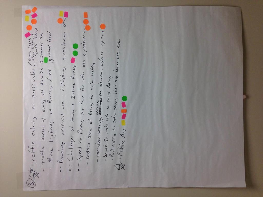
5 - Lacks trees 1 dot - No clear marking for the number of lanes - Highlight historic building facades not the views of gas stations Group TWO: - Cars can see you as a pedestrian 7 dots - Takes forever to get from Lincoln St to Library 6 dots - Poor visibility due to parked cars 5 dots - Slow traffic down as they approach rotary 4 dots - Shrubs at crosswalks 3 dots Group THREE: - Rules of rotary is not clear 6 dots - Lack of signs - 6 dots - Lack of road markings 6 dots - Poor pedestrian crossings 5 dots - Speeding 4 dots - Lacks greenway 4 dots - Traffic 4 dots - Backed up 3 dots - Aesthetics 2 dots - Boring all about traffic 2 dots - Doesn t incorporate side st./front 2 dots - Inadequate safe/parking 2 dots - Visibility pedestrian/parking/car 1 dot - No visibility for pedestrian 1 dot - Yield/Right of Way question 3. Combination question 3 and 4: What would make the rotary better? (e.g. safer, more attractive, more Hudson, more interesting)/ If you would do one thing to improve the rotary, what would it be? Prioritize the responses. Group ONE: - Traffic calming at crosswalks (cones, signage, lighting, rumble strips) - 7 dots - Public art 5 dots - Specific roadway material use (ie bricks) to highlight different circulation use 3 dots - Challenges of having a 2-lane rotary 3 dots - Speed at Rotary is too fast for other cars and pedestrians 3 dots - More lighting at Rotary specifically at the ground level/within the road - 1 dot - Outdoor seating, activate the downtown with new space 1 dot - South street make left to avoid rotary - Pull traffic to other streets that are lower have less congestion - Reduce size of rotary to calm traffic Group TWO: - Remove vegetation, Shade, Place to sit/socialize, Bike racks (in front of town hall) 8 dots - 80 foot diameter/1 lane 7 dots
6 - Light up cross walk indicators 5 dots - More places to lock up bike - 4 dots - Other shape? No longer a rotary 3 dots - Privacy fence to hide Robinson s rental equipment (to make view from park nicer) 2 dots - Good to see trashcans 1 dot - Red brick to look nice (or maybe not real brick b/c it s hard for wheel chairs) Group THREE: - Parking 9 dots - Mark traffic lanes 7 dots - take over McDonalds for parking 6 dots - Increase trees/evergreen 5 dots - Benches along street 4 dots - Sidewalk bump out/rail trail/increase green space/decrease speed 4 dots - fountain 3 dots - flowers 3 dots - Welcome to Sign 2 dots - Traffic light Lincoln St. 2 dots - Beautify and islands 2 dots - Consistency with other rotary in Hudson (near tux store) 2 dots - No crosswalks at rotary 1 dot - Increase green space - More crosswalks - Bicycle friendly - Low profile/backlights/tie in Highland rotary When asked to identify their favorite things about the rotary, participants placed a high value on the rotaries efficiency and function. Physical features that the public wanted to see preserved in the redesign included maintaining or even expanding the rotary radius, and not incorporating traffic lights at the rotary. Collective least favorite features of the rotary included lack of markings and signage when approaching. Another feature identified to be changed in the future was improving crosswalks, particularly at Washington St, where line of sight is limited for both cars and pedestrians. Incorporating traffic calming strategies at crosswalks and establishing places to sit and socializing are features that most participants see contributing to improving the rotary. Other well received ideas shared at the forum, included establishing an 80 diameter for the rotary and clarifying lane markings. Media Coverage: The entire meeting was filmed by HudTV, Hudson s local public access studio. A link to the video exists here:

7 Event Photos:
8 Sign In Sheet:
9

10 Small Group Discussion Notes:
11
12
13
HUDSON, MA PUBLIC FEEDBACK SUMMARY Second Public Meeting October 26, :30pm Welcome and Rotary Trivia - 7:00-8:30pm Event
 MAIN STREET ROTARY HUDSON, MA PUBLIC FEEDBACK SUMMARY Second Public Meeting October 26, 2016-6:30pm Welcome and Rotary Trivia - 7:00-8:30pm Event The Second Public Meeting for the redesign of the Main
Tonight is for you. Learn everything you can. Share all your ideas.
 Strathcona Neighbourhood Renewal Draft Concept Design Tonight is for you. Learn everything you can. Share all your ideas. What is Neighbourhood Renewal? Creating a design with you for your neighbourhood.
CLOSED. Highlights of the Final Concept Design:
 The final Concept Design is the result of many months of listening, learning, creating, balancing, and understanding different needs and viewpoints, as well as incorporating technical requirements and
Victoria Park Master Plan
 Victoria Park Master Plan Phase I Presented By: ARCHITECTURAL ALLIANCE & HUGHES HUGHES INC. History of Victoria Park Phase I Purpose Inventory of Existing Conditions Identification of Options by Type (for
50 Avenue S.W. Corridor Study Glenmore Aquatic Centre Drop-In Event
 Project overview The City of Calgary is conducting a transportation corridor study of 5 Avenue S.W., between Crowchild Trail and 4A Street S.W. In 29, it was reclassified as a Parkway under the Calgary
Observations and Ideas: Toomer s Corner Streetscape Improvements
 Observations and Ideas: Toomer s Corner Streetscape Improvements AUBURN DOWNTOWN MASTER PLAN planning downtown s future August 26, 2013 Observations: Vertical Clutter at Corners 6 3 7 5 9 2 8 4 1 Excess
WELCOME. Purpose of the Open House. Update you on the project. Present a draft recommended plan. Receive your input
 WELCOME Purpose of the Open House The Town of Smiths Falls has initiated the Beckwith Street Redevelopment Plan that includes the preparation of a streetscape functional design for the renewal of Beckwith
FOCUS AREA 1 - Alberta Avenue Pocket Park 3 (121 Ave and 92 St)
") FOCUS AREA 1 - Alberta Avenue Pocket Park 3 (121 Ave and 92 St) New benches Plant evergreen trees Widen existing sidewalk from 1.5m to 1.8m Marked crosswalk 1.8m wide sidewalk Add pedestrian oriented lights
FOCUS AREA 1 - Alberta Avenue Pocket Park 3 (121 Ave and 92 St) New benches Plant evergreen trees Widen existing sidewalk from 1.5m to 1.8m Marked crosswalk 1.8m wide sidewalk Add pedestrian oriented lights
Please leave more comments below! (Or refer to numbered comments on your own comment sheet/form if you need more space)
") 1. Public washrooms and drinking fountains 2. Public washrooms could be beside the library? 3. Design Library grounds to be a more social space 4. Clear post divisions for RV parking Please leave more
1. Public washrooms and drinking fountains 2. Public washrooms could be beside the library? 3. Design Library grounds to be a more social space 4. Clear post divisions for RV parking Please leave more
CHAPTER 3: Vision Statement and Goals
 Davidson Walks & Rolls: Active Transportation Master Plan CHAPTER 3 Contents: Overview Vision Statement Measurable Goals Public Outreach CHAPTER 3: Vision Statement and Goals Overview The vision statement
ALBERTA AVENUE WHAT WE HEARD REPORT BUILDING GREAT NEIGHBOURHOODS
 ALBERTA AVENUE WHAT WE HEARD REPORT BUILDING GREAT NEIGHBOURHOODS FEBRUARY 2019 EXECUTIVE SUMMARY Starting in 2019, Alberta Avenue will see the replacement and enhancement of its aging collector and local
Introduction. North 12 th Complete Street Project Overview
 Introduction On Wednesday, March 1, 2017, the City of Sacramento, in partnership with Sacramento Regional Transit District and the Sacramento Housing and Redevelopment Agency, hosted a community outreach
Reconnecting Communities ACTION PLAN FOR LOGAN CIRCLE
 Reconnecting Communities ACTION PLAN FOR LOGAN CIRCLE Project for Public Spaces, Inc. May 2003 Reconnecting Communities ACTION PLAN FOR LOGAN CIRCLE VINE STREET EXPRESSWAY, PHILADELPHIA, PA Prepared by:
Vision: Traditional hamlet with an attractive business/pedestrian friendly main street connected to adjacent walkable neighborhoods
 N D. Focus Area II Vision: Traditional hamlet with an attractive business/pedestrian friendly main street connected to adjacent walkable neighborhoods Transit Road Focus Area II is located in the Hamlet
MARTIN LUTHER KING JR. WAY
 OCTOBER 2011 40 Vision and Goals The Martin Luther King, Jr. Way Illustrative Master Plan that follows has been developed through a process of community involvement. It expresses a long term vision for
A CHANGING CITY. of Edmonton, it is essential that it reflects the long-term vision of the City.
 A CHANGING CITY By the year 2040, Edmonton will be home to more than 1 million people. To accommodate growth and support a healthy and compact city, we need a new approach to development/redevelopment
Preliminary PUBLIC ENGAGEMENT CHANNELSIDE DRIVE 17-D JULY 16, 2018 (DRAFT)
") Preliminary PUBLIC ENGAGEMENT CHANNELSIDE DRIVE 17-D-00019 JULY 16, 2018 (DRAFT) CHANNELSIDE DRIVE DESIGN PROJECT (17-D-00019) PUBLIC ENGAGEMENT SUMMARY [This page intentionally left blank.] CHANNELSIDE
Preliminary PUBLIC ENGAGEMENT CHANNELSIDE DRIVE 17-D-00019 JULY 16, 2018 (DRAFT) CHANNELSIDE DRIVE DESIGN PROJECT (17-D-00019) PUBLIC ENGAGEMENT SUMMARY [This page intentionally left blank.] CHANNELSIDE
MEDIAN DESIGN example median A
 MEDIAN DESIGN example median A MLK Blvd Design Workshop #3 September 21, 2010 Participants voted on each idea, gave comments about specific ideas or general comments about all ideas. Comments and suggestions
Monroe Street Reconstruction Business Focus Group Notes July 18, 2016, HotelRED
 Monroe Street Reconstruction Business Focus Group Notes July 18, 2016, HotelRED Total participants: 31 Focus Group Conversation #1: During this exercise, participants talked in small table groups in response
Raymond Avenue: Rightsizing Improved Safety and Pedestrian Experience
 Page 1 of 5 Work With Us Free Newsletter Stay Connected Home About Services Training Projects Placemaking Blog Resources Reference Store Great Public Spaces Image Collection Raymond Avenue: Rightsizing
Appendix C. TRAFFIC CALMING PROGRAM TOOLBOX
 Appendix C. TRAFFIC CALMING PROGRAM TOOLBOX PHASE I...2 Do Not Enter Sign...3 One-Way Sign...4 Turn Prohibition...5 Pavement Markings...6 Speed Monitoring Trailer...7 Neighborhood Speed Watch...8 Police
THE ALAMEDA CONCEPT DESIGN COMMUNITY MEETING 3. A Plan for The Beautiful Way JANUARY 28, 2010
 CONCEPT DESIGN COMMUNITY MEETING 3 JANUARY 28, 2010 AGENDA INTRODUCTION COMMUNITY INPUT ROADWAY STUDIES STREETSCAPE DESIGN STATIONS DISCUSSION SUMMARY AND DISCUSSION NEXT STEPS CLOSE INTRODUCTION SCHEDULE
Neil Street Plaza Placemaking Plan
 Neil Street Plaza Placemaking Plan MARSHALL ST. SITE ORIENTATION VINE ST. COLUMBIA AVE. NEIL ST. HICKORY ST. WALNUT ST. MARKET ST. WASHINGTON ST. STATE ST. HILL ST. CHURCH ST. RANDOLPH ST. PLAZA SITE WALNUT
CLOSED. The draft concept design has been broken down into 5 categories for the purpose of this survey:
 Old Strathcona s neighbourhood renewal process is now at the draft concept design phase. Over the last several months, the city has been gathering local knowledge and resident input that has been used
Austin Avenue Bridges Project. Public Meeting Summary
 Austin Avenue Bridges Project Public Meeting Summary June 29, 2016 Red Table Safety and Connectivity Notes: 1. Would like to see forensic report evaluations 2. What is the lifespan? 3. Extend safety considerations
Open House Summary INTRODUCTION COMMUNITY COMMENTS
 Open House Summary INTRODUCTION On October 1, 2013, the City of Sonora held a Community Open House to share the draft Vision Sonora Plan with the community and seek input on the components of the draft
Community Workshop #1 Summary October 2017
 Community Workshop #1 Summary October 2017 1 Background Pleasure Point has a unique character and strong community identity. In 2008, the community and the County developed the Pleasure Point Community
DATE: June 22, General Release SUBMITTED BY: LAND DEVELOPMENT SERVICES. RE: City Centre Survey Results
 DATE: June 22, 2018 TO: General Release SUBMITTED BY: LAND DEVELOPMENT SERVICES RE: City Centre Survey Results The following is a summary of preliminary findings for the Community Identity and Vision survey.
Design Guidelines. Overview. Design Vision for Yellow Brick Road
 Design Guidelines Overview This section presents the design vision for the Yellow Brick Road network. The Yellow Brick Road is envisioned to be an interconnected network of safe and secure roadways where
WORKSHOP 2 SUMMARY OVERVIEW GENERAL COMMENTS. Walking and Biking. Greening & Stormwater. Transportation & Parking. Lighting, Art and Identity
 WORKSHOP 2 SUMMARY OVERVIEW On May 9, 2016, 55 people came to the second public meeting for the Lower Haight Public Realm Plan. Roughly 34 of attendees were neighborhood residents. The open house was a
Intersection Improvement: Sturgeon Road, Silver Avenue and Murray Park Road Roundabout. Welcome. Public Information Session
 Intersection Improvement: 1 Welcome WHY IS AN INTERSECTION IMPROVEMENT NEEDED? 2 Traffic volumes for Sturgeon Road, Silver Avenue and Murray Park Road exceed the capacity of the existing 4-way stop controlled
Merrick and Memorial Neighborhood Study 5/14/2014 Public Meeting
 Merrick and Memorial Neighborhood Study 5/14/2014 Public Meeting Study Area April 9 Public Meeting Comments Summary Pedestrian Safety - A Walking Neighborhood Pedestrian traffic is very difficult A need
UPTOWN REGIONAL BIKE CORRIDORS PROJECT SAN DIEGO ASSOCIATION OF GOVERNMENTS
 UPTOWN REGIONAL BIKE CORRIDORS PROJECT SAN DIEGO ASSOCIATION OF GOVERNMENTS SUMMARY REPORT: COMMUNITY UPDATE MEETING February 6, 2014 6 8:30 p.m. Roosevelt Middle School Library 3366 Park Blvd, San Diego
A Plan for The Beautiful Way NOVEMBER 16, 2009
 COMMUNITY VISION WORKSHOP NOVEMBER 16, 2009 AGENDA INTRODUCTION COMMUNITY INPUT REVIEW AND SURVEY RESULTS VISIONING IMAGERY SMALL GROUP VISIONING SESSION NEXT STEPS CLOSE SCHEDULE COMMUNITY SURVEY 198
Streetscape: Core Shopping District
 Streetscape: Core Shopping District DRAFT DRAFT DRAFT May 00 Core Shopping District: Phase Blue Island s Core Shopping District is located along Western Avenue, between Grove and Union Streets. Streetscape
ACTIVE TRANSPORTATION Active Community Checklist
 ACTIVE TRANSPORTATION Active Community Checklist Safe, accessible spaces to walk, hike, bike and play is an important part of building strong, healthy and active communities for residents and visitors.
Hamilton Transportation Master Plan Public Consultation. Public Information Centre One Summary
 Hamilton Transportation Master Plan Public Consultation Public Information Centre One Summary Table of Contents Introduction 1 Purpose 2 What Was Presented 2 Who Came to the Meeting 2 The Breakout Sessions
Executive Summary Route 30 Corridor Master Plan
 Route Corridor Master Plan Project Overview The Route Corridor Master Plan is a coordinated multimodal transportation and land use plan for the entire stretch of Route through East Whiteland Township,
City of Darlington Beautification Report
 City of Darlington Beautification Report Approved by the City of Darlington Beautification Board February 2016 The New Downtown Darlington has seen many changes during the past decade with the rehabilitation
Bicycle and Pedestrian Advisory Committee (BPAC) November 21, 2013
 November 21, 2013") Bicycle and Pedestrian Advisory Committee (BPAC) November 21, 2013 OVERALL LAND USE CONCEPT Overall Broadway Valdez District: 95.5 acres (35.1 acres right-of ways + 60.4 acres developable land) Plan Subareas:
Bicycle and Pedestrian Advisory Committee (BPAC) November 21, 2013 OVERALL LAND USE CONCEPT Overall Broadway Valdez District: 95.5 acres (35.1 acres right-of ways + 60.4 acres developable land) Plan Subareas:
Obey Creek PEDESTRIAN CIRCULATION EAST WEST PARTNERS PEDESTRIAN CIRCULATION CREEK SIDE LANE SLIP STREET SCOTT MURRAY MAIN STREETS EAST/WEST
 THE VILLAGE AT PEDESTRIAN CIRCULATION MAIN STREETS NORTH/SOUTH MAIN STREETS EAST/WEST SLIP STREET CREEK SIDE LANE PEDESTRIAN CIRCULATION DESCRIPTION: Circulation through the downtown of is organized by
2014/2015 BIKE ROUTE PLAN 83 AVENUE PROTECTED BIKE LANE
 About the Project 2014/2015 BIKE ROUTE PLAN The City of Edmonton is planning a major bike route on the south side of Edmonton. This bike route is one part of a plan to provide citizens with transportation
Transportation Assessment
 Transportation Assessment Midtown Open House February 10, 2018 Overview Midtown in Focus Overview & Purpose of Today Transportation Assessment overview Summary of Transportation work to date Review & Analysis
Complete Streets. Designing Streets for Everyone. Sarnia
 Complete Streets Designing Streets for Everyone Sarnia Complete Streets ~ Sarnia ~ 2018 Introduction Our City is made up of a network of streets that we use to go for a walk, cycle to work, drive to the
City of Ann Arbor Pedestrian Safety & Access Task Force
 City of Ann Arbor Pedestrian Safety & Access Task Force (PSATF) Community Wide Meeting Wednesday, July 8th 6:30 to 8:30 PM Multi purpose Room, Downtown Library www.a2gov.org/pedsafety The Greenway Collaborative,
COMPLETE STREETS PLANNER S PORTFOLIO
 COMPLETE STREETS PLANNER S PORTFOLIO ISSUE 3 APRIL 2016 PLANNER S PORTFOLIO COMPLETE STREETS 1 2 6 10 14 OVERVIEW MATURE NEIGHBORHOODS GROWING SUBURBS CENTRAL PLACES ACTIVITY CORRIDORS Planner s Portfolio
Franklin Parking Analysis
 Franklin Parking Analysis Report Prepared for: The Town of Franklin, North Carolina Report prepared by: 525 N. Main Street Waynesville, NC 28786 Town of Franklin Parking Study J.M. Teague Engineering 1
AGENDA REPORT. Issue: Discussion of potential improvements on Barnwell Road at Niblick Drive
 AGENDA REPORT To: From: By: Honorable Mayor and City Council Members Warren Hutmacher, City Manager Tom Black, Public Works Director Date: March 23, 2016 Agenda: March 28, 2016 WORK SESSION AGENDA: Barnwell
Introduction. Who is WILMAPCO. Why are walkable communities important
 Walkable Community Workshops Round 1 April 2005 SPONSORED BY WILMAPCO AND CCOBH CITY OF NEW CASTLE EDGEMOOR GARDENS CIVIC ASSOCIATION WITH FUNDING BY DELAWARE DEPARTMENT OF TRANSPORTATION AND THE DELAWARE
EXECUTIVE SUMMARY. Vision
 Vision Walking and bicycling in Salt Lake City will be safe, convenient, comfortable, and viable transportation options that connect people to places, foster recreational and economic development opportunities,
BETHEL ROAD AND SEDGWICK ROAD CORRIDOR STUDY
 DRAFT PLAN City Council Meeting August 14, 2017 STUDY AREA Sedgwick Corridor State Route 160, principal arterial with Class 3 access management designation, commuter and freight route, connection to SR
City of Novi Non-Motorized Master Plan 2011 Executive Summary
 City of Novi Non-Motorized Master Plan 2011 Executive Summary Prepared by: February 28, 2011 Why Plan? Encouraging healthy, active lifestyles through pathway and sidewalk connectivity has been a focus
Display Boards Including Five Refined Design Concepts
 APPENDIX D Workshop Session 3 Sign-in sheets Agenda Booklet Display Boards Including Five Refined Design Concepts PowerPoint Presentation Questions Recorded Discussion of Preference Exercise AGENDA
CONNECTING PEOPLE TO PLACES
 CONNECTING PEOPLE TO PLACES 82 EAST BENCH MASTER PLAN 07 Introduction The East Bench transportation system is a collection of slow moving, treelined residential streets and major arteries that are the
Town of Ashland. Downtown Planning Initiative 2 nd Community Workshop. March 29, Presented by:
 Town of Ashland Downtown Planning Initiative 2 nd Community Workshop Presented by: March 29, 2018 Agenda Tonight Review project & goals Recap 1st workshop (September 18, 2017) Present design alternatives
TRAVEL PLAN: CENTRAL EUROPEAN UNIVERSITY CAMPUS REDEVELOPMENT PROJECT TRAVEL PLAN. Central European University Campus Redevelopment Project.
 TRAVEL PLAN Central European University Campus Redevelopment Project Page 1 Table of Contents Introduction... 3 Background... 7 Building Users... 7 Transportation in Community Consultation... 7 Summary
FONTAINE AVENUE STUDY Final Report
 FONTAINE AVENUE STUDY Final Report March 28, 2005 FONTAINE AVENUE STUDY City of Charlottesville March 28, 2005 Renaissance Planning Group Kenneth Schwartz, FAIA, AICP Director of Design Leigh Wilkerson,
GLEN EIRA CITY COUNCIL. MURRUMBEENA Transforming our neighbourhood together our concepts based on your ideas
 GLEN EIRA CITY COUNCIL MURRUMBEENA Transforming our neighbourhood together our concepts based on your ideas 1 WHAT HAVE WE HEARD? WHAT NOW? Stage one Tell us what you love about your shopping strip November
APPENDIX A. Outreach Summary
 APPENDIX A Outreach Summary COUNTYWIDE TRANSPORTATION PLAN Summary of Public Outreach and Engagement To gather an understanding of the transportation issues and priorities throughout the county, and inform
Mainstreet Master Plan Land Use
 Mainstreet Master Plan 04 Land Use Top Recommendations Active Uses: Promote active ground-floor uses such as retail, restaurants, galleries and personal services with interactive storefronts for Mainstreet
City of Davis East Covell Corridor Plan
 Community Open House #2 January 22, 2014 6:00 8:00 p.m. Veterans Memorial Center, Club Room City of Davis Introduction The (ECCP) is a taking a comprehensive look at the existing transportation systems
WHITE STREET/ ENGLISH PLAZA STREETSCAPE IMPROVEMENT PROJECT
 WHITE STREET/ ENGLISH PLAZA STREETSCAPE IMPROVEMENT PROJECT 1 Project Goals 1 Improved Safety: Lighting, Multi-Modal Circulation, Emergency Access, Tripping Hazards; Stormwater 4 Environmental Performance:
State Street Workshop Summary September 26, 2012 SITE A. - INTERSECTION OF STATE AND HOLLY TOTAL ATTENDEES = ~29
 State Street Workshop Summary September 26, 2012 TOTAL ATTENDEES = ~29 SITE A. - INTERSECTION OF STATE AND HOLLY What do you like best about this place? YMCA building / facade Crosswalk design Landscaping
Agenda. Overview PRINCE GEORGE S PLAZA METRO AREA PEDESTRIAN PLAN
 PRINCE GEORGE S PLAZA METRO AREA PEDESTRIAN PLAN May 28, 2008 Agenda Welcome and introductions Project overview and issue identification Planning context and strengths Design challenges and initial recommendations
ROUTE 81 CORRIDOR STUDY DESIGN CONCEPTS
 RT 81 Corridor Study CLINTON ROUTE 81 CORRIDOR STUDY DESIGN CONCEPTS View north on High Street, with potential improvements to the streetscape Draft Recommendations November 8 th, 2018 TOWN OF CLINTON
The Wiggle Route in Context
 The Wiggle Route in Context In a city of hills, the Wiggle is an important route because it winds its way along the flattest streets from Market to the Panhandle, bringing residents to local parks and
Byron Avenue. Public Meeting. Thursday June 16, Traffic Calming Design Sherbourne Road to Island Park Drive
 Byron Avenue Traffic Calming Design Sherbourne Road to Island Park Drive Public Meeting Thursday June 16, 2016 Our Lady of Fatima Parish 153 Woodroffe Avenue 6 9pm 1 Project Summary Area Projects Background
The Leadville Bikeway Design Recommendations DRAFT January 2018
 The Leadville Bikeway Design Recommendations DRAFT January 2018 Overview The Leadville Bikeway project aims to create a bikeway that is compatible with and adds value to the neighborhood and surrounding
West Capitol Avenue Road Rehabilitation and Safety Enhancement Project
 West Capitol Avenue Road Rehabilitation and Safety Enhancement Project Stakeholder Focus Group Meeting #2 Tuesday, August 28, 2018 7:00 8:00 a.m. West Sacramento City Hall 1110 West Capitol Avenue, West
Point Defiance Park. Master Plan
 Point Defiance Park Master Plan Public Participation 1/29, 2/26, 3/26 & 4/23 Owen Beach Ferry Zoo Fort Nisqually Mildred Street Pearl Street Triangle Hare & Hare Master Plan - 1911 2008 Concept Plan Comments
Speed Limits Study and Proposal. Public Input Session: 8/14/13
 Speed Limits Study and Proposal Public Input Session: 8/14/13 Why is Decatur a unique place for this project? First Community Transportation Plan in the nation with a Health Impact Assessment. Strong sense
WalkShop. Highland Creek Village
 On June 5, 2014, 15 people participated in a for the Transportation Master Plan. The purpose of the was to receive feedback from a diverse range of local stakeholders and document existing transportation
STONY PLAIN ROAD STREETSCAPE
 Jasper Place Revitalization Strategy: Vision The people involved in the Jasper Place Revitalization Strategy envision: Goal 1: Feeling safe in our community Create a community where feeling safe is common--where
Cross Street Corridor Non-Motorized Enhancement Project Project Description
 Cross Street Corridor Non-Motorized Enhancement Project Project Description A cooperative study of the Cross Street neighborhood was completed in May 2002 by the City of Ypsilanti, the Depot Town Downtown
Hennepin County Bicycle and Pedestrian Planning
 Hennepin County Bicycle and Pedestrian Planning 1 Value of bicycle and sidewalk systems Safety Livability Mobility Health Personal Finances Economic Sustainability Clean Air Recreation Parking and congestion
Southview Blvd & 3 rd Avenue Improvement Project. Public Open House December 4, to 7pm
 Southview Blvd & 3 rd Avenue Improvement Project Public Open House December 4, 2014 5 to 7pm Southview Blvd & 3 rd Avenue Public Information Meeting Agenda Presentation 5:30 to 6:15 pm Purpose of Project
Lincoln Highway Streetscape Plan Concept Plan
 Lincoln Highway Streetscape Plan Concept Plan November 14, 2014 Introduction This report provides a summary of conceptual transportation, land use, and design recommendations in the Lincoln Highway Streetscape
2014/2015 BIKE ROUTE PLAN 83 AVENUE PROTECTED BIKE LANE
 About the Project The City of Edmonton is planning a major bike route on the southside of Edmonton. The Strathcona Bike Route will connect the communities of Strathcona, Garneau and the University area,
PEDESTRIAN ACTION PLAN
 ATTACHMENT 2 CITY OF SANTA MONICA PEDESTRIAN ACTION PLAN CITY OF SANTA MONICA PEDESTRIAN ACTION PLAN This page intentionally left blank EXECUTIVE SUMMARY CHAPTER 1 EXECUTIVE SUMMARY Setting the Stage
Comments The Plan for Port Whitby
 Comments The Plan for Port Whitby April 24th, 2013 Community Meeting #2 Summary Report Prepared by GLPi April 29th, 2013 1 Introduction The purpose of the Port Whitby Secondary Plan Update, Community Improvement
Pennsylvania Avenue (CR 484) Design Alternatives Study
 Design Alternatives Study") MEMORANDUM Pennsylvania Avenue (CR 484) Design Alternatives Study Prepared for: APRIL 2016 Prepared By TABLE OF CONTENTS Project Background... 2 Previous Concept... 2 Existing Conditions... 4 New Alternatives...
MEMORANDUM Pennsylvania Avenue (CR 484) Design Alternatives Study Prepared for: APRIL 2016 Prepared By TABLE OF CONTENTS Project Background... 2 Previous Concept... 2 Existing Conditions... 4 New Alternatives...
Table #6 VISION CHARACTERISTICS
 Table #6 VISION White Flint is a place to live, work, play, shop, and walk with sufficient density to encourage quality redevelopment. Vibrant streets and consistent streetscapes are important. CHARACTERISTICS
$ 12" $#&%$ 86.) *1! *1 /3 )00, , (1* Neighborhood Traffic Calming Part 3 Solutions Bradley William Yarger, P.E.
 *1! *1 /3 )00, , (1* Neighborhood Traffic Calming Part 3 Solutions Bradley William Yarger, P.E.") $ 12" $#&%$ 86.)3+5+2 714 *1! *1 /3 )00,12 3.+ -0127 1, (1* Neighborhood Traffic Calming Part 3 Solutions by Bradley William Yarger, P.E. It is extremely tempting to jump to this step of the process thinking
$ 12" $#&%$ 86.)3+5+2 714 *1! *1 /3 )00,12 3.+ -0127 1, (1* Neighborhood Traffic Calming Part 3 Solutions by Bradley William Yarger, P.E. It is extremely tempting to jump to this step of the process thinking
CASE STUDY WALKABLE WASHINGTON WHO WE ARE & WHAT WE DO CITY OF BOTHELL DOWNTOWN REVITALIZATION PLAN BOTHELL, WA
 LKABLE SHNGTON Transformation towards walkability is taking place all over the state of Washington. From urban, suburban and small town initiatives, the program showcases the effects of a renewed focus
Transforming the. Michigan Avenue Corridor. a complete streets and transit-oriented development study Michigan State University Student Research Team
 Transforming the Michigan Avenue Corridor a complete streets and transit-oriented development study Michigan State University Student Research Team Dominic Adams Annie Fardell Jon Roberts Jeff Stivenson
AGENDA ITEM SUMMARY SPECIAL AGENDA ITEM NO. _1A_
 AGENDA ITEM SUMMARY AGENCY: City Council MEETING DATE: June 25, 2012 DEPARTMENT: Community Dev PREPARED BY: T Spade DEPT. DIR. APPROVAL: MJ CITY MGR. APPROVAL: LR PRESENTED BY: T Spade TITLE: RECEIVE REPORT
CONNECTIVITY PLAN. Adopted December 5, 2017 City of Virginia Beach
 CONNECTIVITY PLAN Adopted December 5, 2017 City of Virginia Beach CONTENTS 1.0 Background & Purpose... 2 2.0 Existing Inventory & Analysis... 3 ViBe District Existing Walking Conditions... 4 3.0 ViBe District
Typical Cross Section: DOWNTOWN (Observer Highway - 8th Street)
") Typical Cross Section: DOWNTOWN (Observer Highway - 8th Street) DRAFT SEPTEMBER 23, 14 1 Washington Street Typical Block Downtown Typical Block: DOWNTOWN (Observer Highway - 8th Street) New crosswalks
Typical Cross Section: DOWNTOWN (Observer Highway - 8th Street) DRAFT SEPTEMBER 23, 14 1 Washington Street Typical Block Downtown Typical Block: DOWNTOWN (Observer Highway - 8th Street) New crosswalks
McLean Main Street Public Forum Follow-up
 McLean Main Street Public Forum Follow-up Sponsored & Hosted by John W. Foust, Dranesville District Supervisor McLean Planning Committee Fairfax County Office of Community Revitalization and Reinvestment
Ann Arbor Downtown Street Plan
 1 Ann Arbor Downtown Street Plan Public Workshop #1 We know that. 2 Public right-of-way (streets, sidewalks, and alleys) make up 30% of the total District area of downtown. Streets need to provide mobility
Section VIII Community Design
 Section VIII Community Design Overview Town and village centers are critically important to communities. They are the centers of commerce. They are the places where residents and visitors seek and receive
Bicycle Facilities Planning
 Bicycle Facilities Planning Overview Types of Cyclists Purpose for Riding Types of Facilities Bike Lanes Bicycle Boulevards Cycle Tracks Intersections Signals Signing and Marking Discussion Types of Bicyclists
Kennedy Plaza and Providence Downtown Transit Connector PUBLIC MEETING. Stakeholder Meeting #1 October 24, 2016
 Kennedy Plaza and Providence Downtown Transit Connector PUBLIC MEETING Stakeholder Meeting #1 October 24, 2016 May 2017 1 WHAT IS THE DTC? 1.5 mile corridor between Providence Station and the Hospital
DOWNTOWN TENINO. Goal: Get more People in Downtown. A Pamphlet of Concepts for
 A Pamphlet of Concepts for DOWNTOWN TENINO The Tenino Planning Commission believes that the highest potential for economic development and business development in the City of Tenino (in the short-term)
City of Sammamish. Welcome. Issaquah-Fall City Road Improvements Project Phase I Design: 242nd Avenue SE to Klahanie Drive SE
 Welcome Welcome to the third community meeting for the Issaquah-Fall City Road Improvements Project. AGENDA 6:00 p.m. Welcome and sign-in 6:10 p.m. Presentation 6:50 p.m. Open house Learn about the roadway
Summary of Comments Public Meeting: Marietta Street Resurfacing Project Atlanta Contemporary August 29, 2017 / 6:00 pm to 8:00 pm
 Renew Atlanta hosted a public meeting to discuss the Marietta Street Resurfacing project at. Councilmember Cleta Winslow attended the public meeting, where over seventy (70) citizens to include representatives
NUMBER PROJECT TITLE ESTIMATED COST
 NUMBER PROJECT TITLE ESTIMATED COST PROJECT CATEGORY DESCRIPTION TBD= To be determined 1 Art in Pedestrian Underpass $70,000 Culture and Recreation A public art mural in accordance with the Public Art
South Park Street Bicycle Lane Improvements. Public Engagement. November 2017
 South Park Street Bicycle Lane Improvements Public Engagement November 2017 South Park Street Bicycle Lane Improvements WHAT WE HEARD REPORT Introduction To improve safety and bicycle route continuity
Ocean Park Boulevard Green Street Project Alternatives & Trade Offs
 Planning Commission March 4, 2009 Ocean Park Boulevard Green Street Project Alternatives & Trade Offs Purpose of Tonight s Meeting Review concept plans and options Provide input on alternatives and trade-offs
Broad Street Bicycle Boulevard Design Guidelines
 Broad Street Bicycle Boulevard Design Guidelines Building from the strategies introduced in the 2013 Bicycle Transportation Plan and community input received thus far, City Transportation Staff have identified