STREETSCAPE / URBAN DESIGN ELEMENTS
|
|
|
- Andra Mathews
- 6 years ago
- Views:
Transcription


1 CITY OF CHEYENNE STREETSCAPE / URBAN DESIGN ELEMENTS DEFINITIONS
2 TABLE OF CONTENTS Introduction How To Use This Guide...1 Design Elements Sidewalks...2 Street Corners and Curb Extension...4 Trees and Landscape Strips...6 Planters Moveable...8 Raised Seating Trash / Ash Receptacles Public Art Screening Fences, Railings, and Walls Cafe Spaces 8-foot Sidewalk foot Sidewalk foot Sidewalk Special Event Spaces Alley and In-Fill Spaces Fixtures / Utility Zone Utilities Lighting Prepared by: Otak, Inc. 36 N. 4th Street Carbondale, CO 81623
3 1 INTRODUCTION PURPOSE This guide explains and illustrates general concepts for streetscaping and urban design in the City of Cheyenne. It is intended to provide guidance for the planning and design of projects on both public and private property. HOW TO USE THIS GUIDE At the top of each page, the PURPOSE At lower left, the list At the bottom right, directs the explains the basic functions of each minimum standards and requirements for reader to related pages and documents that streetscape/design element. each element. should be consulted during the design and permitting process. An illustration and/or photo example(s) of At the lower center, RULES FOR each design element is included. A photo SUCCESS provides tips and inspiration example page generally follows each design for designing an atttractive streetscape element page. project that adds life and utility to public spaces. ADA requirements are an essential design element for every project, and are always a consideration. This guide should be used with the Downtown Development Association Guidelines and the City of Cheyenne s Road, Street, and Site Design Standards. DOWNTOWN DEVELOPMENT ASSOCIATION STANDARDS; ROAD, STREET, AND SITE DESIGN STANDARDS SS


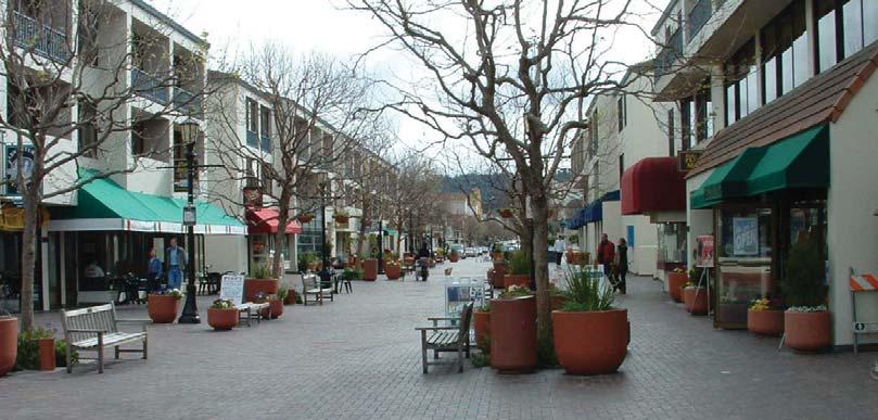
4 SIDEWALKS PURPOSE Sidewalks function as integral components of pedestrian-friendly street systems where pedestrians can experience safety, comfort, accessibility, and effi cient mobility. Sidewalks also function as outdoor rooms and gathering places, and help defi ne community character. Sidewalk Zone Street Sidewalk Zone Recommended minimum clear travel way on all sidewalks: 3.0 feet (required by the ADA for all accessible routes of travel.) However, this clearance is only suitable where pedestrian volumes are low. A 3-foot-wide area is typically insuffi cient for use by more than one person. Typical minimum width for downtown and high-volume pedestrian zones: 6.0 feet. Minimum height clearance for mounted traffi c signs and tree branches in pedestrian travel ways: 8.0 feet. Sidewalk and walkway materials must be slipresistant and easy to maintain (smooth for snow removal and resistant to buckling and cracking). Surfaces must be ADA-accessible. Locate obstacles such as signs, street furniture, and newspaper stands to the side of the travel way, in the fi xtures/utility zone. Special districts and downtown streets often incorporate special paving into the design of sidewalks and pedestrian areas, such as stamped or colored concrete, brick or other unit pavers. Special paving must be installed so the fi nished surface is smooth and level, and easily maintained. ALL OTHER ELEMENTS 2

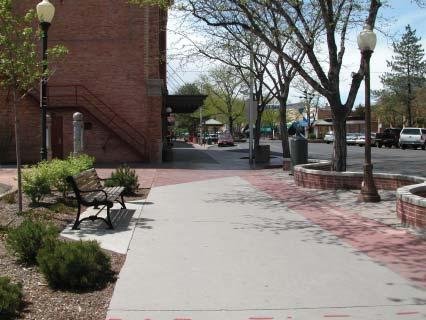
5 SIDEWALKS 3

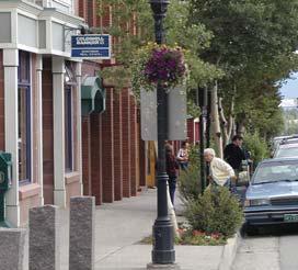
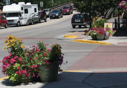
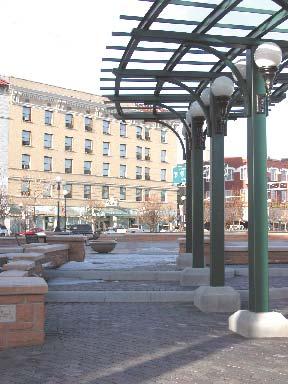
6 STREET CORNERS and CURB EXTENSIONS PURPOSE Curb extensions provide increased pedestrian space and opportunity for social interaction through the placement of benches and site furnishings as well as a safe refuge while waiting to cross the street. They also provide shorter crossing distances for pedestrians. Keep sight triangles open to facilitate safe vehicle and pedestrian movements. Minimum height clearance for mounted traffi c signs and tree branches in pedestrian travel ways: 8.0 feet. Maximum height of shrubs and raised planters within the sight triangle: 2.0 feet. Minimum clear width for pedestrian traffi c and safe street crossing: 8-foot sidewalks, 3.0 feet; 12-foot sidewalks, 4.5 feet; 16-foot sidewalks, 6.5 feet (see illustration above). In addition to pedestrian crossing and traffi c calming benefi ts, expanded street corners provide space for place-making elements such as landscaping, benches, bicycle racks, and improved lighting. Raised planters, moveable planters, landscape strips, bollards, and benches help create defi ned pedestrian space. In some locations, street corner amenities can be associated with small plazas to enhance the public landscape. PLANTERS: MOVEABLE, PLANTERS: RAISED, TREE and LANDSCAPE STRIPS, SEATING, TRASH / ASH RECEPTACLES, PUBLIC ART 4

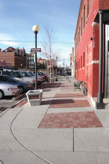
7 STREET CORNERS and CURB EXTENSIONS 5


.")
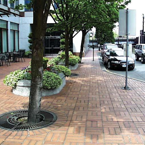
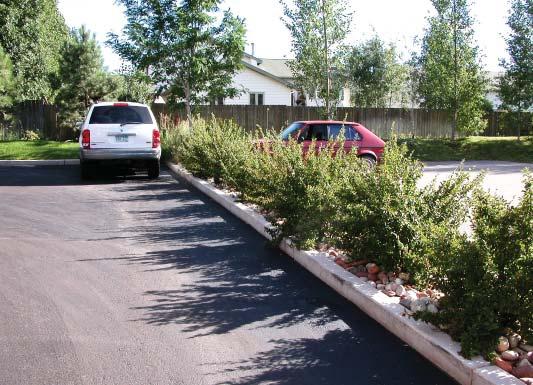
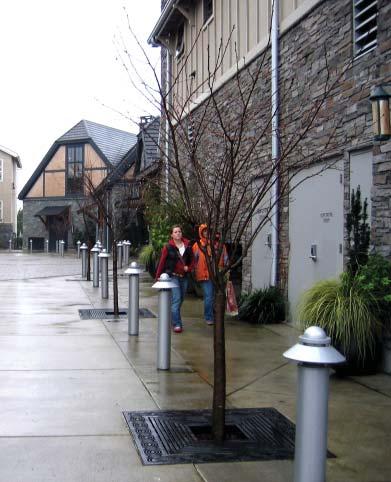
8 TREES and LANDSCAPE STRIPS PURPOSE Landscape strips are an effective treatment between sidewalks and streets to create a buffer from moving vehicles and street noise, and help pedestrians feel more comfortable walking along the street. Minimum width: 4.5 feet (check City standards for specifi c applications) Tree and light standard placement need to be coordinated to assure trees do not block proper illumination. If possible, place lights midway between trees to avoid confl icts. Tree species shall be approved by City Forestry. Drip irrigation is strongly recommended. Refer to DDA Streetscape Standards Refer to Road Street & Site Design Standards Use low-profi le shrubs and upward branching trees to maintain visibility and sight distance at intersections, driveways, crossing, and other critical areas. (Add general dimensions of heights, clear space etc). Tree wells installed on urban sidewalks should be placed adjacent to the back of curb, out of the pedestrian travel way. Tree grates adjacent to or within sidewalks must meet ADA accessibility requirements: top-mounted fl ush with grade and no opening larger than 0.5 inches in diameter. Planters strips can provide space for street furniture, signs, utility and signal poles, mailboxes, parking meters, fi re hydrants and other elements outside the clear space of the walkway. LIGHTING, PLANTERS: MOVEABLE, PLANTERS: RAISED, FIXTURES / UTILITY ZONE, UTILITIES 6


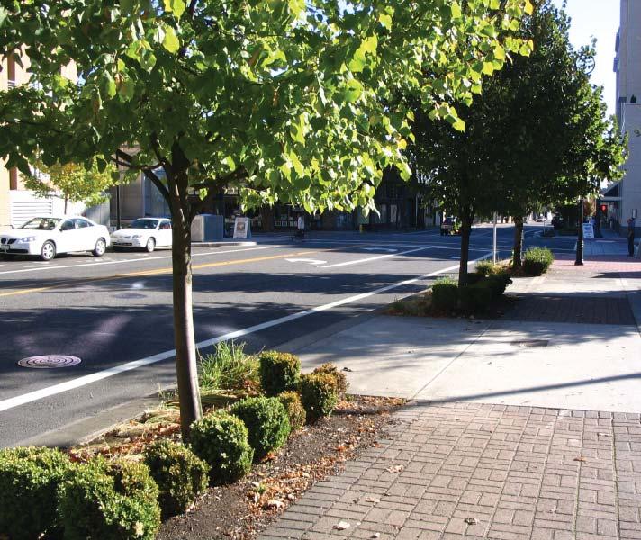

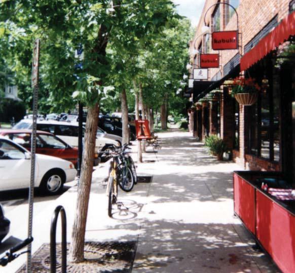
9 TREES and LANDSCAPE STRIPS 7


10 PLANTERS: MOVEABLE PURPOSE Planters add color, texture and interest to a streetscape and can help defi ne and separate spaces. Moveable planters are a simple, affordable, easily accessible option for individual building owners. Minimum through-zones on sidewalks must be maintained. Planters placed on walkways should not create congestion or block pedestrian traffi c. Placement on street corners should not obstruct driver views. Maintain a clear distance from back of curb of 1.5 feet to avoid confl icts with car doors. Properly sited and maintained planters can provide year-round interest. Moveable planters can be placed to provide temporary barriers for special event closures as well as summer or seasonal seating defi nition. Planters help defi ne primary building entrances, defi ne spaces, and enhance aesthetic value. Planters can be installed at seating areas, along edges of parking lots, in pedestrian plazas, and in clustered furnishing areas. TREES & LANDSCAPE STRIPS, PLANTERS: RAISED CAFÉ SPACES 8

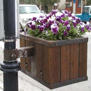
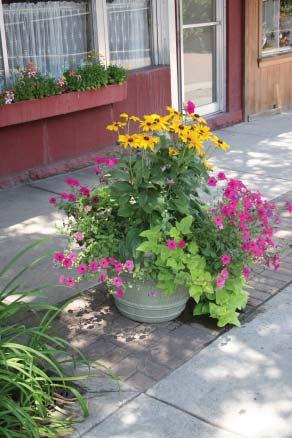
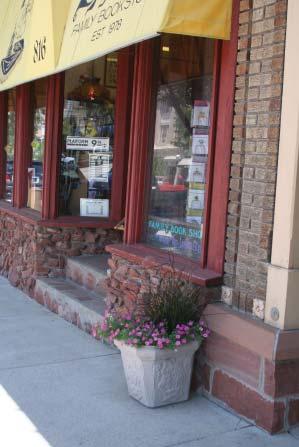
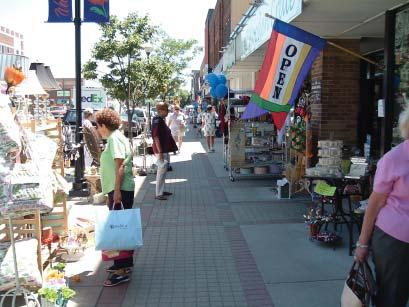
11 PLANTERS: MOVEABLE 9


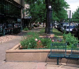
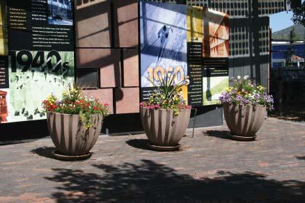
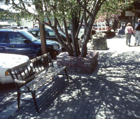
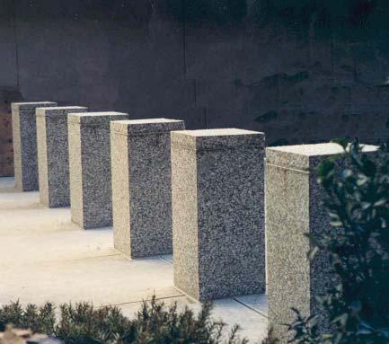
12 PLANTERS: RAISED PURPOSE Planters add life, color, texture, and interest to a streetscape and can help defi ne and separate spaces. The edges of raised planters can provide informal seating. The height of the planter walls should be between 12 and 20 high and 16 wide where possible. Raised planters can help buffer trees and plants from snowmelt chemicals and snow removal equipment. Raised planters should not obstruct driver views. Maintain a clear distance from back of curb of 1.5 feet to avoid confl icts with car doors. Minimum through zones on sidewalks must be maintained. The minimum inside dimension for a raised planter without trees is 2.5 feet. The minimum inside dimension for a raised planter with a small tree is 4 feet. Raised planters can add trees and plantings to the street where landscaped medians are not feasible. Planters help defi ne street edges and pedestrian spaces. Benches and seating areas can be integrated into raised planters. TREES & LANDSCAPE STRIPS, PLANTERS: MOVEABLE 10

13 PLANTERS: RAISED 11


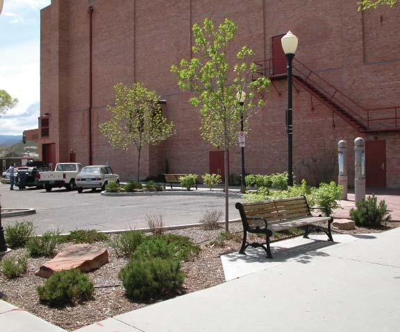
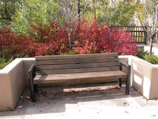
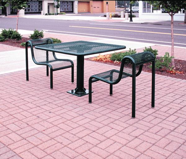
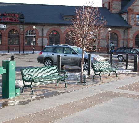
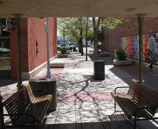
14 SEATING PURPOSE Waiting and resting areas along walkways provide welcome relief to pedestrians, and a place to sit together, interact, and observe. Maintain through zones if seating is placed within a sidewalk area. For benches placed on the curb edge with the back to the street, maintain a clear distance from the back of curb of 1.5 feet to avoid confl icts with car doors. Walls used for seating should be 12 to 20 inches high and 16 wide where possible. Walls that allow seating from both sides shall be a minimum of 30 wide. Seating on street corners must not obstruct driver views. Placing benches in the utility zone helps avoid confl icts and keep through zones clear. Place benches where they are accessible and visible. Provide seating in areas of high pedestrian traffi c and/or areas of interest. Cluster benches with planters and waste receptacles to help frame spaces. When feasible and space allows, place benches perpendicular to the street edge to create pocket pedestrian spaces. Select street furniture that is compatible with existing furnishings and standards. PLANTERS: MOVEABLE, PLANTERS: RAISED, TREES & LANDSCAPE STRIPS, FIXTURES / UTLITY ZONE, SIDEWALKS, TRASH / ASH RECEPTACLES 12


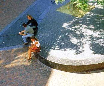
15 SEATING 13

.")
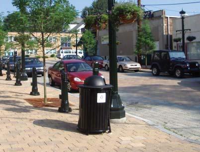
16 TRASH / ASH RECEPTACLES PURPOSE Strategically located garbage receptacles and cigarette ash cans help keep areas clean and attractive. At a minimum, one trash/ash receptacle should be placed at every corner. For blocks with a high concentration of restaurants, a mid-block trash receptacle should be considered, especially if outdoor seating is provided. Special event spaces should also have a midblock trash receptacle (can be a temporary placement with a portable receptacle). Trash and ash receptacles may be the mostused streetscape element and should be conveniently located for pedestrian traffi c near benches, bus stops, and other activity nodes. Receptacles should be easily accessible for trash collection and maintenance. Covered tops and sealed bottoms should be included to keep contents dry and pests out. Where vandalism is a concern, trash and ash receptacles should be securely attached to the pavement. Contact the Sanitation Department for consultation on placement and ease of removal. SEATING, SIDEWALKS, STREET CORNERS & CURB EXTENSIONS 14

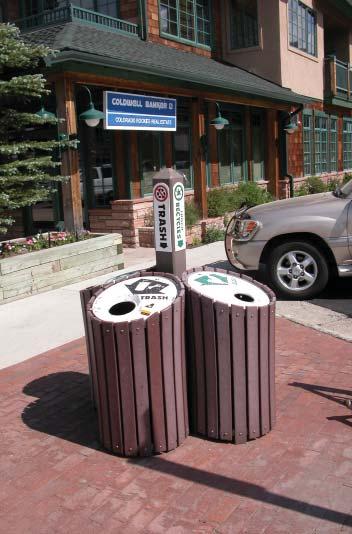
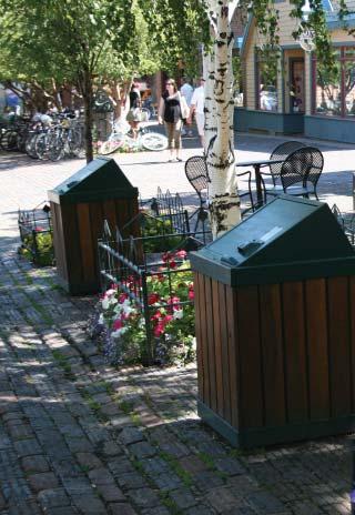
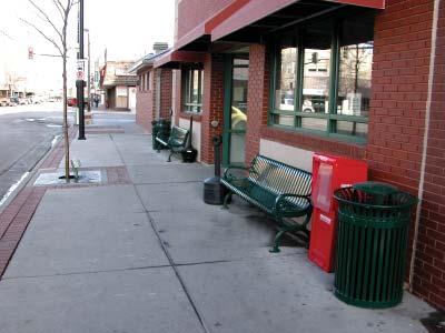
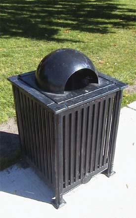
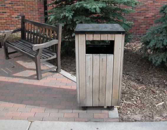
17 TRASH / ASH RECEPTACLES 15


18 PUBLIC ART PURPOSE Public art can help establish a unique identity, enhance civic pride, depict a cultural or historic event, and add interest to public spaces. Where space is limited, public art can be placed in the utility zone or on street corners/ curb extensions. Installations of public art can be permanent or temporary. Historic painted wall signs can function as a form of art and should be preserved and enhanced where possible. Examples of public art can include murals, banners, decorative or unique signs, and sculptures. Pavement designs can include public art. Public art encourages pedestrian activity and humanizes the scale of a street. The addition of public art improves the visual environment, strengthens community identity, and increases community pride. SIDEWALKS, STREET CORNERS & CURB EXTENSIONS, FIXTURES/ UTLITY ZONE, SPECIAL EVENT SPACES 16

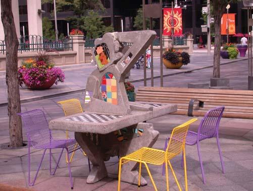
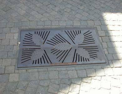
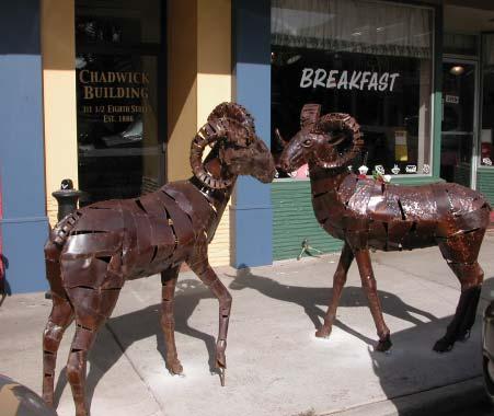
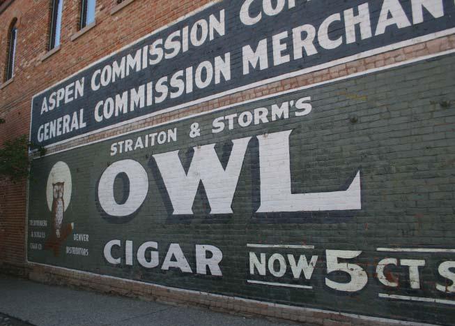
19 PUBLIC ART 17


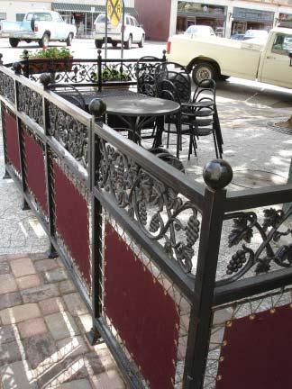
20 SCREENING PURPOSE Screening provides a visual buffer between pedestrian and vehicular spaces and a continuation of the street wall. Delineation between the two can also improve public safety through separation of public areas from parking and circulation areas, as well as grade changes. Trellis, grillwork, or pedestrian covering. Planted vines or hanging fl owers are encouraged 18 minimum height 32 maximum height Sidewalk 30 minimum height 42 maximum height Brick or masonry to match building material if possible Fences and railings should be a minimum of 30 inches and a maximum of 42 inches in height. Fencing and railing shall be a minimum of 70 percent open. Solid walls shall be a minimum of 18 inches and a maximum of 32 inches in height. Hedges shall be no less that 80 percent open in the winter months and no more than 32 inches in height. The buffer area should be a minimum of fi ve feet in width to provide adequate space for landscaping and a railing or wall. Screening provides a defi ned edge that reduces the impact of parked vehicles and enhances the streetscape. Fences, railings, and walls shall be constructed of metal, brick, or stone. Plastic and wood fences are discouraged. Bollards and chain-link fencing can serve as a temporary or moveable barrier. PLANTERS: MOVEABLE, PLANTERS: RAISED, TREES & LANDSCAPE STRIPS 18

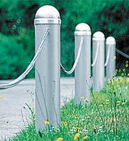
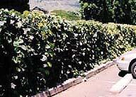
21 SCREENING 19

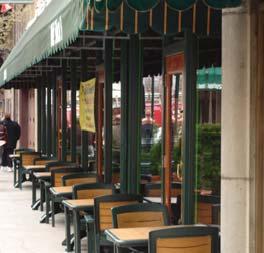
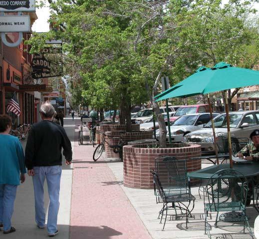
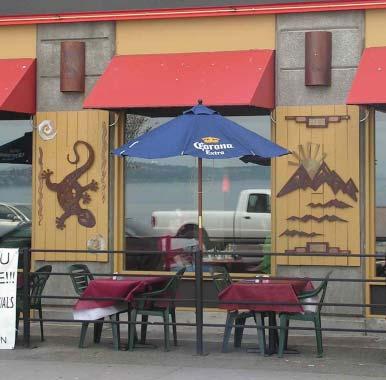
22 CAFÉ SPACES: 8-foot sidewalk PURPOSE Outdoor cafés provide an active street frontage and natural locations for arranged and spontaneous social interactions. Even narrow sidewalks can accommodate café-style seating. Minimum practical depth: 3.0 feet, to allow for a table and two chairs parallel to the premises. Minimum clear distance: 3.0 feet adjacent to the seating area for pedestrian circulation exclusive of any obstruction or street fi xture (bench, tree, planter, utility pole). 8 sidewalks do not provide adequate room for cafés located along the curb edge. Place tables and chairs under building awnings when possible. Umbrellas may not interfere with pedestrian movement and must be at least 8 feet above ground level. The preferred location for an outdoor café on an 8 sidewalk is directly adjacent to the respective indoor premise, rather than separated by a pedestrian thoroughfare. Corner cafés should be placed against the building edge, rather than at the outer edge of the sidewalk, to maintain visibility at intersections. Ground surfaces must be suitably constructed and suffi ciently level to support a proper layout and safe use of the required furniture and associated circulation areas. Due to narrow width, screening or enclosures should not be allowed along the accessible/ public edge. City permits are required for sidewalk cafés. CAFÉ SPACES: 12-foot and 16-foot sidewalk; SIDEWALKS, STREET CORNERS & CURB EXTENSIONS 20
23 CAFÉ SPACES: 12-foot sidewalk PURPOSE Outdoor cafés provide an active street frontage and natural locations for arranged and spontaneous social interactions. Minimum practical depth: 3.0 feet, to allow for a table and two chairs. 5.0 feet is preferred. Minimum clear distance: 4.5 feet adjacent to the seating area for pedestrian circulation exclusive of any obstruction or street fi xture (bench, tree, planter, utility pole). Umbrellas must not encroach on or interfere with pedestrian movement and must be at least 8 feet above ground level. The preferred location for an outdoor café with table service is directly adjacent to the respective indoor premise, rather than separated by a pedestrian thoroughfare. Corner cafés should be placed against the building edge, rather than at the outer edge of the sidewalk, to maintain visibility at intersections. Ground surfaces must be suitably constructed and suffi ciently level to support a proper layout and safe use of the required furniture and associated circulation areas. Continuous screening or enclosures should not be allowed along the accessible/public edge Cafés serving alcohol must be enclosed and should be placed against the building. City permits are required for sidewalk cafés. CAFÉ SPACES: 8-foot and 16-foot sidewalk; SIDEWALKS, STREET CORNERS & CURB EXTENSIONS 21
24 CAFÉ SPACES: 16-foot sidewalk PURPOSE Outdoor cafés provide an active street frontage and natural locations for arranged and spontaneous social interactions. Wider sidewalks provide the most fl exibility and optinos for creating café spaces. Minimum practical depth: 3.0 feet, to allow for a table and two chairs. 6.5 feet is preferred. Minimum clear distance: 4.5 feet adjacent to the seating area for pedestrian circulation exclusive of any obstruction or street fi xture (bench, tree, planter, utility pole). Umbrellas must not encroach on or interfere with pedestrian movement and must be at least 8 feet above ground level. The preferred location for an outdoor café with table service is directly adjacent to the respective indoor premise, rather than separated by a pedestrian thoroughfare. Corner cafés should be placed against the building edge, rather than at the outer edge of the sidewalk, to maintain visibility at intersections. Ground surfaces must be suitably constructed and suffi ciently level to support a proper layout and safe use of the required furniture and associated circulation areas. Continuous screening or enclosures should not be allowed along the accessible/public edge Cafés serving alcohol must be enclosed and should be placed against the building. City permits are required for sidewalk cafés. CAFÉ SPACES: 8-foot and 16-foot sidewalk; SIDEWALKS, STREET CORNERS & CURB EXTENSIONS 22

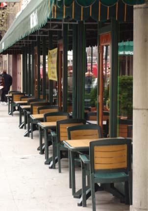
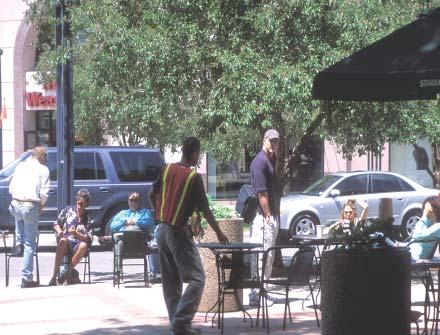
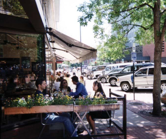
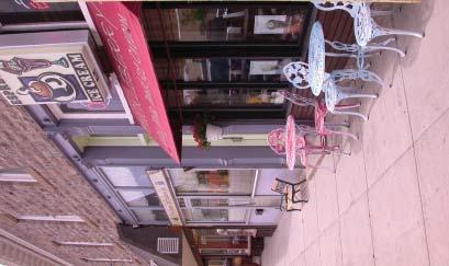
25 CAFÉ SPACES 23


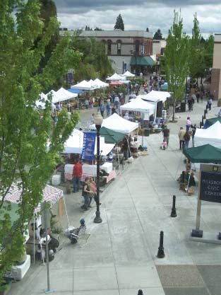
26 SPECIAL EVENT SPACES PURPOSE Special event spaces can signifi cantly enliven the streetscape. Surrounding streets may be signifi cantly affected by a street closure. Consider a traffi c routing plan if a street is closed off to create a special event space. Provide adequate access to utilities such as lighting and water. The spaces should be readily visible and accessible. Locate special event spaces within or adjacent to areas that have a high level of existing pedestrian circulation. Event spaces are most successful when they augment established year-round facilities. The spaces should be pleasant and active during non-event times. Special event spaces require a fl exible site layout to accommodate a wide range of events. Design of streets that may have temporary closures for event space should consider special pavement treatment, rollover curbs, and removable bollards. PLANTERS: MOVEABLE, PLANTERS: RAISED, LIGHTING, SIDEWALKS, SEATING, PUBLIC ART, UTILITIES, TRASH/ ASH RECEPTACLES 24

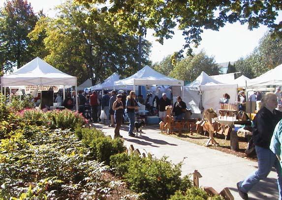
27 SPECIAL EVENT SPACES 25
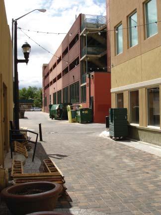
28 ALLEY and IN-FILL SPACES PURPOSE Properly lit and designed, alleys and in-fi ll spaces can turn dead space into secure, inviting, and lively spaces. Provide adequate lighting for pedestrian comfort and safety. Must have a destination point such as a café, shop, or other activity with people present to prevent secluded, hidden spaces. Access for delivery trucks and services for surrounding businesses needs to be accommodated. Access to utilities and maintenance areas needs to be preserved. Add public art, pavers, and planters to enliven the corridors and make them feel welcoming. Provide clear wayfi nding and signage to help direct pedestrians to alley and in-fi l spaces. Create vibrant entrance points. Special paving can help defi ne pedestrian areas. Screen dumpsters, recycling, and other utility areas to help create clean, inviting spaces. Underground utilities where possible. Alley and in-fi ll redevelopment provides a continuation of the street edge. PLANTERS: MOVEABLE, PLANTERS: RAISED, SCREENING, TREES & LANDSCAPE STRIPS, LIGHTING, UTIITIES, PUBLIC ART, TRASH / ASH RECEPTACLES, SEATING 26

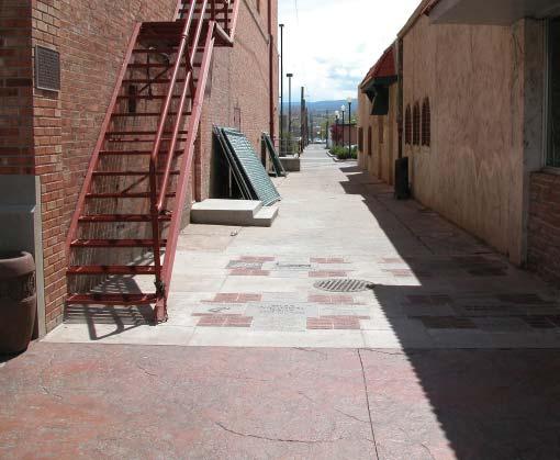
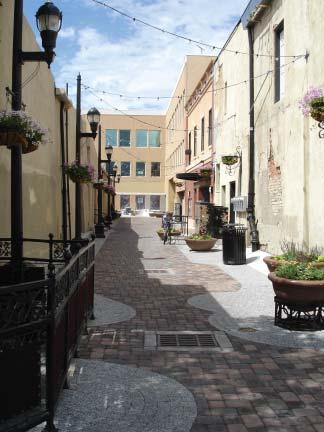
29 ALLEY and IN-FILL SPACES 27


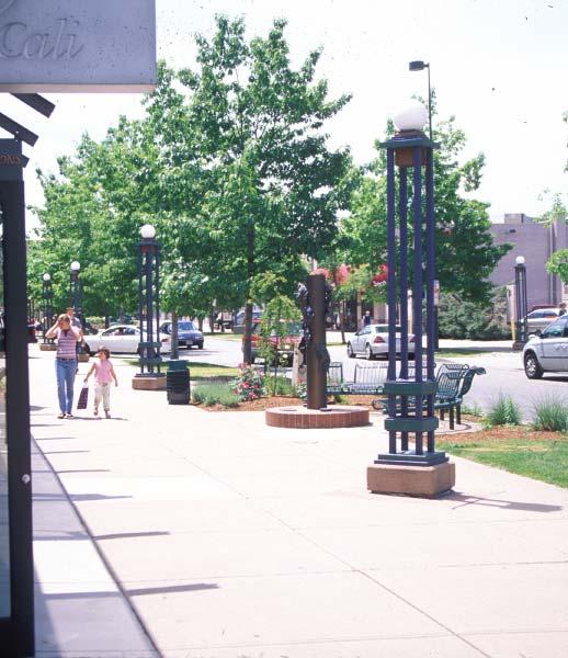
30 FIXTURES / UTILITY ZONE PURPOSE The fi xtures/utility zone is located directly adjacent to the street and provides a buffer between street traffi c and the pedestrian travel zone. It also offers a location for lights, poles, and signs outside the pedestrian travelway. Fixtures/utility zone Pedestrian clear zone Minimum typical dimension for this zone: typically 2.5 feet; preferred minimum, 3.0 feet. When possible, consolidate or congregate utilities, street furniture, etc., to minimize pedestrian obstacles and improve visual appearance. When possible, install multiple utilities on a pole system or multiple signs on one post. Cluster furnishings within the planting strip or to one side of the primary walking area. This zone may be combined with the tree and landscape strip. While it is benefi cial to keep utility poles, Items in the fi xtures/utility zone should not lighting, street furnishing etc. to one side of the be spaced so closely that they create a barrier street to create a clear zone for pedestrians, to the street and parking. The edge should be care must be taken not to clutter the zone. permeable enough to allow pedestrian access Adequate spacing between trash receptacles, from the street. newspaper boxes, and street furnishings contributes to a cleaner visual environment. TREES and LANDSCAPE STRIPS, LIGHTING 28

.")
31 UTILITIES PURPOSE Proper placement and access to utility sources contributes to the success and maintenance of streetscape elements. Electrical box Design utilities in accordance with the design criteria of the Cheyenne Board of Public Utilities. Provide at least one water source per block, on each side of the street, to water moveable planters and for maintenance purposes. Locate utilities outside the pedestrian throughzone where possible. Provide sources for electricity as an integrated component of streetlight poles. Install irrigation systems in permanent planters (ground level and raised). Commercial-grade irrigation equipment should be installed. If hanging baskets are provided, water sources should be integrated into the streetlight poles. Coordinate utility lines with landscape plans to avoid confl icts. LIGHTING, FIXTURES / UTILITY ZONE 29


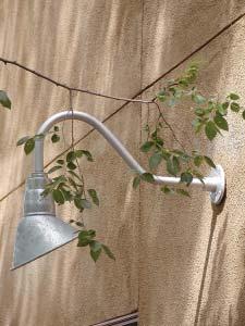
32 LIGHTING PURPOSE Lighting of the street system, including adjacent sidewalks, walkways and bike lanes, increases security and pedestrian safety and comfort. Lighting levels between 0.5 to 2.0 footcandles should be provided along pedestrian travelways, depending on conditions. Lighting must be functionally appropriate and properly scaled to both pedestrians and vehicles. Pedestrian-scale lighting requires a light source relatively low to the ground to be in scale with the human body and to provide light beneath the tree canopy. Roadway light standards must illuminate the road and require much greater height than those for pedestrian travelways. Urban streetlights are typically suffi cient for sidewalks and pedestrian walkways adjacent to the street. Additional lighting may be necessary at pedestrian crossings, intersections, building entrances, and alleyways. Pedestrian-scale lighting can be integrated into bollards, walls / seat walls, buildings, and pavement. Street lights located in special event spaces and plazas should structurally accommodate string lighting, banners, and other seasonal elements. Temporary lighting of roof lines, entryways, windows, street trees, and planters can add visual interest and defi nition and are a simple, affordable, and easily obtainable option for individual building owners. Table lanterns and lanterns placed in planters add function and atmosphere to outdoor cafés. UTILITIES, FIXTURES / UTLITY ZONE, SPECIAL EVENT SPACES 30

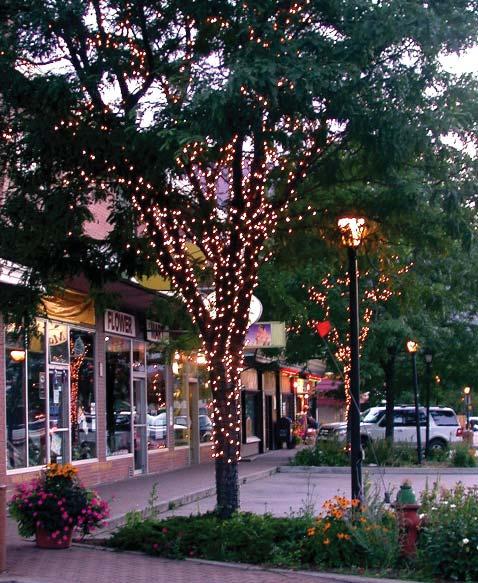
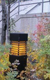
33 LIGHTING 31
1.3 Pedestrian Environments
 SECTION 1: COMMERCIAL DEVELOPMENT 1.3 Pedestrian Environments Design Principle The quality of the pedestrian environment often defines the overall success of a commercial project. Attention to the development
Guthriesville Village Manual of Written & Graphic Design Guidelines
 Exhibit B Revisions: May 23, June 21, July 20, September 20, & October 9, 2012 Updated: December 13, 2012; June 27, 2013; February 7, 2014 Outline of Contents: 1. Purpose and Applicability 2. Overall Form
MARTIN LUTHER KING JR. WAY
 OCTOBER 2011 40 Vision and Goals The Martin Luther King, Jr. Way Illustrative Master Plan that follows has been developed through a process of community involvement. It expresses a long term vision for
DEFINING THE STREETSCAPE DRAFT
 3 DEFINING THE STREETSCAPE Context Sensitive Design Context Sensitive Design The structuring elements of streetscapes for the City of Vaughan are road classifi cation, streetscape type and level of service.
Aurora Urban Street Standards For Transit Oriented Developments and Urban Centers
 Aurora Urban Street Standards For Transit Oriented Developments and Urban Centers I. Purpose These standards will be applied to create a safe, comfortable, pleasant and pedestrian-friendly multi-modal
PEDESTRIAN CIRCULATION & STREETSCAPE DESIGN
 CHAPTER 4 Chapter 4 Pedestrian Circulation & Trails PEDESTRIAN CIRCULATION & STREETSCAPE DESIGN In recent years, the City has constructed new sidewalks and enhanced existing ones in the downtown with brick
Elm Street Business District: Streetscape and Signage Plan
 Winnetka Preliminary Streetscape & Signage Village Council Presentation 1 Elm Street Business District: Streetscape and Signage Plan VILLAGE OF WINNETKA DOWNTOWN MASTER PLAN VILLAGE COUNCIL PRESENTATION
CURBSIDE ACTIVITY DESIGN
 5 CURBSIDE ACTIVITY DESIGN This chapter provides design guidance for separated bike lanes adjacent to curbside activities including parking, loading and bus stops. Typical configurations are presented
Community Meeting February 27, 2007 Dorchester Avenue Transportation & Streetscape Improvements Action Plan February 27, 2007
 Community Meeting Tonight s Agenda 6:00 Introductions South Boston/Dot Ave Improvement Study Background 6:15 Consultant Introductions Review of Scope and Schedule Review of Proposed Corridor Wide Guidelines
PUBLIC REALM MASTER PLAN
 WESTSHORE BUSINESS DISTRICT PUBLIC REALM MASTER PLAN MASTER PLAN COMMITTEE MEETING MARCH 20, 2013 WESTSHORE BUSINESS DISTRCT PUBLIC REALM MASTER PLAN MACRO-SCALE CONCEPT: A PUBLIC REALM FRAMEWORK DEFINED
Bicycle and Pedestrian Advisory Committee (BPAC) November 21, 2013
 November 21, 2013") Bicycle and Pedestrian Advisory Committee (BPAC) November 21, 2013 OVERALL LAND USE CONCEPT Overall Broadway Valdez District: 95.5 acres (35.1 acres right-of ways + 60.4 acres developable land) Plan Subareas:
Bicycle and Pedestrian Advisory Committee (BPAC) November 21, 2013 OVERALL LAND USE CONCEPT Overall Broadway Valdez District: 95.5 acres (35.1 acres right-of ways + 60.4 acres developable land) Plan Subareas:
S T A T I O N A R E A P L A N
 The Circulation and Access Plan describes vehicle, pedestrian, and transit improvements recommended within the Concept Plan. In order to create and sustain a vibrant business district that provides pedestrian-friendly
Streetscape: Core Shopping District
 Streetscape: Core Shopping District DRAFT DRAFT DRAFT May 00 Core Shopping District: Phase Blue Island s Core Shopping District is located along Western Avenue, between Grove and Union Streets. Streetscape
GENERAL. 1. Description
 GENERAL 1. Description This standard identifies minimum requirements that shall be met for all Bus Stops in the design and construction of elements for Arlington County Horizontal Design Standards. This
Sidewalk Cafe City of St. Petersburg City Code Chapter 16, Land Development Regulations
 Section 16.50.370 Sidewalk Café Sections: 16.50.370.1 Generally 16.50.370.2 Declarations 16.50.370.3 Definitions 16.50.370.4 Permit Required 16.50.370.5 Application, Permit and Fee 16.50.370.6 Liability
Tonight is for you. Learn everything you can. Share all your ideas.
 Strathcona Neighbourhood Renewal Draft Concept Design Tonight is for you. Learn everything you can. Share all your ideas. What is Neighbourhood Renewal? Creating a design with you for your neighbourhood.
UDC Street Cross Sections
 UDC Street Cross Sections Local Street - Downtown Local Street Mountable Curb Local Street Vertical Curb Alley Major Arterial Minor Arterial Residential Lane Residential Collector Residential Collector
TRANSPORTATION STANDARDS
 INTRODUCTION LOCAL STREETS ON-STREET PARKING SIDEWALKS STREET LIGHTING STREET FURNISHINGS TRAFFIC CALMING STREET TREES MEDIAN PLANTING BOULEVARD LOCATIONS VILLAGE CENTER STREET LOCATIONS RESIDENTIAL STREET
A CHANGING CITY. of Edmonton, it is essential that it reflects the long-term vision of the City.
 A CHANGING CITY By the year 2040, Edmonton will be home to more than 1 million people. To accommodate growth and support a healthy and compact city, we need a new approach to development/redevelopment
FOCUS AREA 1 - Alberta Avenue Pocket Park 3 (121 Ave and 92 St)
") FOCUS AREA 1 - Alberta Avenue Pocket Park 3 (121 Ave and 92 St) New benches Plant evergreen trees Widen existing sidewalk from 1.5m to 1.8m Marked crosswalk 1.8m wide sidewalk Add pedestrian oriented lights
FOCUS AREA 1 - Alberta Avenue Pocket Park 3 (121 Ave and 92 St) New benches Plant evergreen trees Widen existing sidewalk from 1.5m to 1.8m Marked crosswalk 1.8m wide sidewalk Add pedestrian oriented lights
Figure 5-1 Complete Street Zones. Roadside. May include frontage, pedestrian throughway, furnishings and curbside areas.
 Design Guidelines 5 The design guidelines presented in this section provide descriptions related to the form and function of the four Complete Streets zones: roadside, parking, roadways and lanes, median,
City of Darlington Beautification Report
 City of Darlington Beautification Report Approved by the City of Darlington Beautification Board February 2016 The New Downtown Darlington has seen many changes during the past decade with the rehabilitation
Figure 4-10: Pedestrian Improvements Types of Potential Station Area Improvements - Place-Making Improvements
 INCORPORATE FEATURE PAVIN IN CROSSWALK AND INTERSECTION FIELDS Identifies high-priority pedestrian areas and create a station identity through colorful and interesting patterns ADD CURB EXTENSIONS Extending
Sidewalk Café Ordinance Group Report
 Neighborhood Advisory Council (NAC) 11 August 10, 2018 Sidewalk Café Ordinance Group Report 1. Introduction Downtown Frederick restaurants offer a variety of outdoor dining options that add to the attractiveness
CHAPTER 16 PEDESTRIAN FACILITIES DESIGN AND TECHNICAL CRITERIA TABLE OF CONTENTS
 CHAPTER 16 PEDESTRIAN FACILITIES DESIGN AND TECHNICAL CRITERIA TABLE OF CONTENTS Section Title Page 16.1 General... 16-1 16.1.1 AASHTO Reference... 16-1 16.1.2 ADA Requirements... 16-1 16.2 Sidewalks...
Appendix C. TRAFFIC CALMING PROGRAM TOOLBOX
 Appendix C. TRAFFIC CALMING PROGRAM TOOLBOX PHASE I...2 Do Not Enter Sign...3 One-Way Sign...4 Turn Prohibition...5 Pavement Markings...6 Speed Monitoring Trailer...7 Neighborhood Speed Watch...8 Police
CONNECTIVITY PLAN. Adopted December 5, 2017 City of Virginia Beach
 CONNECTIVITY PLAN Adopted December 5, 2017 City of Virginia Beach CONTENTS 1.0 Background & Purpose... 2 2.0 Existing Inventory & Analysis... 3 ViBe District Existing Walking Conditions... 4 3.0 ViBe District
WHITE STREET/ ENGLISH PLAZA STREETSCAPE IMPROVEMENT PROJECT
 WHITE STREET/ ENGLISH PLAZA STREETSCAPE IMPROVEMENT PROJECT 1 Project Goals 1 Improved Safety: Lighting, Multi-Modal Circulation, Emergency Access, Tripping Hazards; Stormwater 4 Environmental Performance:
Chapter 3: Multi-Modal Circulation and Streetscapes
 CHAPTER 3: MULTI-MODAL CIRCULATION AND STREETSCAPES Chapter 3: Multi-Modal Circulation and Streetscapes Overview Streetscape improvements have already been completed for Depot Street between Main Avenue
Village of Plainfield Design and Operational Guidelines for Outdoor Uses within the Public Right-of-Way
 Village of Plainfield Design and Operational Guidelines for Outdoor Uses within the Public Right-of-Way Table of Contents 1. Applicability... 2 Purpose: The Village of Plainfield wishes to allow outdoor
Item to be Addressed Checklist Consideration YES NO N/A Required Description Complete Streets Guidelines
 Passaic County Complete Streets Checklist - Concept Development Project Name Item to be Addressed Checklist Consideration YES NO N/A Required Description Complete Streets Guidelines Existing Plans Have
Chapter 10: Pedestrian Facility Design. ACCESS MINNEAPOLIS Design Guidelines for Streets & Sidewalks
 Chapter 10: Pedestrian Facility Design ACCESS MINNEAPOLIS Design Guidelines for Streets & Sidewalks October 26, 2009 TABLE OF CONTENTS 10 PEDESTRIAN FACILITY DESIGN... 10-1 10.0 INTRODUCTION... 10 1 10.0.1
WELCOME. City of Eden Prairie West 70 th Street
 WELCOME City of Eden Prairie West 70 th Street Project Schedule Sep Oct Nov Dec Jan Feb Mar Apr May Jun Jul Aug >>> May WEST SEGMENT Concept Plan Fall 2014 Plan Development Winter 2014 Summer 2015 Construction
14 TH STREET TRANSPORTATION & STREETSCAPE DESIGN STUDY PLAN B PLAN B TRANSPORTATION & STREETSCAPE RECOMMENDATIONS
 14 TH STREET TRANSPORTATION & STREETSCAPE DESIGN STUDY PLAN B PLAN B TRANSPORTATION & STREETSCAPE RECOMMENDATIONS 141 Symbols Recommendations - Southern End of 14th Street Study Area Streetscape Each icon
SECTION 14: LANDSCAPING AND BEAUTIFICATION
 SECTION 14: LANDSCAPING AND BEAUTIFICATION RULE 14.1 GENERAL PROVISIONS 14.1.1 The rules and guidelines contained in this section have been established to provide proper guidelines for the beautification
PEDESTRIAN ENVIRONMENTS & SHARED STREETS
 PEDESTRIAN ENVIRONMENTS & SHARED STREETS PEDESTRIAN ENVIRONMENTS & SHARED STREETS PRINCIPAL CONSIDERATIONS Pedestrian Priority. This chapter describes features that delineate where pedestrians can walk
Ballston Station Multimodal Study WMATA and Arlington County. Meeting Minutes
 Date of Meeting: June 10, 2010 Location: Ballston Metrorail Station and NRECA Building 4301 Wilson Blvd, Arlington, VA Subject: Ballston Station Multimodal Study Stakeholder Meeting #1 Summary: This first
Chapter 6: Along the Street
 Chapter 6: Along the Street This section describes the types of infrastructure that should be in place along school routes to make walking and bicycling to school safer. Sidewalks In communities with sidewalks,
APPENDIX A: Complete Streets Checklist DRAFT NOVEMBER 2016
 APPENDIX A: Complete Streets Checklist DRAFT NOVEMBER 2016 Complete Streets Checklist MetroPlan Orlando s Complete Streets Checklist is an internal planning tool for staff to further implementation of
7/23/2017 VIA . Michael Hanebutt City of Sacramento Community Development Department 300 Richards Boulevard, 3 rd Floor Sacramento, CA 95811
 7/23/2017 VIA EMAIL Michael Hanebutt City of Sacramento Community Development Department 300 Richards Boulevard, 3 rd Floor Sacramento, CA 95811 RE: 65 th Street Apartments (DR17-220) Dear Mr. Hanebutt:
Blackfalds Downtown. Architectural Guidelines: Streetscape
 Blackfalds Downtown Architectural Guidelines: Streetscape Streetscape INTRODUCTION A variety of street furniture has been chosen for locations within the Town of Blackfalds Downtown and highway commercial
complete streets design and construction standards public primer City of Edmonton
 complete streets design and construction standards public primer City of Edmonton introduction Complete Streets are streets for everyone: people who walk, wheel, bike, take transit, or drive. They are
ALBERTA AVENUE WHAT WE HEARD REPORT BUILDING GREAT NEIGHBOURHOODS
 ALBERTA AVENUE WHAT WE HEARD REPORT BUILDING GREAT NEIGHBOURHOODS FEBRUARY 2019 EXECUTIVE SUMMARY Starting in 2019, Alberta Avenue will see the replacement and enhancement of its aging collector and local
Observations and Ideas: Toomer s Corner Streetscape Improvements
 Observations and Ideas: Toomer s Corner Streetscape Improvements AUBURN DOWNTOWN MASTER PLAN planning downtown s future August 26, 2013 Observations: Vertical Clutter at Corners 6 3 7 5 9 2 8 4 1 Excess
A. Pedestrian Facility Design
 A. Pedestrian Facility Design Photo by Dan Burden Photo by Cara Seiderman Walkways are the portion of the public right-of-way that provide a separated area for people traveling on foot.walkways that are
STEERING COMMITTEE MEETING June 17, Streetscape Overview Burlington Comprehensive Master Plan
 STEERING COMMITTEE MEETING June 17, 2015 Streetscape Overview Burlington Comprehensive Master Plan 1 Introduction Slide This slide show was presented to the Burlington Steering Committee on June 17, 2015
BROOKLAND Multi-Modal Transportation & Streetscape Study* NE Washington, DC
 BROOKLAND Multi-Modal Transportation & Streetscape Study* NE Washington, DC The study s goal is to create a multi-modal transportation and streetscape design plan to increase transportation efficiency,
A Guide to Great Streets: The Basics. September 25, 2009
 A Guide to Great Streets: The Basics September 25, 2009 Streets are more than connectors, they are the city 2 Streets are the glue that hold a city together 3 Streets are the means in which a city is perceived
THE ALAMEDA CONCEPT DESIGN COMMUNITY MEETING 3. A Plan for The Beautiful Way JANUARY 28, 2010
 CONCEPT DESIGN COMMUNITY MEETING 3 JANUARY 28, 2010 AGENDA INTRODUCTION COMMUNITY INPUT ROADWAY STUDIES STREETSCAPE DESIGN STATIONS DISCUSSION SUMMARY AND DISCUSSION NEXT STEPS CLOSE INTRODUCTION SCHEDULE
Broad Street Bicycle Boulevard Design Guidelines
 Broad Street Bicycle Boulevard Design Guidelines Building from the strategies introduced in the 2013 Bicycle Transportation Plan and community input received thus far, City Transportation Staff have identified
Victoria Park Master Plan
 Victoria Park Master Plan Phase I Presented By: ARCHITECTURAL ALLIANCE & HUGHES HUGHES INC. History of Victoria Park Phase I Purpose Inventory of Existing Conditions Identification of Options by Type (for
ROUTE 81 CORRIDOR STUDY DESIGN CONCEPTS
 RT 81 Corridor Study CLINTON ROUTE 81 CORRIDOR STUDY DESIGN CONCEPTS View north on High Street, with potential improvements to the streetscape Draft Recommendations November 8 th, 2018 TOWN OF CLINTON
CURB EXTENSIONS BULB OUTS DPS 201 NECKDOWNS
 CURB EXTENSIONS BULB OUTS DPS 201 NECKDOWNS WHY WHEN & WHERE When Limited Sight Distance Pedestrians & Vehicles Vehicles and Signs Want to put two curb ramps in Discourage High speed turning High number
To: Planning Commission Date: September 19, 2012 From: By: Subject:
 To: Planning Commission Date: September 19, 2012 From: By: Subject: City of Woodinville, WA Report to the planning commission 17301 133 rd Avenue NE, Woodinville, WA 98072 www.ci.woodinville.wa.us Richard
STREETSCAPE CONCEPT PLAN
 03 STREETSCAPE CONCEPT PLAN Zone 1 This zone includes the gateway into both the downtown and the Village at Harlem. The gateway features are shown closer to the Harlem intersection to make them more prominent.
Typical Cross Section: DOWNTOWN (Observer Highway - 8th Street)
") Typical Cross Section: DOWNTOWN (Observer Highway - 8th Street) DRAFT SEPTEMBER 23, 14 1 Washington Street Typical Block Downtown Typical Block: DOWNTOWN (Observer Highway - 8th Street) New crosswalks
Typical Cross Section: DOWNTOWN (Observer Highway - 8th Street) DRAFT SEPTEMBER 23, 14 1 Washington Street Typical Block Downtown Typical Block: DOWNTOWN (Observer Highway - 8th Street) New crosswalks
MEDIAN DESIGN example median A
 MEDIAN DESIGN example median A MLK Blvd Design Workshop #3 September 21, 2010 Participants voted on each idea, gave comments about specific ideas or general comments about all ideas. Comments and suggestions
Off-road Trails. Guidance
 Off-road Trails Off-road trails are shared use paths located on an independent alignment that provide two-way travel for people walking, bicycling, and other non-motorized users. Trails specifically along
Omaha s Complete Streets Policy
 Omaha s Complete Streets Policy (Adopted August 2015) VISION To create great places and enhance our quality of life, the City of Omaha will provide safe, accessible streets for all users. Complete Streets
5 CIRCULATION AND STREET DESIGN
 5 CIRCULATION AND STREET DESIGN This chapter describes circulation and streetscape improvements proposed for the Northwest Chico Specific Plan Area. It includes detailed design specifications for existing
Active Transportation Facility Glossary
 Active Transportation Facility Glossary This document defines different active transportation facilities and suggests appropriate corridor types. Click on a facility type to jump to its definition. Bike
Chapter 4 TOOLBOX AND SAMPLE BIKE BOULEVARD LAYOUT
 Chapter 4 TOOLBOX AND SAMPLE BIKE BOULEVARD LAYOUT OVERVIEW This chapter describes a cohesive set of strategies to create a bicycle boulevard, namely to make streets safer and more efficient for bicycle
Fulton Market Streetscape
 Fulton Market Streetscape Ogden Avenue to Halsted Street Public Meeting Recommended Improvements December 10th, 2014 Meeting Purpose and Goals Present Existing Conditions Community Input and Charrette
Make Lincoln Highway an economically vibrant corridor that is safe, efficient, and beautiful for local residents and visitors.
 Lincoln Highway Streetscape Plan Stakeholder Workshop #2 Handout Contents Introduction and Project Vision Planning Principles Specific Recommendations including a Proposed Typical Roadway Section Renderings
4.0 DESIGN ELEMENTS TRANSIT DESIGN ELEMENTS PEDESTRIAN DESIGN ELEMENTS VEHICLE DESIGN ELEMENTS...
 4.0 DESIGN ELEMENTS 4.1 PEDESTRIAN DESIGN ELEMENTS... 65 4.2 COMMERCIAL DESIGN ELEMENTS... 113 4.3 BICYCLE DESIGN ELEMENTS... 133 4.4 TRANSIT DESIGN ELEMENTS... 175 4.5 VEHICLE DESIGN ELEMENTS... 195 4.6
FONTAINE AVENUE STUDY Final Report
 FONTAINE AVENUE STUDY Final Report March 28, 2005 FONTAINE AVENUE STUDY City of Charlottesville March 28, 2005 Renaissance Planning Group Kenneth Schwartz, FAIA, AICP Director of Design Leigh Wilkerson,
Option W: N. Washington Street Project
 Option W: N. Washington Street Project Location: one block of North Washington Street, between West Broad Street and Park Avenue Description: upgrades to existing lighting new brick sidewalk to replace
Design Guidelines. Overview. Design Vision for Yellow Brick Road
 Design Guidelines Overview This section presents the design vision for the Yellow Brick Road network. The Yellow Brick Road is envisioned to be an interconnected network of safe and secure roadways where
NJDOT Complete Streets Checklist
 Background The New Jersey Department of Transportation s Complete Streets Policy promotes a comprehensive, integrated, connected multi-modal network by providing connections to bicycling and walking trip
Chapter 2: Standards for Access, Non-Motorized, and Transit
 Standards for Access, Non-Motorized, and Transit Chapter 2: Standards for Access, Non-Motorized, and Transit The Washtenaw County Access Management Plan was developed based on the analysis of existing
INDEX. Geometric Design Guide for Canadian Roads INDEX
 Acceleration lane, see Lanes, Acceleration Access, 8.1 Access Management and Functional Classification 8.2 Access Management by Design Classification 8.3 Access Configuration 8.4 Building Set-Back Guidelines
5. Automobile Circulation, Wayfinding and Signage
 5. Automobile Circulation, Wayfinding and Signage Policy: The City Center should have a balanced, safe, and interconnected circulation system that provides expanded travel opportunities for transit, pedestrian,
Community Task Force November 15, 2017
 Community Task Force November 15, 2017 Welcome and Introductions Project Partners Regional Transportation District (RTD) Colorado Department of Transportation (CDOT) Denver Regional Council of Governments
Table 6.1: Recommended Street Tree Species
 Community Design 6-15 Table 6.1: Recommended Street Tree Species Street / Plaza Tree Common Name Mature Size (H. x W.) Preferred Spacing Description Neighborhood Street Schinus Molle California Pepper
CALL-TO-ARTISTS. Issue Request for Qualifications. Artist Designed Bike Racks Downtown Investment District, Lancaster, PA
 CALL-TO-ARTISTS Request for Qualifications Artist Designed Bike Racks Downtown Investment District, Lancaster, PA PROJECT: Two or More Artist Designed Bike Racks Project Summary: The Lancaster City Downtown
TRAVEL PLAN: CENTRAL EUROPEAN UNIVERSITY CAMPUS REDEVELOPMENT PROJECT TRAVEL PLAN. Central European University Campus Redevelopment Project.
 TRAVEL PLAN Central European University Campus Redevelopment Project Page 1 Table of Contents Introduction... 3 Background... 7 Building Users... 7 Transportation in Community Consultation... 7 Summary
Please leave more comments below! (Or refer to numbered comments on your own comment sheet/form if you need more space)
") 1. Public washrooms and drinking fountains 2. Public washrooms could be beside the library? 3. Design Library grounds to be a more social space 4. Clear post divisions for RV parking Please leave more
1. Public washrooms and drinking fountains 2. Public washrooms could be beside the library? 3. Design Library grounds to be a more social space 4. Clear post divisions for RV parking Please leave more
WELCOME. Purpose of the Open House. Update you on the project. Present a draft recommended plan. Receive your input
 WELCOME Purpose of the Open House The Town of Smiths Falls has initiated the Beckwith Street Redevelopment Plan that includes the preparation of a streetscape functional design for the renewal of Beckwith
Complete Streets. Designing Streets for Everyone. Sarnia
 Complete Streets Designing Streets for Everyone Sarnia Complete Streets ~ Sarnia ~ 2018 Introduction Our City is made up of a network of streets that we use to go for a walk, cycle to work, drive to the
4.0 STREETSCAPE ELEMENTS
 .0 Table 3 lists streetscape elements and their maintenance requirements. The figures that follow the table illustrate the streetscape elements. With respect to maintenance, if an element is required as
Obey Creek PEDESTRIAN CIRCULATION EAST WEST PARTNERS PEDESTRIAN CIRCULATION CREEK SIDE LANE SLIP STREET SCOTT MURRAY MAIN STREETS EAST/WEST
 THE VILLAGE AT PEDESTRIAN CIRCULATION MAIN STREETS NORTH/SOUTH MAIN STREETS EAST/WEST SLIP STREET CREEK SIDE LANE PEDESTRIAN CIRCULATION DESCRIPTION: Circulation through the downtown of is organized by
Three Springs Design Guidelines Fencing and Wall Standards
 Three Springs Design Guidelines Fencing and Wall Standards Original Adopted: June 12, 2006 Minor Amendment: December 2012 Minor Amendment: March 23, 2017 TABLE OF CONTENTS: FENCING AND WALLS 1.0 INTRODUCTION
Town of Beaumont Sidewalk Café Guidelines
 Town of Beaumont Sidewalk Café Guidelines 0 Table of Contents 1. Purpose... 1 2. Definition... 1 3. Project Area... 1 3.1 Town Centre-Mixed Use... 1 3.2 Direct Control... 1 4. Types of Sidewalk Cafés Permitted...
Right-of-Way Standards
 City of Ketchum P.O. Box 2315 480 East Ave. N. Ketchum, ID 83340 Right-of-Way Standards Effective July 2015 Introduction A public right-of-way is defined as improved or unimproved public property dedicated
Preliminary Design of Wayzata Boulevard Improvements(CSAH 112)
") Project Area Map 6 COUNTY 112 COUNTY Preliminary Design of Wayzata Boulevard Improvements(CSAH 112) Public Open House Open House To Do List: Sign in Visit with Hennepin County staff and design team Learn
Project Area Map 6 COUNTY 112 COUNTY Preliminary Design of Wayzata Boulevard Improvements(CSAH 112) Public Open House Open House To Do List: Sign in Visit with Hennepin County staff and design team Learn
Footpath design. A guide to creating footpaths that are safe, comfortable, and easy to use
 Footpath design A guide to creating footpaths that are safe, comfortable, and easy to use November 2013 Contents Introduction / 1 Zoning system / 2 Width / 4 Height / 5 Surface / 5 Footpath elements /
Roadway Classification Design Standards and Policies. Pueblo, Colorado November, 2004
 Roadway Classification Design Standards and Policies Pueblo, Colorado November, 2004 Table of Contents Page Chapter 1. General Provisions 1.1 Jurisdiction 3 1.2 Purpose and Intent 3 1.3 Modification 3
Ocean Park Boulevard Green Street Project Alternatives & Trade Offs
 Planning Commission March 4, 2009 Ocean Park Boulevard Green Street Project Alternatives & Trade Offs Purpose of Tonight s Meeting Review concept plans and options Provide input on alternatives and trade-offs
Bases, Ballasts, and Paving
 Sections Included In This Standard: 1.1 Paving and Surfacing 1.2 Protection of the Work 1.3 Repair of Pavement 1.4 Pavement Marking 1.1 PAVING AND SURFACING A. DESIGN REQUIREMENTS 1. Applicable Design
Executive Summary Route 30 Corridor Master Plan
 Route Corridor Master Plan Project Overview The Route Corridor Master Plan is a coordinated multimodal transportation and land use plan for the entire stretch of Route through East Whiteland Township,
Appendix 3 Roadway and Bike/Ped Design Standards
 Appendix 3 Roadway and Bike/Ped Design Standards OTO Transportation Plan 2040 4/20/2017 Page A3-1 Adopted Standards The adopted OTO Design Standards and Major Thoroughfare Plan are contained herein.
Brooklyn Boulevard (County Road 152) Reconstruction Project Phase I. OPEN HOUSE June 20, 2017
 Reconstruction Project Phase I. OPEN HOUSE June 20, 2017") Brooklyn Boulevard (County Road 152) Reconstruction Project Phase I OPEN HOUSE June 20, 2017 Brooklyn Boulevard (County Road 152) Phase I Project Partners Project Lead Other Project Partners include Brooklyn
Brooklyn Boulevard (County Road 152) Reconstruction Project Phase I OPEN HOUSE June 20, 2017 Brooklyn Boulevard (County Road 152) Phase I Project Partners Project Lead Other Project Partners include Brooklyn
Right-of-Way Standards
 City of Ketchum P.O. Box 2315 480 East Ave. N. Ketchum, ID 83340 Right-of-Way Standards Effective July 2015 Introduction A public right-of-way is defined as improved or unimproved public property dedicated
Illustrated Principles of Good Planning
 Illustrated Principles of Good Planning The Miami 21 Zoning Code incorporates time-tested planning principles into the zoning regulations of our City. These are principles that make for better neighborhoods,
Cross Street Corridor Non-Motorized Enhancement Project Project Description
 Cross Street Corridor Non-Motorized Enhancement Project Project Description A cooperative study of the Cross Street neighborhood was completed in May 2002 by the City of Ypsilanti, the Depot Town Downtown
8. Design Guidelines for Consideration
 8. Design Guidelines for Consideration ADOT and other implementing agencies within Arizona should consider the appropriate accommodation of bicyclists and pedestrians in planning and construction projects.
Toronto Sidewalk Café Manual
 Toronto Sidewalk Café Manual SEPTEMBER 2015. TRANSPORTATION SERVICES. PUBLIC REALM SECTION FALL 2015 PROJECT UPDATE Project Overview the project THE MANUAL Describes the requirements for the design of
 COMPLETE STREETS CHECKLIST City of Philadelphia The City of Philadelphia's Complete Streets policies are designed ensure that city streets are safe, comfortable and convenient for people of all ages and
4 GENERIC COST ESTIMATING TOOL
 4 GENERIC COST ESTIMATING TOOL Table 4-1 presents a generic cost estimating tools that can serve as a conceptual planning tool for local jurisdictions to estimate the costs of pedestrian improvements.
City of Margate, Florida. Neighborhood Traffic Management Manual
 City of Margate, Florida Neighborhood Traffic Management Manual Table of Contents Page No. I. INTRODUCTION... 1 II. TRAFFIC CALMING REQUEST AND PROCESSING PROCEDURES... 2 1. COMPLETE AND SUBMIT PROJECT