Castlemorris Wood Walk
|
|
|
- Thomasina Turner
- 6 years ago
- Views:
Transcription
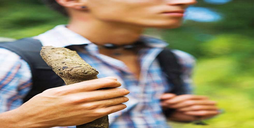
1 Castlemorris Wood Walk
2 Trail Tips This walk is one of a range of scenic walks developed by trailkilkenny and designed to allow you explore more of the great outdoors; bringing Kilkenny s wonderful countryside to walkers. The walks are essentially mini hikes and the character of each walk varies we describe this character at the start of the trail guide. You may find that the terrain may alter as you progress along the trail, an easy stroll along the flat may become a more challenging ascent. Choose a walk to suit your fitness level and the nature of your walking party. Some walks may not suit children under 10 years of age. We recommend that you dress appropriately; taking account of weather conditions. In periods of heavy rainfall the trail may become wet. You may check the daily weather forecast by phoning Weather Dial or log onto Each trail has been clearly marked with directional arrows. Note that the trails are marked in one direction only. We recommend that you follow the trail bringing the trail map with you for reference. The Country Code The country code reminds us that we are all guardians of our landscape and that these trails in particular have been developed with the kind permission of landowners we ask that you Respect the people who live and Guard against all risk of fire work in the countryside Leave animals, crops and Do not park in farm gateways or machinery alone on narrow lanes Keep dogs on a lead at all times Leave gates as you find them Avoid making unnecessary noise Keep to the edges of field when crossing farmland Protect wildlife, plants and trees Avoid disturbing fences, hedges, walls and gates Use public paths where possible Always consider your personal safety and keep children under close supervision
3 P Castlemorris Wood Walk Two looped walks that start and finish at the Grand Gates which lies west of the villages of Newmarket and Hugginstown and east of the village of Kilmaganny in south Kilkenny. Red Loop Green Loop Trail Length: 6 Km 3 Km Duration: 1.5 Hours 1 Hour Difficulty: Moderate Moderate Footwear: Walking Boots Walking Boots Terrain: Forest track, Grasslands Forest track Some wet ground, Some wet ground, Minor Roads 1.3Km Grasslands Parking: Parking available opposite the Grand Gates of Castlemorris Estate Caution: This is a working forest. The loops will be closed for thirty days of the year as the forest houses pheasants which are released during the shooting season. Notification of the closures will be placed on the map information board. You will come across ruins of old buildings as you take this walk. Please do not interfere with these ruins. Not suitable for buggies due to wet ground. Dogs must be kept on leads at all times. Along the Trail: Follow the pathway of the forest which leads you to two colour coded looped walks (a red and a green) offering an excellent display of the various flora and fauna changing with each season. This developing coniferous woodland also offers samples of broadleaf trees including oak, beech, birch, larch and ash. The trail starts/finishes at the Grand Gates entrance to Castlemorris Wood, Aghaviller, Newmarket, Co.Kilkenny Entering through the Grand gates of Castlemorris, you will pass the Gate Lodge on the right hand side. Climb over the stile on the left hand side and walk straight along path for both the red and green loop. Continue walking for approx 15 mins, until you come to an open space where there is a picnic table. Old out buildings are visible at the back entrance to what was Castlemorris house Courtyard.
4 At this point the loops diverge. Turn right for the Red loop and left for Green loop. Red loop This trail continues right around the estate with views of the old out buildings. The Trail does not include passing through the old courtyard outbuildings. Walk along a narrow path at the side of the forest, at the end of this path, turn right. Continue to follow the signs until you exit the forest onto a minor public road. Turn left and continue to walk down the hill. Enter back into forest at the end of the hill by turning left. Follow the signs to the area where you join with green route and follow the trail back to the Grand gates. Green Loop Starting the trail from the Gate Lodge, follow the signs to a common area where the two loops will diverge. Turn left at the picnic table. Continue to the next junction and turn left again. Follow the signs through the forest path. You will join back with the red route. Continue walking back towards the Gate Lodge, taking the two sign posted left turns. Your walk will end at the Grand Gates. Castlemorris Castlemorris Estate (also known as Castle Morres). Harvey Morres received a grant of land here in the late 17th century. Francis Morres, the first Viscount Mountmorris and Harvey s eldest son commissioned Castle Morres and as one of the largest stately homes in the country and it was built in approx Francis Blunden who also designed such notable houses as Bessborough House and Woodstock House in Co Kilkenny, designed the house. Based in the parish of Aghaviller, the Castlemorris Estate was previously known as Diore Lia a grey wood. Formerly home to the Morres and De Montmorency families, the family vault can still be seen in the local church yard. The church yard also contains the remains of an ancient round tower. Built to protect the occupants and valuables of monastic settlements from Viking raids, these towers dot the Nore valley.
5 In 1924 the house was sold to the Land Commission. In the early 1930 s it was unroofed and a demolition sale took place. Many parts of the house are to be found in houses around the country. The house was finally demolished in The grounds now merge with other Coillte woods totalling approximately 2000 acres. Flora With the changing of the season so too the variety of flora change see which of the following you can spot. Bramble, fern, bracken, great woodrush, honeysuckle, holly, ivy, moss, bilberry, gorse, bluebell, cherry laurel, wood sedge, speedwell, foxglove, willow herb and raspberry. Fauna The forest is the chosen habitat of a number of wildlife including the fox, badger, hare, rabbit, woodmouse, brown rat, grey squirrel, hedgehog and birds including the woodpidgeon, crow, magpie, blackbird, thrush, coal tit, willow warbler, wren, robin and goldcrest. Tree Species The forest at Castlemorris contain broadleaf species including beech, oak, hazel, ash, sycamore, Spanish chestnut, birch, elm, poplar, rowan and hazel. Conifers include the Sitka and Norway spruce, Japanese and European Larch, Scots pine and lodgepole pine, Douglas and silver fir, western hemlock, Lawson cypress. For details of other walking trails in Kilkenny log onto www. trailkilkenny.ie Our Trail Kilkenny Partners
6 N9 To Kilkenny R697 Knocktopher N9 To Thomastown R701 Kilmaganny Newmarket R697 To Carrick on Suir Castlemorris Hugginstown N10 To Waterford R701 Picnic Area P Grand Gates Newmarket Castlemorris Wood Walk
Lincolnshire Limewoods Walks. Woodhall Spa. A circular walk of 13km (8 miles)
") Lincolnshire Limewoods Walks Woodhall Spa A circular walk of 13km (8 miles) Introduction The Lincolnshire Limewoods is an area between Wragby, Bardney and Woodhall Spa. It is a fantastic place to explore
Lincolnshire Limewoods Walks Woodhall Spa A circular walk of 13km (8 miles) Introduction The Lincolnshire Limewoods is an area between Wragby, Bardney and Woodhall Spa. It is a fantastic place to explore
Lincolnshire Walks. Grainthorpe. Three circular walks of 2 ¾, 9 and 9 ½ km (1 ¾, 5 ½ and 6 miles)
") Lincolnshire Walks Grainthorpe Three circular walks of ¾, 9 and 9 ½ km (1 ¾, ½ and 6 miles) Introduction Explore the coastal marshes, arable hinterland, Louth Navigation canal and the village of Grainthorpe
Lincolnshire Walks Grainthorpe Three circular walks of ¾, 9 and 9 ½ km (1 ¾, ½ and 6 miles) Introduction Explore the coastal marshes, arable hinterland, Louth Navigation canal and the village of Grainthorpe
holly tree Wellhill Farm Woodyard Bramham House red kites Round House ha-ha
 This 6.4 mile walk around the magnificent Bramham Park Estate has been made possible with the active support of the owner of the Estate, Nick Lane Fox, with funding from Natural England, as part of Defra
9.5 km Circular 3 hours
 RANMORE CIRCULAR A 6 mile (9.5km) circular walk from Boxhill and Westhumble Station in the village of Westhumble, passing through part of the Polesden Lacey Estate, Ranmore Common and Denbies Vineyard.
Lincolnshire Walks. Ancaster. Three cir cular walks of2 3/4,4or 6km (11/3, 21/2 or 33/4 miles)
") Lincolnshire Walks Ancaster Three cir cular walks of2 3/4,4or 6km (11/3, 21/2 or 33/4 miles) Introduction These walks are set in the attractive countryside around the historic town of Ancaster. The town
Lincolnshire Walks Ancaster Three cir cular walks of2 3/4,4or 6km (11/3, 21/2 or 33/4 miles) Introduction These walks are set in the attractive countryside around the historic town of Ancaster. The town
How to get there. Respect - Protect - Enjoy
 How to get there Driving: Postcode is OX49 5HL with a car park for customers Nearest station: Henley on Thames station is 9.5 miles away. We re delighted to present three circular walks all starting and
Heartwood Forest, in Sandridge, Hertfordshire, is a place where everyone can find space, peace, wildlife and miles of beautiful woodland to explore.
 Heartwood Forest Accessibility Statement September 2016 Purpose: This accessibility statement outlines the available facilities and access information for Heartwood Forest. Welcome We, the Woodland Trust,
Tinneyhall Wood, Cornwall - About 9 ½ acres, 59,000
 Tinneyhall Wood, Cornwall - About 9 ½ acres, 59,000 Tinney Hall is a hamlet close by the small hilltop village of Lewannick, which is centred around a crossroads. This is unusual for Cornwall, where the
Beautiful Walks from the Blue Ball Inn
 Walk No. 7 COAST AND VALLEY WALK Countisbury, Glenthorne, County Gate, Brendon, Rockford and Wilsham 10 MILES APPROX. Walking time 5 hours approx. (not including breaks)> OS Sheet 64/74 Lynton and Lynmouth.
Slindon Folly - South Downs, West Sussex
 Slindon Folly - South Downs, West Sussex Starts at Park road-side near entrance to Slindon College 2 hours 15 minutes 4.5miles 7.2km Easy ID: 0.1598 Developed by: Chris Mumford Checked by: Rockpit www.ramblersroutes.org
Approximate distance: 10 miles For this walk we ve included OS grid references should you wish to use them. Start. End
 Approximate distance: 10 miles For this walk we ve included OS grid references should you wish to use them. 2 3 Start End 1 N W E S Reproduced by permission of Ordnance Survey on behalf of HMSO. Crown
THE DOG AND DUCK HAREWOODS ESTATE TRAIL. 6 Miles Circular 3 hours. Getting there. Walk Sections
 THE DOG AND DUCK HAREWOODS ESTATE TRAIL Moderate Terrain A 6 mile circular pub walk from the Dog and Duck in Outwood, Surrey. The Dog and Duck is a delightful pub where everyone is made welcome. From walkers
Clyde Walkway Community Links: Nemphlar Moor Road to Braidwood
 Clyde Walkway Community Links: Nemphlar Moor Road to Braidwood Nemphlar Moor Road to Braidwood Digital Trail Difficulty (out of 3) 2 Distance Main route to Braidwood (shortest) 2.5km, 5km return. Detours
Countryside Walks. 1) Highclere Park Public Walk.
 Highclere Park Public Walk.") 1) Highclere Park Public Walk. Access: From Highclere Estate Main Entrance at Whitway, please note there is no parking on site or access for vehicles. Open: Throughout the year. Description: This footpath
1) Highclere Park Public Walk. Access: From Highclere Estate Main Entrance at Whitway, please note there is no parking on site or access for vehicles. Open: Throughout the year. Description: This footpath
9. Marbury Country Park
 9. Marbury Country Park Marbury has seen many dramatic changes, particularly within living memory. After Leslie Fink and Company demolished Marbury Hall in 1968, they tried several times to get planning
10 Miles Circular 5 hours
 VISIT RYEDALE PICKERING AND CAWTHORN CAMPS 10 Miles Circular 5 hours Moderate Terrain 120616 A 10 mile (16km) there and back walk from the market town of Pickering in Ryedale. The route heads north through
Sandilands to Huttoft Bank
 Coastal Country Park Walks Sandilands to Huttoft Bank A CIRCULAR WALK OF 11KM (7 MILES) INTRODUCTION The Lincolnshire Coastal Country Park lies between Sandilands, Chapel St Leonards and Huttoft on the
Danbury Words and pictures by Laurie Page of the Public Rights of Way team at Essex County Council.
 Danbury Words and pictures by Laurie Page of the Public Rights of Way team at Essex County Council. An undulating walk from Danbury village to the bluebells at the National Trust property of Blakes Wood.
9.5 km Circular 3 hours
 MEDIEVAL WAVERLEY Challenging Terrain A 6 mile (9.5km) undulating circular walk from Tilford village passing close to The Sands village and the historic ruins of Waverley Abbey. From the top of Crooksbury
THE WELLDIGGERS ARMS, HESWORTH AND FITTLEWORTH TRAIL
 THE WELLDIGGERS ARMS, HESWORTH AND FITTLEWORTH TRAIL 5.5 miles Circular 3 hours 041017 Challenging Terrain A 300-year-old pub turned country-inn on the edge of the South Downs National Park, The Welldiggers
Uif!Sfe!Mjpn-!Mpnhepn! bne!dbnnpdl!dibtf-! Tubggpsetijsf
 Uif!Sfe!Mjpn-!Mpnhepn! bne!dbnnpdl!dibtf-! Tubggpsetijsf 7/6!njmft! Djsdvmbs!!!!!!! 4!up!4/6! ipvst Strenuous Terrain Uif!Sfe!Mjpn!jt!b!dmbttjd!wjmmbhf!qvc-!b! hsfbu!qmbdf!up!tbujtgz!zpvs!ivnhfs!bgufs!b!
Stokenchurch. Bluebell Woods, Bomber Memorial, Red Kites, Getty s Cricket Ground, Nature Reserve
 Stokenchurch Bluebell Woods, Bomber Memorial, Red Kites, Getty s Cricket Ground, Nature Reserve Bomber Memorial The best time to visit Cowleaze Wood is in the spring when there is a memorable display of
THE PONTON PLOD - 27 MILE ROUTE
 THE PONTON PLOD - 27 MILE ROUTE Emergency Phone Number 07771 813514 Abbreviations: BW Bridleway X Cross immd immediately FP Footpath TL Turn left L Left thro through KG Kissing Gate TR Turn right R Right
Slew Wood near South Molton, Devon, acres of productive conifer woodland 115,000 freehold.
 WOODS 4 SALE Phone: 01248 364 362 www.woods4sale.co.uk UK Woodland & Woods For Sale: Specialising in the Sales of Small Woodlands in England, Scotland and Wales for Recreation, Wildlife Conservation and
Margam Country Park. Saturday 10 September, 10am 5pm Margam Country Park, Neath Port Talbot SA13 2TJ. Enjoy a great day out!
 Margam ountry Park Saturday 10 September, 10am 5pm Margam ountry Park, S13 2TJ Enjoy a great day out! #boutg www.ramblers.org.uk/walkabout From 10am 5pm, there s plenty on offer for everyone Throughout
Welsh Newton and Woodland
 Welsh Newton and Woodland This is a 8.2km miles (approx) walk which will take about 2.5 hours at a relaxed and leisurely pace. There are a few hills but no steep inclines. Start at Llangrove bus stop and
The Mendip Way. Route Directions and Maps Wells to Frome
 The Mendip Way Route Directions and Maps Wells to Frome Website: www.mendiphillsaonb.org.uk Email: mendip@mendiphillsaonb.org.uk Facebook & Twitter: @MendipHillsAONB Phone: 01761462338 1 Wells to Shepton
Spring Walking Weekend June 6, 7, and 8, Walk List
 Spring Walking Weekend June 6, 7, and 8, 2014 Walk List Friday, June 6 Barnstable Conservation with Yoga, West Barnstable from Service Rd 9:30 AM 2.5 miles, 1.5 hrs: Moderate Description: A leisurely hike
The Hundred Parishes
 The Hundred Parishes Walks from railway stations number 9 6.4 miles (10kms) from Bishop s Stortford to Stansted Mountfitchet Start: Bishop s Stortford station (Grid Reference TL492209) (ample parking and
Saltash, Cornwall - Railways, Rivers & Castles
 Saltash, Cornwall - Railways, Rivers & Castles Starts at St Stephen's Church, Saltash, Cornwall 2 hours 45 minutes 5.5miles 8.9km Easy ID: 0.2532 Developed by: Peter Clements Checked by: Kevin Connor www.ramblersroutes.org
For more information and to buy this book click here ISBN: CICERONE. Guides for walkers, trekkers, mountaineers, climbers and cyclists
 For more information and to buy this book click here ISBN: 9781852845377 CICERONE Guides for walkers, trekkers, mountaineers, climbers and cyclists www.cicerone.co.uk WALK 5 Ouston and Urpeth Distance
This walk description is from happyhiker.co.uk
 This walk description is from happyhiker.co.uk Pendle Hill Walk From Barley Starting point and OS Grid reference Ordnance Survey map Distance Traffic light rating Barley village honesty box car park OS
Walk 2 Village Hall - The Shippy - Woodhouse Farm - Village Hall
 Walk 2 Village Hall - The Shippy - Woodhouse Farm - Village Hall The walk is approximately 4km (2.5 miles) across fairly flat countryside with about a quarter on country lanes. It should take about 1 hour
2112 Behan Road Crystal Lake, IL 60014
 McHenry County Conservation District Prairieview Education Center Field Trip 2112 Behan Road Crystal Lake, IL 60014 Name Winter Ecology Schedule 10:00-1:30pm Tracks Not Commonly Found at PEC 10:00 10:20
The South Huron Trail
 The South Huron Trail Exeter, Ontario Health Recreation Nature Welcome to Exeter s South Huron Trail Beautiful in all the seasons 2 The South Huron Trail The South Huron Trail is an eight-kilometre, allseason
Other useful information Nearest Refreshments: In the Victoria Inn or the Lugger Inn, in Chickerell OS Explorer Map: OL15 (Purbeck and South Dorset)
") they find the diamond, and then to Holland, where they try to sell it, finding themselves in worse trouble than ever as a result. It is ten years before John returns to Moonfleet, fortuitously being shipwrecked
they find the diamond, and then to Holland, where they try to sell it, finding themselves in worse trouble than ever as a result. It is ten years before John returns to Moonfleet, fortuitously being shipwrecked
Distance: 14 km=8½ miles or 7 km=4½ miles easy-to-moderate walking
 point your feet on a new path Normandy Distance: 14 km=8½ miles or 7 km=4½ miles easy-to-moderate walking Region: Surrey Author: Botafuego Refreshments: Pirbright, Ash date written: 20-feb-2012 date revised:
Although the majority of these walks are around country lanes you should still follow the Country Code:-
 With the update of the Parish Plan was a request for details of any Walks around Pillaton The following pages give several walks that I and my wife have done for many years. Please be aware that NONE OF
Achievement Badges. Page 1 of 7 EQUINE ACHIEVEMENT BADGES
 Equine Access to Endurance Awarded to Members who have attained the following badges: Fitness, Map Reading, First Aid (Equine), First Aid (Human), Road Rider, Care of the Foot, Countryside Access, and
Harlington - Sharpenhoe - Pulloxhill
 Harlington - Sharpenhoe - Pulloxhill ID: 3676, Distance: 8 miles, Height gain: 140 Metres, Map: Explorer 193 Luton & Stevenage, Contributor: Dennis Jeanes Duration: 3 Hours 27 Mins Features Church,Great
Winterfold Wood. point your feet on a new path. In Brief
 point your feet on a new path Winterfold Wood Distance: 8½ km=5¼ miles Region: Surrey Author: Schwebefuss Refreshments: Windmill Inn, Peaslake after the walk moderate walking with many gradients Date written:
Cilgerran Wildlife Park Circular Walk
 Walking embrokeshire Cilgerran Wildlife ark Circular Walk It s good to walk, so why not step out and sample some of the walks your neighbourhood has to offer. This pleasant and interesting walk which starts
8 Miles Circular 4 hours
 VISIT RYEDALE HELMSLEY AND RICCAL DALE 8 Miles Circular 4 hours 090616 Challenging Terrain An 8 mile (13km) circular walk from the market town of Helmsley in Ryedale. The route heads out across sheep pastures
Fertile farms in the heart of Kent
 55 55 Fertile farms in the heart of Kent A bright sunny day is perfect for enjoying the rich and fertile Kent countryside and outstanding views across the valley of the Great Stour to the North Downs.
F R E E R E s E R v o i R WA L K s REsERvoiR WALKs To BLoW AWAY THE CoBWEBs BRougHT To You BY
 F R E E r e s e r v o i r WALKS reservoir WALKS TO BLOW AWAY THE COBWEBS Brought to you by Only available in Yorkshire. We look after 72,000 acres of land in Yorkshire, spanning the North York Moors, the
9.5 km Circular 3 hours
 SILENT POOL AND ST MARTHA S HILL Challenging Terrain A 9.5km (6 mile) circular walk in the Surrey Hills, visiting a number of popular attractions including Silent Pool, a stretch of the North Downs Way,
Masson Hill. Walk. Approximately 4 km. Moderate Walk Begins from Matlock Railway Station
 Masson Hill Walk Approximately 4 km Moderate Walk Begins from Matlock Railway Station TOWN WALKS Masson Hill walk is approx. 4 km. It can be walked in a couple of hours or so. Enjoy your walk and the beautiful
Oldbury & Littleton, South Gloucestershire
 Oldbury & Littleton, South Gloucestershire Starts at Church Lane, Oldbury. BS35 1QF 2 hours 0 minutes 5.2miles 8.4km Easy ID: 0.2468 Developed by: GEOFF MULLETT Checked by: Marion Stone www.ramblersroutes.org
6.5 km Circular 2 hours
 REIGATE MILLS AND PILLBOXES A 4 mile (6.5km) enjoyable circular walk from Reigate Heath, passing Reigate Heath windmill, Wonham Mill and pillboxes built during the Second World War. 6.5 km Circular 2 hours
Echo Point to Leura Forest via Three Sisters and Giant Stairs loop
 Echo Point to Leura Forest via Three Sisters and Giant Stairs loop 3 hrs 3.8 km Circuit Hard track 512m This walk starts from the popular Echo Point, in Katoomba, and winds down to the base of the Three
GENERAL INFORMATION PLEASE FOLLOW THE COUNTRYSIDE CODE:
 KNIGHTON CIRCULAR WALKS The East Radnor Group of the Ramblers Association invites you to enjoy these walks around Knighton. Knighton is an excellent centre for walks in the lovely unspoilt mid-wales countryside
Poundgate and The Hurstwood
 point your feet on a new path Poundgate and The Hurstwood Distance: 11 km=7 miles Region: East Sussex Author: Stivaletti Refreshments: High Hurstwood easy walking Date written: 24-jul-2016 Last update:
Ambergate & Betty Kenny's Tree.
 Walk Information Walk Area: Ambergate OS Map: Explorer OL24 Distance: 4 Miles White Peak Area Start Point: Holly Lane, Ambergate 1:25000 Map Ref: SK 346 254 Post Code N/A General Information Altitude Data
Right of public access a unique opportunity
 1 Right of public access a unique opportunity Don t disturb don t destroy The right of public access is a fantastic opportunity for all of us to roam freely in nature. You make use of the right of public
Walk Description. Directions
 Title: Saffron Trail: Battlesbridge to Chelmsford Distance: 14¾ miles Time taken: 6 hours Start Point: Outside the Barge Inn, Battlesbridge OS Explorer Map: 175 & 183 Grid Ref.: TQ 780 947 Transport: Rail:-
How to get there. Respect - Protect - Enjoy
 How to get there Driving: Postcode is RG9 5PF and there is a car park just across from the pub. Nearest station: Henley-on-Thames station is 5.6 miles away. We re delighted to present three circular walks
Distance: 5 km=3 miles or 4½ km=2¾ miles or 3½ km=2 miles
 point your feet on a new path Vann Lake Distance: 5 km=3 miles or 4½ km=2¾ miles or 3½ km=2 miles Region: Surrey Author: Schwebefuss Refreshments: Ockley easy walking Date written: 12-feb-2011 Date revised:
BALCOMBE AND ARDINGLY RESERVOIR, WEST SUSSEX
 BALCOMBE AND ARDINGLY RESERVOIR, WEST SUSSEX 7 miles Circular 4 hours 080816 Challenging Terrain Hi, I'm Luke and this is my West Sussex Weekends walk It's a 7 mile loop from Balcombe rail station, taking
A la s d ai r H o o d Co ns ul ti ng Ar bo ric ul tu ra
 A la s d ai r H o o d Co ns ul ti ng Ar bo ric ul tu ra ah Tree Management at Dunfermline Golf Club Summary Report August 2017 Prepared by Alasdair Hood Prepared for John McNeil on behalf of Dunfermline
Upper Rumbalara circuit
 Upper Rumbalara circuit 1 hr 30 mins 3.3 km Circuit Hard track 176m A great circuit walk, covering most of the walking tracks and sights in the upper section of the Rumbalara Reserve. There is some really
A circular walk of or km (2 1 4 or miles)
") Grantham A circular walk of 3 3 4 or 5 3 4 km (2 1 4 or 3 1 2 miles) Introduction This relatively short circular walk, which starts in the middle of Grantham, offers plenty of variety. The route takes
Grantham A circular walk of 3 3 4 or 5 3 4 km (2 1 4 or 3 1 2 miles) Introduction This relatively short circular walk, which starts in the middle of Grantham, offers plenty of variety. The route takes
Clyde Walkway Community Links: Rosebank Circular via Ashgill and Dalserf
 Clyde Walkway Community Links: Rosebank Circular via Ashgill and Dalserf Rosebank Circular via Ashgill and Dalserf Digital Trail Difficulty (out of 3) 1 Distance 7 km / 4.35 miles. Time 2 hours Terrain
Thornton le Dale Walks
 Thornton le Dale Walks A collection of walks in and around the village Thornton le Dale Traders Forum www.visitthorntonledale.co.uk Thornton le Dale Walks Walk 1: Beck Isle Cottage and All Saints Church
Minnesota TREK MINNESOTA TRAIL SELF-GUIDED TOUR 6TH - 8TH GRADE. Minnesota Trek 6 8th grades 1
 Minnesota TREK MINNESOTA TRAIL SELF-GUIDED TOUR 6TH - 8TH GRADE Minnesota Trek 6 8th grades 1 Welcome to the MINNESOTA ZOO Minnesota Trek Self-Guided Tour USE THE MINNESOTA TREK TO HELP YOU LEARN HOW...
Hexham Abbey to the Racecourse Road
 Hexham Abbey to the Racecourse Road The Yarridge Road, or Racecourse Road as it is often known, runs along the ridge line to the south of Hexham and provides wonderful views of the river valley and fells
Chapel Point to Anderby Creek
 Coastal Country Park Walks Chapel Point to Anderby Creek A CIRCULAR WALK OF 8.5 OR 6 KM (5.3 OR 3.75 MILES) INTRODUCTION The Lincolnshire Coastal Country Park lies between Sandilands, Chapel St Leonards
Thornton le Dale Walks
 Thornton le Dale Walks A collection of circular walks in, and around, the village www.visitthorntonledale.co.uk Thornton-le-Dale Traders Forum and Thornton le Dale Parish Council 1 Thornton le Dale Circular
Fritton Lake Retreats
 Activities Fritton Lake Retreats is part of the historic and prestigious 5,000 acre Somerleyton Estate on the Norfolk/ Suffolk border. The park itself is set within 250 acres of mature woodland and parkland
Hammer Vale and Linchmere Common
 point your feet on a new path Hammer Vale and Linchmere Common Distance: 9 km=5½ miles or 6 km=3¾ miles easy walking with one steep section Region: Hampshire, West Sussex Author: Botafuego Refreshments:
East Devon Way Circulars
 East Devon Way s A new series of circular walks developed by the East Devon Ramblers to help you explore the wildlife, heritage and places of interest just off the East Devon Way. h. i. l. g. k. b. c.
Bagshot Heath and Swinley Forest
 point your feet on a new path Bagshot Heath and Swinley Forest Distance: 13 km=8 miles Region: Berkshire, Surrey Author: Botafuego Refreshments: Forest Look Out, Bagshot easy walking Date written: 17-feb-2013
Maps The maps provided are a guide and are not to scale. Please use OS Explorer Map 120 (Chichester).
.") A Walker s Guide - Chichester Harbour Useful Information Directions All the walks were tested in 2013. Please note, however, that some footpaths may be diverted and buildings such as pubs may have changed
A Walker s Guide - Chichester Harbour Useful Information Directions All the walks were tested in 2013. Please note, however, that some footpaths may be diverted and buildings such as pubs may have changed
Bonnie Prince Charlie Walk
 Bonnie Prince Charlie Walk A waymarked route from Ashbourne to Derby to celebrate the 60th anniversary (1995) of the formation of the Ramblers' Association. This route follows the general direction of
How to get there. Respect - Protect - Enjoy
 How to get there Driving: Postcode is RG9 3DG and there is a carpark just across from the pub. Nearest station: Henley-on-Thames station is 5.6 miles away. We re delighted to present three circular walks
Walk 2: Beamsley Beacon and Bolton Abbey
 Walk 2: Beamsley Beacon and Bolton Abbey Start and Finish: The Memorial Hall, Main Street, Addingham, LS29 0LZ, SE 079 497 The shortest walk is about 5½ miles (8.8km) The medium Walk is about 8¼ miles
ST. AGNES. you cannot put a time limit on beauty.
 ST. AGNES CIRCULAR WALKS AROUND There are many enjoyable and picturesque walks around St. Agnes most are signposted and are featured on the St. Agnes Mini-guide map. Because most of our footpaths are in
Dyrham and Hinton Parish Walks
 Dyrham and Hinton Parish Walks A series of five walks in the parish, exploring most of the public footpaths. By John Miller Each walk is described in detail, with a complete map, to provide a handy guide
Bakewell Club Site - Robin Hood's Stride
 Bakewell Club Site - Robin Hood's Stride Camping and Caravanning Route Summary A circular walk with fabulous views winding it's way through the beautiful White Peak scenery. Points of interest include
236 HORSE CHESTNUT 1. REDUCE CROWN HEIGHT - BY 3.0M 2. REDUCE CROWN RADIAL SPREAD - BY 2.0M 242 LIME 1. REMOVE - MAJOR DEAD WOOD 2.
 NETHERNE ON THE HILL TREE NUMBER SPECIES TREE WORK DESCRIPTION 2 LIME REMOVE - MAJOR DEAD WOOD 3 HORSE CHESTNUT 1. REMOVE BROKEN BRANCH 2. RAISE LOW CANOPY - TO 5.2M 30 HORSE CHESTNUT SEVER IVY AT BASE
Greenwood. Walks. Cossall Canal Walk. Cossall Canal Walk
 Cossall Canal Walk C5 Cossall Canal Walk C5 Features: Cossall is a picturesque, relatively unspoiled village on the Nottingham canal, four miles south-east of Eastwood. Architecturally interesting. See
NEWLANDS CORNER AND ST MARTHAS
 NEWLANDS CORNER AND ST MARTHAS 10k CIRCULAR ROUTE 2½-3HRS GU4 8SE From Newlands Corner on the North Downs just outside Guildford, you can enjoy one of the most beautiful panoramas of quintessential English
Walks in Lenham. Three delightful walks in and around Lenham from 30 minutes to 90 minutes with map and photographic guides. l l l ABOUT LENHAM
 Walks in Lenham Three delightful walks in and around Lenham from 0 minutes to 90 minutes with map and photographic guides l l l ABOUT LENHAM The medieval village of Lenham, in the Borough of Maidstone,
Epping to Eastwood Station (via Lane Cove River)
") Epping to Eastwood Station (via Lane Cove River) hrs 45 mins 10.2 km One way Moderate track 189m Epping to Eastwood, via Lane Cove River, is the longer route through the bush between the stations. This
Epping to Eastwood Station (via Lane Cove River) hrs 45 mins 10.2 km One way Moderate track 189m Epping to Eastwood, via Lane Cove River, is the longer route through the bush between the stations. This
Corkagh Park Maths Trail
 Open your Corkagh Park Maths Trail In association with: This trail begins at the noticeboard at the entrance near the St John s Wood car parks in Corkagh Park The producers of this Maths Trail accept no
Weatherman Walking. Approximate distance: 5.5 miles For this walk we ve included OS grid references should you wish to use them. Start.
 Approximate distance: 5.5 miles For this walk we ve included OS grid references should you wish to use them. 4 1 Start End 3 2 N W E S Reproduced by permission of Ordnance Survey on behalf of HMSO. Crown
Husthwaite to Byland Abbey
 Husthwaite to Byland Abbey This walk begins with a loop round the village of Husthwaite and continues towards Coxwold along a disused railway line, which is now a right of way. It passes through Coxwold
Tideswell to Castleton
 Tideswell to Castleton 1 Walk summary Length: 14 km, 8.5 miles Maps: OS Explorer OL1 The Peak District - Dark Peak Area, OS Explorer OL24 The Peak District - White Peak Area, OS Landranger 110 Sheffield
CHILTERN RAMBLING TRAIL
 CHILTERN RAMBLING TRAIL This route, including a section of the Ridgeway Long Distance Path, offers breathtaking views from the Chiltern ridge. It starts in the Ashridge Estate and returns to Tring via
10 km Circular 3 hours
 FRIMLEY AND FRIMLEY GREEN 10 km Circular 3 hours Easy Terrain 250716 A 10km (6 mile) circular walk exploring the canal towpath, riverside path, woodland, heath and small settlements around Frimley in Surrey.
Footpaths and walks in the Leckhampton Fields
 APPENDIX 5 Footpaths and walks in the Leckhampton Fields Because of its network of footpaths, the Leckhampton Fields have many different walks. The rich diversity of landscape, hedgerows, trees, streams,
Follow the Lantern Way clockwise from Dursley Town Hall through Cam & Coaley to Uley and back to Dursley (about 14 miles)
") According to the Rev Kilvert's diary of 1873, couples on their way to evening services in winter followed a practical though unusual local tradition: "My Mother says that at Dursley, when ladies and gentlemen
According to the Rev Kilvert's diary of 1873, couples on their way to evening services in winter followed a practical though unusual local tradition: "My Mother says that at Dursley, when ladies and gentlemen
Liam & Zell Conway Welcome You To Riversdale House Guided & Self Guided Walking & Electric Bike Tours Designed especially for you
 Liam & Zell Conway Welcome You To Riversdale House Guided & Self Guided Walking & Electric Bike Tours Designed especially for you Phone 00353 ( 0)404 45858 w.w.w.glendalough.eu.com info@glendalough.eu.com
Distance: 9½ km=5¾ miles moderate walking or two walks of 4¼ km=2¾ miles and 6½ km=4 miles
 point your feet on a new path White Hill, Headley Distance: 9½ km=5¾ miles moderate walking or two walks of 4¼ km=2¾ miles and 6½ km=4 miles Region: Surrey Author: Fusszweig Refreshments: Headley Date
connectivity through walking and cycling
 active design case study the national forest: connectivity through walking and cycling active design principles in action: 1. ACTIVITY FOR ALL 2. WALKABLE COMMUNITIES 3. CONNECTED WALKING & CYCLING ROUTES
RANS WOOD WALK circa 3 miles/ 5 kilometres
 RANS WOOD EXCURSION This walk is about an hour. It is rarely frequented by tourists or by visitors to the National Park. It is a secret favourite amongst local dog walkers and cyclists. The walk is in
Horsted Keynes to Sheffield Park Hop On The Bluebell Line
 point your feet on a new path to Sheffield Park Hop On The Bluebell Line Distance 11½ km=7 miles Region: West Sussex, East Sussex Author: Hautboy easy walking with a steam train ride Refreshments: The
SOUTH LONDON ORIENTEERS OK Nuts Trophy and Blood Races Richmond Park Sunday 21st January Assembly Location, Facilities and Travel
 SOUTH LONDON ORIENTEERS OK Nuts Trophy and Blood Races Richmond Park Sunday 21st January 2018 Welcome to Richmond Park, a National Nature Reserve, London s largest Site of Special Scientific Interest,
Clyde Walkway Community Links: Crossford Stonebyres Nemphlar- Kirkfieldbank
 Clyde Walkway Community Links: Crossford Stonebyres Nemphlar- Kirkfieldbank Crossford Stonebyres Nemphlar - Kirkfieldbank Digital Trail Difficulty (out of 3) 2 Distance 1. Crossford to Kirkfield Bank Bridge
What are National Parks?
 Honeypot sites What are National Parks? National Parks are protected areas of natural beauty. The areas include mountains, moorland, heathland, woodland and coasts. National Parks are not theme parks they
The King s Forest Ride 6 th 7 th and 8 th July 2018
 The King s Forest Ride 6 th 7 th and 8 th July 2018 Dear Competitor, Thank you for entering this ride, it is hope you are successful and enjoy the event. Please take the time to read this programme and