State Street Corridor Study. Table of Contents
|
|
|
- Bethany Ward
- 6 years ago
- Views:
Transcription

1
2 Table of Contents EXECUTIVE SUMMARY INTRODUCTION Background Project Overview Project Implementation Schedule Basemap Development Technical Memorandum A Contents STATUS OF RECENTLY COMPLETED STUDIES City Planning Documents Traffic Impact Studies Regional Documents Proposed Special Transportation Studies CORRIDOR CHARACTERISTICS Historical Information Land Use Current Land Use Vacant and Under-valued Land Corridor Design Features (Green/Blue Layer) State Street Nodes Physical Features TRANSIT AND PEDESTRIAN/BICYCLE INFRASTRUCTURE Regional Pathways Existing Pathway Infrastructure Walking Amenities Future Pathway and Walking Amenities Public Transit ROADWAY CONDITIONS Volume Development Existing Turn Movements and Link Volumes Future Turn Movements and Link Volumes Cross-section, Intersection, and Geometric Data Safety Analysis Connection Spacing and Driveway Density Analysis Connection Spacing Driveway Density Analysis Signal Information Existing Traffic Signal System Signal Timing ITS Applications Fiber Optic Communications Infrastructure CCTV Incident Cameras Signal Systems/Controllers Advanced Technology Signage...60 Meyer, Mohaddes Associates Supporting Data Volume I i
3 5.6 Intersection and corridor Operations Existing Intersection and Corridor Operation Conditions Future Intersection and Corridor Operation CORRIDOR DEFICIENCIES AND BREAKDOWN POINTS Existing Deficiencies Year 2010 Deficiencies and Breakdown Points Year 2025 Deficiencies and Breakdown Points PROGRESSING TO STAGE BIBLIOGRAPHY...68 APPENDIX A- RECENTLY COMPLETED STUDIES AND DOCUMENTS APPENDIX B- HISTORIC DATA APPENDIX C- GREENBELT DATABASE APPENDIX D- EXISTING AND FUTURE VOLUMES APPENDIX E CRASH DATABASE Meyer, Mohaddes Associates Supporting Data Volume I ii
4 List of Figures Figure 1. Project Area Map...6 Figure 2. Project Schedule...8 Figure 3. Land Use Map Figure 4. Zoning Parcel Map Figure 5. Undervalued/Vacant Parcel Map...18 Figure 6. Node Entry Image Map...19 Figure 7. Physical Organizations Map...22 Figure 8. Boise City s Parks & Recreation Greenbelt Map...26 Figure 10. Monthly Greenbelt Use...27 Figure 11. Weekly Use Trends...28 Figure 12. Designated Bike Path Striping...28 Figure 13. Ada County Ridge to Rivers Bikeway Map...29 Figure 14. Walking Amenities along State Street...31 Figure 15. State Street via N. 28 th Street BUS Route...35 Figure 16. State Street via Pierce Park BUS Route...36 Figure 17. BUS Route 16 Ridership Figure 18. Existing Volumes...41 Figure Volumes...43 Figure Volumes...44 Figure 21. Cross-sections along State Street at Change Locations...46 Figure 22. Key Intersection Layouts...47 Figure 23. Crashes per Day of Week...50 Figure 24. Three-Year Collision Type Percentages...51 Figure 25. Three Year Crash Locations Along the State Street Corridor...52 Figure 26. Crash Type by Specific Location...53 Meyer, Mohaddes Associates Supporting Data Volume I iii
5 List of Tables Table 1. Studies Related to Key Locations (see Appendix A)...9 Table 2. List of Projects included in the 2025 Network...12 Table 3. Gaps in Walking Amenities along the Corridor...30 Table 4. Crash Cause Totals Table 5. Connection Density along State Street Table 6 Driveway Densities along the State Street Corridor Table 7 State Street Cycle Length and Phasing Summary...58 Table 8. Levels of Service...60 Table 9. Level of Service by Intersection Table 10. Future Level of Service by Intersection...62 Meyer, Mohaddes Associates Supporting Data Volume I iv
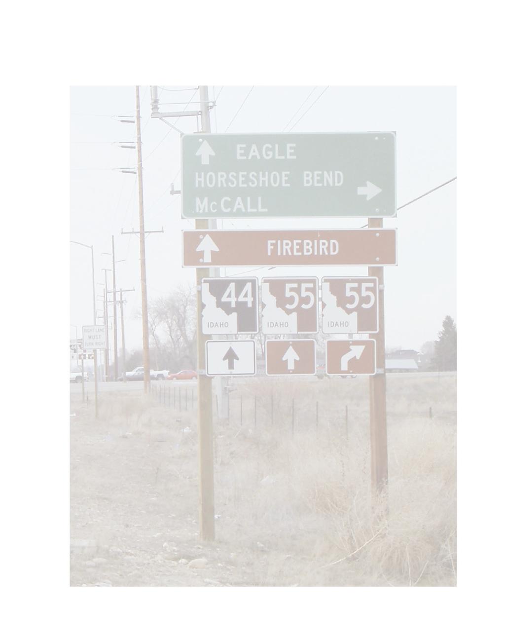
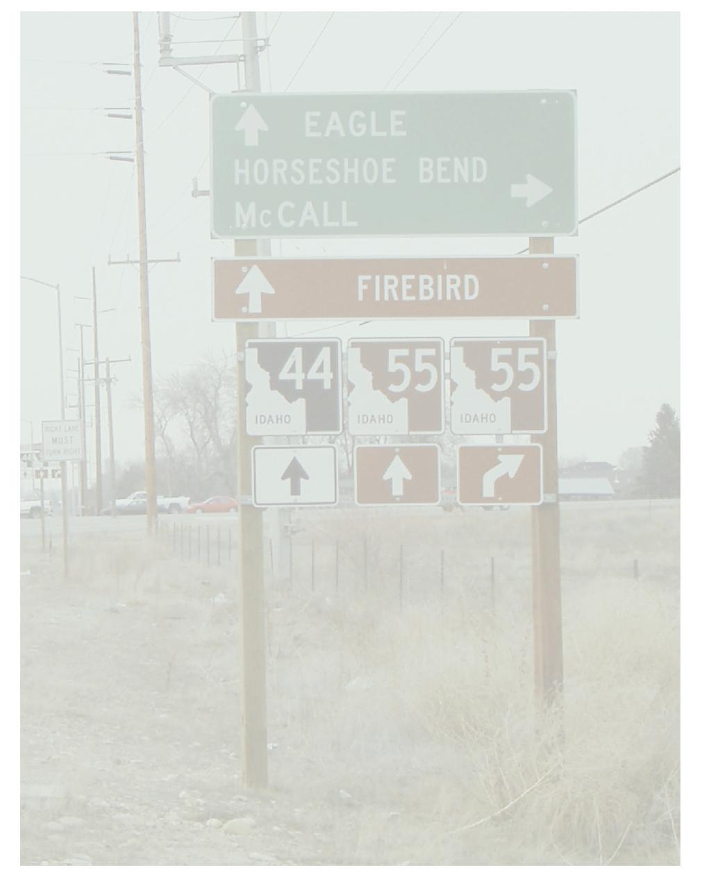
6 EXECUTIVE SUMMARY The Ada County Highway District (ACHD) requested professional engineering services to conduct a traffic study to develop long-term transportation and operation strategies for State Street from 23 rd Street to State Highway 55. This 6.4 mile segment, which is under the jurisdiction of ACHD and the Idaho Transportation Department (ITD), passes through the City of Boise, Garden City, and the City of Eagle, as well as through unincorporated areas of Ada County. ValleyRide operates transit routes on this segment of State Street. State Street is located in the north end of the Treasure Valley and serves as an essential east-west arterial carrying commuter, neighborhood, general business, leisure/recreational, and commercial traffic to and from downtown Boise. In fact, as a connection to northern and western neighboring cities that include McCall, Horseshoe Bend, Eagle, and Star, it represents a major gateway to the City of Boise. No other major arterial exists north of the Boise River that provides this full east to west connection. The thriving Treasure Valley economy, successful downtown Boise businesses, and tremendous residential growth to the west have left State Street with significant traffic delays during peak times, higher than average accident rates, and a growing need for a long term transportation and operational strategy to guide future implementations. This report presents the data collected, and analysis performed to establish the existing and future conditions. CORRIDOR FEATURES Boise, Garden City, and Eagle, border the State Street corridor. Northwest Boise City limits extend to Horseshoe Bend Road on the north side of State Street and just west of Lake Harbor on the south. Garden City extends from Plantation River Drive to Horseshoe Bend Road on the south side, where the City of Eagle begins. The predominant land uses along State Street are commercial, office, public, and residential. The corridor is substantially built-up on the east end with large portions of vacant land on the west. Newer neighborhoods predominate the western segments of State Street. Many homes have large lots, gardens, and horse pastures. The zoning designations as identified in the corridor encourage redevelopment of much of the corridor toward commercial centers and medium and high-density housing. The development of more intensive uses along State Street reflects higher land values and will continue to displace single-family residential uses along the street frontage. Design review procedures have been established by the City of Boise for new development fronting State Street. Design elements in Boise include a 20-foot landscaped setback for a parking area or building. State Street serves as a gateway to Boise and the regional connection to north Idaho. The street presents an image of the city with visually stimulating views of the Boise Foothills. As a primary gateway, particular attention should be given to enhancing the function and image of the corridor. Seven nodes have been identified along the corridor that serve as centers of activity Meyer, Mohaddes Associates Supporting Data Volume I 1
7 and connections to the surrounding neighborhoods. Proceeding east on State Street, development spreads over the 4-mile entrance to Boise with a variety of architectural styles, numerous signs, and overhead utility lines presenting a visually chaotic image. A number of large grassy and treed areas help shape State Street. These include the Idaho Transportation Department campus, Veterans Park with its numerous evergreen trees, Lowell School with over a block of tree-lined playground, and a row of Maple trees along Plantation Golf Course. Often large cottonwood trees are visible from the street and along cross streets such as Willow Lane. Canals provide a natural feature to the roadway and a connection to local irrigation and agriculture. They include the Farmers Union Canal, which flows along the south side of street from Willow Lane to Collister Drive. Other waterways crossing State Street includes Crane Creek Flume, Stuart Gulch, Boise Valley Canal, and Little Union Canal. The waterways provide both an aesthetic opportunity and a challenge to cross and blend into new development. Major pedestrian and bicycle investments have been made in the corridor to provide a multi-use path along the Boise River that connects from Glenwood Street to the central business district (CBD). Following a northwest alignment, the Boise Greenbelt provides a paved path parallel to State Street. The path follows the north side of the river to Plantation River Street, where it crosses the river and follows along the southern bank until it temporarily ends west of Glenwood Street. Future plans will extend the greenbelt westward to Eagle Island beyond the City of Eagle. Besides the Boise River Greenbelt and as illustrated in the Ada County Ridge to Rivers Bikeway Map, State Street is designated a bike lane and mixed-use route from 36 th Street to Gary Lane. State Street provides pedestrian connections to shopping centers, businesses, parks, schools, churches and neighborhoods along the corridor. Pedestrian facilities along State Street are limited to attached sidewalks along various portions of the corridor and numerous gaps are present in the western half of the corridor. Boise Urban Stages (BUS) operates Route 16 with one-hour headways along State Street to provide regular daily service and reverse-commute service during peak periods on weekdays. Routes 1 and 2 provide directional service to State Street on Saturdays with 45-minute headways. TRAFFIC OPERATIONS Many facets of a roadway contribute to its operations. These factors include corridor capacity and geometry, signal operations, intersection geometry, access/driveway density, and public transit operations. Existing and future public transit conditions were addressed in the proceeding section. Corridor capacity is evaluated through analysis of existing link volumes and lane availability. Traffic volumes, lane geometry, signal spacing, and signal timing all contribute to signal operations. Intersections and signal operations are the critical element limiting capacity and causing delay on a street network. Meyer, Mohaddes Associates Supporting Data Volume I 2
8 Crash records for the project were obtained from the Idaho Transportation Department (ITD) Safety Department. There were 192, 181, and 188 crashes in the State Street study area in 1999, 2000, and 2001, respectively. Although volumes have increased over the three-year analysis period, crashes remain constant if not lower, which suggests that the rate of crashes may be declining. However, there are significant numbers of access-related crashes, rear-end crashes, head-on crashes, and congestion-related crashes at intersections in the corridor that need to be addressed. The segments of State Street near Glenwood, Pierce Park, Plantation River, Collister, Willow, Veterans Memorial, 32 nd, 33 rd, and 28 th Streets have numerous driveway connections that are at or above 45 per mile, which is an indicator of increased crash potential and decreased corridor operations and capacity. Intersection traffic operations were evaluated using control delay and level of service. Intersection volumes were developed for both existing and future conditions. Initially, the existing conditions with current volumes were evaluated. Existing volumes provided a base for future volumes and analysis. The evaluation was performed using data compiled from field reviews, and traffic counts and existing timing data provided by the Ada County Highway District. As with most arterial corridors, the intersections along the State Street corridor are restricting the capacity of the corridor, due to the confluence of traffic flows. Traffic volumes on State Street have increased from around 30,000 ADT to 37,000 ADT (over 23%) in the last 4 years. Traffic growth is expected to increase 50-60% in the next 20 years with volumes reaching 55,000 to 60,000 ADT. From existing traffic volumes and based on the COMPASS model, traffic growth will range from 8% to 54% depending on the intersection and intersection approach. A greater level of growth is expected when forecasting volumes into the year 2025 because of regional growth and the addition of new connecting roadways to the corridor. This increase in traffic will exceed corridor and intersection capacity and create operational bottlenecks, as well as increased safety concerns. While analyzing State Street from the year 2002 to 2010 and from 2010 to the year 2025, thresholds were exceeded and saturation reached for State Street facilities at different time periods along the corridor. CORRIDOR DEFICIENCIES Understanding existing and future conditions along the State Street corridor has allowed for corridor deficiencies to become visible, in terms of breakdown thresholds and problematic areas. Tracking these deficiencies over time into the future sets the stage for the development of alternative solutions. The existing conditions analysis shows that peak period intersection operations at the Glenwood/Gary Lane and 26th/27th Street locations are currently operating in saturated (LOS F) conditions and that the Veteran s Memorial Parkway intersection is experiencing near breakdown conditions during the PM peak period. From the year 2002 to 2010, in addition to the Glenwood/Gary Lane and 26th/27th Street intersections that would experience worsening conditions, the Veteran s Memorial Parkway intersection would reach saturation and Collister Drive would experience LOS E conditions during the evening peak period. Meyer, Mohaddes Associates Supporting Data Volume I 3
9 Further breakdown and deficiencies would be expected to occur by the year Higher volumes along State Street would worsen conditions by causing more delay and lowering levels of service if modifications to the roadway are not made. As saturation is reached and thresholds are exceeded, problems compound when improvements are not made. The existing and 2010 problem areas (Glenwood/Gary Lane, Veteran s Memorial Parkway, and 26th/27th Street) would deteriorate further as volumes increase along the State Street corridor. By 2025, the Highway 55, Horseshoe Bend, Wal-Mart, Pierce Park, Collister Drive, 32nd Street, and 28th Street intersections would also reach saturation during one or both peak periods. The 2025 traffic volumes are significantly affected by several new regional roadway connections that are projected to occur. As these project improvements were included in the COMPASS regional model, travel patterns were affected in the study area. The added roadway connections both increased and decreased traffic in areas along the corridor. Forecasted volumes reflect these changes. Because only minimal operational and design changes were assumed for 2025, the amount of traffic volume expected on Hwy 55 with the new Three Cities River Crossing will exceed capacity and breakdown between the year 2010 and Similarly, 32nd Street/30th Street extension will also breakdown based on the projected volume attraction and increase in that area. In addition to the intersection locations, existing deficiencies are present with regard to crash patterns, access spacing, and pedestrian accommodation at several locations along the corridor. The pedestrian accommodation deficiencies need to be addressed from a system connectivity standpoint and from a safety perspective, particularly at and near the intersection with Veteran s Memorial Parkway/36 th Street where a high incidence of ped/bike crashes are occurring. The crash patterns and access spacing deficiencies need to be addressed from the standpoint of both operations and design. The high incidence of rear-end crashes and some of the approachturn and head-on crashes may be improved by a combination of signal operations changes and ITS applications, which should be addressed first. Design changes to State Street related to turning movements and crossing patterns may also be necessary and will need to be included in the alternatives development. Access consolidation should be considered in several segments of the corridor. Alternatives development for 2010 will need to factor in the effects of changes suggested for to address existing deficiencies. From that standpoint, alternatives for 2010 will be an extension of the strategies discussed above, since the general volume level appears to such that the 2010 deficiencies may be addressed with localized improvements in operations and design. The overall level of volume forecast for the corridor by 2025 indicates that more substantive corridor level changes will be necessary to achieve acceptable operations. Alternatives development for the 2025 condition will need to build from the localized improvements anticipated for existing and 2010 conditions and extend those to a series of corridor options. Demand management and regional movement patterns will need to be addressed in the 2025 alternatives, as will alternate mode use and potential changes in land use patterns and access along the corridor. Meyer, Mohaddes Associates Supporting Data Volume I 4
10 1.0 INTRODUCTION 1.1 BACKGROUND The Ada County Highway District (ACHD) requested professional engineering services to conduct a traffic study to develop long-term transportation and operation strategies for State Street from 23 rd Street to State Highway 55. This 6.4-mile segment of the State Street Corridor, as shown in Figure 1, is multi-jurisdictional, including City of Boise, Garden City, Idaho Transportation Department (ITD), and ACHD owned or maintained sections. The primary focus is on the ACHD controlled section of State Street (23 rd Street to Glenwood Street/Gary Lane). State Street is located in the north end of the Treasure Valley and serves as an essential east-west arterial carrying commuter, neighborhood, general business, leisure/recreational, and commercial traffic to and from downtown Boise. In fact, as a connection to the northern and western neighboring cities such as McCall, Horseshoe Bend, Eagle, and Star, it represents a major gateway to the City of Boise. There exists no other major arterial north of the Boise River that provides this full east to west connection. The thriving Treasure Valley economy, successful downtown Boise businesses, and tremendous residential growth to the west have left State Street with significant traffic delays during peak times, higher than average accident rates, and a growing need for a long term transportation and operational strategy to guide future implementations. Between the study boundaries of 23 rd Street and Highway 55, State Street includes residences, schools, ITD headquarters, small office complexes, general businesses, retail stores, churches, and open land to be developed. It is important to understand these and future uses in order to develop meaningful strategies to guide future implementation. 1.2 PROJECT OVERVIEW This traffic study responds to concern by ACHD and users about the impact that increased demand and use of State Street is having on safety, capacity, access, and Treasure Valley circulation. Due to State Street s increased demand and use, delays and vehicle queue lengths have become excessive, disrupting the flow of traffic, and affecting the safety and operation of travelers, businesses, public entities, and residents in the area. State Street is the second busiest corridor in Ada County and nearing capacity. Eagle Road, a major north-south arterial, tops State Street s average daily traffic (ADT) by supporting around 40,000 vehicles a day. Traffic volumes are expected to increase 50-60% on State Street in the next 20 years. 11 The purpose of this study is to develop an implementation strategy for making improvements to State Street through Boise and Garden City, while maintaining its function as a primary transportation corridor for vehicles, transit, cyclists and pedestrians. As ACHD controls the major part of State Street to the east of Glenwood Street/Gary Lane and ITD controls and maintains the rest of State Street (Hwy 44) west of Glenwood Street/Gary Lane. Meyer, Mohaddes Associates Supporting Data Volume I 5
11 Figure 1. Project Area Map Meyer, Mohaddes Associates Supporting Data Volume I 6
12 Appropriate strategies and improvements that might be applied to the corridor at particular locations as traffic levels increase based on a 20-year horizon will be identified and evaluated. The following approach defines a framework from which a detailed scope of work and work tasks were developed: Establish existing and future conditions Public involvement (stage one) Identify and evaluate alternatives Public involvement (stage 2) Determine preferred alternative and prepare design concepts Develop implementation strategy and recommendations Public involvement (stage 3) This approach to the State Street Corridor traffic study evaluates numerous transportation alternatives. Intermediate public involvement tasks provide for the necessary user input to assist in information gathering, potential alternative review, and development of implementation strategies and study recommendations for deployment. This approach ensures that the appropriate State Street transportation improvement alternatives are recommended for deployment over the next 20 years to help relieve congestion and improve safety as traffic levels increase. 1.3 PROJECT IMPLEMENTATION SCHEDULE The current State Street Corridor Traffic Study schedule is shown in Figure 2. The existing data has been collected, and the existing and future conditions have been established. The public involvement (stage 1) process is underway, and the first public meeting was conducted on January 16, The remaining tasks will be conducted as defined. The results of the first work activity, Task A, are described in this technical memorandum Meyer, Mohaddes Associates Supporting Data Volume I 7
13 Work Activity Establish baseline and future conditions Identify and evaluate alternatives Determine preferred alternative and concept design Develop implementation strategy and recommendations Public Involvement Meeting Legend Stakeholder meetings Months After Notice to Proceed Technical Memorandum Technical Memorandum Final Report Needs Alternatives Recommendations Public meetings ACHD Commission meetings Figure 2. Project Evaluation Schedule 1.4 BASEMAP DEVELOPMENT A basemap to illustrate conditions, problems, and potential solutions was developed. From existing GIS mapping files, aerial photography, and as-builts and other information collected from ACHD, Ada County, COMPASS, and the City of Boise, basemapping was completed. Review of the available mapping files and discussion with the client and stakeholders resulted in two types of mapping; 1) GIS shape and 2) CAD files. 1.5 TECHNICAL MEMORANDUM A CONTENTS Technical Memorandum A presents the data collected for existing conditions, the projected information for future conditions, and the analysis completed for both existing and future conditions. This memorandum established the existing and future conditions and is the foundation for the remaining Tasks. Presented in the sections of this Technical Memorandum A is a status of recently completed studies, the corridor characteristics, the transit and pedestrian infrastructure, the roadway conditions, and the corridor deficiencies and breakdown points. Meyer, Mohaddes Associates Supporting Data Volume I 8
14 2.0 STATUS OF RECENTLY COMPLETED STUDIES AND DOCUMENTS A compilation of recent transportation studies in, around, or adjacent to the major east/west State Street Corridor was completed as shown in Appendix A. MMA collected reports from local agencies, public entities, and local consultants for review The comprehensive compilation of studies is shown in Appendix A. The condensed list below shows recent studies crucial in establishing and recording community goals, objectives, and policies and providing insight to land use and volume projections along State Street. Boise City Comprehensive Plan Ada County Highway District Development Policy Manual Garden City Comprehensive Plan Traffic Impact Study of Eagle Excellence Traffic Impact Study Retail State/Glenwood Destination 2025 Statewide Transportation Improvement Program (TIP) Also, these recently completed studies assisted in better understanding the corridor, intersections, and surrounding developments. In the end, findings in these obtained studies and documents contributed in identifying problem areas and corridor deficiencies. This section presents report findings and potential options when considering appropriate alternatives of these recently completed documents based on four general categories: 1) City planning documents, 2) traffic impact studies, 3) regional documents, and 4) specific transportation studies. Table 1 shows the quantity of previous studies that pertain to specific, key locations along the State Street Corridor. No. of Location Key Location Related Studies/Reports 23rd / State 1 26th / 27th / State 28th / State 32nd / Bella / State 33rd / ITD / State 36th / State / VMP 1 W illow / State Collister / State 3 Market Pl / State 3 Bloom / Plantation River / State 2 Ellens Ferry / N. Kessinger / State 1 N. Peirce Park / State 1 Glenwood / Gary / State 5 WalMart / State 1 Bogart / State 1 Horshoe Bend / N. 5 Mile / State 2 Hwy 55 / Monroc / State 2 Eagle & State 2 Eagle & SH 44 2 General To Project Length 9 Not Specifically in Project Study Length 3 Table 1. Studies Related to Key Locations (see Appendix A) Meyer, Mohaddes Associates Supporting Data Volume I 9
15 2.1 CITY PLANNING DOCUMENTS Besides County and State, the State Street Corridor falls in the jurisdiction of Boise City, Garden City, and Eagle City. These three cities share in the responsibility of the corridor s operations and safety. City planning documents show common goals, objectives, and policy when addressing the State Street s future. They desire to maintain the corridor s functionality for current users, emergency response crews, and future generations. The cities advocate the use of traffic management strategies (signal coordination, ITS, and other advanced efforts) to protect service levels on State Street from naturally increasing background traffic as well as generated traffic from new or re-development. Also, they desire to maintain land use adjacent and parallel to State Street that is supportive of service level standards identified in regional plans and documents. All three entities through their Comprehensive Plans designate State Street as a principal arterial from Hwy 55 to 23 rd Street (where State Street unloads into the Boise central business district (CBD). The Cities, from their planning and zoning departments, identified their land use and zoning for the State Street region. These details have been incorporated into the Land Use Map in Section 3 of this report. All three entities, based on their comprehensive plans, are proponents of public transit and bicycle and pedestrian facilities. They would desire that zoning and design ordinances facilitate and encourage safe park-and-ride lots, public transit facilities, and walking/bicycle amenities. In turn, this would reduce the number of single-occupancy vehicle trips and provide other modes of transportation in the State Street corridor. They see the need to coordinate transit planning with the land use planning process. 2.2 TRAFFIC IMPACT STUDIES The traffic impact studies compiled addressed site-specific development along the corridor. These impact studies were as recent as, 2002, and dated back to This site-specific information assisted in identifying common analysis factors such as growth factors, movement volume percentages, directional splits, passer-by traffic, transit mode split percentages, pedestrian movement percentages, and heavy vehicle percentages. Common factors and methodologies were followed when analyzing the impact of the proposed developments. Traffic impact study procedures of the past were used as a guide and check for analyzing the existing and future conditions along the State Street corridor. Based on past studies, it was apparent that the noon peak hour did not warrant analysis because AM and PM peak periods grossly exceeded that of the noon peak. Background growth factors used in traffic impact studies along the corridor ranged from 1.8% to 3.0% per year. General site generated traffic expected a transit mode split of around 2% and an auto mode split of 98%. This generally correlated with the corridor mode split for existing conditions. Use of the COMPASS model and its forecasted volumes were reviewed and, thus, model limitations were better understood when performing site-specific studies. Besides assisting in the check for consistency of factors used when analyzing site locations along the corridor, traffic impact studies provided a check on key intersection delay and level-of- Meyer, Mohaddes Associates Supporting Data Volume I 10
16 service (LOS) calculations for existing conditions. Many proposed developments were not builtout as planned thus only background traffic and existing condition analysis could be compared with the analysis of this State Street Corridor Study. However, developments that were constructed provided for a good check on existing and projected volumes and analysis. 2.3 REGIONAL DOCUMENTS Regional documents that were collected include, naming a few, Destination 2025 Long-Range Transportation Plan, the ACHD Development Policy Manual, Transportation Improvement Program/Plan, and the Treasure Valley ITS Plan. Besides the review of these documents, the COMPASS, ACHD, ITD, City of Boise, and Treasure Valley Futures websites were visited for additional insight to the State Street corridor. Gained from the review of these regional documents was an understanding of the overall vision, goals, objectives, policies, and standards of the State Street study area. These governing forces drive the future of State Street and show what role State Street will play on a regional transportation basis. They show how the State Street Corridor fits in with all the other transportation pieces in the valley. These documents reiterate the importance of State Street as a major east/west route north of the Boise River and drive the future analysis in preparation to develop appropriate solutions and alternatives along State Street. Also, these regional documents identify and confirm project area demographics, land use, zoning, and projects in the work plan (short term and long term). This information is useful in the analysis of both existing and future conditions; it is the same information used in the COMPASS model. Listed below are some key pieces of information gained through the review of agency websites and these regional documents: Traffic considerations (standards/policies) of arterial streets ADT capacity levels, recommended speed limits, intersection spacing and offsets, intersection design, lane geometry configuration standards, walking and pedestrian pathway dimensions, driveway recommendations, and transit facility considerations. List of transportation planned projects in the State Street study area shown in Table 2 roadway projects Air quality conformity regulations Regional growth projections and TAZ boundaries in the study area travel forecasts Land use and demographics Existing and future public transit facilities multi-modal Existing and potential Intelligent Transportation System (ITS) to assist in traffic management Meyer, Mohaddes Associates Supporting Data Volume I 11
17 No. Project Location 34 3 City s River Crossing (new road) th St. (new Chinden Blvd State St. road) TH St. Extend 36 th St. from existing to Cartwright Rd. and Bogus Basin Rd. 46 Glenwood St. US 20/26 (Chinden Blvd) State St. Table 2. List of Projects included in the 2025 Network No. of Lanes Source 5 Destination 2025 Amendment Main St State St. 3 ACHD Comment N/A 2-3 ACHD, Destination 2020 Regionally Significant Principal Arterial N/A 7 Destination 2020 Principal Arterial 2.4 PROPOSED SPECIAL TRANSPORTATION STUDIES A compilation of other adjacent studies, mainly corridor studies, was completed to understand how similar facilities were operating in the adjacent area. Such studies included the Chinden Boulevard Corridor Study, Hill Road Corridor Study, and Cloverdale Corridor Study. These studies not only provided examples but also assisted in understanding how State Street correlates with its adjacent, neighboring arterials. These corridor studies assisted in tracking major travel changes along State Street. Meyer, Mohaddes Associates Supporting Data Volume I 12


18 3.1 HISTORICAL INFORMATION Early travelers, northwest of Boise, followed either Valley Road or Hill Road. Valley Road, the more traveled and better road, is now State Street. It ran, approximately, onehalf mile north and parallel to the Boise River, extending from the Statehouse. State Street today is the same route platted in the original town site. It makes a mild bend at 19 th Street, where it extends in a straight northwest direction, before making two other mild bends: 1) where it crosses the Farmers Union Canal and 2) following the Boise River valley west of Gary Lane. Farms and ranches defined the State Street area until the electric era of the Interurban railway. State Street was designed to a 3.0 CORRIDOR CHARACTERISTICS substantial width to accommodate streetcars on the north side. At 23 rd and State Street, the Boise and Interurban Railway tracks curved onto private right-of-way. From 1907 to 1928, the Interurban provided a rail line linking all the communities up and down the valley. 1 The trolley line along State Street connected Boise to Eagle, Star and Middleton. 1 Expanding to the west, the city's early neighborhoods and large lot grid system extended out to Collister Drive and Pierce Park Lane. Further west, new homes grew along lanes up to Hill Road creating the infrastructure that now exists as residential neighborhoods. As the automobile became more affordable and subsidies were provided to build roads, buses replaced the trolley system. The automobile era brought travelers and roadside businesses. In the 1950s, state highway status and urban growth resulted in the roadway s expansion to four lanes. Besides the many unique small State Street looking west in Interurban tracks on right and station in background. Former Boise & Interurban tracks on State at 23 rd Street, curving onto private right-of-way, looking west (ISHS ). businesses that sprung up along State Street, there are corridor historic resources including homes, commercial buildings, schools, churches, and parks. 2 Corridor historic information is presented in Appendix B in greater detail. Meyer, Mohaddes Associates Supporting Data Volume I 13
19 3.2 LAND USE Current Land Use Boise, Garden City, and Eagle, border the State Street corridor. Northwest Boise City limits extend to Horseshoe Bend Road on the north side of State Street and just west of Lake Harbor on the south. Garden City extends from Plantation River Drive to Horseshoe Bend Road on the south side, where the City of Eagle begins. 3 As indicated on the land use map in Figure 3, the predominant land uses are commercial, office, public, and residential. The corridor is substantially built-up on the east end with large portions of vacant land on the west. Newer neighborhoods predominate the western segments of State Street. Many homes have large lots, gardens, and horse pastures. Boise City land uses designated for the edge of State Street include commercial C-2D and C-3D; office, L-OD/DA; and residential, with either town lot density, (8 DU/acre); medium density R-2, (15 BU/acre), and high density, (43 DU/acre). Other residential zones include RUT R6 and R8M. Garden City designated uses along State Street include commercial, high-density residential, R-20, and mixed use near Eagle. Eagle designated the area around Highway 55 as commercial, C-3; business park, BP; residential and mixed use, MU (office, commercial and residential (20/DU/acre). 4 The zoning designations as identified in the corridor encourage redevelopment of much of the corridor toward commercial centers and medium and high-density housing as shown in Figure 4. The development of more intensive uses along State Street reflects higher land values and will continue to displace single-family residential uses along the street frontage. New development fronting State Street requires design review by the City. Design elements include a 20-foot landscaped setback for a parking area or building. 4 Meyer, Mohaddes Associates Supporting Data Volume I 14

20 Figure 3. Land Use Map Meyer, Mohaddes Associates Supporting Data Volume I 15

21 Figure 4. Zoning Parcel Map Meyer, Mohaddes Associates Supporting Data Volume I 16
22 Large residential complexes including The Landing, Blue Meadows, Peach Tree, Market Place Clayton Court, and Shenandoah Estates exemplify higher density use along the State Street corridor. An early trailer park, the area between Duncan Lane and Horseshoe Bend Road, is in need of housing rehabilitation and potential redevelopment. State Street encompasses a number of strip commercial segments, which are typically narrow depth commercial lots with parking lots facing State Street. Access and egress during rush hours can be difficult. Adjacent lot parking areas are often disconnected prohibiting access to center street businesses from side streets. Long narrow commercial areas spread from 26 th Street to Willow Lane and east from Pierce Park to North Street. In Garden City, a strip extends from Roe Street to Umber Street. Traffic generators on the east end of State Street include Boise's central business district, the Idaho State Capitol Mall, Boise High School, St. Luke's Hospital and Boise State University. Other generators along State Street include commercial activity surrounding Glenwood, Collister and 36 th, and businesses along the linear commercial strips. Destinations include offices such as the Idaho Transportation Department and parks, schools, churches, and rest homes. Neighborhoods, apartment complexes, trailer parks, and subdivisions branch off of State Street. The Good Samaritan home and Salvation Army discount store generate impaired, often times wheelchair users. Recent growth in the western valley from Eagle, Star and Middleton along with ongoing development in northwest Boise and the foothills continues to increase traffic. Street system disconnects along Hill Road at Seamans Gulch Road and Castle Drive also encourage traffic to use State Street. 14 Because of limited river crossings, drivers utilize State Street to travel east-west when attempting to go north-south. Also, a limited number of major cross streets connect the foothills to State Street between Glenwood and Collister Drive, which also intensifies east-west traffic. Cross streets such as Pierce Park, Gary, Bogart, and Duncan extend to Hill Road, and Glenwood and Veterans Memorial Parkway are the only major streets extending south across the Boise River to Chinden Boulevard. Access to and from Wylie, Alamosa, and Willow lanes are often difficult due to the skewed angle of these streets entering State Street. Because of the former Interurban right-of-way, frontage roads exist between 23rd and 28 th Streets with three blocks of homes, St. Mary's Church, and the School set back and screened from the street. A similar frontage road lies between Lander Street and Willow Lane with an un-landscaped median separating the frontage road. Canals, such as the one near Collister Community Church, restrict movement Vacant and Under-valued Land The State Street Corridor Vacant and Under-valued land map, illustrated in Figure 5, where potential new development may occur. Glenwood/Gary Lane to 23 rd Street of the corridor is built up, while lands in-between Glenwood/Gary Lane and Highway 55 have numerous vacant parcels both along State Street and in the study area. Large vacant areas of land exist north of State Street near Roe, Bogart, and Duncan lanes. Residential and retail/office development are currently planned for some vacant parcels. Development has increased in recent years. There has been a substantial increase in residential subdivisions in this area. Meyer, Mohaddes Associates Supporting Data Volume I 17

23 Figure 5. Undervalued/Vacant Parcel Map Meyer, Mohaddes Associates Supporting Data Volume I 18
24 Traffic from future foothills growth will most likely enter the corridor from Cartwright Road, which feeds into 36 th Street or Seaman's Gulch and subsequently feeds into Gary Lane. Future development in these vacant and underutilized lands will influence traffic on State Street. Large development properties exist at the Highway 44 and 55 intersection. Proposed development includes the Eagle Town and Country Plaza, a large retail complex, a business park and a mixeduse project for the Monrock site. 3.3 CORRIDOR DESIGN FEATURES Seven nodes have been identified along the corridor that serve as centers of activity and connections to the surrounding neighborhoods. A composite of images and associations that give State Street a presence are identified in Figure 6. Proceeding east on State Street, development spreads over the 4-mile entrance to Boise with a variety of architectural styles, numerous signs, and overhead utility lines presenting a visually chaotic image. Figure 6. Node Entry Image for State Street Meyer, Mohaddes Associates Supporting Data Volume I 19
25 State Street serves as a gateway to Boise and the regional connection to north Idaho. The street presents an image of the city with visually stimulating views of the Boise Foothills. As a primary gateway, particular attention should be given to enhancing the function and image of the corridor. A number of large grassy and treed areas help shape State Street. These include the Idaho Transportation Department campus, Veterans Park with its numerous evergreen trees, Lowell School with over a block of tree-lined playground, and a row of Maple trees along Plantation Golf Course. Often large cottonwood trees are visible from the street and along cross streets such as Willow Lane. Canals provide a natural feature to the roadway and a connection to local irrigation and agriculture. They include the Farmers Union Canal, which flows along the south side of street from Willow Lane to Collister Drive. Other waterways crossing State Street includes Crane Creek Flume, Stuart Gulch, Boise Valley Canal, and Little Union Canal. The waterways provide both an aesthetic opportunity and a challenge to cross and blend into new development. Various streetlights and traffic signals serve State Street. Grey steel mast arm lights and traffic signals have been installed from 23 rd Street to 36 th Street. Power poles extend along the north side of the street from Highway 55 to 36 th Street, and then cross to the south side. Numerous wires cross the street creating clutter, and speak of the need to reduce overhead lines. Due to the former Interurban right-of-way, two frontage roads exist from 23rd to 28 th streets and from Lander to Wiley Lane. One has a dense landscaped median screen; the other is not landscaped. New development on State Street requires a 20-foot landscaped setback for either parking or building site. Many lots along the corridor pre-date landscaping requirements. All parcels along the State Street frontage carry a design review designation State Street Nodes As shown in Figure 6, nodes are the strategic spots along State Street where an observer can enter into a concentration of activity or physical character, such as Veteran's Park. Standing as a symbol, these concentration nodes are the focus and center of a district, over which their influence radiates. The concept of the node is the junction of paths that converge to the center. The junction is a break in transportation where people heighten their attention to places and detail elements. State Street Nodes include the following: Meyer, Mohaddes Associates Supporting Data Volume I 20
26 28 th Street Lowell School and playground along State, Municipal Pool, small commercial, extends to 26 th St. and St. Mary's School and Church. Good neighborhood proximity. Idaho Transportation Department Large employer in campus setting with 3 1/2 block frontage from Rose to Vine streets. Veteran's Park - 36 th Street Albertson's, Taft School, regional park, river crossing Collister Shopping Center-Lake Harbor A developing center with mixed retail, post office, and bowling. The Landing provides high density residential and Lake Harbor limited office, commercial, and residential. Strong neighborhood proximity. Plantation Golf Course - Pierce Park Lane Golf, Lake Elmore, small commercial Glenwood Drive - Gary Lane Largest node on State Street. The three commercial corners include Northgate Center, The Plantation, and Wal-Mart Super Center. Highway 55 and 44 intersection Proposed commercial, business park and mixed use Physical Features Physical features shape State Street and help define development and travel patterns as shown on the map in Figure 7. The State Street corridor has minimal grade with an elevation of 2,680 feet near 23 rd Street, sloping down 100 feet to 2580 feet near State Highway 55. Drainages flowing from the Boise Foothills crossing State Street include Crane Creek Flume, just west of 30 th Street, and Stuart Gulch east of Bloom Street. Canals Canals provide a natural feature to the roadway and a connection to local irrigation and agriculture. With water diverted from the Boise River, the Farmers Union Canal flows along the south side of State Street from Willow Lane to Collister Drive, where it crosses under State Street heading north. Another branch, the Boise Valley Canal flows under State just west of North Street and parallels State west of Gary Lane, until it crosses State again west of Duncan Lane. Near this point, the Little Union Canal follows State Street on the south side, where it ends on McGrath Road. Typically, the canals are privately owned. Schools The following schools, which are potential sensitive receptors for noise and air quality, are located in the corridor: St. Mary's Catholic School Lowell Elementary School Taft Elementary School Collister Elementary School Pierce Park Elementary School 2620 State Street 1501 N. 28 th Street 3722 Anderson 4426 Catalpa Drive 5015 Pierce Park Lane Meyer, Mohaddes Associates Supporting Data Volume I 21

27 Figure 7. Physical Organizations Map Meyer, Mohaddes Associates Supporting Data Volume I 22
28 Parks Four parks, the Municipal Pool, and the Plantation Golf Course lie within the study corridor and include a state park and sports park, which connect to the Boise Greenbelt. Across the river from State Street on Glenwood Street, the Western Idaho State Fairgrounds and Hawks Stadium are major attractions. Veteran's Memorial State Park Municipal Pool Catalpa Park Owens Park Willow Lane Sports Park Plantation Golf Course (private) Western Idaho State Fairgrounds Veterans Parkway (See Soldier's Home history) 26 th Street Catalpa Drive (7 acres next to Collister School) 39 th Street Willow Lane Plantation Drive Glenwood Street Emergency Services Emergency services sites exist adjacent to the State Street corridor and the project area. Police, fire, and EMS personnel depend on State Street for quick commutes to and from an emergency. The 5 to 7-Lane facility is wide with few blind cornered intersections, thus, providing easier, quicker responses for emergency vehicles. Of course, congestion slows and, at times, impedes the quick response of emergency personnel for emergency situations adjacent to or on the State Street corridor. Besides Police and other EMS personnel using the State Street corridor as a major avenue to get to and from emergency scenes, the Fire Department has broken up State Street into 3 specific regions. The following assigned stations provide vigilance for the surrounding area: Boise City Fire Station # 9 also known as the Collister Fire Station, located at 3101 N. Sycamore Drive is assigned the area from 30 th Street to around Pierce Park on State Street North Ada County Fire Station #1 located at 5800 Glenwood is assigned the area from Pierce Park to Hwy 55 No emergency response personnel or crews are confined to their specific areas. They cross over assigned areas to assist one another. Therefore, the corridor is crucial for connecting EMS personnel with emergency scenes. Religious Institutions Churches of a number of denominations are located along the corridor. Transportation to churches is provided primarily by automobile on weekends with church parking lots providing potential opportunities for sharing weekday parking. Also, some parking facilities serve as school playgrounds during the week. St. Mary's Catholic Church Collister Community Church Collister United Methodist Church Foothills Community Church River Wind Church Salvation Army Store 2612 W. State Street 4709 W. State Street 4444 Taft Street 9655 W. State Street W. State Street 4419 Willow Lane Meyer, Mohaddes Associates Supporting Data Volume I 23
29 Neighborhoods Recognized neighborhoods along the corridor include the following: North End Neighborhood Association (NENA) boundaries include south of Irene Street and from 4 th to 28 th streets between Hill Road and State Street. The neighborhood is defined by its historic districts, Harrison Boulevard and tree lined streets. The districts residential fabric and design assures quality of life for Boise's oldest neighborhood. The neighborhood s web site is nena.neighborhood.com Veterans Park Neighborhood includes the Wiley and Willow Lane area. The neighborhood s web site is veteranspark.neighborhood.com. Sunset Neighborhood includes the area west of 36 th Street. Collister Neighborhood is bound by Pierce Park Lane, State Street, Taft Street, 36 th Street and Hill Road. With about 3,000 households, it is a mix of older homes on big lots, new development and retail. East of the neighborhood is older and more rural, while to the west is dotted with subdivisions that have sprung up in the past 15 years. The neighborhood s website is collister.neighborhood.com Northwest Neighborhood extends out to Highway 55. The neighborhood s web site is northwest.neighborhood.com. These adjacent neighborhood groups have the opportunity to help refine State Streets use, design and movement of people. Meyer, Mohaddes Associates Supporting Data Volume I 24
30 4.0 TRANSIT AND PEDESTRIAN/BICYCLE INFRASTRUCTURE 4.1 REGIONAL PATHWAYS Bicycle/Pedestrian System Major pedestrian and bicycle investments have been made in the corridor to provide a multi use path along the Boise River that connects from Glenwood Street to the central business district (CBD). Following a northwest alignment, The Boise Greenbelt provides a paved path parallel to State Street. The path follows the north side of the river to Plantation River Street, where it crosses the river and follows along the southern bank until it temporarily ends west of Glenwood Street. Future plans will extend the greenbelt westward to Eagle Island beyond the City of Eagle. The Greenbelt, from the Boise CBD to Glenwood Street, provides access to and from State Street, as well as, across the Boise River for bicyclists and pedestrians. The many access points along the State Street corridor to and from the Greenbelt as shown in Figure 8 have increased pathway, seasonal use over the years. 11 Greenbelt access is provided at Rose Street (next to ITD), the east side of Veterans Memorial, Lander Street, Willow Lane, Alamosa Street, Wylie Street, Collister Drive, Lake Harbor, and Glenwood just to name a few within the project extents. Besides these existing access points, there are plans by the Department of Parks and Recreation to add 8+ access points as a part of the western expansion efforts in the near future. Meyer, Mohaddes Associates Supporting Data Volume I 25
31 Figure 8. Boise City s Park & Recreation Greenbelt Map Meyer, Mohaddes Associates Supporting Data Volume I 26
32 Greenbelt use varies throughout the year. The Garden City Police Department have organized officers and volunteers to perform seasonal counts on the greenbelt during two-hour morning and evening periods over a 7 day duration. 3 Counts performed in the year 2002 were conducted in January, March, May, July, and September and were kept on file. Recent counts show an increase of users during the fair-weather months of the year as shown in Figure Monthly Count Greenbelt Use User Count Dates from Jan 14th - Jan 26th Count Dates from Mar 15th - Mar 27th Count Dates from May 13th - May 25th Count Dates from Jul 14th - Jul 26th Count Dates from Sept 16th - Sept 28th Figure 9. Monthly Greenbelt Use Count Dates The Boise Greenbelt is also used more on the weekends that during the week. Figure 10 shows the daily use based on daily totals of all counts made throughout the year. A complete greenbelt use database is presented in Appendix C. Meyer, Mohaddes Associates Supporting Data Volume I 27


33 Daily Users Weekly Use Trends Monday Tuesday Wednesday Thursday Friday Saturday Sunday Figure 10. Greenbelt Weekly Use Trends Mondays, Saturdays, and Sundays have more usage than other days. Users consist of 60% bicyclists, 10% runners, and 30% walkers. In the future, usage, on a commute basis and pleasure basis, will increase as the Boise Greenbelt expands and the facility access points increase Existing Pathway Infrastructure Besides the Boise River Greenbelt and as illustrated in the Ada County Ridge to Rivers Bikeway Map, State Street is designated a bike lane and mixed-use route from 36 th Street to Gary Lane. Though most of this section serves as a bike route, portions between Cobbler and Lake Harbor, as well as along the Northgate Center have been striped as a bike lane as shown in Figure 11. In other cases the shoulder is striped. Routes to the north travel on Gary Lane, Pierce Park Lane and 36 th Street connecting to Hill Road. Routes to the south of State Street include Glenwood Street and a multi-use north-south path from the greenbelt through Veterans Park that connects to 36 th Street. Ellis Street is designated as a parallel bike route for the segment of State Street east of 26 th Street that has a narrow fourlane cross section. The parallel route connects onto State Street at Taft Street adjacent to Lowell Elementary School. No bicycle Figure 11. Designated Bike Path Striping accommodation, other than 5-foot sidewalks adjacent to the curb, connect the Taft Street route to the bike route west of 36 th Street. Future Ridge to Rivers Trail, systems shown in figure 12, encourage more north south pedestrian, bicycle and equestrian routes, connecting the Boise Greenbelt to foothills trails. 5 Meyer, Mohaddes Associates Supporting Data Volume I 28
34 Figure 12. Ada County Ridge to Rivers Bikeway Map Meyer, Mohaddes Associates Supporting Data Volume I 29
35 4.2 WALKING AMENITIES State Street provides pedestrian connections to shopping centers, businesses, parks, schools, churches and neighborhoods along the corridor. Pedestrian facilities along State Street are limited as shown in the pictures below. A 4 to 5 -foot wide sidewalk exists in both directions, adjacent to the curb from 23 rd Street to 36 th Street. West of that point, sidewalks have been constructed only where new development has occurred, leaving numerous gaps. Table 3 shows the gaps in walking amenities provided along the corridor. Due to these gaps in walking amenities and high volumes and speeds along the corridor, crossing State Street is challenging for pedestrians. In some locations, no shoulder exists. Concrete barriers placed at the pavement edge separate the roadway from the canal between Collister Drive and Willow Lane eliminating walking or biking room on the south side of State. Willow Lane serves as a major access point to the Greenbelt. Pedestrian/vehicle crashes are above average in a several locations along State Street as shown in the crash analysis data mainly east of Veterans Memorial Parkway, between Willow Lane and Collister Drive, and East of the Glenwood/Gary Lane intersection. The following pictures in Figure 13 illustrate the type and location of walking amenities in the corridor. Eastbound Westbound Locations Milepost Walking Amenities Locations Milepost Walking Amenities Hwy No Walking Amenities 23rd Street to to No Walking Amenities Wal-Mart Super Store Detached & Attached 26th/27th Street Attached Walking to Walking Amenities to Amenities Hertford Wy No Walking Amenities Veterans Memorial/36th St to to No Walking Amenities Ellens Ferry Attached Walking Market Place Detached Walking to Amenities to Amenities Collister Drive Plantation River Detached Walking No Walking Amenities to to Amenities Willow Lane Detached Walking Ellens Ferry to Amenities to No Walking Amenities Fargo Street Hertford Wy Attached Walking No Walking Amenities to to Amenities Mercer Drive Glenwood/Gary Lane Attached Walking to to Amenities 23rd Street Hwy No Walking Amenities Table 3. Gaps in Walking Amenities along the Corridor Meyer, Mohaddes Associates Supporting Data Volume I 30


 From Ellens Ferry to")

36 LOOKING EAST FROM HWY 55 Small shoulder/no walking path From Hwy 55 to Bogart LOOKING EAST FROM BOGART Small shoulder/no walking path From Bogart to Wal-Mart Bldg LOOKING EAST FROM WAL-MART BLDG 5 wide sidewalk - separated From Wal-Mart to Glenwood LOOKING WEST FROM SUNRISE Sidewalk (5 wide), curb, gutter From Glenwood to D&B drwy LOOKING EAST FROM PLANTATION DR Small shoulder/partial fence From D&B drwy to Ellens Ferry LOOKING EAST FROM ELLENS FERRY Sidewalk (4 ), curb, & gutter (ADA) From Ellens Ferry to Bloom/Plant. Figure 13. Walking Amenities along State Street Meyer, Mohaddes Associates Supporting Data Volume I 31
 From Bloom St to Collister LOOKING EAST")
, curb, &")

 From Mercer St. to 24 th St.")

37 LOOKING EAST FROM BLOOM ST/PLANT. Separated sidewalk (4 wide) From Bloom St to Collister LOOKING EAST FROM COLLISTER No shoulder/ no walking path (NJ) From Collister to Willow Ln LOOKING EAST FROM WAL-MART BLDG Sidewalk (5 ), curb, & gutter (ADA) From Willow Ln to Lander/Fargo LOOKING WEST FROM LANDER/FARGO Small shoulder/no walking path From Lander/Fargo to Mercer St LOOKING WEST THROUGH VETERANS Sidewalk(5 ), curb, & gutter (ADA) From Mercer St. to 24 th St. LOOKING EAST FROM 24 TH STREET Sidewalk(4 ), curb, & gutter (ADA) From 24 th St. to 23 rd St Figure 13. Walking Amenities along State Street (continued) Meyer, Mohaddes Associates Supporting Data Volume I 32


 From 26 th /27 th to 28 th St LOOKING WEST")


38 LOOKING WEST FROM 23 RD STREET 4 sidewalk/shrubbery From 23 rd St. to 26 th /27 th St LOOKING EAST FROM 26 TH /27 TH STREET Frontage Road/No walking path From 26 th /27 th St. to almost 23 rd St. LOOKING WEST 26 TH /27 TH STREET 4 or less wide sidewalk (ADA) From 26 th /27 th to 28 th St LOOKING WEST FROM 28 TH STREET Sidewalk (5 ), curb, gutter (ADA) From 28 th St. to Veterans/36 th Street LOOKING WEST FROM VETERANS/36 TH Small shoulder/partial fence From Veterans/36 th St to Mercer St LOOKING WEST FROM MERCER STREET Small shoulder/dirt walking area From Mercer St. to Bloom St Figure 13. Walking Amenities along State Street (continued) Meyer, Mohaddes Associates Supporting Data Volume I 33
, curb, gutter From Hertford to Glenwood/Gary LOOKING WEST FROM GLENWOOD/GARY Small shoulder/dirt walking area From Glenwood/Gary to Hwy 55")


39 LOOKING EAST THROUGH ELLENS FERRY Separated sidewalk (5 wide) From Bloom St to Pierce Park LOOKING WEST FROM N. HERTFORD WY Sidewalk (4 wide), curb, gutter From Hertford to Glenwood/Gary LOOKING WEST FROM GLENWOOD/GARY Small shoulder/dirt walking area From Glenwood/Gary to Hwy 55 LOOKING EAST FROM HORSESHOE BEND Small shoulder/no walking path From Horseshoe Bend to Hwy 55 Figure 13. Walking Amenities along State Street (continued) Future Pathway and Walking Amenities As development has occurred, the Cities, County, and State have encouraged and required walking amenities along the corridor. Through development of vacant parcels and redevelopment of existing parcels, gaps along State Street are being diminished. There are, however, no immediate plans to put in curb, gutter, and sidewalk the length of the corridor. There have been concerns expressed over the storm drainage system development, because drainage system development would dramatically increase construction and maintenance costs. 4.3 PUBLIC TRANSIT Boise Urban Stages (BUS) operates in the greater Boise area from the Surprise Valley and Micron Technology region in southeast Boise to shopping destinations on Five Mile Road, Hewlett Packard and the West Family YMCA west of the city. Twenty regular weekday routes Meyer, Mohaddes Associates Supporting Data Volume I 34
40 and seven Saturday routes serve most major streets and focus on access to and from the downtown area. There is no bus service on Sundays. Headways throughout the system vary from 30 minutes to one hour depending on the route and the time of day. There are several fixed route commuter shuttles that run a very limited number of times each day and are focused during the morning and evening peak times. A wealth of information regarding BUS services is available to help passengers either by visiting the web site at or by calling These sources provide information regarding routes, schedules and fares as well as basic information about how to get on and off the bus, loading a bicycle, purchasing tokens or monthly passes, and how to access lost and found. An overall system map is available for both weekday and Saturday service as well as individual route maps that show stops along with specific schedule information. Bus fare for an adult is 75 cents per trip or $27 for a monthly pass. A youth or student fare is 50 cents per trip or $18 for a monthly pass. A fare for a senior, a person with a disability, or a Medicare cardholder is 35 cents per trip or $13.50 for a monthly pass. Tokens are 10 for $7. All Saturday fares are 35 cents. With two regular weekday routes, Boise Urban Stages/ValleyRide serves State Street and the area north of State Street and west of 23 rd Street. They are Route 16 State Street via Pierce Park and Route 16 State Street via North 28 th Street. They follow the same basic route, which is essentially a loop that begins and ends in the downtown area. The North 28 th Street route shown in Figure 14 is the regular bus running throughout the day from 6:45 am to 7:40 pm. Figure 14: State Street via North 28 th Street BUS Route Meyer, Mohaddes Associates Supporting Data Volume I 35
41 The Pierce Park bus runs in the opposite direction for most of the loop from 5:15 to 9:10 in the morning and from 3:15 to 7:10 in the afternoon and evening. This route is shown in Figure 15. The headways for both of these State Street routes are 30 minutes in the peak periods and one hour at other times of the day. Figure 15: State Street via Pierce Park BUS Route Figures 14 and also 15 show regularly scheduled stops as indicated by the numbers in the figures. There are two stops on State Street in either direction. The bus will stop, however, at any intersection if a passenger flags the bus by waving. In addition, if no passengers are standing at the stop and none on the bus indicate that they would like to get off the bus at a particular stop, the driver frequently bypasses unnecessary stops. There are two Saturday routes on State Street, which travel out from downtown to Glenwood south to the Boise Town Square Mall and then return. These buses operate from around 7:45 am to 6:00 pm with approximately 45-minute headways. They use the same stops with an additional eastbound stop at 36 th Street. At all of the BUS stops, the bus uses a traffic lane while stopped. The westbound stop at 23 rd Street, however, is conveniently located at the beginning of an auxiliary lane that continues through the 28 th Street intersection. The pavement at most stops is asphalt except for those at 23 rd Street where the pavement is concrete. No other BUS routes either cross or operate along the study section of the State Street corridor. The average daily ridership of a typical workweek for Route 16, including both the North 28 th Street and the Pierce Park buses from January 2000 to August 2002 was approximately Figure 16 shows the ridership since the beginning of Meyer, Mohaddes Associates Supporting Data Volume I 36
42 Jan-00 Mar-00 May-00 Jul-00 Sep-00 Nov-00 Jan-01 Mar-01 May-01 Jul-01 Sep-01 Nov-01 Jan-02 Mar-02 May-02 Jul-02 Figure 16: BUS Route 16 Ridership There are several other transit-related commuter operations using the State Street corridor. Two ACHD vanpools operate from Emmett into downtown Boise. The first enters the corridor from the west at approximately 7:00 am and the second at 7:30 am. In the afternoon, the first is eastbound at approximately 5:00 pm and the second at about 5:30 pm. Depending on the day, ACHD vans make stops on State Street to pickup or drop off riders. One additional vanpool turns east onto State Street from Veterans Memorial Parkway and goes to the Idaho Transportation Department (ITD) arriving just prior to 7:30 am. This van reverses its course in the afternoon departing ITD just prior to 4:30 pm. The ACHD Commuteride Program manages the vanpool programs and vehicles. For planning purposes, they use an average of 11 passengers per vehicle based on historical records. This equates to 660 passenger trips per month for each vanpool vehicle. A private company called Commuters Bus, Inc. operates from Middleton, Star and Eagle to downtown Boise and the Boise State University area. This bus uses State Street to travel east bound in the 7:15 am to 7:20 am time frame and west bound from 5:20 pm to 5:30 pm. Meyer, Mohaddes Associates Supporting Data Volume I 37
43 While there are currently no planned changes to the services provided in the State Street corridor, ValleyRide (Regional Public Transportation Agency) is in the process of initiating a system-wide planning activity in Boise. The Transit Operations planning effort will tentatively begin in the spring of 2003 and will evaluate the network of routes to better meet user needs and optimize efficiency. This work will likely impact the routes on State Street at least to a minor degree. A multi-agency group, led by ValleyRide is also working to begin a study to analyze the traffic circulation in the downtown area and plan improvements in traffic management. This effort has a public transportation element that may provide additional input to this State Street study area. In addition, ValleyRide is investigating several specific technologies that may present cost effective means of enhancing efficiency in a variety of areas. More advanced computer applications that aid system managers in activities from data collection to route scheduling may be on the horizon. These planning projects provide potential forums in which to focus input regarding improvements to the State Street corridor. Recommendations regarding improvements to State Street should be closely coordinated with any planning efforts that address State Street. Furthermore, recommendations generated by these planning studies and affecting State Street should be used as input into ongoing traffic improvements. Meyer, Mohaddes Associates Supporting Data Volume I 38
44 5.1 VOLUME DEVELOPMENT 5.0 ROADWAY CONDITIONS Many facets of a roadway contribute to roadway conditions and operations. These factors include corridor capacity and geometry, signal operations, intersection geometry, access/driveway density, and public transit operations. Existing and future public transit conditions were addressed in the proceeding section. Corridor capacity is evaluated through analysis of existing link volumes and lane availability. Traffic volumes, lane geometry, signal spacing, and signal timing all contribute to signal operations. Intersections and signal operations are the critical element limiting capacity and causing delay on a street network. In order to analyze signal operations, corridor capacity, and access density in the State Street corridor, volumes were developed for both existing and future conditions. Initially, the existing conditions with current volumes were evaluated. Existing volumes provided a base for future volumes and analysis Existing Turn Movements and Link Volumes As data collection efforts commenced, a search of current link and turning movement volumes was completed. The intersections and major driveways along State Street were identified as potential analysis locations in the corridor. Average daily traffic (ADT) and link volumes were needed to establish existing conditions. AM and PM peak hour turning movements at identified key locations were collected to conduct the necessary analysis and to assist in future volume projections. A midday peak hour count was deemed to be unnecessary based on reduced volumes during this time of day. Similarly, there was no need to analyze the weekend peak. The weekday peak hour analyses were determined to provide the necessary, conservative evaluation of the corridor s existing conditions. This methodology correlated with similar studies completed recently in the area Heavy vehicle and pedestrian counts were also collected in appropriate locations. The Idaho Transportation Department (ITD), Community Planning Association (COMPASS), and Ada County Highway District (ACHD) databases were searched for valid, recent counts. The year 2000 was determined to be the threshold for accepting past counts. This insured that the study and evaluation remained current and depicted current conditions on the corridor. Missing link and turning movement were counted by ACHD personnel. Meyer, Mohaddes Associates Supporting Data Volume I 39
45 Link volumes provided for a top-level analysis of the corridor and were a base for determining directional splits and proportions of daily traffic occurring during the peak hour. In Figure 17, the link volumes in the corridor are represented by the bandwidth on the blue State Street line. Turning movement volumes allowed for detailed analysis of the intersections and signal operations. Figure 17 also shows the existing turning movement volumes in the bubbles. Yellow lines indicate queuing at the major intersections along the corridor. Appendix D provides detailed, balanced intersection turning movement volumes used in the AM/PM existing condition analyses. Because composite peak hours were used and counts were completed by ACHD personnel on different days, balancing of the volumes was required. MMA s standard threshold for in/out volumes to an intersection or analysis point is 50 vehicles. A balancing spreadsheet developed by MMA specifically for volume balancing and smoothing in a corridor was used to finalize the turning movement counts. This preparation allowed for State Street capacity, saturation flow rate, and driveway access rate analyses. In the end, it helped to determine the corridor deficiencies and needs in current, existing conditions. Near breakdown of existing conditions at some locations along the corridor flagged problematic locations in future conditions FUTURE TURN MOVEMENTS AND LINK VOLUMES With existing link volumes as a base, future volumes were formulated for future condition analysis. The source of future volumes was the COMPASS developed travel forecasting model. The Treasure Valley relies on the COMPASS developed regional transportation model which forecasts daily volumes. Modeling is a delicate process in which demographics, land use, and other factors are used to forecast link volumes. MMA performed spot checks using existing ADT link volumes on State Street and conducted reviews of future model years. ADT link volumes along State Street modeled growth consistent with demographic, land use, and past growth pattern reviews in all forecasted years except the year The project steering committee agreed to exclude the 2015-year s forecasted volumes due to outdated forecast volumes. Also, cross-streets (minor streets) along State Street forecasted low volumes and minor movements were missing at 5 locations. The 5 missing locations were all between modeled locations on State Street and did not serve areas of great change north or south of State Street. In fact, 3 of the 5 missing movements serve driveways to development parcels south of State Street that have limited growth potential. The other 2 missing movements serve areas of growth that were included in the model, but the model peak hour volume by direction on State street in and out of the modeled intersections upstream and downstream of the missing intersections were determined. These numbers were used in conjunction with the obtained growth factors for volumes on State Street. Thus the calculated State Street growth factors were applied to these missing locations to fill in the turning movement network on State Street. Meyer, Mohaddes Associates Supporting Data Volume I 40

46 Figure 17. Existing Volumes Meyer, Mohaddes Associates Supporting Data Volume I 41
47 On a cases by case basis, review of the potential for traffic growth to occur on the missing 8 minor street movements was completed and expressed as a growth factor that could be applied to the counted turning movements. This review included perusing city documents and traffic studies in these areas to understand projected growth Recent studies such as the 30 th Street Extension 10 and State Street/Glenwood Traffic Impact Study 13 assisted in determining appropriate volumes. Once the cases by case review and growth factors were applied, a fully populated turning movement network for the 2010 and 2025 years existed. COMPASS model ADT volumes and developed movement volumes in the missing locations were used in a Furness adjustment to determine the future year turning movements. The future volumes were put into the balancing spreadsheet and checked for consistency between nodes. The same volume balancing spreadsheet used in balancing existing turning movement volumes was employed again to balance the future turning movement volumes and resolve imbalances in the volumes. ACHD then reviewed and approved the developed volumes. This readied future volumes for input in Synchro software for analysis purposes. Future volume data was completed and Figures 18 and 19 show the future 2010 and 2025 ADT link and turning movement volumes, respectively, in the State Street corridor. Appendix D shows detailed, forecasted and balanced turning movement volumes used in the conservative PM future condition analysis. Meyer, Mohaddes Associates Supporting Data Volume I 42
48 Figure Volumes Meyer, Mohaddes Associates Supporting Data Volume I 43

49 Figure Volumes Meyer, Mohaddes Associates Supporting Data Volume I 44
50 5.2 CROSS-SECTION, INTERSECTION, AND GEOMETRIC DATA State Street, from 23 rd Street to Hwy 55, generally has a five-lane cross-section with two travel lanes in each direction separated by a center two-way left-turn lane (TWLTL). There are very few exceptions to this geometry throughout this section of the corridor. Right-of-way widths vary from 79 feet to 152 feet along the length of the corridor. Edge-ofpavement widths vary from 44 feet to 102 feet from 23 rd Street to Hwy 55. There are 7 changes in the State Street cross-section from 23 rd Street to Highway 55 excluding separated walking amenities within the right-of-way as shown in these cross-sections of Figure 20. Approaching from the east into the 23 rd Street intersection of the study area, there is a 4-lane section entering into the designated downtown area. West of 23 rd Street, the corridor quickly expands to a 7-lane structure with a TWLTL. Just west of the 28 th Street intersection, State Street converges to a 5- lane section. This 5-lane geometry continues west the rest of the corridor until Highway 55 with the occasional 6-lane section to accommodate exclusive right turn lanes (the sixth lane alters with directional travel lanes on the north or south sides of State Street as they approach the busy intersections). There is a short 7-lane section by the Northgate Shopping Center to accommodate merge traffic and access points. Curb, gutter, and sidewalk are primarily found in the corridor east of Veterans Memorial Parkway. To the west of Veterans Memorial Parkway, there are intermittently short, unconnected lengths of curb, gutter, and sidewalks and separated sidewalks along the corridor to Highway 55. Meyer, Mohaddes Associates Supporting Data Volume I 45
51 Figure 20. Cross-sections along State Street at Change Locations Meyer, Mohaddes Associates Supporting Data Volume I 46
52 In order to understand the existing geometry; cross-sections, lane configurations, travel way/right-of-way widths, existing as-builts, and GIS mapping/database files were collected and reviewed from City, County, and State. Based on collected information for the segments along the corridor, intersection layouts were drawn detailing existing conditions. Sixteen key intersections were drawn and are shown in Figure 21. Figure 21. Key Intersection Layouts Meyer, Mohaddes Associates Supporting Data Volume I 47
53 Figure 21. Key Intersection Layouts (continued) Meyer, Mohaddes Associates Supporting Data Volume I 48
54 Figure 21. Key Intersection Layouts (continued) The State Street corridor includes many different types of intersections and layouts. They vary from T-intersections to offset 4-legged intersections. Dual left turn lanes, exclusive right turn lanes, and many other lane configurations accommodate the high volumes through the corridor. Analysis of the intersections individually and collectively with their various signal timing schemes and traffic management appurtenances helped assess the existing conditions. This analysis assisted in identifying deficiencies and where improvements could be made through improved lane configuration. 5.2 SAFETY ANALYSIS This section presents the results of the analysis of crash records for the project extents of the State Street Study obtained from the Idaho Transportation Department (ITD) Safety Department. Crash records were generated from the department s database, which consists of all reported crashes on the corridor that involved an officer or any other emergency response personnel. Meyer, Mohaddes Associates Supporting Data Volume I 49
55 Crash data was gathered for the 1999, 2000, and 2001 analysis years. Appendix E presents this detailed database. There were 192, 181, and 188 crashes in 1999, 2000, and 2001 respectively. Although volumes (ADTs) are increasing over the three-year analysis period, crashes remain constant if not lower. Based on analysis, driver familiarity and milder winters could be factors in the slightly lower crash rate despite higher volumes of traffic. As revealed in Figure 22 below, more crashes occurred on weekdays. For all three years, the crash frequency decreased on Saturdays and Sundays when there were fewer vehicles on the road. No. of Crashes Monday Tuesday Wednesday Thursday Friday Saturday Sunday Total of all Crashes Figure 22. Crashes per Day of Week The three-year daily totals show Friday as having the highest crash frequency. As one would expect based on peak AM and PM traffic levels, over 34% and 33% of the crashes happened in the morning and evening commute times respectively. Just over 92% of these crashes along the State Street corridor occurred on clear days and 80% of the crashes occurred during the day or at dusk there was sufficient lighting and dry pavement conditions. Therefore, weather and lighting did not seem to be a contributing factor in a majority of these reported crashes. Also, 92% of the crashes on State Street involved multiple vehicles. Only 8% of the crashes were single vehicle incidents. Of the total number of vehicles involved in these crashes, 94% were listed as a car, pickup, or van; trucks/heavy vehicles consisted of 2% of all crashes; and pedestrian or bicycle incidents make up 3% of the three-year crashes. Meyer, Mohaddes Associates Supporting Data Volume I 50
56 Over 36% of all drivers involved in the three-year crashes were sited for inattentive/sleepy driving. There were also significant numbers of crashes due to the following to close, failing to yield, and other categories. The other category included vehicle defect, road defect, or object in the roadway. When analyzing the collision type, just over 44% of the crashes were typified as rear-end collisions which are typically congestion-related. When combined with the 19% angle/turning crashes, these two categories account for about two-thirds of all crashes. Head-on collisions account for 14% of all crashes. This is potentially a large percentage. Figure 23 below shows all other types of collisions and the percentage of crashes in each type. Listed in Table 4 below are the causes of the crashes along State Street. CRASH CAUSE Year Total No. % No. % No. % No. % Following too close 34 18% 31 17% 25 13% 90 16% Inattentive/Sleepy 82 43% 66 36% 56 30% % Fail to Yld/Ran Signal 38 20% 31 17% 35 19% % Driving too Fast 2 1% 5 3% 13 7% 20 4% Vision Obstructed 7 4% 1 1% 10 5% 18 3% Alc/Drug Impaired 9 5% 9 5% 14 7% 32 6% Other - Vehicle Defect 12 6% 28 15% 20 11% 60 11% Unknown/none 8 4% 10 6% 15 8% 33 6% Section Total % % % % Table 4. Crash Cause Totals Collision Type 0% 1% 6% 11% 19% Angle/Turning Head-on 4% Rear-end Overturn/Ran Off Rd 14% Struck Pedestrian Animal Involved Hit fixed object Side Sw ipe/other/unknow n 45% Figure 23. Three-Year Collision Type Percentages Meyer, Mohaddes Associates Supporting Data Volume I 51
57 An analysis documenting where multiple vehicle and rear-end collisions occur was completed and shows that approximately 60% of the three-year total of crashes were at-intersection or intersection related crashes. When collisions at driveways are added in, access-related collisions account for 87% of the total crashes in the corridor. Further analysis shows that specific locations along the corridor have higher crash frequencies. These higher frequencies of crashes correlate with the busiest intersection locations on State Street. Figure 24 shows intersection related or at-intersection crashes and non-junction or between intersections crashes. Crash Location Histogram No. of Crashes Before Hwy 55 Inbetween Horseshoe Bend Road Inbetween Glenwood Inbetween Pierce Park Inbetween Ellens Ferry Inbetween Plantation River/Bloom St Inbetween Market Place Inbetween Collister Inbetween Location Figure 24. Three-Year Crash Locations Along the State Street Corridor Willow Ln Inbetween Veterans/36th Inbetween 33rd St Inbetween 32nd St Inbetween 28th St Inbetween 26th/27th Inbetween 23rd Before The histogram shows a sinusoidal crash pattern throughout the corridor. The pattern reveals a natural clustering of crashes occurring around the most congested locations along State Street. As high frequency crash locations corresponded with high volume intersections, analysis was completed to understand driver actions, and types of crashes happening in these natural clusters in hopes distinguishing addressable needs or concerns. Further detailed analysis provided insight to what actions the drivers were performing at the time of the incidents in these clusters. Over 500 crashes occurred when drivers were progressing straight and almost 300 crashes occurred when drivers were slowing, stopping, or starting. By adding the crashes together when driver action was a left or right turning movement from State Street onto a side street or some type of access, there were 200 crashes. The quantities accounting for most of the crashes Meyer, Mohaddes Associates Supporting Data Volume I 52
58 occurring in the State Street corridor correspond with the high frequency of rear-end, angle/turning, and head-on collisions at intersection or non-intersection locations. Especially, these quantities account for the corresponding high frequency of rear-end and intersection related crashes. The remaining driver actions at the time of occurring crashes in the corridor were the following: Change of lanes/merge/pass Access related - Leave an alley Pedestrian or bicycle action Unknown/other Where or in which clusters did these driver actions occur? A majority of the 24 pedestrian/bicycle action incidents occurred just west of Veterans Memorial Parkway, near 28 th Street, and near Ellens Ferry Court. These locations correspond to park/recreation, school, and high density residential areas where children and other pedestrian and bicyclists are present. Further analysis showed the types of crashes resulting from driver actions or behavior due to the existing roadway operations. Figure 25 below shows the results of the cluster analysis in respect to types at moderate to high volume locations. Figure 25 shows there are many angle-turning crashes at these high incident locations. Head-on crashes have occurred based on this cluster analysis at Glenwood/Gary, Pierce Park, Veterans Memorial, and 26 th /27 th Street intersections. These locations have high volumes of left turn movements and recently there have been modifications in the lane geometry and alignment to add dual left turn lanes. Driver unfamiliarity or inattentiveness and lane misalignment may account for these high head-on frequencies. Other head-on crash locations are low enough to No. of Crashes Glenwood Pierce Park Crash Type per Location Ellens Ferry Collister Veterans/36th Location 28th St 26th/27th Angle turning Head-on Other Pedestrian/ Bicycle Rear-end Figure 25. Crash Type by Specific Location Meyer, Mohaddes Associates Supporting Data Volume I 53
59 indicate isolated incidents. The analysis revealed a high number of pedestrian/bicycle crashes at and near the Veterans Memorial Parkway that correlating with the high volumes of cyclist and pedestrian use. The clusters shared a high number of rear-end collisions. There was a considerably high number of rear-end crashes throughout these high volume locations, especially, at and near the Glenwood/Gary Lane intersection because of high speeds in approaching the signal, long queues, and high traffic volumes in all movements. Understanding the crashes assists in understanding the existing conditions of the State Street Corridor. More appropriate solutions that will both improve safety and operations can be developed through this crash and specific cluster analysis. This review has contributed to understanding the corridor deficiencies and breakdown points. 5.4 CONNECTION SPACING AND DRIVEWAY DENSITY ANALYSIS Connection Spacing Because State Street is the only major arterial north of the Boise River providing east/west connectivity, river crossings play an important part in travel patterns in the Boise region. Noticeable travel changes occur where river crossings are provided. All other cross streets serve as local collector streets feeding into State Street to travel east or west. Neighborhoods and developments set by the Boise River to the south and the foothills to the north are frequently connected into the State Street corridor. These cross streets are located in between the 16 signalized intersections. Segment lengths and minor streets were collected to determine a connection density as shown in Table 5. Street connection densities can be compared against national averages and standards to explain the corridors functionality. Meyer, Mohaddes Associates Supporting Data Volume I 54
60 Connection Spacing Analysis Intersections Streets Segment length (miles) Connection Density (Intersections per mile) Hwy 55 - Horseshoe Bend Horseshoe Bend - Walmart Walmart - Glenwood Glenwood - Pierce Park Pierce Park - Ellens Ferry Ellens Ferry - Plantation Plantation - Market Market - Collister Collister - Willow Wilow - 36th th - 33rd rd - 32nd nd - 28th th - 27th th - 23rd rd - end Table 5. Connection Density along State Street According to a Department of Transportation (DOT) report on a Statistical Relationship Between Vehicle Crashes and Access completed in Minnesota, urban arterials (4-lane with Two-way Left Turn Lanes - TWLTL) with more than 15 intersections per mile tend to experience higher than average crash rates. Three segments of State Street, Ellens Ferry to Plantation River Street, 36 th to 33 rd Street, and 32 nd to 28 th Street have densities that exceed 15 per mile. These densities and locations correlate with common crash locations and congestion locations along State Street. Possible consolidation may improve traffic conditions at these locations DRIVEWAY DENSITY ANALYSIS In a similar analysis, driveways densities along the corridor were reviewed in order to help analyze the existing facility and existing operation of State Street. By similar methods, driveway densities were tallied in between the 16 major (signalized) intersections. Segment lengths in miles were taken and the densities were calculated as shown in Table 6. Meyer, Mohaddes Associates Supporting Data Volume I 55
61 Intersections Business Park Access Private Driveways Total Segment length (miles Equivalent Density (driveways per mile) Hwy 55 - Horseshoe Bend Horseshoe Bend - Walmart Walmart - Glenwood Glenwood - Pierce Park Pierce Park - Ellens Ferry Ellens Ferry - Plantation Plantation - Market Market - Collister Collister - Willow Willow - 36th th - 33rd rd - 32nd nd - 28th th - 27th/26th th/26th - 23rd rd - end Based on aerial count Based on field work Table 6. Driveway Densities along the State Street Corridor National standards showed that for similar facilities an urban, 4-lane facility with a TWLTL, driveway densities exceeding 45.0 per mile increased crashes and decreased corridor operations and capacity. Eight segments of State Street, Glenwood, Pierce Park, Plantation River, Collister, Willow, Veterans Memorial, 32 nd, 33 rd, and 28 th Streets, exceed the threshold level. Based on analysis demonstrated in other sections of this report, crashes and congestion or decreased functionality correlate with these locations. Driveway access consolidation and access management could be a solution to improving conditions on State Street. 5.5 SIGNAL INFORMATION Existing Traffic Signal System Signalized Intersections There are 16 traffic signals Ada County Highway District maintains and operates on State Street from Idaho Highway 55 to 23 rd Street. Signal locations are shown in Figure 18. Existing Volumes. These controllers are solid-state, state-of-the-art controllers with advanced capabilities. The controllers are temporarily coordinated using time-base until the signal interconnect is re-established. Left turn phases from State Street are typically protected only. Left turns onto State Street are protected as needed, but are generally permissive (yield on green). Meyer, Mohaddes Associates Supporting Data Volume I 56
62 5.5.2 SIGNAL TIMING ACHD provided copies of signal timing for intersections along the State Street corridor, which show the following: Minimum green times are set at 4-5 seconds Vehicle clearance times are typically 4 seconds of yellow and one second of all-red Pedestrian clearance intervals are variable depending on crosswalk length, with calculations using a walking speed of four feet per second Walk times are programmed at 5-8 seconds Maximum I green times are set high to accommodate peak traffic volume, in case of central control failure Maximum II green times are not used. Coordinated Systems Currently, from 23 rd Street to 33 rd Street, cycle lengths are 130 seconds for the AM, 110 seconds for midday, and 120 seconds for PM peak. From 31st Street to Glenwood, the cycle lengths are 150 seconds for the AM and PM peaks, and 110 seconds for midday. In both sections, the midday pattern is also used to transition from the PM peak pattern, to nighttime free operation. Protected left turn phases generally lead the opposing through phases. West of the Wal-Mart entrance, the intersections are vehicle-actuated without central coordination. Table 7 summarizes the cycle lengths and phasing at each of the study intersections. In Table 7, the number of phases is defined as follows: 2 One main street phase, one cross street phase 3 Usually a T-intersection: one main street phase, one protected left turn from the main street, and one cross-street phase 5 Both left turns from the main street are protected phases, two main street phases, single cross-street phase 6 Both left turns from the main street are protected, two main street phases, two crossstreet phases (left turn and through move in one direction, then left turn and through in the opposing direction) 8 All left turn phases are protected, two main street phases, two cross-street phases Meyer, Mohaddes Associates Supporting Data Volume I 57
63 Cross Street Coordinated Cycle Length (seconds) Number AM Midday- PM of Phases Evening 23 rd St th /27 th St th St nd St rd St Veteran s Memorial Parkway Willow Lane Collister Drive Market Place Plantation River/Booth St Ellens Ferry Lane Pierce Park Road Glenwood Wal-Mart Entrance Free Free Free 3 Horseshoe Bend Road Free Free Free 5 Highway 55 Free Free 6 Table State Street Cycle Length and Phasing Summary The Ada County Highway District controls traffic signals from its state-of-the-art Traffic Management Center (TMC), completed in January The TMC also controls ACHD s arterial street camera system. ACHD has been working with the Idaho Transportation Department (ITD) to make this a joint center that will control operations on all arterial streets within Ada County and the Treasure Valley freeway system. Approximately 225 traffic signals in Ada County are controlled directly from the center, including those along State Street. This represents approximately 70% of all the traffic signals within ACHD s jurisdiction. Traffic flows are monitored and as conditions warrant, new signal timing plans can be downloaded to any connected intersection in less than one minute ITS Applications The application of Intelligent Transportation Systems, ITS, will play a significant role in the future of State Street s enhanced efficiency and improved safety. ACHD traffic managers will have better information and tools to support more efficient traffic flow in safer conditions as ITS applications continue to be deployed. State Street was identified as a priority corridor for ITS applications in the Treasure Valley ITS Deployment Plan, completed in In order to recommend future applications of these technologies to achieve traffic and operations goals, a clear understanding of the existing and planned conditions is required. The following paragraphs document these conditions for ITS Meyer, Mohaddes Associates Supporting Data Volume I 58
64 systems including fiber optic communication infrastructure, CCTV incident cameras, signal systems/controllers, and advanced technology signage Fiber Optic Communications Infrastructure Fiber optic communications are critical to the Treasure Valley s ITS system to carry information to and from the Traffic Management Center (TMC). State Street was identified as one of the corridors for a fiber optic trunk line to form one leg of a master loop. Currently, there is a 36- strand fiber optic communications cable (single mode) available on State Street from Veterans Parkway to Glenwood. This was just recently installed as part of ACHD s trunk line loop and will be used to interconnect signal systems and other ITS devices such as CCTV cameras. This installation does not include the sections of the study area from 23 rd street to Veterans Parkway or Glenwood to Hwy 55. The current study will determine if those sections are required for future communication infrastructure deployments CCTV Incident Cameras CCTV incident cameras have proven to be an excellent approach to monitoring intersections, other key areas in corridors, and freeways to assist in traffic management and incident detection and response throughout the Treasure Valley. Although currently no cameras are installed in the State Street study corridor, several are planned in the near future. Those include the intersections of Veterans Parkway, Collister, Ellens Ferry, and Glenwood. The goal of ACHD, and the recommendation of the Treasure Valley ITS Plan, is to have these cameras spaced approximately 1 mile apart throughout the entire State Street study corridor Signal Systems/Controllers One of the primary ongoing goals of the ACHD Traffic Management Center is to have localized computer control of each signalized intersection and to be able to make changes quickly to respond to traffic demand. The signals from Veterans Parkway to the new signal at Wal-Mart will be connected to the TMC using the recently installed fiber optic communications system by late The signals from Veterans Parkway, east to downtown Boise, are currently interconnected to the TMC using copper wire communications. These interconnections will have a significant impact on the control of the signals systems with the goal of improving traffic flow. As part of these efforts the signal controllers are planned for an upgrade to new NTCIP compliant NazTech controllers (same as recently installed in the downtown area). The study will determine what additional signal-related ITS applications would be required for future deployments. Meyer, Mohaddes Associates Supporting Data Volume I 59
65 5.5.7 Advanced Technology Signage This category would include Dynamic Message Signs (DMS) and other signage required to provide travelers with important information as they use State Street. Currently, no signage is existing or planned in the corridor. It will be up to the study to recommend what will be necessary to support the future applications. Examples could include signage for general traffic conditions or incidents ahead, reversible lane approaches, variable speed limits, and/or trail blazer signs. 5.6 INTERSECTION AND CORRIDOR OPERATIONS Existing Intersection and Corridor Operation Conditions Intersection traffic operations were evaluated using control delay and level of service in accordance with the Highway Capacity Manual (HCM) 2000, published by the Transportation Research Board. The HCM method evaluates the traffic level of service at signalized intersections through the use of average delay per vehicle. Level of service is rated on a progressive letter scale, with A representing the highest level of service, and F, the worst. Level of service E is considered theoretical capacity. Table 8 shows the delay thresholds for signalized intersections on for this type of roadway (i.e., 5-lane major arterial). Average Level of Delay/Vehicle Service (secs) A < 10 B C D E F > 80 Table 8 -- Levels of Service The evaluation was performed using existing signal timing data provided by the Ada County Highway District. As with most arterial corridors, the intersections along the State Street corridor restrict the capacity of the corridor, due to the confluence of traffic flows. Drivers experience the most delay (and the lowest level of service) at the intersections of Glenwood, Peirce Park, Collister, Veteran s Memorial, and 26 th Street. Figure 17 shows the existing volumes that generate the levels of service shown in Table 9 and queue lengths along State Street. As indicated in Figure 17 by the yellow line, queues back up into upstream intersections causing disruption in signal timing and, therefore, intersection operation. Meyer, Mohaddes Associates Supporting Data Volume I 60
66 Table 9 displays the level of service by intersection and peak period. AM PM Average Average Level of Level of Delay/Vehicle Delay/Vehicle Service Service (secs) (secs) Highway C 23.5 C Horseshoe Bend Road 16.0 B 13.6 B Wal-Mart Entrance 20.2 C 12.0 B Glenwood 85.0 F 99.5 F Pierce Park 25.6 C 39.1 D Ellens Ferry 12.4 B 19.1 B Plantation River/ Bloom 14.3 B 12.8 B Market Place 9.6 A 8.0 A Collister Dr 15.6 B 16.1 B Willow Lane 5.9 A 8.1 A Veteran s Memorial 49.8 D 68.8 E 33 rd St 6.8 A 7.1 A 32 nd St 2.9 A 3.0 A 28 th St 12.1 B 8.8 A 26 th St 83.2 F > 120* F 23 rd St 5.7 A 4.9 A * Measured volumes exceed the limits of the delay model. ** Indicates excessive queue at intersection approaches Table 9 -- Level of Service by Intersection Future Intersection and Corridor Operation Using the same analysis process (HCM 2000), future intersection traffic operations were evaluated. Forecast turning movement volumes for the years 2010 and 2025 developed by the process described in Section served as input volumes for the analysis. Conditions for 2010 were evaluated on the basis that no changes to the existing signal operations and lane configurations would occur. Evaluation of conditions for 2025 used a similar approach, but added the following expansions to address programmed improvement projects along the corridor that were included in the COMPASS forecast: 1 a link, signal phase, and lanes were added to at Hwy 55 to reflect the Three Cities River Crossing project 2 a link, signal phase, and lanes were added to reflect the 30 th Street Extension project. Table 10 provides control delay and level of service (LOS) at signalized intersections on State Street for both the 2010 and 2025 AM and PM scenarios. In the future condition, volumes at several of the approaches exceed the limits of the delay model and would be operating at an unspecified LOS F. Refer to Table 8 to view average delay per vehicle as it relates to the national standard level-of-service. Meyer, Mohaddes Associates Supporting Data Volume I 61
67 Table 10 displays the level of service by year, intersection, and peak period. Year 2010 Year 2025 AM PM AM PM Average Delay/ Vehicle (secs) Level of Service Average Delay/ Vehicle (secs) Level of Service Average Delay/ Vehicle (secs) Level of Service Average Delay/ Vehicle (secs) Level of Service Highway 55 Horseshoe Bend Road 35.8 D 37.8 D > 120* F > 120* F 28.1 C 31.3 C 96.4 F 98.4 F Wal-Mart Entrance 54.2 D 35.2 D 90.4 F 42.2 D Glenwood 82.5 F 99.1 F > 120* F > 120* F Pierce Park 14.1 B 48.7 D 22.3 C F Ellens Ferry Plantation River/ Bloom Market Place 6.7 A 12.5 B 10.3 B 15.5 B 8 A 12.2 B 10 B 26.8 C 8.5 A 12.9 B 12.9 B 23.5 C Collister Dr 20.9 C 57 E 38.5 D 82.3 F Willow Lane Veteran s Memorial 6.6 A 15.9 B 19.1 B 52.8 D 75.2 E F 101 F > 120* F 33 rd St 5.4 A 23.7 C 23.7 C 73.5 E 32 nd St 1.7 A 7 A > 120* F > 120* F 28 th St 23.5 C 24.3 C > 120* F > 120* F 26 th St 99.6 F > 120* F > 120* F > 120* F 23 rd St 2.3 A 7.4 A 5.9 A 16.5 B *-- Measured volumes exceed the limits of the delay model. Table 10 Future Level of Service by Intersection Based on forecasted volumes and no changes to the existing timing or lane configuration, drivers will experience higher delays in the evening commute. In the existing conditions, Glenwood/Gary and 26 th /27 th Street intersections operated at a LOS F with volumes that exceeded capacity on one or more approaches. By the year 2010, Veteran s Memorial Parkway and Collister Drive also reach sub-standard operating levels. Evaluation of 2025 forecasted volumes shows that LOS F conditions would extend to: Meyer, Mohaddes Associates Supporting Data Volume I 62
68 Highway 55 Horseshoe Bend Road Pierce Park Lane 32 nd Street, and 28 th Street Without changes to the existing signal timing or lane configuration, drivers would be expected to experience high delays at these intersections with one or more approaches serving volumes that exceed their capacity. The intersection analysis shows that a progressive breakdown of operations along the corridor would occur over the 2010 to 2025 time period, if no changes are made to the corridor intersections. Because the intersections along State Street control the flow of peak period traffic on the corridor, breakdown at one or more intersections along the corridors would act as bottlenecks and would restrict the flow of traffic to down stream intersections. Of particular note are those locations where the cross streets carry a substantial amount of traffic that enters State Street (Hwy 55, Veterans Memorial). At these locations, the cross street approaches would exceed capacity by 2025 and, unless widened or substantially altered operationally, would restrict the flow of traffic onto State Street, which would reduced the downstream volumes on State Street. Thus, the composite level of service shown for 2010, and especially 2025, would not exist concurrently in the corridor since not all of the traffic forecast for each intersection could operate in the corridor. However, the results shown in Table 10 provide a representation of where breakdowns will likely occur and the pattern of progression over time, which forms the basis for alternatives development in the next phase of this study Meyer, Mohaddes Associates Supporting Data Volume I 63
69 6.0 CORRIDOR DEFICIENCIES AND BREAKDOWN POINTS Throughout this document, roadway conditions (including the geometric, safety analysis, intersection operations, and signal information review), transit and pedestrian/bicycle infrastructure, corridor characteristics (including land use and design features), and recently completed studies analyses are presented for the purpose of pin-pointing corridor deficiencies. With the establishment and understanding of existing conditions and the development and analysis of future conditions along the State Street corridor, breakdown, and problematic areas are visible, thus setting the stage for the development of alternative solutions. This section summarizes deficiencies and breakdowns primarily on the basis of traffic volumes. Traffic growth, such as the growth State Street is experiencing and will experience in the future, is the primary element of operational, safety, access, design feature, and recreational route deficiencies and breakdown. Traffic volumes on State Street have increased from around 30,000 ADT to 37,000 ADT (over 23%) in the last 4 years. Traffic growth is expected to increase 50-60% in the next 20 years with volumes reaching 55,000 to 60,000 ADT. From existing traffic volumes and based on the COMPASS model, traffic growth will range from 8% to 54% depending on the intersection and intersection approach. A greater traffic amount of growth is expected when forecasting volumes into the year 2025 because of regional growth and the addition of new connecting roadways to the corridor. This increase in traffic will exceed corridor and intersection capacity and create operational bottlenecks. While analyzing State Street from the year 2002 to 2010 and from 2010 to the year 2025, thresholds were exceeded and saturation reached for State Street facilities at different time periods along the corridor. 6.1 Existing Deficiencies The existing conditions analysis shows that peak period intersection operations at the Glenwood/Gary Lane and 26 th /27 th Street locations are currently operating in saturated (LOS F) conditions and that the Veteran s Memorial Parkway intersection is experiencing near breakdown conditions during the PM peak period. The northbound left-turn lane volumes on Glenwood Street are exceeding capacity by the year The left movement at this location can accommodate 620 vehicles per hour (vph) before breaking down. Glenwood will be increased to a seven-lane cross-section in the near future, which will provide more capacity and funnel higher volumes of traffic into the already over saturated intersection. The northwest left-turn lane experiences a similar breakdown with vehicle delays just exceeding LOS F thresholds. Left-turn volumes reach 960 vph on the Glenwood/Gary Lane intersection by the year 2010 and will continue to increase as lanes are added to Glenwood Street on both the northbound and northwest bound approaches. The projected level of volume is about 50 and 20 percent above the threshold operating capacity, even though dual left-turn lanes already exist for both left-turn movements. Given their current signal timing allocations and lane geometries (with the conflicting development entrances to the southwest, southeast, and northeast of the intersection), the intersection will breakdown by 2010 Meyer, Mohaddes Associates Supporting Data Volume I 64
70 as high volumes travel northward on Glenwood Street increasing traffic volumes on all the approaches. Deficiencies at the 26 th /27 th Street intersection include high left-turn and through volumes that are reaching saturation. Part of the breakdown exists n the proximity of the adjacent 28 th Street intersection. The situation at 26 th /27 th Street is complicated by its proximity to a heavily used school zone. Alternative development needs to consider both operational and capacity enhancements at these locations. In addition to the intersection locations, existing deficiencies are present with regard to crash patterns, access spacing, and pedestrian accommodation at several locations along the corridor. The pedestrian accommodation deficiencies need to be addressed from a system connectivity standpoint and from a safety perspective, particularly at and near the intersection with Veteran s Memorial Parkway/36 th Street where a high incidence of pedestrian/bicycle crashes are occurring. With the Good Samaritan Home and Salvation Army located at Willow Lane, wheelchair and impaired user facilities need to be address around Veteran s Memorial and, especially, west of Veteran s Memorial along the corridor where walking/bicycling amenities are deficient. Increased connectivity to regional bike paths may improve situations along the corridor as connection is limited. The crash patterns and access spacing deficiencies need to be addressed from the standpoint of both operations and design. The high incidence of rear-end crashes and some of the approachturn and head-on crashes may be improved by a combination of signal operations changes and ITS applications, which should be addressed first. Design changes to State Street related to turning movements and crossing patterns may also be necessary and will need to be included in the alternatives development. Access consolidation should be considered in several segments of the corridor. 6.2 Year 2010 Deficiencies and Breakdown Points From the year 2002 to 2010, in addition to the Glenwoood/Gary Lane and 26 th /27 th Street intersections that would experience worsening conditions, the Veteran s Memorial Parkway intersection would reach saturation and Collister Drive would experience LOS E conditions during the evening peak period. Based on recent traffic studies of development north and south of State Street and COMPASS forecasted volumes in that vicinity, volumes will increase 100% on the side streets and 20 to 40% on State Street itself by Signal timing and phasing deficiencies are evident at these locations during this time period and suggest that operational modifications are needed to address the 2010 volume levels. Left turn approach and receiving lanes will not accommodate the future left-turn lane volumes at several of these locations, which suggests that some lane additions will be necessary to address the deficiencies in Collister Drive also approaches saturation and exceeds the threshold of acceptable operations by the year 2010 on the southbound left-turn, southeast left-turn, and northwest through lanes. Current lane and geometry configurations will not accommodate the increased traffic traveling on State Street and from the north. Meyer, Mohaddes Associates Supporting Data Volume I 65
71 Veteran s Memorial Parkway, which neared saturation flow rates under existing conditions, will also reach saturation and exceed its capacity sometime between 2002 and Traffic volumes originating from the north end and south (Chinden Blvd. and the central business district) exceed current lane capacity and signal timing at this intersection. Although the current intersection geometry provides dual left-turn and through lanes, high volumes approaching the intersection at all sides will exceed the intersection capacity. The intersection will breakdown even before the 2010 year. Alternatives development for 2010 will need to factor in the effects of changes suggested to address existing deficiencies. From that standpoint, alternatives for 2010 will be an extension of the strategies discussed above, since the general volume level appears to such that the 2010 deficiencies may be addressed with localized improvements in operations and design. 6.3 Year 2025 Deficiencies and Breakdown Points Further breakdown and deficiencies would be expected to occur by the year Higher volumes along State Street would worsen conditions by causing more delay and lowering levels of service if modifications to the roadway are not made. As saturation is reached and thresholds are exceeded, problems compound when improvements are not made. The existing and 2010 problem areas (Glenwood/Gary Lane, Veteran s Memorial Parkway, and 26 th /27 th Street) would deteriorate further as volumes increase along the State Street corridor. By 2025, the Highway 55, Horseshoe Bend, Wal-Mart, Pierce Park, Collister Drive, 32 nd Street, and 28 th Street intersections would also reach saturation during one or both peak periods. The 2025 traffic volumes are significantly affected by several new regional roadway connections that are projected to occur. As these project improvements were included in the COMPASS regional model, travel patterns were affected in the study area. The added roadway connections both increased and decreased traffic in areas along the corridor. Forecasted volumes reflect these changes. Because only minimal operational and design changes were assumed for 2025, the amount of traffic volume expected on Hwy 55 with the new three Cities River Crossing will exceed capacity and breakdown between the year 2010 and Similarly, 32 nd Street/30 th Street extension will also breakdown based on the projected volume attraction and increase in that area. The 28 th Street intersection will reach saturation on the southeast through and northwest rightturn lanes due to proximity with the 26 th /27 th Street intersection. Dual through lanes along State Street commence breaking down when volumes exceed the 2200 vehicle per hour threshold. Based on forecasted volumes, the breakdown will occur between the year 2010 and The overall level of volume forecast for the corridor by 2025 indicates that more substantive corridor level changes will be necessary to achieve acceptable operations. Alternatives development for the 2025 condition will need to build from the localized improvements anticipated for existing and 2010 conditions and extend those to a series of corridor options. Demand management and regional movement patterns will need to be addressed in the 2025 alternatives, as will alternate mode use and potential changes in land use patterns and access along the corridor. Meyer, Mohaddes Associates Supporting Data Volume I 66
72 7.0 PROGRESSING TO STAGE 2 Completion of this report, Technical Memorandum A, documents the collection, assembly, and analysis of the existing and future conditions in the corridor to provide the foundation from which to identify needs and potential solutions. It also completes the task of assembling and developing a comprehensive basemap from which the conditions, problems, and potential solutions will be illustrated. The report and basemap establish the corridor deficiencies and problem areas throughout the State Street study area to be addressed during the remaining work activities. Coupled with the public involvement, these efforts complete stage 1. The public involvement consisted of focused meetings with stakeholders and a public meeting and provided crucial feedback in preparation of the next stage of this study. Stage 2 will now analyze needs based on documentation in Technical Memorandum A and public involvement feedback summaries. The State Street Study will progress from the identification of corridor deficiencies to the identification of sets of strategies, potential alternatives, and appropriate solutions to mitigate corridor deficiencies and problem areas. After these sets of strategies are evaluated, they will again be presented to the public for input, thus preparing for the efforts of stage 3 and the remaining work activities. Meyer, Mohaddes Associates Supporting Data Volume I 67
73 Bibliography 1. Casner, Nick and Kiesig, Valerie, Trolley Boise Valley's Electric Road Black Canyon Communications, Boise, Idaho, Carothers, Richard, Veterans Memorial State Park Master Plan, Idaho Department of Parks and Recreation, Carla L. Olson, Garden City Comprehensive Plan, Olson Planning Consulting, adopted Boise City Comprehensive Plan Team, Boise City Comprehensive Plan, Boise City, ACHD, Ada County Highway District Development Policy Manual, Ada County Highway District, Meyer Mohaddes Associates, Treasure Valley Intelligent Transportation System Plan, Ada Planning Association, CH2M Hill and Olson Planning Consulting, Idaho Transportation Guide Book, Idaho Transportation Department, ITD District 3, Statewide Transportation Improvement Program, Idaho Transportation Department, ACHD, Five Year Work Program FY 03 07: Funded Projects and Preliminary Development Projects, Ada County Highway District, CH2M Hill, 30 th Street Extension Study, Ada County Highway District, COMPASS, Destination 2025: Long-Range Transportation Plan for Ada County, Community Planning Association, JUB, Traffic Analysis Lakeharbor Planned Development, Landsing Property Corporation Developer, Earth Tech, Eagle Gravel, State Street/Glenwood Traffic Impact Study, & Eagle Excellence, Ada County Highway District, 1995 & MK Centennial, Hill Road Corridor Study, Ada County Highway District, 1996 Meyer, Mohaddes Associates Supporting Data Volume I 68
74 Appendix A Recently Completed Studies & Documents 3-13 Study No. Reports Received Year Study Location in Respect to State St Study Completed by Pertinent Content to State Street Study 1 Traffic Study Intersection 23rd Street w/ Main and Fairview Ave State St / 23rd St Idaho Department of Highways Historic counts, pictures and layouts 2 The Landing at Lake Harbor - Between State/Collister & State/ Volumes, location development, signal Market Traffic Study 1993 Market Place W&H Pacific Place 3 Traffic Impact Study for Wolfgram Properties 1991 State/Glenwood & State/Arney Ln Bell-Walker Inc. Volumes, location development, LOS calcs 4 None - Meridian & 1st St in Meridian Corridor 1997 Meridian Earth Tech Example corridor study 5 Final Concept Report for Meridian None - Meridian & 1st St in Rd 1993 Meridian CH2MHill Example Study 6 Contains Standards/Goals for State Bench Valley Transportation Study 1995 St MK Centennial Key projects, Land use, news articles, transit in the valley 7 Between State/Collister & Bloom Street Apartments TIS 1994 State/Bloom Bell-Walker Inc. Volumes, Layouts, contributing development traffic 8 Gary Ln, State St to Hill Rd Traffic Report 1991 State St / Gary Ln north to Hill Rd MK Centennial Volumes, layouts, development between Gary & Bogart 9 Glenwood Junction Shopping Center TIA 1995 Glenwood/Gary Ln/State St S. Chamberlain & Assoc. Volumes, layouts, LOS calcs based on development 10 Hill Road Corridor Study 1996 Adjacent Corridor Study MK Centennial Adjacent numbers, goals, plans and standards 11 Traffic Analysis Lakeharbor Planned Development Landsing Between State/Collister & Property 1985 State/Gary&Glenwood J-U-B Engineers Turn & Link Volumes, LOS calcs, and warrants 12 Traffic Impact Study- Smith's Food or Retail State/Glenwood 1995 Glenwood/Gary Ln/State St Bell-Walker Inc. TIS everything 13 Mitigation on the Eagle Alternate - Area Improvement 2001 City of Eagle and State St Earth Tech Eagle City Master Plan, Volumes, Layouts, development 14 Updated Traffic Study for Proposed Intersection on the Eagle Alternate 2002 Eagle Rd and SH 55/SH44 Earth Tech Counts, projections, development 15 Traffic Impact Study - Eagle River 1997 Eagle Rd and SH 55/SH44 Earth Tech Counts, projections, development 16 Traffic Impact Study of Eagle Gravel 2000 SH 44 and Eagle Rd - Edgewood Earth Tech Volumes, projections, development & plans 17 Traffic Impact Study of Eagle between SH 55 and Horseshoe Bend Excellence 1997 on SH 44 Earth Tech Volumes, Projections, development & plans 18 Statewide Transportation Improvement Program (TIP) 2002 The whole corridor ITD Future Plans and Projects 19 Idaho Hwy Users Satisfaction Survey 1999 The State Street Corridor ID HWY Users, Inc User satisfaction 20 Voluntary Air Quality Conformity of TIP 2000 The State Street Corridor COMPASS Future Plans and Projects 21 Ada County Highway 1999 The whole corridor ACHD Policies, Standards, and Procedures 22 Boise City Comprehensive Plan 2000r The whole corridor City of Boise Transportation Element and planning 23 Garden City Comprehensive Plan 2000r The whole corridor Garden City Transportation Element and planning 24 Eagle City Master Plan 2001r The whole corridor City of Eagle Transportation Element and planning 25 Destination The whole corridor COMPASS Future Projections and Plans City Planning Documents Traffic Impact Studies - New Developments Regional Traffic Documents Specific Corridor and Proposed Meyer, Mohaddes Associates Supporting Data Volume I 69

75 Appendix B Historic Data 1-2 HISTORICAL INFORMATION Early travelers, northwest of Boise, followed either Valley Road or Hill Road. Valley Road, the more traveled and better road, is now State Street. It ran, approximately, one-half mile north and parallel to the Boise River, extending from the Statehouse. State Street today is the same route platted in the original town site. It makes a mild bend at 19 th Street, where it extends in a straight northwest direction, before making another mild bend, where it crosses the Farmers Union Canal. Another bend following the Boise River valley occurs west of Gary Lane. Farms and ranches defined the State Street area until the electric era of the Interurban railway. The trolley line along State Street connected Boise to Eagle, Star and Middleton. Expanding to the west, the city's early neighborhoods and large lot grid system extended out to Collister Drive and Pierce Park Lane. Further west, new homes grew along lanes up to Hill Road. The automobile era brought travelers and roadside businesses. In the 1950s, state highway status and urban growth resulted in the roadway s expansion to four lanes. The Strawberry Glenn Bridge was the only river crossing between the Eagle and Fairview bridges prior to construction of the Glenwood Bridge in the 1960s and the Veterans Memorial Bridge in State Street looking west in Interurban tracks on right and station in background. STATE STREET'S HISTORIC SITES George D. Ellis Centennial Ranch State Street's early agricultural growth is best illustrated by George D. Ellis, who homesteaded Centennial Ranch on Valley Road, now State Street, one-half mile northwest of Boise City. The ranch extended from 20 th to 30 th streets on the north side of State Street. An early lithograph illustrates a fine brick home, built in 1875, along with barns, outbuildings, orchards, gardens and horses. The Victorian home was moved to 1021 N. 22nd Street in the 1960s Centennial Ranch between 20 th and 30 th Streets along Valley Road (ISHS 2105). Meyer, Mohaddes Associates Supporting Data Volume I 70

76 Boise & Interurban Railway Company (B & I Ry. Co.) State Street was designed to a substantial width to accommodate streetcars on the north side. At 23 rd and State Street, the Boise and Interurban Railway tracks curved onto private right-of-way. From 1907 to 1928, the Interurban provided a rail line linking all the communities up and down the valley. On State Street, wood and gable roof stations served the Old Soldiers Home, Collister, Pierce Park, Saxton and Eagle. A complete loop of the valley extended to Star, Middleton, Caldwell, Nampa and back to Boise. Sixty-six miles of track allowed access to both sides of the river, providing Former Boise & Interurban tracks on State at 23 rd Street, curving onto private right-of-way, looking west (ISHS ). transportation and carrying freight. In 1912 various trolley companies merged as the Idaho Traction Company, and four years later came under the control of the Idaho Power Company. Though the company had some profitable years in the early 1920s, the capital for equipment, Boise & Interurban railway car on State Street. Notice overhead electric lines and pole (ISHS /A). repairs, and crews to operate and maintain the trolley added to the expense, which often ran in the red. However, early owners of the rail made excellent investments in real estate near the lines. Property values boomed. People could now travel considerable distance in little time, and land prices in rural areas just a few miles out offered affordable parcels in organized additions. Meyer, Mohaddes Associates Supporting Data Volume I 71


77 As the automobile became more affordable and subsidies were provided to build roads, buses replaced the trolley system. The final trolley car run in the Treasure Valley was made on May 17, Eventually the tracks were removed and the right-of-way under the tracks sold. All that remains today is the substation used to supply power for the electric interurban cars, located at Pierce Park. Idaho Soldiers Home Veterans Memorial State Park Providing shelter and care for veterans of the Civil War, the Idaho Soldiers Home opened on State Street in In 1901, the main building was destroyed by fire and rebuilt with distinctive Russo-Byzantine towers in the center and on both ends. In 1915, the ladies of the GAR planted a Lincoln oak in front of the home along with a life-size bronze statue of Lincoln. Those beautiful towers were destroyed when the building again burned in Residents had included veterans of the Spanish-American War and World War I. In 1966, a new Veterans Administration ground was dedicated and the old home fell into silence. Controversy over a new river crossing through the site finally led to the current western Veterans Parkway Boise Valley Traction Soldiers Home station alignment. The buildings on the site were formerly located near 36 th Street (IDS 1981-L). razed, and in 1976, the Bicentennial Year, 38-acre Veterans State Park was opened. That same year, the Lincoln statue was relocated and a Former building at the Idaho Soldiers Home, now Veterans State Park (IDS 1981-L). Meyer, Mohaddes Associates Supporting Data Volume I 72


78 POW-MIA sculpture, by Alfred Kober, was installed. Today, the site offers a park setting with mature evergreen trees along State Street between Clover Street and Veterans Parkway. The park connects to the Boise Greenbelt and numerous natural resources. Collister Neighborhood The Collister neighborhood is named for Dr. George Collister, who owned more than 100 acres of land in the area at the turn of the century. Orchards of prunes, peaches, and apples, and several hundred head of cattle, occupied the land that now is the site of Collister Shopping Center and the neighborhood behind it. The Collister mansion served as a streetcar stop for the Interurban and later the Elks Hospital. As the neighborhood grew in the 1940s, a number of streets were planted with red oak, sycamore, Typical road crossing with cattle guards. In the hawthorn, and tamarack and given background the Wylie Interurban Station those names. The shopping center was (ISHS ). built in the 1960s. Unfortunately, its major tenant, the M & W Market closed in Interurban station at Collister Road and State Street (ISHS ). Meyer, Mohaddes Associates Supporting Data Volume I 73


79 Pierce Park When the new interurban provided access along State Street, Pierce Park, opened a grand recreation spot for the modern electric world in The park featured an electriclighted entrance archway, ticket booths, picnic area, a lake with rowboats, and a 21- foot long electric launch, a lighted bridge over part of the lake, refreshment stands, a bandstand, a baseball diamond, dance pavilion, and hundreds of trees. Bands played concerts and an orchestra entertained dancers. The park became a favorite spot for union and church activity or holiday celebrations. Nearly 200 acres, the park included the excavation of a lake one-half mile long by 300-feet that is now Lake Elmore. The Boise & Interurban reported taking over 2,200 people to the park for a large event. After the park closed, it became Boise Country Club golf course in 1917 and is now Plantation Golf Course. The park was named after W. E. Pierce, mayor of Boise between 1896 and 1904, one of Boise's earliest and most prosperous real estate developers. Pierce encouraged Pittsburgh capitalists who supported the Boise and Interurban Railway to invest in the park, thereby encouraging use of the streetcar. His W. E. Pierce & Co. developed one successful north end addition after another. The company was the exclusive agent for Ellis and Elm Grove Additions, and Pierce Park Subdivision. Pierce helped lay out Harrison Boulevard and line it with street trees, which were prevalent in his additions. He built a fanciful Pierce Park boathouse with view across lake Have Interurban Substation and carban (ISHS A). Interurban Substation at Pierce Park provided electricity (ISHS ). Victorian house with towers, turrets, porches, and elegant decoration at 10 th and Franklin streets, later occupied by Senator William Borah and his wife Mamie. The house was moved west of Garden City in the 1950s to allow expansion of Boise High School. Roadside Businesses Scattered along State Street, fragments of earlier roadside businesses remain today. Meyer, Mohaddes Associates Supporting Data Volume I 74

80 With one-of-a kind signs, and homemade architecture they create strong romantic illusions, an American folk art. These State Street businesses reflect individualism unduplicated in today's world of franchised businesses. Many of these are restaurants or taverns, characterized by home-style cooking from greasy spoon to mom and pops. Few of these have splashy ads, but have built their reputation by word of mouth. Their scale and form follow a car-oriented urban architecture. Most often located along a parking lot, their simple shapes and colorful signs beckon drivers far down the street. These roadside businesses from an earlier era include: State Davis Meat Co. GMC truck, c. 1919, now Smokey Davis (ISHS ). Street Café, Smokey Davis, Turners Sports Fair, Rosebud Tavern, 20 th Century Lanes, Terry's, Club 44, and Merritt's Country Café. Historic Building Inventory State Street corridor historic resources include the following homes, commercial buildings, schools and churches. Homes on north side of 2300, 2400 and 2500 blocks of State Street Guernsey Dairy W. State Street Two-story home c W. State Street *St. Mary's Catholic Church W. State Street (Hummel Architects) St Mary's School W. State Street Lowell Elementary School c th Street Municipal Pool 1953) 26 th Street Veteran's Memorial State Park 1895 Veteran's Parkway & State Street M & M Jewlers (Lundy Home) W. State Street Brick House c W. State Street Collister Community Church c W. State Street Evergreen House c W. State Street Collister House c Plum Street Collister United Methodist Church Taft Street Plantation House c W. State Street Pierce Park Substation (Int. Stone) W. State Street *Pierce Park School Pierce Park Lane Strawberry Glen Airport site Boise River and Glenwood Street RME House c W. State Street House and Barn c W. State Street Green Meadows School c W. State St. (Pierce Park Grange Hall/River Wind Church) * National Register of Historic Places Meyer, Mohaddes Associates Supporting Data Volume I 75
State Highway 44/State Street High Capacity Corridor
 Background State Highway 44/State Street runs from I-84 in Canyon County through parts of the cities of Middleton, Star, Eagle, and Garden City to downtown Boise. It is a commuter route from several communities
Overview. Existing Conditions. Corridor Description. Assessment
 Overview A study of the 23 rd Street corridor was undertaken to document the existing conditions, analyze traffic operations, and recommend remedies for deficient situations Although 23 rd Street is frequently
Garden City State Street Corridor Existing Conditions October 2012
 Garden City State Street Corridor Existing Conditions October 2012 Prepared by Garden City Development Services Leon Letson, Missy Harris & Jenah Thornborrow 6015 Glenwood Street Garden City, Idaho 83714
5.0 Roadway System Plan
 Southwest Boise Transportation Study Page 16 5.0 Roadway System Plan The Roadway System Plan outlines roadway improvements in the Initial Study Area. It forecasts future deficiencies on the arterial system,
Exhibit 1 PLANNING COMMISSION AGENDA ITEM
 Exhibit 1 PLANNING COMMISSION AGENDA ITEM Project Name: Grand Junction Circulation Plan Grand Junction Complete Streets Policy Applicant: City of Grand Junction Representative: David Thornton Address:
CONNECTING PEOPLE TO PLACES
 CONNECTING PEOPLE TO PLACES 82 EAST BENCH MASTER PLAN 07 Introduction The East Bench transportation system is a collection of slow moving, treelined residential streets and major arteries that are the
State Highway 16 Kuna-Mora Road to Ada/Gem County Line
 Background State Highway 16 is the main commuter route from Gem County to the Treasure Valley. An increase in traffic and accidents on this highway have been a concern for several years, and the Idaho
State Highway 16/McDermott Road Kuna-Mora Road to Ada/Gem County Line
 Background State Highway 16 is the main commuter route from Gem County to the Treasure Valley. An increase in traffic and accidents on this highway have been a concern for several years, and the Idaho
State Highway 16 Kuna-Mora Road to Ada/Gem County Line
 Background Update! (February 2018): This project has been partially funded; see below. State Highway 16 is the main commuter route from Gem County to the Treasure Valley. An increase in traffic and accidents
Route 7 Corridor Study
 Route 7 Corridor Study Executive Summary Study Area The following report analyzes a segment of the Virginia State Route 7 corridor. The corridor study area, spanning over 5 miles in length, is a multi
SECTION 1 - TRAFFIC PLANNING
 SECTION 1 - TRAFFIC PLANNING 1.1 TRAFFIC OPERATIONS 1.1.1 Roadway Functional Classification The Multnomah County Comprehensive Framework Plan s Policy 34: Trafficways and the Functional Classification
Chapter 7. Transportation. Transportation Road Network Plan Transit Cyclists Pedestrians Multi-Use and Equestrian Trails
 Chapter 7 Transportation Transportation Road Network Plan Transit Cyclists Pedestrians Multi-Use and Equestrian Trails 7.1 TRANSPORTATION BACKGROUND The District of Maple Ridge faces a number of unique
5 CIRCULATION AND STREET DESIGN
 5 CIRCULATION AND STREET DESIGN This chapter describes circulation and streetscape improvements proposed for the Northwest Chico Specific Plan Area. It includes detailed design specifications for existing
State Street Corridor Study Final Report. Table of Contents
 Table of Contents Executive Summary... 1 Introduction... 4 Problem Statement... 4 Study Purpose... 4 Purpose of this Document... 4 Corridor Characteristics... 6 Existing and Future... 7 Study Approach...
Corpus Christi Metropolitan Transportation Plan Fiscal Year Introduction:
 Introduction: The Safe, Accountable, Flexible, Efficient Transportation Equity Act: A Legacy for Users (SAFETEA-LU) has continued the efforts started through the Intermodal Surface Transportation Efficiency
State Street and Pierce Park Lane Intersection Concept Report
 State Street and Pierce Park Lane Intersection Prepared for September 2017 Prepared by CITATION Parametrix. 2017. State Street & Pierce Park Lane Intersection. Prepared by Parametrix, Boise, ID. September
INNER LOOP EAST. AIA Rochester Annual Meeting November 13, 2013 TRANSFORMATION PROJECT. Bret Garwood, NBD Erik Frisch, DES
 INNER LOOP EAST TRANSFORMATION PROJECT AIA Rochester Annual Meeting November 13, 2013 Bret Garwood, NBD Erik Frisch, DES Why? We are building a city that encourages walking, biking and enjoying the outdoor
TRAFFIC STUDY GUIDELINES Clarksville Street Department
 TRAFFIC STUDY GUIDELINES Clarksville Street Department 9/1/2009 Introduction Traffic studies are used to help the city determine potential impacts to the operation of the surrounding roadway network. Two
Executive Summary Route 30 Corridor Master Plan
 Route Corridor Master Plan Project Overview The Route Corridor Master Plan is a coordinated multimodal transportation and land use plan for the entire stretch of Route through East Whiteland Township,
CITY OF COCOA BEACH 2025 COMPREHENSIVE PLAN. Section VIII Mobility Element Goals, Objectives, and Policies
 CITY OF COCOA BEACH 2025 COMPREHENSIVE PLAN Section VIII Mobility Element Goals, Objectives, and Policies Adopted August 6, 2015 by Ordinance No. 1591 VIII MOBILITY ELEMENT Table of Contents Page Number
West Dimond Blvd Upgrade Jodhpur Street to Sand Lake Road
 West Dimond Blvd Jodhpur St to Sand Lake CSS Transportation Project Summary Municipality of Anchorage Project # 05 005 Project Manager: John Smith, P.E. (MOA PM&E) Project Administrator: Julie Makela,
City of Homewood Transportation Plan
 City of Homewood Transportation Plan Prepared for: City of Homewood, Alabama Prepared by: Skipper Consulting, Inc. May 2007 TABLE OF CONTENTS INTRODUCTION... 1 BACKGROUND INFORMATION... 1 EXISTING TRANSPORTATION
TRANSPORTATION NEEDS ASSESSMENT
 TRANSPORTATION NEEDS ASSESSMENT A travel demand analysis was carried out to determine the operational issues and the potential benefit that adding traffic capacity would have on the road network. All the
Northwest Foothills Transportation Study Update
 DRAFT Northwest Foothills Transportation Study Update Ada County, Idaho Study Area Parks Schools Prepared For Ada County Highway District 3775 Adams Street Garden City, Idaho 83714 (208) 387-6100 Prepared
Vision: Traditional hamlet with an attractive business/pedestrian friendly main street connected to adjacent walkable neighborhoods
 N D. Focus Area II Vision: Traditional hamlet with an attractive business/pedestrian friendly main street connected to adjacent walkable neighborhoods Transit Road Focus Area II is located in the Hamlet
3.0 Future Conditions
 3.0 Future Conditions In order to be able to recommend appropriate improvements to the transportation system of the Town, it is important to first understand the nature and volume of traffic that is expected
Traffic Impact Memorandum. May 22, 2018
 BISHOP PROFESSIONAL DEVELOPMENT BUILDING Proposed Land-use Change & Parking Modification 3601 SW 31st Street Topeka, Kansas 66614 CFS Project No. 185077 Traffic Impact Memorandum May 22, 2018 Prepared
ADOT Statewide Bicycle and Pedestrian Program Summary of Phase IV Activities APPENDIX B PEDESTRIAN DEMAND INDEX
 ADOT Statewide Bicycle and Pedestrian Program Summary of Activities APPENDIX B PEDESTRIAN DEMAND INDEX May 24, 2009 Pedestrian Demand Index for State Highway Facilities Revised: May 29, 2007 Introduction
2.0 Existing Conditions
 20 2.0 Existing Conditions 2.1 Land Use, Future Growth Patterns, Physical Barriers Geographic Overview Sutter County s land use pattern is characterized by extensive agricultural areas, significant natural
Bikeway action plan. Bicycle Friendly Community Workshop March 5, 2007 Rochester, MN
 Bikeway action plan Summary The was held on March 5, 2007 at the Rochester Mayo Civic Center. The workshop was hosted by Rochester-Olmsted County Planning Department in collaboration with the League of
Chapter 6 Transportation Plan
 Chapter 6 Transportation Plan Transportation Plan Introduction Chapter 6 Transportation Plan Transportation Plan Introduction This chapter describes the components of Arvada s transportation system, comprised
Highway 217 Corridor Study. Phase I Overview Report
 Highway 217 Corridor Study Phase I Overview Report November 3, 24 BACKGROUND AND OVERVIEW Study purpose The Highway 217 Corridor Study is developing multi-modal transportation solutions for traffic problems
o n - m o t o r i z e d transportation is an overlooked element that can greatly enhance the overall quality of life for the community s residents.
 N o n - m o t o r i z e d transportation is an overlooked element that can greatly enhance the overall quality of life for the community s residents. 84 Transportation CHAPTER 11 INTRODUCTION Transportation
METHODOLOGY. Signalized Intersection Average Control Delay (sec/veh)
") Chapter 5 Traffic Analysis 5.1 SUMMARY US /West 6 th Street assumes a unique role in the Lawrence Douglas County transportation system. This principal arterial street currently conveys commuter traffic
Chapter 5 Traffic Analysis 5.1 SUMMARY US /West 6 th Street assumes a unique role in the Lawrence Douglas County transportation system. This principal arterial street currently conveys commuter traffic
TRAFFIC IMPACT ANALYSIS
 TRAFFIC IMPACT ANALYSIS FOR THE CHAMPAIGN UNIT#4 SCHOOL DISTRICT PROPOSED HIGH SCHOOL (SPALDING PARK SITE) IN THE CITY OF CHAMPAIGN Final Report Champaign Urbana Urbanized Area Transportation Study 6/24/2014
Corridor Advisory Group and Task Force Meeting #10. July 27, 2011
 Corridor Advisory Group and Task Force Meeting #10 July 27, 2011 1 Agenda Recap CAG/TF #9 Public Meeting #2 Summary Single Mode Alternatives Evaluation Results Next Steps 2 3 CAG/TF #9 Recap CAG /TF #9
Chapter 5 Future Transportation
 Chapter 5 Future Transportation The Future Land Use Plan identifies the desired land use designations. The land uses desired for Crozet depend, in large part, on the success of the transportation system,
CITY OF ALPHARETTA DOWNTOWN MASTER PLAN TRAFFIC EVALUATION
 CITY OF ALPHARETTA DOWNTOWN MASTER PLAN TRAFFIC EVALUATION June 2015 CITY OF ALPHARETTA DOWNTOWN MASTER PLAN TRAFFIC EVALUATION Introduction The Alpharetta Downtown Master Plan was developed in the fall
Moving Cambridge. City of Cambridge Transportation Master Plan Public Consultation Centre. March 7, :00 8:00 PM.
 City of Cambridge Transportation Master Plan Public Consultation Centre March 7, 2018 5:00 8:00 PM Region of Waterloo City of Cambridge Transportation Master Plan Public Consultation Centre March 7, 2018
City of Novi Non-Motorized Master Plan 2011 Executive Summary
 City of Novi Non-Motorized Master Plan 2011 Executive Summary Prepared by: February 28, 2011 Why Plan? Encouraging healthy, active lifestyles through pathway and sidewalk connectivity has been a focus
DUNBOW ROAD FUNCTIONAL PLANNING
 DUNBOW ROAD FUNCTIONAL PLANNING Final Report August 3, 216 #31, 316 5th Avenue NE Calgary, AB T2A 6K4 Phone: 43.273.91 Fax: 43.273.344 wattconsultinggroup.com Dunbow Road Functional Planning Final Report
EXECUTIVE SUMMARY OF CALEDON TRANSPORTATION NEEDS STUDY
 EXECUTIVE SUMMARY OF CALEDON TRANSPORTATION NEEDS STUDY The Caledon Transportation Needs Study has been undertaken as a joint project by the Town of Caledon and the Region of Peel to determine the existing
EXECUTIVE SUMMARY: TRANSIT-ORIENTED DEVELOPMENT IN SMITHS FALLS, ONTARIO; A COMPARISON BETWEEN TWO SITES
 EECUTIVE SUMMARY: TRANSIT-ORIENTED DEVELOPMENT IN SMITHS FALLS, ONTARIO; A COMPARISON BETWEEN TWO SITES Topic and Purpose In 2007, the Mayor of Ottawa s Task Force on Transportation suggested adding a
Northwest Foothills Transportation Study Update
 DRAFT Northwest Foothills Transportation Study Update Ada County, Idaho Study Area Parks Schools Prepared For Ada County Highway District 3775 Adams Street Garden City, Idaho 83714 (28) 387-61 Prepared
Regional Transportation Needs Within Southeastern Wisconsin
 Regional Transportation Needs Within Southeastern Wisconsin #118274 May 24, 2006 1 Introduction The Southeastern Wisconsin Regional Planning Commission (SEWRPC) is the official areawide planning agency
Clackamas County Comprehensive Plan
 ROADWAYS The County s road system permits the movement of goods and people between communities and regions, using any of a variety of modes of travel. Roads provide access to virtually all property. They
AGENDA REPORT. Issue: Discussion of potential improvements on Barnwell Road at Niblick Drive
 AGENDA REPORT To: From: By: Honorable Mayor and City Council Members Warren Hutmacher, City Manager Tom Black, Public Works Director Date: March 23, 2016 Agenda: March 28, 2016 WORK SESSION AGENDA: Barnwell
Committed to Service
 Committed to Service Paul Woods, President Rebecca W. Arnold, Vice President Sara M. Baker, Commissioner Jim D. Hansen, Commissioner Kent Goldthorpe, Commissioner March 14, 2017 Planning and Programming
Multimodal Through Corridors and Placemaking Corridors
 68 Multimodal Through Corridors and Placemaking Corridors Corridors have different functions in a region. Some corridors are used to get smoothly and rapidly through a region or to get quickly to major
INTRODUCTION THOROUGHFARE SYSTEM CLASSIFICATIONS
 INTRODUCTION The thoroughfare plan will assist public officials in the development of a specialized system for efficient and safe movement of vehicular traffic while minimizing potential conflicts with
Solana Beach Comprehensive Active Transportation Strategy (CATS)
") Solana Beach Comprehensive Active Transportation Strategy (CATS) 3.0 Goals & Policies The Solana Beach CATS goals and objectives outlined below were largely drawn from the Solana Beach Circulation Element
Solana Beach Comprehensive Active Transportation Strategy (CATS) 3.0 Goals & Policies The Solana Beach CATS goals and objectives outlined below were largely drawn from the Solana Beach Circulation Element
PRINCE GEORGE S PLAZA METRO AREA PEDESTRIAN PLAN
 PRINCE GEORGE S PLAZA METRO AREA PEDESTRIAN PLAN May 28, 2008 Agenda Welcome and introductions Project overview and issue identification Planning context and strengths Design challenges and initial recommendations
Bluffdale/ UDOT South High-T Intersection Project Type Operations
 Bluffdale/ UDOT 14600 South High-T Intersection Project Type Operations 14600 South and Redwood Road $ 600,000 $ 550,000 This project is to install a new High-T intersection at Redwood Road and 14600 South
Traffic Study 30th Street Specific Area Plan
 Prepared for HDR Engineering, Inc. River Quarry at Park Center 412 E. Parkcenter Blvd., Suite 100 Boise, ID 83706-6659 Prepared by 5561 N Glenwood Street, Suite B Boise, ID 83714-1336 208-898-0012 www.parametrix.com
Final Report. Southwest Boise Transportation Study. Prepared For: Ada County Highway District
 Final Report Southwest Boise Transportation Study Ada County, Idaho September 2009 Prepared by: 101 S Capitol Boulevard, Suite 301 Boise, ID 83702 (208) 338-2683 Southwest Boise Transportation Study Final
2. Context. Existing framework. The context. The challenge. Transport Strategy
 Transport Strategy Providing quality connections Contents 1. Introduction 2. Context 3. Long-term direction 4. Three-year priorities 5. Strategy tree Wellington City Council July 2006 1. Introduction Wellington
MAG Town of Cave Creek Bike Study Task 6 Executive Summary and Regional Significance Report
 Page 1 MAG Town of Cave Creek Bike Study Task 6 Executive Summary and Regional Significance Report August 1, 2012 MAG Project #481 Page 2 Task 6 Executive Summary and Regional Significance Report Introduction
ACTIVE TRANSPORTATION
 ACTIVE TRANSPORTATION Mobility 2040 Supported Goals Improve the availability of transportation options for people and goods. Support travel efficiency measures and system enhancements targeted at congestion
WELCOME TO OPEN HOUSE # 1 June 14, 2017
 Langstaff Road Weston Road to Highway 7 Class Environmental Assessment Study WELCOME TO OPEN HOUSE # 1 June 14, 2017 Please sign in and join our mailing list Purpose of Open House #1 & Study Area York
City of Wayzata Comprehensive Plan 2030 Transportation Chapter: Appendix A
 A1. Functional Classification Table A-1 illustrates the Metropolitan Council s detailed criteria established for the functional classification of roadways within the Twin Cities Metropolitan Area. Table
Town of Bethlehem. Planning Assessment. Bethlehem Town Board
 Town of Bethlehem US 9W Corridor Transportation Planning Assessment Presented e to: Bethlehem Town Board June 2009 Overview Study Background Route 9W Corridor Conditions and Improvements Selkirk Bypass
Peer Review of Highlands Neighborhood Traffic and Pedestrian Safety Plan
 FINAL REPORT March 14, 2017 Prepared for: Ada County Highway District Prepared by: SIX MILE ENGINEERING, PA Executive Summary The (Highlands Safety Plan) developed by the Ada County Highway District (ACHD)
Highway 111 Corridor Study
 Highway 111 Corridor Study June, 2009 LINCOLN CO. HWY 111 CORRIDOR STUDY Draft Study Tea, South Dakota Prepared for City of Tea Sioux Falls Metropolitan Planning Organization Prepared by HDR Engineering,
THIS PAGE LEFT BLANK INTENTIONALLY
 GA SR 25 Spur at Canal Road Transportation Impact Analysis PREPARED FOR GLYNN COUNTY, GEORGIA 1725 Reynolds Street, Suite 300 Brunswick, Georgia 31520 PREPARED BY 217 Arrowhead Boulevard Suite 26 Jonesboro,
MCTC 2018 RTP SCS and Madera County RIFP Multi-Modal Project Eval Criteria GV13.xlsx
 MCTC 8 RTP SCS and Madera County RIFP Multi-Modal Project Eval Criteria GV.xlsx Madera County Transportation Commission Regional Transportation Plan / Sustainable Communities Strategy Multi-Modal Project
Preliminary Transportation Analysis
 Preliminary Transportation Analysis Goals of a Robust, Multimodal Transportation Network Safe Accessible/Connected Efficient Comfortable Context-Sensitive Motor Vehicle: Continue to analyze the data to
Agenda. Overview PRINCE GEORGE S PLAZA METRO AREA PEDESTRIAN PLAN
 PRINCE GEORGE S PLAZA METRO AREA PEDESTRIAN PLAN May 28, 2008 Agenda Welcome and introductions Project overview and issue identification Planning context and strengths Design challenges and initial recommendations
The Leadville Bikeway Design Recommendations DRAFT January 2018
 The Leadville Bikeway Design Recommendations DRAFT January 2018 Overview The Leadville Bikeway project aims to create a bikeway that is compatible with and adds value to the neighborhood and surrounding
Improve the livability of our streets by
 Pedestrian and Traffic Calming Policy March 2018 2 of 6 Neighborhood Traffic Calming Policy The City of Aspen continually strives to protect multimodal function while maintaining a high standard of safety.
M-58 HIGHWAY ACCESS MANAGEMENT STUDY Mullen Road to Bel-Ray Boulevard. Prepared for CITY OF BELTON. May 2016
 M-58 HIGHWAY ACCESS MANAGEMENT STUDY Prepared for CITY OF BELTON By May 2016 Introduction Missouri State Highway 58 (M-58 Highway) is a major commercial corridor in the City of Belton. As development has
TRAFFIC IMPACT STUDY COMPREHENSIVE UPDATE TOWN OF THOMPSON S STATION, TENNESSEE PREPARED FOR: THE TOWN OF THOMPSON S STATION
 TRAFFIC IMPACT STUDY COMPREHENSIVE UPDATE TOWN OF THOMPSON S STATION, TENNESSEE PREPARED FOR: THE TOWN OF THOMPSON S STATION Transportation Consultants, LLC 1101 17 TH AVENUE SOUTH NASHVILLE, TN 37212
4. ENVIRONMENTAL IMPACT ANALYSIS 9. TRANSPORTATION AND TRAFFIC
 4. ENVIRONMENTAL IMPACT ANALYSIS 9. TRANSPORTATION AND TRAFFIC 4.9.1 INTRODUCTION The following section addresses the Proposed Project s impact on transportation and traffic based on the Traffic Study
NM-POLICY 1: Improve service levels, participation, and options for non-motorized transportation modes throughout the County.
 Transportation PRINCE WILLIAM COUNTY 2008 COMPREHENSIVE PLAN NON-MOTORIZED PLAN CONTENTS Goals, Policies, and Action Strategies Table 4 (Bike Facility Classifications and Descriptions) Table 5 (Bike Facility
RESOLUTION NO ?? A RESOLUTION OF THE CITY OF NEPTUNE BEACH ADOPTING A COMPLETE STREETS POLICY
 RESOLUTION NO. 2018-?? A RESOLUTION OF THE CITY OF NEPTUNE BEACH ADOPTING A COMPLETE STREETS POLICY WHEREAS, safe, convenient, and accessible transportation for all users is a priority of the City of Neptune
HIGHBURY AVENUE/HAMILTON ROAD INTERSECTION IMPROVEMENTS PUBLIC INFORMATION CENTRE 1 MAY 14, 2015
 HIGHBURY AVENUE/HAMILTON ROAD INTERSECTION IMPROVEMENTS Municipal Class Environmental Assessment PUBLIC INFORMATION CENTRE 1 MAY 14, 2015 ACCESSIBILITY Under the Accessibility Standards 2015 for Customer
Roadway Classification Design Standards and Policies. Pueblo, Colorado November, 2004
 Roadway Classification Design Standards and Policies Pueblo, Colorado November, 2004 Table of Contents Page Chapter 1. General Provisions 1.1 Jurisdiction 3 1.2 Purpose and Intent 3 1.3 Modification 3
CONNECTIVITY PLAN. Adopted December 5, 2017 City of Virginia Beach
 CONNECTIVITY PLAN Adopted December 5, 2017 City of Virginia Beach CONTENTS 1.0 Background & Purpose... 2 2.0 Existing Inventory & Analysis... 3 ViBe District Existing Walking Conditions... 4 3.0 ViBe District
Planning Guidance in the 2012 AASHTO Bike Guide
 Planning Guidance in the 2012 AASHTO Bike Guide Presentation by: RJ Eldridge Peter Lagerwey August 22, 2012 WEBINAR 2: PLANNING GUIDANCE IN THE 2012 AASHTO BIKE GUIDE Today s Webinar Significant Updates
APPENDIX G: INTERSECTION NEEDS AT OKEECHOBEE BOULEVARD
 APPENDIX G: INTERSECTION NEEDS AT OKEECHOBEE BOULEVARD INTERSECTION NEEDS AT SR 7 and OKEECHOBEE BOULEVARD SR 7 Extension Project Development and Environment (PD&E) Study From Okeechobee Boulevard (SR
APPENDIX 2 LAKESHORE ROAD TRANSPORTATION REVIEW STUDY EXECUTIVE SUMMARY
 APPENDIX 2 LAKESHORE ROAD TRANSPORTATION REVIEW STUDY EXECUTIVE SUMMARY Appendix 2 City of Mississauga Lakeshore Road FINAL REPORT Transportation Review Study December 2010 EXECUTIVE SUMMARY Study Purpose
TRAFFIC ACTION PLAN. North Central Neighborhood CITY OF SAN MATEO
 TRAFFIC ACTION PLAN North Central Neighborhood CITY OF SAN MATEO Draft February 2017 Table of Contents Introduction... 1 The Traffic Forum Process... 4 Neighborhood Traffic Issues... 6 Neighborhood Recommendations
Transportation Corridor Studies: Summary of Recommendations
 Transportation Corridor Studies: Summary of Recommendations Route 4 Corridor Study: Route 10 Corridor Study: Route 44 Corridor Study: Route 175 Corridor Study: Route 5/15 Corridor Study: Rentschler Field
Make Lincoln Highway an economically vibrant corridor that is safe, efficient, and beautiful for local residents and visitors.
 Lincoln Highway Streetscape Plan Stakeholder Workshop #2 Handout Contents Introduction and Project Vision Planning Principles Specific Recommendations including a Proposed Typical Roadway Section Renderings
Tonight is for you. Learn everything you can. Share all your ideas.
 Strathcona Neighbourhood Renewal Draft Concept Design Tonight is for you. Learn everything you can. Share all your ideas. What is Neighbourhood Renewal? Creating a design with you for your neighbourhood.
North Coast Corridor:
 North Coast Corridor: Connecting People, Transportation & Environment Legislative Hearing: 11.8.10 1 North Coast Corridor Region s Lifeline A Regional Strategy Mobility, Economy & Environment North Coast
5. Pedestrian System. Accomplishments Over the Past Five Years
 5. Pedestrian System Accomplishments Over the Past Five Years The Alamo Area Metropolitan Planning Organization (MPO) and its partner agencies recognize the importance of improving pedestrian mobility.
summary of issues and opportunities
 1 summary of issues and opportunities EXECUTIVE SUMMARY CHAPTER 2: HISTORY - 3: LAND USE This first chapter is an overview of lessons learned from analysis of the existing conditions on El Camino as well
Planning Study SR 976. Project Advisory Team Meeting May 24, 2017
 ` SR 976 BIRD ROAD/SW 40TH STREET FROM SR 821/HEFT TO SR 5/US-1 Miami-Dade County, Florida FPID No.: 434845-4-22-01 Planning Study Project Advisory Team Meeting May 24, 2017 1 Agenda Introductions Project
BETHEL ROAD AND SEDGWICK ROAD CORRIDOR STUDY
 DRAFT PLAN City Council Meeting August 14, 2017 STUDY AREA Sedgwick Corridor State Route 160, principal arterial with Class 3 access management designation, commuter and freight route, connection to SR
Public Meeting #1 January 30, 2018
 Public Meeting #1 January 30, 2018 Meeting Outline Mayor s Introduction Presentation Q&A Group Activities Wrap-up Presentation Outline Introduction Existing Conditions Market Assessment Break-out Setup
This chapter describes the proposed circulation system and transportation alternatives associated with
 5.0 Circulation 5.1 OVERVIEW This chapter describes the proposed circulation system and transportation alternatives associated with West Landing, and summarize the information contained in the Existing
Develop a Multi-Modal Transportation Strategy (Theme 6)
") DEVELOP A MULTI-MODAL TRANSPORTATION STRATEGY (THEME 6) WHY IS THIS THEME ADDRESSED? Develop a Multi-Modal Transportation Strategy (Theme 6) Statement of Ideal Reduce resident and visitor reliance on single
DEVELOP A MULTI-MODAL TRANSPORTATION STRATEGY (THEME 6) WHY IS THIS THEME ADDRESSED? Develop a Multi-Modal Transportation Strategy (Theme 6) Statement of Ideal Reduce resident and visitor reliance on single
CITY MANUALS AND STANDARDS REVIEW
 GEORGETOWN SIDEWALK MASTER PLAN CITY MANUALS AND STANDARDS REVIEW RESOURCES AND STANDARDS As part of the Master Plan process, a review and evaluation of current City documents and policies relevant to
JONESBORO HIGHWAY 63 HIGHWAY 18 CONNECTOR STUDY
 JONESBORO HIGHWAY 63 HIGHWAY 18 CONNECTOR STUDY Craighead County May 2007 JONESBORO HIGHWAY 63 HIGHWAY 18 CONNECTOR STUDY Craighead County May 2007 Prepared by Planning and Research Division Arkansas State
NEWMARKET CENTRE Mobility Hub Profile
 Mobility Hub Profile Dundas Newmarket West-Bloor Centre Anchor Hub Gateway Hub N MOBILITY HUBS: Places of connectivity between regional and rapid transit services, where different modes of transportation
City of Seattle Edward B. Murray, Mayor
 City of Seattle Edward B. Murray, Mayor Department of Transportation Scott Kubly, Director Eastlake Community Council 117 E Louisa St. #1 Seattle, WA 98102-3278 January 28, 2016 RE: Roosevelt to Downtown
EUCLID AVENUE PARKING STUDY CITY OF SYRACUSE, ONONDAGA COUNTY, NEW YORK
 EUCLID AVENUE PARKING STUDY CITY OF SYRACUSE, ONONDAGA COUNTY, NEW YORK CITY OF SYRACUSE DEPARTMENT OF PUBLIC WORKS 1200 CANAL STREET EXTENSION SYRACUSE, NEW YORK 13210 DRAFT REPORT DATE: November 13,
Lee s Summit Road Improvement Study Public Open House June 7, 2007 Summary of Comment Card Responses
 Lee s Summit Road Improvement Study Public Open House June 7, 2007 Summary of Comment Card Responses Introduction At the Lee s Summit Road Improvement Study Public Open House held Thursday, June 7, 2007
DON MILLS-SHEPPARD Mobility Hub Profile
 DON MILLS-SHEPPARD Mobility Hub Profile Dundas Don Mills-Sheppard West-Bloor Anchor Hub Gateway Hub N MOBILITY HUBS: Places of connectivity between regional and rapid transit services, where different
3.9 Recreational Trails and Natural Areas
 3.9 Recreational Trails and Natural Areas 3.9.1 Introduction Parks and other recreational facilities such as trails, bicycle routes, and open space are important community resources. This section discusses