School Travel Plan. Donnell Middle School Glenwood Middle School Washington Intermediate School
|
|
|
- Kristina Atkinson
- 6 years ago
- Views:
Transcription

1 School Travel Plan Donnell Middle School Glenwood Middle School Washington Intermediate School August 11, 2010
2 ii City of Findlay, Ohio July 1, 2010
3 Contents Table of Contents Section 1 The Safe Routes To Schools Team Section 2 Introduction Section 3 Public Input Process Section 4 Description of Schools Section 5 School Demographics Section 6 Current School Travel Environment Section 7 Barriers To Active Transportation Section 8 Creating Solutions Section 9 Improvement Mapping Section 10 The Action Plan Section 11 Plan Endorsements Section 12 Supporting Documentation City of Findlay, Ohio 1


4 Section 1: Safe Routes To School Team City of Findlay, SRTS Advisory Committee: Pete Schnert - Mayor, City of Findlay Bill Schedel City Council Person Brian Hurt City Engineer Jim Barker - City of Findlay Bruce Hardy City Service Director Dean Wittwer Findlay City Schools Don Williams - Donnell MS, Principal David Alvarado - Glenwood MS, Principal Andrea King - Washington IS, Principal Dennis McPheron Findlay City Schools Jerri Strait Findlay City Schools Barb Shick - Findlay City Schools Laurie Sphar PTO Donnell Lynn Parsell PTO Glenwood Linda Reid PTO Washington Greg Horne Findlay Police Chief Marty Terry University of Findlay Myron Cobb University of Findlay Tim Brugeman Hancock County Park District Mick Gould - Hancock Handlebars Bicycle Club Name Affiliation Program Area Contact Information Greg Horne Findlay Police Dept Enforcement Phone: ghorne@ci.findlay.oh.us Brian Hurt City Engineer Engineering Phone: bhurt@ci.findlay.oh.us Barb Shick Findlay City Schools Education Phone: bshick@findlaycityschools.org Barb Shick Findlay City Schools Encouragement Phone: bshick@findlaycityschools.or Dennis McPheron Findlay City Schools Evaluation Phone: dmcpheron@findlaycityschools.org School Travel Plan Primary Contact: Name: Brian Hurt - Chief Engineer, City of Findlay Engineering Department Phone: Fax: Consultant Team Matt Simpson, ASLA, LEED AP 3769 Columbus Pike Andrea Oyster, ASLA Delaware, Ohio Tony Eyerman, ASLA, LEED AP (740) Chuck Hall, P.E. 2 City of Findlay, Ohio July 1, 2010
5 Section 2: Introduction This School Travel Plan (STP) encompasses three schools, Donnell Middle School, Glenwood Middle School and Washington Intermediate School within the Findlay City School District. Donnell and Glenwood Middle Schools will both be removed after the school year and be reconstructed at their current locations. They are both scheduled for reopening for the school year. The new buildings and site improvements will provide a significantly enhanced walking and biking environment for students, staff, and community. Washington Intermediate School was relocated to its current site in This School Travel Plan serves as a strategic planning tool for the entire City that improves children s safety, enhances community life and protects community character. This plan is committed to the City of Findlay s goals to: Increase awareness of the benefits of active transportation. Educate students, parents and residents of pedestrian and bicycle safety, address barriers to walking and biking and promote the health and environmental benefits of active transportation. Build community interest and excitement for walking and biking by holding events that are fun and informative for both students and parents. Provide safe routes, sidewalks and trails that enable and encourage students to walk and bike to school. Implement strategies that are cost effective and impact the largest student population. Utilize the resources of law enforcement officers, adult crossing guards and student safety patrols to make it safer and easier to walk and bike to school. Also utilize officers to conduct various safety programs and seminars. Monitor and evaluate the Safe Routes to School program to ensure the goals and objectives are being met. Identify strategies to solve problems that will improve the short and long term development of the program. City of Findlay, Ohio 3
6 Section 3: Public Input Process The foundation of the STP is based on community and stakeholder input. Insight, observations and recommendations from City officials, stakeholders, key individuals and the general public were gathered to help gain consensus on key issues and strategies. An advisory committee was established, consisting of key City departments, School officials, PTO representatives, a law enforcement officer and invested citizens. In addition, meetings with the committee provided insight into the current travel environment, community needs and safety issues. Also, five presentations to the public were made to present information and gather feedback from the citizens at large. This community feedback was critical in determining the City residents feelings toward barriers and obstacles to active transportation. Student opinions were taken and over 700 parent surveys were distributed and collected. The City also made walkability and bikeability checklists available to the public. Below are key meeting and submittal dates during the planning process. January, 2010 February 9, 2010 March 18, 2010 April 15, 2010 May 4, 2010 May 14, 2010 May 20, 2010 May 28, 2010 June 14, 2010 June, 2010 July 1, 2010 City of Findlay contracted with Floyd Browne Group to assist with the School Travel Plan. City and Floyd Browne Group met to discuss STP requirements and to identify potential advisory committee members. Held the STP kick-off meeting with advisory committee members. Discussed goals of the SRTS program, 5E s, barriers to active transportation, and timeline for assembling STP sections 1-7. Held SRTS Advisory committee meeting to discuss barriers to active transportation. Donnell and Glenwood Middle Schools Public Open House to present STP background information and barriers to active transportation. Washington Intermediate School Public Open House to present STP background information and barriers to active transportation. Submit preliminary STP to ODOT District 1 for review and comments Held SRTS Advisory Committee workshop- creating solutions, improvement mapping and action plan. Held Donnell, Glenwood and Washington Schools Public Open House to present draft school travel Plan and proposed solutions and countermeasures. Received endorsement letters from the City, School, PTO and Police Department. Submited final STP to ODOT District 1 for review and approval. 4 City of Findlay, Ohio July 1, 2010

7 Section 4: Descriptions of Schools Donnell Middle School Physical Location Donnell Middle School is located at 301 Baldwin Avenue, Findlay, Ohio Enrollment Donnell Middle School currently has 467 students. Serves students in sixth through eighth grade Don Williams, Principal. Operating Hours Students arrive at 7:00 Dismissal is at 2:25 Donnell Middle School City of Findlay, Ohio 5

8 Glenwood Middle School Physical Location Glenwood Middle School is located at 1715 North Main Street, Findlay, Ohio Enrollment Glenwood Middle School currently has 389 students. Serves students in sixth through eighth grade David Alvarado, Principal. Operating Hours Students arrive at 7:00 Dismissal is at 2:25 Glenwood Middle School 6 City of Findlay, Ohio July 1, 2010

9 Washington Intermediate School Physical Location Washington Intermediate School is located at 1100 Broad Avenue, Findlay, Ohio Enrollment Washington Intermediate School currently has 230 students. Serves students in third through fifth grade Andrea King, Principal. Operating Hours Students arrive at 8:25 Dismissal is at 3:20 Washington Intermediate School City of Findlay, Ohio 7
10 Section 5: School Demographics Donnell Middle School School Statistics (Data from Tally Sheets) Average number of student trips for morning and afternoon Enrollment Walk Bike Bussed Family Vehicle Carpool other 474 Students Percentage (24%) (1.5%) (22%) (42%) (8%) (.2%) Ethnic Make-up (Source: School District Education Management Information System (EMIS) Coordinator) Black, Non-Hispanic 1.9% White, Non-Hispanic 86.5% Multiracial 7.2% Hispanic 2.5% Economically disadvantaged 31.2% Disabled 17.4% Gifted 12.4% Migrant 0% LEP 0% 8 City of Findlay, Ohio July 1, 2010
11 Glenwood Middle School School Statistics (Data from Tally Sheets) Average number of student trips for morning and afternoon Enrollment Walk Bike Bussed Family Vehicle Carpool other 380 Students Percentage (27%) (3%) (11%) (47%) (9%) (0.3%) Ethnic Make-up (Source: School District Education Management Information System (EMIS) Coordinator) Black, Non-Hispanic 1.6% White, Non-Hispanic 84.1% Multiracial 7.9% Hispanic 5.3% Economically disadvantaged 59.6% Disabled 18.2% Gifted 8.8% Migrant 0% LEP 0% City of Findlay, Ohio 9
12 Washington Intermediate School School Statistics (Data from Tally Sheets) Average number of student trips for morning and afternoon Enrollment Walk Bike Bussed Family Vehicle Carpool other 227 Students Percentage (0.9%) (0%) (77%) (20%) (0.8%) (0%) Ethnic Make-up (Source: School District Education Management Information System (EMIS) Coordinator) Black, Non-Hispanic 3.1% White, Non-Hispanic 73.1% Multiracial 12.8% Hispanic 5.3% Economically disadvantaged 75.2% Disabled 23% Gifted 1.7% Migrant 0% LEP 0% 10 City of Findlay, Ohio July 1, 2010


13 Section 6: Current School Travel Environment Glenwood Middle School Washington Intermediate School Donnell Middle School Project Location Map City of Findlay, Ohio 11
14 Donnell Middle School Summary of Parent Surveys The following summary illustrates parents perceptions and attitudes towards allowing their child to walk or bike to school. Based upon the response from the parents surveys, the primary issues that affect parents allowing or not allowing their child to walk or bike to school were: Distance Time Traffic volume along the route Sidewalks or pathways Safety of intersections & crossings Violence or crime Weather or climate For parents whose children do not walk or bike to school, if the following issues were changed or improved would probably let their child walk or bike to/from school: Distance Traffic speed along route to school Traffic volume along the route Sidewalks or pathways Safety of intersections & crossings Weather or climate Travel Environment: 11.6% of parents felt students are encouraged or strongly encouraged to use active transportation 86% were neutral 2.5% felt students were discouraged or strongly discouraged Fun Level: 34% of parents felt walking or biking to school was fun or very fun for their child 51% neutral 15% boring or very boring How healthy is walking or biking: 26.4% parents felt it is healthy or very healthy 20.4% neutral 2.7% unhealthy or very unhealthy 12 City of Findlay, Ohio July 1, 2010
15 Sample of parent comments: Too many kids cross Baldwin from their parent s car. I would feel comfortable having my child bike to school with a group of children if we lived closer. My main decision in allowing my children to walk is related to the distance from our home to the school and daylight hours. My children ride the bus to and from school. However on nice weather days they do like to walk home. I don t allow my child to walk/bike due to the time in AM crossing Main Street. During winter months it s too cold and dark to walk over a mile to school. Transportation should be provided. My daughter walks home from school when the weather is good. Do not want her walking when it s dark in the morning. Too far to walk in the winter time. Too far to walk in the dark. The distance is not the issue, its the major streets that have to be crossed and the time of the morning (darkness) My biggest issue with this is the change in safety- the world is not a safe as it once was. It would be nice to have an adult at South Main and 6th just in case the older kids have any problems. No matter the age I would not let her walk or ride a bike to school. Child has no one to walk or bike to school with. School needs a larger bike parking area- very small and crowded now. Traffic is to bad where we live. Safety is my largest concern. Therefore, I drive my children to school rather than letting them walk. I would feel more comfortable if he had someone who lived in the same area he could walk with. The biggest problem he has had is the unshoveled sidewalks. I don t feel it s safe for the younger children to walk alone without an adult to school. Weather is the most important factor in whether my child bikes or is driven. I will never let my kids walk or ride their bikes to school because Lima Ave is a very busy street. We would probably walk or bike more often if there were sidewalks and the streets weren t so busy and traffic so heavy at those times of day. City of Findlay, Ohio 13
16 Source: School District Education Management Information System (EMIS) and Transportation Coordinators Current Travel Modes: Donnell Middle School has 467 total students in grades 6th, 7th, and 8th. Approximately 135 of these students ride a bus, and the other 332 students walk, ride a bike, or use personal transportation. Additionally, there are no separate parent pick-up/drop-off and bus pick-up/ drop-off areas. All of these factors lead to heavy vehicle, bus, and walk traffic congestion that is unsafe and poses a safety hazard to our students. Arrival/Dismissal Procedures: School Arrival and Departure Hours: Arrival: 7:00 7:30 am Departure: 2:25 2:50 pm Procedures: A.M. School busses unload at a stop sign located on the southeast corner of the Liberty St. / Baldwin Ave. intersection. Students then walk approximately 250 ft. to the front of Donnell. Donnell has 2 busses that unload on the east end of the building. These busses transport special needs students who live outside a safe walk distance for them due to their disability and/or live outside the Donnell attendance area. (One of the busses is a lift bus for a student in a wheelchair.) Parents drop off students in the east alley that connects Lime St. to Baldwin Ave. They also drop off students on Baldwin Ave. as they are headed both east and west. Some parents even drop off their students at the intersection of S. West St. and Baldwin Ave. The parent drop off creates a very hazardous situation because we have students crossing the street as cars are traveling in both directions. This is especially troublesome during times of the year when it is dark as students arrive at school. A bike compound is located in the rear of the building. Students who ride bikes then walk to the front of the building. Students enter through the main front entrance to 7:25. P.M. Busses load curb side on Baldwin Ave. (2 busses 2:35 & 2:45 because they pick up students at another building first). Special needs busses load on the east end of the building. Parents in cars line up in the alley connecting Lime St. and Baldwin Ave. to pick up their child. Parent vehicles also park along the north and south curb of Baldwin Ave to wait for students. (This creates a problem because parking is not permitted on the south curb of Baldwin Ave.) Pedestrian Walk Plan: Students walking, biking, boarding a bus or being picked up are all released at the same time. Two busses arrive later because they pick up from another building first. 14 City of Findlay, Ohio July 1, 2010
17 Supports During Travel Time: Support: Principal and two teachers monitor the front of Donnell during loading and pickup times. Teachers and aides who are assisting special needs students during loading/ unloading and pick-up/drop-off on the East end of the building monitor that area. We do not currently have crossing guards. City Assistance: A traffic light is located at the end of Baldwin Ave. where it intersects Main St. This is an intersection used by many students who walk to and from school. Distance From School: (Source: School District Education Management Information System (EMIS) Coordinator) Walking: Students living within walking distance of 2 miles is 317 (68%). Biking: A bike compound is located on the south side of the building. During times of most favorable weather, 45+ students ride their bikes. School Travel Policies: Restrictions: Parents are restricted from parking in the bus lane in front of the building (South curb of Baldwin Ave). Walking Bikes: Students are prohibited from riding bikes, skateboards, or scooters on sidewalks while on school property to help ensure safety. City of Findlay, Ohio 15


18 Existing Donnell Middle School H H U U R R D D A A V V E E Ï PAVEMENT MARKING L L I I B B E E R R T T Y Y S S T T ÅÆÇ 123 BUS DROP OFF DONNELL MIDDLE SCHOOL W W E E S S T T S S T T BUS DROP OFF AND PICK UP L O C U S T EXISTING TRAFFIC LIGHT WITH PEDESTRIAN LIGHT L I M E S T 123 ÅÆÇ B A L D W I N A V E èé ïâ BIKE RACKS Ï PAVEMENT MARKING S T S T A D I U M D R W W E E S S T T S S T T M C P H E R S O N A V E M A I N S T L A K E C A S C A D E S P K W Y EXISTING TRAFFIC LIGHT WITH PEDESTRIAN LIGHT èé ïâ 16 City of Findlay, Ohio July 1, 2010

19 Proposed Donnell Middle School - Opens School Year City of Findlay, Ohio 17
20 Glenwood Middle School Summary of Parent Surveys The following summary illustrates parents perceptions and attitudes towards allowing their child to walk or bike to school. Based upon the response from the parents surveys, the primary issues that affect parents allowing or not allowing their child to walk or bike to school were: Distance Time Traffic speed along the route to school Traffic volume along the route Safety of intersections & crossings Violence or crime Weather or climate For parents whose children do not walk or bike to school, if the following issues were changed or improved would probably let their child walk or bike to/from school: Distance Traffic speed along route to school Traffic volume along the route Safety of intersections & crossings Violence or crime Weather or climate Travel Environment: 19.5% of parents felt students are encouraged or strongly encouraged to use active transportation 77.6% were neutral 3% felt students were discouraged Fun Level: 29.8% of parents felt walking or biking to school was fun or very fun for their child 50.5% neutral 19.7% boring or very boring How healthy is walking or biking: 33.8% parents felt it is healthy or very healthy 19.3% neutral 3.9% unhealthy or very unhealthy 18 City of Findlay, Ohio July 1, 2010
21 Sample of parent comments: Crosswalk crossing Trenton Ave does not give enough time to cross. Won t allow child to ride bike to school because someone would steal bike. If we lived in Findlay I would allow my children to walk or bike to school. I think that there should be someone watching the kids crossing near Foulke Ave & Trenton overpass. Too many kids don t pay attention as they walk to/from school. I don t feel comfortable with my child walking, especially in the rain or snow. Fear of kidnapping etc. All children should be bussed. Need crossing guards for smaller kids. I don t think I would allow my child to walk to school on dark mornings. Home trip would be better for walking and riding. I don t feel comfortable about children at any age walking or biking to school. Winter weather and poor snow removal on our street and overpass limit my willingness for my child to walk. Even though we sometimes let them walk, it s never alone. Biggest concern is safety due to people driving unsafe and not paying attention to children walking/crossing streets. Having a safe walkway sounds like a wonderful idea as long as it s monitored because it would probably be used by a lot of kids. Four lane road should have crossing guard especially for the 6th grade students. We need crossing guards on Main St. to Glenwood and on Crystal Ave. and hope no child should walk over the overpass. Very Dangerous. Child rides his bike to school when the weather is nicer. I am concerned about my child walking alone even from the bus stop to home. Designate drop-off areas on main street, clean off snow at crosswalks signals and talk to the students. The traffic at the school before and after is the biggest problem I see. Not only do the children have to be on guard for adult abuse but also bullishness from other children which is very pronounced and prevalent. Currently there are 7 sex offenders living within 1/2 mile of Glenwood. In winter most sidewalks are not cleared forcing children to walk in the busy street. I would love for my kids to get the experience of walking to school like I did. However, it s no longer safe for children to walk. The very long walk is the biggest reason she does not walk/ride to school. Heavy traffic and bad walkways are second. As long as I know he is walking home with a buddy system then he is ok to walk home. City of Findlay, Ohio 19
22 Source: School District Education Management Information System (EMIS) and Transportation Coordinators Current Travel Modes: Glenwood Middle School has 398 total students in grades 6, 7, and 8. Approximately 110 of these students ride a bus, and the other 288 students walk, ride a bike, or use personal transportation. Because of the high number of students that do not ride a bus, only four buses come to the building during pick-up and drop-off times. The low amount of bus traffic does help the overall pick-up and drop-off flow; however, this also leads to a high number of personal vehicles, bike riders, skateboarders, walkers, scooters, and other forms of transportation being used. The fact that the school is located on a busy four lane street does not make the traffic pattern any easier. Additionally, there are no separate parent pick-up/drop-off and bus pick-up/drop-off areas. All of these factors lead to heavy vehicle, bus, and walk traffic congestion that is unsafe and a hazard to our students. Arrival/Dismissal Procedures: School Arrival and Departure Hours: Arrival: 7:00 7:30 am Departure: 2:25 2:45 pm Procedures: School bus loading and unloading occurs directly at curb in front of the building. The building is located on Main Street and there is a loading/unloading lane. Main Street is a four lane busy street and even with the loading/unloading lane, this is still a safety concern. Parents are told to drop-off/pick-up their students by entering the school parking lot and not to do so in the loading/unloading lane in front of the building. Arrows have been painted on the drive way and parking lot indicating the direction vehicles should go. This has helped, but parents still want to drive against traffic coming into the parking lot, and also park in the loading/unloading lane in front of the building. Pedestrian Walk Plan: Students walking, biking, or being picked up are released the same time as bus students. The four buses that arrive at the school for pick-up arrive at different times with the earliest arriving 10 minutes after the school is released. Supports During Travel Time: Support: Two teachers and both principals patrol the loading and unloading areas both pick-up and drop-off times. Currently there are no crossing guards. City Assistance: There are school zone traffic lights that blink yellow limiting the speed limit to 20 miles per hour, one hour before school begins and one hour after school is dismissed. 20 City of Findlay, Ohio July 1, 2010
23 Distance From School: (Source: School District Education Management Information System (EMIS) Coordinator) Walking: Students living within walking distance of two miles are 288 (74%) Biking: There are four sets of bike racks at the school. Two on the south end of the building and two on the north end of the building. On a nice weather day, approximately 50 bikes have been counted at these racks. School Travel Policies: Restrictions: Parents have been restricted from exiting the school parking lot during student pick-up and drop-off times in order to help with traffic flow. Parents are also restricted from parking, picking up, or dropping off using the bus lane in front of the building. Walking Bikes: Students are prohibited from riding bikes, skateboards, or scooters while on school property to help ensure safety. Glenwood Middle School Current Activities: Breakfast Program: Glenwood Middle School has a morning breakfast program which begins serving at 7:15 am with an average of 50 students attending. Wellness Program: Our physical education teachers use the Physical Fit standards for all students and are tested throughout the year. GLADD/HAPPY: Students participating in GLADD/HAPPY pledge to make the choice to live a drug and alcohol free life-style. Communities Current Activities: CPR Class/First Aid/AED Training: Teachers and coaches are offered training in these three areas. HATS Program: The HATS program provides transportation at minimal cost for members of the community. City of Findlay, Ohio 21


24 Existing Glenwood Middle School R E C T O R A V E C L I F T O N A V E èé ïâ BUS PICK UP AND DROP OFF EXISTING TRAFFIC LIGHT WITH PEDESTRIAN LIGHT MID-BLOCK CROSSING M O N R O E A V E M A D I S O N A V E M A I N S T ÅÆÇ 1 9 T H S T PARENT PICK UP/ DROP OFF BIKE RACKS BIKE RACKS 1 8 T H S T C S X R A I L R O A D èé ïâ EXISTING TRAFFIC LIGHT WITH PEDESTRIAN LIGHT T R E N T O N A V E 22 City of Findlay, Ohio July 1, 2010


25 Proposed Glenwood Middle School èé ïâ EXISTING TRAFFIC LIGHT WITH PEDESTRIAN LIGHT MID-BLOCK CROSSING C L I F T O N A V E M O N R O E A V E M A D I S O N A V E M A I N S T ÅÆÇ 1 9 T H S T BUS PICK UP/ DROP OFF PARENT PICK UP/ DROP OFF 1 8 T H S T C S X R A I L R O A D èé ïâ EXISTING TRAFFIC LIGHT WITH PEDESTRIAN LIGHT T R E N T O N A V E City of Findlay, Ohio 23
26 Washington Intermediate School Summary of Parent Surveys The following summary illustrates parents perceptions and attitudes towards allowing their child to walk or bike to school. Based upon the response from the parents surveys, the primary issues that affect parents allowing or not allowing their child to walk or bike to school were: Distance Time Traffic speed along the route to school Traffic volume along the route Safety of intersections & crossings Crossing guards Violence or crime Weather or climate For parents whose children do not walk or bike to school, if the following issues were changed or improved would probably let their child walk or bike to/from school: Distance Traffic speed along route to school Traffic volume along the route Safety of intersections & crossings Crossing guards Weather or climate Travel Environment: 1.9% of parents felt students are encouraged or strongly encouraged to use active transportation 3.2% were neutral 94.2% felt students were discouraged Fun Level: 25% of parents felt walking or biking to school was fun or very fun for their child 52.3% neutral 22.7% boring or very boring How healthy is walking or biking: 34.6% parents felt it is healthy or very healthy 29.3% neutral 10.8% unhealthy or very unhealthy 24 City of Findlay, Ohio July 1, 2010
27 Sample of parent comments: The high school has a crossing guard, why not the younger kids? Major state route along the walk to school. Has to cross over Main St. Very busy intersections. I wouldn t allow them to walk to Washington. We live almost 2 miles away and they are too little. My child is too young and we live too far from the school for him to walk. He can walk when he starts high school. From where I live the only way I would let my child walk or bike to school would be if she was accompanied by an adult. We live very close to school with only one major street to cross. He wants to ride bike or walk but your school will not allow it. I feel Washington is too far from any of their kids to be considered walkers since most Washington kids live across town. I don t want my child walking due to violence and crime. I do not want my child walking by a bar to get to school. Take the high school crossing guard from them. They should know by that age how to cross the street. The younger children need to learn the street s safety crossing. Speed and traffic on Howard St. is ridiculous. Way to many sex offenders in Findlay in the neighborhoods. A lot of bullies also. Child is to young to cross Main Street & Blanchard and to far to walk. Trenton and Broad are just to busy. Too many train crossings to have my child walk. It is to dangerous for children to walk. They could get hit by a car, abducted, bitten by a dog. Things are not like it was when we were kids. Please keep our children safe and on a bus. We feel it is not in the best interest for our children to walk or bike to school especially at those grade levels that Washington provides because of the location of the school itself and the traffic on the routes going to the school. City of Findlay, Ohio 25
28 Source: School District Education Management Information System (EMIS) and Transportation Coordinators Current Travel Modes: Washington Intermediate is a building of 3rd, 4th, and 5th graders with a total of 230 students. (Washington is a very transient school where the total number of students may vary from week to week). Two years ago, the school was moved from the old location on Main Street to a wonderful, newer, more efficient building at 1100 Broad Ave. The relocation puts the school on a very busy street with no crossing sections, crossing guards or streetlights conveniently located for students to walk to the building. The closest intersection is half a block away, and if students were to use this intersection they still would have to cross the staff parking area and the school bus lane. Therefore, every student in Washington must ride a bus or be driven to school by personal vehicles. There are only two students who live on the same side of Broad Avenue on which the building lies who are able to walk to school, and they cross the parking lot area to enter the building. Arrival/Dismissal Procedures: School Arrival and Departure Hours: Arrival: 8:25 9:55 am Departure: 3:20 3:45 pm Procedures: School bus loading and unloading occurs directly in the bus lane that is in front of the building. The administration of Washington developed a plan for parents and guardians who wish to drive their child to school to drop them off south of the building in the parking area which is connected to a sidewalk that leads to the building. This, however, creates a problem of dropping off and picking up in the afternoons when many parents are trying to pick up their children at the same time. A staff member is on duty in the afternoon to make sure that students are picked up safely. Often it takes two adults to work this area, especially when the weather is inclement. Pedestrian Walk Plan: As shared above, the two students who are able to walk do not cross Broad or Howard Streets, which are very busy, traveled streets. Supports During Travel Time: Support: There are two teachers on duty in front of the school with the loading of busses. There is at least one teacher/ and or an administrator on duty at the entrance to the staff parking lot where the students are picked up by parents using their personal vehicles. We have no crossing guards. City Assistance: There are school zone traffic lights that blink yellow limiting the speed limit to 20 miles per hour all day during school hours. These are placed because of the high school that is located north of us on Broad Street. 26 City of Findlay, Ohio July 1, 2010
29 Distance From School: (Source: School District Education Management Information System (EMIS) Coordinator) Walking: If students were able to walk to school, the district limits walking to 3/4 of a mile from our building. Biking: There are no bike racks at our building. Students are not allowed to ride their bikes to school. School Travel Policies: Restrictions: Parents are restricted from parking, picking up, or dropping off in the bus lane in front of the building during the arrival and departure times of the day. Walking Bikes: Students are prohibited from riding bikes, skateboards, or scooters at any time. Washington Intermediate School Current Activities: Breakfast Program: Washington Intermediate School has a morning breakfast program, which begins serving at 8:25 am with an average of 168 students participating in the program. Wellness Program: Our physical education teacher uses the Physical Fit standards for all students and they are tested throughout the year. Intramural Program: Our physical education teacher holds intramurals in basketball, volleyball and flag football for our 4th and 5th graders. City of Findlay, Ohio 27


30 Existing Washington Intermediate School T R E N T O N A V E èé ïâ EXISTING TRAFFIC LIGHT WITH PEDESTRIAN LIGHT F O U L K E A V E S W I N G A V E 75 FINDLAY HIGH SCHOOL B R O A D A V E D A V I S S T WASHINGTON INTERMEDIATE SCHOOL PARENT PICK UP/ DROP OFF H O W A R D S T BUS PICK UP/ DROP OFF 28 City of Findlay, Ohio ÅÆÇ ÅÆÇ C O L L E G E 123 F R A Z I E R ÅÆÇ ÅÆÇ èé ïâ EXISTING TRAFFIC LIGHT WITH PEDESTRIAN LIGHT èé ïâ S T EXISTING TRAFFIC LIGHT WITH PEDESTRIAN LIGHT S T July 1, 2010
31 Section 7: Barriers to Active Transportation Obstacles that Prevent Safe Travel for Walkers and Bikers Findlay has several significant thoroughfares that run through the City. These include Main Street, Broad Avenue, Trenton Avenue, Interstate 75, and State Routes 12 and 224. In addition, the CSX and Norfolk Southern railroads, Blanchard River and its tributaries; Howard Run, Eagle Creek and Lye Creek, act as barriers limiting vehicular and pedestrian crossings. Local Ordinances The City of Findlay has several ordinances that encourage walking and biking. Section allows bicycles on sidewalks in residential and business districts. Section prohibits vehicles from driving upon sidewalks, street lawns and curbs, thus reducing the potential for sidewalk obstacles. Section requires sidewalks be included on all newly platted subdivision, on properties where new primary structures are being constructed, and on all primary thoroughfares within the corporate limits that do not have sidewalks. Section identifies priority sidewalk construction projects by street and Section pertains to implementing sidewalks in school zones. And finally, Section and prohibit sidewalk obstructions and damage, and identifies responsibility of owners or occupants abutting sidewalks to keep all sidewalks in good repair and free of filth, mud, snow or any nuisance. Traffic Accidents Over a three year period from 2007 through 2009, several intersections within the City have had an increased risk of accidents. These include: S. Blanchard and E. Sandusky Street Lima Ave at the SR 15 entrance and exits N. Blanchard St and Trenton Ave Broad Ave and W. Trenton Ave Broad Ave. and W. Bigelow Ave S. Main St and E. Sandusky St E. Melrose Ave. and N. Blanchard St. Crystal Ave. and N. Blanchard St. N. Main St. and Trenton Ave Dangerous Conditions, Driving and Speed Matters Stakeholder interviews, walkability and bikeability checklists and parental surveys indicate a high percentage of residents who are concerned by the large volume of traffic and speed of vehicles in the City. In addition, pedestrian and vehicular circulation problems during student drop-off and pick-up times has caused significant concern by parent, school staff and residents. Other conditions routinely mentioned during the School Travel Plan s development have been issues such as missing or broken sidewalks, excessive road width, no space for bicyclist to ride and drivers don t behave well. Distance to School According to the parent survey for both Donnell and Glenwood Middle Schools, the issue of distance had the greatest number of respondents listing it as having an affect on whether to allow or not allow their child to walk to school. Other key issues were violence or crime, weather or climate and safety at intersections. Safety at Intersections The issue of safety at intersections had the greatest number of Washington Intermediate School respondents listing it as having an affect on whether to allow or not allow their child to walk to school. Other key issues at Washington were distance, weather or climate and violence. City of Findlay, Ohio 29


32 Donnell Middle School Railroad Crossings Active railways run throughout the City creating barriers for students and residents. Pedestrian and bicyclists must enter into vehicular traffic in order to use this route. In other instances there are sidewalks, but conditions are poor making crossings dangerous and difficult for pedestrians and bikes to maneuver. 6th Street RR Crossing 2nd Street RR Crossing Bike Parking and Bike Racks Convenient access to the existing bicycle parking area is difficult. Bicyclists must navigate through the parking lot, driveways or across the lawn. The existing bike racks are the single post style that have a higher chance of damage to the wheel and frame due to vandalism. 30 City of Findlay, Ohio July 1, 2010


33 Pavement and Vegetation Obstacles There are intermittent sections of sidewalks throughout the City that are buckling, cracked or broken. These sidewalks present trip hazards and may be impassible for wheelchair users. Also, there are several instances where plant material has overgrown the sidewalk and obstructed visibility and the ability for pedestrians to walk on the sidewalk area. Buckling brick sidewalk Large shrubs obstruct the view as pedestrians approach the railroad crossing. ADA Accessible Ramps The primary pedestrian crossing at Baldwin Avenue lacks ADA compliant curb ramps with appropriate slopes, landings and detectable warning strips. This crossings is not accessible for wheelchair users. City of Findlay, Ohio 31


34 Missing or Insufficient Sidewalks Various streets have missing or disconnected sidewalks. The sidewalk just east of the Donnell school building abruptly ends at the staff parking lot. In order for students to access the building from the southeast, they have to cross the parking lot. Along Baldwin Ave, the northern sidewalk forces students to enter the street before the sidewalk starts up again just a few feet away. 32 City of Findlay, Ohio July 1, 2010


35 Donnell Middle School accident and sex offender location map Information provided by City of Findlay Police S. MAIN ST. & E. SANDUSKY ST. 3 CRASHES LIMA AVE. & ST. RT CRASHES ce MAIN ST. DONNELL SCHOOL DISTRICT cc cc LIMA AVENUE ce cc cc cc 2ND STREET cc cc cc cc cc cc 1 MILE ce BLANCHARD ST cc SANDUSKY STREET DONNELL SCHOOL DISTRICT 6TH STREET 6 ST. S. BLANCHARD ST. & E. SANDUSKY ST. 12 CRASHES S. BLANCHARD ST. BLANCHARD AVE!( MAIN STREET 2 MILE ce cc Legend High Accident Area Sex Offenders Study Area City of Findlay, Ohio 33

.")


36 Glenwood Middle School Traffic and Speed Glenwood Middle School is located on Main Street which is the primary north-south thoroughfare through the City. This road has significant traffic volume, speed, and spans a total of six lanes (four travel and two parking). There is also significant traffic congestion at drop-off and pick-up times. Trenton Ave Bridge/Railroad Overpass Narrow sidewalks, steep slopes, limited visibility and low guardrail on the bridge embankment makes pedestrian and bicycle access on this route hazardous. In addition, the Trenton Road bridge lacks a physical barrier between the pedestrian walkway and vehicle travel lane. 34 City of Findlay, Ohio July 1, 2010


37 Main Street Pedestrian Crossings Pedestrian signalization is provided on Main Street to aid in students crossing at the school site. However, due to the roadway width and traffic congestion at pick-up and drop-off times, this is still a difficult crossing. Bike Racks and Bike Parking Several bike racks are located on the site and receive significant use when weather is pleasant. The existing bike racks are the single post style that have a higher chance of damage to the wheel and frame due to vandalism. City of Findlay, Ohio 35


38 Pavement Striping Crosswalk pavement striping is missing or faded at key intersections within the school zone. School Zone advanced warning pavement marking is also missing. Walkway Obstacles There are instances where vehicles and vegetation encroach on the pedestrian routes. This situation prevents the entire width of the sidewalk from being used and forces pedestrians to walk closer to the roadways. 36 City of Findlay, Ohio July 1, 2010


39 Pavement Conditions There are intermittent sections of sidewalks that are damaged, buckled or cracked which could cause someone to fall and may be impassible for wheelchair users. ADA Accessible Ramps There are several intersections that lack ADA compliant curb ramps with appropriate ramps, landings and detectable warning strips. The photo of the street crossing on the left has one compliant curb ramp on the opposite corner and one that is not. The photograph on the right, shows the signal pole partially blocking the crosswalk, acting as a barrier to crossing the street. City of Findlay, Ohio 37


40 Missing or Insufficient Sidewalks Occasionally streets have missing segments of sidewalks or were designed without tree lawn buffers. Where sidewalks are missing, students are forced to walk in the street or on the grass. In areas with no tree lawn, the lack of buffer zone increases the potential for walkways to be blocked by snow piles in the winter and puts children uncomfortably close to high speed traffic. 38 City of Findlay, Ohio July 1, 2010


41 Glenwood Middle School accident and sex offender location map Information provided by City of Findlay Police GLENWOOD SCHOOL DISTRICT cc cc BIGELOW AVE MELROSE AVE 75 CLIFTON AVE MONROE AVE MAIN ST cc cc cc TRENTON AVE cc cc BLANCHARD ST ce ce N. BLANCHARD ST. & E. MELROSE AVE. 2 CRASHES cc CRYSTAL AVE BRIGHT RD GLENWOOD SCHOOL DISTRICT cc cc cc cc cc ce N. BLANCHARD ST. & TRENTON AVE 7 CRASHES 1 MILE N. BLANCHARD ST. & CRYSTAL AVE 2 CRASHES 2 MILE ce Legend High Accident Area cc Sex Offenders LIMA AVE. & ST. RT. Study 15 Area 7 CRASHES City of Findlay, Ohio 39


42 Washington Intermediate School Walkway Obstacles There are instances where vehicles and vegetation encroach on the pedestrian routes. This situation prevents the entire width of the sidewalk from being used and forces pedestrians and bicyclists to walk/ride closer to the roadways. On the right, not only does the shrub encroach on the sidewalk, but there are no curb ramps at the alley making this route impassible for wheelchair users. Intersection Crossings and Accessible Ramps Crosswalk pavement striping is missing or faded at key intersections within the school zone. School Zone advanced warning pavement marking is also missing. There are several intersections that lack ADA compliant curb ramps with appropriate slopes, landings and detectable warning strips. 40 City of Findlay, Ohio July 1, 2010


43 Pavement Condition and Lack of Sidewalks There are sporadic sections of sidewalks that are damaged, buckling, have cracks or are missing. These present tripping hazards and may be impassible for wheelchair users. Narrow or Missing Sidewalks Narrow sidewalks and missing tree lawn buffer space make walking and biking more dangerous. Sidewalks less than five feet wide are more difficult to pass another pedestrian or walk comfortably side-by-side. At the Washington school site, there is not a sidewalk connection to the College Street signalized pedestrian crossing, which has caused the School District to prohibit students from walking and biking to school. City of Findlay, Ohio 41
44 Drop-Off and Pick-Up Procedures Pedestrian circulation problems occur during drop-off and pick-up times when vehicles enter the school grounds from the wrong location. Depending on which direction the parent is driving, the motor vehicle may be between student and the building. School officials have had to barricade the easterly staff parking lot to prevent parents from parking or dropping off their students in this area. 42 City of Findlay, Ohio July 1, 2010


45 Washington Intermediate School accident and sex offender location map Information provided by City of Findlay Police BROAD AVE. & W. BIGELOW AVE. 5 CRASHES BIGELOW AVE 24 MELROSE AVE BROAD AVE. & W. TRENTON AVE 22 CRASHES 75 BROAD AVE ce TRENTON AVE COLLEGE ST cc FRAZIER ST cc HOWARD ST cc DEFIANCE AVE MELROSE AVE. MAIN ST ce cc cc cc cc cc cc BLANCHARD ST N. MAIN ST. & TRENTON AVE 7 CRASHES cc c c BLANCHARD ST. TRENTON AVE CRYSTAL AVE CRYSTAL AVE WASHINGTON SCHOOL DISTRICT BRIGHT RD WASHINGTON SCHOOL DISTRICT WALNUT ST cc cc 1 MILE 2 MILE ce cc Legend High Accident Area Sex Offenders Study Area City of Findlay, Ohio 43
46 Section 8: Creating Solutions & Countermeasures Goals: The goals of the following Solutions and Countermeasures are to implement strategies that enhance children s safety, have the ability to implement, are cost effective and impact the greatest student population. Through the use of strategies from all five countermeasure categories (5 E s: Education, Encouragement, Enforcement, Evaluation and Engineering), the plan addresses specific issues affecting student s ability to safely walk to school. Upon implementation of these strategies, the SRTS Advisory Committee hopes for an increased number of students walking and biking to school, improved student physical health, and greater community awareness of the benefits of active transportation. Non Infrastructure Projects: Education: Bicycle Safety Training: The City, Police Department and School District will start a bicycle safety program at each school to teach all children about safely riding their bike to school. The program will instruct participants on hand signals, the proper places to ride their bikes, as well as the proper safety equipment that should be worn while riding, including bike helmets. This event will also provide an opportunity to inspect children s bicycles to ensure that they are in good repair and to distribute bike helmets to students who do not have one. Community Newsletter: Each year the City will include in its community newsletter important information about the SRTS program. Among the items that may be included in the newsletter are: dates of special events, location of the safe route, and the City s sidewalk policies. City and School Web site: The City of Findlay and Findlay City School s will include any important information concerning the SRTS Project on their web sites, and update this information as needed. Encouragement: Walk to School Day: The administration of Findlay City Schools is planning a Walk to School Day event quarterly during the school year. The event will be discussed with the student body and information will be sent home to inform parents. The administration will track the number of students who walk or bike each Walk to School Day event and will recognize those students who take part in the event. Frequent Rider Program: To build interest in biking to school, Findlay City Schools will implement a Frequent Rider Program. Students and parents will be informed of the program and encouraged to participate. The School Administration and teachers will keep track of students who participate and will record the number of days they ride their bike to school, for a year-end bike give-away. 44 City of Findlay, Ohio July 1, 2010
47 Encouragement Cont.: Walking School Bus/Bicycle Train: A Walking School Bus/Bicycle Train event/program will be held at least once every nine weeks. Findlay City Schools s Administration will work with the Parent-Teacher Organization (PTO) and the School District Transportation Supervisor to identify adults who will supervise these events and to plan for stops along the route. Adults who help supervise these events will be recognized for their effort and support of the program. Safe Businesses: Safe businesses are intended to be designated locations where students can go during any type of emergency while coming and going to school and during the summer months. Examples of emergencies that would require the use of a safe business may include a stranger following them, an aggressive dog, or a storm event. Business owners will be instructed to contact the police so they can respond and deal with the problem accordingly. Enforcement: Adult Crossing Guard: Findlay City School Administration is committed to having school staff members at key crosswalks to assist the School Safety Patrol and assure the safety of our walkers and bike riders. Student Safety Patrol: The Findlay City School Administration will implement a Student Safety Patrol. A teacher or administrator at each school location will volunteer to be The Safety Patrol leader and will be responsible for annually training the students and testing them after their training, to ensure that the students are prepared for the responsibilities. Active Speed Monitors: Active speed monitors will be used along specific streets of concern. This will increase the awareness of the speed limit and call attention to the vehicles current speed as they enter the school zone, thus helping to reduce the risk of accidents in and around the school zone. Progressive Ticketing: The City of Findlay Police Department is committed to the safety and well being of every student and visitor to the school. The Department plans to aggressively educate, warn and issue citations to all violators of the speed limit in and around the school zone on a daily basis. City of Findlay, Ohio 45
48 Evaluation: Tallies and Counts: The City of Findlay plans to keep track of the number of kids who walk or bike to school at least one week each month of the school year. Homeroom teachers will assist with this task. Students will be made aware of the weeks that counts are being conducted. Individual students, or classrooms with the highest % of walkers/bikers may be recognized. Surveys: Parent and student surveys will be conducted by the school annually to gather information important for the success of this program as well as gathering opinions and additional insight. Interviews: The school will interview parents and students annually to gather their thoughts about this program as well as to consider their suggestions for improvement. 46 City of Findlay, Ohio July 1, 2010
49 Donnell Middle School Refer to Section 9 for Improvement Mapping Infrastructure Projects: Engineering: Lima Avenue Trail: The residential neighborhood west of US15/I-68 is disconnected from the Donnell School by State Route 15 /Interstate 68 and the heavy traffic volume and speed along Lima Ave. These issues act as a major walking and biking barrier and is an unsafe route for students to travel. However, due to the wide right-of-way and potential for a trail underpass below SR15/I-68, there is great potential to provide a safe route for the students. The addition of a trail and sidewalk system will provide a safer option for students who live in this neighborhood. The following improvements should be considered: Provide an off road trail beginning at the intersection of Logan Avenue and Lima Avenue. Provide trail underpass below US15/I-68 Provide an enhanced visibility crosswalk at the intersection of Lima Ave and Lake Cascades Parkway. This includes pavement marking, signage and advanced warning signs Extend the sidewalk along Lake Cascades Parkway to Lima Ave crossing Provide sidewalk connection from Lake Cascades Parkway to W. McPhersons and on to South West Street City of Findlay, Ohio 47

50 Main Street and Baldwin Avenue Crossing: The intersection of Main Street and Baldwin Avenue is the primary intersection for students traveling from the east side of Main Street to Donnell Middle School. Due to the large volume of traffic and wide street, the following improvements should be considered at this intersection. Provide curb extension to the east and west side of Main Street at Baldwin Ave to reduce the crossing distance to four lanes and to calm traffic. Provide stand-back line pavement areas Provide new ladder crosswalk pavement marking Relocate east side crosswalk curb ramp to the north of the existing signal box and away from the existing private drive. Angle crosswalk to new curb ramp location. Main Street Sidewalk Improvements - Donnell Middle School is located to the west of Main Street. A large portion of the school district utilizes Main Street as the primary north/south route to travel to and from school. Main Street typically has 4 lanes of traffic with an additional 2 lanes of parking on either side of the road and is a heavily traveled by both students and vehicles. It is important that the route be safe and that students be visible at the intersections. The following improvements should be considered along Main Street within the Donnell School District. Update non-compliant curb ramps at all intersections to meet ADA Standards Replace sidewalks that are damaged or heaving with new sidewalks to improve accessibility, safety and comply with ADA Standards. Replacement sidewalks should be a minimum of 5 wide. Add signage along the route to indicate that the street is a Safe School Travel Route. Provide marked crosswalks to guide students along the school walking route and to alert drivers to an often used pedestrian crossing. Identify safe businesses or houses along Main Street so that students who may not feel safe or who are threatened while walking or biking to school, have the option to go to these locations for help. 48 City of Findlay, Ohio July 1, 2010


51 Second Street Railroad Crossing: This is one of the two main east/west railroad crossings within the Donnell School District. Second Street is a residential street with lower traffic volume and is the preferred route for students to travel. Second Street is also a direct route to Donnell Middle School. In order to improve the existing crossing, the following strategies are recommended: Improve the sidewalk grading to ADA compliance Provide pedestrian gate arms to control crossing times Provide sidewalk stop bars Provide contrasting pavement color and texture to highlight the crossing zone Add safety fencing to reduce the potential for crossing at unauthorized locations Sixth Street Railroad Crossing: The Sixth Street Railroad crossing has several barriers. First of all, Sixth Street is a busy east/west route that provides vehicular access to US15 and I-68. In addition, commercial driveways and signage have blocked the use of sidewalks and forces pedestrian to enter the roadway in order to cross the tracks. In order to improve the existing crossing, the following strategies are recommended: Relocation of the existing commercial property signage outside of the pedestrian pathway. Provide a sidewalk on the north side of the street/crossing Provide pedestrian gate arms to control crossing times Provide sidewalk stop bars Provide contrasting pavement color and texture to highlight the crossing zone City of Findlay, Ohio 49
52 Sixth Street Sidewalk Extension: The majority of students in the Donnell school walking zone have neighborhood sidewalks. However, along the eastern side of Sixth street there are missing sidewalks that connect to the Burson Dr., Lockwood Rd., and Greenfield Dr. neighborhoods. This additional 1,200 of sidewalk will provide a continuous safe route from the eastern edge of the City along 6th street. Firestine Pedestrian Bridge: Provide a 12 wide pedestrian bridge and associated trail that links the Brookside Drive residents that are just east of Firestine Park. This trail and bridge will act as a funnel that will allow students on the far southeast edge of the City to safely use existing parkland that connects to the designated safe walking route on Second St. Emory Park Trail: Provide a 10 wide trail that links the Brookside Drive residents that are just east of Emory Adams Park. This trail linkage will act as a funnel that will allow students on the far southeast edge of the City to safely connect to the existing multi-use trail system in Emory Adams Park and to the designated safe walking route on Sixth Ave. Safe Route Sidewalk Rehabilitation: Various sidewalk and curb ramps along the designated safe walking routes are showing signs of deterioration. The City should continue to monitor sidewalk conditions for cracks, buckling, or heaving. Damaged sections should be identified and repaired or replaced. In addition, the City should notify property owners to trim trees and shrubs that interfere with visibility and access along the sidewalk and to keep sidewalks clear of obstacles such as parked cars, trash receptacles and piled snow. 50 City of Findlay, Ohio July 1, 2010


53 Glenwood Middle School See Section 9 for Improvement Mapping Infrastructure Projects: Engineering: Main Street Crossing: This intersection is a primary intersection for students traveling from the west side of Main Street. A large population of students use this intersection to cross Main Street directly to the school property. The following improvement should be considered at this intersection to improve safety for students: Upgrade existing pedestrian crosswalk Implement an adult crossing guard program to assist students crossing Main Street Provide curb extension on west side of the intersection to reduce crossing distance, improve visibility and calm traffic. Update curb ramps to all intersections to meet ADA Standards. Provide stand back line areas on both the east and west sides of Main Street. Provide ladder crosswalk pavement marking on the southern corner of Monroe Avenue and Main Street. City of Findlay, Ohio 51
.")

54 Foulke Avenue Sidewalk Improvements: Foulke Avenue is a primary east/west safe walking route for the Glenwood Middle School. This route will direct students from Broad Avenue to the west and Wood Ridge Crescent to the east. In addition it will link two additional school (Findlay High School and Jacobs Elementary School). The following improvements should be considered for this low volume, low speed residential street. Update non-compliant curb ramps at all intersections to meet ADA Standards Replace sidewalks that are damaged or heaving with new sidewalks to improve accessibility, safety and comply with ADA Standards. Replacement sidewalks should be a minimum of 5 wide. Add signage along the route to indicate that the street is a safe school travel route. Provide marked crosswalks to guide students along the school walking route and to alert drivers to an often used pedestrian crossing. Identify safe businesses or houses along Foulke Avenue so that students who may not feel safe while walking or biking to school, have the option to go to these locations for help. Confirm adequate crosswalk lighting. Add additional lights to increase visibility 52 City of Findlay, Ohio July 1, 2010

55 Foulke Avenue Railroad Crossing: This is one of the two main east/west railroad crossings within the Glenwood School District. Foulke Avenue is a residential street with lower traffic volume and is the preferred route for students to travel. In order to improve the existing crossing, the following strategies are recommended: Improve the sidewalk grading to ADA compliance Provide pedestrian gate arms to control crossing times Provide sidewalk stop bars Provide contrasting pavement color and texture to highlight the crossing zone Add safety fencing to reduce the potential for crossing at unauthorized locations Main Street Sidewalk Improvements - Glenwood Middle School is located on Main Street. A large portion of the school district utilizes Main Street as the primary north/south route to travel to and from school. Main Street typically has 4 lanes of traffic with an additional 2 lanes of parking on either side of the road and is a heavily traveled by both students and vehicles. It is important that the route be safe and that students be visible at the intersections. The following improvements should be considered along Main Street within the Glenwood School District. Update non-compliant curb ramps at all intersections to meet ADA Standards Replace sidewalks that are damaged or heaving with new sidewalks to improve accessibility, safety and comply with ADA Standards. Replacement sidewalks should be a minimum of 5 wide. Add signage along the route to indicate that the street is a safe school travel route. Provide marked crosswalks to guide students along the school walking route and to alert drivers to an often used pedestrian crossing. Identify safe businesses or houses along Main Street so that students who may not feel safe while walking or biking to school, have the option to go to these locations for help. City of Findlay, Ohio 53


56 Foulke Avenue Trail: Foulke Avenue Trail is a pedestrian link from Foulke Avenue just west of the railroad track, under the Trenton Avenue Bridge to the existing school grounds. This route will provide separated grade crossing of Trenton Avenue and conveniently route students to the school from the south. An easement will need to be obtained from the Christian Education Daycare to use part of their property to access the Trenton Avenue right-of-way. Once within the right-of-way student will be able to cross under Trenton Avenue and have direct access to the school site. Improvements to this trail includes: multi-use trail, safety fencing, security lighting, and signage. Monroe Avenue Sidewalk Improvements: West of Main Street across from the school site are numerous neighborhoods that are well connected by a network of sidewalks. Monroe Avenue will serve to collect students as they walk to school from these neighborhoods. To ensure this safe route is accessible the following improvements should be considered. Update non-compliant curb ramps at all intersections to meet ADA Standards Replace sidewalks that are damaged or heaving with new sidewalks to improve accessibility, safety and comply with ADA Standards. Replacement sidewalks should be a minimum of 5 wide. Add signage along the route to indicate that the street is a safe school travel route. Provide marked crosswalks to guide students along the school walking route and to alert drivers to an often used pedestrian crossing. Identify safe businesses or houses along Monroe Avenue so that students who may not feel safe while walking or biking to school, have the option to go to these locations for help. 54 City of Findlay, Ohio July 1, 2010
57 Melrose Avenue Sidewalk Improvements: West of Main Street, Melrose Avenue will serve as a funnel to collect students as they walk to school from various neighborhoods. To ensure this safe route is accessible the following improvements should be considered. Update non-compliant curb ramps at all intersections to meet ADA Standards Replace sidewalks that are damaged or heaving with new sidewalks to improve accessibility, safety and comply with ADA Standards. Replacement sidewalks should be a minimum of 5 wide. Add signage along the route to indicate that the street is a safe school travel route. Provide marked crosswalks to guide students along the school walking route and to alert drives to an often used pedestrian crossing. Blanchard Street and Trenton Avenue Intersection: The intersection of Blanchard Street and Trenton Avenue is a primary crossing for students on the eastern edge of the Glenwood School District. Due to the large volume of traffic, wide street and busy intersection, the following improvements should be considered at this intersection. Provide stand back line pavement areas Provide new ladder crosswalk pavement marking Right turn on red restrictions Confirm adequate crosswalk lighting. Add additional lights to increase visibility Safe Route Sidewalk Rehabilitation: Various sidewalk and curb ramps along the designated safe walking routes are showing signs of wear. The City should continue to monitor sidewalk conditions for cracks, buckling, or heaving. Damaged sections should be identified and repaired or replaced. In addition, the City should notify property owners to trim trees and shrubs that interfere with visibility and access along the sidewalk and to keep sidewalks clear of obstacles such as parked cars, trash receptacles and piled snow. City of Findlay, Ohio 55


58 Infrastructure Projects: Engineering: Washington Intermediate School See Section 9 Improvement Mapping Broad Avenue Pedestrian Signal: The intersection of Broad Avenue and Frazier Street is a key intersection within the Washington School District. Due to the lack of crossing guards, walkways to the school and traffic on Broad Street, students are not currently allowed to walk or bike to school. The School is currently reconfiguring their bus and parent drop off lanes and plan to eliminate the vehicular connection from the east bus drop-off to the south parking lot. This will become open lawn and provide a safe route that is an unobstructed walk for students once on the school grounds. The following improvement should be considered at this intersection to improve safety for students: Provide a pedestrian signalized crossing at the intersection of Broad Ave. and Fraizer St. Provide curb ramps at the intersection of Broad Avenue and Fraizer St. Provide stand back line areas on both the east and west side of Broad Ave. Provide ladder crosswalk pavement marking. Relocate advanced warning signage based on new pedestrian crossing Add an active speed monitor along Broad Avenue to the north and south of Frazier Street to help reduce the speed of drivers around this intersection. Confirm adequate crosswalk lighting. Add additional lights to increase visibility Implement an adult crossing guard program to assist students crossing Broad Avenue 56 City of Findlay, Ohio July 1, 2010


59 Fraizer Street Sidewalk Improvements: Fraizer Street is the primary safe school route and will serve as a funnel to collect students as they walk to school from Washington s various neighborhoods. To ensure this safe route is accessible the following improvements should be considered. Update non-compliant curb ramps at all intersections to meet ADA Standards Replace sidewalks that are damaged or heaving with new sidewalks to improve accessibility, safety and comply with ADA Standards. Replacement sidewalks should be a minimum of 5 wide. Add signage along the route to indicate that the street is a safe school travel route. Provide marked crosswalks to guide students along the school walking route and to alert drivers to an often used pedestrian crossing. Identify safe businesses or houses along Frazier Street so that students who may not feel safe while walking or biking to school, have the option to go to these locations for help. Provide upgrade to the Howard Run bridge including widened sidewalk and railings Defiance Avenue Sidewalk Improvements: Defiance Street is a critical safe school route and will serve to collect students as they walk to school from Washington s southeast neighborhoods. To ensure this safe route is accessible the following improvements should be considered. Update non-compliant curb ramps at all intersections to meet ADA Standards Replace sidewalks that are damaged or heaving with new sidewalks to improve accessibility, safety and comply with ADA Standards. Replacement sidewalks should be a minimum of 5 wide. Add signage along the route to indicate that the street is a safe school travel route. Provide marked crosswalks to guide students along the school walking route and to alert drivers to an often used pedestrian crossing. Identify safe businesses or houses along Defiance Avenue so that students who may not feel safe while walking or biking to school, have the option to go to these locations for help. Provide enhanced visibility crosswalks at the intersection of Howard and Defiance and Defiance and Cory St City of Findlay, Ohio 57


60 Main Street Sidewalk Improvements - Washington Intermediate School is located several blocks west of Main Street. However, Main Street serves as the primary north/south route for students traveling to and from their homes. The following improvements should be considered along Main Street within the Washington Intermediate School District. Update non-compliant curb ramps at all intersections to meet ADA Standards Replace sidewalks that are damaged or heaving with new sidewalks to improve accessibility, safety and comply with ADA Standards. Replacement sidewalks should be a minimum of 5 wide. Add signage along the route to indicate that the street is a safe school travel route. Provide marked crosswalks to guide students along the school walking route and to alert drivers to an often used pedestrian crossing. Identify safe businesses or houses along Main Street so that students who may not feel safe while walking or biking to school, have the option to go to these locations for help. Main Street and George Street Crossing: The intersection of Main Street and George Street is the primary intersection for students traveling from the east side of Main Street to Washington Intermediate School. Due to the large volume of traffic and wide street, the following improvements should be considered at this intersection. Provide curb extension to the east and west side of Main Street to reduce the crossing distance to four lanes and to calm traffic. Provide stand back line pavement areas Provide new ladder crosswalk pavement marking Provide crosswalk signage Confirm adequate crosswalk lighting. Add additional lights to increase visibility 58 City of Findlay, Ohio July 1, 2010


61 George Street Railroad Crossing: This is one of the four east/west railroad crossings within the Washington Intermediate School District. George Street is a residential street with lower traffic volume and is the preferred route for students to travel. In order to improve the existing crossing, the following strategies are recommended: Improve the sidewalk grading to ADA compliance Provide pedestrian gate arms to control crossing times Provide sidewalk stop bars Provide contrasting pavement color and texture to highlight the crossing zone Add safety fencing to reduce the potential for crossing at unauthorized locations Walnut Street Railroad Crossing: Walnut Street has two east/west railroad crossings within the Washington Intermediate School District. Walnut Street is a residential street with lower traffic volume and is the preferred route for students to travel. In order to improve the existing crossing, the following strategies are recommended: Improve the sidewalk grading to ADA compliance Provide pedestrian gate arms to control crossing times Provide sidewalk stop bars Provide contrasting pavement color and texture to highlight the crossing zone Add safety fencing to reduce the potential for crossing at unauthorized locations City of Findlay, Ohio 59
62 Crystal Avenue and George Street Intersection: The intersection of Crystal Avenue and George Street is a primary crossing for students on the far eastern edge of the Washington Intermediate School District. This is a direct route for student and is located a an existing signalized crossing. Due to the complexity of the intersection, the following improvements are recommended. Provide ladder crosswalk pavement marking Right turn on red restrictions Safe Route Sidewalk Rehabilitation: Various sidewalk and curb ramps along the designated safe walking routes are showing signs of wear. The City should continue to monitor sidewalk conditions for cracks, buckling, or heaving. Damaged sections should be identified and repaired or replaced. In addition, the City should notify property owners to trim trees and shrubs that interfere with visibility and access along the sidewalk and to keep sidewalks clear of obstacles such as parked cars, trash receptacles and piled snow. 60 City of Findlay, Ohio July 1, 2010
63 Donnell Middle School Section 9- Improvement Mapping City of Findlay, Ohio 61
64 Glenwood Middle School City of Findlay, Ohio 63

65 Washington Intermediate School City of Findlay, Ohio 65
66 Section 10: The Action Plan The following action items were selected because they have the greatest impact on the barriers of active transportation in the City. The primary barriers that have been identified by the SRTS Advisory Committee, parent and student surveys, public forums and walkability checklists include: Distance & time, traffic speed & volume along the school routes, intersections & railroad crossing, violence & crime along the route, and Dropoff and Pick-up procedures. With the implementation of these action items, the City will have made a significant improvement to the walkability and bikeability of the community and increased children s safety and health as they travel the school route. City of Findlay, Ohio 67
67 Donnell Middle School Lima Avenue Trail Summer 2011 City Planning/ Funding Stage Main St & Baldwin Ave Crossing Main St Sidewalk Improvements 2nd Street Railroad Crossing 6th Street Railroad Crossing 6th Street Sidewalk Extension Firestine Pedestrian Bridge Summer 2011 City Planning/ Funding Stage Summer 2011 City Planning/ Funding Stage Summer 2012 City Planning/ Funding Stage Summer 2012 City Planning/ Funding Stage Summer 2012 City Planning/ Funding Stage Summer 2013 City Planning/ Funding Stage Emory Park Trail Summer 2013 City Planning/ Funding Stage Safe Route Sidewalk Rehabilitation Neighborhood Watch Program Yearly City Currently being performed High $336,000 Medium, $28,000 Medium, $32,000 Medium $32,000 Medium $37,000 Medium $84,000 High $179,000 SRTS & Local Funds SRTS & Local Funds SRTS & Local Funds SRTS, Local Funds, P.U.C. SRTS, Local Funds, P.U.C. SRTS & Local Funds SRTS & Local Funds, ODNR Low $13,000 SRTS & Local Funds, ODNR High Local Funds, Other 10% 47% 67% 13% 5% 1% 1% 13% 100% Yearly Findlay Police Dept Planning Not Applicable Not Applicable 100% Speed Trailer Summer 2011 Findlay Police Dept Planning/ Funding Stage Progressive Ticketing Summer 2010 Findlay Police Dept Currently being performed Low $4,000 SRTS & Local Funds 100% Not Applicable Not Applicable 100% 68 City of Findlay, Ohio July 1, 2010
68 Bicycle Safety Training Community Newsletter City and School Website Yearly Findlay Police Dept Planning Low $4,000 SRTS & Local Funds Yearly City and School Planning Low $ % Local Funds 100% Summer 2011 City & School Planning Not Applicable Not Applicable 100% Parent Instruction Yearly School Planning Not Applicable Not Applicable 100% Walk to School Day Quarterly School Planning Low $500 Frequent Rider Program Yearly School Planning/ Funding Stage Walking School Bus Yearly School Planning Low $500 Safe businesses Yearly City & Findlay Police Department Low $500 SRTS & Local Funds SRTS & Local Funds SRTS & Local Funds 100% 100% 100% Planning Not Applicable Not Applicable 100% Tallies and Counts Bi-annually School Planning Not Applicable Not Applicable 100% Surveys Yearly School Currently being performed Interviews Yearly School Currently being performed Not Applicable Not Applicable 100% Not Applicable Not Applicable 100% City of Findlay, Ohio 69
69 Glenwood Middle School Main St Crossing Summer 2011 City Planning/ Funding Stage Foulke Ave Sidewalk Improvements Foulke Ave Railroad Crossing Main St Sidewalk Improvements Summer 2011 City Planning/ Funding Stage Summer 2012 City Planning/ Funding Stage Summer 2011 City Planning/ Funding Stage Foulke Ave Trail Summer 2012 City Planning/ Funding Stage Monroe Ave Sidewalk Imp. Melrose Ave Sidewalk Imp. Blanchard St &Trenton Ave Int. Safe Route Sidewalk Rehabilitation Neighborhood Watch Program Summer 2012 City Planning/ Funding Stage Summer 2013 City Planning/ Funding Stage Summer 2013 City Planning/ Funding Stage Yearly City Currently being performed Medium $27,000 Medium $30,000 Medium $32,000 Medium $98,000 High $135,000 Medium $23,000 SRTS & Local Funds SRTS & Local Funds SRTS, Local Funds, P.U.C. SRTS & Local Funds SRTS & Local Funds SRTS & Local Funds Low $3,200 SRTS & Local Funds Low $5,000 SRTS & Local Funds Medium Local Funds, Other 41% 37% 26% 100% 22% 12% 10% 22% 100% Yearly Findlay Police Dept Planning Not Applicable Not Applicable 100% Speed Trailer Summer 2011 Findlay Police Dept Planning/ Funding Stage Progressive Ticketing Summer 2010 Findlay Police Dept Currently being performed Low $4,000 SRTS & Local Funds 100% Not Applicable Not Applicable 100% 70 City of Findlay, Ohio July 1, 2010
70 Bicycle Safety Training Community Newsletter City and School Website Yearly Findlay Police Dept Planning Low $4,000 Yearly City and School Planning Low $500 SRTS & Local Funds 100% Local Funds 100% Summer 2011 City & School Planning Not Applicable Not Applicable 100% Parent Instruction Yearly School Planning Not Applicable Not Applicable 100% Walk to School Day Quarterly School Planning Not Applicable Not Applicable 100% Frequent Rider Program Yearly School Planning/ Funding Stage Walking School Bus Yearly School Planning Low $500 Safe businesses Yearly City & Findlay Police Department Low $500 SRTS & Local Funds SRTS & Local Funds 100% 100% Planning Not Applicable Not Applicable 100% Tallies and Counts Bi-annually School Planning Not Applicable Not Applicable 100% Surveys Yearly School Currently being performed Interviews Yearly School Currently being performed Not Applicable Not Applicable 100% Not Applicable Not Applicable 100% City of Findlay, Ohio 71
71 Washington Intermediate School Broad Ave Pedestrian Signal Fraizer Street Sidewalk Imp. Defiance Ave Sidewalk Imp. Main St Sidewalk Improvements Main St and George St Crossing George St Railroad Crossing Walnut St Railroad Crossing Crystal Ave & George St Crossing Safe Route Sidewalk Rehabilitation Summer 2011 City Planning/ Funding Stage Summer 2011 City Planning/ Funding Stage Summer 2012 City Planning/ Funding Stage Summer 2012 City Planning/ Funding Stage Summer 2012 City Planning/ Funding Stage Summer 2013 City Planning/ Funding Stage Summer 2013 City Planning/ Funding Stage Summer 2013 City Planning/ Funding Stage Yearly City Currently being performed Adult Crossing Guard Yearly School & Findlay Police Dept Neighborhood Watch Program Medium $67,000 Medium $94,000 Medium $29,000 Low $7,000 Medium $30,000 Medium $32,000 Medium $32,000 Low $1,000 Planning Low $1,000 SRTS & Local Funds SRTS & Local Funds SRTS & Local Funds SRTS & Local Funds SRTS & Local Funds SRTS, Local Funds, P.U.C. SRTS, Local Funds, P.U.C. SRTS & Local Funds Medium Local Funds, Other SRTS & Local Funds 100% 100% 8% 57% 57% 34% 9% 12% 100% 100% Yearly Findlay Police Dept Planning Not Applicable Not Applicable 100% Active Speed Monitor Summer 2011 Findlay Police Dept Planning/ Funding Stage Progressive Ticketing Summer 2010 Findlay Police Dept Currently being performed Low $4,000 SRTS & Local Funds 100% Not Applicable Not Applicable 100% 72 City of Findlay, Ohio July 1, 2010
72 Bicycle Safety Training Community Newsletter City and School Website Yearly Findlay Police Dept Planning Low $4,000 Yearly City and School Planning Low $500 SRTS & Local Funds 100% Local Funds 100% Summer 2011 City & School Planning Not Applicable Not Applicable 100% Parent Instruction Yearly School Planning Not Applicable Not Applicable 100% Walk to School Day Quarterly School Planning Low $500 Frequent Rider Program Yearly School Planning/ Funding Stage Walking School Bus Yearly School Planning Low $500 Safe businesses Yearly City & Findlay Police Department Low $500 Not Applicable 100% SRTS & Local Funds SRTS & Local Funds 100% 100% Planning Not Applicable Not Applicable 100% Tallies and Counts Bi-annually School Planning Not Applicable Not Applicable 100% Surveys Yearly School Currently being performed Interviews Yearly School Currently being performed Not Applicable Not Applicable 100% Not Applicable Not Applicable 100% City of Findlay, Ohio 73
73 Section 11: Plan Endorsements 74 City of Findlay, Ohio July 1, 2010


74 May 26, 2010 To Whom It May Concern: The Findlay City School district supports the grant application for a School Travel Plan proposed by the City of Findlay. As the Superintendent of Findlay City Schools, I am in complete support of a plan that would encourage our students to walk and/or ride their bikes to school. I would also look forward to seeing improved sidewalks and bike paths within the City of Findlay for our community members to enjoy physical activity as well. Any plan that improves children s safety, encourages student physical activity, and enhances community life would certainly be positive for our neighborhoods. This School Travel Plan will be of great benefit to the City of Findlay and the students of Findlay City Schools and is one more example of the collaborative effort by the city and schools to keep Findlay the fantastic community that it is. Sincerely, Dr. Dean A. Wittwer Superintendent of Schools Findlay City Schools City of Findlay, Ohio 75
75 76 City of Findlay, Ohio July 1, 2010
76 City of Findlay, Ohio 77
77 78 City of Findlay, Ohio July 1, 2010
78 City of Findlay, Ohio 79

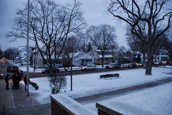
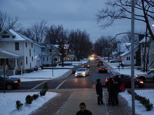
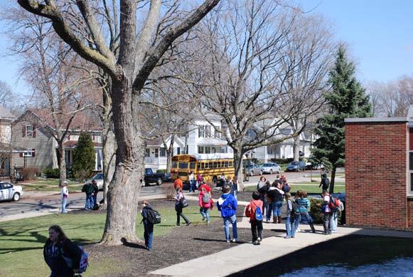
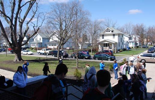
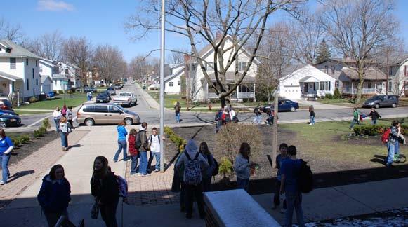
79 Section 12: Supporting Documentation Donnell Middle School 80 City of Findlay, Ohio July 1, 2010

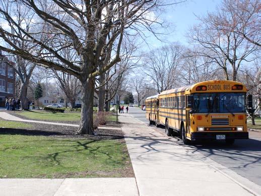
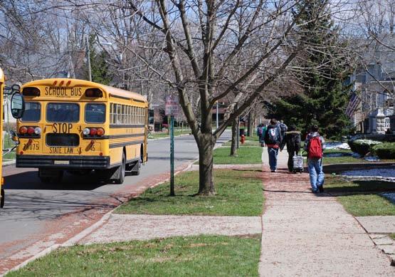
80 City of Findlay, Ohio 81


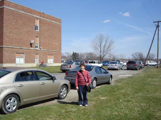
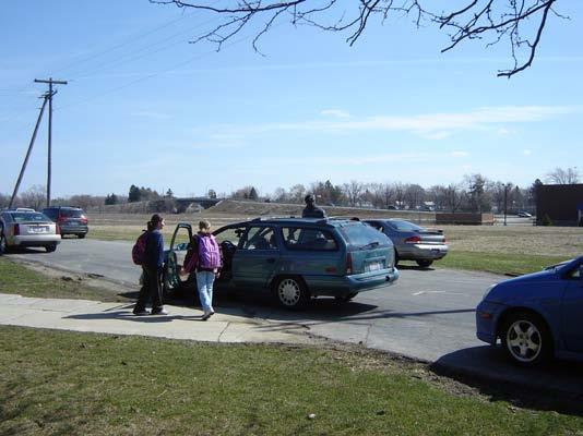
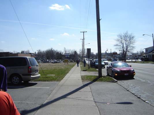
81 Glenwood Middle School 82 City of Findlay, Ohio July 1, 2010

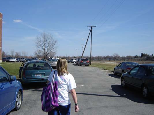
82 City of Findlay, Ohio 83
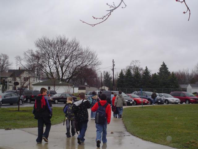
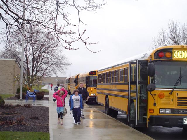
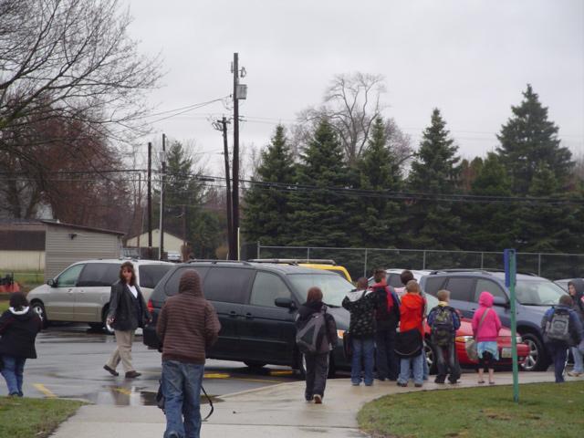
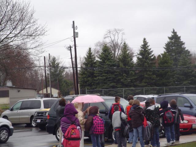
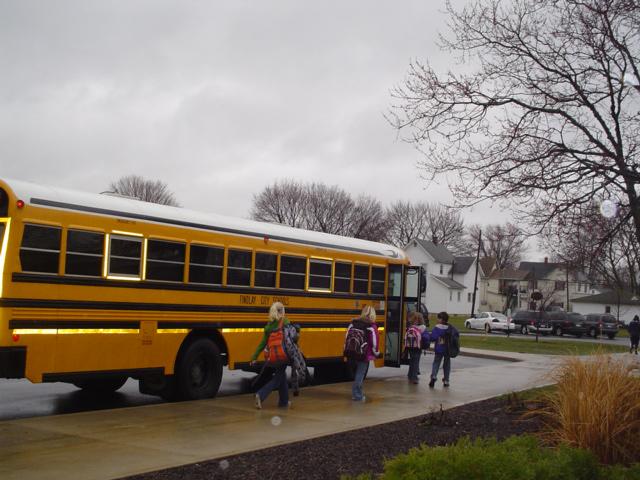
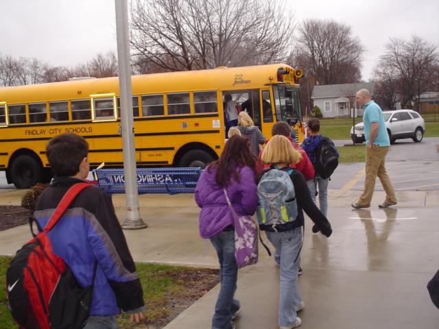
83 Washington Intermediate School 84 City of Findlay, Ohio July 1, 2010

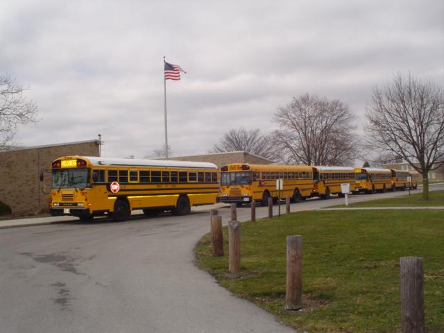
84 City of Findlay, Ohio 85
85 Apr 20, 2010 Findlay to seek student safety grants By JOY BROWN STAFF WRITER Findlay intends to apply for $1.5 million in federal grants that would fund street and sidewalk improvements to make walks to and from three schools safer for students. The federal Safe Schools/Healthy Students grant program benefits public school buildings that serve students in middle school grades and below. The grant would be used where new school construction will take place, including Donnell Middle School at 301 Baldwin Ave. and Glenwood Middle School, 1715 N. Main St. It would also be used to make improvements along the most frequently used routes around Washington Intermediate at 1100 Broad Ave. "The program was put into place to get middle school and elementary school students to walk and bike to school safer," and to encourage students to use that type of transportation more than the bus, said Brian Hurt, Findlay engineer. Funding can be used for improvements such as sidewalk replacement, curb refurbishing, street paving and traffic light improvements. It can also be used for non-structural things like purchasing bicycle helmets and crossing guard salaries. To become eligible for funding, a school district must put together a plan showing how the money would be used to enhance safety along routes, and to encourage student walking and bicycling. Hurt said improvements must be made within an approximate one-mile radius for walkers and a two-mile radius for bicyclers. "We hope to submit plans by August," Hurt said. 86 City of Findlay, Ohio July 1, 2010
86 An advisory team has been formed including Hurt and Mayor Pete Sehnert, school district principals, Parent Teacher Organization representatives and others. Hurt said they have already identified some problem areas around the three schools and have some ideas for improvements, but plan to seek input from the public, too. Information will be provided at open houses to be held at Donnell Middle School from 6:30 p.m. to 7:30 p.m. May 4, at Central Middle School for Glenwood Middle School plans at the same time and date, and at Washington Intermediate from 5:30 p.m. to 6:30 p.m. May 14. Exhibits will illustrate some potential solutions and information will be handed out to help the task force gather more ideas. For instance, Hurt said, adults can be asked to walk or bicycle the most heavily traveled routes to and from the schools in their neighborhood, and relay what their experiences are like. Hurt said the city is hoping to apply for Safe Schools grant money for other schools, but for now is concentrating on schools near where construction will be taking place so that everything can be implemented at the same time. "Doing all of the schools at once is a lot of involvement on the part of the schools," said Hurt. The work involves contacting parents for opinions and alerting them to changes, counting the number of students who walk and bicycle to school, and other measures. "It can be somewhat overwhelming," he said. Hurt said the government wants the improvements to focus most on helping students, rather than infrastructure touch-ups in the area where schools happen to be located, he said. The money is distributed by the Ohio Department of Transportation. Brown: , Send an to Joy Brown City of Findlay, Ohio 87
87 REGULAR MEETING April 26, 2010 The mission of the Findlay City Schools, a community partnership committed to educational excellence is to instill in each student the knowledge, skills and virtues necessary to be lifelong learners who recognize their unique talents and purpose and use them in pursuit of their dreams and for service to a global society. This is accomplished through a passion for knowledge, discovery and vision shared by the students, families, staff, and community. Strategy 1 We will continually align our curriculum with state standards and effectively utilize data and best instructional practices to help every student achieve a proficient or higher rating on all State of Ohio assessments. Strategy 2 We will develop and implement plans to ensure sufficient funding for current and future operations, programs and facilities. Strategy 3 We will nurture and foster trusting relationships among all members of the school and community partnership in order to improve the communication, understanding and commitment necessary to achieve the mission and objectives. Strategy 4 We will design a system to assist students in setting, achieving and assessing personally challenging educational goals related to their unique talents, purpose and dreams. Meeting will be held at 5:30 P.M. At Jefferson Primary School in the Gymnasium I. CALL TO ORDER II. PLEDGE OF ALLEGIANCE III. CELEBRATIONS A. Jefferson Update Mike Wallace B. Celebration of Students National Merit Scholarship Finalists Jessica Braddock Cole Lautermilch Emily Rivest National Merit Scholarship Commended Students Amanda Gerardi Maggie Gilliland Nick Taylor C. Findlay-Hancock County Community Foundation Check Presentation by Kimberly Bash Grant Writers Courtney Roush Jacobs Primary $1,030 and Judy Withrow Gifted $2,000. The superintendent recommends approval of the two Grants the Findlay City School Board is being awarded by The Community Foundation in the amounts indicated above to the teachers listed above for reasons noted in EXHIBIT A. Both grants are funded from the Hancock Education Fund. IV. PUBLIC PARTICIPATION A. Public Hearing on North Middle School Revitalization Grant Betsy Bowe and Lydia Mihalik B. Safe Routes to Schools Brian Hurt, City of Findlay Engineer C. Employee representatives (FEA/OAPSE) D. Students E. Parents and/or Public V. READING, APPROVAL, AND SIGNING OF MINUTES A. Regular Meeting April 12, 2010 VI. VII. CORRESPONDENCE A. Board Members and Treasurer B. District Superintendent CONSENT ITEMS CERTIFICATED PERSONNEL 88 City of Findlay, Ohio July 1, 2010
88 NEWS RELEASE PUBLIC MEETINGS CITY OF FINDLAY, OHIO ENGINEERING DEPARTMENT BRIAN C. HURT, P.E. CITY ENGINEER 318 DORNEY PLAZA ROOM 304 FINDLAY, OHIO FOR IMMEDIATE RELEASE Findlay, Ohio The City of Findlay, Findlay City Schools, and the Safe Routes to School Advisory Committee is seeking public input regarding the Safe Routes to School program. Several public meetings will be held in an effort to gather feedback from citizens on barriers and obstacles that may hinder students walking or biking to school. Representatives will be available to introduce visitors to the Safe Routes to School program, review proposed School Travel Plans for Donnell Middle School, Glenwood Middle School, and Washington Intermediate School, and answer questions. The meetings are scheduled as follows: Location Date Time Central Middle School May 4, :30 p.m. 7:30 p.m. (regarding Donnell Middle School) Glenwood Middle School May 4, :30 p.m. 7:30 p.m. Washington Intermediate School May 14, :30 p.m. 6:30 p.m. The meetings will be organized and presented in an Open House format. Stations will be setup for visitors to review barrier maps, school site maps, and site photos. The public is welcome to attend the meetings anytime during these periods to ask questions and submit comments. Comments and suggestions can be submitted at the meeting or mailed to the Engineering Department prior to May 28, Additional information and details will be provided at the meetings. FOR MORE INFORMATION CONTACT: Brian C. Hurt, P.E., City Engineer City of Findlay Engineer s Office 318 Dorney Plaza Room 304 Findlay, OH Phone: (419) Fax: (419) City of Findlay, Ohio 89

89 Dennis McPheron with Findlay City Schools reviewing information with a resident 90 City of Findlay, Ohio July 1, 2010
90 City of Findlay, Ohio 91

91 Committee members discussing the Safe Routes to school program for Glenwood Middle School 92 City of Findlay, Ohio July 1, 2010
92 City of Findlay, Ohio 93
93 94 City of Findlay, Ohio July 1, 2010


94 City of Findlay, Ohio 95
95 96 City of Findlay, Ohio July 1, 2010

96 City of Findlay, Ohio 97
PROSPECT ELEMENTARY GIRARD INTERMEDIATE GIRARD JUNIOR HIGH
 PROSPECT ELEMENTARY GIRARD INTERMEDIATE GIRARD JUNIOR HIGH SAFE ROUTES TO SCHOOL SCHOOL TRAVEL PLAN January 8, 2014 2 SECTION 1: OUR SCHOOLS School District School Name School Address Grades served Girard
Hedgepeth Williams Middle School and Paul Robeson Elementary School Trenton, NJ. School Travel Plan
 Hedgepeth Williams Middle School and Paul Robeson Elementary School Trenton, NJ School Travel Plan Hedgepeth Williams Middle School Description: Hedgepeth-Williams Middle School is located at 301 Gladstone
SAFE ROUTES TO SCHOOL
 SAFE ROUTES TO SCHOOL Forest Ridge Elementary School Existing Conditions and ACTION PLAN > Oak Creek - Franklin Joint School District Table of Contents CONTEXT Enrollment Boundaries
Wellington Exempted Village School District SAFE ROUTES TO SCHOOL TRAVEL PLAN January 2014
 Wellington Exempted Village School District SAFE ROUTES TO SCHOOL TRAVEL PLAN January 2014 OHIO SAFE ROUTES TO SCHOOL WELLINGTON EXEMPTED VILLAGE SCHOOL DISTRICT TRAVEL PLAN SECTION 1: WELLINGTON EXEMPTED
CHILLICOTHE CITY SCHOOLS. SAFE ROUTES TO SCHOOL TRAVEL PLANS for Allen, Mt. Logan, Tiffin & Worthington Elementary Schools January 2013
 CHILLICOTHE CITY SCHOOLS SAFE ROUTES TO SCHOOL TRAVEL PLANS for Allen, Mt. Logan, Tiffin & Worthington Elementary Schools January 2013 i Ohio s Safe Routes to School Travel Plan Template www.dot.state.oh.us/saferoutes
Taft Elementary School
 CITY OF MARION Taft Elementary School School Travel Plan September 15, 2011 ii City of Marion, Ohio September 15, 2011 Contents 1 2 3 4 6 7 13 18 25 27 30 35 Table of Contents Section 1 Target School &
Vallecito Elementary School. Travel Plan
 Vallecito Elementary School Travel Plan TABLE OF CONTENTS 1. PURPOSE... 1 1.1. SR2S PLANNING, IMPLEMENTATION AND MONITORING... 1 1.2. MARIN COUNTY MEASURE A... 1 2. VALLECITO ELEMENTARY SCHOOL PROFILE...
Rim Rock Elementary School Walking and Biking Audit
 Rim Rock Elementary School Walking and Biking Audit September 29, 2016 Rim Rock Elementary School Audit for Walking and Biking September 29, 2016 Audit Team Members: Sam Atkins, City Engineer, City of
Safe Routes to School Comprehensive Plan
 Safe Routes to School Comprehensive Plan City of Apple Valley Dakota County, MN May 2010 Prepared by: Project Background The Statewide Health Improvement Program (SHIP) aims to help Minnesotans live longer,
Parent Survey Report: One School in One Data Collection Period
 Parent Survey Report: One School in One Data Collection Period School Name: Pinckney Elementary School Set ID: 12170 School Group: Douglas County Month and Year Collected: October 2014 School Enrollment:
ARCADIA ELEMENTARY & MIDDLE SCHOOLS
 ARCADIA ELEMENTARY & MIDDLE SCHOOLS SAFE ROUTES TO SCHOOL TRAVEL August 2013 ARCADIA LOCAL SCHOOLS OHIO SAFE ROUTES TO SCHOOL SCHOOL TRAVEL Ohio Safe Routes to School Travel Plan Local Schools www.dot.state.oh.us/saferoutes
THORNVILLE-GLENFORD STP
 THORNVILLE-GLENFORD STP SAFE ROUTES TO SCHOOL TRAVEL PLAN September 2013 OHIO SAFE ROUTES TO SCHOOL SCHOOL TRAVEL PLAN SECTION 1: OUR SCHOOL/S 1A. Identify Target Schools School District School Name School
C/CAG. Sunnybrae Elementary School Walking and Bicycling Audit. San Mateo-Foster City School District JUNE 2013
 Sunnybrae Elementary School Walking and Bicycling Audit JUNE 2013 San Mateo-Foster City School District C/CAG City/County Association of Governments of San Mateo County SUNNYBRAE ELEMENTARY SCHOOL WALKING
Lawrence Safe Routes to School. Community Meeting January 14, 2015
 Lawrence Safe Routes to School Community Meeting January 14, 2015 Safe Routes to School The 6 E s Education Encouragement Enforcement Engineering Evaluation Equity What are the elements of a SRTS plan?
Parent Survey Report: One School in One Data Collection Period
 Parent Survey Report: One School in One Data Collection Period School Name: Broken Arrow Elementary School Set ID: 12172 School Group: Douglas County Month and Year Collected: October 2014 School Enrollment:
Bremen Elementary. SAFE ROUTES TO SCHOOL TRAVEL PLAN October 9, 2012
 Bremen Elementary SAFE ROUTES TO SCHOOL TRAVEL PLAN October 9, 2012 Introduction The purpose of the Bremen Elementary Safe Route to School (SRTS) Plan is to encourage school age children to travel to school
7/23/2017 VIA . Michael Hanebutt City of Sacramento Community Development Department 300 Richards Boulevard, 3 rd Floor Sacramento, CA 95811
 7/23/2017 VIA EMAIL Michael Hanebutt City of Sacramento Community Development Department 300 Richards Boulevard, 3 rd Floor Sacramento, CA 95811 RE: 65 th Street Apartments (DR17-220) Dear Mr. Hanebutt:
Monument Elementary School Trenton, NJ School Travel Plan
 Monument Elementary School Trenton, NJ School Travel Plan Prepared by Greater Mercer TMA With Assistance from Alan M. Voorhees Transportation Center; Rutgers, The State University of New Jersey and NJ
AMHERST EXEMPTED VILLAGE SCHOOLS AND SAINT JOSEPH SCHOOL
 AMHERST EXEMPTED VILLAGE SCHOOLS AND SAINT JOSEPH SCHOOL SAFE ROUTES TO SCHOOL TRAVEL PLAN 12/11/18 DRAFT OHIO SAFE ROUTES TO SCHOOL SCHOOL TRAVEL PLAN Ohio s Safe Routes to School Travel Plan Template
Pedestrian, Bicycle and Traffic Calming Strategic Implementation Plan. January 18, 2011
 Pedestrian, Bicycle and Traffic Calming Strategic Implementation Plan January 18, 2011 Tonight s Agenda Receive update on project Provide feedback on two policy issues Complete Streets Policy Project Prioritization
July 5, Arthur R. Ware, Jr. Elementary School 2017 Safe Routes to School Walkabout Report
 July 5, 2017 Arthur R. Ware, Jr. Elementary School 2017 Safe Routes to School Walkabout Report 1 Walkabout Report Introduction On April 28, 2017, City, School, and SAWMPO staff met to conduct a Safe Routes
NORTH UNION LOCAL SCHOOLS
 NORTH UNION LOCAL SCHOOLS SAFE ROUTES TO SCHOOL TRAVEL PLAN November 2015 OHIO SAFE ROUTES TO SCHOOL SCHOOL TRAVEL PLAN SECTION 1: OUR SCHOOL(S) 1A. Identify Target Schools School District School Name
Aitkin School Routing Plan July 2010
 Aitkin School Routing Plan July 2010 Prepared by: Arrowhead Regional Development Commission Regional Planning Division Aitkin School Routing Plan July 2010 Aitkin School Routing Plan July 2010 Prepared
Chapter 3.9 Timbercrest Elementary School. Volusia County MPO. November 2008
 Chapter 3.9 Timbercrest Elementary School Deltona, FL Volusia County MPO November 2008 Volusia County MPO School Bicycle and Pedestrian Review Study, Phase 3B School Summary Timbercrest Elementary School
About the Studio. Edward J. Bloustein School of Planning and Public Policy - Rutgers University
 About the Studio Edward J. Bloustein School of Planning and Public Policy - Rutgers University Purpose of studio: Help City of Bayonne apply for Safe Routes to School (SRTS) funding by producing a School
FREMONT CITY SCHOOLS STP
 FREMONT CITY SCHOOLS STP SAFE ROUTES TO SCHOOL TRAVEL PLAN February 2014 OHIO SAFE ROUTES TO SCHOOL SCHOOL TRAVEL PLAN SECTION 1: OUR SCHOOL(S) 1A. Identify Target Schools School District School Name School
Drag and drop pic and stretch/crop to the limits of the blue rectangle (delete this text box) Maxey Elementary School
 Maxey Elementary School") Drag and drop pic and stretch/crop to the limits of the blue rectangle (delete this text box) Maxey Elementary School SCHOOL ROUTE PLAN For MAXEY ELEMENTARY SCHOOL LOCATION 33 ORANGE COUNTY Prepared for:
Drag and drop pic and stretch/crop to the limits of the blue rectangle (delete this text box) Maxey Elementary School SCHOOL ROUTE PLAN For MAXEY ELEMENTARY SCHOOL LOCATION 33 ORANGE COUNTY Prepared for:
Parent Survey Report: One School in One Data Collection Period
 Parent Survey Report: One School in One Data Collection Period School Name: Bilquist Elementary School Set ID: 15803 School Group: Clackamas County Month and Year Collected: December 2016 School Enrollment:
Orange Center Elementary School
 Drag and drop pic and stretch/crop to the limits of the blue rectangle (delete this text box) Orange Center Elementary School Drag and drop pic and stretch/crop to the limits of the blue rectangle (delete
COWETA HIGH SCHOOL AND EAST HIGHWAY 51
 COWETA HIGH SCHOOL AND EAST HIGHWAY 51 Lack of sidewalks along Ben Lumpkin Rd. Lack of crosswalks and ramps at intersection. Hwy 51 is wide to cross as a pedestrian. No ADA compliance or connection to
Grandview Heights Safe Routes to School School Travel Plan Ohio Department of Transportation, District 6 February 23, 2012
 Grandview Heights Safe Routes to School School Travel Plan Ohio Department of Transportation, District 6 February 23, 2012 Grandview Heights School Travel Plan (STP) Safe Routes to School Table of Contents
9/21/2016 VIA . RE: The Knot (DR16-270)
") 9/21/2016 VIA EMAIL Garrett Norman, Assistant Planner City of Sacramento Community Development Department 300 Richards Boulevard, 3 rd Floor Sacramento, CA 95811 RE: The Knot (DR16-270) Dear Mr. Norman:
9/21/2016 VIA EMAIL Garrett Norman, Assistant Planner City of Sacramento Community Development Department 300 Richards Boulevard, 3 rd Floor Sacramento, CA 95811 RE: The Knot (DR16-270) Dear Mr. Norman:
Bikeway action plan. Bicycle Friendly Community Workshop March 5, 2007 Rochester, MN
 Bikeway action plan Summary The was held on March 5, 2007 at the Rochester Mayo Civic Center. The workshop was hosted by Rochester-Olmsted County Planning Department in collaboration with the League of
Hidden Oaks Elementary School
 Hidden Oaks Elementary School SCHOOL ROUTE PLAN For HIDDEN OAKS ELEMENTARY SCHOOL LOCATION 13 ORANGE COUNTY Prepared for: ORANGE COUNTY SCHOOL ASSESSMENT PROGRAM ORANGE COUNTY PUBLIC WORKS Traffic Engineering
Bringing together community and health. Physical Activity and Nutrition Unit Office of Statewide Health Improvement Initiatives
 Bringing together community and health. Physical Activity and Nutrition Unit Office of Statewide Health Improvement Initiatives Physical Activity and Nutrition Unit Office of Statewide Health Improvement
ASHTABULA AREA SCHOOLS STP
 ASHTABULA AREA SCHOOLS STP SAFE ROUTES TO SCHOOL TRAVEL PLAN April 2013 OHIO SAFE ROUTES TO SCHOOL SCHOOL TRAVEL PLAN SECTION 1: OUR SCHOOL/S 1A. Identify Target Schools School District School Name School
2 Mark Twain Elementary School Report
 2 Mark Twain Elementary School Report Principal: Greg Kaatz Grades: K-2 Enrollment: 323 Address: 425 N. Church Street First bell: 8:10 a.m. Silverton, OR 97381 Last bell: 2:30 p.m. Free & Reduced Lunch:
Lake Whitney Elementary School
 Lake Whitney Elementary School SCHOOL ROUTE PLAN For LAKE WHITNEY ELEMENTARY SCHOOL LOCATION 18 ORANGE COUNTY Prepared for: ORANGE COUNTY SCHOOL ASSESSMENT PROGRAM ORANGE COUNTY PUBLIC WORKS Traffic Engineering
Windy Ridge Elementary School
 Windy Ridge Elementary School SCHOOL ROUTE PLAN For WINDY RIDGE ELEMENTARY SCHOOL LOCATION 54 ORANGE COUNTY Prepared for: ORANGE COUNTY SCHOOL ASSESSMENT PROGRAM ORANGE COUNTY PUBLIC WORKS Traffic Engineering
11/28/2016 VIA
 11/28/2016 VIA EMAIL Ethan Meltzer, Assistant Planner City of Sacramento Community Development Department 300 Richards Blvd., 3 rd Floor Sacramento, Ca 95811 RE: Natomas Corporate Center Commercial Building
8/31/2016 VIA . RE: Freeport Arco Fuel Station (P16-039)
") 8/31/2016 VIA EMAIL Garrett Norman, Assistant Planner City of Sacramento Community Development Department 300 Richards Boulevard, 3 rd Floor Sacramento, CA 95811 RE: Freeport Arco Fuel Station (P16-039)
8/31/2016 VIA EMAIL Garrett Norman, Assistant Planner City of Sacramento Community Development Department 300 Richards Boulevard, 3 rd Floor Sacramento, CA 95811 RE: Freeport Arco Fuel Station (P16-039)
Safe Routes to School Action Plan Aberdeen, Idaho
 Background Aberdeen, Idaho is a largely agricultural community of nearly 2,000 people and is located in the southeast portion of the state on the western edge of American Falls Reservoir. The community
CITY OF OAK CREEK SAFE ROUTES TO SCHOOL ACTION PLAN. East Middle School
 CITY OF OAK CREEK SAFE ROUTES TO SCHOOL ACTION PLAN East Middle School CITY OF OAK CREEK SAFE ROUTES TO SCHOOL ACTION PLAN East Middle School Why Safe Routes to School? Safe Routes to School ( SRTS ) is
OCEAN DRIVE ELEMENTARY SCHOOL
 OCEAN DRIVE ELEMENTARY SCHOOL North Myrtle Beach, SC Safe Routes to School Travel Plan JANUARY 2017 SRTS Team Roster SRTS Team members represent key community stakeholders, share work of developing the
BEVERLY GARDENS ELEMENTARY SCHOOL TRAVEL PLAN
 BEVERLY GARDENS ELEMENTARY SCHOOL TRAVEL PLAN City of Riverside, Ohio Ohio Safe Routes to School Plan INDEX SECTION 1: TARGET SCHOOLS AND THE SAFE ROUTES TO SCHOOL TEAM SECTION 2: INTRODUCTION SECTION
Barnum- Safe Routes to School Meeting #2 January 20, 2015
 Barnum- Safe Routes to School Meeting #2 January 20, 2015 1. Introductions 2. SRTS Program Overview 1. Purpose 2. Benefits 3. Background of planning Process 3. Existing Conditions Review and Summary 1.
David Hung, Associate Planner City of Sacramento Community Development Department 300 Richards Boulevard, 3 rd Floor Sacramento, CA
 June 13, 2016 VIA EMAIL David Hung, Associate Planner City of Sacramento Community Development Department 300 Richards Boulevard, 3 rd Floor Sacramento, CA 959811 RE: Fire Station 14 (DR16-128) Dear Mr.
EXECUTIVE SUMMARY. Vision
 Vision Walking and bicycling in Salt Lake City will be safe, convenient, comfortable, and viable transportation options that connect people to places, foster recreational and economic development opportunities,
Arlington Public Schools Thomas Jefferson Site Evaluation Transportation Networks. Thomas Jefferson Working Group Meeting #6 November 10, 2014
 Arlington Public Schools Thomas Jefferson Site Evaluation Transportation Networks Thomas Jefferson Working Group Meeting #6 November 10, 2014 2 3 INTRODUCTION 4 Goal of our work: Identify and assess multi-modal
5/7/2013 VIA . RE: University Village Safeway Expansion (P13-019)
") 5/7/2013 VIA EMAIL David Hung, Associate Planner Community Development Department, Current Planning Division City of Sacramento 300 Richards Boulevard, 3 rd Floor Sacramento, CA 95811 RE: University Village
5/7/2013 VIA EMAIL David Hung, Associate Planner Community Development Department, Current Planning Division City of Sacramento 300 Richards Boulevard, 3 rd Floor Sacramento, CA 95811 RE: University Village
3 Silverton High School Report
 3 Silverton High School Report Principal: Justin Lieuallen Grades: 9-12 Enrollment: 1,277 Address: 1456 Pine Street First bell: 7:55 a.m. Silverton, OR 97381 Last bell: 3:05 p.m. Free & Reduced Lunch:
12/4/2016 VIA . RE: Grocery Outlet Del Paso (DR16-328)
") 12/4/2016 VIA EMAIL Ethan Meltzer, Assistant Planner City of Sacramento Community Development Department 300 Richards Blvd, 3 rd Floor Sacramento, CA 95811 RE: Grocery Outlet Del Paso (DR16-328) Dear Mr.
12/4/2016 VIA EMAIL Ethan Meltzer, Assistant Planner City of Sacramento Community Development Department 300 Richards Blvd, 3 rd Floor Sacramento, CA 95811 RE: Grocery Outlet Del Paso (DR16-328) Dear Mr.
BEXLEY CITY SCHOOL DISTRICT
 BEXLEY CITY SCHOOL DISTRICT SAFE ROUTES TO SCHOOL TRAVEL PLAN December 2012 OHIO SAFE ROUTES TO SCHOOL SCHOOL TRAVEL PLAN SECTION 1: OUR SCHOOLS 1A. Identify Target Schools School District School Name
Chapter 3.5 Osteen Elementary School. Volusia County MPO. November 2008
 Chapter 3.5 Osteen Elementary School Osteen, FL Volusia County MPO November 2008 Volusia County MPO School Bicycle and Pedestrian Review Study, Phase 3B School Summary Osteen Elementary School is located
Builta Arrival and Dismissal Procedures
 Builta Arrival and Dismissal Procedures The safety of your children/our students is our first concern. The system now in place establishes a pattern for children to arrive and depart safely from Builta.
SAFE ROUTES TO SCHOOL (SR2S)
") SAFE ROUTES TO SCHOOL (SR2S) In partnership with Burbank Unified School District (BUSD) & City of Burbank George Washington Elementary School Thomas Jefferson Elementary School John Muir Middle School
SAFE ROUTES TO SCHOOL (SR2S) In partnership with Burbank Unified School District (BUSD) & City of Burbank George Washington Elementary School Thomas Jefferson Elementary School John Muir Middle School
5. Pedestrian System. Accomplishments Over the Past Five Years
 5. Pedestrian System Accomplishments Over the Past Five Years The Alamo Area Metropolitan Planning Organization (MPO) and its partner agencies recognize the importance of improving pedestrian mobility.
Lakewood, Ohio Safe Routes to Schools 2010 School Travel Plan
 Lakewood, Ohio Safe Routes to Schools 2010 School Travel Plan 1) Safe Routes to Schools Team Joe Beno, City of Lakewood, Public Works 12650 Detroit Avenue Lakewood, Ohio 44107 (216) 529-6804 joe.beno@lakewoodoh.net
City of Davis East Covell Corridor Plan
 Community Open House #2 January 22, 2014 6:00 8:00 p.m. Veterans Memorial Center, Club Room City of Davis Introduction The (ECCP) is a taking a comprehensive look at the existing transportation systems
Summary Report School Walking & Bicycling Audits. Mesa County Regional Transportation Planning Office
 Summary Report School Walking & Bicycling Audits Mesa County Regional Transportation Planning Office This page left blank intentionally WALKING & BICYCLING AUDIT SUMMARY 2 Executive Summary Background:
Middle School Walk Audit Booklet
 Safe Routes to School GEORGIA Georgia Department of Transportation Middle School Walk Audit Booklet This Walk Audit Guide was prepared by the Georgia Safe Routes to School Resource Center, funded by the
11/3/2014 VIA . WALKSacramento has reviewed the Stockton and T Mixed-Use project at 3675 T Street in the
 11/3/2014 VIA EMAIL Antonio Ablog Planning Department City of Sacramento 300 Richards Boulevard Sacramento, CA 95811 RE: Design Review for Stockton and T Mixed-Use (P14-042) Dear Mr. Ablog: WALKSacramento
Chapter 4.3 Enterprise Elementary. Volusia County MPO. March Page 7.0
 Chapter 4.3 Enterprise Elementary Enterprise, FL Volusia County MPO March 2008 Page 7.0 Volusia County MPO Bicycle and Pedestrian School Safety Review Study Introduction Enterprise Elementary School is
2016 APS Go! Surveys Summary Results for Oakridge Elementary School
 2016 APS Go! Surveys Summary Results for Oakridge Elementary School This report summarizes results from the 2016 APS Go! surveys for Oakridge Elementary School. Student, parent/caregiver and staff surveys
DRAFT. Table of Contents. Background
 Douglas County Table of Contents Existing Infrastructure 86 Funding 89 Policy and Program Recommendations 90 Infrastructure Recommendations 92 Conclusion 95 Background Home to 4,500 residents and Baker
Dos Rios Elementary School Walking and Biking Audit
 Dos Rios Elementary School Walking and Biking Audit October 19, 2016 Dos Rios Elementary School Audit for Walking and Biking October 19, 2016 Audit Team Members: Jessica Carlson, Safe Routes to School,
SAFE ROUTES TO SCHOOL
 SAFE ROUTES TO SCHOOL Edgewood Elementary School Existing Conditions and ACTION PLAN > Oak Creek - Franklin Joint School District Table of Contents CONTEXT Enrollment Boundaries Enrollment
Venetia Valley Elementary School. Travel Plan
 Venetia Valley Elementary School Travel Plan TABLE OF CONTENTS 1. PURPOSE... 1 1.1. SR2S PLANNING, IMPLEMENTATION AND MONITORING... 1 1.2. MARIN COUNTY MEASURE A... 1 2. VENETIA VALLEY ELEMENTARY SCHOOL
2016 APS Go! Surveys Summary Results for Arlington Traditional School
 2016 APS Go! Surveys Summary Results for Arlington Traditional School This report summarizes results from the 2016 APS Go! surveys for Arlington Traditional School. Student, parent/caregiver and staff
o n - m o t o r i z e d transportation is an overlooked element that can greatly enhance the overall quality of life for the community s residents.
 N o n - m o t o r i z e d transportation is an overlooked element that can greatly enhance the overall quality of life for the community s residents. 84 Transportation CHAPTER 11 INTRODUCTION Transportation
6/14/2013 VIA . Evan Compton, Associate Planner Community Development Department City of Sacramento 300 Richards Blvd Sacramento, CA 95814
 6/14/2013 VIA EMAIL Evan Compton, Associate Planner Community Development Department City of Sacramento 300 Richards Blvd RE: Sacramento Natural Foods Co-Op (P13-025) Dear Mr. Compton: WALKSacramento appreciates
Introduction Additional Safe Routes to School Resources Main Street Elementary School Survey Results Field Audit...
 Contents Introduction... 2 Additional Safe Routes to School Resources... 2... 3 Survey Results... 4 Field Audit... 6 Proposed Safe Routes to School Elements... 9 Typical Safe Routes to School Summary...
CLEVELAND HEIGHTS STP
 CLEVELAND HEIGHTS STP SAFE ROUTES TO SCHOOL TRAVEL PLAN February 2014 OHIO SAFE ROUTES TO SCHOOL SCHOOL TRAVEL PLAN TEMPLATE SECTION 1: OUR SCHOOL(S) 1A. Identify Target Schools School District School
What are the Qualities that make Newark a Bicycle Friendly Community? What are aspects that make Newark less Bicycle Friendly?
 What are the Qualities that make Newark a Bicycle Friendly Community? Many stores are within biking distance (1) Lots of bike lanes and new trail Existing bike routes (2) Designated bike lanes on Del ave.
Streets. Safe for Pedestrians 20% 2nd 5,000. Are We People-Friendly?
 Streets Safe for Pedestrians 20% Pedestrian deaths account for more than of all traffic-related fatalities in California each year. 600 More than people are killed and another 13,000 are injured every
Ballston Station Multimodal Study WMATA and Arlington County. Meeting Minutes
 Date of Meeting: June 10, 2010 Location: Ballston Metrorail Station and NRECA Building 4301 Wilson Blvd, Arlington, VA Subject: Ballston Station Multimodal Study Stakeholder Meeting #1 Summary: This first
Sunset Park Center for Accelerated Studies
 Sunset Park Center for Accelerated Studies The following are a simple list of advantages, disadvantages, and recommendations based on a community assessment. It is not intended to be a list of complete
Walkabout Summary Report
 Walkabout Summary Report Introduction On September 3, 2014, stakeholders at Bessie Weller Elementary School (Bessie Weller ES) in Staunton, Virginia met to examine the walking and bicycling network around
10/30/2012 VIA
 10/30/2012 VIA EMAIL David Hung, Associate Planner Community Development Department, Current Planning Division City of Sacramento 300 Richards Blvd., 3 rd Floor Sacramento, CA 95811 RE: The Cannery On-Site
General Design Factors
 Chapter 3: 3-1.0 Introduction General Design Factors Mn/DOT s goals include encouraging and accommodating safe bicycling. From a design perspective, these goals are achieved by first having an understanding
A Safe Routes to School Survey in Hillsborough County
 A Safe Routes to School Survey in Hillsborough County Prepared for Florida Department of Transportation, District 7 Project Manager: Peter Hsu, P.E. Prepared by Huaguo Zhou, Ph.D., P.E. Senior Research
Sebastopol Charter School Traffic Management Plan
 Sebastopol Charter School The serves as the working document in support of these essential goals: to ensure the safety and efficiency of student arrival to and departure from school to ensure the safety
Improvements Infrastructure Gap Assessment and Improvements Street Striping
 Infrastructure Project Proposal The federal-aid Safe Routes to School program funds infrastructure/engineering projects that fall into two categories: Design (available only to School Development Authority
Safe Routes to School: Creating an Action Plan Template
 odot25m Page 1 4/13/2016-1 - Safe Routes to School: Creating an Action Plan Template Note: This document can be protected to prevent unintended changes to the form. If you wish to protect the template,
THE PLAINS ELEMENTARY SCHOOL SCHOOL TRAVEL PLAN
 THE PLAINS ELEMENTARY SCHOOL SCHOOL TRAVEL PLAN We would like to extend a special thank you to all of those involved in the development of this plan. Our group especially appreciates the efforts and support
NAPIER AVENUE PEDESTRIAN AND BICYCLE PLAN
 NAPIER AVENUE PEDESTRIAN AND BICYCLE PLAN Prepared By: DRAFT: 1/17/1 WHAT ARE WALKABILITY AUDITS AND WHY ARE THEY IMPORTANT? Walkability is important for a community and everyone benefits from walking.
LTAC: Katie Mencarini, Central & Hampton Roads streets and a fifteen minute debrief to discuss the findings. Participants walked along Mill Road
 Walkabout Summary On June 3, 2013, five participants met at Glen Allen Elementary School in Glen Allen, Virginia to take a closer look at the walking and biking network around the school. In addition to
PEDESTRIAN ACTION PLAN
 ATTACHMENT 2 CITY OF SANTA MONICA PEDESTRIAN ACTION PLAN CITY OF SANTA MONICA PEDESTRIAN ACTION PLAN This page intentionally left blank EXECUTIVE SUMMARY CHAPTER 1 EXECUTIVE SUMMARY Setting the Stage
James Williams Middle School 915 Acacia Lane
 James Williams Middle School 915 Acacia Lane Grades Served: 6 th -8 th Student Geography According to an address analysis of students, 36.7% of students attending JWMS live within 2 miles of school (see
Meadow Woods Elementary School
 Drag and drop pic and stretch/crop to the limits of the blue rectangle (delete this text box) Meadow Woods Elementary School Drag and drop pic and stretch/crop to the limits of the blue rectangle (delete
FRANKLIN, ISHAM MEMORIAL, OVERLOOK & VALLEY VIEW ELEMENTARY SCHOOLS
 FRANKLIN, ISHAM MEMORIAL, OVERLOOK & VALLEY VIEW ELEMENTARY SCHOOLS SAFE ROUTES TO SCHOOL TRAVEL PLAN August 2013 OHIO SAFE ROUTES TO SCHOOL SCHOOL TRAVEL PLAN SECTION 1: OUR SCHOOL(S) School District
Today. Develop Plans. Public Listening Session
 Welcome! 1. Share Existing Conditions and Data 2. Share Details of Proposed Project 3. Gather Feedback from Public M Ju ee ly tin 17 g D th a, 2 te 01 : 7 Meeting Purpose and 26th Street Project Timeline
6/22/2018 VIA . Darcy Goulart, Planning Manager City of Rancho Cordova Planning Department 2729 Prospect Park Drive Rancho Cordova, CA 95670
 6/22/2018 VIA EMAIL Darcy Goulart, Planning Manager City of Rancho Cordova Planning Department 2729 Prospect Park Drive Rancho Cordova, CA 95670 RE: Quick Quack Car Wash (DD9801) Dear Ms. Goulart: WALKSacramento
3/10/2016 VIA th Street, Suite 203 Sacramento, CA
 3/10/2016 VIA EMAIL Arwen Wacht, Associate Planner City of Sacramento Community Development Department 300 Richards Boulevard, 3 rd Floor Sacramento, CA 95811 RE: Natomas Fountains (P16-012) Dear Ms. Wacht:
Why Zone In on Speed Reduction?
 Learn it. Do it. Live it! SPEED REDUCTION IN THE ZONE Why Zone In on Speed Reduction? Speeding is a serious issue that plays a major role in the risk of serious injury and pedestrian fatality in a crash.
Parental Responsibilities
 Bicycle riding is a fun way to exercise and enjoy the outdoors. To remain safe on Illinois roads, bicyclists must obey the same traffic safety laws that govern vehicle drivers. No amount of bicycle safety
FLETCHER AVENUE PEDESTRIAN AND BICYCLIST BEHAVIOR CHANGE FORMATIVE RESEARCH PROJECT
 FLETCHER AVENUE PEDESTRIAN AND BICYCLIST BEHAVIOR CHANGE FORMATIVE RESEARCH PROJECT EXTENT OF CHANGES IN PEDESTRIAN AND BICYCLIST ATTITUDES AND BEHAVIORS DIRECTLY AFTER A COMPLETE STREETS PROJECT IN FLORIDA
Chapter 3.3 Horizon Elementary School. Volusia County MPO. June 2009
 Chapter 3.3 Horizon Elementary School Port Orange, FL Volusia County MPO June 2009 Volusia County MPO School Bicycle and Pedestrian Review Study, Phase 3C School Summary Horizon Elementary School is located
BETHEL ROAD AND SEDGWICK ROAD CORRIDOR STUDY
 DRAFT PLAN City Council Meeting August 14, 2017 STUDY AREA Sedgwick Corridor State Route 160, principal arterial with Class 3 access management designation, commuter and freight route, connection to SR
Summary of School Observations and Education and Encouragement Initiatives
 Rye Shared Committee Summary of School Observations and Education and Encouragement Initiatives Presented to the Rye City Council & The Rye City School District Board of Education April 9 th, 2011 1 Why