CLEVELAND HEIGHTS STP
|
|
|
- Clement Cunningham
- 5 years ago
- Views:
Transcription


1 CLEVELAND HEIGHTS STP SAFE ROUTES TO SCHOOL TRAVEL PLAN February 2014 OHIO SAFE ROUTES TO SCHOOL SCHOOL TRAVEL PLAN TEMPLATE
2 SECTION 1: OUR SCHOOL(S) 1A. Identify Target Schools School District School Name School Address Cleveland Heights - University Heights City School District Canterbury Elementary School 2530 Canterbury Road Cleveland Heights, OH Grades Served K-5 Your School s Students Average Daily Student Enrollment Black, non- Hispanic American Indian or Alaska Native Asian or Pacific Islander Hispanic Multi- Racial White, non- Hispanic Economically Disadvantaged Limited English Proficient Students with Disabilities Migrant % N/A N/A N/A 6.6% 25.7% 62% N/A 14.2% N/A School District School Name School Address Cleveland Heights - University Heights City School District Average Daily Student Enrollment Black, non- Hispanic American Indian or Alaska Native Oxford Elementary School Asian or Pacific Islander Your School s Students Hispanic Multi- Racial White, non- Hispanic 939 Quilliams Road Cleveland Heights, OH Economically Disadvantaged Limited English Proficient Students with Disabilities Grades Served % N/A N/A N/A 4.8% 4.3% 81.1% N/A 14.1% N/A School District School Name School Address Cleveland Heights - University Heights City School District Average Daily Student Enrollment Black, non- Hispanic American Indian or Alaska Native Roxboro Elementary School Asian or Pacific Islander Your School s Students Hispanic Multi- Racial White, non- Hispanic 2405 Roxboro Road Cleveland Heights, OH Economically Disadvantaged Limited English Proficient Students with Disabilities K-5 Migrant Grades Served K-5 Migrant % N/A 2.8% 5% 8.3% 43.8% 44.9% 4.2% 9% N/A 1
3 School District School Name School Address Cleveland Heights - University Heights City School District Monticello Middle School 3665 Monticello Boulevard Cleveland Heights, OH Grades Served 6-8 Your School s Students Average Daily Student Enrollment Black, non- Hispanic American Indian or Alaska Native Asian or Pacific Islander Hispanic Multi- Racial White, non- Hispanic Economically Disadvantaged Limited English Proficient Students with Disabilities Migrant % NA NA NA 6.8% 4.8% 78.2% NA 22.7% NA School District School Name School Address N/A Hebrew Academy of Cleveland 1860 South Taylor Road Cleveland Heights, Ohio Grades Served K-8* Your School s Students Average Daily Student Enrollment Black, non- Hispanic American Indian or Alaska Native Asian or Pacific Islander Hispanic Multi- Racial White, non- Hispanic Economically Disadvantaged Limited English Proficient Students with Disabilities 856 N/A N/A 0.1% N/A N/A 99.9% 51% <1% 2.3% N/A *School serves grades pre-kindergarten through 12; however, only grades K-8 are addressed as part of this STP. 1B. Community Stakeholders and the Safe Routes to School Team School Representatives: Name address 5 E Role: Deborah Moore, Monticello Middle School Principal Erica Wigton, Canterbury Elementary School Principal Joseph Nicklos, Oxford Elementary School Principal Michael Jenkins, Roxboro Elementary School Principal d_moore@chuh.org e_wigton@chuh.org j_nicklos@chuh.org m_jenkins@chuh.org Education, Encouragement Education, Encouragement Education, Encouragement Education, Encouragement Rabbi Dessler, Hebrew Academy desslere@hac1.org Education, Encouragement Community Representatives: Name address 5 E Role: Mary Dunbar, City of Cleveland Heights Council Member marydunbar@gmail.com Education, Encouragement, Evaluation Migrant
4 Local Government Representatives: Name address 5 E Role: Jennifer Kuzma, Cleveland Heights Development Officer jkuzma@clvhts.com Education, Encouragement Alex Mannarino, Cleveland Heights Service Director Linda Dulik, Service Director s Assistant Richard Wong, Cleveland Heights Planning Director Karen Knittel, Cleveland Heights Planning Susanna O Neil, Cleveland Heights Director of Comm. Srvc. amannarino@clvhts.com ldulik@clvhts.com rwong@clvhts.com kknittel@clvhts.com snoneil@clvhts.com Engineering Engineering Education, Encouragement Education, Encouragement Education, Encouragement Education Representative: Name address 5 E Role: Superintendent Nylajean McDaniel, CH-UH Schools Joe Bagatti, CH-UH Schools Operations Manager n_mcdaniel@chuh.org j_bagatti@chuh.org Health Representatives: Name address 5 E Role: Domenica McClintock, Cuyahoga County Board of Health Megan Dunleavy, Cuyahoga County Board of Health dmcclintock@ccbh.net mdunleavy@ccbh.net Public Safety Representatives: Name address 5 E Role: Chief Jeff Robertson, Police Chief chief@clvhts.com Enforcement Sgt. Ben Osowski, Commander of Day Traffic Bureau bosowski@clvhts.com Education, Encouragement, Evaluation Education, Encouragement Education, Encouragement Education, Encouragement Enforcement 1C. The lead contact for our Plan is: Name: Mary Dunbar Affiliation: Council Member, City of Cleveland Heights Phone Number: address: maryadunbar@gmail.com Mailing address: 2880 Fairfax Road, Cleveland Heights, OH
5 Body Mass Index for Ohio s Third Grade Students A review of the Report on the Body Mass Index of Ohio s Third Graders, conducted by the Ohio Department of Health, found that childhood obesity is one of the most important public health issues in Ohio with more than 30 percent of children and adolescents classified as overweight or obese. In a study, it was reported that 37.7% of third grade students living in Cuyahoga County, where the Cleveland Heights-University Heights City Schools and Hebrew Academy are located, have a prevalence of being overweight or obese. A map showing the percentage of overweight and obese third graders by county can be found in Appendix A. Through physical activity, such as walking or biking to and from school, or educating youth about the importance of an active lifestyle, ODOT s Safe Routes to School Program hopes to foster awareness and prevention to combat this serious public health issue. 4
6 SECTION 2: OUR SRTS VISION Our SRTS Vision: Successful SRTS programs benefit from the school and community working together toward a common vision. Vision statements can be a single statement, a list of goals or a short paragraph. There is no correct or incorrect vision statement. In 100 words or less, explain your team s vision for your SRTS program in the space below. The vision of the Cleveland Heights SRTS Planning Team is to identify and develop safe routes for students to walk or bike to and from school. This will strengthen our ability to encourage positive lifelong exercise habits using active modes of transportation. Walking or biking to school can foster a sense of joy and independence. By walking and biking to school, kids and parents can get to know one another, their neighbors and neighborhood, and build community. We can develop pride in reducing traffic congestion and air-polluting emissions from cars. We can improve safety through education programs and infrastructure improvements. 5
7 SECTION 3: CURRENT STUDENT TRAVEL CANTERBURY ELEMENTARY 3A. How many students live within walking and bicycling distance of school? (Distances are cumulative; meaning that within a ½-mile of school would include students within a ¼-mile as well.) Canterbury Elementary: Distance From School Number of Students % of Student Body Within a ¼-mile of school 35 9% Within a ½-mile of school % Within 1 mile of school % Within 2 miles of school % Mapping student addresses. A map showing the school attendance boundary, school site and dots indicating where students live is included is Appendix B. 3B. How many students are currently walking and bicycling to school? What are the primary walking and bicycling routes? Canterbury Elementary: Number of students (morning trips) Number of students (afternoon trips) Primary walking / bicycling routes Walk Bike School Bus Family Vehicle Carpool Public Transit Other 13% 3% 13% 71% 0% 0% 0% 14% 3% 13% 69% 0% 0% 0% Canterbury, Princeton, E. Scarborough, Meadowbrook, Fairmount 3C. Are there any school or district policies that impact students walking or bicycling to school? District Bus Policies Policy: Students participating in the Intradistrict Open Enrollment Plan are eligible for transportation if they meet the district transportation guidelines for BOTH their school of residence and their school of choice. 6 ELEMENTARY SCHOOL: Students must live ONE mile or more from the school of residence and attendance.
8 MIDDLE SCHOOL: Students must live TWO or more miles from the school of residence and attendance. How it affects student travel modes (3-5 sentences): As written, the policy encourages elementary students who live within one mile of their school to walk and bicycle to school. School Travel Policies Policy: Children may ride their bicycles to school if they are properly licensed by the city, are equipped with an appropriate lock and have written permission given by parent or guardian. Licenses are available at City Hall. Bicycles are not to be ridden on school grounds at any time during school hours, including arrival at and departure from school. Children must ride alone on their bicycles. Bicycles are to be parked and locked at the bike racks. The school and District are not responsible for bikes that are lost, stolen or damaged. The Board of Education regards the use of bicycles for travel to and from school by students as an assumption of responsibility on the part of students a responsibility in the care of property, in the observation of safety rules, and in the display of courtesy and consideration toward others. How it affects student travel modes (3-5 sentences): This policy allows children to ride their bicycles to school, but does require them to have their bikes properly licensed by the city. 3D. School Arrival and Dismissal Process. Using prompt questions provided below, describe key school arrival and dismissal procedures at your school. Do school buses and parent vehicles use the same driveway for arrival and dismissal? Yes, all vehicles use the same driveway. No, there are separate driveways for family vehicles and school buses. Do all students use the same entrance to the school building in the morning? Yes, all students enter the building at the same location. No, students can use different entrances. Students enter through different doors based on grade level. Are all students released at the same time during dismissal? Yes, all students are released at the same time. No, we use a staggered release process (walkers are released first, bus riders second, etc.). Is school staff involved in either arrival or dismissal? Yes, we have school staff help students enter and exit the campus safely. No, school staff is not involved in either arrival or dismissal. Staff members help with students safe arrival and dismissal from school. 7
9 Are there any adult crossing guards located along student walking routes? Yes, we have at least one adult crossing guard that helps students on their walking routes. No, we do not have any adult crossing guards serving our school. A crossing guard is located at Meadowbrook & Canterbury. Are there police officers that help with arrival or dismissal procedures at this school? Yes, we have at least one police officer helping direct traffic around our school. No we do not have police officers who help direct traffic around the school. Are students involved in any arrival or dismissal process (i.e. student safety patrol)? Yes, we have a student safety patrol. No, we do not have a student safety patrol. Safety patrollers assist students around the perimeter of school grounds at arrival and dismissal. 3E. Parent Attitudes towards walking and biking. Using the Parent Survey Summary Data Report generated by the National Center for Safe Routes to School, indicate the top 5 reasons impacting the decisions of parents who currently DO NOT allow their children to walk or bicycle to school. Reasons for not allowing children to walk or bicycle to school: Weather or climate. Distance. Safety of intersections and crossings. Violence or crime. Adults to walk/bike with. 3F. Safety Issues and Concerns. Summarize traffic safety issues and concerns that are gathered anecdotally from the team, parents and the community at large. Record your summary in the space below in 100 words or less. Parents commented on the lack of bike racks at the school as well as the unsafe conditions for walkers/bikers at arrival and dismissal due to parent drop-off/pick-up. Many parents also expressed concern with letting their child walk or bike alone to school and also commented that the distance is too far. They also were concerned about safety (both in terms of predators and bullying), the speed and amount of traffic (especially along Canterbury Road, Northcliffe Road, Silsby Road, and Meadowbrook Boulevard), and unsafe crossings (especially along Brockway Road and Silsby Road). 8
10 Relevant traffic crashes. There were 70 crashes within 2 miles of the school from (11 of which occurred outside the Cleveland Heights-University Heights School District). The crashes resulted in 54 injuries and 0 fatalities. The number of crashes that involved bicycles was 32. The number of crashes that involved pedestrians was 38. 3G. Walking and bicycling encouragement activities at the school. Identify and describe activities at your school that support or encourage walking and bicycling. Bike Club Activity How it encourages walking or bicycling (1-3 sentences) Students in grades 3 through 5 can pay to participate in an after-school bike club that meets once a week for six weeks in the fall and spring and teaches safe cycling. Bike Rodeo A bike rodeo has been held annually for the past several years to teach safe cycling. Walk and Bike to School Days Since 2011, Heights Bicycle Coalition, some teachers and principals, and since 2012 the district have promoted Walk or Bike to School Days in the spring and fall at elementary schools, resulting in growing numbers of students walking and biking to school at Canterbury. 9
11 SECTION 3: CURRENT STUDENT TRAVEL OXFORD ELEMENTARY 3A. How many students live within walking and bicycling distance of school? (Distances are cumulative; meaning that within a ½-mile of school would include students within a ¼-mile as well.) Oxford Elementary: Distance From School Number of Students % of Student Body Within a ¼-mile of school 83 25% Within a ½-mile of school % Within 1 mile of school % Within 2 miles of school % Mapping student addresses. A map showing the school attendance boundary, school site and dots indicating where students live is included is Appendix B. 3B. How many students are currently walking and bicycling to school? What are the primary walking and bicycling routes? Oxford Elementary: Number of students (morning trips) Number of students (afternoon trips) Primary walking / bicycling routes Walk Bike School Bus Family Vehicle Carpool Public Transit Other 26% 0% 7% 61% 5% 2% 0% 32% 0% 11% 48% 7% 2% 0% Quilliams, Oxford, Randolph, Lowell, Noble, Monticello, Pennfield, Yellowstone, Roanoke, Englewood 3C. Are there any school or district policies that impact students walking or bicycling to school? See Section 3C under Canterbury Elementary above. 3D. School Arrival and Dismissal Process. Using prompt questions provided below, describe key school arrival and dismissal procedures at your school. Do school buses and parent vehicles use the same driveway for arrival and dismissal? Yes, all vehicles use the same driveway. No, there are separate driveways for family vehicles and school buses. 10
12 Do all students use the same entrance to the school building in the morning? Yes, all students enter the building at the same location. No, students can use different entrances. Are all students released at the same time during dismissal? Yes, all students are released at the same time. No, we use a staggered release process (walkers are released first, bus riders second, etc.). Is school staff involved in either arrival or dismissal? Yes, we have school staff help students enter and exit the campus safely. No, school staff is not involved in either arrival or dismissal. Staff members help with students safe arrival and dismissal from school. Are there any adult crossing guards located along student walking routes? Yes, we have at least one adult crossing guard that helps students on their walking routes. No, we do not have any adult crossing guards serving our school. Are there police officers that help with arrival or dismissal procedures at this school? Yes, we have at least one police officer helping direct traffic around our school. No we do not have police officers who help direct traffic around the school. Are students involved in any arrival or dismissal process (i.e. student safety patrol)? Yes, we have a student safety patrol. No, we do not have a student safety patrol. 3E. Parent Attitudes towards walking and biking. Using the Parent Survey Summary Data Report generated by the National Center for Safe Routes to School, indicate the top 5 reasons impacting the decisions of parents who currently DO NOT allow their children to walk or bicycle to school. Reasons for not allowing children to walk or bicycle to school: Violence or crime. Safety of intersections and crossings. Weather or climate. Amount of traffic along route. Speed of traffic along route. 11
13 3F. Safety Issues and Concerns. Summarize traffic safety issues and concerns that are gathered anecdotally from the team, parents and the community at large. Record your summary in the space below in 100 words or less. Most parents were concerned with their child s safety if walking or biking to school alone (especially in terms of predators along the routes to school). Parents also commented on the unsafe conditions for walkers/bikers at arrival and dismissal due to parent drop-off/pick-up. Relevant traffic crashes. There were 85 crashes within 2 miles of the school from (52 of which occurred outside the Cleveland Heights-University Heights School District). The crashes resulted in 74 injuries and 0 fatalities. The number of crashes that involved bicycles was 40. The number of crashes that involved pedestrians was 44. 3G. Walking and bicycling encouragement activities at the school. Identify and describe activities at your school that support or encourage walking and bicycling. Activity How it encourages walking or bicycling (1-3 sentences) There currently are no walking or bicycling encouragement activities in place at this school. 12
14 SECTION 3: CURRENT STUDENT TRAVEL ROXBORO ELEMENTARY 3A. How many students live within walking and bicycling distance of school? (Distances are cumulative; meaning that within a ½-mile of school would include students within a ¼-mile as well.) Roxboro Elementary: Distance From School Number of Students % of Student Body Within a ¼-mile of school 34 8% Within a ½-mile of school 69 17% Within 1 mile of school % Within 2 miles of school % Mapping student addresses. A map showing the school attendance boundary, school site and dots indicating where students live is included is Appendix B. 3B. How many students are currently walking and bicycling to school? What are the primary walking and bicycling routes? Roxboro Elementary: Number of students (morning trips) Number of students (afternoon trips) Primary walking / bicycling routes Walk Bike School Bus Family Vehicle Carpool Public Transit Other 12% 0.2% 24% 61% 3% 0.2% 0.2% 15% 0.2% 26% 54% 4% 0.4% 0% Roxboro, Colchester, St. James, Delamere, Tudor, Demington, Woodmere, Ardleigh, Grandview, Delaware, Overlook 3C. Are there any school or district policies that impact students walking or bicycling to school? See Section 3C under Canterbury Elementary above. 3D. School Arrival and Dismissal Process. Using prompt questions provided below, describe key school arrival and dismissal procedures at your school. Do school buses and parent vehicles use the same driveway for arrival and dismissal? Yes, all vehicles use the same driveway. No, there are separate driveways for family vehicles and school buses. 13
15 Do all students use the same entrance to the school building in the morning? Yes, all students enter the building at the same location. No, students can use different entrances. Students can enter from different school doors. Are all students released at the same time during dismissal? Yes, all students are released at the same time. No, we use a staggered release process (walkers are released first, bus riders second, etc.). Is school staff involved in either arrival or dismissal? Yes, we have school staff help students enter and exit the campus safely. No, school staff is not involved in either arrival or dismissal. Staff members help with students safe arrival and dismissal from school. Are there any adult crossing guards located along student walking routes? Yes, we have at least one adult crossing guard that helps students on their walking routes. No, we do not have any adult crossing guards serving our school. A crossing guard is located at West St. James and Colchester. Are there police officers that help with arrival or dismissal procedures at this school? Yes, we have at least one police officer helping direct traffic around our school. No we do not have police officers who help direct traffic around the school. Are students involved in any arrival or dismissal process (i.e. student safety patrol)? Yes, we have a student safety patrol. No, we do not have a student safety patrol. School has a Safety Patrol program but it is currently not active. 3E. Parent Attitudes towards walking and biking. Using the Parent Survey Summary Data Report generated by the National Center for Safe Routes to School, indicate the top 5 reasons impacting the decisions of parents who currently DO NOT allow their children to walk or bicycle to school. Reasons for not allowing children to walk or bicycle to school: Safety of intersections and crossings. Amount of traffic along route. Speed of traffic along route. Distance. Weather or climate. 14
16 3F. Safety Issues and Concerns. Summarize traffic safety issues and concerns that are gathered anecdotally from the team, parents and the community at large. Record your summary in the space below in 100 words or less. Many parents who don t let their child walk or bike to school cited safety as a main concern they feel that many roads (such as Euclid Heights Boulevard, Cedar Road, and Fairmont Boulevard) are unsafe to walk or bike along and they feel that many crossings (especially along Fairmont Boulevard) are unsafe, especially since they are not monitored by crossing guards. Parents also noted the distance to/from school and walking unsupervised as concerns and also mentioned that it is not safe for many children to ride bikes as they don t know how to properly do so. Relevant traffic crashes. There were 160 crashes within 2 miles of the school from (102 of which occurred outside the Cleveland Heights-University Heights School District). The crashes resulted in 136 injuries and 1 fatality. The number of crashes that involved bicycles was 62. The number of crashes that involved pedestrians was 99. 3G. Walking and bicycling encouragement activities at the school. Identify and describe activities at your school that support or encourage walking and bicycling. Bike Rodeo Activity Walk to School Day How it encourages walking or bicycling (1-3 sentences) Rodeo teaches bike safety in a fun setting. Co-sponsored by school and PTA. Shows students the ease and benefits of walking to school. 15
17 SECTION 3: CURRENT STUDENT TRAVEL MONTICELLO MIDDLE 3A. How many students live within walking and bicycling distance of school? (Distances are cumulative; meaning that within a ½-mile of school would include students within a ¼-mile as well.) Monticello Middle: Distance From School Number of Students % of Student Body Within a ¼-mile of school 73 19% Within a ½-mile of school % Within 1 mile of school % Within 2 miles of school % Mapping student addresses. A map showing the school attendance boundary, school site and dots indicating where students live is included is Appendix B. 3B. How many students are currently walking and bicycling to school? What are the primary walking and bicycling routes? Monticello Middle: Number of students (morning trips) Number of students (afternoon trips) Primary walking / bicycling routes Walk Bike School Bus Family Vehicle Carpool Public Transit Other N/A N/A N/A N/A N/A N/A N/A N/A N/A N/A N/A N/A N/A N/A Monticello, Yellowstone, Pennfield, Quilliams, Oxford, Noble, Rushleigh, Pembrook, Elbon, Woodview, Randolph, Castleton 3C. Are there any school or district policies that impact students walking or bicycling to school? District Bus Policies Policy: Students participating in the Intradistrict Open Enrollment Plan are eligible for transportation if they meet the district transportation guidelines for BOTH their school of residence and their school of choice. 16 ELEMENTARY SCHOOL: Students must live ONE mile or more from the school of residence and attendance.
18 MIDDLE SCHOOL: Students must live TWO or more miles from the school of residence and attendance. How it affects student travel modes (3-5 sentences): As written, the policy encourages middle school students who live within two miles of their school to walk and bicycle to school. School Travel Policies The school follows the district s policies. 3D. School Arrival and Dismissal Process. Using prompt questions provided below, describe key school arrival and dismissal procedures at your school. Do school buses and parent vehicles use the same driveway for arrival and dismissal? Yes, all vehicles use the same driveway. No, there are separate driveways for family vehicles and school buses. Do all students use the same entrance to the school building in the morning? Yes, all students enter the building at the same location. No, students can use different entrances. Are all students released at the same time during dismissal? Yes, all students are released at the same time. No, we use a staggered release process (walkers are released first, bus riders second, etc.). Is school staff involved in either arrival or dismissal? Yes, we have school staff help students enter and exit the campus safely. No, school staff is not involved in either arrival or dismissal. Staff members help with students safe arrival and dismissal from school. Are there any adult crossing guards located along student walking routes? Yes, we have at least one adult crossing guard that helps students on their walking routes. No, we do not have any adult crossing guards serving our school. Are there police officers that help with arrival or dismissal procedures at this school? Yes, we have at least one police officer helping direct traffic around our school. No we do not have police officers who help direct traffic around the school. Are students involved in any arrival or dismissal process (i.e. student safety patrol)? Yes, we have a student safety patrol. No, we do not have a student safety patrol. 17
19 3E. Parent Attitudes towards walking and biking. Using the Parent Survey Summary Data Report generated by the National Center for Safe Routes to School, indicate the top 5 reasons impacting the decisions of parents who currently DO NOT allow their children to walk or bicycle to school. Reasons for not allowing children to walk or bicycle to school: Violence or crime. Weather or climate. Time. Safety of intersections and crossings. Distance. 3F. Safety Issues and Concerns. Summarize traffic safety issues and concerns that are gathered anecdotally from the team, parents and the community at large. Record your summary in the space below in 100 words or less. Parents noted safety concerns with letting their child walk or bike to school (namely, the fear of predators along the routes), but many stated that they were comfortable letting their child walk as long as they were in a group. Relevant traffic crashes. There were 102 crashes within 2 miles of the school from (58 of which occurred outside the Cleveland Heights-University Heights School District). The crashes resulted in 86 injuries and 0 fatalities. The number of crashes that involved bicycles was 45. The number of crashes that involved pedestrians was 57. 3G. Walking and bicycling encouragement activities at the school. Identify and describe activities at your school that support or encourage walking and bicycling. Activity Bike Safety in PE Class How it encourages walking or bicycling (1-3 sentences) At the invitation of the PE teacher, officers from the police bike patrol instructed six grade students in bicycle safety during a PE class in the fall. 18
20 SECTION 3: CURRENT STUDENT TRAVEL HEBREW ACADEMY OF CLEVELAND 3A. How many students live within walking and bicycling distance of school? (Distances are cumulative; meaning that within a ½-mile of school would include students within a ¼-mile as well.) Hebrew Academy: Distance From School Number of Students % of Student Body Within a ¼-mile of school 96 11% Within a ½-mile of school % Within 1 mile of school % Within 2 miles of school % 19 Mapping student addresses. A map showing the school attendance boundary, school site and dots indicating where students live is included is Appendix B. 3B. How many students are currently walking and bicycling to school? What are the primary walking and bicycling routes? Hebrew Academy: Number of students (morning trips) Number of students (afternoon trips) Primary walking / bicycling routes Walk Bike School Bus Family Vehicle Carpool Public Transit Other 7% 0% 42% 32% 18% 1% 0.1% 8% 0.1% 43% 26% 21% 0.9% 0.5% Taylor Road, Blanche Road, Berkeley Road, Bendemeer Road, Shannon Road, Severn Road 3C. Are there any school or district policies that impact students walking or bicycling to school? The Hebrew Academy follows the CH-UH transportation policy. See Section 3C under Canterbury Elementary above. 3D. School Arrival and Dismissal Process. Using prompt questions provided below, describe key school arrival and dismissal procedures at your school. Do school buses and parent vehicles use the same driveway for arrival and dismissal? Yes, all vehicles use the same driveway. No, there are separate driveways for family vehicles and school buses.
21 Do all students use the same entrance to the school building in the morning? Yes, all students enter the building at the same location. No, students can use different entrances. Students can enter the building through two different entrances. Are all students released at the same time during dismissal? Yes, all students are released at the same time. No, we use a staggered release process (walkers are released first, bus riders second, etc.). Is school staff involved in either arrival or dismissal? Yes, we have school staff help students enter and exit the campus safely. No, school staff is not involved in either arrival or dismissal. Staff members help with students safe arrival and dismissal from school. Are there any adult crossing guards located along student walking routes? Yes, we have at least one adult crossing guard that helps students on their walking routes. No, we do not have any adult crossing guards serving our school. A crossing guard is located at the intersection of S. Taylor Road and Blanche Avenue. Are there police officers that help with arrival or dismissal procedures at this school? Yes, we have at least one police officer helping direct traffic around our school. No we do not have police officers who help direct traffic around the school. Are students involved in any arrival or dismissal process (i.e. student safety patrol)? Yes, we have a student safety patrol. No, we do not have a student safety patrol. 3E. Parent Attitudes towards walking and biking. Using the Parent Survey Summary Data Report generated by the National Center for Safe Routes to School, indicate the top 5 reasons impacting the decisions of parents who currently DO NOT allow their children to walk or bicycle to school. Reasons for not allowing children to walk or bicycle to school: Safety of intersections and crossings. Weather or climate. Adults to walk/bike with. Violence or crime. Time. 20
22 3F. Safety Issues and Concerns. Summarize traffic safety issues and concerns that are gathered anecdotally from the team, parents and the community at large. Record your summary in the space below in 100 words or less. Parents are concerned with the safety of their children, especially when walking along Taylor Road where there are only a few crossing guards. Many noted that they would feel comfortable letting their children walk if they had a group to walk with or were supervised. Relevant traffic crashes. There were 115 crashes within 2 miles of the school from The crashes resulted in 97 injuries and 0 fatalities. The number of crashes that involved bicycles was 44. The number of crashes that involved pedestrians was 71. 3G. Walking and bicycling encouragement activities at the school. Identify and describe activities at your school that support or encourage walking and bicycling. Activity How it encourages walking or bicycling (1-3 sentences) There currently are no walking or bicycling encouragement activities in place at this school 21
23 SECTION 4: KEY ISSUES IMPACTING SAFE WALKING AND BICYCLING TO SCHOOL Top 5 Issues impacting student ability to safely walk or bicycle to your school. Canterbury Elementary: Issue/Description 1. Issue: Parents are concerned with the safety of their students walking or biking around the school due to unsafe conditions from parent drop-off/pick-up. 2. Issue: Many parents are uncomfortable letting their children walk or bicycle to school alone. This, in turn, means that many students do not know proper walking and bicycling behaviors. 3. Issue: Although 80% of students live within one mile of the school, many parents are not comfortable letting their children walk this far (or farther) to get to school. 4. Issue: Many parents don t want to let their children walk to school because they feel the routes are unsafe (in terms of predators and bullying) Issue: A number of parents are concerned with how safe it is for their children to walk along some of the routes to school because they feel some of the roadway crossings are unsafe and that there is too much traffic along the routes to/from school. Oxford Elementary: Issue/Description 1. Issue: Many parents are uncomfortable letting their children walk or bicycle to school alone. This, in turn, means that many students do not know proper walking and bicycling behaviors. 2. Issue: Many parents don t want to let their children walk to school because of the fear of predators along the routes to/from school. 3. Issue: Parents are concerned with the safety of their students walking or biking around the school due to unsafe conditions from parent drop-off/pick-up. 4. Issue: Parents are concerned about how safe it is for their children to walk along some of the routes to school because they feel some of the roadway crossings are unsafe. 5. Issue: A number of parents don t want to let their children walk to school because of the speeds and amounts of traffic along the routes they would take. Roxboro Elementary: Issue/Description 1. Issue: Many parents are concerned about how safe it is for their children to walk along some of the routes to school because of the speeds of traffic along the routes they would take.
24 Issue/Description 2. Issue: Many parents are concerned about how safe it is for their children to walk along some of the routes to school because of the amounts of traffic along the routes they would take. 3. Issue: Parents are concerned about how safe it is for their children to walk along some of the routes to school because they feel some of the roadway crossings are unsafe, especially along Fairmont Boulevard where there are no crossing guards. 4. Issue: Parents feel the distance for their child to walk to/from school is too far. 5. Issue: Many parents are uncomfortable letting their children walk or bicycle to school alone. This, in turn, means that many students do not know proper walking and bicycling behaviors. Monticello Middle: Issue/Description 1. Issue: Many parents don t want to let their children walk to school because of the fear of predators along the routes to/from school. 2. Issue: Many parents are uncomfortable letting their children walk or bicycle to school alone. This, in turn, means that many students do not know proper walking and bicycling behaviors. 3. Issue: Parents are concerned about how safe it is for their children to walk along some of the routes to school because they feel some of the roadway crossings are unsafe. 4. Issue: While 82% of students live within one mile of the school, many parents are not comfortable letting their children walk this far (or farther) to get to school. 5. Issue: Parents feel it takes too long for their child to get to/from school if walking or bicycling. Hebrew Academy: Issue/Description 1. Issue: Parents are concerned about how safe it is for their children to walk along some of the routes to school because they feel some of the roadway crossings are unsafe, especially along Taylor Road at the locations where there are no crossing guards. 2. Issue: Many parents are uncomfortable letting their children walk or bicycle to school alone. This, in turn, means that many students do not know proper walking and bicycling behaviors. 3. Issue: Many parents don t want their children walking or bicycling to school in inclement weather. 4. Issue: Many parents don t want to let their children walk to school because they feel the routes are unsafe (in terms of crime and violence). 5. Issue: Parents feel it takes too long for their child to get to/from school if walking or bicycling. 23
25 SECTION 5: RECOMMENDED SRTS COUNTERMEASURES 5A. Non-infrastructure Countermeasure Recommendations EDUCATION COUNTERMEASURES EDUCATION Issue Because children currently don t bike, they are unaware of proper biking behaviors. Because children currently don t bike, they are unaware of proper biking behaviors. Countermeasure Promote Safety Town program to all incoming kindergarten students. Expand the Bike Rodeo program to include all elementary school students as well as include bike safety training for middle school students. Parents don t want their children walking or biking to school unsupervised. Because children currently don t bike, they are unaware of proper biking behaviors. Parents don t want their children walking or biking to school unsupervised. Parents and students don t know dropoff/pick-up procedures which makes walking and bicycling at those times dangerous. Drivers aren t aware of how to drive in school zones. Attend ODOT s Walking School Bus Training to train parents and educators about starting a Walking School Bus program. Utilize ODOT s Every Move You Make, Make It Safe campaign to educate students (and parents) about the proper ways to walk and bicycle to school, as well as the benefits of doing so. Send out informational materials at the beginning of each year and/or host an SRTS Meeting to inform parents/neighbors/etc. about the goals of the Cleveland Heights SRTS program. Educate parents and students on proper pickup/drop-off procedures at each school and make sure students know the appropriate crossing locations by utilizing Walking Maps. Compile a driver tip sheet for police officers to hand out when patrolling around schools. Medium and long term strategies (those that your team will undertake beyond 12 months): 1. Continue to incorporate pedestrian and bicycle education activities into the elementary curriculum. 2. Continue to offer and promote Safety Town and Bike Rodeo programs. 24
26 ENCOURAGEMENT COUNTERMEASURES ENCOURAGEMENT Issue Parents don t want their children walking or biking to school unsupervised. Some children live far from school, so walking or bicycling to school isn t as encouraged. Because children currently don t bike, they are unaware of proper biking behaviors. Countermeasure Assist the Heights Bicycle Coalition in promoting Walk and Bike to School Days. Establish a frequent walker/biker program with lanyards and punch cards such that students can claim a small reward when the card is completely punched (perhaps 10 punches). Promote helmet usage through local encouragement campaign, such as the AAA Helmet Smart Program. 25 Walkers and bikers must deal with bus/vehicular traffic at dismissal, making conditions unsafe for them. Promote early dismissal (3-5 minutes) for walkers/bikers which gives them a head start to get home and away from dismissal traffic. Medium and long term strategies: 1. Continue to offer frequent walker/biker program and consider expansion of program. 2. Start a Walking School Bus program. ENFORCEMENT COUNTERMEASURES Issue Parents are concerned with speeding along the routes to school. Parents are concerned with speeding and traffic at schools. Parents are concerned with safety along routes to school. Parents are concerned with speeding and safety along the routes to school. Parents are concerned with speeding and safety along the routes to school. School staff members and students assisting with dismissal aren t highly visible to vehicles. ENFORCEMENT Countermeasure Enforce School Zone speed limits at all schools. Expand police bike patrols to encompass school arrival/dismissal. Enforce the removal of snow and other hazards and debris from sidewalks throughout the year (for example, by sending flyers home with students). Send Adult Crossing Guard representative(s) to ODOT s Adult School Crossing Guard Training Program. Expand the Student Safety Patrol programs to all elementary schools and purchase walkietalkies for use. Purchase new safety vests and other equipment for Adult Crossing Guards, Student Safety Patrollers, and other staff members to use during arrival/dismissal.
27 Medium and long term strategies: 1. Continue Adult Crossing Guard program and expand Student Safety Patrol programs. EVALUATION COUNTERMEASURES EVALUATION Issue Follow-up on SRTS program effectiveness. Follow-up on SRTS program effectiveness. Follow-up on SRTS program effectiveness. Countermeasure Conduct Parent Surveys annually to track the program. Conduct Student Travel Tallies seasonally (fall / winter / spring) to see when encouragement techniques should be further employed. Hold regular meetings of the SRTS committee to identify next steps in the SRTS process and monitor progress. 26
28 5B. 12-Month SRTS Non-Infrastructure Activity Calendar. Non-Infrastructure Countermeasure Jun 2014 Jul 2014 Aug 2014 Sep 2014 Oct 2014 Nov 2014 Dec 2014 Jan 2015 Feb 2015 Mar 2015 Apr 2015 May 2015 Promote Safety Town program to kindergarten students. PLAN Lead: Susanna O Neil, Education Expand and promote Bike Rodeo programs. Lead: Mary Dunbar, Education Attend ODOT s Walking School Bus training. Lead: Michael Jenkins, Education Utilize ODOT s Every Move You Make, Make It Safe campaign. Lead: Joseph Nicklos, Education Send out informational items &/or host informational SRTS meeting. Lead: Michael Jenkins, Education Teach proper pick-up/drop-off procedures and crossing locations. Lead: Deborah Moore, Education Compile a driver tip sheet. Lead: Erica Wigton, Education Promote Walk and Bike to School Days. IMPLEMENT PLAN IMPLEMENT PLAN IMPLEMENT PLAN IMPLEMENT PLAN IMPLEMENT PLAN IMPLEMENT PLAN IMPLEMENT PLAN 27 Lead: Jennifer Kuzma, Encouragement IMPLEMENT
29 Non-Infrastructure Countermeasure Jun 2014 Jul 2014 Aug 2014 Sep 2014 Oct 2014 Nov 2014 Dec 2014 Jan 2015 Feb 2015 Mar 2015 Apr 2015 May 2015 Establish a frequent walker/biker program. PLAN Lead: Domenica McClintock, Encouragement IMPLEMENT 28 Promote helmet usage through local encouragement campaign. Lead: Domenica McClintock, Encouragement Promote early dismissal for walkers/bikers. Lead: Nylajean McDaniel, Encouragement Enforce School Zone speed limits. Lead: Jeff Robertson, Enforcement Expand police bike patrols to encompass arrival/dismissal. Lead: Jeff Robertson, Enforcement Enforce removal of hazards and debris from sidewalks year-round. Lead: Jeff Robertson, Enforcement Send representative to ODOT s Adult Crossing Guard Training. Lead: Ben Osowski, Enforcement Expand Student Safety Patrol program. Lead: Ben Osowski, Enforcement Purchase equipment for Crossing Guards, Safety Patrollers, etc. Lead: Ben Osowski, Enforcement PLAN IMPLEMENT PLAN IMPLEMENT PLAN IMPLEMENT PLAN IMPLEMENT PLAN IMPLEMENT PLAN IMPLEMENT PLAN IMPLEMENT PLAN IMPLEMENT
30 Non-Infrastructure Countermeasure Jun 2014 Jul 2014 Aug 2014 Sep 2014 Oct 2014 Nov 2014 Dec 2014 Jan 2015 Feb 2015 Mar 2015 Apr 2015 May 2015 Conduct Parent Surveys annually. PLAN Lead: Nylajean McDaniel, Evaluation Conduct Student Travel Tallies seasonally. Lead: Nylajean McDaniel, Evaluation Hold regular SRTS committee meetings. Lead: Mary Dunbar, Evaluation IMPLEMENT PLAN IMPLEMENT PLAN IMPLEMENT 29
31 5C. Infrastructure Countermeasure Recommendations Below is the table identifying the infrastructure countermeasures that have been identified as appropriate and feasible. The Timeframe column indicates the time it will take to implement the strategy, with Short Term being 0-3 years, Medium Term being 4-7 years, and Long Term being 8 or more years. The estimated cost of the projects is classified as High ($150,000 or higher), Medium (between $20,000 and $150,000), and Low ($20,000 or below). 30 Map ID A B B B B C Location Issue Countermeasure Timeframe School site (Canterbury) Scarborough Road and Canterbury Road (Canterbury) Scarborough Road and Princeton Road (Canterbury) Canterbury Road and Bradford Road (Canterbury) Princeton Road and Bradford Road / pedestrian path (Canterbury) Meadowbrook Boulevard and Canterbury Road (Canterbury) Lack of bicycle accommodations. Poor pedestrian accommodations. Poor pedestrian accommodations. Poor pedestrian accommodations. Poor pedestrian accommodations. Poor pedestrian accommodations. Install concrete pads for bike racks by the entrances off of Princeton Road and Canterbury Road and by the playground; replace bike racks and move to this location and add additional bike racks as necessary. Paint a ladder-style crosswalk across the southern leg of this intersection, connecting the sidewalk on both sides of the street. Add OMUTCD-compliant pedestrian crossing signage and ADAcompliant curb ramps. Additionally, repaint the crosswalk across Scarborough Road in the ladder-style. Paint ladder-style crosswalks at this intersection and add OMUTCD-compliant pedestrian crossing signage. Install ADAcompliant curb ramps where necessary. Paint ladder-style crosswalks at this intersection and add OMUTCD-compliant pedestrian crossing signage. Install ADAcompliant curb ramps where necessary. Paint ladder-style crosswalks at this intersection and add OMUTCD-compliant pedestrian crossing signage. Install ADAcompliant curb ramps where necessary. Repaint the crosswalks at this intersection in the ladder-style. Priority (% Impacted) Jurisdiction Responsible Estimated Cost Possible Funding Source Short Term High (95%) CHUH Schools Low SRTS Funds Short Term High (76%) City of Cleveland Heights Short Term High (76%) City of Cleveland Heights Short Term Medium (8%) City of Cleveland Heights Short Term High (30%) City of Cleveland Heights Short Term High (71%) City of Cleveland Heights Low Low Low Low Low CHUH Schools SRTS Funds ODOT Sign Program City of Cleveland Heights SRTS Funds ODOT Sign Program City of Cleveland Heights SRTS Funds ODOT Sign Program City of Cleveland Heights SRTS Funds ODOT Sign Program City of Cleveland Heights SRTS Funds City of Cleveland Heights Status
32 Map ID Location Issue Countermeasure Timeframe Priority (% Impacted) Jurisdiction Responsible Estimated Cost Possible Funding Source Status D Noble Road and Quilliams Road (Oxford) Poor pedestrian accommodations. Repaint the crosswalks at this intersection in the ladder-style. Additionally, upgrade the pedestrian indicators at this intersection to pedestrian countdown timers. Encourage students to cross Noble Road at this location. Short Term High (52%) City of Cleveland Heights Low SRTS Funds City of Cleveland Heights E F G G H I Noble Road and Roanoke Road (Oxford) School site (Roxboro) St. James Parkway (Roxboro) Colchester Road (Roxboro) Park Boulevard / St. James Parkway (Roxboro) School site (Monticello) Poor pedestrian accommodations. Lack of bicycle accommodations. Poor pedestrian accommodations. Poor pedestrian accommodations. Unsafe pedestrian conditions. Lack of bicycle accommodations. Repaint the crosswalks at this intersection in the ladder-style. Additionally, improve the curb ramps to be ADA-compliant and upgrade the pedestrian indicators at this intersection to pedestrian countdown timers. Encourage students to cross Noble Road at this location. Install concrete pads for bike racks in front of school near Colchester Road and behind school near the entrance door; replace bike racks and move to this location and add additional bike racks as necessary. Restripe pedestrian crosswalks along St. James Parkway near the school in the ladder-style and upgrade the existing curb ramps to meet ADA compliance. Upgrade pedestrian crossing signage to be OMUTCD-compliant where necessary. Restripe pedestrian crosswalks along Colchester Road near the school in the ladder-style and upgrade the existing curb ramps to meet ADA compliance. Upgrade pedestrian crossing signage to be OMUTCD-compliant where necessary. Consider utilizing this area for a remote pick-up/drop-off location. This will help reduce the vehicular traffic near the front of school. Install concrete pads for bike racks either on the west or north side of the building; replace bike racks and move to this location and add additional bike racks as necessary. Short Term Medium (16%) City of Cleveland Heights Medium SRTS Funds City of Cleveland Heights Short Term High (91%) CHUH Schools Low SRTS Funds Short Term High (23%) City of Cleveland Heights Short Term High (67%) City of Cleveland Heights Low Low CHUH Schools SRTS Funds City of Cleveland Heights SRTS Funds City of Cleveland Heights Short Term High (91%) CHUH Schools Medium SRTS Funds CHUH Schools Short Term High (97%) CHUH Schools Low SRTS Funds CHUH Schools 31 J School site (Monticello) Unsafe pedestrian conditions. Install speed bumps in the parking lot to slow down traffic. This will make it safer for the high volume of pedestrians that walk through the parking lot. Short Term High (97%) CHUH Schools Low SRTS Funds CHUH Schools
33 Map ID Location Issue Countermeasure Timeframe Priority (% Impacted) Jurisdiction Responsible Estimated Cost Possible Funding Source Status K School zone on Monticello Boulevard Proximity of School Zone to school. Extend the 20 MPH School Zone 300 feet east and west of the school property along Monticello Boulevard. Short Term High (97%) CHUH Schools Low SRTS Funds CHUH Schools (Monticello) L M N N/A N/A N/A Monticello Boulevard and Pennfield Road (Monticello) School zone on S. Taylor Road (Hebrew Academy) S. Taylor Road and Berkeley Road (Hebrew Academy) Oxford school site Monticello school site Hebrew Academy school site Poor pedestrian accommodations. Proximity of School Zone to school. Lack of pedestrian accommodations. Poor pedestrian accommodations. Poor pedestrian accommodations. Poor pedestrian accommodations. N/A All school sites Poor School Zone visibility. Repaint the crosswalks at this intersection in the ladder-style and improve the curb ramps to be ADA-compliant. Additionally, consider installing a HAWK pedestrian signal or Rapid Flash Beacon and a median refuge island. Extend the 20 MPH School Zone 300 feet north and south of the school property along S. Taylor Road. Install a pedestrian crossing signal across the south leg of S. Taylor Road at Berkeley Road (southern intersection). Repaint the crosswalks at the intersections around the school in the ladder-style. Additionally, install OMUTCD-compliant pedestrian crossing signage and in-road Yield to Pedestrian signage, and add ADA-compliant curb ramps. Repaint the crosswalks at the intersections around the school in the ladder-style. Additionally, install OMUTCD-compliant pedestrian crossing signage and in-road Yield to Pedestrian signage, and add ADA-compliant curb ramps. Repaint the crosswalks at the intersections around the school in the ladder-style. Additionally, install OMUTCD-compliant pedestrian crossing signage and in-road Yield to Pedestrian signage, and add ADA-compliant curb ramps. Install speed feedback signs on existing School Zone signage. These signs should only be in operation during school hours. Short Term Medium (39%) City of Cleveland Heights Medium SRTS Funds City of Cleveland Heights Short Term High (51%) CHUH Schools Low SRTS Funds Short Term High (37%) City of Cleveland Heights Short Term High (84%) CHUH Schools City of Cleveland Heights Short Term High (84%) CHUH Schools City of Cleveland Heights Short Term High (84%) City of Cleveland Heights Medium Medium Medium Medium CHUH Schools SRTS Funds City of Cleveland Heights SRTS Funds ODOT Sign Program CHUH Schools City of Cleveland Heights SRTS Funds ODOT Sign Program CHUH Schools City of Cleveland Heights SRTS Funds ODOT Sign Program City of Cleveland Heights Short Term High (86%) CHUH Schools Medium SRTS Funds CHUH Schools 32
34 Map ID Location Issue Countermeasure Timeframe Priority (% Impacted) Jurisdiction Responsible Estimated Cost Possible Funding Source Status N/A All school sites Poor School Zone visibility. Install lights on back of school zone beacons to alert drivers that they are leaving a school zone. Short Term High (86%) CHUH Schools Low SRTS Funds CHUH Schools N/A All school sites. Unsafe pedestrian conditions. Install No Right on Red signage during school hours at intersections around schools. Total estimated cost for recommended infrastructure countermeasures: $485,000 Short Term High (86%) City of Cleveland Heights Low SRTS Funds ODOT Sign Program City of Cleveland Heights 33
35 5D. Safe Routes for Non-Drivers Map ID Location Issue Countermeasure Timeframe Priority Jurisdiction Responsible Estimated Cost Possible Funding Source Status O Roxboro Road, behind school Unsafe pedestrian conditions. Restrict parking along Roxboro Road (in the triangle area with Park Boulevard) behind the school during school hours. Short Term High City of Cleveland Heights Low City of Cleveland Heights (Roxboro) Total estimated cost for recommended Safe Routes for Non-Drivers countermeasures: $1,000 34
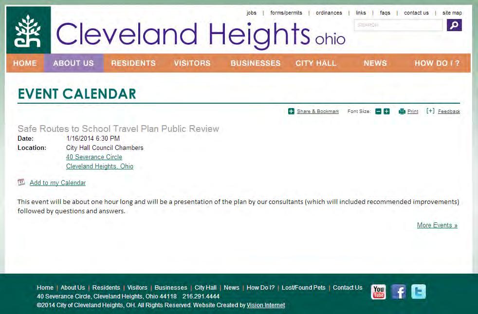
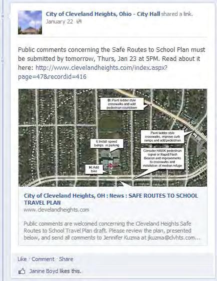
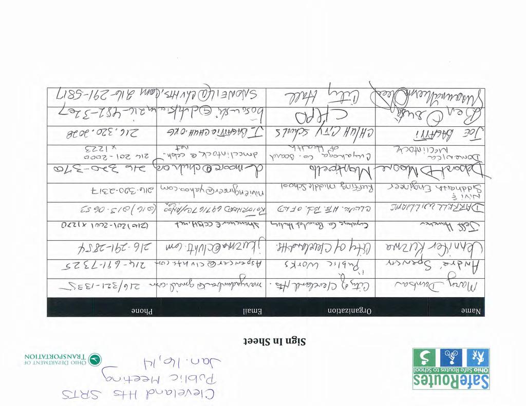
36 SECTION 6: PUBLIC INPUT A public meeting to discuss the Cleveland Heights STP was held on January 16, 2014, at the Cleveland Heights City Hall. Key feedback from that meeting is outlined below; materials from the meeting are included in Appendix C. 35 Public Input Process: Public meeting Date: Thursday, January 16, 2014 Target Audience: SRTS Team Member, parents, community members Key Input Received: The following input was received from attendees regarding the proposed countermeasures included in the Cleveland Heights STP: There was a question if the infrastructure countermeasures presented in the plan are eligible for SRTS funding? Yes. A number of comments and questions were brought up about the proposed countermeasures for Roxboro: o It was suggested to enforce the no parking zone in front of the school. o It was asked if traffic pattern changes are possible. It was suggested educational countermeasures as such tickets from students might be more effective. o It was suggested that the problem at Roxboro is that Roxboro Road south of West St. James has been closed off, so that there is no road between the elementary and middle schools. o One suggestion for rerouting traffic is to have remote drop off and add a loop at the G triangle. A number of comments and questions were brought up about the proposed countermeasures for Monticello: o The Principal said she likes the speed bumps. o Is there a limit on the number of bike racks that would be added? No. There was a question about why these schools were selected for the STP? Councilmember Mary Dunbar said these schools were selected as these sites were likely to remain in operation as the district moves forward with its facilities renovation plan with the Ohio Facilities Construction Commission. A question was asked about how to handle sidewalks when residents don t shovel? It was explained that education and encouragement activities such as friendly resident contact by students were more effective than enforcement. Another question was about the school district s policy on shoveling on school grounds? The district does not have a policy or in fact a written procedure for snow removal. They do have a norm they look at the forecast and if it calls for 2 snow accumulation overnight, they send the Grounds crew out around 1:00 AM to start clearing parking lots and sidewalks on school property. If the snowfall is less than two inches, they work around it and clear parking & sidewalks when the staff arrives at their normal start time of 6:30 AM. They cannot send employees off their property to clear city sidewalks, bus stops, or any other non-district property. Is early dismissal of walkers and bicyclists effective? It was explained that there are several positive benefits of early dismissal safety, so students are away from school when buses and cars arrive, to the cool factor of getting out of school early.
37 36 Could you please explain the walking school bus concept? The walking school bus was described again. What is the liability for walk school bus captains? It was explained that it is a local issue to determine as the program can be informal or very structured with background checks for captains and permission forms for students to participate. Representatives from Cuyahoga County Public Health made the following general comments and suggestions for the STP: o Add a social marketing campaign into the STP with newsletters, etc. o Target enforcement at schools, with bike patrol officers for 6 weeks at the beginning of the school year. o Have police officers on bicycles at schools at arrival and dismissal (current CHPD officers could be redirected to the schools, and paid using SRTS grant dollars). o Consider creating a Parent Safety Patrol to supplement Student Safety Patrol. o Create a school district walking map like the one in Brooklyn. o Have the police department purchase bike helmets for giveaways throughout the year and tied to events and observances like Bike to School Day, bike rodeos, etc. o Identify business partners that have security staff to augment police department s work. The following comment was received during the public comment period: I like the positive adjustments with crosswalks, signage, and events. I agree that we need bike racks for the south entrances of the schools. As a family that uses the cinder path south of Canterbury, I would like public education about who maintains the path and who to call if maintenance is needed. As a side note, for walking and biking families schools should also provide trash cans near bike racks. This seems trivial, but it is an issue faced by families who come and go on foot. I remain concerned that promoting bike and walking options without accounting for automobile traffic and safety may undermine the intent of the Safe Routes initiative. Our communities wrestle with traffic flow and related safety issues, particularly around the school perimeter. To omit this aspect seems to limit the potential success of this program. This comment was responded to by the City of Cleveland Heights: Thank you for your suggestions! The addition of trash cans is a wonderful idea and I agree it is not a suggested improvement one would consider unless you are walking or biking regularly. Great recommendation! I have been told that our "Plan" is a living breathing document and that we can amend to and add to it regularly. The bigger issues you point could very well be the types of issues which need to be identified in a more complete way as the document lives and breathes. I am hopeful that this is just the beginning of our process. I spoke with our service director and he said the paved path, known as Bradford Lane, is a city responsibility. He was not aware of a cinder path. I would guess if it's on the school property it is the school's responsibility. There was a facilities staff person from the district at the meeting last week and I will try to locate his name and number for you. He indicated a few times that he would be the person to speak with about concerns like this one. Many thanks again for your ideas! The following comment was received during the public comment period: I am thrilled that this project is underway, and look forward to seeing improvements in the pedestrian and bicycle environments at all of these locations.
38 37 I would like to make a few suggestions for the Canterbury area (and some of these may be applicable at other schools as well). Crosswalk and pedestrian signage improvements were proposed for the intersections of Meadowbrook and Canterbury and East Scarborough and Canterbury. These types of improvements are also important for the intersections of East Scarborough and Princeton, Canterbury and Bradford, and Princeton and Bradford (at the pedestrian path). I was hoping to see more details to encourage the development of safer bike routes around the school. Current vehicular volumes and patterns around the school make adding children on bicycles into the mix an undesirable option. It is also widely recognized that it is not as safe to have children riding bikes along sidewalks, where driver visibility is greatly decreased. I had been hoping to see the inclusion of highly visible bike lanes, bike paths within the school campus (as included in the Chagrin Falls SRTS project), and increased signage alerting drivers of school bike routes. The provision of additional bike racks is badly needed, and I am glad to see this recommendation. I am assuming that other schools within the district are like Canterbury in that multiple entrances are used for the students (different entry points for each grade level), and that bike racks near each of these entrances (or at least on multiple sides of school buildings) would be helpful rather than the recommendation of a single bike rack near the main entrance. This comment was responded to by the City of Cleveland Heights: So glad to get your feedback! It is so important to this process! I will be sure to share your comments with our entire Safe Routes to School Team and I am hopeful that your suggestions can be added to the Plan. As a recent recipient of a bronze level Bicycle Friendly Community award, we will be taking more steps (like those you suggested) so that we may achieve silver status soon. There is tremendous interest in making Cleveland Heights as bicycle and pedestrian friendly as possible and the areas nearest the schools are a high priority. Additionally, the STP has been updated to include the recommendations for crossing facilities at for the intersections of East Scarborough and Princeton, Canterbury and Bradford, and Princeton and Bradford (at the pedestrian path) and to provide bike racks at multiple locations to accommodate multiple entrances to the school. The following comment was received during the public comment period: My daughter attends Oxford Elementary School. Many children use the Noble Road and Oxford Road intersection to get to the school. This intersection has a high volume of traffic and occasional speeding cars. Unfortunately, the intersection does not have a traffic light, a crossing guard, a police presence or any signs warning drivers to watch out for children. Most mornings I see a little girl (possibly second grade) walking with her distracted, little brother to school (he appears to be in first grade or kindergarten) and I fear for their safety and the safety of other children using this intersection. Is there any way to place crosswalks with flashing lights at this intersection? Perhaps like the crosswalks on Coventry near the bars and businesses. If crosswalks are not possible, perhaps flashing signs or something else. Pedestrian improvements are being recommended at the intersections of Noble Road and Quilliams Road and Noble Road and Roanoke Road as part of this STP. Because of the proximity of the Noble Road and Oxford Road intersection to these two intersections (Oxford Road is the only street between these two intersections along Noble Road), no improvements are being recommended at the Noble Road and Oxford Road intersection. The school
39 should encourage students to cross at either the Noble Road and Quilliams Road or Noble Road and Roanoke Road signalized intersections. 38
40 SECTION 7: FINAL PLAN ENDORSEMENT Officials, administrators, and residents of the City of Cleveland Heights are joining together to improve safety and encourage more students to walk and bicycle to school. By implementing our Safe Routes to School Travel Plan, it is the vision of the Cleveland Heights Safe Routes to School Planning Team to provide safe routes for students to walk or bike to and from school that will encourage positive lifelong habits and develop pride in their communities while improving their safety, health, and education as well as the environment. The undersigned are fully supportive of the City of Cleveland Heights Safe Routes to School Travel Plan and program, and pledge to support their efforts and provide resources as appropriate. 39

41 APPENDIX A: OHIO DEPARTMENT OF HEALTH 3 RD GRADE BMI REPORT The Cleveland Heights-University Heights City Schools and Hebrew Academy of Cleveland are located in Cuyahoga County. The prevalence of overweight or obese 3 rd graders in the county is 30-39% (based on the Ohio Department of Health s A Report on the Body Mass Index of Ohio s Third Graders ).
42 APPENDIX B: MAPPING
 S TAYLOR RD (CR-26) WARRENSVILLE CENTER RD (CR-4) GREEN RD (CR-14) CEDAR RD (CR-23) WASHINGTON BLVD (CR-41) FAIRMOUNT BLVD (CR-19) FAIRHILL RD (CR-287) k LARCHMERE BLVD (CR-29)")
 0.25 0.5 1.0 2.")
43 COVENTRY RD (CR-330) LEE RD (CR-8) BELVOIR BLVD (CR-284) Canterbury Elementary - Cleveland Heights - University Heights City - Cuyahoga Co k SUPERIOR RD (CR-41) tu 322 MAYFIELD RD EUCLID HGTS BLVD (CR-345) S TAYLOR RD (CR-26) WARRENSVILLE CENTER RD (CR-4) GREEN RD (CR-14) CEDAR RD (CR-23) WASHINGTON BLVD (CR-41) FAIRMOUNT BLVD (CR-19) FAIRHILL RD (CR-287) k LARCHMERE BLVD (CR-29) FAIRMOUNT BLVD (CR-19) 87 SHAKER BLVD VAN AKEN BLVD (CR-776) S WOODLAND RD (CR-21) k School Students KINSMAN RD Roads by Type Interstate Route US Route State Route Freeway Ramp County Roads Township Roads Radius (Miles) City Boundary County Boundary State Boundary Date: 5/8/2013 tu 422 CHAGRIN BLVD Total Enrollment = 362 q 8 Feet ,500 3,000 4, Minutes to Walk
 CO IT RD (CR-328) BELVOIR BLVD (CR-284) GREEN RD (CR-14) N NOBLE RD (CR-253) COIT AVE (CR-362) SHAW AVE (CR-353) NOBLE RD (CR-6) TAYLOR RD (CR-26) k MONTICELLO BLVD (CR-313) FOREST HILLS")
44 Oxford Elem - Cleveland Heights - University Heights City - Cuyahoga Co k E 152ND ST (CR-362) HOLMES AVE (CR-725) LONDON RD (CR-725) ST CLAIR AVE (CR-9) EUCLID AVE tu 6 HIGHLAN D R D (CR-47) IVANHOE RD (CR-355) CO IT RD (CR-328) BELVOIR BLVD (CR-284) GREEN RD (CR-14) N NOBLE RD (CR-253) COIT AVE (CR-362) SHAW AVE (CR-353) NOBLE RD (CR-6) TAYLOR RD (CR-26) k MONTICELLO BLVD (CR-313) FOREST HILLS BLVD (CR-729) SUPERIOR RD (CR-41) MAYFIELD RD tu 322 k School Students Roads by Type Interstate Route US Route State Route Freeway Ramp County Roads Township Roads LEE RD (CR-8) Radius (Miles) S TAYLOR RD (CR-26) EUCLID HGTS BLVD (CR-345) City Boundary County Boundary State Boundary Date: 5/7/2013 WARRENSVILLE CENTER RD (CR-4) Total Enrollment = 334 q Feet ,500 3,000 4, Minutes to Walk
 E 105TH ST (CR-400) tu 6 E SUPERIOR AVE LAKEVIE W RD (CR-328) FOREST HILLS BLVD (CR-729) SUPERIOR RD (CR-41) MONTICELLO BLVD (CR-313) tu 322 WADE PARK AVE (CR-723) HOUGH AVE (CR-359) tu 322")
45 E 89TH ST (CR-724) KINSMAN RD E 130TH ST (CR-62) COVENTRY RD (CR-330) LEE RD (CR-8) Roxboro Elementary - Cleveland Heights - University Heights City - Cuyahoga Co k N ANSEL RD (CR-724) EAST BLVD (C R-1596) E 105TH ST (CR-400) tu 6 E SUPERIOR AVE LAKEVIE W RD (CR-328) FOREST HILLS BLVD (CR-729) SUPERIOR RD (CR-41) MONTICELLO BLVD (CR-313) tu 322 WADE PARK AVE (CR-723) HOUGH AVE (CR-359) tu 322 CHESTER AVE EUCLID AVE CARNEGIE AVE (CR-722) CEDAR AVE (CR-23) EAST BLVD (C R-730) STOKES BLVD (CR-287) E 118TH ST (CR-723) DR MARTIN LUTHER KING BLVD (CR-406) tu 20 MURRAY HILL RD (CR-726) F EUCLID HGT S BLVD (CR-345) S TAYLOR RD (CR-26) CEDAR RD (CR-23) QUINCY AVE (CR-765) OPPORTUNITY BLVD (CR-490) WOODLAND AVE (CR-27) k FAIRHILL RD (CR-287) AIRMOUNT BLVD (CR-19) MAYFIELD RD LARCHMERE BLVD (CR-29) FAIRMOUNT BLVD (CR-19) W PARK BLVD (CR-29) WOODHILL RD (CR-398) EAST BLVD (CR-770) BUCKEYE RD (CR-21) E 116TH (MLK BLVD) ST (CR-406) S MORELAND BLVD (CR-62) SHAKER BLVD S WOODLAND RD (CR-21) VAN AKEN BLVD (CR-776) 87 tu 422 CHAGRIN BLVD E 93RD ST (CR-398) UNION RD (CR-233) k School Students Roads by Type Interstate Route US Route State Route Freeway Ramp County Roads Township Roads Radius (Miles) City Boundary County Boundary State Boundary Date: 5/7/2013 Total Enrollment = 409 q Feet ,600 3,200 4, Minutes to Walk
 NOBLE RD (CR-6) TAYLOR RD (CR-26) k MONTICELLO BLVD (CR-313) F OREST HILLS BLVD (CR-729) COVENTRY RD (CR-330) SUPERIOR RD (CR-41) LEE RD (CR-8) EU CLID HGTS BLVD (CR-345) S TAYLOR RD")
46 HAYDEN AVE (CR-342) Monticello Middle - Cleveland Heights - University Heights City - Cuyahoga Co k E 152ND ST (CR-362) ST CLAIR AVE (CR-9) HIGHLAND RD (CR-47) COIT RD (CR-328) BELVOIR BLVD (CR-284) GREEN RD (CR-14) NOBLE RD (CR-6) TAYLOR RD (CR-26) k MONTICELLO BLVD (CR-313) F OREST HILLS BLVD (CR-729) COVENTRY RD (CR-330) SUPERIOR RD (CR-41) LEE RD (CR-8) EU CLID HGTS BLVD (CR-345) S TAYLOR RD (CR-26) E 140TH ST (CR-342) HOLMES AVE (CR-725) LONDON RD (CR-725) IVANHOE RD (CR-355) WOODWORTH AVE (CR-253) N NOBLE RD (CR-253) COIT AVE (CR-362) SHAW AVE (CR-353) tu 6 EUCLID AVE tu 322 MAYFIELD RD WARRENSVILLE CENTER RD (CR-4) k School Students Roads by Type Interstate Route US Route State Route Freeway Ramp County Roads Township Roads Radius (Miles) City Boundary County Boundary State Boundary Date: 5/8/2013 Total Enrollment = 394 q Feet ,500 3,000 4, Minutes to Walk
 tu 6 TAYLOR RD (CR-26) MONTICELLO BLVD (CR-313) FOREST HILLS BLVD (CR-729) tu 20 EUCLID AVE SUPERIOR RD (CR-41) tu 322 MAYFIELD RD EUCLID HGTS BLVD (CR-345) k S TAYLOR RD (CR-26)")
47 BUCKEYE RD (CR-21) COVENTRY RD (CR-330) LEE RD (CR-8) BELVOIR BLVD (CR-284) GREEN RD (CR-14) Hebrew Academy of Cleveland - - Cuyahoga Co k SHAW AVE (CR-353) NOBLE RD (CR-6) EDDY RD (C R-318) HAYDEN AVE (CR-342) tu 6 TAYLOR RD (CR-26) MONTICELLO BLVD (CR-313) FOREST HILLS BLVD (CR-729) tu 20 EUCLID AVE SUPERIOR RD (CR-41) tu 322 MAYFIELD RD EUCLID HGTS BLVD (CR-345) k S TAYLOR RD (CR-26) WARRENSVILLE CENTER RD (CR-4) CEDAR RD (CR-23) WASHINGTON BLVD (CR-41) F AIRMOUNT B LVD (CR-19) FAIRHILL RD (CR-287) LARCHMERE BLVD (CR-29) W PARK BLVD (CR-29) FAIRMOUNT BLVD (CR-19) SHAKER BLVD k School Students Roads by Type Interstate Route US Route State Route Freeway Ramp County Roads Township Roads S WOODLAND RD (CR-21) Radius (Miles) City Boundary County Boundary State Boundary Date: 10/28/ Total Enrollment = 835 q Feet ,600 3,200 4, Minutes to Walk
48 Legend!( Canterbury Students 1/4-mile Buffer Cleveland Heights - Canterbury Proposed Countermeasures O Feet
49 Legend!( Oxford Students!( Monticello Students 1/4-mile Buffer 1/2-mile Buffer Cleveland Heights - Oxford & Monticello Proposed Countermeasures O Feet
50 Legend!( Roxboro Students 1/4-mile Buffer Cleveland Heights - Roxboro Proposed Countermeasures O Feet
51 Legend!( Hebrew Academy Students 1/4-mile Buffer Cleveland Heights - Hebrew Academy Proposed Countermeasures O Feet
52 APPENDIX C: PUBLIC MEETING MATERIALS
53
54
55

56 Cleveland Heights-University Heights City Schools & Hebrew Academy SRTS Public Meeting January 16, 2014 Agenda 1. Introductions 2. What is Safe Routes to School? 3. Developing the School Travel Plan 4. Overview of the School Travel Plan 5. Meeting Participant Comments 6. Next Steps, Adjourn the Meeting Open comment period until Thursday, January 23 Send comments to: Stephanie Tresso, SRTS Consultant

?")
 Next Steps Questions?")
57 Cleveland Heights SRTS - Public Meeting January 16, 2014 Cleveland Heights Safe Routes to School School Travel Plan (STP) Meeting January 16, 2014 Agenda What is Safe Routes to School (SRTS)? Ohio s SRTS Program Cleveland Heights s School Travel Plan (STP) Next Steps Questions? 2 Cleveland Heights Safe Routes to School January 16,
58 Cleveland Heights SRTS - Public Meeting January 16, 2014 National Safe Routes to School International movement to promote active transportation Highway Transportation Bill since 2004 Focuses on barriers/improvements to walking and biking Within 2 miles of any school (K-8 Students) Funds for Infrastructure and Non- Infrastructure Projects Includes five components (5 E s) Education, Encouragement, Enforcement, Engineering, and Evaluation 3 Cleveland Heights Safe Routes to School January 16, 2014 Ohio Safe Routes to School Managed by ODOT John Motl ODOT District 12 SRTS Coordinator Goal: Encourage more students to walk/bike and make walking/biking routes safer for all users School Travel Plan Process Documentation of a communities intentions related to active transportation ODOT assists communities STP is a requirement for further funding requests $500,000 (Infrastructure) and $30,000 (Non- Infrastructure) for Cleveland Heights Safe Routes to School January 16,


59 Cleveland Heights SRTS - Public Meeting January 16, 2014 Developing the School Travel Plan 3 Key Items Where are the kids coming from? What travel mode are they using? And why? 5 Cleveland Heights Safe Routes to School January 16, 2014 Cleveland Heights s School Travel Plan STP Process began in 2013 Local Group includes members from: City, School Officials, and others Goal to provide safe routes for students that will encourage positive lifelong habits and develop pride in their communities while improving their safety, health, education as well as the environment. STP Tasks Parent Surveys/Travel Tally s Current School Travel Information (How children get to/from school?) Issues Audit of Existing Conditions (December 10, 2013) Recommended Solutions and Countermeasures Infrastructure and Non-Infrastructure 6 Cleveland Heights Safe Routes to School January 16,

60 Cleveland Heights SRTS - Public Meeting January 16, 2014 Cleveland Heights s School Travel Plan Next Steps Incorporate Public Comments Finalize Countermeasures and Mapping Endorsements Project Prioritization Final STP in early February Funding Request by March 3, 2014 at 5pm Both Infrastructure and Non- Infrastructure 7 Cleveland Heights Safe Routes to School January 16, 2014 Non-Infrastructure Countermeasures Education Promote Safety Town program to incoming kindergarteners. Start a Bike Rodeo program for 2 nd /3 rd Graders. Attend ODOT s Walking School Bus Training. Utilize ODOT s Every Move You Make, Make It Safe campaign materials. Host informational SRTS meeting for parents, neighbors, etc. Educate parents and students on proper pick-up/drop-off procedures at each school and make sure students know the appropriate crossing locations. Encouragement Start Walking School Bus Program. Participate in Walk and Bike to School Days. Develop mileage clubs and other classroom competitions. 8 Cleveland Heights Safe Routes to School January 16,
61 Cleveland Heights SRTS - Public Meeting January 16, 2014 Non-Infrastructure Countermeasures Enforcement Enforce School Zone speed limits. Attend ODOT s Adult School Crossing Guard Training. Expand Student Safety Patrol Program to all elementary schools and purchase walkie-talkies for use. Purchase safety vests and other equipment for use during arrival and/or dismissal. Evaluation Conduct Parent Surveys annually. Conduct Student Travel Tallies seasonally. 9 Cleveland Heights Safe Routes to School January 16, 2014 Infrastructure Countermeasures all schools Bring existing curb ramps on and adjacent to school sites up to ADA standards. Install lights on back of school zone beacons to alert drivers that they are leaving a school zone. Upgrade all pedestrian crossing signage around school sites to be OMUTCD-compliant and repaint crosswalks in the ladder-style for better visibility. 10 Cleveland Heights Safe Routes to School January 16,


62 Cleveland Heights SRTS - Public Meeting January 16, 2014 Infrastructure Countermeasures Canterbury B: Paint ladder-style crosswalks, and add pedestrian crossing signage and curb ramps. C: Paint ladderstyle crosswalks. 11 Cleveland Heights Safe Routes to School January 16, 2014 A: Add bike racks. Infrastructure Countermeasures Oxford D: Paint ladder-style crosswalks and add pedestrian countdown timers. 12 Cleveland Heights Safe Routes to School January 16,


63 Cleveland Heights SRTS - Public Meeting January 16, 2014 Infrastructure Countermeasures Roxboro F: Repaint crosswalks along St. James in the ladder-style and add pedestrian crossing signage. E: Add bike racks. F: Repaint crosswalks along Colchester in the ladder-style and add pedestrian crossing signage. G: Restrict parking along Roxboro during school hours. 13 Cleveland Heights Safe Routes to School January 16, 2014 Infrastructure Countermeasures Monticello D: Paint ladder-style crosswalks and add pedestrian countdown timers. I: Install speed bumps in parking lot. H: Add bike racks. 14 Cleveland Heights Safe Routes to School January 16, 2014 J: Extend School Zone along Monticello. 7


 433-7821 Stephanie Tresso Murphy Epson / Engage")
64 Cleveland Heights SRTS - Public Meeting January 16, 2014 Infrastructure Countermeasures Hebrew Acad. L: Install pedestrian crossing signal. K: Extend School Zone along S. Taylor. 15 Cleveland Heights Safe Routes to School January 16, 2014 Questions? David Shipps TranSystems Corporation dfshipps@transystems.com (614) Stephanie Tresso Murphy Epson / Engage stresso@murphyepson.com (614) , ext Cleveland Heights Safe Routes to School January 16,
Wellington Exempted Village School District SAFE ROUTES TO SCHOOL TRAVEL PLAN January 2014
 Wellington Exempted Village School District SAFE ROUTES TO SCHOOL TRAVEL PLAN January 2014 OHIO SAFE ROUTES TO SCHOOL WELLINGTON EXEMPTED VILLAGE SCHOOL DISTRICT TRAVEL PLAN SECTION 1: WELLINGTON EXEMPTED
THORNVILLE-GLENFORD STP
 THORNVILLE-GLENFORD STP SAFE ROUTES TO SCHOOL TRAVEL PLAN September 2013 OHIO SAFE ROUTES TO SCHOOL SCHOOL TRAVEL PLAN SECTION 1: OUR SCHOOL/S 1A. Identify Target Schools School District School Name School
FREMONT CITY SCHOOLS STP
 FREMONT CITY SCHOOLS STP SAFE ROUTES TO SCHOOL TRAVEL PLAN February 2014 OHIO SAFE ROUTES TO SCHOOL SCHOOL TRAVEL PLAN SECTION 1: OUR SCHOOL(S) 1A. Identify Target Schools School District School Name School
ARCADIA ELEMENTARY & MIDDLE SCHOOLS
 ARCADIA ELEMENTARY & MIDDLE SCHOOLS SAFE ROUTES TO SCHOOL TRAVEL August 2013 ARCADIA LOCAL SCHOOLS OHIO SAFE ROUTES TO SCHOOL SCHOOL TRAVEL Ohio Safe Routes to School Travel Plan Local Schools www.dot.state.oh.us/saferoutes
ASHTABULA AREA SCHOOLS STP
 ASHTABULA AREA SCHOOLS STP SAFE ROUTES TO SCHOOL TRAVEL PLAN April 2013 OHIO SAFE ROUTES TO SCHOOL SCHOOL TRAVEL PLAN SECTION 1: OUR SCHOOL/S 1A. Identify Target Schools School District School Name School
CHILLICOTHE CITY SCHOOLS. SAFE ROUTES TO SCHOOL TRAVEL PLANS for Allen, Mt. Logan, Tiffin & Worthington Elementary Schools January 2013
 CHILLICOTHE CITY SCHOOLS SAFE ROUTES TO SCHOOL TRAVEL PLANS for Allen, Mt. Logan, Tiffin & Worthington Elementary Schools January 2013 i Ohio s Safe Routes to School Travel Plan Template www.dot.state.oh.us/saferoutes
AMHERST EXEMPTED VILLAGE SCHOOLS AND SAINT JOSEPH SCHOOL
 AMHERST EXEMPTED VILLAGE SCHOOLS AND SAINT JOSEPH SCHOOL SAFE ROUTES TO SCHOOL TRAVEL PLAN 12/11/18 DRAFT OHIO SAFE ROUTES TO SCHOOL SCHOOL TRAVEL PLAN Ohio s Safe Routes to School Travel Plan Template
ZANESVILLE CITY SCHOOLS STP. SAFE ROUTES TO SCHOOL TRAVEL PLAN February 2015
 ZANESVILLE CITY SCHOOLS STP SAFE ROUTES TO SCHOOL TRAVEL PLAN February 2015 SECTION 1: OUR SCHOOL(S) School District School Name School Address Grades served City Schools Average Daily Student Enrollment
FRANKLIN, ISHAM MEMORIAL, OVERLOOK & VALLEY VIEW ELEMENTARY SCHOOLS
 FRANKLIN, ISHAM MEMORIAL, OVERLOOK & VALLEY VIEW ELEMENTARY SCHOOLS SAFE ROUTES TO SCHOOL TRAVEL PLAN August 2013 OHIO SAFE ROUTES TO SCHOOL SCHOOL TRAVEL PLAN SECTION 1: OUR SCHOOL(S) School District
NORTH UNION LOCAL SCHOOLS
 NORTH UNION LOCAL SCHOOLS SAFE ROUTES TO SCHOOL TRAVEL PLAN November 2015 OHIO SAFE ROUTES TO SCHOOL SCHOOL TRAVEL PLAN SECTION 1: OUR SCHOOL(S) 1A. Identify Target Schools School District School Name
PROSPECT ELEMENTARY GIRARD INTERMEDIATE GIRARD JUNIOR HIGH
 PROSPECT ELEMENTARY GIRARD INTERMEDIATE GIRARD JUNIOR HIGH SAFE ROUTES TO SCHOOL SCHOOL TRAVEL PLAN January 8, 2014 2 SECTION 1: OUR SCHOOLS School District School Name School Address Grades served Girard
BEXLEY CITY SCHOOL DISTRICT
 BEXLEY CITY SCHOOL DISTRICT SAFE ROUTES TO SCHOOL TRAVEL PLAN December 2012 OHIO SAFE ROUTES TO SCHOOL SCHOOL TRAVEL PLAN SECTION 1: OUR SCHOOLS 1A. Identify Target Schools School District School Name
CITY OF FRANKLIN STP. SAFE ROUTES TO SCHOOL TRAVEL PLAN February 2015
 CITY OF FRANKLIN STP SAFE ROUTES TO SCHOOL TRAVEL PLAN February 2015 SECTION 1: OUR SCHOOL(S) School District School Name School Address Grades served Average Daily Student Enrollment Franklin City Schools
DANIEL WRIGHT ELEMENTARY
 DANIEL WRIGHT ELEMENTARY SAFE ROUTES TO SCHOOL TRAVEL PLAN February 2016 OHIO SAFE ROUTES TO SCHOOL SCHOOL TRAVEL PLAN TEMPLATE SECTION 1: OUR SCHOOL(S) 1A. Identify Target Schools School District School
Bremen Elementary. SAFE ROUTES TO SCHOOL TRAVEL PLAN October 9, 2012
 Bremen Elementary SAFE ROUTES TO SCHOOL TRAVEL PLAN October 9, 2012 Introduction The purpose of the Bremen Elementary Safe Route to School (SRTS) Plan is to encourage school age children to travel to school
San Ramon Elementary School. Travel Plan
 San Ramon Elementary School Travel Plan TABLE OF CONTENTS 1. PURPOSE... 1 1.1. SR2S PLANNING, IMPLEMENTATION AND MONITORING... 1 1.2. MARIN COUNTY MEASURE A... 1 2. SAN RAMON ELEMENTARY SCHOOL PROFILE...
KENTON CITY SCHOOLS STP
 KENTON CITY SCHOOLS STP SAFE ROUTES TO SCHOOL TRAVEL PLAN January 2014 OHIO SAFE ROUTES TO SCHOOL SCHOOL TRAVEL PLAN SECTION 1: OUR SCHOOL/S 1A. Identify Target Schools School District School Name School
Vallecito Elementary School. Travel Plan
 Vallecito Elementary School Travel Plan TABLE OF CONTENTS 1. PURPOSE... 1 1.1. SR2S PLANNING, IMPLEMENTATION AND MONITORING... 1 1.2. MARIN COUNTY MEASURE A... 1 2. VALLECITO ELEMENTARY SCHOOL PROFILE...
Rim Rock Elementary School Walking and Biking Audit
 Rim Rock Elementary School Walking and Biking Audit September 29, 2016 Rim Rock Elementary School Audit for Walking and Biking September 29, 2016 Audit Team Members: Sam Atkins, City Engineer, City of
WINTON WOODS CITY SCHOOLS
 WINTON WOODS CITY SCHOOLS SAFE ROUTES TO SCHOOL TRAVEL PLAN August 2017 OHIO SAFE ROUTES TO SCHOOL SCHOOL TRAVEL PLAN SECTION 1: OUR SCHOOL/S School District School Name School Address Grades served Winton
CITY OF OAK CREEK SAFE ROUTES TO SCHOOL ACTION PLAN. East Middle School
 CITY OF OAK CREEK SAFE ROUTES TO SCHOOL ACTION PLAN East Middle School CITY OF OAK CREEK SAFE ROUTES TO SCHOOL ACTION PLAN East Middle School Why Safe Routes to School? Safe Routes to School ( SRTS ) is
OCEAN DRIVE ELEMENTARY SCHOOL
 OCEAN DRIVE ELEMENTARY SCHOOL North Myrtle Beach, SC Safe Routes to School Travel Plan JANUARY 2017 SRTS Team Roster SRTS Team members represent key community stakeholders, share work of developing the
National Safe Routes to School Program: Initial Results
 National Safe Routes to School Program: Initial Results Lauren Marchetti National Center for Safe Routes to School 9 th Annual New Partners for Smart Growth Thursday, February 4, 2010 Seattle, WA August
July 5, Arthur R. Ware, Jr. Elementary School 2017 Safe Routes to School Walkabout Report
 July 5, 2017 Arthur R. Ware, Jr. Elementary School 2017 Safe Routes to School Walkabout Report 1 Walkabout Report Introduction On April 28, 2017, City, School, and SAWMPO staff met to conduct a Safe Routes
2 Mark Twain Elementary School Report
 2 Mark Twain Elementary School Report Principal: Greg Kaatz Grades: K-2 Enrollment: 323 Address: 425 N. Church Street First bell: 8:10 a.m. Silverton, OR 97381 Last bell: 2:30 p.m. Free & Reduced Lunch:
Parent Survey Report: One School in One Data Collection Period
 Parent Survey Report: One School in One Data Collection Period School Name: Bilquist Elementary School Set ID: 15803 School Group: Clackamas County Month and Year Collected: December 2016 School Enrollment:
Safe Routes to School in New Jersey
 Safe Routes to School in New Jersey The need for Safe Routes to School 1. Fewer kids today walk and bike to school 2. Unintended consequences have resulted 3. SRTS programs can be part of the solution
SAFE ROUTES TO SCHOOL
 SAFE ROUTES TO SCHOOL Forest Ridge Elementary School Existing Conditions and ACTION PLAN > Oak Creek - Franklin Joint School District Table of Contents CONTEXT Enrollment Boundaries
3 Silverton High School Report
 3 Silverton High School Report Principal: Justin Lieuallen Grades: 9-12 Enrollment: 1,277 Address: 1456 Pine Street First bell: 7:55 a.m. Silverton, OR 97381 Last bell: 3:05 p.m. Free & Reduced Lunch:
Grandview Heights Safe Routes to School School Travel Plan Ohio Department of Transportation, District 6 February 23, 2012
 Grandview Heights Safe Routes to School School Travel Plan Ohio Department of Transportation, District 6 February 23, 2012 Grandview Heights School Travel Plan (STP) Safe Routes to School Table of Contents
Sunset Park Center for Accelerated Studies
 Sunset Park Center for Accelerated Studies The following are a simple list of advantages, disadvantages, and recommendations based on a community assessment. It is not intended to be a list of complete
Safe Routes to School Comprehensive Plan
 Safe Routes to School Comprehensive Plan City of Apple Valley Dakota County, MN May 2010 Prepared by: Project Background The Statewide Health Improvement Program (SHIP) aims to help Minnesotans live longer,
AGENDA. 5. Next Steps a. Survey Distribution b. Draft Action Plan/Recommendations c. Review at next meeting in advance of document preparation
 Congdon Elementary Safe Routes to School Plan Update SRTS Team Meeting #2-Walk Audit March 21, 2018, 3:00 p.m. Congdon Elementary School Art Room-Duluth, MN 1. Welcome and Introductions 2. SRTS Review
THE PLAINS ELEMENTARY SCHOOL SCHOOL TRAVEL PLAN
 THE PLAINS ELEMENTARY SCHOOL SCHOOL TRAVEL PLAN We would like to extend a special thank you to all of those involved in the development of this plan. Our group especially appreciates the efforts and support
About the Studio. Edward J. Bloustein School of Planning and Public Policy - Rutgers University
 About the Studio Edward J. Bloustein School of Planning and Public Policy - Rutgers University Purpose of studio: Help City of Bayonne apply for Safe Routes to School (SRTS) funding by producing a School
Getting Your SRTS Project Funded. Ryan Snyder
 Getting Your SRTS Project Funded Ryan Snyder Steps in Submitting a Successful Application 1. Stakeholder outreach: create a SRTS coalition 2. Develop a comprehensive plan and program with all 5 Es 3. Conceive
Doull Elementary School
 Doull Elementary School Safe Routes to School Walking Audit and Recommendations WalkDenver Fall 2013 Doull Elementary School (ECE grade 5) 2520 South Utica Street, Denver 80219 This project was supported
SECTION 1 - CONTACT INFORMATION
 SECTION 1 - CONTACT INFORMATION Please complete the information below. The person identified as the Project Contact Person will be the primary point of contact for Georgia DOT staff. Organization: (Please
Parent Survey Report: One School in One Data Collection Period
 Parent Survey Report: One School in One Data Collection Period School Name: Broken Arrow Elementary School Set ID: 12172 School Group: Douglas County Month and Year Collected: October 2014 School Enrollment:
SAFE ROUTES TO SCHOOL
 SAFE ROUTES TO SCHOOL Edgewood Elementary School Existing Conditions and ACTION PLAN > Oak Creek - Franklin Joint School District Table of Contents CONTEXT Enrollment Boundaries Enrollment
EVENDALE ELEMENTARY SCHOOL. SAFE ROUTES TO SCHOOL TRAVEL PLAN February 13, 2018
 EVENDALE ELEMENTARY SCHOOL SAFE ROUTES TO SCHOOL TRAVEL PLAN February 13, 2018 INTRODUCTION The purpose of the Evendale Elementary School Safe Routes to School (SRTS) Travel Plan is to prospectively identify
Summary Report School Walking & Bicycling Audits. Mesa County Regional Transportation Planning Office
 Summary Report School Walking & Bicycling Audits Mesa County Regional Transportation Planning Office This page left blank intentionally WALKING & BICYCLING AUDIT SUMMARY 2 Executive Summary Background:
Bringing together community and health. Physical Activity and Nutrition Unit Office of Statewide Health Improvement Initiatives
 Bringing together community and health. Physical Activity and Nutrition Unit Office of Statewide Health Improvement Initiatives Physical Activity and Nutrition Unit Office of Statewide Health Improvement
Safe Routes to School NELLIE STONE JOHNSON COMMUNITY SCHOOL
 December 2010 Safe Routes to School NELLIE STONE JOHNSON COMMUNITY SCHOOL Encouraging walking and biking to school Safe Routes to School: Healthy Kids Focused Students Across the nation, communities are
City of Struthers. SAFE ROUTES TO SCHOOL TRAVEL PLAN January 2015
 SAFE ROUTES TO SCHOOL TRAVEL PLAN January 2015 SECTION 1: OUR SCHOOLS School District School Name School Address Grades served City Schools Elementary School 520 9 th Street, OH 44471 K 4 Your School s
ST. HENRY ELEMENTARY & MIDDLE SCHOOLS
 ST. HENRY ELEMENTARY & MIDDLE SCHOOLS SAFE ROUTES TO SCHOOL TRAVEL PLAN December 2013 OHIO SAFE ROUTES TO SCHOOL SCHOOL TRAVEL PLAN TABLE OF CONTENTS Table of Contents 2 Section 1: Our Schools 3 School
Arlington Public Schools Thomas Jefferson Site Evaluation Transportation Networks. Thomas Jefferson Working Group Meeting #6 November 10, 2014
 Arlington Public Schools Thomas Jefferson Site Evaluation Transportation Networks Thomas Jefferson Working Group Meeting #6 November 10, 2014 2 3 INTRODUCTION 4 Goal of our work: Identify and assess multi-modal
Aitkin School Routing Plan July 2010
 Aitkin School Routing Plan July 2010 Prepared by: Arrowhead Regional Development Commission Regional Planning Division Aitkin School Routing Plan July 2010 Aitkin School Routing Plan July 2010 Prepared
Parent Survey Report: One School in One Data Collection Period
 Parent Survey Report: One School in One Data Collection Period School Name: Pinckney Elementary School Set ID: 12170 School Group: Douglas County Month and Year Collected: October 2014 School Enrollment:
Conway Elementary School
 Conway Elementary School Safe Routes to School Travel Plan February 2012 Prepared with assistance from the SC SRTS Resource Center INTRODUCTION This Travel Plan represents the work of the Conway Elementary
S A F E R O U T E S T O S C H O O L H E R M A N TOW N S C H O O L S A N D P R O C TO R S C H O O L S P L A N A P P R OVA L S
 S A F E R O U T E S T O S C H O O L H E R M A N TOW N S C H O O L S A N D P R O C TO R S C H O O L S P L A N A P P R OVA L S WHAT IS SAFE ROUTES TO SCHOOL? In 1969, nearly 50% of children walked or rode
Hedgepeth Williams Middle School and Paul Robeson Elementary School Trenton, NJ. School Travel Plan
 Hedgepeth Williams Middle School and Paul Robeson Elementary School Trenton, NJ School Travel Plan Hedgepeth Williams Middle School Description: Hedgepeth-Williams Middle School is located at 301 Gladstone
Safe Routes to School: Creating an Action Plan Template
 odot25m Page 1 4/13/2016-1 - Safe Routes to School: Creating an Action Plan Template Note: This document can be protected to prevent unintended changes to the form. If you wish to protect the template,
Barnum- Safe Routes to School Meeting #2 January 20, 2015
 Barnum- Safe Routes to School Meeting #2 January 20, 2015 1. Introductions 2. SRTS Program Overview 1. Purpose 2. Benefits 3. Background of planning Process 3. Existing Conditions Review and Summary 1.
Randolph-Hamline ( Ran-Ham ) Area Safe Routes to School Plan
 Area Safe Routes to School Plan") Randolph-Hamline ( Ran-Ham ) Area Safe Routes to School Plan Cretin Derham Hall Expo Elementary Holy Spirit Elementary Randolph Heights Elementary Saint Paul, Minnesota September 2016 Prepared By: Saint
Randolph-Hamline ( Ran-Ham ) Area Safe Routes to School Plan Cretin Derham Hall Expo Elementary Holy Spirit Elementary Randolph Heights Elementary Saint Paul, Minnesota September 2016 Prepared By: Saint
Safe Routes to School Travel Plan 2011 Reading-Fleming Intermediate School (RFIS)
") Safe Routes to School Travel Plan 0 Reading-Fleming Intermediate School (RFIS) Reading Fleming Intermediate School 50 Court Street Flemington, NJ 088 Grades: 5-6 Introduction Reading-Fleming Intermediate
Safe Routes to School Travel Plan 0 Reading-Fleming Intermediate School (RFIS) Reading Fleming Intermediate School 50 Court Street Flemington, NJ 088 Grades: 5-6 Introduction Reading-Fleming Intermediate
Venetia Valley Elementary School. Travel Plan
 Venetia Valley Elementary School Travel Plan TABLE OF CONTENTS 1. PURPOSE... 1 1.1. SR2S PLANNING, IMPLEMENTATION AND MONITORING... 1 1.2. MARIN COUNTY MEASURE A... 1 2. VENETIA VALLEY ELEMENTARY SCHOOL
Sardis Elementary School Road Safety Plan. Produced by: Sardis Elementary School - Safer School Travel Team in cooperation with Safer City
 Sardis Elementary Road Safety Plan Produced by: Sardis Elementary - Safer Travel Team in cooperation with Safer City Plan completed in January 2016 1 Acknowledgements It takes commitment and community
2016 APS Go! Surveys Summary Results for Oakridge Elementary School
 2016 APS Go! Surveys Summary Results for Oakridge Elementary School This report summarizes results from the 2016 APS Go! surveys for Oakridge Elementary School. Student, parent/caregiver and staff surveys
Background and Goals of SRTS
 Safe Routes to School Background and Goals of SRTS Oklahoma Kick-off May 4, 2011 The Good, the Bad, and the Ugly Fewer kids are biking and walking More parents are driving 1969 2009 48% walked or biked
Chapter 2. Bellingham Bicycle Master Plan Chapter 2: Policies and Actions
 Chapter 2 Bellingham Bicycle Master Plan Chapter 2: Policies and Actions Chapter 2: Policies and Actions The Bicycle Master Plan provides a road map for making bicycling in Bellingham a viable transportation
Dr. Howard Elementary School Safe Routes to School Plan
 Dr. Howard Elementary School 2011-12 Safe Routes to School Plan Prepared by: Staff at the Champaign-Urbana Urbanized Area Transportation Study (CUUATS), a program of the Champaign County Regional Planning
Safe and Active Routes to School in Cabarrus County
 Safe and Active Routes to School in Cabarrus County In 2014, Cabarrus Health Alliance became the host agency for the Charlotte region s coordinator in the NC Active Routes to School program. The NC-ARTS
C/CAG. Sunnybrae Elementary School Walking and Bicycling Audit. San Mateo-Foster City School District JUNE 2013
 Sunnybrae Elementary School Walking and Bicycling Audit JUNE 2013 San Mateo-Foster City School District C/CAG City/County Association of Governments of San Mateo County SUNNYBRAE ELEMENTARY SCHOOL WALKING
Windy Ridge Elementary School
 Windy Ridge Elementary School SCHOOL ROUTE PLAN For WINDY RIDGE ELEMENTARY SCHOOL LOCATION 54 ORANGE COUNTY Prepared for: ORANGE COUNTY SCHOOL ASSESSMENT PROGRAM ORANGE COUNTY PUBLIC WORKS Traffic Engineering
Sebastopol Charter School Traffic Management Plan
 Sebastopol Charter School The serves as the working document in support of these essential goals: to ensure the safety and efficiency of student arrival to and departure from school to ensure the safety
Lawrence Safe Routes to School. Community Meeting January 14, 2015
 Lawrence Safe Routes to School Community Meeting January 14, 2015 Safe Routes to School The 6 E s Education Encouragement Enforcement Engineering Evaluation Equity What are the elements of a SRTS plan?
Mary H Wright Elementary School
 Mary H Wright Elementary School Safe Routes to School Travel Plan February Prepared with assistance from the SC SRTS Resource Center INTRODUCTION This Travel Plan represents the work of the Mary H. Wright
Implementing the Three Es of School Zone Traffic Calming
 Implementing the Three Es of School Zone Traffic Calming Use this evaluation tool as a guide to analyze the specific safety needs of your school. SCHOOL PROFILE School Name: School District: Address: Phone
Introduction.
 2307-1.0. Introduction. Delaware s Safe Routes to School (SRTS) Program was established September 10, 2002 when Governor Ruth Ann Minner signed Senate Bill 353 of the 141st General Assembly of Delaware
Chapter 3.9 Timbercrest Elementary School. Volusia County MPO. November 2008
 Chapter 3.9 Timbercrest Elementary School Deltona, FL Volusia County MPO November 2008 Volusia County MPO School Bicycle and Pedestrian Review Study, Phase 3B School Summary Timbercrest Elementary School
Orange Center Elementary School
 Drag and drop pic and stretch/crop to the limits of the blue rectangle (delete this text box) Orange Center Elementary School Drag and drop pic and stretch/crop to the limits of the blue rectangle (delete
Drag and drop pic and stretch/crop to the limits of the blue rectangle (delete this text box) Maxey Elementary School
 Maxey Elementary School") Drag and drop pic and stretch/crop to the limits of the blue rectangle (delete this text box) Maxey Elementary School SCHOOL ROUTE PLAN For MAXEY ELEMENTARY SCHOOL LOCATION 33 ORANGE COUNTY Prepared for:
Drag and drop pic and stretch/crop to the limits of the blue rectangle (delete this text box) Maxey Elementary School SCHOOL ROUTE PLAN For MAXEY ELEMENTARY SCHOOL LOCATION 33 ORANGE COUNTY Prepared for:
Chapter 4.3 Enterprise Elementary. Volusia County MPO. March Page 7.0
 Chapter 4.3 Enterprise Elementary Enterprise, FL Volusia County MPO March 2008 Page 7.0 Volusia County MPO Bicycle and Pedestrian School Safety Review Study Introduction Enterprise Elementary School is
Bicycle Master Plan Goals, Strategies, and Policies
 Bicycle Master Plan Goals, Strategies, and Policies Mobilizing 5 This chapter outlines the overarching goals, action statements, and action items Long Beach will take in order to achieve its vision of
GUIDEBOOK Version
 GUIDEBOOK Version 4. 2010 alk&âoll to Íchool Îays Table of Contents Introduction... 3 How to establish a weekly Walk and Roll to School Day at your elementary school... 4 Words of Wisdom from a Team Leader...
Chapter 3.3 Horizon Elementary School. Volusia County MPO. June 2009
 Chapter 3.3 Horizon Elementary School Port Orange, FL Volusia County MPO June 2009 Volusia County MPO School Bicycle and Pedestrian Review Study, Phase 3C School Summary Horizon Elementary School is located
2016 APS Go! Surveys Summary Results for Arlington Traditional School
 2016 APS Go! Surveys Summary Results for Arlington Traditional School This report summarizes results from the 2016 APS Go! surveys for Arlington Traditional School. Student, parent/caregiver and staff
PEDESTRIAN ACTION PLAN
 ATTACHMENT 2 CITY OF SANTA MONICA PEDESTRIAN ACTION PLAN CITY OF SANTA MONICA PEDESTRIAN ACTION PLAN This page intentionally left blank EXECUTIVE SUMMARY CHAPTER 1 EXECUTIVE SUMMARY Setting the Stage
Chapter 5. Complete Streets and Walkable Communities.
 Chapter 5. Complete Streets and Walkable Communities. 5.1 Description of Complete Streets. Cities throughout the world, and specifically the United States, are coming to embrace a new transportation and
This is a story of the Ugly, the Bad, and the Good. Fewer kids are biking and walking. More parents are driving.
 Why Safe Routes to School Matters: Safety, Health & Transportation This is a story of the Ugly, the Bad, and the Good. Fewer kids are biking and walking. More parents are driving. 2001: 16% walked Parents
Memorandum. Public Comments
 711 SE Grand Ave. Portland, OR 97214 (503) 230-9862 www.altaplanning.com Memorandum Date: November 30, 2016 To: From: Re: City of Tacoma Hannah Day-Kapell and Gena Gastaldi, Alta Planning + Design Tacoma
Safe Routes to School Comprehensive Plan
 Safe Routes to School Comprehensive Plan City of Rosemount Dakota County, MN June 2010 Prepared by: Project Background The Statewide Health Improvement Program (SHIP) aims to help Minnesotans live longer,
Village of Caldwell Safe Routes to School School Travel Plan Ohio Department of Transportation, District 10 May 31, 2012
 Village of Caldwell Safe Routes to School School Travel Plan Ohio Department of Transportation, District 10 May 31, 2012 Caldwell School Travel Plan (STP) Safe Routes to School Table of Contents Part 1:
CAPITAL COEXIST TRAFFIC SAFETY AMBASSADOR PROGRAM GUIDEBOOK
 CAPITAL COEXIST TRAFFIC SAFETY AMBASSADOR PROGRAM GUIDEBOOK Contents How to Use This Guide 3 Walking School Bus 4 Safe Routes to School 5 Slow Down / Stop for Pedestrians Campaign 6 Group Bike Ride 7 Helmet
SRTS Programs That Increase Walking and Bicycling to School
 Getting Results: SRTS Programs That Increase Walking and Bicycling to School SafeRoutes National Center for Safe Routes to School Communities initiate Safe Routes to School (SRTS) programs for a variety
Monument Elementary School Trenton, NJ School Travel Plan
 Monument Elementary School Trenton, NJ School Travel Plan Prepared by Greater Mercer TMA With Assistance from Alan M. Voorhees Transportation Center; Rutgers, The State University of New Jersey and NJ
SAFE ROUTES TO SCHOOL (SR2S)
") SAFE ROUTES TO SCHOOL (SR2S) In partnership with Burbank Unified School District (BUSD) & City of Burbank George Washington Elementary School Thomas Jefferson Elementary School John Muir Middle School
SAFE ROUTES TO SCHOOL (SR2S) In partnership with Burbank Unified School District (BUSD) & City of Burbank George Washington Elementary School Thomas Jefferson Elementary School John Muir Middle School
BEVERLY GARDENS ELEMENTARY SCHOOL TRAVEL PLAN
 BEVERLY GARDENS ELEMENTARY SCHOOL TRAVEL PLAN City of Riverside, Ohio Ohio Safe Routes to School Plan INDEX SECTION 1: TARGET SCHOOLS AND THE SAFE ROUTES TO SCHOOL TEAM SECTION 2: INTRODUCTION SECTION
Get Oregon kids. Walking, biking and rolling to school planning guide
 Get Oregon kids Walking, biking and rolling to school planning guide The Oregon Health Authority produced this guide with assistance from the Oregon Department of Education, Oregon Department of Transportation
Committee Members. Member Title Organization. Development Administrator. Principal, Harmar Elementary School. Principal, Phillips Elementary School
 1 SECTION 1: Committee Members Member Title Organization Joe Tucker P.E. (Engineering) (Primary Contact) (740) 373-5495 Dr. Bruce Thomas (Education) City Engineer Superintendent City of City Schools William
Arlington Public Schools Abingdon Elementary School Site Evaluation Preliminary Transportation Findings
 Arlington Public Schools Abingdon Elementary School Site Evaluation Preliminary Transportation Findings Arlington County Public Facilities Review Committee (PFRC) November 19, 2014 SAN ANTONIO-BEXAR COUNTY
School Travel Plan. Donnell Middle School Glenwood Middle School Washington Intermediate School
 School Travel Plan Donnell Middle School Glenwood Middle School Washington Intermediate School August 11, 2010 ii City of Findlay, Ohio July 1, 2010 Contents 1 2 3 4 5 8 11 29 44 61 67 74 80 Table of Contents
Iowa's Bicycle and Pedestrian Encouragement Guide
 1 Iowa's Bicycle and Pedestrian Encouragement Guide Developed by the Iowa Bicycle Coalition for the Iowa Department of Transportation Safe Routes to School Program Acknowledgment Iowa's Bicycle and Pedestrian
East Cleveland Safe Routes to School. School Travel Plan
 East Safe Routes to School School Travel Plan Table of Contents Section 1: The Safe Routes to School Team 3 Section 2: Introduction. 4 Section 3: The Public Input Process 7 Section 4: Description of Schools
Walkabout Summary Report
 Walkabout Summary Report Introduction On September 3, 2014, stakeholders at Bessie Weller Elementary School (Bessie Weller ES) in Staunton, Virginia met to examine the walking and bicycling network around
Safe Routes to School Guide
 Safe Routes to School Guide Steps to Creating a Safe Routes to School Program Created February 2007 SafeRoutes National Center for Safe Routes to School This guide was developed by the Pedestrian and Bicycle
What is non-infrastructure?
 Non-Infrastructure What is non-infrastructure? Education Encouragement Enforcement Evaluation Education Who needs educational messages? 1. Children 2. Parents 3. Neighbors 1. Educating children Pedestrian
Complete Streets Chicago: Data Driven Design. Luann Hamilton Deputy Commissioner
 Complete Streets Chicago: Data Driven Design Luann Hamilton Deputy Commissioner AGENDA Chicago s goals Complete Streets & Sustainable Infrastructure Guides Data-Driven Planning Setting goals Scoping/research
EMPHASIS AREA 2: SCHOOL CHILDREN
 EMPHASIS AREA 2: SCHOOL CHILDREN A child is seriously injured or killed every 17 weeks on their way to or from school on Toronto s roads. School children are pedestrians and cyclists between the ages of