III. ALTERNATIVES ANALYSIS... 8 A. Alternatives Analysis Narrative... 8
|
|
|
- Ann Simmons
- 5 years ago
- Views:
Transcription
1
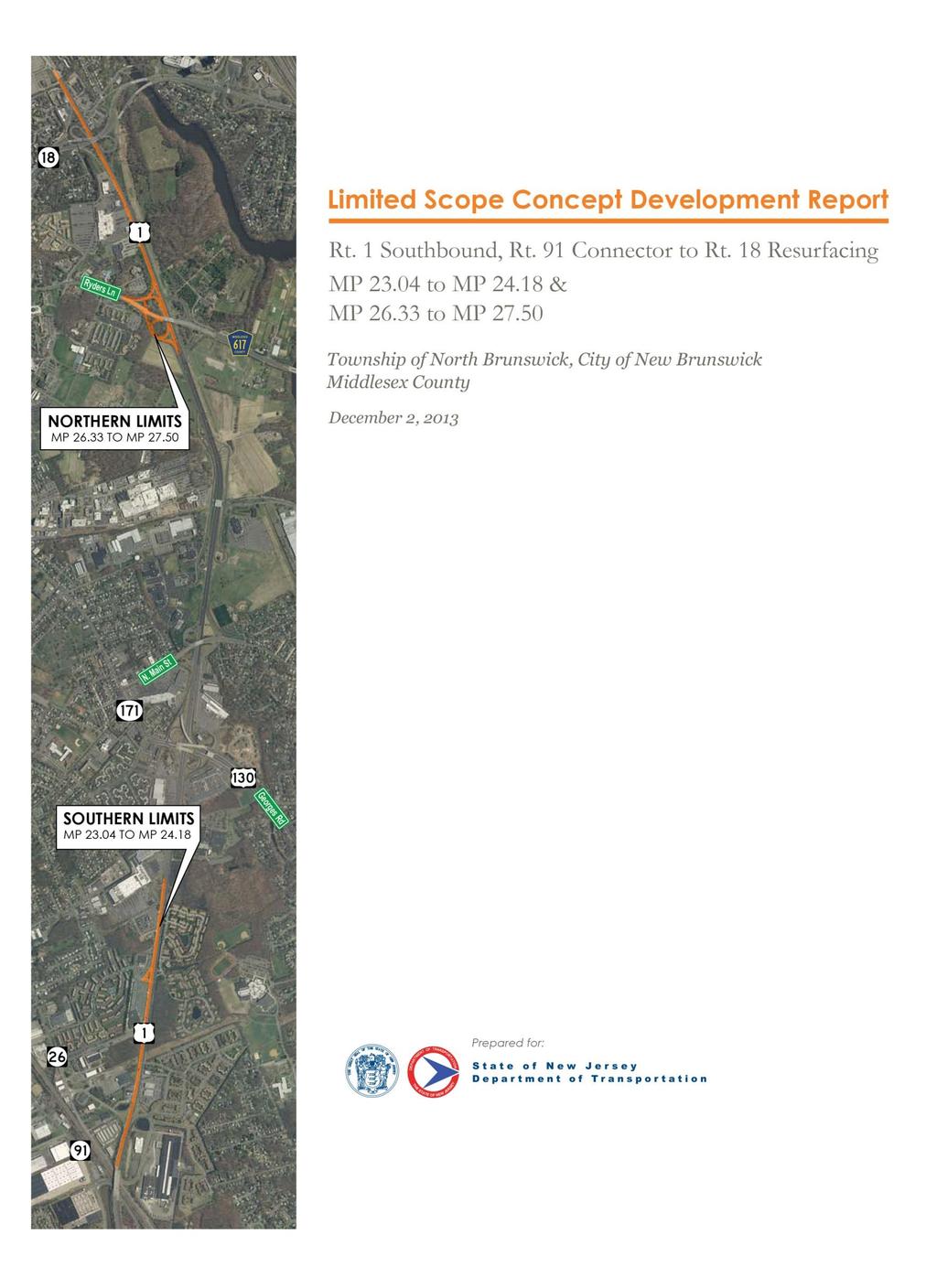
2 LIMITED SCOPE CONCEPT DEVELOPMENT REPORT Route 1 Southbound, Rt. 91 Connector to Rt Resurfacing Milepost to & Milepost to TABLE OF CONTENTS I. INTRODUCTION... 1 A. Roadway Characteristics... 1 B. Purpose &Need Statement... 1 C. Project Location and Project Limits... 2 D. List of Other Projects in the Vicinity... 2 II. EXISTING CONITIONS ANALYSIS... 3 A. Pavement... 3 B. Structures within the Project Limits... 3 C. Drainage... 4 D. Traffic Control within the Project Limits... 4 E. Utility Facilities... 5 F. Access... 5 G. ITS Facilities... 6 H. Geometrics... 6 I. Community Concerns... 6 J. Environmental Concerns... 6 K. Management System Input... 6 L. Pedestrian and Bicycle Facilites... 7 III. ALTERNATIVES ANALYSIS... 8 A. Alternatives Analysis Narrative... 8 IV. PRELIMINARY PREFERRED ALTERNATIVE... 9 A. Scope of Work... 9 i. Pavement... 9 ii. Structural... 9 iii. Pedestrian and Bicycle Facilities... 9 iv. Traffic Signal v. Incidental Roadway Work vi. Drainage B. Anticipated Impacts to Existing Facilities i. Utility ii. Access iii. ITS C. Maintenance of Traffic During Construction D. Community Concerns E. Environmental Document Summary i
3 LIST OF APPENDICES Appendix A Appendix B Appendix C Appendix D Appendix E Appendix F Appendix G Appendix H Appendix I Appendix J Appendix K Appendix L Appendix M Appendix N Appendix O Concept Development Checklist Location Map &Straight Line Diagram Pavement Design Recommendation PreliminaryPreferred Alternative Structural SI&A Sheets Photos Lane Closure Schedule, Construction Staging &Ramp Closure Detour Schematics Environmental Screening Report Project Cost Estimate As-Built Plans Crash Data Traffic Data Utility Correspondence SME Correspondence Final Design Scope Statement ii
4 Limited Scope Concept Development Report Route 1 SB, Rt. 91 Connector To Rt Resurfacing MP to & MP to I. INTRODUCTION A. Roadway Characteristics Within the limits of the proposed project, Route US 1 functions as an Urban Principal Arterial. There are two sections within the limits of the project. They are: Milepost to Milepost Route US 1 southbound between these mileposts consists of three 12-foot travel lanes, a 3-foot minimum and variable inside shoulder, and a 15-foot auxiliary lane or full 12-foot wide outside shoulder. Milepost to Milepost Route US 1 southbound between these mileposts consists of three 12-foot travel lanes, a 3-foot minimum and variable inside shoulder, and a 15-foot auxiliary lane or full 12-foot wide outside shoulder. The northbound and southbound roadways are separated by a concrete median barrier. Median barrier fencing exists between Milepost & Milepost 24.15, and again between Milepost & Milepost Route US 1 is constructed as bothcrowned and superelevatedsections throughout the project limits. There are three (3) interchanges within the limits of the project. They are: Route US 1 and Route 26 Milepost Route US 1 and Ryders Lane (CR 617) Milepost Route US 1 and Route 18 Milepost Acceleration / Deceleration lanes exist at all ramps exiting and entering Route US 1 SB at the interchanges. There are two (2) signalized intersections within the limits of the project. They are: Route US 1 and North Oaks Boulevard Milepost Route US 1 & Fashion Plaza Driveway Milepost Auxiliary lanes exist at intersections. Where permitted, left turn movements are accommodated using nearside jughandles. B. Purpose &Need Statement Purpose: The purpose of this project is to rehabilitate the pavement surface to improve the service life of the roadway. 1
5 Limited Scope Concept Development Report Route 1 SB, Rt. 91 Connector To Rt Resurfacing MP to & MP to Need: This section of Route US 1 southbound has been identified by both the Pavement Management System and the Pavement & Management Drainage Office as being in need of rehabilitation. Goals: Within the limits of the project, in the southbound direction, the existing pavement exhibits various types of cracking and deterioration. Based on the most recent pavement assessment, existing mainline, shoulder and ramp pavement conditions vary from fair to good with medium severity transverse reflection cracking, medium severity longitudinal reflection cracking, scattered low severity fatigue cracking and low severity longitudinal cracking throughout. Therefore, based on the overall pavement condition, the goal of this project is to resurface the roadway within the project limits. Pedestrian related features such as curb ramps and crosswalks will also be brought into compliance with ADA standards. The proposed improvements will be designed to maintain the existing roadway footprint, and to minimize environmental impacts to the greatest extent possible. C. Project Location and Project Limits The proposed project is located in North Brunswick Township and the City of New Brunswick, Middlesex County. The proposed limits of the project are from Milepost to Milepost and from Milepost to Milepost 27.50; all in the southbound direction. A location map and the applicable Straight Line Diagram pages are provided in Appendix B. D. List of Other Projects in the Vicinity A review of all applicable databases has indicated that there are three (3) projects within the vicinity of the proposed pavement project.these projects are: US Route 1 Adaptive Traffic Signal Contract No.1 (2013) This is a project to upgradeexisting traffic signals along Route US 1 with adaptive signal equipment. This project was advertised for construction in September 2013, and includes adaptive signal equipment installations at both the North Oaks Boulevard and Fashion Plaza Driveway intersections. Substantial Completion is scheduled for May Final Completion is anticipated in November Route 18 Bridge over Route 1 This project includes widening of the Route 18 NB structure to create a new acceleration /deceleration lane for the ramps to and from RouteUS 1. The project will also modify Ramp D from Route 18 NB to RouteUS 1 SB and replacement of the entire Route 18 NB/SB super structure.construction Authorization is anticipated in the Spring Maintenance Roadway Repair Contract Central, Sub Region C-2, Contract No. C205, DP This project includes various roadway repairs to Route 18, Route 28 and Route 27, including, but not limited to, milling & paving of mainline roadways, signalized intersections, intersecting streets, U-Turns, ramps and median 2
6 Limited Scope Concept Development Report Route 1 SB, Rt. 91 Connector To Rt Resurfacing MP to & MP to openings; full depth pavement repairs; concrete sidewalk; and, curb ramps. This project includes the milling/resurfacing of the Route US 1 SB ramps to/from Route 26. The Construction Contract was awarded in the Spring of Final Completion is anticipated in November Coordination with both the US Route 1 Adaptive Traffic Signal Contract No. 1 (2013) and the Route 18 Bridge over Route 1 Project will be required for this pavement project. II. EXISTING CONITIONS ANALYSIS Field trips were conducted on August 16, 2013 and August 21, 2013 to assess the existing conditions of the pavement and to ascertain other features that could potentially have an impact on the delivery of the project. A follow-up field trip was conducted on September 24, 2013 and included Subject Matter Experts (SMEs) of the New Jersey Department of Transportation. Based on discoveries made during these field trips and subsequent follow-ups with SMEs, several issues, which will be addressed as part of the project, were identified. The following provides a summary of the key issues: A. Pavement Within the project limits, Route US 1 southbound is comprised of both flexible and composite (asphalt over concrete pavement) sections. Flexible pavement exists from MP Both flexible and composite pavements exist from MP From MP , lanes 1 to 3 are comprised of composite pavement, while lane 4, where it exists, consists of flexible pavement. The composite pavement areas from MP generally consist of 5 to 9 inches of AC (Asphalt Concrete) over 9 to10 inches PCC (Portland Cement Concrete) slabs, while composite pavement areas from MP generally consist of 5 to 9 inches of AC over 9.5 to 10.5 inch PCC slabs. The PCC slabs are approximately 35 ft. in length. The flexible pavement areas are generally comprised of 8 to 10 inches of AC. The condition of the existing Route US 1 southbound mainline pavement is in fair to good condition exhibiting medium severity transverse reflection cracking, medium severity longitudinal reflection cracking, scattered low severity fatigue cracking and low severity longitudinal cracking. Shoulder pavement, accel/decal/auxiliary lanes, and ramps are also in fair to good condition exhibiting similar reflection and fatigue cracking. B. Structures within the Project Limits There are two (2) bridge structuresand one (1) culvert within the proposed limits of the pavement project. These structures are characterized as follows: Route US 1 is crossed by two (2) local roadways via structure: Ryders Lane (CR617) over Rt. US 1 (Str ); MP exposed conc. deck Rt. 18 over Rt. US 1 (Str ); MP asphalt overlaid deck 3
7 Limited Scope Concept Development Report Route 1 SB, Rt. 91 Connector To Rt Resurfacing MP to & MP to One (1) culvert exists within the limits of the project: Route US 1 over Stream (Str ); MP Based on visual inspection, and as confirmed by the most recent Structural Evaluation Report for the Ryders Lane (CR617) Bridge over Route US 1 (Str ), the structure is rated overall in satisfactory condition. Deficiencies noted include damaged guide rail sections on the west approach (northwest corner) and raveling of asphalt pavement, with small potholes. Based on visual inspection, and as confirmed by the most recent Structural Evaluation Report for the Route NJ 18 over Route US 1 (Str ) the structure is rated in overall fair condition; however, the deck is in poor condition due to the existence of large spalls with exposed rebars and fine map cracking with efflorescence in the underside of the deck. The structure is classified as structurally deficient due to the condition of the deck. This structure will receive a major rehabilitation under the Route 18 Bridge over Route 1 Project. Based on visual inspection, and as confirmed by the most recent Structural Evaluation Report for the culvert structure, Route US 1 over Stream (Str ), the structure is rated in overall fair condition. In addition to the two (2) bridge structures and one (1) culvert, there are two (2) overhead sign structures located within the project limits; one at MP (Str ), and a second at MP Both span over the Route US 1 southbound roadway. Individual Structural Inventory & Appraisal (SI&A) Sheets for all bridge and culver structures are provided in Appendix E. C. Drainage Route US 1 is constructed with both crownedand superelevated sectionsthroughout the project limits. Curb and inlets exist along the mainline roadway, and along ramps at each of the three (3) interchanges. Records obtained from the Pavement & Drainage Management office indicate that within the past five (5) years, there were only (2) reported incidents of flooding within the limits of the pavement project. These incidences occurred due to construction in the area, and the problems have since been resolved. Maintenance records indicate that drainage inlets, pipes and manholes within the project limits were cleaned twice in the last five (5) years, and miscellaneous repairswere made three (3) times over that same five (5) year period. D. Traffic Control within the Project Limits There are two (2) signalized intersections within the limits of the project. The intersections are: Route US 1 and North Oaks Boulevard (MP 23.77) This intersection permits both right and left turning movements from North Oaks Drive to Route US 1. This intersection also provides a U-turn movement for Route US 1 southbound (Rt. 1 SB to Rt. 1 NB) via a nearside jughandle. Crosswalks, as well as pedestrian signal heads 4
8 Limited Scope Concept Development Report Route 1 SB, Rt. 91 Connector To Rt Resurfacing MP to & MP to (countdown type) exist at this intersection. The existing signal and jughandle are under the Jurisdiction of the New Jersey Department of Transportation. Route US 1 and Fashion Plaza Driveway (MP 24.15) This intersection permits both right and left turning movements from Fashion Plaza Driveway to Route US 1. This intersection also provides both left-turn access to the Walmart Shopping Center, and a U-Turn movement for Route US 1 northbound (Rt. 1 NB to Rt. 1 SB) via a nearside jughandle. Neither crosswalks nor pedestrian signal heads exist at this intersection. The existing signal is under the jurisdiction of the New Jersey Department of Transportation. Based on the current Jurisdictional Limit Map for this section of Route US 1, the nearside jughandle lieswithin an easement and is maintained by others. As-Built Traffic Signal & Electrical Plans were reviewed for each signalized intersection, and based on a visual inspection assisted by NJDOT SMEs from both the Division of Project Management and Traffic Signal & Safety Engineering, traffic signal modifications are not necessary. E. Utility Facilities Aerial and underground facilities exist within the project limits and were observed during the field trip. Utility Letter No. 1 was prepared and distributed to request verification of existing and/or proposed facilities within the project limits, and to obtain the name, address and telephone number of the appropriate contact of those utility owners who have facilities within the project limits. The following utility owners have responded indicating that their facilities exist within the limits of this pavement project: Electric Public Service Electric & Gas (PSE&G) Gas Public Service Electric & Gas (PSE&G) Telephone Verizon, NJ Inc. Cable Cablevision Water Township of East Brunswick; City of New Brunswick Sewer Middlesex County Sewer Authority Utility Letter No. 1 and utility correspondence can be found in Appendix L. F. Access Route US 1 within the project limits is an Urban Principal Arterial. Based on the New Jersey State Highway Access Management Code, Route US 1, within the project limits, is classified as an Access Level 3 roadway allowing right-turn access to and from an access point with left turn access via jughandles at signalized intersections. A total of thirteen (13) access driveways are located within the limits of the pavement project. 5
9 Limited Scope Concept Development Report Route 1 SB, Rt. 91 Connector To Rt Resurfacing MP to & MP to G. ITS Facilities Asearch of the NJDOT Intelligent Transportation System Engineering Inventory was performed and as confirmed during a field visit, ITS facilities exist within the project limits.these include ITS conduit manholes and underground conduit. One CCTV is located in the northwest quadrant of the Route US 1 / Ryders Lane Interchange; however, there are no DMS s located within the limits of the pavement project. Consultation with NJDOT s ITS Group has determined that existing system loops are located within the Route US 1 SB Roadway at MP In addition,the US Route 1 Adaptive Traffic Signal Contract No. 1 (2013) will install new ITS facilities at the intersection of Route US 1 and North Oaks and at the intersection of Route US 1 and Fashion Plaza Driveway. New ITS facilities include Adaptive Image Detectors, Adaptive Signal Processors, a pole-mounted Radar Detector, and a TVS Automatic Traffic Recorder. H. Geometrics Route US 1 southbound from Milepost to Milepost consists of three 12-foot travel lanes, a 3-foot minimum and variable inside shoulder, and a 15-foot auxiliary lane or full 12-foot wide outside shoulder.route US 1 southbound from Milepost26.33 to Milepost consists of three 12-foot travel lanes, a 3-foot minimum and variable inside shoulder, and a 15-foot auxiliary lane or full 12-foot wide outside shoulder. Based upon field investigations, and a review of existing As-Built plans, no significant crossslope, ponding or settlement issues were evident. I. Community Concerns Route US 1 is an Urban Principal Arterial with businesses, shopping centers, and residential developments located within the project limits; however, the Mill x Pave x project will have no impact on these properties. The concerns of the community should therefore be limited to work hours (noise) and lane closures during construction (inconvenience). J. Environmental Concerns Based on the environmental screening, no significant impact is anticipated. K. Management System Input In addition to the Pavement Management System, the following Management Systems have been cross referenced: Bridge: Based on a review of the most recent Structural Evaluation Reportsand SI&A Sheets for both the Ryders Lane (CR617) Bridge over Route US 1 (Str ), and the culvert structure, Route US 1 over Stream (Str ), there are no significant issues with either of these structures. The Route 18 Bridge over Route US 1, which has been classified as structurally deficient due to the condition of the deck, is being addressed under a separate project. 6
10 Limited Scope Concept Development Report Route 1 SB, Rt. 91 Connector To Rt Resurfacing MP to & MP to Drainage: Records obtained from the Pavement & Drainage Management office indicate that within the past five (5) years, there were only (2) reported incidents of flooding within the limits of the pavement project. These incidences occurred due to construction in the area, and the problems have since been resolved. Safety: The crash rates for these sections of Route US 1 SB are below the Statewide Average (1.81 crashes/mvm) over the five (5) year period of Between Mileposts and 24.18, the five (5) year crash rate is 0.74 crashes/mvm. Between Mileposts and 27.50, the five (5) year crash rate is 1.37 crashes/mvm. Congestion: The priority ratings for the length of the project on the Congestion Management System (CMS) rage from Medium to High. From Milepost to 23.05, the Priority Ranking is rated Medium. From Milepost to Milepost 24.00, the Priority Ranking is rated Med-High. From Milepost to and from Milepost to 27.50, the Priority Ranking is rated High. Maintenance: Maintenance records indicate that drainage inlets, pipes and manholes within the project limits were cleaned twice in the last five (5) years, and miscellaneous repairswere made three (3) times over that same five (5) year period. L. Pedestrian and Bicycle Facilities As per the New Jersey Administrative Code, Route US 1 within the project limits is not a bicycle compatible roadway, and no bicycle facilities exist. Pedestrian facilities exist at various locations throughout the project limits.existing sidewalk and curb ramp slopes were field measured and were found to be in compliance with current Americans with Disabilities Act (ADA) guidelines. At the signalized intersection of Route US 1 and North Oaks Boulevard (MP 23.77) curb ramps, pedestrian crosswalks, pedestrian push buttons, and pedestrian signal heads (countdown type) are provided for the crossing of both North Oaks Boulevard and Route US 1. Existing curb ramps were found to be missing detectable warning surfaces, and existing concrete was found to be cracked and/or broken. Existing Pedestrian Push Button positions are not ADA compliant not parallel with the intended direction of crossing. A signed Suburban Transit Bus Stop exists along Route US 1 SB approximately 150-feet south of North Oaks Boulevard; however, a sidewalk connecting the Bus Stop to the signalized intersection does not exist. Between the intersections of Route US 1 / North Oaks Boulevard (MP 23.77) and Route US 1 / Fashion Plaza Driveway (MP 24.15), portions of existing sidewalk were observed to be cracked/broken and settled, and warrant replacement. Curb ramps at driveway crossings were also found to be cracked/broken, and the required detectable warning surfaces were missing. At the signalized intersection of Route US 1 and Fashion Plaza Driveway (MP 24.15), one curb ramp exists at the southwest corner and the sidewalk terminates at this intersection. There was no evidence of a worn footpath beyond the sidewalk endpoint. Pedestrian push buttons exist for 7
11 Limited Scope Concept Development Report Route 1 SB, Rt. 91 Connector To Rt Resurfacing MP to & MP to the crossing of Route US 1, but an opposing curb ramp does not exist on the northbound side of Route US 1. Existing Pedestrian Push Button positions are not ADA compliant not parallel with the intended direction of crossing. At Milepost (immediately north of the Route US 1 SB exit ramp to Route 18) an existing sidewalk terminates, and between Milepost and Milepost 27.47, a worn footpath was observed leading to the existing AMC Loews Movie Theater driveway located on Route 1 SB. III. ALTERNATIVES ANALYSIS A. Alternatives Analysis Narrative This section of Route US 1 southbound has been identified by the Pavement Management System as being in need of rehabilitation. The condition of the existing pavement is in fair to good condition exhibiting medium severity transverse reflection cracking, medium severity longitudinal reflection cracking, scattered low severity fatigue cracking and low severity longitudinal cracking. This indicates the need for either a mill x pave x treatment, or a complete reconstruction of the pavement box. The New Jersey Department of Transportation hired XYZ Consultant to conduct a pavement evaluation and service life analysis. Ground Penetrating Radar (GPR) testing, Falling Weight Deflectometer (FWD) testing, coring and visual surveys were performed as part of the project scoping and pavement design efforts for this project. The pavement evaluation and the service life analysis performed by XYZ Consultant indicates that a mill x - pave x treatment throughout the limits of the project will provide a 20-year plus pavement life. A no-build alternative was considered, but did not address the project need of extending pavement life and meeting the Department s Pavement Management System goals. Based on the cost of reconstructing the entire pavement box, and the service life attained through the mill x pave x treatment, the full reconstruction option was not considered. Therefore, the preferred alternative selected for advancement is a mill x pave x resurfacing project. The depth of milling and paving varies between 2 on wide shoulders, acceleration and deceleration lanes and ramps, and 3 on the Route 1 SB mainline (including narrow shoulders). Specifics of the Pavement Design Recommendation can be found in Appendix C. Graphics illustrating the Preliminary Preferred Alternative can be found in Appendix D. 8
12 Limited Scope Concept Development Report Route 1 SB, Rt. 91 Connector To Rt Resurfacing MP to & MP to IV. PRELIMINARY PREFERRED ALTERNATIVE A. Scope of Work i. Pavement- The scope of work, within the proposed limits of work, is to resurface Route US 1 southbound. The pavement recommendation for this work is to Mill 3 and Pave 3 usinga Stone Matrix Asphalt Surface Course in the mainline lanes and narrow width shoulders (less than 6-feet). The recommendation for wide shoulders(6-feet and greater) and acceleration/deceleration lanes, is to Mill 2 and Pave 2 using a Hot Mix Asphalt Surface Course. The recommendation for ramps to and from the Route US 1 SB is to Mill 2 and Pave 2 also using a Hot Mix Asphalt Surface Course. See the Pavement Design Recommendation for specific limits of the various treatments. The Pavement Design Recommendation is provided in Appendix C. ii. iii. Structural- Since the Project Need, as identified by the Management Systems, is the resurfacing of Route US 1 SB and the ramps at the interchanges, and since the review of the most recent bridge inspection reports (Bridge Management System) did not identify any issues with any of the structures within the limits of the proposed project, there will be no structural scope of work included as part of this project. Pedestrian and Bicycle Facilities- As per the New Jersey Administrative Code, Route US 1 within the project limits is not a bicycle compatible roadway and will remain so after construction. There are no bicycle facilities planned within the limits of this pavement project. The scope of work for pedestrian facilities shall include the reconstruction of existing sidewalks and curb ramps found to be damaged and in need of repair.this includes existing sidewalk and curb ramps along Route US 1 SB between North Oaks Boulevard and Fashion Plaza Driveway. Curb ramp reconstruction and the installation of ADA compliant detectable warning surfaces will occur at all existing driveway crossings. At the intersection of Route US 1 and North Oaks Boulevard, new sidewalk is needed to connect the SW corner of North Oaks Boulevard to the existing Suburban Transit Bus Stop no sidewalk exists and a worn footpath through a parking lot was observed. This requires the reconstruction of one existing curb ramp. At the intersection of Route US 1 and Fashion Plaza Driveway, a new curb ramp and level landing area is required on the northbound side of Route US 1 to allow pedestrians a means of leaving the Route US 1 roadway. Based on consultation with NJDOT s Bureau of Traffic Signal & Safety Engineering, cross walks at this intersection are not required. At Milepost (immediately north of the Route US 1 SB exit ramp to Route 18), where the existing sidewalk terminates, and a worn footpath was observed leading to the AMC Loews Movie Theater driveway, new sidewalk will be constructed to the movie theater driveway. The pedestrian path crosses an existing egress driveway from the 9
13 Limited Scope Concept Development Report Route 1 SB, Rt. 91 Connector To Rt Resurfacing MP to & MP to Gardens at Raritan apartment complex where two new curb ramps will be required. Sidewalk construction north of the residential driveway will require a short retaining wall (less than 3 feet) to avoid grading impacts beyond the existing right-of-way line. At the AMC Loews Movie Theater driveway, new curb ramps will be required on both the SW and NW corners. The new sidewalk will terminate at the NW corner with a level landing area located immediately behind the new curb ramp. iv. Traffic Signal Based on field observations and consultation with NJDOT s Bureau of Traffic Signal & Safety Engineering, the scope of traffic signal work will be limited to the repositioning of existing Pedestrian Push Buttons and the replacement and/or addition of Pedestrian Push button Signs. No other traffic signal work is warranted. v. Incidental Roadway Work-The scope of work shall include the repair of all damaged guiderail and the upgrading of substandard guide rail end treatments within the limits of the project. vi. Drainage - No new drainage facilities will be constructed based on field inspection and review of the Drainage Management System. However, the cleaning of all drainage structures and pipes within the project limits is recommended. B. Anticipated Impacts to Existing Facilities i. Utility - There are no anticipated utility impacts. ii. iii. Access - There are no anticipated access impacts. ITS Consultation with NJDOT s ITS SME determined that existing systems loops are located in the Route US 1 SB roadway at MP and will be impacted by proposed milling and paving operations. Existing system loops will need to be replaced; however, no other ITS impacts are anticipated. C. Maintenance of Traffic During Construction The milling and paving of Route 1 Southbound Mainline will be completed using standard single and multi-lane lane closures. The approved lane closure schedule, as developed by Traffic Operations North, is provided in Appendix G. Additionally, since milling and paving operations along existing ramps will necessitate temporary overnight closures, the need for short-term (nighttime) detours has been anticipated. Detour routes for each ramp closure have been identified and were field verified to assure feasibility. Schematics showing proposed ramp closure detours are also provided in Appendix G. Preliminary construction-staging schemes were evaluated to determine the number of anticipated construction stages and their anticipated durations. Conceptual Construction Staging Sections have been developed to determine the placement of drums/cones, and to evaluate the number of lanes maintained during each stage. Construction Staging Sections can be found in Appendix G. 10
14 Limited Scope Concept Development Report Route 1 SB, Rt. 91 Connector To Rt Resurfacing MP to & MP to The general staging of this pavement project can be divided into the following two (2) phases: 1. Phase A Route US 1 SB from Milepost to Milepost Phase B - Route US 1 SB from Milepost to Milepost The general sequence of construction within each Phase is anticipated as follows: Pre-Stage 1 Incidental Construction: Construct proposed Guide Rail, Sidewalks, Curb Ramps, and install Detectable Warning Surfaces. Estimated Duration (Per Phase) = 10 Working Days Stages 1 3 Mainline Roadway (including left shoulder): Install Traffic Control Devices as per the Standard Traffic Control Details for required nighttime lane closures (maintain one thru-lane during allowable hours) Mill, Resurface, and Install Temporary Striping Estimated Duration (Per Phase) = 8 Working Days Stage 4 - Right Shoulder/Auxiliary Lane: Install Traffic Control Devices as per the Standard Traffic Control Details for a rightlane closure Mill, Resurface, and Install Temporary Striping. Estimated Duration (Per Phase) = 3 Working Days Stage 5 Ramps: Implement overnight ramp closures and closure detours (see Appendix G ) Mill, Resurface, and Install Temporary Striping Estimated Duration (Per Phase) = 4 Working Days Stage 6 - Final Striping and Raised Pavement Markers: Install Traffic Control Devices as per the Standard Traffic Control Details for required nighttime lane closures Complete final striping and install raised pavement markers Estimated Duration (Per Phase) = 4 Working Days D. Community Concerns The community, local officials and property owners will be consulted and apprised of the proposed work as Final Design progresses. E. Environmental Document Summary The project is classified as a Categorical Exclusion (CE) and does not have any significant environmental impacts. 11
15 Appendix A Concept Development Checklist A.1
16 Appendix B Location Map& Straight Line Diagram Provide an aerial map of the project location (Google Earth) with the project site/limits identified. and Provide the Straight Line Diagram Sheet(s) with the project site/limits identified. A.2
17 Appendix C Pavement Design Recommendation Provide a copy of the Pavement Design Recommendation that is provided by the Office of Civil Engineering Pavement Technology. A.3
18 Appendix D Preliminary Preferred Alternative A.4
19 Appendix E Structural SI&A Sheets Include Structural SI&A Sheets for all structures within the limits of the project regardless of whether any work is proposed for that structure or not. A.5
20 Appendix F Photos Provide photos to clearly highlight the issues & elements discussed in the CD Report and the CD Checklist. A.6
21 Appendix G Lane Closure Schedule, Construction Staging &Ramp Closure Detour Schematics Provide the Lane Closure memo as provided by the Office of Traffic Operations. or If traffic staging is not feasible and a detour is required, provide a schematic of a feasible detour route that has been approved by the Office of Traffic Operations. A.7
22 Appendix H Environmental Screening Report Environmental Screening Report is to be provided by the Bureau of Landscape Architecture & Environmental Solutions. A.8
23 Appendix I Project Cost Estimate A.9
24 Appendix J As-Built Plans Attach as-built plans if available. or Provide as-built plans on disc if not feasible to include in the CD Report. A.10
25 Appendix K Crash Data This Crash Data should be the overall data for the corridor, not specific to any controlling substandard design element. A.11
26 Appendix L Traffic Data This is the Traffic Design Data and the Pavement Design Data. This should be for the design year and the design year A.12
27 Appendix M Utility Correspondence A.13
28 Appendix N SME Correspondence A.14
29 Appendix O Final Design Scope Statement A.15
FY 2006 TRANSPORTATION CAPITAL PROGRAM
 Eden Lane Bridge over Whippany River NS9908 The existing structure was built in 1972 as a temporary single-span structure. The bridge consists of simply supported steel acrow panel trusses and is supported
WYDOT DESIGN GUIDES. Guide for. NHS Arterial (Non-Interstate)
") WYDOT DESIGN GUIDES Guide for NHS Arterial (Non-Interstate) 2014 GUIDE FOR NATIONAL HIGHWAY SYSTEM (NHS) HIGHWAYS (NHS ARTERIALS, Non-Interstate) PRESERVATION REHABILITATION RECONSTRUCTION INTRODUCTION
WYDOT DESIGN GUIDES Guide for NHS Arterial (Non-Interstate) 2014 GUIDE FOR NATIONAL HIGHWAY SYSTEM (NHS) HIGHWAYS (NHS ARTERIALS, Non-Interstate) PRESERVATION REHABILITATION RECONSTRUCTION INTRODUCTION
WYDOT DESIGN GUIDES. Guide for. Non-NHS State Highways
 WYDOT DESIGN GUIDES Guide for Non-NHS State Highways 2014 GUIDE FOR Non-NATIONAL HIGHWAY SYSTEM (Non-NHS) STATE HIGHWAYS PRESERVATION REHABILITATION RECONSTRUCTION INTRODUCTION This Guide is directed to
Poor pavement condition Substandard Intersections. / Substandard bike/pedestrian/transit accommodations. Driveway access Environmental concerns
 Public Informational Meeting University Avenue (Allen Boulevard Segoe Road) March 23, 2011 City of Madison City of Middleton Village of Shorewood Hills Dane County Existing Roadway Conditions Poor pavement
Alleviate Traffic Congestion and Improve Operational Reliability of the Route 17 Corridor
 Project Purpose PURPOSE AND NEED STATEMENT Route 17 Bottleneck Project, MP 10.19 to 12.04 Alternatives Analysis and Preliminary Engineering Borough of Maywood, Township of Rochelle Park, and Borough of
IMPLEMENTATION WORKBOOK
 Lawrence Township Bicycle and Pedestrian Planning Assistance Study IMPLEMENTATION WORKBOOK Final Action Plan - Part 2 April 2009 Prepared For: The Township of Lawrence and the New Jersey Department of
FY STATEWIDE TRANSPORTATION IMPROVEMENT PROGRAM New Jersey Department of Transportation Projects
 ROUTE/ Project ID No. TIP No. Electrical Load Center Replacement - North 04324 04324 This project will provide for the betterment of the existing highway lighting facilities located along Routes 3, 17
FY STATEWIDE TRANSPORTATION IMPROVEMENT PROGRAM New Jersey Department of Transportation Projects
 Barclay Street Viaduct NS9807 NS9807 This project will provide for the rehabilitation of the Barclay Street Viaduct, from Route 19 to Marshall Street, in order to increase the weight load of the structure.
Accommodating Pedestrians in the Work Zone
 Accommodating Pedestrians in the Work Zone Guidance for Section C Plan Preparers Some impacts cannot be avoided and those impacts apply to residents, businesses, motorists, and pedestrians alike. However,
2017 Temporary traffic control guidelines for pedestrians. v.2
 2017 Temporary traffic control guidelines for pedestrians v.2 Temporary Traffic Control Guidelines for Pedestrians (2017) The safety and mobility of pedestrians, cyclists and motorists must be considered
Readington Road (C.R. 637) Construction
 Construction") Public Information Meeting Thursday, August 2, 2012 Readington Road (C.R. 637) Construction from Dreahook Road to Harlan School Road Branchburg Township, Somerset County Readington Township, Hunterdon
Public Information Meeting Thursday, August 2, 2012 Readington Road (C.R. 637) Construction from Dreahook Road to Harlan School Road Branchburg Township, Somerset County Readington Township, Hunterdon
ADA on Construction. Guidance for Section C Plan Preparers
 ADA on Construction Guidance for Section C Plan Preparers Some impacts cannot be avoided and those impacts apply to residents, businesses, motorists, and pedestrians alike. However, good planning can minimize
FDOT Treasure Coast Traffic Report
 July 6, 2018 Barbara Kelleher, 954 777 4090 Barbara.Kelleher@dot.state.fl.us FDOT Treasure Coast Traffic Report July 6 through July 13, 2018 TREASURE COAST Construction and maintenance related lane closures
APPENDIX A: Complete Streets Checklist DRAFT NOVEMBER 2016
 APPENDIX A: Complete Streets Checklist DRAFT NOVEMBER 2016 Complete Streets Checklist MetroPlan Orlando s Complete Streets Checklist is an internal planning tool for staff to further implementation of
STAKING TRAFFIC CONTROL SIGNAL SYSTEMS
 Locating the components of a traffic control signal is not an exact science; many factors influence the location of the components. These factors include: lane widths, radii, pedestrian curb ramp requirements,
CHAPTER 8 STAKING SIGNALS AND LIGHTING FIELD GUIDE. 8.1 Staking Traffic Control Signal Systems
 CHAPTER 8 STAKING STAKING Correct staking of traffic control signal or lighting systems is critical to the appropriate placement of system components. 8.1 Traffic Control Signal Systems Locating the components
PROJECT NO. 093 MA 199 H C. FEDERAL NO. xxxx WIKIEUP-WICKENBURG-PHOENIX HIGHWAY TEGNER STREET, ALTERNATIVE 10 PROJECT IMPROVEMENT
 PROJECT NO. 093 MA 199 H 5807 01C FEDERAL NO. xxxx WIKIEUP-WICKENBURG-PHOENI HIGHWAY TEGNER STREET, ALTERNATIVE 10 PROJECT IMPROVEMENT (INTERSECTION IMPROVEMENT) US 93/US 60 FINAL PROJECT ASSESSMENT April
Legislative Update Williamsburg Residency
 Hampton Roads District Legislative Update Williamsburg Residency Jim Brewer, Resident Administrator 757-253-5140 Projects Under Way Warwick Boulevard Project http://www.warwickboulevard.org/ Contractors:
INDEX. Geometric Design Guide for Canadian Roads INDEX
 Acceleration lane, see Lanes, Acceleration Access, 8.1 Access Management and Functional Classification 8.2 Access Management by Design Classification 8.3 Access Configuration 8.4 Building Set-Back Guidelines
ADA PRESENTATION (CURB RAMPS)
") ADA PRESENTATION (CURB RAMPS) ACECNJ/NJDOT/FHWA DESIGN SUMMIT Warren Howard New Jersey Department of Transportation May 21, 2013 ADA Curb Ramps NJDOT wants curb ramps to be designed & constructed properly
ADA PRESENTATION (CURB RAMPS) ACECNJ/NJDOT/FHWA DESIGN SUMMIT Warren Howard New Jersey Department of Transportation May 21, 2013 ADA Curb Ramps NJDOT wants curb ramps to be designed & constructed properly
NJDOT Complete Streets Checklist
 Background The New Jersey Department of Transportation s Complete Streets Policy promotes a comprehensive, integrated, connected multi-modal network by providing connections to bicycling and walking trip
Americans with Disabilities Act Transition Plan for Public Right-of-Way Improvements
 Americans with Disabilities Act Transition Plan for Public Right-of-Way Improvements Prepared by: Public Works Department Engineering Division October 2015 Table of Contents Section I Introduction.. 3
Design Criteria. Design Criteria
 F Design Criteria Design Criteria Ministry of Transportation Ministère des Transports DESIGN CRITERIA Page: 1 of 13 WORK PROJECT NO. N/A GO Bloomington Station TYPE OF PROJECT LOCATION Bloomington Road
Roadway Design Manual
 Roadway Design Manual Manual Notice Archive by Texas Department of Transportation (512) 302-2453 all rights reserved Manual Notice 2009-1 From: Manual: Mark A. Marek, P.E Roadway Design Manual Effective
FY 2004 TRANSPORTATION CAPITAL PROGRAM New Jersey Department of Transportation Projects
 Avenue P Bridge 03315 This project will address potential construction in the vicinity of the Avenue P Bridge. SPONSOR: City of Newark Bridge Preservation - Local Bridges NJTPA 288 DES STATE $400,000 CARGOMATE
FOR HISTORICAL REFERENCE ONLY
 To: From: Subject: Electronic Distribution Recipients MINNESOTA DEPARTMENT OF TRANSPORTATION Engineering Services Division Technical Memorandum No. 12-14-B-03 December 18, 2012 Jon M. Chiglo, P.E. Division
ADA TRANSITION PLAN. For
 Page 1 of 7 ADA TRANSITION PLAN For PUBLIC WORKS DEPARTMENT 121 SW Port St. Lucie Boulevard Port St. Lucie, FL 34983 Phone: 772-871-5177 Website: www.cityofpsl.com September 2018 Table of Contents 1) Introduction
Board of Supervisors February 27, 2017
 : Traffic Analysis Results & Draft Conceptual Plan Board of Supervisors February 27, 2017 Transportation Solutions Building Better Communities Presentation Overview Background Summary of Traffic Analysis
St. Francis Drive through the City of Santa Fe Corridor Study
 VII. ENGINEERING AND ENVIRONMENTAL EVALUATION TRAIL CONNECTIVITY In the southern portion of the Corridor there is a lack of a sidewalk, trail or bicycle facility within the right-ofway. However, the City
FY STATEWIDE TRANSPORTATION IMPROVEMENT PROGRAM New Jersey Department of Transportation Projects
 Cape May-Lewes Ferry 00377A 00377A This project will provide for the rehabilitation of the approach roads and signage for the Cape May- Lewes ferry. Other roadside features will be upgraded to meet present
Brian McHugh, Buckhead Community Improvement District. SUBJECT: Wieuca Road at Phipps Boulevard Intersection Improvements Project
 MEMO TO: FROM: Brian McHugh, Buckhead Community Improvement District Jagan Kaja, AICP, WSP Parsons Brinckerhoff SUBJECT: Wieuca Road at Phipps Boulevard Intersection Improvements Project DATE: October
Washington St. Corridor Study
 FIGURE 7.17 Bridge Alternatives - Cross Sections 86 Discarded Alternative: Short-Term Bridge Repair Short-term repairs and west bridge span replacement were considered during analysis. Short-term repairs
ADA TRANSITION PLAN 2013
 ADA TRANSITION PLAN 2013 TABLE OF CONTENTS Contents Introduction 1 Purpose 2 Identified Obstacles to the Public Right of Way 3 Criteria for Determining Impediments at Village Facilities 4 Removing Barriers
6.0 PEDESTRIAN AND BICYCLE FACILITIES 6.1 INTRODUCTION 6.2 BICYCLE DEMAND AND SUITABILITY Bicycle Demand
 6.0 PEDESTRIAN AND BICYCLE FACILITIES 6.1 INTRODUCTION Bicycle and pedestrian travel along and in the vicinity of the corridor is part of the vision of Somerset and Hunterdon counties and the integrated
APPENDIX D COST SUMMARY TABLES
 APPENDIX D COST SUMMARY TABLES Section 1 Between Route 50 and Evergreen Mills Road 3850 linear feet of one 12 foot wide additional lane in southbound direction of Rte 606; from north side of Rte 50 to
5. RUNNINGWAY GUIDELINES
 5. RUNNINGWAY GUIDELINES These guidelines should be considered collectively when making runningway decisions. A runningway is the linear component of the transit system that forms the right-of-way reserved
Project Description Form 8EE
 Project Description Form 8EE Basic Project Information Submitting Jurisdiction/Agency: Town of Dumfries Project Title: Route 1 (Fraley Blvd) Widening: Brady's Hill Road to Dumfries Road Project Location:
Paul Vraney Bureau of Project Development 02/11/2016
 Paul Vraney Bureau of Project Development 02/11/2016 ADA background & alterations definition Design considerations Provide sufficient layout data Curb ramp selection Maximum curb ramp and gutter slopes
Building Great Neighbourhoods BELLEVUE AND VIRGINIA PARK
 Building Great Neighbourhoods BELLEVUE AND VIRGINIA PARK This is Meeting 2 Unfortunately, some residents in Bellevue and Virginia Park received the wrong information for this public open house (Meeting
SECTION 1A NEW JERSEY TURNPIKE GEOMETRIC DESIGN
 SECTION 1A NEW JERSEY TURNPIKE GEOMETRIC DESIGN Table of Contents Page No 1A.1 GENERAL...1 1A.1.1 DESIGN CONTROLS...1 1A.2 MAINLINE ROADWAYS...4 1A.2.1 ROADWAY DESIGNATION...4 1A.2.2 DESIGN SPEED...4 1A.2.3
City Avenue Projects
 City Avenue Projects City Avenue Special Services District Conceived in the early 1990 s Lita Cohen, Jim Ettelson, Joe Manko, and Michael Nutter Saint Joseph s provided key start-up support. True Public/Private
FDOT Treasure Coast Traffic Report
 July 13, 2018 Barbara Kelleher, 954 777 4090 Barbara.Kelleher@dot.state.fl.us FDOT Treasure Coast Traffic Report July 13 through July 20, 2018 TREASURE COAST Construction and maintenance related lane closures
S.R. 3009, Section A20 South Park & Logan Road Intersection Improvement Project
 Open House Public Meeting S.R. 3009, Section A20 South Park & Logan Road Intersection Improvement Project Municipality of Bethel Park, Allegheny County Bethel Park Municipal Building 5001 West Library
City of Madison, East Johnson Street North Baldwin Street to First Street Local Street Dane County
 City of Madison, East Johnson Street North Baldwin Street to First Street Local Street Dane County Public Involvement Meeting Thursday, April 28, 2016 6 to 8 P.M. Lapham Elementary School 1045 E. Dayton
FY 2018 TRANSPORTATION CAPITAL PROGRAM New Jersey Department of Transportation Projects
 Camden County Bus Purchase Project ID Numbers: D0601 / 068082 In the DVRPC region, a combination of fixed route, subscription, and demand responsive transit services are provided in Camden County by Senior
RZC Appendix 8A Marymoor Subarea Street Requirements
 RZC Appendix 8A Marymoor Subarea Street Requirements For additional design details for Marymoor Subarea infrastructure, refer to the 2017 Marymoor Subarea Infrastructure Planning Report. STREET REQUIREMENTS
M-58 HIGHWAY ACCESS MANAGEMENT STUDY Mullen Road to Bel-Ray Boulevard. Prepared for CITY OF BELTON. May 2016
 M-58 HIGHWAY ACCESS MANAGEMENT STUDY Prepared for CITY OF BELTON By May 2016 Introduction Missouri State Highway 58 (M-58 Highway) is a major commercial corridor in the City of Belton. As development has
MUTCD Part 6G: Type of Temporary Traffic Control Zone Activities
 MUTCD Part 6G: Type of Temporary Traffic Control Zone Activities 6G.01 Typical Applications Each temporary traffic control (TTC) zone is different. Many variables, such as location of work, highway type,
CHAPTER 16 PEDESTRIAN FACILITIES DESIGN AND TECHNICAL CRITERIA TABLE OF CONTENTS
 CHAPTER 16 PEDESTRIAN FACILITIES DESIGN AND TECHNICAL CRITERIA TABLE OF CONTENTS Section Title Page 16.1 General... 16-1 16.1.1 AASHTO Reference... 16-1 16.1.2 ADA Requirements... 16-1 16.2 Sidewalks...
East Downtown Tax Increment Reinvestment Zone (TIRZ) No. 15 Infrastructure Assessment Study
 No. 15 Infrastructure Assessment Study") East Downtown Tax Increment Reinvestment Zone (TIRZ) No. 15 Infrastructure Assessment Study Houston, TX Technical Memorandum April 15 th, 2009 Prepare by: 2950 North Loop West, Ste. 900 Houston, TX 77092
East Downtown Tax Increment Reinvestment Zone (TIRZ) No. 15 Infrastructure Assessment Study Houston, TX Technical Memorandum April 15 th, 2009 Prepare by: 2950 North Loop West, Ste. 900 Houston, TX 77092
Phone: Fax: Project Reference No. (to be filled out by MassHighway):
:") Massachusetts Highway Department District 3 Project Need Form (PNF) This form is intended to provide preliminary information about the proposed project. It is not expected that all information that is
Massachusetts Highway Department District 3 Project Need Form (PNF) This form is intended to provide preliminary information about the proposed project. It is not expected that all information that is
Overview. Illinois Bike Summit IDOT Complete Streets Policy Presentation. What is a Complete Street? And why build them? And why build them?
 Overview Illinois Bike Summit IDOT Complete Streets Policy Presentation Aren Kriks, P.E. District One Bicycle Coordinator and Bureau of Programming Project Engineer History of Complete Streets IDOT Policy
MAG Town of Cave Creek Bike Study Task 6 Executive Summary and Regional Significance Report
 Page 1 MAG Town of Cave Creek Bike Study Task 6 Executive Summary and Regional Significance Report August 1, 2012 MAG Project #481 Page 2 Task 6 Executive Summary and Regional Significance Report Introduction
ADA Transition Plan. City of Gainesville FY19-FY28. Date: November 5, Prepared by: City Of Gainesville Department of Mobility
 ADA Transition Plan FY19-FY28 Date: November 5, 2018 Prepared by: City Of Gainesville Department of Mobility 1.0 INTRODUCTION 1.1 BACKGROUND The federal statute known as the Americans with Disabilities
01. VICINITY OF GREENBRAE POC: EXISTING CONDITIONS
 01. VICINITY OF GREENBRAE POC: EXISTING CONDITIONS Existing Bus Stop Existing US101 On-ramp Existing POC Old Redwood Highway Rich Street City ROW Environmental Study Limit Industrial Way NO DESIGNATED
SC 41/Joe Rouse Intersection Improvements
 SC 41/Joe Rouse Intersection Improvements Scope: Add dual left-turn lanes from Joe Rouse Road onto southbound SC 41 to reduce re-occurring peak hour congestion, particularly the AM peak. Construction Cost
Hospital Link Project Project Update September 2017
 Hospital Link Project Project Update September 2017 General The project provides a link from Riverside Drive and the Transitway to the Hospital Link Road. Construction is well underway. Read on for important
Operations -- Transit From: N/A To: N/A. Improvement Type: Regionally Significant: No
 Central Puget Sound Regional 2017-2020 Transportation Improvement Program Amendments and Corrections to be included in the 2017-20 STIP PSRC's Amendment 2017-08 County: King List of 17-08 Amendment Projects:
Alberta Infrastructure HIGHWAY GEOMETRIC DESIGN GUIDE AUGUST 1999
 Alberta Infrastructure HIGHWAY GEOMETRIC DESIGN GUIDE AUGUST 1999,1'(; A ACCELERATION Data on acceleration from stop D-29 Effects of grade D-35 Intersections D-97, D-99 Lanes D-97, F-5, F-7, F-15, F-21,
Orange Center Elementary School
 Drag and drop pic and stretch/crop to the limits of the blue rectangle (delete this text box) Orange Center Elementary School Drag and drop pic and stretch/crop to the limits of the blue rectangle (delete
Long Island Rail Road Expansion Project Floral Park to Hicksville
 Long Island Rail Road Expansion Project Floral Park to Hicksville Final Environmental Impact Statement Appendix 1-D Complete Streets Policy Checklist April 2017 0902ML PIN: Project Location: 18A-4 Floral
Traffic Impact Analysis Chatham County Grocery Chatham County, NC
 Chatham County Grocery Chatham County, NC TABLE OF CONTENTS 1. INTRODUCTION... 1 1.1. Location and Study Area... 1 1.2. Proposed Land Use and Access... 2 1.3. Adjacent Land Uses... 2 1.4. Existing ways...
Steps to Conducting a Complete Streets Assessment
 Steps to Conducting a Complete Streets Assessment Familiarize yourself with Complete Streets Read through the Complete Streets Assessment Guidelines. This will give you an idea of what Complete Streets
FLORIDA DEPARTMENT OF TRANSPORTATION DISTRICT 7 DISTRICT WIDE BICYCLE/PEDESTRIAN ACCESS TO TRANSIT SAFETY ASSESSMENT AND IMPROVEMENT PLAN
 FLORIDA DEPARTMENT OF TRANSPORTATION DISTRICT 7 DISTRICT WIDE BICYCLE/PEDESTRIAN ACCESS TO TRANSIT SAFETY ASSESSMENT AND IMPROVEMENT PLAN TRANSIT SAFETY ASSESSMENT SR 55/US 19 AT 80 TH AVE N DRAFT JUNE
ADA Operations Contact Info
 Intro ADA Operations Contact Info Todd Grugel ph: 651-366-3531 email: todd.grugel@state.mn.us Joe Zilka ph: 651-366-3311 email: joseph.zilka@state.mn.us Harvey Unruh ph: 651-216-2912 email: harvey.unruh@state.mn.us
APPENDIX L: COST ESTIMATING TOOLS
 APPENDIX L: COST ESTIMATING TOOLS Rural Arterial From LRE MOT * Mobilization * Subtotal Scope Contingency (25%) Total PE Design (15%) CEI (15%) Total Project ** New (2-Lane Roadway) with 5' Paved Shoulders
Hospital Link Project Project Update November 2017
 Hospital Link Project Project Update November 2017 General The project provides a link from Riverside Drive and the Transitway to the Hospital Link Road. Construction is well underway. Read on for important
TRANSPORTATION ALTERNATIVES PROGRAM: SELECTED PROJECTS AND FUNDING ALLOCATIONS
 ITEM #9: TRANSPORTATION ALTERNATIVES PROGRAM: SELECTED PROJECTS AND FUNDING ALLOCATIONS The Transportation Alternatives Program (TAP) created by MAP-21 requires that 50% of the program funds received by
Kalamazoo County Weekly Project Updates from the Cities of Portage, Kalamazoo and the Kalamazoo County Road Commission
 FOR IMMEDIATE RELEASE Date: October 31, 2014 Kalamazoo County Weekly Project Updates from the Cities of Portage, Kalamazoo and the Kalamazoo County Road Commission Kalamazoo, MI- In a collaborative effort
PROCEDURE FOR ACCOMMODATING PEDESTRIANS IN WORK ZONES FOR CONSTRUCTION AND MAINTENANCE
 PROCEDURE FOR ACCOMMODATING PEDESTRIANS IN WORK ZONES FOR CONSTRUCTION AND MAINTENANCE A.1 STANDARD Measures shall be taken to accommodate pedestrian traffic through and/or around Work Zones for Construction
Roadway Design Manual
 Roadway Design Manual Revised December 2013 2013 by Texas Department of Transportation (512) 302-2453 all rights reserved Manual Notice 2013-1 From: Manual: Mark A. Marek, P.E Roadway Design Manual Effective
MUTCD Part 6: Temporary Traffic Control
 MUTCD Part 6: Temporary Traffic Control OMUTCD English units are preferred. OHIO MANUAL OF UNIFORM TRAFFIC CONTROL DEVICES TABLE OF CONTENTS PREFACE INTRODUCTION TABLE OF CONTENTS PART 1. GENERAL Chapter
R A M P U P! - City of Tacoma's Curb Ramp Installation Matrix
 R A M P U P! - City of Tacoma's Curb Ramp Installation Matrix DESCRIPTION OF WORK NEW CONSTR. ALTERATION MAINT. COMMENTS STREET PAVING New street paving or overlay through an intersection (Figures 1 &
FY 2016 TRANSPORTATION ALTERNATIVES PROGRAM PROJECT SELECTION
 AGENDA ITEM #8: FY 2016 TRANSPORTATION ALTERNATIVES PROGRAM PROJECT SELECTION The Transportation Alternatives Program (TAP) created by MAP-21 requires that 50% of the program funds received by the state
Preparing a Curb Ramp Project. December 15, 2010
 Preparing a Curb Ramp Project December 15, 2010 3 Tiers of Project Types Non-Signalized Curb Ramp Reconstruction - Typically utilizing standard plans and identifying ramp types at each quadrant Signalized
CTH M HIGHWAY PROJECT CTH Q to STH 113
 CTH M HIGHWAY PROJECT CTH Q to STH 113 PUBLIC INFORMATIONAL MEETING #3 Wednesday, May 25, 2005 Town of Westport Administration Building 5387 Mary Lake Road 6:00 p.m. to 8:00 p.m. PUBLIC INFORMATIONAL MEETING
Paul Huston, P.E., Design-Build Coordinator Chuck Gonderinger, HDR Engineering. Minnesota Department of Transportation (the Department)
") To: From: Paul Huston, P.E., Design-Build Coordinator Chuck Gonderinger, HDR Engineering Date: March 20, 2001 Subject: Roadway Geometric Design Criteria Project: TH 14/218 Design-Build Project, SP 7408-29,
To: From: Paul Huston, P.E., Design-Build Coordinator Chuck Gonderinger, HDR Engineering Date: March 20, 2001 Subject: Roadway Geometric Design Criteria Project: TH 14/218 Design-Build Project, SP 7408-29,
Chapter 4: Funding and Implementation
 Chapter 4: Funding and Implementation 83 84 Cost Estimating Cost estimating is an iterative process. When a project is in the conceptual stage, preliminary cost estimates are also provided conceptually,
Route 28 (South Orleans Road)/Route 39 (Harwich Road)/Quanset Road Intersection
/Route 39 (Harwich Road)/Quanset Road Intersection") TRAFFIC FEASIBILITY STUDY Route 28 (South Orleans Road)/Route 39 (Harwich Road)/Quanset Road Intersection Orleans, Massachusetts Prepared for: Town of Orleans Prepared by: Fay, Spofford & Thorndike, LLC
TRAFFIC FEASIBILITY STUDY Route 28 (South Orleans Road)/Route 39 (Harwich Road)/Quanset Road Intersection Orleans, Massachusetts Prepared for: Town of Orleans Prepared by: Fay, Spofford & Thorndike, LLC
CHAPTER 1 GENERAL DESIGN
 CHAPTER 1 GENERAL DESIGN 1.0 INTRODUCTION The purpose of this Manual is to provide its users with the current, uniform procedures and guidelines for the application and design of safe, convenient, efficient
Chapter 3 DESIGN SPECIFICATIONS
 Brampton PathWays Planning and Design Guidelines 27 Chapter 3 DESIGN SPECIFICATIONS 3.1 CLASS 1 MULTI-USE PATH Off-road multi-use trails are the backbone of the Brampton PathWays Network. They are typically
5. MODIFICATIONS AT JEANNE D ARC BOULEVARD/REGIONAL ROAD 174 INTERCHANGE INTERSECTION - PUBLIC HEARING COMMITTEE RECOMMENDATION
 5. MODIFICATIONS AT JEANNE D ARC BOULEVARD/REGIONAL ROAD 174 INTERCHANGE INTERSECTION - PUBLIC HEARING COMMITTEE RECOMMENDATION Having held a public hearing, that Council approve the preliminary designs
FDOT Treasure Coast Traffic Impact Report
 January 20, 2017 Chuck McGinness, 954 777 4302 chuck.mcginness@dot.state.fl.us FDOT Treasure Coast Traffic Impact Report January 20 through January 27, 2017 TREASURE COAST Construction and maintenance
City of Madison, East Johnson Street North Baldwin Street to First Street Local Street Dane County
 City of Madison, East Johnson Street North Baldwin Street to First Street Local Street Dane County Public Involvement Meeting Thursday, November 10, 2016 5:30 to 7 P.M. Festival Foods 810 E. Washington
Transportation and General Civil Engineering Projects
 Continuing Engineering Services for Transportation and General Civil Engineering Projects Broward County, Florida Why Atkins 2 Existing and Past Clients 3 25+ years Experienced in Civil Engineering PM
Scenarios. The following slides will show existing pictures that deny access, followed by a retrofitted picture that provides access.
 Scenarios. The following slides will show existing pictures that deny access, followed by a retrofitted picture that provides access. For the following slides assume an overlay project and provide pedestrian
Recommended Roadway Plan Section 2 - Land Development and Roadway Access
 Recommended Roadway Plan Section 2 - Land Development and Roadway Access SECTION 2 Land Development and Roadway Access 2.1 Land Use and Access Management The Federal Highway Administration (FHWA) defines
Inspector MUST Sign and Date Each Inspection
 Work Area: Applicant: Mercer County Department of Transportation - Highways Division Application and Permit for Road Work in Mercer County, New Jersey NO. East Windsor Ewing Hamilton Hopewell Lawrence
New Measure A Expenditure Categories DEFINITIONS OF ELIGIBLE EXPENDITURES Adopted March 8, 2007
 New Measure A Expenditure Categories DEFINITIONS OF ELIGIBLE EXPENDITURES Adopted March 8, 2007 City Street and County Road Maintenance Program The preservation and keeping of public street and road rights-of-way
Houma-Thibodaux Metropolitan Planning Organization STP<200K Funding Application APPLICATION
 APPLICATION HOUMA-THIBODAUX METROPOLITAN PLANNING ORGANIZATION (HTMPO) FOR SURFACE TRANSPORTATION PROGRAM (STP
Trans-Canada Highway 1 RW Bruhn Bridge Replacement
 Trans-Canada Highway 1 RW Bruhn Bridge Replacement May 2016 RW Bruhn Bridge Project Objectives Improve safety, traffic flow and movement of goods Improve safety for pedestrians and cyclists Replace the
Welcome to the Open House
 Leslie Street Between 19 th Avenue and Stouffville Road Addendum to Class Environmental Assessment Study Welcome to the Open House Please sign in at the front desk. March 28, 2017 Richmond Green Sports
AMERICANS WITH DISABILITIES ACT TRANSITION PLAN LEON COUNTY FOR CURB RAMPS AND SIDEWALKS DEPARTMENT OF PUBLIC WORKS. 1 P age
 AMERICANS WITH DISABILITIES ACT TRANSITION PLAN FOR CURB RAMPS AND SIDEWALKS 2015 LEON COUNTY DEPARTMENT OF PUBLIC WORKS 1 P age INTRODUCTION The goal of the Americans with Disabilities Act (ADA) Transition
Multi-Modal Traffic Analysis. Parisi and Associates
 Mill Valley to Corte Madera Bicycle and Pedestrian Corridor Study Appendix D: Multi-Modal Traffic Analysis Prepared by Parisi and Associates August 2009 Appendix D - Multi-Modal Traffic Analysis Table
New Jersey Department of Transportation. Safety Impact Teams. May 22, 2007 Patricia Ott, P. E. Director, Traffic Engineering & Safety
 New Jersey Department of Transportation Safety Impact Teams May 22, 2007 Patricia Ott, P. E. Director, Traffic Engineering & Safety Safe Corridor Legislation Approved July 2003 Double Fines for Motor Vehicle
Traffic Control Inspection Checklist Segment:
 Traffic Control Inspection Checklist Segment: Simon Contractors Simon Contractors Originator: Description Reviewed by: Initials Date Distribution: Traffic Quality Manager, Site Assistant Traffic Manager
Brooklyn Boulevard (County Road 152) Reconstruction Project Phase I. OPEN HOUSE June 20, 2017
 Reconstruction Project Phase I. OPEN HOUSE June 20, 2017") Brooklyn Boulevard (County Road 152) Reconstruction Project Phase I OPEN HOUSE June 20, 2017 Brooklyn Boulevard (County Road 152) Phase I Project Partners Project Lead Other Project Partners include Brooklyn
Brooklyn Boulevard (County Road 152) Reconstruction Project Phase I OPEN HOUSE June 20, 2017 Brooklyn Boulevard (County Road 152) Phase I Project Partners Project Lead Other Project Partners include Brooklyn
DISTRICT BICYCLE PROGRAM
 DISTRICT BICYCLE PROGRAM TxDOT Fort Worth District Public Hearing Bicycle Use on the State Highway System Public Hearing Agenda 1 2 3 4 5 6 Introduction Susan Howard TxDOT Public Involvement Specialist
Roadway Network Development Plan FINAL
 Monroe Township Bicycle and Pedestrian Planning Study Roadway Network Development Plan FINAL March 2010 Prepared For: The Township of Monroe and The New Jersey Department of Transportation Prepared by:
Maywood Town Hall Meeting. May 4, 2016
 Maywood Town Hall Meeting May 4, 2016 1 AGENDA Overall I-290 Study Background Maywood Advisory Working Group (AWG) findings to date Noise Wall Update Next Steps 2 Questions? Study team members also available