TRANSPORTATION & INDUSTRIAL ACCESS STUDY PHASE II GENESEE TRANSPORTATION COUNCIL
|
|
|
- Peregrine Shields
- 5 years ago
- Views:
Transcription
1


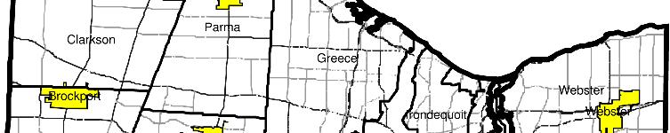
2 TRANSPORTATION & INDUSTRIAL ACCESS STUDY PHASE II GENESEE TRANSPORTATION COUNCIL MONROE COUNTY VILLAGE SQUARE FINAL CONCEPT-LEVEL STRATEGY REPORT I. Introduction The purpose of this report is to recommend infrastructure improvements that will foster future development at the site. The contents of this report will be used by the County for preparing future grant applications for implementing these improvements. The report also includes concept level cost estimates for implementing these improvements, identifies potential future funding sources and recommends key next steps. Village Square is located in an Empire Zone in southern Monroe County in the Village of Honeoye Falls. The 93-acre site is zoned for a mixed-use light industrial and commercial district. Vehicular access to the site is provided from West Main Street. One of the lots is currently constructed and partially occupied by Eastman Savings and Loan. Nineteen of twenty lots remain for future development. This project will benefit the community by providing increased long term tax revenues for the Village, School District and County. In addition, the project will create a retail center that will be beneficial to the residents of the Village and it will provide the opportunity for the development of a job market associated with commercial and light industrial growth. It is estimated that the project will support 1,200 new jobs once it is completed. The completion of Village Square will take place in three phases over the next 15 to 25 years. As of the date of this report, the first phase of initial site development has been completed. Approximately 300 feet of Village Square Boulevard has been constructed to provide access to a 7,500 square foot retail building. Some grading and drainage facilities have also been constructed for the future stormwater management facility. The site will feature the only shovel ready status in Monroe County by the beginning of summer of The County of Monroe Industrial Development Agency (COMIDA) has approved incentives for the next phase of construction which will include an additional 10,000 square feet of building on 1.1 acres at the site. The building will be leased to Custom Brewcrafters, who is anticipated to move into the building in the fall of Approximately 800 feet of additional roadway and storm water drainage will be constructed. Proposed Village Square II. Project Tasks On April 30, 2007 Dewberry and Genesee Transportation Council (GTC) staff met with David Dworkin and John August, owners of the property from LLD Enterprises, and performed a site visit to identify concept level infrastructure improvements. Several improvement tasks were 1 Q:\4602\Adm\Reports\Monroe\Final\Monroe Co - Village Square - Report.doc

3 ...\Honeoye Falls - Fig 1.dgn 8/15/ :15:32 AM
4 ...\Honeoye Falls - Fig 2.dgn 8/15/ :13:39 AM


5 identified for this site. The following is a brief summary of each improvement being considered along with its estimated cost. Task 1 Improve Intersection of Village Square Boulevard and West Main Street The unsignalized 4-way intersection is stop controlled on the north approach at Village Square Boulevard and on the south approach at Pine Trail. The Village Square Boulevard approach contains one northbound lane and two southbound lanes. West Main Street and Pine Trail are both two-lane roads. Left turn lanes are also provided on West Main Street for turning movements onto Village Square Boulevard and Pine Trail. According to the Traffic Impact Analysis for Village Square, performed by Parrone & Associates and dated February 2002, the intersection has an existing Level of Service (LOS) of B. A service level B is defined as reasonably free flow in AASHTO s A Policy on Geometric Design of Highways and Streets. In order to estimate future traffic and service levels, the report assumed that the first phase of construction would include 298,000 square feet of construction. Village Square Blvd. Intersection (Looking South) The increased traffic generated after this construction is predicted to decrease the intersection LOS to E. A service level E is defined as unstable flow by AASHTO. The nearly failing service level will occur for motorists on the southbound approach turning onto West Main Street. The traffic study recommends installation of a traffic signal before this phase of construction. A signalized intersection would operate at a LOS of B in As part of the permit approval, representatives of LLD Enterprises agreed to install a traffic signal before this phase of construction. According to the traffic study, additional intersection improvements at the intersection and along West Main Street are not warranted. This task proposes installation of a traffic signal at the intersection of Village Square Boulevard and West Main Street. A new traffic signal will be necessary to provide safe and appropriate traffic flow levels. The estimated cost for this task is approximately $125,000. Task 2 Improve Intersection of NYS Route 15A and West Main Street This intersection is a 4-way signalized intersection. Rush Lima Road (NYS Route 15A) is a north-south two-lane road, located approximately 2,000 feet west of Village Square Boulevard. Honeoye Falls Road No. 6 (also known as County Route 94 east of the intersection and County Route 63 west of the intersection) is an east-west two-lane road. The intersection does not contain dedicated left or right turn lanes. However, a by-pass road exists in the southwest quadrant of the intersection and connects NYS Route 15A north to Honeoye Falls Road No.6 east. A yield sign controls the end of this by-pass road. According to the Parrone traffic study, the intersection has an existing LOS of B. By 2010, increasing traffic volume is predicted to degrade the intersection LOS to F. A service level F is defined as forced or breakdown flow by NYS Route 15A Intersection (Looking West) 2 Q:\4602\Adm\Reports\Monroe\Final\Monroe Co - Village Square - Report.doc

6 AASHTO. The failing service level will occur for motorists on the westbound approach turning left onto the southbound direction. The traffic study recommends providing a dedicated left-turn lane on the westbound approach and adjusting the traffic signal phase times to maintain a safe level of service. As observed during our site visit, the existing pavement is in poor condition at the corners of the intersection. The cracking may be caused by an inadequate turning radius or perhaps due to vehicles passing on the right shoulder to make a right turn on red. This task involves widening approximately 1,200 feet of West Main Street / Honeoye Falls Road No. 6 by approximately 11 feet to provide left-turn lanes onto NYS Route 15A. Also, approximately 4,800 square feet of damaged pavement in the corners of the intersection will be replaced. It is assumed that the existing sewer and water systems would not be affected by the proposed widening. The estimated cost for this task is approximately $366,000. Task 3 Improve Access from Marketplace Plaza to West Main Street Westbound The unsignalized 3-way intersection between Market place Plaza and West Main Street is stop controlled on the north bound approach at Marketplace Plaza. Marketplace Plaza is located approximately 400 feet west of Village Square Boulevard and serves as an entrance to the plaza on the south side of West Main Street. The entrance includes left and right egress lanes and one ingress lane. West Main Street is a twolane road with an additional left turn lane into the plaza in the westbound direction. According to the Parrone traffic study, the intersection has an existing LOS of B. By 2020, increasing traffic volume will degrade the intersection LOS to D. The nearly failing service level will occur for motorists on the northbound approach turning left onto the westbound direction. The traffic study recommends providing a new access point into the plaza from Pine Trail to allow westbound left turns onto West Main Street at the signalized intersection. Marketplace Plaza Intersection (Looking North) This task involves the construction of a new entrance to the plaza from Pine Trail. It is assumed that the existing sewer and water systems would not be affected by the proposed construction. The estimated cost for this task is approximately $51,000. The following table summarizes the costs of each of the above tasks: Task Number Description Estimated Cost 1 Improve Intersection of Village Square $125,000 Boulevard and West Main Street 2 Improve Intersection of NYS Route 15A $366,000 and West Main Street 3 Improve Access from Marketplace Plaza $51,000 to West Main Street Westbound Total $542,000 3 Q:\4602\Adm\Reports\Monroe\Final\Monroe Co - Village Square - Report.doc
7 III. Possible Funding Options The online Catalog of Federal Domestic Assistance (CFDA) gives you access to a database of all Federal programs available to State and local governments. Contact the office that administers the program and find out how to apply. Visit the following website: Below is a summary of the applicable programs that can be found on the CFDA website: GRANTS FOR PUBLIC WORKS AND ECONOMIC DEVELOPMENT FACILITIES OBJECTIVES To enhance regional competitiveness and promote long-term economic development in regions experiencing substantial economic distress. EDA provides Public Works investments to help distressed communities and regions revitalize, expand, and upgrade their physical infrastructure to attract new industry, encourage business expansion, diversify local economies, and generate or retain long-term private sector jobs and investment. Current priorities include proposals that help support existing industry clusters, develop emerging new clusters, or attract new economic drivers , Economic Development Technical Assistance; , Economic Adjustment Assistance; EXAMPLES OF FUNDED PROJECTS (1) Infrastructure for industrial park development; (2) port development and expansion; (3) infrastructure necessary for economic development (e.g. water/sewer facilities); (4) renovation and recycling of old industrial buildings; (5) construction of vocational/technical facilities and skill centers; (6) construction of incubator facilities; (7) redevelopment of brownfields; and (8) eco-industrial development. Visit the following web site for more information: THE NYS INDUSTRIAL ACCESS PROGRAM The New York State Industrial Access Program has been designed to complement economic development projects throughout the State where transportation access poses a problem or may offer a unique opportunity to the viability of a project. It is important to emphasize that before a formal application is prepared, a potential applicant should initiate discussion with the Regional Program Coordinator of the New York State Department of Transportation to obtain up-to-date advice and information that are likely to facilitate the remainder of the process. Visit the following web site for more information: Municipalities, governmental agencies, and others who are considering submitting an application for the use of Industrial Access Funds should be aware of the following 4 Q:\4602\Adm\Reports\Monroe\Final\Monroe Co - Village Square - Report.doc
8 features of the Program. (The law creating the Program and the State's rules and regulations governing the administration of the Program are contained in the Appendix) Municipalities, industrial development agencies, or other governmental agencies involved in promotion economic development are eligible Industrial Access Program applicants. In the case of a private corporation, a State agency, municipality, or industrial development agency must sponsor the project and file an application with the NYSDOT Regional Director on behalf of the non-governmental entity. Awards are made on a 60% grant, 40% interest free loan basis, up to a maximum of $1 million. As specified by law, the loan portion must be paid back within 5 years after the acceptance of the project by the department. Repayment terms are negotiable. Eligible work includes design, acquisition of property, public access road/rail construction or reconstruction, curbing, sidewalks, traffic control and safety devices, drainage systems, landscaping and similar work that may facilitate industrial access. THE STATEWIDE TRANSPORTATION IMPROVEMENT PROGRAM The Statewide Transportation Improvement Program (STIP) is a list of every project in New York State for which Federal funding is proposed to be used and that is scheduled to begin during the designated three Federal fiscal year time frame. The STIP was last updated during the summer and fall of 2005 with formal approval occurring on December 5, As it must be updated every two years and include a minimum three-year listing of Federal-aid projects, it will very likely be updated again during The new federal Transportation Act called Safe Accountable Flexible Efficient Transportation Equity Act: a Legacy for Users SAFETEA-LU, includes provisions allowing States to adopt a longer cycle for updates. Implications of this change are being evaluated and the next scheduled STIP update may change as a result. The currently approved STIP covers the period between October 1, 2005 and September 30, Prior to being incorporated into the STIP, projects requesting federal funds must be incorporated into the regions TIP. The TIP is administered cooperatively by GTC and NYSDOT. The draft TIP has already been developed and will be adopted by the GTC Board in June Project solicitation for the next TIP ( ) will take place in September 2008 for adoption in June In addition to the STIP, which administers federal funds only, NYSDOT has its own statewide program for state-funded projects which may also be a viable funding option. Visit the following web site for more information: 5 Q:\4602\Adm\Reports\Monroe\Final\Monroe Co - Village Square - Report.doc
9 Earmarks and Sponsored Funding The Monroe County may want to contact their local and state legislators to request sponsorship of an earmark funding source for some or all of these improvements. This type of funding approval can often provide quick and direct turn around for acquiring public works funding and would give this project a higher priority over other projects which are in line for more conventional funding sources. IV. Next Steps A Preliminary Engineering Study should be performed to further study the various tasks in greater detail and recommend a preferred alternative for each task. This study should include the following design tasks: 1. Survey and mapping of the areas to be improved 2. Traffic and accident analysis 3. Subsurface investigations to determine the soil conditions and presence of rock. 4. Preliminary design alternative development and evaluation 5. Preliminary cost estimates 6. Environmental screenings 7. Public Informational Meetings 8. Preparation of a Design Report that recommends a preferred alternative for each task. Once a preferred alternative has been determined, Final Design of the various tasks can be implemented and construction drawings can be developed for bidding purposes. Dewberry recommends following a NYSDOT scope of work for public improvement projects as outlined in the NYSDOT Local Procedures Manual. Visit the following web site for more information: 6 Q:\4602\Adm\Reports\Monroe\Final\Monroe Co - Village Square - Report.doc
10 Highway TASK 1 - IMPROVE INTERSECTION OF VILLAGE SQUARE BOULEVARD AND WEST MAIN STREET CONSTRUCTION COST ESTIMATE Village of Honeoye Falls Monroe County ITEM UNIT QUANTITY UNIT COST TOTAL COST Traffic Signal LS 1 $85, $85,000 Subtotal: $85,000 Maintenance & Protection of Traffic; Survey & Stake-out; Field Office; Mobilization & Demobilization LS 1 $10,000 $10,000 Total: $95,000 Say: $95,000 TOTAL: $95,000 ENGINEERING AND INSPECTION: $30,000 GRAND TOTAL: $125,000 DEWBERRY-GOODKIND, INC. Q:\4602\Adm\Reports\Monroe\Final\Monroe Co - Honeoye - Estimate
11 TASK 2 - IMPROVE INTERSECTION OF NYS ROUTE 15A AND WEST MAIN STREET CONSTRUCTION COST ESTIMATE Village of Honeoye Falls Monroe County Highway ITEM UNIT QUANTITY UNIT COST TOTAL COST Excavation & Disposal (Topsoil) CY 165 $10.00 $1,650 Excavation & Disposal (Box-Out) CY 667 $15.00 $10,005 Rock Excavation CY 667 $95.00 $63,365 Pavement Top Course Ton 278 $65.00 $18,070 Pavement Binder Ton 278 $65.00 $18,070 Pavement Base Ton 1,111 $60.00 $66,660 Pavement Subbase CY 667 $35.00 $23,345 Topsoil (Tree Lawns & Along ROW) CY 165 $30.00 $4,950 Seeding (Tree Lawns & Along ROW) SF 13,200 $0.10 $1,320 Asphalt Driveways SF 360 $4.00 $1,440 Subtotal: $208,875 Supplemental Construction LS 1 15% $31,331 Maintenance & Protection of Traffic; Survey & Stake-out; Field Office; Mobilization & Demobilization LS 1 10% $20,888 Total: $261,094 Say: $261,000 TOTAL: $261,000 ENGINEERING AND INSPECTION: $65,000 ROW and EASEMENTS $40,000 GRAND TOTAL: $366,000 DEWBERRY-GOODKIND, INC. Q:\4602\Adm\Reports\Monroe\Final\Monroe Co - Honeoye - Estimate
12 TASK 3 - IMPROVE ACCESS FROM MARKETPLACE PLAZA TO WEST MAIN STREET WESTBOUND CONSTRUCTION COST ESTIMATE Village of Honeoye Falls Monroe County Highway ITEM UNIT QUANTITY UNIT COST TOTAL COST Excavation & Disposal (Topsoil) CY 16 $10.00 $160 Excavation & Disposal (Box-Out) CY 22 $15.00 $330 Rock Excavation CY 22 $95.00 $2,090 Pavement Top Course Ton 10 $65.00 $650 Pavement Binder Ton 10 $65.00 $650 Pavement Base Ton 40 $60.00 $2,400 Pavement Subbase CY 22 $35.00 $770 Topsoil (Tree Lawns & Along ROW) CY 8 $30.00 $240 Seeding (Tree Lawns & Along ROW) SF 600 $0.10 $60 Subtotal: $7,350 Supplemental Construction LS 1 15% $1,103 Maintenance & Protection of Traffic; Survey & Stake-out; Field Office; Mobilization & Demobilization LS 1 10% $735 Total: $9,188 Say: $9,000 TOTAL: $9,000 ENGINEERING AND INSPECTION: $2,000 ROW and EASEMENTS $40,000 GRAND TOTAL: $51,000 DEWBERRY-GOODKIND, INC. Q:\4602\Adm\Reports\Monroe\Final\Monroe Co - Honeoye - Estimate
13
CITY OF KASSON TRANSPORTATION ALTERNATIVES KASSON SAFE ROUTES TO SCHOOL
 ve ha 8t G B A Mantorville Ave N 240th Ave 16th St NE 11th Ave NE K-M HIGH SCHOOL SUNRISE TRAIL TO MANTORVILLE MNTH 57 SUNSET TRAIL TO MANTORVILLE NE PARK 16TH ST NE TRAIL K-M ELEMENTARY SCHOOL K-M MIDDLE
Project Update May 2018
 Project Update May 2018 Dakota County, in cooperation with the City of Lakeville, is planning to reconstruct 202 nd Street West (County Road 50) from Holyoke Avenue to Cedar Avenue (County Road 23). 202
West Dimond Blvd Upgrade Jodhpur Street to Sand Lake Road
 West Dimond Blvd Jodhpur St to Sand Lake CSS Transportation Project Summary Municipality of Anchorage Project # 05 005 Project Manager: John Smith, P.E. (MOA PM&E) Project Administrator: Julie Makela,
HOOPA DESIGN FAIR 4. IMPLEMENTATION PHASES & FUNDING
 4. IMPLEMENTATION PHASES & FUNDING HOOPA DESIGN FAIR 4-1 4. IMPLEMENTATION PHASES & FUNDING Phase One Development 1. Implementation The Conceptual Plan recommends five concept elements to revitalize downtown
M-58 HIGHWAY ACCESS MANAGEMENT STUDY Mullen Road to Bel-Ray Boulevard. Prepared for CITY OF BELTON. May 2016
 M-58 HIGHWAY ACCESS MANAGEMENT STUDY Prepared for CITY OF BELTON By May 2016 Introduction Missouri State Highway 58 (M-58 Highway) is a major commercial corridor in the City of Belton. As development has
JONESBORO HIGHWAY 63 HIGHWAY 18 CONNECTOR STUDY
 JONESBORO HIGHWAY 63 HIGHWAY 18 CONNECTOR STUDY Craighead County May 2007 JONESBORO HIGHWAY 63 HIGHWAY 18 CONNECTOR STUDY Craighead County May 2007 Prepared by Planning and Research Division Arkansas State
Readington Road (C.R. 637) Construction
 Construction") Public Information Meeting Thursday, August 2, 2012 Readington Road (C.R. 637) Construction from Dreahook Road to Harlan School Road Branchburg Township, Somerset County Readington Township, Hunterdon
Public Information Meeting Thursday, August 2, 2012 Readington Road (C.R. 637) Construction from Dreahook Road to Harlan School Road Branchburg Township, Somerset County Readington Township, Hunterdon
Exhibit 1 PLANNING COMMISSION AGENDA ITEM
 Exhibit 1 PLANNING COMMISSION AGENDA ITEM Project Name: Grand Junction Circulation Plan Grand Junction Complete Streets Policy Applicant: City of Grand Junction Representative: David Thornton Address:
TOWN OF IRONDEQUOIT ACTIVE TRANSPORTATION PLAN
 TOWN OF IRONDEQUOIT March 2017 FINAL DRAFT: EXECUTIVE SUMMARY PREPARED FOR SUBMITTED BY IN ASSOCIATION WITH Town of Barton & Loguidice, DPC Sprinkle Consulting, Inc. 1280 Titus Avenue Rochester, New York
Building Great Neighbourhoods QUEEN ALEXANDRA
 Building Great Neighbourhoods QUEEN ALEXANDRA We are here today to Explain how the City is investing in improving your neighbourhood and how your neighbourhood will be improved to meet current City standards.
TULSA INTERNATIONAL AIRPORT ECONOMIC DEVELOPMENT PROJECT PLAN
 Adopted, 2016 TULSA INTERNATIONAL AIRPORT ECONOMIC DEVELOPMENT PROJECT PLAN A PROJECT OF: THE CITY OF TULSA IN COOPERATION WITH: TULSA COUNTY TULSA INTERNATIONAL AIRPORT DEVELOPMENT TRUST TULSA AIRPORTS
APPENDIX A: Complete Streets Checklist DRAFT NOVEMBER 2016
 APPENDIX A: Complete Streets Checklist DRAFT NOVEMBER 2016 Complete Streets Checklist MetroPlan Orlando s Complete Streets Checklist is an internal planning tool for staff to further implementation of
NM-POLICY 1: Improve service levels, participation, and options for non-motorized transportation modes throughout the County.
 Transportation PRINCE WILLIAM COUNTY 2008 COMPREHENSIVE PLAN NON-MOTORIZED PLAN CONTENTS Goals, Policies, and Action Strategies Table 4 (Bike Facility Classifications and Descriptions) Table 5 (Bike Facility
TOWN OF PORTLAND, CONNECTICUT COMPLETE STREETS POLICY
 TOWN OF PORTLAND, CONNECTICUT COMPLETE STREETS POLICY I. VISION, GOALS & PRINCIPLES VISION To improve the streets of Portland making them safer and more accessible for all users including pedestrians,
Legislative Update Williamsburg Residency
 Hampton Roads District Legislative Update Williamsburg Residency Jim Brewer, Resident Administrator 757-253-5140 Projects Under Way Warwick Boulevard Project http://www.warwickboulevard.org/ Contractors:
APPENDIX G: INTERSECTION NEEDS AT OKEECHOBEE BOULEVARD
 APPENDIX G: INTERSECTION NEEDS AT OKEECHOBEE BOULEVARD INTERSECTION NEEDS AT SR 7 and OKEECHOBEE BOULEVARD SR 7 Extension Project Development and Environment (PD&E) Study From Okeechobee Boulevard (SR
Highway 56 Traffic Study Rymal Road to Cemetery Road
 January 31, 2018 6:00 pm 8:00 pm Highway 56 Traffic Study Rymal Road to Cemetery Road City of Hamilton Public Meeting 2 2 Purpose of Public Meeting To review and obtain public input and comments on the
ROUTE 22 CORRIDOR STUDY: CORRIDOR MANAGEMENT PLAN APPENDIX A A-12
 ROUTE 22 CORRIDOR STUDY: CORRIDOR MANAGEMENT PLAN APPENDIX A A-12 3.0 HARLEM VALLEY TRANSPORTATION PLAN Incorporates transportation systems management and safety improvements. Location: Route 22 corridor
Bicycle and Pedestrian Connectivity Study Phase 2
 Connectivity Study Phase 2 Process PROCESS OUTCOMES Phase Prepared By STEP I Public Participation and Outreach 1. RTP Outreach activities, and development of the Bike and Ped Task Force Phase 1 2011 OCPC
CONNECTIVITY PLAN. Adopted December 5, 2017 City of Virginia Beach
 CONNECTIVITY PLAN Adopted December 5, 2017 City of Virginia Beach CONTENTS 1.0 Background & Purpose... 2 2.0 Existing Inventory & Analysis... 3 ViBe District Existing Walking Conditions... 4 3.0 ViBe District
East Downtown Tax Increment Reinvestment Zone (TIRZ) No. 15 Infrastructure Assessment Study
 No. 15 Infrastructure Assessment Study") East Downtown Tax Increment Reinvestment Zone (TIRZ) No. 15 Infrastructure Assessment Study Houston, TX Technical Memorandum April 15 th, 2009 Prepare by: 2950 North Loop West, Ste. 900 Houston, TX 77092
East Downtown Tax Increment Reinvestment Zone (TIRZ) No. 15 Infrastructure Assessment Study Houston, TX Technical Memorandum April 15 th, 2009 Prepare by: 2950 North Loop West, Ste. 900 Houston, TX 77092
Building Great Neighbourhoods BELLEVUE AND VIRGINIA PARK
 Building Great Neighbourhoods BELLEVUE AND VIRGINIA PARK This is Meeting 2 Unfortunately, some residents in Bellevue and Virginia Park received the wrong information for this public open house (Meeting
Environment and Public Works Committee Presentation
 Mixed Use Centers Complete Streets Guidelines Project Environment and Public Works Committee Presentation December 10, 2008 Project Objectives: Conduct an inter-departmental and agency process to study
COMMITTEE RECOMMENDATIONS. That Council approve:
 4. MODIFICATIONS TO INNES ROAD (REGIONAL ROAD 30) AND TENTH LINE ROAD (REGIONAL ROAD 47) TO ACCOMMODATE THE DEVELOPMENT OF THE TRINITY COMMONS SHOPPING CENTRE COMMITTEE RECOMMENDATIONS That Council approve:
Introduction.
 2307-1.0. Introduction. Delaware s Safe Routes to School (SRTS) Program was established September 10, 2002 when Governor Ruth Ann Minner signed Senate Bill 353 of the 141st General Assembly of Delaware
Chapter 2: Standards for Access, Non-Motorized, and Transit
 Standards for Access, Non-Motorized, and Transit Chapter 2: Standards for Access, Non-Motorized, and Transit The Washtenaw County Access Management Plan was developed based on the analysis of existing
WHEREAS delivery trucks also pass through the Narrows, into the northern parking lot, to loading docks in the back of the building.
 CEDAR-ISLES-DEAN NEIGHBORHOOD ASSOCIATION ( CIDNA ) RESOLUTION OPPOSING A DRUG STORE DRIVE THRU, AND COMMENDING DORAN COMPANIES FOR PROPOSING MITIGATING AMENITIES INCLUDING NEW LANDSCAPING AND A DEDICATED
TRAFFIC IMPACT STUDY CRITERIA
 Chapter 6 - TRAFFIC IMPACT STUDY CRITERIA 6.1 GENERAL PROVISIONS 6.1.1. Purpose: The purpose of this document is to outline a standard format for preparing a traffic impact study in the City of Steamboat
Corpus Christi Metropolitan Transportation Plan Fiscal Year Introduction:
 Introduction: The Safe, Accountable, Flexible, Efficient Transportation Equity Act: A Legacy for Users (SAFETEA-LU) has continued the efforts started through the Intermodal Surface Transportation Efficiency
3.0 PROJECT DESCRIPTION
 The following section of the Draft EIR contains a description of the proposed Elk Grove Boulevard/SR 99 Interchange Modification project, consistent with the requirements of CEQA Guidelines Section 15124.
Public Facilities & Services
 Public Facilities & Services This Chapter will inventory the municipal facilities and public services available to Windham residents, whether they are provided by the Town, a public utility like the Portland
ROUTES 55 / 42 / 676 BUS RAPID TRANSIT LOCALLY PREFERRED ALTERNATIVE
 ROUTES 55 / 42 / 676 BUS RAPID TRANSIT LOCALLY PREFERRED ALTERNATIVE April, 2012 1 INTRODUCTION The need for transit service improvements in the Routes 42/55/676 corridor was identified during the Southern
8 PROPOSED ROUNDABOUT DUFFERIN STREET AND KING VAUGHAN ROAD INTERSECTION CITY OF VAUGHAN
 8 PROPOSED ROUNDABOUT DUFFERIN STREET AND KING VAUGHAN ROAD INTERSECTION CITY OF VAUGHAN The Transportation Services Committee recommends the adoption of the recommendation contained in the following report
TRAFFIC IMPACT STUDY COMPREHENSIVE UPDATE TOWN OF THOMPSON S STATION, TENNESSEE PREPARED FOR: THE TOWN OF THOMPSON S STATION
 TRAFFIC IMPACT STUDY COMPREHENSIVE UPDATE TOWN OF THOMPSON S STATION, TENNESSEE PREPARED FOR: THE TOWN OF THOMPSON S STATION Transportation Consultants, LLC 1101 17 TH AVENUE SOUTH NASHVILLE, TN 37212
4. ENVIRONMENTAL IMPACT ANALYSIS 9. TRANSPORTATION AND TRAFFIC
 4. ENVIRONMENTAL IMPACT ANALYSIS 9. TRANSPORTATION AND TRAFFIC 4.9.1 INTRODUCTION The following section addresses the Proposed Project s impact on transportation and traffic based on the Traffic Study
2016 Church Street Access Study. 100 Clinton Square 126 North Salina Street, Suite 100 Syracuse, NY
 2016 Church Street Access Study 100 Clinton Square 126 North Salina Street, Suite 100 Syracuse, NY 13202 www.smtcmpo.org Syracuse Metropolitan Transportation Council Final Report February 23, 2016 This
Item No. 14 Town of Atherton
 Item No. 14 Town of Atherton CITY COUNCIL STAFF REPORT CONSENT AGENDA TO: THROUGH: FROM: HONORABLE MAYOR AND CITY COUNCIL GEORGE RODERICKS, CITY MANAGER MICHAEL KASHIWAGI, COMMUNITY SERVICES DIRECTOR MARTY
Pavement Management Report. City Council Meeting of May 21, 2013
 Pavement Management Report City Council Meeting of May 21, 2013 Previous Meetings Summary In February, we presented the 2012 pavement survey and our consultant presented general pavement management strategies
Building Great Neighbourhoods BONNIE DOON
 Building Great Neighbourhoods BONNIE DOON We Are Here Today To Explain the Neighbourhood Renewal Process Show you the Westwood Preliminary Design Ask for local knowledge Highlight the Local Improvement
Bicycle Master Plan Goals, Strategies, and Policies
 Bicycle Master Plan Goals, Strategies, and Policies Mobilizing 5 This chapter outlines the overarching goals, action statements, and action items Long Beach will take in order to achieve its vision of
Traffic Impact Analysis Chatham County Grocery Chatham County, NC
 Chatham County Grocery Chatham County, NC TABLE OF CONTENTS 1. INTRODUCTION... 1 1.1. Location and Study Area... 1 1.2. Proposed Land Use and Access... 2 1.3. Adjacent Land Uses... 2 1.4. Existing ways...
Traffic Impact Study. Westlake Elementary School Westlake, Ohio. TMS Engineers, Inc. June 5, 2017
 TMS Engineers, Inc. Traffic Impact Study Westlake Elementary School Westlake, Ohio June 5, 2017 Prepared for: Westlake City Schools - Board of Education 27200 Hilliard Boulevard Westlake, OH 44145 TRAFFIC
DRAFT BUENA VISTA 2020 TRANSPORTATION PLAN
 DRAFT BUENA VISTA 2020 TRANSPORTATION PLAN DEVELOPED BY THE TRANSPORTATION PLANNING DIVISION OF THE VIRGINIA DEPARTMENT OF TRANSPORTATION IN COOPERATION WITH THE U.S. DEPARTMENT OF TRANSPORTATION, FEDERAL
Transportation Corridor Studies: Summary of Recommendations
 Transportation Corridor Studies: Summary of Recommendations Route 4 Corridor Study: Route 10 Corridor Study: Route 44 Corridor Study: Route 175 Corridor Study: Route 5/15 Corridor Study: Rentschler Field
Building Great Neighbourhoods LANSDOWNE
 Building Great Neighbourhoods LANSDOWNE We are here today to Explain how the City is investing in improving your neighbourhood and how your neighbourhood will be improved to meet current City standards.
DIMARCO CANANDAIGUA PROPERTIES HOUSING PROJECT CANANDAIGUA, ONTARIO COUNTY, NEW YORK
 TRAFFIC IMPACT STUDY FOR THE DIMARCO CANANDAIGUA PROPERTIES HOUSING PROJECT CANANDAIGUA, ONTARIO COUNTY, NEW YORK MARCH 14, 2017 PREPARED FOR: 1950 Brighton Henrietta Town Line Rd Rochester, NY 14623 PREPARED
Solana Beach Comprehensive Active Transportation Strategy (CATS)
") Solana Beach Comprehensive Active Transportation Strategy (CATS) 3.0 Goals & Policies The Solana Beach CATS goals and objectives outlined below were largely drawn from the Solana Beach Circulation Element
Solana Beach Comprehensive Active Transportation Strategy (CATS) 3.0 Goals & Policies The Solana Beach CATS goals and objectives outlined below were largely drawn from the Solana Beach Circulation Element
COUNTY ROAD 22 HORSESHOE VALLEY ROAD. Municipal Class Environmental Assessment. simcoe.ca
 OCTOBER 2014 Municipal Class Environmental Assessment COUNTY ROAD 22 HORSESHOE VALLEY ROAD Project A Truck Climbing Lanes Project B Intersection Improvements simcoe.ca CORPORATE COMMUNICATIONS DEPARTMENT
WELCOME. Purpose of the Open House. Update you on the project. Present a draft recommended plan. Receive your input
 WELCOME Purpose of the Open House The Town of Smiths Falls has initiated the Beckwith Street Redevelopment Plan that includes the preparation of a streetscape functional design for the renewal of Beckwith
AMATS Complete Streets Policy
 AMATS Complete Streets Policy Table of Contents: Section 1. Definition of Complete Streets Section 2. Principles of Complete Streets Section 3. Complete Streets Policy Section 4. Consistency Section 5.
Non-Motorized Transportation 7-1
 Non-Motorized Transportation 7-1 Transportation facilities no longer mean just accommodating a vehicle powered by a combustion engine. Pedestrian and non-motorized facilities are important modes of travel
ARTINSVILLE ENRY OUNTY REA RANSPORTATION TUDY
 ARTINSVILLE ENRY OUNTY REA RANSPORTATION TUDY DEVELOPED BY THE TRANSPORTATION AND MOBILITY PLANNING DIVISION OF THE VIRGINIA DEPARTMENT OF TRANSPORTATION IN COOPERATION WITH THE U.S. DEPARTMENT OF TRANSPORTATION,
Highway 49, Highway 351 and Highway 91 Improvements Feasibility Study Craighead County
 Highway 49, Highway 351 and Highway 91 Improvements Feasibility Study Craighead County Executive Summary March 2015 Highway 49, Highway 351 and Highway 91 Improvements Feasibility Study Craighead County
FY STATEWIDE TRANSPORTATION IMPROVEMENT PROGRAM New Jersey Department of Transportation Projects
 ROUTE/ Project ID No. TIP No. Electrical Load Center Replacement - North 04324 04324 This project will provide for the betterment of the existing highway lighting facilities located along Routes 3, 17
Americans with Disabilities Act Transition Plan for Public Right-of-Way Improvements
 Americans with Disabilities Act Transition Plan for Public Right-of-Way Improvements Prepared by: Public Works Department Engineering Division October 2015 Table of Contents Section I Introduction.. 3
SAN FRANCISCO MUNICIPAL TRANSPORTATION AGENCY
 THIS PRINT COVERS CALENDAR ITEM NO. : 11 DIVISION: Sustainable Streets BRIEF DESCRIPTION: SAN FRANCISCO MUNICIPAL TRANSPORTATION AGENCY Approving traffic modifications on Twin Peaks Boulevard between Christmas
WEST AND SOUTH WEST RING ROAD DOWNSTREAM TRAFFIC IMPACTS
 Page 1 of 9 EXECUTIVE SUMMARY Alberta Transportation ( AT ) is preparing to construct the final sections of the Calgary Ring Road. This includes the South West Ring Road ( SWRR ) (from Lott Creek Blvd
2. Executing a legal agreement with respect to (1) above.
 above.") 3. INSTALLATION OF TRAFFIC CONTROL SIGNALS AT HUNT CLUB AND PAUL ANKA TO ACCOMMODATE THE DEVELOPMENT OF A GAS BAR, CONVENIENCE STORE AND CAR WASH COMMITTEE RECOMMENDATIONS That Council approve the installation
3. INSTALLATION OF TRAFFIC CONTROL SIGNALS AT HUNT CLUB AND PAUL ANKA TO ACCOMMODATE THE DEVELOPMENT OF A GAS BAR, CONVENIENCE STORE AND CAR WASH COMMITTEE RECOMMENDATIONS That Council approve the installation
Fleur Drive Reconstruction
 Fleur Drive Reconstruction October 29, 2018 1 Agenda: Fleur Drive Reconstruction Project Scope & Cost Overview Fleur Drive Cross Section Elements - Travel Lane Widths - Sidewalk Widths - Parkway Widths
1.0 EXECUTIVE SUMMARY
 1.0 EXECUTIVE SUMMARY The Active Transportation Plan is a guide to accomplish the Town s vision for developing a network of sidewalks, on-road bicycle facilities, and trails that allow for safe and convenient
Transportation Master Plan Advisory Task Force
 Transportation Master Plan Advisory Task Force Network Alternatives & Phasing Strategy February 2016 BACKGROUND Table of Contents BACKGROUND Purpose & Introduction 2 Linking the TMP to Key Council Approved
Date: September 7, Project #: Re: Spaulding Youth Center Northfield, NH Property. Traffic Impact Study
 To: Ms. Susan C. Ryan Spaulding Youth Center 72 Spaulding Road Northfield, NH 03276 Date: September 7, 2017 Project #: 52455.00 From: Robin Bousa Director of Transportation Systems Re: Spaulding Youth
Shockoe Bottom Preliminary Traffic and Parking Analysis
 Shockoe Bottom Preliminary Traffic and Parking Analysis Richmond, Virginia August 14, 2013 Prepared For City of Richmond Department of Public Works Prepared By 1001 Boulders Pkwy Suite 300, Richmond, VA
Active Transportation Infrastructure Investment A Business Case
 Active Transportation Infrastructure Investment A Business Case In 2016, the Real Estate Foundation awarded the Capital Regional District a $50,000 grant for Shifting Gears: Land Use Change through Active
TRASBURG RANSPORTATION
 TRASBURG RANSPORTATION LAN DEVELOPED BY THE TRANSPORTATION PLANNING DIVISION OF THE VIRGINIA DEPARTMENT OF TRANSPORTATION IN COOPERATION WITH THE U.S. DEPARTMENT OF TRANSPORTATION, FEDERAL HIGHWAY ADMINISTRATION
SECTION 7 INVENTORY OF SELECTED INTERSECTIONS AND RECOMMENDATIONS FOR FURTHER STUDY
 SECTION 7 INVEY OF SELECTED INTERSECTIONS AND RECOMMENDATIONS FOR FURTHER STUDY The study corridor includes a total of 19 signalized intersections. Through consultation with Campbell County and the KYTC,
May 10, 2013 Meredith Cruz, (561) Palm Beach County Traffic Report May 10 through May 17, 2013
 Palm Beach County Traffic Report May 10 through May 17, 2013") May 10, 2013 Meredith Cruz, (561) 641-6440 mcruz@corradino.com Palm Beach County Traffic Report May 10 through May 17, 2013 Palm Beach County Palm Beach County traffic will be affected this week by ongoing
May 10, 2013 Meredith Cruz, (561) 641-6440 mcruz@corradino.com Palm Beach County Traffic Report May 10 through May 17, 2013 Palm Beach County Palm Beach County traffic will be affected this week by ongoing
BUDGET FOR RESEDA BOULEVARD, STREET RECONSTRUCTION / VISION ZERO PROGRAM, REPORT BACK, COUNCIL FILE
 FORM GEN. 160 (Rev. 11-02) CITY OF LOS ANGELES INTERDEPARTMENTAL CORRESPONDENCE Date: To: Honorable City Council From: Gary Lee Moore, City Engineer Bureau of Engineering 7%mt /Electronically signed by
TRAFFIC IMPACT STUDY And A TRAFFIC SIGNAL WARRANT ANALYSIS FOR A SENIOR LIVING AND APARTMENT DEVELOPMENT
 TRAFFIC IMPACT STUDY And A TRAFFIC SIGNAL WARRANT ANALYSIS FOR A SENIOR LIVING AND APARTMENT DEVELOPMENT DEERFIELD TOWNSHIP, WARREN COUNTY, OHIO Nantucket Circle and Montgomery Road () Prepared for: ODLE
Dewey Avenue Corridor Traffic Calming Study Town of Greece and City of Rochester, NY Executive Summary, September 2010
 Dewey Avenue Corridor Traffic Calming Study Town of Greece and City of Rochester, NY Executive Summary, September 2010 This report summarizes the analysis and preliminary design studies of the Dewey Avenue
APPENDIX D COST SUMMARY TABLES
 APPENDIX D COST SUMMARY TABLES Section 1 Between Route 50 and Evergreen Mills Road 3850 linear feet of one 12 foot wide additional lane in southbound direction of Rte 606; from north side of Rte 50 to
City of Fairfax, Virginia City Council Work Session
 City of Fairfax, Virginia City Council Work Session Agenda Item # City Council Meeting 12a 9/8/2015 TO: FROM: SUBJECT: ISSUE(S): SUMMARY: FISCAL IMPACT: RECOMMENDATION: ALTERNATIVE COURSE OF ACTION: RESPONSIBLE
Chapter 4 Traffic Analysis
 Chapter 4 Traffic Analysis PURPOSE The traffic analysis component of the K-68 Corridor Management Plan incorporates information on the existing transportation network, such as traffic volumes and intersection
Orange Center Elementary School
 Drag and drop pic and stretch/crop to the limits of the blue rectangle (delete this text box) Orange Center Elementary School Drag and drop pic and stretch/crop to the limits of the blue rectangle (delete
Report Purpose To seek Council s approval of the Wye Road Functional Planning Study (January 2015).
.") COUNCIL MEETING Meeting Date: March 10, 2015 Agenda Item #: 13.1 Wye Road Functional Planning Study (January 2015) Report Purpose To seek Council s approval of the Wye Road Functional Planning Study (January
COUNCIL MEETING Meeting Date: March 10, 2015 Agenda Item #: 13.1 Wye Road Functional Planning Study (January 2015) Report Purpose To seek Council s approval of the Wye Road Functional Planning Study (January
Transportation Planning Division
 Transportation Planning Division Presentation Outline Study Tasks Recap of Previous Meetings Data Collected Focus Areas within Study Limits Design Principles Tool Box Recommended Concepts Schedule Moving
Chapter 2. Bellingham Bicycle Master Plan Chapter 2: Policies and Actions
 Chapter 2 Bellingham Bicycle Master Plan Chapter 2: Policies and Actions Chapter 2: Policies and Actions The Bicycle Master Plan provides a road map for making bicycling in Bellingham a viable transportation
Chapter 7. Transportation. Transportation Road Network Plan Transit Cyclists Pedestrians Multi-Use and Equestrian Trails
 Chapter 7 Transportation Transportation Road Network Plan Transit Cyclists Pedestrians Multi-Use and Equestrian Trails 7.1 TRANSPORTATION BACKGROUND The District of Maple Ridge faces a number of unique
Executive Summary. Also included is an Appendix that consists of more detailed discussions of the extensive public participation process.
 Executive Summary A. Introduction As a result of issues that have arisen through the historical development of Elmont and Hempstead Turnpike as a primarily automobile-related corridor, the Elmont community
East Burke Transportation, Safety and Capacity Improvements
 East Burke Transportation, Safety and Capacity Improvements The purpose of this project is to increase mobility and improve safety for pedestrians, cyclists, and motor vehicles along VT Route 114 in the
Figure 1: Vicinity Map of the Study Area
 ARIZONA TEXAS NEW MEXICO OKLAHOMA May 5, 2016 Mr. Anthony Beach, P.E. BSP Engineers 4800 Lakewood Drive, Suite 4 Waco, Texas 76710 Re: Intersection and Access Analysis along Business 190 in Copperas Cove
CITY OF BLOOMINGTON COMPLETE STREETS POLICY
 CITY OF BLOOMINGTON COMPLETE STREETS POLICY POLICY OBJECTIVE: The City of Bloomington will enhance safety, mobility, accessibility and convenience for transportation network users of all ages and abilities,
Shore Drive Safety Task Force. Report to the SDAC
 Shore Drive Safety Task Force Report to the SDAC April 20, 2006 Table of Contents Introduction... 3 Section I Safety Recommendations... 5 Section II Communication/Public Involvement Plan... 14 Section
City of Gainesville Transportation/Roadway Needs PROJECT SUMMARY
 A1 Roadway Resurfacing $23,846,000 TYPE: Preservation of existing system Roadway resurfacing A2 Signal Replacement $6,000,000 TYPE: Preservation of existing system Replace traffic signals. B1 W 6th St
King Soopers #116 Thornton, Colorado
 Traffic Impact Study King Soopers #116 Thornton, Colorado Prepared for: Galloway & Company, Inc. 1.0 EXECUTIVE SUMMARY King Soopers #116, a grocery marketplace anchored commercial development, is proposed
Funding Sources Appendix I. Appendix I. Funding Sources. Virginia Beach Bikeways and Trails Plan 2011 Page I-1
 Funding Sources Virginia Beach Bikeways and Trails Plan 2011 Page I-1 Funding Sources Federal and state agencies provide funding for local bikeway and trail projects. Descriptions follow for programs that
Safe Routes to School Action Plan Aberdeen, Idaho
 Background Aberdeen, Idaho is a largely agricultural community of nearly 2,000 people and is located in the southeast portion of the state on the western edge of American Falls Reservoir. The community
ACTIVE TRANSPORTATION
 ACTIVE TRANSPORTATION Mobility 2040 Supported Goals Improve the availability of transportation options for people and goods. Support travel efficiency measures and system enhancements targeted at congestion
2.0 LANE WIDTHS GUIDELINE
 2.0 LANE WIDTHS GUIDELINE Road Engineering Design Guidelines Version 2.0.1 May 2018 City of Toronto, Transportation Services City of Toronto Page 0 Background In early 2014, Transportation Services initiated
Corporate. Report COUNCIL DATE: May 25, 1998 NO: R1500 REGULAR COUNCIL. TO: Mayor & Council DATE: April 27, 1998
 R1500 : Traffic Safety at 25 Avenue and 128 Street Intersection Corporate NO: R1500 Report COUNCIL DATE: May 25, 1998 REGULAR COUNCIL TO: Mayor & Council DATE: April 27, 1998 FROM: General Manager, Engineering
APPENDIXB. Traffic Operations Technical Memorandum
 APPENDIXB Traffic Operations Technical Memorandum Environmental Assessment - Lincoln County, SD 85 th Street: Sundowner Avenue to Louise Avenue November 2017 MEMORANDUM Transportation Jim Kollbaum, PE
Roadway Classification Design Standards and Policies. Pueblo, Colorado November, 2004
 Roadway Classification Design Standards and Policies Pueblo, Colorado November, 2004 Table of Contents Page Chapter 1. General Provisions 1.1 Jurisdiction 3 1.2 Purpose and Intent 3 1.3 Modification 3
Comments EXECUTIVE SUMMARY
 Comments 1. Under any Alternatives, MCDOT should provide better at-grade pedestrian crossing of Georgia Avenue and Forest Glen Road, including improved crosswalks with wider medians and adequate signal
Appendix D: Planning Level Cost Calculator
 Appendix D: Planning Level Cost Calculator Network Costs by Facility Type Facility Type Total Miles of Facility Total Number of Intersections Cost per feature or per mile Total Cost Bicycle Boulevard 52.14
Meadow Woods Elementary School
 Drag and drop pic and stretch/crop to the limits of the blue rectangle (delete this text box) Meadow Woods Elementary School Drag and drop pic and stretch/crop to the limits of the blue rectangle (delete
Access Management Guidelines February 2013 THE CITY OF
 Access Management Guidelines February 2013 THE CITY OF Table of Contents Introduction 2 Review and Approval Process 5 Technical Guidelines 9... 10... 12 3. Separation Distance: Non-Signalized All-Turns
SC 41/Joe Rouse Intersection Improvements
 SC 41/Joe Rouse Intersection Improvements Scope: Add dual left-turn lanes from Joe Rouse Road onto southbound SC 41 to reduce re-occurring peak hour congestion, particularly the AM peak. Construction Cost
10.0 CURB EXTENSIONS GUIDELINE
 10.0 CURB EXTENSIONS GUIDELINE Road Engineering Design Guidelines Version 1.0 March 2017 City of Toronto, Transportation Services City of Toronto Page 0 Background In early 2014, Transportation Services
Chapter 3 DESIGN SPECIFICATIONS
 Brampton PathWays Planning and Design Guidelines 27 Chapter 3 DESIGN SPECIFICATIONS 3.1 CLASS 1 MULTI-USE PATH Off-road multi-use trails are the backbone of the Brampton PathWays Network. They are typically
Public Involvement Outreach Requirements for Public Information Open House Meeting: C.N , HSIP-5003(12) 132 nd and West Center Road, Omaha
 132 nd and West Center Road, Omaha") To: NDOR Environmental From: Randy McCart, HDR Date: 4 April 2017 RE: Public Involvement Summary Report, HSIP-5003(12) 132 nd and West Center Road, Omaha; C.N. 22629 Public Involvement Outreach Requirements
To: NDOR Environmental From: Randy McCart, HDR Date: 4 April 2017 RE: Public Involvement Summary Report, HSIP-5003(12) 132 nd and West Center Road, Omaha; C.N. 22629 Public Involvement Outreach Requirements