Table of Contents SR-91 IMPLEMENTATION PLAN i
|
|
|
- Cordelia Francis
- 5 years ago
- Views:
Transcription
1
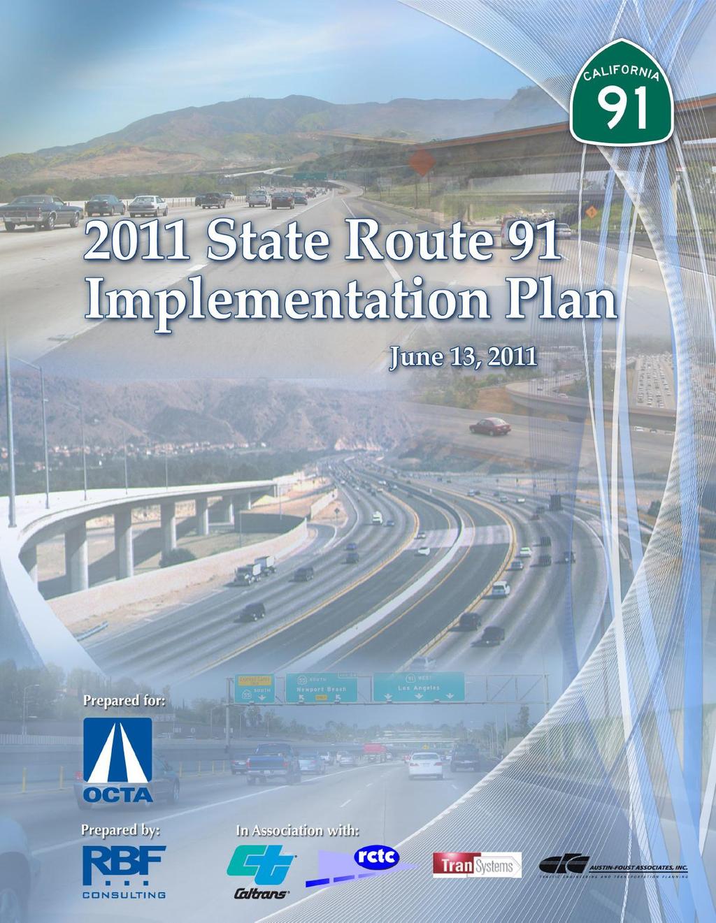
2 Table of Contents TABLE OF CONTENTS... I SECTION 1: 2011 STATUS REPORT AND UPDATE... 1 SECTION 2: IMPLEMENTATION PLAN... 8 BY YEAR BY YEAR BY YEAR SECTION 3: COMPLETED PROJECT EXHIBITS SECTION 4: REFERENCES SR-91 IMPLEMENTATION PLAN i
3 SECTION 1: 2011 Status Report and Update INTRODUCTION Previous law authorized the California Department of Transportation (Caltrans) to enter into franchise agreements with private companies to construct and operate four demonstration toll road projects in California. This resulted in the development of the 91 Express Lanes facility in Orange County. The four-lane, 10-mile toll road runs along the median of the Riverside Freeway (State Route 91) in northeast Orange County between the Orange/Riverside County Line and the Costa Mesa Freeway (State Route 55). Since the 91 Express Lanes carried its first vehicle on December 27, 1995, the facility has saved users tens of millions of hours of commuting time. While the 91 Express Lanes facility has improved travel time along the State Route 91 (SR-91) corridor, provisions in the franchise agreement between Caltrans and the private franchisee, the California Private Transportation Company (CPTC), prohibited Caltrans and county transportation agencies from adding transportation capacity or operational improvements to the SR-91 corridor from the Ontario Freeway (Interstate 15) in Riverside County to the Orange/Los Angeles Counties border through the year Consequently, the public agencies were barred from adding new lanes, improving interchanges, and adding other improvements to decrease congestion on the SR-91 freeway. Recognizing the need to eliminate the non-compete provision of the franchise agreement, Governor Gray Davis signed Assembly Bill 1010 (Lou Correa) (AB 1010) into law in September 2002, paving the way for muchneeded congestion relief for thousands of drivers who use SR-91 to travel between Riverside and Orange Counties each day. The bill allowed the Orange County Transportation Authority (OCTA) to purchase the 91 Express Lanes franchise and eliminate the existing clause that prohibited any capacity-enhancing improvements from being made to SR-91 until the year The purchase agreement for the 91 Express Lanes was completed in January 2003, placing the road in public hands at a cost of $207.5 million. With the elimination of the non-compete provision through AB 1010 and the subsequent 91 Express Lanes purchase by the OCTA, Orange County and Riverside County public officials and Caltrans Districts 8 and 12 have been coordinating improvement plans for SR-91. Senate Bill 1316 (Lou Correa) (SB 1316) was signed into law in August 2008 as an update to the provisions of AB SB 1316 authorizes OCTA to transfer its rights and interests in the Riverside County portion of SR-91 toll lanes by assigning them to the Riverside County Transportation Commission (RCTC), and authorizes RCTC to impose tolls for 50 years. SB 1316 also requires OCTA, in consultation with Caltrans and RCTC, to annually issue a plan and a proposed completion schedule for SR-91 improvements from State Route 57 (SR-57) to Interstate 15 (I-15). The previous SR-91 Implementation Plan included a westerly project limit of State Route 55 (SR-55). This plan establishes a program of projects eligible for funding by the use of potential excess toll revenue and other funds. This 2011 SR-91 Implementation Plan (Plan) is the result of the requirement to provide the State Legislature with an annual Implementation Plan for SR-91 improvements and builds on the 2010 report, which was a major update of the previous annual Implementation Plans. This year s update includes projects identified in the Riverside County Orange County Major Investment Study (MIS) as well as other project development efforts and funding programs such as the RCTC 10-Year Western County Highway Delivery Plan that outlines a number of projects such as the extension of High Occupancy Toll (HOT) Lanes from the Orange/Riverside County Line to I-15, the California Transportation Commission (CTC) Corridor Mobility Improvement Account (CMIA) that provides a funding source for transportation projects, the extension of the Measure A program that provides funding for transportation projects in Riverside County, and the Renewed Measure M program that provides funding for transportation projects in Orange County. The 2011 Plan includes an overview, identification of issues and needs, time frames for project packages to improve mobility on 2011 SR-91 IMPLEMENTATION PLAN 1
4 SR-91, and are listed based on a logical sequence for implementation. Project descriptions include conceptual lane diagrams (as appropriate), cost estimates (in 2011 dollars, or as noted), and discussion of key considerations that need to be addressed in the planning and development of each project. This plan will provide OCTA, RCTC, and Caltrans with a framework to implement SR-91 and other related improvements. Future annual plan updates will continue to refine the scope, cost, and schedule of each project included in this version of the plan. SR-91 CORRIDOR CONDITIONS Project Limits The project study limits encompass the segment of SR-91 from west of the junction of SR-57 and SR-91 in the City of Anaheim in Orange County, to east of the junction of SR-91 and I-15 in the City of Corona in Riverside County. The freeway segment is approximately 20.3 miles long, and includes approximately 12.7 miles within Orange County and approximately 7.6 miles within Riverside County. Traffic Conditions Summary A review of traffic conditions in the Corridor indicates that the existing carrying capacity of the facility is inadequate to accommodate current and future peak demand volumes, and that Level of Service (LOS) F prevails in the peak direction during the entire peak period, where LOS F is defined as the worst freeway operating condition and is defined as a density of more than 45 passenger cars/lane/mile. The results also indicate that there are several physical constraints that generate unacceptable traffic queues. The following list summarizes the deficiencies identified along the SR-91 Corridor: Heavy traffic volumes from I-15 (North and South) converge with SR-91. The weaving and merging condition is complicated by the close proximity of the Westbound (WB) Main Street off-ramp. High demand from several on-ramps within the eastern segment exacerbates traffic conditions during rush hours. High traffic volumes from Gypsum Canyon Road and Santa Ana Canyon Road contribute to congestion on the mainline. The Eastern Transportation Corridor (State Route 241) merges with SR-91 causing additional congestion in the EB direction. One of the two EB lanes from State Route 241 (SR-241) is dropped just east of the merge to State Route 91 (SR-91). Heavy traffic reentering the freeway merges at slow speeds from existing WB and EB truck scales, impacting the general-purpose lanes. SR-55 merges with SR-91. An EB lane on SR-91 is dropped at Lakeview Avenue and a second EB lane is dropped at Imperial Highway creating a severe merge condition. WB SR-91 drops a GP lane and a 91 Express Lane to SB SR-55, which contributes to mainline congestion. This drop also occurs on the left-hand side of SR-91 as opposed to the typical right-hand exit. High demand from Weir Canyon Road, Imperial Highway and Lakeview Avenue. WB traffic entering SR-91 at Lakeview Avenue weaving through three lanes from WB SR-91 to southbound (SB) SR-55 contributes to mainline congestion. PROJECT SUMMARY Many of the projects identified in this 2011 Plan are based on the MIS that was completed in January The projects are presented based on potential implementation schedules and priorities established in the MIS as well as through subsequent project development. Table 1 summarizes the various projects in the 2011 Plan, and they are outlined below by implementation schedule (see Section 2 for detailed project summaries): The first set of projects is anticipated to be completed by 2016 and include six improvements at a total cost of approximately $1.57 billion. The projects include the Metrolink short-term expansion plan; new travel lanes between SR-55 and SR-241; interchange improvements at SR-71/SR-91; a new WB lane at Tustin Avenue; the Initial SR-91 Corridor Improvement Project (CIP) that will widen SR-91 by one GP lane in each direction east of the County Line, add collector-distributor (CD) roads and direct south connectors at I-15/SR-91, and extend the 91 Express Lanes to I-15, and provide system/local interchange improvements; and Express Bus improvements. These projects are in the process of 2011 SR-91 IMPLEMENTATION PLAN 2
5 final design, construction, or procurement and implementation, as noted in the project summaries. Some of these projects may become components of 2035 projects. Three projects for implementation by 2025 include a SR-241/SR-91 Express Lanes connector, a significant expansion of Metrolink service, and station improvements and SR-91 widening improvements between SR-57 and SR-55. OCTA, RCTC, and Caltrans have initiated preliminary planning activities for these projects to ensure readiness when local, state, or federal funding becomes available. Preliminary engineering has been initiated for the highway improvement projects. Consequently, there may be opportunities to advance these projects if additional funding is made available. Projects for implementation by 2025 would cost up to approximately $940 million. Projects for 2035 implementation focus on longerlead time projects and include: a potential new interchange or overcrossing at Fairmont Boulevard; the Ultimate CIP that widens SR-91 by one GP lane in each direction from SR-241 to SR-71, I-15/SR-91 Direct North Connector, extension of Express Lanes on I-15 and SR-91 improvements east of I-15; an elevated 4-lane facility (MIS Corridor A) from SR-241 to I-15; Irvine-Corona Expressway (ICE) 4-lane facility from SR-241/SR-133 to I-15/Cajalco Road (formerly known as MIS Corridor B); and the Anaheim to Ontario International Airport High Speed Rail. The Fairmont Boulevard interchange project and the other four, multi-billion dollar potential projects require a significant amount of planning, design, and future policy and public input. In some cases, these projects may include previous projects as project components, such that all projects may not be implemented within this project summary. Traffic Analysis For the 2011 Plan, the traffic analysis for major SR-91 capacity projects has been updated from the 2010 Plan. This analysis used the latest freeway operations software Project No. Table 1 SR-91 Implementation Plan Projects Project Summary (Implementation Year) By Year 2016 Cost ($M) 1 Metrolink Short-Term Expansion Plan (2013) Widen SR-91 between SR-55 and SR-241 by Adding a th GP Lane in Each Direction (2013) 3 SR-71/SR-91 Interchange Improvements (2015) SR-91 WB Lane at Tustin Avenue (2015) Initial CIP: Widen SR-91 by One GP Lane in Each 1,300 Direction East of County Line, CD Roads and I-15/SR-91 Direct South Connector, Extension of Express Lanes to I-15 and System/Local Interchange Improvements (2016) 6 Express Bus Improvements Orange County to Riverside 9.5 County (2016) SUBTOTAL 1,574 By Year SR-241/SR-91 Express Lanes Connector (2017) Metrolink Service and Station Improvements (2020) SR-91 between SR-57 and SR-55 (2025) 425 SUBTOTAL 940 By Year Fairmont Boulevard Improvements (Post-2025) Ultimate CIP: Widen SR-91 by One GP Lane in Each Direction from SR-241 to SR-71, I-15/SR-91 Direct North Connector, Extension of Express Lanes on I-15 and SR- 91 Improvements East of I-15 (Post-2025) TBD 12 Elevated 4-Lane Facility (MIS Corridor A) from SR-241 to I-15 (TBD) 2, Irvine-Corona Expressway (ICE) 4-Lane Facility from 8,855 SR-241/SR-133 to I-15/Cajalco Road (TBD) 14 Anaheim to Ontario International Airport High Speed Rail TBD (Post-2030) SUBTOTAL 11,650+ model available from UC Berkeley and traffic data calibrated to reflect new traffic patterns since the 2010 Plan. This freeway operations model provides a better depiction of actual travel delays experienced by motorists compared to traditional travel demand models. The model can be used to analyze freeway bottlenecks sometimes neglected in traditional travel demand models. This approach is especially important given high SR-91 traffic volumes and the potential for relatively few vehicles to significantly slow down traffic. For example, a minor freeway merging area can cause many vehicles to slow, cascading delay through the traffic stream, and suddenly both speed and volume rapidly decrease for major segments of the freeway SR-91 IMPLEMENTATION PLAN 3
6 The operations analysis quantified travel time savings for WB morning and EB afternoon conditions for the following major capacity enhancing projects: New WB/EB lanes from SR-55 to SR-241 by 2013 (Project 2). New WB/EB lanes from SR-71 to I-15 by 2016 (Initial CIP, Project 5). SR-241/SR-91 Express Lanes connector with lanes to Coal Canyon on SR-91 by 2017 (Project 7). EB lane between SR-57 and SR-55 by 2023 (Project 9). New WB/EB lanes, various segments, from SR-241 to I-15 by Post-2025 (Ultimate CIP, Project 11). New capacity provided by Corridor A and Irvine-Corona Expressway (ICE) by 2035 (Projects 12 and 13). The WB morning traffic analysis results indicate that the year 2016 forecasts, bottlenecks are shown at the Orange-Riverside County line and at the SR-55 interchange. A minor bottleneck is shown at the SR-241. The main bottlenecks in Riverside County have decreased because of the completion of proposed projects, though some congestion is still forecasted. In the year 2025 forecast, WB bottlenecks are at Main Street, the Orange- Riverside County Line, at the SR-241 interchange, and at the SR-55 interchange. Assuming Corridors A and ICE are not constructed by the year 2035, bottlenecks appear at Main Street, just east of the SR-71 interchange, at the Orange-Riverside County Line, at the SR-241 interchange, and at the SR-55 interchange. For the year 2035, the construction of Corridors A and ICE is forecast to notably improve WB operations along the SR-91 freeway. A bottleneck is shown at the SR-55 interchange. main bottlenecks and queuing in Riverside County have largely decreased because of the completion of proposed projects, though some congestion is still forecasted. It is possible for this congestion to develop into new bottlenecks due to future growth of traffic volumes. In the year 2025 forecast, EB bottlenecks are still shown west of the SR-55 and at the Orange-Riverside County Line. Due to traffic growth, a bottleneck begins to reappear at Lincoln Avenue. Assuming Corridors A and ICE are not constructed by the year 2035, bottlenecks appear at SR- 55, at the SR-241 interchange, and at Lincoln Avenue. For the year 2035, the construction of Corridors A and ICE is forecast to notably improve EB operations along the SR- 91 freeway. A bottleneck is shown before the SR-55, and some minor congestion is shown at the SR-241 and in short stretches within Riverside County. The current design of the SR-55/SR-91 interchange limits the ability to move traffic into north and central Orange County via SR-55, and significant future vehicle delays may result without major interchange improvements and downstream capacity increases or diversion to other corridors. The introduction of Corridors A and ICE by 2035 offers the potential capacity to manage future SR-91 traffic demand in both directions. While both of these corridors are still concepts, they provide substantial relief to EB and WB traffic congestion in the future. Further feasibility studies will determine if one or both concepts move forward in the project development process. The charts below describe the travel time benefits by year including these various project concepts. The EB evening traffic analysis indicates that the year 2016 forecasts, bottlenecks are shown shortly before the SR-55 and at the Orange-Riverside County line. The 2011 SR-91 IMPLEMENTATION PLAN 4


7 Figure 1-1 Mainline Westbound SR-91 from I-15 to SR-57 A.M. Peak Hour Average Travel Time Figure 1-2 Mainline Eastbound SR-91 from SR-57 to I-15 P.M. Peak Hour Average Travel Time PROJECT ACCOMPLISHMENTS Much progress has been made since the initial 2003 SR-91 Implementation Plan was approved. The 2011 Plan includes select completed project exhibits as a historical reference, see Section 3. Recently Completed Construction/Improvement Projects As of June 2011, the following physical improvements have been constructed/implemented: Repave and seal pavement surfaces, restripe, and replace raised channelizers on the 91 Express Lanes SR-91 IMPLEMENTATION PLAN 5
8 EB SR-91 restripe and median barrier reconstruction project that removed the CHP enforcement area and extended the EB auxiliary lane from SR-71 to the Serfas Club Drive off-ramp. WB auxiliary lane extension between the County Line and SR-241. This project eliminated the lane drop at the 91 Express Lanes and extended the existing auxiliary lane from the County Line to SR-241 in the westbound direction. This improvement minimized the traffic delays at the lane drop area, resulting in improved vehicle progression. WB restripe project extended the auxiliary lane between SR-71 and the County Line resulting in a new continuous auxiliary lane between SR-71 & SR-241. Express Bus improvements are implemented for the Galleria at Tyler to South Coast Metro route. Safety Improvements at the Truck Scales. Existing shoulders were improved, lanes were re-striped, illumination improved, and signage was modified into and out of the EB facilities. Green River Road overcrossing replacement (See Section 3). Metrolink parking structure at the North Main Street Corona Metrolink Station (See Section 3). EB SR-91 lane addition from SR-241 to SR-71 (See Section 3). These projects provide enhanced freeway capacity and improved mobility for one of the most congested segments of the freeway. The recently completed EB SR-91 lane addition project from SR-241 to SR-71 (See Section 3) has greatly enhanced highway operations with the addition of EB capacity from SR-241 to SR-71. This accounts for some of the improvement in existing EB p.m. peak hour travel time from approximately 70+ minutes in 2010 to approximately 50 minutes as shown in Figure 1-2. In addition, there are two projects that are currently in the project development or environmental phase that have a direct impact upon SR-91 widening projects. The first is the $2 billion U.S. Army Corps of Engineers (Corps) Santa Ana River Mainstem (SARM) improvement project that provides flood protection from the recently improved Prado Dam (near SR-71) to the Pacific Ocean. As part of the Corps project, existing riverbanks are being improved due to the increased capacity of the Prado Dam outlet works, which can now release up to 30,000 cubic feet per second (cfs) compared to the previous facility capacity of 10,000 cfs. The only remaining segment of the Santa Ana River to be improved is Reach 9 Phase 2A, which includes areas along SR-91 from just east of the Coal Canyon Wildlife Corridor Crossing to SR-71. SR-91 project design teams have coordinated with the Corps, Caltrans, and other federal, regional, and local agencies in order to accommodate future SR-91 improvements by the Corps bank protection project within Reach 9 by relocating the Santa Ana River. This will greatly enhance the ability of Caltrans and other regional transportation agencies to implement many of the SR-91 improvement projects listed herein. The Corps SARM Reach 9 improvements are under construction with American Recovery and Reinvestment Act (ARRA) stimulus funding and construction is anticipated to start in November 2011 be completed by June The other project with a direct impact to SR-91 is the $100 million Santa Ana Regional Interceptor (SARI) sewer trunk line relocation. The existing SARI line is within the Santa Ana River floodplain and is in jeopardy of failure due to scour from the potential increased flood releases by the aforementioned Corps project. In order to relocate the proposed 48-inch diameter SARI line outside of the floodplain, which is immediately adjacent to SR-91, highway R/W was relinquished to the Orange County Flood Control District (OCFCD) for location of the SARI line. SR-91 project teams have coordinated with the OCFCD, Caltrans, and other federal, regional, and local agencies in order to accommodate planned SR-91 improvements within the remaining State R/W subsequent to relinquishment. This project completed the preliminary engineering phase and is scheduled to complete construction by summer Recently Completed PSR s and other Reports In addition to the physical improvements in the corridor, there are several reports and PSR s that are completed, in draft form, or anticipated to be approved that identify improvements that will provide improved mobility. The reports and PSR s include (also see Section 4): MIS Final Project Report: Locally Preferred Strategy Report (January 2006). Project Study Report On Route 91 from State Route 241 in Orange County to Pierce Street in the City of Riverside in Riverside County (October 2006). Renewed Measure M Transportation Investment Plan (November 2006) SR-91 IMPLEMENTATION PLAN 6
9 Project Study Report for SR-71/SR-91 Interchange (December 2006). RCTC 10-Year Western County Highway Delivery Plan (December 2006). 91 Express Lanes Extension and State Route 241 Connector Feasibility Study (March 2009). Plans, Specifications and Estimates (PS&E) for Eastbound SR-91 lane addition from SR-241 to SR-71 (May 2009). SR-91 Feasibility Study from SR-57 to SR-55 (June 2009). SR-91/Fairmont Boulevard Feasibility Study (December 2009). Corridor System Management Plan (CSMP) Orange County SR-91 Corridor Final Report (August 2010). PS&E On State Route 91 Between the SR-91/SR-55 Interchange and the SR-91/SR-241 Interchange in Orange County (April 2011). Renewed Measure M Early Action Plan, approved August 2007 and subsequently renamed as the Capital Action Plan (April 2011). Updates from the 2010 SR-91 Implementation Plan In addition, to the improvements and progress noted above, the following items that were included in the 2010 SR-91 Implementation Plan have been modified or dropped for the 2011 Plan update: The EB lane addition project improvements from SR-241 to SR-71 have been completed and the project is moved to Section 3 of the Plan. The 2013 horizon year has been updated to 2016 to capture projects to be implemented by The 2023 horizon year has been updated to 2025 to capture projects to be implemented by The Post-2025/2030 horizon year has been updated to 2035 to capture projects to be implemented by Various project costs and schedules have been updated from the 2010 Plan based on continued project development SR-91 IMPLEMENTATION PLAN 7

10 SECTION 2: OVERVIEW The 2011 Plan describes projects, implementation schedules, key consideration, benefits, and costs (in 2011 dollars, or as noted) for major projects through Most of the projects identified in this Implementation Plan are based on the MIS that was completed in January The projects are presented based on potential implementation schedules and priorities established in the MIS. The schedules for implementation of the packages of projects include 2016, 2025, and The 2016 projects are capable of being implemented through the project development process with minimal to moderate environmental constraints. Some of the longer-range projects for 2025 and 2035 require more significant planning and environmental assessment prior to design. Each of the project improvements includes an estimate of project schedules. It is important to note that implementing various time saving measures, such as design-build or contractor incentives for early completion, may potentially reduce project schedules. The implementation phases are defined as follows: Conceptual Engineering = Pre-Project Study Report (Pre-PSR) Conceptual planning and Implementation Plan engineering for project scoping and feasibility prior to initiating the PSR phase. Preliminary Engineering = Project Study Report (PSR) Conceptual planning and engineering phase that allows for programming of funds. Environmental = Project Report/Environmental Documentation (PR/ED) The detailed concept design that provides environmental clearance for the project and programs for final design and right of way acquisition. The duration for this phase is typically 2-3 years. Design = Plans, Specifications and Estimates (PS&E) Provide detailed design to contractors for construction bidding and implementation. Construction = The project has completed construction and will provide congestion relief to motorists. The intent of these implementation plan project packages is to provide an action list for OCTA, RCTC and Caltrans to pursue in the project development process or for initiating further studies. Figure 2-1 SR-91 Project Study Area from SR-57 to I SR-91 IMPLEMENTATION PLAN 8

11 By Year 2016 The first set of projects will be completed by 2016 and includes six (6) improvements at a total cost of approximately $1.57 billion (in 2011 dollars, or as noted). One of the projects is the interchange improvements at SR-71/SR-91. The Initial SR-91 Corridor Improvement Project (CIP) will widen SR-91 by one general purpose (GP) lane in each direction east of the County Line, collector-distributor (CD) roads and direct south connectors at I-15/SR-91, extension of 91 Express Lanes to I-15, and system interchange improvements. The other project that will be completed in this time frame includes the WB lane at Tustin Avenue. Some of these projects may become components of 2035 projects. Project No. Project Summary (Implementation Year) Cost ($M) 1 Metrolink Short-Term Expansion Plan (2013) Widen SR-91 between SR-55 and SR-241 by Adding a 5 th GP Lane in Each Direction (2013) SR-71/SR-91 Interchange Improvements (2015) SR-91 WB Lane at Tustin Avenue (2015) Initial CIP: Widen SR-91 by One GP Lane in Each Direction East of County Line, CD Roads and I-15/SR-91 1,300 Direct South Connector, Extension of Express Lanes to I-15 and System/Local Interchange Improvements (2016) 6 Express Bus Improvements Orange County to Riverside County (2016) 9.5 SUBTOTAL 1,574 Figure 2-3 Summary of Projects for Implementation By SR-91 IMPLEMENTATION PLAN 9

12 2011 SR-91 IMPLEMENTATION PLAN 10

13 2011 SR-91 IMPLEMENTATION PLAN 11

14 2011 SR-91 IMPLEMENTATION PLAN 12

15 2011 SR-91 IMPLEMENTATION PLAN 13

16 2011 SR-91 IMPLEMENTATION PLAN 14

17 2011 SR-91 IMPLEMENTATION PLAN 15

18 By Year 2025 Projects for implementation by 2025 include a SR-241/SR-91 Express Lanes direct connector, a significant expansion of Metrolink service and station improvements and SR-91 improvements between SR-57 and SR-55. OCTA, RCTC, and Caltrans have initiated preliminary planning activities for these projects to ensure readiness when local, state, or federal funding becomes available. Consequently, there may be opportunities to advance these projects if additional funding is made available. Projects for implementation by 2025 are expected to cost up to approximately $940 million (in 2011 dollars, or as noted). Project No. Project Summary (Implementation Year) Cost ($M) 7 SR-241/SR-91 Express Lanes Connector (2017) Metrolink Service and Station Improvements (2020) SR-91 between SR-57 and SR-55 (2025) 425 SUBTOTAL 940 Figure 2-4 Summary of Projects for Implementation By SR-91 IMPLEMENTATION PLAN 16

19 2011 SR-91 IMPLEMENTATION PLAN 17

20 2011 SR-91 IMPLEMENTATION PLAN 18
21 2011 SR-91 IMPLEMENTATION PLAN 19

22 By Year 2035 Projects for implementation by 2035 focus on longer-lead time projects. This multi-billion dollar program includes: a potential new interchange or overcrossing at Fairmont Boulevard; the Ultimate CIP that widens SR-91 by one GP lane in each direction from SR-241 to SR-71, I-15/SR-91 Direct North Connector, extension of Express Lanes on I-15 and SR-91 improvements east of I-15; an elevated 4-lane facility (MIS Corridor A) from SR-241 to I-15; Irvine-Corona Expressway (ICE) 4-lane facility from SR-241/SR-133 to I-15/Cajalco Road (formerly known as MIS Corridor B); and the Anaheim to Ontario International Airport High Speed Rail. The $77 million dollar interchange project and the other four, multi-billion dollar potential projects include significant environmental constraints and right of way requirements in addition to requiring a significant amount of planning, design, and future policy and public input. The Corridor A project may incorporate projects being developed in the earlier programs as project components. Project No. Project Summary (Implementation Year) Cost ($M) 10 Fairmont Boulevard Improvements (Post-2025) Ultimate CIP: Widen SR-91 by One GP Lane in Each Direction from SR-241 to SR-71, I-15/SR-91 Direct North Connector, Extension of Express Lanes on I-15 and SR-91 Improvements East of I-15 (Post-2025) TBD 12 Elevated 4-Lane Facility (MIS Corridor A) from SR-241 to I-15 (TBD) 2, Irvine-Corona Expressway (ICE) 4-Lane Facility from SR-241/SR-133 to I-15/Cajalco Road (TBD) 8, Anaheim to Ontario International Airport High Speed Rail (Post-2030) TBD SUBTOTAL 11,650+ Figure 2-5 Summary of Projects for Implementation by SR-91 IMPLEMENTATION PLAN 20

23 2011 SR-91 IMPLEMENTATION PLAN 21

24 2011 SR-91 Implementation Plan 22

25 2011 SR-91 Implementation Plan 23

26 2011 SR-91 Implementation Plan 24

27 2011 SR-91 Implementation Plan 25
28 SECTION 3: COMPLETED PROJECT EXHIBITS The following exhibits represent completed projects from previous Plans and are intended to be used as a reference to illustrate the progress made since the inception of the Plan. Note, some projects listed in the Plan as completed (see Section 1, Project Accomplishments) are not included herein since there was no exhibit created for use with prior Plans (such as for restriping projects, various safety enhancements, minor operational improvements, etc.) SR-91 Implementation Plan 26
29 2011 SR-91 Implementation Plan 27

30 2011 SR-91 Implementation Plan 28

31 2011 SR-91 Implementation Plan 29
32 SECTION 4: REFERENCES The following documents and resources were used in the development of the 2011 Plan. Data was provided by OCTA, RCTC, Caltrans Districts 8 and 12, Transportation Corridor Agencies (TCA), and other agencies. PS&E On State Route 91 Between the SR-91/SR-55 Interchange and the SR-91/SR-241 Interchange in Orange County (April 2011) Corridor System Management Plan (CSMP) Orange County SR-91 Corridor Final Report, August 2010 Project Study Report/Project Report Right of Way Relinquishment on Westbound State Route 91 Between Weir Canyon Road and Coal Canyon, May 2010 SR-91/Fairmont Boulevard Feasibility Study, December 2009 SR-91 Feasibility Study from SR-57 to SR-55, December 2009 Feasibility Evaluation Report for Irvine-Corona Expressway Tunnels, December 2009 Renewed Measure M Strategic Plan, June 2009 Plans, Specifications and Estimates (PS&E) for Eastbound SR-91 lane addition from SR-241 to SR-71, May 2009 Project Study Report On State Route 91 Between the SR-91/SR-55 Interchange and the SR-91/SR-241 Interchange in Orange County, April Express Lanes Extension and State Route 241 Connector Feasibility Study, March 2009 Project Study Report/Project Report On Gypsum Canyon Road Between the Gypsum Canyon Road/SR-91 Westbound Off- Ramp (PM 16.4) and the Gypsum Canyon Road/SR-91 Eastbound Direct On-Ramp (PM 16.4), June 2008 California Transportation Commission, Corridor Mobility Improvement Account (CMIA), February 2007 Project Study Report On Route 91 from Green River Road to Serfas Club Drive in the City of Corona in Riverside County, December 2006 Orange County Transportation Authority Renewed Measure M Transportation Investment Plan, November 2006 Project Study Report On Route 91 from State Route 241 in Orange County to Pierce Street in the City of Riverside in Riverside County, October 2006 Riverside County-Orange County Major Investment Study (MIS) Final Project Report: Locally Preferred Strategy Report, January 2006 Preliminary design plans for Eastbound Lane Addition from SR-241 to SR-71, 2006 Project Study Report Westbound State Route 91 Auxiliary Lane from the NB SR-55/WB SR-91 Connector to the Tustin Avenue Interchange, July 2004 California Nevada Interstate Maglev Project Report, Anaheim-Ontario Segment; California-Nevada Super Speed Train Commission, American Magline Group, August 2003 Route Concept Reports for SR-91, Caltrans Districts 8 and 12 Various Preliminary Drawings and Cross Sections, Caltrans Districts 8 and SR-91 Implementation Plan 30
STATE ROUTE 91 (SR-91) IMPLEMENTATION PLAN KEEPING MOTORISTS MOVING ON THE SR-91 CORRIDOR
 IMPLEMENTATION PLAN KEEPING MOTORISTS MOVING ON THE SR-91 CORRIDOR") STATEROUTE91 Dr af t I MPLEMENTATI ON PLAN 201 8 Pr epar edby: STATE ROUTE 91 (SR-91) IMPLEMENTATION PLAN KEEPING MOTORISTS MOVING ON THE SR-91 CORRIDOR Every year since 2002, OCTA, RCTC, and stakeholders
STATEROUTE91 Dr af t I MPLEMENTATI ON PLAN 201 8 Pr epar edby: STATE ROUTE 91 (SR-91) IMPLEMENTATION PLAN KEEPING MOTORISTS MOVING ON THE SR-91 CORRIDOR Every year since 2002, OCTA, RCTC, and stakeholders
7.0 FREEWAYS CONGESTION HOT SPOT PROBLEM & IMPROVEMENT PROJECT ANALYSIS & DEFINITION
 7.0 FREEWAYS CONGESTION HOT SPOT PROBLEM & IMPROVEMENT PROJECT ANALYSIS & DEFINITION 7.1 INTRODUCTION & METHODOLOGY FEASIBILITY REPORT Congestion hot spot problem locations have been assessed using the
Washington DC Section of ITE Project Briefing
 Washington DC Section of ITE Project Briefing November 5, 2015 Renée Hamilton, VDOT, Deputy District Administrator I-66 Outside the Beltway Improvement Area Project Location Virginia 2 Purpose and Need
MoPac South: Impact on Cesar Chavez Street and the Downtown Network
 MoPac South: Impact on Cesar Chavez Street and the Downtown Network Prepared by: The University of Texas at Austin Center for Transportation Research Prepared for: Central Texas Regional Mobility Authority
TABLE OF CONTENTS FEASIBILITY REPORT
 TABLE OF CONTENTS 1.0 Executive Summary... 1 2.0 Introduction... 6 2.1 BACKGROUND... 6 2.2 PURPOSE OF STUDY... 7 2.3 STUDY AREA... 8 2.4 STUDY PROCESS / STAKEHOLDER INVOLVEMENT... 8 3.0 Summary of Freeways
4. ENVIRONMENTAL IMPACT ANALYSIS 9. TRANSPORTATION AND TRAFFIC
 4. ENVIRONMENTAL IMPACT ANALYSIS 9. TRANSPORTATION AND TRAFFIC 4.9.1 INTRODUCTION The following section addresses the Proposed Project s impact on transportation and traffic based on the Traffic Study
I-395 Express Lanes Northern Extension Project Crystal City Civic Association September 21, 2016
 I-395 Express Lanes Northern Extension Project Crystal City Civic Association September 21, 2016 Mike Snare, PE, Project Manager Virginia Department of Transportation GEC Michelle Holland, Megaprojects
Highway 49, Highway 351 and Highway 91 Improvements Feasibility Study Craighead County
 Highway 49, Highway 351 and Highway 91 Improvements Feasibility Study Craighead County Executive Summary March 2015 Highway 49, Highway 351 and Highway 91 Improvements Feasibility Study Craighead County
Detailed Description of Work
 Trail Items I-580 Eastbound Shoulder Running Lane and Bi-Directional Bike Lane Project Bay Area Toll Authority Task Order Contract with HNTB Corporation Effective May 12, 2014 Description of Work: Implement
Highway 217 Corridor Study. Phase I Overview Report
 Highway 217 Corridor Study Phase I Overview Report November 3, 24 BACKGROUND AND OVERVIEW Study purpose The Highway 217 Corridor Study is developing multi-modal transportation solutions for traffic problems
3.0 PROJECT DESCRIPTION
 The following section of the Draft EIR contains a description of the proposed Elk Grove Boulevard/SR 99 Interchange Modification project, consistent with the requirements of CEQA Guidelines Section 15124.
Northwest Corridor Project Interchange Modification, Interchange Justification and System Analysis Report Reassessment (Phase I)
") Northwest Corridor Project Interchange Modification, Interchange Justification and System Analysis Report Reassessment (Phase I) Introduction The Georgia Department of Transportation (GDOT) prepared a
Northwest Corridor Project Interchange Modification, Interchange Justification and System Analysis Report Reassessment (Phase I) Introduction The Georgia Department of Transportation (GDOT) prepared a
Transportation Corridor Agencies t..
 Proposed State Route 241/91 Tolled Express Lanes Connector Draft Supplemental Environmental Impact Report/ Environmental Impact Statement Public Hearing November 29, 2016 Transportation Corridor Agencies
Presented by: Aziz Elattar Deputy District Director Planning, Public Transportation and Local Assistance October 4, 2013
 Presented by: Aziz Elattar Deputy District Director Planning, Public Transportation and Local Assistance October 4, 2013 2 Project Study Report Project Development Support (PSR-PDS) 1. Purpose: Gain approval
DUNBOW ROAD FUNCTIONAL PLANNING
 DUNBOW ROAD FUNCTIONAL PLANNING Final Report August 3, 216 #31, 316 5th Avenue NE Calgary, AB T2A 6K4 Phone: 43.273.91 Fax: 43.273.344 wattconsultinggroup.com Dunbow Road Functional Planning Final Report
Project Budget and Schedule Status
 Program Management Project Budget and Schedule Status Highway Program Planning & Programming Committee February 20, 2013 Highway Program Project Schedules Project 2010 2011 2012 2013 2015 2016 2017 2018
Harrah s Station Square Casino
 Transportation Analysis Harrah s Station Square Casino Pittsburgh, Pennsylvania Submitted To: City of Pittsburgh and Pennsylvania Gaming Control Board Prepared By: DKS Associates GAI Consultants December
EXECUTIVE SUMMARY... vii 1 STUDY OVERVIEW Study Scope Study Area Study Objectives
 Contents EXECUTIVE SUMMARY... vii 1 STUDY OVERVIEW... 1-1 1.1 Study Scope... 1-1 1.2 Study Area... 1-1 1.3 Study Objectives... 1-3 2 EXISTING CONDITIONS... 2-1 2.1 Existing Freeway Conditions... 2-4 2.1.1
Stakeholder Focus Group Meeting #3 January 9, 2013 Cattlemens, 2000 Taylor Road, Roseville
 PRESENT Stakeholder Focus Group Meeting #3 January 9, 2013 Cattlemens, 2000 Taylor Road, Roseville PROJECT TEAM REPRESENTATIVES Name Organization Celia McAdam Luke McNeel Caird Leo Heuston Judy Matsui
Los Altos Hills Town Council - June 18, 2015 Palo Alto City Council June 22, AGENDA ITEM #2.B Presentation
 Los Altos Hills Town Council - June 18, 2015 Palo Alto City Council June 22, 2015 AGENDA ITEM #2.B Presentation Previous Presentations Los Altos Hills Town Council in May 2014 and February 2015 Palo Alto
Chapter 4 Traffic Analysis
 Chapter 4 Traffic Analysis PURPOSE The traffic analysis component of the K-68 Corridor Management Plan incorporates information on the existing transportation network, such as traffic volumes and intersection
405 Express Lanes General Information & Frequently Asked Questions
 The questions and answers below provide current information on the project to improve Interstate 405 (I-405) in Orange County from State Route 73 to Interstate 605. Why are improvements needed on I-405?
I-105 Corridor Sustainability Study (CSS)
") I-105 Corridor Sustainability Study (CSS) Metro Streets and Freeways Subcommittee March 21, 2019 Gary Hamrick Cambridge Systematics, Inc. I-105 CSS Project History & Background Funded by Caltrans Sustainable
I-105 Corridor Sustainability Study (CSS) Metro Streets and Freeways Subcommittee March 21, 2019 Gary Hamrick Cambridge Systematics, Inc. I-105 CSS Project History & Background Funded by Caltrans Sustainable
Northbound San Jose Avenue & I-280 Off-Ramp Road Diet Pilot Project
 Project Overview Fed by a two-lane Interstate-280 (I-280) off-ramp, high vehicular volumes and speeds are longstanding issues along San Jose Avenue. Residents in the surrounding neighborhoods have expressed
I-395 Express Lanes Northern Extension Project Public Hearings
 I-395 Express Lanes Northern Extension Project Public Hearings Susan Shaw, PE, Megaprojects Director Virginia Department of Transportation Amanda Baxter, Special Projects Manager Virginia Department of
INTRODUCTION. The focus of this study is to reduce congestion and improve mobility for all modes of transportation. Figure ES-1 Study Corridor Map
 INTRODUCTION The I-280 Corridor Study is a highway planning study led by Santa Clara VTA, in partnership with the City of Cupertino and in coordination with other stakeholders in the study area. The study
I-264 CORRIDOR EVALUATION STUDY. September 7, 2016 Eric Stringfield VDOT Planning Director Chris Lawrence AECOM Senior Transportation Engineer
 I-264 CORRIDOR EVALUATION STUDY September 7, 2016 Eric Stringfield VDOT Planning Director Chris Lawrence AECOM Senior Transportation Engineer Study Overview Interchange Locations Study Context Follow-up
Subject: Solberg Avenue / I-229 Grade Separation: Traffic Analysis
 MEMORANDUM Transportation Bill Troe, AICP Jason Carbee, AICP 12120 Shamrock Plaza Suite 300 Omaha, NE 68154 (402) 334-8181 (402) 334-1984 (Fax) To: Project File Date: Subject: Solberg Avenue / I-229 Grade
Regional Transportation Needs Within Southeastern Wisconsin
 Regional Transportation Needs Within Southeastern Wisconsin #118274 May 24, 2006 1 Introduction The Southeastern Wisconsin Regional Planning Commission (SEWRPC) is the official areawide planning agency
I-395 Express Lanes Northern Extension Project Fairlington Citizens Association September 12, 2016
 I-395 Express Lanes Northern Extension Project Fairlington Citizens Association September 12, 2016 Susan Shaw, PE, Megaprojects Director, Virginia Department of Transportation Amanda Baxter, Special Projects
San Tomas Expressway
 Implementation Plan San Tomas Expressway Roads and Airports Department August 19, 2003 Implementation Plan San Tomas Expressway County of Santa Clara Roads and Airports Department 101 Skyport Drive San
SR 9/I-95 Interchange at 45 th Street PD&E Study Palm Beach County, Florida FPID No.: FAP No.: ETDM No.
 SR 9/I-95 Interchange at PD&E Study Palm Beach County, Florida FPID No.: 436519-1-22-01 FAP No.: 0951-682-1 ETDM No.: 14225 Palm Beach County MPO October 19, 2017 SR 9/I-95 Interchange at PD&E Study Presentation
Proposed Project I 35 from Denton to Cooke County Line
 Proposed Project I 35 from Denton to Cooke County Line The existing I 35 facility is four lanes from I 35E/I 35W to Farm to Market Road (FM) 3002. The purpose of the proposed project is to increase capacity
Operational Comparison of Transit Signal Priority Strategies
 Operational Comparison of Transit Signal Priority Strategies Revision Submitted on: November, 0 Author: Adriana Rodriguez, E.I Assistant Engineer Parsons Brinckerhoff 0 South Orange Avenue, Suite 00 Orlando,
I-395 Express Lanes Northern Extension Project Arlington County Board October 18, 2016
 I-395 Express Lanes Northern Extension Project Arlington County Board October 18, 2016 Susan Shaw, PE, Megaprojects Director Virginia Department of Transportation Amanda Baxter, Special Projects Manager
EXECUTIVE SUMMARY OF CALEDON TRANSPORTATION NEEDS STUDY
 EXECUTIVE SUMMARY OF CALEDON TRANSPORTATION NEEDS STUDY The Caledon Transportation Needs Study has been undertaken as a joint project by the Town of Caledon and the Region of Peel to determine the existing
Florida Department of Transportation District Four. I-95 at 6 th Avenue Interchange Improvements FDOT PM - Fernando Morales, PE
 1 Florida Department of Transportation District Four I-95 at 6 th Avenue Interchange Improvements FDOT PM - Fernando Morales, PE Presentation Outline Overview of Planning and Programming I-95 Interchange
Interstate Route 77 / US Route 62 / State Route 687 (Fulton Road) Transportation Improvement Project. Prepared September 6, 2017
 Transportation Improvement Project. Prepared September 6, 2017") EODOT Project: ODOT Project: STA-IR 77-.50; PID 00290 Interstate Route 77 / US Route 62 / State Route 687 (Fulton Road) Transportation Improvement Project Summary of Public Comments Received and Responses
EODOT Project: ODOT Project: STA-IR 77-.50; PID 00290 Interstate Route 77 / US Route 62 / State Route 687 (Fulton Road) Transportation Improvement Project Summary of Public Comments Received and Responses
METHODOLOGY. Signalized Intersection Average Control Delay (sec/veh)
") Chapter 5 Traffic Analysis 5.1 SUMMARY US /West 6 th Street assumes a unique role in the Lawrence Douglas County transportation system. This principal arterial street currently conveys commuter traffic
Chapter 5 Traffic Analysis 5.1 SUMMARY US /West 6 th Street assumes a unique role in the Lawrence Douglas County transportation system. This principal arterial street currently conveys commuter traffic
Freeway System Considerations
 Session 11 Jack Broz, PE, HR Green May 5-7, 2010 Freeway System Considerations Mainline Transit: Shoulder Operations, BRT, Stations HOV, HOT, UPA Interchanges Exit Ramps Entrance Ramps Bridges Local Crossings
JONESBORO HIGHWAY 63 HIGHWAY 18 CONNECTOR STUDY
 JONESBORO HIGHWAY 63 HIGHWAY 18 CONNECTOR STUDY Craighead County May 2007 JONESBORO HIGHWAY 63 HIGHWAY 18 CONNECTOR STUDY Craighead County May 2007 Prepared by Planning and Research Division Arkansas State
91 Express Lanes Model Update 2006 State Route 91 Implementation Plan. Gerald V. Nielsten May 18, 2007
 91 Express Lanes Model Update 2006 State Route 91 Implementation Plan Gerald V. Nielsten May 18, 2007 1 Vollmer Associates LLP is now Stantec Inc. Stantec Inc. completed the acquisition of Vollmer Associates
TECHNICAL MEMORANDUM
 TECHNICAL MEMORANDUM DATE: January 17, 2005 TO: Ted Idlof, URS FROM: Jeff Clark, Fehr & Peers RE: U.S. 50 Interchange Planning Study 1042-2011 This memorandum describes conceptual improvements for the
 TRAFFIC IMPACT STUDY CANYON HILLS PROJECT LOS ANGELES, CALIFORNIA INTRODUCTION This traffic analysis has been conducted to identify and evaluate the potential traffic impacts of the proposed Canyon Hills
Abrams Associates. Transportation Impact Analysis. City of Rocklin. Prepared for: David Mohlenbrok City of Rocklin 4081 Alvis Court Rocklin, CA 95677
 Transportation Impact Analysis Sierra College Boulevard Commercial Project City of Rocklin Prepared for: David Mohlenbrok City of Rocklin 081 Alvis Court Rocklin, CA 95677 Prepared by: 1875 Olympic Boulevard,
BOSTON REGION METROPOLITAN PLANNING ORGANIZATION MEMORANDUM. DATE June 2, 2011
 BOSTON METROPOLITAN PLANNING ORGANIZATION State Transportation Building Ten Park Plaza, Suite 2150 Boston, MA 02116-3968 Tel. (617) 973-7100 Fax (617) 973-8855 TTY (617) 973-7089 www.bostonmpo.org Jeffrey
# Southeastern Wisconsin Regional Freeway System Reconstruction Study and Preliminary Recommended Plan
 #70421 Southeastern Wisconsin Regional Freeway System Reconstruction Study and Preliminary Recommended Plan Public Information Meetings and Hearings May June 2002 1 Reason for Freeway System Study 270-mile
ROUTES 55 / 42 / 676 BUS RAPID TRANSIT LOCALLY PREFERRED ALTERNATIVE
 ROUTES 55 / 42 / 676 BUS RAPID TRANSIT LOCALLY PREFERRED ALTERNATIVE April, 2012 1 INTRODUCTION The need for transit service improvements in the Routes 42/55/676 corridor was identified during the Southern
Glenn Avenue Corridor Traffic Operational Evaluation
 Glenn Avenue Corridor Traffic Operational Evaluation PREPARED FOR: THE CITY OF AUBURN PREPARED BY: DECEMBER 2007 Glenn Avenue Corridor Study--Auburn, Alabama TABLE OF CONTENTS Introduction... 1 Background
Memorandum. Fund Allocation Fund Programming Policy/Legislation Plan/Study Capital Project Oversight/Delivery Budget/Finance Contract/Agreement Other:
 Memorandum Date: November 20, 2017 To: Transportation Authority Board From: Eric Cordoba Deputy Director Capital Projects Subject: 12/5/17 Board Meeting: San Francisco Freeway Corridor Management Study
David DiPierro, John Amberson. Steering Committee Meeting #4 Overview
 IBI GROUP 18401 Von Karman Avenue Suite 110 Irvine CA 92612 USA tel 949 833 5588 fax 949 833 5511 ibigroup.com Memorandum To/Attention Steering Committee Members Date February 17, 2016 From IBI Group Project
HIGHBURY AVENUE/HAMILTON ROAD INTERSECTION IMPROVEMENTS PUBLIC INFORMATION CENTRE 1 MAY 14, 2015
 HIGHBURY AVENUE/HAMILTON ROAD INTERSECTION IMPROVEMENTS Municipal Class Environmental Assessment PUBLIC INFORMATION CENTRE 1 MAY 14, 2015 ACCESSIBILITY Under the Accessibility Standards 2015 for Customer
PRELIMINARY DRAFT WADDLE ROAD / I-99 INTERCHANGE PROJECT ALTERNATIVE ANALYSIS FINAL TRAFFIC SUMMARY REPORT
 PRELIMINARY DRAFT WADDLE ROAD / I-99 INTERCHANGE PROJECT ALTERNATIVE ANALYSIS FINAL TRAFFIC SUMMARY REPORT Prepared by: In Association with: November 2013 EXECUTIVE SUMMARY Patton Township, in partnership
Congestion Management Report
 Congestion Management Report F.E. EVERETT TURNPIKE (NORTH), MERRIMACK Segment Length: 7.0 miles Daily Traffic Volumes: 60,000-69,000 Analysis Period: May 2015 Number of Traffic Signals: 0 Number of travel
City of Homewood Transportation Plan
 City of Homewood Transportation Plan Prepared for: City of Homewood, Alabama Prepared by: Skipper Consulting, Inc. May 2007 TABLE OF CONTENTS INTRODUCTION... 1 BACKGROUND INFORMATION... 1 EXISTING TRANSPORTATION
Managed Lanes. Steve Schilke, P.E. Major Projects Unit Head District 1. Illinois Traffic Engineering and Safety Conference October 2016
 Managed Lanes Steve Schilke, P.E. Major Projects Unit Head District 1 Illinois Traffic Engineering and Safety Conference October 2016 Agenda Managed Lanes Projects I-55 (Stevenson Expressway) Express Toll
STUDY PROCESS & SCHEDULE
 STUDY PROCESS & SCHEDULE Route Centennial Bridge Study KDOT Project No. -52 KA-3229-01 STUDY OVERVIEW STUDY SCHEDULE The Kansas Department of Transportation (KDOT) has identified a future need to replace
1. What is the Doran Street and Broadway/Brazil Grade Separation Project (Project)?
?") 1. What is the Doran Street and Broadway/Brazil Grade Separation Project (Project)? The Los Angeles County Metropolitan Transportation Authority (Metro) is evaluating the development of a grade separation
1. What is the Doran Street and Broadway/Brazil Grade Separation Project (Project)? The Los Angeles County Metropolitan Transportation Authority (Metro) is evaluating the development of a grade separation
Simulating Street-Running LRT Terminus Station Options in Dense Urban Environments Shaumik Pal, Rajat Parashar and Michael Meyer
 Simulating Street-Running LRT Terminus Station Options in Dense Urban Environments Shaumik Pal, Rajat Parashar and Michael Meyer Abstract The Exposition Corridor transit project is a light rail project
Santa Clara I-280 CORRIDOR STUDY
 Santa Clara I-280 CORRIDOR STUDY OCTOBER 2017 PREPARED BY: 1.1 Background The I-280 Corridor Study within Santa Clara County is a high-level highway planning study led by the Santa Clara VTA, in partnership
Shockoe Bottom Preliminary Traffic and Parking Analysis
 Shockoe Bottom Preliminary Traffic and Parking Analysis Richmond, Virginia August 14, 2013 Prepared For City of Richmond Department of Public Works Prepared By 1001 Boulders Pkwy Suite 300, Richmond, VA
TRAFFIC IMPACT STUDY COMPREHENSIVE UPDATE TOWN OF THOMPSON S STATION, TENNESSEE PREPARED FOR: THE TOWN OF THOMPSON S STATION
 TRAFFIC IMPACT STUDY COMPREHENSIVE UPDATE TOWN OF THOMPSON S STATION, TENNESSEE PREPARED FOR: THE TOWN OF THOMPSON S STATION Transportation Consultants, LLC 1101 17 TH AVENUE SOUTH NASHVILLE, TN 37212
PRESENTATION OUTLINE
 November 8, 2017 PRESENTATION OUTLINE Regional Express Lanes Network Purpose/Benefits of Express Lanes 95 Express Phase 3C Project Video and Overview 95 Express Phase 3C Schedule 2 SOUTH FLORIDA REGIONAL
TABLE TRAFFIC ANALYSIS SCENARIOS
 4.11 TRANSPORTATION The potential traffic impacts of the proposed project are evaluated in the Buena Park Beach/Orangethorpe Mixed Use Project Traffic Analysis (Traffic Analysis) by Austin-Foust Associates
Focused Traffic Analysis for the 200 Nellen Avenue Project
 March 13, 2017 Mr. Phil Boyle Town of Corte Madera 300 Tamalpais Drive Corte Madera, CA 94976-0159 Focused Traffic Analysis for the 200 Nellen Avenue Project Dear Mr. Boyle; W-Trans has completed a focused
City of Wayzata Comprehensive Plan 2030 Transportation Chapter: Appendix A
 A1. Functional Classification Table A-1 illustrates the Metropolitan Council s detailed criteria established for the functional classification of roadways within the Twin Cities Metropolitan Area. Table
INTERSTATE 540 IMPROVEMENT STUDY
 INTERSTATE 540 IMPROVEMENT STUDY WASHINGTON COUNTY AND BENTON COUNTY APRIL, 2006 INTERSTATE 540 IMPROVEMENT STUDY WASHINGTON COUNTY AND BENTON COUNTY April, 2006 Prepared by Parsons Transportation Group
Orange County Rail-Highway Grade Crossing Safety Enhancement Program. City of San Juan Capistrano April 17, 2012
 Orange County Rail-Highway Grade Crossing Safety Enhancement Program City of San Juan Capistrano April 17, 2012 Orange County Rail-Highway Grade Crossing Safety Enhancement Program (OCX) 52 crossings 8
Congestion Reducing Activities. Toby Carr GDOT Director of Planning April 10, 2014
 Congestion Reducing Activities Toby Carr GDOT Director of Planning April 10, 2014 GDOT Performance Dashboard Congestion Congestion Relief Strategies 511 HEROS RTOP Highway Emergency Response Operators
Maryland State Highway Mobility Report. Morteza Tadayon
 Maryland State Highway Mobility Report Morteza Tadayon Background Mobility is a Key Performance Area (KPA) in the SHA Business Plan SHA adopts a performance based approach Monitors Highway System to identify
DULLES AREA TRANSPORTATION ASSOCIATION (DATA) February 18, Susan Shaw, P.E., VDOT, Megaprojects Director
 February 18, Susan Shaw, P.E., VDOT, Megaprojects Director") DULLES AREA TRANSPORTATION ASSOCIATION (DATA) February 18, 2015 Susan Shaw, P.E., VDOT, Megaprojects Director I-66 Corridor Conditions Steady population growth Employment growth in activity centers Congestion
DULLES AREA TRANSPORTATION ASSOCIATION (DATA) February 18, 2015 Susan Shaw, P.E., VDOT, Megaprojects Director I-66 Corridor Conditions Steady population growth Employment growth in activity centers Congestion
July 10, :00-11:30 a.m.
 July 10, 2012 10:00-11:30 a.m. 1. Welcome and Self Introductions 2. Briefing on 10 & 110 Metro ExpressLanes Stephanie Wiggins, Executive Officer, ExpressLanes Demo Project, Metro Metro ExpressLanes is
Highway 17 Transportation Improvement Study
 Final Report Highway 17 Transportation Improvement Study prepared for Santa Cruz County Regional Transportation Commission (SCCRTC) prepared by Planning and Engineering, Inc. 1155 North First Street, Suite
Traffic Impact Analysis Chatham County Grocery Chatham County, NC
 Chatham County Grocery Chatham County, NC TABLE OF CONTENTS 1. INTRODUCTION... 1 1.1. Location and Study Area... 1 1.2. Proposed Land Use and Access... 2 1.3. Adjacent Land Uses... 2 1.4. Existing ways...
FY STATEWIDE TRANSPORTATION IMPROVEMENT PROGRAM New Jersey Department of Transportation Projects
 ROUTE/ Project ID No. TIP No. Electrical Load Center Replacement - North 04324 04324 This project will provide for the betterment of the existing highway lighting facilities located along Routes 3, 17
Traffic Circulation Study for Neighborhood Southwest of Mockingbird Lane and Airline Road, Highland Park, Texas
 ARIZONA TEXAS NEW MEXICO OKLAHOMA February 13, 2015 Mr. Meran Dadgostar P.E., R.S. Town of Highland Park 4700 Drexel Dr. Highland Park, Texas 75205 Re: Traffic Circulation Study for Neighborhood Southwest
DRAFT. The HOV/HOT Alternative: Working Paper #3
 Portland Area Mainline Needs Assessment DRAFT The HOV/HOT Alternative: Working Paper #3 The feasibility of an HOV/HOT lane on the Maine Turnpike HNTB Corporation Original: April 2018 Revised: June 2018
I-215 / NEWPORT ROAD INTERCHANGE PROJECT PRESS KIT
 I-215 / NEWPORT ROAD INTERCHANGE PROJECT PRESS KIT March I-215 / NEWPORT ROAD INTERCHANGE PROJECT Fact Sheet Project Overview This project will reconstruct the existing interchange located on Interstate
Reference number /VP. Lafayette Downtown Congestion Study - Additional Traffic Analysis
 To James Hinkamp and Tony Coe, City of Lafayette Date January 19, 2017 Copies Reference number 243381/VP From Michael Iswalt and Vanessa Peers File reference 4-05 Subject Lafayette Downtown Congestion
FM #: ETDM #: 11241
 SR 826/Palmetto Expressway PD&E Study From SR 93/I 75 to the Golden Glades Interchange FM #: 418423 1 22 01 ETDM #: 11241 Agency/ Kick Off Meeting October 27, 2011 2 Location Map From SR 93/I 75 to Golden
August 12, The Honorable Edmund G. Brown Jr. Governor, State of California State Capitol Sacramento, CA Dear Governor Brown:
 August 12, 2014 The Honorable Edmund G. Brown Jr. Governor, State of California State Capitol Sacramento, CA 95814 Dear Governor Brown: The (VTA) supports AB 1720 (Bloom) and respectfully requests that
I-15 Comprehensive Corridor Study. Final Report
 I-15 Comprehensive Corridor Study Final Report Southern California Association of Governments (SCAG) San Bernardino Associated Governments (SANBAG) Prepared by: California Department of Transportation
Project Mobility - Route 3 South Express Toll Lanes. Industry Day Overview
 Project Mobility - Route 3 South Express Toll Lanes Industry Day Overview October 15, 2014 Today s Agenda Project Mobility Overview Design Alternatives and Construction Estimates Existing Traffic Congestion/Project
Transform 66 Project February 4, 2016 Partnering Conference Michigan Department of Transportation American Council of Engineering Companies
 Transform 66 Project February 4, 2016 Partnering Conference Michigan Department of Transportation American Council of Engineering Companies Susan Shaw, PE, CCM, DBIA Megaprojects Director Northern Virginia
State Road & Tollway Authority Georgia 400 Demolition Project Frequently Asked Questions
 State Road & Tollway Authority Georgia 400 Demolition Project Frequently Asked Questions 1. When will toll collection end? Toll collection is scheduled to end on Friday, November 22, weather permitting.
APPENDIX G: INTERSECTION NEEDS AT OKEECHOBEE BOULEVARD
 APPENDIX G: INTERSECTION NEEDS AT OKEECHOBEE BOULEVARD INTERSECTION NEEDS AT SR 7 and OKEECHOBEE BOULEVARD SR 7 Extension Project Development and Environment (PD&E) Study From Okeechobee Boulevard (SR
University Hill Transportation Study Technical Memorandum Alternatives Modeling and Analysis May 2007
 Technical Memorandum May 2007 Syracuse Metropolitan Transportation Council Edwards and Kelcey with Wallace Roberts and Todd Alta Planning and Design CONTENTS SECTION ONE- INTRODUCTION...1 SECTION TWO-
Welcome! San Jose Avenue Open House August 25, 2015
 Welcome! San Jose Avenue Open House August 25, 2015 Vision Zero The City and County of San Francisco adopted Vision Zero San Francisco Vision Zero High Injury Network as a policy in 2014, committing an
CHAPTER 3 STUDY AREA OPERATIONAL OVERVIEW
 HPTER 3 STUY RE OPERTIONL OVERVIEW This chapter describes the overall traffic operations within the study area under existing and future conditions and focuses on individual intersections not directly
Final Project Report. Monterey Bay Area Feasibility Study of Bus on Shoulder Operations on State Route 1 and the Monterey Branch Line
 Final Project Report Monterey Bay Area Feasibility Study of Bus on Shoulder Operations on State Route 1 and the Monterey Branch Line Monterey-Salinas Transit June 26, 2018 Acknowledgements Project Partners
Date: September 7, Project #: Re: Spaulding Youth Center Northfield, NH Property. Traffic Impact Study
 To: Ms. Susan C. Ryan Spaulding Youth Center 72 Spaulding Road Northfield, NH 03276 Date: September 7, 2017 Project #: 52455.00 From: Robin Bousa Director of Transportation Systems Re: Spaulding Youth
Washington St. Corridor Study
 FIGURE 7.17 Bridge Alternatives - Cross Sections 86 Discarded Alternative: Short-Term Bridge Repair Short-term repairs and west bridge span replacement were considered during analysis. Short-term repairs
Figure 1: East West Connector Alignment Alternatives Concept Drawing
 Page 2 of 9 Figure 1: East West Connector Alignment Alternatives Concept Drawing The Montebello Drive extension will run north south and connect Wilsonville Road to the Boones Ferry Road to Brown Road
Gwinnett County Department of Transportation SR 324 / Gravel Springs Road at I-85 / SR 403 Interchange Project Number F , PI No.
 June 4, 2015 Dear Resident: Thank you for attending this public information meeting for the proposed SR 324 / Gravel Springs Road at I-85 Interchange. The purpose of this meeting is two-fold: to provide
ARTINSVILLE ENRY OUNTY REA RANSPORTATION TUDY
 ARTINSVILLE ENRY OUNTY REA RANSPORTATION TUDY DEVELOPED BY THE TRANSPORTATION AND MOBILITY PLANNING DIVISION OF THE VIRGINIA DEPARTMENT OF TRANSPORTATION IN COOPERATION WITH THE U.S. DEPARTMENT OF TRANSPORTATION,
Appendix D: Concept Screening
 Concept Description Concept #1 Route 288 Roadway Widening This concept consists of constructing a third lane on northbound and southbound Route 288 between Powhite Parkway and US 360. This improvement
TRAFFIC ACTION PLAN. Laurie Meadows Neighborhood CITY OF SAN MATEO
 TRAFFIC ACTION PLAN Laurie Meadows Neighborhood CITY OF SAN MATEO Draft January 2017 Table of Contents Introduction... 2 The Traffic Forum Process... 5 Neighborhood Traffic Issues... 7 Neighborhood Recommendations
5.0 Roadway System Plan
 Southwest Boise Transportation Study Page 16 5.0 Roadway System Plan The Roadway System Plan outlines roadway improvements in the Initial Study Area. It forecasts future deficiencies on the arterial system,
Albany Shaker Road Corridor Study Public Meeting # 2
 Albany Shaker Road Corridor Study Public Meeting # 2 Scope / Meeting Purpose This project is a CDTC Linkage Study. The Linkage Program is designed to implement the adopted planning and investment principles
Scottsdale Road/Rural Road Alternatives Analysis (AA) Study. Arizona ITE/IMSA Spring Conference March 7, 2012
 Study. Arizona ITE/IMSA Spring Conference March 7, 2012") Scottsdale Road/Rural Road Alternatives Analysis (AA) Study Arizona ITE/IMSA Spring Conference March 7, 2012 Study Location and Duration Primary Study Corridor (major focus of effort) Rural Road and Scottsdale
Scottsdale Road/Rural Road Alternatives Analysis (AA) Study Arizona ITE/IMSA Spring Conference March 7, 2012 Study Location and Duration Primary Study Corridor (major focus of effort) Rural Road and Scottsdale