PROJECT PURPOSE & NEED
|
|
|
- Timothy Tucker
- 5 years ago
- Views:
Transcription


1 PROJECT PURPOSE & NEED Expansion to a four-lane divided highway will address congestion on a critical roadway that provides connections to established industrial parks, significant commercial businesses with heavy freight uses, and future high growth areas. Project work is anticipated to include: Expanding to a 4-lane divided roadway Constructing turn lanes at major intersections Improving drainage Managing access Replacing traffic signals Project Benefits - Added capacity to an established industrial area that continues to grow Reduced delays Improved drainage and storm water management Pedestrian and bicycle accommodations Project Goals Support regional mobility Provide a safe corridor for all users Accommodate needs for the next 20 years of growth Holyoke Avenue Intersection looking west Project Schedule Project Design Right of Way Acquisition Construction Dodd Boulevard Intersection looking west Heath Avenue Intersection looking east


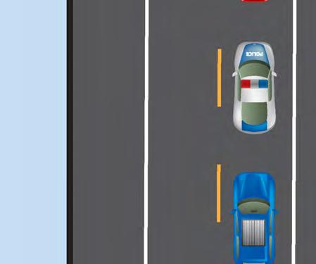
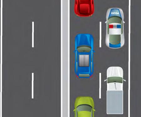
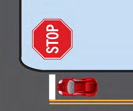
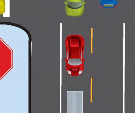
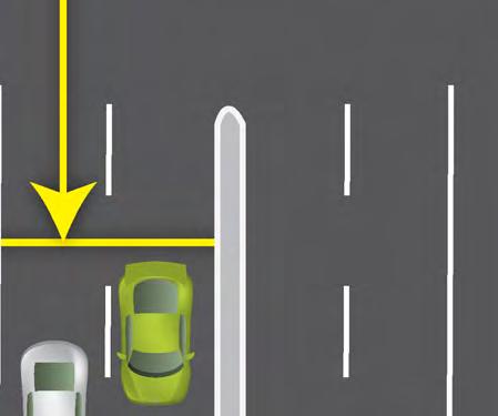
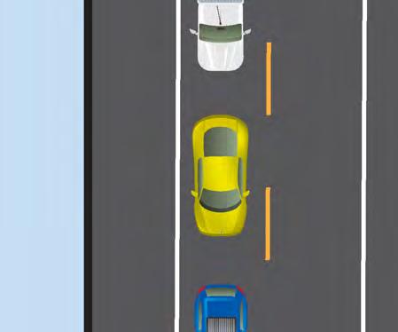
2 HIGHWAY 70 EXPANSION PROJECT ACCESS MANAGEMENT FINAL REPORT What is Access Management? Planning and control of the location, spacing, design, and operation of driveways, median openings, and street connections to a roadway Designates where and how vehicles access and exit a roadway Helps protect public investment in roadways by: - Preserving mobility - Reducing delay - Minimizing crashes - Reducing conflict points Full Access Right-In /Out Full Access Right In/Out Access Directional Access Directional Access FIGURE 10. EXAMPLE OF ARTERIAL ACCESS MANAGEMENT PROGRESSION

3 future principal arterial


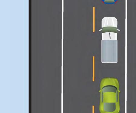


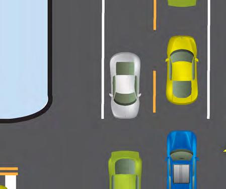


4 HIGHWAY 70 EXPANSION PROJECT traffic gaps How does adding lanes improve gaps at intersections?


5 Intersection traffic control All-way stops are used for hhmoderate traffic volumes. hhbalanced traffic. hhspeed limits of 40 mph or less. Drawbacks hhinefficient and cause delay. h hmultiple lanes can increase crash risk. hhincreased crash risk when disregarded. hhconstant stopping/acceleration is noisy. Traffic signals are used for hhconsistently high volume of traffic. hhcollector or arterial corridor intersections. Drawbacks h hintroduces additional decision making. h hincreased crash risk when disregarded. hhincreased risk of fatal or serious injury crashes. h hcreates delay, particularly for higher volume movements. Roundabouts are used for hhmoderate to high traffic volumes. hhimproving traffic flow. Drawbacks hhmay have higher construction cost and right-of-way needs. hhpotential for more property damage crashes. hhnot suitable for six-lane or principal arterial roadways.


6 Traffic signals Traffic signals are effective because they hhmanage high volumes of traffic conflicts. hhprovide crossing opportunities. hhcan improve intersection efficiency. hhcan reduce right-angle crashes. New signals are added with caution because hhcrashes often increase, especially rear-end crashes. hhcrashes at signals are typically more severe. hhthey typically result in higher delays throughout the day. The decision to install signals is based on hhtraffic volumes. hhvehicle delays. hhcrash history. hhanticipated crash rate. In Dakota County hhapproximately 10% of intersections are signalized. hh47% of fatal and serious injury crashes occur at signalized intersections Crash rate crashes per one million vehicles entering the intersection. Severity rate weighted rate with injury and fatal crashes given more weight Urban Thru Stop Rural Thru Stop All Way Stop Low Volume Low Speed Low Volume High Speed High Volume Low Speed High Volume High Speed Unsignaled Signaled


7 Speed limits Speed limits are important because they hhmake roads safer by reducing variability in vehicle speeds. hhhelp unfamiliar drivers know the appropriate speed. hhhelp law enforcement curb dangerous behavior. Speed limits are established through Minnesota Statute The statute hhdefines speeds for certain roadway types. hhestablishes a process for the State to determine speeds. Speed studies examine hhactual speeds of vehicles using the roadway. hhroadway type, condition and length. hhlocation of intersections and driveways. hhtraffic volume and crash history. hhsight distance limitations caused by curves or hills. After a speed study is conducted, a speed limit is set by the State. Posted limits reflect speeds for ideal road and weather conditions. Speed limit facts hhlowering the posted speed limit will not slow traffic. hhmost people drive what is comfortable and safe to them regardless of posted speeds. hhlowering a posted speed limit does not reduce crashes. hhimproperly set speed limits decrease safety.
Project Update May 2018
 Project Update May 2018 Dakota County, in cooperation with the City of Lakeville, is planning to reconstruct 202 nd Street West (County Road 50) from Holyoke Avenue to Cedar Avenue (County Road 23). 202
CITY OF FRANKLIN, TENNESSEE. Columbia Avenue. Widening & Improvements Project. Public Meeting May 16, 2017
 CITY OF FRANKLIN, TENNESSEE Columbia Avenue Widening & Improvements Project Public Meeting May 16, 2017 Agenda 6:00 6:30 Formal Presentation 6:30 8:00 Town Hall Forum City of Franklin Columbia Avenue Alternatives
Frequently Asked Questions
 Frequently Asked Questions Business US 190 in Copperas Cove From Avenue D to Constitution Drive What is access management? A. Access Management is a growing effort by government agencies to improve how
Access Location, Spacing, Turn Lanes, and Medians
 Design Manual Chapter 5 - Roadway Design 5L - Access Management 5L-3 Access Location, Spacing, Turn Lanes, and Medians This section addresses access location, spacing, turn lane and median needs, including
A Behind-the-Scenes Look at Traffic Safety Reviews: Why the Solutions Might Be Different from Travelers Expectations
 A Behind-the-Scenes Look at Traffic Safety Reviews: Why the Solutions Might Be Different from Travelers Expectations Kristi Sebastian, Dakota County Sarah Tracy, Dakota County Brad Estochen, MnDOT 2018
Highway 49, Highway 351 and Highway 91 Improvements Feasibility Study Craighead County
 Highway 49, Highway 351 and Highway 91 Improvements Feasibility Study Craighead County Executive Summary March 2015 Highway 49, Highway 351 and Highway 91 Improvements Feasibility Study Craighead County
Access Management Regulations and Standards
 Access Management Regulations and Standards January 2014 Efficient highway operation Reasonable property access Concept of Access Management The way to manage access to land development while preserving
RAISED MEDIAN EFFECTIVENESS
 RAISED MEDIAN EFFECTIVENESS William E. Frawley, AICP Texas A&M Transportation Institute Access Management Overview Set of Tools to Help Improve Safety and Protect Public Investments in Roadways Balances
Access Management Benefits & Techniques. Access Management Workshop June 2, 2006
 Access Management Benefits & Techniques Access Management Workshop June 2, 2006 1 Benefits of Access Management Safety As access density increases, crash rates increase Increasing the density of access
Access Management Regulations and Standards
 Access Management Regulations and Standards Efficient highway operation Reasonable property access Concept of Access Management The way to manage access to land development while simultaneously preserving
MN Green Step Cities December 7, Hannah Pritchard, PE PTOE
 MN Green Step Cities December 7, 2016 Hannah Pritchard, PE PTOE Hannah Pritchard PE PTOE @bicyclehannah hpritchard@tooledesign.com Choose your own adventure How we got here the history of traffic engineering
Innovative Intersections
 Innovative Intersections Things You Need to Know About FDOT D-7 Safety Academy October 19, 2016 Mark Doctor FHWA Resource Center Atlanta, GA HOW DO YOU FEEL??? about innovative intersections??? Why is
Executive Summary June 2015
 Executive Summary June 2015 Highway 112 Corridor Study Benton and Washington Counties Executive Summary June 2015 Prepared by Transportation Planning and Policy Division Arkansas State Highway and Transportation
City of Wayzata Comprehensive Plan 2030 Transportation Chapter: Appendix A
 A1. Functional Classification Table A-1 illustrates the Metropolitan Council s detailed criteria established for the functional classification of roadways within the Twin Cities Metropolitan Area. Table
Route 28 (South Orleans Road)/Route 39 (Harwich Road)/Quanset Road Intersection
/Route 39 (Harwich Road)/Quanset Road Intersection") TRAFFIC FEASIBILITY STUDY Route 28 (South Orleans Road)/Route 39 (Harwich Road)/Quanset Road Intersection Orleans, Massachusetts Prepared for: Town of Orleans Prepared by: Fay, Spofford & Thorndike, LLC
TRAFFIC FEASIBILITY STUDY Route 28 (South Orleans Road)/Route 39 (Harwich Road)/Quanset Road Intersection Orleans, Massachusetts Prepared for: Town of Orleans Prepared by: Fay, Spofford & Thorndike, LLC
Mark Malone, P.E. SD DOT
 Mark Malone, P.E. SD DOT SD10 Grading & Surfacing From 8 th Ave W to 8 th Ave E 1 mile plus transition lengths Complete Urban Reconstruction Grading, C&G, Storm Sewer, Sidewalk, Concrete Surfacing Railroad
Recommended Roadway Plan Section 2 - Land Development and Roadway Access
 Recommended Roadway Plan Section 2 - Land Development and Roadway Access SECTION 2 Land Development and Roadway Access 2.1 Land Use and Access Management The Federal Highway Administration (FHWA) defines
Controlled. Semi-Controlled PAGE 01 CHAPTER 12 INTERSECTIONS
 PAGE 01 CHAPTER 12 INTERSECTIONS You will cross many intersections while driving. Intersections are especially dangerous because vehicles are crossing each other s driving path. Many crashes happen at
Access Management Regulations and Standards for Minor Arterials, Collectors, Local Streets
 Access Management Regulations and Standards for Minor Arterials, Collectors, Local Streets September 2009 Paul Grasewicz Access Management Administrator Concept of Access Management The way to manage access
DEPARTMENT OF ENVIRONMENTAL SERVICES. North Harrison Street (Lee Highway to Little Falls Road) Comparative Analysis. Prepared for:
 Comparative Analysis. Prepared for:") DEPARTMENT OF ENVIRONMENTAL SERVICES North Harrison Street (Lee Highway to Little Falls Road) Comparative Analysis Prepared for: Arlington County Department of Environmental Services 2100 Clarendon Boulevard,
DEPARTMENT OF ENVIRONMENTAL SERVICES North Harrison Street (Lee Highway to Little Falls Road) Comparative Analysis Prepared for: Arlington County Department of Environmental Services 2100 Clarendon Boulevard,
TRANSPORTATION ANALYSIS REPORT US Route 6 Huron, Erie County, Ohio
 TRANSPORTATION ANALYSIS REPORT US Route 6 Huron, Erie County, Ohio December 12, 2012 Prepared for: The City of Huron 417 Main Huron, OH 44839 Providing Practical Experience Technical Excellence and Client
Intersection Improvement: Sturgeon Road, Silver Avenue and Murray Park Road Roundabout. Welcome. Public Information Session
 Intersection Improvement: 1 Welcome WHY IS AN INTERSECTION IMPROVEMENT NEEDED? 2 Traffic volumes for Sturgeon Road, Silver Avenue and Murray Park Road exceed the capacity of the existing 4-way stop controlled
West Dimond Blvd Upgrade Jodhpur Street to Sand Lake Road
 West Dimond Blvd Jodhpur St to Sand Lake CSS Transportation Project Summary Municipality of Anchorage Project # 05 005 Project Manager: John Smith, P.E. (MOA PM&E) Project Administrator: Julie Makela,
City of Albert Lea Policy and Procedure Manual 4.10 ALBERT LEA CROSSWALK POLICY
 4.10 ALBERT LEA CROSSWALK POLICY PURPOSE: Pedestrian crosswalks are an integral part of our transportation infrastructure. To be effective and promote safety, marked crosswalks must be installed after
Characteristics of. Entering & Exiting High Speed Considerations
 Mod 6 Characteristics of Expressways Entering & Exiting High Speed Considerations Characteristics of an Expressway Controlled access (limited entry and exit) High speed (up to 65 mph) Divided by a barrier
Parks Highway: MP Lucus Road to Big Lake Road
 2 Purpose and Need 2.1 Corridor History The Parks Highway is a 324-mile long Rural Interstate Highway that extends from its intersection with the Glenn Highway north to Fairbanks, Alaska. The Parks Highway
Chapter 4 Traffic Analysis
 Chapter 4 Traffic Analysis PURPOSE The traffic analysis component of the K-68 Corridor Management Plan incorporates information on the existing transportation network, such as traffic volumes and intersection
INTERSECTION DESIGN. Bicycle Facility Workshop Intersections 4-1
 INTERSECTION DESIGN 4-1 Intersections Avoid unusual conflicts Provide direct path for cyclists, close to that of motor vehicles Bicyclists should be visible; their movements should be predictable Simple
Intersection Traffic Control Feasibility Study
 Intersection Traffic Control Feasibility Study CSAH 9 at CSAH 60 (185th Avenue) Prepared For: Dakota County Transportation Department Western Service Center 14955 Galaxie Avenue, 3rd Floor Apple Valley,
Driveway Design Criteria
 Design Manual Chapter 5 - Roadway Design 5L - Access Management 5L-4 Driveway Design Criteria A. General For efficient and safe operations, access drives and minor public street intersections can be improved
Roundabouts,+A+Perspec2ve+
 Roundabouts,+A+Perspec2ve+ The safest, most efficient, and attractive form of traffic control in the world. Michael J. Wallwork, P.E. Alternate Street Design, P.A. 1516 Plainfield Avenue, Orange Park,
WELCOME Public Information Centre
 WELCOME Public Information Centre Fernforest Drive Brampton Soccer Centre Community Room #2 Tuesday January 19, 2016 6:30 p.m.to 9:00 p.m. Please sign in Neighbourhood Traffic Calming Guide Background
5.0 Roadway System Plan
 Southwest Boise Transportation Study Page 16 5.0 Roadway System Plan The Roadway System Plan outlines roadway improvements in the Initial Study Area. It forecasts future deficiencies on the arterial system,
Access Management in the Vicinity of Intersections
 Access Management in the Vicinity of Intersections FHWA-SA-10-002 Technical Summary Photo: Ralph Bentley (used with permission) 0 Access Management is: The design, implementation and management of entry
Designing for Pedestrian Safety
 Designing for Pedestrian Safety Introduction to Pedestrian Safety Design and Planning Principles Presented by: Craig Allred FHWA Resource Center Technical Specialist and Michael Ronkin Owner, Designing
Clackamas County Comprehensive Plan
 ROADWAYS The County s road system permits the movement of goods and people between communities and regions, using any of a variety of modes of travel. Roads provide access to virtually all property. They
SPEED MANAGEMENT FOR VISION ZERO
 SPEED MANAGEMENT FOR VISION ZERO LUANN HAMILTON, DEPUTY COMMISSIONER FOR PROJECT DEVELOPMENT CHICAGO DEPARTMENT OF TRANSPORTATION NACTO DESIGNING CITIES 2017 Vision Zero Action Plan Speed management and
Application of a Complete Street
 Application of a Complete Street Southbend to Prima Vista Update May 14, 2018 Meeting Agenda Perspective and History Public input received Typical sections being considered Presentation of the 2-lane master
Fields of St. Croix HOA Meeting. October 27, 2016
 Fields of St. Croix HOA Meeting October 27, 2016 Welcome! Why are we here? Update on Manning Avenue Phase 2 Project: Project Design Schedule Project Background Importance of Manning Avenue: Primary north-south
Designing for Pedestrian Safety. Alabama Department of Transportation Pre-Construction Conference May 2016
 Designing for Pedestrian Safety Alabama Department of Transportation Pre-Construction Conference May 2016 1 Designing for Pedestrians Marking Crosswalks at Signalized intersections High Visibility Markings
Why do you think the chances of a collision are greater at an intersection than at any other point on the roadway?
 UNIT 5 PACKET 1 NAME: HOUR: DATE: NO: Chapter 7 Negotiating Intersections THINK*PAIR*SHARE In a group of 2 to 3 people write down at least 4 things that would require your attention to safely navigate
Road Diets FDOT Process
 Florida Department of TRANSPORTATION Road Diets FDOT Process Humberto Castillero, PE, PTOE Roadway Design Office Purpose of Guide Develop a statewide lane elimination review process Balance state & local
Preliminary Engineering Study
 Preliminary Engineering Study Open House # 2 June 6, 2018 PREPARED FOR: PREPARED BY: Agenda Background and status of preliminary engineering study County Road 26 design summary County Road 63 design summary
ROUNDABOUTS/TRAFFIC CIRCLES
 GENERAL 1. Description This standard identifies minimum requirements that shall be met for Roundabouts and Neighborhood Traffic Circles in the design and construction of elements for Arlington County Horizontal
and Rural Multimodal Networks 2017 ALTA PLANNING + DESIGN
 Small Town and Rural Multimodal Networks 2017 ALTA PLANNING + DESIGN SMALL TOWN AND RURAL MULTIMODAL NETWORKS GUIDE Why a Rural and Small Town Focused Guide? ONE SIZE DOES NOT FIT ALL. The new FHWA-endorsed
INNOVATIVE INTERSECTION DESIGN
 INNOVATIVE INTERSECTION DESIGN J. Eddie Valtier, P.E. ELP TP&D Director Introduction Why Do We Need To Start Looking For Innovative Intersection Designs? Congestion is worsening and traffic volumes and
Southbend to Prima Vista. October 30, Floresta Corridor Master Plan
 Application of a Complete Street initiative and how it might function operationally 8 8 Southbend to Prima Vista October 30, 2017 Presentation Agenda 2 Perspective and History Traffic projections, Levels
Highway 111 Corridor Study
 Highway 111 Corridor Study June, 2009 LINCOLN CO. HWY 111 CORRIDOR STUDY Draft Study Tea, South Dakota Prepared for City of Tea Sioux Falls Metropolitan Planning Organization Prepared by HDR Engineering,
Unit Five : Driving In Neighborhoods
 Unit Five : Driving In Neighborhoods What Are We Going To Do Today? Students will be able to describe the skills necessary to How safely and do legally you make drive in a residential How do area. you
M-58 HIGHWAY ACCESS MANAGEMENT STUDY Mullen Road to Bel-Ray Boulevard. Prepared for CITY OF BELTON. May 2016
 M-58 HIGHWAY ACCESS MANAGEMENT STUDY Prepared for CITY OF BELTON By May 2016 Introduction Missouri State Highway 58 (M-58 Highway) is a major commercial corridor in the City of Belton. As development has
Report. Typical Sections. City of Middleton, WI
 Report Typical Sections City of Middleton, WI December 2006 Report for City of Middleton, Wisconsin Typical Sections repared by: Traffic Associates LLC and STRAND ASSOCIATES, INC. 910 West Wingra Drive
Toolbox of Countermeasures and Their Potential Effectiveness to Make Intersections Safer
 8 Toolbox of Countermeasures and Their to Make Intersections Safer Introduction Studies included in the NCHRP 17-18 (3), Guidance for Implementation of the AASHTO Strategic Highway Safety Plan, as well
Existing Conditions. Date: April 16 th, Dan Holderness; Coralville City Engineer Scott Larson; Coralville Assistant City Engineer
 Date: April 16 th, 2015 To: From: Re: Dan Holderness; Coralville City Engineer Scott Larson; Coralville Assistant City Engineer Darian Nagle-Gamm, Traffic Engineering Planner Highway 6 (2 nd Street) /
Module 5: Navigating Roadways
 Module 5: Navigating Roadways Topic 1: Intersections 1. One out of FATAL crashes occur at intersections. 2. Label the intersection warning signs: 3. When possible, begin searching seconds ahead of the
ORANGE COUNTY PUBLIC WORKS TRAFFIC INVESTIGATIONS
 ORANGE COUNTY PUBLIC WORKS TRAFFIC INVESTIGATIONS STAFF REPORT OF: January 6, 2019 SUPERVISORIAL DISTRICT: 5 SUBJECT: LOCATION: INVESTIGATOR: O Neill Drive at Roanoke Drive; Ladera Ranch; TB 922-E6 Clever
J Street and Folsom Boulevard Lane Conversion Project (T ) Before and After Traffic Evaluation
 Before and After Traffic Evaluation") J Street and Folsom Boulevard Lane Conversion Project (T15125400) Before and After Traffic Evaluation Prepared by Transportation Division June 2014 Executive Summary On February 12, 2013, the City of Sacramento
J Street and Folsom Boulevard Lane Conversion Project (T15125400) Before and After Traffic Evaluation Prepared by Transportation Division June 2014 Executive Summary On February 12, 2013, the City of Sacramento
Speed Limits in the Hoddle Grid
 Speed Limits in the Hoddle Grid Recent History of speed limits March 2013 Docs # 7738485 1 Introduction Muncipalities have power to Erect speed limit signs BUT Municipalities DO NOT have the power to approve
Route 7 Corridor Study
 Route 7 Corridor Study Executive Summary Study Area The following report analyzes a segment of the Virginia State Route 7 corridor. The corridor study area, spanning over 5 miles in length, is a multi
INTRODUCTION THOROUGHFARE SYSTEM CLASSIFICATIONS
 INTRODUCTION The thoroughfare plan will assist public officials in the development of a specialized system for efficient and safe movement of vehicular traffic while minimizing potential conflicts with
Tonight we will be discussing accidents
 Good evening PRAG members WELCOME BACK SAFETY ON HANA HIGHWAY NEAR PAIA Tonight we will be discussing accidents Safety is a Top Priority One of the top priority Goals and objectives of this project is
Linking Transportation and Health in Nashville & Middle Tennessee
 Linking Transportation and Health in Nashville & Middle Tennessee Fit Nation New Orleans CPPW Mentoring Grant Built Environment Program May 14, 2011 Local Transportation Planning Framework Federal U.S.
COWETA HIGH SCHOOL AND EAST HIGHWAY 51
 COWETA HIGH SCHOOL AND EAST HIGHWAY 51 Lack of sidewalks along Ben Lumpkin Rd. Lack of crosswalks and ramps at intersection. Hwy 51 is wide to cross as a pedestrian. No ADA compliance or connection to
Safety Impacts: Presentation Overview
 Safety Impacts: Presentation Overview The #1 Theme How Access Management Improves Safety Conflict Points The Science of Access Management By Treatment Studies Themes for Texas Access Management Improve
Public Information Centre
 WELCOME Public Information Centre Father Tobin Road Lougheed Middle School - Library Wednesday November 7, 2012 7:00 p.m.to 9:00 p.m. Please sign in Neighbourhood Traffic Calming Guide Background The City
Pine Hills Road Pedestrian/Bicycle Safety Study Board of County Commissioners Work Session
 Pine Hills Road Pedestrian/Bicycle Safety Study Board of County Commissioners Work Session February 20, 2018 Meeting Agenda Study Overview Existing Conditions Access Management Potential Gateway Features
Safety of U-turns at Unsignalized Median Openings
 Safety of U-turns at Unsignalized Median Openings Ingrid Potts Midwest Research Institute Kansas City, MO August 31, 2004 Douglas W. Harwood Co-Authors Midwest Research Institute Herbert S. Levinson Transportation
FMATS Transportation Improvement Program Project Nomination Form
 FMATS 2015 2018 Transportation Improvement Program Project Nomination Form Project nominations are accepted from the public and are scored based on the adopted Project Scoring Criteria. These criteria
Bay to Bay Boulevard Complete Streets Project
 Bay to Bay Boulevard Complete Streets Project Dale Mabry Highway to Bayshore Boulevard February 08, 2018 Photo Source: Tampa Bay Times Alessandra Da Pra Meeting Format Introduction Resurfacing Information
Project Goals and Objectives
 Project Goals and Objectives Goal 1: Goal 2: Goal 3: Transform Coast Highway into a Complete Street that accommodates all roadway users (pedestrians, bicyclists, and autos) Objectives: Improve the pedestrian
Rebecca Szymkowski, P.E., PTOE Wisconsin Department of Transportation. ITE Midwestern District Annual Meeting June 30, 2015
 Rebecca Szymkowski, P.E., PTOE Wisconsin Department of Transportation ITE Midwestern District Annual Meeting June 30, 2015 Strategic Highway Safety Plan (SHSP) Roundabout Safety Analysis J-turn Experiences
How to Develop a Pedestrian Safety Action Plan
 How to Develop a Pedestrian Safety Action Plan Course Introduction Presented by: Peter Eun FHWA RC Safety Engineer Ryan Snyder President, Ryan Snyder Associates, LLC Paul Zykofsky Director, Land Use and
CTH M Reconstruction
 CTH M Reconstruction ID 5992 09 81 City of Madison, South Pleasant View Road (Cross Country Road Prairie Hill Road) CTH M Dane County Public Information Meeting Thursday, May 24, 2012 6 p.m. to 8 p.m.
Unit Six: Driving Faster with More Risk URBAN, SUBURBAN, AND RURAL DRIVING
 Unit Six: Driving Faster with More Risk URBAN, SUBURBAN, AND RURAL DRIVING What Is The Impact Of Distraction? Objectives For Unit Six Students will be able to describe the skills necessary to What safely
Drivers Responsibilities to Pedestrians
 Drivers Responsibilities to Pedestrians The following 60 slides use real photos, a video clip and quizzes to teach drivers what to do when they encounter a pedestrian. This takes about 5 minutes to view.
Design Public Hearing MassDOT Project # February 19, 2015 Chatham Town Hall Annex 7:00 P.M.
 Design Public Hearing MassDOT Project #606596 February 19, 2015 Chatham Town Hall Annex 7:00 P.M. Overview Process to date Project goals Data collection results Existing conditions Alternative analysis
FM 471 PROJECT. OPEN HOUSE FM 471 (Culebra Road) from SH 211 to Old FM 471 Medina and Bexar Counties. FM 471 Project
 from SH 211 to Old FM 471 Medina and Bexar Counties. FM 471 Project") FM 471 PROJECT OPEN HOUSE FM 471 (Culebra Road) from SH 211 to Old FM 471 Medina and Bexar Counties January 24, 2018 Project Location 2 Proposed Improvements Improvements include: Expansion of FM 471 from
FM 471 PROJECT OPEN HOUSE FM 471 (Culebra Road) from SH 211 to Old FM 471 Medina and Bexar Counties January 24, 2018 Project Location 2 Proposed Improvements Improvements include: Expansion of FM 471 from
AGENDA REPORT. Issue: Discussion of potential improvements on Barnwell Road at Niblick Drive
 AGENDA REPORT To: From: By: Honorable Mayor and City Council Members Warren Hutmacher, City Manager Tom Black, Public Works Director Date: March 23, 2016 Agenda: March 28, 2016 WORK SESSION AGENDA: Barnwell
Identify the letter of the choice that best completes the statement or answers the question.
 Chapter 10 - Practice Questions Multiple Choice Identify the letter of the choice that best completes the statement or answers the question. 1) Before passing a vehicle in your lane, a. anticipate the
Draft North Industrial Area-Wide Traffic Plan
 Summary of North Industrial and Hudson Bay Industrial Recommended Improvements Table 1. Summary of s Item Location 1 2 3 4 5 6 7 8 9 10 11 12 Millar Ave north of 51st St Super 8 Motel back lane 400 Block
SELECTED ROADWAY CAPACITY ANALYSIS
 CHAPTERFOUR SELECTED ROADWAY CAPACITY ANALYSIS 4.1 SELECTED ROADWAY CAPACITY ANALYSIS Introduction Capacity analysis was performed on six selected roadways within the Dearborn County study area using the
METHODOLOGY. Signalized Intersection Average Control Delay (sec/veh)
") Chapter 5 Traffic Analysis 5.1 SUMMARY US /West 6 th Street assumes a unique role in the Lawrence Douglas County transportation system. This principal arterial street currently conveys commuter traffic
Chapter 5 Traffic Analysis 5.1 SUMMARY US /West 6 th Street assumes a unique role in the Lawrence Douglas County transportation system. This principal arterial street currently conveys commuter traffic
SD Highway 50 in Yankton (4 TH Street) Reconstruction Project NH 0050(99)381 PCN By Josh Larson McLaury Engineering Inc.
 Reconstruction Project NH 0050(99)381 PCN By Josh Larson McLaury Engineering Inc.") SD Highway 50 in Yankton (4 TH Street) Reconstruction Project NH 0050(99)381 PCN 6926 By Josh Larson McLaury Engineering Inc. Project Limits SD 50 from Broadway to Burleigh and from Marne Creek to Archery
SD Highway 50 in Yankton (4 TH Street) Reconstruction Project NH 0050(99)381 PCN 6926 By Josh Larson McLaury Engineering Inc. Project Limits SD 50 from Broadway to Burleigh and from Marne Creek to Archery
TRAFFIC IMPACT ANALYSIS
 TRAFFIC IMPACT ANALYSIS FOR THE CHAMPAIGN UNIT#4 SCHOOL DISTRICT PROPOSED HIGH SCHOOL (SPALDING PARK SITE) IN THE CITY OF CHAMPAIGN Final Report Champaign Urbana Urbanized Area Transportation Study 6/24/2014
Access requests to County streets and roadways are processed through one of the following methods:
 13.1 GENERAL APPLICATION PROCESS Access requests to County streets and roadways are processed through one of the following methods: A. Planned Developments may set general locations for access points.
Design Considerations for Complete Streets. The Kiewit Center for Infrastructure and Transportation
 Design Considerations for Complete Streets Objective Provide design geometrics and features that accommodate balanced operations of bicycles, pedestrians and vehicles on a complete street Cul-de-sacs,
Albany Shaker Road Corridor Study Public Meeting # 2
 Albany Shaker Road Corridor Study Public Meeting # 2 Scope / Meeting Purpose This project is a CDTC Linkage Study. The Linkage Program is designed to implement the adopted planning and investment principles
American Fork City Access Management Manual
 American Fork City Access Management Manual American Fork, Utah April 2012 UT09-181 3315 West Mayflower Way, Ste. 4 Lehi, Utah 84043 p. 801/ 766.4343 www.halesengineering.com EXECUTIVE SUMMARY As traffic
JONESBORO HIGHWAY 63 HIGHWAY 18 CONNECTOR STUDY
 JONESBORO HIGHWAY 63 HIGHWAY 18 CONNECTOR STUDY Craighead County May 2007 JONESBORO HIGHWAY 63 HIGHWAY 18 CONNECTOR STUDY Craighead County May 2007 Prepared by Planning and Research Division Arkansas State
MUTCD Part 6G: Type of Temporary Traffic Control Zone Activities
 MUTCD Part 6G: Type of Temporary Traffic Control Zone Activities 6G.01 Typical Applications Each temporary traffic control (TTC) zone is different. Many variables, such as location of work, highway type,
SUPERSTREETS IN TEXAS. ITS Texas Annual Meeting San Marcos, Texas Session 6A - Operations November 11, 2011
 SUPERSTREETS IN TEXAS ITS Texas Annual Meeting San Marcos, Texas Session 6A - Operations November 11, 2011 1 Superstreet Corridor Location 2 3 US Highway 281 2007 Looking south above Evans Road, pm peak
This page intentionally left blank.
 This page intentionally left blank. COMMUNITY Coweta Community Overview Coweta Coweta, a residential community located in Wagoner County, is a suburb of Tulsa situated southeast of the metropolitan area
City of Homewood Transportation Plan
 City of Homewood Transportation Plan Prepared for: City of Homewood, Alabama Prepared by: Skipper Consulting, Inc. May 2007 TABLE OF CONTENTS INTRODUCTION... 1 BACKGROUND INFORMATION... 1 EXISTING TRANSPORTATION
Project Advisory Group (PAG) Meeting #2 January 31, SR 693 (Pasadena Avenue) Corridor Study from Shore Drive South to 66 th Street
 Meeting #2 January 31, SR 693 (Pasadena Avenue) Corridor Study from Shore Drive South to 66 th Street") Project Advisory Group (PAG) Meeting #2 January 31, 2018 Welcome & Introductions AGENDA 1. Where are we at? 2. Project Survey / Virtual Comment Tool / PAG Meeting #1 / Visioning Workshop Corridor Map Exercise
Project Advisory Group (PAG) Meeting #2 January 31, 2018 Welcome & Introductions AGENDA 1. Where are we at? 2. Project Survey / Virtual Comment Tool / PAG Meeting #1 / Visioning Workshop Corridor Map Exercise
Proven Safety Countermeasures. FHWA Office of Safety January 12, :00 p.m. to 2:00 p.m. Eastern Time
 Proven Safety Countermeasures FHWA Office of Safety January 12, 2012 1:00 p.m. to 2:00 p.m. Eastern Time Introduction and Background While States should still be considering the application of all of the
Acknowledgements. Mr. David Nicol 3/23/2012. Daniel Camacho, P.E. Highway Engineer Federal Highway Administration Puerto Rico Division
 Daniel Camacho, P.E. Highway Engineer Federal Highway Administration Puerto Rico Division Acknowledgements Mr. David Nicol Director, FHWA Office of Safety FHWA Office of Safety http://safety.fhwa.dot.gov/provencountermeasures/
BETHEL ROAD AND SEDGWICK ROAD CORRIDOR STUDY
 DRAFT PLAN City Council Meeting August 14, 2017 STUDY AREA Sedgwick Corridor State Route 160, principal arterial with Class 3 access management designation, commuter and freight route, connection to SR
6.4 RECOMMENDED IMPROVEMENTS
 6.4 RECOMMENDED IMPROVEMENTS 6.4.1 Williston Road Recommendations While all alternatives would be an improvement over existing conditions, Alternative 3B is recommended over the others because it provides
133 rd Street and 132 nd /Hemlock Street 132 nd Street and Foster Street MINI ROUNDABOUTS. Overland Park, Kansas
 133 rd Street and 132 nd /Hemlock Street 132 nd Street and Foster Street MINI ROUNDABOUTS Overland Park, Kansas September 1, 2017 TABLE OF CONTENTS 1. INTRODUCTION... 1 2. LITERATURE REVIEW... 1 3. CONCEPT
Atwood Avenue Fair Oaks Avenue Cottage Grove Road
 Atwood Avenue Fair Oaks Avenue Cottage Grove Road Agenda Purpose Review project scope & goals Present design alternatives Gather feedback Answer Questions Format Open House Presentation Q&A Open House
CONTEXT SENSITIVE STREETS STANDARDS COMMITTEE
 CONTEXT SENSITIVE STREETS STANDARDS COMMITTEE February 23, 2015 Prepared by: Denise Chaplick, AICP City Jacksonville Bicycle and Pedestrian Coordinator Source: NCDOT Complete Streets Planning and Design