APPENDIX A CONTENTS. Government and Agency Issues With Plans and Comments. Results From Round 1, Public Input Meetings
|
|
|
- Rosalyn Dalton
- 5 years ago
- Views:
Transcription


1 CAMPBELL COUNTY
2 CAMPBELL COUNTY
3 APPENDI A CONTENTS Government and Agency Issues With Plans and Comments Results From Round 1, Public Input Meetings Summary of Public Meeting Results Summary of Responses: Station B: Bike and Pedestrian Summary of Responses: Station C and D: QUESTION 1, Roadways Frequently Traveled Comments From Round 2, Public Input Meetings
4 GOVERNMENT AND AGENCY COMMENTS COMMENT/PROJECT DESCRIPTION SI-YEAR PLAN KY UNSCHEDULED NEEDS Alexandria Ky 536, extension from US 27 to AA Dayton Cold Spring Ky. 547, Ky. 10 vicinity to AA Ky. 709, turn lanes Lickert Road, straighten and widen Repair and upgrade all county roads in the city. Widen (Upper) Lick Branch COUNTY PLAN ONLY COMMENTS No specific project included at this Add lanes at Washington (Ky 10) and US27 time Evaluate Ky 8 from I-471 to/through city (includes Bellevue) Portions of Ky. 8 are included in plan Pooles Creek No. 1, improve and add connection to NKU Connect Darlas Drive and Bunning Lane Project not included in Top 20 New intersection tying E. Alexandria intersection with Murnan/ Pooles No. 2 Cold Spring Parkway (Pooles No. 2, Murnan, East Alexandria, Low Gap) Southgate General traffic concerns Impact of new development (US 27 and I- 471) on US 27 and Blossom Lane area Fort Thomas East/West movement in County Grand Avenue Traffic Management possibly by reducing from 4 to 2 lanes and adding median, parking and pedestrian improvements. Safety improvements to Ky. 8 Bike path/lane along Memorial Parkway No specific project included at this time No specific project included at this time No specific project included at this time Portions of Ky. 8 are included in plan No specific project included at this time
5 GOVERNMENT AND AGENCY COMMENTS COMMENT/PROJECT DESCRIPTION SI-YEAR PLAN KY UNSCHEDULED NEEDS Wilder Connectivity of city to surrounding areas Extend Ky. 9 to Newport Three Mile Road improvements to NKU Intersection improvements at St. Johns Road and Ky. 9 Realignment of Moock Road Improve Johns Hill Road Improve bike and pedestrian transportation along Ky. 9 and Moock Road Connection under I-275 to Gloria Terrell Drive Licking River Bridge to Taylor Mill Campbell County Maximize efficiency of US 27 and Ky. 9 corridors Improve east/west travel (i.e., Ky. 536 corridor) NKU Improve Johns Hill Road Technology Triangle/NKU I-275/KY2345 to Pooles Creek No. 1/AA Highway access road New Ky. 9 connector with Ky. 8, near Licking Newport River Bridge Improved I-471 southbound exit ramp to Ky. 8 New bridge connection with Covington at Fourth/Fifth Street Improvements to Carothers Road and Grand Avenue "Connector" through Cote Brilliante Redevelopment Area COUNTY PLAN ONLY COMMENTS No specific project included at this time No specific project included at this time No specific project included at this time No specific project included at this time No specific project included at this time No specific project included at this time No specific project included at this time
6 GOVERNMENT AND AGENCY COMMENTS Bellevue COMMENT/PROJECT DESCRIPTION Improvements to Ky. 8 between Riverboat Row and Berry Ave. add a center turn lane, which may require removal of parking from one or both sides of Ky. 8 in this area. Southbound exit ramp from I-471 onto Route 8 through will require improvements to Riviera Drive and Donnermeyer Drive. SI-YEAR PLAN KY UNSCHEDULED NEEDS COUNTY PLAN ONLY COMMENTS
7 RESULTS FROM ROUND 1 PUBLIC INPUT MEETINGS
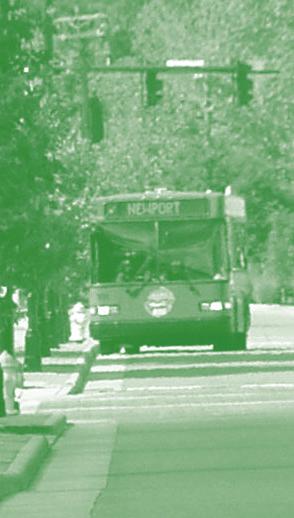
8 SUMMARY OF PUBLIC MEETING RESULTS Ninety (90) persons attended the public meetings held on Monday, November 18 and Thursday, November 21. The Monday meeting held at the Campbell County High School had the largest attendance of eighty (80) persons. These attendance figures exclude OKI and consultant staff. Approximately 53 percent of the persons attending completed survey forms (48 total forms). Many of the forms included the name and/or addresses of the person(s) completing the forms, which was optional. In several instances, more than one person completed the same form as indicated by multiple names on the form. Forty- one (41) survey forms were completed from the Monday meeting and seven (7) from the Thursday meeting. Bus 1. Give us your opinion of the quality of current bus service (please select one) Excellent Good Fair Poor Summary: 28 total responses - 17 or 61% Good; 8 or 29 % Fair 2. Give us your opinion of the quantity of current bus service (please select one) Excellent Good Fair Poor Summary: 26 total responses 14 or 54% Good; 9 or 35% Fair 3. I would like to see new service to: Summary: 4 responses Butler and Rt. 177; Melbourne and east; On Licking Pike and Ky 915 past the trailer parks; and convert to smaller busses like the Southbank Shuttle. 4. Do you use the bus service? Yes No Occasionally Summary: 44 responses 36 or 82% No; 8 or 18% Occasionally Rail The Regional Rail System Plan includes possible light rail service in the northern part of the county. Is this an option that should be evaluated in more detail? Yes No Summary: 43 total responses 25 or 58% No; 18 or 42% Yes (The split between the two meeting is noteworthy in that all 6 responses or 100%, were Yes at the Newport High School location) Comments:
9 Bike and Pedestrian 1. Improved Bike and Pedestrian facilities are important components of the transportation system. Yes No Summary: 39 total responses 22 or 56% Yes; 17 or 44% No (The Newport High School meeting results were 100 % Yes) 2. Expanded Bike and Pedestrian facilities are important components of the transportation system. Yes No Summary: 37 total responses 19 or 51% Yes; 18 or 49% No (The Newport High School meeting results were 86% Yes) Comments: Summary: See Summary of Responses: STATION B: Bike and Pedestrian
10 Improved Expanded Comments 1 Yes No Good but not necessary 2 No No 3 No No Road need more maintenance than they now receive - too narrow for the most part for both cars, trucks - plus bikes 4 Yes Yes Use county parks and connect them 5 No No 6 No No 7 Yes Yes 8 No No 9 Yes Yes Bike paths are healthy 10 No No 11 No No Yes Yes 14 Yes Yes 15 Yes Yes 16 Yes Yes No No 19 No No No No 22 Yes Yes Yes 26 No No No No 29 No No 30 No No 31 Yes Yes 32 Yes Yes 33 Summary of Responses: STATION B: Bike and Pedestrian Bicycle paths in this area are intended for recreational use. The route on Rt. 8 in Campbell County is very unsafe because the bikes have to share the road with car and truck traffic Route 8 is scenic, but not wide enough for a path for bikers. It's dangerous for them. Leave the road as is except for the slippage and have the bikers go to parks elsewhere. Living on 547 I would say that bike riding is very unsafe. Bikes do not use 34 this road as a scenic highway. 35 No No 36 Yes No Yes 39 No No 40 Yes Yes Need safe route to protect our kids from being run over. 41 Yes Yes Better economy, better for environment, better for health
11 Improved Expanded Comments 42 Yes Yes 43 Yes Yes 44 Yes Yes 45 Yes No 46 Yes Yes 47 Yes Yes 48 Yes Yes STATION B: Bike and Pedestrian (cont.) This provides entertainment and exercise opportunities also transportation that is not based on the auto Must consider traffic calming in heavy bike and pedestrian areas. I do not bike now because of fear of being run over by cars and SUV's. Frequently when I walk drivers do not yield ROW to peds. While the quantity of traffic reduction may be minimal, the quality of life and image and recreation opportunities aspect are important to the area The actual bike/pedestrian dedicated facilities seems terribly inadequate given the size of the county. While signage on state routes is helpful, it is very dangerous to interact with vehicular traffic
12 STATION C AND D: STATE AND COUNTY ROADS AND OTHER ISSUES The Campbell County Transportation Plan Task Force appreciates the time you are taking to attend this meeting. Please help us by taking just a few minutes to complete this survey. Thank You. 1. Please indicate the roadway(s) you most frequently travel, and then CIRCLE the condition that most closely matches the condition of that roadway. Route Pavement Condition Safety Condition Level of Congestion E G F P E G F P E G F P E G F P E G F P E G F P E G F P E G F P E G F P E G F P E G F P E G F P E G F P E G F P E G F P E G F P E G F P E G F P E=Excellent, G=Good, F=Fair, P=Poor Summary: See Summary of Responses: STATION C and D: Question 1, Roadways Frequently Traveled 2. What is your biggest issue from a transportation perspective in Campbell County (please select one)? Difficulty in Reaching Desired Destination Travel Time Cost of Travel Other Summary: 22 total responses 10 or 45% Difficulty in Reaching Desired Destination; 11 or 50% Travel Time; 1 or 5% Cost of Travel Responses to Other included comments relative to specific location and several mentioned safety.
13 3. Please identify any specific improvements you feel would significantly impact your travel. Summary: See Summary of Responses: STATION C and D: Question 3, Identification of Specific Improvements 4. Please indicate the importance of the following ways to improve the transportation system in Campbell County (please select one). A. Add capacity to roadway system Very important Somewhat important Not important Summary: 40 total responses 20 or 50% Very Important; 11 or 28 % Somewhat important; 9 or 22 % Not important B. Improve roadway geometrics (i.e. turn radii, roadway width, steep slopes, etc.) and traffic signalization. Very important Somewhat important Not important Summary: 41 total responses 23 or 56% Very important; 13 or 32% Somewhat important; 5 or 12% Not important C. Expand public transportation (i.e. bus service, rail transit, bike paths, etc.) Very important Somewhat important Not important Summary: 41 total responses 7 or 17% Very important; 26 or 64% Somewhat important; 8 or 19% Not important 6. In number 5, if you felt all were important, which one do you feel is most important (please select one)? Add capacity to roadway system Improve roadway geometrics Expand public transportation. Summary: 33 total responses 14 or 42% Add Capacity; 15 or 46% Improve Roadway Geometrics; and 3 or 9% Expand public transportation (1 response "rail" was written in) ADDITIONAL COMMENTS: Summary: See Summary of Responses: STATION C and D: Additional Comments
14 Summary of Responses: STATION C and D: QUESTION 1, Roadways Frequently Traveled Route Pavement Cond. Safety Cond. Level of Congestion E G F P E G F P E G F P 1 US 27 (n. of AA) x x x Johns Hill Road x x x Martha Lane Collins Blvd. x x x I x x x 2 None 3 Racetrack Road x x x Persimmon Grove Rd. x x x US 27 x x x Shaw Hess x x 4 Hissem Rd. x x x Clay Ridge Rd. x US 27 x x x 5 US 27 x x x Lickert Road x x x Persimmon Grove Rd. x x x E. Alexandria Pike Connector x x x Reitman Road x x x Pooles Creek No. 1 x x x 6 Ky East x x x Winters Lane x x x 445 (?) x x x Ky. 8 x x x 7 Pooles Creek No. 1 x x x Winters Lane x x x 8 Ky. 10 x x x Ky 1997 x x x AA Highway x x x 9 Ky. 8 x x x Ky. 547 x x x US 27 x x x 10 US 27 x x x Lickert Road x x x Licking Pike x x x Pleasant Ridge Rd. x x x
15 Station C and D: QUESTION 1, Roadways Frequently Travelled Route Pavement Cond. Safety Cond. Level of Congestion E G F P E G F P E G F P 11 Ky 8 x x x 12 Ky 8 x x x Twelve Mile Road x x x Ky 9 x x x I x x x US 27 x x x Ky 10 x x x 13 None 14 Upper Eight Mile x x x Ky 547 x x x Upper Tug Fork x x x 15 Poplar Ridge Rd. x x 16 AA Highway x Poplar Ridge Rd. x US 27 x 17 Losey Rd. x x x Pleasant Ridge Rd. x x x 18 US 27 x x x AA Highway x x x 19 Persimmon Grove Pike x x x 20 None 21 Ky x x x Ky 8 x x x 22 US 27 x x x 23 Racetrack Road x x x US 27 x x x 24 Racetrack Road x x x US 27 x x x 25 US 27 x x x AA Highway x x x 26 Ky 547 x x x Ky 10 x x x Barrs Branch Road x x x Ky 1997 x x x Ky 9 x x x Poplar Ridge Rd. x x x
16 Station C and D: QUESTION 1, Roadways Frequently Travelled Route Pavement Cond. Safety Cond. Level of Congestion E G F P E G F P E G F P 27 Barrs Branch Road x x x Riley Road x x x Stevens Road x x x 28 AA Highway x x x US 27 x x x Ky 10 x x x 29 US 27 x x x Pleasant Ridge Road x x x Schmudde Phillips x x x I-471 x x x 30 None 31 Pooles Creek No. 1 x x x 32 Pooles Creek No. 1 x x x AA Highway x x x US 27 x x x 33 Ky 1997 x x x US 27 x x x Nelson Road x x x AA Highway x x x 34 Ky 547 x x x AA Highway x x 35 Sheanshang Road x x x Wagoner Road x x x California Crossroads x x x AA Highway x x x 36 Persimmon Grove Road x x California Crossroads x x 37 Ky 1997 x x x 38 Ky 10 x x x AA Highway x x x I-275 x x x 39 Daniels Road x x x AA Highway x x x US 27 x x x I-471 x x x 40 None
17 Station C and D: QUESTION 1, Roadways Frequently Travelled Route Pavement Cond. Safety Cond. Level of Congestion E G F P E G F P E G F P 41 US 27 I-471 Kenton Station Road 42 I-471 x x x US 27 x x Ky 8 x x x 43 Ft. Thomas Avenue x x x Grand Avenue x x x Washington Street x x x 10th Street/Memorial Parkway x x x 44 None 45 US 27 x x x Pooles Creek No. 1 x x x AA Highway x x x Ky 1998 x x x I-275 x x x I-471 x x x 46 US 27 x x x 47 I-471 x x x I-275 x x x 48 I-471 x x x Park Avenue x x x I-275 x x x US 27 x x x
18 Summary of Results: STATION C and D: Question 3 Identification of Specific Improvements 1.* rework US 27 and 471 intersection; better pedestrian walking for US 27 in cities of H.H. and CS; sidewalk improvement on county roads or just install some walkways. 2.* None 3.* Shaw Hess-as well as other roads that recently been Re-paved Patched Patch job is terrible. Half patches on one side & not the other throw your vehicle all over the place several secondary roads have received the same treatment. A WASTE OF MONEY! 4. Need bypass around Alexandria on the south. Need to improve licking Pike (915) from sun Valley to I 275/AA. Need turn lanes at Lickert & US 27. Need light at Clay Road & US Rt turn lane on AA at E. Alex Pk. East bound. Rt turn lane on AA exit at US 27 Cold Spring onto US 27 South. 6. Intersection at 27 & Mile markers continuity throughout state 8.* None 9.* Congestion on US 27 Going North in AM, and South in PM. (Make 3 lanes N. in AM-3 Lanes S. in PM) 10.* US 27 and Lickert Road needs turn lites from all 4 ways. School time got to sit in 6-8 lites from Lickert Rd. to US 27 each morning. Someone is going to get killed! Pleasant Ridge Rd and Licking Pike still got one lane horse and burggy Bridge. Road coming out on angle onto Licking Pike. Should meet with school s drive. Kids will not let you out. Someone is going to get killed here also. 11.* None 12.* There is no reason for these of us living on RT 8 or along it to love 536 coming to us. Leave our land (farms) alone. Don t fix roads with cement vomit. 13.* None 14.* Building the proposed new 536 route. 15.* Create outer belt (536 to RT 9)
19 16. None 17.* Pleasant Ridge Rd & Losey Rd. install 3 way stop sign Pleasant Ridge Rd & Licking Pike install 3 way stop sign until improvement is made. Large tree on Pleasant Ridge by Deckers needs to be cut down. 18.* Adequately maintained existing roads especially county roads. 19.* Improve pavement on Persimmon Grove Pike from RT 10 to Lickert Rd. 20. None 21.* None 22. None 23. US Parkside US Lickert 24. US Parkside US Lickert 25.* The intersection of 27 & AA. As these parcels develop the traffic will get terrible. Try leaving O Charlies and turing left to go Smith to Alexandria extremely difficult during rush hour. As the parcel between Meijers and O Charlies develops there needs to be a lot of planning regarding curb cuts to enter & exit this parcel so we don t get a bunch of people killed by traffic backing up to enter/exit this parcel. 26.* Improve safety intersections on RT 9 AA hwy at Poplan Ridge, E. Alex Pike, RT 1997, and 1996 Get school busses off barrs Branch Rd. safety is a priority on AA highway before 536 connector is added. It should all be limited access. 27.* Make left turns unnessary on AA highway. 28.* None 29.* Change intersection Licking Pike and Pleasant Ridge Rd. Remove Oaktree ½ mile west on Pleasant Ridge Rd. Tree at edge of Blacktop Road. Install STOP SIGN on Pleasant Ridge Rd and Losey for a two way stop. 30. None 31.* Improve cross county travel. Less windy travel we need to improve roads to support businesses better travel for employees. 32.* None
20 33. None 34.* None 35.* We request maintenance of Sheanshang Road #2 CR 1127A beyond the 600 foot maintained road in accordance with Campbell County Fiscal Court ordinance , Book 38 page * I think the connector between 536 & AA is an absolute necessity. Could something be done about Persimmon Grove from Burns Rd to California Crossroad. The shoulder of the road needs to be fixed. 37.* On RT thenths of a mile from RT 547 limbs are tooo close to the road it s on a curse and my mail box is there not safe to get my mail could the speed limit be lower to 35 miles a hour for our safety and the small trees cut down. 38. None 39.* Need traffic signal at ramp off AA onto US * Timed traffic lights could be synchronized better to facilitate main route traffic flow during rush hour. After all the main route is where the traffic is keep it rolling. 41.* Intersection US 27 & KY 9 AA exit ramp at signal needs two lanes. Each should have its own detector. And each with its own delay. Much too often all traffic on US 27 stops for a vehicle that has already turned right. 42* The ramp from I-471 south to Route 8 in Newport needs to be relocated. It regularly backs up onto the highway even though lanes have been added on Park Ave. and parking was eliminated on Park Ave. This ramp empties into a national historic neighborhood. The speeds coming off the highway are too fast for the curve (cars regularly run through the traffic island) and speeds are too fast for a residential neighborhood. The volume is so high that it is dangerous for a pedestrian to cross Park Ave. where the ramp connects to Route 8. There is no stop light, stop sign or yield sign between I-471 and Route 8 and it is hard for vehicles or pedestrians to access or cross Park Ave. (diagram included with text.) 43. More peak transit so I could ride it more often as an option. Calming traffic in congested areas. Safer pedestrian travel (better lighting, crosswalks, enforcement). 44. None 45. Reduce truck traffic
21 Develop alternate routes to relieve US 27 congestion 46.* Ky 709 (US 27 to AA Connector) upgrade to both R & L turn lanes at 27 and AA to move traffic thru lights faster. Better yet make it 4 lanes all the way! 47.* None 48.* Rush hour on S. I-471 is a mess. Additionally, the traffic stack at the 1 st Newport exit to the Levee is extremely dangerous and discouraging to visitors.
22 STATION C and D Additional Comments 1.* None 2.* We need a connector road US 27 to AA Hwy. and US 27 to Visalia, Kenton County to I-75 and I-71 3.* #US 27- Get rid of some congestion Alexandria is the most congested part of the drive from Ohio to Grants Lick. 4. None 5. None 6. None 7. None 8. None No need for 536 from AA to #8- a complete waste of money & misuse of property. Who is going to benefit from it? Nothing to go to on Mary Inglis. 9.* Educate drives & enforce traffic laws might help. Restrict large truck traffic to Off hours Encourage/Reward use of public transit 10.* If you ve got larger capacity to road system you will have better geometrics to roads. 11.* I feel that the extension of 536 to RTE 8 is wasteful spending. RTE 8 is prone to constant slippage in the area where the proposed 536 would intersect with RT 8. RT 8 is being used as a bike path, it also has other recreational activities, it doesn t need a high volume of traffic to endanger the participants. RT 8 has a low volume of traffic, the need for the 536 connector would not justify the cost. 12.* There is no need for 536 to come from AA (RT9) to RT 8 Golf course. Hose a B/B and LaFarge should ve thought of their neighbors before they located. Also, government or those making road location decision should consider the little guy sreen space and farmers not big money. Your 536 is coming right through my house. We didn t want sanitation plan, and we don t want to lose our home for an unnecessary road. We are going to fight tooth and nail. Taking
23 homes to make a few minutes from travel time is ridiculous and those living in area have been fine with existing roadways, so truth should be told and we ll deal with it there. It s a flood area. 13.* Stop the run of water coming off the AA highway at 189 A Nelson & at the Brentwood Nursing and coming on to our property of Leroy J. & Germaine Kremer. 14.* None 15.* None 16. None 17.* None 18.* None 19.* None 20. None 21.* None 22. None 23. None 24. None 25.* Please send me info and keep me informed regarding the intersection of 536 & US 27. We live in the Woodstone development at the very end of Stonegate Drive and I would like to see where the proposed connector road from 27 to RT 8 is potentially going as it relates to our property. Bill & Susan Rachford 153 Stonegate Dr. Alexandria, KY * None Someone should look into widening and improving Old State Rd # 2. As development continues on this road traffic will get worse. The road is very narrow with no shoulders. Pedestrians use this too of 35 homes (Beacon Hill Estates) is coming and Drees is adding onto Southwood Development. The road will not be able to handle the increased traffic flow in a safe manner. 27.* Remove traffic from inferior roads especially heavy trucks Remove school busses from inferior roads. Spend your money on existing main roads and quit
24 trying to make highways out of trash roads. Quit building monuments to yourselves. 28.* The RT 536 project in my opinion is a gross waste of tax payer s monies. The project will bring a 2, 3 or 4 lane highway to a rural, tranquil area. It will bring light noise and air pollution to residents who have made conscious decisions to live a rural life. The residents of this area are not interested in getting from place to place any quicker. The monies proposed for the RT 536 project would be better spent on other projects. (Perhaps improvements to existing roads) The portion of Rt 536 that would go from RT 27 to AA hwy would greatly disturb the current tranquility and serenity. We now live in the country and want to continue to live in the country 29.* None 30. Need a connector from 27 to AA highway 31.* None 32.* None 33. None 34.* None 35.* Refer to item # 3 and cover for all signatures for all input. 36.* None 37.* None 38. None 39. None 40.* Post on website transportation plan, volume, pavement condition, accident info, most of these statistics are vital to planning especially proposed bike routes and routes in general planned by the public also dates of completion are also nice in planning my life as far as construction goes. 41.* Short term, long term 42.* We need to get out of cars and to live closer to our work. I don't want to pay for roads through N. Ky. so people in Clermont County, OH. can get to work faster.
25 43. As Campbell Co. ages pub transit will be more important. Governments in areas should set an example and implement transit subsidies for their employees. These programs are low cost and federally subsidized. 44. None 45. Address access for NKU to eleviate City (Highland Hts./Cold Spring) traffic would significantly enhance city life and growth. NKU growth can significantly help or hinder Highland Heights/Cold Spring community. The more traffic access that can be offloaded around the cities will allow cities to develop residential communities to fully support NKU needs. 46.* Ky. 709 has more then 1000 car count. 47* None 48* None Ky. 536 needs to be built from US 27 to AA, not moved off its earlier plan. We have no safe east-west rd. from 27 AA.
26 Comments From Round 2, Public Input Meetings During the Round 2 public meetings only four (4) comments sheets were returned. Responses on these included: requesting that roadway improvements be made within the portions of the county where most of the population is residing; a request for more dedicated bikeways within the transportation system; a request to re-establish transit service to the City of Crestview; and the need to improve access (ingress and egress) along the AA Highway at heavily used intersections.
El Paso County 2040 Major Transportation Corridors Plan
 El Paso County 2040 Major Transportation Corridors Plan Connect-our-County Online Transportation User Survey Preliminary Results June 24, 2010 Years of Residence 2. How many years have you LIVED HERE?
SECTION 7 INVENTORY OF SELECTED INTERSECTIONS AND RECOMMENDATIONS FOR FURTHER STUDY
 SECTION 7 INVEY OF SELECTED INTERSECTIONS AND RECOMMENDATIONS FOR FURTHER STUDY The study corridor includes a total of 19 signalized intersections. Through consultation with Campbell County and the KYTC,
2.0 Existing Conditions
 20 2.0 Existing Conditions 2.1 Land Use, Future Growth Patterns, Physical Barriers Geographic Overview Sutter County s land use pattern is characterized by extensive agricultural areas, significant natural
8/31/2016 VIA . RE: Freeport Arco Fuel Station (P16-039)
") 8/31/2016 VIA EMAIL Garrett Norman, Assistant Planner City of Sacramento Community Development Department 300 Richards Boulevard, 3 rd Floor Sacramento, CA 95811 RE: Freeport Arco Fuel Station (P16-039)
8/31/2016 VIA EMAIL Garrett Norman, Assistant Planner City of Sacramento Community Development Department 300 Richards Boulevard, 3 rd Floor Sacramento, CA 95811 RE: Freeport Arco Fuel Station (P16-039)
City of Davis East Covell Corridor Plan
 Community Open House #2 January 22, 2014 6:00 8:00 p.m. Veterans Memorial Center, Club Room City of Davis Introduction The (ECCP) is a taking a comprehensive look at the existing transportation systems
Sherwood Drive Traffic Circle
 Strathcona County Sherwood Drive Traffic Circle Online Survey Results April 7, 215 I. Executive Summary The Sherwood Drive Traffic Circle Survey was administered in March 215. In total, 2,263 residents
Chapter 5 Future Transportation
 Chapter 5 Future Transportation The Future Land Use Plan identifies the desired land use designations. The land uses desired for Crozet depend, in large part, on the success of the transportation system,
Bay to Bay Boulevard Complete Streets Project
 Bay to Bay Boulevard Complete Streets Project Dale Mabry Highway to Bayshore Boulevard February 08, 2018 Photo Source: Tampa Bay Times Alessandra Da Pra Meeting Format Introduction Resurfacing Information
25th Avenue Road Diet Project A One Year Evaluation. Transportation Fund for Clean Air Project #05R07
 25th Avenue Road Diet Project A One Year Evaluation Transportation Fund for Clean Air Project #05R07 Submitted by: The San Francisco Municipal Transportation Agency Dan Provence May 22, 2009 EXECUTIVE
2011 Capital Projects University Area - Community Council Priority List Municipality of Anchorage
 2011 Capital Projects University Area - Community Council Priority List Municipality of Anchorage 2 Project Management and Engineering Projects on 40th Ave Extension - Lake Otis Pkwy to Dale St $18,103,000
Draft North Industrial Area-Wide Traffic Plan
 Summary of North Industrial and Hudson Bay Industrial Recommended Improvements Table 1. Summary of s Item Location 1 2 3 4 5 6 7 8 9 10 11 12 Millar Ave north of 51st St Super 8 Motel back lane 400 Block
Chapter 2: Standards for Access, Non-Motorized, and Transit
 Standards for Access, Non-Motorized, and Transit Chapter 2: Standards for Access, Non-Motorized, and Transit The Washtenaw County Access Management Plan was developed based on the analysis of existing
11/28/2016 VIA
 11/28/2016 VIA EMAIL Ethan Meltzer, Assistant Planner City of Sacramento Community Development Department 300 Richards Blvd., 3 rd Floor Sacramento, Ca 95811 RE: Natomas Corporate Center Commercial Building
What are the Qualities that make Newark a Bicycle Friendly Community? What are aspects that make Newark less Bicycle Friendly?
 What are the Qualities that make Newark a Bicycle Friendly Community? Many stores are within biking distance (1) Lots of bike lanes and new trail Existing bike routes (2) Designated bike lanes on Del ave.
Public Meeting #1 Comment Summary
 Public Meeting #1 Comment Summary This summary includes comments received on comment forms and during conversations between attendees and project team staff at the February 18, 2016 public open house.
6.4 RECOMMENDED IMPROVEMENTS
 6.4 RECOMMENDED IMPROVEMENTS 6.4.1 Williston Road Recommendations While all alternatives would be an improvement over existing conditions, Alternative 3B is recommended over the others because it provides
Lee s Summit Road Improvement Study Public Open House June 7, 2007 Summary of Comment Card Responses
 Lee s Summit Road Improvement Study Public Open House June 7, 2007 Summary of Comment Card Responses Introduction At the Lee s Summit Road Improvement Study Public Open House held Thursday, June 7, 2007
Regional Transportation Needs Within Southeastern Wisconsin
 Regional Transportation Needs Within Southeastern Wisconsin #118274 May 24, 2006 1 Introduction The Southeastern Wisconsin Regional Planning Commission (SEWRPC) is the official areawide planning agency
Transportation Planning Division
 Transportation Planning Division Presentation Outline Study Tasks Recap of Previous Meetings Data Collected Focus Areas within Study Limits Design Principles Tool Box Recommended Concepts Schedule Moving
Transportation Corridor Studies: Summary of Recommendations
 Transportation Corridor Studies: Summary of Recommendations Route 4 Corridor Study: Route 10 Corridor Study: Route 44 Corridor Study: Route 175 Corridor Study: Route 5/15 Corridor Study: Rentschler Field
6/14/2013 VIA . Evan Compton, Associate Planner Community Development Department City of Sacramento 300 Richards Blvd Sacramento, CA 95814
 6/14/2013 VIA EMAIL Evan Compton, Associate Planner Community Development Department City of Sacramento 300 Richards Blvd RE: Sacramento Natural Foods Co-Op (P13-025) Dear Mr. Compton: WALKSacramento appreciates
Agenda. Overview PRINCE GEORGE S PLAZA METRO AREA PEDESTRIAN PLAN
 PRINCE GEORGE S PLAZA METRO AREA PEDESTRIAN PLAN May 28, 2008 Agenda Welcome and introductions Project overview and issue identification Planning context and strengths Design challenges and initial recommendations
Meeting Schedule 7:00-7:15 Open House 7:15-7:45 Existing Conditions/Short-Term Improvements Study Presentation 7:45-8:00 Q&A Session 8:00-8:10
 Meeting Schedule 7:00-7:15 Open House 7:15-7:45 Existing Conditions/Short-Term Improvements Study Presentation 7:45-8:00 Q&A Session 8:00-8:10 Long-Term Study Presentation 8:10-8:40 Table Discussions 8:40-9:00
Houma-Thibodaux Metropolitan Planning Organization STP<200K Funding Application APPLICATION
 APPLICATION HOUMA-THIBODAUX METROPOLITAN PLANNING ORGANIZATION (HTMPO) FOR SURFACE TRANSPORTATION PROGRAM (STP
Clay Street Bridge Replacement Project
 Clay Street Bridge Replacement Project Frequently Asked Questions (FAQs) The project is located in downtown Placerville on Clay Street between US Highway 50 and Main Street and Cedar Ravine Road. The proposed
The DC Pedestrian Master Plan
 The DC Pedestrian Master Plan September 28, 2010 George Branyan Pedestrian Program Coordinator District Department of Transportation Presentation Agenda Scope of the Plan Methodology Recommendations Implementation
5/7/2013 VIA . RE: University Village Safeway Expansion (P13-019)
") 5/7/2013 VIA EMAIL David Hung, Associate Planner Community Development Department, Current Planning Division City of Sacramento 300 Richards Boulevard, 3 rd Floor Sacramento, CA 95811 RE: University Village
5/7/2013 VIA EMAIL David Hung, Associate Planner Community Development Department, Current Planning Division City of Sacramento 300 Richards Boulevard, 3 rd Floor Sacramento, CA 95811 RE: University Village
Bluffdale/ UDOT South High-T Intersection Project Type Operations
 Bluffdale/ UDOT 14600 South High-T Intersection Project Type Operations 14600 South and Redwood Road $ 600,000 $ 550,000 This project is to install a new High-T intersection at Redwood Road and 14600 South
COWETA HIGH SCHOOL AND EAST HIGHWAY 51
 COWETA HIGH SCHOOL AND EAST HIGHWAY 51 Lack of sidewalks along Ben Lumpkin Rd. Lack of crosswalks and ramps at intersection. Hwy 51 is wide to cross as a pedestrian. No ADA compliance or connection to
Merrick and Memorial Neighborhood Study 5/14/2014 Public Meeting
 Merrick and Memorial Neighborhood Study 5/14/2014 Public Meeting Study Area April 9 Public Meeting Comments Summary Pedestrian Safety - A Walking Neighborhood Pedestrian traffic is very difficult A need
WELCOME Public Information Centre
 WELCOME Public Information Centre Fernforest Drive Brampton Soccer Centre Community Room #2 Tuesday January 19, 2016 6:30 p.m.to 9:00 p.m. Please sign in Neighbourhood Traffic Calming Guide Background
2014/2015 BIKE ROUTE PLAN 83 AVENUE PROTECTED BIKE LANE
 About the Project 2014/2015 BIKE ROUTE PLAN The City of Edmonton is planning a major bike route on the south side of Edmonton. This bike route is one part of a plan to provide citizens with transportation
Roads and Vehicular Traffic Design Principles. Roads and Vehicular Traffic Recommendations
 CIRCULATION AND PARKING roads and vehicular traffic The Campus Master Plan updates the campus transportation network through a multi-modal approach that encourages walking and biking while improving vehicular
APPENDIX D. May 22, 2002 Open House Summary and Materials
 APPENDIX D May 22, 2002 Open House Summary and Materials TH 36 Partnership Study Open House May 22, 2002 Summary of Survey Responses 1. If no new crossing of the St. Croix River is built (e.g. the existing
AGENDA ITEM NO. 5b HCAOG TAC meeting of May 8, 2014
 Humboldt County Association of Governments Eureka, CA, 95501 AGENDA ITEM NO. 5b HCAOG TAC meeting of May 8, 2014 DATE: May 1, 2014 TO: HCAOG Technical Advisory Committee (TAC) FROM:, SUBJECT: Letters of
Cherry Creek Transportation and Land Use Forum September 25, 2013 Meeting Summary
 Cherry Creek Transportation and Land Use Forum September 25, 2013 Meeting Summary I. LEAD-IN TO SMALL GROUP DISCUSSION, POLLING AND STEERING COMMITTEE/TECHNICAL TASK FORCE DISCUSSION The meeting began
Solana Beach Comprehensive Active Transportation Strategy (CATS)
") Solana Beach Comprehensive Active Transportation Strategy (CATS) 3.0 Goals & Policies The Solana Beach CATS goals and objectives outlined below were largely drawn from the Solana Beach Circulation Element
Solana Beach Comprehensive Active Transportation Strategy (CATS) 3.0 Goals & Policies The Solana Beach CATS goals and objectives outlined below were largely drawn from the Solana Beach Circulation Element
MAG Town of Cave Creek Bike Study Task 6 Executive Summary and Regional Significance Report
 Page 1 MAG Town of Cave Creek Bike Study Task 6 Executive Summary and Regional Significance Report August 1, 2012 MAG Project #481 Page 2 Task 6 Executive Summary and Regional Significance Report Introduction
Swamp Road Residents Study
 Swamp Road Residents Study SRRG Meeting with PennDot and Elected Officials Newtown and Wrightstown, PA April 25, 2008 Newtown Township Section of Swamp Road Limited Public Funds No reconstruction of a
AGENDA ITEM SUMMARY SPECIAL AGENDA ITEM NO. _1A_
 AGENDA ITEM SUMMARY AGENCY: City Council MEETING DATE: June 25, 2012 DEPARTMENT: Community Dev PREPARED BY: T Spade DEPT. DIR. APPROVAL: MJ CITY MGR. APPROVAL: LR PRESENTED BY: T Spade TITLE: RECEIVE REPORT
City of Wilsonville 5 th Street to Kinsman Road Extension Project
 City of Wilsonville 5 th Street to Kinsman Road Walking Tour & Neighborhood Workshop Summary Report Public Outreach Overview On July 18 th, 2017, the City of Wilsonville hosted a neighborhood walking tour
Summary: Mercer County Princeton Avenue & Spruce Street Study January 2009
 Summary: Several recent studies have assessed potential development and redevelopment opportunities in the Mercer Crossing area of Trenton, Ewing, and Lawrence. This Princeton Avenue and Spruce Street
Albany Shaker Road Corridor Study Public Meeting # 2
 Albany Shaker Road Corridor Study Public Meeting # 2 Scope / Meeting Purpose This project is a CDTC Linkage Study. The Linkage Program is designed to implement the adopted planning and investment principles
Public Information Centre
 WELCOME Public Information Centre Father Tobin Road Lougheed Middle School - Library Wednesday November 7, 2012 7:00 p.m.to 9:00 p.m. Please sign in Neighbourhood Traffic Calming Guide Background The City
10/30/2012 VIA
 10/30/2012 VIA EMAIL David Hung, Associate Planner Community Development Department, Current Planning Division City of Sacramento 300 Richards Blvd., 3 rd Floor Sacramento, CA 95811 RE: The Cannery On-Site
5 CIRCULATION AND STREET DESIGN
 5 CIRCULATION AND STREET DESIGN This chapter describes circulation and streetscape improvements proposed for the Northwest Chico Specific Plan Area. It includes detailed design specifications for existing
Tonight is for you. Learn everything you can. Share all your ideas.
 Strathcona Neighbourhood Renewal Draft Concept Design Tonight is for you. Learn everything you can. Share all your ideas. What is Neighbourhood Renewal? Creating a design with you for your neighbourhood.
Frequently Asked Questions
 Frequently Asked Questions Business US 190 in Copperas Cove From Avenue D to Constitution Drive What is access management? A. Access Management is a growing effort by government agencies to improve how
2014/2015 BIKE ROUTE PLAN 83 AVENUE PROTECTED BIKE LANE
 About the Project The City of Edmonton is planning a major bike route on the southside of Edmonton. The Strathcona Bike Route will connect the communities of Strathcona, Garneau and the University area,
9/21/2016 VIA . RE: The Knot (DR16-270)
") 9/21/2016 VIA EMAIL Garrett Norman, Assistant Planner City of Sacramento Community Development Department 300 Richards Boulevard, 3 rd Floor Sacramento, CA 95811 RE: The Knot (DR16-270) Dear Mr. Norman:
9/21/2016 VIA EMAIL Garrett Norman, Assistant Planner City of Sacramento Community Development Department 300 Richards Boulevard, 3 rd Floor Sacramento, CA 95811 RE: The Knot (DR16-270) Dear Mr. Norman:
NEWMARKET UPHAM S CORNER
 SOUTH STATION Planning Initiative NEWMARKET UPHAM S CORNER COLUMBIA ROAD (P) FOUR CORNERS/GENEVA Working Advisory Group (WAG) Meeting #5 TALBOT AVENUE MORTON STREET BLUE HILL AVE/CUMMINS HWY (P) RIVER
Duwamish Way-finding and CTR Report
 V. North Tukwila When the North Tukwila Manufacturing and Industrial Center was designated in 1992 as part of the region s land use and transportation plan, the plan called for the area to set a light-rail
Mission Bay Loop (MBL) Public Meeting
 Public Meeting") Mission Bay Loop (MBL) Public Meeting La Scuola Internazionale di San Francisco, November 18, 2014 Frequently Asked Questions 1. When would construction have to start before the SFMTA loses TIGER funds?
Mission Bay Loop (MBL) Public Meeting La Scuola Internazionale di San Francisco, November 18, 2014 Frequently Asked Questions 1. When would construction have to start before the SFMTA loses TIGER funds?
Memorandum. Sunday, July 13, Saturday, July 19, 2014
 Memorandum To: David Lowin, Brooklyn Bridge Park Corporation From: Daniel Schack, AICP, PTP Date: Re: Brooklyn Bridge Park Pier 5/6 Loop Road Traffic Study Project No: 14-01-2407 At the request of Brooklyn
PRIORITIES RESULTS YOUR PRIORITIES FOR BRIDGEPORT 5% 4% 13% RESIDENTIAL CHOICES TRAILS & PARKS
 Community Visioning Open House The Community Visioning Open House was held on January, 31st 2018 at Harrisburg Area Community College (HACC), Lancaster Campus. Approximately 80 people attended this Open
Giles Run Connector Road
 Giles Run Connector Road Laurel Hill Adaptive Reuse Area to Laurel Crest Drive South County Federation Meeting June 14, 2016 History Connector road included in the Laurel Hill Comprehensive Plan amendment
CHAPTER 5 TRANSPORTATION GOAL
 CHAPTER 5 TRANSPORTATION GOAL Create and sustain a transportation system that meets the demands for existing and future traffic; skillfully integrates existing and planned development; and provides a safe
Safe Routes to School Action Plan Aberdeen, Idaho
 Background Aberdeen, Idaho is a largely agricultural community of nearly 2,000 people and is located in the southeast portion of the state on the western edge of American Falls Reservoir. The community
7/23/2017 VIA . Michael Hanebutt City of Sacramento Community Development Department 300 Richards Boulevard, 3 rd Floor Sacramento, CA 95811
 7/23/2017 VIA EMAIL Michael Hanebutt City of Sacramento Community Development Department 300 Richards Boulevard, 3 rd Floor Sacramento, CA 95811 RE: 65 th Street Apartments (DR17-220) Dear Mr. Hanebutt:
Appendix C. TRAFFIC CALMING PROGRAM TOOLBOX
 Appendix C. TRAFFIC CALMING PROGRAM TOOLBOX PHASE I...2 Do Not Enter Sign...3 One-Way Sign...4 Turn Prohibition...5 Pavement Markings...6 Speed Monitoring Trailer...7 Neighborhood Speed Watch...8 Police
Active Transportation Facility Glossary
 Active Transportation Facility Glossary This document defines different active transportation facilities and suggests appropriate corridor types. Click on a facility type to jump to its definition. Bike
12/4/2016 VIA . RE: Grocery Outlet Del Paso (DR16-328)
") 12/4/2016 VIA EMAIL Ethan Meltzer, Assistant Planner City of Sacramento Community Development Department 300 Richards Blvd, 3 rd Floor Sacramento, CA 95811 RE: Grocery Outlet Del Paso (DR16-328) Dear Mr.
12/4/2016 VIA EMAIL Ethan Meltzer, Assistant Planner City of Sacramento Community Development Department 300 Richards Blvd, 3 rd Floor Sacramento, CA 95811 RE: Grocery Outlet Del Paso (DR16-328) Dear Mr.
Northeast 65 th Street Vision Zero Project Proposals From A Roosevelt High School Student Joe Mangan
 Northeast 65 th Street Vision Zero Project Proposals From A Roosevelt High School Student Joe Mangan PROPOSALS: 1. Extend raised cycle tracks down 65 th Street Northeast. Please do not consider any other
Houma-Thibodaux Metropolitan Planning Organization STP<200K Funding Application APPLICATION
 APPLICATION HOUMA-THIBODAUX METROPOLITAN PLANNING ORGANIZATION (HTMPO) FOR SURFACE TRANSPORTATION PROGRAM (STP
20 th Avenue Neighborway Project August 2, Second Open House
 20 th Avenue Neighborway Project August 2, 2018 - Second Open House General Comments We love the plan in general and appreciate the SFMTA looking out for walkers and bikers. Can we get better traffic enforcement
AGENDA REPORT. Issue: Discussion of potential improvements on Barnwell Road at Niblick Drive
 AGENDA REPORT To: From: By: Honorable Mayor and City Council Members Warren Hutmacher, City Manager Tom Black, Public Works Director Date: March 23, 2016 Agenda: March 28, 2016 WORK SESSION AGENDA: Barnwell
Edenbrook Hill Drive Traffic Calming Study
 WELCOME Public Information Centre Edenbrook Hill Drive Traffic Calming Study Fletchers Meadow Secondary School Wednesday January 20, 2016 6:30 p.m.to 9:00 p.m. Please sign in Neighbourhood Traffic Calming
Mission-Geneva Transportation Study Community Workshop 2 July 8, 2006
 Community Workshop 2 July 8, 2006 Small Group Workbook 1 Basic Improvements on Mission Street Streetscape. Pedestrian-scale lighting; landscaping; community art on utility boxes; more (possibly unique)
Public Opinion about Transportation Issues in Northern Virginia
 Public Opinion about Transportation Issues in Northern Virginia Research and Strategy Presented to: The Northern Virginia Transportation Authority July 28, 2005 Research Objectives 1. Travel Patterns*
Northbound San Jose Avenue & I-280 Off-Ramp Road Diet Pilot Project
 Project Overview Fed by a two-lane Interstate-280 (I-280) off-ramp, high vehicular volumes and speeds are longstanding issues along San Jose Avenue. Residents in the surrounding neighborhoods have expressed
County of Greenville South Carolina. Traffic Calming Program Neighborhood Traffic Education Program and Speed Hump Program
 County of Greenville South Carolina Traffic Calming Program Neighborhood Traffic Education Program and Speed Hump Program (rev) August 2008 I. PURPOSE The potential negative impacts from vehicular traffic
Kentucky s Surface Transportation System
 Kentucky s Surface Transportation System ROAD AND BRIDGE CONDITIONS, TRAFFIC SAFETY, TRAVEL TRENDS, AND NEEDS MARCH 2018 PREPARED BY WWW.TRIPNET.ORG Founded in 1971, TRIP of Washington, DC, is a nonprofit
TRASBURG RANSPORTATION
 TRASBURG RANSPORTATION LAN DEVELOPED BY THE TRANSPORTATION PLANNING DIVISION OF THE VIRGINIA DEPARTMENT OF TRANSPORTATION IN COOPERATION WITH THE U.S. DEPARTMENT OF TRANSPORTATION, FEDERAL HIGHWAY ADMINISTRATION
ARTINSVILLE ENRY OUNTY REA RANSPORTATION TUDY
 ARTINSVILLE ENRY OUNTY REA RANSPORTATION TUDY DEVELOPED BY THE TRANSPORTATION AND MOBILITY PLANNING DIVISION OF THE VIRGINIA DEPARTMENT OF TRANSPORTATION IN COOPERATION WITH THE U.S. DEPARTMENT OF TRANSPORTATION,
01. VICINITY OF GREENBRAE POC: EXISTING CONDITIONS
 01. VICINITY OF GREENBRAE POC: EXISTING CONDITIONS Existing Bus Stop Existing US101 On-ramp Existing POC Old Redwood Highway Rich Street City ROW Environmental Study Limit Industrial Way NO DESIGNATED
APPENDIX A: Complete Streets Checklist DRAFT NOVEMBER 2016
 APPENDIX A: Complete Streets Checklist DRAFT NOVEMBER 2016 Complete Streets Checklist MetroPlan Orlando s Complete Streets Checklist is an internal planning tool for staff to further implementation of
Public Feedback Comments Appendix G. Appendix G. Public Feedback Comments. Virginia Beach Bikeways and Trails Plan 2011 Page G-1
 Public Feedback Comments Virginia Beach Bikeways and Trails Plan 2011 Page G-1 This is a complete collection to date of responses to the feedback survey which was used at public open houses in December
Legislative Update Williamsburg Residency
 Hampton Roads District Legislative Update Williamsburg Residency Jim Brewer, Resident Administrator 757-253-5140 Projects Under Way Warwick Boulevard Project http://www.warwickboulevard.org/ Contractors:
How to Develop a Pedestrian Safety Action Plan
 How to Develop a Pedestrian Safety Action Plan Course Introduction Presented by: Peter Eun FHWA RC Safety Engineer Ryan Snyder President, Ryan Snyder Associates, LLC Paul Zykofsky Director, Land Use and
New Seward and 36 th Avenue Intersection Conceptual Design
 University of Alaska Anchorage New Seward and 36 th Avenue Intersection Conceptual Design Prepared By: Zaid S. Hussein Dana Menendez Galen Jones Civil Engineering Department Prof. Osama Abaza CE A404 Highway
Complete Street Analysis of a Road Diet: Orange Grove Boulevard, Pasadena, CA
 Complete Street Analysis of a Road Diet: Orange Grove Boulevard, Pasadena, CA Aaron Elias, Bill Cisco Abstract As part of evaluating the feasibility of a road diet on Orange Grove Boulevard in Pasadena,
Welcome and Introductions Overview of the Study to Date Community Involvement Intersection Improvement Concepts Bike-Ped Recommendations ITS
 Welcome and Introductions Overview of the Study to Date Community Involvement Intersection Improvement Concepts Bike-Ped Recommendations ITS Recommendations Transit Recommendations Next Steps Inventoried
WILMAPCO Public Opinion Survey Summary of Results
 Wilmington Area Planning Council WILMAPCO Public Opinion Survey Summary of Results Prepared by: 2955 Valmont Road, Suite 300 Boulder, Colorado 80301 t: 303-444-7863 f: 303-444-1145 www.n-r-c.com Table
Bridgewater Complete Streets Prioritization Plan and Pedestrian Safety Assessment
 Bridgewater Complete Streets Prioritization Plan and Pedestrian Safety Assessment Presented by Luciano Rabito Manager of Complete Streets Presented to Bridgewater, MA Wednesday, April 26, 2017 6:30 P.M.
Town of Bethlehem. Planning Assessment. Bethlehem Town Board
 Town of Bethlehem US 9W Corridor Transportation Planning Assessment Presented e to: Bethlehem Town Board June 2009 Overview Study Background Route 9W Corridor Conditions and Improvements Selkirk Bypass
STREET AND HIGHWAY PLAN
 STREET AND HIGHWAY PLAN Introduction The street and highway system in the Winston-Salem Urban Area consists of thousands of miles of traffic carrying facilities, ranging from short local residential streets
Colchester/Riverside/Barrett/ Mill Intersection Study. PAC Meeting #3 September 22, 2016
 Colchester/Riverside/Barrett/ Mill Intersection Study PAC Meeting #3 September 22, 2016 Tonight s Agenda Review Project Purpose and Need Describe short term and long improvements and changes since public
6/22/2018 VIA . Darcy Goulart, Planning Manager City of Rancho Cordova Planning Department 2729 Prospect Park Drive Rancho Cordova, CA 95670
 6/22/2018 VIA EMAIL Darcy Goulart, Planning Manager City of Rancho Cordova Planning Department 2729 Prospect Park Drive Rancho Cordova, CA 95670 RE: Quick Quack Car Wash (DD9801) Dear Ms. Goulart: WALKSacramento
County of Spartanburg South Carolina
 County of Spartanburg South Carolina Traffic Calming Program June 2012 (Revised/Program on Hold) PURPOSE The potential negative impacts from vehicular traffic on residential roads have been a longstanding
Princeton Avenue and Spruce Street Transportation and Site Access Enhancements Project
 Princeton Avenue and Spruce Street Transportation and Site Access Enhancements Project Mercer County Planning Division AECOM Transportation (formerly DMJM Harris) January 29, 2009 Agenda Project Status
THE ALAMEDA CONCEPT DESIGN COMMUNITY MEETING 3. A Plan for The Beautiful Way JANUARY 28, 2010
 CONCEPT DESIGN COMMUNITY MEETING 3 JANUARY 28, 2010 AGENDA INTRODUCTION COMMUNITY INPUT ROADWAY STUDIES STREETSCAPE DESIGN STATIONS DISCUSSION SUMMARY AND DISCUSSION NEXT STEPS CLOSE INTRODUCTION SCHEDULE
Key objectives of the survey were to gain a better understanding of:
 3 COMMUNITY INPUT Community input is an essential part of corridor studies. For the SR 87 corridor study, VTA staff conducted an extensive online survey of people living and commuting along the corridor.
MINERAL AVENUE CORRIDOR ASSESSMENT STUDY IMPLEMENTATION STRATEGY
 MINERAL AVENUE CORRIDOR ASSESSMENT STUDY IMPLEMENTATION STRATEGY INTRODUCTION City Personnel Sign-in Sheet Comment Forms Please Write Down Any Feedback INTRODUCTION List of Topics for Presentation Study
Summary of Comments Public Meeting: Marietta Street Resurfacing Project Atlanta Contemporary August 29, 2017 / 6:00 pm to 8:00 pm
 Renew Atlanta hosted a public meeting to discuss the Marietta Street Resurfacing project at. Councilmember Cleta Winslow attended the public meeting, where over seventy (70) citizens to include representatives
PRINCE GEORGE S PLAZA METRO AREA PEDESTRIAN PLAN
 PRINCE GEORGE S PLAZA METRO AREA PEDESTRIAN PLAN May 28, 2008 Agenda Welcome and introductions Project overview and issue identification Planning context and strengths Design challenges and initial recommendations
TRAFFIC CALMING TOOLBOX. For the residents of the City of Decatur, Georgia
 TRAFFIC CALMING TOOLBOX For the residents of the City of Decatur, Georgia 2 City of Decatur Traffic Calming Toolbox Public Works Department 2635 Talley Street Decatur, GA 30030 404.377.5571 3 Welcome to
133 rd Street and 132 nd /Hemlock Street 132 nd Street and Foster Street MINI ROUNDABOUTS. Overland Park, Kansas
 133 rd Street and 132 nd /Hemlock Street 132 nd Street and Foster Street MINI ROUNDABOUTS Overland Park, Kansas September 1, 2017 TABLE OF CONTENTS 1. INTRODUCTION... 1 2. LITERATURE REVIEW... 1 3. CONCEPT
Off-road Trails. Guidance
 Off-road Trails Off-road trails are shared use paths located on an independent alignment that provide two-way travel for people walking, bicycling, and other non-motorized users. Trails specifically along
Description: Widen I-64 to 6 lanes from I-265 to the KY 53 interchange in Shelby County.
 I-64 KIPDA ID # 350 Project Type: ROADWAY CAPACITY Description: Widen I-64 to 6 lanes from I-265 to the KY 53 interchange in Shelby County. Purpose: Project will improve capacity and address safety concerns.
Broad Street Bicycle Boulevard Design Guidelines
 Broad Street Bicycle Boulevard Design Guidelines Building from the strategies introduced in the 2013 Bicycle Transportation Plan and community input received thus far, City Transportation Staff have identified