CONNECTING COMMUNITIES THROUGH TRAILS
|
|
|
- Abner Aldous Hamilton
- 5 years ago
- Views:
Transcription


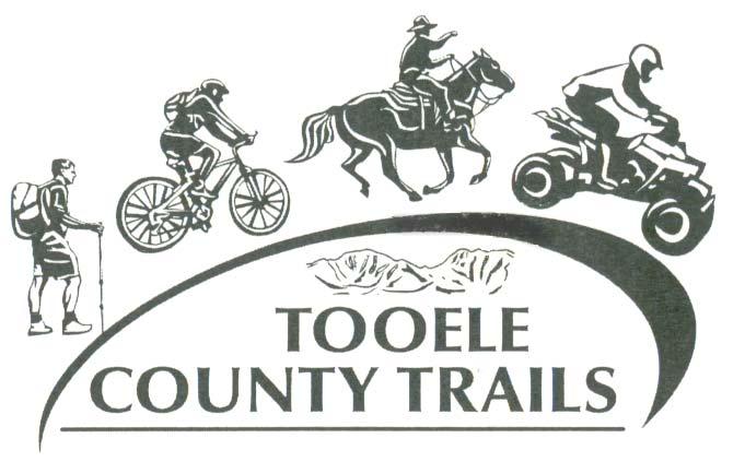
1 CONNECTING COMMUNITIES THROUGH TRAILS


2 CONNECTING COMMUNITIES THROUGH TRAILS
3 Create a master trails plan Connect communities to each other Connect communities to Deseret Peak Complex Access to a maintained system for motorized and non motorized users


4 Trail Use Supported Non-motorized within community boundaries Foot traffic (walking, hiking, jogging, snow shoe, cross country skiing, etc.) Bicyclists Equestrian OHV within the County boundaries outside of community boundaries.
5

6
7
8
9 Tooele Valley Trails Master Plan Index December 5, 2007 The location of the trail heads may be incorrect. When the proposed trail heads are built, the location may shift based upon the approved final design. The size of the trail heads are enlarged for illustration purposes. The existing trails may or may not been completely built at the time of this map was proposed. Some trails may be mixed used and non motorized use, depending upon the location of the trail segment. Trail Number Trail Title Trail Designation 1 Sheep Lane Trail Existing mixed use 2 Mid-Valley Trail Existing mixed use 3 Smelter Road Trail Non-motorized 101 Outer Rim Trail, SR 138 Segment Non-motorized 102 Grantsville /Erda Way Trail Non-Motorized 103 Grantsville to Deseret Peak Trail, SR-112 Segment Non-Motorized 104 North Depot Boundary Trail Non-Motorized 105 NW Depot Boundary Trail Non-Motorized West Trail, Bates Canyon Rd to SR-138 Segment Non-Motorized West Trail, Bates Canyon Rd to UP Right-of Way Rd Segement Non-Motorized 108 Bates Canyon Rd, Droubay to SR-36 Trail Non-Motorized 109 Bates Canyon Rd, SR-36 to 1200 West Trail Non-Motorized 110 Rabbit Lane to UP Right-of-Way Rd Trail Non-Motorized th North Trail, Droubay Rd to Rodgers Rd Non-Motorized 112 Droubay Road Trail, Tooele to UP Right-of-Way Rd Segment Non-Motorized 113 Ranches Pine Canyon Trail, UP Mainline Segment Non-Motorized 114 South Tooele Trail, SR-36 to Vine Street Segment Non-Motorized 115 Mills Junction Trail Non-Motorized 201 Outer Rim Trail, Lakepoint to UP Right-of-Way Rd Segment Motorized 202 UP Right-of-Way Trail, Droubay Road to Sheep Lane Segment Motorized 203 Mormon Trail to Bauer Trail Motorized 204 Davenport Trail Motorized 205 Grantsville Reservoir Trail Motorized 206 North Willow Canyon Trail Motorized A B C Mid-Valley Trail Head 28-Acre Park Trail Head Hollywood Trail Head
10 Tooele Valley Trails Tooele Valley Trails Master Plan Index December 5, 2007 The location of the trail heads may be incorrect. When the proposed trail heads are built, the location may shift based upon the approved final design. The size of the trail heads are enlarged for illustration purposes. The existing trails may or may not been completely built at the time of this map was proposed. Some trails may be mixed used and non-motorized use, depending upon the location of the trail segment. Trail Number Trail Title Trail Designation 1 Sheep Lane Trail Existing mixed use 2 Mid-Valley Trail Existing mixed use 3 Smelter Road Trail Non-motorized 101 Outer Rim Trail, SR 138 Segment Non-motorized 102 Grantsville /Erda Way Trail Non-Motorized 103 Grantsville to Deseret Peak Trail, SR-112 Segment Non-Motorized 104 North Depot Boundary Trail Non-Motorized 105 NW Depot Boundary Trail Non-Motorized West Trail, Bates Canyon Rd to SR-138 Segment Non-Motorized West Trail, Bates Canyon Rd to UP Right-of Way Rd Segement Non-Motorized 108 Bates Canyon Rd, Droubay to SR-36 Trail Non-Motorized 109 Bates Canyon Rd, SR-36 to 1200 West Trail Non-Motorized 110 Rabbit Lane to UP Right-of-Way Rd Trail Non-Motorized th North Trail, Droubay Rd to Rodgers Rd Non-Motorized 112 Droubay Road Trail, Tooele to UP Right-of-Way Rd Segment Non-Motorized 113 Ranches Pine Canyon Trail, UP Mainline Segment Non-Motorized 114 South Tooele Trail, SR-36 to Vine Street Segment Non-Motorized 115 Mills Junction Trail Non-Motorized 201 Outer Rim Trail, Lakepoint to UP Right-of-Way Rd Segment Motorized 202 UP Right-of-Way Trail, Droubay Road to Sheep Lane Segment Motorized 203 Mormon Trail to Bauer Trail Motorized 204 Davenport Trail Motorized 205 Grantsville Reservoir Trail Motorized 206 North Willow Canyon Trail Motorized A B C D Mid-Valley Trail Head 28-Acre Park Trail Head Hollywood Trail Head North Pine Canyon Trail Head
Utah. North Stansbury Mountains Wilderness Study Area Site-Specific Monitoring Guide
 Utah North Stansbury Mountains Wilderness Study Area Site-Specific Monitoring Guide 1 General Information WildSNAP Monitoring Peter Woodruff, American Conservation Experience Coordinator Phone (801) 989-7069
Engineering Report: Apache-Sitgreaves National Forests. Black Mesa Ranger District. Analysis of. National Forest System Roads (NFSRs) #s 504 & 169
 #s 504 & 169") Engineering Report: Apache-Sitgreaves National Forests Black Mesa Ranger District Analysis of National Forest System Roads (NFSRs) #s 504 & 169 for Motorized Mixed Use Designation Forest: Apache-Sitgreaves
Engineering Report: Apache-Sitgreaves National Forests Black Mesa Ranger District Analysis of National Forest System Roads (NFSRs) #s 504 & 169 for Motorized Mixed Use Designation Forest: Apache-Sitgreaves
COMMERCIAL SNOWSHOE TRAILS
 COMMERCIAL SNOWSHOE TRAILS Chapter 17: Commercial Snowshoe Trails: Many of the Wasatch ski resorts have Nordic Centers and/or periphery trails for snowshoeing--some also rent snowshoe gear. Other state
Student Pedestrian Safety Fiddlers Canyon Elementary Community Council 2012
 Student Pedestrian Safety Fiddlers Canyon Elementary Community Council 2012 Introduction Fiddlers Canyon Elementary students must cross North Wedgewood Lane and Fiddlers Canyon Drive in order to come to
Agenda Item No. 6C ATTACHMENT 1
 ATTACHMENT District Bike Plan Proposed s Hillside Ln Livermore D TAC
2012 Diamond Complex Assessment BLM administered: Battle Mountain, Ely, Elko districts
 2012 Diamond Complex Assessment BLM administered: Battle Mountain, Ely, Elko districts wild horse removal scheduled January 2013 Horse Canyon, Diamond HMA July 2012 Preliminary Report (Final Version) of
ORDINANCE NO. 10- AN ORDINANCE OF THE COUNTY OF PLUMAS, STATE OF CALIFORNIA, ADDING ARTICLE 10 TO CHAPTER 3 OF TITLE 4 OF THE PLUMAS COUNTY CODE
 ORDINANCE NO. 10- AN ORDINANCE OF THE COUNTY OF PLUMAS, STATE OF CALIFORNIA, ADDING ARTICLE 10 TO CHAPTER 3 OF TITLE 4 OF THE PLUMAS COUNTY CODE The Board of Supervisors of the County of Plumas, State
CTH M Reconstruction
 CTH M Reconstruction ID 5992 09 81 City of Madison, South Pleasant View Road (Cross Country Road Prairie Hill Road) CTH M Dane County Public Information Meeting Thursday, May 24, 2012 6 p.m. to 8 p.m.
NOTICE OF 30-DAY OPPORTUNITY TO COMMENT March 20, 2013
 NOTICE OF 30-DAY OPPORTUNITY TO COMMENT March 20, 2013 COMMENTS WELCOME The U.S. Forest Service (USFS) Sawtooth National Forest - Ketchum Ranger District is seeking public comments specific on proposal
Ulster County Non-motorized Transportation Plan
 Ulster County Non-motorized Transportation Plan NTAC Meeting NOTES Ulster County Community College Date 08.29.07 Time: 1:00 p.m. - 3:00 p.m. Agenda Welcome /Intro Project Status Report o Project is on
Appendix H. Traffic Analysis
 Appendix H Traffic Analysis Allyn D. Rifkin PE Los Feliz Towers E-mail allynrifkin@gmail.com 4455 Los Feliz Boulevard Suite 1403 Telephone and fax -- (323) 664-2805 Los Angeles, CA 90027 Mobile phone (323)
APPENDIX G: INTERSECTION NEEDS AT OKEECHOBEE BOULEVARD
 APPENDIX G: INTERSECTION NEEDS AT OKEECHOBEE BOULEVARD INTERSECTION NEEDS AT SR 7 and OKEECHOBEE BOULEVARD SR 7 Extension Project Development and Environment (PD&E) Study From Okeechobee Boulevard (SR
TABLE OF CONTENTS. Executive Summary
 Executive Summary Background... ES-1 Pedestrian Network... ES-2 Bikeway Network... ES-2 Collision History... ES-2 Public Input... ES-4 Conclusions and Recommendations... ES-4 1. Introduction and Setting
PRESENTATION OUTLINE
 November 8, 2017 PRESENTATION OUTLINE Regional Express Lanes Network Purpose/Benefits of Express Lanes 95 Express Phase 3C Project Video and Overview 95 Express Phase 3C Schedule 2 SOUTH FLORIDA REGIONAL
City of San Bernardino
 City of San Bernardino Population 204,800 City Overview The City of San Bernardino is the largest City and the county seat of San Bernardino County, California. The City encompasses approximately 81 square
4. ENVIRONMENTAL IMPACT ANALYSIS 9. TRANSPORTATION AND TRAFFIC
 4. ENVIRONMENTAL IMPACT ANALYSIS 9. TRANSPORTATION AND TRAFFIC 4.9.1 INTRODUCTION The following section addresses the Proposed Project s impact on transportation and traffic based on the Traffic Study
PROPOSED REGULATION OF THE BOARD OF WILDLIFE COMMISSIONERS. LCB File No. R112-14
 PROPOSED REGULATION OF THE BOARD OF WILDLIFE COMMISSIONERS LCB File No. R112-14 COMMISSION GENERAL REGULATION 452 EXPLANATION Matter in italics is new; matter in brackets [omitted material] is material
CITY OF WOODINVILLE ONGOING CAPITAL IMPROVEMENT PROJECT UPDATES
 CITY OF WOODINVILLE ONGOING CAPITAL IMPROVEMENT PROJECT UPDATES PROJECT LOCATION MAP (1) DEYOUNG PARK IMPROVEMENTS Project Description - DeYoung Park Improvements include treehouse deck, play area, new
Clackamas County Comprehensive Plan
 ROADWAYS The County s road system permits the movement of goods and people between communities and regions, using any of a variety of modes of travel. Roads provide access to virtually all property. They
February 2018 HIGHWAY 316 IMPROVEMENTS PROJECT
 February 2018 HIGHWAY 316 IMPROVEMENTS PROJECT Agenda 1 2 3 4 5 A Message from the City Project Area Traffic Conditions Pedestrian/Bicycle Comfort & Safety Next Steps Q&A City of Hastings Supports a study
PARADISE CANYON RANCH
 PARADISE CANYON RANCH 4,413 Acres Lost Creek - Morgan County - Utah A5 REAL ESTATE WWW.A5REALESTATE.COM A5 REAL ESTATE 2 Paradise Canyon Ranch QUICK FACTS Located in upper Lost Creek, Morgan County, Utah
Rabbit Lake. Recreational Trail. Tour Guide
 Rabbit Lake Recreational Trail Tour Guide Rabbit Lake Trail RABBIT LAKE RECREATIONAL TRAIL HISTORICAL WALKING TOUR The Rabbit Lake Trail system is partially inclusive, accessible and paved. This trail
Lyons Avenue/Dockweiler Road Extension Project Draft Environmental Impact Report. Appendix I Traffic Impact Study
 Lyons Avenue/Dockweiler Road Extension Project Draft Environmental Impact Report Appendix I Traffic Impact Study Street 0 80-1947 500.4501 RITA ld Court 0 91355-1096 400.7401 LA n Avenue 0 590-3745 300-9301
Appendix B. Summary of Public Comments Tri County Health Department Comments
 Appendix B Summary of Public Comments Tri County Health Department Comments PUBLIC COMMENTS RECEIVED AT THE OPEN HOUSES HELD ON NOVEMBER 17, 2010, NOVEMBER 18, 2010 AND NOVEMBER 22, 2010, AND FROM THE
3.0 Future Conditions
 3.0 Future Conditions In order to be able to recommend appropriate improvements to the transportation system of the Town, it is important to first understand the nature and volume of traffic that is expected
ORANGE COUNTY TRAFFIC COMMITTEE. Speed Limit. Traffic Engineering. Deepthi Arabolu. Establish Speed Limit
 ORANGE COUNTY TRAFFIC COMMITTEE SUPERVISORIAL DISTRICT: 3 SUBJECT: LOCATION: INITIATED BY: INVESTIGATOR: REQUEST: Speed Limit Orange Park Boulevard; Orange Park Acres; TB 770-F7 & 800-F1, F3 Traffic Engineering
91
 90 91 92 93 94 95 96 97 98 99 100 101 102 103 104 105 106 As previously depicted in Exhibit 4-J, vehicular accidents are shown along Forrester Road. The contributing factors may be due to its current two
Faler Creek Ranch DANIEL, WYOMING. Fly Fishing Hunting Ranching Conservation
 Faler Creek Ranch DANIEL, WYOMING Fly Fishing Hunting Ranching Conservation Faler Creek Ranch DANIEL, WYOMING Introduction: Faler Creek Ranch is comprised of 91 acres, providing stunning views of the Wyoming
NWS 44: Mining Activities Location #1, Stanislaus River
 NWS 44: Mining Activities Location #1, Stanislaus River Permit is for the use of a single 8 dredge on a federal mining claim at the location described on the map and as Twp 02N Range 14E, Section 04, MDM
TRAFFIC IMPACT ANALYSIS
 TRAFFIC IMPACT ANALYSIS FOR THE CHAMPAIGN UNIT#4 SCHOOL DISTRICT PROPOSED HIGH SCHOOL (SPALDING PARK SITE) IN THE CITY OF CHAMPAIGN Final Report Champaign Urbana Urbanized Area Transportation Study 6/24/2014
Reference: Laguna Canyon Road Traffic Conditions Data Collection Summary
 Stantec Consulting Services Inc. 38 Technology Drive Suite 100, Irvine CA 92618-5312 September 8, 2017 File: 2073014320 Attention: Mark Trestik, Assistant City Engineer City of Beach Department of Public
RZC Appendix 8A Marymoor Subarea Street Requirements
 RZC Appendix 8A Marymoor Subarea Street Requirements For additional design details for Marymoor Subarea infrastructure, refer to the 2017 Marymoor Subarea Infrastructure Planning Report. STREET REQUIREMENTS
4.4 TRAFFIC and CIRCULATION
 4.4 TRAFFIC and CIRCULATION This section analyzes potential impacts relating to traffic and circulation. The section summarizes the findings of a traffic impact study performed by Associated Transportation
Almon Street Bike Lane Planning
 Almon Street Bike Lane Planning Public Engagement Session Maritime Room, Halifax Forum May 3, 2017 Agenda 6:30 pm 7:00 pm Browse display boards, talk to staff. 7:00 pm 7:30 pm Presentation 7:30 pm 7:40
Module 2 Narration What is a watershed?
 Module 2 Narration What is a watershed? Timing Key Narrative Snapshots a) 00:10 Every living thing relies on water to exist. But where does our water come from? The most natural place to look is upstream
SOLITUDE MOUNTAIN RESORT MASTER DEVELOPMENT PLAN AMENDMENT PROPOSAL
 SOLITUDE MOUNTAIN RESORT MASTER DEVELOPMENT PLAN AMENDMENT PROPOSAL 6/02/14 INTRODUCTION Solitude Mountain Resort s (Solitude) current Master Development Plan (MDP) was accepted by the Wasatch-Cache National
A. You see 4 squirrels. You see 5 more squirrels. How many squirrels did you see altogether?
 Group #1: You are going hiking in a forest. Put a red X on your map in the place where you can do this. Then solve the following problems. A. You see 4 squirrels. You see 5 more squirrels. How many squirrels
7.0 FREEWAYS CONGESTION HOT SPOT PROBLEM & IMPROVEMENT PROJECT ANALYSIS & DEFINITION
 7.0 FREEWAYS CONGESTION HOT SPOT PROBLEM & IMPROVEMENT PROJECT ANALYSIS & DEFINITION 7.1 INTRODUCTION & METHODOLOGY FEASIBILITY REPORT Congestion hot spot problem locations have been assessed using the
Consultation Report & Results August 2016
 Queen Edith s Way Consultation Report & Results August 216 Summary The consultation on walking and cycling improvements along Queen Edith s Way took place from 2 June to 1 August 216. A total of 64 survey
Information on display. Inside this handout. Triangle Area revisions. Project need displays. Preferred alternative on aerial maps
 Public information meeting #4 4 to 7 p.m., September 30, 2009 Hales Corners Welcome Thank you for attending this public information meeting for the WIS 100 Corridor Study. Your interest and comments are
Intersection Control Evaluation Report. This report conforms to the Caltrans Traffic Operations Policy Directive
 Intersection Control Evaluation Report This report conforms to the Caltrans Traffic Operations Policy Directive 13-02. Intersection Control Evaluation (ICE) is a directive issued by the California Department
3.6 Traffic and Transportation/Pedestrian and Bicycle Facilities
 3.6 Traffic and Transportation/Pedestrian and Bicycle Facilities The information in this section is based on the Traffic Technical Report (2012). The Riverside County Traffic Analysis Model (RIVTAM) (with
Fish Lake Team Relay Course Information 2016
 Fish Lake Team Relay Course Information 2016 Fish Lake Team Relay Course Information 2016 The Fish Lake Team Relay begins at Fish Lake Lodge on the shores of beautiful Fish Lake located in Sevier County,
2018 East Canyon Marathon 26.2/13.1/10K/5K. Runners Guide
 2018 East Canyon Marathon 26.2/13.1/10K/5K Runners Guide 1 Index Introduction.3 Sponsors.4 Race Agenda.5 Parking....5 Course Maps 6-7 o Full Marathon..6 o Half Marathon. 7 o 10K/5K.... 7 o More Races 8
Traffic Impact Statement
 Traffic Impact Statement Mixed Use Development, US 41 and Old Trail Drive aka Tide-Starbucks 4900 9 th Street North General Development Site Plan (GDSP) Collier County, FL 10/6/2015 Prepared for: Prepared
Application to AASHTO to recognize six suggested relocations of U.S. Bicycle Route 1 in the Northern Virginia District.
 September 7 th, 2007 Application to AASHTO to recognize six suggested relocations of U.S. Bicycle Route 1 in the Northern Virginia District. Acting District Administrator Mr. Morteza Salehi has endorsed
Phone: Fax: Project Reference No. (to be filled out by MassHighway):
:") Massachusetts Highway Department District 3 Project Need Form (PNF) This form is intended to provide preliminary information about the proposed project. It is not expected that all information that is
Massachusetts Highway Department District 3 Project Need Form (PNF) This form is intended to provide preliminary information about the proposed project. It is not expected that all information that is
REMOVE BARRIERS TO, ENCOURAGE CREATION OF AND PROVIDE GUIDELINES FOR SAFE ROUTES (ALL DISTRICTS)
") Ordinance 2009-98 AN ORDINANCE OF THE BOARD OF SUPERVISORS OF PIMA COUNTY, ARIZONA; RELATING TO ZONING; AMENDING THE PIMA COUNTY ZONING CODE TITLE 18 BY AMENDING SECTION 18.03.020 (DEFINITIONS) TO ADD
Ordinance 2009-98 AN ORDINANCE OF THE BOARD OF SUPERVISORS OF PIMA COUNTY, ARIZONA; RELATING TO ZONING; AMENDING THE PIMA COUNTY ZONING CODE TITLE 18 BY AMENDING SECTION 18.03.020 (DEFINITIONS) TO ADD
State Highway 16 Kuna-Mora Road to Ada/Gem County Line
 Background State Highway 16 is the main commuter route from Gem County to the Treasure Valley. An increase in traffic and accidents on this highway have been a concern for several years, and the Idaho
Bicycle and Pedestrian Facilities Toolbox (Excerpt from Figure 3.1)
") Appendix B Neighborhood Connections Summaries This Appendix is a supplement to the information presented in Chapter 3 Connect People. The Appendix includes a summary or profile for each of the proposed
Appendix B Neighborhood Connections Summaries This Appendix is a supplement to the information presented in Chapter 3 Connect People. The Appendix includes a summary or profile for each of the proposed
Napa Hot Air Balloon Adventure
 Napa Hot Air Balloon Adventure * August 24 Lunch at The Grill at Silverado Golf Course * August 24-1 night stay at Napa River Inn * August 24 - Celadon's Restaurant - Napa River Mill Complex * August 25
Exhibit 1 PLANNING COMMISSION AGENDA ITEM
 Exhibit 1 PLANNING COMMISSION AGENDA ITEM Project Name: Grand Junction Circulation Plan Grand Junction Complete Streets Policy Applicant: City of Grand Junction Representative: David Thornton Address:
State Highway 16/McDermott Road Kuna-Mora Road to Ada/Gem County Line
 Background State Highway 16 is the main commuter route from Gem County to the Treasure Valley. An increase in traffic and accidents on this highway have been a concern for several years, and the Idaho
Los Altos Hills Town Council - June 18, 2015 Palo Alto City Council June 22, AGENDA ITEM #2.B Presentation
 Los Altos Hills Town Council - June 18, 2015 Palo Alto City Council June 22, 2015 AGENDA ITEM #2.B Presentation Previous Presentations Los Altos Hills Town Council in May 2014 and February 2015 Palo Alto
State Highway 16 Kuna-Mora Road to Ada/Gem County Line
 Background Update! (February 2018): This project has been partially funded; see below. State Highway 16 is the main commuter route from Gem County to the Treasure Valley. An increase in traffic and accidents
City of Springboro Bicycle & Pedestrian Plan
 City of Springboro Bicycle & Pedestrian Plan Public Visioning Workshop Documentation of Input August 24, 2012 List of Figures Public Input A Public Visioning Workshop was held on August 7, 2012 from 6:00
Overland Traffic Consultants, Inc. October 15, Mr. Bruce McBride Project Delivery Analysts, LLC Shawnee Street Moorpark, CA 93021
 Overland Traffic Consultants 952 Manhattan Beach Boulevard, Suite #100 Manhattan Beach, CA 90266 Phone (661) 799-8423 E-mail: otc@overlandtraffic.com October 15, 2015 Mr. Bruce McBride Project Delivery
Bicycle Count Data. December 2008
 Bicycle Count Data December 28 Published By: San Luis Obispo Public Works Department 919 Palm Street, San Luis Obispo, California 9341 Telephone (85) 781 719; FAX (85) 781 7198 www.slocity.org Introduction
LANCASTER CITY BICYCLE NETWORK
 LANCASTER CITY BICYCLE NETWORK Downtown Merchants Meeting Wednesday, July 19, 2017 http://www.lancasteratp. DOWNTOWN WALKABILITY ANALYSIS What changes can be made, in the least amount of time, and for
Emergency Response Support Signage on Multi-Use Trails Plan
 DRAFT ( ) Emergency Response Support Signage on Multi-Use Trails Plan Prepared for: SATS Multi-Use Trails Jurisdictions Committee Table of Contents Introduction... 3 Mileage Markers... 4 Rest Stop Identifiers...
Santa Clara I-280 CORRIDOR STUDY
 Santa Clara I-280 CORRIDOR STUDY OCTOBER 2017 PREPARED BY: 1.1 Background The I-280 Corridor Study within Santa Clara County is a high-level highway planning study led by the Santa Clara VTA, in partnership
Bicycle Safety Presented by: Name
 e l c y c Bi Safety Presented by: Name Questions? Who should wear a helmet? Little kids Where and when should a helmet be worn? Answers! Everyone. Every time. Everywhere. Moms & Dads On the bike path
Smith Falls Hunting Haven
 Smith Falls Hunting Haven An extraordinary hunting property with beautiful canyon draws, and gorgeous views of the Niobrara River valley Property Highlights List Price $395,000 $360,000 Location 15 minutes
Iowa Highway 58 Corridor Improvement Study
 1 Iowa Highway 58 Corridor Improvement Study Public Informational Meeting May 6, 2014 2 Welcome and Introductions Randy Lorenzen, City of Cedar Falls Engineer 3 Outline of Presentation Review of Project
Stimson Lumber Company Oregon Lands Public Access Policy 2013 Revised 9/3/2013
 Stimson Lumber Company Oregon Lands Public Access Policy 2013 Revised 9/3/2013 Stimson Lumber Company owns and manages approximately 174,000 acres of commercial timberland in northwest Oregon. It is Stimson
Durrance Elementary School
 Durrance Elementary School SCHOOL ROUTE PLAN For DURRANCE ELEMENTARY SCHOOL LOCATION 9 ORANGE COUNTY Prepared for: ORANGE COUNTY SCHOOL ASSESSMENT PROGRAM ORANGE COUNTY PUBLIC WORKS Traffic Engineering
Join us for Trailbound Trip s. Yellowstone Winter Adventure! Tuesday-Tuesday. Jan , Explore. Dream. Discover.
 Join us for Trailbound Trip s Yellowstone Winter Adventure! Tuesday-Tuesday Jan. 22-29, 2019 Explore. Dream. Discover. Explore Wyoming wilderness! Discover the pristine, wild beauty of Yellowstone in winter!
Edgehill Rd. Sharrow & Buffered Bike Lane
 1 Buffered uphill and Sharrow downhill Trail length: 700 Total cost: $5,500 for striping and markings & $23,000 for repaving Funded from the city s local street fund (from license plate fees and gas tax
ISSUES SUBMITTAL FORM
 Date: 12/2/13 ISSUE: Should the West Bank Boat Ramp be renamed to Sam Caudill SWA? The West Bank Boat Ramp has been under lease to the DOW and now CPW for several years. CPW acquired the property through
Turbo Roundabout Design? Redesign of Park City s 14 Year Old Deer Valley Roundabout Bill Baranowski, P.E. RoundaboutsUSA
 TRB 4 th International Conference on Roundabouts Seattle, WA April 2014 Turbo Roundabout Design? Redesign of Park City s 14 Year Old Deer Valley Roundabout Bill Baranowski, P.E. RoundaboutsUSA Abstract:
August 3, Bay Trail Connection With The Community
 Ms. Lina Velasco, Senior Planner City of Richmond Planning Division P.O. Box 4046 Richmond, CA 94804 Dear Ms. Velasco: August 3, 2009 73 Belvedere Ave. Richmond, CA 94801 Phone/Fax: 510-235-2835 Email:tracbaytrail@earthlink.net
Route 7 Corridor Study
 Route 7 Corridor Study Executive Summary Study Area The following report analyzes a segment of the Virginia State Route 7 corridor. The corridor study area, spanning over 5 miles in length, is a multi
DOWNLOAD OR READ : VERMONT ROADS RECREATION PDF EBOOK EPUB MOBI
 DOWNLOAD OR READ : VERMONT ROADS RECREATION PDF EBOOK EPUB MOBI Page 1 Page 2 vermont roads recreation vermont roads recreation pdf vermont roads recreation Serving Those Who Serve Vermont. The Department
RIDGE ROAD EXTENSION - PHASE I AND II (FROM RIDGE ROAD I DECUBELLIS ROAD I MOON LAKE ROAD INTERSECTION TO US 41)
") RIDGE ROAD EXTENSION - PHASE I AND II (FROM RIDGE ROAD I DECUBELLIS ROAD I MOON LAKE ROAD INTERSECTION TO US 41) ARMY CORPS OF ENGINEERS PERMIT APPLICATION SAJ-2011-00551 (IP-TEH) PASCO COUNTY ADDITIONAL
RIDGE ROAD EXTENSION - PHASE I AND II (FROM RIDGE ROAD I DECUBELLIS ROAD I MOON LAKE ROAD INTERSECTION TO US 41) ARMY CORPS OF ENGINEERS PERMIT APPLICATION SAJ-2011-00551 (IP-TEH) PASCO COUNTY ADDITIONAL
10A. DATE: October 5, Pedestrian and Bicycle Advisory Committee. Kevin Colin, Deputy Planning Manager Curt Bates, City Engineer
 10A DATE: October 5, 2016 TO: PREPARED BY: SUBJECT: Pedestrian and Bicycle Advisory Committee Kevin Colin, Deputy Planning Manager Curt Bates, City Engineer Discussion and Provide Comments, Associated
FOREST SERVICE HANDBOOK NATIONAL HEADQUARTERS (WO) WASHINGTON, DC
 WASHINGTON, DC") Page 1 of 14 FOREST SERVICE HANDBOOK NATIONAL HEADQUARTERS (WO) WASHINGTON, DC FSH 7709.55 - TRAVEL PLANNING HANDBOOK Amendment No.: 7709.55-2009-3 Effective Date: January 8, 2009 Duration: This amendment
Page 1 of 14 FOREST SERVICE HANDBOOK NATIONAL HEADQUARTERS (WO) WASHINGTON, DC FSH 7709.55 - TRAVEL PLANNING HANDBOOK Amendment No.: 7709.55-2009-3 Effective Date: January 8, 2009 Duration: This amendment
Appendix H RESPONSES TO PUBLIC COMMENTS
 Appendix H TO PUBLIC COMMENTS A-1 This comment letter confirms receipt and distribution of the draft IS/ MND and documents project compliance with State Clearinghouse review requirements for the draft
Fish Lake Team Relay Course Information
 Fish Lake Team Relay Course Information Fish Lake Team Relay Course Information The Fish Lake Team Relay begins at Fish Lake Lodge on the shores of beautiful Fish Lake located in Sevier County, Utah. The
Lincoln Avenue Road Diet Trial
 Lincoln Avenue Road Diet Trial Data Collection Report June 1, 2015 Department of Transportation Table of Contents I. Introduction...... 3 II. Data Collection Methodology & Results...... 5 A. Traffic Volume
Transportation 2040 Update - Financial Strategy Balancing
 Move PROJECTS TO BE MOVED FROM CONSTRAINED TO UNPROGRAMMED AUBURN 4513 White River Trail Bicycle/ Pedestrian P 27 2030 $6,000,000 Auburn 4514 Williams Trail Bicycle/ Pedestrian P 25 2020 $2,000,000 AUBURN
Request for Authorization to Open Public Comment Period
 Request for Authorization to Open Public Comment Period May 12, 2015 LRP, TIPs, and Conformity Reasons for Requested Action: LRP and TIP Amendment to Connections 2040 LRP, and Draft FY 2016 TIP for New
Mountain Bike Guide To Oregon
 Mountain Bike Guide To Oregon If searching for a ebook Mountain Bike Guide To Oregon in pdf form, in that case you come on to faithful site. We furnish full release of this book in txt, PDF, epub, DjVu,
DRAFT. Memo. Range of the Alternatives Considered in the EIS
 Memo Date: Friday, December 09, 2016 Project: To: From: Subject: State Route 30 EIS UDOT Vince Izzo This memorandum summarizes the draft State Route (S.R.) 30 Level 1 screening results. A more detailed
Final Technical Report RAILYARD ALIGNMENT AND BENEFITS STUDY. Appendix F: Traffic Analysis, I 280
 Final Technical Report RAILYARD ALIGNMENT AND BENEFITS STUDY Appendix F: Traffic Analysis, I 280 MEMORANDUM Date: To: From: Subject: Susan Gygi, San Francisco Planning Department Dennis Lee and Eric Womeldorff
Reference number /VP. Lafayette Downtown Congestion Study - Additional Traffic Analysis
 To James Hinkamp and Tony Coe, City of Lafayette Date January 19, 2017 Copies Reference number 243381/VP From Michael Iswalt and Vanessa Peers File reference 4-05 Subject Lafayette Downtown Congestion
Mill Creek/Rose Valley Watershed General Information Presented by Dr. Mel Zimmerman Lycoming College CWI
 Mill Creek/Rose Valley Watershed General Information Watershed Concerns Rose Valley Lake Areas of Interest Biodiversity of Interest in Rose Valley Lake Rose Valley Lake Bird Area Fishes of Rose Valley
Owyhee Hikes February & April, 2009
 Owyhee Hikes February & April, 2009 I did a 22 mile loop hike along the Snake River at Swan Falls to view petroglyphs and to find locations to fish for Bass, Catfish and Crappie later in the summer. I
Request for Proposals Contra Costa County Contra Costa Centre I 680/Treat Boulevard Bicycle & Pedestrian Plan
 Request for Proposals Contra Costa County Contra Costa Centre I 680/Treat Boulevard Bicycle & Pedestrian Plan Funded by a Contra Costa Measure J Transportation for Livable Communities Grant from the Contra
Appendix SEA Seattle, Washington 2003 Annual Report on Freeway Mobility and Reliability
 (http://mobility.tamu.edu/mmp) Office of Operations, Federal Highway Administration Appendix SEA Seattle, Washington 2003 Annual Report on Freeway Mobility and Reliability This report is a supplement to:
Gravel Bike Guide Haywood County
 Gravel Bike Guide Haywood County Haywood County is an ideal place for bicycling on gravel roads, because 37% or 129,994 acres of Haywood County is federal property, including portions of the Pisgah National
Supplemental Regulations Utah Motorsports Campus May 4-6, 2018 Version 1.1
 GENERAL Event Facility Length of the Racetrack Supplemental Regulations 512 S Sheep Lane Grantsville, UT 84074 Phone: (435) 277-8000 E-mail: utahmotorsportscampus.com 3.048-mile Outer course; 15-turn Road
State Route 28 Shared Use Path & Safety/Stormwater Enhancements Public Information Meeting
 State Route 28 Shared Use Path & Safety/Stormwater Enhancements Public Information Meeting Thursday, March 30, 2017 4-7 p.m. Presentation at 5:30 p.m. The Chateau at Incline Village 955 Fairway Blvd. Incline
Non-Motorized Overpass at SR 5/US1
 Non-Motorized Overpass at SR 5/US1 And SR 97/SW th Street (Bird Road) Executive Summary March 9, 17 Prepared By: MARLIN Engineering Inc 17 NW th Avenue, Ste. 1 Plantation, FL 33313 P: 35.77.7575 www.marlinengineering.com
Presentation Comments and Questions
 Presentation Comments and Questions The community had a number of questions regarding the master plan process and operational issues in and around the MARC rail station areas. The bullet points below are
Bluffdale/ UDOT South High-T Intersection Project Type Operations
 Bluffdale/ UDOT 14600 South High-T Intersection Project Type Operations 14600 South and Redwood Road $ 600,000 $ 550,000 This project is to install a new High-T intersection at Redwood Road and 14600 South
Purpose. Process. Recommendations
 Summary Document Purpose The was developed to increase safety, mobility, and recognition of cycling in the High Country region (Alleghany, Ashe, Avery, Mitchell, Watauga, Wilkes, and Yancey Counties).
REVOCABLE PERMIT FOR STREET BANNER APPLICATION PACKAGE
 Development Engineering 300 Richards Blvd., 3rd Floor Sacramento, CA 95811 Engineering Services Division REVOCABLE PERMIT FOR STREET BANNER APPLICATION PACKAGE Phone: 916-808-8300 Fax: 916-808-1984 Preparation
3.0 PROJECT DESCRIPTION
 The following section of the Draft EIR contains a description of the proposed Elk Grove Boulevard/SR 99 Interchange Modification project, consistent with the requirements of CEQA Guidelines Section 15124.
Complete Streets Funding Program Project Prioritization Plan
 Funding Program Project Prioritization Plan Location and Type Needs South Street Crosswalk Installation Stripe a new formalized crosswalk across South Street at the Anne T. Dunphy School pedestrian path
Traffic Impact Memorandum. May 22, 2018
 BISHOP PROFESSIONAL DEVELOPMENT BUILDING Proposed Land-use Change & Parking Modification 3601 SW 31st Street Topeka, Kansas 66614 CFS Project No. 185077 Traffic Impact Memorandum May 22, 2018 Prepared