ASHBOURNE PUBLIC REALM STRATEGY
|
|
|
- Vernon Mills
- 5 years ago
- Views:
Transcription

1 ASHBOURNE PUBLIC REALM STRATEGY


2 Ashbourne Public Realm : Introduction and Vision BSM Job Reference 6380 Issuing Date / Office 31/07/2018/ Dublin Project Team JK / RN /AL Version: Final 2
3 Ashbourne Public Realm : Introduction and Vision CONTENTS 1 INTRODUCTION AND VISION 2 APPRECIATING THE CONTEXT 3 PUBLIC REALM STRATEGY 4 PUBLIC REALM PROJECTS 5 IMPLEMENTATION 6 APPENDICES
4
5 1 INTRODUCTION AND VISION
6 Ashbourne Public Realm : Introduction and Vision VISION FOR ASHBOURNE TOWN CENTRE Ashbourne has its origins as a service stop or travellers rest on the Dublin-Belfast coach road. Until the 1970s, Ashbourne had a small population living mostly along Frederick Street. In the last 50 years however, with private transport and new road infrastructure, Ashbourne has taken advantage of both its proximity to Dublin and its location on the Dublin-Belfast economic corridor and expanded in all directions to become the second largest town in County Meath. The scale of Ashbourne has changed immensely - both within the town centre and in the wider town. Frederick Street, once the only street in Ashbourne, is now one of a network of streets that form the town centre. While Frederick Street still incorporates many of the original buildings that defined Ashbourne, including the Ashbourne House Hotel the Church and Parish Hall, the Old School and Hunters Moon, refurbishment, infill development and new development is such that its heritage is not immediately apparent to those visiting the town. The newly expanded town centre to the west along Killegland Street, is of a higher density and of taller and more contemporary buildings. Much of the car parking in the town is within the expanded town, with the effect that many people arrive in the new town having passed by Frederick Street. Frederick Street generally offers pubs and restaurants, the hotel, banks, and community services around the Church and school. Killegland Street principally offers retail, commercial, restaurant and residential uses, and includes the Ashbourne Library. There is a disconnect between Frederick Street and Killegland Street that is manifest in both the look and feel and the offer of both streets, but also exacerbated by the lack of physical connection between them. This disconnection is felt by many who visit the town who are not sure where to go and who find it difficult to navigate the town centre. Ashbourne has a strong heritage and culture, a vibrant and multi-cultural community, and a wealth of sporting, commercial and amenity assets. It also enjoys proximity to Dublin to the south and convenient access to the wider landscape and cultural heritage of County Meath and the Boyne Valley to the north. This Public Realm Strategy is an opportunity to establish the overall town centre as a more cohesive and appealing town centre, building on its heritage, its location, and the newer assets of the town, and where all parts work more effectively together to create an economically and socially vibrant town centre. The town centre should be a strongly people focussed centre for the local community, but also a distinctive and memorable place for visitors. The Vision for the Public Realm is to develop a high quality, attractive and coherent town centre, reflecting the heritage of the town and its people; where streets and spaces of the town centre are distinctive and contribute to sense of place; and where the town centre presents a clear and legible streetscape in which pedestrian and vehicular access is convenient and self-evident. A strong people focussed public realm that connects the streets, spaces and facilities of the town centre, will underpin the long term social and economic vitality of Ashbourne. 6
7 Ashbourne Public Realm : Introduction and Vision 7

8 Ashbourne Public Realm : Introduction and Vision NORTH ASHBOURNE TOWN AND ENVIRONS 8

9 Ashbourne Public Realm : Introduction and Vision PURPOSE OF THE PLAN AND STUDY AREA Meath County Council is promoting a public realm strategy for the town of Ashbourne. Its purpose is to guide the enhancement and vitality of the town as great place to live, work and visit, and also to facilitate and foster growth in the town. This Public Realm Strategy is informed by a comprehensive assessment and analysis of the existing town centre, and also by a process of consultation and engagement between 2017 and 2018 that has included elected members, stakeholders, interest groups and the local community. This process facilitated the establishment of a clear picture of the strengths and weaknesses of Ashbourne, and has led to the identification of a range of potential opportunities for the town centre. The Public Realm Strategy presents a suite of recommendations and potential public realm projects with the aim of improving the physical fabric of the town, and enhancing the experience of the town centre. The overarching objective is to guide the establishment of a strong and cohesive public realm one that makes it a more appealing, distinctive and memorable place for residents and visitors alike, and underpins the social and economic vitality of Ashbourne. This document has been prepared for Meath County Council by Brady Shipman Martin; urban designers, masterplanners and landscape architects. 9


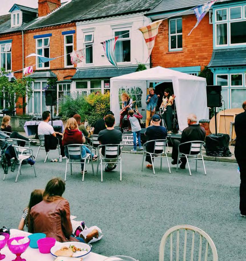
10 Ashbourne Public Realm : Introduction and Vision PUBLIC REALM : WHAT IS IT AND WHY IT MATTERS IDENTITY Public realm is the space between buildings. It includes streets, laneways, civic and open spaces, building frontages that define these spaces, and a host of other elements such as lighting, seating, paving, planting, signage and public art that contribute to the appeal, experience and identity of a town. The quality of the public realm will greatly influence the overall presentation and experience of a town, and will underpin its long term social and economic vitality. It can contribute greatly to the establishment of the town centre as a destination for tourism and investment. The public realm of Ashbourne town centre is an arena for the day-to-day life of the town and its community. It is for living, for business and shopping, for gathering and recreation, and for celebration. It is also where the community and visitors can come together to participate in public activities of all types - from weekly farmers markets to seasonal and one-off events and festivals. It is a place for individuals, families and visitors to enjoy. The public realm should be people and experience focussed, with generous footpaths and spaces that allow easy access, movement and connections throughout the town, and also allow retail units and cafés to open onto the streets to bring life and animation to the street. Greater movement and experience will increase footfall - benefiting the businesses in Ashbourne and encouraging community interaction. Importantly, it will provide visitors with an enjoyable and memorable experience of the Ashbourne, and encourage return visits. There must be an appropriate balance between pedestrian and vehicular movement, with convenient and flush access for pedestrians throughout, including at crossings. The public realm should be a safe place to be, and be comfortable for users of all ages. If carefully considered and well-designed, the public realm will be distinctive and convey a sense of place or identity of the town and its culture. Signage, gateways, street furniture, information panels and other elements can incorporate the brand of the town as appropriate, and information panels in particular can incorporate the story of the town. These can be accessed either casually as people move about the town, or formally as part of an overall heritage trail. Either way, they serve to provide locals and visitors with a sense of the heritage and modern day offer of the town. Public realm investment in Ashbourne in recent years include Frederick Street and parts of Killegland Street, and plans are developing for improvement of the linear park along Broadmeadow River. There is still considerable scope for further improvements, and this Public Realm Strategy sets out recommendations and potential projects that could guide future investment in the town centre. INTERACTIVE 10


11 Ashbourne Public Realm : Introduction and Vision ENGAGING ADAPTABLE FUN ANIMATED 11
12
13 2 APPRECIATING THE CONTEXT
14 Ashbourne Public Realm : Appreciating the Context PLANNING OVERVIEW A Public Realm Plan is a non-statutory plan which is intended to put in place the broad principles to develop and deliver the most effective presentation management and development of the town s public realm. Ashbourne Local Area Plan The current Local Area Plan sets out the policy framework for the future growth of Ashbourne. It consists of a written statement accompanied by a land use zoning objectives map. The Council have a key role in ensuring that policies and objectives contained in the Local Area Plan are achieved. The following objectives are relevant to this plan: As per Section 3.3: Settlement Strategy, it is an objective of the Council: SS OBJ 4: To encourage and promote integration and consolidation of the old and new sections of Ashbourne town centre. SS OBJ 5: To promote the public realm and amenities of Ashbourne so that the quality of life for residents can be improved. Section 7.4 Keeping the Streets Clean In respect of litter control, the Planning Authority believes that litter greatly reduces the appeal of a town and discourages people from making return trips. Any such litter bins shall be in keeping with the character of the area by means of appropriate design and styling to be agreed with the Planning Authority. Therefore, it is the policy of the Council INF POL 19 To require the provision of public litter bins where there is a risk in the opinion of the Planning Authority that a development would result in increased levels of litter on the public road or street. Meath Development Plan Sporting and Leisure Facilities/Recreation/ Open Space and Public Open Space Public open space is a critical element to the creation of a quality and distinctive urban environment, offering opportunities for both passive and active recreation, contributing to the quality of life of residents and visitors alike and offering environmental and ecological benefits. Private open space provision is a fundamental tenet of residential amenity, offering the resident an opportunity for safe and private recreation. SOC OBJ 7 To examine existing public open spaces and carry out improvements where necessary to increase their usefulness as recreational spaces. Chapter 6: Transport One of the strategic aims of the Development Plan is to co-ordinate transport and land use planning. The concept of an integrated transport policy encompasses not only integration within and between different modes of transport, but also integration with environmental, social, recreational, economic, educational and health policies and objectives. Therefore, the provision of transport facilities be no longer be considered or decided upon in isolation. To facilitate this integration, it is a policy of the Council to promote the sustainable development of walking, cycling, public transport and other more sustainable forms of transport. TRAN SP 2 To promote the sustainable development of walking, cycling, public transport and other more sustainable forms of transport as an alternative to the private car, together with the development of the necessary infrastructure and promotion of the initiatives contained within Smarter Travel, A Sustainable Transport Future TRAN SO 1 To prepare local transport plans for Navan, Drogheda Environs, Dunboyne, Kells, Trim, Ashbourne and Dunshaughlin, in accordance with the NTA s draft Transportation Strategy, in consultation with the NTA. Cycling Meath County Council recognises the importance of having a public realm plan that incorporates elements of Smarter Travel whereby an emphasis on promoting sustainable transport, including making developments easily accessible for pedestrian and cyclists, reducing the need to travel and the distance of journeys. As per Section : Cycle Parking of the Meath County Development Plan , 14


 cycle")


15 Ashbourne Public Realm : Appreciating the Context N O R T H Cycle parking facilities should be conveniently located within a populated, well-supervised area, and monitored by CCTV where possible. Moreover, weather protected facilities should be considered where appropriate. All long-term (more than three hours) cycle racks shall be protected from the weather. KEY To protect, provide for and / or improve town and village centre facilities and uses To provide for and facilitate mixed residential and business uses To protect and enhance the amenity of developed residential communities Protected structures Sites and monuments Extract: land use zoning objectives map (Meath County Development Plan ) 15
16 Ashbourne Public Realm : Appreciating the Context PUBLIC CONSULTATION AND ENGAGEMENT The Public Realm Strategy has been informed through analysis of the town centre, but also through consultation with local interest groups, private and commercial stakeholders, and the public. A schedule of consultations is provided on the following pages. A public consultation event, held on 16th January 2018, presented the emerging draft public realm strategy and associated projects, and sought the response and input from local residents and business operators who attended the event. A series of exhibition boards were placed on display in the Ashbourne Library and complimented by a presentation made by the project team. The exhibition boards were left in place in Ashbourne Library between 24th January and 23rd February Attendees and visitors to the exhibition, were asked to complete a feedback form (opposite) and to record their thoughts. Over 300 responses were received in total and a summary of these responses is provided on the page opposite. A number of formal submissions were also received from local business and stakeholders and are also summarised on the page opposite. THANKS FOR COMING Ashbourne Town Centre Public Realm Strategy The community and local stakeholders are at the heart of this consultation process and your views will help us to decide what improvements should be made. ABOUT YOU Do you work / study In Ashbourne Outside Ashbourne How do you travel to Ashbourne Town Centre: Do you prefer to park underground or on the street? Underground On street YOUR TOWN Do you like / enjoy Ashbourne? Where do you identify as the centre of Ashbourne? Do you spend time in the Town Centre for leisure / food / drink / other? Please describe: What evening life offer is available in Ashbourne? Could this be improved? Do you think Ashbourne is safe for pedestrians (young and old)? Is Ashbourne easy to get around / find your way around? Would Mapping / Wayfinding aids / Interpretative information be important? Ashbourne Identity: what do you identify Ashbourne with? (i.e.: Westport = Greenway, Kilorglin = Puck Fair) Horses GAA Rugby Soccer Heritage Culture Music/Dance Other Please Describe: Yes Yes Yes What facilities are available for children? Would civic spaces / pocket parks bring value to the town? Yes No No No No ANY OTHER COMMENTS THANK YOU FOR ATTENDING TODAYS EVENT AND TAKING THE TIME TO COMPLETE THIS FEEDBACK FORM. Public consultation feedback form 16


17 Ashbourne Public Realm : Appreciating the Context CONSULTATION AND ENGAGEMENT SUMMARY Sample of public consultation exhibition boards 17
18 Ashbourne Public Realm : Appreciating the Context PUBLIC CONSULTATION AND ENGAGEMENT Travel to Ashbourne by: Park in Ashbourne: Ashbourne is easy to get The identity of Ashbourne The centre of Ashbourne is around? is: identified as: 41% 1% Cycle Car Walk 58% 78% On street 22% Under ground 60% Yes No 40% 4% 9% Culture Rugby 9% Music Equine Heritage 11% Gaa 15% 52% 5% 20% Library 35% House Church Hotel Frederick No Street Centre 20% 20% Would enhanced open spaces / civic spaces bring value to the town? % Yes Would way-finding / interpretative mapping be important? 1% No Yes 99% Any other comments: + Town lacks character due to dominance of the private car; + Lack of street names is a real issue; + Fear of evening time anti-social issues; + Which is the High Street, Frederick Street or Killegland Street?; + Desire to integrate heritage features into project opportunities; + Retail streets are too car orientated; + Parking enforcement is needed, particularly in pedestrian areas; + Desire for more pedestrian crossings; + Desire for better pedestrian orientated links between housing estates and the town centre; + A very walkable town but no proper pedestrian / cycle links to facilitate this / poor permeability; + Link Frederick Street and Killegland Street via pedestrian routes; + Additional central play spaces are needed; + Broadmeadow River bank needs enhancement; + Enhance gateways into the town; + More bus shelters are required; + Disabled parking desired in close proximity to retail offerings; + Ensure seamless cycle connectivity throughout the town; and + Issues with car parking restrictions along main retail streets.

 07 July 2017 Fr. Derek Darby and Liam Mulvihill (Church grounds) 14 July 2017 Joe Giltinane, Ashbourne Chamber.")

19 Ashbourne Public Realm : Appreciating the Context CONSULTATION AND ENGAGEMENT SUMMARY A series of Stakeholder Engagement meetings were also held during 2017 and 2018 including: 16 Jan 2017 Ashbourne Municipal District 02 Feb 2017 Elected Members 19 June 2017 Ashbourne Municipal District 30 June 2017 Oliver Russell and Niall Barrett (regarding AIB lane project) 06 July 2017 CBRE Aidan Grimes (receivers of lands at Ashbourne) 07 July 2017 Fr. Derek Darby and Liam Mulvihill (Church grounds) 14 July 2017 Joe Giltinane, Ashbourne Chamber. 11 Dec 2017 Ashbourne Municipal District Ashbourne Heritage Trail The Ashbourne Historical Society engaged with BSM during the process and a Heritage Trail Brochure, see below, was submitted to inform the design strategies as presented earlier. Cover page of Ashbourne Historical Society Heritage Trail Brochure 19


20 Ashbourne Public Realm : Appreciating the Context LOCATION OVERVIEW N O R T H County Cavan County Lough Navan Trim County Meath Summerhill Dunshaughlin Ratoath Ashbourne Declan Street Frederick Street County Westmeath Ashbourne Killegland Street Dublin Airport Enfield County Offaly County Kildare Dublin Dublin Castle Street COUNTY SCALE Ashbourne is located on the Dublin to Belfast economic corridor, in close proximity to Dublin, and with convenient access via the M2 motorway to Dublin and Dublin Airport, and northwards towards Belfast. Ashbourne also enjoys convenient access to the wider towns and landscapes of County Meath, including the internationally renowned Boyne Valley. Ashbourne is the second largest urban centre in County Meath. It is convenient to Dublin while retaining the appeal and advantages of a rural town. Ashbourne has a strong relationship with Dublin, with a substantial proportion of its population commuting to Dublin for work and third level education. TOWN SCALE Ashbourne has a compact town centre that is essentially contained between Frederick Street and the Broadmeadow River. The town includes Frederick Street of the old town and Killegland Street of the new town, and together, they incorporate a range of retail, commercial, pubs, restaurants and community facilities that serve the local community. The Broadmeadow River defines the southern boundary of the town centre, and provides an opportunity to establish connections between the built town centre and the natural river corridor. 20

21 Ashbourne Public Realm : Appreciating the Context ORIGINS OF ASHBOURNE The origins of Ashbourne can be traced back to medieval times, and the area around of the town was known for many centuries as Killegland. A Norman tower house, Killegland Castle, was built in the 14th century on the banks of the Broadmeadow River just south of the town centre. The castle was built by the Wafre family, and in time passed to the Seagrave and Carter families. By the 18th century however, it had fallen into disrepair and was ultimately demolished for building stone. Killegland Castle In the early 19th century, a Mr. Frederick Bourne purchased the lands of Killegland and financed the construction of a ten mile section of road from Killegland to Dublin, collecting revenue from tolls from travellers on the mail coach road to Derry and Belfast. He built a small village near the ten mile tollbooth as a service stop for travellers and built an inn, a hotel and other small businesses. He named his village Ashbourne, and the main street was called Frederick Street. Ashbourne grew quickly to a population of just over 400, expanding principally along Frederick Street, and as far as Ashbourne Bridge at the end of Bridge Street. Although the population declined during the famine, it grew again and stabilised at around 400 until the 1970 s. Killegland Castle Ashbourne in 1837 and original location of Killegland Castle 21


22 Ashbourne Public Realm : Appreciating the Context ASHBOURNE TODAY Population growth in Dublin, combined with increasing popularity of the private car, resulted in rapid expansion of satellite towns and villages around Dublin, including Ashbourne. During the 1970s, while the village core of Ashbourne remained as a single street, a series of housing estates were developed in surrounding lands to the Garden City model. The role of Ashbourne as a commuter town began, and the population grew rapidly from only 400 in the early 1970s to over 5,000 by the year Intense economic and physical growth during the early 2000 s saw the continued development of housing estates and apartments around Ashbourne, but also the significant expansion of the original village core beyond Frederick Street. The street network was expanded westwards from the backs of properties along Frederick Street over fields leading to Broadmeadow River. High density mixed used buildings incorporating basement and multi-storey car parking were developed along a major new street running parallel to Frederick Street. This new main street took the historical townland name and was called Killegland Street. R135 Ashbourne in 1995 Town Centre Dublin Road M2 R135 Ashbourne in 2017 Town Centre N O R T H The population of Ashbourne is now over 14,000, and will continue to grow as Ashbourne takes maximum advantage of it proximity to Dublin and Dublin Airport, and also the economic opportunity of its location on the Dublin-Belfast corridor. 22


23 Ashbourne Public Realm : Appreciating the Context Ashbourne House Hotel Out of town residential development High density residential development Civic space, Killegland Street Killegland Street 23


24 Ashbourne Public Realm : Appreciating the Context ASHBOURNE TOWN CENTRE ASSETS Ashbourne is a rural town with a significant, engaged and multi-cultural community that has strong ties with Dublin. Ashbourne enjoys easy access to Dublin and Dublin Airport via the M2 motorway, making it highly accessible town both nationally and internationally. Ashbourne also enjoys convenient access to the wider towns and landscape of County Meath including the internationally renowned heritage of the Boyne Valley. Quality homes and a wide range of retail, community, educational, sporting and recreational facilities underpin the appeal of Ashbourne as an attractive place to live. Ashbourne is projected to grow significantly in the coming years. 24 KEY Walking distance Town Centre Fabric Core Retail Spine Public Realm Improvement Area Green Public Realm Gateways Arrival Point Existing Linear Park Access Points Re-invented Space/Focal Area Bus Stops Retail Anchors Community / Social Anchors The town centre has a wealth of established assets and attractors, which include: + A compact, walkable town centre; + Well established public transport services; + A rich heritage background; + A contrasting urban grain, street structure and vernacular architecture with interesting streets and spaces offering potential for enhancement and connectivity; + Civic spaces positioned in the heart of the town centre; + Ample car parking; + Substantial retail and commercial space along Killegland Street and Frederick Street; + An attractive balance of smaller retail units in the heart of the town with larger anchor units generally towards the edge of the town; + Recent streetscape enhancement along Frederick Street; and + A linear park and river with potential to link seamlessly with the town centre. These town centre assets, supported by a wealth of established leisure, sporting and amenity facilities around the town, are the starting point for the establishment of a public realm strategy for Ashbourne town centre. This strategy will build on these assets and bring them together in a meaningful manner, so that they work together to enhance the identity, vitality, economy and overall experience of the town for residents and visitors. Focal point on Frederick Street Green and blue assets north of Castle Street

25 Ashbourne Public Realm : Appreciating the Context N O R T H 25


26 Ashbourne Public Realm : Appreciating the Context PUBLIC REALM : ISSUES AND WEAKNESSES No sense of arrival into the town centre Unused green spaces Bollard dominated streetscape 26 Illegible and fragmented connectivity to civic spaces Car orientated streetscape Illegible public space


27 Ashbourne Public Realm : Appreciating the Context PUBLIC REALM : OPPORTUNITIES AND POTENTIALS Provide streetscape variety Support a thriving local economy Provide adaptable spaces Create interactive spaces Provide an activated streetscape Create a shared and safe streetscape for all Create a vibrant streetscape with social opportunities 27
28
29 3 PUBLIC REALM STRATEGY
30 Ashbourne Public Realm : Public Realm Strategy OBJECTIVES FOR A SUCCESSFUL PUBLIC REALM The primary objectives of this strategy are to guide the creation of an enhanced and robust public realm in Ashbourne - a realm that is people and experience focussed and enlivens and animates the town centre; is welcoming, engaging and distinctive; is characterful and reflects the culture of the town; and is an arena for the day-to-day life of the town and its community and visitors: Identity + Reflect the historical and contemporary identity of Ashbourne in the streets, spaces, street furniture and other streetscape elements to create meaningful and distinctive sense of place for locals and visitors alike; + Engage the community in determining what the identity should be, and develop a brand that can be used appropriately at gateways, on signage and on interpretive information around the town centre that tells the story of Ashbourne; + Consider the appropriateness of street names and whether any modifications street names could aid understanding and way-finding of the town. 30 Bringing Streets to Life + Create a distinctive, vibrant and appealing town centre by establishing people focussed streetscapes and public spaces with high quality paving, seating, street furniture and lighting; + Create an environment within the town centre that is conducive to an attractive, memorable and authentic town centre destination for residents and visitors. Connections and Movement + Establish new pedestrian links within the town centre that facilitate connection of Frederick Street, Killegland Street and the Broadmeadow River, encouraging greater footfall and social interaction within the town centre; + Adjust the pedestrian to vehicular balance of streets where appropriate so as to provide a stronger and safer pedestrian environment around the town centre. Welcome and Legibility + Establish distinctive gateways and arrival points to the town centre that reflect the brand and create a sense of arrival and welcome; + Provide clear directional signage from the gateways through to key town centre destinations and facilities, including parking and public transport, as well as retail, commercial, civic and amenity destinations; + Provide clear town mapping at key locations to facilitate way-finding and easy exploration around the town.

31 Welcoming Ashbourne Public Realm : Public Realm Strategy Appealing and High Quality People Focussed PUBLIC REALM Identity Connected and Safe Legible 31
32 Ashbourne Public Realm : Public Realm Strategy PUBLIC REALM STRATEGY AND RECOMMENDATIONS The public realm strategy for Ashbourne builds upon existing assets of the town, its unique characteristics, its heritage and its location. Building on these to create an enhanced public realm in Ashbourne, four key themes are the drivers for the public realm strategy. PUBLIC REALM THEMES Identity To establish an identity for Ashbourne that is distinctive and authentic. Connections and Movement To reinforce the streetscapes and enhance pedestrian connectivity throughout the town centre. Welcome and Legibility To create legible and attractive entry points to the town centre that provide strong first impressions. Bringing Streets to Life To create animated streetscapes and a connected town centre whereby people s experiences of the town are enhanced. PUBLIC REALM STRATEGY The overall public realm strategy builds upon and ties the four themes together to create an integrated town centre where a sense of arrival is created at clearly defined gateways and where key public realm spaces and streetscapes are connected. The natural environment along the Broadmeadow River is stitched into the town centre through a series of pedestrian routes and crossings. The following pages explain in further detail how the overall strategy will be facilitated, under the headings of Identity, Connections and Movement, Welcome and Legibility, and Bringing Streets to Life. 32 KEY Town Centre Fabric Key Public Realm Town Centre Access Routes Green Public Realm Gateway Arrival Point Access Point Improved/New Linear Park Access Re-invented Space/Focal Area Potential/Improved Links 1-Way Section of the Road Opportunity Site

33 Ashbourne Public Realm : Public Realm Strategy OVERALL STRATEGY N O R T H 33


34 Ashbourne Public Realm : Public Realm Strategy IDENTITY Ashbourne is a rural town that has its origins as a travellers rest or service stop on the Dublin- Belfast coach road. Modern day Ashbourne still leverages advantage from its location along the Dublin-Belfast economic corridor and benefits from its proximity to Dublin Airport and access to the M2 motorway. Ashbourne has grown significantly as a town and community, and has developed strong associations with other activities including sporting, equine, heritage and music. It is also a convenient location from which to access the wider landscape heritage of County Meath including the Boyne Valley. All of these associations are substantial assets that should contribute to the establishment of a strong identity for Ashbourne both as a settlement and a destination. In considering the identity and brand, it may also be timely to review the street and place naming of the town. While the official name of the old main street is Frederick Street, it is frequently referred to a Main Street, Dublin Road, High Street and even Killegland Street. Similarly, Killegland Street, which is named after the historic townland despite being the main street in the new part of the town centre, is often referred to as Main Street, High Street or Killegland Road. Other streets also have uncertain naming, and this ambiguity undermines the legibility and identity of the town centre. A comprehensive review of street and place names, potentially including historical names that are not currently in use, could be beneficial in aiding legibility of the town and also telling the story of Ashbourne. It is a recommendation of this Public Realm Strategy that a strong and meaningful identity for Ashbourne be established through collaboration and consultation with the local community and other stakeholders. It may be informed by a combination of the strong associations it has with sport and culture, but also by the heritage of the town and the names that were important to the town throughout its history. 34


35 Ashbourne Public Realm : Public Realm Strategy 35


36 Ashbourne Public Realm : Public Realm Strategy MOVEMENT AND ACCESS The connections and movement strategy for Ashbourne town centre has been informed by analysis of existing patterns of pedestrian, cycle and vehicular movement in and around the town centre, and through discussion with local stakeholders. People arrive in the town centre by car or bicycle, by foot, and by public transport. In all cases, once they have arrived, they become pedestrians for the remainder of their visit. In order for the town centre to be a positive experience for visitors, there must be a strong pedestrian focus, with convenient, direct and safe access throughout the centre. This should not be to the exclusion of vehicular traffic which must be able to access and exit the car parking facilities. Opportunities exist to provide a people focussed streetscape within the town centre where walking, cycling, services vehicles and the private car can seamlessly move along the streetscape and provide a more comfortable, connected and safe environment. The greatest apparent demand in Ashbourne is for connections between Frederick Street and Killegland Street that will allow pedestrians to come and go more freely between both streets and to avail of the services on both. Two potential pedestrian connections are indicated on the accompanying map, and their implementation will be subject to detailed design and consultation with the relevant stakeholders. 36 Other options for improving the pedestrian offer in the town is to re-balance certain streets to provide wider pavements that will provide more generous and safer pedestrian space, and reduce the perceived dominance of vehicular traffic. There is also potential to strengthen existing public spaces and to establish new ones. On Killegland Street in particular, and by virtue of the relative locations of car parking access points, it would be possible to convert the middle section of the street to one-way traffic for a short length without precluding access to the car parks. This would have the advantage of retaining on-street parking while greatly enhancing the pedestrian space, which in turn would have a beneficial effect on the street as a strong pedestrian street. This option, and a suite of other potential projects, are set out in Section 4 Public Realm Projects. Additionally, the establishment and reinforcing pedestrian connections between the town centre and the Broadmeadow River would make the playground and linear park more accessible to pedestrians from the town centre. Additional connections would also enhance the appeal of walking into town from the residential areas to the south of the town reducing car dependency and encouraging community interaction. At grade pedestrian crossing Shared streetscape

37 Ashbourne Public Realm : Public Realm Strategy N O R T H KEY Primary vehicular routes Secondary vehicular routes Enhanced Pedestrian connectivity P Parking Key public spaces Proposed Linear Park Access crossings Reorientated flow and direction of vehicular and cycle movement along Killegland Street 37


38 Ashbourne Public Realm : Public Realm Strategy WELCOME AND LEGIBILITY The Welcome and Legibility strategy for Ashbourne is provided in response to strong local demand to provide a clear and effective signage system for people visiting the town centre. Easy navigation will encourage people into Ashbourne, and also to spend more time enjoying the streets, shops, restaurants, pubs, cafés and spaces on offer. The Welcome and Legibility strategy spans the entire town centre, and includes the following hierarchy of features that will assist any visitor to Ashbourne: 1. Gateway welcome points at the northern and southern entry points approaching Frederick Street. 2. Directional signage providing clear directions to car parking and other key destinations. 3. Information points at key public spaces and junctions that includes town mapping. 4. Legible street name plaques 5. Interpretive information either in conjunction with information panels or as stand-alone components of a heritage trail. All components of the welcome, signage and information infrastructure must be easy to see, distinctive and co-ordinated, and incorporate the Ashbourne brand. Each element should contribute to the creation of a mental map of the town centre for all visitors, and provide the appropriate level of information at each stage of the visit. 38 Way-finding Information Street naming

39 Ashbourne Public Realm : Public Realm Strategy N O R T H KEY Welcome to Ashbourne Directional / way-finding Information P Parking Street naming Key public realm / destination Potential / improved pedestrian links Key public spaces 39
40 Ashbourne Public Realm : Public Realm Strategy BRINGING STREETS TO LIFE Bringing streets to life is the ultimate objective of a Public Realm Strategy. Bringing streets to life incorporates the identity, connectivity, and signage elements, but goes further by ensuring that presentation and quality of streets and spaces, and the experience of those streets and spaces, provides people with an engaging, comfortable and memorable experience of the town. Bringing streets to life involves physical improvements to streetscapes and spaces. It includes consideration of the detailed and human scale of spaces, materials, lighting, seating, paving, planting, signage and public art. The ground surfaces people move along; the spaces they can spend time in; the provision and quality of seating; the comfort and adequacy of lighting; the ease of access and separation from vehicles; the use of colour and planting all of these, together with the retail and other experiences on offer, contribute to the quality and character of streets, and to the sense of place and ultimate enjoyment of that place. The strategy for bringing streets to life in Ashbourne centres on a suite of related potential projects that enhance existing streets and spaces and establish or expand others. All of these projects are located within the town centre and are connected to each other by previous public realm improvements or other potential projects. Together, they provide a strong pedestrian focussed network of streets and spaces within the core of Ashbourne town centre. Bringing streets to life in Ashbourne is demonstrated through the suite of potential projects identified on the accompanying map. Each project is further detailed in the following Chapter 4: Public Realm Projects. The range of facilities and events also plays an important role. Public spaces can play host to a wide range of one-off and regular events, including farmers markets and book stalls, buskers and music festivals, parades and other community gatherings. Public spaces should be easily adaptable and have the capacity to accommodate different events within the town centre. 40 KEY 1 Declan Street / Frederick Street Park 2 Declan Street 3 Declan Street Pocket Park 4 Killegland Street Square & Crescent 5 Killegland Street 6 Killegland Street South 7 Frederick Street / Broadmeadow Castle

41 Ashbourne Public Realm : Public Realm Strategy N O R T H


42 Ashbourne Public Realm : Public Realm Strategy BRINGING STREETS TO LIFE


43 Ashbourne Public Realm : Public Realm Strategy KEY 1 Declan Street / Frederick Street Park 2 Declan Street 3 Declan Street Pocket Park 4 Killegland Street Square & Crescent 5 Killegland Street 6 Killegland Street South 7 Frederick Street / Broadmeadow Castle 43
44
45 4 PUBLIC REALM PROJECTS

 and vignette (opposite) of proposed public realm")
46 Ashbourne Public Realm : Public Realm Projects FREDERICK STREET / BROADMEADOW CASTLE N O R T H KEY Civic space at town entrance with seating, lighting and information/ way-finding signage Hedges and trees to screen prominence of parked cars Potential prominent re-location for Arkle sculpture at entrance to town Street planter with high canopy trees Raised table junction with high quality pedestrian crossings Advertisement signage location Raised table pedestrian crossing Indicative plan (above) and vignette (opposite) of proposed public realm improvements

47 Ashbourne Public Realm : Public Realm Projects OPPORTUNITIES: + To create sense of arrival and a strong civic focal point at the town centre; + To optimise pedestrian space by de-cluttering; + To enhance presentation using high quality paving, lighting, street furniture and trees; + To incorporate civic art, integrated directional signage, and interpretive information; and + To visually reduce the prominence of road surfaces and traffic. RECOMMENDATIONS: BEFORE + Establish an arrival point and civic space at this junction as a welcoming and focal point; + Provide strong definition of the streetscape space and pedestrian environment; + Create a visual boundary to adjacent car parking, and possible expansion of pavement space; + Provide a raised table junction treatment and surface material to differentiate space from carriageways; + Rationalise traffic management infrastructure, including bollards; + Distribute public art at entrances to the town; + Provide welcoming, directional and way-finding signage can be provided that connects appropriately with existing signage; + Provide soft landscape, quality paving, seating and lighting; and + Soften the hard landscape, de-clutter bollards. AFTER 47

48 Ashbourne Public Realm : Public Realm Projects DECLAN STREET / FREDERICK STREET PARK N O R T H KEY Civic space with seating, trees and information / way-finding signage Pocket park with outdoor gym equipment Playground Street planter Seating Raised table junction / crossing Street planter with high canopy trees Outdoor seating area (cafe / restaurant) Potential green buffer zone to Church car park Pedestrian link to Library Square Pergola / hedge screening 8 10 Indicative plan (above) and vignette (opposite) of proposed public realm improvements 9

49 Ashbourne Public Realm : Public Realm Projects OPPORTUNITIES: + To create a civic space as an arrival point to the town centre that is pedestrian focussed; + To utilise the green space for visual and pedestrian amenity; + To establish a sense of street rather than road ; + To enhance presentation using high quality paving, lighting, seating, trees and landscape; + To integrate directional signage, and interpretive information; and + To improve pedestrian crossing facilities, existing and new. BEFORE RECOMMENDATIONS: + Establish a civic space at the gable of The Stag s Head as an arrival and focal point, and connecting to a high quality landscaped green space; + Potential to provide sculpture installation(s) appropriate to town at civic space; + Provide integrated welcoming, directional and way-finding signage; + Provide a raised table junction with crossings, differentiated from carriageway, at Frederick Street and Dominick Street; + Provide a pocket park with seating, outdoor gym equipment and small playground; + Potential for a pedestrian link through to Library Square, subject to agreement with stakeholders; + Streetscape enhancement opportunity using high quality paving, lighting, and street furniture coherent with Frederick Street; and + Replace bollards with combined planters, lighting and seating. AFTER 49

50 Ashbourne Public Realm : Public Realm Projects KILLEGLAND STREET SOUTH N O R T H KEY 1 Civic space with seating and information signage 2 Pedestrian zone with seating 3 Landscaped area with tree planting and seating 4 Bicycle parking 5 Raised table pedestrian crossing 6 Planting to screen the car park 7 Way-finding 8 Raised table junction with pedestrian crossing 9 River walk potential access point 10 Street planters Indicative plan (above) and vignette (opposite) of proposed public realm improvements 7 8 6


51 Ashbourne Public Realm : Public Realm Projects OPPORTUNITIES: + To create a pedestrian focussed public space; + To enhance presentation using high quality paving, lighting, seating, trees and landscape; + To optimise the layout and elements of pedestrian spaces; + To incorporate civic art, integrated directional signage, and interpretive information; and + To improve pedestrian crossing facilities, existing and new. RECOMMENDATIONS: BEFORE + Establish a civic space at this location as an arrival and focal point; + Provide strong definition of the streetscape space and pedestrian environment; + Provide a visual boundary to adjacent car parking, and possible expansion of footpath dimension; + Provide a raised table junction treatment and surface material to differentiate space from carriageways; + Provide integrated information, directional and way-finding signage; + Provide soft landscape, quality paving, seating and lighting; + Soften the hard landscape; + Replace bollards with combined planters, lighting and seating; + Reduce carriageway widths where possible to ensure comfortable footpath space; + Remove traffic island at current pedestrian crossing opposite McDonald s and introduce additional crossings at Broad Meadow Castle/ Killegland Street junction; and + Explore potential of River Walk pedestrian access point. AFTER 51
 and")
52 Ashbourne Public Realm : Public Realm Projects KILLEGLAND STREET N O R T H KEY One-way vehicular section of the street; car park access from either end of street Two-way section of the street Pedestrian build-outs, with planting and seating, to increase pedestrian amenity Street planter with high canopy trees Two-way cycle access Indicative plan (above) and vignette (opposite) of proposed public realm improvements 4 3

53 Ashbourne Public Realm : Public Realm Projects OPPORTUNITIES: + To improve the legibility of the street through integrated design (high quality paving, lighting, street furniture and planting); + To activate street frontages to increase activity and diversity from day through to evening; + To improve street footpaths that can facilitate stronger retail, social and creative uses of the street and enhance urban life of the town; + To create potential one-way vehicular section for enhanced pedestrian space and realm; and + Provide a contra-flow cycle track. BEFORE AFTER RECOMMENDATIONS: + Introduce a short one-way vehicular section, maintaining two-way cycle access and access to car parks and deliveries. Retain on-street parking; + Widen pavement widths to provide more comfortable pedestrian space, encourage passive amenity and increase retail space; + Remove concrete bollards and soften the highly engineered road edges by introducing street planters and enclosed seating areas; + Provide appropriate planting in number of locations; + Use high quality paving, lighting, and street furniture coherent with Frederick Street; + Provide a raised paved carriageway along the one-way section to reinforce the visual appeal of the street and to clearly signal the pedestrian nature of the street; + Re-configure selected on-street parking spaces to optimise footpath widths and pedestrian space at key locations where appropriate; + Facilitate on street loading and disabled parking bays; + Minimise street signage and footpath clutter; and + Introduce polycarbonate multicolour panels or similar to multi-storey car park facade. 53

54 Ashbourne Public Realm : Public Realm Projects KILLEGLAND STREET SQUARE AND CRESCENT N O R T H 9 54 KEY 1 Library square with rearranged steps and seating 2 Crescent square 3 Raised table at Killegland Street, connecting the squares and facilitating drop-off 4 Seating area 5 Street planter with high canopy trees 6 Sheltered seating area 7 Planter with high canopy trees and seating 8 Planters around car park pedestrian exit/ entrance 9 Two-way cycle access 10 Feature paved road surface 11 Catenary feature lighting over the public space Indicative plan (above) and vignette (opposite) of proposed public realm improvements

55 Ashbourne Public Realm : Public Realm Projects OPPORTUNITIES: BEFORE AFTER + To reinforce as a pedestrian focussed public space and connect the two public spaces visually and functionally; + To enhance presentation using high quality paving, lighting, seating, trees and landscape; + To encourage/accommodate street frontages to increase activity and diversity from day through to evening; + A potential to develop daytime street performance; and + A potential to introduce a one-way vehicular section of street and two way contra flow cycle track. RECOMMENDATIONS: + Join the two public spaces for an enhanced streetscape and improved pedestrian experience; + Provide a one-way vehicular section, retaining two-way cycle access, maintaining service and access to car parks, rationalising on-street parking, and increasing pedestrian / retail space; + Provide a raised table paved carriageway to connect both sides of the square, increase pedestrian priority, and reinforce the visual appeal of the combined street and public space; + Facilitate on street loading and drop-off bay; + Use high quality paving, lighting, seating, trees in planters and landscape and soften the hard landscape; + Replace bollards with combined planters, lighting and seating; + Consider catenary lighting over the space to create unique character; + Introduce covered shelter around car park vent; + Provide integrated information and way-finding signage; and + Re-arrange steps at the Crescent Square to create larger usable area for street performances etc. 55
 and vignette (opposite) of proposed public realm")
56 Ashbourne Public Realm : Public Realm Projects DECLAN STREET N O R T H KEY 1 Raised table junction 2 High canopy trees 3 Raised table vehicular access 4 Street planter 5 Street planter with seating 3 Indicative plan (above) and vignette (opposite) of proposed public realm improvements


57 Ashbourne Public Realm : Public Realm Projects OPPORTUNITIES: BEFORE + To establish a sense of street rather than road ; + To enhance presentation using high quality paving, lighting, seating, trees and landscape; + To encourage/accommodate street frontages to increase activity and diversity from day through to evening; + To improve and widen street footpaths mainly by removing unused cycle track that can facilitate stronger retail, social and creative uses of the street and enhance urban life of the town; + To create a low speed street for cyclists and other road users; and + To improve pedestrian crossing facilities, existing and new. RECOMMENDATIONS: + Improve the streetscape by using high quality paving, lighting, and street furniture coherent with Frederick Street; + Create a shared surface street environment and provide a comfortable pavement space; + Replace bollards with combined planters, lighting and seating; + Provide a number of raised tables crossings to enhance pedestrian movement, slow traffic speeds and encourage cyclist use of the street; and + Introduce a raised table junction at Declan Street/ Killegland Street. AFTER 57
 and vignette")
58 Ashbourne Public Realm : Public Realm Projects DECLAN STREET POCKET PARK N O R T H KEY 1 Amenity space with seating 2 Planting area 3 Raised table pedestrian crossing 4 Street planters with high canopy trees 5 Raised table vehicular access 6 Screen planting 7 Pedestrian link to park 8 Rearranged parking to provide pedestrian link Indicative plan (above) and vignette (opposite) of proposed public realm improvements 8 7


59 Ashbourne Public Realm : Public Realm Projects OPPORTUNITIES: + To create a pedestrian focussed public space; + To utilise the green space for visual and pedestrian amenity; + To enhance presentation using high quality paving, lighting, seating, trees and landscape; and + To improve pedestrian crossing facilities. RECOMMENDATIONS: BEFORE + Redesign space as a pocket park for improved visual amenity and pedestrian activity; + Improve streetscape through use of high quality paving, lighting, planters and street furniture coherent with proposals for Declan Street + Introduce a raised table pedestrian crossing; and + Introduce climbers to boundary walls to create an attractive setting for the pocket park. AFTER 59
60
61 5 IMPLEMENTATION
62 Ashbourne Public Realm : Implementation PUBLIC REALM ACTION PLAN The enhancement of the public realm in Ashbourne town centre can be facilitated in a number of way and approaches, in addition to the opportunity projects presented in Chapter 4. The following are steps and recommendations by which Meath County Council can begin to deliver in the short to medium term: + Establish a Public Realm Stakeholder forum, including private and commercial stakeholders and the local community; + Facilitate a public and stakeholder consultation to consider the appropriate identity and brand of Ashbourne, and in parallel, undertake a detailed review of the street and place names in the town centre; + Commission and install distinctive welcome features at the gateways to the town that incorporate the Ashbourne brand; + Install clear directional signage at key locations to guide people to key town centre destinations and facilities, including retail, commercial, civic and amenity destinations, car parks and public transport; + Commission and install bespoke street name plaques on the streets, laneways and public spaces; + Provide clear way-finding mapping at key locations in the town centre to facilitate orientation and exploration; + Allow for the installation of interpretive (heritage, tourist, cultural) information boards that provide information and also contribute to the quality of the streets; + Provide high quality street planting to provide visual variety; + Provide high quality paving, seating, street furniture and lighting on a street by street and / or space by space basis; + Establish and promote a year round programme of events and festivals; + Maintain communications and engagement with stakeholders and residents; and + Ensure continuity of design intent as presented in the public realm projects (see chapter 4). 62


63 Ashbourne Public Realm : Implementation MATERIALS PALETTE The appropriate selection and quality of materials, together with development of well informed and considered design solutions, is essential to the success of the public realm strategy and its implementation. Surface materials and finishes The strategy proposes to build upon existing elements in the town that are successful. In this regard, the materials of both the architectural heritage and of the more recent public realm interventions are the starting point and will inform the material palettes. Mixture of light & dark grey setts along Frederick Street Enhanced footpaths and materials, Frederick Street Visual contrast created through material variety and tree planting Streetscape furnishings, Frederick Street 63


64 Ashbourne Public Realm : Implementation MATERIALS PALETTE Typical Street Furniture Sample of street lamp Sample of tree grilles Black litter bin Sample of quality black street litter bins Sample of quality black bicycle racks Sample of timber seating and tables Black bollards (heritage style if required) 64


65 Ashbourne Public Realm : Implementation MATERIALS PALETTE Typical Street Planting Dual purpose planters / seating examples Interactive street planting Adds variety and colour Adds visual contrast 65

66

67 6 APPENDICES
68 Ashbourne Public Realm : Appendices POLICY CONTEXT National Planning Framework One of the national strategic outcomes of the National Planning Framework (NPF) is for enhanced amenities and heritage and to offer a good quality of life. The aim seeks to deliver investment in well-designed public realm, which includes public spaces, parks and streets, as well as recreational infrastructure. This outcome ties in with the objective of compact growth to create liveability place. Design Manual for Urban Roads & Streets (2013) The Design Manual for Urban Roads & Streets (DMURS) provides guidance relating to the design of urban roads and streets. It presents a series of principles, approaches and standards. One aspect fundamental to the success of a public realm strategy relies in part to street networks and way finding. As identified by the DMURS document, Street Networks should be designed to maximise connectivity between destinations to promote higher levels of permeability and legibility for all users, in particular more sustainable forms of transport. This will allow people to move from place to place in a direct manner with greater route choice. The movement towards more integrated and sustainable forms of development will result in a shift away from dendritic street layouts to highly connected networks which maximise permeability, particularly for pedestrians and cyclists. In addition, way finding is an important factor. There are many tools that designers can use to provide a series of design cues by which people can orientate themselves. For example, changes in building height and form, materials and finishes and landscape features. Materials & Finishes Another fundamental aspect of a public realm plan relies on the use of materials and finishes. This is one of the most defining elements of a street particularly where it is used to define the levels of segregation and integration within a street. The material palette can define space, calm traffic and improve legibility, reducing the need for barriers, signage and line marking in favour of texture and colour. In this case, Ashbourne Public Realm Plan could utilise the benefits associated with different materials and finishes as a way to reduce clutter on the street and promote legibility in a subtle more powerful way. A number of other plans that have informed this plan including: + Smarter Travel - A Sustainable Transport Future : A New Transport Policy for Ireland Urban Design Manual (2009)- A companion document to the Guidelines for Planning Authorities on Sustainable Residential Development in Urban Areas + Manual for Local Area Plans - A companion document to the Guidelines for Planning Authorities on Local Area Plans (2013).

69 Ashbourne Public Realm : Appendices TOWN CENTRE CHARACTER AREAS N O R T H KEY Historic town Killegland new quarter Linear park Residential Retail core
70 Ashbourne Public Realm : Appendices URBAN STRUCTURE N O R T H KEY Gateway Focal point Building / space with high visual value Well defined frontage Green area Tree Water bodies Open area Cemetery Bollards


71 Ashbourne Public Realm : Appendices Focal point on Frederick Street Well defined frontage Green area north of Castle Street Southern gateway from Dublin Road Open area along Killegland Street
72 Ashbourne Public Realm : Appendices BUILDING USE N O R T H KEY Residential Retail Commercial Community Hotel Pub / restaurant Health Car park Derelict / vacant

73 Ashbourne Public Realm : Appendices ROADS HIERARCHY N O R T H KEY Primary strategic vehicular link Secondary strategic vehicular link Link routes Access roads

74 Ashbourne Public Realm : Appendices BUILDING HEIGHTS N O R T H KEY 1 storey 2 storeys 3 storeys 4 storeys
75 Ashbourne Public Realm : Appendices PEDESTRIAN AND CYCLE ACTIVITY N O R T H KEY Low level of pedestrian activity / offer Moderate level of pedestrian activity / offer High level of pedestrian activity / offer Trip destination Cycle lane / track Heritage trail Pedestrian crossing Bus stop

76 Ashbourne Public Realm : Appendices PARKING PROVISION N O R T H KEY Large multi-storey car park Public / retail parking Large underground car park Private parking On-street parking
Douglas Land Use and Transportation Strategy (DLUTS) Summary. August 2013
 Summary. August 2013") Douglas Land Use and Transportation Strategy (DLUTS) Summary August 2013 Background Douglas is a large and popular residential suburb of approximately 30,000 persons on the periphery of Cork City along
Douglas Land Use and Transportation Strategy (DLUTS) Summary August 2013 Background Douglas is a large and popular residential suburb of approximately 30,000 persons on the periphery of Cork City along
WELCOME. Purpose of the Open House. Update you on the project. Present a draft recommended plan. Receive your input
 WELCOME Purpose of the Open House The Town of Smiths Falls has initiated the Beckwith Street Redevelopment Plan that includes the preparation of a streetscape functional design for the renewal of Beckwith
21.07 TRANSPORT CONNECTIVITY AND INFRASTRUCTURE
 21.07 TRANSPORT CONNECTIVITY AND INFRASTRUCTURE 21.07-1 Connectivity and Choice Transport connectivity and mode choice are critical to achieving productive, sustainable and socially just cities. Travel
IAN WHITE ASSOCIATES. Crawley Station Gateway Public Realm
 IAN WHITE ASSOCIATES Crawley Station Gateway Public Realm contents 1. objectives & client brief 2. site appraisal 3. best practice guidance 4. design concept 1. objectives & client brief Crawley Train
Living Streets response to the Draft London Plan
 Living Streets response to the Draft London Plan Contents Living Streets response to the Draft London Plan... 1 About Living Streets... 2 Summary... 2 Consultation response... 3 Chapter 1: Planning London
2. Context. Existing framework. The context. The challenge. Transport Strategy
 Transport Strategy Providing quality connections Contents 1. Introduction 2. Context 3. Long-term direction 4. Three-year priorities 5. Strategy tree Wellington City Council July 2006 1. Introduction Wellington
Your views are important. Please fill in a form before you leave. Or alternatively
 Drum Property Group is delighted to welcome you to this exhibition which sets out our initial proposals for a mixed-use development at Stead s Place, Edinburgh. We are keen to hear the views of local people
A CHANGING CITY. of Edmonton, it is essential that it reflects the long-term vision of the City.
 A CHANGING CITY By the year 2040, Edmonton will be home to more than 1 million people. To accommodate growth and support a healthy and compact city, we need a new approach to development/redevelopment
Additional Policies & Objectives for Local Area Plans Ashbourne LAP. Ashbourne
 Ashbourne Strategic Policies SP 1 To operate an Order of Priority for the release of residential lands in compliance with the requirements of CS OBJ 6 of the County Development Plan as follows: i) The
Comments The Plan for Port Whitby
 Comments The Plan for Port Whitby April 24th, 2013 Community Meeting #2 Summary Report Prepared by GLPi April 29th, 2013 1 Introduction The purpose of the Port Whitby Secondary Plan Update, Community Improvement
DRAFT for a State Policy for Healthy Spaces and Places
 DRAFT for a State Policy for Healthy Spaces and Places 1 DRAFT State Policy for Healthy spaces and Places 1. Purpose To encourage the use and development of land that builds healthy communities through
GLEN EIRA CITY COUNCIL. MURRUMBEENA Transforming our neighbourhood together our concepts based on your ideas
 GLEN EIRA CITY COUNCIL MURRUMBEENA Transforming our neighbourhood together our concepts based on your ideas 1 WHAT HAVE WE HEARD? WHAT NOW? Stage one Tell us what you love about your shopping strip November
Transportation Master Plan Advisory Task Force
 Transportation Master Plan Advisory Task Force Network Alternatives & Phasing Strategy February 2016 BACKGROUND Table of Contents BACKGROUND Purpose & Introduction 2 Linking the TMP to Key Council Approved
Exhibit 1 PLANNING COMMISSION AGENDA ITEM
 Exhibit 1 PLANNING COMMISSION AGENDA ITEM Project Name: Grand Junction Circulation Plan Grand Junction Complete Streets Policy Applicant: City of Grand Junction Representative: David Thornton Address:
Additional Policies & Objectives for Local Area Plans Ashbourne LAP. Ashbourne
 Ashbourne Strategic Policies SP 1 To operate an Order of Priority for the release of residential lands in compliance with the requirements of CS OBJ 6 of the County Development Plan as follows: i) The
Douglas Land Use and Transportation Study
 Douglas Land Use and Transportation Study Summary: Key: Yellow Box = key project information Green Box = project recommendations Grey Box = anticipated project outcomes Background: It is an objective of
University of Victoria Campus Cycling Plan Terms of Reference. 1.0 Project Description
 University of Victoria Campus Cycling Plan Terms of Reference 1.0 Project Description The Campus Cycling Plan, a first for the University, will provide a comprehensive and coordinated approach to support
Part B Design Guidance / Principles _
 Part B Design Guidance / Principles www. landlab.co.nz Queenstown Town Centre Public Realm Design Guidelines Version 7 14 June 2018 Page 006 B1 Design Guidance & Best Practice The Queenstown Town Centre
Launceston's Transport Futures. Greater travel options for the people of Launceston
 Launceston's Transport Futures Greater travel options for the people of Launceston Final Draft 13 Jan 2014 1 Page Number Executive summary 3 What is Transport Futures? 4 Vision 6 Economy, access and liveability
TRAVEL PLAN: CENTRAL EUROPEAN UNIVERSITY CAMPUS REDEVELOPMENT PROJECT TRAVEL PLAN. Central European University Campus Redevelopment Project.
 TRAVEL PLAN Central European University Campus Redevelopment Project Page 1 Table of Contents Introduction... 3 Background... 7 Building Users... 7 Transportation in Community Consultation... 7 Summary
TRANSPORTATION NEEDS ASSESSMENT
 TRANSPORTATION NEEDS ASSESSMENT A travel demand analysis was carried out to determine the operational issues and the potential benefit that adding traffic capacity would have on the road network. All the
DESIGN CODE. Enterprise West Harlow London Road North Design Code 21
 DESIGN CODE Enterprise West Essex @ Harlow London Road North Design Code 21 4 MAXIMUM BUILDING HEIGHTS 4.1 Table 4A sets out maximum building height standards for each character area within the LDO boundary.
Transit boulevard: A new road type for Sydney s Growth Centres
 Transit boulevard: A new road type for Sydney s Growth Centres Cleaver, M. A., de Roos, M. P., NSW Centre for Road Safety, Roads and Traffic Authority, NSW Collins, G., Network Services, Roads and Traffic
Chapter 7. Transportation. Transportation Road Network Plan Transit Cyclists Pedestrians Multi-Use and Equestrian Trails
 Chapter 7 Transportation Transportation Road Network Plan Transit Cyclists Pedestrians Multi-Use and Equestrian Trails 7.1 TRANSPORTATION BACKGROUND The District of Maple Ridge faces a number of unique
Obey Creek PEDESTRIAN CIRCULATION EAST WEST PARTNERS PEDESTRIAN CIRCULATION CREEK SIDE LANE SLIP STREET SCOTT MURRAY MAIN STREETS EAST/WEST
 THE VILLAGE AT PEDESTRIAN CIRCULATION MAIN STREETS NORTH/SOUTH MAIN STREETS EAST/WEST SLIP STREET CREEK SIDE LANE PEDESTRIAN CIRCULATION DESCRIPTION: Circulation through the downtown of is organized by
TRANSPORT AND MOVEMENT
 TRANSPORT AND MOVEMENT Movement Strategy Public Transport Cycling and Walking Road Network Parking Standards Transport Impact Assessments Traffic Management Policies DRAFT POOLBEG PLANNING SCHEME Movement
ATTACHMENT 4 - TDM Checklist. TDM Checklist Overview
 ATTACHMENT 4 - TDM Checklist TDM Checklist Overview The proposed checklist rates developments on the degree to which they are TDM and transit supportive. Points are assigned based on the level of transit
Draft Greater Sydney Region Plan
 Powered by TCPDF (www.tcpdf.org) Draft Greater Sydney Region Plan Submission_id: 31452 Date of Lodgment: 15 Dec 2017 Origin of Submission: Online Organisation name: UNSW Sydney Organisation type: Other
summary of issues and opportunities
 1 summary of issues and opportunities EXECUTIVE SUMMARY CHAPTER 2: HISTORY - 3: LAND USE This first chapter is an overview of lessons learned from analysis of the existing conditions on El Camino as well
STONY PLAIN ROAD STREETSCAPE
 Jasper Place Revitalization Strategy: Vision The people involved in the Jasper Place Revitalization Strategy envision: Goal 1: Feeling safe in our community Create a community where feeling safe is common--where
Bentleigh GLEN EIRA COUNCIL TRANSFORMATIONAL CONCEPTS 15
 2 Bentleigh GLEN EIRA COUNCIL TRANSFORMATIONAL CONCEPTS 15 Bentleigh Bentleigh urban design context The Bentleigh activity centre is a busy strip shopping centre that runs along Centre Road and is dissected
Background. Caversham a vision for the future. Joint public meeting arranged by:
 Joint public meeting arranged by: Sharing our Streets Caversham a vision for the future and Caversham Traders Association This presentation followed a presentation by Simon Beasley, Network Manager for
AUTOMATED AND ZERO EMISSION VEHICLES HOW THEY MIGHT RESHAPE OUR STREETS
 AUTOMATED AND ZERO EMISSION VEHICLES HOW THEY MIGHT RESHAPE OUR STREETS STURT ST BALLARAT WATERGARDENS TAYLORS LAKES SIMPSON ST YARRAVILLE CHAPEL ST SOUTH YARRA RINGWOOD STATION MONASH FREEWAY SA NSW VIC
BYRES ROAD: PUBLIC REALM Public Consultation
 Public Consultation Introduction As a vibrant commercial, shopping and residential location within the heart of the West End Byres Road is an important destination. Its proximity to the University of Glasgow
PUBLIC REALM MASTER PLAN
 WESTSHORE BUSINESS DISTRICT PUBLIC REALM MASTER PLAN MASTER PLAN COMMITTEE MEETING MARCH 20, 2013 WESTSHORE BUSINESS DISTRCT PUBLIC REALM MASTER PLAN MACRO-SCALE CONCEPT: A PUBLIC REALM FRAMEWORK DEFINED
4.1 Introduction. 4.2 Aspects of walkable communities
 4 Community walkability Community walkability Making communities walkable Urban form Feeling secure 4.1 Introduction Walkability describes the extent to which the built environment is walking-friendly.
COUNCIL POLICY NAME: COUNCIL REFERENCE: 06/119 06/377 09/1C 10llC 12/1C INDEX REFERENCE: POLICY BACKGROUND
 COUNCIL POLICY NAME: COUNCIL ADVISORY COMMITTEES - TERMS OF REFERENCE ISSUED: APRIL 3, 2006 AMENDED: NOVEMBER 27, 2006 NOVEMBER 23, 2009 JANUARY 11, 2010 DECEMBER 17, 2012 POLICY COUNCIL REFERENCE: 06/119
Woolwich Ferry A205 PURPOSE OF VISITING THE TOWN CENTRE. Usually for shopping (particularly groceries) and for transport PARTS OF WOOLWICH VISITED
 and for transport PARTS OF WOOLWICH VISITED") INTRODUCTION ABOUT THE STRATEGY WHAT HAS HAPPENED SO FAR? Woolwich is changing. Recent new developments and the arrival of Crossrail are creating a huge opportunity for tranformation in Woolwich. This
INTRODUCTION ABOUT THE STRATEGY WHAT HAS HAPPENED SO FAR? Woolwich is changing. Recent new developments and the arrival of Crossrail are creating a huge opportunity for tranformation in Woolwich. This
PEDESTRIAN ACTION PLAN
 ATTACHMENT 2 CITY OF SANTA MONICA PEDESTRIAN ACTION PLAN CITY OF SANTA MONICA PEDESTRIAN ACTION PLAN This page intentionally left blank EXECUTIVE SUMMARY CHAPTER 1 EXECUTIVE SUMMARY Setting the Stage
ABERDEEN: CITY OF THE FUTURE
 ABERDEEN: CITY OF THE FUTURE A contribution towards discussions on a future transport strategy for Aberdeen and its Region Prepared by the Centre for Transport Research University of Aberdeen June 2010
S T A T I O N A R E A P L A N
 The Circulation and Access Plan describes vehicle, pedestrian, and transit improvements recommended within the Concept Plan. In order to create and sustain a vibrant business district that provides pedestrian-friendly
Vision: Traditional hamlet with an attractive business/pedestrian friendly main street connected to adjacent walkable neighborhoods
 N D. Focus Area II Vision: Traditional hamlet with an attractive business/pedestrian friendly main street connected to adjacent walkable neighborhoods Transit Road Focus Area II is located in the Hamlet
Public Workshop #2. September 14, 2016
 Public Workshop #2 September 14, 2016 Agenda Welcome Project Overview Where We Have Been Alternatives for State Street Land Use Street Design Next Steps 2 Project Overview Create a Vibrant State Street
Illustrated Principles of Good Planning
 Illustrated Principles of Good Planning The Miami 21 Zoning Code incorporates time-tested planning principles into the zoning regulations of our City. These are principles that make for better neighborhoods,
Active Transportation Infrastructure Investment A Business Case
 Active Transportation Infrastructure Investment A Business Case In 2016, the Real Estate Foundation awarded the Capital Regional District a $50,000 grant for Shifting Gears: Land Use Change through Active
LEA BRIDGE ROAD - A STREET FOR EVERYONE Public consultation document
 LEA BRIDGE ROAD - A STREET FOR EVERYONE Public consultation document TELL US Bakers Arms to Leyton Green Road (Section D, E, F) Leyton Green Road to Whipps Cross Roundabout (Section G) YOUR VIEWS www.enjoywalthamforest.co.uk
Building a Liveable Ottawa 2031 Backgrounder 5: Barrhaven/Riverside South/Leitrim
 Building a Liveable Ottawa 2031 Backgrounder 5: Barrhaven/Riverside South/Leitrim Wards 3 and 22 Official Plan Transportation Master Plan Cycling Plan Pedestrian Plan October 2013 ottawa.ca/liveableottawa
Strategy for Walking & Cycling Action Plan
 Strategy for Walking & Cycling Action Plan To achieve higher levels of walking and cycling activity, the destinations which people access have to be available within suitable distances and designed to
Green Streets and Urban Greenways
 127 11 Green Streets and Urban Greenways 11. Green Streets and Urban Greenways 128 11 Green Streets and Urban Greenways Once the traffic-free section of a route has come to an end, then comes the remaining
9. Parking Supporting Statement
 9. Parking Supporting Statement Content 1. Setting the Scene 2. Vision 3. Parking and the Shared Priorities 4. Issues 5. Delivery Programme in the first Plan Period 2001/02 2005/06 6. Good Practice 7.
MARTIN LUTHER KING JR. WAY
 OCTOBER 2011 40 Vision and Goals The Martin Luther King, Jr. Way Illustrative Master Plan that follows has been developed through a process of community involvement. It expresses a long term vision for
NEWMARKET UPHAM S CORNER
 SOUTH STATION Planning Initiative NEWMARKET UPHAM S CORNER COLUMBIA ROAD (P) FOUR CORNERS/GENEVA Working Advisory Group (WAG) Meeting #5 TALBOT AVENUE MORTON STREET BLUE HILL AVE/CUMMINS HWY (P) RIVER
York Boulevard Streetscape Master Plan
 York Boulevard Streetscape Master Plan October 24 th, 2008 The Story of York Boulevard Streetscape Master Plan Design. Chapter 126 Dealing with Engineers. 2 1 Today s Presentation Topics: 1. Show the streetscape
CONNECTIVITY PLAN. Adopted December 5, 2017 City of Virginia Beach
 CONNECTIVITY PLAN Adopted December 5, 2017 City of Virginia Beach CONTENTS 1.0 Background & Purpose... 2 2.0 Existing Inventory & Analysis... 3 ViBe District Existing Walking Conditions... 4 3.0 ViBe District
CONNECTING PEOPLE TO PLACES
 CONNECTING PEOPLE TO PLACES 82 EAST BENCH MASTER PLAN 07 Introduction The East Bench transportation system is a collection of slow moving, treelined residential streets and major arteries that are the
EXECUTIVE SUMMARY: TRANSIT-ORIENTED DEVELOPMENT IN SMITHS FALLS, ONTARIO; A COMPARISON BETWEEN TWO SITES
 EECUTIVE SUMMARY: TRANSIT-ORIENTED DEVELOPMENT IN SMITHS FALLS, ONTARIO; A COMPARISON BETWEEN TWO SITES Topic and Purpose In 2007, the Mayor of Ottawa s Task Force on Transportation suggested adding a
162 RESIDENTS ATTENDED 2 DAYS OF WORKSHOPS 15 TABLE DISCUSSIONS WHAT WE HEARD. Oakridge Municipal Town Centre Workshops PLANNING PROGRAM
 OAKRIDGE MTC WORKSHOP 2017 CAMBIE CORRIDOR Phase 3 STEP 3: 3: October June 2017 CAMBIE CORRIDOR PLANNING PROGRAM 2 DAYS OF WORKSHOPS 15 TABLE DISCUSSIONS 162 RESIDENTS ATTENDED WHAT WE HEARD Oakridge Municipal
Chapter 3: Multi-Modal Circulation and Streetscapes
 CHAPTER 3: MULTI-MODAL CIRCULATION AND STREETSCAPES Chapter 3: Multi-Modal Circulation and Streetscapes Overview Streetscape improvements have already been completed for Depot Street between Main Avenue
Frome Street Bicycle Route
 The Adelaide City Council invites engagement from the community about Frome Street Bicycle Route Project Summary Adelaide City Council is seeking feedback on design options to construct bicycle facilities
Living Streets Policy
 Living Streets Policy Introduction Living streets balance the needs of motorists, bicyclists, pedestrians and transit riders in ways that promote safety and convenience, enhance community identity, create
Table #6 VISION CHARACTERISTICS
 Table #6 VISION White Flint is a place to live, work, play, shop, and walk with sufficient density to encourage quality redevelopment. Vibrant streets and consistent streetscapes are important. CHARACTERISTICS
AUTOMATED AND ZERO EMISSION VEHICLES HOW THEY MIGHT RESHAPE OUR STREETS
 AUTOMATED AND ZERO EMISSION VEHICLES HOW THEY MIGHT RESHAPE OUR STREETS BACKGROUND: This study is a collaboration between Urban Circus (Visualisation) and Ethos Urban (Urban Design) Ideas were workshopped
Complete Streets for Niagara A working method to visualize the creation of a complete street June 20th, 2013
 Complete Streets for Niagara A working method to visualize the creation of a complete street June 20th, 2013 C O N T E N T S Introduction and background of the report What is a complete street? What can
MEETING Agenda. Introductions. Project Overview. Key Study Components. Alternative Station Concepts. Preferred Station Concept. Next Steps.
 City GARLAND Council ROADVISION Briefing STUDY VISION STUDY Dallas, TX April 8, 2010 1 1 MEETING Agenda Introductions Project Overview Key Study Components Alternative Station Concepts Preferred Station
APPENDIX A: Complete Streets Checklist DRAFT NOVEMBER 2016
 APPENDIX A: Complete Streets Checklist DRAFT NOVEMBER 2016 Complete Streets Checklist MetroPlan Orlando s Complete Streets Checklist is an internal planning tool for staff to further implementation of
Welcome! Public Open House on UBC s Transportation Plan
 1 Welcome! Public Open House on UBC s Transportation Plan Public open house hours: to When it comes to on-campus transportation, what do you think is working well and what are some opportunities for improvement?
Tonight is for you. Learn everything you can. Share all your ideas.
 Strathcona Neighbourhood Renewal Draft Concept Design Tonight is for you. Learn everything you can. Share all your ideas. What is Neighbourhood Renewal? Creating a design with you for your neighbourhood.
Perryville TOD and Greenway Plan
 Perryville TOD and Greenway Plan Greenway Glossary Pathway: A bicycle and pedestrian path separated from motorized vehicular traffic by an open space, barrier or curb. Multi-use paths may be within the
City of Perth Cycle Plan 2029
 Bicycling Western Australia s response City of Perth Cycle Plan 2029 2012-2021 More People Cycling More Often ABOUT BICYCLING WESTERN AUSTRALIA Bicycling Western Australia is a community based, not-for-profit
Cycle traffic and the Strategic Road Network. Sandra Brown, Team Leader, Safer Roads- Design
 Cycle traffic and the Strategic Road Network Sandra Brown, Team Leader, Safer Roads- Design Highways England A Government owned Strategic Highways Company Department for Transport Road Investment Strategy
CITY OF BLOOMINGTON COMPLETE STREETS POLICY
 CITY OF BLOOMINGTON COMPLETE STREETS POLICY POLICY OBJECTIVE: The City of Bloomington will enhance safety, mobility, accessibility and convenience for transportation network users of all ages and abilities,
Newcastle Racecourse Masterplan. 1 Introduction. Completing the vision of a redeveloped Newcastle Racecourse Welcome to our exhibition.
 1 Introduction Completing the vision of a redeveloped Newcastle Racecourse Welcome to our exhibition. Please take a look at our information boards and feel free to ask members of the project team any questions
FUTUREDMS 2018 CONSULTATION REPORT
 FUTUREDMS 2018 CONSULTATION REPORT Rev 1 17/08/2018 Sharing ideas of how to make amazing spaces and facilities better through the passion of talented people working together This document presents the
Bicycle and Pedestrian Advisory Committee (BPAC) November 21, 2013
 November 21, 2013") Bicycle and Pedestrian Advisory Committee (BPAC) November 21, 2013 OVERALL LAND USE CONCEPT Overall Broadway Valdez District: 95.5 acres (35.1 acres right-of ways + 60.4 acres developable land) Plan Subareas:
Bicycle and Pedestrian Advisory Committee (BPAC) November 21, 2013 OVERALL LAND USE CONCEPT Overall Broadway Valdez District: 95.5 acres (35.1 acres right-of ways + 60.4 acres developable land) Plan Subareas:
complete streets design and construction standards public primer City of Edmonton
 complete streets design and construction standards public primer City of Edmonton introduction Complete Streets are streets for everyone: people who walk, wheel, bike, take transit, or drive. They are
City of Novi Non-Motorized Master Plan 2011 Executive Summary
 City of Novi Non-Motorized Master Plan 2011 Executive Summary Prepared by: February 28, 2011 Why Plan? Encouraging healthy, active lifestyles through pathway and sidewalk connectivity has been a focus
East Burke Transportation, Safety and Capacity Improvements
 East Burke Transportation, Safety and Capacity Improvements The purpose of this project is to increase mobility and improve safety for pedestrians, cyclists, and motor vehicles along VT Route 114 in the
Make Lincoln Highway an economically vibrant corridor that is safe, efficient, and beautiful for local residents and visitors.
 Lincoln Highway Streetscape Plan Stakeholder Workshop #2 Handout Contents Introduction and Project Vision Planning Principles Specific Recommendations including a Proposed Typical Roadway Section Renderings
Executive Summary Route 30 Corridor Master Plan
 Route Corridor Master Plan Project Overview The Route Corridor Master Plan is a coordinated multimodal transportation and land use plan for the entire stretch of Route through East Whiteland Township,
MAG Town of Cave Creek Bike Study Task 6 Executive Summary and Regional Significance Report
 Page 1 MAG Town of Cave Creek Bike Study Task 6 Executive Summary and Regional Significance Report August 1, 2012 MAG Project #481 Page 2 Task 6 Executive Summary and Regional Significance Report Introduction
PEDESTRIAN CIRCULATION & STREETSCAPE DESIGN
 CHAPTER 4 Chapter 4 Pedestrian Circulation & Trails PEDESTRIAN CIRCULATION & STREETSCAPE DESIGN In recent years, the City has constructed new sidewalks and enhanced existing ones in the downtown with brick
EXECUTIVE SUMMARY. Vision
 Vision Walking and bicycling in Salt Lake City will be safe, convenient, comfortable, and viable transportation options that connect people to places, foster recreational and economic development opportunities,
5 Circulation & Parking
 5 Circulation & Parking Downtown Parking & Circulation Strategy. Downtown Wayne has a somewhat disconnected system of local public streets to connect downtown with the residential neighborhoods, and primary
Section 2 Strategic Alignment. Contents
 Section 2 Strategic Alignment Contents 2 Strategic Alignment... 2 2.1 General... 2 2.2 SmartGrowth Strategy and Implementation Plan... 2 2.3 Walking and Cycling Strategy... 3 2.4 Built Environment Strategy...
Omaha s Complete Streets Policy
 Omaha s Complete Streets Policy (Adopted August 2015) VISION To create great places and enhance our quality of life, the City of Omaha will provide safe, accessible streets for all users. Complete Streets
o n - m o t o r i z e d transportation is an overlooked element that can greatly enhance the overall quality of life for the community s residents.
 N o n - m o t o r i z e d transportation is an overlooked element that can greatly enhance the overall quality of life for the community s residents. 84 Transportation CHAPTER 11 INTRODUCTION Transportation
WEST CENTRAL DRAFT DISTRICT PLAN SUBMISSION 3 HASSAL ST WESTMEAD
 Ref: OBF 170330 LGSC - DDP Sub 30 March 2017 Greater Sydney Commission PO Box 257 PARRAMATTA NSW 2124 Attention: District Commissioner - Professor Edward Blakely Dear Professor Ed Blakeley, WEST CENTRAL
This objective implies that all population groups should find walking appealing, and that it is made easier for them to walk more on a daily basis.
 Walking for life The Norwegian Walking Strategy Guro Berge Norwegian public Roads Administration "Walking for life" is the slogan for the National Walking Strategy that is now being formulated in Norway.
Hopkins Architects. University of Nottingham. University Park Campus Masterplan Strategy. 13 th February 2009
 University of Nottingham University Park Campus Masterplan Strategy 13 th February 2009 Purpose of this Document The purpose of this document is to set out a new masterplan strategy for University Park
Bicycle-Pedestrian Master Plan Update
 Bicycle-Pedestrian Master Plan Update Planning & Zoning Commission November 29, 2017 Overview Project Purpose & Scope Project History Plan Vision & Goals Chapter 5: Making Connections-Beyond the Path Next
WALKNBIKE DRAFT PLAN NASHVILLE, TENNESSEE EXECUTIVE SUMMARY NASHVILLE, TENNESSEE
 NASHVILLE, TENNESSEE EXECUTIVE SUMMARY Executive Summary A world-class multi-modal transportation system is essential to a vibrant city and better quality of life. -Mayor Barry The WalknBike plan aims
March Maidstone Integrated Transport Strategy Boxley Parish Council Briefing Note. Context. Author: Parish Clerk 2 March 2016
 Context. Author: Parish Clerk 2 The Draft Integrated Transport Policy (DITS) sets out a vision and objectives, and identifies a detailed programme of interventions to support the Maidstone Borough Local
BROOKLAND Multi-Modal Transportation & Streetscape Study* NE Washington, DC
 BROOKLAND Multi-Modal Transportation & Streetscape Study* NE Washington, DC The study s goal is to create a multi-modal transportation and streetscape design plan to increase transportation efficiency,
Ann Arbor Downtown Street Plan
 1 Ann Arbor Downtown Street Plan Public Workshop #1 We know that. 2 Public right-of-way (streets, sidewalks, and alleys) make up 30% of the total District area of downtown. Streets need to provide mobility
CHAPTER 7.0 IMPLEMENTATION
 CHAPTER 7.0 IMPLEMENTATION Achieving the vision of the Better Streets Plan will rely on the ability to effectively fund, build and maintain improvements, and to sustain improvements over time. CHAPTER
FAQ s Walsh Road / Ferguson Road Pilot Scheme
 FAQ s Walsh Road / Ferguson Road Pilot Scheme What is happening? Traffic calming measures are being installed as a pilot. Temporary Bollards will be installed to the east of 1 Ferguson Road and a Temporary
CITY OF COCOA BEACH 2025 COMPREHENSIVE PLAN. Section VIII Mobility Element Goals, Objectives, and Policies
 CITY OF COCOA BEACH 2025 COMPREHENSIVE PLAN Section VIII Mobility Element Goals, Objectives, and Policies Adopted August 6, 2015 by Ordinance No. 1591 VIII MOBILITY ELEMENT Table of Contents Page Number
Design Workshops Summary of all Feedback January 2017
 Histon Road Corridor Design Workshops Summary of all Feedback January 2017 CITY DEAL AND GROWTH Commitment to Growth: Government, County, City and District Emerging Local Plans: 33,000 new homes 45,000
Easton Safer Streets - Final Project Report BRISTOL
 - Final Project Report BRISTOL A Sustrans Community Street Design Project in partnership with Bristol City Council February 07 About Sustrans Sustrans makes smarter travel choices possible, desirable and
September HAWKHURST PARISH COUNCIL Page 1 of 13 SPORTS STRATEGY FINAL
 September 2017 HAWKHURST PARISH COUNCIL Page 1 of 13 SPORTS STRATEGY FINAL Table of Contents EXECUTIVE SUMMARY 3 1. INTRODUCTION 4 2. LOCAL CONTEXT 5 3. OBJECTIVES 7 4. PRIORITIES 8 5. FUNDING OPTIONS