Monroe Street Reconstruction. Kickoff Meeting June 13, 2016
|
|
|
- Erick Cain
- 6 years ago
- Views:
Transcription
1 Monroe Street Reconstruction Kickoff Meeting June 13, 2016

2 Wingra School Thanks to: Trader Joe s Dudgeon-Monroe Neighborhood Association
3 Introductions
4 Project Team: City Staff Christy Bachmann, P.E., Principal Engineer Jim Wolfe, Project Engineer Phil Gaebler, Water Resources Specialist Yang Tao, Ph.D., P.E., Assistant City Traffic Engineer Rebecca Cnare, PLA, Urban Design Planner Ruth Rohlich, Business Development Specialist Benjamin Zellers, Transportation Planner Tim Sobota, Transit Planner
5 Project Team: Urban Assets Zia Brucaya, AICP, Associate Planner Melissa Huggins, AICP, Principal Planner Quinn Heneghan, Project Coordinator Katie Fadelli, Planning Assistant
6 Table Introductions Your name The street you live on What brought you here this evening Something you re most excited about doing this summer
7 Tonight s Agenda 1. Project Timeline & Context 2. Table Conversation #1 Definitions of Success 3. City Engineering Presentation Existing Conditions, Plans & Opportunities 4. Table Conversation #2 Likes, concerns, need to know more 5. Issues & Opportunities Mapping
8 Public Engagement Process & Timeline
9 Organizing Topics 1. Pedestrian Safety and Access 2. Green Infrastructure 3. Bicycle Safety and Access 4. Transit Safety and Access 5. Business Enhancement
10 The Engagement Resource Team (ERT) Members 1. Alder Eskrich 2. Dudgeon-Monroe Neighborhood Association 3. Monroe Street Merchants Association 4. Friends of Lake Wingra 5. Madison Bikes 6. Wingra School 7. Edgewood College 8. University of Wisconsin 9. Vilas Neighborhood Association (TBD) Role Help to implement a broadly inclusive engagement process over the next months. Provide input on appropriate engagement strategies and opportunities. Share project information and encourage community involvement.
11 2016 Public Engagement Process & Timeline June 13 th Kickoff! Visioning & Mapping September Cross Section Modeling Workshop Summer Refine Vision, Goals, Issues, Opportunities October Cross Section Open House Summer Collect Data November Resolution to Establish Cross Section
12 2017 Public Engagement Process & Timeline Spring Streetscape & Green Infrastructure Workshop Summer Placemaking Nodes Workshop Early Fall Wrap Celebration and Open House We hope you will join us!
13 Project Context

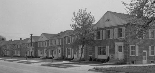
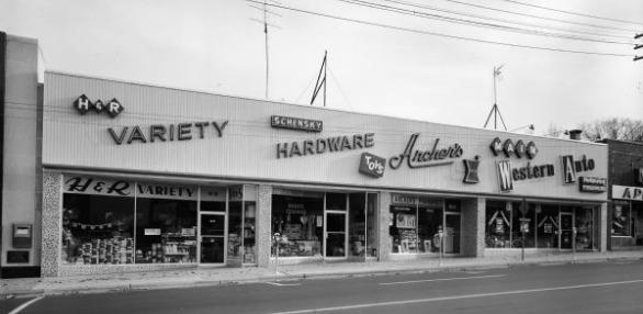
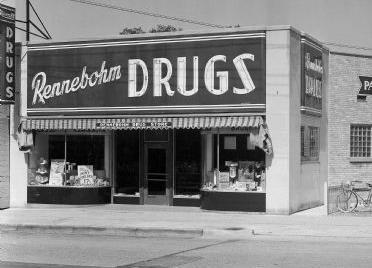
14 Monroe Street History

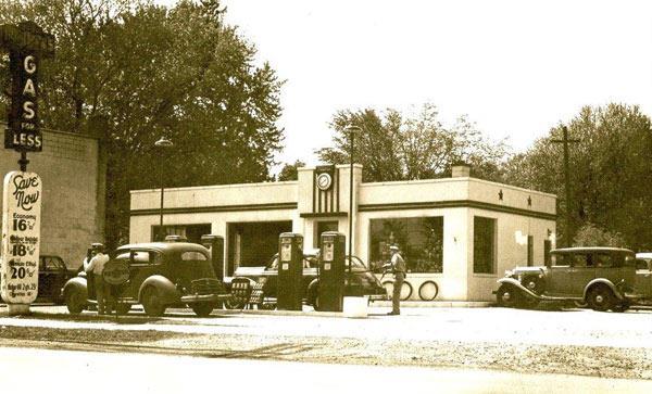
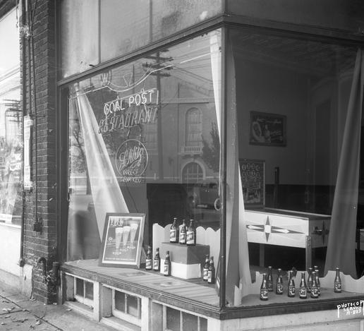
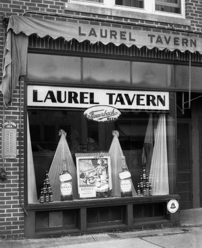
15 Monroe Street History

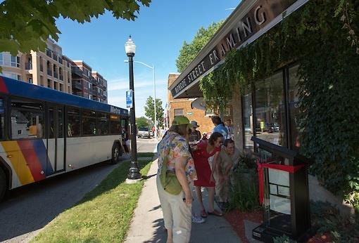
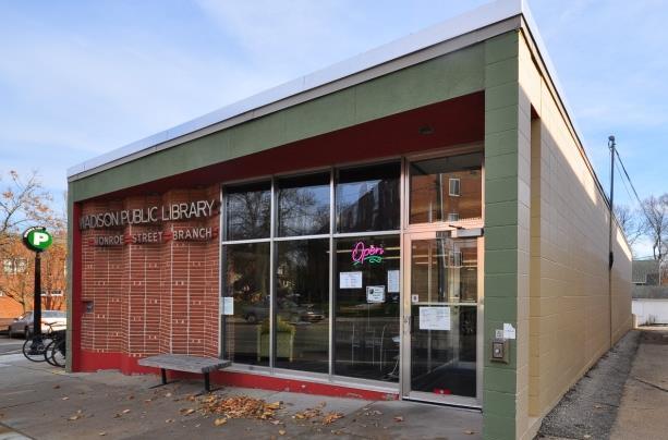
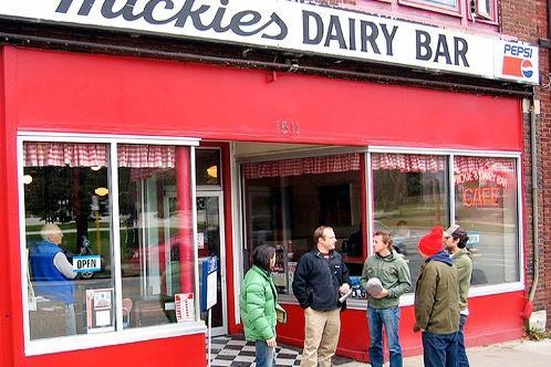
16 Monroe Street today

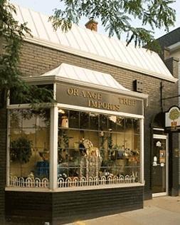
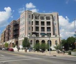
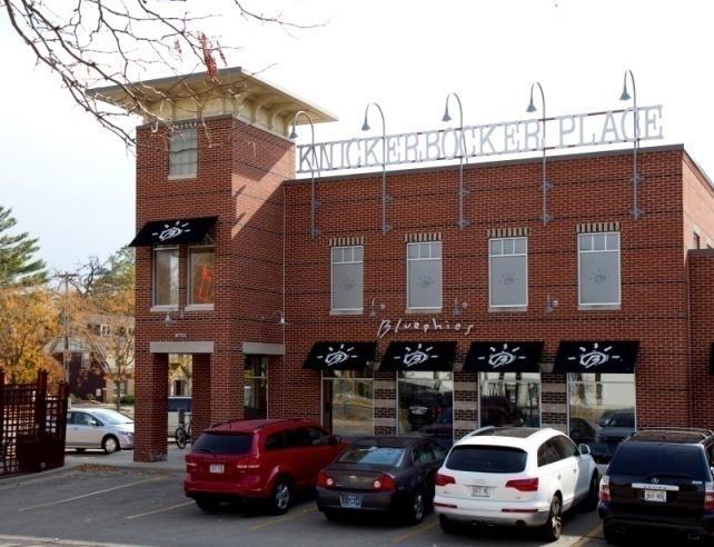
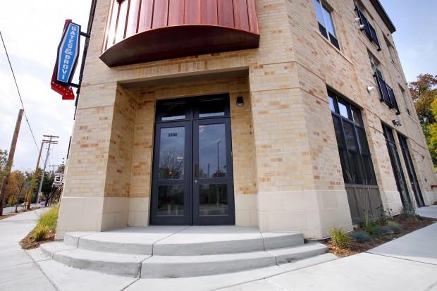
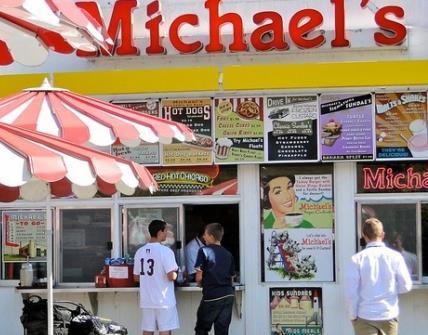
17 Monroe Street today
 Planning Efforts")
 Wingra Watershed Plan")
18 Brittingham-Vilas Neighborhood Plan (1989) Planning Efforts Monroe Street Commercial District Plan (2007) Wingra Watershed Plan (pending)
19 Planning Efforts: 1989 Brittingham- Vilas Neighborhood Plan Goal #5 Encourage the beautification & revitalization of Park, Regent and Monroe St. Commercial Districts. Goal #7 Provide barrier-free access to public places for all people, including those with disabilities. Transportation recommendations: Increase speed limit enforcement Improve synchronization of traffic lights for pedestrian safety Study traffic impacts of new development
20 Planning Efforts: 2007 Monroe Street Commercial District Plan Recommendations (Pages 45-47) Pedestrian-scale lighting, street furniture, banners, undergrounding wires Intersection enhancements at key pedestrian crossings Consistent speed limit (25 mph) Explore shared parking and wellpublicized/specifically designated areas on side streets Increase bicycle parking Encourage bus use


21 Planning Efforts: 2007 Monroe Street Commercial District Plan Placemaking concepts at nodes: Breese Terrace / Regent Street Knickerbocker Commonwealth

22 Planning Efforts: Wingra Watershed Plan
23 The Monroe Street Reconstruction What We Heard in 2014

24 Traffic Parking Business Improve pedestrian safety by enhancing crosswalks, reducing speeds and boosting enforcement Configure lanes to be multi-modal friendly Maintain and improve parking, especially near businesses Consider traffic calming and modified parking on neighborhood streets Provide adequate access, parking, signage and detours during construction Complete construction in one year

25 Pedestrians Bikes Transit Address pedestrian safety/crosswalks Reduce speed and increase enforcement Provide more space/options for bike use and additional bike parking Offer more frequent, dedicated buses Locate bus stops at far side of intersections Maintain parking for businesses, but discourage commuter parking
26 Stormwater Utilities Placemaking Minimize run-off and collect sediment Control erosion during construction Consider watershed-wide stormwater mgmt Underground utilities to improve tree canopy Preserve existing amenities and character Identify points of interest on kiosks & maps Add green space, art & storytelling opportunities Add streetscape amenities (seating, lights, bike racks, signage, banners, etc.)

27 Feedback on Placemaking at Crazy Legs Triangle:
28 Questions?
29 Small Group Conversation #1
30 Ground Rules & Etiquette Work with your assigned group Passing time will be marked. Listen for the cowbell! Give all members an opportunity to share Do not judge or criticize others ideas During each conversation we will: Brainstorm alone Share in small groups Share with large group
31 What headline would you most like to see following the Monroe Street Reconstruction? (What is your definition of success?) Question: Definitions of Success One headline per sheet Be as specific as possible. Brainstorm alone for 2 minutes. Share top 2 in small groups for 5 minutes. Place on the wall, combine similar, and mark X s on those you like best.

32 Monroe Street Reconstruction Kickoff Meeting June 2016 Monroe Street Reconstruction Project
33 Engineering Presentation Outline Traffic data Interim pedestrian improvements Existing infrastructure conditions Reconstruction project scope & current budget Environmental impact & Envision Introduction

34 Project Limits
35 Existing Conditions: Traffic Data Average speeds highest near Odana (posted 30 mph) & decrease moving to northeast (toward Regent) Ave. about 30.4 mph at Odana Ave mph near Knickerbocker Ave. about 27.5 mph near Edgewood Ave. Ave. about 23 mph west of Grant (Trader Joe s)
36 Existing Conditions: Traffic Data Volumes also highest near Odana & decrease to east 20,000 AWT near Odana, 13,500 AWT near Regent Volumes generally trending down since late 90s 30,000 25,000 20,000 15,000 10,000 5,000 0 BREESE - OAKLAND EDGEWOOD - LINCOLN (MONTHLY) COMMONWEALTH - WEST LAWN SPRAGUE - COMMONWEALTH NAKOMA - LEWIS
37 Existing Conditions: Traffic Data 269 vehicular crashes at intersections since mid-block vehicular crashes since bike crashes since pedestrian crashes since Took place under various conditions, mostly day-time & dry
38 Interim Pedestrian Crossing Improvements Reconstruction project has been delayed until 2018 Pedestrian improvements noted priority at previous meetings & important aspect of the project Install Rectangular Rapid Flashing Beacons (RRFB) in summer of 2016
 Cost")
39 Interim Pedestrian Crossing Improvements Benefits of RRFB Highly visible LED strobe Observed good motorist compliance Solar capable (interim) Cost Effective
40 Interim Pedestrian Crossing Improvements Locations based on input from previous meetings Harrison (Trader Joe s) Prospect Edgewood Knickerbocker or Sprague (still determining) Western Odana Limited budget for interim improvements, but can consider additional/alternative improvements with the reconstruction
41 Existing Conditions: Pavement & Curb Odana to Leonard (Resurfacing portion) Pavement rated 4/10 Curb rated 7/10 Street width 42 ft. (curb face to curb face) Leonard to Regent (Reconstruction portion) Pavement rated 3/10 or 4/10 Curb: rated 2/10 (short portion 5/10) Existing street width 44 ft. or 46 ft. (Harrison- Regent)
42 Existing Conditions: Utilities Odana to Leonard (Resurfacing portion) Sanitary: existing from , 6 to 16 Water: existing installed in , mostly 10 Storm: existing from 1918, 1950 & 1989 Leonard to Regent (Reconstruction portion) Sanitary: existing from , mostly 6 Water: existing from , mostly 8 Storm: existing from sewer backups since 2014, 3 emergency sewer repairs in 2015 & 3 inlet/manhole repairs since 2015
43 General Project Scope Utilities Replace sanitary sewer main & laterals to property line Replace the water main Repair/replace & install new storm sewer as needed Storm water treatment devices Street Replace the failing asphalt pavement Replace the curb & gutter (salvage where possible) Replace sidewalk as needed & other ped improvements
44 Project Budgeting for 2018 Current budgeted amounts (as of 6/9/16) Total project budget: approximately $17 Million Street: $9.8 Million Infrastructure replacement (pavement, curb, sidewalk) Lighting & signal replacement Pavement markings Other pedestrian improvements Some storm sewer (inlets & leads) Costs of any Placemaking (including Crazy Legs Triangle) Includes some funds for undergrounding in business areas
45 Project Budgeting for 2018 Sanitary Sewer: $4 Million Replacement of sewer main & laterals Water Main: $2.2 Million Replacement of main & reconnection of services Storm Sewer: $750,000 Replacement & installation of new main Water Quality: $200,000 Catch basins & treatment structure Rain Gardens: $20,000
46 Pedestrian Crossing Improvements More discussion on additional pedestrian improvements (Organizing Themes) Several options that have been used in past Willing to consider other ideas


47 Pedestrian Crossing Improvements Modified/improved markings for cross walks Continental Cross walks Colored Cross Walks

48 Pedestrian Crossing Improvements Countdown timers on signals


49 Pedestrian Crossing Improvements Overhead sign and/or flashers Re-install beacons

50 Additional Future Input Opportunities Placemaking opportunities Crazy Legs Triangle Other nodes Street lighting Street area lights Pedestrian lights
51 Evaluating, Discussing and Reducing the Environmental Impact of the Monroe Street Reconstruction


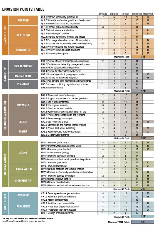
52 Comprehensive list of criteria to evaluate sustainability of planning, construction and operation of a project. Both a guide and a tool for scoring a project Helps project teams by providing a framework Has a credentialing program 8 hr training and test
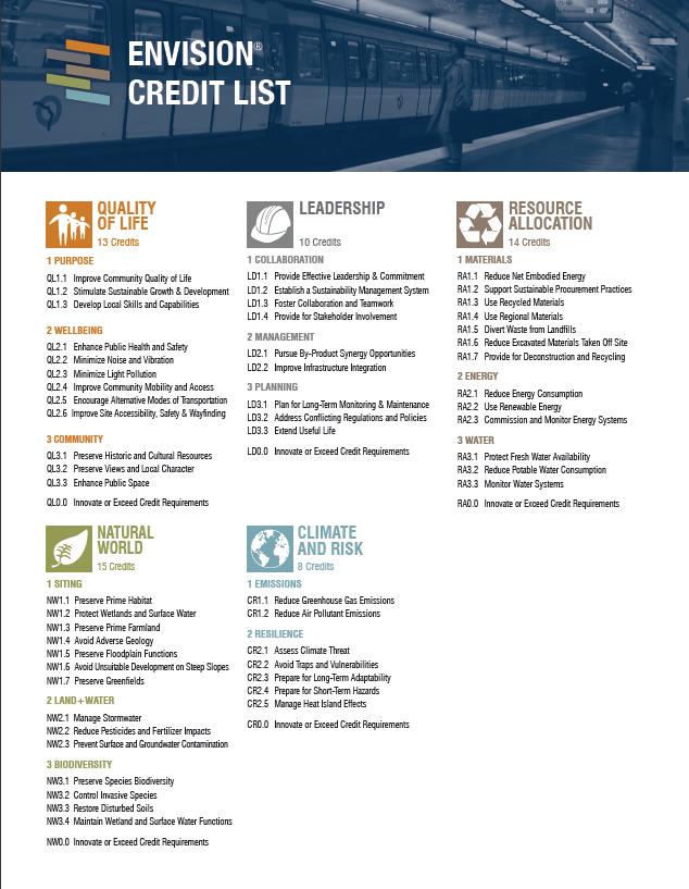
53

54 How will the city use Envision? City will be using Envision for the first time on Monroe Street. We will be giving updates at each public information meeting Envision framework will help to guide portions of the public meetings

55 Wingra Watershed Plan Sets Phosphorus, Sediment, groundwater recharge and Chloride reduction goals for Lake Wingra Monroe Street Reconstruction is a project discussed in reaching these goals.
56 Going forward Public information meetings will include Envision updates and feedback opportunities Detailed discussions on trade offs between the goals of all street users Alternative analysis to put numbers behind alternatives and allow informed decisions to be made. Documentation of decisions and process
57 Small Group Conversation #2
58 Ground Rules & Etiquette Work with your assigned group Passing time will be marked. Listen for the cowbell! Give all members an opportunity to share Do not judge or criticize others ideas During each conversation we will: Brainstorm alone Share in small groups Share with large group
59 3 Questions: Processing & Next Steps 1. What have you heard today that you like, appreciate, and/or agree with?
60 3 Questions: Processing & Next Steps 2. What have you heard today that you disagree with or that concerns you?
61 3 Questions: Processing & Next Steps 3. What 2-3 things would you like to learn more about, or discuss further, in order to provide more informed input during this process? a. This could mean things that you, individually, want to learn or things that we, collectively, need to explore.
62 Wrapping Up
63 Stay Tuned Summer conversations on five themes: 1. Pedestrian Safety and Access 2. Green Infrastructure 3. Bicycle Safety and Access 4. Transit Safety and Access 5. Business Enhancement
64 For More Information: City of Madison Engineering: rojects/monroe-street Subscribe to updates View presentations and notes Alder Eskrich, District 13: t13/ Subscribe to updates. Share additional comments.

65 Thank You! Source:
Monroe Street Reconstruction Planning
 Monroe Street Reconstruction Planning July 2014 Monroe Street Reconstruction Project What to expect this evening Introductions Project to date Project scope and summary of input from April meeting Details:
Monroe Street Reconstruction
 Total participants: 45+ Monroe Street Reconstruction Cross Section Workshop Notes September 29, 2016, Wingra School Workshop Orientation, Technical and Functional Considerations: The workshop began with
Monroe Street Ped Modifications
 Monroe Street Ped Modifications May 11, 2016 Hotel Red ~1.7 mile Posted Speed Limit 25 mph 30 mph Some Background Data Regent St Average Speed 7-9 am 26.8 mph 11 am-1 pm 20.2 mph 4-6 pm 22.2 mph Source:
Monroe Street Reconstruction Kickoff Meeting Notes Wingra School, June 13, 2016
 Monroe Street Reconstruction Kickoff Meeting Notes Wingra School, June 13, 2016 Total participants: 89 Table Conversation #1: Headlines Exercise During this 15-minute exercise, participants worked both
Monroe Street Reconstruction Business Focus Group Notes July 18, 2016, HotelRED
 Monroe Street Reconstruction Business Focus Group Notes July 18, 2016, HotelRED Total participants: 31 Focus Group Conversation #1: During this exercise, participants talked in small table groups in response
Crazylegs Triangle Re:Design Workshop Discussion Notes 6:00-7:30PM, August 8, 2017
 Crazylegs Triangle Re:Design Workshop Discussion Notes 6:00-7:30PM, August 8, 2017 Total Participants: 15 plus city staff City of Madison staff and project team in attendance: Christy Bachmann (Engineering),
Chicago Safe Routes to School Safe Routes to High School (SRTS/SRTHS)
") Chicago Safe Routes to School Safe Routes to High School (SRTS/SRTHS) Marshall Community High School and Faraday Elementary School Recommended Improvements Agenda Goals Related Programs Project Location/Area
Chicago Safe Routes to School Safe Routes to High School (SRTS/SRTHS) Marshall Community High School and Faraday Elementary School Recommended Improvements Agenda Goals Related Programs Project Location/Area
Living Streets Policy
 Living Streets Policy Introduction Living streets balance the needs of motorists, bicyclists, pedestrians and transit riders in ways that promote safety and convenience, enhance community identity, create
Ocean Park Boulevard Green Street Project Community Workshop
 Ocean Park Boulevard Green Street Project Community Workshop 2.2.10 Project Objectives Community Priority: reclaim OPB for public open space. Build upon LUCE principles; neighborhood enhancement, connectivity,
Bicycle and Pedestrian Advisory Committee (BPAC) November 21, 2013
 November 21, 2013") Bicycle and Pedestrian Advisory Committee (BPAC) November 21, 2013 OVERALL LAND USE CONCEPT Overall Broadway Valdez District: 95.5 acres (35.1 acres right-of ways + 60.4 acres developable land) Plan Subareas:
Bicycle and Pedestrian Advisory Committee (BPAC) November 21, 2013 OVERALL LAND USE CONCEPT Overall Broadway Valdez District: 95.5 acres (35.1 acres right-of ways + 60.4 acres developable land) Plan Subareas:
Lawrence Avenue Streetscape Concepts August 30, 2011
 Lawrence Avenue Streetscape Concepts August 30, 2011 Neighborhood Context Phase II: River to Western Ave. Phase I: Western Ave. to Clark St. Key Map Lawrence Ave. Existing Streetscape Conditions East of
Omaha s Complete Streets Policy
 Omaha s Complete Streets Policy (Adopted August 2015) VISION To create great places and enhance our quality of life, the City of Omaha will provide safe, accessible streets for all users. Complete Streets
APPENDIX A: Complete Streets Checklist DRAFT NOVEMBER 2016
 APPENDIX A: Complete Streets Checklist DRAFT NOVEMBER 2016 Complete Streets Checklist MetroPlan Orlando s Complete Streets Checklist is an internal planning tool for staff to further implementation of
STONY PLAIN ROAD STREETSCAPE
 Jasper Place Revitalization Strategy: Vision The people involved in the Jasper Place Revitalization Strategy envision: Goal 1: Feeling safe in our community Create a community where feeling safe is common--where
City of Madison, East Johnson Street North Baldwin Street to First Street Local Street Dane County
 City of Madison, East Johnson Street North Baldwin Street to First Street Local Street Dane County Public Involvement Meeting Thursday, November 10, 2016 5:30 to 7 P.M. Festival Foods 810 E. Washington
Chicago Safe Routes to High School (SRHS) Kelly High School Recommended Improvements
 Kelly High School Recommended Improvements") Chicago Safe Routes to High School (SRHS) Kelly High School Recommended Improvements March 18, 2014 Presentation Outline Goals Related Programs Project Location/Area Existing Conditions Improvement Types
Chicago Safe Routes to High School (SRHS) Kelly High School Recommended Improvements March 18, 2014 Presentation Outline Goals Related Programs Project Location/Area Existing Conditions Improvement Types
A CHANGING CITY. of Edmonton, it is essential that it reflects the long-term vision of the City.
 A CHANGING CITY By the year 2040, Edmonton will be home to more than 1 million people. To accommodate growth and support a healthy and compact city, we need a new approach to development/redevelopment
City of Madison, East Johnson Street North Baldwin Street to First Street Local Street Dane County
 City of Madison, East Johnson Street North Baldwin Street to First Street Local Street Dane County Public Involvement Meeting Thursday, April 28, 2016 6 to 8 P.M. Lapham Elementary School 1045 E. Dayton
Ocean Park Boulevard Green Street Project Alternatives & Trade Offs
 Planning Commission March 4, 2009 Ocean Park Boulevard Green Street Project Alternatives & Trade Offs Purpose of Tonight s Meeting Review concept plans and options Provide input on alternatives and trade-offs
Item to be Addressed Checklist Consideration YES NO N/A Required Description Complete Streets Guidelines
 Passaic County Complete Streets Checklist - Concept Development Project Name Item to be Addressed Checklist Consideration YES NO N/A Required Description Complete Streets Guidelines Existing Plans Have
WELCOME. Purpose of the Open House. Update you on the project. Present a draft recommended plan. Receive your input
 WELCOME Purpose of the Open House The Town of Smiths Falls has initiated the Beckwith Street Redevelopment Plan that includes the preparation of a streetscape functional design for the renewal of Beckwith
Ocean Park Boulevard Streetscape Improvement Project Alternatives & Trade Offs
 City Council Study Session January 27, 2009 Ocean Park Boulevard Streetscape Improvement Project Alternatives & Trade Offs Scope of Work Purpose of Tonight s Meeting Review work to date and direct staff
Atwood Avenue Fair Oaks Avenue Cottage Grove Road
 Atwood Avenue Fair Oaks Avenue Cottage Grove Road Agenda Purpose Review project scope & goals Present design alternatives Gather feedback Answer Questions Format Open House Presentation Q&A Open House
Designing for Pedestrian Safety in Washington, DC
 Designing for Pedestrian Safety in Washington, DC February 25, 2014 George Branyan Pedestrian Program Coordinator District Department of Transportation DC Journey to work mode split: 2012 Means of Transportation
CITY OF BLOOMINGTON COMPLETE STREETS POLICY
 CITY OF BLOOMINGTON COMPLETE STREETS POLICY POLICY OBJECTIVE: The City of Bloomington will enhance safety, mobility, accessibility and convenience for transportation network users of all ages and abilities,
Proposed. City of Grand Junction Complete Streets Policy. Exhibit 10
 Proposed City of Grand Junction Complete Streets Policy Exhibit 10 1 City of Grand Junction Complete Streets Policy Vision: The Complete Streets Vision is to develop a safe, efficient, and reliable travel
Tonight is for you. Learn everything you can. Share all your ideas.
 Strathcona Neighbourhood Renewal Draft Concept Design Tonight is for you. Learn everything you can. Share all your ideas. What is Neighbourhood Renewal? Creating a design with you for your neighbourhood.
Fulton Market Streetscape
 Fulton Market Streetscape Ogden Avenue to Halsted Street Public Meeting Recommended Improvements December 10th, 2014 Meeting Purpose and Goals Present Existing Conditions Community Input and Charrette
Commerce Street Complete Street Project from Good Latimer Expressway to Exposition Avenue
 Commerce Street Complete Street Project from Good Latimer Expressway to Exposition Avenue T A N Y A B R O O K S A S S I S T A N T D I R E C T O R M O B I L I T Y P L A N N I N G M O B I L I T Y A N D S
NJDOT Complete Streets Checklist
 Background The New Jersey Department of Transportation s Complete Streets Policy promotes a comprehensive, integrated, connected multi-modal network by providing connections to bicycling and walking trip
Agenda. Overview PRINCE GEORGE S PLAZA METRO AREA PEDESTRIAN PLAN
 PRINCE GEORGE S PLAZA METRO AREA PEDESTRIAN PLAN May 28, 2008 Agenda Welcome and introductions Project overview and issue identification Planning context and strengths Design challenges and initial recommendations
Broad Street Bicycle Boulevard Design Guidelines
 Broad Street Bicycle Boulevard Design Guidelines Building from the strategies introduced in the 2013 Bicycle Transportation Plan and community input received thus far, City Transportation Staff have identified
Active Transportation Facility Glossary
 Active Transportation Facility Glossary This document defines different active transportation facilities and suggests appropriate corridor types. Click on a facility type to jump to its definition. Bike
PEDESTRIAN CROSSING SOLUTIONS ANDREA HARTH, PE, PTOE TEC ENGINEERING, INC.
 PEDESTRIAN CROSSING SOLUTIONS ANDREA HARTH, PE, PTOE TEC ENGINEERING, INC. Pedestrian Safety 2017 Pedestrian Crashes in Ohio Crash Severity Number % Fatal Crash 141 4.9% Injury Crash 2546 89.1% Property
Vision: Traditional hamlet with an attractive business/pedestrian friendly main street connected to adjacent walkable neighborhoods
 N D. Focus Area II Vision: Traditional hamlet with an attractive business/pedestrian friendly main street connected to adjacent walkable neighborhoods Transit Road Focus Area II is located in the Hamlet
City of Novi Non-Motorized Master Plan 2011 Executive Summary
 City of Novi Non-Motorized Master Plan 2011 Executive Summary Prepared by: February 28, 2011 Why Plan? Encouraging healthy, active lifestyles through pathway and sidewalk connectivity has been a focus
Complete Streets Chicago: Data Driven Design. Luann Hamilton Deputy Commissioner
 Complete Streets Chicago: Data Driven Design Luann Hamilton Deputy Commissioner AGENDA Chicago s goals Complete Streets & Sustainable Infrastructure Guides Data-Driven Planning Setting goals Scoping/research
Major Bike Routes 102 Avenue Workshop April 21, 2015
 Major Bike Routes 102 Avenue Workshop April 21, 2015 Our Purpose Today Provide context on how Major Bike Routes fit into Edmonton s future Share information on what we heard in our last phase, and how
The previous chapters in this plan have established the value of this plan (Chapter 1), the
, the") 4 Making Madison an Even Better Place to Walk: Vision, Goals, Objectives The previous chapters in this plan have established the value of this plan (Chapter 1), the importance of walking (Chapter 2), and
4 Making Madison an Even Better Place to Walk: Vision, Goals, Objectives The previous chapters in this plan have established the value of this plan (Chapter 1), the importance of walking (Chapter 2), and
MARTIN LUTHER KING JR. WAY
 OCTOBER 2011 40 Vision and Goals The Martin Luther King, Jr. Way Illustrative Master Plan that follows has been developed through a process of community involvement. It expresses a long term vision for
Balancing Operation & Safety for Motorized and Non-Motorized Traffic
 Balancing Operation & Safety for Motorized and Non-Motorized Traffic Brian Willham, PE, PTOE Iowa Director - MOVITE June 30, 2014 Learning Objectives: When & Why should we measure the performance of complete
Mission-Geneva Transportation Study Community Workshop 2 July 8, 2006
 Community Workshop 2 July 8, 2006 Small Group Workbook 1 Basic Improvements on Mission Street Streetscape. Pedestrian-scale lighting; landscaping; community art on utility boxes; more (possibly unique)
MAG Town of Cave Creek Bike Study Task 6 Executive Summary and Regional Significance Report
 Page 1 MAG Town of Cave Creek Bike Study Task 6 Executive Summary and Regional Significance Report August 1, 2012 MAG Project #481 Page 2 Task 6 Executive Summary and Regional Significance Report Introduction
REGIONAL BICYCLE AND PEDESTRIAN DESIGN GUIDELINES
 REGIONAL BICYCLE AND PEDESTRIAN DESIGN GUIDELINES November 16, 2011 Deb Humphreys North Central Texas Council of Governments Bicycle and Pedestrian Advisory Committee Snapshot of the Guide 1. Introduction
Dr. M.L. King, Jr. Street North Complete Streets Resurfacing Opportunities HOUSING, LAND USE, AND TRANSPORTATION COMMITTEE MARCH 22, 2018
 Dr. M.L. King, Jr. Street North Complete Streets Resurfacing Opportunities HOUSING, LAND USE, AND TRANSPORTATION COMMITTEE MARCH 22, 2018 What s Happening The City plans to mill and resurface Dr. M.L.
TRAVEL PLAN: CENTRAL EUROPEAN UNIVERSITY CAMPUS REDEVELOPMENT PROJECT TRAVEL PLAN. Central European University Campus Redevelopment Project.
 TRAVEL PLAN Central European University Campus Redevelopment Project Page 1 Table of Contents Introduction... 3 Background... 7 Building Users... 7 Transportation in Community Consultation... 7 Summary
MEMORANDUM. Charlotte Fleetwood, Transportation Planner
 MEMORANDUM Date: Updated August 22, 2017 To: Organization: Charlotte Fleetwood, Transportation Planner Boston Transportation Department From: Jason DeGray, P.E., PTOE, Regional Director of Engineering
Pedestrian, Bicycle and Traffic Calming Strategic Implementation Plan. January 18, 2011
 Pedestrian, Bicycle and Traffic Calming Strategic Implementation Plan January 18, 2011 Tonight s Agenda Receive update on project Provide feedback on two policy issues Complete Streets Policy Project Prioritization
Building Great Neighbourhoods BELLEVUE AND VIRGINIA PARK
 Building Great Neighbourhoods BELLEVUE AND VIRGINIA PARK This is Meeting 2 Unfortunately, some residents in Bellevue and Virginia Park received the wrong information for this public open house (Meeting
City of Ann Arbor. Crosswalk Design Guidelines Project Second Public Meeting: December 8, :00-8:00 p.m. ~ Slauson Middle School.
 Introduction City of Ann Arbor A public meeting was held on December 5, 2016 from 6:00-8:00 p.m. at Slauson Middle School (1019 W. Washington St.) to share a set of draft guidelines for crosswalk designs
HARRISON STREET/OAKLAND AVENUE COMMUNITY TRANSPORTATION PLAN
 HARRISON STREET/OAKLAND AVENUE Community Workshop #4: Draft Plan Review December 3, 2009 D E S I G N, C O M M U N I T Y & E N V I R O N M E N T INTRODUCTIONS Key Project Staff: Alisa Shen, Project Manager,
FONTAINE AVENUE STUDY Final Report
 FONTAINE AVENUE STUDY Final Report March 28, 2005 FONTAINE AVENUE STUDY City of Charlottesville March 28, 2005 Renaissance Planning Group Kenneth Schwartz, FAIA, AICP Director of Design Leigh Wilkerson,
SAFE ROUTES TO SCHOOL
 SAFE ROUTES TO SCHOOL Edgewood Elementary School Existing Conditions and ACTION PLAN > Oak Creek - Franklin Joint School District Table of Contents CONTEXT Enrollment Boundaries Enrollment
TULSA CITY COUNCIL CAPITAL IMPROVEMENT PROGRAM TASK FORCE MEETING JANUARY
 CITY OF TULSA BICYCLE & PEDESTRIAN INFRASTRUCTURE TULSA CITY COUNCIL CAPITAL IMPROVEMENT PROGRAM TASK FORCE MEETING JANUARY 31, 2013 CITY OF TULSA ENGINEERING SERVICES DEPARTMENT CITY OF TULSA ADA TRANSITION
Lincoln Neighborhood Corridor Plan The LiNC
 CITY OF SANTA MONICA Lincoln Neighborhood Corridor Plan The LiNC PLANNING COMMISSION September 2, 2015 COMMUNITY DESIGN + ARCHITECTURE TEAM: Community Design + Architecture Iteris Studio 111 Urban Place
Improving intersections for people that walk in Minneapolis
 Matthew Dyrdahl, AICP, LCI Bicycle and Pedestrian Coordinator Minneapolis Public Works CITY OF MINNEAPOLIS Improving intersections for people that walk in Minneapolis Transportation Bonanza February 8,
TOWN OF MORAGA MORAGA WAY AND CAMINO PABLO/CANYON ROAD IMPROVEMENTS Town Council Meeting March 13, 2019
 TOWN OF MORAGA MORAGA WAY AND CAMINO PABLO/CANYON ROAD IMPROVEMENTS Town Council Meeting March 13, 2019 1 Edric Kwan, Public Works Director Josh Peterman, Principal, Fehr and Peers Shawn Knapp, Senior
BETHEL ROAD AND SEDGWICK ROAD CORRIDOR STUDY
 DRAFT PLAN City Council Meeting August 14, 2017 STUDY AREA Sedgwick Corridor State Route 160, principal arterial with Class 3 access management designation, commuter and freight route, connection to SR
Complete Streets. Designing Streets for Everyone. Sarnia
 Complete Streets Designing Streets for Everyone Sarnia Complete Streets ~ Sarnia ~ 2018 Introduction Our City is made up of a network of streets that we use to go for a walk, cycle to work, drive to the
CLOSED. The draft concept design has been broken down into 5 categories for the purpose of this survey:
 Old Strathcona s neighbourhood renewal process is now at the draft concept design phase. Over the last several months, the city has been gathering local knowledge and resident input that has been used
Welcome to the Quebec Alternatives Analysis Public Meeting
 Welcome to the Public Meeting Please sign in. Public Comment Please fill out a comment card and tell us what you think. Check back or comment any time at: www.quebecalternatives.com Project Area Technical
Advancing Transportation Choices in Des Moines. MPO Environmental Roundtable January 9, 2018
 Advancing Transportation Choices in Des Moines MPO Environmental Roundtable January 9, 2018 Presented by Jennifer McCoy, PE, PTOE City Traffic Engineer Agenda Des Moines Area Transportation Planning Connect
Hale iwa Improvement District Project
 Hale iwa Improvement District Project Hale iwa, North Shore, O ahu October 10, 2017 Public Informational Meeting Environmental Impact Statement Preparation Notice Waialua Elementary School 67-020 Waialua
The Wiggle Route in Context
 The Wiggle Route in Context In a city of hills, the Wiggle is an important route because it winds its way along the flattest streets from Market to the Panhandle, bringing residents to local parks and
Building Great Neighbourhoods QUEEN ALEXANDRA
 Building Great Neighbourhoods QUEEN ALEXANDRA We are here today to Explain how the City is investing in improving your neighbourhood and how your neighbourhood will be improved to meet current City standards.
North Avenue Corridor Study
 North Avenue Corridor Study City Council October 6, 2014 Presentation Outline Project Initiation & Process Corridor Conditions & Issues Vision & Goals Concept Development - Development/Evaluation Implementation
Southview Blvd & 3 rd Avenue Improvement Project. Public Open House December 4, to 7pm
 Southview Blvd & 3 rd Avenue Improvement Project Public Open House December 4, 2014 5 to 7pm Southview Blvd & 3 rd Avenue Public Information Meeting Agenda Presentation 5:30 to 6:15 pm Purpose of Project
MEMORANDUM. Earl Haugen and UND Transportation and Traffic Coordination Committee
 SRF No. 7766 MEMORANDUM TO: FROM: Earl Haugen and UND Transportation and Traffic Coordination Committee Rick Lane, P.E. DATE: November 26, 2013 SUBJECT: UNIVERSITY AVE REVIEW Our review of the University
Community Task Force November 15, 2017
 Community Task Force November 15, 2017 Welcome and Introductions Project Partners Regional Transportation District (RTD) Colorado Department of Transportation (CDOT) Denver Regional Council of Governments
West Capitol Avenue Road Rehabilitation and Safety Enhancement Project
 West Capitol Avenue Road Rehabilitation and Safety Enhancement Project Stakeholder Focus Group Meeting #2 Tuesday, August 28, 2018 7:00 8:00 a.m. West Sacramento City Hall 1110 West Capitol Avenue, West
Report. Typical Sections. City of Middleton, WI
 Report Typical Sections City of Middleton, WI December 2006 Report for City of Middleton, Wisconsin Typical Sections repared by: Traffic Associates LLC and STRAND ASSOCIATES, INC. 910 West Wingra Drive
Building Great Neighbourhoods LANSDOWNE
 Building Great Neighbourhoods LANSDOWNE We are here today to Explain how the City is investing in improving your neighbourhood and how your neighbourhood will be improved to meet current City standards.
MOBILITY WORKSHOP. Joint City Council and Transportation Commission May 5, 2014
 MOBILITY WORKSHOP Joint City Council and Transportation Commission May 5, 2014 Review of General Plan M-1 Develop world-class transit system M-3 Maintain/enhance pedestrian-oriented City M-4 Create comprehensive
5. RUNNINGWAY GUIDELINES
 5. RUNNINGWAY GUIDELINES These guidelines should be considered collectively when making runningway decisions. A runningway is the linear component of the transit system that forms the right-of-way reserved
Bringing together community and health. Physical Activity and Nutrition Unit Office of Statewide Health Improvement Initiatives
 Bringing together community and health. Physical Activity and Nutrition Unit Office of Statewide Health Improvement Initiatives Physical Activity and Nutrition Unit Office of Statewide Health Improvement
PEDESTRIAN ACTION PLAN
 CITY OF SANTA MONICA PEDESTRIAN ACTION PLAN DRAFT OCTOBER 2015 Safe Streets Santa Monica, December 3, 2015 Beth Rolandson, AICP Principal Transportation Planner Strategic + Transportation Planning, Planning
CHAPTER 7.0 IMPLEMENTATION
 CHAPTER 7.0 IMPLEMENTATION Achieving the vision of the Better Streets Plan will rely on the ability to effectively fund, build and maintain improvements, and to sustain improvements over time. CHAPTER
Complete Streets Successes, Opportunities, and Challenges
 Complete Streets Successes, Opportunities, and Challenges Juliet Walker, Transportation Planner, City of Portsmouth Rob Houseman, Director of Planning and Development, Town of Wolfeboro Chris Parker, Director
City of Vallejo Traffic Calming Toolbox
 City of Vallejo Traffic Calming Toolbox June 1, 2013 Final Table of Contents Introduction... 1 Non-Physical Devices... 3 High-Visibility Crosswalk... 3 In Pavement Lighted Crosswalk... 4 Rapid Flashing
City of Scotts Valley CITY COUNCIL STAFF REPORT
 DATE: April 19, 2017 City of Scotts Valley CITY COUNCIL STAFF REPORT AGENDA ITEM 2 DATE: 4-19-2017 TO: FROM: APPROVED: SUBJECT: Honorable Mayor and City Council Scott Hamby, Public Works Director Jenny
Org Chart. Steering. Committee. Project Advisory. Committee. Nicole Losch, PTP Senior Transportation. Bryan Davis, AICP Senior Transportation
 1 Org Chart Project Advisory Committee Steering Committee Nicole Losch, PTP Senior Transportation Planner Bryan Davis, AICP Senior Transportation Planner Jonathan Slason, PE Project Manager Diane Meyerhoff
83 AVENUE PRE-CONSTRUCTION MEETING
 83 AVENUE PRE-CONSTRUCTION MEETING April 6, 2017 5-8PM Please visit displays for project information Talk to staff, ask questions, visit website at: www.edmonton.ca/bike83avenue Pre-Construction Meeting
Watertown Complete Streets Prioritization Plan. Public Meeting #1 December 14, 2017
 Watertown Complete Streets Prioritization Plan Public Meeting #1 December 14, 2017 Goals for Public Meeting Overview of MassDOT Complete Streets Funding Program Educate the community on Complete Streets
122 Avenue: 107 Street to Fort Road
 : 107 Street to Fort Road November 24, 2015 4:30 8:00 p.m. Meeting Purpose Summarize project work completed to date Share results of public input from Phase 1 Share the draft concept plan and proposed
Oakland Pedestrian Master Plan Oakland Pedestrian Plan Draft Recommendations Chapter Outline
 EISEN LETUNIC T R A N S P O R T A T I O N, ENVIRO N M E N TA L A N D URBAN PLANNIN G MEMORANDUM To Oakland Pedestrian Plan Technical Advisory Committee & Pedestrian Advisory Group From Victoria Eisen Date
City of Gainesville Transportation/Roadway Needs PROJECT SUMMARY
 A1 Roadway Resurfacing $23,846,000 TYPE: Preservation of existing system Roadway resurfacing A2 Signal Replacement $6,000,000 TYPE: Preservation of existing system Replace traffic signals. B1 W 6th St
Eliminate on-street parking where it will allow for a dedicated bus only lane %
 Traffic Dashboard Priorities Survey Responses Introduction 1) Are you familiar with bus rapid transit (BRT)? a. No, BRT is new to me. 597 23.5% b. I ve heard of BRT, but I don t know much about it. 1,136
DISTRICT BICYCLE PROGRAM
 DISTRICT BICYCLE PROGRAM TxDOT Fort Worth District Public Hearing Bicycle Use on the State Highway System Public Hearing Agenda 1 2 3 4 5 6 Introduction Susan Howard TxDOT Public Involvement Specialist
El Centro Mobility Hub
 The El Centro drive shed comprises a major portion of the El Centro downtown area, which is well served by bus routes. The proposals intend to promote use of public transit through improvements and enhancements
Ann Arbor Downtown Street Plan
 1 Ann Arbor Downtown Street Plan Public Workshop #1 We know that. 2 Public right-of-way (streets, sidewalks, and alleys) make up 30% of the total District area of downtown. Streets need to provide mobility
UNIVERSITY AVENUE CORRIDOR REDESIGN. January 8, 2017 PUBLIC OPEN HOUSE
 January 8, 2017 PUBLIC OPEN HOUSE COLLABORATIVE COMMUNITY-BASED DESIGN IS THE FOUNDATION TO A SUCCESSFUL PROJECT AGENDA FOR TONIGHT 1 INTRODUCTIONS 2 WHY ARE WE HERE PROJECT NEED 3 SCHEDULE & GOALS 4 OPEN
Citywide Sidewalk and Crosswalk Programs
 Citywide Sidewalk and Crosswalk Programs Council Meeting October 20, 2015 Presented by Rita Hu and Jamal Mahmoud Program Goals Implement the City s comprehensive plan. Provide pedestrian with safe walking
Caltrans Sloat Boulevard Pedestrian Safety Project Response to Community Questions, Comments & Concerns
 Caltrans Sloat Boulevard Pedestrian Safety Project Response to Community Questions, Comments & Concerns Revised: May 10, 2016 The California Department of Transportation (Caltrans) is planning various
A Guide to Great Streets: The Basics. September 25, 2009
 A Guide to Great Streets: The Basics September 25, 2009 Streets are more than connectors, they are the city 2 Streets are the glue that hold a city together 3 Streets are the means in which a city is perceived
Saskatchewan Drive Roadway Rehabilitation and Shared-Use Path Widening
 Saskatchewan Drive Roadway Rehabilitation and Shared-Use Path Widening We are here today to present the draft plan for the Saskatchewan Drive Roadway Rehabilitation and Shared-Use Path Widening project
Bicycle + Pedestrian Connectivity Gap Analysis
 Accelerated Bridge Program Bicycle + Pedestrian Connectivity Gap Analysis Tuesday, October 11 Shriners Hospital, Boston 6:30-8:00 PM Thursday, October 13 Community Rowing, Brighton 6:30-8:00 PM Tuesday,
Henderson Ave. Complete Streets Project
 Henderson Ave. Complete Streets Project Meeting Purpose To finalize conceptual components of project prior to proceeding with preliminary engineering www.dallascompletestreets.wordpress.com MeetingAgenda
University of Victoria Campus Cycling Plan Terms of Reference. 1.0 Project Description
 University of Victoria Campus Cycling Plan Terms of Reference 1.0 Project Description The Campus Cycling Plan, a first for the University, will provide a comprehensive and coordinated approach to support
West Dimond Blvd Upgrade Jodhpur Street to Sand Lake Road
 West Dimond Blvd Jodhpur St to Sand Lake CSS Transportation Project Summary Municipality of Anchorage Project # 05 005 Project Manager: John Smith, P.E. (MOA PM&E) Project Administrator: Julie Makela,
AMATS Complete Streets Policy
 AMATS Complete Streets Policy Table of Contents: Section 1. Definition of Complete Streets Section 2. Principles of Complete Streets Section 3. Complete Streets Policy Section 4. Consistency Section 5.