A concept of footpath axes and child-friendly footpaths in Kiel
|
|
|
- Rebecca Curtis
- 6 years ago
- Views:
Transcription
1 A concept of footpath axes and child-friendly footpaths in Kiel Walk 21 - Munich 12 September 2013


2 Contents Short introduction to Kiel 2008 Transport Development Plan Current situation Goal and task setting Approach Standards for footpaths Classification of footpath axes Involvement and cooperative work Results Conclusion 2

3

4 4 Rathaus am Kleinen Kiel/Landeshauptstadt Kiel/Touristinformation

5 5 Kieler Förde zur Kieler Woche/Landeshauptstadt Kiel/3-pix
6

7 7 Kreutzfahrer zu Gast in Kiel/Landeshauptstadt Kiel/Behrenbruch

8 8 Nord-Ostsee-Kanal/Landeshauptstadt Kiel/Behrenbruch

9 9

10 10

11

12 12

13 13

14 2008 Transport Development Plan Topic foot traffic in two chapters: 6.1 Foot Traffic 6.4 Children as Traffic Participants 14


15 Pavement parking, accessibility Current situation 15


16 Increasing conflicts between bike and foot traffic Current situation 16

17 Many routes are not noticeable Current situation 17

18 - Developing a conceptual approach to supporting foot traffic - Increasing the public and internal awareness of the topic of foot traffic - Prioritising the rectification of defects through targeted assignment of budgetary funds - Acquiring means of funding - Highlighting synergy potential, e.g. for construction projects of network operators, investors Goal setting 18

19 - Developing mandatory standards for footpaths Task setting in Kiel - City-wide development of a footpath axes and child-friendly footpath network as a basis of planning for foot traffic measures - Concrete proposals for action for implementation in the near future - Communication through citizen and child involvement, as well as public relations 19

20 First axes layout with classifications Internal agreement in city administration Involvement of associations, local councils and citizens in planning walks Approach Child involvement in primary schools Adjustment of the axes design Recognising defects Suggesting actions Internal agreement in city administration Presentation to local councils and associations 20 Enactment by the planning bodies
21 Quality standards High comfort Optimal navigation Accommodating footpath design Consistent accessibility Safe crossing points Passenger-friendly 21 bus stops Criteria Among other things, consistent design, benches, spaces to stay and relax, restrooms, lighting, elements and space for playing Clear and understandable signposting, orientation points Footpath width (min. 2.5m), width proportions, locally typical and comfortably traversable surfaces, additions to path width Two-sense-principle, kerb lowering, surfaces, obstacles, height dimensions, slopes and inclines, tactile elements, etc. Traffic load/speed, traffic lanes, junction design, shorter distances, shorter waiting time Noticeability, direct accessibility and crossing opportunities, ample waiting areas Standards for footpaths Additional criteria for child-friendly footpaths

22 Classification of footpath axes 22 permanently accessible footpaths leisure footpaths child-friendly footpaths


23 Planning walks Involvement and cooperative work 23


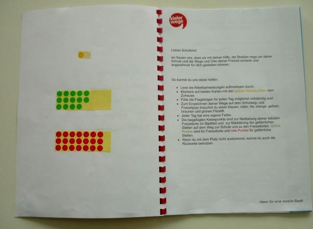


24 Child involvement Involvement and cooperative work 24


25 Child involvement Involvement and cooperative work 25

26 Key action points Results x 26


27 Defect Defect mapping Mapping with priorities Results x 27
28 Current status Implementation 2013 Climate protection support applied for On-going planning 28 Planning assignments under preparation
 The level of detail is positively perceived and employed by many")
 and footpaths (green spaces) are increasingly being recognised The first measures are being")
29 Public awareness of foot traffic has noticeably increased Strong interest in the project from other areas of administration (Urban Green Space Planning Office, City Planning, Schools, Sport) The level of detail is positively perceived and employed by many colleagues It is standard practice to consider accessibility aspects in the context of construction works Network relationships between streets (street construction) and footpaths (green spaces) are increasingly being recognised The first measures are being implemented Conclusion 29
30 Christian Stamer City of Kiel Civil Engineering Office, Department: Transport Phone Thank you for your attention
Cycling City Munich. Developing a Bicycle Masterplan
 Cycling City Munich Developing a Bicycle Masterplan Sustainable Urban Mobility: Planning Tools Knowledge Sharing Seminar Kyiv, September 21, 2012 Wigand von Sassen City of Munich (KVR) Introduction The
Living Streets Policy
 Living Streets Policy Introduction Living streets balance the needs of motorists, bicyclists, pedestrians and transit riders in ways that promote safety and convenience, enhance community identity, create
DESIGN CODE. Enterprise West Harlow London Road North Design Code 21
 DESIGN CODE Enterprise West Essex @ Harlow London Road North Design Code 21 4 MAXIMUM BUILDING HEIGHTS 4.1 Table 4A sets out maximum building height standards for each character area within the LDO boundary.
Economic and Social Council
 UNITED NATIONS E Economic and Social Council Distr. GENERAL 20 December 2006 ENGLISH Original: ENGLISH and FRENCH ECONOMIC COMMISSION FOR EUROPE INLAND TRANSPORT COMMITTEE Working Party on Road Traffic
Masterplan Bicycle Traffic in Munich
 Masterplan Bicycle Traffic in Munich Implementation and First Results Elisabeth Zorn Department of Urban Planning and Building Regulation Michael Lonhard Department of Public Construction Introduction
Tonight is for you. Learn everything you can. Share all your ideas.
 Strathcona Neighbourhood Renewal Draft Concept Design Tonight is for you. Learn everything you can. Share all your ideas. What is Neighbourhood Renewal? Creating a design with you for your neighbourhood.
Transportation Master Plan Advisory Task Force
 Transportation Master Plan Advisory Task Force Network Alternatives & Phasing Strategy February 2016 BACKGROUND Table of Contents BACKGROUND Purpose & Introduction 2 Linking the TMP to Key Council Approved
BYRES ROAD: PUBLIC REALM Public Consultation
 Public Consultation Introduction As a vibrant commercial, shopping and residential location within the heart of the West End Byres Road is an important destination. Its proximity to the University of Glasgow
This objective implies that all population groups should find walking appealing, and that it is made easier for them to walk more on a daily basis.
 Walking for life The Norwegian Walking Strategy Guro Berge Norwegian public Roads Administration "Walking for life" is the slogan for the National Walking Strategy that is now being formulated in Norway.
Appendix 12 Parking on footways and verges
 Appendix 12 Parking on footways and verges Legal position Parking on footways and verges whether wholly or partly is banned throughout London, unless signs are placed to allow parking. The ban requires
Report on MEPS Přerov TH MIDDLE EUROPEAN PROJECT SEMINAR LAURA ENJUANES NOGUERO E
 2017 Report on MEPS Přerov 2017 28TH MIDDLE EUROPEAN PROJECT SEMINAR LAURA ENJUANES NOGUERO E01650478 Table of Content 1. Introduction... 1 2. Problem definition... 1 3. Proposed solution in the presentation...
TYPES OF CYCLING. Figure 1: Types of Cycling by Gender (Actual) Figure 2: Types of Cycling by Gender (%) 65% Chi-squared significance test results 65%
 Figure 2: Types of Cycling by Gender (%) 65% Chi-squared significance test results 65%") TYPES OF CYCLING 1,980 responses were received to this question (multiple answers were allowed), 727 female (41%) and 1,242 (71%) from male respondents. The most common responses for both genders were
TYPES OF CYCLING 1,980 responses were received to this question (multiple answers were allowed), 727 female (41%) and 1,242 (71%) from male respondents. The most common responses for both genders were
E4 Cycle Route Exeter University to Redhayes Bridge. - Recommendations from Exeter Cycling Campaign
 E4 Cycle Route Exeter University to Redhayes Bridge - Recommendations from Exeter Cycling Campaign 1.0 Introduction Exeter Cycling Campaign has prepared this report to provide recommendations for Devon
ADA TRANSITION PLAN 2013
 ADA TRANSITION PLAN 2013 TABLE OF CONTENTS Contents Introduction 1 Purpose 2 Identified Obstacles to the Public Right of Way 3 Criteria for Determining Impediments at Village Facilities 4 Removing Barriers
NM-POLICY 1: Improve service levels, participation, and options for non-motorized transportation modes throughout the County.
 Transportation PRINCE WILLIAM COUNTY 2008 COMPREHENSIVE PLAN NON-MOTORIZED PLAN CONTENTS Goals, Policies, and Action Strategies Table 4 (Bike Facility Classifications and Descriptions) Table 5 (Bike Facility
Safe Living: Road Safety. Rationale
 Safe Living: Road Safety Rationale This mini unit of work is designed to assist teacher s in the planning and implementation of the content strand Safe Living, specifically Road Safety. The unit includes
Active Travel Survey for Bridgend and Pencoed towns. Page description:
 Active Travel Survey for Bridgend and Pencoed towns Page description: Bridgend County Borough Council want to hear from you on how you think we can improve facilities for walking and cycling in and around
1.3.4 CHARACTERISTICS OF CLASSIFICATIONS
 Geometric Design Guide for Canadian Roads 1.3.4 CHARACTERISTICS OF CLASSIFICATIONS The principal characteristics of each of the six groups of road classifications are described by the following figure
Integrated Urban Mobility
 Integrated Urban Mobility The Berlin Experience Forum Urba 2015 Conference Montreal, 23 th March 2011 Maria Krautzberger Permanent Secretary of State, Senate Department for Urban Development, Berlin The
Omaha s Complete Streets Policy
 Omaha s Complete Streets Policy (Adopted August 2015) VISION To create great places and enhance our quality of life, the City of Omaha will provide safe, accessible streets for all users. Complete Streets
Highway 111 Corridor Study
 Highway 111 Corridor Study June, 2009 LINCOLN CO. HWY 111 CORRIDOR STUDY Draft Study Tea, South Dakota Prepared for City of Tea Sioux Falls Metropolitan Planning Organization Prepared by HDR Engineering,
Milton Road Bus Stop and Crossings Workshop WSP. 19th September 2017
 Bus Stop and Crossings Workshop WSP 19th September 2017 Workshop Aims Task 1: Identify preferences for bus stop designs relative to: (a) Ranking preference between 4 possible bus stop designs on the narrower
INDICATORS ON STREET & NEIGHBOURHOOD LEVEL. Ryan Martinson Tim Pharoah
 INDICATORS ON STREET & NEIGHBOURHOOD LEVEL Ryan Martinson Tim Pharoah Why a difference between National/City and Street/Neighbourhood indicators? there are a variety of treatments there are a variety of
Frascati Road and Temple Hill Route Improvements. Outline Design Report to Accompany Public consultation
 Frascati Road and Temple Hill Route Improvements Outline Design Report to Accompany Public consultation September 2013 Background: Dún Laoghaire-Rathdown is committed to providing high quality pedestrian
Alberta Infrastructure HIGHWAY GEOMETRIC DESIGN GUIDE AUGUST 1999
 Alberta Infrastructure HIGHWAY GEOMETRIC DESIGN GUIDE AUGUST 1999,1'(; A ACCELERATION Data on acceleration from stop D-29 Effects of grade D-35 Intersections D-97, D-99 Lanes D-97, F-5, F-7, F-15, F-21,
GIS Based Data Collection / Network Planning On a City Scale. Healthy Communities Active Transportation Workshop, Cleveland, Ohio May 10, 2011
 The Purpose of GIS Based Network Planning GIS Based Data Collection / Network Planning Healthy Communities Active Transportation Conference Tuesday, May 10, 2011 10:00 AM Norman Cox, LLA, ASLA. Ann Arbor,
High frequency bus services operating to Little Island; Creation of a new Park and Ride site and train station at North Esk;
 Cork County Council 7 th December 2018 Dear Adrian O Neill (aoneill@jbbarry.ie) The Transport and Mobility Forum, Cork (TMF) is a representative group of organisations who have a common interest in sustainable
Design and Installation of Low Level Cycle Signals
 Transport for London Surface Transport Management System Document Guidance Note Design and Installation of Low Level Cycle Signals Document reference: SQA-0651 - Issue: Draft out of date information. 1
ONE SIZE DOESN T FIT ALL RECONCILING OVERLAPPING TRANSPORT NETWORKS IN A CONSTRAINED URBAN ENVIRONMENT
 One Size Doesn t Fit All S Corbett, C Chenery Page 1 ONE SIZE DOESN T FIT ALL RECONCILING OVERLAPPING TRANSPORT NETWORKS IN A CONSTRAINED URBAN ENVIRONMENT Authors/Presenters: Sam Corbett, Principal Transport
UNIVERSITY AVENUE CORRIDOR REDESIGN. January 8, 2017 PUBLIC OPEN HOUSE
 January 8, 2017 PUBLIC OPEN HOUSE COLLABORATIVE COMMUNITY-BASED DESIGN IS THE FOUNDATION TO A SUCCESSFUL PROJECT AGENDA FOR TONIGHT 1 INTRODUCTIONS 2 WHY ARE WE HERE PROJECT NEED 3 SCHEDULE & GOALS 4 OPEN
Urban Street Design and Development
 Urban Street Design and Development Ashok Bhattacharjee, Advisor, Clean Air and Sustainable Mobility, Centre for Science and Environment CSE Workshop on Safe Access and Parking - Lytton Hotel, Kolkata
Strategy for Walking & Cycling Action Plan
 Strategy for Walking & Cycling Action Plan To achieve higher levels of walking and cycling activity, the destinations which people access have to be available within suitable distances and designed to
TOWN OF PARADISE VALLEY
 TOWN OF PARADISE VALLEY The Paradise Valley Bicycle & Pedestrian Master Plan Planning Commission January 16, 2018 Purpose of Today s Meeting Review January 2018 draft plan Input on compliance to SOD Review
Amendments to Essex Highway Maintenance Strategy Maintenance Policy and Standards April 2008
 Amendments to Essex Highway Maintenance Strategy Maintenance Policy and Standards April 2008 The following amendments to the wording of the maintenance strategy apply following the revised maintenance
Introduction Methodology Study area and data collection Results and recommendation Conclusion References
 Introduction Methodology Study area and data collection Results and recommendation Conclusion References It is formal procedure for assessing accident potential and safety performance in the provision
PLACE CONCEPT! DESIGNS. Simplified crossroads junction to take traffic away from the heart of Picardy Place
 ith W alk Le Simplified crossroads junction to take traffic away from the heart of Picardy Place lace Quality public space & transport interchange hub surrounding new development. P York Wider pavements
5 CIRCULATION AND STREET DESIGN
 5 CIRCULATION AND STREET DESIGN This chapter describes circulation and streetscape improvements proposed for the Northwest Chico Specific Plan Area. It includes detailed design specifications for existing
By: CHE ROS ISMAIL PROF DR MOHD ROSLI HAININ DR HARYATI YAACOB DR SITTI ASMAH HASSAN JGP-FKA, UTM
 By: CHE ROS ISMAIL PROF DR MOHD ROSLI HAININ DR HARYATI YAACOB DR SITTI ASMAH HASSAN JGP-FKA, UTM CONTENT 1. INTRODUCTION 2. STAGES OF HIGHWAY DEVELOPMENT 3. ROAD CATEGORY/CLASSIFICATION 4. DESIGN STANDARDS
Dan Andrews. Expert Advisor to the Ontario Ministry of Tourism, Culture & Sport OPA Ed Conference, Burlington, ON March 1, 2018
 Dan Andrews Expert Advisor to the Ontario Ministry of Tourism, Culture & Sport OPA Ed Conference, Burlington, ON March 1, 2018 I Will Share With You Typical New User Experience Leading Towards Classification:
Liveable Neighbourhoods Design Code and Policy
 CNU London Transportation Summit, November 2007 The West Australian Liveable Neighbourhoods Design Code and Policy Incorporating a New Urbanist Street Design Manual for New Communities Wendy Morris Ecologically
4. Guided Bus Explained
 4. Guided Bus Explained Contents 1 INTRODUCTION... 2 Structure of this report... 2 2 KERB GUIDED BUS... 3 Overview... 3 Kerb guidance... 3 Figures Figure 2.1 Figure 2.2 Figure 2.3 Figure 2.4 Figure 2.5
Mobility-Friendly Street Standards for Delaware
 Mobility-Friendly Street Standards for Delaware ABSTRACT REID EWING Fehr & Peers Associates, Inc. 3685 Mt. Diablo Blvd. Lafayette, CA 94549 r.ewing@fehrandpeers.com or Surface Transportation Policy Project
Part B Design Guidance / Principles _
 Part B Design Guidance / Principles www. landlab.co.nz Queenstown Town Centre Public Realm Design Guidelines Version 7 14 June 2018 Page 006 B1 Design Guidance & Best Practice The Queenstown Town Centre
VDOT BICYCLE & PEDESTRIAN IMPLEMENTATION GUIDE FOR LOCALITY INVOLVEMENT April 2017
 VDOT BICYCLE & PEDESTRIAN IMPLEMENTATION GUIDE FOR LOCALITY INVOLVEMENT April 2017 1 TABLE OF CONTENTS Topic Page(s) About this Guide 3 Encouraging development of bicycle and pedestrian plans by localities
complete streets design and construction standards public primer City of Edmonton
 complete streets design and construction standards public primer City of Edmonton introduction Complete Streets are streets for everyone: people who walk, wheel, bike, take transit, or drive. They are
Ocean Park Boulevard Green Street Project Community Workshop
 Ocean Park Boulevard Green Street Project Community Workshop 2.2.10 Project Objectives Community Priority: reclaim OPB for public open space. Build upon LUCE principles; neighborhood enhancement, connectivity,
TABLE OF CONTENTS. Executive Summary
 Executive Summary Background... ES-1 Pedestrian Network... ES-2 Bikeway Network... ES-2 Collision History... ES-2 Public Input... ES-4 Conclusions and Recommendations... ES-4 1. Introduction and Setting
Chapter 5. Complete Streets and Walkable Communities.
 Chapter 5. Complete Streets and Walkable Communities. 5.1 Description of Complete Streets. Cities throughout the world, and specifically the United States, are coming to embrace a new transportation and
MEPS Report Reina Doi
 MEPS Report 21.06.2010 0925866 Reina Doi 1. Task Survey at the bikeway network with respect to weaknesses/ gaps including elaboration of measures to enhance the situation. The bikeway network of Wiener
Welcome. If you have any questions or comments on the project, please contact:
 Welcome This drop-in public open house is intended to provide information about the Bay Street bike lanes project. This project proposes a dedicated cycling facility along Bay Street between Aberdeen Avenue
LEA BRIDGE ROAD - A STREET FOR EVERYONE Public consultation document
 LEA BRIDGE ROAD - A STREET FOR EVERYONE Public consultation document TELL US Bakers Arms to Leyton Green Road (Section D, E, F) Leyton Green Road to Whipps Cross Roundabout (Section G) YOUR VIEWS www.enjoywalthamforest.co.uk
Durham Region Long Term Transit Strategy
 Durham Region Long Term Transit Strategy An adaptive, safe, reliable, frequent, accessible and desirable transit system that shapes and connects Durham Region and beyond in an economically and environmentally
10.0 CURB EXTENSIONS GUIDELINE
 10.0 CURB EXTENSIONS GUIDELINE Road Engineering Design Guidelines Version 1.0 March 2017 City of Toronto, Transportation Services City of Toronto Page 0 Background In early 2014, Transportation Services
IAN WHITE ASSOCIATES. Crawley Station Gateway Public Realm
 IAN WHITE ASSOCIATES Crawley Station Gateway Public Realm contents 1. objectives & client brief 2. site appraisal 3. best practice guidance 4. design concept 1. objectives & client brief Crawley Train
The previous chapters in this plan have established the value of this plan (Chapter 1), the
, the") 4 Making Madison an Even Better Place to Walk: Vision, Goals, Objectives The previous chapters in this plan have established the value of this plan (Chapter 1), the importance of walking (Chapter 2), and
4 Making Madison an Even Better Place to Walk: Vision, Goals, Objectives The previous chapters in this plan have established the value of this plan (Chapter 1), the importance of walking (Chapter 2), and
Frome Street Bicycle Route
 The Adelaide City Council invites engagement from the community about Frome Street Bicycle Route Project Summary Adelaide City Council is seeking feedback on design options to construct bicycle facilities
Exhibit 1 PLANNING COMMISSION AGENDA ITEM
 Exhibit 1 PLANNING COMMISSION AGENDA ITEM Project Name: Grand Junction Circulation Plan Grand Junction Complete Streets Policy Applicant: City of Grand Junction Representative: David Thornton Address:
Footpath design. A guide to creating footpaths that are safe, comfortable, and easy to use
 Footpath design A guide to creating footpaths that are safe, comfortable, and easy to use November 2013 Contents Introduction / 1 Zoning system / 2 Width / 4 Height / 5 Surface / 5 Footpath elements /
Community Task Force July 25, 2017
 Community Task Force July 25, 2017 Welcome and Introductions Project Partners Regional Transportation District (RTD) Colorado Department of Transportation (CDOT) Denver Regional Council of Governments
Transit boulevard: A new road type for Sydney s Growth Centres
 Transit boulevard: A new road type for Sydney s Growth Centres Cleaver, M. A., de Roos, M. P., NSW Centre for Road Safety, Roads and Traffic Authority, NSW Collins, G., Network Services, Roads and Traffic
Richmond Connects Visioning Update
 Richmond Connects Visioning Update To date there have been four elements of the visioning process: Vision20 Night at Byrd Theatre on May 3rd Advisory Committee Meeting on May 12 th Public Visioning Workshop
Bicyclist Signing Guidelines
 Bicyclist Signing Guidelines April, 2009 1 Introduction This paper describes the Montana Department of Transportation s (MDT) current practices related to bicyclist safety and signing issues and presents
EXECUTIVE SUMMARY: TRANSIT-ORIENTED DEVELOPMENT IN SMITHS FALLS, ONTARIO; A COMPARISON BETWEEN TWO SITES
 EECUTIVE SUMMARY: TRANSIT-ORIENTED DEVELOPMENT IN SMITHS FALLS, ONTARIO; A COMPARISON BETWEEN TWO SITES Topic and Purpose In 2007, the Mayor of Ottawa s Task Force on Transportation suggested adding a
ECONOMY PEOPLE ENVIRONMENT
 Report Back on Local Transit Improvements May 29, 2013 ECONOMY PEOPLE ENVIRONMENT Intro Council Requested Report Back Topics Progress on Planning for Broadway Subway False Creek Bridges Local Transit Improvements
THE TWO BANKS OF THE TAGUS RIVER BY INTEGRATING THE BYCICLE INTO A MULTIMODAL SYSTEM
 TH 1.E Cycling to work, school, retail and for leisure LINKING THE TWO BANKS OF THE TAGUS RIVER BY INTEGRATING THE BYCICLE INTO A MULTIMODAL SYSTEM Summary A glimpse of Almada Transport impacts in Almada
El Centro Mobility Hub
 The El Centro drive shed comprises a major portion of the El Centro downtown area, which is well served by bus routes. The proposals intend to promote use of public transit through improvements and enhancements
 COMPLETE STREETS CHECKLIST City of Philadelphia The City of Philadelphia's Complete Streets policies are designed ensure that city streets are safe, comfortable and convenient for people of all ages and
CHECKLIST 2: PRELIMINARY DESIGN STAGE AUDIT
 CHECKLIST 2: PRELIMINARY DESIGN STAGE AUDIT 2.1 General topics 2.1.1 Changes since previous audit Do the conditions for which the scheme was originally designed still apply? (for example, no changes to
Road Safety. Inspections
 Title of your presentation Road Safety Name and contact details Inspections Phil Allan Australiaame ROAD SAFETY SEMINAR Lome, Togo October 2006 Definition A Road Safety Inspection (RSI) is an on-site systematic
APPENDIX A: Complete Streets Checklist DRAFT NOVEMBER 2016
 APPENDIX A: Complete Streets Checklist DRAFT NOVEMBER 2016 Complete Streets Checklist MetroPlan Orlando s Complete Streets Checklist is an internal planning tool for staff to further implementation of
CONNECTING PEOPLE TO PLACES
 CONNECTING PEOPLE TO PLACES 82 EAST BENCH MASTER PLAN 07 Introduction The East Bench transportation system is a collection of slow moving, treelined residential streets and major arteries that are the
TS 109 DURHAM ROAD QTC PHASE 4 PROJECT PROPOSAL. Page 1
 TS 109 DURHAM ROAD QTC PHASE 4 PROJECT PROPOSAL Page 1 Table of Contents 1.0 Introduction... 3 2.0 Project Overview... 3 3.0 Project Proposals... 4 3.1 Enfield Road / Durham Road Junction... 3 5 3.2 Summerfield
City of Wayzata Comprehensive Plan 2030 Transportation Chapter: Appendix A
 A1. Functional Classification Table A-1 illustrates the Metropolitan Council s detailed criteria established for the functional classification of roadways within the Twin Cities Metropolitan Area. Table
Corpus Christi Metropolitan Transportation Plan Fiscal Year Introduction:
 Introduction: The Safe, Accountable, Flexible, Efficient Transportation Equity Act: A Legacy for Users (SAFETEA-LU) has continued the efforts started through the Intermodal Surface Transportation Efficiency
York Boulevard Streetscape Master Plan
 York Boulevard Streetscape Master Plan October 24 th, 2008 The Story of York Boulevard Streetscape Master Plan Design. Chapter 126 Dealing with Engineers. 2 1 Today s Presentation Topics: 1. Show the streetscape
Cyclists gaze behavior in urban space: an eye-tracking experiment on bicycle facilities.
 Scientific Seminar SIDT 2015 Torino 15.09.2015 Cyclists gaze behavior in urban space: an eye-tracking experiment on bicycle facilities. Alessandra Mantuano, Silvia Bernardi, Federico Rupi DICAM Department
Improving the Bus Network through Traffic Signalling. Henry Axon Transport for London
 Improving the Bus Network through Traffic Signalling Henry Axon Transport for London Improving the Bus Network through Traffic Signalling Introduction Transport for London (TfL) operates the most frequent
A Traffic Operations Method for Assessing Automobile and Bicycle Shared Roadways
 A Traffic Operations Method for Assessing Automobile and Bicycle Shared Roadways A Thesis Proposal By James A. Robertson Submitted to the Office of Graduate Studies Texas A&M University in partial fulfillment
Agenda. Overview PRINCE GEORGE S PLAZA METRO AREA PEDESTRIAN PLAN
 PRINCE GEORGE S PLAZA METRO AREA PEDESTRIAN PLAN May 28, 2008 Agenda Welcome and introductions Project overview and issue identification Planning context and strengths Design challenges and initial recommendations
ASSOCIATION OF RUNNING CLUBS EVENT PLANNING AND RISK ASSESSMENT
 ASSOCIATION OF RUNNING CLUBS EVENT PLANNING AND RISK ASSESSMENT The purpose of this document is to inform and promote best practice for organisers of ARC permitted races. Consideration of the following
Ocean Park Boulevard Streetscape Improvement Project Alternatives & Trade Offs
 City Council Study Session January 27, 2009 Ocean Park Boulevard Streetscape Improvement Project Alternatives & Trade Offs Scope of Work Purpose of Tonight s Meeting Review work to date and direct staff
Circulation in Elk Grove includes: Motor vehicles, including cars and trucks
 Circulation, as it is used in this General Plan, refers to the many ways people and goods move from place to place in Elk Grove and the region. Circulation in Elk Grove includes: Motor vehicles, including
Ministry of Education Flat Bush School Notice of Requirement. Integrated Transportation Assessment Report. February 2016
 Ministry of Education Flat Bush School Notice of Requirement Integrated Transportation Assessment Report February 2016 TDG Ref: 12988-2 151105 ita flat bush.docx Ministry of Education Flat Bush School
Peterborough Council on Aging
 Peterborough Council on Aging Discussion paper series #4, 2015 Transportation Transportation, including accessible and affordable public transport is a key factor influencing active aging. in particular,
Launceston's Transport Futures. Greater travel options for the people of Launceston
 Launceston's Transport Futures Greater travel options for the people of Launceston Final Draft 13 Jan 2014 1 Page Number Executive summary 3 What is Transport Futures? 4 Vision 6 Economy, access and liveability
TRAVEL PLAN: CENTRAL EUROPEAN UNIVERSITY CAMPUS REDEVELOPMENT PROJECT TRAVEL PLAN. Central European University Campus Redevelopment Project.
 TRAVEL PLAN Central European University Campus Redevelopment Project Page 1 Table of Contents Introduction... 3 Background... 7 Building Users... 7 Transportation in Community Consultation... 7 Summary
DUPAGE COUNTY ON-ROAD BICYCLE CONNECTION GUIDELINES
 DUPAGE COUNTY ON-ROAD BICYCLE CONNECTION GUIDELINES (DRAFT) Prepared For: DuPage County Division of Transportation Jack T. Knuepfer Administration Building 421 North County Farm Road Wheaton, Illinois
Maynooth Cycling Submission on North South Corridor
 Maynooth Cycling Submission on North South Corridor Maynooth Cycling welcomes the intention to improve facilities and quality of service for pedestrians and cyclists in Maynooth. In particular, we strongly
Dodder Greenway Emerging Preferred Route Consultation - October 2018
 Dodder Greenway Emerging Preferred Route Consultation - October 2018 1.0 Introduction Dublin Cycling Campaign is the advocacy group for cycling in Dublin. Dublin Cycling Campaign is the leading member
SANDNES HEALTHY CITY
 SANDNES HEALTHY CITY 56.000 inhabitants Part of a continuous conurbation of 190.000 Strong expansion rate (pop. growth 2% pr year) High car density Challenging topography Flyfoto THE REGION OF NORD-JÆREN
CITY OF SAINT JOHN TRAFFIC CALMING POLICY
 CITY OF SAINT JOHN TRAFFIC CALMING POLICY VERSION: 1.0 April 10, 2012 Pedestrians, Cyclists and Motorists Sharing Street Spaces CONTENTS INTRODUCTION... 3 POLICY GOAL... 3 POLICY OBJECTIVES... 3 GUIDING
PRINCE GEORGE S PLAZA METRO AREA PEDESTRIAN PLAN
 PRINCE GEORGE S PLAZA METRO AREA PEDESTRIAN PLAN May 28, 2008 Agenda Welcome and introductions Project overview and issue identification Planning context and strengths Design challenges and initial recommendations
03 Roads, Car Parks and Civil Works
 03 Roads, Car Parks and Civil Works Version Date Authors Summary of Changes 1.0 13 August 2010 Alex Chryss 1.1 8 February 2012 Solomon Elijah Changed Title, Clause Numbers & Header 1.2 10 September 2012
In station areas, new pedestrian links can increase network connectivity and provide direct access to stations.
 The Last Mile Planning for Pedestrians Planning around stations will put pedestrians first. Making walking to stations safe and easy is important; walking will be a part of every rapid transit Accessible
ACTIVE TRANSPORTATION/NONMOTORIZED TRANSPORTATION
 ACTIVE TRANSPORTATION/NONMOTORIZED TRANSPORTATION BACKGROUND Active transportation, also known as nonmotorized transportation, is increasingly recognized as an important consideration when planning and
WELLINGTON CITY COUNCIL CYCLING NETWORK DRAFT FRAMEWORK
 PO BOX 7316, Newtown, Wellington, 6242 newtownwellington@gmail.com WELLINGTON CITY COUNCIL CYCLING NETWORK DRAFT FRAMEWORK Introduction The Newtown Residents' Association is the Incorporated Society representing
Paul Huston, P.E., Design-Build Coordinator Chuck Gonderinger, HDR Engineering. Minnesota Department of Transportation (the Department)
") To: From: Paul Huston, P.E., Design-Build Coordinator Chuck Gonderinger, HDR Engineering Date: March 20, 2001 Subject: Roadway Geometric Design Criteria Project: TH 14/218 Design-Build Project, SP 7408-29,
To: From: Paul Huston, P.E., Design-Build Coordinator Chuck Gonderinger, HDR Engineering Date: March 20, 2001 Subject: Roadway Geometric Design Criteria Project: TH 14/218 Design-Build Project, SP 7408-29,
County of Spartanburg South Carolina
 County of Spartanburg South Carolina Traffic Calming Program June 2012 (Revised/Program on Hold) PURPOSE The potential negative impacts from vehicular traffic on residential roads have been a longstanding
General Design Factors
 Chapter 3: 3-1.0 Introduction General Design Factors Mn/DOT s goals include encouraging and accommodating safe bicycling. From a design perspective, these goals are achieved by first having an understanding
Item No. 14 Town of Atherton
 Item No. 14 Town of Atherton CITY COUNCIL STAFF REPORT CONSENT AGENDA TO: THROUGH: FROM: HONORABLE MAYOR AND CITY COUNCIL GEORGE RODERICKS, CITY MANAGER MICHAEL KASHIWAGI, COMMUNITY SERVICES DIRECTOR MARTY