Livable Community Principles City of North Las Vegas, Nevada June, 2005 Dan Burden, Glatting Jackson and Walkable Communities, Inc.
|
|
|
- Earl Carroll
- 5 years ago
- Views:
Transcription


1 Livable Community Principles City of North Las Vegas, Nevada June, 2005 Dan Burden, Glatting Jackson and Walkable Communities, Inc. What is the Purpose of Cities? 1


2 Dan has learned to see the world through the lens of his camera, carefully picking subjects of interest to illustrate his view of the world. Jon Marty Paul Earl Dale There is a saying among National Geographic photographers. National Geographic photographers stand on top of the garbage cans to photograph the flowers while Life magazine photographers stand in the flowers to photograph the garbage cans. Photo by Paul Dan s Arm Mayors Institute on City Design Charleston, South Carolina National Endowment of the Arts and the American Institute of Architects Debbie -- Retired School Teacher Painted rainbow crosswalks throughout town 2


3 What is your vision of Homer, Alaska? 3


4 What is Place? Littleton, New Hampshire Thornton, Colorado 4

5 100% Location Five Minute Walk 100% Location 100% Location Bridge Appropriate Technology Lift Visual Treats Activity Center 5


6 The World is Changing Expect: Option One: 25% more traffic every ten years. More intersections failing. More people spreading out into canyons, ridges and other high risk locations. Also Expect: More cars per household Limited new lanes and limits on intersections being rebuilt More demand for slowing traffic More demand for traffic to stay in motion More demand for safer streets More demand for quieter streets Los Angeles, Then Los Angeles, Now In the next past fifty years transportation planners/engineers have: will: Removed Add parking parking for safety for safety Removed Add trees for trees safety for safety Added Remove lanes for for safety Widened Narrow lanes for for safety Widened Narrow Intersections for for safety Taken Add sidewalks out sidewalks for added for added capacity capacity In the past future traffic planners and engineers have will be been seen seen as heroes as villains and heroines leading leading to the to decline the rise of cities and quality of life. 6


7 Option Two: People once fled cities for their health Return to Traditional streets and land uses More connectivity More walking, bicycling and transit People living closer to services, shorter trips by time and distance More funding for well located engine houses Improved and more appropriate equipment More ways to respond Fewer personal injury auto crashes Tennessee Avenue, Tallahassee, Florida Today people are returning to cities for their health Portland, Oregon 7


8 America s high level of dependence upon the automobile has lowered the standard of living, snarled traffic and lowered air quality. 8


9 9


10 Designed by college graduates Narrow streets Short blocks Tight corner radii Great plazas Beautiful buildings Limited parking new Town, Key West, Florida Built by Pirates Old Town, Key West, Florida 10


11 Cars are happiest When they have Unlimited Freedom -- When few other cars are around Victoria, British Columbi a People are Happiest when there are many others around. Victoria, British Columbia DAN I HAVE ED YOU BEFORE. I HAVE A JOB OFFER IN SARATOGA SPRINGS (I'M FROM NEW YORK CITY). I DON'T DRIVE. IS IT TRULY WALKABLE IF I LIVED DOWNTOWN? THANKS AGAIN JEANNIE Yes, Jeannie it is Okay to downtown Saratoga Springs. Great Place. Enjoy! 11


12 Places of Discovery The Greatest Access on Earth 12


13 Building from our Values Standard Of Living Quality Of Life Very High Low 13


14 People Active Transportation Living By Design 14


15 Compact, lively town center Low speed streets, distributed volumes Fine grained streets, many trails, transit links Neighborhood schools and parks, within one quarter mile or one eighth mile Ten Steps To Walkability Public places with inviting features: benches, restrooms, shade, water and art Convenient, safe and efficient crossings Many people of all ages and abilities walking many hours Celebrated public space and public life, parades, markets, festivals, awards Land use and transportation partnerships Affordable, inspiring, well maintained streets and homes. Not Walkable High Car Dependency Serious Congestion Walkable Low Car Dependency Moderate Congestion The Popsicle Test Can you take a Popsicle to your your brother or sister from the store to your house before it melts? 15


16 Sprawl Origins and Sustainability 2001 National Geographic Magazine Article on Sprawl 1550 feet from NOTHING Orlando, Florida Photo by: Newsday Levittown New York 16


17 Pattern: Low Density(1-3 units/acre) Sprawl Costs: Does not pay its fair share Takes money from and weakens town center Takes over valuable forests, fields wetlands, preserves Moves town resources outward Fuels urban flight Forces other harmful land use Builds traffic congestion Adds to isolation, NIMBYism Trip Generation and Trip Quality Land Use Patterns 9 Traditional Conventional Soccer 4 5 Home


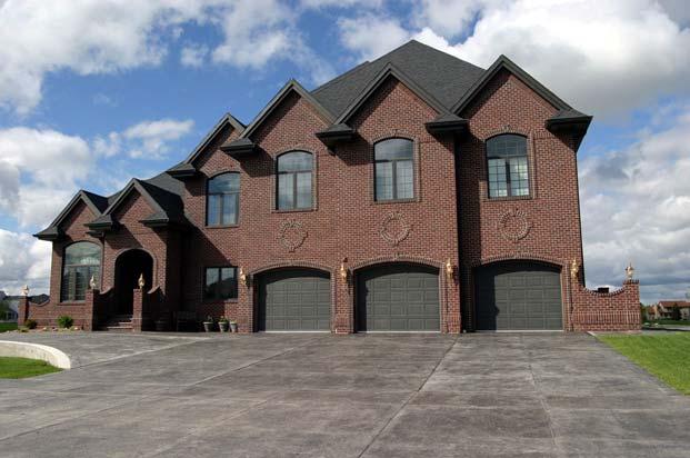
18 Connectivity Options Disappearing Trips Traditional Interior Perimeter Single Entry B B A Connected Street Spacing None A C Ped/Bike Spacing None C Connected Road Character All Streets Fronted Connectors Fronted Connectors Walled (No Connection) 3 Destinations 6 ITE Trips 3 Destinations 2 ITE Trips Bigger is Not better Parks It is always easier to leave Churches problems behind than it Shopping is to solve them Postal Lack of courage? Today The we bigger are learning the attraction, to the Face Fewer these people challenges What have Is access This? and We are The running more people out of have room to ask And resources for a ride. Provide Services Downtowns should provide essential services Postal Residential Commercial Public Space Restrooms Ferndale California 18


19 Not a good place Seniors The Cycle of Strip Development Poor Location for Shopping Plaza Okay Location for Shopping Plaza Best Location for Shopping Plaza Not a good place people with disabilities INPUTS Auto Oriented Business Single Use Zoning Single Family Residential Land Use Use Planning GROWTH GROWTH OUTCOMES Wider Roads Induced Traffic More Traffic Not a good place for the town hall Not a good place for multi-family OUTCOMES Isolated Neighborhoods Multiple Automobile Trips Poor Mobility Difficult Walking GROWTH GROWTH Transportation Planning INPUTS Traffic Demand Forecasting Congestion Breaking The Cycle of Strip Development INPUTS Diversity of Business Mixed Use Zoning Diversity of Residential Units Context Sensitive Solutions Community Involvement Land Use Community Transportation Planning Planning Planning Five keys to Success of Place Security Convenience Efficiency Comfort Welcome OUTCOMES Healthy Neighborhoods Choices of Transportation More Open Space Sense of Place Sense of Community GROWTH OUTCOMES Increased Mobility More Walking & Bicycling Increased Access 19


20 Density with Design Density with Design Dover Kohl & Partners Dover Kohl & Partners 1980s & 90s: Density, but In New Projects: Maintain the Relationship of Building and the Street Density with Design Density with Design In New Projects: Make the Streets Good Neighbors Dover Kohl & Partners In New Projects: Promote the Street as an Amenity, and Inspire Investment Dover Kohl & Partners 20


21 Victoria British Columbia Welcoming Eatery and Defensible Space 21


22 22


23 Broadway, Vancouver, British Columbia 23


24 24


25 Is This a House or a Garage? 25


26 Build for Multiple Uses Beauty Function Open Space Diversity, Inclusiveness Art/Music Green Friendly Economic prosperity Which building looks most like Southern Texas?? 26


27 40% of apartment residents choose to rent for lifestyle reasons not because they have to. Nearly one-quarter of renters earn $50K or more. Sources: Fannie Mae Foundation; U.S. Census Bureau Attracting the Best Some of the same solutions to our growth-related challenges, can help support new housing options. Crime and other social issues are highly correlated to lack of ownership, investment and pride. Attracting the Best Higher-density development offers homes that are within reach of vital community members such as: Teachers Nurses Fire fighters Police officers and our own children! A Plan for Tomorrow Build a new model. Strong, healthy communities have: Walkable, mixed-uses mixed income A rich mix of homes for a wide range of residents Many conveniences Green space Ownership/pride Strong economies Low crime Balanced budgets du/a du/a du/a 6-9 du/a 27


28 Sources: Massachusetts Citizens Housing and Planning Association; Byrne McKinney & Associates and Goody Clancy Architecture, Planning and Preservation Attract new retail development. Attract new retail development du/acre Densities of 8 to 12 homes per acre can create compact low-rise centers that can support a lively business district, mixed uses, and public transit nodes du/acre Densities of 8 to 12 homes per acre can create compact low-rise centers that can support a lively business district, mixed uses, and public transit nodes du/acre 1,000 to 2,000 new houses and apartments within a minute walk can support new retail areas. 1,000 to 2,000 new houses and apartments within a minute walk can support new retail areas du/acre 28


29 Thornton Park, Orlando, Florida Commercial, Retail, Residential Du/a


30 Du/a Du/a Du/a


31 Density Distribution Robinson Speeds reduced from to


32 Scaleybark Station South Corridor Station Areas New Bern Station Woodlawn Station Freeway Tyvola Station Archdale Station Arrowood Station Los Vegas Boulevard and Lake Mead Sharon Road West Station Arrowood Existing Conditions Arrowood Pedestrian Vision 32


33 Arrowood Bicycle Vision ARROWOOD URBAN DESIGN VISION 33


34 34


35 Civic Center and Lake Mead Civic Center and Lake Mead 35


36 36


37 37


38 38


39 39


40 40


41 41
42 42
43 43
44 44
45 45
46 46
47 47
48 48
49 49
50 50
51 51
52 52
53 53
54 54
Livable Community Principles Memphis, Tennessee June, 2005 Dan Burden, Glatting Jackson and Walkable Communities, Inc.
 Livable Community Principles Memphis, Tennessee June, 2005 Dan Burden, Glatting Jackson and Walkable Communities, Inc. What is the Purpose of Cities? 1 Before and After Citizen Planner Institute 2 In the
Healthy Built Environments Cowlitz-Wahkiakum County, Washington
 Healthy Built Environments Cowlitz-Wahkiakum County, Washington Bringing Back Active Transportation and Health Presented By Dan Burden, Blue Zones, LLC Livability/Health and the role of Place, Walkability
Stand by: The future is coming. Double The Feet On The Street. New Zealand, 4-54
 Double The Feet On The Street Is there a magic potient? He Tengata It s The People Stand by: The future is coming New Zealand, 4-54 5 August, 2008 Dan Burden, Founder of Walkable Communities, Inc. Partner
Illustrated Principles of Good Planning
 Illustrated Principles of Good Planning The Miami 21 Zoning Code incorporates time-tested planning principles into the zoning regulations of our City. These are principles that make for better neighborhoods,
WALK Friendly Communities: Creating Vibrant, Inclusive Places for People
 WALK Friendly Communities: Creating Vibrant, Inclusive Places for People Walkers are the indicator species for vibrant communities ~ Dr. Rodney Tolley, Director, Walk21 Imagine yourself walking safely
A CHANGING CITY. of Edmonton, it is essential that it reflects the long-term vision of the City.
 A CHANGING CITY By the year 2040, Edmonton will be home to more than 1 million people. To accommodate growth and support a healthy and compact city, we need a new approach to development/redevelopment
EXECUTIVE SUMMARY. Vision
 Vision Walking and bicycling in Salt Lake City will be safe, convenient, comfortable, and viable transportation options that connect people to places, foster recreational and economic development opportunities,
CONNECTING PEOPLE TO PLACES
 CONNECTING PEOPLE TO PLACES 82 EAST BENCH MASTER PLAN 07 Introduction The East Bench transportation system is a collection of slow moving, treelined residential streets and major arteries that are the
Ann Arbor Downtown Street Plan
 1 Ann Arbor Downtown Street Plan Public Workshop #1 We know that. 2 Public right-of-way (streets, sidewalks, and alleys) make up 30% of the total District area of downtown. Streets need to provide mobility
City of Novi Non-Motorized Master Plan 2011 Executive Summary
 City of Novi Non-Motorized Master Plan 2011 Executive Summary Prepared by: February 28, 2011 Why Plan? Encouraging healthy, active lifestyles through pathway and sidewalk connectivity has been a focus
Vision: Traditional hamlet with an attractive business/pedestrian friendly main street connected to adjacent walkable neighborhoods
 N D. Focus Area II Vision: Traditional hamlet with an attractive business/pedestrian friendly main street connected to adjacent walkable neighborhoods Transit Road Focus Area II is located in the Hamlet
Designing and Retrofitting Neighborhoods to Improve Safety
 Walkability Designing and Retrofitting Neighborhoods to Improve Safety Dan Burden, Executive Director of Walkable Communities, Inc. And Partner with Glatting Jackson In the past next fifty years transportation
Berkeley Strategic Transportation Plan A-76
 Berkeley Strategic Transportation Plan A-76 Appendices 1. A Team Effort 2. Where We ve Been A-11 Berkeley Strategic Transportation Plan Alameda County Transportation Plan Alameda County will be served
About the Active Transportation Alliance
 About the Active Transportation Alliance Chicagoland s voice for better biking, walking and transit Founded 1985 7,000 members, ~33 full time staff Serve Chicago metro region 1 More Cars, More Driving
Walkable Cities. A Presentation by Michalis Lambrinos Ministry of Transport, Communications and Works
 Walkable Cities A Presentation by Michalis Lambrinos Ministry of Transport, Communications and Works Contents What Makes a City Walkable Why is Walkability Important The Theory of Walkability Restrict
Proposed. City of Grand Junction Complete Streets Policy. Exhibit 10
 Proposed City of Grand Junction Complete Streets Policy Exhibit 10 1 City of Grand Junction Complete Streets Policy Vision: The Complete Streets Vision is to develop a safe, efficient, and reliable travel
How To Encourage More Efficient Transportation in Brazilian Cities
 How To Encourage More Efficient Transportation in Brazilian Cities Todd Litman Victoria Transport Policy Institute Presented Seminar on Discouraging The Use Of Cars São Paulo, Brazil 3 September 2013 Creating
FACTS AND FIGURES: MAKING THE CASE FOR COMPLETE STREETS IN LEE COUNTY
 FACTS AND FIGURES: MAKING THE CASE FOR COMPLETE STREETS IN LEE COUNTY Safety: Close to 5,000 pedestrians and bicyclists die each year on U.S. roads, and more than 70,000 are injured. [Mean Streets, Surface
The Impact of Placemaking Attributes on Home Prices in the Midwest United States
 The Impact of Placemaking Attributes on Home Prices in the Midwest United States 2 0 1 3 C O N S T R U C T E D E N V I R O N M E N T C O N F E R E N C E M A R Y B E T H G R A E B E R T M I C H I G A N
University of Michigan & Urban Land Institute Real Estate Forum. Mary Beth Graebert Michigan State University
 University of Michigan & Urban Land Institute Real Estate Forum Mary Beth Graebert Michigan State University November 20, 2013 Michigan State University Land Policy Institute Strong focus on research and
ASSESSING THE WALKING & BIKING ENVIRONMENT
 ASSESSING THE WALKING & BIKING ENVIRONMENT M A Y 2 0 1 3 Jon Morgan WI DHS ACTIVE COMMUNITY LINE-UP Rationale Why do an audit What s involved in an audit Things to look for and consider Hitting the streets
Creating walkable, bikeable and transit-supportive communities in Halton
 Creating walkable, bikeable and transit-supportive communities in Halton By presenting current research and best practices, the information in this paper is meant to support and broaden discussion on how
Approaches. Livable Neighborhood Design. Examples. Traditional neighborhood development. CE 594 University of Wisconsin- Milwaukee
 Approaches Livable Neighborhood Design CE 594 University of Wisconsin- Milwaukee Traditional neighborhood design (TND), new urbanism, transit friendly design, transit oriented development and walkable
How to Develop a Pedestrian Safety Action Plan
 How to Develop a Pedestrian Safety Action Plan Course Introduction Presented by: Peter Eun FHWA RC Safety Engineer Ryan Snyder President, Ryan Snyder Associates, LLC Paul Zykofsky Director, Land Use and
Cherry Creek Transportation and Land Use Forum September 25, 2013 Meeting Summary
 Cherry Creek Transportation and Land Use Forum September 25, 2013 Meeting Summary I. LEAD-IN TO SMALL GROUP DISCUSSION, POLLING AND STEERING COMMITTEE/TECHNICAL TASK FORCE DISCUSSION The meeting began
2015 Florida Main Street Annual Conference. Complete Streets Equal Stronger Main Streets
 WHAT ARE COMPLETE STREETS? CASE STUDIES COMPLETING YOUR MAIN STREET 2015 Florida Main Street Annual Conference St. Petersburg, Florida August 19, 2015 WHAT ARE COMPLETE STREETS? CASE STUDIES COMPLETING
Chapter 7. Transportation. Transportation Road Network Plan Transit Cyclists Pedestrians Multi-Use and Equestrian Trails
 Chapter 7 Transportation Transportation Road Network Plan Transit Cyclists Pedestrians Multi-Use and Equestrian Trails 7.1 TRANSPORTATION BACKGROUND The District of Maple Ridge faces a number of unique
NEWMARKET UPHAM S CORNER
 SOUTH STATION Planning Initiative NEWMARKET UPHAM S CORNER COLUMBIA ROAD (P) FOUR CORNERS/GENEVA Working Advisory Group (WAG) Meeting #5 TALBOT AVENUE MORTON STREET BLUE HILL AVE/CUMMINS HWY (P) RIVER
The Naples Park Community Plan DRAFT- MARCH 2003
 The Naples Park Community Plan DRAFT- MARCH 2003 prepared by: Dover, Kohl & Partners Town Planning Agnoli, Barber, & Brundage, Inc. Drainage Analysis Hall Planning and Engineering Transportation Planning
Land Use and Transportation Town Hall September 17, 2018
 Land Use and Transportation Town Hall September 17, 2018 Welcome! Tonight s Agenda: 7:00-7:30 OVERVIEW PRESENTATIONS 7:30-8:15 BREAKOUT SESSIONS 8:15 - End TOWN HALL CITIZEN S TIME Purpose of Tonight s
San Jose Transportation Policy
 San Jose Transportation Policy Protected Intersections in LOS Policies to Support Smart Growth Presented by: Manuel Pineda City of San Jose Department of Transportation Bay Area Map San Francisco Oakland
Front and Myrtle Improvement Project
 Front and Myrtle Improvement Project MAKING BOISE THE MOST LIVABLE CITY IN THE COUNTRY DOWNTOWN: Our unique and vibrant urban neighborhood GUIDING PRINCIPLES: Innovation Celebration Transportation Downtown
Complete Streets 101: The Basics
 Complete Streets 101: The Basics Michigan Municipal League - Capital Conference March 21, 2017 Chip Smith, AICP - Senior Planner - Wade Trim Inc. and City Council member City of Ann Arbor 2017 MML Capital
Progress Table GreenStep HIA Best Practices
 Executive Summary The HIA will guide the City of Marshall and the GreenStep Committee in prioritizing its involvement in the Minnesota GreenStep Cities Program to advance best practices that leverage improving
Executive Summary Route 30 Corridor Master Plan
 Route Corridor Master Plan Project Overview The Route Corridor Master Plan is a coordinated multimodal transportation and land use plan for the entire stretch of Route through East Whiteland Township,
Uniting Cleveland through the Euclid Corridor Transportation Project
 Zhang 1 Uniting Cleveland through the Euclid Corridor Transportation Project Jinmeng Zhang As a bus passenger takes a ride to downtown Cleveland through Euclid Avenue, constructions can be seen along the
Community Task Force July 25, 2017
 Community Task Force July 25, 2017 Welcome and Introductions Project Partners Regional Transportation District (RTD) Colorado Department of Transportation (CDOT) Denver Regional Council of Governments
PEDESTRIAN ACTION PLAN
 ATTACHMENT 2 CITY OF SANTA MONICA PEDESTRIAN ACTION PLAN CITY OF SANTA MONICA PEDESTRIAN ACTION PLAN This page intentionally left blank EXECUTIVE SUMMARY CHAPTER 1 EXECUTIVE SUMMARY Setting the Stage
PEOPLE ARE PEDESTRIANS BY DESIGN JOIN THE MOVEMENT AT
 PEOPLE ARE PEDESTRIANS BY DESIGN JOIN THE MOVEMENT AT WWW.WALKDENVER.ORG Our Vision: In 2040, Denver will be the most walkable city in the United States. As a result, its residents will be the country
Comments The Plan for Port Whitby
 Comments The Plan for Port Whitby April 24th, 2013 Community Meeting #2 Summary Report Prepared by GLPi April 29th, 2013 1 Introduction The purpose of the Port Whitby Secondary Plan Update, Community Improvement
2016 I-30 CROSSING ARKANSAS BOULEVARD KEY IDEAS OF PLAN B:
 KEY IDEAS OF PLAN B: Transportation shall support all parts of the cities and improve the quality of life downtown. There is no need to shorten commuting time at rush hour by a few minutes at the risk
Bikeway action plan. Bicycle Friendly Community Workshop March 5, 2007 Rochester, MN
 Bikeway action plan Summary The was held on March 5, 2007 at the Rochester Mayo Civic Center. The workshop was hosted by Rochester-Olmsted County Planning Department in collaboration with the League of
Prioritizing Transportation Policy and Funding for Active Transportation, Safety, Equity and Health
 Mayor Karl Dean, Chairman Prioritizing Transportation Policy and Funding for Active Transportation, Safety, Equity and Health Leslie A. Meehan, AICP Planning and Implementing the Active Community Webinar
Exhibit 1 PLANNING COMMISSION AGENDA ITEM
 Exhibit 1 PLANNING COMMISSION AGENDA ITEM Project Name: Grand Junction Circulation Plan Grand Junction Complete Streets Policy Applicant: City of Grand Junction Representative: David Thornton Address:
PEDALING FORWARD. A Glance at the SFMTA s Bike Program for SFMTA.COM
 PEDALING FORWARD A Glance at the SFMTA s Bike Program for 2017-2021 SFMTA.COM INTRODUCTION About This Booklet More people from all walks of life see their bicycle as a more convenient way to get where
Planning Regionally With Transit
 Planning Regionally With Transit Nathan Coats Director of Operations CTAA Expo 2015 Tampa Began 1992. Serves eastern Cache County to Preston, ID. Population- 115,000 34 bus fleet, 26 fixed route buses;
Designing for Pedestrian Safety
 Designing for Pedestrian Safety Introduction to Pedestrian Safety Design and Planning Principles Presented by: Craig Allred FHWA Resource Center Technical Specialist and Michael Ronkin Owner, Designing
Don t be Left Behind: Make Your Community More Walkable Now
 Don t be Left Behind: Make Your Community More Walkable Now Samantha Thomas Blue Zones, LLC Christopher A. Coes Speakers Responsible Real Estate Developers & Investors Nate Johnson Coastal Carolinas Association
2. Context. Existing framework. The context. The challenge. Transport Strategy
 Transport Strategy Providing quality connections Contents 1. Introduction 2. Context 3. Long-term direction 4. Three-year priorities 5. Strategy tree Wellington City Council July 2006 1. Introduction Wellington
good walking is good business making massachusetts more walkable
 good walking is good business making massachusetts more walkable Nothing draws a crowd like a crowd. P.T. Barnum 15 minutes with WalkBoston who we are / what we do why walkability makes economic sense
Bicycle and Pedestrian Advisory Committee (BPAC) November 21, 2013
 November 21, 2013") Bicycle and Pedestrian Advisory Committee (BPAC) November 21, 2013 OVERALL LAND USE CONCEPT Overall Broadway Valdez District: 95.5 acres (35.1 acres right-of ways + 60.4 acres developable land) Plan Subareas:
Bicycle and Pedestrian Advisory Committee (BPAC) November 21, 2013 OVERALL LAND USE CONCEPT Overall Broadway Valdez District: 95.5 acres (35.1 acres right-of ways + 60.4 acres developable land) Plan Subareas:
Complete Streets Workshop Follow-up. April 27, 2011 Rockledge City Hall
 Complete Streets Workshop Follow-up April 27, 2011 Rockledge City Hall Agenda Complete Streets draft briefing presentation and sample policy language Share your Complete Streets projects and post workshop
Chapter 5. Principles Appropriating Process
 Chapter 5 Principles Appropriating Process New, post and other urbanism [ ] However these urbanism are perceived, they do represent different values and sensibilities. They need to be situated in time
WELCOME. to the meeting for the. Westside Avenue Action Plan Gateway to Revitalization
 WELCOME to the meeting for the Columbia Road - Before and After Ridge Road - Before and After Before and After WAAP Bridge Sections Fountain Creek Before Retaining Wall for Roadway 30' Existing Fountain
Cascade Bicycle Club Strategic Plan
 The Greater Context Bicycling has become fundamentally important as large-scale currents of change threaten the health, economy and livability of communities throughout the United States and the world
FONTAINE AVENUE STUDY Final Report
 FONTAINE AVENUE STUDY Final Report March 28, 2005 FONTAINE AVENUE STUDY City of Charlottesville March 28, 2005 Renaissance Planning Group Kenneth Schwartz, FAIA, AICP Director of Design Leigh Wilkerson,
Use this guide to learn more about walkability and how you can make your community safer to walk
 Walkability Guide Do You Enjoy Walking In Your Community? Use this guide to learn more about walkability and how you can make your community safer to walk 2 About This Guide Circulate San Diego believes
Cities Connect. Cities Connect! How Urbanity Supports Social Inclusion
 Cities Connect! How Urbanity Supports Social Inclusion Todd Litman Victoria Transport Policy Institute Metropolis Toronto, Canada - 14 June 2006 Cities Connect People with people. People with jobs. People
Implementing Complete Streets: The Road Diet. Ed McKinney, AICP Senior Associate, Glatting Jackson
 Implementing Complete Streets: The Road Diet Ed McKinney, AICP Senior Associate, Glatting Jackson How do we implement complete streets on our existing roads? Many Roads Could Use a road diet Trying to
Morningside Neighborhood Association. Neighborhood Survey, Spring 2017
 Morningside Neighborhood Association Neighborhood Survey, Spring 2017 239 Total Responses The chart below tracks when the following neighborhood organizations encouraged their members to respond to respond
The best indicator of an individual s and expanding access to parks and open space.
 Health & Wellness Create a Safe and Healthy Built Environment Artist s rendering, 2014 Health is important to Loveland residents, and stakeholders see the many strong connections between quality of life,
City of Birmingham Draft Multi-modal Transportation Plan
 City of Birmingham Draft Multi-modal Transportation Plan City Commission Public Hearing Monday, November 25, 2013 7:30 pm Norman Cox, PLA, ASLA The Greenway Collaborative, Inc. Ann Arbor, Michigan The
TRANSIT-ORIENTED DEVELOPMENT POLICY. City Planning and Development Department Kansas City, Missouri
 TRANSIT-ORIENTED DEVELOPMENT POLICY City Planning and Development Department Kansas City, Missouri TOD Framework Connectivity: Expand transit access, increase mobility options Integrated system of pedestrian,
Speed Limits Study and Proposal. Public Input Session: 8/14/13
 Speed Limits Study and Proposal Public Input Session: 8/14/13 Why is Decatur a unique place for this project? First Community Transportation Plan in the nation with a Health Impact Assessment. Strong sense
Public Workshop #2. September 14, 2016
 Public Workshop #2 September 14, 2016 Agenda Welcome Project Overview Where We Have Been Alternatives for State Street Land Use Street Design Next Steps 2 Project Overview Create a Vibrant State Street
7 NE 145TH STREET STATION TOD POTENTIAL
 7 NE 145TH STREET STATION TOD POTENTIAL Key Findings The 145th Street Station area has limited TOD potential, primarily because of its location in an area that is currently zoned predominantly single-family
Urban planners have invested a lot of energy in the idea of transit-oriented
 DOES TRANSIT-ORIENTED DEVELOPMENT NEED THE TRANSIT? D A N I E L G. C H AT M A N Urban planners have invested a lot of energy in the idea of transit-oriented developments (TODs). Developing dense housing
Perryville TOD and Greenway Plan
 Perryville TOD and Greenway Plan Greenway Glossary Pathway: A bicycle and pedestrian path separated from motorized vehicular traffic by an open space, barrier or curb. Multi-use paths may be within the
REGIONAL BICYCLE AND PEDESTRIAN DESIGN GUIDELINES
 REGIONAL BICYCLE AND PEDESTRIAN DESIGN GUIDELINES November 16, 2011 Deb Humphreys North Central Texas Council of Governments Bicycle and Pedestrian Advisory Committee Snapshot of the Guide 1. Introduction
GIS Based Data Collection / Network Planning On a City Scale. Healthy Communities Active Transportation Workshop, Cleveland, Ohio May 10, 2011
 The Purpose of GIS Based Network Planning GIS Based Data Collection / Network Planning Healthy Communities Active Transportation Conference Tuesday, May 10, 2011 10:00 AM Norman Cox, LLA, ASLA. Ann Arbor,
DATE: June 22, General Release SUBMITTED BY: LAND DEVELOPMENT SERVICES. RE: City Centre Survey Results
 DATE: June 22, 2018 TO: General Release SUBMITTED BY: LAND DEVELOPMENT SERVICES RE: City Centre Survey Results The following is a summary of preliminary findings for the Community Identity and Vision survey.
Welcome. Background. Goals. Vision
 Welcome The formal Public Information Centre (PIC) for the Transportation Master Plan How We GO will be held in early 2017. At that time we will present the recommended transportation system for Niagara
Practicing what we preach in POMONA! Daryl Grigsby, Public Works Director, City of Pomona, California
 Practicing what we preach in POMONA! Daryl Grigsby, Public Works Director, City of Pomona, California Who lives in Pomona? 150,000 people: Young average age 26, 34% under 18 years old, and only 6.5% over
Table #6 VISION CHARACTERISTICS
 Table #6 VISION White Flint is a place to live, work, play, shop, and walk with sufficient density to encourage quality redevelopment. Vibrant streets and consistent streetscapes are important. CHARACTERISTICS
GRAHAM PEDESTRIAN TRANSPORTATION PLAN
 GRAHAM PEDESTRIAN TRANSPORTATION PLAN Chapter 1 I 1.1 Scope and Purpose n March of 2005, the City of Graham contracted with Greenways Incorporated (GWI) to create a Pedestrian Transportation Plan. The
Eastern PA Trail Summit October 1, 2018
 Eastern PA Trail Summit October 1, 2018 WHO WE ARE + WHY + WE RE * HERE * * * * * * Session Goals: Discuss how to coordinate planning and design in small, urbanized towns Consider how to develop alternative
What s Health Got to Do With It? Health and Land Use Planning
 What s Health Got to Do With It? Health and Land Use Planning CANDACE RUTT, PH.D. EXECUTIVE DIRECTOR APRIL 13 TH, 2016 Planning and Public Health Planning + Public Health Healthy Communities Healthier
PETITION AND LETTER WRITING BEST PRACTICES
 PETITION AND LETTER WRITING BEST PRACTICES Petitions and campaign letters can be a great way to bring important bicycle and pedestrian policies and projects to the attention of elected officials. They
Transportation Master Plan Advisory Task Force
 Transportation Master Plan Advisory Task Force Network Alternatives & Phasing Strategy February 2016 BACKGROUND Table of Contents BACKGROUND Purpose & Introduction 2 Linking the TMP to Key Council Approved
Mainstreet Master Plan Land Use
 Mainstreet Master Plan 04 Land Use Top Recommendations Active Uses: Promote active ground-floor uses such as retail, restaurants, galleries and personal services with interactive storefronts for Mainstreet
Linking Transportation and Health in Nashville & Middle Tennessee
 Linking Transportation and Health in Nashville & Middle Tennessee Fit Nation New Orleans CPPW Mentoring Grant Built Environment Program May 14, 2011 Local Transportation Planning Framework Federal U.S.
York Boulevard Streetscape Master Plan
 York Boulevard Streetscape Master Plan October 24 th, 2008 The Story of York Boulevard Streetscape Master Plan Design. Chapter 126 Dealing with Engineers. 2 1 Today s Presentation Topics: 1. Show the streetscape
The future of city streets: NACTO Urban Street Design Guide. November 19, 2013
 The future of city streets: NACTO Urban Street Design Guide November 19, 2013 November 19, 2013 State Smart Transportation Initiative Practical Solutions to Move America Forward. A network of reform-oriented
CALIFORNIA STATE UNIVERSITY, NORTHRIDGE
 CALIFORNIA STATE UNIVERSITY, NORTHRIDGE Connecting Reseda Boulevard & CSUN: One Great Street A graduate project submitted in partial fulfillment of the requirements For the degree of Master of Urban Planning
Goodlettsville Bicycle and Pedestrian Plan Executive Summary
 Goodlettsville Bicycle and Pedestrian Plan July 2010 In Cooperation with the Nashville Area Metropolitan Planning Executive Organization Summary Introduction Progressive and forward thinking communities
Living Streets Policy
 Living Streets Policy Introduction Living streets balance the needs of motorists, bicyclists, pedestrians and transit riders in ways that promote safety and convenience, enhance community identity, create
5 CIRCULATION AND STREET DESIGN
 5 CIRCULATION AND STREET DESIGN This chapter describes circulation and streetscape improvements proposed for the Northwest Chico Specific Plan Area. It includes detailed design specifications for existing
STUDY ADVISORY COMMITTEE. October 8, 2015
 STUDY ADVISORY COMMITTEE October 8, 2015 Study Purpose evaluate the long-term transportation strategies and investments needed to sustain the county s economic health and quality of life in the coming
Appendix C 3. Bicycle / Pedestrian Planning
 Appendix C 3. Bicycle / Pedestrian Planning BICYCLE/PEDESTRIAN PLANNING 2005 Master Plan GOAL: Provide for safe and convenient bicycle and pedestrian circulation throughout the City. Develop a city-wide
Anniedale- Tynehead NCP Best Practices in Transportation Planning Summary
 Anniedale- Tynehead NCP Best Practices in Transportation Planning Summary The City of Surrey Anniedale-Tynehead NCP Best Practices Transportation Summary This document provides a summary of the Bunt &
COUNCIL POLICY NAME: COUNCIL REFERENCE: 06/119 06/377 09/1C 10llC 12/1C INDEX REFERENCE: POLICY BACKGROUND
 COUNCIL POLICY NAME: COUNCIL ADVISORY COMMITTEES - TERMS OF REFERENCE ISSUED: APRIL 3, 2006 AMENDED: NOVEMBER 27, 2006 NOVEMBER 23, 2009 JANUARY 11, 2010 DECEMBER 17, 2012 POLICY COUNCIL REFERENCE: 06/119
SETTINGS AND OPPORTUNITIES MOBILITY & ACCESS
 7 mobility & access how do people use el camino what is it like to drive on el camino/to park along el camino what is the pedestrian experience like what is the role of transit along the corridor what
summary of issues and opportunities
 1 summary of issues and opportunities EXECUTIVE SUMMARY CHAPTER 2: HISTORY - 3: LAND USE This first chapter is an overview of lessons learned from analysis of the existing conditions on El Camino as well
EVAN GLASS. Montgomery County Council District 5
 EVAN GLASS 1. Do you support funding and advancing the Purple Line to groundbreaking as described in the Locally Yes. As a member of the recently convened Purple Line Implementation Advisory Group, I will
Florida Coalition CTST COMMUNITY TRAFFIC SAFETY TEAMS COLLEGE OF MEDICINE
 CTST Florida Coalition COMMUNITY TRAFFIC SAFETY TEAMS COLLEGE OF MEDICINE How to Choose Your Lifelong Community A Transportation Checklist What Is a Lifelong Community? You might be more familiar with
Regional Transportation Needs Within Southeastern Wisconsin
 Regional Transportation Needs Within Southeastern Wisconsin #118274 May 24, 2006 1 Introduction The Southeastern Wisconsin Regional Planning Commission (SEWRPC) is the official areawide planning agency
TORONTO WALKING STRATEGY
 CITY OF TORONTO t TORONTO WALKING STRATEGY EVERYONE IS A PEDESTRIAN ItitiORONM TORONTO MAYOR DAVID MILLER Toronto's Walking Strategy is a vision for a more liveable, prosperous and sustainable city. It
Bicycle and Pedestrian Plans and Improvements
 Bicycle and Pedestrian Plans and Improvements Presented to the City Council By Randle Harwood, Planning and Development, and Richard Zavala, Parks and Community Services September 24, 2013 Purpose Review
THIRD&GRAND. Public Workshop #1. Transportation Hub Area Plan. June 12, 2013
 Transportation Hub Area Plan Public Workshop #1 June 12, 2013 Agenda Study Background Who is Involved Process and Schedule Planning Area and Project Site The Opportunity Site Analysis Land Use/Zoning Transportation
Pedestrian Survey Report
 Pedestrian Survey Report The City of Albany conducted a Pedestrian Survey in 2007 with the purpose of identifying resident s concerns about barriers to walking and accessibility in the City. The survey