Stand by: The future is coming. Double The Feet On The Street. New Zealand, 4-54
|
|
|
- Nathan Dennis
- 6 years ago
- Views:
Transcription


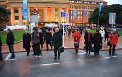
1 Double The Feet On The Street Is there a magic potient? He Tengata It s The People Stand by: The future is coming New Zealand, August, 2008 Dan Burden, Founder of Walkable Communities, Inc. Partner And Senior Urban Designer with Glatting Jackson Kercher and Anglin Dan has learned to see the world through the lens of his camera, carefully picking subjects of interest to illustrate his view of the world. There is a saying among National Geographic photographers. Jon Marty Paul Earl Dale National Geographic photographers stand on top of the garbage cans to photograph the flowers while Life magazine photographers stand in the flowers to photograph the garbage cans. Dan s Arm Photo by Paul What is the first thing an infant wants to do and the last thing an older person wants to give up? Walking is the exercise that does not need a gym. It is the prescription without medicine, the weight control without diet, and the cosmetic that can t be found in a chemist. It is the tranquilizer without a pill, the therapy without a psychoanalyst, and the holiday that does not cost a penny. What s more, it does not pollute, consumes few natural resources and is highly efficient. Walking is convenient, it needs no special equipment, is self-regulating and inherently safe.. Palo Alto, California


2 Our cars matter. But Our People Come First Why do we need public places? How can you know what to try with traffic until. Automobiles are often conveniently tagged as the villains responsible for the ills of cities and the disappointments and futilities of city planning. But the destructive effects of automobiles are much less a cause than a symptom of our incompetence at city building. The simple needs of automobiles are more easily understood and satisfied than the complex needs of cities, and a growing number of planners and designers have come to believe that if they can only solve the problems of traffic, they will thereby have solved the major problems of cities. Cities have much more intricate economic and social concerns than automobile traffic. How can you know what to try with traffic until you know how the city itself works, and what else it needs to do with its streets? You can't. Jane Jacobs, Death and Life of Great American Cities, 1961 Not Walkable High Car Dependency Serious Congestion Walkable Low Car Dependency Moderate Congestion Which See Makes Any Differences? More Money?


3 2001 National Geographic Magazine Article on Sprawl Photo by: Newsday Levittown New York Lakeshore Road (SR 5), Hamburg, NY What the Community Provided What the Customer Wanted


4 Standard Of Living Quality Of Life Very High Low If it weren t for the damn pedestrian there would be no traffic problem in Los Angeles circa 1972, Los Angeles Traffic Engineer Compact villages and a strong civilian presence is the only solution to our traffic problems circa 1995, San Diego Traffic Engineer Tennessee Avenue, Tallahassee, Florida People once fled cities for their health Today people are returning to cities for their health Portland, Oregon


5 Cars are happiest When they have Unlimited Freedom -- When few other cars are around Victoria, British Columbia People are Happiest when there are many others around. Victoria, British Columbia Peak Happiness 1965 So what makes societies happy? Feelings of well-being are determined as much by status and social connectedness as by income. Richer people are happier than poor people, but societies with wider income gaps are less happy on the whole. People who interact more with friends, family and neighbours are happier than those who don t. Recent studies on life satisfaction show that commuting makes people more unhappy than anything else in life. There are a few things we can agree on about happiness, he says. You need to fulfill your potential as a human being. You need to walk. You need to be with other people. Most of all, you need to not feel inferior. When you talk about these things, designing a city can be a very powerful means to generate happiness. From a recent article on Enrique Penalosa, former Mayor of Bogota, Columbia


6 Last year car buyers ranked fuel economy 17th on their list of priorities, just below cup holders and the car's stereo system, according to a survey by CNW Research, a respected automotive market analysis firm. Newsweek, April 08 Sustainable Transportation is about meeting present transportation needs without compromising the ability of future generations to meet their needs. The concept of sustainable transportation is a reaction to things that have gone radically and visibly wrong with current transportation and land use policy, practice and performance over the last half of the twentieth century. In particular unsustainable transportation consumes more energy and creates pollution and declining service levels despite increasing investments. It delivers poor service for specific social and economic groups. It reduces happiness. It raises the cost of personal transportation to 20% of a family budget and takes time away from family time and ties. Indirectly, it increases health care to 15-20% Why we cannot build our way out of traffic Vehicle miles traveled (VMT) around the U.S. have increased by 70 percent over the last 20 years, compared with a two percent increase in new highway construction. The U.S. General Accounting Office predicts that road congestion in the U.S. will triple in 15 years even if capacity is increased by 20 percent. Traffic is growing about five times faster than the growth in population. (Data compiled for a report to the U.S. Department of Transportation in 2006 written by Stephen Polzin, (transportation researcher at the University of South Florida in Tampa.) Houston, Texas There is No There There Gertrude Stein Fifty percent of all American cities are now under concrete and asphalt. (In Los Angeles it is now 66 percent.)


7 Designed by college graduates Narrow streets Short blocks Tight corner radii Great plazas Beautiful buildings Limited parking new Town, Key West, Florida Built by Pirates Old Town, Key West, Florida Five keys to Success of Walking Security Convenience Efficiency Comfort Welcome


, and walking, bicycling")


.")


8 Ten Steps To Walkability Compact, lively town center Many people of all ages and abilities walking many hours Low speed streets, distributed volumes Fine grained streets, many trails, transit links Neighborhood schools and parks, within one quarter mile or one eighth mile Public places with inviting features: benches, restrooms, shade, water and art Convenient, safe and efficient crossings Celebrated public space and public life, parades, markets, festivals, awards Land use and transportation partnerships Affordable, inspiring, well maintained streets and homes. As density increases, per capita hours and miles of automobile travel tend to decline (Ewing and Cervero, 2001; Holtzclaw 1994; Frank et al 2006), and walking, bicycling and transit tend to increase, all else being equal. Charleston, SC Seattle starts a new pedestrian or cycling project each six hours over 500 per year. Seattle responds to citizen complaints within 48 hours. Always! A recent study in Seattle found that each quartile increase in residential density corresponded with a 23 per cent increase in the odds of walking for non-work travel. (King County ORTP, 2005). Seattle, Washington Density relates with travel behavior by affecting distances between destinations and the portion of destinations that can be reached by active modes (walking and cycling). A concentration of jobs and households makes transit more viable and provides the critical mass necessary for supporting retail development. Santa Fe, NM If Cities are to reduce auto-dependence a Developers no longer block access to those places people want to reach. If Cities are to reduce auto-dependence a Streets must become right-sized for their greater mission.


9 If Cities are to reduce auto-dependence a Streets must support retail with the Smart Tools, such as road diets. If Cities are to reduce autodependence a Intersection confluences are solved by building network Chico, CA Nord Avenue Chico, CA Nord Avenue If Cities are to reduce autodependence a working alternative should include: Walls come down and buildings honor streets If Cities are to reduce autodependence a Buildings no longer moon the street


10 If Cities are to reduce auto-dependence a Strip centers are replaced with town squares, destinations are a walkable scale If Cities are to reduce autodependence a Empty placeless space becomes lovable and loved. If Cities are to reduce autodependence a Streets undergoing reconstruction become attractive, respectful and function for all users If Cities are to reduce auto-dependence a Creative partnering for infill projects replace ill-conceived Super Blocks Freeway DOWNTOWN Investment moves to SHOPPING CENTERS Investment moves to Corridor STRIP CORRIDOR Steve Price, Urban Advantage Courtesy of Michael Freedman
 is the result of this planning approach; it shows the hypothetical")


11 The Strip Falling out of Favor: Linear Strip format Courtesy of Michael Freedman Courtesy of Michael Freedman A linear pattern of commercial development along suburban arterial roadways The Illustrative Plan (above) is the result of this planning approach; it shows the hypothetical buildout of the corridor, locating building footprints (new and existing), open space, and parking areas. The corridor was divided into four study areas, the Western Gateway, the Neighborhood Center, the Village Center, and the Town Center. Each area has it s own unique characteristics and challenges which were addressed. Quick sketches were done to study buildings that would result from the hypothetical building footprints in the Illustrative Plan, combined with the proposed height limits in the study areas and potential architectural regulations of the new code. each street, which corresponds to written code regulations. This Transport Strategy will be successful when all Tauranga citizens find it easy to travel around the city safely by any form of transport; and when people making choices about the way they travel they have the full knowledge of the consequences of those choices. Plan the corridor retail as part of a supportable city & regional hierarchy of centers Pre-existing Zoning retail permitted Real Centers are nodes of accessibility Supportable Pattern of Centers Pre-existing Zoning residential permitter Courtesy of Michael Freedman New Pattern of Centers & Segments


12 Real Centers are Walkable Real Centers center around the neighborhood/city/region s primary public and civic spaces $5-15/ sq ft $25-50/ sq ft Reframing Key Transportation Conventions DESIGN TRAFFIC - Interpreting the Results Capacity of Streets Canada Marine Drive, Dundarave, B.C. Highway 93, Missoula, Montana USA


13 Bridgeport Way, University Place, Washington You Know When You Have Left Claremont Claremont, California Proposed x-section x alternatives on Foothill Blvd N side Hurley looking west near Greer Elementary School Bike ½ section Bike lane lane & wider median Bike & wider lane sidewalk to and sidewalk curb wider with north with textured sidewalk (commercial) parking parking bays side bays median/ctl median/ctl walking travel travel travel bike parking sidewalk area Steve Price Urban Advantage


14 Before and After Espanola Way, circa 1986 Citizen Planner Institute West Palm Beach Florida South Beach, Florida Ocean Drive


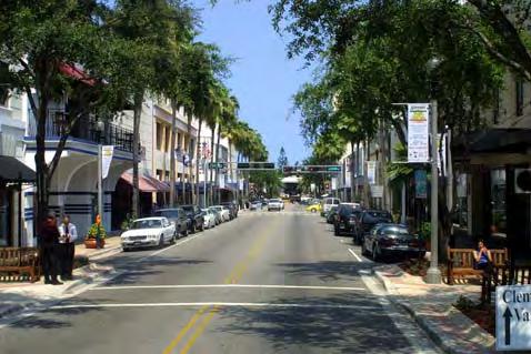

15 West Palm Beach, 1994 Charrette Team Ian Lockwood, P.E. West Palm Beach West Palm Beach, Florida Clematis


16 14 Feet La Jolla Boulevard, Bird Rock, San Diego, California Rex Burkholder Portland Area Regional Commissioner Thanks, Dad For Everything In Memoriam Fire Chief, Ralph Burden

17
Healthy Built Environments Cowlitz-Wahkiakum County, Washington
 Healthy Built Environments Cowlitz-Wahkiakum County, Washington Bringing Back Active Transportation and Health Presented By Dan Burden, Blue Zones, LLC Livability/Health and the role of Place, Walkability
Livable Community Principles City of North Las Vegas, Nevada June, 2005 Dan Burden, Glatting Jackson and Walkable Communities, Inc.
 Livable Community Principles City of North Las Vegas, Nevada June, 2005 Dan Burden, Glatting Jackson and Walkable Communities, Inc. What is the Purpose of Cities? 1 Dan has learned to see the world through
Livable Community Principles Memphis, Tennessee June, 2005 Dan Burden, Glatting Jackson and Walkable Communities, Inc.
 Livable Community Principles Memphis, Tennessee June, 2005 Dan Burden, Glatting Jackson and Walkable Communities, Inc. What is the Purpose of Cities? 1 Before and After Citizen Planner Institute 2 In the
Measuring Transportation: Traffic, Mobility and Accessibility
 Measuring Transportation: Traffic, Mobility and Accessibility THIS FEATURE COMPARES THREE APPROACHES TO MEASURING TRANSPORTATION SYSTEM PERFORMANCE. TRAFFIC-BASED MEASUREMENTS EVALUATE MOTOR VEHICLE MOVEMENT;
By Dan Burden, Executive Director Walkable and Livable Communities Institute
 By Dan Burden, Executive Director Walkable and Livable Communities Institute Is this the landscape we want to leave our children? LaJolla Boulevard, Birdrock, San Diego, CA 78 Feet Speeds above
How To Encourage More Efficient Transportation in Brazilian Cities
 How To Encourage More Efficient Transportation in Brazilian Cities Todd Litman Victoria Transport Policy Institute Presented Seminar on Discouraging The Use Of Cars São Paulo, Brazil 3 September 2013 Creating
What s Health Got to Do With It? Health and Land Use Planning
 What s Health Got to Do With It? Health and Land Use Planning CANDACE RUTT, PH.D. EXECUTIVE DIRECTOR APRIL 13 TH, 2016 Planning and Public Health Planning + Public Health Healthy Communities Healthier
2015 Florida Main Street Annual Conference. Complete Streets Equal Stronger Main Streets
 WHAT ARE COMPLETE STREETS? CASE STUDIES COMPLETING YOUR MAIN STREET 2015 Florida Main Street Annual Conference St. Petersburg, Florida August 19, 2015 WHAT ARE COMPLETE STREETS? CASE STUDIES COMPLETING
Cities Connect. Cities Connect! How Urbanity Supports Social Inclusion
 Cities Connect! How Urbanity Supports Social Inclusion Todd Litman Victoria Transport Policy Institute Metropolis Toronto, Canada - 14 June 2006 Cities Connect People with people. People with jobs. People
Bikeway action plan. Bicycle Friendly Community Workshop March 5, 2007 Rochester, MN
 Bikeway action plan Summary The was held on March 5, 2007 at the Rochester Mayo Civic Center. The workshop was hosted by Rochester-Olmsted County Planning Department in collaboration with the League of
CITY OF COCOA BEACH 2025 COMPREHENSIVE PLAN. Section VIII Mobility Element Goals, Objectives, and Policies
 CITY OF COCOA BEACH 2025 COMPREHENSIVE PLAN Section VIII Mobility Element Goals, Objectives, and Policies Adopted August 6, 2015 by Ordinance No. 1591 VIII MOBILITY ELEMENT Table of Contents Page Number
Complete Streets Workshop Follow-up. April 27, 2011 Rockledge City Hall
 Complete Streets Workshop Follow-up April 27, 2011 Rockledge City Hall Agenda Complete Streets draft briefing presentation and sample policy language Share your Complete Streets projects and post workshop
Designing and Retrofitting Neighborhoods to Improve Safety
 Walkability Designing and Retrofitting Neighborhoods to Improve Safety Dan Burden, Executive Director of Walkable Communities, Inc. And Partner with Glatting Jackson In the past next fifty years transportation
BUILDING THE CASE FOR TRAVEL OPTIONS IN WASHING TON COUNTY. Image: Steve Morgan. Image: Steve Morgan
 BUILDING THE CASE FOR TRAVEL OPTIONS IN WASHING TON COUNTY Image: Steve Morgan Image: Steve Morgan Image: TriMet Image: TriMet WHAT ARE TRAVEL OPTIONS PROGRAMS? Travel options programs encourage residents,
Complete Streets 101: The Basics
 Complete Streets 101: The Basics Michigan Municipal League - Capital Conference March 21, 2017 Chip Smith, AICP - Senior Planner - Wade Trim Inc. and City Council member City of Ann Arbor 2017 MML Capital
FACTS AND FIGURES: MAKING THE CASE FOR COMPLETE STREETS IN LEE COUNTY
 FACTS AND FIGURES: MAKING THE CASE FOR COMPLETE STREETS IN LEE COUNTY Safety: Close to 5,000 pedestrians and bicyclists die each year on U.S. roads, and more than 70,000 are injured. [Mean Streets, Surface
SETTINGS AND OPPORTUNITIES MOBILITY & ACCESS
 7 mobility & access how do people use el camino what is it like to drive on el camino/to park along el camino what is the pedestrian experience like what is the role of transit along the corridor what
Concept of Sustainable Transport and integrated Land Use Planning- An Overview. Manfred Breithaupt GIZ Water, Energy, Transport
 Concept of Sustainable Transport and integrated Land Use Planning- An Overview Manfred Breithaupt GIZ Water, Energy, Transport The adverse impacts of growth in motorization - in economic, environmental
About the Active Transportation Alliance
 About the Active Transportation Alliance Chicagoland s voice for better biking, walking and transit Founded 1985 7,000 members, ~33 full time staff Serve Chicago metro region 1 More Cars, More Driving
COASTAL RAIL TRAIL ROSE CREEK BIKEWAY PROJECT COMMUNITY WORKSHOP #2 AUGUST 15, 2013
 COASTAL RAIL TRAIL ROSE CREEK BIKEWAY PROJECT COMMUNITY WORKSHOP #2 AUGUST 15, 2013 CHRIS CARTERETTE, AICP PROJECT MANAGER Chris.Carterette@sandag.org Direct: 619-699.7319 REGIONAL PLANNING BACKGROUND
Win-Win Transportation Solutions
 Win-Win Transportation Solutions Todd Litman Victoria Transport Policy Institute Presented Lipinski Symposium on Transportation Policy Chicago, Illinois 15 October 2007 What is The Transportation Problem?
COWETA HIGH SCHOOL AND EAST HIGHWAY 51
 COWETA HIGH SCHOOL AND EAST HIGHWAY 51 Lack of sidewalks along Ben Lumpkin Rd. Lack of crosswalks and ramps at intersection. Hwy 51 is wide to cross as a pedestrian. No ADA compliance or connection to
5/7/2013 VIA . RE: University Village Safeway Expansion (P13-019)
") 5/7/2013 VIA EMAIL David Hung, Associate Planner Community Development Department, Current Planning Division City of Sacramento 300 Richards Boulevard, 3 rd Floor Sacramento, CA 95811 RE: University Village
5/7/2013 VIA EMAIL David Hung, Associate Planner Community Development Department, Current Planning Division City of Sacramento 300 Richards Boulevard, 3 rd Floor Sacramento, CA 95811 RE: University Village
PRINCE GEORGE S PLAZA METRO AREA PEDESTRIAN PLAN
 PRINCE GEORGE S PLAZA METRO AREA PEDESTRIAN PLAN May 28, 2008 Agenda Welcome and introductions Project overview and issue identification Planning context and strengths Design challenges and initial recommendations
Active Community Design: Why Here? Why Now?
 Active Community Design: Why Here? Why Now? Chris Holm Development Review Coordinator 20 April, 2015 Sacramento, California Our environment has changed North Natomas We ve rapidly urbanize our open space
Philadelphia Bus Network Choices Report
 Philadelphia Bus Network Choices Report JUNE 2018 SEPTA Table of Contents Executive Summary...7 What if transit gave us more freedom?... 8 What is this report?... 8 The main conclusions... 9 What is happening
Proposed. City of Grand Junction Complete Streets Policy. Exhibit 10
 Proposed City of Grand Junction Complete Streets Policy Exhibit 10 1 City of Grand Junction Complete Streets Policy Vision: The Complete Streets Vision is to develop a safe, efficient, and reliable travel
THESE DAYS IT S HARD TO MISS the story that Americans spend
 WHICH COMES FIRST: THE NEIGHBORHOOD OR THE WALKING? BY SUSAN HANDY AND PATRICIA MOKHTARIAN THESE DAYS IT S HARD TO MISS the story that Americans spend more time stuck in traffic than ever, that they re
Safety & Convenience for All Users, in All Modes. Barbara McCann NCSL December 3, 2013
 Safety & Convenience for All Users, in All Modes Barbara McCann NCSL December 3, 2013 Safety & Convenience for All Users? Who was left out when this road was planned? Takaaki Iwabu for Raleigh News Observer
Preview. Second midterm Tables in your paper Mass Transit as alternative to auto California s problems in urban transportation
 Preview Second midterm Tables in your paper Mass Transit as alternative to auto California s problems in urban transportation Score Distribution 1 st Midterm 2 nd Midterm 3.5-4.0 8% 21% 3.0-3.5 23% 34%
4. ENVIRONMENTAL IMPACT ANALYSIS 9. TRANSPORTATION AND TRAFFIC
 4. ENVIRONMENTAL IMPACT ANALYSIS 9. TRANSPORTATION AND TRAFFIC 4.9.1 INTRODUCTION The following section addresses the Proposed Project s impact on transportation and traffic based on the Traffic Study
5/31/2016 VIA . Arwen Wacht City of Sacramento Community Development Department 300 Richards Blvd., 3 rd Floor Sacramento, CA 95811
 5/31/2016 VIA EMAIL Arwen Wacht City of Sacramento Community Development Department 300 Richards Blvd., 3 rd Floor Sacramento, CA 95811 RE: El Pollo Loco (P16-028) Dear Ms. Wacht: WALKSacramento has reviewed
TOWN OF WILLIAMSTON, SC BICYCLE AND PEDESTRIAN MASTER PLAN TOWN OF WILLIAMSTON, SC BICYCLE AND PEDESTRIAN MASTER PLAN
 TOWN OF WILLIAMSTON, SC BICYCLE AND PEDESTRIAN MASTER PLAN Americans Want Choices 55% of Americans would rather drive less & walk more. Transit use is growing faster than population or highway travel.
The DC Pedestrian Master Plan
 The DC Pedestrian Master Plan September 28, 2010 George Branyan Pedestrian Program Coordinator District Department of Transportation Presentation Agenda Scope of the Plan Methodology Recommendations Implementation
Beach Cities Living Streets Design Manual and Aviation Boulevard Multimodal Corridor Plan
 Beach Cities Living Streets Design Manual and Aviation Boulevard Multimodal Corridor Plan AGENDA 1 Introductions & Project Scope 2 Public Outreach Recap 3 Living Streets Design Manual 4 Aviation Boulevard
City of Novi Non-Motorized Master Plan 2011 Executive Summary
 City of Novi Non-Motorized Master Plan 2011 Executive Summary Prepared by: February 28, 2011 Why Plan? Encouraging healthy, active lifestyles through pathway and sidewalk connectivity has been a focus
Urban planners have invested a lot of energy in the idea of transit-oriented
 DOES TRANSIT-ORIENTED DEVELOPMENT NEED THE TRANSIT? D A N I E L G. C H AT M A N Urban planners have invested a lot of energy in the idea of transit-oriented developments (TODs). Developing dense housing
Creating Complete Streets to Accommodate All Users
 Creating Complete Streets to Accommodate All Users Peter Lagerwey, Toole Design Group plagerwey@tooledesign.com Brian Dougherty, Seattle DOT brian.dougherty@seattle.gov International Conference on Urban
FROM: CITY MANAGER DEPARTMENT: PLANNING AND COMMUNITY ENVIRONMENT DATE: OCTOBER 4, 2004 CMR:432:04
 TO: HONORABLE CITY COUNCIL FROM: CITY MANAGER DEPARTMENT: PLANNING AND COMMUNITY ENVIRONMENT DATE: OCTOBER 4, 2004 CMR:432:04 SUBJECT: FINANCE COMMITTEE RECOMMENDATION TO ADOPT TRANSPORTATION STRATEGIC
Downtown Investment Authority JULY 19 TH, 2017
 Downtown Investment Authority JULY 19 TH, 2017 COMMUNITY SUPPORT AND LONG-TERM PLANS Redevelopment Goal No. 1 Reinforce Downtown as the City s unique epicenter for business, history, culture, education,
ASSESSING THE WALKING & BIKING ENVIRONMENT
 ASSESSING THE WALKING & BIKING ENVIRONMENT M A Y 2 0 1 3 Jon Morgan WI DHS ACTIVE COMMUNITY LINE-UP Rationale Why do an audit What s involved in an audit Things to look for and consider Hitting the streets
INFRASTRUCTURE: Using the Grid to Create a more Self-Sustaining Downtown. Studio Spring 2013
 EMERGENT FUTURES The San Diego Section of the American Society of Civil Engineers (ASCE) released a new report, the 2012 San Diego County Infrastructure Report Card. Since the last San Diego Report Card
FEDERAL HIGHWAY ADMINISTRATION APPLICATION
 FEDERAL HIGHWAY ADMINISTRATION APPLICATION REQUEST FOR PERMISSION TO EXPERIMENT WITH A BICYCLE BOX INTERSECTION TREATMENT Submitted by: City of Columbus Department of Public Service Date: June 26, 2009
How to Develop a Pedestrian Safety Action Plan
 How to Develop a Pedestrian Safety Action Plan Course Introduction Presented by: Peter Eun FHWA RC Safety Engineer Ryan Snyder President, Ryan Snyder Associates, LLC Paul Zykofsky Director, Land Use and
Moving Towards Complete Streets MMLOS Applications
 Moving Towards Complete Streets MMLOS Applications Transportation Education Series May 18 th, 2012 It s not just for cars! Presentation Overview The Complete Streets Movement What is Multi-Modal Level
Chapter 7. Transportation. Transportation Road Network Plan Transit Cyclists Pedestrians Multi-Use and Equestrian Trails
 Chapter 7 Transportation Transportation Road Network Plan Transit Cyclists Pedestrians Multi-Use and Equestrian Trails 7.1 TRANSPORTATION BACKGROUND The District of Maple Ridge faces a number of unique
Convergence Around Transportation
 Using Transportation Investments to Support Smart Growth What is Your IQ on Smart Growth? 2007 APWA Congress September, 2007 Surface Transportation Policy Partnership Convergence Around Transportation
Economics of Highway Spending and Traffic Congestion. Todd Litman Victoria Transport Policy Institute Presented Strong Towns Webinar 3 February 2016
 Economics of Highway Spending and Traffic Congestion Todd Litman Victoria Transport Policy Institute Presented Strong Towns Webinar 3 February 2016 Motor Vehicle Travel is Peaking Annual Vehicle Mileage
Exceeding expectations: The growth of walking in Vancouver and creating a more walkable city in the future through EcoDensity
 Exceeding expectations: The growth of walking in Vancouver and creating a more walkable city in the future through EcoDensity Melina Scholefield, P. Eng. Manager, Sustainability Group, City of Vancouver
Retrofitting Urban Arterials into Complete Streets
 Retrofitting Urban Arterials into Complete Streets John N. LaPlante, P.E., P.T.O.E., T.Y. Lin International Prepared for: Illinois Traffic Engineering & Safety Conference Urbana, Illinois October 18, 2007
Vision: Traditional hamlet with an attractive business/pedestrian friendly main street connected to adjacent walkable neighborhoods
 N D. Focus Area II Vision: Traditional hamlet with an attractive business/pedestrian friendly main street connected to adjacent walkable neighborhoods Transit Road Focus Area II is located in the Hamlet
Walkable Cities. A Presentation by Michalis Lambrinos Ministry of Transport, Communications and Works
 Walkable Cities A Presentation by Michalis Lambrinos Ministry of Transport, Communications and Works Contents What Makes a City Walkable Why is Walkability Important The Theory of Walkability Restrict
SOCIALLY AND ENVIRONMENTALLY SUSTAINABLE URBAN TRANSPORT
 SOCIALLY AND ENVIRONMENTALLY SUSTAINABLE URBAN 1 Not only for clean air, but for basic human rights, those without cars must also be able to move without fear of being killed. 2 Bogotá is far from being
Speed Limits Study and Proposal. Public Input Session: 8/14/13
 Speed Limits Study and Proposal Public Input Session: 8/14/13 Why is Decatur a unique place for this project? First Community Transportation Plan in the nation with a Health Impact Assessment. Strong sense
Typical Rush Hour Commute. PennyforTransportation.com
 Typical Rush Hour Commute In the News Overview of the Plan Collaborative plan with projects in every community Prioritizing connectivity and congestion relief Dedicated transportation-specific funding;
Non-Motorized Transportation 7-1
 Non-Motorized Transportation 7-1 Transportation facilities no longer mean just accommodating a vehicle powered by a combustion engine. Pedestrian and non-motorized facilities are important modes of travel
Approaches. Livable Neighborhood Design. Examples. Traditional neighborhood development. CE 594 University of Wisconsin- Milwaukee
 Approaches Livable Neighborhood Design CE 594 University of Wisconsin- Milwaukee Traditional neighborhood design (TND), new urbanism, transit friendly design, transit oriented development and walkable
12/4/2016 VIA . RE: Grocery Outlet Del Paso (DR16-328)
") 12/4/2016 VIA EMAIL Ethan Meltzer, Assistant Planner City of Sacramento Community Development Department 300 Richards Blvd, 3 rd Floor Sacramento, CA 95811 RE: Grocery Outlet Del Paso (DR16-328) Dear Mr.
12/4/2016 VIA EMAIL Ethan Meltzer, Assistant Planner City of Sacramento Community Development Department 300 Richards Blvd, 3 rd Floor Sacramento, CA 95811 RE: Grocery Outlet Del Paso (DR16-328) Dear Mr.
Dear City Council Members,
 From: Bob Kenyon [mailto: ] Sent: Monday, February 08, 2016 10:20 AM To: City Clerk Subject: Please prioritize Caltrain and a complete transit network Thank you for prioritizing bringing BART to San Jose
TAMPA BAY EXPRESS (TBX)
") TAMPA BAY EXPRESS (TBX) Hank Schneider, P.E. FDOT- District 7 Consultant Project Manager Florida Department of TRANSPORTATION TAMPA BAY EXPRESS AGENDA What is TBX? What does TBX do? Why is TBX Important?
TAMPA BAY EXPRESS (TBX) Hank Schneider, P.E. FDOT- District 7 Consultant Project Manager Florida Department of TRANSPORTATION TAMPA BAY EXPRESS AGENDA What is TBX? What does TBX do? Why is TBX Important?
o n - m o t o r i z e d transportation is an overlooked element that can greatly enhance the overall quality of life for the community s residents.
 N o n - m o t o r i z e d transportation is an overlooked element that can greatly enhance the overall quality of life for the community s residents. 84 Transportation CHAPTER 11 INTRODUCTION Transportation
PEOPLE ARE PEDESTRIANS BY DESIGN JOIN THE MOVEMENT AT
 PEOPLE ARE PEDESTRIANS BY DESIGN JOIN THE MOVEMENT AT WWW.WALKDENVER.ORG Our Vision: In 2040, Denver will be the most walkable city in the United States. As a result, its residents will be the country
Governance and Priorities Committee Report For the July 2, 2015 Meeting
 CITY OF VICTORIA For the July 2, 2015 Meeting To: Governance and Priorities Committee Date: From: Subject: Brad Dellebuur, A/Assistant Director, Transportation and Parking Services Executive Summary The
Congestion Evaluation Best Practices
 Congestion Evaluation Best Practices Todd Litman Victoria Transport Policy Institute Presented International Transportation and Economic Development Conference 10 April 2014 Congestion Indicators Indicator
Goodlettsville Bicycle and Pedestrian Plan Executive Summary
 Goodlettsville Bicycle and Pedestrian Plan July 2010 In Cooperation with the Nashville Area Metropolitan Planning Executive Organization Summary Introduction Progressive and forward thinking communities
Creating walkable, bikeable and transit-supportive communities in Halton
 Creating walkable, bikeable and transit-supportive communities in Halton By presenting current research and best practices, the information in this paper is meant to support and broaden discussion on how
Illustrated Principles of Good Planning
 Illustrated Principles of Good Planning The Miami 21 Zoning Code incorporates time-tested planning principles into the zoning regulations of our City. These are principles that make for better neighborhoods,
FDOT Bicycle/Pedestrian Focused Initiative & Complete Streets
 Florida Department of TRANSPORTATION FDOT Bicycle/Pedestrian Focused Initiative & Complete Streets Billy L. Hattaway, PE District One Secretary Secretary s Pedestrian Safety Initiative Dangerous by Design
San Jose Transportation Policy
 San Jose Transportation Policy Protected Intersections in LOS Policies to Support Smart Growth Presented by: Manuel Pineda City of San Jose Department of Transportation Bay Area Map San Francisco Oakland
2010 Pedestrian and Bicyclist Special Districts Study Update
 2010 Pedestrian and Bicyclist Special Districts Study Update Pedestrian and Bicyclist Special Districts Program Overview H-GAC s Special Districts Program aims to provide strategic investments in pedestrian
Beyond Congestion: Sex, Neuroscience, and Walkable Urbanism. Jeffrey Tumlin
 Beyond Congestion: Sex, Neuroscience, and Walkable Urbanism Jeffrey Tumlin Dallas Morning News http://www.dallasnews.com/incoming/20111016-highfive_main.jpg.ece/binary/w620x413/highfive_main.jpg
Chapter 5 Future Transportation
 Chapter 5 Future Transportation The Future Land Use Plan identifies the desired land use designations. The land uses desired for Crozet depend, in large part, on the success of the transportation system,
Congestion Management Report
 Congestion Management Report NH 101A (Amherst St and Canal/Bridge St), NASHUA Segment Length: 2.7 miles Daily Traffic Volumes: 9,000-40,000 Analysis Period: August 2015 Number of Traffic Signals: 9 Number
Purpose and Need. Chapter Introduction. 2.2 Project Purpose and Need Project Purpose Project Need
 Chapter 2 Purpose and Need 2.1 Introduction The El Camino Real Bus Rapid Transit (BRT) Project (Project) would make transit and other transportation improvements along a 17.6-mile segment of the El Camino
Network Preamble: CNU Statement of Principles on Transportation Networks
 Network Preamble: CNU Statement of Principles on Transportation Networks Cities and their surrounding regions are the social, cultural, and economic drivers of human civilization. Of especial importance
WALK Friendly Communities: Creating Vibrant, Inclusive Places for People
 WALK Friendly Communities: Creating Vibrant, Inclusive Places for People Walkers are the indicator species for vibrant communities ~ Dr. Rodney Tolley, Director, Walk21 Imagine yourself walking safely
Sustainable Transportation Planning in the Portland Region
 Sustainable Transportation Planning in the Portland Region Jennifer Dill, Ph.D. Associate Professor School of Urban Studies & Planning jdill@pdx.edu http://web.pdx.edu/~jdill/ Outline Elements of a sustainable
Carmel, Indiana Illinois Street and 126th Street Westfield Boulevard and 96th Street Arts and Design District RAB
 Sustainability Benefits Of Network Wide Roundabout Use Case Study of Carmel, Indiana Presented By: Michael McBride PE Carmel City Engineer Carmel, Indiana Carmel, Indiana 1996 Carmel, Indiana Population
Washington County SW Beaverton-Hillsdale Hwy. & SW Scholls Ferry Rd.
 Washington County SW Beaverton-Hillsdale Hwy. & SW Scholls Ferry Rd. SW Beaverton-Hillsdale Hwy. & SW Scholls Ferry Rd. Washington County The SW Beaverton-Hillsdale Hwy & SW Scholls Ferry Rd. focus area
PEDESTRIAN ACTION PLAN
 ATTACHMENT 2 CITY OF SANTA MONICA PEDESTRIAN ACTION PLAN CITY OF SANTA MONICA PEDESTRIAN ACTION PLAN This page intentionally left blank EXECUTIVE SUMMARY CHAPTER 1 EXECUTIVE SUMMARY Setting the Stage
Highway School, Ithaca NY
 Highway School, Ithaca NY June 1, 2009 Michael Ronkin Designing Streets for Pedestrians and Bicyclists 1 We know how to build right 6 Yet many roads are built like this 7 What is a Complete Street?
CHAPTER 7.0 IMPLEMENTATION
 CHAPTER 7.0 IMPLEMENTATION Achieving the vision of the Better Streets Plan will rely on the ability to effectively fund, build and maintain improvements, and to sustain improvements over time. CHAPTER
Planning Study SR 976. Project Advisory Team Meeting May 24, 2017
 ` SR 976 BIRD ROAD/SW 40TH STREET FROM SR 821/HEFT TO SR 5/US-1 Miami-Dade County, Florida FPID No.: 434845-4-22-01 Planning Study Project Advisory Team Meeting May 24, 2017 1 Agenda Introductions Project
Multimodal Transportation Plan
 Multimodal Transportation Plan The Multimodal Transportation Plan will accommodate MILLENIALS ARE DRIVING LESS. WE CANNOT BUILD OUR WAY all modes of transportation by keeping pedestrians, OUT OF CONGESTION.
CONNECTING PEOPLE TO PLACES
 CONNECTING PEOPLE TO PLACES 82 EAST BENCH MASTER PLAN 07 Introduction The East Bench transportation system is a collection of slow moving, treelined residential streets and major arteries that are the
SANTA MONICA BOULEVARD CORRIDOR
 CIRCULATION ELEMENT WHITE PAPER NO. 3 SANTA MONICA BOULEVARD CORRIDOR INTRODUCTION From the 1930s to the beginning of Los Angeles freeway era, Santa Monica Boulevard, (previously Route 66, the Beverly
Measuring the Distribution and Costs of Congestion. Tim Lomax Texas Transportation Institute
 Measuring the Distribution and Costs of Congestion Tim Lomax Texas Transportation Institute http://mobility.tamu.edu The Congestion Measurement Story Travel time, variations, compare to goals WHAT? WHY?
Table #6 VISION CHARACTERISTICS
 Table #6 VISION White Flint is a place to live, work, play, shop, and walk with sufficient density to encourage quality redevelopment. Vibrant streets and consistent streetscapes are important. CHARACTERISTICS
Building Community Partnerships for Mobility:
 Building Community Partnerships for Mobility: San Francisco 2008 Presented by: Cynthia Hoyle, AICP Transportation Planning Consultant Champaign-Urbana Mass Transit District Background The Heartland Champaign-Urbana,
Uniting Cleveland through the Euclid Corridor Transportation Project
 Zhang 1 Uniting Cleveland through the Euclid Corridor Transportation Project Jinmeng Zhang As a bus passenger takes a ride to downtown Cleveland through Euclid Avenue, constructions can be seen along the
Protected Bike Lanes in San Francisco Mike Sallaberry SFMTA NACTO Workshop - Chicago IL
 Protected Bike Lanes in San Francisco Mike Sallaberry SFMTA 10 14 2011 NACTO Workshop - Chicago IL San Francisco 2 nd Highest Density in the U.S. 47 square miles Mild Climate Market Population ~810,000
Preview. Tables in your paper Mass Transit as alternative to auto California s problems in urban transportation
 Preview Tables in your paper Mass Transit as alternative to auto California s problems in urban transportation Integrating tables in your writing Commuting in Urban Areas Last time auto and congestion
Chapter VISION, MISSION, AND GOALS AND OBJECTIVES. Vision. Mission. Goals and Objectives CONNECTING COMMUNITIES ACROSS THE ST.
 VISION, MISSION, AND GOALS AND OBJECTIVES Chapter 3 The Plan s vision, mission, and goals and objectives were developed through a series of interactive exercises with the Citizens Advisory Committee (CAC)
Agenda. Overview PRINCE GEORGE S PLAZA METRO AREA PEDESTRIAN PLAN
 PRINCE GEORGE S PLAZA METRO AREA PEDESTRIAN PLAN May 28, 2008 Agenda Welcome and introductions Project overview and issue identification Planning context and strengths Design challenges and initial recommendations
Presentation Starts at 5:30 PM
 Presentation Starts at 5:30 PM Public Meeting #1 September 22, 2016 Purpose of Study Conceptual Complete Streets Study on South Carson Street 5 th Street to Roland Drive Approximately 2.5 miles Consider
MOBILITY WORKSHOP. Joint City Council and Transportation Commission May 5, 2014
 MOBILITY WORKSHOP Joint City Council and Transportation Commission May 5, 2014 Review of General Plan M-1 Develop world-class transit system M-3 Maintain/enhance pedestrian-oriented City M-4 Create comprehensive
Don t be Left Behind: Make Your Community More Walkable Now
 Don t be Left Behind: Make Your Community More Walkable Now Samantha Thomas Blue Zones, LLC Christopher A. Coes Speakers Responsible Real Estate Developers & Investors Nate Johnson Coastal Carolinas Association
Bridgewater Complete Streets Prioritization Plan and Pedestrian Safety Assessment
 Bridgewater Complete Streets Prioritization Plan and Pedestrian Safety Assessment Presented by Luciano Rabito Manager of Complete Streets Presented to Bridgewater, MA Wednesday, April 26, 2017 6:30 P.M.
City of Wayzata Comprehensive Plan 2030 Transportation Chapter: Appendix A
 A1. Functional Classification Table A-1 illustrates the Metropolitan Council s detailed criteria established for the functional classification of roadways within the Twin Cities Metropolitan Area. Table
Complete Streets 101: Placemaking, Mobility and Parking
 Complete Streets 101: Placemaking, Mobility and Parking April 16, 2016 Today s Agenda Welcome Complete Streets 101 Presentation Panel Discussion and Q & A Planning Process Next Steps Open House Summary