Methuen Rail Trail City of Methuen Public Information Meeting Methuen City Hall
|
|
|
- Whitney Shaw
- 5 years ago
- Views:
Transcription


1 Methuen Rail Trail City of Methuen Public Information Meeting Methuen City Hall September 22, 2016
2 Agenda 1 Welcome and Introductions 2 Methuen Rail Trail Update 3 What is a Rail Trail? 4 Conceptual Design 5 Next Steps and Questions
3 1 Introductions Project Team: City of Methuen Executive Office of Energy and Environmental Affairs (EOEEA) BR&R Design Team Brown, Richardson & Rowe Stantec Surveying and Mapping Consultants (SMC) LEC Environmental Consultants

4 2 Methuen Rail Trail Update Methuen Rail Trail near Five Corners Underpass
5 Public Outreach 2006 Methuen Rail Trail Alliance created Volunteers developed a single track path out over two years. December 20, 2011 Methuen Rail Trail Ribbon Cutting Former RR steel and ties removed and crushed stone surface installed through 2016 Alliance Activation Hosted numerous interpretive events, moon walks, cleanups, and trail stewardship events since the ribbon cutting. Over ten sponsors have contributed funds to ensure stewardship of this recreational asset. The alliance hosts monthly public meetings at the Nevins Library. June 9, 2016 Design Kickoff Public Meeting The design team presented preliminary concepts to the Methuen Rail Trail Alliance. July 2016 Design Development Updated plans provided based on feedback.
6 2Project Methuen Overview Rail Trail Update Project Limits: Approximate length = 2 miles Manchester Street Park in Lawrence north to Salem, New Hampshire State Border Construction Cost = $2M


7 Project Location Connecting Methuen:» Manchester Street Park» Gill Ave Playground» Depot» City Hall» Nevins Nature Preserve» MSPCA» Salem NH to shopping Click to edit Master text styles


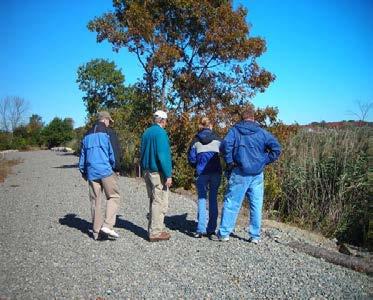
8 3 What is a Rail Trail? A rail trail is a shared use path created along a former railroad right-of-way. Cape Cod Rail Trail Nashua River Rail Trial
9 What are the benefits of a Rail Trail? Recreation A place for cyclists, hikers, walkers, runners, inline skaters, cross-country skiers and physically challenged individuals to exercise. Health Help people of all ages and abilities incorporate exercise into their daily routines by connecting them with places they want or need to go. Transportation Provide a safe transportation alternative for residents, workers and tourists of all ages and abilities.
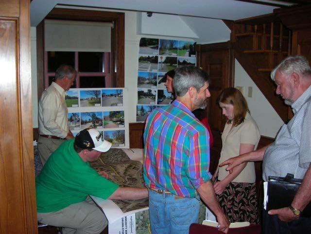


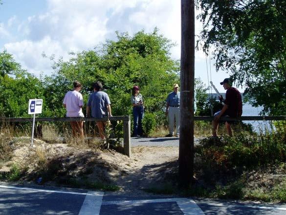
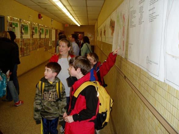
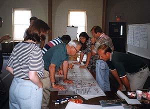
10 Common Questions: Public Participation & Outreach

11 Common Questions: Property Value Being on or near the Minuteman Bikeway can increase the value of a home by 4 or 5 percent, said Brian Greeley, a realtor with Bowes GMAC in Arlington. The old saying in real estate is location, location, location, Greeley said. The path is one of the crown jewels in the area. We re in an age where physical fitness is a high priority. Having access to a bike path is analogous to years ago of having a house across from a park or playground.

12 Common Questions: Crime, Litter & Privacy Salem Evening News, November 2005 Several years ago, we received notice about a proposed plan to convert the former rail bed to a bike path. As abutters we were extremely apprehensive about this proposal. We envisioned that such a path would open access to undesirable activities such as drugs, drinking, graffiti, litter, gangs and neighborhood crime. We were also concerned about a lack of privacy, having streams of people walking and biking through our backyard. As a result of these concerns, the city did provide a fence and some landscaping to minimize impacts to bike path neighbors. Having lived with the bike path now for several years, none of the above concerns have materialized. The bike path has instead become a haven for families; couples strolling hand in hand, mothers with strollers, children pushing doll carriages, families on bikes, joggers, serious cyclists, neighbors walking their dogs, Salem State sports teams working out, etc. In the winter, it is a popular place for snowshoeing and cross-country skiing. Mostly, it has brought neighbors together with a passing hello or to stop and chat while out for a walk. I have never felt unsafe on the bike path, day or night, and we have never had to report a problem of any kind.


13 Common Questions: Methuen Rail Trial Maintenance Mowing Trail cleanups Adopt a Trail Logan Greenway Connector Quequechan River Rail Trail Cape Cod Rail Trail - Harwich


14 Common Questions: Lighting Public parks and recreation facilities are typically open between dawn and dusk. Alternatives to lighting include painting tunnel walls white to help reflect the daytime light.


15 4 Conceptual Design Quequechan River Rail Trail Fall River, MA
 8 foot surface width acceptable")

16 Shared Use Path Design Design Considerations: 10 foot surface width (typical) 8 foot surface width acceptable in areas where there are environmental, historical and/or structural constraints Attractive to all ages and skill levels


17 Conceptual Design Begin Project at Lawrence City Line Shared use path 10 foot wide paved surface N Source: Google Maps


18 Conceptual Design Oakland Ave Underpass to Five Corners Underpass Shared use path 10 foot wide paved surface N Source: Google Maps = Depot Area


19 Conceptual Design Intersections Typical Intersection Treatment Example Project : Quequechan River Rail Trail in Fall River, MA


20 Conceptual Design Five Corners Underpass to Route 213 Underpass Shared use path 10 foot wide paved surface Equestrian trail 5 foot wide soft surface shoulder N Source: Google Maps


21 Conceptual Design Route 213 Underpass to NH State Border Shared use path 10 foot wide paved surface Equestrian trail 5 foot wide soft surface shoulder N Source: Google Maps

22 Conceptual Design Depot Area Open Space Public Gathering Area and Market Separation between passive and active uses 17 parking spaces Tree planting, flowering plants, and mown lawn


23 Conceptual Design Depot Area Open Space Trail at Old Rail Station Typical Trail Planting Trail at Lawn & Seatwall Gathering Area Paving

24 Conceptual Design Gill Ave Connection Ramp and stairs on grade with handrails Street Crossings New sidewalks to playground parking lot

25 Conceptual Design Trail Signage Interpretive Signage Depot History Bird Sanctuary Trail Map with Places of Interest and Trail Rules Trail Markers ¼ mile intervals City/State Markers
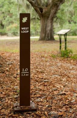
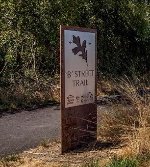
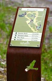
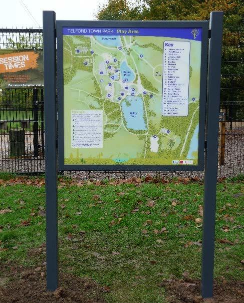
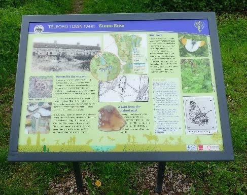
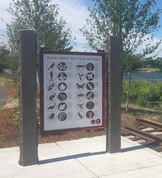
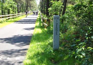
26 Conceptual Design Trail Signage Types Corten Steel Steel Stone
27 5 Next Steps Design Schedule: Fall Design Team to revise drawings after comments from public and City Fall Design Team to determine signage and furniture with City and Trail Alliance Winter 2016/17 - Design Team to submit Final Construction Documents Winter 2016/17 Construction Documents out to Bid
28 Questions? Website: Brad Buschur Groundwork Lawrence Phone: (617) Joe Giarrusso City of Methuen Conservation Officer Phone: (978)
Active Transportation Rail to River Corridor. Community Meeting - Segment A
 Active Transportation Rail to River Corridor Community Meeting - Segment A June 29, 2017 Tonight s Agenda > Open House (30 min) > Welcome / Project Overview > Presentation of 30% Design Refinements > Next
MAG Town of Cave Creek Bike Study Task 6 Executive Summary and Regional Significance Report
 Page 1 MAG Town of Cave Creek Bike Study Task 6 Executive Summary and Regional Significance Report August 1, 2012 MAG Project #481 Page 2 Task 6 Executive Summary and Regional Significance Report Introduction
Bar Harbor Route 3 Gateway Project Advisory Committee September 21, 1-3 PM Atlantic Oakes Hotel Minutes
 Bar Harbor Route 3 Gateway Project Advisory Committee September 21, 1-3 PM Atlantic Oakes Hotel Minutes Attending: Dick Cough, Edith Milbury, James Blanchard, Chris Fogg, Paul MacQuinn Millard Billings,
General Design Factors
 Chapter 3: 3-1.0 Introduction General Design Factors Mn/DOT s goals include encouraging and accommodating safe bicycling. From a design perspective, these goals are achieved by first having an understanding
Perryville TOD and Greenway Plan
 Perryville TOD and Greenway Plan Greenway Glossary Pathway: A bicycle and pedestrian path separated from motorized vehicular traffic by an open space, barrier or curb. Multi-use paths may be within the
WALKABILITY CHECKLIST How walkable is your community?
 WALKABILITY CHECKLIST How walkable is your community? Everyone benefits from walking and other forms of active transportation. These benefits include: improved fitness, cleaner air, reduced risks of certain
Construction Specifications Manual
 Isle of Wight County Pedestrian and Bicycle Master Plan Construction Specifications Manual Adopted August 20, 2009 Introduction The Isle of Wight County Pedestrian and Bicycle Facilities Master Plan was
Fill in the rating for each section. Total up the ratings to see how your neighbourhood scores overall for walkability.
 WALKABILITY CHECKLIST How walkable is your community? Everyone benefits from walking and other forms of active transportation. These benefits include: improved fitness, cleaner air, reduced risks of certain
PRINCE GEORGE S PLAZA METRO AREA PEDESTRIAN PLAN
 PRINCE GEORGE S PLAZA METRO AREA PEDESTRIAN PLAN May 28, 2008 Agenda Welcome and introductions Project overview and issue identification Planning context and strengths Design challenges and initial recommendations
Parks, Open Space, Trails and Recreation Master Plan
 5.3 DEFINITIONS AND VOCABULARY In order to fully understand the range of trails that have been developed, and should be developed, throughout the community, a vocabulary needs to be established for the
DRAFT. System Components. Greenway Trails. Introduction. Trail Types. Zebulon Greenway Master Plan
 5 System Components Wakefield Street Photo Simulation showing Sharrows Introduction The Master Plan identifies various system components that, together, create a comprehensive greenway system. These components
Knox Street Complete Streets Project
 Knox Street Complete Streets Project Meeting Purpose Get community feedback on two conceptual street design options Meeting Agenda Presentation (20 minutes) Project background and schedule Summary of preferences
Proposed Amendment to the City-Wide Trails Plan
 Proposed Amendment to the City-Wide Trails Plan Planning and Zoning Commission June 23, 2015 Comprehensive Plan 2010 Sustainable Community Recommendations 2 Goal: Walking and Cycling are Encouraged throughout
2016 Neighborhood Street Fund Application
 2016 Neighborhood Street Fund Application 2016-109 #146 COMPLETE Collector: Web Link 1 (Web Link) Started: Sunday, April 17, 2016 2:29:58 PM Last Modified: Sunday, April 17, 2016 2:36:28 PM Time Spent:
UPTOWN REGIONAL BIKE CORRIDORS PROJECT SAN DIEGO ASSOCIATION OF GOVERNMENTS
 UPTOWN REGIONAL BIKE CORRIDORS PROJECT SAN DIEGO ASSOCIATION OF GOVERNMENTS SUMMARY REPORT: COMMUNITY UPDATE MEETING February 6, 2014 6 8:30 p.m. Roosevelt Middle School Library 3366 Park Blvd, San Diego
Tonight is for you. Learn everything you can. Share all your ideas.
 Strathcona Neighbourhood Renewal Draft Concept Design Tonight is for you. Learn everything you can. Share all your ideas. What is Neighbourhood Renewal? Creating a design with you for your neighbourhood.
Introduction. North 12 th Complete Street Project Overview
 Introduction On Wednesday, March 1, 2017, the City of Sacramento, in partnership with Sacramento Regional Transit District and the Sacramento Housing and Redevelopment Agency, hosted a community outreach
Public Feedback Comments Appendix G. Appendix G. Public Feedback Comments. Virginia Beach Bikeways and Trails Plan 2011 Page G-1
 Public Feedback Comments Virginia Beach Bikeways and Trails Plan 2011 Page G-1 This is a complete collection to date of responses to the feedback survey which was used at public open houses in December
Agenda. Overview PRINCE GEORGE S PLAZA METRO AREA PEDESTRIAN PLAN
 PRINCE GEORGE S PLAZA METRO AREA PEDESTRIAN PLAN May 28, 2008 Agenda Welcome and introductions Project overview and issue identification Planning context and strengths Design challenges and initial recommendations
Elon Bicycle, Pedestrian and Lighting Plan. Pedestrian Rail Crossings Study
 Elon Bicycle, Pedestrian and Lighting Plan Pedestrian Rail Crossings Study Project Overview The Town of Elon, Elon University and the Twin Lakes Retirement Community began a comprehensive bicycle, pedestrian
Bicycle and Pedestrian Facilities Toolbox (Excerpt from Figure 3.1)
") Appendix B Neighborhood Connections Summaries This Appendix is a supplement to the information presented in Chapter 3 Connect People. The Appendix includes a summary or profile for each of the proposed
Appendix B Neighborhood Connections Summaries This Appendix is a supplement to the information presented in Chapter 3 Connect People. The Appendix includes a summary or profile for each of the proposed
CITY OF ELKO BICYCLE AND PATHWAY PLAN
 CITY OF ELKO BICYCLE AND PATHWAY PLAN INTRODUCTION: The City of Elko is intended to provide the basic framework for the development of a functional bicycle and pathway system for the community with connections
Community Task Force November 15, 2017
 Community Task Force November 15, 2017 Welcome and Introductions Project Partners Regional Transportation District (RTD) Colorado Department of Transportation (CDOT) Denver Regional Council of Governments
All Season Age Friendly Pedestrian Safety and Walkability Checklist *
 FOSTERING AGE FRIENDLY, WALKABLE NEIGHBOURHOODS Walkability is a key component of optimal aging in Age Friendly cities. Walkable neighbourhoods promote physical and mental health and well-being, support
TOWN OF WILLIAMSTON, SC BICYCLE AND PEDESTRIAN MASTER PLAN TOWN OF WILLIAMSTON, SC BICYCLE AND PEDESTRIAN MASTER PLAN
 TOWN OF WILLIAMSTON, SC BICYCLE AND PEDESTRIAN MASTER PLAN Americans Want Choices 55% of Americans would rather drive less & walk more. Transit use is growing faster than population or highway travel.
City Birmingham Multi-Modal Transportation Plan Visioning Workshop Results Meeting
 City Birmingham Multi-Modal Transportation Plan Visioning Workshop Results Meeting Monday, January 28, 2013 7:30 PM, City Hall Norman Cox, PLA, ASLA. Ann Arbor, Michigan. www.greenwaycollab.com Community
TO: Board Members Vancouver Park Board FROM: General Manager Parks and Recreation SUBJECT: Seaside Greenway Improvements
 Date: October 1, 2013 TO: Board Members Vancouver Park Board FROM: General Manager Parks and Recreation SUBJECT: Seaside Greenway Improvements RECOMMENDATION A. THAT the Board approve the new bike paths
Henderson Ave. Complete Streets Project
 Henderson Ave. Complete Streets Project Meeting Purpose To finalize conceptual components of project prior to proceeding with preliminary engineering www.dallascompletestreets.wordpress.com MeetingAgenda
Community Open House December 13, A project of the Green Infrastructure Center, supported by Skeo Solutions
 Community Open House December 13, 2011 A project of the Green Infrastructure Center, supported by Skeo Solutions Project Background The Green Infrastructure Center, Inc. (GIC) was formed in 2006 to help
RiNo Railroad Crossing Connectivity Analysis. Stakeholder Workshop June 29, 2017
 RiNo Railroad Crossing Connectivity Analysis Stakeholder Workshop June 29, 2017 Ideas and Considerations Presented at Stakeholder Workshop Primary Focus: 38 th Street (between Walnut & Wynkoop) 1 Basic
Pedestrian Survey Report
 Pedestrian Survey Report The City of Albany conducted a Pedestrian Survey in 2007 with the purpose of identifying resident s concerns about barriers to walking and accessibility in the City. The survey
Watertown Complete Streets Prioritization Plan. Public Meeting #1 December 14, 2017
 Watertown Complete Streets Prioritization Plan Public Meeting #1 December 14, 2017 Goals for Public Meeting Overview of MassDOT Complete Streets Funding Program Educate the community on Complete Streets
APPENDIX A: Complete Streets Checklist DRAFT NOVEMBER 2016
 APPENDIX A: Complete Streets Checklist DRAFT NOVEMBER 2016 Complete Streets Checklist MetroPlan Orlando s Complete Streets Checklist is an internal planning tool for staff to further implementation of
Off-Road Facilities Part 1: Shared Use Path Design
 Off-Road Facilities Part 1: Shared Use Path Design Presentation by: Eric Mongelli, P.E. Tom Huber October 9, 2012 FOLLOW THE CONVERSATION ON TWITTER Toole Design Group is live tweeting this webinar @tooledesign
Clarkson Walkability Audit: Results and Recommendations Summary
 Clarkson Walkability Audit: Results and Recommendations Summary The following document was prepared by the Region of Peel and includes a summary of comments made by participants during our breakout discussion
ACTIVE TRANSPORTATION Active Community Checklist
 ACTIVE TRANSPORTATION Active Community Checklist Safe, accessible spaces to walk, hike, bike and play is an important part of building strong, healthy and active communities for residents and visitors.
Sandwich Pedestrian/Bicycle Planning
 Sandwich Pedestrian/Bicycle Planning Improved Pedestrian and Bicycle Connections with the Cape Cod Canal Multi-use Path February 2014 Table of Contents Introduction... 1 Background... 1 Study Goals...
Cecil County, Maryland. Bicycle Master Plan
 Cecil County, Maryland Bicycle Master Plan Overview Background Schedule and Tasks Network Assessment Network Identification Next Steps Schedule and Tasks May 2011 Plan Scoping and Mobilization Data Collection
Plant City Walk-Bike Plan
 Plant City Walk-Bike Plan Plant City Commute Mode Share 2.2% 1.4% 2.9% Drove alone 10.2% Carpooled Public transportation (0.1%) Walked Used a Bike (0.4%) 82.9% Taxicab, motorcycle, or other means Worked
RESOLUTION NO ?? A RESOLUTION OF THE CITY OF NEPTUNE BEACH ADOPTING A COMPLETE STREETS POLICY
 RESOLUTION NO. 2018-?? A RESOLUTION OF THE CITY OF NEPTUNE BEACH ADOPTING A COMPLETE STREETS POLICY WHEREAS, safe, convenient, and accessible transportation for all users is a priority of the City of Neptune
City of Wilsonville 5 th Street to Kinsman Road Extension Project
 City of Wilsonville 5 th Street to Kinsman Road Walking Tour & Neighborhood Workshop Summary Report Public Outreach Overview On July 18 th, 2017, the City of Wilsonville hosted a neighborhood walking tour
Outer Cape Bicycle & Pedestrian Master Plan. PUBLIC WORKSHOP #2 March 26, 2015
 Outer Cape Bicycle & Pedestrian Master Plan PUBLIC WORKSHOP #2 March 26, 2015 Introductions TODAY S DISCUSSION PRESENTATION: Project Background : Where have we been? Where are we now? Steering Committee
Building Great Neighbourhoods BELLEVUE AND VIRGINIA PARK
 Building Great Neighbourhoods BELLEVUE AND VIRGINIA PARK This is Meeting 2 Unfortunately, some residents in Bellevue and Virginia Park received the wrong information for this public open house (Meeting
Living Streets Policy
 Living Streets Policy Introduction Living streets balance the needs of motorists, bicyclists, pedestrians and transit riders in ways that promote safety and convenience, enhance community identity, create
Chapter 3: Multi-Modal Circulation and Streetscapes
 CHAPTER 3: MULTI-MODAL CIRCULATION AND STREETSCAPES Chapter 3: Multi-Modal Circulation and Streetscapes Overview Streetscape improvements have already been completed for Depot Street between Main Avenue
Enhancing Downtown
 Enhancing Downtown 2014-2015 Process Masterplan reviewed TIF scope, fund availability, and timing Conceptual cost estimate stage things may change with full engineering Sequencing Coordination with businesses
5 CIRCULATION AND STREET DESIGN
 5 CIRCULATION AND STREET DESIGN This chapter describes circulation and streetscape improvements proposed for the Northwest Chico Specific Plan Area. It includes detailed design specifications for existing
Developing a Bike/Pedestrian Plan Using ArcInfo and Public Participation Rob Shumowsky, Madison County Council of Governments
 Developing a Bike/Pedestrian Plan Using ArcInfo and Public Participation Rob Shumowsky, Madison County Council of Governments Abstract: The Madison County Council of Governments is creating a bike/pedestrian
CLOSED. Highlights of the Final Concept Design:
 The final Concept Design is the result of many months of listening, learning, creating, balancing, and understanding different needs and viewpoints, as well as incorporating technical requirements and
Please forward comments, suggestions, and corrections to or
 Seven Easy Walks on the Eastern Shore Creating walking trails with signage on existing sidewalks or paths is an easy way for towns to encourage resident health as well as economic development when these
2.0 Existing Conditions
 20 2.0 Existing Conditions 2.1 Land Use, Future Growth Patterns, Physical Barriers Geographic Overview Sutter County s land use pattern is characterized by extensive agricultural areas, significant natural
SUBJECT: TOP OF THE WORLD PEDESTRIAN PATHWAY ALIGNMENT SELECTION AND DESIGN CONTRACT AMENDMENT
 City of Laguna Beach AGENDA BILL No. 1 6 Meeting Date: 8/19/14 SUBJECT: TOP OF THE WORLD PEDESTRIAN PATHWAY ALIGNMENT SELECTION AND DESIGN CONTRACT AMENDMENT I. SUMMARY OF THE MATTER Pedestrians and cyclists
Ulster County Non-motorized Transportation Plan
 Ulster County Non-motorized Transportation Plan NTAC Meeting NOTES Ulster County Community College Date 08.29.07 Time: 1:00 p.m. - 3:00 p.m. Agenda Welcome /Intro Project Status Report o Project is on
MARTIN LUTHER KING JR. WAY
 OCTOBER 2011 40 Vision and Goals The Martin Luther King, Jr. Way Illustrative Master Plan that follows has been developed through a process of community involvement. It expresses a long term vision for
Stakeholders Advisory Working Groups (SAWGs) Bridge and Bike / Pedestrian SAWG (#15)
 Bridge and Bike / Pedestrian SAWG (#15)") Presentation Bridge and Bike / Pedestrian SAWG (#15) Tappan Zee Bridge/I-287 Corridor Project December 8, 2009 Slide 1. This is the title slide for the Tappan Zee Bridge Joint Stakeholders Advisory Working
Presentation Bridge and Bike / Pedestrian SAWG (#15) Tappan Zee Bridge/I-287 Corridor Project December 8, 2009 Slide 1. This is the title slide for the Tappan Zee Bridge Joint Stakeholders Advisory Working
Elm Street Business District: Streetscape and Signage Plan
 Winnetka Preliminary Streetscape & Signage Village Council Presentation 1 Elm Street Business District: Streetscape and Signage Plan VILLAGE OF WINNETKA DOWNTOWN MASTER PLAN VILLAGE COUNCIL PRESENTATION
Bicycle and Pedestrian Chapter TPP Update Overview. TAB September 20, 2017
 Bicycle and Pedestrian Chapter TPP Update Overview TAB September 20, 2017 Bicycling & Walking in the Twin Cities Where are we now? The Bike-Pedestrian system Current trends New developments Where are we
Fitting Light Rail through Well-established Communities
 Fitting Light Rail through Well-established Communities San Francisco 2008 Michael D. Madden Chief, Project Development, Maryland Transit Administration Project Setting Located inside the Capital Beltway
APPENDIX A Community Pedestrian Workshops
 Appendices 67 APPENDIX A Community Pedestrian Workshops Summary of Community Workshop No.1 Meeting Date: Tuesday, March 24, 2015 at 6 p.m. OVERVIEW As part of the planning process for the first-ever Topeka
LAUDERDALE LAKES. Lake District Revisioning
 LAUDERDALE LAKES Lake District Revisioning PROJECT OVERVIEW Client Client Representatives Community Design Solutions (CDS) Staff CDS Project Assistant CDS Director Lauderdale Lakes District Scott Mason
City of Sammamish. Welcome. Issaquah-Fall City Road Improvements Project Phase I Design: 242nd Avenue SE to Klahanie Drive SE
 Welcome Welcome to the third community meeting for the Issaquah-Fall City Road Improvements Project. AGENDA 6:00 p.m. Welcome and sign-in 6:10 p.m. Presentation 6:50 p.m. Open house Learn about the roadway
COASTAL RAIL TRAIL ROSE CREEK BIKEWAY PROJECT COMMUNITY WORKSHOP #2 AUGUST 15, 2013
 COASTAL RAIL TRAIL ROSE CREEK BIKEWAY PROJECT COMMUNITY WORKSHOP #2 AUGUST 15, 2013 CHRIS CARTERETTE, AICP PROJECT MANAGER Chris.Carterette@sandag.org Direct: 619-699.7319 REGIONAL PLANNING BACKGROUND
5:30 1 Introductions, appointment of note taker (5 minutes) Ad
 Ad") CITY OF OAKLAND DALZIEL BUILDING. 250 FRANK H. OGAWA PLAZA. SUITE 4344. OAKLAND. CALIFORNIA. 94612 Public Works Agency TEL: (510) 238-3466 Transportation Planning & Funding Division FAX: (510) 238-7415
CITY OF OAKLAND DALZIEL BUILDING. 250 FRANK H. OGAWA PLAZA. SUITE 4344. OAKLAND. CALIFORNIA. 94612 Public Works Agency TEL: (510) 238-3466 Transportation Planning & Funding Division FAX: (510) 238-7415
GOOD AFTERNOON, AND THANK-YOU FOR VISITING US AT D2! I AM LAURA HANSON BIKE/PED COORDINATOR HERE AT THE DISTRICT, AND I AM IN THE PROJECT DEVELOPMENT
 GOOD AFTERNOON, AND THANK-YOU FOR VISITING US AT D2! I AM LAURA HANSON BIKE/PED COORDINATOR HERE AT THE DISTRICT, AND I AM IN THE PROJECT DEVELOPMENT SECTION. 1 HERE IS MA SHOWING THE SIX DISTRICTS AND
HARRISON STREET/OAKLAND AVENUE COMMUNITY TRANSPORTATION PLAN
 HARRISON STREET/OAKLAND AVENUE Community Workshop #4: Draft Plan Review December 3, 2009 D E S I G N, C O M M U N I T Y & E N V I R O N M E N T INTRODUCTIONS Key Project Staff: Alisa Shen, Project Manager,
Walking Audit Supporting Information
 Walking Audit Supporting Information Planning to do a walking audit of your streets? Here s some helpful suggestions to help get you started. 1. Preparing for your audit Decide where you want to walk.
Technical Working Group November 15, 2017
 Technical Working Group November 15, 2017 Welcome and Introductions Project Partners Regional Transportation District (RTD) Colorado Department of Transportation (CDOT) Denver Regional Council of Governments
Encouragement. Chapter 4. Education Encouragement Enforcement Engineering & Facilities Evaluation & Planning. Encouragement Chapter 4
 Encouragement Education Encouragement Enforcement Engineering & Facilities Evaluation & Planning Photo above: Children show off their ribbons at the Tour de Virginia Beach. Virginia Beach Bikeways and
Plainfield Gateway. Plainfield Context
 Plainfield Gateway The western arm of The Campus, much like the Thomas Street Placita eastern arm, must connect residents and workers from the western side of the neighborhood to The Campus and the activity
TxDOT Bicycle Tourism Trails Study Update. April 2017 BAC Meeting April 10, 2017
 AGENDA ITEM 6 TxDOT Bicycle Tourism Trails Study Update April 2017 BAC Meeting April 10, 2017 Agenda Approval of interim products o Present study vision statement, goals, and study objectives o Present
Thoreau Path Master Plan Final Draft. prepared for: The Boston Redevelopment Authority West End Community November 2007
 Thoreau Path Master Plan Final Draft prepared for: The Boston Redevelopment Authority West End Community November 2007 Introduction Carol R. Johnson Associates ( CRJA ) was retained by the Boston Redevelopment
Moraga Pedestrian and Bicycle Master Plan Update and Wayfinding Plan. Citizens Advisory Committee Meeting July 21, 2015
 Moraga Pedestrian and Bicycle Master Plan Update and Wayfinding Plan Citizens Advisory Committee Meeting July 21, 2015 Planning process Inventory of existing conditions 2 of 21 Planning process Inventory
Pedestrian. Identifying Important Pedestrian Routes. 7 Pedestrian CHAPTER 7
 CHAPTER 7 Pedestrian T he City of Decatur is a prime location for walking. Historic houses, tree lined streets, a range of fine shopping and restaurants, and a conveniently small size all help create an
Palou Complete Street Project Barneveld Avenue to Crisp Road Project overview and concept design Community Meeting #2 May 13, 2015
 Palou Complete Street Project Barneveld Avenue to Crisp Road Project overview and concept design Community Meeting #2 May 13, 2015 Agenda Welcome and introductions Project overview, history and goals Concept
Villa Rica Trail Master Plan
 Public Meeting April 18, 2018 v Presentation Outline Introductions & Benefits of Trails Master Planning Process Preliminary Findings Trail Branding Construction Standards Next Steps & Schedule PATH Planning
ACTIVE TRANSPORTATION
 ACTIVE TRANSPORTATION Mobility 2040 Supported Goals Improve the availability of transportation options for people and goods. Support travel efficiency measures and system enhancements targeted at congestion
Gordon County Trail Master Plan
 Gordon County Trail Master Plan Public Meeting March 28, 2017 Agenda Introduction Methodology Types of Trail Facilities Rivers to Ridge Master Plan Branding / Amenities / Design Standards Next Steps Questions
SCHOOL PATH PRESENTATION 10/10/2013 HAAPASAARI HIIDENKARI LEPISTÖ
 WORKGROUP JENNY HAAPASAARI industrial design PEPPI HIIDENKARI industrial design SONJA LEPISTÖ interior design 2 CONTENTS I school path concept II path elements III school path network IV housing fair Vantaa
FOCUS AREA 1 - Alberta Avenue Pocket Park 3 (121 Ave and 92 St)
") FOCUS AREA 1 - Alberta Avenue Pocket Park 3 (121 Ave and 92 St) New benches Plant evergreen trees Widen existing sidewalk from 1.5m to 1.8m Marked crosswalk 1.8m wide sidewalk Add pedestrian oriented lights
FOCUS AREA 1 - Alberta Avenue Pocket Park 3 (121 Ave and 92 St) New benches Plant evergreen trees Widen existing sidewalk from 1.5m to 1.8m Marked crosswalk 1.8m wide sidewalk Add pedestrian oriented lights
Click to edit Master title style
 Click to edit Master title style Public Information Meeting August 2, 2018 Town of Rotterdam Transportation Alternatives Program Main St (NYS 5S) Pedestrian/Bicycle Access Improvement Project Agenda TAP
Non-Motorized Transportation 7-1
 Non-Motorized Transportation 7-1 Transportation facilities no longer mean just accommodating a vehicle powered by a combustion engine. Pedestrian and non-motorized facilities are important modes of travel
CONNECTING PEOPLE TO PLACES
 CONNECTING PEOPLE TO PLACES 82 EAST BENCH MASTER PLAN 07 Introduction The East Bench transportation system is a collection of slow moving, treelined residential streets and major arteries that are the
8 Bicycle and Pedestrian Facilities
 8 Bicycle and Pedestrian Facilities 8.1 Existing Facilities The facilities available to walkers and bikers are diverse in the rural ACOG area. Walking and biking are, by their nature, localized modes of
The DC Pedestrian Master Plan
 The DC Pedestrian Master Plan September 28, 2010 George Branyan Pedestrian Program Coordinator District Department of Transportation Presentation Agenda Scope of the Plan Methodology Recommendations Implementation
REGIONAL BICYCLE AND PEDESTRIAN DESIGN GUIDELINES
 REGIONAL BICYCLE AND PEDESTRIAN DESIGN GUIDELINES November 16, 2011 Deb Humphreys North Central Texas Council of Governments Bicycle and Pedestrian Advisory Committee Snapshot of the Guide 1. Introduction
What is the status of the CPR Yards Crossing Study?
 September 2015 Project Advisory Committee (PAC) Sectors RESIDENTS Centennial Community Improvement Association Dufferin Residents Association of Winnipeg William Whyte Residents Association LOCAL BUSINESS
Tuesday, September 25 th Mount Holly Municipal Complex 400 East Central Avenue 5:30pm to 7:30pm. Activity Stations o Where do you Live?
 Meeting Information Overview The public workshop for the Mount Holly Comprehensive Bicycle Plan occurred on September 25, 2018. The drop-in workshop allowed attendees to participate in a series of interactive
Memo. Ocean Avenue Corridor Design Project Public Workshop #2 Summary
 Ocean Avenue Corridor Design Project Public Workshop #2 Summary The second public workshop for the Ocean Avenue Corridor Design Project was held on Wednesday, May 14, 2014 from, 6 to 8 pm at Lick Wilmerding
REGIONAL MUNICIPALITY OF WOOD BUFFALO BIKE PARK OPEN HOUSE. RMWB BIKE PARK IBI Group NOVEMBER 7, 2013
 REGIONAL MUNICIPALITY OF WOOD BUFFALO BIKE PARK OPEN HOUSE SITE CONTEXT SITE 1 NORTH PARSONS CREEK LANDS SITE 2 SILIN FOREST ROAD SITE 3 LOWER WOLVERINE SITE 4 REAL MARTIN DRIVE PARSONS CREEK TIMBERLEA
CONNECTIVITY PLAN. Adopted December 5, 2017 City of Virginia Beach
 CONNECTIVITY PLAN Adopted December 5, 2017 City of Virginia Beach CONTENTS 1.0 Background & Purpose... 2 2.0 Existing Inventory & Analysis... 3 ViBe District Existing Walking Conditions... 4 3.0 ViBe District
Leveraging Active Transportation & Recreation for Economic Development in Rural VT Vermont Bike Walk Summit
 Leveraging Active Transportation & Recreation for Economic Development in Rural VT 2018 Vermont Bike Walk Summit 5.4.18 MRV Moves Active Transportation Plan Scope & Purpose Watershed-wide long-range
Welcome to the Sellwood Bridge Project Open House!
 Welcome to the Sellwood Bridge Project Open House! 5:30 7:30 pm Please sign in here Information stations and project staff are located throughout the room. Goals for Tonight s Meeting: Learn how the Preferred
South False Creek Seawall Park Upgrades & Tree Replacements
 South False Creek Seawall Park Upgrades & Tree Replacements PARK BOARD COMMITTEE MEETING May 2, 2016 Recommendations A. THAT the Vancouver Park Board approve the design plan for the South False Creek Seawall
EXECUTIVE SUMMARY. Vision
 Vision Walking and bicycling in Salt Lake City will be safe, convenient, comfortable, and viable transportation options that connect people to places, foster recreational and economic development opportunities,
BETHEL ROAD AND SEDGWICK ROAD CORRIDOR STUDY
 DRAFT PLAN City Council Meeting August 14, 2017 STUDY AREA Sedgwick Corridor State Route 160, principal arterial with Class 3 access management designation, commuter and freight route, connection to SR
APPENDIX D LEVEL OF TRAFFIC STRESS METHODOLOGY
 APPENDIX D LEVEL OF TRAFFIC STRESS METHODOLOGY 01 WHAT IS LEVEL OF TRAFFIC STRESS? When people bicycle on roadways, they encounter varying levels of stress from traffic. A quiet residential street with
The pathways of Lethbridge are key to the quality of life and the health of citizens of all ages and abilities.
 4.0 PLANNING AND DEVELOPMENT GUIDELINES 4.1. THE IMPORTANCE OF PATHWAYS Pathway networks provide connectivity between residents and their community. They have become an integral part of a lifestyle choice
City of Novi Non-Motorized Master Plan 2011 Executive Summary
 City of Novi Non-Motorized Master Plan 2011 Executive Summary Prepared by: February 28, 2011 Why Plan? Encouraging healthy, active lifestyles through pathway and sidewalk connectivity has been a focus
NEWMARKET UPHAM S CORNER
 SOUTH STATION Planning Initiative NEWMARKET UPHAM S CORNER COLUMBIA ROAD (P) FOUR CORNERS/GENEVA Working Advisory Group (WAG) Meeting #5 TALBOT AVENUE MORTON STREET BLUE HILL AVE/CUMMINS HWY (P) RIVER
64% UNSAFE and. Where can features be added to improve the street for bicyclists?
 BICYCLING Where can features be added to improve the street for bicyclists? Due to its proximity to neighborhoods, downtown and the waterfront, many people bike Niagara Street to get to where they need