Make CSUN Shine Brighter: Pedestrian and Vehicular Traffic Improvement Initiative. Progress Update February 21, 2013
|
|
|
- Leonard Cole
- 5 years ago
- Views:
Transcription


1 Make CSUN Shine Brighter: Pedestrian and Vehicular Traffic Improvement Initiative Progress Update February 21, 2013
2 Question No. 1: As we continually strive to improve and plan for a more user-friendly campus, what modifications or adjustments large or small would improve pedestrian and/or vehicular traffic flow on and around campus?
3 Response Categories Roadway Safety/Traffic Control Parking Structures and Lots Pedestrian Walkways Campus Way-finding Alternative Transportation Bicycling/skateboarding Mass Transit Major Master Plan Initiatives
4 Roadway Safety/Traffic Control Primary Response Themes: 1. Add traffic signals and stop signs at strategic locations 2. Improve crosswalks, particularly by adding smart crossings 3. Improve street lighting 4. Open Etiwanda Ave. at Halsted (contradicts master plan)
5 Traffic Control/Roadway Safety Projects and Initiatives Currently Underway: 1. Darby/Plummer Crosswalk Improvements 2. Dearborn/Reseda traffic light addition (City of L.A.) 3. Enforcement measures (project ped, hang it up)

6 Darby Ave. at Plummer

7 Darby Ave. at Plummer St.
8 Traffic Control/Roadway Safety Future Considerations: 1. Etiwanda and Lindley Ave. smart crossings

9 Etiwanda South Smart Crosswalk

10 Etiwanda south- existing smart crossing

11 Etiwanda Ave.-existing crossing at Bayramian Hall
12 Parking Structures and Lots Primary Response Themes: 1. Improve way-finding, primarily to parking dispenser locations 2. Improve lighting at surface lots 3. Automated signage indicating parking availability by level 4. Increased enforcement within structures 5. Increase parking space count 6. Enter D6/E6 lots via Plummer (contradicts master plan)
13 Parking Structures and Lots Projects and Initiatives Currently Underway: 1. B4 surface parking lot LED lighting 2. F10 surface parking lot lighting and security improvements 3. Analysis of entry point signage leading to dispensers

14 Lot B1 Entry

15 Lot B5 Entry from Darby

16 Structure B3 Entry from Prairie

17 B3 Main Stair N/E Corner

18 Typical B3 structure pay station

19 B3 Structure Elevator Lobby

20 Lobby Graphic Example (not at CSUN)
21 Pedestrian Walkways Primary Response Themes: 1. Provide more shade 2. Improve lighting 3. Repair sidewalk paving 4. Reduce pedestrian/cycle/skateboard conflicts
22 Pedestrian Walkways Projects and Initiatives Currently Underway: 1. Plummer Street ADA sidewalk/lighting 2. Bookstore south ADA pathway and stair 3. Orange grove walk concrete replacement, ADA ramp & hydraulic bollards

23 Bookstore south walkway/ramp

24

25 Orange Grove Walk-ADA Ramp
26 Campus Way-finding Primary Response Themes: 1. Update kiosk maps, possibly with additional transportation info. 2. Consider interactive tools, such as QR codes and way-finding app 3. Improve directional signage to athletic, arts venues 4. Identify functions on building (i.e. Bayramian Hall Student Services)
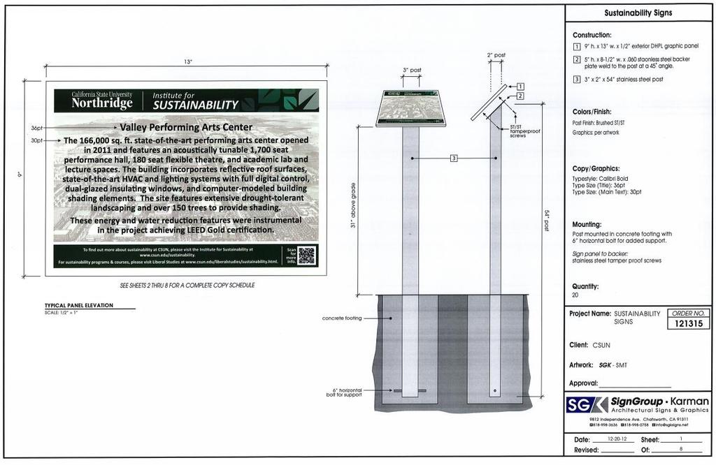
27 Campus Wayfinding Projects and Initiatives Currently Underway: 1. QR codes on campus sustainability signs 2. New signage at Matador Drive near Matadome
28
29 Alternative Transportation- Mass Transit Primary Response Themes: 1. Promote use of Mass Transit 2. Advocate for expanded service from various providers 3. Study student transportation habits
30 Alternative Transportation- Mass Transit Projects and Initiatives Currently Underway: 1. Discussions with Simi Valley Transit
31 Alternative Transportation- Bicycling Primary Response Themes: 1. Add bicycle/skateboard lanes and pavement markings 2. Enforcement and safety training 3. Increased bike racks and repair stations
32 Alternative Transportation- Bicycling Projects and Initiatives Currently Underway: 1. Bicycle compound repair stations 2. Chaparral Hall bike parking paving/racks 3. Lindley Ave. landscape/bike lanes (north of Halsted) 4. Dismount zones in campus core

33 Alternative Transportation- Bicycling Primary Response Themes: Projects and Initiatives Currently Underway: Future Considerations: Bike Repair Station-Transit Center

34 B3 Structure Bicycle Compound

35 Dismount Sign Example (UCLA)

36 Chaparral Hall Bicycle Parking
37 Master Plan Considerations Primary Response Themes: 1. Pedestrian bridges/tunnels at core loop road. 2. Restrict loop road traffic.
See Figure 38, Existing Nonmotorized Connections.
 Nonmotorized Connections Existing Nonmotorized Connections Pedestrian, vehicle and bike traffic access and movements are confined primarily to Penny Drive on campus. Due to the steep slope along the length
PUBLIC REALM MASTER PLAN
 WESTSHORE BUSINESS DISTRICT PUBLIC REALM MASTER PLAN MASTER PLAN COMMITTEE MEETING MARCH 20, 2013 WESTSHORE BUSINESS DISTRCT PUBLIC REALM MASTER PLAN MACRO-SCALE CONCEPT: A PUBLIC REALM FRAMEWORK DEFINED
El Centro Mobility Hub
 The El Centro drive shed comprises a major portion of the El Centro downtown area, which is well served by bus routes. The proposals intend to promote use of public transit through improvements and enhancements
EXECUTIVE SUMMARY. Vision
 Vision Walking and bicycling in Salt Lake City will be safe, convenient, comfortable, and viable transportation options that connect people to places, foster recreational and economic development opportunities,
Chicago Safe Routes to High School (SRHS) Kelly High School Recommended Improvements
 Kelly High School Recommended Improvements") Chicago Safe Routes to High School (SRHS) Kelly High School Recommended Improvements March 18, 2014 Presentation Outline Goals Related Programs Project Location/Area Existing Conditions Improvement Types
Chicago Safe Routes to High School (SRHS) Kelly High School Recommended Improvements March 18, 2014 Presentation Outline Goals Related Programs Project Location/Area Existing Conditions Improvement Types
NM-POLICY 1: Improve service levels, participation, and options for non-motorized transportation modes throughout the County.
 Transportation PRINCE WILLIAM COUNTY 2008 COMPREHENSIVE PLAN NON-MOTORIZED PLAN CONTENTS Goals, Policies, and Action Strategies Table 4 (Bike Facility Classifications and Descriptions) Table 5 (Bike Facility
About the Studio. Edward J. Bloustein School of Planning and Public Policy - Rutgers University
 About the Studio Edward J. Bloustein School of Planning and Public Policy - Rutgers University Purpose of studio: Help City of Bayonne apply for Safe Routes to School (SRTS) funding by producing a School
Provincetown Parking and Circulation Study
 Provincetown Parking and Circulation Study March 15 th, 2016 Spring Provincetown Traffic Hearing Image courtesy of: http://i.imgur.com/rfvfkmt.jpg Presentation Outline + List of considerations + Dismissed
Existing Transportation System
 < Open for Additional Text Transportation System Existing Transportation System This section describes vehicular transportation associated with Children s. transportation are described in a separate section
Rolling Out New Bike Facilities Within the North Bethesda & White Flint Area
 Rolling Out New Bike Facilities Within the North Bethesda & White Flint Area Rolling Out New Bike Facilities Within the North Bethesda & White Flint Area Agenda Designing for all Cyclists Background on
Transportation Planning Division
 Transportation Planning Division Presentation Outline Study Tasks Recap of Previous Meeting Stakeholder Interviews Data Collection Design Principles Tool Box Recommendations Schedule Moving Forward North
15 April CAMPUS MASTER PLAN UPATE F o c us G r o up M o b ility
 15 April 2016 CAMPUS MASTER PLAN UPATE F o c us G r o up M o b ility AGENDA What We Heard Campus Framework & Open Space Network Mobility Approach Supporting the Pedestrian Environment Mobility & Sustainability
Derby Street. Project Updates. Salem, Massachusetts
 Derby Street Project Updates Salem, Massachusetts September 13, 2017 Project Limits Derby Street Project Objectives 1. Improve complete streets elements on Derby Street 2. Improve sidewalks on finger streets
Chicago Safe Routes to School Safe Routes to High School (SRTS/SRTHS)
") Chicago Safe Routes to School Safe Routes to High School (SRTS/SRTHS) Marshall Community High School and Faraday Elementary School Recommended Improvements Agenda Goals Related Programs Project Location/Area
Chicago Safe Routes to School Safe Routes to High School (SRTS/SRTHS) Marshall Community High School and Faraday Elementary School Recommended Improvements Agenda Goals Related Programs Project Location/Area
MAG Town of Cave Creek Bike Study Task 6 Executive Summary and Regional Significance Report
 Page 1 MAG Town of Cave Creek Bike Study Task 6 Executive Summary and Regional Significance Report August 1, 2012 MAG Project #481 Page 2 Task 6 Executive Summary and Regional Significance Report Introduction
Hennepin County Bicycle and Pedestrian Planning
 Hennepin County Bicycle and Pedestrian Planning 1 Value of bicycle and sidewalk systems Safety Livability Mobility Health Personal Finances Economic Sustainability Clean Air Recreation Parking and congestion
TOWN OF PARADISE VALLEY
 TOWN OF PARADISE VALLEY The Paradise Valley Bicycle & Pedestrian Master Plan Planning Commission January 16, 2018 Purpose of Today s Meeting Review January 2018 draft plan Input on compliance to SOD Review
Improvements Infrastructure Gap Assessment and Improvements Street Striping
 Infrastructure Project Proposal The federal-aid Safe Routes to School program funds infrastructure/engineering projects that fall into two categories: Design (available only to School Development Authority
Niantic Center Elementary School
 Niantic Elementary School is located in the Northwest corner of the intersection of West Main Street and East Pattagansett Road, as so noted on the Facility Location Map. location Overview: The site is
Sustainable Transportation Initiatives and Plans in Caledon
 Sustainable Transportation Initiatives and Plans in Caledon Arash Olia, P.Eng., PhD. Coordinator, Transportation Development Finance & Infrastructure Services Town of Caledon Eric Chan, P.Eng., PMP Manager,
BROOKLAND Multi-Modal Transportation & Streetscape Study* NE Washington, DC
 BROOKLAND Multi-Modal Transportation & Streetscape Study* NE Washington, DC The study s goal is to create a multi-modal transportation and streetscape design plan to increase transportation efficiency,
and older adults and people with disabilities still face barriers when using the pedestrian network and public transportation.
 Background Afterthe1980Olympics,theLakePlacid/NorthElbacommunityadoptedaneconomicstrategy ofdevelopingandmarketingeventstoincreaseareatourism.thisstrategyhasbeenvery successful.overrecentyearsthevolumeofvisitorshasincreased,andthelengthofthe
Drag and drop pic and stretch/crop to the limits of the blue rectangle (delete this text box) Maxey Elementary School
 Maxey Elementary School") Drag and drop pic and stretch/crop to the limits of the blue rectangle (delete this text box) Maxey Elementary School SCHOOL ROUTE PLAN For MAXEY ELEMENTARY SCHOOL LOCATION 33 ORANGE COUNTY Prepared for:
Drag and drop pic and stretch/crop to the limits of the blue rectangle (delete this text box) Maxey Elementary School SCHOOL ROUTE PLAN For MAXEY ELEMENTARY SCHOOL LOCATION 33 ORANGE COUNTY Prepared for:
Point Defiance Park. Master Plan
 Point Defiance Park Master Plan Public Participation 1/29, 2/26, 3/26 & 4/23 Owen Beach Ferry Zoo Fort Nisqually Mildred Street Pearl Street Triangle Hare & Hare Master Plan - 1911 2008 Concept Plan Comments
George Washington Bridge Restoring the George Construction Program Supplemental Information on Bicycle and Pedestrian Access
 George Washington Bridge Restoring the George Construction Program Supplemental Information on Bicycle and Pedestrian Access The replacement of the George Washington Bridge suspender ropes is part of the
Brooklyn Boulevard (County Road 152) Reconstruction Project Phase I. OPEN HOUSE June 20, 2017
 Reconstruction Project Phase I. OPEN HOUSE June 20, 2017") Brooklyn Boulevard (County Road 152) Reconstruction Project Phase I OPEN HOUSE June 20, 2017 Brooklyn Boulevard (County Road 152) Phase I Project Partners Project Lead Other Project Partners include Brooklyn
Brooklyn Boulevard (County Road 152) Reconstruction Project Phase I OPEN HOUSE June 20, 2017 Brooklyn Boulevard (County Road 152) Phase I Project Partners Project Lead Other Project Partners include Brooklyn
Observations and Ideas: Toomer s Corner Streetscape Improvements
 Observations and Ideas: Toomer s Corner Streetscape Improvements AUBURN DOWNTOWN MASTER PLAN planning downtown s future August 26, 2013 Observations: Vertical Clutter at Corners 6 3 7 5 9 2 8 4 1 Excess
Streetscape: Core Shopping District
 Streetscape: Core Shopping District DRAFT DRAFT DRAFT May 00 Core Shopping District: Phase Blue Island s Core Shopping District is located along Western Avenue, between Grove and Union Streets. Streetscape
Watertown Complete Streets Prioritization Plan. Public Meeting #1 December 14, 2017
 Watertown Complete Streets Prioritization Plan Public Meeting #1 December 14, 2017 Goals for Public Meeting Overview of MassDOT Complete Streets Funding Program Educate the community on Complete Streets
Prince George s County plans, policies, and projects
 Prince George s County plans, policies, and projects Over 250 projects for trails, bikeways, designated bike lanes and sidewalk construction Trail projects that improve access to Metro Sidewalk and trail
Midtown Rail Station Accessibility Assessment N4
 Midtown Rail Station Accessibility Assessment N4 Joel Anders, Arnaud Huguet, and Alex Poznanski 15 August 2012 Table of Contents EXECUTIVE SUMMARY... 1 MISSION STATEMENT... 2 INTRODUCTION... 2 CROSSWALKS
Arts Center Rail Station Accessibility Assessment
 Arts Center Rail Station Accessibility Assessment Joel Anders, Arnaud Huguet, and Alex Poznanski 25 July 2012 Table of Contents EXECUTIVE SUMMARY... 1 MISSION STATEMENT... 2 OVERVIEW... 2 CROSSWALKS AND
Appendix C 3. Bicycle / Pedestrian Planning
 Appendix C 3. Bicycle / Pedestrian Planning BICYCLE/PEDESTRIAN PLANNING 2005 Master Plan GOAL: Provide for safe and convenient bicycle and pedestrian circulation throughout the City. Develop a city-wide
MEASURE B AND MEASURE BB Annual Program Compliance Report Reporting Fiscal Year AGENCY CONTACT INFORMATION
 MEASURE B AND MEASURE BB Annual Program Complia Report Reporting Fiscal Year 20162017 AGENCY CONTACT INFORMATION Agency Name: City of Piedmont Date: 12/4/2017 Primary Point of Contact Name: Chester Nakahara
Balancing Operation & Safety for Motorized and Non-Motorized Traffic
 Balancing Operation & Safety for Motorized and Non-Motorized Traffic Brian Willham, PE, PTOE Iowa Director - MOVITE June 30, 2014 Learning Objectives: When & Why should we measure the performance of complete
APPENDIX A: Complete Streets Checklist DRAFT NOVEMBER 2016
 APPENDIX A: Complete Streets Checklist DRAFT NOVEMBER 2016 Complete Streets Checklist MetroPlan Orlando s Complete Streets Checklist is an internal planning tool for staff to further implementation of
Public Meeting #6. Buffalo Niagara Medical Campus Phase III Allen Street Extension Project D Youville College Center February 21, 2018
 Public Meeting #6 Buffalo Niagara Medical Campus Phase III Allen Street Extension Project D Youville College Center February 21, 2018 PHASE A - PROGRESS The Pathway design extends from Washington Street
James Williams Middle School 915 Acacia Lane
 James Williams Middle School 915 Acacia Lane Grades Served: 6 th -8 th Student Geography According to an address analysis of students, 36.7% of students attending JWMS live within 2 miles of school (see
Traffic Improvements for the Transit Oriented Development District (TODD) Meriden Public Library March 11, 2014
 Meriden Public Library March 11, 2014") Traffic Improvements for the Transit Oriented Development District (TODD) Meriden Public Library March 11, 2014 Project Overview Coordinate roadway improvements with other major projects HUB Flood Control
Traffic Improvements for the Transit Oriented Development District (TODD) Meriden Public Library March 11, 2014 Project Overview Coordinate roadway improvements with other major projects HUB Flood Control
Fulton Market Streetscape
 Fulton Market Streetscape Ogden Avenue to Halsted Street Public Meeting Recommended Improvements December 10th, 2014 Meeting Purpose and Goals Present Existing Conditions Community Input and Charrette
Roads and Vehicular Traffic Design Principles. Roads and Vehicular Traffic Recommendations
 CIRCULATION AND PARKING roads and vehicular traffic The Campus Master Plan updates the campus transportation network through a multi-modal approach that encourages walking and biking while improving vehicular
F L E T C H E R A V E N U E
 Jan. 29, 2014 Introduction F L E T C H E R A V E N U E FDOT Local Agency Program (LAP) Project FPN: 428214-1-58-01 CIP 63090 Hillsborough County, Traffic Engineering, PWD Stake holders and partners are
BALBOA AREA: TRANSPORTATION PROJECTS & PLANNING
 BALBOA AREA: TRANSPORTATION PROJECTS & PLANNING TRANSPORTATION FOR ALL AGES, ABILITIES & MEANS CHANGING PATTERNS: TRENDING TO WALKING, BIKING, TRANSIT San Francisco s Change in Number of Commuters by Mode
Building Great Neighbourhoods BELLEVUE AND VIRGINIA PARK
 Building Great Neighbourhoods BELLEVUE AND VIRGINIA PARK This is Meeting 2 Unfortunately, some residents in Bellevue and Virginia Park received the wrong information for this public open house (Meeting
First Mile, Last Mile: Plans for all Shapes and Sizes. Hannah Lindelof, Principal Planner San Francisco Bay Area Rapid Transit September 18, 2017
 First Mile, Last Mile: Plans for all Shapes and Sizes Hannah Lindelof, Principal Planner San Francisco Bay Area Rapid Transit September 18, 2017 BART Station Access Policy Goals A. Safer, Healthier, Greener.
Clybourn Ave. Protected Bike Lane Study Halsted St. to Division St.
 Clybourn Ave. Protected Bike Lane Study Halsted St. to Division St. Nathan Roseberry, Senior Engineer Pam Broviak, Project Manager July 24, 2014 Agenda Project Goals Existing Roadway Conditions Traffic
Chapter 7 Nonmotorized Facilities
 Chapter 7 Nonmotorized Facilities What is in this chapter? This chapter discusses existing and proposed pedestrian and bicycle facilities referred to as nonmotorized facilities along the SR 520 corridor.
Complete Streets Needs. Complete Streets Project Origin (planning documentation or supporting analysis)
") Mobility MassDOT Program Project Prioritization Plan (Revised 3/31/16) Municipality Winchendon 7/25/2017 Location Needs Request Schedule 1 Development of roundabout at the intersection of Front Street
Mobility MassDOT Program Project Prioritization Plan (Revised 3/31/16) Municipality Winchendon 7/25/2017 Location Needs Request Schedule 1 Development of roundabout at the intersection of Front Street
Bicycle Pedestrian Master Plan Pre Bid Meeting Portsmouth, NH August 15, 2013
 Bicycle Pedestrian Master Plan Pre Bid Meeting Portsmouth, NH August 15, 2013 2005 Master Plan GOAL: Provide for safe and convenient bicycle and pedestrian circulation throughout the City. Develop a city
Transportation Planning Division
 Transportation Planning Division Presentation Outline Study Tasks Recap of Previous Meetings Data Collected Focus Areas within Study Limits Design Principles Tool Box Recommended Concepts Schedule Moving
Taking a Step back, can we make crossing the street less chancy? Kerry Wilcoxon City of Phoenix Street Transportation Department
 Taking a Step back, can we make crossing the street less chancy? Kerry Wilcoxon City of Phoenix Street Transportation Department What are the realities? Pedestrian Source - Neighborhood - Bus Stop - Business
PROJECT KEY TYPICAL SECTION 1 =60
 6 WASHINGTON BLVD - BETWEEN NE 1ST ST AND NE 3RD ST Washington Boulevard is a low volume, low speed one-way road, signed for no street between NE 1st Street and NE 2nd Street, and closed to traffic between
4 GENERIC COST ESTIMATING TOOL
 4 GENERIC COST ESTIMATING TOOL Table 4-1 presents a generic cost estimating tools that can serve as a conceptual planning tool for local jurisdictions to estimate the costs of pedestrian improvements.
NJDOT Complete Streets Checklist
 Background The New Jersey Department of Transportation s Complete Streets Policy promotes a comprehensive, integrated, connected multi-modal network by providing connections to bicycling and walking trip
Plant City Walk-Bike Plan
 Plant City Walk-Bike Plan Plant City Commute Mode Share 2.2% 1.4% 2.9% Drove alone 10.2% Carpooled Public transportation (0.1%) Walked Used a Bike (0.4%) 82.9% Taxicab, motorcycle, or other means Worked
The University of Alabama Pedestrian System Plan
 The University of Alabama Pedestrian System Plan 1 Introduction The University of Alabama Campus Master Plan was developed with a comprehensive open space, accessibility, and circulation system in mind,
Sebastopol Charter School Traffic Management Plan
 Sebastopol Charter School The serves as the working document in support of these essential goals: to ensure the safety and efficiency of student arrival to and departure from school to ensure the safety
Blackfalds Downtown. Architectural Guidelines: Streetscape
 Blackfalds Downtown Architectural Guidelines: Streetscape Streetscape INTRODUCTION A variety of street furniture has been chosen for locations within the Town of Blackfalds Downtown and highway commercial
Coquitlam Cross-town Bike Route Improving Bicycle Facilities in a Mature Suburban Environment
 Coquitlam Cross-town Bike Route Improving Bicycle Facilities in a Mature Suburban Environment Sarah Rocchi, Vice-President, Projects, Opus International Consultants (Main Presenter) Catherine Mohoruk,
7/23/2017 VIA . Michael Hanebutt City of Sacramento Community Development Department 300 Richards Boulevard, 3 rd Floor Sacramento, CA 95811
 7/23/2017 VIA EMAIL Michael Hanebutt City of Sacramento Community Development Department 300 Richards Boulevard, 3 rd Floor Sacramento, CA 95811 RE: 65 th Street Apartments (DR17-220) Dear Mr. Hanebutt:
Ottawa Beach Road Study
 Ottawa Beach Road Study Prepared For: Park Township September 30, 2014 Project No. G140303 OTTAWA BEACH ROAD STUDY PREPARED FOR: PARK TOWNSHIP SEPTEMBER 30, 2014 PROJECT NO. G140303 TABLE OF CONTENTS 1.0
Arlington Public Schools Thomas Jefferson Site Evaluation Transportation Networks. Thomas Jefferson Working Group Meeting #6 November 10, 2014
 Arlington Public Schools Thomas Jefferson Site Evaluation Transportation Networks Thomas Jefferson Working Group Meeting #6 November 10, 2014 2 3 INTRODUCTION 4 Goal of our work: Identify and assess multi-modal
Complete Streets Funding Program Project Prioritization Plan
 Funding Program Project Prioritization Plan Location and Type Needs South Street Crosswalk Installation Stripe a new formalized crosswalk across South Street at the Anne T. Dunphy School pedestrian path
TRAVEL PLAN: CENTRAL EUROPEAN UNIVERSITY CAMPUS REDEVELOPMENT PROJECT TRAVEL PLAN. Central European University Campus Redevelopment Project.
 TRAVEL PLAN Central European University Campus Redevelopment Project Page 1 Table of Contents Introduction... 3 Background... 7 Building Users... 7 Transportation in Community Consultation... 7 Summary
14 TH STREET TRANSPORTATION & STREETSCAPE DESIGN STUDY PLAN B PLAN B TRANSPORTATION & STREETSCAPE RECOMMENDATIONS
 14 TH STREET TRANSPORTATION & STREETSCAPE DESIGN STUDY PLAN B PLAN B TRANSPORTATION & STREETSCAPE RECOMMENDATIONS 141 Symbols Recommendations - Southern End of 14th Street Study Area Streetscape Each icon
Bicycle and Pedestrian Chapter TPP Update Overview. TAB September 20, 2017
 Bicycle and Pedestrian Chapter TPP Update Overview TAB September 20, 2017 Bicycling & Walking in the Twin Cities Where are we now? The Bike-Pedestrian system Current trends New developments Where are we
Arlington s Master Transportation Plan
 Arlington s Master Transportation Plan The Master Transportation Plan (MTP) Adopted in eight parts Goals & Policies element and MTP Map adopted in 2007 Bicycle, Pedestrian and Demand and Systems Management
Safe Routes to School Action Plan Aberdeen, Idaho
 Background Aberdeen, Idaho is a largely agricultural community of nearly 2,000 people and is located in the southeast portion of the state on the western edge of American Falls Reservoir. The community
San Jose Transportation Policy
 San Jose Transportation Policy Protected Intersections in LOS Policies to Support Smart Growth Presented by: Manuel Pineda City of San Jose Department of Transportation Bay Area Map San Francisco Oakland
Off-road Trails. Guidance
 Off-road Trails Off-road trails are shared use paths located on an independent alignment that provide two-way travel for people walking, bicycling, and other non-motorized users. Trails specifically along
Lessons Learned from Cycle Tracks (Class IV Bikeways) Design Practice
 Design Practice") Lessons Learned from Cycle Tracks (Class IV Bikeways) Design Practice By: Min Zhou, P.E., Principal/Vice President KOA Corporation 1 What is a Cycle Track (Class IV) TYPICAL BIKEWAY CLASSIFICATION CLASS
Lessons Learned from Cycle Tracks (Class IV Bikeways) Design Practice By: Min Zhou, P.E., Principal/Vice President KOA Corporation 1 What is a Cycle Track (Class IV) TYPICAL BIKEWAY CLASSIFICATION CLASS
Sarasota High School June 26, 2018
 June 6, 08 June 9, 08 Review of SHS Security & Safety, Community Input & Ideas June 6, 08 Review of Community Concerns and Ideas, Confirm Community Enhancement Priorities July/August, 08 Vacation Application
Elm Street Business District: Streetscape and Signage Plan
 Winnetka Preliminary Streetscape & Signage Village Council Presentation 1 Elm Street Business District: Streetscape and Signage Plan VILLAGE OF WINNETKA DOWNTOWN MASTER PLAN VILLAGE COUNCIL PRESENTATION
Cottonwood Heights HAWK Pedestrian Crossing on Fort Union Blvd. Project Type Capital Improvement
 Cottonwood Heights HAWK Pedestrian Crossing on Fort Union Blvd. At West Side of Mountview Park Entrance (Approx. 1600 East) $ 206,800 $ 192,800 Install a HAWK Pedestrian Crossing System on Fort Union Boulevard,
CIRCULATION, PARKING AND ALTERNATIVE TRANSPORTATION PLANS
 CIRCULATION, PARKING AND ALTERNATIVE TRANSPORTATION PLANS 2 VEHICULAR CIRCULATION / PARKING PLAN FUTURE GARY DRIVE PRIMARY VEHICULAR CIRCULATION 90 SECONDARY VEHICULAR CIRCULATION PRIMARY SERVICE ACCESS
FOCUS AREA 1 - Alberta Avenue Pocket Park 3 (121 Ave and 92 St)
") FOCUS AREA 1 - Alberta Avenue Pocket Park 3 (121 Ave and 92 St) New benches Plant evergreen trees Widen existing sidewalk from 1.5m to 1.8m Marked crosswalk 1.8m wide sidewalk Add pedestrian oriented lights
FOCUS AREA 1 - Alberta Avenue Pocket Park 3 (121 Ave and 92 St) New benches Plant evergreen trees Widen existing sidewalk from 1.5m to 1.8m Marked crosswalk 1.8m wide sidewalk Add pedestrian oriented lights
Washington State University Bicycle and Pedestrian Plan Working Paper #7: Implementation Strategies
 nnn Washington State University Bicycle and Pedestrian Plan nnn TO: Bridgette Brady, CAPP, Director Parking and Transportation Services FROM: Alta Planning Design DATE: November 2013 Introduction As described
Tri-State Transportation Campaign Greater Newark Conservancy Newark Complete Streets Walking Audit July 2013
 Tri-State Transportation Campaign Greater Newark Conservancy Newark Complete Streets Walking Audit July 2013 On July 22, 2013, TSTC teamed up with 40 high school student interns and their mentors from
NUMBER PROJECT TITLE ESTIMATED COST
 NUMBER PROJECT TITLE ESTIMATED COST PROJECT CATEGORY DESCRIPTION TBD= To be determined 1 Art in Pedestrian Underpass $70,000 Culture and Recreation A public art mural in accordance with the Public Art
GIS Based Data Collection / Network Planning On a City Scale. Healthy Communities Active Transportation Workshop, Cleveland, Ohio May 10, 2011
 The Purpose of GIS Based Network Planning GIS Based Data Collection / Network Planning Healthy Communities Active Transportation Conference Tuesday, May 10, 2011 10:00 AM Norman Cox, LLA, ASLA. Ann Arbor,
QUILCENE COMPLETE STREETS - SITE ANALYSIS PAVED IN RIGHT-OF-WAY GRAVEL IN RIGHT-OF-WAY STRUCTURES
 US BANK PENINSULA FOODS QUILCENE THEATRE POST OFFICE QUILCENE COMMUNITY CENTER LANDSCAPE IN RIGHT-OF-WAY RIGHT-OF-WAY PAVED IN RIGHT-OF-WAY GRAVEL IN RIGHT-OF-WAY STRUCTURES QUILCENE COMPLETE STREETS -
WalkShop. Highland Creek Village
 On June 5, 2014, 15 people participated in a for the Transportation Master Plan. The purpose of the was to receive feedback from a diverse range of local stakeholders and document existing transportation
A CHANGING CITY. of Edmonton, it is essential that it reflects the long-term vision of the City.
 A CHANGING CITY By the year 2040, Edmonton will be home to more than 1 million people. To accommodate growth and support a healthy and compact city, we need a new approach to development/redevelopment
North Avenue Rail Station Accessibility Assessment
 North Avenue Rail Station Accessibility Assessment Joel Anders, Arnaud Huguet, and Alex Poznanski 30 July 2012 Table of Contents EXECUTIVE SUMMARY... 1 MISSION STATEMENT... 2 INTRODUCTION... 2 CROSSWALKS
5. Automobile Circulation, Wayfinding and Signage
 5. Automobile Circulation, Wayfinding and Signage Policy: The City Center should have a balanced, safe, and interconnected circulation system that provides expanded travel opportunities for transit, pedestrian,
'Tis the Season...for Construction Multi Modal Project Updates
 Page 1 of 5 September 13th, 2013 Free Transit Days Tuesday, Sept. 24th: Sponsored by Methodist Thrift Store Tuesday, Oct. 29th: Sponsored by Methodist Thrift Store Needham Elementary Celebrates Safe Routes
City of Gainesville Transportation/Roadway Needs PROJECT SUMMARY
 A1 Roadway Resurfacing $23,846,000 TYPE: Preservation of existing system Roadway resurfacing A2 Signal Replacement $6,000,000 TYPE: Preservation of existing system Replace traffic signals. B1 W 6th St
Southside Pilot Proposal
 To improve bicycle access and mobility to UC Berkeley, Downtown Berkeley, and the Southside area, a pilot project could include a two-way parking-protected cycle track. Turn pockets and island bus stops
Community Bicycle Planning
 Community Bicycle Planning City of Mentor s Bicycle Facility Plan Allen E. Pennington, P.E. Civil Engineer - Traffic Office of the Mentor City Engineer Why has Mentor participated in bicycle planning?
CONCERNS / CHALLENGES
 CONCERNS / CHALLENGES Time frame Transit Pedestrian Access & Comfort Bicycle Access & Comfort Neighborhood Spillover Public Info & Signange Connection to Downtown Physical Contraints of site 0-5 years
CONNECTING PEOPLE TO PLACES
 CONNECTING PEOPLE TO PLACES 82 EAST BENCH MASTER PLAN 07 Introduction The East Bench transportation system is a collection of slow moving, treelined residential streets and major arteries that are the
CHAPTER 3: Vision Statement and Goals
 Davidson Walks & Rolls: Active Transportation Master Plan CHAPTER 3 Contents: Overview Vision Statement Measurable Goals Public Outreach CHAPTER 3: Vision Statement and Goals Overview The vision statement
Quantity Completed in FY 07/08 (e.g., bike lane miles, sidewalk sq. ft., bike parking spaces, etc. ) Project Status at the end of FY 07/08
 Project Status at the end of FY 07/08") ACTIA Programs Annual Compliance Report 2007/2008 Reporting Year Table 1 - Summary of Program Expenditure Accomplishments Measure B-Funded Bicycle and Pedestrian Safety Category Phase Type Name Description
ACTIA Programs Annual Compliance Report 2007/2008 Reporting Year Table 1 - Summary of Program Expenditure Accomplishments Measure B-Funded Bicycle and Pedestrian Safety Category Phase Type Name Description
Modest Improvements for More Bicycle-Friendly Road Projects
 Modest Improvements for More Bicycle-Friendly Road Projects Ed Barsotti Ride Illinois 630-978-0583 ed@rideillinois.org About Ride Illinois Bicycle advocacy (501c3) organization Roads, trails, education,
Pedestrian Road Safety Audit
 Pedestrian Road Safety Audit Middlebrook Road From Father Hurley Boulevard to Waring Station Road December 2017 Montgomery County Department of Transportation Table of Contents 1. Introduction... 1 1.1
SAN FRANCISCO MUNICIPAL TRANSPORTATION AGENCY
 THIS PRINT COVERS CALENDAR ITEM NO. : 10.3 DIVISION: Sustainable Streets Division BRIEF DESCRIPTION: SAN FRANCISCO MUNICIPAL TRANSPORTATION AGENCY Approving traffic and parking modifications to install
Montclair s Complete Streets Experience
 Presented by: Hon. Jerry Fried, Mayor Montclair Township About Montclair Six square miles Six commuter rail stations Four local bus routes (NJ Transit) Two private commuter bus routes Five business districts
ADA Transition Plan. City of Gainesville FY19-FY28. Date: November 5, Prepared by: City Of Gainesville Department of Mobility
 ADA Transition Plan FY19-FY28 Date: November 5, 2018 Prepared by: City Of Gainesville Department of Mobility 1.0 INTRODUCTION 1.1 BACKGROUND The federal statute known as the Americans with Disabilities
Elmhurst Metra Station. Public Hearing Wednesday - November 30, 2016
 Elmhurst Metra Station Public Hearing Wednesday - November 30, 2016 Agenda Introduction to Hearing Format - Presentation (20 Minutes) - Exhibits/Workstations - Record (Comment Cards, Court Reporter)
Lynchburg District Update
 Lynchburg District Update Virginia Statewide Bicycle and Pedestrian Advisory Committee Spring Meeting May 16 th, 2017 David Cook Transportation Planner, VDOT Lynchburg District Table of Contents Active