Review of Bus Service & Performance in Co-op City with Recommendations for Service Enhancements. January 2014
|
|
|
- Chastity Murphy
- 6 years ago
- Views:
Transcription

1 Review of Bus Service & Performance in Co-op City with Recommendations for Service Enhancements, January 2014
2 , Metropolitan Transportation Authority TABLE OF CONTENTS EXECUTIVE SUMMARY 4 REVERT TO PRE-2010 SERVICE (NYCT & MTA BUS) 5 BX38 EXTENSION TO SECTION 5 (NYCT) 6 BX38 EXTENSION TO LEHMAN COLLEGE (NYCT) 6 BX29 EXTENSION TO SECTIONS 1-4 (NYCT) 6 MODIFICATION OF BX23 SERVICE PATTERN (MTA BUS) 6 IMPLEMENTATION OF A NEW BUS STOP ON Q50 LIMITED ROUTE (MTA BUS) 7 NEW LOCAL BUS STOP ON ASCH LOOP AT ADLER PLACE (NYCT & MTA BUS) 7 BX28 REROUTE INTO ASCH LOOP (NYCT) 7 INTRODUCTION 9 METHODOLOGY 9 CHARACTERISTICS OF CO-OP CITY 10 CURRENT BUS SERVICE & SCHEDULE 10 RECENT CHANGES TO CO-OP CITY SERVICE 13 HEADWAY CHANGES 16 QUALITY OF SERVICE 17 WAIT ASSESSMENT (WA) 18 ENROUTE ON-TIME PERFORMANCE (OTP) 19 BUS RELIABILITY 19 PASSENGER ENVIRONMENT SURVEY (PES) 19 LOADING GUIDELINES 20 BUS STOP FURNITURE 20 CUSTOMER COMMUNICATION 22 SUMMARY OF QUALITY OF SERVICE IN CO-OP CITY 22 MARKET SURVEY 23 DESTINATIONS 23 LOCATION OF RESIDENCE 25 TRIP PURPOSE 26 AGE GROUP 28 REGULAR USAGE 29 USAGE PRIOR TO SATISFACTION WITH CURRENT SERVICE 31 1
3 , Metropolitan Transportation Authority EXPRESS BUS SURVEY 35 BUS FREQUENCY & RIDERSHIP 35 BUS BOARDING AND ALIGHTING ESTIMATION DEVELOPMENT 35 VALIDATION 36 ORIGINS AND DESTINATIONS OF CO-OP CITY RESIDENTS AND VISITORS 37 BOARDINGS AND ALIGHTINGS AT CO-OP CITY STOPS 40 ALTERNATIVES ANALYSIS 41 REVERT TO PRE-2010 SERVICE (NYCT & MTA BUS) 41 BX38 EXTENSION TO SECTION 5 (NYCT) 43 BX38 EXTENSION TO LEHMAN COLLEGE (NYCT) 43 BX29 EXTENSION TO SECTIONS 1-4 (NYCT) 44 MODIFICATION OF BX23 SERVICE PATTERN (MTA BUS) 46 NEW STOP ON Q50 LIMITED ROUTE AT DREISER LOOP (MTA BUS) 47 NEW LOCAL BUS STOP ON ASCH LOOP AT ADLER PLACE (NYCT & MTA BUS) 48 BX28 REROUTE INTO ASCH LOOP (NYCT) 49 RECOMMENDED SERVICE MODIFICATIONS 50 INCREASE IN TRIPS 50 RUNNING TIME MODIFICATIONS 51 ROUTE MODIFICATIONS 52 SUMMARY OF RECOMMENDED SERVICE CHANGES 53 NEXT STEPS 54 APPENDICES APPENDIX A MARKET SURVEY APPENDIX B RIDERSHIP ANALYSIS MAPS APPENDIX C CO-OP CITY SITE PLAN I I II III 2
4 , Metropolitan Transportation Authority LIST OF TABLES TABLE 1 - BUS SERVICE FREQUENCY IMPROVEMENTS (SINCE 2010) 16 TABLE 2 - CHANGE IN WEEKDAY BUS HEADWAY IN MINUTES (2010 TO 2013) 17 TABLE 3 WEEKDAY BUS PERFORMANCE AND PASSENGER ENVIRONMENT SUMMARY 18 TABLE 4 - BUS WAIT ASSESSMENT FOR CO-OP CITY ROUTES 18 TABLE 5 - BUS ON-TIME PERFORMANCE IN CO-OP CITY 19 TABLE 6 - PASSENGER ENVIRONMENT SURVEY 19 TABLE 7 - BUS STOP FURNITURE IN CO-OP CITY 21 TABLE 8 - RIDER SURVEY SUMMARY TABLE (WEEKDAYS) 32 TABLE 9 - RIDER SURVEY SUMMARY TABLE (SATURDAYS) 32 TABLE 10 - CO-OP CITY WEEKDAY BUS TRIP DISPERSION FROM AFC DATA 38 TABLE 11 - RECOMMENDED ADDITIONAL TRIPS 51 LIST OF FIGURES FIGURE 1 - CURRENT (2013) CO-OP CITY BUS SERVICE 11 FIGURE 2 - BX23 SERVICE PATTERN 11 FIGURE 3 - NEW YORK CITY TRANSIT CO-OP CITY ROUTE CHANGES IMPLEMENTED IN FIGURE 4 - QBX1 ROUTE MAP (2010) 14 FIGURE 5 - BX23 ROUTE MAP (2013) 14 FIGURE 6 - Q50 ROUTE MAP (2013) 14 FIGURE 7 - CO-OP CITY BUS ROUTES (2010) 15 FIGURE 8 - CO-OP CITY BUS ROUTES (2013) 15 FIGURE 9 - RIDER SURVEY: DESTINATION (WEEKDAY RIDERS) 24 FIGURE 10 - RIDER SURVEY: DESTINATION (SATURDAY RIDERS) 24 FIGURE 11 - RIDER SURVEY: CO-OP CITY RESIDENCY STATUS (WEEKDAY RIDERS) 25 FIGURE 12 - RIDER SURVEY: CO-OP CITY RESIDENCY STATUS (SATURDAY RIDERS) 25 FIGURE 13 - RIDER SURVEY: HOME ZIP CODE (NON-CO-OP CITY) 26 FIGURE 14 - RIDER SURVEY: TRIP PURPOSE (WEEKDAY RIDERS) 27 FIGURE 15 - RIDER SURVEY: TRIP PURPOSE (SATURDAY RIDERS) 27 FIGURE 16 - RIDER SURVEY: AGE GROUP (WEEKDAY RIDERS) 28 FIGURE 17 - RIDER SURVEY: AGE GROUP (SATURDAY RIDERS) 28 FIGURE 18 - RIDER SURVEY: BUS USAGE DURING PAST WEEK (WEEKDAY RIDERS) 29 FIGURE 19 - RIDER SURVEY: BUS USAGE DURING PAST WEEK (SATURDAY RIDERS) 29 FIGURE 20 - RIDER SURVEY: DID YOU MAKE THIS TRIP PRIOR TO 2010 (WEEKDAY RIDERS) 30 FIGURE 21 - RIDER SURVEY: DID YOU MAKE THIS TRIP PRIOR TO 2010 (SATURDAY RIDERS) 30 FIGURE 22 - RIDER SURVEY: SATISFACTION WITH CURRENT SERVICE (WEEKDAY RIDERS) 31 FIGURE 23 - RIDER SURVEY: SATISFACTION WITH CURRENT SERVICE (SATURDAY RIDERS) 31 FIGURE 24 - RIDER SURVEY: SATISFACTION BY AGE GROUP 33 FIGURE 25 - RIDER SURVEY: SATISFACTION BY AREA 34 FIGURE 26 - RIDER SURVEY: SATISFACTION BY DESTINATION 34 FIGURE 27 - RIDER SURVEY: SATISFACTION BY TRIP PURPOSE 35 FIGURE 28 - SHORT BUS ROUTE VALIDATION (BX23) 37 FIGURE 29 - LONG BUS ROUTE VALIDATION (Q50) 37 FIGURE 30 - ALTERNATIVES ANALYSIS: REVERT TO 2010 (BX25/26) 42 FIGURE 31 - ALTERNATIVES ANALYSIS: REVERT TO 2010 (BX28) 42 FIGURE 32 - ALTERNATIVES ANALYSIS: BX38 EXTENSION TO SECTION 5 43 FIGURE 33 - ALTERNATIVES ANALYSIS: BX38 EXTENSION TO LEHMAN COLLEGE 44 FIGURE 34 - ALTERNATIVES ANALYSIS: BX29 EXTENSION TO SECTIONS FIGURE 36 - ALTERNATIVES ANALYSIS: BX23 ALL-DAY CIRCULATOR 47 FIGURE 37 - ALTERNATIVES ANALYSIS: Q50 STOP AT DREISER LOOP 48 FIGURE 35 - ALTERNATIVES ANALYSIS: BX28 REROUTE INTO ASCH LOOP 50 3
5 , Metropolitan Transportation Authority Executive Summary In June and September 2010, several service changes were made affecting the routing and frequency of NYC Transit and MTA Bus Company bus service in Co-op City, Bronx. In response to community requests, this study was undertaken in the fall of 2013 to assess current service and propose any revisions or service changes. This study utilized a large amount of archived MTA Bus Time data, integrated with Automatic Fare Collection (AFC) data from Metrocards. The data were captured and analyzed to evaluate bus service, performance, and ridership. This methodology provided service planners with a comprehensive dataset based on 100% of actual data over a full month. A bus passenger interview survey was also conducted at various stops throughout Co-op City that asked service-related questions to determine ridership trends and satisfaction levels. The Co-op City Review of Bus Service and Performance study is the first largescale use of these data for planning purposes. Key Findings: The following findings resulted from this research: Bus service in Co-op City is generally at or better than the MTA Board approved guideline levels of service and generally exceeds the performance of buses throughout the Bronx; however, some areas were identified for potential improvements and are included in the study recommendations. Although many customers have adjusted to the bus route changes, some customer confusion remains regarding the bus route patterns, which creates perceived long wait times and difficulties in traveling between the northern and southern sections of Co-op City. Many of the community requests that led to this study indicated that riders want a single bus route that would connect all sections of Co-op City in the same way throughout the day. The survey and ridership analyses show that the majority of bus riders are Co-op City residents traveling to points outside of Co-op City for work and, secondarily, for shopping. These riders are best served by bus routes that travel quickly out of Co-op City, without making circuitous trips around all sections. Service options were considered to address the needs of intra-co-op City users without placing an undue burden on other riders. A significant majority of survey respondents during all time periods reported that they were satisfied or very satisfied with current service. Although some people have stated that the 2010 service changes created two-fare zones and/or additional transfers within Co-op City, there are actually no trips within Co-op City that cannot be completed on a single bus, throughout the day, without transferring, except some trips to/from Bay Plaza Mall, which also required a transfer prior to The only two-fare trips that were created by the 2010 service changes are between northern Coop City and the 4 train (also accessible with a single fare via the 2 or 5 train), the Bx1/2, Bx22 and Bx32. Approximately 20 people make this trip to the 4 train on an average weekday, half of whom walk five blocks from the Bx38 to avoid the extra fare. Approximately 45 people make the trip to one of the above bus routes on an average weekday. 4
6 , Metropolitan Transportation Authority Changes Since 2010: The following changes have been made to bus service in Co-op City since 2010 to improve service in the area: Bus Time implementation in late 2012, allowing customers to get information about how far the next bus is from their stop; Bx30 rerouted into Asch Loop in January 2012, reverting to its former routing to provide more of a Co-op City circulator service; Additional trips scheduled for several routes in 2011, 2012 and 2013 (Bx28/38, Bx30, Q50, Bx12 SBS) to accommodate increased ridership; Hours of service extended on Bx23 (Winter and Summer 2011) and Q50 (Winter 2011 and Fall 2012) to accommodate additional ridership; Guide-a-Ride canisters with maps and schedules were installed for the first time at Bx23 and Q50 stops in 2012, similar to those that were already present on the other Co-op City bus routes; Bx23 Section 5 weekday PM peak period service reversed in Winter 2011 from clockwise to counterclockwise in response to community requests; and Distributed customer information brochure in 2012 providing detailed travel information for Coop City bus riders. Routing Options: This study considered several options for route changes based on rider impact, service coverage and cost: Revert to Pre-2010 Service (NYCT & MTA Bus) This option would include the following changes: Discontinue Bx23, Bx38, Q50 Reinstate the QBx1 with two off-peak, five AM peak and three PM peak-period variants Reinstate Bx25 peak direction service connecting Section 5 and Lehman College Reroute Bx26 via Co-op City Boulevard, Dreiser Loop, and Baychester Avenue Reroute Bx28 via Asch Loop, Co-op City Boulevard, Dreiser Loop, and Baychester Avenue Benefits: Provides additional travel options for northern Co-op City Drawbacks: Cuts off most direct service from Section 5 to points west of Co-op City, except briefly in the peak direction only greatly increases travel time for many travelers in return for small reductions in waiting time for others; reinstates complicated QBx1 route with a total of ten variants and increases travel times by 5 to 17 minutes depending on time of day and direction of travel; requires transfers from one QBx1 to another QBx1 to access Queens from some points in Co-op City currently served by the Q50; eliminates direct access to Bay Plaza Mall for many riders; very high cost; would require four additional peak buses, which are not currently available 5
7 , Metropolitan Transportation Authority Cost: >$2.0 million Bx38 Extension to Section 5 (NYCT) This option would extend the Bx38 from its current eastern terminal in Bay Plaza Mall to Section 5 via Bartow Avenue, Hutchinson River Parkway East, Boller Avenue, Earhart Lane, Hunter Avenue and Erskine Place. An alternative that bypassed the mall was considered but rejected because a large number of riders use the Bx38 to access the mall (approximately 400 per weekday). Benefits: Connects all sections of Co-op City with one bus route at all times, including Bay Plaza Mall Drawbacks: High cost to duplicate service provided by Bx23, Bx30, Q50; some stops in Bay Plaza Mall would not be able to be served in both directions due to physical layout Cost: Approximately $800,000 Bx38 Extension to Lehman College (NYCT) This option would extend the Bx38 from its current western terminal in Norwood to Lehman College and the 4 train via Bainbridge Avenue and Bedford Park Boulevard. Benefits: Provide single-seat ride from northern Co-op City to the 4 train and Lehman College Drawbacks: High cost to benefit few riders Cost: $500, ,000 Bx29 Extension to Sections 1-4 (NYCT) This option would extend the Bx29 from its current western terminal in Bay Plaza Mall to Sections 1-4 via Co-op City Boulevard, Dreiser Loop and Baychester Avenue. Benefits: Connects most sections of Co-op City with one bus route at all times Drawbacks: Reliability issues on City Island segment of route would impact, and be exacerbated by, this extension; the current routing out of Section 5 serves Palmer Avenue and not Earhart Lane in Section 5; high cost; some stops in Bay Plaza Mall would not be able to be served in both directions due to physical layout Cost: $500, ,000 Modification of Bx23 Service Pattern (MTA Bus) This option would modify Bx23 service to operate a uniform service pattern, serving all sections of Coop City at all times (both clockwise and counterclockwise). The weekday peak period variants would be discontinued. Benefits: Reduces confusion by streamlining route to follow a single variant at all times; provides circulator service that connects all parts of Co-op City at all times 6
8 , Metropolitan Transportation Authority Drawbacks: Eliminates direct peak-period access to Pelham Bay Park 6 station from Bellamy Loop and Asch Loop Cost: Approximately $180,000 Implementation of a New Bus Stop on Q50 Limited Route (MTA Bus) Provide a new Q50 limited stop on Co-op City Boulevard at Dreiser Loop East in both directions. Benefits: Provide additional option for customers to travel between Section 5 and Dreiser Loop, in addition to the Bx23 and Bx30, and provides Dreiser Loop residents with Q50 Limited access to Pelham Bay Park 6 station and Flushing Drawbacks: 8-10 parking spaces removed Cost: Neutral New Local Bus Stop on Asch Loop at Adler Place (NYCT & MTA Bus) This option would add a new stop on Asch Loop at Adler Place for all local routes in both directions - Bx23, B26, Bx28 (if rerouted see below), Bx30. Benefits: Reduces walking distance for riders accessing Adler Place residences and Bartow Mall by approximately 650 feet; new stop provides additional travel options for southwest Bellamy Loop Drawbacks: Approximately parking spaces would be removed (some would be replaced on Bartow Avenue with the relocation of the Bx28 stop to Asch Loop) Cost: Neutral Bx28 Reroute into Asch Loop (NYCT) This option would reroute the Bx28 via Asch Loop and Co-op City Boulevard and install new stop on Asch Loop at Adler Place. Benefits: Provide additional option for customers travelling between Asch Loop and Section 5 and Gun Hill Road; does not adversely impact customers and employees of Bartow Mall (with new stop) Drawbacks: Minor impact on travel time of Bx28 service Cost: Negligible 7
9 , Metropolitan Transportation Authority Study Recommendations: All of the aforementioned route extensions and modifications would benefit some riders, but some of the changes would have significant costs and drawbacks that would negatively impact many other riders. Based on the potential benefits, drawbacks and costs, the study recommends the following changes to be implemented, dependent on budget and equipment constraints: Modify Bx23 route pattern to operate one uniform service pattern all day, discontinuing the current weekday peak period variants. With the elimination of the peak period variants, the Bx23 would travel in both directions along a single route path serving all sections of Co-op City and the Pelham Bay Park 6 train station at all times during its scheduled service. This would help eliminate passenger confusion. This change would increase the cost of the route by approximately $180,000; Install a new Q50 limited stop on Co-op City Boulevard at the eastern intersection with Dreiser Loop in both directions to provide additional travel options for residents in the area; Install a new local Bx23, Bx26, Bx28, Bx30 bus stop in both directions on Asch Loop at Adler Place to provide improved access to Bartow Mall, Asch Loop and parts of Bellamy Loop; Reroute Bx28 through Asch Loop in both directions to provide additional travel options between Asch Loop and Section 5, Gun Hill Road, and points west. This change would be cost neutral (this reroute is not recommended if the new stop on Asch Loop at Adler Place is not installed, as described in the previous bullet); Schedule additional trips for most routes that serve Co-op City to meet growing ridership, which will incidentally reduce waiting time (Weekday service adjustments will be implemented on the Bx12, Bx12 SBS, Bx26, Bx28/38, Bx29, Bx30 and Q50 in Spring 2014; Weekend data analysis is currently underway, and if necessary, schedules will be adjusted for Fall 2014); Continue to adjust scheduled running times on the Bx12, Bx12 SBS, Bx28/38, Bx29 and Bx30 to improve schedule adherence; Adjust scheduled running time on the BxM7 to improve schedule adherence (completed for winter 2014); and Distribute new customer information brochure, as in This study analyzes the current state of Co-op City bus service and provides recommendations accordingly. Future analysis will consider full build-out of Bay Plaza Shopping Center, and eventually, the construction of a new Metro North Railroad station in the area. As completion of these future projects becomes imminent, further analysis of the local bus routes serving the area will be conducted to determine if additional service will be required to meet the needs of growing ridership tied to these projects. 8
10 , Metropolitan Transportation Authority Introduction Co-op City is a community of high-rise apartments located in northeastern Bronx. There is also a large shopping center Bay Plaza Mall in addition to several other commercial developments throughout the neighborhood. A dense and complex network of bus routes provides service throughout Co-op City as well as connecting the neighborhood to several subway stations. In 2010 and 2011, several service changes were made affecting the routing and frequency of bus service in Co-op City. In response to community requests, this study was undertaken in the fall of 2013 to assess current service and propose any revisions or service changes. Several aspects of bus service were reviewed, including stop-by-stop and origin-destination ridership data, bus service patterns and reliability, passenger environment, and rider satisfaction. Co-op City is a multi-faceted community of students, workers, retirees and families, and as in any community, the needs of all residents and visitors must be considered when planning the transportation system. This report will show that while some members of the community are dissatisfied and outspoken, they do not represent the majority of bus users who are generally satisfied with service. The vast majority of bus riders are traveling to points outside of Co-op City and therefore are better served by routes that quickly leave Co-op City without making circuitous trips around all sections of the neighborhood. However, while there are many fewer trips occurring entirely within Co-op City than elsewhere, that does not mean that the needs of these riders should be ignored. This report makes service recommendations that will improve intra-co-op City travel without placing an undue burden on extra- Co-op City travel. Methodology This study evaluates current Co-op City service and ridership using a large amount of data recently made available with the deployment of new technologies and advanced algorithmic solutions. The launch of MTA Bus Time for Bronx buses in 2012 provides real time automatic vehicle location information for all equipped buses. These data are captured and stored to evaluate bus service, performance, and ridership, supplementing the prior system of manual data sampling with traffic counts. With the data captured from MTA Bus Time, wait assessment and on-time performance data are captured. These metrics, along with service availability and passenger environment, were evaluated for Co-op City routes to determine quality of service. By merging MTA Bus Time GPS data with Automatic Fare Collection (AFC) data from Metrocards, passenger boarding times and locations can be captured. Using a novel estimation procedure that tracks the next system swipe of any Metrocard, alighting locations from buses or subways can be determined. Using an algorithmic procedure to distribute and match passengers to observed boardings and alightings, inferred origins and destinations of passengers are estimated for all trips. Manually observed traffic counts are used to verify and validate the estimations. Using these data, adequacy of bus service to/from and within Co-op City is evaluated. A bus passenger interview survey was also conducted at bus stops throughout Co-op City that asked service-related questions to determine ridership trends and satisfaction levels. On the weekdays of September 16th, 24th, 26th, and October 1st, 2013, from 7:00 AM to 7:00 PM, 1,363 customers were interviewed at stops throughout Co Op City. On the Saturdays of October 12th and October 15th, an 9
11 , Metropolitan Transportation Authority additional 634 customers were interviewed. These samples were drawn in proportion to estimated weekday ridership at each stop, during each time of day. The results of these surveys provided a view of customer ridership needs and satisfaction. Characteristics of Co-op City Co-op City is a neighborhood in eastern Bronx with a population of 35, It is bounded by the New England Thruway to the west and north, the Hutchinson River to the east, and the Amtrak rail line to the south. It consists of five primarily residential sections and three shopping centers, with additional commercial and institutional facilities throughout. There are three distinct, contiguous areas. Approximately 75% of the population live in the northern part of Co-op City (Sections 1-4), which is encircled by a large loop of primary roadways Co-op City Boulevard to the north and east, Baychester Avenue to the west, and Bartow Avenue to the south and accessed by several smaller internal loops. The Bay Plaza Shopping Center, a large, regional shopping center currently undergoing expansion, occupies the area south of Bartow Avenue to the Hutchinson River Parkway. Section 5, with the remaining 25% of the population, is to the southeast of the Hutchinson River Parkway. Co-op City is a Naturally Occurring Retirement Community (NORC), which is a community that was not purpose-built as a retirement community but has come to have a large elderly population as people have remained in their homes as they aged. While Co-op City is the largest NORC in New York City in terms of total number of elderly persons, the percentage of the population which is elderly (18%) is the fourth lowest of the 27 NORCs in the city, according to a study of NORCs in New York City 2 produced by the Urban Omnibus group in As such, Co-op City is not simply a retirement community, but a vibrant community of students, workers, retirees and families. Current Bus Service & Schedule Co-op City is currently served by several bus routes (Figure 1), including the Bx12 SBS, Bx26, Bx28, Bx29, Bx30, and Bx38, operated by New York City Transit; and the Bx23, Q50 limited service to/from Queens, and BxM7 express service to Manhattan operated by MTA Bus Company. The Bx12 SBS, Bx23, Bx29, and Q50 provide connections to the 6 train at Pelham Bay Park. The Bx12 SBS, Bx26, Bx28, Bx30, and Bx38 provide connections to the 25 and D trains. The Bx26 and Bx28 also provide connections to the 4 train, however few Co-op City residents make these connections. The Q50 provides limited-stop service to Flushing, Queens. The BxM7 provides premium-fare express bus service to Midtown Manhattan. Sections 1-4 are served by the Bx23, Bx30, Bx38, Q50, BxM7 express, and at night, the Bx28. These routes travel on Co-op City Boulevard, Baychester Avenue and all but the Q50 enter Dreiser Loop in the north. Asch Loop in the south is served by the Bx23, Bx26, Bx30, BxM7 express, and at night, the Bx28. 1 US Census Bureau 2010 Decennial Census


12 , Metropolitan Transportation Authority Bay Plaza Shopping Center is served by the Bx12 SBS, Bx29 and Bx38, all of which terminate in the shopping center. Although every other Co-op City route stops on Bartow Avenue in front of the shopping center, it is a long walk to most stores in the center. Section 5 is served by the Bx23, Bx26, Bx28, Bx29, Q50, and BxM7 express. Several of these routes terminate in Section 5. The BxM7 enters Einstein Loop into Section 5, while the others remain on Hutchinson River Parkway East and all but the Bx29 travel along Earhart Lane and Erskine Place. Routes are primarily designed to serve both the needs of passengers traveling within and around Co-op City, as well as passengers traveling to other destinations via bus or subway. In Figure 1 - Current (2013) Co-op City Bus Service 2010 and 2011, several service changes were made affecting the routing and frequency of bus service in Co-op City. The following paragraphs describe specific types of service in Co-op City. Bx23 Circulator The Bx23 exclusively serves Co-op City, acting as a circulator route to take passengers between the different sections of Co-op City as well as to/from the 6 train at Pelham Bay Park. The Bx23 replaced part of the former QBx1 route, which ran several variants in different patterns prior to The QBx1 route was split into the Bx23 and the Q50 Limited service to Flushing, Queens, in 2010 to simplify service. The Bx23 operates in two directions along the loop through Co-op City starting at the Pelham Bay Park station: clockwise (to Sections 1-4 first) and counterclockwise (to Section 5 first). Figure 2 - Bx23 Service Pattern The route is currently organized in three variations (Figure 2 - Bx23 Service Pattern): during off-peak service the full loop (black line) is completed in both directions. During peak periods the loop is divided into two smaller loops serving either Sections 1-4 or Section 5 independently for faster and more frequent service to/from the Pelham Bay Park station. Travel between Sections
13 , Metropolitan Transportation Authority and Section 5 of Co-op City must be completed on other routes during these times. Service frequency is high during the peak hours: with a trip in either direction every 6-8 minutes. During off-peak periods service is provided every minutes during the shoulder periods and typically every 30 minutes other times. On weekends, service is provided every 30 minutes in each direction. Service currently runs between 5:00 AM and 1:00 AM on weekdays and between 6:00 AM and 1:00 AM on weekends. Crosstown Service (Bx12 SBS, Bx26, Bx28, Bx30, Bx38) Co-op City is also well connected to other parts of the Bronx. Crosstown service that terminates or originates in Co-op City is provided by the Bx12 SBS, Bx26, Bx28, Bx30, and Bx38. The Bx29 provides service to/from City Island, via Pelham Bay Park. The Bx12 Select Bus Service (SBS) was New York City s first Bus Rapid Transit route, implemented in June 2008, providing service from the Inwood neighborhood in Manhattan to Co-Op City via Pelham Bay Park. Since SBS was implemented on Fordham Road, travel time has decreased 20%, from 58 minutes on the Bx12 Limited to 47 minutes one way on Bx12 SBS. The Bx12 SBS serves Co-op City during the daytime, while the Bx12 Local serves Co-op City overnight. Supplemental service is also provided during weekends between the Pelham Bay Park station and Bay Plaza Mall. In addition to crosstown service, most of the routes provide an alternative for internal travel in Co-op City, particularly the Bx30, which loops from Section 5 around Sections 1-4 before continuing crosstown. The Q50 Limited provides a similar function with an alternate pattern from Section 5, around Sections 1-4, before connecting with the 6 train at Pelham Bay Park station and continuing onward to Flushing, Queens. Subway Access Co-op City residents therefore have many options in addition to the Bx23 for travel within Co-op City and connecting with the 6 train at Pelham Bay Park station: Bx12/Bx12-SBS, Bx29, and Q50. In addition, the Bx28 and Bx38 connect with the 5 train at Gun Hill Road Station on the Dyre Avenue Line, and the Bx28, Bx30, and Bx38 connect to the 25 trains at the Gun Hill Road Station at White Plains Road, and the D train at Norwood-205 St. The Bx30 also provides close connections to the 5 train at the Eastchester Dyre Avenue and Baychester Avenue stations. The Bx26 connects with the 25 trains at Allerton Avenue, the BD trains at Bedford Park Boulevard, and the 4 train at Bedford Park Boulevard-Lehman College. The Bx12 SBS connects with the 12456ABD trains along its route on Pelham Parkway and Fordham Road across the Bronx, and West 207 th Street in Manhattan. Express Service (BxM7) Finally, the BxM7 provides express service between Co-op City and Manhattan. The BxM7 originates at the northern end of Co-op City and makes stops within Co-op City before conitnuing express to Manhattan and making drop-offs along 5 th Avenue. Some AM trips to Manhattan begin in Asch Loop or Einstein Loop. Running time between Co-op City and 23 rd Street in Manhattan is approximately one hour. 12

14 , Metropolitan Transportation Authority Recent Changes to Co-op City Service In 2010, several service changes were implemented affecting service in Co-op City. These included the re-organization of routes as well as some reduction of service. The following changes were implemented in Figure 3 shows NYC Transit 2010 changes. The MTA Bus QBx1 route reorganization, shown is Figure 4, Figure 5 and Figure 6, was a cost-neutral route rationalization separate from the NYC Transit service change package. Rerouted the Bx26 to match the Bx25 path at all times, using Bartow Avenue instead of looping around Sections 1-4 of Co-op City (the Bx25 designation is no longer used) Split the Bx28 into two branches, one serving the northern section of Co-op City, which was extended to Bay Plaza Mall and numbered Bx38, and one serving the southern section of Co-op City, which was numbered Bx28 Rerouted the Bx30 out of Asch Loop Reorganized MTA Bus QBx1 into Bx23 and Q50 Limited Figure 3 - New York City Transit Co-op City Route Changes Implemented in
 Figure 5 - Bx23 Route Map (2013) Figure 6 - Q50 Route Map")
15 , Metropolitan Transportation Authority Figure 4 - QBx1 Route Map (2010) Figure 5 - Bx23 Route Map (2013) Figure 6 - Q50 Route Map (2013) 14
 Figure 8 - Co-op City Bus Routes (2013) The following changes have been made since 2010 in response to community input and as part of guideline schedule")
 to accommodate increased")
16 , Metropolitan Transportation Authority Figure 7 and Figure 8 show Co-op City bus routes in 2010 and 2013, respectively. Figure 7 - Co-op City Bus Routes (2010) Figure 8 - Co-op City Bus Routes (2013) The following changes have been made since 2010 in response to community input and as part of guideline schedule changes: Bus Time implementation in late 2012, allowing customers to get information about when the next bus will arrive at their stop; Bx30 rerouted into Asch Loop in January 2012, reverting to its former routing to provide more of a Co-op City circulator service; Additional trips scheduled for several routes in 2011, 2012 and 2013 (Bx28/38, Bx30, Q50, Bx12 SBS) to accommodate increased ridership (see Table 1); Hours of service extended on Bx23 (Winter and Summer 2011) and Q50 (Winter 2011 and Fall 2012) to accommodate additional ridership; Guide-a-Ride canisters with maps and schedules were installed for the first time at Bx23 and Q50 stops in 2012, similar to those that were already present on the other Co-op City bus routes; Bx23 Section 5 weekday PM peak period service reversed in Winter 2011 from clockwise to counterclockwise in response to community requests; and 15
17 , Metropolitan Transportation Authority Distributed customer information brochure in 2012 providing detailed travel information for Coop City bus riders. Table 1 - Bus Service Frequency Improvements (Since 2010) Increases in Scheduled Trips Route Weekday Saturday Sunday SBS12 Fall 2012: Spring 2013: Fall 2013: +11.9% +26% +14.2% Bx26 Fall 2011: Adjust trips* Bx28/38 Fall 2011: +2.6% Bx29 Fall 2012: Fall 2011: Adjust trips* Adjust trips* -- Bx30 Fall 2011: Fall 2011: Fall 2011: +7.5% +13.0% +5.6% Q50 Spring 2013: Spring 2013: Spring 2014: +2.9% +2.9% +5.1% *trips were adjusted (spacing) with no overall change in service Headway Changes The average headways (minutes between buses) were compared from 2010 to 2013 on each segment of roadway in Co-op City. Headways are in minutes and are based on the average time between scheduled trips during each period and are not necessarily the exact time between scheduled trips. Table 2 shows the headways for all routes along each section, so it is a basic indication of how travel within that section has changed. While headways increased slightly for all parts of Co-op City, meaning less frequent service, the largest increases in headways were in northern Co-op City, particularly in the midday period. More detailed headway analysis is found in the origin-destination section of the report. 16
18 , Metropolitan Transportation Authority Table 2 - Change in Weekday Bus Headway in Minutes (2010 to 2013) Direction Location AM Midday PM Evening Clockwise* Baychester Av - Q50,Bx23,Bx30,Bx Dreiser Loop - Bx23,Bx30,Bx Co-op City at Bellamy Loop - Q50,Bx23,Bx Counterclockwise* Asch Loop - Bx23,Bx26,Bx Bartow Av east of Co-op City Bl - Q50,Bx23,Bx26,Bx28,Bx29,Bx30,Bx Section 5 - Q50,Bx23,Bx26,Bx28,Bx30 Section 5 - Q50,Bx23,Bx26,Bx28,Bx30 Bartow Av east of Co-op City Bl - Q50,Bx23,Bx26,Bx28,Bx Asch Loop - Bx23,Bx26,Bx Co-op City at Bellamy Loop - Q50,Bx23,Bx Dreiser Loop - Bx23,Bx30,Bx Baychester Av - Q50,Bx23,Bx30,Bx *Clockwise is the 'Northbound' direction of the Bx23 - north on Baychester, counterclockwise on Dreiser, east & south on Co-op City, west & south on Asch, east on Bartow, south in Section 5; Counterclockwise is the opposite Quality of Service The results of the detailed analysis of the performance of bus routes serving Co-op City are summarized in this section. Performance is measured by tracking bus trips and evaluating whether service was provided as scheduled. Detailed performance data for Bronx buses are available as a result of MTA Bus Time, which equipped Bronx buses with a GPS transmitter providing Automatic Vehicle Location (AVL) data every 30 seconds. The transmitted data are compared to the schedule. Several performance indicators were measured for the purposes of this study. Each performance measure is discussed in greater detail in the following paragraphs: Wait Assessment measures regularity of service to ensure riders do not consistently experience excessive waits between successive buses. A headway interval is considered to be passing if it is within the scheduled headway +3 minutes during the peak, or the scheduled headway +5 minutes during off-peak hours. On-Time Performance for buses is defined as being between 1 minute early and 5 minutes late to timepoints, (major stops along the route for which scheduled departure times are provided to the public). 17
19 , Metropolitan Transportation Authority Bus Availability is defined by the percentage of scheduled timepoint stops that are made. Occasionally, scheduled pickups cannot be made because the bus is full, the bus had a mechanical issue, or did not make the trip. The Passenger Environment Survey provides an assessment of the conditions passengers encounter on board buses, in terms of floor and seat cleanliness, litter, and climate control. Data were analyzed for routes serving Co-op City during weekdays in September and October 2013, and processed to measure these performance indicators. In order to account for Co-op City residents and visitors riding to other parts of the city, performance is measured for the full extent of routes serving Coop City. Table 3 summarizes the key findings for the routes serving Co-op City and compares them against average performance for all Bronx routes. The measures show that service to Co-op City is provided at a relatively high standard within Co-op City and through the entirety of routes serving Co-op City. Compared to service in the Bronx overall, Co-op City service ranks better for wait assessment, ontime performance, and passenger environment. Table 3 Weekday Bus Performance and Passenger Environment Summary Co-op City Routes Bronx Average Performance Wait Assessment 84% 83% On-Time Performance 73% 71% Bus Availability 99% 99% Passenger Environment Litter 91% 81% Cleanliness 92% 82% Climate 92% 93% Wait Assessment (WA) NYCT s primary performance measure, wait assessment (WA), measures the headways between buses departing timepoints compared to scheduled headways. This measures regularity of service to ensure riders do not have excessive waits between buses. A headway interval is considered to be passing if it is no more than three minutes longer than the scheduled headway during the peak, or no more than five minutes longer than the scheduled headway off-peak. Table 4 shows a breakdown of WA for routes serving Co-op City on Weekdays, Saturdays, and Sundays (does not include express bus). When compared against the Bronx average, service to Co-op City is better than average for all days of the week. Table 4 - Bus Wait Assessment for Co-op City Routes Co-op City Routes 18 Bronx Average Weekday 84% 83% Saturday 89% 86% Sunday 90% 86%
20 , Metropolitan Transportation Authority Enroute On-Time Performance (OTP) On-Time Performance for buses is defined as being between 1 minute early and 5 minutes late to scheduled timepoints. Table 5 shows OTP breakdown by day of the week for Co-op City routes, and the Bronx routes average, showing that OTP is markedly better for Co-op City routes. Table 5 - Bus On-Time Performance in Co-op City Co-op City Routes Bronx Average Weekday 73% 71% Saturday 74% 70% Sunday 76% 71% Bus Reliability Bus Reliability is defined by the percentage of scheduled trips (observed at timepoints) that are made. Occasionally, scheduled pickups cannot be made due to several circumstances: the bus is full or otherwise unable to pick up passengers (headsign displays Not In Service or Next Bus Please ), the bus had a road call due to a mechanical or equipment issue, or the bus did not pull out of the depot. Following a review of trips made during the study period, 99% of all scheduled bus trips were made in both Co-op City and the Bronx overall for all days of the week. Passenger Environment Survey (PES) The Passenger Environment Survey (PES) provides an assessment of the conditions passengers encounter on board buses in terms of floor and seat cleanliness, litter, and climate control. For this study, additional PES surveys in Co-op City were collected by observing a sample of over 300 buses serving Co-op City routes at their terminal locations during the third quarter of 2013 (July through September). Observations were conducted on buses between 7:00 AM and 7:00 PM while no passengers were on board. Passing scores for climate control require the average temperature at the back and front of the bus between 50 F and 78 F degrees, except if the ambient temperature is above 98F in which case the temperature must maintain a 20 F gradient. Passing scores for litter require the bus to be essentially litter free with no opened or spilled food nor rolling bottles/cans. Floors and seats are required to be essentially dirt free except for ground in spots (i.e. no sticky wet spots or unusable seats) in order to be considered passing. The results shown in Table 6 depict overall PES results for Co-op City routes and all Bronx routes. As can be seen in the results, the Third Quarter 2013 Litter and Cleanliness scores for the Co-op City routes are 10% higher than the rest of the Bronx. Climate scores are essentially the same as the rest of the Bronx (92% vs. 93%). Table 6 - Passenger Environment Survey Co-op City Routes Bronx Average Litter-Free 91% 81% Cleanliness 92% 82% Climate 92% 93% 19
21 , Metropolitan Transportation Authority Loading Guidelines As with most public transit agencies, NYCT and MTA Bus have service and loading guidelines to ensure the proper level of bus and subway service is provided. These guidelines are a function of where along the route the bus has its highest number of riders on board. This is called the peak load point. Schedule guidelines (which establish the minimum service frequencies or policy headways for bus and subway service) apply when ridership is low; loading guidelines apply when ridership is high. With the exception of the Bx23, the peak load points of the routes that serve Co-op City lie in other parts of the Bronx, with ridership being lower within Co-op City. Because of this, the service provided on those routes is better than what would be provided if it were based on Co-op City ridership. On routes such as those that serve Co-op City where demand is higher, loading guidelines determine the appropriate level of bus and subway service based on the maximum load point, or the greatest number of customers riding at one time along a route. The number of customers can vary by the frequency of service, time of day, day of week, vehicle size or type, and route type. NYC Transit loading guidelines reflect this variation. There are several important characteristics of loading guidelines: Loading guidelines are based on the maximum load point on a bus or subway route in the peak direction. The number of customers at other locations along the route, and in the reverse direction, is lower (often much lower) than the maximum load point. The maximum load points on most routes that serve Co-op City are outside of Co-op City, which means that on average there is excess capacity within Co-op City. Loading guidelines are an average for each time period. For example, bus loading guidelines call for a seated load, with no standees, on routes operating on six-minute headways during weekday middays. This guideline does not guarantee that no customers will stand; it does ensure that, on average, buses will carry a seated load of customers during the weekday midday time period. Loading guidelines are designed for optimal operations. When crowds on buses and trains exceed loading guidelines limited passenger movement during boarding and alighting causes systemwide service delay. Loading guidelines have a sliding scale during peak periods, with fewer customers per vehicle allowed on routes with less frequent service. This encourages ridership by scheduling more frequent service than demand would otherwise warrant and making transit a more attractive option. Bus Stop Furniture A survey of bus stop furniture was conducted at all stops within Co-op City. Citywide, approximately 21% of bus stops have bus shelters, whereas 50% of the bus stops in Co-Op City have shelters, and virtually all of the Co-Op City bus shelters have benches. Several additional stops have some type of sheltered space under an adjacent awning or overhang, and others have some non-bench seating space. Bus Stop furniture is under the jurisdiction of the New York City Department of Transportation, not NYC Transit or MTA Bus. While NYC Transit and MTA Bus support the installation of bus shelters and benches as a way to improve customer comfort, community requests for additional locations should be forwarded to the New York City Department of Transportation for consideration. 20
22 , Metropolitan Transportation Authority Table 7 - Bus Stop Furniture in Co-op City Street On Direction Intersection Box# Routes Shelter Seating Bay Plaza Bl South Bartow Cinemas Bx29,38 Entryway No Bay Plaza Bl West Co-op City Bl Bx12,29 No No Bay Plaza Bl West Applebees Bx29,38 No No Co-op City Bl North Bay Plaza Bl Bx29,38 Awning No Bartow Av West Co-op City Bl Bx12 Yes Planters Bartow Av West Co-op City Bl Bx28 No In adjacent strip mall Asch Loop North Bartow Av Bx23,26,30 No In adjacent park Asch Loop North Alcott Pl Bx23,26,30,BxM7 Yes Yes Asch Loop East Co-op City Bl Bx23,26,30 Yes Yes Co-op City Bl North Bellamy Loop N Bx23,38,BxM7,Q50 Yes Yes Pear Tree Av North Conner St Bx30 No No Pear Tree Av South Givan Av Bx30 No No Co-op City Bl West Pear Tree Av Bx23,30,38,Q50 No No Co-op City Bl West Conner St Bx23,30,38,BxM7,Q50 Yes Yes Dreiser Loop South Co-op City Bl Bx23,30,38 Yes Yes Dreiser Loop South Debs Pl Bx23,30,38 Overhang Yes Dreiser Loop South Defoe Pl Bx23,30,38 Overhang Yes Dreiser Loop West Co-op City Bl Bx23,30,38 Yes Yes Baychester Av South Darrow Pl Bx23,30,38,Q50 Yes Yes Baychester Av South Donizietti Pl Bx23,30,38,Q50 Yes Yes Baychester Av South 750 Baychester Av Bx30,38 No No Baychester Av South Aldrich St Bx23,30,38,Q50 Yes Yes Bartow Av East Asch Loop Bx28 No No Asch Loop West Co-op City Bl Bx23,26,30 No Yes Asch Loop West Alcott Pl Bx23,26,30,BxM7 Yes Yes Asch Loop South Bartow Av Bx23,26,30 Yes Yes Baychester Av North Aldrich St Bx23,30,38,Q50 Yes Yes Baychester Av North 750 Baychester Av Bx30,38 No No Baychester Av North Donizietti Pl Bx23,30,38,Q50 Yes Yes Baychester Av North Darrow Pl Bx23,30,38,Q50 No No Dreiser Loop South Co-op City Bl Bx23,30,38 Yes Yes Dreiser Loop East Defoe Pl Bx23,30,38,BxM7 Yes (2) Yes (several) Dreiser Loop North Debs Pl Bx23,30,38 No No Dreiser Loop North Co-op City Bl Bx23,30,38 Yes Yes Co-op City Bl East Carver Loop Bx23,30,38,BxM7,Q50 Yes Yes Co-op City Bl South Bellamy Loop N Bx23,38,BxM7,Q50 Yes Yes Co-op City Bl South Bellamy Loop S Bx23,38,Q50 No No Bartow Av East Co-op City Bl Bx23,26,28,29,30,38, BxM7,Q50 No No Bartow Av East 2136 Bartow Av Bx23,26,28,29,30,38,Q50 No No Hutchinson River Pkwy South Einstein Loop N Bx23,26,28,29,30,Q50 Yes Yes Hutchinson River Pkwy South Einstein Loop S Bx23,26,28,29,30,Q50 Yes Yes Hunter Av South Boller Av Bx23,26,28,30,Q50 No No Erskine Pl East Earhart Ln Last Bx26,28,30 No No 21
23 , Metropolitan Transportation Authority Earhart Ln North Erskine Pl Bx23,26,28,30,Q50 Yes Yes Earhart Ln South Erskine Pl Bx23 No No Hunter Av North Earhart Ln Bx23,26,28,30,Q50 Yes Yes Hutchinson River Pkwy North Boller Av Bx23,26,28,29,30,Q50 Yes Yes Hutchinson River Pkwy North Einstein Loop S Bx23,26,28,29,30,Q50 Yes Yes Einstein Loop North Elgar Pl BxM7 No Planters Hutchinson River Pkwy North Einstein Loop N Bx23,26,28,29,30,Q50 Yes Yes Bartow Av West Rear Pathmark Bx23,26,28,30,Q50 No No Bartow Av West Co-op City Bl Bx23,26,28,30,BxM7,Q50 No Yes (2) Customer Communication Guide-a-Ride canisters are available at all bus stops within Co-op City. These canisters contain maps and schedules of the routes serving the stop to help customer navigation. Guide-a-Ride canisters with maps and schedules were installed for the first time at Bx23 and Q50 stops in 2012, similar to those that were already present on NYCT bus routes for many years. The Bx23 and Q50 are operated by MTA Bus and did not have Guide-a-Ride canisters. The Bx23 and Q50 were the first local bus routes operated by MTA Bus to receive this information, leading MTA Bus system-wide roll-out to local bus routes (express routes were completed previously). The information is updated whenever the schedule is changed. In addition to printed Guide-a-Ride maps and schedules, MTA Bus Time offers bus riders advanced information on approaching buses via the internet on computers, smartphones, and other web-enabled devices, as well as via SMS message from cell phones. It uses Global Positioning System (GPS) hardware and wireless communications technology to track the real-time location of buses. MTA Bus Time has been available for all Bronx buses as well as the Q50 since November This technology allows riders to see how far buses are from their stop for any given route, to predict wait times. It can also be used at home so that riders can choose to leave in time to meet their bus at the stop. In Co-op City, riders are often provided multiple route options to travel between sections of Co-op City and other parts of the Bronx. By taking advantage of Bus Time, riders can better decide which bus route to utilize when multiple options exist, especially in the event of service disruptions or incidents. Riders can also take advantage of public MTA service alerts through the MTA website and apps to learn about any broadcasted alerts. A comprehensive customer information brochure was printed and distributed in Co-op City in The brochure provided detailed travel information for various trips within Co-op City to help reduce confusion about the changes that had been made in Summary of Quality of Service in Co-op City Overall, bus service is provided at a relatively high standard within Co-op City and through the entirety of routes serving Co-op City. Compared to service in the Bronx overall, Co-op City service ranks better for wait assessment, bus bunching, on-time performance, and passenger environment. Furthermore, shelters and seating are widely available at bus stops within Co-op City, with more than half of stops having a shelter or benches, and most of these with both. The rollout of Bus Time and the deployment of 22
24 , Metropolitan Transportation Authority Guide-a-Ride information canisters for all Co-op City routes provide comprehensive travel information for riders. Market Survey An in-person market survey was conducted to determine the characteristics and opinions of bus riders and understand the types of bus trips taken in Co-op City. On the weekdays of September 16 th, 24 th, 26 th, and October 1 st, 2013, from 7:00 AM to 7:00 PM, 1,363 customers were interviewed at stops throughout Co Op City. An additional 634 customers were interviewed on the Saturdays of October 5 th and October 12 th. These samples were drawn in proportion to estimated weekday ridership at each stop, during each time of day. Respondents were asked various questions related to their travel patterns, travel needs, and satisfaction with current service. The full survey and additional graphs are found in APPENDIX A MARKET SURVEY. There are two important aspects of the survey design that must be considered when drawing conclusions from the results. All surveys were taken from a representative sample of bus stops within Co-op City only. This implies that any trip with a destination outside of Co-op City is associated with a commensurate trip into Co-op City that is not at all represented in the surveys, whereas both directions of trips that remain within Co-op City are represented by the surveys; i.e., trips that remain entirely within Co-op City are overrepresented by approximately 2-to-1 compared to trips that begin or end outside of Co-op City. An additional complication is that respondents were not asked if they were waiting transfer to another bus, or were beginning their trip at that stop. This means that trips that require a transfer within Co-op City are overrepresented in the surveys compared to trips that do not. This could have implications on the interpretation of some data, particularly satisfaction responses. Many of the community requests that led to this study indicated that riders want a single bus route that would connect all sections of Co-op City in the same way throughout the day. The survey and ridership analyses show that the majority of bus riders are Co-op City residents traveling to points outside of Coop City for work and, secondarily, for shopping. These riders are best served by bus routes that travel quickly out of Co-op City, without making circuitous trips around all sections. The survey also shows that the majority of riders are satisfied or very satisfied with service. The following is a discussion of some of the main outcomes of the survey. Destinations Figure 9 and Figure 10 show that approximately half of all weekday and Saturday customers, throughout the day, have non Co Op City destinations in the Bronx. Furthermore, during the morning peak (especially on weekdays), the relative travel demand to Manhattan is high. Section 1 and Section 5, together, account for 62% of intra-co-op City destinations on weekdays and 54% on Saturdays. During the rest of the day, it appears as though there is a relatively high demand to Co Op City destinations (22% weekdays, 22% Saturdays); however, this does not account for the sampling limitation discussed above where the intra-co-op City trips are represented approximately 2-to-1 over trips with destinations outside of Co-op City. Taking a simplified approach in the midday, if the Co-op City-bound trips are reduced by half, the percentage for that category would drop from 30% to 18% and the 12% going to Manhattan would increase to 14%, which would imply that these destinations are more equally in demand than they initially appear. The same approach would change the percentages for the entire weekday to 12% of trips being entirely within Co-op City, and 20% of trips destined for 23
25 , Metropolitan Transportation Authority Manhattan. These adjustments are validated by the ridership estimates obtained from the Bus Time data analysis. These figures show that the majority of travelers are not, in fact, traveling within Co-op City, but are accessing destinations outside of the neighborhood. 70% 60% 50% 49% 54% 58% 53% Co-op City 40% 30% 20% 10% 0% 32% 9% 30% 12% 28% 22% 8% 18% 5% 3% 3% 4% 3% 1% AM Midday PM Total Weekday The Bronx (excluding Co-op City) Manhattan Queens Other Figure 9 - Rider Survey: Destination (Weekday Riders) 70% 60% 50% 40% 30% 20% 10% 0% 56% 58% 55% 57% 22% 14% 5% 3% 26% 27% 11% 12% 3% 2% 22% 15% 3% 3% AM Midday PM Total Weekday Co-op City The Bronx (excluding Co-op City) Manhattan Queens Other Figure 10 - Rider Survey: Destination (Saturday Riders) 24


26 , Metropolitan Transportation Authority Location of Residence Figure 11 and Figure 12 show that, on average, approximately 75% of customers live in Co Op City. However, the proportion of Co Op City residents declines with the time of day, especially on weekdays. This is likely because riders boarding buses in the AM are more likely to be Co-op City residents commuting out of the neighborhood for work, while in the afternoon there is a greater proportion of residents from outside of Co-op City returning home after work. Figure 4 shows that the vast majority of non Co Op City residents live in northeast Bronx. Figure 11 - Rider Survey: Co-op City Residency Status (Weekday Riders) Figure 12 - Rider Survey: Co-op City Residency Status (Saturday Riders) 25

27 , Metropolitan Transportation Authority Figure 13 - Rider Survey: Home Zip Code (Non-Co-op City) Trip Purpose Figure 14, trip purpose, shows that the majority of travelers are going to either work or school during the weekday AM peak. During the midday, most trips are for shopping, followed by work and medical appointments. During the PM peak, most trips are work based, followed by shopping, school, and visiting people. Figure 15 shows that Saturday trip purposes are considerably more varied, and are much more oriented towards shopping and visiting people. 26
28 , Metropolitan Transportation Authority 60% 50% 40% 30% 20% 10% 0% 56% 37% 3% 1% 31% 25% 15% 7% 35% 23% 16% 14% 9% 3% 38% 20% 8% 6% AM Midday PM Total Weekday Work or job interview School / college Shopping (includes "gym", "bank" and "pay bills") Visit friend / relative Medical Figure 14 - Rider Survey: Trip Purpose (Weekday Riders) 45% 40% 35% 30% 25% 20% 15% 10% 5% 0% 41% 34% 32% 33% 21% 23% 21% 18% 15% 11% 14% 15% 8% 7% 7% 7% 3% 3% 1% 3% AM Midday PM Total Weekday Figure 15 - Rider Survey: Trip Purpose (Saturday Riders) Work or job interview School / college Shopping (includes "gym", "bank" and "pay bills") Religious / community activity Visit friend / relative Medical Personal errand Leisure / vacation / Recreation Other 27
29 , Metropolitan Transportation Authority Age Group Most customers are between 19 and 64 years old (65% on the weekday and 69% on Saturday). On weekdays the second largest age group of customers during the AM are younger than 19 years, and during the midday are older than 65 years. During the PM, those younger than 19 years and older than 65 years are present in roughly equal numbers (Figure 16). On Saturdays, the over 65 customers outnumber the under 19 customers all day (Figure 17). 100% 90% 80% 70% 60% 50% 40% 30% 20% 10% 0% AM Midday PM Total Weekday 18 years or younger 65 years or older Between 19 and % 90% 80% 70% 60% 50% 40% 30% 20% 10% 0% Figure 16 - Rider Survey: Age Group (Weekday Riders) AM Midday PM Total Weekday 18 years or younger 65 years or older Between 19 and 64 Figure 17 - Rider Survey: Age Group (Saturday Riders) 28
30 , Metropolitan Transportation Authority Regular Usage Figure 19 shows that on weekdays, when responding to the question, on how many days over the past week did you use a bus in Co-op City? customers most often reported that they used buses in Co Op City on five days during the prior week, especially those surveyed during the AM peak. Figure 18 shows that on Saturdays, customers are most likely to have used buses in Co Op City on seven days during the prior week. These figures suggest that most bus users are frequent users and are likely commuting to work or school by bus. 60% 50% 40% 30% 20% 10% 0% 36% 34% 20% 15% 12% 12% 22% 18% 10% 10% 16% 2% 9% 9% 7% 8% 1% AM Midday PM Total Weekday Figure 18 - Rider Survey: Bus Usage During Past Week (Weekday Riders) 40% 35% 30% 25% 20% 15% 10% 5% 0% 36% 33% 19% 18% 14% 12% 13% 8% 7% 5% 10% 11% 7% 7% 7% 1% 4% AM Midday PM Total Weekday Figure 19 - Rider Survey: Bus Usage During Past Week (Saturday Riders) 29

31 , Metropolitan Transportation Authority Usage Prior to 2010 Figure 20 and Figure 21 show that 60% of all customers on weekdays and 64% on Saturdays were making this trip prior to In particular, midday customers are the group who are most likely to have made their trips prior to Figure 20 - Rider Survey: Did You Make This Trip Prior to 2010 (Weekday Riders) Figure 21 - Rider Survey: Did You Make This Trip Prior to 2010 (Saturday Riders) 30
32 , Metropolitan Transportation Authority Satisfaction with Current Service Figure 22 and Figure 23 show the stated satisfaction with current bus service in Co-op City. The majority of survey respondents during all time periods reported that they were satisfied or very satisfied with current service. 100% 90% 80% 70% 60% 50% 40% 30% 20% 10% 0% AM Midday PM Total Weekday Very unsatisfied Unsatisfied Satisfied Very satisfied Figure 22 - Rider Survey: Satisfaction with Current Service (Weekday Riders) 100% 90% 80% 70% 60% 50% 40% 30% 20% 10% 0% AM Midday PM Total Weekday Very unsatisfied Unsatisfied Satisfied Very satisfied Figure 23 - Rider Survey: Satisfaction with Current Service (Saturday Riders) 31
33 , Metropolitan Transportation Authority The following tables provide an overall summary of some of the main findings of the market survey. Table 8 - Rider Survey Summary Table (Weekdays) Weekdays AM Peak Midday PM Peak Other parts of the Other parts of the Other parts of the Most Common Destination Bronx Bronx Bronx Next Most Common Destination Manhattan Co-op City Co-op City Residence Co-op City 75% Co-op City 50% Co-op City Main Trip Purpose Work Shopping (work is second) Work Primary Age Group Secondary Age Group 18 & younger 65 & older 18 & younger AND 65 & older Percent Satisfied or Very Satisfied 73% 65% 76% Table 9 - Rider Survey Summary Table (Saturdays) Saturdays AM Peak Midday PM Peak Other parts of the Other parts of the Other parts of the Most Common Destination Bronx Bronx Bronx Next Most Common Destination Manhattan Co-op City Co-op City Residence 85% Co-op City 75% Co-op City 67% Co-op City Main Trip Purpose Work Shopping (work & visiting others are second) Shopping (visiting others is second) Primary Age Group Secondary Age Group 65 & older 65 & older 65 & older Percent Satisfied or Very Satisfied 64% 62% 61% As shown above, the majority of respondents reported being either satisfied or very satisfied with bus service in Co-op City. The following tables delve a little deeper into the satisfaction data and show the reported levels of satisfaction as stated by various categories of respondents, specifically age group, 32
34 Reported Satisfaction, Metropolitan Transportation Authority location, destination, and trip purpose. It is important to note however, that if an association is found between satisfaction and "something", it might not really be the "something" that is related to satisfaction, but instead a confounding variable. For example if, say, young people are more satisfied, that might be attributable not to age, but instead to their travelling more often during peak periods when service is more frequent. 100% 90% 80% 70% 60% 50% 40% 30% 20% 10% 0% 18 and under and over Very Unsatisfied 4.4% 6.2% 10.1% Unsatisfied 15.3% 26.0% 30.9% Satisfied 67.7% 58.7% 49.5% Very Satisfied 12.5% 9.1% 9.6% Age Group Figure 24 - Rider Survey: Satisfaction by Age Group Approximately 68% of all respondents across all time periods on all days reported being satisfied or very satisfied with current bus service in Co-op City. Respondents between 19 and 64 years of age reported similar satisfaction levels, while those aged 18 years and younger reported higher levels of satisfaction and those aged 65 years and over reported lower levels of satisfaction. As described above, this difference could be explained by differing time of day travel for these two groups. 33
35 Reported Satisfaction Reported Satisfaction, Metropolitan Transportation Authority 100% 90% 80% 70% 60% 50% 40% 30% 20% 10% 0% Asch Loop Bartow Baychester Bellamy Figure 25 - Rider Survey: Satisfaction by Area North/ Dreiser Section 5 Unsatisfied 39.9% 24.5% 33.7% 40.4% 41.4% 28.1% Satisfied 60.1% 75.5% 66.3% 59.6% 58.6% 71.9% General Area Satisfaction was relatively consistent across Co-op City, although respondents in Section 5 and along Bartow Avenue reported higher levels of satisfaction than those in other sections. This is likely due to the results of the service changes in 2010, which eliminated some service from these other sections. The Bartow section also includes the Bx12-SBS, which is a high-frequency, rapid bus service. 100% 80% 60% 40% 20% 0% Coop City Bronx Manhattan Other Unsatisfied 37.1% 29.5% 39.4% 28.8% Satisfied 62.9% 70.5% 60.6% 71.2% Destination Figure 26 - Rider Survey: Satisfaction by Destination Satisfaction was relatively consistent across destinations. Travelers destined for points within Co-op City and Manhattan reported slightly less satisfaction than those traveling to other parts of the Bronx and beyond. 34
36 Reported Satisfaction, Metropolitan Transportation Authority 100% 90% 80% 70% 60% 50% 40% 30% 20% 10% 0% School Shopping Visiting friend Work/job interview Figure 27 - Rider Survey: Satisfaction by Trip Purpose Other Unsatisfied 18.7% 35.2% 32.1% 33.6% 39.9% Satisfied 81.3% 64.8% 67.9% 66.4% 60.1% Trip Purpose School travelers reported greater satisfaction than those traveling for other purposes, which is also indicated by the higher levels of satisfaction reported by those who are aged 18 years and younger. Again, this could be due to time of day differences across groups of riders. Express Bus Survey A market survey was also conducted for the BxM7 express bus, which showed that BxM7 customers have a high level of satisfaction (90-94% weekday, 85% Saturday). Approximately 95% of express bus customers identified Manhattan as their destination, and their primary trip purpose as employment related. The survey also showed that the BxM7 is used almost exclusively by Co Op City residents; approximately 90% of its ridership resides in Co-op City. Also, customers typically use the BxM7 five days a week. The full survey and review graphs are found in APPENDIX A MARKET SURVEY. Bus Frequency & Ridership Current ridership is measured based on Automatic Fare Collection (AFC) Metrocard data. Using a newly developed bus boarding/alighting location estimation methodology, exact boarding and alighting locations can be determined, to estimate loading of every bus. Origins and destinations of all riders to/from Co-op City are also identified based on tracking linked trips using the same Metrocard. Overall, bus service is frequent within Co-op City relative to the rest of the Bronx. Owing to its position at the end of the line for several bus routes, 14% of all weekday Bronx bus trips include stops within Co-op City, whereas approximately 2% of all Bronx bus riders board a bus within Co-op City. The ridership analysis, in conjunction with service and schedule analysis, is used to determine if service is adequately provided to Co-op City residents and visitors. Bus Boarding and Alighting Estimation Development The estimation procedure uses Automated Fare Collection (AFC) data from Metrocard swipes to determine a rider s point of entry and exit on buses. This information is then used to estimate overall 35
37 , Metropolitan Transportation Authority ridership information along bus routes. By merging AFC data with Bus Time data based on the time of payment and position of that bus at the time of payment, the points of entry are known. Points of exit are determined based on the next payment location when using a Metrocard swipe when known. In other cases, riders are distributed to alighting locations based on observed boarding and alighting trends. Due to the availability of information, sometimes narrowing down the points of entry and exit will be more difficult. In these cases, designated points of entry and exit are randomly assigned based on best estimate probabilities. Reviewing the estimations on an aggregated basis (e.g. monthly basis) yields more accurate information than on a single day basis. For the purposes of this study, ridership days from mid-september to mid-october 2013 were aggregated to form an average weekday of ridership. Cash payments and fare evasion are also included in determining ridership numbers based on observed data. Validation Throughout September 2013, manual traffic checks were completed for bus routes circulating around the Co-op City area. Analysis was conducted to verify the AFC-based estimation was consistent with on the ground observations. The average loads were calculated across multiple weekdays, providing a more robust probabilistic estimation and minimizing the impact of deviations from the less reliable inferences. Co-op City contains bus routes running in a somewhat atypical fashion compared to other areas around New York City. Due to the close proximity of the Co-op City bus stops and the multiple looped bus routes in the area, many riders may walk short distances covering multiple bus stops between their alighting bus stop and their next bus swipe. These conditions present a challenge to the procedure which infers points of entry and exit based on next bus swipes. For example, on bus routes near the school area along Baychester Avenue, students alight on Baychester Avenue in front of the school in the morning. After school, many of the students walk a short distance to the Bay Plaza Shopping Center and board for their return journey in the vicinity of Bay Plaza Shopping Center. Thus, the estimation will not be completely exact, but the analysis yields similar results to the estimation to determine origin and destination as well as to estimate approximate ridership. The average load difference between ride check and AFC estimation were calculated across bus stops along the route. The plotted charts contain similar shape comparisons with the estimation closely approximating the ride check. 36
38 , Metropolitan Transportation Authority Figure 28 - Short Bus Route Validation (Bx23) Figure 29 - Long Bus Route Validation (Q50) Origins and Destinations of Co-op City Residents and Visitors The data that have become available since the rollout of Bus Time have allowed NYC Transit staff to estimate the origins and destinations of average bus passengers by capturing Metrocard swipe location details throughout the day. These data represent the daily ridership for an average mid-week weekday (Tuesday/Wednesday/Thursday) or an average Saturday from the period covering mid-september to mid-october The origin-destination analysis can help to identify where Co-op City bus users are traveling, and therefore, what connections need to be served. These data can also show which bus routes are being used in different areas. 37
39 , Metropolitan Transportation Authority Table 10 shows the dispersion of trips originating in Co-op City, comparing the Metrocard AFC databased analysis and results of the market survey. The difference in Manhattan-bound trips is likely due to the fact that the market survey excluded riders of the BxM7 express bus to Manhattan. Many of the requests from the community suggested that there is a high demand for travel between the sections of Co-op City. However, these data show that only approximately 8-12% of weekday trips are taken entirely within Co-op City. This is important because the potential detriment to travelers leaving Co-op City must be considered when analyzing any potential changes that would benefit travel within Co-op City. Table 10 - Co-op City Weekday Bus Trip Dispersion from AFC Data Destination AFC-based Market Survey Results Results Co-op City 8% 12% Other Bronx 55% 59% Manhattan 27% 20% Brooklyn 3% 3% Queens 5% 4% Other 2% 2% Several maps are included in APPENDIX B RIDERSHIP ANALYSIS MAPS to highlight the results of these analyses. Ridership Map 1 shows the destinations of Co-op City residents leaving Co-op City, as outlined above in Table 10. Ridership Map 2 shows the neighborhood-level travel pattern for Co-op City trips ending outside of Co-op City. Ridership Maps 3 and 4 show that the majority of subway transfers from buses originating in Co-op City are made at the Pelham Bay Park 6 station. A large percentage of transfers are also made to the 2 and 5 trains on Gun Hill Road. Several maps were also developed that show the relative demand for local bus travel between various groups of bus stops. These maps provide an insight into travel behavior of Co-op City riders. The following stop groups were identified based on bus route characteristics: Co-op City - Baychester Avenue - Dreiser Loop - Northern Co-op City Boulevard - Co-op City Boulevard at Bellamy Loop - Asch Loop - Bartow Avenue - Bay Plaza Mall - Section 5 38
40 , Metropolitan Transportation Authority Outside of Co-op City - Pelham Bay Park - Boston Road (Bx30) - Bartow Avenue west of Co-op City (Bx26, Bx28, Bx38) - Allerton Avenue (Bx26) - Eastern Gun Hill Road (Bx28, Bx38) - Central Gun Hill Road and Norwood (Bx28, Bx30, Bx38) - Western Bx28 - Western Bx26 The thickness of the lines on the maps indicate the demand for local bus travel between the stop groups. The lines begin and end in the center of the stop group and do not indicate the ridership at any specific stop within the group, but the aggregate ridership to/from all stops. This includes trips that resulted in a transfer to a subway or non-co-op City bus. Ridership Map 5 shows the travel patterns to and from stops in the northern part of Co-op City, excluding Bartow Avenue and Asch Loop. These are the sections that would benefit from the reroute of the Bx26 and Bx28 around Co-op City Boulevard. Only origin-destination pairs with greater than 75 round trips on the average weekday are shown. The largest destination for trips originating in northern Co-op City is to the Central Gun Hill Road and Norwood section, particularly from Dreiser Loop and Baychester Avenue. This section is directly served by both the Bx30 and Bx38. This map also shows that a smaller, but still relatively large number of trips are made to Pelham Bay Park. Pelham Bay Park is served from these sections by the Bx23 and Q50, except for Dreiser Loop, which does not have a Q50 stop. Ridership Map 6 shows the travel patterns to and from Section 5. This is the section that gained a direct trip to points west of Co-op City with the 2010 service changes and would be most negatively impacted by a reroute of the Bx26 or Bx28 to pre-2010 paths, as travel times would increase substantially. Only origin-destination pairs with greater than 75 round trips on the average weekday are shown. While smaller than the northern sections, the demand for travel between Section 5 and Gun Hill Road, served directly by the Bx28, is quite high. The demand for travel to Allerton Avenue from Section 5, served directly by the Bx26, is also not insignificant. The largest destination by far however, is Pelham Bay Park. There are approximately 1,400 round trips between Section 5 and Pelham Bay Park, which is more than twice as many as the next largest origin-destination pair from Co-op City. This trip is served by the Bx23, Bx29, and circuitously, by the Q50. Ridership Map 7 shows the travel patterns to and from the section that encompasses the section of the Bx30 and Bx38 route along Gun Hill Road west of Boston Road, and Bainbridge Avenue. This is the most common destination for bus riders originating in the northern sections of Co-op City, and is an important destination for travelers from all parts of Co-op City. The 2010 service changes split the Bx28 into two routes, with half of the trips being routed directly out of Co-op City along Bartow Avenue. This change provided an option for travelers in Section 5 and along Bartow Avenue to travel quickly west. These travelers previously had only one option in the peak direction only that did not take the long, circuitous path around northern Co-op City. The other half of trips were designated the Bx38 and remained on the former Bx28 path around northern Co-op City, but 39
41 , Metropolitan Transportation Authority terminated in Bay Plaza Mall instead of continuing to Section 5. While this change decreased the number of buses following the former Bx28 route, the high-demand section west of Boston Road is still served by the Bx30. Therefore, the effective headway increase for this origin-destination pair that resulted from the service change was approximately 1.5 minutes in the AM and PM peaks, and approximately 2.8 minutes in the midday. Westbound Bx30 and Bx38 buses stop on opposite sides of the street, which is not ideal. However, due to the layout of the street network in the area, it is not possible to operate these buses on the same side without either dramatically increasing travel time and cost, or completely eliminating service for a portion of one of the routes. Ridership Map 8 shows the travel patterns within Co-op City. It is important to note that this map shows only trips that remained entirely within Co-op City, which only represent approximately 8-12% of all trips beginning or ending in Co-op City. While the number of trips between other origin-destination pairs within Co-op City is not insignificant, the vast majority of intra-co-op City trips are to or from Section 5. In fact, approximately 54% of trips that remained within Co-op City include Section 5. Approximately 31% of intra-co-op City trips were between Section 5 and Asch Loop or Bartow Avenue. These maps highlight the results of the origin-destination analysis. The service changes in 2010 reduced the quantity of service in some areas, while providing other areas with a direct trip to points west of Coop City for the first time. Despite the reductions, these maps show that the service currently provided is adequate based on ridership guidelines, while continuing to provide valuable direct trips to a multitude of destinations within and outside of Co-op City. Boardings and Alightings at Co-op City Stops Ridership Maps 9 and 10 show the share of riders boarding and alighting each bus route for various sections of Co-op City. The size of the pies indicate the ridership at each group of stops, and the segments show the splits among the various routes. Riders along Baychester Avenue and northern Co-op City Boulevard are using the Bx30, Bx38 and Q50 in approximately equal proportions, with slightly lower ridership on the Bx23. The Q50 does not stop in Dreiser Loop. The majority of riders here are approximately split between the Bx30 and Bx38, with a smaller proportion using the Bx23. The BxM7 Express bus to Manhattan also has a relatively large portion of the ridership from Dreiser Loop and Coop City Boulevard. Ridership at Bellamy Loop is relatively low, the largest portion of which are using the Bx38, with the remainder fairly equally split among the Bx23, Q50 and BxM7 Express bus to Manhattan. It is interesting to note that the direction of travel impacts route choice at Bellamy Loop. Approximately twothirds of alightings are from the Bx38, but only approximately one-quarter of boardings are on the Bx38, with the difference made up by the Bx23. Section 5 ridership is fairly evenly split among all local routes, with the Bx23 and especially, the Q50 receiving fewer riders. 40
42 , Metropolitan Transportation Authority Alternatives Analysis The primary concern raised by community input, appears to be a perceived lack of service between the various sections within Co-op City. While service was reduced for some residents in the community, it was not slashed, as some have described it. In fact, due to its location where several bus routes converge at the end of their lines, Co-op City enjoys greater service than would otherwise be provided based on loading and service guidelines. Furthermore, some requests have claimed that the service changes in 2010 created a two-fare zone within Co-op City. There are no two points within Co-op City that require the payment of a second fare, and there are only two trips within Co-op City requiring a single transfer, both of which include Bay Plaza Mall, and neither of which could be completed without a transfer prior to the service changes. While it is true that no points within Co-op City were disconnected as a result of the 2010 service changes, the adjustments did change which routes must be used to connect certain origin-destination pairs, and in some cases, have reduced the quantity of service between points. Furthermore, the Bx23 operates on several route variants at different times throughout the day. While variants on the Bx23 are simpler than those on its forebear, the QBx1, this could still lead to confusion. The frequency of service was decreased for some sections of Co-op City; however, the current service is well within the guidelines for the demand in the area. Several potential route modifications were identified in Co-op City and were subjected to detailed ridership analyses. These potential modifications are described below. Revert to Pre-2010 Service (NYCT & MTA Bus) Since the 2010 service changes, there have been requests from some members of the community to simply put everything back. This option would include the following changes: - Eliminate Bx23, Bx38, Q50 - Reinstate the two off-peak, five AM peak and three PM peak-period variants of QBx1 service - Reinstate Bx25 peak direction service connecting Section 5 and Lehman College - Reroute Bx26 via Co-op City Boulevard, Dreiser Loop, and Baychester Avenue - Reroute Bx28 via Asch Loop, Co-op City Boulevard, Dreiser Loop, and Baychester Avenue Reinstating the QBx1 with its 10 route variants would add significant travel times to current Bx23 customers which now have a time savings of 5 to 17 minutes depending on the time of day and direction of travel. Rerouting the Bx28 through Sections 1-4 would add approximately 211 cumulative rider hours of additional travel time (11 minutes lost per rider) per weekday for current Bx28 riders leaving Co-op City, and reduce waiting time by at most 103 hours per weekday for current Bx38 riders leaving Co-op City (6-10 minutes saved per rider). This is a conservative estimate because it assumes that the average rider leaving Co-op City on the Bx38 would have their wait time reduced by half of the resulting reduction in headway, which is an upper limit because, 1) the average wait time estimate of half of the reduction in headway assumes that riders arrive at random times between arriving buses, but regular passengers tend not to arrive randomly, but arrive at the stop near the scheduled arrival time, and now with Bus Time, closer to the actual arrival time; 2) the Bx30 headways were not considered and this is still an available alternative for riders going west of Boston Road or transferring to the Dyre Avenue Line; and 3) Some of the Bx38 riders included in the calculations may have begun their trip at Bay Plaza Mall, which was not previously served by the Bx28. These riders would not see a decrease in waiting 41

43 , Metropolitan Transportation Authority time, but rather would lose service and be forced to use a different route, walk further and/or endure an additional transfer. Rerouting the Bx26 around all sections would greatly increase travel time for many through riders and would only improve travel for few. Approximately 90 riders per weekday traveling from northern Co-op City (Co-op City Boulevard, Dreiser Loop, Baychester Avenue) to the Bx26 west of Co-op City would no longer be required to transfer. However, approximately 530 weekday riders from Section 5, Bartow Avenue and Asch Loop would be required increase their travel time to the Bx26 west of Co-op City by minutes. Figure 30 - Alternatives Analysis: Revert to 2010 (Bx25/26) Figure 31 - Alternatives Analysis: Revert to 2010 (Bx28) Summary: Return Co-op City service to pre-2010 conditions Benefits: Provides additional travel options for northern Co-op City Drawbacks: Cuts off most direct service from Section 5 to points west of Co-op City, except briefly in the peak direction only greatly increases travel time for many travelers in return for small reductions in waiting time for others; reinstates complicated QBx1 route with a total of ten variants; requires transfers from one QBx1 to another QBx1 to access Queens from some points in Co-op City currently served by the Q50; eliminates direct access to Bay Plaza Mall for many riders; very high cost; would require four additional peak buses, which are not currently available Cost: >$2.0 million 42
44 , Metropolitan Transportation Authority Bx38 Extension to Section 5 (NYCT) This option would extend the Bx38 from its current eastern terminal in Bay Plaza Mall to Section 5 via Bartow Avenue, Hutchinson River Parkway East, Boller Avenue, Earhart Lane, Hunter Avenue and Erskine Place. The benefit of the extension is that it would provide additional service between the northern sections of Co-op City and Section 5, as well as additional service between Section 5 and Bay Plaza Mall. However, the cost of this extension would be high (~$800,000 per year) to provide a redundant service it is already possible to travel between Section 5 and the northern parts of Co-op City using the Bx23, Bx30 and/or Q50, depending on location. This would also eliminate some stops within Bay Plaza Mall due to roadway limitations. An alternative that bypassed the mall was also considered but rejected because a large number of riders (approximately 400 per weekday) use the Bx38 to access the mall. Figure 32 - Alternatives Analysis: Bx38 Extension to Section 5 Summary: Extend Bx38 to Section 5 Benefits: Connects all sections of Co-op City with one bus route at all times, including Bay Plaza Mall Drawbacks: High cost to duplicate service provided by Bx23, Bx30, Q50; some stops in Bay Plaza Mall would not be able to be served in both directions due to physical layout Cost: Approximately $800,000 Bx38 Extension to Lehman College (NYCT) This option would extend the Bx38 from its current western terminal in Norwood to Lehman College and the 4 train via Bainbridge Avenue and Bedford Park Boulevard. When the Bx26 was rerouted out 43
45 , Metropolitan Transportation Authority of northern Co-op City and the Bx28 was split into the Bx28 and Bx38 in 2010, the single-seat ride from the northern sections of Co-op City to Lehman College and the 4 train. The Bx38 extension would allow travelers in the northern sections to reach these locations without transferring. However, the high annual cost (~$500, ,000) would not be justified by the small quantity of riders who would benefit. Approximately 34 riders travel from northern Co-op City to the section that would be covered by this extension on the average weekday, plus an additional 5 riders from northern Co-op City transfer to the 4 train, and approximately 45 to the Bx1/2, Bx22 or Bx33 on the average weekday. Figure 33 - Alternatives Analysis: Bx38 Extension to Lehman College Summary: Extend the Bx38 from its current western terminal in Norwood to Lehman College and the 4 train via Bainbridge Avenue and Bedford Park Boulevard Benefits: Provide single-seat ride from northern Co-op City to the 4 train and Lehman College Drawbacks: High cost to benefit few riders Cost: Approximately $500, ,000 Bx29 Extension to Sections 1-4 (NYCT) This option would extend the Bx29 from its current western terminal in Bay Plaza Mall to Sections 1-4 via Co-op City Boulevard, Dreiser Loop and Baychester Avenue. This extension would provide the northern sections of Co-op City with additional travel options to Bay Plaza Mall, Section 5, and Pelham Bay Park. However, the cost of this extension would be high ($500, ,000 per year) to provide a 44
46 , Metropolitan Transportation Authority redundant service it is already possible to travel from the northern parts of Co-op City to Bay Plaza Mall via the Bx38; to Pelham Bay Park with the Bx23 and/or the Q50; and to Section 5 using the Bx23, Bx30 and/or Q50, depending on location. Furthermore, reliability issues on the City Island segment of route would impact, and be exacerbated by, the Co-op City extension, especially during summer months. The Bx29 currently does not serve all parts of Section 5, and if rerouted to do so, would exclude the neighborhood to the southwest of Section 5. As in the Bx38 extension, some stops in Bay Plaza Mall would not be able to be served in both directions due to the physical layout. Figure 34 - Alternatives Analysis: Bx29 Extension to Sections 1-4 Summary: Extend the Bx29 from its current western terminal in Bay Plaza Mall to Sections 1-4 via Coop City Boulevard, Dreiser Loop and Baychester Avenue Benefits: Connects most sections of Co-op City with one bus route at all times Drawbacks: Reliability issues on City Island segment of route would impact, and be exacerbated by, Coop City section; the current routing out of Section 5 serves Palmer Avenue and not Earhart Lane; high cost; some stops in Bay Plaza Mall would not be able to be served in both directions due to physical layout Cost: $500, ,000 45
47 , Metropolitan Transportation Authority Modification of Bx23 Service Pattern (MTA Bus) The Bx23 acts as a circulator route between the different sections of Co-op City as well as to/from the 6 train terminus at Pelham Bay Park. The Bx23 replaced part of the former QBx1 route, which ran several variants in different patterns, prior to The QBx1 route was split into the Bx23 and the Q50 service to Flushing, Queens, in order to simplify service. It operates in two directions along the loop through Co-op City starting at the Pelham Bay Park station: clockwise (to Sections 1-4 first) and counterclockwise (to Section 5 first). The Bx23 route is currently organized in several variations: during off-peak service the full loop is completed in both directions. During peak periods the loop is divided into two smaller loops serving either Sections 1-4 or Section 5 independently. Travel between Sections 1-4 and Section 5 of Co-op City must be completed on other routes during these times. In order to reduce the complexity of the route, Bx23 service is suggested to be modified to operate one uniform service pattern all day, discontinuing the current weekday peak period variants. The proposed route would travel the full loop around all sections of Co-op City in both the clockwise and counterclockwise direction throughout the day. This will help eliminate passenger confusion and provide connections between all sections of Co-op City throughout the day. Approximately 230 Bx23 riders traveling to Pelham Bay Park from Bellamy Loop, Asch Loop and Bartow Avenue will experience a 5-8 minute increase in travel time. The benefits of the change are less tangible because the change is providing the benefit of a stable route that will reliably serve all sections of Co-op City at all times, which allows riders to travel without having to understand a potentially confusing array of routes and variants. It will also provide potential reductions in waiting time between all points of Co-op City. 46
; discontinue current weekday peak period variants Benefits: Reduces confusion by streamlining route to follow a single variant at all times; connects all parts of Co-op City at all")
48 , Metropolitan Transportation Authority Figure 35 - Alternatives Analysis: Bx23 All-Day Circulator Summary: Modify Bx23 service to operate uniform service patterns all day (both clockwise and counterclockwise); discontinue current weekday peak period variants Benefits: Reduces confusion by streamlining route to follow a single variant at all times; connects all parts of Co-op City at all times Drawbacks: Eliminates direct peak-period access to Pelham Bay Park 6 station from Bellamy Loop and Asch Loop Cost: Approximately $180,000 New Stop on Q50 Limited Route at Dreiser Loop (MTA Bus) The Q50 provides quick, limited-stop service between northern Co-op City and Section 5 and the Pelham Bay Park 6 station, with continuing connection to Flushing, Queens. However, as a rapid, limited-stop route, the Q50 does not enter Dreiser Loop, nor does it stop at Dreiser Loop. Based on ridership data, there are approximately 286 trips from Dreiser Loop to Pelham Bay Park on the average weekday, and an additional 183 to areas within Co-op City served by the Q50. Providing a new stop in both directions on Co-op City Boulevard at the eastern intersection with Dreiser Loop would provide additional options for many of these travelers, without adding significant travel time to the Q50. 47
49 , Metropolitan Transportation Authority Summary: Provide a new Q50 limited stop on Co-op City Boulevard at Dreiser Loop East in both directions Benefits: Provide additional option for customers to travel between Dreiser Loop, Pelham Bay Park 6 train, and Section 5, in addition to the Bx23 and Bx30 Drawbacks: 8-10 parking spaces removed Cost: Neutral Figure 36 - Alternatives Analysis: Q50 Stop at Dreiser Loop New Local Bus Stop on Asch Loop at Adler Place (NYCT & MTA Bus) This option would add a new stop on Asch Loop at Adler Place for all local routes in both directions - Bx23, B26, Bx28 (if rerouted), Bx30. The stops on the northern section of Asch Loop are approximately 1,300 feet apart, which is wider than the typical spacing between local stops. The addition of a stop on Asch Loop at Adler Place would split this long spacing in half. The new stop would provide greatly reduced walking distances for Asch Loop residents, and would also provide additional travel options for Bellamy Loop, some parts of which are equally as close to this stop as to the stop on Co-op City Boulevard at Bellamy Loop South, which is not served by the Bx26, Bx28 and Bx30. The new stop would require the removal of approximately 15 parking spaces, but many of these spaces would be replaced on Bartow Avenue if the Bx28 is rerouted into Asch Loop. Benefits: Reduces walking distance for riders accessing Adler Place residences and Bartow Mall by approximately 650 feet; new stop provides additional travel options for southwest Bellamy Loop 48
50 , Metropolitan Transportation Authority Drawbacks: Approximately 15 parking spaces removed (some will be replaced on Bartow Avenue) Cost: Neutral Bx28 Reroute into Asch Loop (NYCT) The Bx28 provides a quick service from Section 5 and Bartow Avenue out of Co-op City via Gun Hill Road to points west, including the 245BD trains. The proposal is to reroute the Bx28 via Asch Loop and Co-op City Boulevard. The Bx28 currently makes its final stop in Co-op City on Bartow Avenue in front of Bartow Mall. This stop is currently used by approximately 200 riders per average weekday. Any riders accessing the Bx28 from south of Bartow Avenue would be required to walk an additional feet, although the land use suggests that most riders are accessing the stop from north of Bartow Avenue. Riders accessing the Bx28 from Asch Loop would have their walking distance decrease by feet. Riders accessing the Bx28 from Bartow Mall would see no noticeable change in walking distance. Routing the Bx28 through Asch Loop would provide an additional option for direct service to all of Gun Hill Road and points further west, which is approximately 20 minutes quicker than the current option, the Bx30. This would also provide another option for accessing Section 5. There are approximately 126 customers traveling between Asch Loop and Section 5 on the average weekday. This is the second most traveled intra-co-op City trip. The potential new stop on Asch Loop at Adler Place would be required prior to implementing the Bx28 reroute. The stop at Adler Place would be approximately as close to shops in Bartow Mall as the current Bx28 stop on Bartow Avenue, so the relocation would not be a detriment to Bartow Mall shoppers and employees. The reroute would increase the operating cost by a negligible amount and would add 1-2 minutes of travel time for approximately 800 through passengers on the average weekday, while reducing travel time by approximately 20 minutes for approximately 110 riders traveling from Asch Loop to Gun Hill Road between Boston Road and Norwood on the average weekday. 49
")
51 , Metropolitan Transportation Authority Summary: Reroute the Bx28 via Asch Loop and Co-op City Boulevard (the new stop on Asch Loop at Adler Place would be required prior to this reroute). Benefits: Provide additional option for customers to travel between Asch Loop and Section 5 and Gun Hill Road; does not adversely impact customers and employees of Bartow Mall (with new stop) Drawbacks: Minor impact on speed of Bx28 service Cost: Neutral Figure 37 - Alternatives Analysis: Bx28 Reroute into Asch Loop Recommended Service Modifications Increase in Trips Following a review of bus loads estimated from AFC data and verified with manual checks, additional service is proposed for Co-op City bus routes. These normal, ridership-driven service increases will reduce crowding throughout the entirety of certain routes and reduce wait time between buses. Table 11 lists the recent changes to service since the 2010 modifications, as well as the proposed additional changes to be implemented in Spring Weekend data analysis is currently underway, and will be adjusted in the Fall of
52 , Metropolitan Transportation Authority Route Bx12 SBS12 Bx23 Bx26 Bx28/38 Bx29 Bx30 Table 11 - Recommended Additional Trips Weekday Saturday Sunday Proposed Proposed Proposed Recent Recent Recent Additional Additional Additional Fall 2012: Spring 2013: Fall 2013: +0.7% TBD TBD -5.8% Fall 2012: +11.9% Winter 2013: -1.4% Fall 2011: Adjust trips* Fall 2011: +2.6% Fall 2012: Adjust trips* Fall 2011: +7.5% +6.1% Adjust trips* Spring 2013: +26% TBD -5.3% Fall 2013: +14.2% TBD TBD -- TBD +2.1% -- TBD +4.2% +1.9% +7.5% Q % Fall 2011: -0.6% Fall 2011: Adjust trips* Fall 2011: +13.0% Spring % *trips were adjusted (spacing) with no overall change in service TBD Fall 2011: -5.4% Fall 2011: -0.1% TBD TBD TBD -- TBD TBD TBD Fall 2011: +5.6% Spring % Running Time Modifications Running time is the amount of time scheduled for a bus to travel between two locations along a route. Variability in actual running times are a key indicator as to where problem areas might exist, and if the schedule adequately reflects real road conditions. When scheduled running times are too short, buses will routinely arrive at stops and terminals late. When a bus begins to fall behind schedule, delays can be compounded by the increased loading times required for the additional passengers who have arrived after the scheduled arrival time. Insufficient running time can have a domino effect on later service if the bus arrives late enough to the terminal that it then leaves late for its next trip. Conversely, when the running time is too long, travel time for passengers on board increases as the operator travels slowly to meet scheduled timepoints, or worse, the bus may arrive at stops early, which means that someone who comes to the stop at the scheduled time will have to wait until the next scheduled bus. Therefore, adjustments to running times can help improve performance for the adjusted trips, make later service more reliable, and decrease waiting and travel time for customers. Schedule planners can better track and correct these inaccuracies with the increased availability of data from Bus Time. To improve performance and schedule adherence, several modifications to scheduled running times have been recently implemented, and more will be made in the future. The adjustments are made to match observed running times provided by MTA Bus Time data. A slight reduction in running time is planned to for Spring 2014 for local bus routes since these buses are able to complete their trips more quickly than what was previously scheduled. For the BxM7 Express bus, a running time increase will be applied in Winter TBD TBD 51
53 , Metropolitan Transportation Authority Route Modifications Many of the community requests that led to this study indicated that riders were confused by the current bus route configuration and that they wanted a single bus route that would connect all sections of Co-op City in the same way throughout the day. The survey and ridership analyses show that the majority of bus riders are Co-op City residents traveling to points outside of Co-op City for work and, secondarily, for shopping. These riders are best served by bus routes that travel quickly out of Co-op City, without making circuitous trips around all sections. The majority of survey respondents during all time periods reported that they were satisfied or very satisfied with current service. Some community input suggested that residents were now required to make additional transfers and pay an additional fare to get around Co-op City. However, there are no two points within Co-op City that are not connected by a single-seat ride throughout the day (the only exceptions are Asch Loop to Bay Plaza Mall, and southern Section 5 to Bay Plaza Mall, but these points have never been connected). The problem is a perception of lack of service, likely due to confusion surrounding the numerous changes that were made in 2010, some of which changed which routes connect some origin-destination pairs. The complicated QBx1 route was simplified in 2010 by splitting into two routes the Q50 Limited, and the Bx23 which reduced the number of variants. However, the Bx23 still operates on several route variants at different times throughout the day, albeit fewer than its forebear, the QBx1. This could still lead to confusion. This is particularly the case because the Bx23 connects all sections of Co-op City during off-peak hours, but not during peak hours when it operates in two smaller loops. During peak periods customers must use one of several other routes depending on their destination. While the frequency of service has been decreased between some points in Co-op City, the current service is well within service guidelines for the demand in the area. As a result of these analyses, the study recommends that Bx23 circulator service be modified to operate one uniform service pattern all day, discontinuing the current weekday peak period variants. With the elimination of the peak period variants, the Bx23 would travel in both directions along a single route path serving all sections of Co-op City and the Pelham Bay Park 6 train station at all times during its scheduled service. This will help reduce passenger confusion on this route. It will increase the annual operating cost of the route by approximately $180,000. Another recommended route change is to reroute the Bx28 through Asch Loop in both directions at all times. This option will provide additional travel options between Asch Loop and Section 5, Gun Hill Road, and points west, while maintaining a relatively direct trip out of Co-op City for the many Bx28 passengers who board in Section 5 and along Bartow Avenue. In conjunction with the Bx28 reroute, it is recommended to add a new stop for all local routes (Bx23, Bx26, Bx28, Bx30) on Asch Loop at Adler Place, in both directions. This would eliminate an excessively long stop spacing on Asch Loop between Co-op City Boulevard and Alcott Place, which would provide improved access to Bartow Mall from the local routes currently operating on Asch Loop and greatly reduce walking distances for some Asch Loop residents. It would also provide additional travel options for Bellamy Loop, some parts of which are equally as close to this stop as to the existing stop on Co-op City Boulevard at Bellamy Loop South, which is not served by the Bx26, Bx28 and Bx30. It is also approximately as close to shops in Bartow Mall as the current Bx28 stop on Bartow Avenue, so the relocation would not be a detriment to Bartow Mall shoppers and employees. Therefore, it is not recommended to reroute the Bx28 through Asch Loop without adding this stop. 52
54 , Metropolitan Transportation Authority The Bx28 reroute would be cost-neutral and would not add excessive travel time for through passengers. The proposed stop on Asch Loop at Adler Place could be installed and would be beneficial without the reroute of the Bx28, but the reroute should not be made without the new stop. It is also recommended to install a Q50 limited stop on Co-op City Boulevard at the eastern intersection with Dreiser Loop in both directions to provide additional travel options for residents in the area. This stop would provide an additional option for travelers in this area who wish to access other parts of Co-op City as well as the 6 train at Pelham Bay Park. New customer information brochures should be distributed to outline the recommended changes. Summary of Recommended Service Changes The following is a summary of the proposed service changes: Modify Bx23 route pattern to operate one uniform service pattern all day, discontinuing the current weekday peak period variants. With the elimination of the peak period variants, the Bx23 would travel in both directions along a single route path serving all sections of Co-op City and the Pelham Bay Park 6 train station at all times during its scheduled service. This would help eliminate passenger confusion. This change would increase the cost of the route by approximately $180,000; Install a new Q50 limited stop on Co-op City Boulevard at the eastern intersection with Dreiser Loop in both directions to provide additional travel options for residents in the area; Install a new local Bx23, Bx26, Bx28, Bx30 bus stop in both directions on Asch Loop at Adler Place to provide improved access to Bartow Mall, Asch Loop and parts of Bellamy Loop; Reroute Bx28 through Asch Loop in both directions to provide additional travel options between Asch Loop and Section 5, Gun Hill Road, and points west. This change would be cost neutral (this reroute is not recommended if the new stop on Asch Loop at Adler Place is not installed, as described in the previous bullet); Schedule additional trips for most routes that serve Co-op City to meet growing ridership, which will incidentally reduce waiting time (Weekday service adjustments will be implemented on the Bx12, Bx12 SBS, Bx26, Bx28/38, Bx29, Bx30 and Q50 in Spring 2014; Weekend data analysis is currently underway, and if necessary, schedules will be adjusted for Fall 2014); Continue to adjust scheduled running times on the Bx12, Bx12 SBS, Bx28/38, Bx29 and Bx30 to improve schedule adherence; Adjust scheduled running time on the BxM7 to improve schedule adherence (completed for winter 2014); and Distribute new customer information brochure, as in
55 , Metropolitan Transportation Authority Next Steps Based on community feedback on the proposed recommendations outlined in this study, the recommendations may be adjusted accordingly and then proceeds toward implementation during the second half of This study analyzes the current state of Co-op City bus service and provides recommendations accordingly. Additional study at a later time is needed that will evaluate the full build-out of Bay Plaza Shopping Center, and eventually, the construction of a new Metro North Railroad station serving Co-Op City. 54
56 APPENDICES
57 , Metropolitan Transportation Authority APPENDIX A MARKET SURVEY Page A-I
58 Memorandum Date November 4 th, 2013 To From Re Sarah Wyss, Director, Short Range Bus Service Planning, Operations Planning Robert Lai, Director, Service Design, Operations Planning, MTA Bus Company Marc Mednick, Market Research Co Op City Local Bus Study Background and Methodology The goal of this study is to identify travel patterns among customers boarding local buses in Co Op City, in order to assist in the examination of possible service changes. On the weekdays of September 16 th, 24 th, 26 th, and October 1 st, 2013, from 7:00 AM to 7:00 PM, 1,363 customers were interviewed at stops throughout Co Op City. And on the Saturdays of October 5 th and October 12 th, an additional 634 customers were interviewed. These samples were drawn in proportion to estimated weekday ridership at each stop, during each time of day. Findings Summary Characteristics of Co op City customers are summarized below: Weekdays AM Peak Midday PM Peak Main Destinations Other parts of The Bronx Other parts of The Bronx Other parts of The Bronx Secondary Destinations Manhattan Co Op City Co Op City Residence Co Op City 3/4 Co Op City 1/2 Co Op City Main Trip Purpose Work Shopping (Work is 2 nd purpose) Work Primary age group Secondary age group 18 & younger 65 & older 18 & younger AND 65 & older Satisfaction level Most satisfied Least satisfied Most satisfied Most important service attribute Waiting time Waiting time Waiting time Saturdays AM Peak Midday PM Peak Main Destinations Other parts of The Bronx Other parts of The Bronx Other parts of The Bronx Secondary Destinations Manhattan Co Op City Co Op City Residence 85% Co Op City 3/4 Co Op City 2/3 Co Op City Shopping (Work & visiting others is 2 nd purpose) Shopping (Visiting others is 2 nd purpose) Trip Purpose Work Primary age group Secondary age group 65 & older 65 & older 65 & older Same as in other Same as in other Same as in other Satisfaction level Saturday periods Saturday periods Saturday periods Most important service attribute Waiting time Waiting time Waiting time
59 Detailed Findings Figures 1w and 1s show that about half of all weekday and Saturday customers, throughout the day, have non Co Op City destinations in The Bronx. Aside from that: During the morning peak (especially on weekdays), the relative travel demand to Manhattan is high and during the rest of the day, there is a relatively high demand to Co Op City destinations. Figures 2w and 2s show Co Op City destinations, for each interviewing location. The most common intra Co Op City trip (17% on weekdays, 10% on Saturdays) is from Bartow Avenue & Co Op City Boulevard to Section 5. Section 1 and Section 5, together, account for 62% of destinations on weekdays and 54% on Saturdays. The dispersion of destinations outside Co Op City can be seen on interactive maps at these links (zoom in for more detail): AM Midday PM Entire Weekday Entire Saturday Figures 3w and 3s show that, on average, about 75% of customers live in Co Op City. However, the proportion of Co Op City residents declines with the time of day, especially on weekdays. Figure 4 shows that the vast majority of non Co Op City residents live in The Northeast Bronx. Figure 5w, trip purpose, shows that almost everyone is going to either work or school during the weekday AM peak. During the midday, most trips are shopping, followed by work and medical appointments. During the PM peak, most trips are work based, followed by shopping, school, and visiting people. Figure 5s shows that Saturday trip purposes are considerably more varied, and are much more oriented to shopping and visiting people. Most customers are between 19 and 64 years old. The remaining weekday customers during the AM are younger than 19, and the remainder during the midday are over 65. During the PM, both young and old are present in roughly equal numbers (Figure 6w). On Saturdays, the over 64 customers outnumber the under 19 customers all day (Figure 6s). Figure 7w shows that on weekdays, customers most often used buses in Co Op City on five days during the prior week especially so during the AM peak, and less so during the midday. Figure 7s shows that on Saturdays, customers are most likely to have used buses in Co Op City on seven days during the prior week. Figures 8w and 8s show that most customers are satisfied with bus service, especially so among weekday AM and PM peak hour users. Figure 9w and 9s show that for most customers, waiting time for the bus is considered the most important attribute of bus service, followed by speed of the ride. Figures 10w and 10s show general customer comments (which, because of their voluntary nature, should only be used as a rough guideline for possible future analyses). The most common comments are, by far, complaints about infrequent and/or unreliable service. Figures 11w and 11s show that 60% of all customers (weekdays) and 64% (Saturdays) were making this trip prior to In particular, midday customers are the group who are most likely to have made their trips prior to 2010.
60 Figure 12 shows a 97% compliance rate with being surveyed; about 1% could not be interviewed because of a failure to understand English. Please contact me if you have any questions. cc: C. Depalma P. Fleuranges J. Sears L. Thorwaldson B. Yung
61 Fig. 1w: Customer Destinations: Weekdays 60% 58% The Bronx (Excluding Co Op City) Co Op City 50% 49% 54% 53% Manhattan Queens Brooklyn Westchester Other 40% 30% 32% 30% 28% 22% 20% 18% 10% 9% 5% 12% 8% 3% 3% 4% 0% AM Midday PM Total Weekday
62 Fig. 1s: Customer Destinations (Saturdays) 60% The Bronx (Excluding Co-Op City) 56% 58% 55% 57% Co-Op City Manhattan 50% Queens Brooklyn Westchester Other 40% 30% 27% 20% 22% 26% 22% 10% 14% 11% 12% 15% 3% 3% 3% 3% 0% AM Midday PM Total Saturday
63 Figure 2w. Intra-Co-Op City Destinations, from Interviewing Locations, Weekdays Interviewing Location Section # Section 1 Section 2 Section 3 Section 4 Section 5 On Earhart La at Erskine Pl (Bx23/26/28/30 Stop) 5 1% 2% 0% 2% 1% On Hutchinson Rvr Pky at Boller Av 5 2% 1% 1% 2% 0% On Hunter Av at Boller Av 5 0% 0% 0% 0% 0% On Earhart La at Erskine Pl (Bx23-Only Stop) 5 0% 0% 0% 0% 0% On Hutchinson Rvr Pky at Einstein Loop South (On the building side of street) 5 2% 3% 2% 4% 1% On Hutchinson Rvr Pky at Einstein Loop North (Vegetation-and-Fence side of street) 5 0% 0% 0% 0% 0% On Bartow Av at Co-Op City Bl (At sidewalk benches) 4 3% 0% 0% 0% 0% On Bartow Av at Co-Op City Bl (At parking lot entrance) 4 0% 0% 0% 0% 17% On Bartow Av near Bartow Mall (In front of eyeglass store) 4 0% 0% 0% 0% 0% On Bartow Av near Bartow Mall (Bx28 Stop) 4 0% 0% 0% 0% 0% On Asch Loop at Bartow Av (Across the street from the bank) 3 0% 0% 0% 0% 3% On Asch Loop at Bartow Av (In front of bank) 3 3% 1% 0% 0% 0% On Asch Loop at Alcott Place, in front of tennis courts 3 0% 0% 0% 0% 1% On Asch Loop at Alcott Place, across the street from the tennis courts 3 2% 1% 0% 0% 1% On Asch Loop at Co-Op City Blvd, near the bus shelter 3 2% 0% 0% 0% 1% On Asch Loop at Co-Op City Blvd, across the street from the bus shelter 4 1% 0% 0% 0% 0% On Baychester Av at Aldrich St (On the building side of the street) 3 2% 0% 0% 1% 0% On Baychester Av at Aldrich St (On the highway side of the street) 3 0% 0% 0% 0% 0% On Baychester Av at Darrow Pl (On the building side of the street) 1 0% 1% 0% 0% 0% On Baychester Av at Darrow Pl (On the highway side of the street) 1 0% 1% 0% 0% 1% On Dreiser Loop at Co-Op City Bl (Eastern leg of Dreiser Loop where buses make a right turn onto Co-Op City Blvd) 1 0% 1% 0% 2% 2% On Dreiser Loop at Defoe Pl (On the side of the street with stores) 1 1% 0% 0% 5% 5% On Co-Op City Bl at Carver Loop (Side of street with buildings) 2 2% 0% 1% 1% 2% On Co-Op City Bl at Carver Loop (In front of shopping center) 2 3% 1% 1% 0% 2% On Co-Op City Bl at Bellamy Loop North (Across the street from the buildings) 4 2% 1% 0% 0% 0% Figure 2s. Intra-Co-Op City Destinations, from Interviewing Locations, Saturdays Interviewing Location Section # Section 1 Section 2 Section 3 Section 4 Section 5 On Earhart La at Erskine Pl (Bx23/26/28/30 Stop) 5 1% 1% 2% 0% 2% On Hutchinson Rvr Pky at Boller Av 5 2% 0% 1% 4% 1% On Hunter Av at Boller Av 5 0% 0% 0% 1% 0% On Earhart La at Erskine Pl (Bx23-Only Stop) 5 2% 1% 1% 0% 0% On Hutchinson Rvr Pky at Einstein Loop South (On the building side of street) 5 3% 3% 1% 3% 4% On Hutchinson Rvr Pky at Einstein Loop North (Vegetation-and-Fence side of street) 5 0% 0% 0% 0% 1% On Bartow Av at Co-Op City Bl (At sidewalk benches) 4 4% 1% 0% 1% 0% On Bartow Av at Co-Op City Bl (At parking lot entrance) 4 0% 0% 0% 0% 10% On Bartow Av near Bartow Mall (In front of eyeglass store) 4 0% 0% 0% 0% 0% On Bartow Av near Bartow Mall (Bx28 Stop) 4 0% 0% 0% 0% 0% On Asch Loop at Bartow Av (Across the street from the bank) 3 1% 0% 0% 0% 1% On Asch Loop at Bartow Av (In front of bank) 3 2% 2% 0% 0% 0% On Asch Loop at Alcott Place, in front of tennis courts 3 0% 0% 1% 0% 0% On Asch Loop at Alcott Place, across the street from the tennis courts 3 1% 1% 2% 0% 0% On Asch Loop at Co-Op City Blvd, near the bus shelter 3 1% 0% 0% 0% 2% On Asch Loop at Co-Op City Blvd, across the street from the bus shelter 4 4% 0% 0% 0% 0% On Baychester Av at Aldrich St (On the building side of the street) 3 2% 0% 0% 1% 0% On Baychester Av at Aldrich St (On the highway side of the street) 3 0% 0% 0% 0% 0% On Baychester Av at Darrow Pl (On the building side of the street) 1 1% 0% 0% 0% 2% On Baychester Av at Darrow Pl (On the highway side of the street) 1 0% 0% 0% 0% 1% On Dreiser Loop at Co-Op City Bl (Eastern leg of Dreiser Loop where buses make a right turn onto Co-Op City Blvd) 1 0% 0% 4% 3% 1% On Dreiser Loop at Defoe Pl (On the side of the street with stores) 1 3% 0% 2% 1% 4% On Co-Op City Bl at Carver Loop (Side of street with buildings) 2 0% 0% 1% 1% 2% On Co-Op City Bl at Carver Loop (In front of shopping center) 2 4% 1% 1% 4% 0% On Co-Op City Bl at Bellamy Loop North (Across the street from the buildings) 4 0% 2% 0% 0% 0%
64 Fig. 3w: Do you live in Co Op City? (Weekdays) 100% 90% 80% 49% 70% 60% 73% 75% 50% 93% Yes No 40% 30% 51% 20% 10% 27% 25% 0% 7% AM Midday PM Total Weekday
65 Fig. 3s: Do you live in Co Op City? (Saturdays) 100% 90% 80% 70% 64% 60% 86% 74% 77% 50% Yes No 40% 30% 20% 36% 10% 14% 26% 23% 0% AM Midday PM Total Saturday
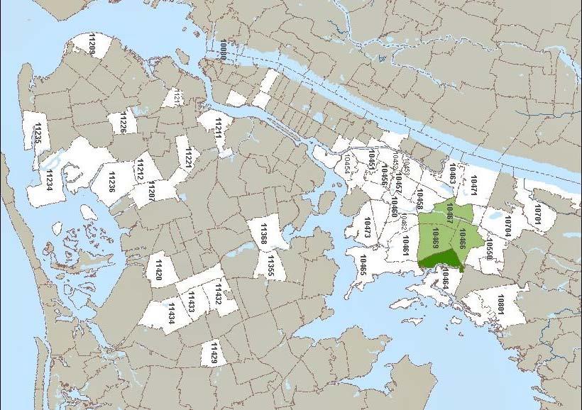
66
67 Fig. 5w: Trip Purpose (Weekdays) Work or job interview 60% 50% 56% School / College Shopping (Includes gym, bank, and "pay bills") Visit friend, relative Medical appointment Other 40% 37% 35% 38% 30% 31% 20% 10% 0% 25% 23% 20% 16% 20% 15% 14% 11% 10% 9% 8% 8% 7% 6% 3% 2% 3% 1% 1% AM Midday PM Weekday Total
68 60% 50% Fig. 5s: Trip Purpose (Saturdays) Work or job interview School / College Shopping (Includes gym, bank, and "pay bills") Religious observance/community activity Visit friend, relative Medical appointment Personal errand Leisure/Vacation/Recreation (Parks, etc.) Other 40% 41% 30% 32% 34% 33% 20% 10% 0% 23% 21% 21% 18% 15% 18% 15% 11% 14% 11% 7% 7% 8% 7% 6% 6% 6% 6% 6% 5% 5% 3% 1% 5% 5% 2% 4% 3% 4% AM Midday PM Saturday Total
69 Fig. 6w: Customer Age (Weekdays) 80% 70% 60% 63% 63% 71% 65% Between 19 and years old or older 18 years old or younger 50% 40% 30% 32% 32% 20% 10% 16% 20% 16% 12% 5% 6% 0% AM Midday PM Weekday Total
70 Fig. 6s: Customer Age (Saturdays) 80% 78% 70% 60% 68% 67% 69% Between 19 and years old or older 18 years old or younger 50% 40% 30% 20% 24% 25% 19% 24% 10% 9% 8% 7% 0% AM Midday PM Saturday Total 3%
71 Fig. 7w: In how many days of the past week did you use a bus in Co Op City? (Weekdays) 80% 70% 60% 50% 56% AM Midday PM Total Weekday 40% 36% 30% 34% 20% 10% 0% 22% 12% 15% 10% 12% 2% 12% 10% 11% 10% 9% 10% 1% 10% 9% 9% 7% 9% 8% 1% 3% 1% 7% 1% 3% % 18% 18% 16%
72 Fig. 7s: In how many days of the past week did you use a bus in Co Op City? (Saturdays) 80% 70% 60% AM Midday PM Total Saturday 50% 40% 30% 36% 35% 34% 33% 20% 10% 0% 19% 13% 5% 13% 5% 4% 10% 1% 14% 8% 11% 7% 8% 7% 10% 6% 11% 8% 7% 7% 4% 18% 15% 12% 13% 10% 10% 7%
73 Fig. 8w: How satisfied are you with overall bus service in Co Op City? (Weekdays) 80% 70% 60% 50% 66% 63% 59% 53% AM Midday PM Total Weekday 40% 30% 26% 23% 20% 10% 0% 21% 12% 21% 11% 9% 10% 7% 10% 6% 3% Very satisfied Satisfied Unsatisfied Very unsatisfied
74 Fig. 8s: How satisfied are you with overall bus service in Co Op City? (Saturdays) 80% 70% 60% 50% 57% 55% 55% 54% AM Midday PM Total Saturday 40% 30% 31% 30% 20% 8% 30% 30% 10% 7% 7% 6% 10% 8% 7% 5% 0% Very satisfied Satisfied Unsatisfied Very unsatisfied
75 Fig. 9w: Which factor is most important to you? (Weekdays) 80% 70% 60% 50% 70% 69% 68% 67% AM Midday PM Total Weekday 40% 30% 20% 10% 0% 22% 17% 15% 14% 11% 7% 6% 5% 5% 4% 4% 3% 3% 3% 2% 3% Waiting time for your bus Speed of the ride Minimizing walking Minimizing transfers Bus cleanliness
76 Fig. 9s: Which factor is most important to you? (Saturdays) 80% 70% 60% 70% 69% 66% 63% AM Midday PM Total Saturday 50% 40% 30% 19% 16% 20% 10% 15% 11% 14% 8% 7% 6% 6% 5% 5% 5% 4% 0% 4% 4% 4% Waiting time for your bus Speed of the ride Minimizing walking Minimizing transfers Bus cleanliness
77 Figure 10w: Customer Comments, Weekdays 45.0% 41.4% 40.0% 35.0% 30.0% 25.0% 20.0% 15.0% 13.2% 11.2% 10.0% 8.8% 7.3% 6.5% 5.0% 0.0% 2.6% 2.3% 1.6% 1.6% 1.1% 0.7% 0.4% 0.4% 0.4% 0.4% 0.2%
78 Figure 10s: Customer Comments, Saturdays 35.0% 32.9% 30.0% 25.0% 20.0% 15.0% 15.8% 12.8% 10.0% 9.5% 8.7% 5.0% 0.0% 5.3% 3.3% 3.1% 2.2% 1.7% 1.4% 1.3% 1.2% 0.5% 0.3% 0.1%
79 Fig. 11w: Did you make this trip prior to 2010? (Weekdays) 100% 90% 1% 1% 1% Not sure / Don't know No 80% 30% 40% 39% Yes 50% 70% 60% 50% 40% 69% 30% 59% 60% 50% 20% 10% 0% AM Midday PM Total Weekday
80 Fig. 11s: Did you make this trip prior to 2010? (Saturdays) 100% 90% 1% 1% 1% Not sure / Don't know No 80% 38% 32% 41% 35% Yes 70% 60% 50% 40% 30% 61% 67% 59% 64% 20% 10% 0% AM Midday PM Total Saturday
81 Fig. 12: Is the respondent willing to be interviewed? 100% Weekday, 98% Saturday, 95% 90% 80% 70% 60% 50% 40% 30% 20% 10% 0% Yes Weekday, 1% Saturday, 1% Weekday, 1% No, because the respondent doesn't seem to speak English Saturday, 4% No, because of some other reason
82
83
84
85
86 Memorandum Date November 19, 2013 To From Re Robert Lai, Director, Service Design, Operations Planning, MTA Bus Company Marc Mednick, Market Research BxM7 Study Background and Methodology The goals of this study are to identify BxM7 customer travel patterns and service perceptions. On Tuesday October 29 th, 2013, 287 interviews were completed at bus stops during the AM peak, and 124 interviews were completed on buses during the weekday midday. On Saturday November 2 nd, 2013, 190 interviews were conducted on board buses. Findings BxM7 destinations (almost entirely in Midtown Manhattan) can be seen at these links: o Weekday AM o Weekday Midday o Saturday Figure 1 shows that BxM7 customers primarily board on Dreiser Loop and on Einstein Loop. Fig ure 2 shows that the nearly unanimous destination borough is Manhattan. Figure 3 shows that the primary trip purpose during all time periods is work. Secondary trip purposes during the midday tend to be visiting people and medical appointments. On Saturdays, the secondary trip purposes are generally visiting people, shopping, and leisure. Figure 4 shows that weekday customers (and especially during the AM peak) typically use the BxM7 five days per week. Usage frequency among Saturday customers varies considerably more. Figure 5 shows that the BxM7 is used almost exclusively by Co Op City residents. Speed of Ride is the most important factor among BxM7 customers, followed by waiting time for their bus (Figure 6). Figure 7 shows high level of customer satisfaction, and especially so among midday users; 42% are Very satisfied with overall BxM7 service. Figure 8 shows that the most common customer comments are, by far, complaints about infrequent and/or unreliable service. (As with the Co Op City Local Bus Study, these comments should only be used as a rough guideline for possible future analyses because of the unstructured methodology of this question). Please contact me if you have any questions. cc: J. Bautista P. Fleuranges L. Thorwaldson S. Wyss C. Depalma J. Sears B. Yung
87 FIG. 1: BOARDING STOP Weekday AM Weekday Midday Saturday 5% 4% 6% 7% 10% 10% 11% 11% 12% 13% 17% 18% 28% 29% 29% 28% 30% 33% DREISER LOOP CARVER LOOP BELLAMY LOOP ASCH LOOP BARTOW AVE CO OP CITY BLVD EINSTEIN LOOP
88 FIG. 2: DESTINATION Weekday AM Weekday Midday Saturday 1% 2% 3% 1% 2% 1% 0% 0% 1% 0% 0% 1% 98% 96% 95% MANHATTAN BROOKLYN QUEENS STATEN ISLAND NEW JERSEY
89 32% 50% 83% 3% 13% 20% 2% 4% 17% 0% 3% 4% 3% 2% 6% 6% 4% 14% 16% 7% 2% 1% 2% 4% 1% 1% 0% 0% 0% 1% FIG. 3: TRIP PURPOSE Weekday AM Weekday Midday Saturday
90 4% 4% 3% 6% 6% 6% 5% 6% 5% 9% 16% 11% 15% 11% 13% 10% 8% 11% 15% 17% 20% 31% 65% 5% FIG. 4: IN HOW MANY DAYS OF THE PAST WEEK DID YOU USE THE BXM7? Weekday AM Weekday Midday Saturday
91 FIG. 5: DO YOU LIVE IN CO OP CITY? Weekday AM Weekday Midday Saturday 3% 11% 9% 89% 91% 97% YES NO
92 FIG. 6: WHEN TAKING THE BXM7, WHICH OF THESE FACTORS IS MOST IMPORTANT TO YOU? Weekday AM Weekday Midday Saturday 8% 10% 7% 6% 7% 10% 4% 4% 3% 23% 25% 28% 54% 52% 59% SPEED OF THE RIDE WAITING TIME FOR YOUR BUS MINIMIZING TRANSFERS MINIMIZING WALKING BUS CLEANLINESS
93 FIG. 7: HOW SATISFIED ARE YOU WITH OVERALL BXM7 SERVICE? Weekday AM Weekday Midday Saturday 1% 2% 4% 4% 9% 11% 22% 32% 42% 52% 53% 68% VERY SATISFIED SATISFIED UNSATISFIED VERY UNSATISFIED
94 FIG. 8: CUSTOMER COMMENTS (INCLUDES ONLY COMMENTS MENTIONED AT LEAST THREE TIMES) Weekday AM, 237 Comments Weekday Midday, 80 Comments Saturday, 196 Comments 3% 3% 3% 33% 12% 18% 3% 2% 3% 3% 2% 3% 2% 1% 1% 3% 1% 4% 2% 1% 1% 20% 2% 5% 9% 8% 36% 20% 5% 5% 10% 10% 10% 18% 15% Other Comments (Mentioned fewer than three times) Passengers are not paying fare Backup buses for breakdowns & missing drivers Notify passengers of detours & route changes Buses should run later Buses temperature uncomfortable Buses are too old Bus should make fewer stops in Co Op City Passengers on cell phones Should take dollar bills Buses need bathrooms More buses needed when there are train issues More stops needed in The Bronx Ban eating on bus Broken seats Seats have no leg room Route should be extended further downtown 3% 2% 2% 1% 1%
95
96
97
98 , Metropolitan Transportation Authority APPENDIX B RIDERSHIP ANALYSIS MAPS Page A-II
99 Final Destination of Trips Originating in Co-op City Borough Level 8.1% (Co-op City) Westchester 1.8% 55.1% (ex. Co-op City) Destination Borough Co-op City Bronx Brooklyn Manhattan Queens Staten Island 27.4% 2.5% 5.0% Nassau 0.1% 0.1% Miles
100 Final Destinations of Trips Originating in Co-op City Bronx & Manhattan Neighborhood Level Trip Counts >1000 * Neighborhood under 10 riders are not shown Miles
101 Co-op city Bus to Subway Transfers, Morning Rush Eastchester - Dyre Av: 160 (5%) Norwood St: 38 (1%) Gun Hill Rd: 58 (2%) Co-op City 207 St: 58 (2%) Fordham Rd: 47 (1%) Fordham Rd: 49 (1%) BX12 BX12+ BX23 BX26 BX28 BX29 BX30 BX38 BxM7 Q50 Allerton Av: 53 (2%) Pelham Pkwy: 54 (2%) Gun Hill Rd: 453 (13%) Pelham Bay Park: 2162 (63%)
102 Co-op city Bus to Subway Transfers, Midday Eastchester - Dyre Av: 25 (3%) Norwood St: 19 (2%) Gun Hill Rd: 58 (6%) Co-op City 207 St: 12 (1%) Fordham Rd: 23 (3%) BX12 BX12+ BX23 BX26 BX28 BX29 BX30 BX38 BxM7 Q50 Fordham Rd: 23 (3%) Allerton Av: 20 (2%) Pelham Pkwy: 39 (4%) Gun Hill Rd: 165 (18%) Pelham Bay Park: 430 (47%)
103 North Co-Op City Bus Trips Western Bx28 ( ( Western Bx26 ( ( ( Trip Count < ( E Gun Hill Rd (2) ( ( ( ( Allerton Av E Gun Hill Rd (5) ( Boston Rd ( Baychester Av Dreiser Loop Northern Co-Op City Bellamy Loop Asch Loop Bartow Av ( ( Bartow Av W. of Co-Op Bay Plaza Section ( >1200 Pelham Bay Park ( Miles (
104 Section 5 Co-Op City Bus Trips Western Bx28 ( ( Western Bx26 ( ( ( Trip Count < ( E Gun Hill Rd (2) ( ( ( ( Allerton Av E Gun Hill Rd (5) ( Boston Rd ( Baychester Av Dreiser Loop Northern Co-Op City Bellamy Loop Asch Loop Bartow Av ( ( Bartow Av W. of Co-Op Bay Plaza Section ( >1200 Pelham Bay Park ( Miles (
105 Co-Op City Bus Trips to E Gun Hill Rd (2) Western Bx28 ( ( Western Bx26 ( ( ( Trip Count < ( E Gun Hill Rd (2) ( ( ( ( Allerton Av E Gun Hill Rd (5) ( Boston Rd ( Baychester Av Dreiser Loop Northern Co-Op City Bellamy Loop Asch Loop Bartow Av ( ( Bartow Av W. of Co-Op Bay Plaza Section ( >425 Pelham Bay Park ( Miles (
106 Bus Trips Within Co-Op City Northern Co-Op City Dreiser Loop Baychester Av Bellamy Loop Asch Loop Trip Count <10 Bartow Av Bay Plaza > Miles Section 5
107 Co-op City Weekday Boardings BX12 Northern Co-Op City BX12+ BX23 BX26 BX28 Dreiser Loop BX29 BX30 BX38 Baychester Av BxM7 Q50 Bellamy Loop Asch Loop Bartow Av W. of Co-Op City Bartow Av Bay Plaza Section Miles
108 Co-op City Weekday Alightings BX12 Northern Co-Op City BX12+ BX23 BX26 BX28 Dreiser Loop BX29 BX30 BX38 Baychester Av BxM7 Q50 Bellamy Loop Asch Loop Bartow Av W. of Co-Op City Bartow Av Bay Plaza Section Miles

109 , Metropolitan Transportation Authority APPENDIX C CO-OP CITY SITE PLAN Page A-III
1999 On-Board Sacramento Regional Transit District Survey
 SACOG-00-009 1999 On-Board Sacramento Regional Transit District Survey June 2000 Sacramento Area Council of Governments 1999 On-Board Sacramento Regional Transit District Survey June 2000 Table of Contents
Philadelphia Bus Network Choices Report
 Philadelphia Bus Network Choices Report JUNE 2018 SEPTA Table of Contents Executive Summary...7 What if transit gave us more freedom?... 8 What is this report?... 8 The main conclusions... 9 What is happening
Operational Comparison of Transit Signal Priority Strategies
 Operational Comparison of Transit Signal Priority Strategies Revision Submitted on: November, 0 Author: Adriana Rodriguez, E.I Assistant Engineer Parsons Brinckerhoff 0 South Orange Avenue, Suite 00 Orlando,
Contents. Champaign-Urbana Mass Transit District Stop Placement Guidelines
 Contents Champaign-Urbana Mass Transit District Introduction... 1 Stop Spacing... 2 Rural... 2 Low Density Suburban... 2 General Urban... 2 Urban Core... 2 Operational Safety... 3 Stop Placement... 4 Nearside
Midtown Corridor Alternatives Analysis
 Midtown Corridor Alternatives Analysis Ridership Forecast Methodology and Results December 2013 Prepared by the SRF Consulting Group Team for Table of Contents Introduction... 1 Methodology... 1 Assumptions...
ITS-NY ANNUAL MEETING Bus Rapid Transit in New York City: Bus Lane Operations on One-Way Arterial Streets
 ITS-NY ANNUAL MEETING Bus Rapid Transit in New York City: Bus Lane Operations on One-Way Arterial Streets June 9, 2011 Ted Orosz AICP, Director Long Range Bus Planning MTA New York City Transit 1 Overview
Travel and Rider Characteristics for Metrobus
 Travel and Rider Characteristics for Metrobus 040829040.15 Travel and Rider Characteristics for Metrobus: 2012-2015 Overview The Miami Dade County Metropolitan Planning Organization (MPO) conducted a series
Purpose and Need. Chapter Introduction. 2.2 Project Purpose and Need Project Purpose Project Need
 Chapter 2 Purpose and Need 2.1 Introduction The El Camino Real Bus Rapid Transit (BRT) Project (Project) would make transit and other transportation improvements along a 17.6-mile segment of the El Camino
ROUTE 11 Downtown to KU to 31 st and Iowa SERVICE DESIGN
 ROUTE EVALUATION ROUTE 11 s ROUTE 11 Downtown to KU to 31 st and Iowa SERVICE DESIGN Route 11 is a route coordinated between Lawrence Transit and KU on Wheels that operates between the Downtown Transit
Traffic Impact Study. Westlake Elementary School Westlake, Ohio. TMS Engineers, Inc. June 5, 2017
 TMS Engineers, Inc. Traffic Impact Study Westlake Elementary School Westlake, Ohio June 5, 2017 Prepared for: Westlake City Schools - Board of Education 27200 Hilliard Boulevard Westlake, OH 44145 TRAFFIC
3 ROADWAYS 3.1 CMS ROADWAY NETWORK 3.2 TRAVEL-TIME-BASED PERFORMANCE MEASURES Roadway Travel Time Measures
 ROADWAYS Approximately 6 million trips are made in the Boston metropolitan region every day. The vast majority of these trips (80 to percent, depending on trip type) involve the use of the roadway network
Calgary Transit Route 302 Southeast BRT Year One Review June
 Calgary Transit Route 302 Southeast BRT Year One Review 2011 June Calgary Transit Route 302 Southeast BRT: Year One Review 2011 April Table of Contents 1.0 Executive Summary... 1 2.0 Introduction... 3
LIVERPOOL TRANSPORTATION MODELING TECHNICAL MEMO MAY 2009
 LIVERPOOL TRANSPORTATION MODELING TECHNICAL MEMO MAY 2009 Syracuse Metropolitan Transportation Council 100 Clinton Square 126 N. Salina Street, Suite 100 Syracuse, NY 13202 Telephone (315) 422-5716; Fax
Tunnel Reconstruction South 5 th Street Association October 16, 2018
 Tunnel Reconstruction South 5 th Street Association October 16, 2018 Reconstructing the Tunnel 2 Service During Tunnel Reconstruction April 2019 through July 2020 3 Projected Cross River Travel Paths of
4 DISRUPTION MANAGEMENT PLAN HIGHWAY 7 RAPIDWAY CONSTRUCTION BETWEEN BAYVIEW AVENUE AND WARDEN AVENUE TOWNS OF MARKHAM AND RICHMOND HILL
 4 DISRUPTION MANAGEMENT PLAN HIGHWAY 7 RAPIDWAY CONSTRUCTION BETWEEN BAYVIEW AVENUE AND WARDEN AVENUE TOWNS OF MARKHAM AND RICHMOND HILL The Transportation Services Committee recommends the adoption of
JONESBORO HIGHWAY 63 HIGHWAY 18 CONNECTOR STUDY
 JONESBORO HIGHWAY 63 HIGHWAY 18 CONNECTOR STUDY Craighead County May 2007 JONESBORO HIGHWAY 63 HIGHWAY 18 CONNECTOR STUDY Craighead County May 2007 Prepared by Planning and Research Division Arkansas State
2013 Customer Satisfaction Survey Subway. New York City Transit 1
 2013 Customer Satisfaction Survey Subway New York City Transit 1 Subway Survey Context Unprecedented damage to the subway system from Superstorm Sandy Weekend shutdowns of Greenpoint Tunnel started shortly
5 Transit & Traffic. Overview
 5 Transit & Traffic Overview Montgomery Place s roadways and overall traffic circulation are unique in the city due to the narrow streets and avenues with boulevards; however, no sidewalks or curbs in
WHITE PAPER: TRANSIT SERVICE FOR SOUTH SHAGANAPPI
 9/27/2012 TRANSIT PLANNING WHITE PAPER: TRANSIT SERVICE FOR SOUTH SHAGANAPPI 2012 Calgary Transit 1 Table of Contents Purpose... 3 Area of Change... 3 Background... 3 Access to destinations... 5 Connecting
1. PELHAM PARKYWAY - DYRE AVENUE STATION
 SUBWAY-SIDEWALK INTERFACE PROJECT. PELHAM PARKYWAY - DYRE AVENUE STATION. LOCATION The Pelham Parkway station on the Dyre Avenue line provides access to the 5 train. The station is centered on a grassy
TRANSPORTATION IMPROVEMENT STRATEGY
 TRANSPORTATION IMPROVEMENT STRATEGY A Vision for Staten Island North Shore November 2016 1 EXISTING CONDITIONS Transit Conditions MTA Bus Staten Island Railroad Peak Directional Traffic Volume (per hour)**:
3 TRAFFIC CONTROL SIGNAL TIMING AND SYNCHRONIZATION
 Report No. 8 of the Transportation Services Committee Regional Council Meeting of October 20, 2011 3 TRAFFIC CONTROL SIGNAL TIMING AND SYNCHRONIZATION The Transportation Services Committee recommends:
Guidelines for Providing Access to Public Transportation Stations APPENDIX C TRANSIT STATION ACCESS PLANNING TOOL INSTRUCTIONS
 APPENDIX C TRANSIT STATION ACCESS PLANNING TOOL INSTRUCTIONS Transit Station Access Planning Tool Instructions Page C-1 Revised Final Report September 2011 TRANSIT STATION ACCESS PLANNING TOOL INSTRUCTIONS
Appendix C. NORTH METRO STATION AREA TRAFFIC IMPACT STATEMENT 88th Avenue Station
 Appendix C NORTH METRO STATION AREA TRAFFIC IMPACT STATEMENT 88th Avenue Station Prepared for: Regional Transportation Department and URS Corporation as part of the North Metro EIS David Evans and Associates,
Integrated Corridor Approach to Urban Transport. O.P. Agarwal World Bank Presentation at CODATU XV Addis Ababa, 25 th October 2012
 Integrated Corridor Approach to Urban Transport O.P. Agarwal World Bank Presentation at CODATU XV Addis Ababa, 25 th October 2012 What is the Integrated Corridor Approach for Urban Transport Public? Why
ENHANCED PARKWAY STUDY: PHASE 2 CONTINUOUS FLOW INTERSECTIONS. Final Report
 Preparedby: ENHANCED PARKWAY STUDY: PHASE 2 CONTINUOUS FLOW INTERSECTIONS Final Report Prepared for Maricopa County Department of Transportation Prepared by TABLE OF CONTENTS Page EXECUTIVE SUMMARY ES-1
ROUTE 52 ALLENTOWN. Port Authority of Allegheny County
 ROUTE 52 ALLENTOWN Route 52 Allentown is a limited service LRT line that operates on weekdays between South Hills Junction and downtown Pittsburgh. The route serves the Allentown neighborhood and skirts
TRANSPORTATION ANALYSIS REPORT US Route 6 Huron, Erie County, Ohio
 TRANSPORTATION ANALYSIS REPORT US Route 6 Huron, Erie County, Ohio December 12, 2012 Prepared for: The City of Huron 417 Main Huron, OH 44839 Providing Practical Experience Technical Excellence and Client
Downtown BRT Corridor Alternatives Review: 1 st, 2 nd, 3 rd and 4 th Avenue. Bus Rapid and Conventional Transit Planning and Design Services
 Downtown BRT Corridor Alternatives Review: 1 st, 2 nd, 3 rd and 4 th Avenue Bus Rapid and Conventional Transit Planning and Design Services City of Saskatoon February 2018 Project Team HDR Corporation
D New York City Transit
 Report D New York City Transit SERVICE CHANGES: NYC TRANSIT COMMITTEE NOTIFICATION MT A BUS OPERATIONS COMMITTEE NOTIFICATION: IMPLEMENT S79 SELECT BUS SERVICE ON HYLAN BOULEVARD Service Issue S79 service
TRANSPORTATION & MOBILITY
 TRANSPORTATION & MOBILITY ROADWAY SYSTEM There are approximately 40 miles of roadways in Manitou Springs. For planning purposes, roadways are typically assigned a functional classification which defines
Defining Purpose and Need
 Advanced Design Flexibility Pilot Workshop Session 4 Jack Broz, PE, HR Green May 5-6, 2010 Defining Purpose and Need In your agency s project development process, when do design engineers typically get
Rider Satisfaction Survey Phoenix Riders 2004
 Rider Satisfaction Survey Riders Prepared For: Valley Metro Spring 2720 E. Thomas Rd. Bldg. A, Arizona 85016-8296 602-707-0050 answers@westgroupresearch.com Valley Metro Rider Satisfaction Survey - Page
Southwest Bus Rapid Transit (SW BRT) Functional Planning Study - Executive Summary January 19 LPT ATTACHMENT 2.
 Functional Planning Study - Executive Summary January 19 LPT ATTACHMENT 2.") Southwest Bus Rapid Transit (SW BRT) Functional Planning Study - Executive Summary 2011 January 19 1 of 19 Introduction This executive summary presents the results of the Southwest Bus Rapid Transit (SW
Southwest Bus Rapid Transit (SW BRT) Functional Planning Study - Executive Summary 2011 January 19 1 of 19 Introduction This executive summary presents the results of the Southwest Bus Rapid Transit (SW
MTA Surveys: Facts and Findings. NYMTC Brown Bag March 12, 2014 Julia Seltzer, MTA Planning
 MTA Surveys: Facts and Findings NYMTC Brown Bag March 12, 2014 Julia Seltzer, MTA Planning MTA Planning Survey Program Why survey? Who was surveyed? Challenges Methodologies Findings Uses for data 1 Why
UNIT V 1. What are the traffic management measures? [N/D-13] 2. What is Transportation System Management (TSM)? [N/D-14]
![UNIT V 1. What are the traffic management measures? [N/D-13] 2. What is Transportation System Management (TSM)? [N/D-14]](/thumbs/87/95571671.jpg "UNIT V 1. What are the traffic management measures? [N/D-13] 2. What is Transportation System Management (TSM)? [N/D-14]") UNIT V 1. What are the traffic management measures? [N/D-13] Some of the well-known traffic management measures are: a) Restrictions on turning movements b) One - way streets c) Tidal - flow operations
UNIT V 1. What are the traffic management measures? [N/D-13] Some of the well-known traffic management measures are: a) Restrictions on turning movements b) One - way streets c) Tidal - flow operations
Interim Transit Ridership Forecast Results Technical Memorandum
 Interim Transit Ridership 401 South Jackson Street Seattle, WA 98104-2826 September 2012 Table of Contents 1 INTRODUCTION... 1-1 1.1 Project Background... 1-1 2 RIDERSHIP FORECASTS... 2-1 2.1 System Ridership
VIVA RETIREMENT COMMUNITIES OAKVILLE TRAFFIC IMPACT STUDY
 VIVA RETIREMENT COMMUNITIES OAKVILLE TRAFFIC IMPACT STUDY VIVA RETIREMENT COMMUNITIES OAKVILLE TRAFFIC IMPACT STUDY DECEMBER 2012 READ, VOORHEES & ASSOCIATES TORONTO, ONTARIO Read, Voorhees & Associates
BOSTON REGION METROPOLITAN PLANNING ORGANIZATION
 PLANNING ORGANIZATIO BOSTON REGION MPO NMETROPOLITAN BOSTON REGION METROPOLITAN PLANNING ORGANIZATION Stephanie Pollack, MassDOT Secretary and CEO and MPO Chair Karl H. Quackenbush, Executive Director,
PURPOSE AND NEED SUMMARY 54% Corridor Need 1. Corridor Need 2. Corridor Need 3. Corridor Need 4. Corridor Need 5
 SUMMARY PURPOSE AND NEED Chapel Hill Transit ridership has increased Buses operate every 4 minutes and have standing room only Exceeding seated capacity by 12% Corridor Need 1 by more than 20 percent between
Cobb Community Transit
 Cobb Community Transit Ridership Survey January 2014 1 Methodology Paper survey of 315 CCT riders 165 on local routes (margin of sampling error: ± 7.6%) 150 on express routes (margin of sampling error:
Traffic Impact Analysis Walton Acres at Riverwood Athletic Club Clayton, NC
 Traffic Impact Analysis Walton Acres at Riverwood Athletic Club Clayton, NC 1. TABLE OF CONTENTS INTRODUCTION...1 1.1. Site Location and Study Area...1 1.2. Proposed Land Use and Site Access...2 1.3.
EUCLID AVENUE PARKING STUDY CITY OF SYRACUSE, ONONDAGA COUNTY, NEW YORK
 EUCLID AVENUE PARKING STUDY CITY OF SYRACUSE, ONONDAGA COUNTY, NEW YORK CITY OF SYRACUSE DEPARTMENT OF PUBLIC WORKS 1200 CANAL STREET EXTENSION SYRACUSE, NEW YORK 13210 DRAFT REPORT DATE: November 13,
Tunnel Reconstruction Brooklyn CB 1 August 14, 2018
 Tunnel Reconstruction Brooklyn CB 1 August 14, 2018 Reconstructing the Tunnel 2 Service During Tunnel Reconstruction April 2019 through July 2020 3 Projected Cross River Travel Paths of Customers The Service
Traffic Impact Analysis Chatham County Grocery Chatham County, NC
 Chatham County Grocery Chatham County, NC TABLE OF CONTENTS 1. INTRODUCTION... 1 1.1. Location and Study Area... 1 1.2. Proposed Land Use and Access... 2 1.3. Adjacent Land Uses... 2 1.4. Existing ways...
. ' motion. APPLtlDK.L - L"iLC_t1GLR 201b APPENDIX 7 TECHNICAL MEMOS
 . ' motion APPLtlDK.L - L"iLC_t1GLR 201b APPENDIX 7 TECHNICAL MEMOS The nmotion program will provide a large number of benefits for Middle Tennessee. This document presents selected benefits and other
TRAFFIC IMPACT STUDY CRITERIA
 Chapter 6 - TRAFFIC IMPACT STUDY CRITERIA 6.1 GENERAL PROVISIONS 6.1.1. Purpose: The purpose of this document is to outline a standard format for preparing a traffic impact study in the City of Steamboat
3.0 Future Conditions
 3.0 Future Conditions In order to be able to recommend appropriate improvements to the transportation system of the Town, it is important to first understand the nature and volume of traffic that is expected
M14A/D Select Bus Service
 M14A/D Select Bus Service Manhattan Community Board 6: April 1, 2019 New York City Transit 2 Background M14 Select Bus Service M14 was identified as a critical future SBS corridor in past BRT studies as
Shockoe Bottom Preliminary Traffic and Parking Analysis
 Shockoe Bottom Preliminary Traffic and Parking Analysis Richmond, Virginia August 14, 2013 Prepared For City of Richmond Department of Public Works Prepared By 1001 Boulders Pkwy Suite 300, Richmond, VA
Roadways. Roadways III.
 Introduction 97 Roadway Design Principles 98 Safe Speeds 99 Optimizing of Street Space 00 Minimum Lane Widths in the City of Boston 02 Design Features that Reduce Operating Speeds 05 Travel Lanes Transit
Transportation Trends, Conditions and Issues. Regional Transportation Plan 2030
 Transportation Trends, Conditions and Issues Regional Transportation Plan 2030 23 Regional Transportation Plan 2030 24 Travel Characteristics Why Do People Travel? Over one-half of trips taken in Dane
4. ENVIRONMENTAL IMPACT ANALYSIS 9. TRANSPORTATION AND TRAFFIC
 4. ENVIRONMENTAL IMPACT ANALYSIS 9. TRANSPORTATION AND TRAFFIC 4.9.1 INTRODUCTION The following section addresses the Proposed Project s impact on transportation and traffic based on the Traffic Study
Understanding Rail and Bus Ridership
 Finance Committee Information Item III-A October 12, 2017 Understanding Rail and Bus Ridership Washington Metropolitan Area Transit Authority Board Action/Information Summary Action Information MEAD Number:
ADOT Statewide Bicycle and Pedestrian Program Summary of Phase IV Activities APPENDIX B PEDESTRIAN DEMAND INDEX
 ADOT Statewide Bicycle and Pedestrian Program Summary of Activities APPENDIX B PEDESTRIAN DEMAND INDEX May 24, 2009 Pedestrian Demand Index for State Highway Facilities Revised: May 29, 2007 Introduction
Pocatello Regional Transit Master Transit Plan Draft Recommendations
 Pocatello Regional Transit Master Transit Plan Draft Recommendations Presentation Outline 1. 2. 3. 4. What is the Master Transit Plan? An overview of the study Where Are We Today? Key take-aways from existing
Eliminate on-street parking where it will allow for a dedicated bus only lane %
 Traffic Dashboard Priorities Survey Responses Introduction 1) Are you familiar with bus rapid transit (BRT)? a. No, BRT is new to me. 597 23.5% b. I ve heard of BRT, but I don t know much about it. 1,136
Chapter 6 Transportation Plan
 Chapter 6 Transportation Plan Transportation Plan Introduction Chapter 6 Transportation Plan Transportation Plan Introduction This chapter describes the components of Arvada s transportation system, comprised
January Project No
 January 13 2015 Project No. 5070.05 Neil Connelly, Director University of Victoria, Campus Planning and Sustainability PO Box 1700 STN CSC Victoria, BC V8P 5C2 Dear Neil: Re: UVic 2014 Traffic Final Report
Cheryl Thole CUTR/NBRTI, Senior Research Associate Tampa, Florida
 A Change in Accessibility and Convenience? Implementing BRT and the Impact on Transit Riders Cheryl Thole CUTR/NBRTI, Senior Research Associate Tampa, Florida Project Background Greater station spacing
Arlington County 10-Year Transit Development Plan & Premium Transit Network Briefing. May 2016
 Arlington County 10-Year Transit Development Plan & Premium Transit Network Briefing May 2016 Overview 10-Year Transit Development Plan Premium Transit Network Columbia Pike service concept Premium amenities
Project Report. South Kirkwood Road Traffic Study. Meadows Place, TX October 9, 2015
 Meadows Place, TX October 9, 2015 Contents 1 Introduction... 1 2 Data Collection... 1 3 Existing Roadway Network... 2 4 Traffic Volume Development... 2 5 Warrant Analysis... 3 6 Traffic Control Alternative
AAMPO Regional Transportation Attitude Survey
 AAMPO Regional Transportation Attitude Survey Traditionally Underserved Populations helping organizations make better decisions since 1982 2018 Submitted to the AAMPO By: ETC Institute 725 W. Frontier
TRAFFIC IMPACT STUDY And A TRAFFIC SIGNAL WARRANT ANALYSIS FOR A SENIOR LIVING AND APARTMENT DEVELOPMENT
 TRAFFIC IMPACT STUDY And A TRAFFIC SIGNAL WARRANT ANALYSIS FOR A SENIOR LIVING AND APARTMENT DEVELOPMENT DEERFIELD TOWNSHIP, WARREN COUNTY, OHIO Nantucket Circle and Montgomery Road () Prepared for: ODLE
LOOP 360 IMPROVEMENT STUDY
 LOOP 360 IMPROVEMENT STUDY Overview and Preliminary Analysis August 2015 1 STUDY PROCESS 2 Study Background Loop 360 serves a wide range of users, including residents, businesses, bicyclists, and commuters
Bus Riders of Saskatoon Meeting with City of Saskatoon Utility Services Department October 23, :30pm 2:30pm th Street West, Saskatoon
 Bus Riders of Saskatoon Meeting with City of Saskatoon Utility Services Department October 23, 2014 1:30pm 2:30pm 301 24 th Street West, Saskatoon Bus Riders of Saskatoon Members: Marianne, Chief and Sarina
S T A T I O N A R E A P L A N
 The Circulation and Access Plan describes vehicle, pedestrian, and transit improvements recommended within the Concept Plan. In order to create and sustain a vibrant business district that provides pedestrian-friendly
RIDERSHIP PREDICTION
 RIDERSHIP PREDICTION Outline 1. Introduction: route ridership prediction needs and issues. 2. Alternative approaches to route ridership prediction. Professional judgement Survey-based methods Cross-sectional
Corpus Christi Metropolitan Transportation Plan Fiscal Year Introduction:
 Introduction: The Safe, Accountable, Flexible, Efficient Transportation Equity Act: A Legacy for Users (SAFETEA-LU) has continued the efforts started through the Intermodal Surface Transportation Efficiency
Bus Rapid Transit (BRT) sets a new global trend in public transportation
 sets a new global trend in public transportation") 01 Transportation Planning 7 International comparative study of Seoul BRT system Ko, Joonho Summary The ridership of the bus rapid transit system in Seoul is the fifth highest among 162 cities worldwide,
01 Transportation Planning 7 International comparative study of Seoul BRT system Ko, Joonho Summary The ridership of the bus rapid transit system in Seoul is the fifth highest among 162 cities worldwide,
Traffic Circulation Study for Neighborhood Southwest of Mockingbird Lane and Airline Road, Highland Park, Texas
 ARIZONA TEXAS NEW MEXICO OKLAHOMA February 13, 2015 Mr. Meran Dadgostar P.E., R.S. Town of Highland Park 4700 Drexel Dr. Highland Park, Texas 75205 Re: Traffic Circulation Study for Neighborhood Southwest
Chapter 3 BUS IMPROVEMENT CONCEPTS
 Chapter 3 BUS IMPROVEMENT CONCEPTS The purpose of this chapter is to describe potential bus improvement strategies and potential impacts or implications associated with BRT implementation within the existing
METHODOLOGY. Signalized Intersection Average Control Delay (sec/veh)
") Chapter 5 Traffic Analysis 5.1 SUMMARY US /West 6 th Street assumes a unique role in the Lawrence Douglas County transportation system. This principal arterial street currently conveys commuter traffic
Chapter 5 Traffic Analysis 5.1 SUMMARY US /West 6 th Street assumes a unique role in the Lawrence Douglas County transportation system. This principal arterial street currently conveys commuter traffic
UBC Vancouver Transportation Status Report Fall 2014
 UBC Vancouver Transportation Status Report Fall 2014 July 2015 1. Introduction... 1 1.1. Context... 1 1.2. Transportation Monitoring Program... 2 1.3. Changes at UBC Affecting Travel Patterns... 4 1.4.
Transit Ridership - Why the Decline and How to Increase. Hosted by the. Virginia Transit Association
 Transit Ridership - Why the Decline and How to Increase Hosted by the Virginia Transit Association Virginia Transit Association 1108 East Main Street, Suite 1108 Richmond, VA 23219 804.643.1166 www.vatransit.com
Title VI Fare Change Equity Analysis
 Title VI Fare Change Equity Analysis Evaluation Report Submitted to Dallas Area Rapid Transit Submitted by TranSystems June 2012 Title VI Fare Change Equity Analysis Introduction DART has proposed a schedule
Southside Road. Prepared for: City of St. John s Police & Traffic Committee. Prepared by: City of St. John s Traffic Division
 Southside Road Prepared for: City of St. John s Police & Traffic Committee Prepared by: City of St. John s Traffic Division January 2007 Southside Road - Traffic Report Page 1 of 9 BACKGROUND: th At the
PUBLIC TRANSPORTATION PLAN FOR THE CITY OF GEORGETOWN
 PUBLIC TRANSPORTATION PLAN FOR THE CITY OF GEORGETOWN PRESENTATION TO CITY COUNCIL JANUARY 22, 2008 PUBLIC TRANSIT FOR THE CITY OF GEORGETOWN LOCAL SERVICE For Georgetown residents to Georgetown destinations.
Executive Summary BEYOND THE B-LINE: RAPID TRANSIT LINE PHASE II - COMMERCIAL DRIVE WEST. Final Draft December 13, Appendix B BROADWAY/LOUGHEED
 BEYOND THE B-LINE: BROADWAY/LOUGHEED RAPID TRANSIT LINE PHASE II - COMMERCIAL DRIVE WEST Appendix B Executive Summary Final Draft December 13, 1999 UMA Lloyd Lindley Davidson Yuen Simpson Architects BROADWAY/LOUGHEED
CITI BIKE S NETWORK, ACCESSIBILITY AND PROSPECTS FOR EXPANSION. Is New York City s Premier Bike Sharing Program Accesssible to All?
 CITI BIKE S NETWORK, ACCESSIBILITY AND PROSPECTS FOR EXPANSION Is New York City s Premier Bike Sharing Program Accesssible to All? How accessible is Citi Bike s network in New York City? Who benefits from
Main-McVay Transit Study: Phase 2 Options Definition and High Level Constraints Evaluation
 Main-McVay Transit Study: Phase 2 Options Definition and High Level Constraints Evaluation APRIL 2016 A collaborative study between: For Additional Information or to Comment If you would like additional
Understanding the Market of Metro Transit's Ridership and Services and How Technology Can Help Kevin J. Krizek Ahmed M. El-Geneidy
 Understanding the Market of Metro Transit's Ridership and Services and How Technology Can Help Kevin J. Krizek Ahmed M. El-Geneidy University of Minnesota Understanding the Market of Metro Transit's
VILLAGE OF NILES TRAFFIC CALMING POLICY
 INTRODUCTION There is increasing interest across the country in developing new strategies to reduce the speed and amount of traffic in residential neighborhoods. Measurement of speeds, traffic volumes,
Greater Cleveland Regional Transit Authority
 Greater Cleveland Regional Transit Authority Transit Priority Corridor Initiatives West 25 th Street /East 105 th /East 93 rd Streets June 20, 2017 Presented to: Planning & Development Committee Greater
Magnolia Place. Traffic Impact Analysis. Prepared for: City of San Mateo. Prepared by: Hexagon Transportation Consultants, Inc.
 Magnolia Place Traffic Impact Analysis Prepared for: City of San Mateo Prepared by: Hexagon Transportation Consultants, Inc. Updated January 4, 2010 Table of Contents 1. Introduction...1 2. Existing Conditions...6
From Disarray to Complete Street:
 From Disarray to Complete Street: Utilizing BRT to improve bus service, pedestrian safety, and traffic organization in the South Bronx BRT, TOD and Complete Streets TRB BRT Conference June 19, 2018 We
Planning Regionally With Transit
 Planning Regionally With Transit Nathan Coats Director of Operations CTAA Expo 2015 Tampa Began 1992. Serves eastern Cache County to Preston, ID. Population- 115,000 34 bus fleet, 26 fixed route buses;
BUS RAPID TRANSIT. A Canadian Perspective. McCormick Rankin International. John Bonsall P.Eng
 BUS RAPID TRANSIT A Canadian Perspective Why choose BRT? Because it is a practical and cost effective rapid transit solution for the most common types of land use in urban Canada Operating experience shows
City of Wayzata Comprehensive Plan 2030 Transportation Chapter: Appendix A
 A1. Functional Classification Table A-1 illustrates the Metropolitan Council s detailed criteria established for the functional classification of roadways within the Twin Cities Metropolitan Area. Table
CHAPTER 3. Transportation and Circulation
 CHAPTER 3 Transportation and Circulation 3.0 TRANSPORTATION AND CIRCULATION This chapter evaluates traffic circulation, transit, parking, pedestrian, bicycle, and rail operational conditions in the Project
6.0 PEDESTRIAN AND BICYCLE FACILITIES 6.1 INTRODUCTION 6.2 BICYCLE DEMAND AND SUITABILITY Bicycle Demand
 6.0 PEDESTRIAN AND BICYCLE FACILITIES 6.1 INTRODUCTION Bicycle and pedestrian travel along and in the vicinity of the corridor is part of the vision of Somerset and Hunterdon counties and the integrated
Appendix A-2: Screen 1 Alternatives Report
 Appendix A-2: Screen 1 Alternatives Report SCREEN 1 ALTERNATIVES REPORT Western & Ashland Corridors Bus Rapid Transit (BRT) Project Prepared for Chicago Transit Authority 567 West Lake Street Chicago,
Brian McHugh, Buckhead Community Improvement District. SUBJECT: Wieuca Road at Phipps Boulevard Intersection Improvements Project
 MEMO TO: FROM: Brian McHugh, Buckhead Community Improvement District Jagan Kaja, AICP, WSP Parsons Brinckerhoff SUBJECT: Wieuca Road at Phipps Boulevard Intersection Improvements Project DATE: October
Gratiot Avenue Transit Study Tech Memo #4: Ridership
 Gratiot Avenue Transit Study Tech Memo #4: Ridership 5/31/2016 Table of Contents 1 INTRODUCTION... 3 PROJECT DESCRIPTION... 3 2 TECH MEMO #4 OVERVIEW... 5 METHODOLOGY... 5 3 THE ALTERNATIVES AND POTENTIAL
DON MILLS-EGLINTON Mobility Hub Profile
 Mobility Hub Profile Dundas Don Mills-Eglinton West-Bloor Anchor Hub Gateway Hub N MOBILITY HUBS: Places of connectivity between regional and rapid transit services, where different modes of transportation
TRAFFIC IMPACT ANALYSIS
 TRAFFIC IMPACT ANALYSIS FOR THE CHAMPAIGN UNIT#4 SCHOOL DISTRICT PROPOSED HIGH SCHOOL (SPALDING PARK SITE) IN THE CITY OF CHAMPAIGN Final Report Champaign Urbana Urbanized Area Transportation Study 6/24/2014
ROUTES 55 / 42 / 676 BUS RAPID TRANSIT LOCALLY PREFERRED ALTERNATIVE
 ROUTES 55 / 42 / 676 BUS RAPID TRANSIT LOCALLY PREFERRED ALTERNATIVE April, 2012 1 INTRODUCTION The need for transit service improvements in the Routes 42/55/676 corridor was identified during the Southern
Evan Johnson, Tindale Oliver & Associates. Alan Danaher, P.E., PTOE, AICP, PTP
 To: Copies: From: Evan Johnson, Tindale Oliver & Associates Matt Muller, RTS Jesus Gomez, RTS Alan Danaher, P.E., PTOE, AICP, PTP Date: January 14, 2014 Subject: Ridership Projections Gainesville Streetcar
Fordham Plaza. Conceptual Design Study
 Fordham Plaza Conceptual Design Study WASHINGTON AVE. N Project Scope Timeline Urban Design Transportation Economics/Market Research A Multi-Disciplinary Study Based on meetings and interviews with Stakeholders:
Washington Metropolitan Area Transit Authority Board Action/Information Summary. MEAD Number:
 Washington Metropolitan Area Transit Authority Board Action/Information Summary Action Information MEAD Number: 100962 Resolution: Yes No TITLE: Bicycle and Pedestrian Access Improvements Study PURPOSE: