Appendix B. Existing Transfort System Route Profiles
|
|
|
- Lynne Eaton
- 6 years ago
- Views:
Transcription
1 Transfort Strategic Operating Plan Update Transfort Technical Report Appendix B Existing Transfort System Route Profiles August 29
2
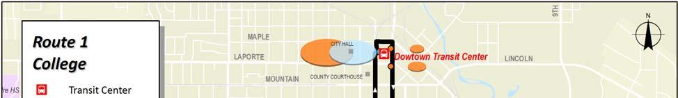
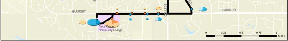
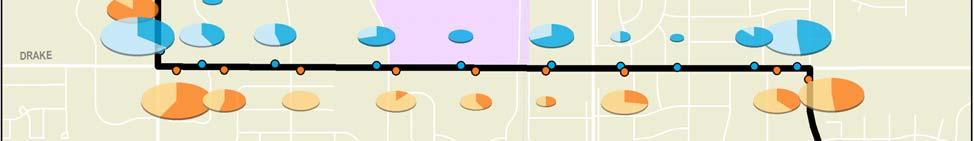
3 Route 1 College Route 1 operates south from DTC on College to the South Transit Center, then continues south on College and west on Harmony to Front Range Community College. The route returns north from Harmony via John F. Kennedy to the STC. Transit Centers Downtown Transit Center South Transit Center Major Destinations Downtown Fort Collins Colorado State University Foothills Mall Front Range Community College Current Operations & Service Requirements (August 28) CSU IN SESSION CSU OUT OF SESSION Weekday Saturday Weekday Saturday Hours of Operation: 6:18 am 7:26 pm 6:18 am 7:26 pm 6:18 am 7:26 pm 6:18 am 7:26 pm Frequency (min): Cycle Time (min): Layover Time (min): Route 1 is interlined with Route 15 for a combined cycle time of 1 min with 14 min of layover. Total One Way Trips: Daily Rev Hours: Daily Rev Miles: Peak Buses: FY 28 Route Service Productivity and Rankings* CSU IN SESSION CSU OUT OF SESSION Weekday Saturday Weekday Saturday Avg. Daily Boardings: 1, , Pass./Rev. Veh. Hr: Ranking (1) (7) (8) (5) Pass./Rev. Veh. Mi: Ranking (8) (4) (4) (2) Pass./Trip: Ranking (7) (3) (4) (1) * In session statistics are averaged from September November 27 and February April 28. Out of session statistics are averaged from July 27 and June 28. Rankings are out of 16 weekday and 13 Saturday routes when CSU is in session, and 14 weekday and 13 Saturday routes when CSU is out of session. Transfort/City of Fort Collins Route 1 Page 1 Route Profile #1 College
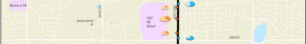
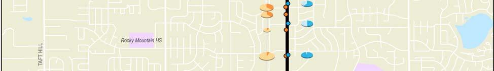
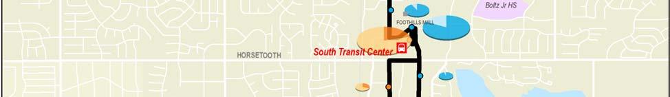
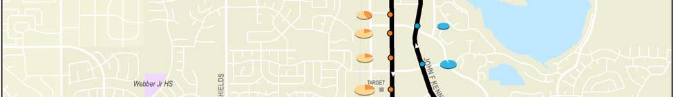
4 Description of Existing Alignment From the Downtown Transit Center, Route 1 travels south on College Avenue through downtown Fort Collins (it returns via Magnolia Street, Remington Street, and Olive Street to access the DTC on Mason Street). As the route continues south on College from Magnolia, it passes the eastern edge of CSU, some single family communities and several medium to highdensity commercial areas that includes Kmart/King Soopers and Foothills Mall. The route deviates into the South Transit Center before continuing south on College Avenue from Horsetooth Road through very dense commercial areas, including Target. Route 1 turns west on Harmony Road, where it passes multi family and single family communities and begins the return trip back to the DTC after looping at Front Range Community College. On its return trip, the route travels north to the STC on John F. Kennedy Parkway, which contains multi family, office and retail centers. Key Route Issues and Observations Alignment Route 1 is fairly direct along College with some deviations. Foremost of these are from STC south, where a split alignment leaves College served only in the southbound direction between Horsetooth and Harmony. Difficult turns that slow the route include Shields from FRCC and Horsetooth to College. Stops There are no stops on Mason through what is essentially Fort Collin s central business district. Transfort operators noted that the southbound stop at College & Mulberry is blocked by parked vehicles. It was also suggested that the stop on College (south of Horsetooth) be moved northward to facilitate transfers with Routes 6, 7 and FoxTrot. Another suggested removing the westbound stop at Harmony & Starflower. Schedule The 2 minute frequencies on this route can make connecting to other routes which operate at 3 or 6 minute headways difficult. Route Connections Route 1 is interlined with Route 15 at the DTC and has timed connections to Routes 5, 14 and 18. Due to schedule variations, transfers to routes 8 and 9 at the DTC are not evenly timed. At STC, the route has partly timed connections to Routes 5, 6, 7, 16 and Foxtrot. Additionally, an untimed connection can be made to Route 7 at Drake and College. PSD Connections This route has no direct connections to PSD schools, although Centennial High School is only two blocks east of Route 1 at Laurel Street. Cycle, Run, and Layover Times The layover time of 14 minutes for the interlined 1/15 is only 14% of the 1 minute cycle time. This is insufficient given the high ridership and severe congestion along this route. As a primary connection to other routes, schedule delays here impact transfers throughout the system. Transfort/City of Fort Collins Route 1 Page 2 Route Profile #1 College
5 Historical Ridership Characteristics Average daily ridership by month from July 27 to June 28 is presented in the figure below. Route 1 ridership is not reliant on CSU riders, with weekday ridership when CSU is in session only slightly higher (4%) than when CSU is out of session at four percent. Route 1 Monthly Average Daily Ridership Levels (July 27 to June 28) 1,3 1,2 1,1 1, Weekday Saturday Jul Aug Sep Oct Nov Dec Jan Feb Mar Apr May Jun Adult fares make up the majority of the riders at 37%. CSU students account for only 12% of the passengers on Route 1, which is lower than the system average. Transfers account for about 12% of ridership, greater than Transfort s average transfer rate of 8%. The figure below shows ridership by fare class compared to systemwide averages. Route 1 Ridership by Fare Class (July 27 to June 28) Youth CSU Adult 26% 25% Senior/ Disabled Other Systemwide 12% 17% 23% 37% 23% 37% Transfort/City of Fort Collins Route 1 Page 3 Route Profile #1 College
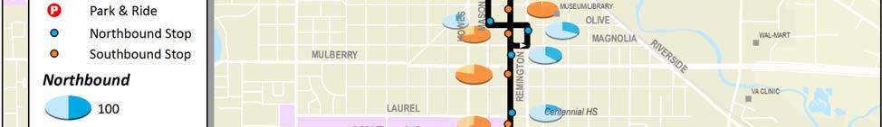
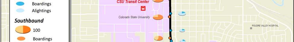
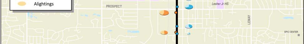
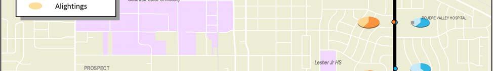
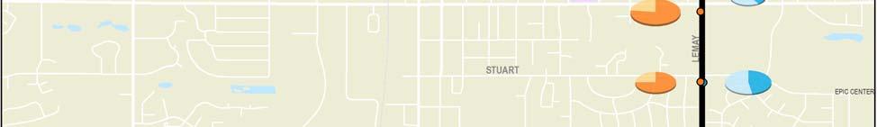
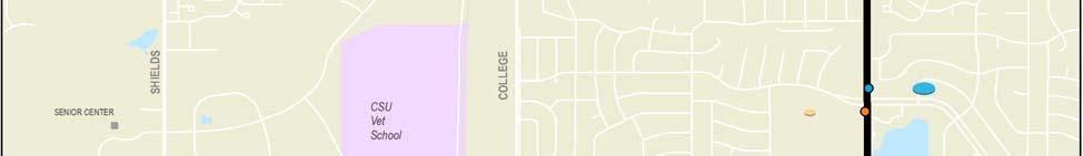
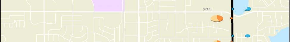
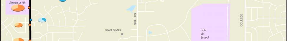
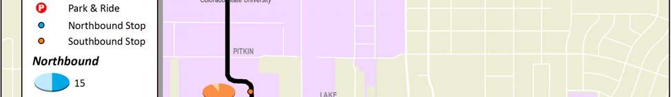
6 Current Ridership Characteristics A ridecheck survey was completed on April 3, 28, when CSU was in session. Passenger boardings and alightings were recorded at every stop on about 85% of systemwide bus trips. Stop data was factored up by average daily ridership by route reported for April 28 in order to approximate a 1% ridecheck. The following survey results are presented below: A graph showing unadjusted weekday ridership activity (boardings and alightings) by time of day; A map that illustrates total adjusted weekday ridership activity by stop; and Graphs that depict adjusted weekday boarding and alighting activity by stop, by direction, along with average daily line loads. Ride Check Observations About 17% of ridership activity occurred at the DTC, and another 18% occurred at the STC. Vehicle loads were about three times greater between DTC and STC than they were south of STC. After the transit centers, ridership at FRCC was highest for a single location, generating 8% of activity. While all of College had good activity, the northern end from DTC to College & Laurel performed best as a segment, with 2% of ridership. Too many trips were not counted to give an accurate assessment of time of day characteristics. In general, afternoon volumes appear greater than morning levels. Route 1 Weekday Ridership by Time of Day and Direction 8 7 Northbound Southbound 6 Boardings AM 7 AM 8 AM 9 AM 1 AM 11 AM 12 PM 1 PM 2 PM 3 PM 4 PM 5 PM 6 PM 7 PM Start of Trip *The first six morning trips and last five afternoon trips were not counted. Transfort/City of Fort Collins Route 1 Page 4 Route Profile #1 College
7 Transfort/City of Fort Collins Route 1 Page 5 Route Profile #1 College
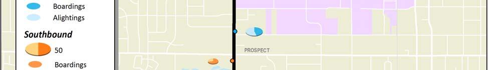
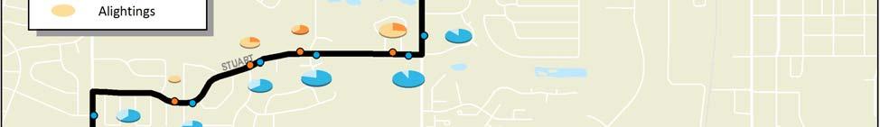
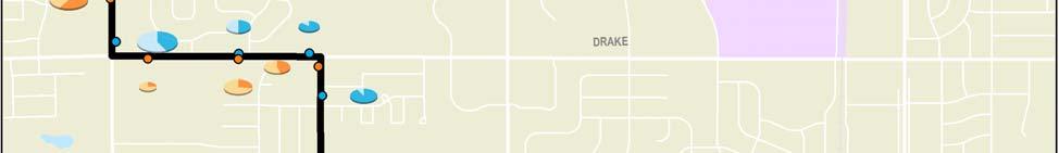
8 Route 1 Total Weekday Ridership by Stop and Average Line Loads (Northbound) Average Load Boardings Alightings Boardings & Alightings Average Vehicle Load SHIELDS & HARMONY FRCC WS HARMONY & HINSDALE EB HARMONY & LARKBUNTING EB HARMONY & MASON EB JFK & HARMONY NB JFK PKWY & TROUTMAN NB JFK PKWY & BOARDWALK NB JFK PKWY & LANDINGS NB MONROE & JFK WB COLLEGE & FOOTHILLS PKWY NB COLLEGE & SWALLOW NB COLLEGE & HARVARD NB COLLEGE & THUNDERBIRD NB COLLEGE & DRAKE NB COLLEGE & RUTGERS NB COLLEGE & SPRING PARK NB COLLEGE & STUART NB COLLEGE & PROSPECT NB COLLEGE & LAKE NB COLLEGE & PITKIN NB COLLEGE & ELIZABETH NB COLLEGE & LAUREL NB COLLEGE & MULBERRY (N OF) NB REMINGTON & OLIVE (DMA) NB MASON & OLIVE NB DTC Transfort/City of Fort Collins Route 1 Page 6 Route Profile #1 College
9 Route 1 Total Weekday Ridership by Stop and Average Line Loads (Southbound) DTC COLLEGE & MAPLE SB COLLEGE & LAPORTE SB COLLEGE & OAK STREET PLAZA SB Average Load Boardings Alightings Boardings & Alightings Average Vehicle Load COLLEGE & OLIVE (S OF) SB COLLEGE & MULBERRY SB COLLEGE & LAUREL SB COLLEGE & ELIZABETH SB COLLEGE MB BTW PITKIN & LAKE SB COLLEGE & PROSPECT SB COLLEGE & STUART SB COLLEGE & RUTGERS SB COLLEGE & COLUMBIA SB COLLEGE & K MART ENTRANCE SB COLLEGE & DRAKE SB COLLEGE & THUNDERBIRD SB COLLEGE & HARVARD SB COLLEGE & SWALLOW SB THE SQUARE SHOPPING CTR COLLEGE & CREGER SB COLLEGE & COLBOARD SB COLLEGE & BOARDWALK SB COLLEGE & TROUTMAN (N OF) SB COLLEGE & TROUTMAN (TARGET) SB HARMONY & MASON WB HARMONY & LARKBUNTING WB HARMONY & HINSDALE WB HARMONY & STARFLOWER (E OF) WB FRCC EASTSIDE SB SHIELDS & HARMONY FRCC WS Transfort/City of Fort Collins Route 1 Page 7 Route Profile #1 College
10 Route 2 Prospect/Elizabeth Route 2 operates in a clockwise loop from the CSU Transit Center south on Meridian, west on Prospect, north on Overland, and east on Elizabeth to return to the CTC. Transit Centers CSU Transit Center Major Destinations Colorado State University Ram s Village Current Operations & Service Requirements (August 28) CSU IN SESSION CSU OUT OF SESSION Weekday Saturday Weekday Saturday Hours of Operation: 6:22 am 6:4 pm 6:22 am 6:4 pm 6:22 am 6:4 pm 6:22 am 6:4 pm Frequency (min): Cycle Time (min): Layover Time (min): Total One Way Trips: Daily Rev Hours: Daily Rev Miles: Peak Buses: 2** FY 28 Route Service Productivity and Rankings* CSU IN SESSION CSU OUT OF SESSION Weekday Saturday Weekday Saturday Avg. Daily Boardings: Pass./Rev. Veh. Hr: Ranking (3) (2) (2) (6) Pass./Rev. Veh. Mi: Ranking (3) (3) (3) (4) Pass./Trip: Ranking (2) (2) (1) (5) * In session statistics are averaged from September November 27 and February April 28. Out of session statistics are averaged from July 27 and June 28. Rankings are out of 16 weekday and 13 Saturday routes when CSU is in session, and 14 weekday and 13 Saturday routes when CSU is out of session. **Supplemental a.m. peak service is provided when CSU is in session from 7:25 a.m. to 9:4 a.m. Transfort/City of Fort Collins Route 2 Page 1 Route Profile #2 Prospect/Elizabeth
11 Description of Existing Alignment Route 2 is a clockwise loop that serves the CSU Transit Center and areas west of campus. From the CSU Transit Center, the route travels south on Meridian Avenue and west on Prospect Road serving shopping centers, multi family residences and single family homes. The route travels northbound on Overland Trail passing single family homes and east on Elizabeth Street, where it serves mid to high density single family, multi family and commercial areas. The route travels north on Shields Street through student housing and a commercial center, and east on Plum Street returning through campus to the CSU Transit Center. Trailer buses are used during morning peak hours (around7:3 to 9:3 a.m.) to alleviate overloading. Route 3 travels a similar pattern in a counterclockwise direction when CSU is in session. Key Route Issues and Observations Alignment The alignment is fairly straightforward, though as a one way loop it creates out of direction travel for riders when CSU is out of session. When school is in session, Route 3 provides complementary reverse direction service. Routing across the CSU campus (with speed limits of 2 mph) can slow this route. Stops Transfort operator comments suggested moving the stop on Meridian Avenue at Lake Street before the crosswalk to eliminate having to stop before and after the crosswalk. Schedule Trailer buses are used to alleviate overcrowding during morning peak travel periods, which can cause difficulty for some riders who are passed by a full bus or want to understand which bus to board. Transfort operators suggested that Route 2 should only operate when CSU is in session, and Route 3 should be a year round route. Route Connections The route is scheduled for timed transfer meets with Routes 3, 4, 6, and 7 at the CTC, and untimed transfers here to Routes 11 and 15. PSD Connections Route 2 does not serve any PSD junior high or high schools. Cycle, Run, and Layover Times The layover time of 5 minutes is 17% of the 3 minute cycle time. Transfort operators noted that more time was needed for this route, with Meridian Avenue traffic and heavy loading slowing the route down. Transfort/City of Fort Collins Route 2 Page 2 Route Profile #2 Prospect/Elizabeth
12 Historical Ridership Characteristics Average daily ridership by month from July 27 to June 28 is presented in the figure below. Weekday ridership when CSU is in session is more twice the ridership than when school is out. Even when CSU is out of session, this is one of the top performing routes in the system. Route 2 Monthly Average Daily Ridership Levels (July 27 to June 28) 1, 9 8 Weekday Saturday Jul Aug Sep Oct Nov Dec Jan Feb Mar Apr May Jun Riders on Route 2 are primarily CSU students and staff, who make up 65% of passengers on this route, far more than the average route. Transfers account for only about 3% of ridership, below Transfort s average transfer rate of 8%. The figure below shows ridership by fare class compared to systemwide averages. Route 2 Ridership by Fare Class (July 27 to June 28) Youth CSU Adult 12% 1% Senior/ Disabled Other 13% Systemwide 17% 23% 65% 23% 37% Transfort/City of Fort Collins Route 2 Page 3 Route Profile #2 Prospect/Elizabeth
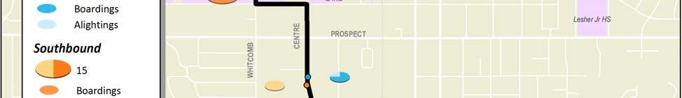
13 Current Ridership Characteristics A ridecheck survey was completed on April 3, 28, when CSU was in session. Passenger boardings and alightings were recorded at every stop on about 85% of systemwide bus trips. Stop data was factored up by average daily ridership by route reported for April 28 in order to approximate a 1% ridecheck. The following survey results are presented below: A graph showing unadjusted weekday ridership activity (boardings and alightings) by time of day; A map that illustrates total adjusted weekday ridership activity by stop; and Graphs that depict adjusted weekday boarding and alighting activity by stop, by direction, along with average daily line loads. Ride Check Observations As expected given the nature of this route, almost half of the ridership activity (45%) occurs at the CTC. Vehicle loads indicate riders use Route 2 to travel from campus to Prospect and to campus from Elizabeth. Of the other stops, Elizabeth & Taft Hill (King Soopers) had the most activity, with 14% of ridership. As a whole, the Elizabeth segment had slightly more activity than the Prospect segment (28% to 24%). Several morning trips and one trip in the noon hour were not counted. With these included, Route 2 would like have very high ridership through the entire morning period and steady riders through the rest of the day. Route 2 Weekday Ridership by Time of Day and Direction Boardings AM 7 AM 8 AM 9 AM 1 AM 11 AM 12 PM 1 PM 2 PM 3 PM 4 PM 5 PM 6 PM 7 PM Start of Trip *Portions of four morning trips and one midday trip were not counted. Transfort/City of Fort Collins Route 2 Page 4 Route Profile #2 Prospect/Elizabeth
14 Transfort/City of Fort Collins Route 2 Page 5 Route Profile #2 Prospect/Elizabeth
15 Route 2 Total Weekday Ridership by Stop and Average Line Loads Average Load Boardings Alightings Boardings & Alightings Average Vehicle Load CSU TRANSIT CENTER MERIDIAN & LAKE SB PROSPECT & WHITCOMB WB PROSPECT & SHEELY WB PROSPECT & SHIELDS WB PROSPECT & HEATHERIDGE WB PROSPECT & CONSTITUTION WB PROSPECT & SKYLINE WB PROSPECT & TAFT HILL WB PROSPECT & NORTHBROOK WB PROSPECT & FUQUA WB PROSPECT & CEDARWOOD WB PROSPECT & LARCH WB PROSPECT & OVERLAND WB OVERLAND & WELLS FARGO NB ELIZABETH & OVERLAND EB ELIZABETH & AZURO EB ELIZABETH & TIMBER EB ELIZABETH & KING SOOPERS EB ELIZABETH & TAFT HILL EB ELIZABETH & GLENMOOR EB ELIZABETH & SKYLINE EB ELIZABETH & CONSTITUTION EB ELIZABETH & CITY PARK EB PLUM & MOBY ARENA EB CSU TRANSIT CENTER Transfort/City of Fort Collins Route 2 Page 6 Route Profile #2 Prospect/Elizabeth
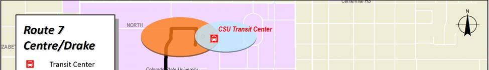
16 Route 3 Elizabeth/Prospect Route 3 operates in a counterclockwise loop from the CSU Transit Center and travels west on Plum and Elizabeth, south on Overland, east on Prospect, north on Shields, east on Pitkin and north on Meridian back to the CTC. Transit Centers CSU Transit Center Major Destinations Colorado State University Ram s Village Current Operations & Service Requirements (August 28) CSU IN SESSION CSU OUT OF SESSION Weekday Saturday Weekday Saturday Hours of Operation: 6:5 am 6:4 pm n/a n/a n/a Frequency (min): 3 n/a n/a n/a Cycle Time (min): 3 n/a n/a n/a Layover Time (min): 5 n/a n/a n/a Total One Way Trips: 25 n/a n/a n/a Daily Rev Hours: n/a n/a n/a Daily Rev Miles: n/a n/a n/a Peak Buses: 2** n/a n/a n/a FY 28 Route Service Productivity and Rankings* CSU IN SESSION CSU OUT OF SESSION Weekday Saturday Weekday Saturday Avg. Daily Boardings: 754 n/a n/a n/a Pass./Rev. Veh. Hr: 63.7 n/a n/a n/a Ranking (2) Pass./Rev. Veh. Mi: 4.9 n/a n/a n/a Ranking (2) Pass./Trip: 26.9 n/a n/a n/a Ranking (3) * In session statistics are averaged from September November 27 and February April 28. Out of session statistics are averaged from July 27 and June 28. Rankings are out of 16 weekday and 13 Saturday routes when CSU is in session, and 14 weekday and 13 Saturday routes when CSU is out of session. ** Supplemental pm peak service is provided from 2:15 p.m. to 4:4 p.m. Transfort/City of Fort Collins Route 3 Page 1 Route Profile #3 Elizabeth/Prospect
17 Description of Existing Alignment Route 3 operates in a counterclockwise loop, the reverse of Route 2, on weekdays when CSU is in session. From the CSU Transit Center, the route travels west on Plum Street and south on City Park Avenue where it serves high density student housing and a commercial center, then west on Elizabeth Street, serving multi family and single family residences. From here, Route 3 operates south on Overland Trail and east on Prospect Road through single family, multifamily and commercial areas. The route travels north on Shields Street, east on Pitkin Street and north on Meridian Avenue to return to the CTC. Trailer buses are used during afternoon peak hours (around 2:15 to 4:3 p.m.) to alleviate overloading. Key Route Issues and Observations Alignment The alignment is fairly straightforward. Although it is technically a one way loop, it is paired with Route 2 to minimize any out of direction travel for riders. Routing across the CSU campus (with speed limits of 2 mph) can slow this route. A dangerous left turn must be made from Elizabeth to Overland. Stops No stop issues were detected on this route. Schedule Route 3 operates only when CSU is in session, leaving riders with only the reverse direction Route 2 the rest of the time. Trailer buses are used to alleviate overcrowding during the afternoon peak travel period, which can cause difficulty for some riders who are passed by a full bus or want to understand which bus to board. Transfort operators identified that this route was easier to keep on schedule than Route 2, and should be year round with Route 2 operating only when CSU is in session. Route Connections The route is scheduled for timed transfer meets with Routes 2, 4, 6, and 7 at the CTC, and untimed transfers here to Routes 11 and 15. PSD Connections Route 3 does not serve any PSD junior high or high schools. Cycle, Run, and Layover Times Congestion around campus slows this route down, but operators indicate that the layover time of 5 minutes (17% of the 3 minute cycle time) is sufficient. Transfort/City of Fort Collins Route 3 Page 2 Route Profile #3 Elizabeth/Prospect
18 Historical Ridership Characteristics Average daily ridership by month from July 27 to June 28 is presented in the figure below. January and February saw the highest average daily ridership for this strong performing route. Route 3 does not operate when CSU is out of session or on Saturday. Route 3 Monthly Average Daily Ridership Levels (July 27 to June 28) 1,1 1, Weekday Jul Aug Sep Oct Nov Dec Jan Feb Mar Apr May Jun Riders on Route 3 are primarily CSU students and staff, who make up 86% of passengers on this route, more than twice the proportion on the average route. Transfers account for only 1% of ridership, far below Transfort s average transfer rate of 8%. The figure below shows ridership by fare class compared to systemwide averages. Route 3 Ridership by Fare Class (July 27 to June 28) Youth CSU Adult 5% 5%4% Senior/ Disabled Other Systemwide 17% 23% 86% 23% 37% Transfort/City of Fort Collins Route 3 Page 3 Route Profile #3 Elizabeth/Prospect
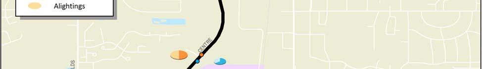
19 Current Ridership Characteristics A ridecheck survey was completed on April 3, 28, when CSU was in session. Passenger boardings and alightings were recorded at every stop on about 85% of systemwide bus trips. Stop data was factored up by average daily ridership by route reported for April 28 in order to approximate a 1% ridecheck. The following survey results are presented below: A graph showing unadjusted weekday ridership activity (boardings and alightings) by time of day; A map that illustrates total adjusted weekday ridership activity by stop; and Graphs that depict adjusted weekday boarding and alighting activity by stop, by direction, along with average daily line loads. Ride Check Observations About 41% of boardings and alightings occurred at the CTC. Vehicle loads indicate riders use Route 3 to travel from campus to Elizabeth and to campus from Prospect. Of the other stops, Elizabeth & Ram Point (9%) and Elizabeth & Taft Hill (7%) had the most activity. As a whole, the Elizabeth segment had twice the activity than the Prospect segment (32% to 16%). Route 3 s ridership grew throughout the day, with a long flat peak from 1PM through 4PM. Route 3 Weekday Ridership by Time of Day and Direction Boardings AM 7 AM 8 AM 9 AM 1 AM 11 AM 12 PM 1 PM 2 PM 3 PM 4 PM 5 PM 6 PM 7 PM Start of Trip *Portions of two morning trips were not counted. Transfort/City of Fort Collins Route 3 Page 4 Route Profile #3 Elizabeth/Prospect
20 Transfort/City of Fort Collins Route 3 Page 5 Route Profile #3 Elizabeth/Prospect
21 Route 3 Total Weekday Ridership by Stop and Average Line Loads Average Load Boardings Alightings Boardings & Alightings Average Vehicle Load CSU TRANSIT CENTER MOBY (N OF) WB PLUM & COLUMBINE WB CITY PARK & PLUM SB ELIZABETH & CITY PARK WB ELIZABETH & CONSTITUTION WB ELIZABETH & SKYLINE WB ELIZABETH & GLENMOOR WB ELIZABETH & TAFT HILL WB ELIZABETH & RAM'S POINT WB ELIZABETH & CYPRESS WB ELIZABETH & KIMBALL WB ELIZABETH & CUERTO WB OVERLAND & GOLDEN CURRANT SB PROSPECT & OVERLAND EB PROSPECT & LARCH EB PROSPECT & CEDARWOOD EB PROSPECT & FUQUA EB PROSPECT & NORTHBROOK EB PROSPECT & TAFT HILL EB PROSPECT & SKYLINE EB PROSPECT & CONSTITUTION EB PROSPECT & HEATHERIDGE EB PROPECT & STONECREEK APTS EB SHIELDS & LAKE NB PITKIN & SHIELDS (E OF) EB PITKIN & MERIDIAN (W OF) EB CSU TRANSIT CENTER Transfort/City of Fort Collins Route 3 Page 6 Route Profile #3 Elizabeth/Prospect
22 Route 4 LaPorte/Mulberry Route 4 operates in a counter clockwise loop from the CSU Transit Center, north on Loomis, west on LaPorte, south on Taft Hill, and east on Mulberry and Laurel back to CTC. Transit Centers CSU Transit Center Major Destinations Colorado State University City Park Hours of Operation: Current Operations & Service Requirements (August 28) CSU IN SESSION CSU OUT OF SESSION Weekday Saturday Weekday Saturday 6:15 am 1:9 am 12:15 pm 4:9 pm n/a 6:15 am 1:9 am 12:15 pm 4:9 pm Frequency (min): 3 n/a 3 n/a Cycle Time (min): 3 n/a 3 n/a Layover Time (min): 6 n/a 6 n/a Total One Way Trips: 17 n/a 17 n/a Daily Rev Hours: 7.8 n/a 7.8 n/a Daily Rev Miles: n/a n/a Peak Buses: 1 n/a 1 n/a FY 28 Route Service Productivity and Rankings* CSU IN SESSION n/a CSU OUT OF SESSION Weekday Saturday Weekday Saturday Avg. Daily Boardings: 138 n/a 42 n/a Pass./Rev. Veh. Hr: 17.7 n/a 5.4 n/a Ranking (14) (14) Pass./Rev. Veh. Mi: 1.7 n/a.5 n/a Ranking (1) (14) Pass./Trip: 6.9 n/a 2.1 n/a Ranking (13) (14) * In session statistics are averaged from September November 27 and February April 28. Out of session statistics are averaged from July 27 and June 28. Rankings are out of 16 weekday and 13 Saturday routes when CSU is in session, and 14 weekday and 13 Saturday routes when CSU is out of session. Transfort/City of Fort Collins Route 4 Page 1 Route Profile #4 LaPorte/Mulberry
23 Description of Existing Alignment Route 4 is a counter clockwise loop that serves the CSU Transit Center and residential areas to the northwest. From the CSU Transit Center, Route 4 travels north on Loomis Avenue, west on LaPorte Avenue, south on Taft Hill Road, east on Mulberry Street, south on City Park Avenue, east on Birch Street, south on Shields Street, and east on Laurel Street to return to the CSU Transit Center. Most of the route comprises of single family residences, student housing and the City Park recreational area, with the greatest densities along City Park, Birch and Laurel. Key Route Issues and Observations Alignment Route 4 is a fairly direct counter clockwise loop that meanders a bit through local neighborhoods as it returns to CTC. As a large one way loop, it creates the potential for significant out of direction travel for its riders. Transfort operators indicated that LaPorte Avenue does not warrant enough demand for service from both Routes 4 and 9. They also indicate the route may be improved by extending to Overland to access Poudre HS and more residential areas. Stops Transfort operators identified the need to paint the curb red in front of the stop at Birch Street and Wagner Drive for safety. Schedule Route 4 operates Monday through Friday year round; however, the route does not run between 1:9 a.m. and 12: 15 p.m. or after 4:9 p.m. due to low ridership. Despite operating at 3 minute frequencies, the sporadic service span may prevent new ridership to be attracted to the route. Route Connections The route is scheduled for timed transfer meets with Routes 2, 3, 6 and 7 at CTC. Due to schedule variations, it does not always provide a good transfer to Routes 11 or 15. Transfort operators suggested moving the timepoints up two minutes to allow for transfers with Route 15. An additional timed transfer with Route 9 along Laporte would allow better access for Poudre HS students to transfer to CSU without traveling to the DTC. PSD Connections Route 4 does not serve any schools directly, although analysis of riders by fare class indicate that 3% of riders are youth fare, most likely coming from Poudre HS. Cycle, Run, and Layover Times Route 4 has no on time issues. If anything, it has excess schedule time. The layover time of 6 minutes is 2% of the 3 minute cycle time. Additionally, excess time was noted at the Loomis and LaPorte timepoint where the schedule provides 7 minutes, but only needs 4 minutes, leaving great potential to more efficiently use this route s resources. Transfort/City of Fort Collins Route 4 Page 2 Route Profile #4 LaPorte/Mulberry
24 Historical Ridership Characteristics Average daily ridership by month from July 27 to June 28 is presented in the figure below. Weekday ridership when CSU is in session is three times greater than when school is out. Route 4 Monthly Average Daily Ridership Levels (July 27 to June 28) 2 Weekday 1 Jul Aug Sep Oct Nov Dec Jan Feb Mar Apr May Jun Riders on Route 4 are primarily CSU students and staff, who make up almost half of passengers on this route. Additionally, 3% of passengers are youth, which is higher than the system average. Transfers account for about 4% of ridership, below Transfort s average transfer rate of 8%. The figure below shows ridership by fare class compared to systemwide averages. Route 4 Ridership by Fare Class (July 27 to June 28) Youth CSU Adult 12% 11% 3% Senior/ Disabled Other Systemwide 17% 23% 47% 23% 37% Transfort/City of Fort Collins Route 4 Page 3 Route Profile #4 LaPorte/Mulberry
25 Current Ridership Characteristics A ridecheck survey was completed on April 3, 28, when CSU was in session. Passenger boardings and alightings were recorded at every stop on about 85% of systemwide bus trips. Stop data was factored up by average daily ridership by route reported for April 28 in order to approximate a 1% ridecheck. The following survey results are presented below: A graph showing unadjusted weekday ridership activity (boardings and alightings) by time of day; A map that illustrates total adjusted weekday ridership activity by stop; and Graphs that depict adjusted weekday boarding and alighting activity by stop, by direction, along with average daily line loads. Ride Check Observations About 44% of ridership activity occurs at the CTC, with the remainder spread evenly across the rest of the alignment. Ridership peaks in the morning and again in the early afternoon, with highest ridership occurring between 7AM and 8AM. This roughly coincides with the school day of most of this route s riders. Route 4 Weekday Ridership by Time of Day and Direction 3 25 Boardings AM 7 AM 8 AM 9 AM 1 AM 11 AM 12 PM 1 PM 2 PM 3 PM Start of Trip *The first trip of the day was not counted. Transfort/City of Fort Collins Route 4 Page 4 Route Profile #4 LaPorte/Mulberry
26 Transfort/City of Fort Collins Route 4 Page 5 Route Profile #4 LaPorte/Mulberry
27 Route 4 Total Weekday Ridership by Stop and Average Line Loads Average Load Boardings Alightings 7 Boardings & Alightings Average Vehicle Load CSU TRANSIT CENTER MERIDIAN & PLUM NB LOOMIS & MYRTLE NB LOOMIS & OAK NB LAPORTE & LOOMIS WB LAPORTE & WOOD WB LAPORTE & SHIELDS WB LAPORTE & McKINLEY WB LAPORTE & FISHBACK WB LAPORTE & FORNEY WB LAPORTE & GRANDVIEW WB LAPORTE & TAFT HILL WB TAFT HILL & LAPORTE (S OF) SB MULBERRY & TAFT HILL EB MULBERRY & COOK EB MULBERRY & BRYAN EB CITY PARK & MYRTLE SB BIRCH & CITY PARK EB BIRCH & WAGNER EB LAUREL & SHIELDS EB LAUREL & WASHINGTON EB MERIDIAN & PLUM SB CSU TRANSIT CENTER Transfort/City of Fort Collins Route 4 Page 6 Route Profile #4 LaPorte/Mulberry
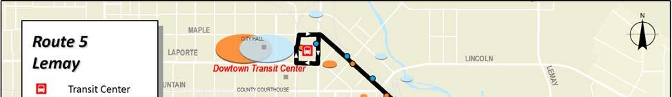
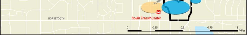
28 Route 5 Lemay Route 5 operates south from the Downtown Transit Center on Riverside and Lemay, then travels west on Horsetooth to the South Transit Center. Transit Centers Major Destinations Downtown Transit Center Downtown Fort Collins South Transit Center Wal Mart VA Clinic Poudre Valley Hospital Woodward Governor Foothills Mall Current Operations & Service Requirements (August 28) CSU IN SESSION CSU OUT OF SESSION Weekday Saturday Weekday Saturday Hours of Operation: 6:24 am 7:15 pm 6:24 am 7:15 pm 6:24 am 7:15 pm 6:24 am 7:15 pm Frequency (min): Cycle Time (min): Layover Time (min): Total One Way Trips: Daily Rev Hours: Daily Rev Miles: Peak Buses: FY 28 Route Service Productivity and Rankings* CSU IN SESSION CSU OUT OF SESSION Weekday Saturday Weekday Saturday Avg. Daily Boardings: Pass./Rev. Veh. Hr: Ranking (11) (9) (9) (7) Pass./Rev. Veh. Mi: Ranking (9) (9) (5) (5) Pass./Trip: Ranking (9) (7) (7) (6) * In session statistics are averaged from September November 27 and February April 28. Out of session statistics are averaged from July 27 and June 28. Rankings are out of 16 weekday and 13 Saturday routes when CSU is in session, and 14 weekday and 13 Saturday routes when CSU is out of session. Transfort/City of Fort Collins Route 5 Page 1 Route Profile #5 Lemay
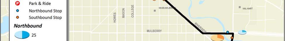
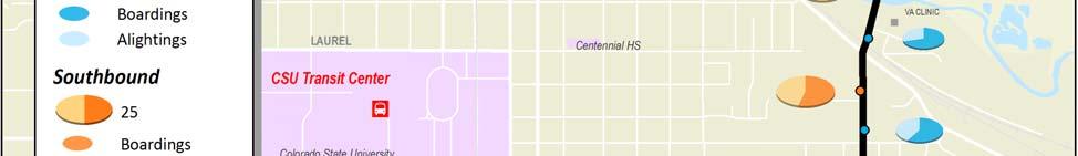
29 Description of Existing Alignment From the CSU Transit Center, Route 5 travels southward from the Downtown Transit Center along Riverside Avenue, east on Mulberry Street to the Wal Mart Shopping Center and south on Lemay Avenue through commercial, office, multifamily and single family areas, including senior living communities. The route then travels west on Horsetooth Road passing multifamily communities before looping north on Stanford Road and west into Foothills Mall and the South Transit Center. Key Route Issues and Observations Alignment Route 5 is a north south route that connects the DTC and the STC. The route is fairly direct with a slight deviation on Mulberry and south on Lemay to serve the Wal Mart Shopping Center. The route is impacted by railroad crossings on Mulberry and Lemay and tracks parallel to Riverside. Stops The stop at Mulberry and Lemay that serves the Wal Mart Shopping Center does not provide good pedestrian access to the shopping center. There are no stops along a one mile segment of the route from Riverside & Lincoln to Mulberry & Lemay. Schedule Route 5 operates at consistent 6 minute service frequencies Monday through Saturday, year round. Transfort operators identified the timing with the South Transit Center is insufficient for connections with Route 6 and FoxTrot. Route Connections This route has timed connections with Routes 8, 9, 14 and 18 at the DTC. Due to schedule variations, Route 5 has only limited connectivity to Routes 1 and 15 at the DTC. At STC, the route has timed transfers to Routes 16 and FoxTrot, but is not timed well to meet Routes 1, 6, and 7. An untimed connection to Route 18 occurs at Prospect and Lemay. PSD Connections Route 5 does not provide direct access to any PSD schools. Cycle, Run, and Layover Times Railroad crossings can adversely affect timing on Route 5. The layover time of 14 minutes is 23% of the 6 minute cycle time and is sufficient for on time operations under normal conditions. Transfort/City of Fort Collins Route 5 Page 2 Route Profile #5 Lemay
30 Historical Ridership Characteristics Average daily ridership by month from July 27 to June 28 is presented in the figure below. Ridership on this route does not fluctuate when CSU is in and out of session and remains relatively steady throughout the year. Route 5 Monthly Average Daily Ridership Levels (July 27 to June 28) 4 Weekday Saturday Jul Aug Sep Oct Nov Dec Jan Feb Mar Apr May Jun 33% of the riders on Route 5 are Senior/Disabled fares, nearly double the system average, and 32% are adult fares, also above average. These trends make sense given some of the destinations along this route, such as the VA Clinic, Poudre Valley Hospital, and senior living communities. Transfers account for about 8% of ridership, same as the average transfer rate. The figure below shows ridership by fare class compared to systemwide averages. Route 5 Ridership by Fare Class (July 27 to June 28) Youth CSU Adult Senior/ Disabled Other 33% 28% Systemwide 6% 17% 23% 32% 23% 37% Transfort/City of Fort Collins Route 5 Page 3 Route Profile #5 Lemay
31 Current Ridership Characteristics A ridecheck survey was completed on April 3, 28, when CSU was in session. Passenger boardings and alightings were recorded at every stop on about 85% of systemwide bus trips. Stop data was factored up by average daily ridership by route reported for April 28 in order to approximate a 1% ridecheck. The following survey results are presented below: A graph showing unadjusted weekday ridership activity (boardings and alightings) by time of day; A map that illustrates total adjusted weekday ridership activity by stop; and Graphs that depict adjusted weekday boarding and alighting activity by stop, by direction, along with average daily line loads. Ride Check Observations Almost half of the ridership activity on Route 5 occurs at one of the route ends, with 23% at DTC and 25% at STC. This leads to steady loads across the length of the route. The majority of the remaining activity occurs on Lemay between Mulberry and Stuart, which sees 38% of the route s boardings and alightings. Despite being over a third of the route length, the Riverside and Horsetooth segments show very little ridership (3%). Ridership is steady throughout the day, with a small northbound spike at 7AM and a large southbound spike at 2PM. The afternoon increase is a result of heavy activity at Lemay & Prospect and Lemay & Stuart. Route 5 Weekday Ridership by Time of Day and Direction Northbound Southbound 35 Boardings AM 7 AM 8 AM 9 AM 1 AM 11 AM 12 PM 1 PM 2 PM 3 PM 4 PM 5 PM 6 PM Start of Trip *A portion of the first trip of the day and last trip of the day were not counted. Transfort/City of Fort Collins Route 5 Page 4 Route Profile #5 Lemay
32 Transfort/City of Fort Collins Route 5 Page 5 Route Profile #5 Lemay
33 Route 5 Total Weekday Ridership by Stop and Average Line Loads (Northbound) Average Load Boardings Alightings 8 7 Boardings & Alightings Average Vehicle Load THE SQUARE SHOPPING CTR HORSETOOTH & STOVER EB LEMAY & HORSETOOTH NB LEMAY & SWALLOW NB LEMAY & OXFORD NB LEMAY & DRAKE NB LEMAY & PARKWOOD NB LEMAY & STUART NB LEMAY & PROSPECT NB LEMAY & POUDRE VALLEY HOSP NB LEMAY AVENUE & ELIZABETH STREET NB LEMAY AVENUE & POUDRE RIVER DR NB MULBERRY AVENUE & LEMAY AVENUE WB RIVERSIDE AVE & LINCOLN AVE NB JEFFERSON ST & LINDEN ST NB COLLEGE & MAPLE SB DTC Transfort/City of Fort Collins Route 5 Page 6 Route Profile #5 Lemay
34 Route 5 Total Weekday Ridership by Stop and Average Line Loads (Southbound) Average Load Boardings Alightings 7 Boardings & Alightings Average Vehicle Load DTC JEFFERSON & LINDEN EB RIVERSIDE AVE & LINCOLN AVE SB LEMAY AVE & MULBERRY SB LEMAY AVE & PENNOCK PL SB LEMAY & POUDRE VALLEY HOSPITAL SB LEMAY & PROSPECT SB LEMAY & STUART SB LEMAY & COLUMBIA SB LEMAY & DRAKE SB LEMAY & OXFORD SB LEMAY & SWALLOW SB LEMAY & MANSFIELD SB HORSETOOTH & LEMAY WB HORSETOOTH & STOVER WB MONROE & JFK WB THE SQUARE SHOPPING CTR Transfort/City of Fort Collins Route 5 Page 7 Route Profile #5 Lemay
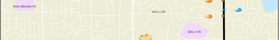
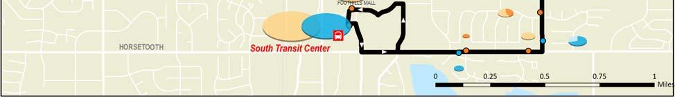
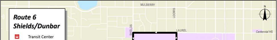
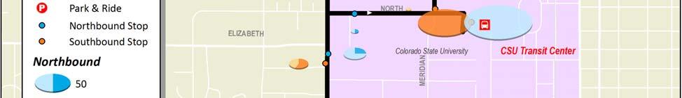
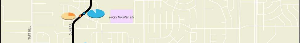
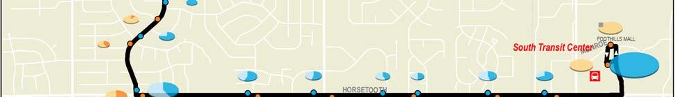
35 Route 6 Shields/Dunbar Route 6 operates south from the CSU Transit Center on Shields, west on Stuart, south on Taft Hill, east on Drake, south on Dunbar and east on Horsetooth to the South Transit Center. Transit Centers CSU Transit Center South Transit Center Major Destinations Colorado State University Colorado DMV Blevins Jr HS Rocky Mountain HS Foothills Mall Current Operations & Service Requirements (August 28) CSU IN SESSION CSU OUT OF SESSION Weekday Saturday Weekday Saturday Hours of Operation: 6:15 am 7:1 pm 6:15 am 7:1 pm 6:15 am 7:1 pm 6:15 am 7:1 pm Frequency (min): Cycle Time (min): Layover Time (min): Route 6 is interlined with Route 16 for a combined cycle time of 12 min with 38 min of layover. Total One Way Trips: Daily Rev Hours: Daily Rev Miles: Peak Buses: FY 28 Route Service Productivity and Rankings* CSU IN SESSION CSU OUT OF SESSION Weekday Saturday Weekday Saturday Avg. Daily Boardings: Pass./Rev. Veh. Hr: Ranking (4) (6) (5) (4) Pass./Rev. Veh. Mi: Ranking (5) (7) (6) (6) Pass./Trip: Ranking (4) (6) (5) (2) * In session statistics are averaged from September November 27 and February April 28. Out of session statistics are averaged from July 27 and June 28. Rankings are out of 16 weekday and 13 Saturday routes when CSU is in session, and 14 weekday and 13 Saturday routes when CSU is out of session. Transfort/City of Fort Collins Route 6 Page 1 Route Profile #6 Shields/Dunbar
36 Description of Existing Alignment Route 6 provides service to the southwest area between the CSU Transit Center and South Transit Center. From the CSU Transit Center, Route 6 travels through campus traveling north on Meridian Avenue and west on Laurel Street to Shields Street. Return trips travel east on Plum Street from Shields Street to the CTC. Route 6 travels south on Shields Street passing single family, multi family and commercial areas, as well as the DMV. The route turns west on Stuart Street through multi family and single family communities. Route 6 travels south on Taft Hill serving Blevins Junior High School, single family homes and a Safeway Shopping Center. From here, Route 6 turns back east on Drake Road which is comprised primarily of single family homes and multi family communities near Dunbar Avenue. On Dunbar Avenue, the route winds south through middle to high income single family neighborhoods before continuing east on Horsetooth Road serving middle to high income commercial, single family and multi family areas until the route ends at the South Transit Center at Foothills Mall. Key Route Issues and Observations Alignment Route 6 is fairly indirect, winding south and west on Shields and Stuart to Taft Hill before turning back south and east to access STC via Horsetooth. Speed humps and slow speed limits on Stuart and Dunbar can slow this route. According to Transfort operators, a long left turn signal at Shields and Stuart causes delays, as well as a difficult un signalized left turn from Stuart to Taft Hill. Stops The northbound stop at Dunbar and Horsetooth was observed to be too close to the intersection. Additionally, Transfort operators identified the eastbound stop at Horsetooth and Dunbar as a dangerous place for passengers to unload. Schedule Route 6 presently operates at 6 minute frequencies throughout the year. Ridership data shows much higher passenger volumes when CSU is in session. Drivers have also expressed the need for more frequent service when CSU is in session. Route Connections The route is scheduled for timed transfer meets with Routes 2, 3, 4 and 7 at CTC. The route does not have a good meet time at CTC with Routes 11 or 15. At STC, Route 6 is timed to meet Route 7 and FoxTrot and is interlined with Route 16, but has only limited ability to connect to Routes 1 and 5. Transfort operators also identified transfers occurring at Shields & Lake to meet Routes 2 and 3 at Prospect. PSD Connections Route 6 provides service to Blevins Junior High School and Rocky Mountain High School. Cycle, Run, and Layover Times Congestion on the CSU campus and in the Foothills Mall retail area, in addition to slow neighborhood streets, adversely impact run time. There is ample 38 minutes of layover time (32%) for the 12 minute cycle time of the interlined Transfort/City of Fort Collins Route 6 Page 2 Route Profile #6 Shields/Dunbar
37 6/16 route. However, drivers have indicated that Route 6 outbound bus trips are often running late in the afternoon because of CSU traffic and slow neighborhood street speeds, resulting in tight connections to the FoxTrot at the South Transit Center. Historical Ridership Characteristics Average daily ridership by month from July 27 to June 28 is presented in the figure below. Weekday ridership when CSU is in session is 75% higher than when CSU is out of session. Route 6 Monthly Average Daily Ridership Levels (July 27 to June 28) 7 6 Weekday Saturday Jul Aug Sep Oct Nov Dec Jan Feb Mar Apr May Jun Riders on Route 6 are primarily youth, who make up 37% of passengers on this route. This route proportionally carries more youth riders than the average route, and an average fraction of CSU riders. Transfers account for about 6% of ridership, below Transfort s average transfer rate of 8%. The figure below shows ridership by fare class compared to systemwide averages. Transfort/City of Fort Collins Route 6 Page 3 Route Profile #6 Shields/Dunbar
38 Route 6 Ridership by Fare Class (July 27 to June 28) Youth CSU Adult 14% Senior/ Disabled Other 17% 37% Systemwide 17% 23% 32% 23% 37% Current Ridership Characteristics A ridecheck survey was completed on April 3, 28, when CSU was in session. Passenger boardings and alightings were recorded at every stop on about 85% of systemwide bus trips. Stop data was factored up by average daily ridership by route reported for April 28 in order to approximate a 1% ridecheck. The following survey results are presented below: A graph showing unadjusted weekday ridership activity (boardings and alightings) by time of day; A map that illustrates total adjusted weekday ridership activity by stop; and Graphs that depict adjusted weekday boarding and alighting activity by stop, by direction, along with average daily line loads. Ride Check Observations About 26% of rider activity occurred at CTC, with another 12% at STC. The next highest activity occurred at Rocky Mountain HS (9%) and Blevins Jr HS (6%). There is steady activity along the length of the route, however vehicle loads increase with proximity to CSU, and decrease south of Rock Mountain HS. Ridership peaks in the morning and again in the early afternoon, with highest ridership occurring between 2PM and 4PM. This roughly coincides with the end of the school day for most of the route s riders. Transfort/City of Fort Collins Route 6 Page 4 Route Profile #6 Shields/Dunbar
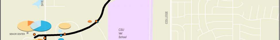
39 Route 6 Weekday Ridership by Time of Day and Direction 7 6 Northbound Southbound 5 Boardings AM 7 AM 8 AM 9 AM 1 AM 11 AM 12 PM 1 PM 2 PM 3 PM 4 PM 5 PM Start of Trip *The first two trips of the day were not counted. Transfort/City of Fort Collins Route 6 Page 5 Route Profile #6 Shields/Dunbar
40 Transfort/City of Fort Collins Route 6 Page 6 Route Profile #6 Shields/Dunbar
41 Route 6 Total Weekday Ridership by Stop and Average Line Loads (Northbound) Average Load Boardings Alightings Boardings & Alightings Average Vehicle Load THE SQUARE SHOPPING CTR HORSETOOTH & MASON WB HORSETOOTH & MEADOWLARK WB HORSETOOTH & COLONY WB HORSETOOTH & WINDMILL (W OF) WB HORSETOOTH & SHIELDS WB HORSETOOTH & SENECA WB DUNBAR & HORSETOOTH NB DUNBAR & BIRMINGHAM NB DUNBAR & CASA GRANDE NB DUNBAR & SWALLOW NB DUNBAR & HASTINGS NB DRAKE & DUNBAR WB DRAKE & CONSTITUTION WB TAFT HILL & DRAKE NB TAFT HILL & MANCHESTER NB TAFT HILL & STUART NB STUART & RIDGEWOOD EB STUART & CONSTITUTION EB STUART & HEATHERIDGE EB STUART & HERITAGE EB SHIELDS & STUART NB SHIELDS & LAKE NB SHIELDS & ELIZABETH NB PLUM & MOBY ARENA EB CSU TRANSIT CENTER Transfort/City of Fort Collins Route 6 Page 7 Route Profile #6 Shields/Dunbar
42 Route 6 Total Weekday Ridership by Stop and Average Line Loads (Southbound) Average Load Boardings Alightings 12 1 Boardings & Alightings Average Vehicle Load CSU TRANSIT CENTER MERIDIAN & PLUM NB SHIELDS & UNIVERSITY SB SHIELDS & PROSPECT SB STUART & HERITAGE WB STUART & HEATHERIDGE WB STUART & CONSTITUTION WB STUART & RIDGEWOOD WB TAFT HILL & BLEVINS JR HS SB TAFT HILL & MANCHESTER SB TAFTHILL & VALLEY FORGE SB DRAKE & TAFT HILL (E OF) EB DRAKE & CONSTITUTION EB DUNBAR & DRAKE SB DUNBAR & SWALLOW SB DUNBAR & KITTERY SB DUNBAR & BIRMINGHAM SB HORSETOOTH & DUNBAR EB HORSETOOTH & SENECA EB HORSETOOTH & SHIELDS EB HORSETOOTH & TRADITION EB HORSETOOTH & MANHATTAN EB HORSETOOTH & MASON EB MONROE & JFK WB THE SQUARE SHOPPING CTR Transfort/City of Fort Collins Route 6 Page 8 Route Profile #6 Shields/Dunbar

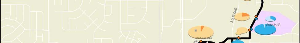
43 Route 7 Centre/Drake Route 7 operates south from CSU on Centre Avenue to the Fort Collins Senior Center, then continues on Drake and Stover to the South Transit Center. Transit Centers CSU Transit Center South Transit Center Major Destinations Colorado State University Fort Collins Senior Center CSU Vet School Foothills Mall Boltz Jr HS Current Operations & Service Requirements (August 28) CSU IN SESSION CSU OUT OF SESSION Weekday Saturday Weekday Saturday Hours of Operation: 6:45 am 7:9 pm 6:45 am 6:39 pm 6:45 am 6:39 pm 6:45 am 6:39 pm Frequency (min): Cycle Time (min): Layover Time (min): Total One Way Trips: Daily Rev Hours: Daily Rev Miles: Peak Buses: FY 28 Route Service Productivity and Rankings* CSU IN SESSION CSU OUT OF SESSION Weekday Saturday Weekday Saturday Avg. Daily Boardings: Pass./Rev. Veh. Hr: Ranking (15) (11) (11) (12) Pass./Rev. Veh. Mi: Ranking (14) (1) (11) (11) Pass./Trip: Ranking (11) (9) (1) (9) * In session statistics are averaged from September November 27 and February April 28. Out of session statistics are averaged from July 27 and June 28. Rankings are out of 16 weekday and 13 Saturday routes when CSU is in session, and 14 weekday and 13 Saturday routes when CSU is out of session. Transfort/City of Fort Collins Route 7 Page 1 Route Profile #7 Centre/Drake
44 Description of Existing Alignment From the CSU Transit Center, Route 7 travels southward across the CSU campus to Centre Avenue. The route passes multi unit residential areas on Centre north and south of Prospect Road before winding through low density business park and university research areas. Route 7 then deviates to the Fort Collins Senior Center before traveling east on Drake Road. Drake Road is highlighted by retail development at Shields Street and College Avenue, the CSU Vet School, and single family and multi unit residential. The route passes a smaller business park as it turns south onto Stover Street, which offers mostly residential (including multi unit) and passes Boltz Junior High School before looping westward to the South Transit Center. Key Route Issues and Observations Alignment Route 7 is fairly indirect, winding south and west on Centre to Shields before an east west segment on Drake, then tuning south and west again to access STC. The route also includes a mid route deviation to the senior center that adds still more time for riders wishing to directly connect between CTC and STC. Speed humps on Lake Street and significant routing across the CSU campus (with speed limits of 2 mph) can also slow this route. Stops No stop issues were detected on this route. Schedule Route 7 is the only route that operates variable service depending on CSU s schedule, with 3 minute weekday frequencies for in session and 6 minute frequencies for out of session. This may prove a challenge to attracting non university ridership. Route Connections The route is scheduled for timed transfer meets with Routes 2, 3, 4 and 6 at CTC. The route does not have a good meet time at CTC with Routes 11 or 15. At STC, Route 7 is timed to meet Route 6/16 and FoxTrot, but due to schedule variations, has only limited ability to connect to Routes 1 and 5. PSD Connections Route 7 provides service to Boltz Junior High School. Cycle, Run, and Layover Times Out side of some congestion on the CSU campus or in the Foothills Mall retail area, no major on time issues were observed. The 6 minute cycle time, which includes 12 minutes of layover (2%) seems very sufficient. Transfort/City of Fort Collins Route 7 Page 2 Route Profile #7 Centre/Drake
45 Historical Ridership Characteristics Average daily ridership by month from July 27 to June 28 is presented in the figure below. Weekday ridership when CSU is in session is about three times greater than when school is out, in part due to the higher frequency of service. Route 7 Monthly Average Daily Ridership Levels (July 27 to June 28) 5 4 Weekday Saturday Jul Aug Sep Oct Nov Dec Jan Feb Mar Apr May Jun Riders on Route 7 are primarily CSU students and staff, who make up 44% of passengers on this route. This route proportionally carries more CSU and Senior/Disabled riders than the average route. Transfers account for about 5% of ridership, below Transfort s average transfer rate of 8%. The figure below shows ridership by fare class compared to systemwide averages. Route 7 Ridership by Fare Class (July 27 to June 28) Youth CSU Adult 22% 19% Senior/ Disabled Other Systemwide 15% 17% 23% 44% 23% 37% Transfort/City of Fort Collins Route 7 Page 3 Route Profile #7 Centre/Drake
46 Current Ridership Characteristics A ridecheck survey was completed on April 3, 28, when CSU was in session. Passenger boardings and alightings were recorded at every stop on about 85% of systemwide bus trips. Stop data was factored up by average daily ridership by route reported for April 28 in order to approximate a 1% ridecheck. The following survey results are presented below: A graph showing unadjusted weekday ridership activity (boardings and alightings) by time of day; A map that illustrates total adjusted weekday ridership activity by stop; and Graphs that depict adjusted weekday boarding and alighting activity by stop, by direction, along with average daily line loads. Ride Check Observations Almost half of the ridership activity on Route 7 occurs at one of the route ends, with 27% at CTC and 2% at STC. This leads to steady loads across the length of the route. After the transit centers, stops at the Senior Center, Drake & Shields, and Drake & Stover are the highest generators, with about 6 7% each of total route ridership. The Drake corridor in general has the strongest rider densities on the alignment. Ridership peaks in the morning and again in the early afternoon, with highest ridership occurring between 2PM and 3PM. This roughly coincides with the end of the junior high school day, senior center programming, and possible classes at CSU. Route 7 Weekday Ridership by Time of Day and Direction 4 35 Northbound Southbound 3 Boardings AM 7 AM 8 AM 9 AM 1 AM 11 AM 12 PM 1 PM 2 PM 3 PM 4 PM 5 PM 6 PM Start of Trip Transfort/City of Fort Collins Route 7 Page 4 Route Profile #7 Centre/Drake

47 Transfort/City of Fort Collins Route 7 Page 5 Route Profile #7 Centre/Drake
48 Route 7 Total Weekday Ridership by Stop and Average Line Loads (Northbound) Average Load Boardings Alightings 9 8 Boardings & Alightings Average Vehicle Load THE SQUARE SHOPPING CTR MONROE & STANFORD (E OF) EB STOVER & BOLTZ DR NB STOVER & BOLTZ JR HS NB STOVER & SWALLOW NB STOVER & DEL CLAIR NB DRAKE & STOVER WB DRAKE & STANFORD WB DRAKE & TULANE (W OF) WB DRAKE & COLLEGE (E OF) WB DRAKE & COLLEGE (@ K MART) WB DRAKE & CSU VET SCHOOL WB DRAKE & RESEARCH WB DRAKE & WORTHINGTON WB DRAKE & DAVIDSON WB SHIELDS & DRAKE NB SENIOR CENTER WB CENTRE & WORTHINGTON EB CENTRE & RESEARCH EB CENTRE & NAT RES RESEARCH CTR NB CENTRE & BAY NB CSU TRANSIT CENTER Transfort/City of Fort Collins Route 7 Page 6 Route Profile #7 Centre/Drake
49 Route 7 Total Weekday Ridership by Stop and Average Line Loads (Southbound) Average Load Boardings Alightings Boardings & Alightings Average Vehicle Load CSU TRANSIT CENTER MERIDIAN & LAKE SB CENTRE & BAY SB CENTRE & NAT RES RESEARCH CTR W CENTRE & RESEARCH WB CENTRE & WORTHINGTON WB SENIOR CENTER WB SHIELDS & RAINTREE SB DRAKE & SHIELDS EB DRAKE & DAVIDSON EB DRAKE & WORTHINGTON EB DRAKE & MEADOWLARK EB DRAKE PROFESSIONAL PARK EB DRAKE & COLLEGE (W OF) EB DRAKE & COLLEGE (E OF) EB DRAKE & STANFORD EB STOVER & DRAKE SB STOVER & STRACHAN SB STOVER & SWALLOW SB STOVER & OAKBROOK SB STOVER & BOLTZ DR SB MONROE & STOVER (W OF) WB MONROE & JFK WB THE SQUARE SHOPPING CTR Transfort/City of Fort Collins Route 7 Page 7 Route Profile #7 Centre/Drake
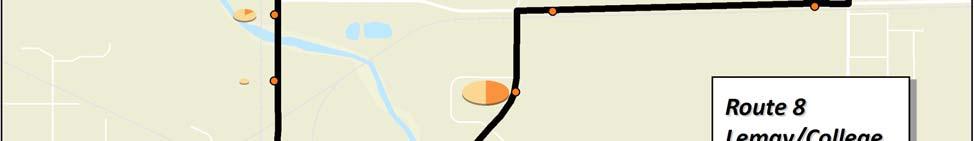
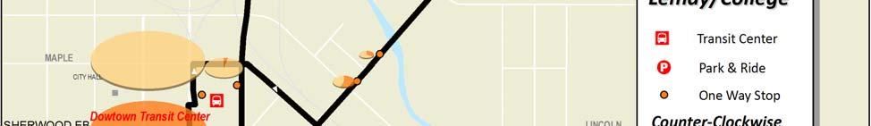
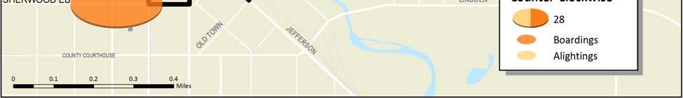
50 Route 8 Lemay/College Route 8 operates in a counter clockwise loop from the Downtown Transit Center traveling north on Linden and east on Vine to Lemay, then winding north and west on Conifer, Blue Spruce, Willox and College to the Poudre Valley Mobile Home Park, before returning south on College to the DTC. Transit Centers Downtown Transit Center Major Destinations Downtown Fort Collins Larimer County Department of Human Service Poudre Valley Mobile Home Park Current Operations & Service Requirements (August 28) CSU IN SESSION CSU OUT OF SESSION Weekday Saturday Weekday Saturday Hours of Operation: 6:22 am 6:49 pm 6:22 am 6:49 pm 6:22 am 6:49 pm 6:22 am 6:49 pm Frequency (min): Cycle Time (min): Layover Time (min): Total One Way Trips: Daily Rev Hours: Daily Rev Miles: Peak Buses: FY 28 Route Service Productivity and Rankings* CSU IN SESSION CSU OUT OF SESSION Weekday Saturday Weekday Saturday Avg. Daily Boardings: Pass./Rev. Veh. Hr: Ranking (6) (1) (1) (1) Pass./Rev. Veh. Mi: Ranking (7) (2) (2) (3) Pass./Trip: Ranking (6) (1) (2) (4) * In session statistics are averaged from September November 27 and February April 28. Out of session statistics are averaged from July 27 and June 28. Rankings are out of 18 weekday and 13 Saturday routes when CSU is in session, and 15 weekday and 13 Saturday routes when CSU is out of session. Transfort/City of Fort Collins Route 8 Page 1 Route Profile #8 Lemay/College
51 Description of Existing Alignment Route 8 is a counter clockwise loop that serves the Downtown Transit Center and areas northeast. From the DTC, Route 8 travels southeast on Jefferson Street and northeast on Linden Street through an industrial area, and east on Vine Drive, serving Larimer County Services offices and low density industrial areas. The route travels north on Lemay Avenue with one stop at the Alta Vista neighborhood. From here, Route 5 turns west on Conifer Street, where it provides service to low density single family and multi family residences, as well as a community center. The route travels north on Blue Spruce Drive, providing service to the Food Bank and the Larimer County Department of Human Services. The route then travels west on Willox Lane through a commercial area and north on College Avenue, where it turns around at the Poudre Valley Mobile Home Park. Finally, Route 5 returns south on College Avenue to the DTC serving commercial areas and the Northside Aztlan Community Center. Key Route Issues and Observations Alignment Route 8 is a circuitous counter clockwise loop, meaning significant out ofdirection travel times will be incurred by many riders. Transfort operators identified the need for a left turn signal into the Poudre Valley Mobile Home Park. The route also makes four railroad crossings. Stops Transfort operators noted that stops were located across the street from the buildings, causing passengers to cross the street without crosswalks. The stop for the Senior Center on Blue Spruce requires a long walk. Operators also identified the stops on Linden Street at Willow Street and the bridge as too close together. Additionally, the eastbound stop on Vine Drive at Lemay Avenue does not have a pad or sidewalk. The stop northbound on College at Willox Lane was identified as unnecessary, as the Albertsons stop is sufficient. Schedule Route 8 operates consistent 3 minute frequencies year round Monday through Saturday. No major schedule issues were determined. Route Connections This route has timed connections with Routes 5, 9, 14 and 18 at the DTC, but only limited connectivity to Routes 1 and 15 due to schedule variations. PSD Connections There are no PSD schools served by Route 8. Cycle, Run, and Layover Times Transfort operators identified an increase in the use of the wheelchair lifts on this route, which has impacted the run time. The schedule can also be impacted by train traffic, in which passengers unload at Maple Street and walk to the DTC. The layover time for this route is only 3 minutes (1%) of the 3 minute cycle time, leaving little time for delays. Transfort/City of Fort Collins Route 8 Page 2 Route Profile #8 Lemay/College
52 Historical Ridership Characteristics Average daily ridership by month from July 27 to June 28 is presented in the figure below. Weekday ridership when CSU is in session is only slightly higher than when school is out, at 7%. Route 8 is one of the best performing routes apart from service to CSU. Route 8 Monthly Average Daily Ridership Levels (July 27 to June 28) 5 4 Weekday Saturday Jul Aug Sep Oct Nov Dec Jan Feb Mar Apr May Jun With CSU students and staff only making up 2% of the ridership, Route 8 proportionally carries more youth, adult, and senior/disabled riders than the average route. Transfers account for about 9% of ridership, slightly higher than Transfort s average transfer rate. The figure below shows ridership by fare class compared to systemwide averages. Route 8 Ridership by Fare Class (July 27 to June 28) Youth CSU Adult Senior/ Disabled Other 3% 34% Systemwide 17% 23% 2% 33% 23% 37% Transfort/City of Fort Collins Route 8 Page 3 Route Profile #8 Lemay/College
53 Current Ridership Characteristics A ridecheck survey was completed on April 3, 28, when CSU was in session. Passenger boardings and alightings were recorded at every stop on about 85% of systemwide bus trips. Stop data was factored up by average daily ridership by route reported for April 28 in order to approximate a 1% ridecheck. The following survey results are presented below: A graph showing unadjusted weekday ridership activity (boardings and alightings) by time of day; A map that illustrates total adjusted weekday ridership activity by stop; and Graphs that depict adjusted weekday boarding and alighting activity by stop, by direction, along with average daily line loads. Ride Check Observations About 44% of ridership activity occurs at DTC. After the transit center, the two highest activity stops are at the mobile home park (1%) and the human services office (7%). Ridership is stronger on the western half of the route (Blue Spruce, Willox, and College). Only 12% of ridership occurs on the eastern segment from Jefferson through Conifer. Ridership peaks a bit in the mornings and afternoons and is strongest from 2PM to 5PM. Route 8 Weekday Ridership by Time of Day and Direction 6 5 Boardings AM 7 AM 8 AM 9 AM 1 AM 11 AM 12 PM 1 PM 2 PM 3 PM 4 PM 5 PM 6 PM 7 PM Start of Trip *The first trip of the day was not counted. Transfort/City of Fort Collins Route 8 Page 4 Route Profile #8 Lemay/College

54 Transfort/City of Fort Collins Route 8 Page 5 Route Profile #8 Lemay/College
55 Route 8 Total Weekday Ridership by Stop and Average Line Loads Boardings & Alightings Average Vehicle Load Average Load Boardings Alightings DTC LINDEN & WILLOW NB LINDEN & BRIDGE NB LINDEN & BUCKINGHAM (N OF) NB VINE & LINDEN (E OF) EB VINE & ALTA VISTA EB LEMAY & MAIN NB CONIFER & LEMAY WB CONIFER & MATUKA WB CONIFER & SUGARPINE WB CONIFER & REDWOOD WB BLUE SPRUCE & CONIFER NB BLUE SPRUCE & BRISTLECONE SOC SRV BLUE SPRUCE & BUTCH CASSIDY NB WILLOX & BLUE SPRUCE (W OF) WB COLLEGE & WILLOX NB PV MOBILE HOME PARK COLLEGE & WILLOX SB COLLEGE & 161 N COLLEGE SB COLLEGE & BRISTLECONE SB COLLEGE & CONIFER SB COLLEGE & ALPINE SB COLLEGE & VINE SB COLLEGE & WOODLAWN (S OF BRIDGE) SB COLLEGE & MAPLE SB DTC Transfort/City of Fort Collins Route 8 Page 6 Route Profile #8 Lemay/College
56 Route 9 Vine/Laporte Route 9 operates in a counter clockwise loop from the Downtown Transit Center via Cherry and Wood to Vine, returning back to the DTC via Overland Trail and LaPorte Avenue. Transit Centers Downtown Transit Center Major Destinations Downtown Fort Collins Lincoln Jr HS Mt. View Jr HS Poudre HS Current Operations & Service Requirements (August 28) CSU IN SESSION CSU OUT OF SESSION Weekday Saturday Weekday Saturday Hours of Operation: 6:52 am 6:15 pm 6:52 am 6:15 pm 6:52 am 6:15 pm 6:52 am 6:15 pm Frequency (min): Cycle Time (min): Layover Time (min): Route 9 is interlined with Route 14 for a combined cycle time of 6 min with 7 min of layover. Total One Way Trips: Daily Rev Hours: Daily Rev Miles: Peak Buses: FY 28 Route Service Productivity and Rankings* CSU IN SESSION CSU OUT OF SESSION Weekday Saturday Weekday Saturday Avg. Daily Boardings: Pass./Rev. Veh. Hr: Ranking (5) (4) (6) (8) Pass./Rev. Veh. Mi: Ranking (6) (5) (8) (1) Pass./Trip: Ranking (5) (5) (6) (7) * In session statistics are averaged from September November 27 and February April 28. Out of session statistics are averaged from July 27 and June 28. Rankings are out of 16 weekday and 13 Saturday routes when CSU is in session, and 14 weekday and 13 Saturday routes when CSU is out of session. Transfort/City of Fort Collins Route 9 Page 1 Route Profile #9 Vine/Laporte
57 Description of Existing Alignment Route 9 is a counter clockwise loop route that serves areas west of the Downtown Transit Center. From the DTC, Route 9 travels north on Mason Street, west on Cherry Street and north on Wood Street through low and middle income single family areas. Route 9 travels west on Vine serving single family and multi family areas, deviating onto the Lincoln Junior High School campus. From here the route travels south on Overland Trail, through low density single family and west on LaPorte Avenue serving single family and multi family residences, as well as Poudre High School, City Park, Fort Collins Housing Authority and Larimer County offices. The route returns north on Mason to the DTC. Key Route Issues and Observations Alignment Route 9 is a counter clockwise loop that is fairly direct, with one deviation to Lincoln Jr. High School. Because the route is one way, a fair amount of out ofdirection may be required for riders to reach their destination. Transfort operators indicated that LaPorte Avenue does not warrant enough demand for service from both Routes 9 and 4. Stops No stop issues were detected on this route. Schedule Route 9 operates at a 6 minute schedule, which can be especially challenging on a one way route since it often means longer travel times for riders to travel around the loop. Route Connections The route is scheduled for timed transfer meets with Routes 5, 8 and 18 at the DTC, and is interlined with Route 14. Due to schedule variations, Route 9 has only limited connectivity to Routes 1 and 15 at the DTC. PSD Connections Route 9 provides service to Lincoln Junior High School, Mountain View Junior High School and Poudre High School. Cycle, Run, and Layover Times No major on time issues were observed, with the exception of the Route 14 interline carrying delays over into Route 9. The layover time for Route 9 is 7 minutes or 23% of the 3 minute cycle time; however, the interlined Route 14 has 3 minutes of run time with no layover time, for a combined cycle time of 6 minutes with 7 minutes of layover. Transfort/City of Fort Collins Route 9 Page 2 Route Profile #9 Vine/Laporte
58 Historical Ridership Characteristics Average daily ridership by month from July 27 to June 28 is presented in the figure below. Weekday ridership when school is in session is about 75% greater than when school is out, due to the two junior high schools and one high school that this route serves. Route 9 Monthly Average Daily Ridership Levels (July 27 to June 28) 3 Weekday Saturday 2 1 Jul Aug Sep Oct Nov Dec Jan Feb Mar Apr May Jun Riders on Route 9 are primarily youth, who make up 6% of passengers on this route. Only four percent of the riders are CSU students and staff. Transfers account for about 9% of ridership, slightly higher than Transfort s average transfer rate of 8%. The figure below shows ridership by fare class compared to systemwide averages. Route 9 Ridership by Fare Class (July 27 to June 28) Youth CSU Adult 15% Senior/ Disabled Other Systemwide 21% 6% 17% 23% 4% 23% 37% Transfort/City of Fort Collins Route 9 Page 3 Route Profile #9 Vine/Laporte
59 Current Ridership Characteristics A ridecheck survey was completed on April 3, 28, when CSU was in session. Passenger boardings and alightings were recorded at every stop on about 85% of systemwide bus trips. Stop data was factored up by average daily ridership by route reported for April 28 in order to approximate a 1% ridecheck. The following survey results are presented below: A graph showing unadjusted weekday ridership activity (boardings and alightings) by time of day; A map that illustrates total adjusted weekday ridership activity by stop; and Graphs that depict adjusted weekday boarding and alighting activity by stop, by direction, along with average daily line loads. Ride Check Observations 73% of riders on this route use one of only three stops: DTC (42%), Poudre HS (16%) or Lincoln Jr HS (15%). Remaining ridership is spread fairly evenly along the rest of the route. Only 3 boardings and 7 alightings (2% of riders) occurred west of Sunset Street. Ridership peaks in the early morning (6AM) and again in the early afternoon, with highest ridership occurring between 2PM and 3PM. This roughly coincides with the school day of most of this route s riders. Route 9 Weekday Ridership by Time of Day and Direction Boardings AM 7 AM 8 AM 9 AM 1 AM 11 AM 12 PM 1 PM 2 PM 3 PM 4 PM 5 PM Start of Trip Transfort/City of Fort Collins Route 9 Page 4 Route Profile #9 Vine/Laporte
60 Transfort/City of Fort Collins Route 9 Page 5 Route Profile #9 Vine/Laporte
61 Route 9 Total Weekday Ridership by Stop and Average Line Loads DTC CHERRY & HOWES WB Average Load Boardings Alightings Boardings & Alightings Average Vehicle Load CHERRY & SHERWOOD WB CHERRY & LOOMIS WB WOOD & CHERRY NB WOOD & ELM NB VINE & WOOD WB VINE & WEST WB VINE & HANNA (W OF) WB LINCOLN JR HS WB LANCER & VINE (N OF) SB VINE & TAFT HILL WB VINE & IRISH WB VINE & SUNSET WB VINE & HOLLYWOOD WB OVERLAND & VINE SB OVERLAND & HIGH SB LAPORTE & OVERLAND EB LAPORTE & HOLLYWOOD EB LAPORTE & SUNSET EB LAPORTE & IMPALA EB LAPORTE & GRANDVIEW EB LAPORTE & BRYAN EB LAPORTE & LYONS (W OF) EB LAPORTE & JAMITH EB LAPORTE & SHIELDS EB LAPORTE & WASHINGTON EB LAPORTE & LOOMIS EB LAPORTE & SHERWOOD EB DTC Transfort/City of Fort Collins Route 9 Page 6 Route Profile #9 Vine/Laporte
62 Route 11 Plum Route 11 operates west on Plum from the CSU Transit Center, looping on City Park, Elizabeth, Constitution and back east on Plum to the CTC. Transit Centers CSU Transit Center Major Destinations Colorado State University Ram s Village Current Operations & Service Requirements (August 28) CSU IN SESSION CSU OUT OF SESSION Weekday Saturday Weekday Saturday Hours of Operation: 6:58 am 6:18 pm n/a n/a n/a Frequency (min): 2 n/a n/a n/a Cycle Time (min): 2 n/a n/a n/a Layover Time (min): 4 n/a n/a n/a Total One Way Trips: 38 n/a n/a n/a Daily Rev Hours: n/a n/a n/a Daily Rev Miles: n/a n/a n/a Peak Buses: 2** n/a n/a n/a FY 28 Route Service Productivity and Rankings* CSU IN SESSION CSU OUT OF SESSION Weekday Saturday Weekday Saturday Avg. Daily Boardings: 1,38 n/a n/a n/a Pass./Rev. Veh. Hr: 95.4 n/a n/a n/a Ranking (1) Pass./Rev. Veh. Mi: 13.1 n/a n/a n/a Ranking (1) Pass./Trip: 3. n/a n/a n/a Ranking (1) * In session statistics are averaged from September November 27 and February April 28. Out of session statistics are averaged from July 27 and June 28. Rankings are out of 16 weekday and 13 Saturday routes when CSU is in session, and 14 weekday and 13 Saturday routes when CSU is out of session. **Supplemental a.m. peak service is provided from 7:22 a.m. to 1:24 a.m. Transfort/City of Fort Collins Route 11 Page 1 Route Profile #11 Plum
63 Description of Existing Alignment Route 11 serves student housing areas just west of the campus. From the CSU Transit Center, the route travels west across campus on Plum Street, south on City Park Avenue, west on Elizabeth Street, north on Constitution Avenue and east on Plum Street to return to the CTC. The route primarily serves several student housing complexes, including Ram s Village, and commercial areas west of the campus. Key Route Issues and Observations Alignment The end of line loop at the western end of the route creates some out of direction travel. Routing across the CSU campus (with speed limits of 2 mph) can slow this route. Stops No stop issues were detected on this route. Schedule Route 11 only operates when CSU is in session at 2 minute frequencies, which make it difficult to connect with other routes at the CTC. Trailer buses are used to alleviate overcrowding during morning peak period, which can cause difficulty for some riders who are passed by a full bus or want to understand which bus to board. Route Connections The route has untimed transfer meets with Routes 2, 3, 4, 6, 7 and 15 at the CTC. PSD Connections No PSD schools are located on this route. Cycle, Run, and Layover Times This route suffers from overcrowding and uses trailer buses to reduce overcrowding in the morning from 7:22 a.m. to 1:24 a.m. The layover time of 4 minutes is 2% of the 2 minute cycle time. This is likely sufficient except during peak travel times. Transfort/City of Fort Collins Route 11 Page 2 Route Profile #11 Plum
64 Historical Ridership Characteristics Average daily ridership by month from July 27 to June 28 is presented in the figure below. Route 11 only operates on weekdays when CSU is in session, with the months of January and February comprising the highest average daily ridership. When in operation, this route ranks first in riders/hour, riders/mile, and riders/trip. Route 11 Monthly Average Daily Ridership Levels (July 27 to June 28) 2, 1,8 Weekday 1,6 1,4 1,2 1, Jul Aug Sep Oct Nov Dec Jan Feb Mar Apr May Jun Riders on Route 11 are almost all CSU students and staff, who make up 97% of passengers on this route. Transfers account for about less than one percent of ridership, below Transfort s average transfer rate of 8%. The figure below shows ridership by fare class compared to systemwide averages. Route 11 Ridership by Fare Class (July 27 to June 28) 1% 1% 1% Youth CSU Adult Senior/ Other Disabled Systemwide 17% 23% 97% 23% 37% Transfort/City of Fort Collins Route 11 Page 3 Route Profile #11 Plum
65 Current Ridership Characteristics A ridecheck survey was completed on April 3, 28, when CSU was in session. Passenger boardings and alightings were recorded at every stop on about 85% of systemwide bus trips. Stop data was factored up by average daily ridership by route reported for April 28 in order to approximate a 1% ridecheck. The following survey results are presented below: A graph showing unadjusted weekday ridership activity (boardings and alightings) by time of day; A map that illustrates total adjusted weekday ridership activity by stop; and Graphs that depict adjusted weekday boarding and alighting activity by stop, by direction, along with average daily line loads. Ride Check Observations As expected given the nature of this route, half the ridership activity occurs at the CTC. Of the other stops, the two at Ram s Village combine to serve 18% of the riders. Constitution & Elizabeth serve 13%, and City Park & Plum serve 8%. Ridership almost exactly demonstrates two mirror image curves. Eastbound ridership (to campus) peaks in the morning between 8AM and 1AM then tapers to nothing. Westbound ridership (from campus) starts from nothing and increases to a longer flatter peak in the afternoon from 1PM to 5PM. Route 11 Weekday Ridership by Time of Day and Direction Eastbound Westbound 1 Boardings AM 7 AM 8 AM 9 AM 1 AM 11 AM 12 PM 1 PM 2 PM 3 PM 4 PM 5 PM 6 PM Start of Trip *Three morning trips were not counted. Transfort/City of Fort Collins Route 11 Page 4 Route Profile #11 Plum
66 Transfort/City of Fort Collins Route 11 Page 5 Route Profile #11 Plum
67 Route 11 Total Weekday Ridership by Stop and Average Line Loads (Eastbound) 8 7 Average Load Boardings Alightings Boardings & Alightings Average Vehicle Load 1 3 CONSTITUTION & ELIZABETH NB RAM'S VILLAGE WEST EB RAM'S VILLAGE EAST EB PLUM & BLUEBELL EB PLUM & MOBY ARENA EB CSU TRANSIT CENTER Transfort/City of Fort Collins Route 11 Page 6 Route Profile #11 Plum
68 Route 11 Total Weekday Ridership by Stop and Average Line Loads (Westbound) Average Load Boardings Alightings Boardings & Alightings Average Vehicle Load CSU TRANSIT CENTER MOBY (N OF) WB PLUM & COLUMBINE WB CITY PARK & PLUM SB ELIZABETH & CITY PARK WB CONSTITUTION & ELIZABETH NB Transfort/City of Fort Collins Route 11 Page 7 Route Profile #11 Plum
69 Route 14 Lincoln/Mulberry Route 14 operates east from the Downtown Transit Center via Lincoln and the Mulberry frontage roads to I 25. The route returns on roughly the same alignment. Transit Centers Downtown Transit Center Major Destinations Downtown Fort Collins Northside Aztlan Center Wal Mart Current Operations & Service Requirements (August 28) CSU IN SESSION CSU OUT OF SESSION Weekday Saturday Weekday Saturday Hours of Operation: 6:2 am 6:51 pm 6:2 am 6:51 pm 6:2 am 6:51 pm 6:2 am 6:51 pm Frequency (min): Cycle Time (min): Layover Time (min): Route 14 is interlined with Route 9 for a combined cycle time of 6 min with 7 min of layover. Total One Way Trips: Daily Rev Hours: Daily Rev Miles: Peak Buses: FY 28 Route Service Productivity and Rankings* CSU IN SESSION CSU OUT OF SESSION Weekday Saturday Weekday Saturday Avg. Daily Boardings: Pass./Rev. Veh. Hr: Ranking (7) (3) (4) (2) Pass./Rev. Veh. Mi: Ranking (11) (6) (9) (7) Pass./Trip: Ranking (12) (8) (9) (8) * In session statistics are averaged from September November 27 and February April 28. Out of session statistics are averaged from July 27 and June 28. Rankings are out of 16 weekday and 13 Saturday routes when CSU is in session, and 14 weekday and 13 Saturday routes when CSU is out of session. Transfort/City of Fort Collins Route 14 Page 1 Route Profile #14 Lincoln/Mulberry
70 Description of Existing Alignment Route 14 is an east west route that travels between the Downtown Transit Center and I 25. From the downtown transit center, Route 14 travels east on Lincoln Avenue, east on Mulberry Street and S. Frontage Road and turns back via N. Frontage Road at Centro Way, and continues west on Frontage Road, north on Summit View Drive, west on Donella Court, south on Timberline Road, and northwest on Lincoln Avenue to return to the DTC. This route serves mostly low and medium density office, industrial and commercial areas with some low income single family residential south of Mulberry and a large multi family area along Lincoln east of Lemay. Additionally, indirect access to the back of the Wal Mart Shopping Center on Mulberry is provided along this route. Key Route Issues and Observations Alignment Route 14 is fairly direct from the DTC to Mulberry Street along Lincoln Avenue. At Mulberry Street, the route begins to make deviations on S. Frontage Road eastbound and from N. Frontage Road northbound to Timberline Road. The route does not get close enough to good trip generators in the area (e.g., Wal Mart, the mobile home park on Timberline, the low income neighborhood south of Mulberry) to be as effective as it could. Additionally, this route has a dangerous left turn from Mulberry Street to the N. Frontage Road and a difficult right turn with an immediate left turn from Lincoln Avenue to Timberline Road to Mulberry Street and S. Frontage Road. Stops Several stops were identified as hazardous or difficult along the route, primarily east of the Lincoln Avenue segment. The stop at Centro Way does not have a curb or shelter. The stop at Timberline Road and S. Frontage Rd. is dangerous. Transfort operators identified the need for a westbound stop at Delozier Drive and N. Frontage Road. A bus shelter was also recommended for the stop on Donnella Court. Stop spacing along this route, particularly on Mulberry, can be very wide. Schedule 6 minute service over what is essentially a one way loop along Mulberry makes attracting riders difficult. Route Connections The route is scheduled for timed transfer meets with Routes 5, 8 and 18 at the DTC, and is interlined with Route 9. Due to schedule variations, Route 14 has only limited connectivity to Routes 1 and 15 at the DTC. PSD Connections Route 14 does not serve any PSD schools. Cycle, Run, and Layover Times Route 14 experiences significant delays due to traffic congestion on Mulberry Street. Additionally, this route does not have any layover time, leading to no chance for recovery. Given these factors, the 6 minute combined cycle time for Routes 14 and 9, with only 7 minutes of layover, is not sufficient. Transfort/City of Fort Collins Route 14 Page 2 Route Profile #14 Lincoln/Mulberry
71 Historical Ridership Characteristics Average daily ridership by month from July 27 to June 28 is presented in the figure below. Weekday ridership when CSU is in session is relatively the same compared to when school is out, with only a three percent change. Route 14 Monthly Average Daily Ridership Levels (July 27 to June 28) 3 Weekday Saturday 2 1 Jul Aug Sep Oct Nov Dec Jan Feb Mar Apr May Jun Riders are primarily adult fares, who make up 4% of passengers on this route. Route 14 proportionally carries more adults, youth, and senior/disabled riders and very few CSU riders. Transfers account for about 22% of ridership, much higher than Transfort s average transfer rate of 8%. The figure below shows ridership by fare class compared to systemwide averages. Route 14 Ridership by Fare Class (July 27 to June 28) Youth CSU Adult Senior/ Disabled Other 22% 3% Systemwide 17% 23% 4% 7% 23% 37% Transfort/City of Fort Collins Route 14 Page 3 Route Profile #14 Lincoln/Mulberry
72 Current Ridership Characteristics A ridecheck survey was completed on April 3, 28, when CSU was in session. Passenger boardings and alightings were recorded at every stop on about 85% of systemwide bus trips. Stop data was factored up by average daily ridership by route reported for April 28 in order to approximate a 1% ridecheck. The following survey results are presented below: A graph showing unadjusted weekday ridership activity (boardings and alightings) by time of day; A map that illustrates total adjusted weekday ridership activity by stop; and Graphs that depict adjusted weekday boarding and alighting activity by stop, by direction, along with average daily line loads. Ride Check Observations About 4% of ridership activity occurs at DTC. Another 13% is at Lincoln & Lemay, behind the Wal Mart and near a large multi unit complex. Ridership is stronger on Lincoln than on Mulberry, though there is consistent activity along the length of the entire route. Ridership peaks a bit in the morning, but is most strong through the afternoon, from 1PM to 5PM. This could be attributed to shoppers and employees accessing the Wal Mart and other commercial/industrial destinations along the route. Route 14 Weekday Ridership by Time of Day and Direction Eastbound Westbound 14 Boardings AM 7 AM 8 AM 9 AM 1 AM 11 AM 12 PM 1 PM 2 PM 3 PM 4 PM 5 PM 6 PM Start of Trip *The first trip of the day was not counted. Transfort/City of Fort Collins Route 14 Page 4 Route Profile #14 Lincoln/Mulberry
73 Transfort/City of Fort Collins Route 14 Page 5 Route Profile #14 Lincoln/Mulberry
74 Route 14 Total Weekday Ridership by Stop and Average Line Loads (Eastbound) Boardings & Alightings Average Load Boardings Alightings Average Vehicle Load DTC JEFFERSON & LINDEN EB LINCOLN & SECOND EB LINCOLN & LEMAY EB LINCOLN & LINK LANE EB LINCOLN & LINCOLN CT EB LINCOLN & AIRPARK EB LINCOLN & AIRWAY EB HIGHWAY 14 & TIMBERLINE EB S FRONTAGE & SUMMIT VIEW EB S FRONTAGE & W OF DAWN EB N FRNTAGE & CENTRO WY WB Transfort/City of Fort Collins Route 14 Page 6 Route Profile #14 Lincoln/Mulberry
75 Route 14 Total Weekday Ridership by Stop and Average Line Loads (Westbound) 8 7 Average Load Boardings Alightings 8 7 Boardings & Alightings Average Vehicle Load 1 1 N FRNTAGE & CENTRO WY WB N FRONTAGE & SUMMIT VIEW WB DONELLA & SUMMIT VIEW WB LINCOLN & AIRWAY WB LINCOLN & AIRPARK WB LINCOLN & LINCOLN CT WB LINCOLN & LINK LANE WB LINCOLN & LEMAY WB LINCOLN & FIRST WB LINCOLN & WILLOW SB MOUNTAIN & MOUNTAIN & WALNUT WB OLD TOWN SQ WB DTC Transfort/City of Fort Collins Route 14 Page 7 Route Profile #14 Lincoln/Mulberry
76 Route 15 Howes/Mason Route 15 operates between the Downtown Transit Center and the CSU Transit Center via Mason or Howes and Meldrum. Transit Centers Downtown Transit Center CSU Transit Center Major Destinations Downtown Fort Collins Colorado State University Current Operations & Service Requirements (August 28) CSU IN SESSION CSU OUT OF SESSION Weekday Saturday Weekday Saturday Hours of Operation: 6:14 am 6:53 pm 6:14 am 6:53 pm 6:14 am 6:53 pm 6:14 am 6:53 pm Frequency (min): Cycle Time (min): Layover Time (min): Route 15 is interlined with Route 1 for a combined cycle time of 1 min with 14 min of layover. Total One Way Trips: Daily Rev Hours: Daily Rev Miles: Peak Buses: FY 28 Route Service Productivity and Rankings* CSU IN SESSION CSU OUT OF SESSION Weekday Saturday Weekday Saturday Avg. Daily Boardings: Pass./Rev. Veh. Hr: Ranking (9) (8) (7) (9) Pass./Rev. Veh. Mi: Ranking (4) (1) (1) (1) Pass./Trip: Ranking (15) (12) (12) (12) * In session statistics are averaged from September November 27 and February April 28. Out of session statistics are averaged from July 27 and June 28. Rankings are out of 16 weekday and 13 Saturday routes when CSU is in session, and 14 weekday and 13 Saturday routes when CSU is out of session. Transfort/City of Fort Collins Rotue 15 Page 1 Route Profile #15 Howes/Mason
77 Description of Existing Alignment Route 15 provides service between the Downtown Transit Center and the CSU Transit Center. From the CSU Transit Center, Route 15 travels north along Meldrum Street through residential areas and east onto Magnolia Street. Northbound trips travel on Mason Street to the DTC and southbound trips return via Howes Street, traveling through the downtown commercial and governmental districts. Key Route Issues and Observations Alignment Route 15 is fairly direct, traveling north and south on Meldrum and the Howes/Mason one way pair. A difficult left turn is made from Magnolia to Mason Street with no traffic signal. On street diagonal parking is prevalent along this route. Stops There are no stops on Mason between Olive and the DTC through what is essentially Fort Collins central business district. Schedule The 2 minute frequencies on this route can make connecting to other routes which operate at 3 or 6 minute headways difficult. Route Connections Route 15 is interlined with Route 1 at the DTC. Due to schedule variations, transfers to Routes 5, 8, 9, 14 and 18 at the DTC are not evenly timed. Likewise, transfer connections at CTC to Routes 2, 3, 4, 6, 7 and 11 are not able to be made easily. PSD Connections Route 15 does not serve any PSD schools. Cycle, Run, and Layover Times No major on time issues were observed on the route itself; however, Route 15 s schedule can be negatively impacted by trains on Mason Street. The interline with Route 1 has only 14 minutes of layover time (14%) with a 1 minute cycle time. Given the congestion on Route 1, this recovery time is insufficient to prevent delays from seeping onto Route 15. Transfort/City of Fort Collins Rotue 15 Page 2 Route Profile #15 Howes/Mason
78 Historical Ridership Characteristics Average daily ridership by month from July 27 to June 28 is presented in the figure below. Weekday ridership when CSU is in session is about 15% higher than when school is out. Route 15 Monthly Average Daily Ridership Levels (July 27 to June 28) 5 4 Weekday Saturday Jul Aug Sep Oct Nov Dec Jan Feb Mar Apr May Jun Riders on Route 15 are equally dispersed, with CSU students and staff making up the smallest proportion of ridership at 19% despite the route reaching CTC. Transfers account for about 15% of ridership, almost double Transfort s average transfer rate. The figure below shows ridership by fare class compared to systemwide averages. Route 15 Ridership by Fare Class (July 27 to June 28) Youth CSU Adult Senior/ Disabled Other 28% 27% Systemwide 17% 23% 26% 19% 23% 37% Transfort/City of Fort Collins Rotue 15 Page 3 Route Profile #15 Howes/Mason
79 Current Ridership Characteristics A ridecheck survey was completed on April 3, 28, when CSU was in session. Passenger boardings and alightings were recorded at every stop on about 85% of systemwide bus trips. Stop data was factored up by average daily ridership by route reported for April 28 in order to approximate a 1% ridecheck. The following survey results are presented below: A graph showing unadjusted weekday ridership activity (boardings and alightings) by time of day; A map that illustrates total adjusted weekday ridership activity by stop; and Graphs that depict adjusted weekday boarding and alighting activity by stop, by direction, along with average daily line loads. Ride Check Observations This route essentially connects riders between the DTC and CTC. Over 4% of trip activity occurs at the DTC, and over 48% occurs at CTC. Only 11% of ridership is using one of the seven other stops on this route. The route appears to peak later than most in the system, with a morning peak at 1AM and an afternoon peak from 3PM to 6PM. Route 15 Weekday Ridership by Time of Day and Direction 5 45 Northbound Southbound 4 35 Boardings AM 7 AM 8 AM 9 AM 1 AM 11 AM 12 PM 1 PM 2 PM 3 PM 4 PM 5 PM 6 PM Start of Trip *Two morning trips were not counted. Transfort/City of Fort Collins Rotue 15 Page 4 Route Profile #15 Howes/Mason
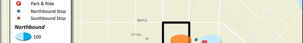
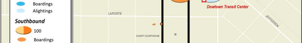

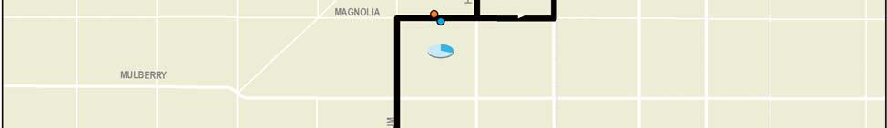

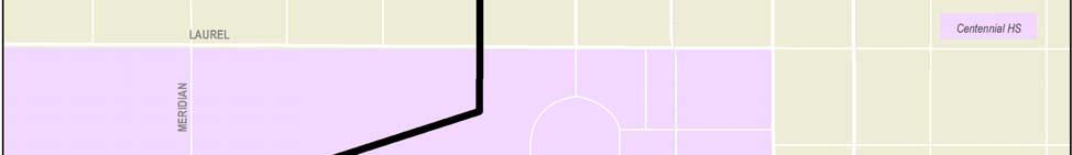
80 Transfort/City of Fort Collins Rotue 15 Page 5 Route Profile #15 Howes/Mason
81 Route 15 Total Weekday Ridership by Stop and Average Line Loads (Northbound) Average Load Boardings Alightings 8 7 Boardings & Alightings Average Vehicle Load 3 1 CSU TRANSIT CENTER MELDRUM & MYRTLE (S OF) NB MAGNOLIA & MELDRUM (W OF) EB MASON & OLIVE NB DTC Transfort/City of Fort Collins Route 15 Page 6 Route Profile #15 Howes/Mason
82 Route 15 Total Weekday Ridership by Stop and Average Line Loads (Southbound) Average Load Boardings Alightings 7 6 Boardings & Alightings Average Vehicle Load 3 1 DTC HOWES & LAPORTE SB HOWES & MOUNTAIN SB MAGNOLIA & HOWES (W OF) WB MELDRUM & MYRTLE (S OF) SB CSU TRANSIT CENTER Transfort/City of Fort Collins Route 15 Page 7 Route Profile #15 Howes/Mason
83 Route 16 Harmony Route 16 travels from the South Transit Center south on John F. Kennedy/Boardwalk, east on Harmony to the Poudre Valley Hospital Harmony (PVH)Campus before looping on Corbett, Rock Creek, Ziegler and Harmony back to PVH. Transit Centers Major Destinations South Transit Center Foothills Mall PVH Harmony Campus Preston Jr HS Fossil Ridge HS Intel/Avago/HP/AMD Front Range Village Current Operations & Service Requirements (August 28) CSU IN SESSION CSU OUT OF SESSION Weekday Saturday Weekday Saturday Hours of Operation: 6:2 am 6:41 pm 6:2 am 6:41 pm 6:2 am 6:41 pm 6:2 am 6:41 pm Frequency (min): Cycle Time (min): Layover Time (min): Every other trip is interlined with Route 6 for a combined cycle time of 12 min with 38 min of layover. Total One Way Trips: Daily Rev Hours: Daily Rev Miles: Peak Buses: FY 28 Route Service Productivity and Rankings* CSU IN SESSION CSU OUT OF SESSION Weekday Saturday Weekday Saturday Avg. Daily Boardings: Pass./Rev. Veh. Hr: Ranking (16) (12) (12) (1) Pass./Rev. Veh. Mi: Ranking (15) (12) (12) (9) Pass./Trip: Ranking (14) (11) (11) (1) * In session statistics are averaged from September November 27 and February April 28. Out of session statistics are averaged from July 27 and June 28. Rankings are out of 16 weekday and 13 Saturday routes when CSU is in session, and 14 weekday and 13 Saturday routes when CSU is out of session. Transfort/City of Fort Collins Route 16 Page 1 Route Profile #16 Harmony
84 Description of Existing Alignment Route 16 serves the South Transit Center and areas southeast. From the STC at Foothills Mall, Route 16 travels south on John F. Kennedy Parkway and Boardwalk Drive serving retail, office, single family and multi family areas. The route travels east on Harmony Road where it serves retail and multifamily areas. Route 16 travels south into the Poudre Valley Hospital Harmony Campus, and continues eastbound on Timberwood Drive and south on Corbett Drive serving middle and high income multi family and single family communities, as well as Preston Junior High School. From here, the route travels east on Rock Creek Drive to Fossil Ridge High School and north on Ziegler Road, where it serves the Harmony Technology Park. Route 16 returns westbound via Harmony Road, making a northbound deviation on Corbett Drive to serve Front Range Village mixed use retail and office center. The route then returns to the PVH Harmony Campus via Snow Mesa Drive and Timberwood Drive and travels north on Timberline Road to return to Harmony Road westbound. Key Route Issues and Observations Alignment Route 16 is fairly indirect, winding south on John F. Kennedy Parkway and Boardwalk Drive before an east west segment on Harmony Road. The route then makes a series of loops east of Timberline Road to serve the hospital and the community around the schools. The route also includes a deviation to the Front Range Village. Transfort operators noted that the deviation to the hospital slows the route down, and the current alignment reflects some attempts to address these concerns. Stops No stop issues were detected on this route. Schedule With every other trip interlined with Route 6, riders may have trouble understanding which trip to board should they wish to through travel onto Route 6. Route Connections The route is scheduled for timed transfer meets with Routes 7 and FoxTrot at STC, but due to schedule variations, has only limited ability to connect to Routes 1 and 5. Every other trip is interlined with Route 6. Transfers to Route 17 occur at Corbett Drive and Harmony Road. PSD Connections Route 16 provides service to Preston Junior High School and Fossil Ridge High School. Cycle, Run, and Layover Times This route has an excessively long layover, with 26 minutes (43%) of a 6 minute cycle time for the stand alone run, and 38 minutes (32%) of a 12 minute cycle time for the Route 6/16 interline. Transfort/City of Fort Collins Route 16 Page 2 Route Profile #16 Harmony
85 Historical Ridership Characteristics Average daily ridership by month from July 27 to June 28 is presented in the figure below. Ridership appears to be trending upward, with weekday growth of 23% and Saturday growth of 4% from the last half of 27 to the first half of 28. Route 16 Monthly Average Daily Ridership Levels (July 27 to June 28) 4 Weekday Saturday Jul Aug Sep Oct Nov Dec Jan Feb Mar Apr May Jun Riders on Route 16 are primarily youth and adults, who make up 37% and 35% of the passengers on this route, respectively. CSU students and staff make up only 11% of the riders. Transfers account for about 17% of ridership, twice Transfort s average transfer rate of 8%. The figure below shows ridership by fare class compared to systemwide averages. Route 16 Ridership by Fare Class (July 27 to June 28) Youth CSU Adult 17% Senior/ Disabled Other 37% Systemwide 17% 23% 35% 11% 23% 37% Transfort/City of Fort Collins Route 16 Page 3 Route Profile #16 Harmony
86 Current Ridership Characteristics A ridecheck survey was completed on April 3, 28, when CSU was in session. Passenger boardings and alightings were recorded at every stop on about 85% of systemwide bus trips. Stop data was factored up by average daily ridership by route reported for April 28 in order to approximate a 1% ridecheck. The following survey results are presented below: A graph showing unadjusted weekday ridership activity (boardings and alightings) by time of day; A map that illustrates total adjusted weekday ridership activity by stop; and Graphs that depict adjusted weekday boarding and alighting activity by stop, by direction, along with average daily line loads. Ride Check Observations About 37% of ridership activity occurs at STC. Only 4% occurred at the Cobett & Harmony where riders can transfer to Route 17. [Note that the ride check predates the route realignment into Front Range Village and around PVH Harmony campus.] Aside from STC, the highest ridership was generated at Fossil Ridge HS (9%). PVH Harmony (7%) and the Harmony segment from Boardwalk to Timberline (21%) were also strong generators. Ridership peaks a bit in the morning, but is most strong through the afternoon, with highest ridership northbound from 3PM to 4PM. The bulk of this activity occurs at Fossil Ridge HS. Route 16 Weekday Ridership by Time of Day and Direction Eastbound Westbound Boardings AM 7 AM 8 AM 9 AM 1 AM 11 AM 12 PM 1 PM 2 PM 3 PM 4 PM 5 PM 6 PM 7 PM Start of Trip *The first trip of the day was not counted. Transfort/City of Fort Collins Route 16 Page 4 Route Profile #16 Harmony
87 Transfort/City of Fort Collins Route 16 Page 5 Route Profile #16 Harmony
88 Route 16 Total Weekday Ridership by Stop and Average Line Loads (Eastbound) Average Load Boardings Alightings 6 Boardings & Alightings Average Vehicle Load THE SQUARE SHOPPING CTR JFK & HORSETOOTH SB BOARDWALK & JFK SB BOARDWALK & TROUTMAN SB BOARDWALK & WHALERS WAY SB HARMONY & BOARDWALK EAST OF EB HARMONY & WHEATON EAST OF EB HARMONY & MCMURRY EAST OF EB PVH HARMONY CAMPUS URGENT CARE EB SNOW MESA WOMANS CLINIC NB TIMBERWOOD & CORBETT EB CORBETT DR & INDIGO CIRCLE SB ROCK CREEK DRIVE & ZIEGLER RD EB ZIEGLE & TIMBERWOOD NB HARMONY ROAD & ZIEGLER ROAD WB CORBETT & HARMONY SB Transfort/City of Fort Collins Route 16 Page 6 Route Profile #16 Harmony
89 Route 16 Total Weekday Ridership by Stop and Average Line Loads (Westbound) Average Load Boardings Alightings 7 6 Boardings & Alightings Average Vehicle Load CORBETT & HARMONY SB TIMBERWOOD & CORBETT WB SNOW MESA WOMANS CLINIC NB PVH HARMONY CAMPUS URGENT CARE WB PVH HARMONY CAMPUS WB HARMONY & TIMBERLINE (W OF) WB HARMONY & MCMURRY WEST OF WB HARMONY & LEMAY WB BOARDWALK & WHALERS WAY NB BOARDWALK & TROUTMAN NB JFK PKWY & BOARDWALK NB JFK PKWY & LANDINGS NB MONROE & JFK WB THE SQUARE SHOPPING CTR Transfort/City of Fort Collins Route 16 Page 7 Route Profile #16 Harmony
90 Route 17 Timberline Route 17 operates from the Sharp Point/Midpoint business park west on Prospect to Timberline, continuing to Harmony where it winds over and back to Ziegler. Transit Centers Major Destinations none Larimer County Detention Center Larimer County Human Services City of Fort Collins Police Dept Rigden Farms Senior Living Fort Collins HS / Preston Jr HS PVH Harmony Campus AMD/Avago/HP/Intel Front Range Village Current Operations & Service Requirements (August 28) CSU IN SESSION CSU OUT OF SESSION Weekday Saturday Weekday Saturday Hours of Operation: 6:45 am 7:36 pm 6:45 am 7:36 pm 6:45 am 7:36 pm 6:45 am 7:36 pm Frequency (min): Cycle Time (min): Layover Time (min): Route 17 is interlined with Route 18 for a combined cycle time of 12 min with 44 min of layover. Total One Way Trips: Daily Rev Hours: Daily Rev Miles: Peak Buses: FY 28 Route Service Productivity and Rankings* CSU IN SESSION CSU OUT OF SESSION Weekday Saturday Weekday Saturday Avg. Daily Boardings: Pass./Rev. Veh. Hr: Ranking (16) (13) (13) (13) Pass./Rev. Veh. Mi: Ranking (16) (13) (13) (13) Pass./Trip: Ranking (16) (13) (13) (13) * In session statistics are averaged from September November 27 and February April 28. Out of session statistics are averaged from July 27 and June 28. Rankings are out of 16 weekday and 13 Saturday routes when CSU is in session, and 14 weekday and 13 Saturday routes when CSU is out of session. Transfort/City of Fort Collins Route 17 Page 1 Route Profile #17 Timberline
91 Description of Existing Alignment From Prospect Parkway and Midpoint Drive, Route 17 travels west on Prospect Road to Timberline Road. (Return trips travel east on Prospect Road from Timberline Road, south on Sharp Point Drive and north on Midpoint Drive to Prospect Parkway and Midpoint Drive.) This area is comprised of office parks, Larimer County Human Services and the Larimer County Detention Center. From Timberline Road, the route continues south passing single family homes and the City of Fort Collins Police Department. At Drake Road, Route 17 deviates east, then south on Kansas Drive, west on Limon Drive, south on Iowa Drive and west on Custer Drive to serve multi family neighborhoods, Rigden Farms Senior Living and King Soopers. The route returns south on Timberline Road serving high income single family and multi family areas, offices and Fort Collins High School. Route 17 turns east on Harmony Road and deviates into Poudre Valley Hospital Harmony Campus before returning to Harmony Road via Snow Mesa Drive. The route continues east on Harmony Road past commercial and office buildings to Ziegler Road, then west on Timberwood Drive, where it serves new single family and multifamily neighborhoods, as well as Preston Junior High School. From here, the route travels north on Corbett Drive, crossing Harmony Road to serve the Front Range Village before returning to Harmony Road to make the return trip west to Timberline Road. Key Route Issues and Observations Alignment Route 17 provides somewhat direct service on Timberline, but with several loops and deviations to the Midpoint/Sharp Point business area, Rigden Farms Senior Living, PVH Harmony Campus, Preston Jr HS, and Front Range Village. Transfort operators identified the Ridgen Farms deviation and Midpoint Drive deviations as being too long and unnecessary. They also suggested exempting buses from the right turn only lane on Drake Road to eliminate unnecessary lane changes. Stops Operators identified the need for an additional stop on the northside of Prospect Road at Midpoint Drive. There are no stops for a long segment from Prospect & Mid Point until Timberline & Nancy Gray/Charles Brockman. Schedule No schedule issues were noted on this route. Route Connections Route 17 is scheduled for timed transfer meets with Routes 16 at Corbett & Harmony. This route is interlined with Route 18. PSD Connections Route 17 provides service to Preston Junior High School and Fort Collins High School. Cycle, Run, and Layover Times There are no major on time issues for this route. The 44 minute layover time (37% of the 12 minute interlined cycle time) is a bit excessive. Transfort/City of Fort Collins Route 17 Page 2 Route Profile #17 Timberline
92 Historical Ridership Characteristics Average daily ridership by month from July 27 to June 28 is presented in the figure below. Despite very low ridership, Route 17 has shown steady gains since its implementation in April 27. Weekday boardings have increased 54% from the last half of 27 to the first half of 28, and Saturday boardings have almost doubled in that time. Route 17 Monthly Average Daily Ridership Levels (July 27 to June 28) 15 Weekday Saturday 1 5 Jul Aug Sep Oct Nov Dec Jan Feb Mar Apr May Jun Riders on Route 17 are primarily adults, who make up almost half of the passengers on this route. Transfers account for about 24% of ridership, highest in the system. The figure below shows ridership by fare class compared to systemwide averages. Route 17 Ridership by Fare Class (July 27 to June 28) Youth CSU Adult 16% 29% Senior/ Disabled Other Systemwide 6% 17% 23% 48% 23% 37% Transfort/City of Fort Collins Route 17 Page 3 Route Profile #17 Timberline
93 Current Ridership Characteristics A ridecheck survey was completed on April 3, 28, when CSU was in session. Passenger boardings and alightings were recorded at every stop on about 85% of systemwide bus trips. Stop data was factored up by average daily ridership by route reported for April 28 in order to approximate a 1% ridecheck. The following survey results are presented below: A graph showing unadjusted weekday ridership activity (boardings and alightings) by time of day; A map that illustrates total adjusted weekday ridership activity by stop; and Graphs that depict adjusted weekday boarding and alighting activity by stop, by direction, along with average daily line loads. Ride Check Observations 13% of boardings and alightings happen at the northern endpoint (Midpoint & Prospect Parkway) and about 8% occurs at the southern endpoint (Corbett & Harmony). [Note that the ride check predates the route realignment into Front Range Village and around PVH Harmony campus.] Ridership is scattered across this route. About 9 12% of activity is generated at each of the following stops: Fort Collins HS, PCH Harmony, Timberline & Horsetooth, and Prospect & Prospect Parkway. Only 2 riders accessed the route on Timberline between Prospect and Drake. Ridership peaks some in the morning and then remains steady from noon till 5PM. Route 17 Weekday Ridership by Time of Day and Direction Northbound Southbound Boardings AM 7 AM 8 AM 9 AM 1 AM 11 AM 12 PM 1 PM 2 PM 3 PM 4 PM 5 PM 6 PM 7 PM Start of Trip *Portions of the first trip and last trip of the day were not counted. Transfort/City of Fort Collins Route 17 Page 4 Route Profile #17 Timberline
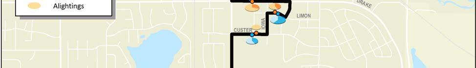
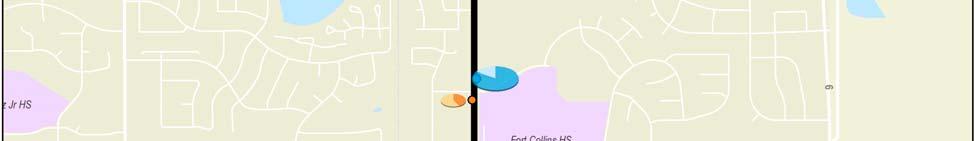
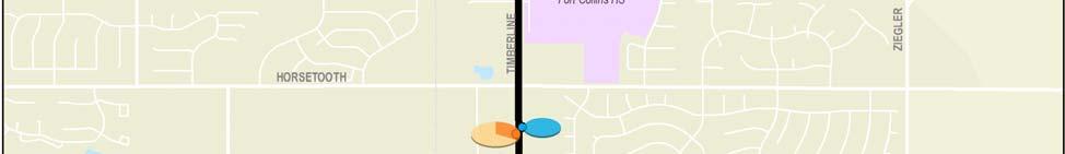
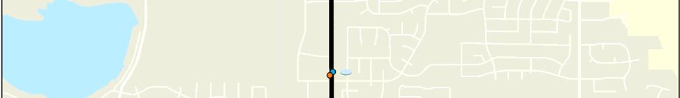
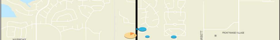
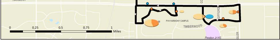
94 Transfort/City of Fort Collins Route 17 Page 5 Route Profile #17 Timberline
95 Route 17 Total Weekday Ridership by Stop and Average Line Loads (Northbound) Average Load Boardings Alightings 5 4 Boardings & Alightings Average Vehicle Load CORBETT DR & HARMONY RD NB HARMONY RD & SNOW MESA WB HARMONY & EAST OF TIMBERLINE WB TIMBERLINE RD & MILE STONE NB TIMBERLINE RD & CARIBOU DR NB TIMBERLINE RD & HORSETOOTH RD NB TIMBERLINE RD & VERMONT DR NB CUSTER DRIVE & ILLINOIS DRIVE EB LIMON DR & KANSAS DR EB DRAKE RD & ILLINOIS RD WB TIMBERLINE RD & NANCE GRAY NB PROSPECT RD & PROSPECT PARKWAY SHARP POINT DRIVE & PROSPECT RD SB SHARP POINT DR & MARCH CT SB MIDPOINT DR & LARIMER COUNTY NB MIDPOINT DR & PROSPECT PARK WAY NB PROSPECT PARKWAY & MIDPOINT NB Transfort/City of Fort Collins Route 17 Page 6 Route Profile #17 Timberline
96 Route 17 Total Weekday Ridership by Stop and Average Line Loads (Southbound) Average Load Boardings Alightings 5 Boardings & Alightings Average Vehicle Load PROSPECT PARKWAY & MIDPOINT NB TIMBERLINE DR & CHARLES BROCKMAN SB DRAKE RD & ILLINOIS DR EB LIMON DR & KANSAS DR WB CUSTER DRIVE AND ILLINOIS WB TIMBERLINE DR & VERMONT DR SB TIMBERLINE RD & HORSETOOTH RD SB TIMBERLINE RD & CARIBOU DR SB TIMBERLINE RD & TIMLINE LANE SB PVH HARMONY CAMPUS URGENT CARE EB SNOW MESA & HARMONY ROAD NB ZIEGLER RD & HARMONY RD SB TIMBERWOOD DR & GIFFORD CT WB CORBETT DR & HARMONY RD NB Transfort/City of Fort Collins Route 17 Page 7 Route Profile #17 Timberline
97 Route 18 Prospect/Whedbee Route 18 travels south from the Downtown Transit Center via Mason/Howe, Whedbee and Stover, and travels east on Prospect to Sharp Point and south on Riverside to EPIC. Transit Centers Major Destinations Downtown Transit Downtown Fort Collins Center Fort Collins Museum & Public Library Centennial HS / Lesher Jr HS Edora Pool and Ice Center (EPIC) Larimer County Human Services Larimer County Detention Center Current Operations & Service Requirements (August 28) CSU IN SESSION CSU OUT OF SESSION Weekday Saturday Weekday Saturday Hours of Operation: 6:15 am 7:14 pm 6:15 am 7:14 pm 6:15 am 7:14 pm 6:15 am 7:14 pm Frequency (min): Cycle Time (min): Layover Time (min): Route 18 is interlined with Route 17 for a combined cycle time of 12 min with 44 min of layover. Total One Way Trips: Daily Rev Hours: Daily Rev Miles: Peak Buses: FY 28 Route Service Productivity and Rankings* CSU IN SESSION CSU OUT OF SESSION Weekday Saturday Weekday Saturday Avg. Daily Boardings: Pass./Rev. Veh. Hr: Ranking (12) (1) (1) (11) Pass./Rev. Veh. Mi: Ranking (13) (11) (1) (12) Pass./Trip: Ranking (11) (1) (8) (11) * In session statistics are averaged from September November 27 and February April 28. Out of session statistics are averaged from July 27 and June 28. Rankings are out of 16 weekday and 13 Saturday routes when CSU is in session, and 14 weekday and 13 Saturday routes when CSU is out of session. Transfort/City of Fort Collins Route 18 Page 1 Route Profile #18 Prospect/Whedbee
98 Description of Existing Alignment From the Downtown Transit Center, Route 18 travels south on Howes Street and east on Olive Street. (Return trips travel north on Mason Street to the DTC). This area is comprised of downtown Fort Collins and includes City of Fort Collins and Larimer County offices, as well as the Post Office, Fort Collins Museum, Fort Collins Public Library and DMA. Route 18 travels south on Whedbee Street serving single family areas and Centennial High School. From here, the route turns east on Elizabeth Street and south on Stover Street to Prospect Road through single family residential areas and Lesher Junior High School. The route turns east on Prospect Road serving single family and multi family residences, neighborhood retail and offices. The route turns south on Riverside Avenue where it serves the Edora Pool and Ice Center (EPIC) and the Arbors at Sweetgrass Apartments. The route returns to Prospect Road where it continues east to Sharp Point Drive, and travels in a loop south to Midpoint Drive and north to Prospect Road. Key Route Issues and Observations Alignment Route 18 is fairly indirect, winding south and east through downtown Fort Collins and older residential areas before making an end of line loop from Prospect Road at Sharp Point Drive and Midpoint Drive. A significant deviation also occurs to serve EPIC. This deviation does not have a specified turnaround, and buses turn around in the EPIC parking lot. Additionally, this route can be delayed by trains on Mason Street, with two rail crossings outbound to Howes Street and parallel tracks on Mason Street inbound. Stops There are no stops on Mason or Howes through what is essentially Fort Collin s central business district. Transfort operators also identified the need for a stop on the north side of Prospect Road at Midpoint Drive. Schedule No schedule issues were observed. Route Connections This route is interlined with Route 17 at Sharp Point/Midpoint. It also has timed connections with Routes 5, 8, 9 and 14 at the DTC. Due to schedule variations, Route 18 has only limited connectivity here to Routes 1 and 15. An additional untimed transfer with Route 5 occurs at Prospect Road and Lemay Avenue. PSD Connections Route 18 provides service to Centennial High School and Lesher Junior High School. Cycle, Run, and Layover Times There are no major on time issues for this route. The 44 minute layover time (37% of the 12 minute interlined cycle time) is a bit excessive. Transfort/City of Fort Collins Route 18 Page 2 Route Profile #18 Prospect/Whedbee
99 Historical Ridership Characteristics Average daily ridership by month from July 27 to June 28 is presented in the figure below. Route 18 has shown steady gains since its implementation in April 27. Weekday boardings have increased 54% from the last half of 27 to the first half of 28, and Saturday boardings have increased 56% in that time. Route 18 Monthly Average Daily Ridership Levels (July 27 to June 28) 3 Weekday Saturday 2 1 Jul Aug Sep Oct Nov Dec Jan Feb Mar Apr May Jun Riders on Route 18 are primarily adults, who make up over half of the passengers on this route. Transfers account for about 11% of ridership, slightly higher than Transfort s average transfer rate of 8%. The figure below shows ridership by fare class compared to systemwide averages. Route 18 Ridership by Fare Class (July 27 to June 28) Youth CSU Adult 18% 22% Senior/ Disabled Other Systemwide 6% 17% 23% 53% 23% 37% Transfort/City of Fort Collins Route 18 Page 3 Route Profile #18 Prospect/Whedbee
100 Current Ridership Characteristics A ridecheck survey was completed on April 3, 28, when CSU was in session. Passenger boardings and alightings were recorded at every stop on about 85% of systemwide bus trips. Stop data was factored up by average daily ridership by route reported for April 28 in order to approximate a 1% ridecheck. The following survey results are presented below: A graph showing unadjusted weekday ridership activity (boardings and alightings) by time of day; A map that illustrates total adjusted weekday ridership activity by stop; and Graphs that depict adjusted weekday boarding and alighting activity by stop, by direction, along with average daily line loads. Ride Check Observations About a third of boardings and alightings happen at DTC, with another 14% occurring at the eastern terminus at Midpoint & Prospect Parkway. The next highest activity stop is at Prospect & Prospect Parkway, which had 12% of the activity. The three stops along Olive account for 14% of ridership. The deviation to EPIC only adds 2% to the ridership totals. Ridership is steady throughout the day, with am afternoon peak in the westbound direction at 2PM. Route 18 Weekday Ridership by Time of Day and Direction 25 2 Eastbound Westbound Boardings AM 7 AM 8 AM 9 AM 1 AM 11 AM 12 PM 1 PM 2 PM 3 PM 4 PM 5 PM 6 PM 7 PM Start of Trip *Portions of the first trip and last trip of the day were not counted. Transfort/City of Fort Collins Route 18 Page 4 Route Profile #18 Prospect/Whedbee
101 Transfort/City of Fort Collins Route 18 Page 5 Route Profile #18 Prospect/Whedbee
102 Route 18 Total Weekday Ridership by Stop and Average Line Loads (Eastbound) Average Load Boardings Alightings Boardings & Alightings Average Vehicle Load DTC OLIVE STREET & REMINGTON ST EB OLIVE ST & PETERSON ST EB WHEDBEE ST & MULBERRY ST SB WHEDBEE ST & LAURLEL ST SB ELIZABETH & WHEDBEE EB STOVER ST & ELIZABETH ST SB PROSPECT RD & STOVER ST EB PROSPECT & ROBERTSON EB PROSPECT RD & LEMAY AVE EB RIVERSIDE AVE & ERIN CT SB EPIC EDORA POOL & ICE CENTER RIVERSIDE AVE & ERIN CT NB PROSPECT RD & PROSPECT PARKWAY SHARP POINT DRIVE & PROSPECT RD SB SHARP POINT DR & MARCH CT SB MIDPOINT DR & LARIMER COUNTY NB MIDPOINT DR & PROSPECT PARK WAY NB PROSPECT PARKWAY & MIDPOINT NB Transfort/City of Fort Collins Route 18 Page 6 Route Profile #18 Prospect/Whedbee
103 Route 18 Total Weekday Ridership by Stop and Average Line Loads (Westbound) Average Load Boardings Alightings 12 1 Boardings & Alightings Average Vehicle Load PROSPECT PARKWAY & MIDPOINT NB PROSPECT RD & ACADEMY CT WB RIVERSIDE AVE & ERIN CT SB EPIC EDORA POOL & ICE CENTER RIVERSIDE AVE & ERIN CT NB PROSPECT RD & LA PLATA AVE WB PROSPECT RD & WELCH ST WB PROSPECT ROAD & LAKE ST WB STOVER ST & PROSPECT RD WB ELIZABETH & STOVER WB WHEDBEE ST & ELIZABETH NB WHEDBEE STREET & LAUREL STREET NB WHEDBEE STREET & MULBERRY STREET NB OLIVE STREET & PETERSON STREET WB OLIVE & REMINGTON WB MASON & OLIVE NB DTC Transfort/City of Fort Collins Route 18 Page 7 Route Profile #18 Prospect/Whedbee
104 Route FOX FoxTrot FoxTrot operates between the South Transit Center and Orchard Shopping Center in Loveland via College/US 287. Transit Centers South Transit Center COLT North Transfer Station (Orchards Shopping Center) Major Destinations Foothills Mall Target Wal Mart Orchards Shopping Center Current Operations & Service Requirements (August 28) CSU IN SESSION CSU OUT OF SESSION Weekday Saturday Weekday Saturday Hours of Operation: 6:17 am 7:11 pm 6:17 am 7:11 pm 6:17 am 7:11 pm 6:17 am 7:11 pm Frequency (min): Cycle Time (min): Layover Time (min): Total One Way Trips: Daily Rev Hours: Daily Rev Miles: Peak Buses: FY 28 Route Service Productivity and Rankings* CSU IN SESSION CSU OUT OF SESSION Weekday Saturday Weekday Saturday Avg. Daily Boardings: Pass./Rev. Veh. Hr: Ranking (8) (5) (3) (3) Pass./Rev. Veh. Mi: Ranking (14) (8) (7) (8) Pass./Trip: Ranking (8) (4) (3) (3) * In session statistics are averaged from September November 27 and February April 28. Out of session statistics are averaged from July 27 and June 28. Rankings are out of 16 weekday and 13 Saturday routes when CSU is in session, and 14 weekday and 13 Saturday routes when CSU is out of session. Transfort/City of Fort Collins FoxTrot Page 1 Route Profile #FOX FoxTrot
105 Description of Existing Alignment FoxTrot travels south from the South Transit Center to Orchards Shopping Center to meet City of Loveland Transit (COLT) routes. From South Transit Center, the route travels south on College Avenue/US287, where it proves service to major commercial centers between Horsetooth and Harmony, as well as single family and multi family neighborhoods. FoxTrot deviates east on 65 th Street to provide access to the Wal Mart before returning south on US 287 and into the Orchards Shopping Center in Loveland at 29 th Street, where it meets the COLT routes. Key Route Issues and Observations Alignment FoxTrot is a direct route providing a north south connection between the cities of Fort Collins and Loveland. A deviation occurs at 65 th Street in order to provide a stop for the Wal Mart Shopping Center. Stops Transfort operators noted that the deviation for the Wal Mart stop added time to the route; however, traffic speeds on US 287 require the bus to exit in order to stop. Stops are spaced very close on this route between Horsetooth and Harmony given the regional nature of this route. Schedule FoxTrot operates at 6 minute frequencies Monday through Saturday, year round. There are scheduling conflicts with connections on both ends of the route, which proves challenging for the large number of riders who endure one or more transfers on Transfort and COLT to make their trip. Transfort operators suggested the need for more frequent service on this route. Route Connections This route is scheduled for timed transfers with 5, 6, 7 and 16 at the STC, and can make untimed transfers with Route 1. An additional untimed transfer to Route 6 occurs at College Avenue and Horsetooth Road. On the southern end, FoxTrot provides timed transfers to COLT s Blue, Green, and Orange routes at Orchards Shopping Center; however, several factors make it difficult for FoxTrot to make this meet. These include having to hold at STC for late arriving routes and COLT s very tight layovers, in addition to traffic congestion and bicycle loading time. PSD Connections FoxTrot does not provide direct service to PSD schools. Cycle, Run, and Layover Times Congestion between the South Transit Center and Harmony Road, bicycle loading time, and waiting for late routes at STC all cause run time delays on FoxTrot. Given these circumstances, the layover time of 12 minutes (2% of the 6 minute cycle time) is not always sufficient. Transfort/City of Fort Collins FoxTrot Page 2 Route Profile #FOX FoxTrot
106 Historical Ridership Characteristics Average daily ridership by month from July 27 to June 28 is presented in the figure below. Weekday ridership seems independent of the CSU schedule, and appears to be trending upward over the last six months.. FoxTrot Monthly Average Daily Ridership Levels (July 27 to June 28) 5 4 Weekday Saturday Jul Aug Sep Oct Nov Dec Jan Feb Mar Apr May Jun Riders on the FoxTrot are primarily youths and adults, who make up 38% and 37% of passengers on this route, respectively. CSU students and staff only make up 5% of the riders. Transfers account for about 17% of ridership, well above Transfort s average transfer rate of 8%. The figure below shows ridership by fare class compared to systemwide averages. FoxTrot Ridership by Fare Class (July 27 to June 28) Youth CSU Adult 2% Senior/ Disabled Other 38% Systemwide 17% 23% 37% 5% 23% 37% Transfort/City of Fort Collins FoxTrot Page 3 Route Profile #FOX FoxTrot
107 Current Ridership Characteristics A ridecheck survey was completed on April 3, 28, when CSU was in session. Passenger boardings and alightings were recorded at every stop on about 85% of systemwide bus trips. Stop data was factored up by average daily ridership by route reported for April 28 in order to approximate a 1% ridecheck. The following survey results are presented below: A graph showing unadjusted weekday ridership activity (boardings and alightings) by time of day; A map that illustrates total adjusted weekday ridership activity by stop; and Graphs that depict adjusted weekday boarding and alighting activity by stop, by direction, along with average daily line loads. Ride Check Observations Over half of the ridership activity on FoxTrot occurs at one of the route ends, with 25% at STC and 32% at Orchard Shopping Center. This leads to steady loads across the length of the route. After the transit centers, stops at College & Horsetooth, College & Trilby, and Wal Mart are the highest generators, with about 4 6% each of total route ridership. Ridership is lower in the mornings and then gains in the afternoon from 1PM all the way to 7PM. The predominant pattern seems to be northbound trips occurring from 1PM to 5PM with returning southbound trips between 3PM and 7PM. FoxTrot Weekday Ridership by Time of Day and Direction Northbound Southbound Boardings AM 7 AM 8 AM 9 AM 1 AM 11 AM 12 PM 1 PM 2 PM 3 PM 4 PM 5 PM 6 PM 7 PM Start of Trip *The first trip of the day was not counted. Transfort/City of Fort Collins FoxTrot Page 4 Route Profile #FOX FoxTrot
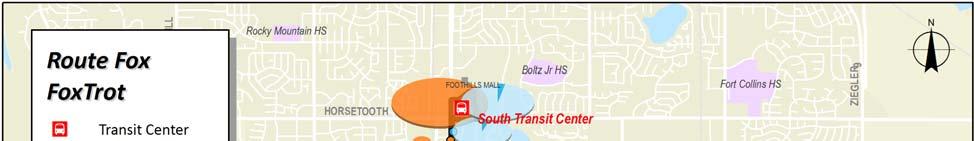
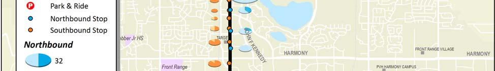
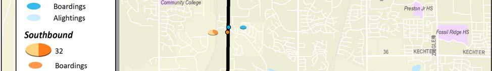
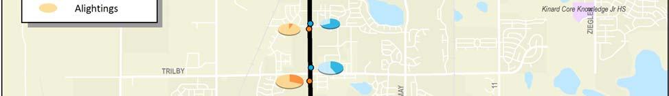
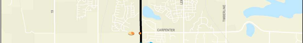


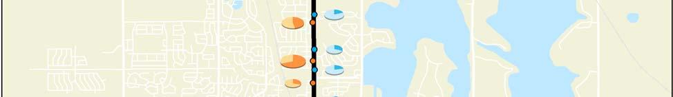
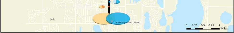
108 Transfort/City of Fort Collins FoxTrot Page 5 Route Profile #FOX FoxTrot
US287 Asset Inventory Fort Collins. Figure 5-1 Fort Collins Bridges and Traffic Signals
 Chapter 5: City of Fort Collins US287 through Fort Collins is known as College Avenue, runs for approximately 9.25 miles, and bisects the City north to south. Within the City, US287 is a principal arterial.
F.1 ENHANCED FISCALLY CONSTRAINED CAPITAL IMPROVEMENT PLAN
 APPENDIX F F.0 APPENDIX F F.1 ENHANCED FISCALLY CONSTRAINED CAPITAL IMPROVEMENT PLAN Recognizing the limitations of the fiscally constrained CIP discussed in Section 7.5, an enhanced fiscally constrained
BICYCLE FACILITIES FULL BUILD PLAN
 KIMBALL RD ROCKY RD CYPRESS DR CITY PARK AVE S SHIELDS ST CONSTITUTION AVE S TAFT HILL RD S OVERLAND TRL HILLCREST DR SKYLINE DR MOBY DR CRAGMORE DR CASTLEROCK DR MEADOWBROOK DR S BRYAN AVE BICYCLE FACILITIES
ROUTE 11 Downtown to KU to 31 st and Iowa SERVICE DESIGN
 ROUTE EVALUATION ROUTE 11 s ROUTE 11 Downtown to KU to 31 st and Iowa SERVICE DESIGN Route 11 is a route coordinated between Lawrence Transit and KU on Wheels that operates between the Downtown Transit
CARTA East Cooper Transit Service Transportation Committee Town of Mount Pleasant. February 5, 2013
 CARTA East Cooper Transit Service Transportation Committee Town of Mount Pleasant February 5, 2013 Service Overview Study Overview East Cooper Service Analysis Provide additional analysis as a follow up
National Highway Traffic Safety Administration. Pedestrian Roadway Facilities. DOT HS , April 2003.
 Appendices Appendix A References Federal Highway Administration Bicycle and Pedestrian Program: http://www.fhwa.dot.gov/environment/bikeped/ The Pedestrian and Bicycle Information Center (PBIC) http://www.walkinginfo.org/main
Appendix ELP El Paso, Texas 2003 Annual Report on Freeway Mobility and Reliability
 (http://mobility.tamu.edu/mmp) Office of Operations, Federal Highway Administration Appendix ELP El Paso, Texas 2003 Annual Report on Freeway Mobility and Reliability This report is a supplement to: Monitoring
DAILY TRIPS (OUTBOUND/INBOUND) Weekdays 6:05 AM to 11:23 PM 30/30/ /28 Saturday 6:15 AM to 8:23 PM 60/60 24/23 Sunday / /
 Weekdays 6:05 AM to 11:23 PM 30/30/ /28 Saturday 6:15 AM to 8:23 PM 60/60 24/23 Sunday / /") ROUTE 6 Shelburne Road SERVICE DESIGN Figure 1: Route Map Route 6 is a Major Local route that operates between Shelburne and the Burlington Downtown Transit Center (DTC). The route travels primarily along
ROUTE 6 Shelburne Road SERVICE DESIGN Figure 1: Route Map Route 6 is a Major Local route that operates between Shelburne and the Burlington Downtown Transit Center (DTC). The route travels primarily along
DAILY TRIPS (OUTBOUND) Monday-Friday 6:45 AM to 7:40 PM 30/30/30 26 Saturday 6:45 AM to 6:40 PM 30/30 24 Sunday - - -
 Monday-Friday 6:45 AM to 7:40 PM 30/30/30 26 Saturday 6:45 AM to 6:40 PM 30/30 24 Sunday - - -") ROUTE 8 City Loop SERVICE OVERVIEW Route 8 is an Urban Local route that operates as a one-way loop serving the Downtown Transit Center (DTC), Fern Hill, McAuley Square, UVM s Waterman Building, and Champlain
ROUTE 8 City Loop SERVICE OVERVIEW Route 8 is an Urban Local route that operates as a one-way loop serving the Downtown Transit Center (DTC), Fern Hill, McAuley Square, UVM s Waterman Building, and Champlain
SOLTRANS BOARD MEETING SUPPLEMENTAL REPORTS / HANDOUTS January 15, 2015 MEETING HANDOUTS
 SOLTRANS BOARD MEETING SUPPLEMENTAL REPORTS / HANDOUTS January 15, 2015 MEETING HANDOUTS Agenda Item 10 January 2015 System Improvements Update - PowerPoint Presentation Agenda Item 12 Construction Projects
in the pop-up survey after drawing it. UPLOAD PHOTOS when you add a route or point or by clicking on an existing route or point.
 Introduction As part of the first phase for the West Elizabeth Enhanced Travel Corridor Plan an online interactive map WikiMap was created and available for input. A link to the WikiMap was distributed
1999 On-Board Sacramento Regional Transit District Survey
 SACOG-00-009 1999 On-Board Sacramento Regional Transit District Survey June 2000 Sacramento Area Council of Governments 1999 On-Board Sacramento Regional Transit District Survey June 2000 Table of Contents
Appendix PDX Portland, Oregon 2003 Annual Report on Freeway Mobility and Reliability
 (http://mobility.tamu.edu/mmp) Office of Operations, Federal Highway Administration Appendix PDX Portland, Oregon 2003 Annual Report on Freeway Mobility and Reliability This report is a supplement to:
ROUTE 75D PENN HILLS-MONROEVILLE
 ROUTE 75D PENN HILLS-MONROEVILLE Route 75D Penn Hills-Monroeville is a crosstown route that operates between Verona and the Monroeville Mall. It travels through local streets for much of its length serves
Appendix PIT Pittsburgh, Pennsylvania 2003 Annual Report on Freeway Mobility and Reliability
 (http://mobility.tamu.edu/mmp) Office of Operations, Federal Highway Administration Appendix PIT Pittsburgh, Pennsylvania 2003 Annual Report on Freeway Mobility and Reliability This report is a supplement
Appendix MSP Minneapolis-St. Paul, Minnesota 2003 Annual Report on Freeway Mobility and Reliability
 (http://mobility.tamu.edu/mmp) Office of Operations, Federal Highway Administration Appendix MSP Minneapolis-St. Paul, Minnesota 2003 Annual Report on Freeway Mobility and Reliability This report is a
WELCOME Mission-Geneva Transportation Study
 WELCOME Mission-Geneva Transportation Study Study Process and Schedule 2005 2006 Oct Nov Dec Jan Feb Mar Apr May Jun Jul Aug Sept Oct Task 2 Develop Outreach Plan Task 3 Document Existing Conditions/ Prioritize
ROUTE 18B AVALON-SHADELAND EXPRESS
 ROUTE 18B AVALON-SHADELAND EXPRESS Route 18B Avalon-Shadeland Express is the weekday-only commute hour version of Route 17B that provides slightly streamlined service between Avalon and downtown Pittsburgh
Philadelphia Bus Network Choices Report
 Philadelphia Bus Network Choices Report JUNE 2018 SEPTA Table of Contents Executive Summary...7 What if transit gave us more freedom?... 8 What is this report?... 8 The main conclusions... 9 What is happening
Appendix SEA Seattle, Washington 2003 Annual Report on Freeway Mobility and Reliability
 (http://mobility.tamu.edu/mmp) Office of Operations, Federal Highway Administration Appendix SEA Seattle, Washington 2003 Annual Report on Freeway Mobility and Reliability This report is a supplement to:
MALL CROSSING STUDY. Testing the Effectiveness Of the 4th Street East Crossing. For: City of Charlottesville Neighborhood Development Services
 MALL CROSSING STUDY One-Year Evaluation Final Report Testing the Effectiveness Of the 4th Street East Crossing For: City of Charlottesville Neighborhood Development Services May 2007 By: CHARLOTTESVILLE
KING STREET TRANSIT PILOT
 STREET TRANSIT PILOT Update toronto.ca/kingstreetpilot #kingstreetpilot HIGHLIGHTS PREVIOUS HIGHLIGHTS TRANSIT RELIABILITY TRANSIT TRAVEL TIMES 85% of streetcars arriving within 4 minutes westbound during
Pocatello Regional Transit Master Transit Plan Draft Recommendations
 Pocatello Regional Transit Master Transit Plan Draft Recommendations Presentation Outline 1. 2. 3. 4. What is the Master Transit Plan? An overview of the study Where Are We Today? Key take-aways from existing
95 Express Annual Operations Report: Fiscal Year
 95 Express Annual Operations Report: Fiscal Year 2014-2015 General The 95 Express Program completed its sixth full Fiscal Year of operations in June 2015. For the FDOT, its Fiscal Year (FY) is from July
Appendix LOU Louisville, Kentucky 2003 Annual Report on Freeway Mobility and Reliability
 (http://mobility.tamu.edu/mmp) Office of Operations, Federal Highway Administration Appendix LOU Louisville, Kentucky 2003 Annual Report on Freeway Mobility and Reliability This report is a supplement
MoPac South: Impact on Cesar Chavez Street and the Downtown Network
 MoPac South: Impact on Cesar Chavez Street and the Downtown Network Prepared by: The University of Texas at Austin Center for Transportation Research Prepared for: Central Texas Regional Mobility Authority
US287 Asset Inventory Loveland. Figure 6-1 Loveland Bridges and Traffic Signals
 Chapter 6: City of Loveland US287 extends for approximately 13.1 miles through the City of Loveland. Between the northern City boundary and 29 th Street, the road is labeled Garfield Avenue, before transitioning
SETTINGS AND OPPORTUNITIES MOBILITY & ACCESS
 7 mobility & access how do people use el camino what is it like to drive on el camino/to park along el camino what is the pedestrian experience like what is the role of transit along the corridor what
MEMORANDUM. Charlotte Fleetwood, Transportation Planner
 MEMORANDUM Date: Updated August 22, 2017 To: Organization: Charlotte Fleetwood, Transportation Planner Boston Transportation Department From: Jason DeGray, P.E., PTOE, Regional Director of Engineering
ROUTE 30 Bob Billings & Kasold to KU SERVICE DESIGN
 ROUTE EVALUATION ROUTE 3 ROUTE 3 Bob Billings & Kasold to KU SERVICE DESIGN Route 3 is a route that operates between the Kansas Union and the intersection of 14 th Street and Apple Lane. The route travels
Providence Downtown Transit Connector STAKEHOLDER MEETING #2. Stakeholder Meeting #1 October 24, 2016
 Providence Downtown Transit Connector STAKEHOLDER MEETING #2 Stakeholder Meeting #1 October 24, 2016 February 2017 1 AGENDA 1 DTC Goals and Expectations 2 Street Design Concepts 3 Potential Benefits and
Waterford Lakes Small Area Study
 Waterford Lakes Small Area Study Existing Traffic Conditions PREPARED FOR: ORANGE COUNTY PUBLIC WORKS DEPARTMENT TRAFFIC ENGINEERING DIVISION ORLANDO, FLORIDA PREPARED WITH: INWOOD CONSULTING ENGINEERS
COMPARISON OF FIXED & VARIABLE RATES (25 YEARS) CHARTERED BANK ADMINISTERED INTEREST RATES - PRIME BUSINESS*
 CHARTERED BANK ADMINISTERED INTEREST RATES - PRIME BUSINESS*") COMPARISON OF FIXED & VARIABLE RATES (25 YEARS) Fixed Rates Variable Rates FIXED RATES OF THE PAST 25 YEARS AVERAGE RESIDENTIAL MORTGAGE LENDING RATE - 5 YEAR* (Per cent) Year Jan Feb Mar Apr May Jun Jul
COMPARISON OF FIXED & VARIABLE RATES (25 YEARS) Fixed Rates Variable Rates FIXED RATES OF THE PAST 25 YEARS AVERAGE RESIDENTIAL MORTGAGE LENDING RATE - 5 YEAR* (Per cent) Year Jan Feb Mar Apr May Jun Jul
City of Davenport CitiBus Public Transportation Study. April 2015
 City of Davenport CitiBus Public Transportation Study April 2015 Overview Project Background Key Findings CitiBus Service Allocation Policy Discussion 2 Project Background 3 About CitiBus Operates 17 routes
TRANSPORTATION & MOBILITY
 TRANSPORTATION & MOBILITY ROADWAY SYSTEM There are approximately 40 miles of roadways in Manitou Springs. For planning purposes, roadways are typically assigned a functional classification which defines
Purpose + Need. Connect: Thrive: Develop: < Strengthen the spine of our regional transportation system
 Purpose + Need I-29 NW Barry Road 64/68/72 MAIN STREET Connect: < Strengthen the spine of our regional transportation system Leavenworth Road Parallel Parkway State Avenue 18th Street Expressway Shawnee
 Community and Business Outreach November 2015 Goal #1: Improve safety in the corridor Goal #2: Make a more livable corridor Goal #3: Improve mobility for all Data Collection Alternatives Recommendations
Purpose and Need. Chapter Introduction. 2.2 Project Purpose and Need Project Purpose Project Need
 Chapter 2 Purpose and Need 2.1 Introduction The El Camino Real Bus Rapid Transit (BRT) Project (Project) would make transit and other transportation improvements along a 17.6-mile segment of the El Camino
Calgary Transit Route 302 Southeast BRT Year One Review June
 Calgary Transit Route 302 Southeast BRT Year One Review 2011 June Calgary Transit Route 302 Southeast BRT: Year One Review 2011 April Table of Contents 1.0 Executive Summary... 1 2.0 Introduction... 3
Site Description: Tower Site
 Wind Resource Summary for Elizabeth Site Final Report Colorado Anemometer Loan Program Monitoring Period: 7/3/6 /15/7 Report Date: December 22, 7 Site Description: The site is.6 miles northeast of the
3.0 ACCESS CONTROL PLAN - HARMONY ROAD (SH68)
") 3.0 ACCESS CONTROL PLAN - HARMONY ROAD (SH68) 3.1 Existing Conditions Roadway Physical Characteristics Typical Section The existing typical cross-section for SH68 is shown on Figure 3-1 and is comprised
3.0 ACCESS CONTROL PLAN - HARMONY ROAD (SH68) 3.1 Existing Conditions Roadway Physical Characteristics Typical Section The existing typical cross-section for SH68 is shown on Figure 3-1 and is comprised
ARTINSVILLE ENRY OUNTY REA RANSPORTATION TUDY
 ARTINSVILLE ENRY OUNTY REA RANSPORTATION TUDY DEVELOPED BY THE TRANSPORTATION AND MOBILITY PLANNING DIVISION OF THE VIRGINIA DEPARTMENT OF TRANSPORTATION IN COOPERATION WITH THE U.S. DEPARTMENT OF TRANSPORTATION,
Wilshire Boulevard Bus Rapid Transit Project
 Los Angeles County Metropolitan Transportation Authority Wilshire Boulevard Bus Rapid Transit Project COMMUNITY MEETINGS November 2008 Agenda Introduction Proposed Project Overview Participating Agencies
Neighborhood Walking, Biking, and Transit Tours Summary BACKGROUND
 Neighborhood Walking, Biking, and Transit Tours Summary BACKGROUND Six tours were scheduled during the week of May 11, 2015. The intent of the tours was for City Staff to experience the corridor with locals
Midtown Corridor Alternatives Analysis
 Midtown Corridor Alternatives Analysis Ridership Forecast Methodology and Results December 2013 Prepared by the SRF Consulting Group Team for Table of Contents Introduction... 1 Methodology... 1 Assumptions...
Everett Transit Action Plan. Community Open House November 16, 2015
 Everett Transit Action Plan Community Open House Everett has a great location, but getting around the city and into surrounding communities is a problem for all ages Many Voices, One Future: The Everett
ROUTE 52 ALLENTOWN. Port Authority of Allegheny County
 ROUTE 52 ALLENTOWN Route 52 Allentown is a limited service LRT line that operates on weekdays between South Hills Junction and downtown Pittsburgh. The route serves the Allentown neighborhood and skirts
DOWNTOWN TUPELO MAIN STREET: ROAD DIET STUDY
 DOWNTOWN TUPELO MAIN STREET: ROAD DIET STUDY Since mid-2009, RPM Transportation Consultants (RPM) has worked with the Downtown Tupelo Main Street Association to evaluate traffic conditions and potential
KC Scout Kansas City s Bi-State Transportation Management Center
 KC Scout Kansas City s Bi-State Transportation Management Center Operations Report August- 215 This report contains statistical and operational data of activities at the Scout TMC for the period Saturday,
25th Avenue Road Diet Project A One Year Evaluation. Transportation Fund for Clean Air Project #05R07
 25th Avenue Road Diet Project A One Year Evaluation Transportation Fund for Clean Air Project #05R07 Submitted by: The San Francisco Municipal Transportation Agency Dan Provence May 22, 2009 EXECUTIVE
Interim Transit Ridership Forecast Results Technical Memorandum
 Interim Transit Ridership 401 South Jackson Street Seattle, WA 98104-2826 September 2012 Table of Contents 1 INTRODUCTION... 1-1 1.1 Project Background... 1-1 2 RIDERSHIP FORECASTS... 2-1 2.1 System Ridership
ROUTE 124. Mountain Condos ROUTE OVERVIEW
 ROUTE 124 Mountain Condos ROUTE OVERVIEW Route 124 is a seasonal route that provides a combination of fixed-route and demand-response service between Sugarbush s Lincoln Peak base area and condo complexes
BEAR CREEK PARK AND RIDE
 BEAR CREEK PARK AND RIDE 7760 178th Pl NE, Redmond, WA 98052 700 Average weekday transit boardings 283 Parking spaces Owned by King County Metro Served by Sound Transit and King County Metro Bear Creek
UBC Vancouver Transportation Status Report Fall 2014
 UBC Vancouver Transportation Status Report Fall 2014 July 2015 1. Introduction... 1 1.1. Context... 1 1.2. Transportation Monitoring Program... 2 1.3. Changes at UBC Affecting Travel Patterns... 4 1.4.
FRONT RANGE CROSSINGS TRAFFIC IMPACT STUDY
 FRONT RANGE CROSSINGS TRAFFIC IMPACT STUDY Prepared for: City of Thornton And Colorado Department of Transportation Prepared by: 11 Blake Street, Suite 2 Denver, Colorado 822 Contact: Brian Bern, PE, PTOE
HENDERSON DEVELOPMENT 213, 217, 221, 221 ½, 223 HENDERSON AVENUE and 65 TEMPLETON STREET OTTAWA, ONTARIO TRANSPORTATION OVERVIEW.
 HENDERSON DEVELOPMENT 213, 217, 221, 221 ½, 223 HENDERSON AVENUE and 65 TEMPLETON STREET OTTAWA, ONTARIO TRANSPORTATION OVERVIEW Prepared for: 2294170 Ontario Inc. February 2, 2017 117-652 Report_1.doc
APPENDIX E: Transportation Technical Report
 New Jersey Pennsylvania Lackawanna Cut-Off Passenger Rail Service Reston Project Environmental Assessment APPENDIX E: Transportation Technical Report E.1 Introduction As part of the overall environmental
Ownership Lots 17 & 18 (Part of Lot 14), Montgomery Auto Sales Park
, Montgomery Auto Sales Park") Traffic Impact Analysis Ownership Lots 17 & 18 (Part of Lot 14), Montgomery Auto Sales Park Silver Spring, MD Lot 17: Site Plan No. 821413 Lot 18: Site Plan No. 821414 Filing Number: 13-TS-1198527A Prepared
Traffic Impact Analysis Ownership Lots 17 & 18 (Part of Lot 14), Montgomery Auto Sales Park Silver Spring, MD Lot 17: Site Plan No. 821413 Lot 18: Site Plan No. 821414 Filing Number: 13-TS-1198527A Prepared
EXECUTIVE SUMMARY... vii 1 STUDY OVERVIEW Study Scope Study Area Study Objectives
 Contents EXECUTIVE SUMMARY... vii 1 STUDY OVERVIEW... 1-1 1.1 Study Scope... 1-1 1.2 Study Area... 1-1 1.3 Study Objectives... 1-3 2 EXISTING CONDITIONS... 2-1 2.1 Existing Freeway Conditions... 2-4 2.1.1
ROUTE 68A MONROEVILLE EXPRESS
 ROUTE 68A MONROEVILLE EXPRESS Route 68A Monroeville Express operates between Turnpike Gardens in Monroeville and downtown Pittsburgh via Northern Pike, the Monroeville Mall, Route 22, I-376, and Wilkinsburg,
A review of 2015 fatal collision statistics as of 31 December 2015
 A review of fatal collision statistics as of 31 December This report summarises the main trends in road fatalities that have emerged in. This has been prepared by the Road Safety Authority following analysis
APPENDIX A. The following stakeholders were interviewed specifically for the Transfort Strategic Operating Plan:
 APPENDIX A The following stakeholders were interviewed specifically for the Transfort Strategic Operating Plan: 1. Will Arduino, Public Affairs Director for Hewlett Packard 2. Ann Azari, Former Mayor,
City of Wilsonville 5 th Street to Kinsman Road Extension Project
 City of Wilsonville 5 th Street to Kinsman Road Walking Tour & Neighborhood Workshop Summary Report Public Outreach Overview On July 18 th, 2017, the City of Wilsonville hosted a neighborhood walking tour
COLUMBUS AVENUE NEIGHBORHOOD TRANSPORTATION STUDY
 COLUMBUS AVENUE NEIGHBORHOOD TRANSPORTATION STUDY Pedestrian Survey Findings Survey Main Findings: Transit and walking are the main two modes used by both visitors and residents of the area, regardless
Giles Run Connector Road
 Giles Run Connector Road Laurel Hill Adaptive Reuse Area to Laurel Crest Drive South County Federation Meeting June 14, 2016 History Connector road included in the Laurel Hill Comprehensive Plan amendment
GOLD COAST TRANSIT DISTRICT SHORT RANGE TRANSIT PLAN FY 2015 FY 2019 APPENDICES
 APPENDICES I. GCTD Ridership Data a. Fixed-Route 10 Year Ridership History b. Ridership Summary - FY 2013-14 & FY 2014-15 c. Performance Indicators By Route FY 2013-14 & FY 2014-15 d. Annual Ridership/Passengers
U NIVERSITY OF B RITISH C OLUMBIA. Fall 2010 Transportation Status Report
 U NIVERSITY OF B RITISH C OLUMBIA Fall 2010 Transportation Status Report 1 April 2011 U NIVERSITY OF B RITISH C OLUMBIA Fall 2010 Transportation Status Report Contents 1. INTRODUCTION... 1 1.1. Context...
41st Avenue B-Line Kerrisdale Village Street Improvements
 1. WELCOME! 41st Avenue B-Line Kerrisdale Village Improvements Public Open House Please sign in so we can provide updates and information on construction The City of Vancouver is working with TransLink
REVENUE & RIDERSHIP REPORT NOVEMBER 2017
 REVENUE & RIDERSHIP REPORT NOVEMBER 2017 November ridership and revenue 1.9% and 2.2% below budget Depressed ridership last November from a six-day City Transit strike Year-to-date revenue 3.2% and ridership
METHODOLOGY. Signalized Intersection Average Control Delay (sec/veh)
") Chapter 5 Traffic Analysis 5.1 SUMMARY US /West 6 th Street assumes a unique role in the Lawrence Douglas County transportation system. This principal arterial street currently conveys commuter traffic
Chapter 5 Traffic Analysis 5.1 SUMMARY US /West 6 th Street assumes a unique role in the Lawrence Douglas County transportation system. This principal arterial street currently conveys commuter traffic
2012 Transit Study Randolph County
 2012 Transit Study Randolph County Appendix B Technical Memorandum 2011 Transportation Survey Prepared for: Randolph County Housing Authority Country Roads Transit Submitted by: July 1, 2012 Table of Contents
Traffic Circulation Study for Neighborhood Southwest of Mockingbird Lane and Airline Road, Highland Park, Texas
 ARIZONA TEXAS NEW MEXICO OKLAHOMA February 13, 2015 Mr. Meran Dadgostar P.E., R.S. Town of Highland Park 4700 Drexel Dr. Highland Park, Texas 75205 Re: Traffic Circulation Study for Neighborhood Southwest
SHORT RANGE TRANSIT PLAN: Survey Results and Analysis
 GOLD COAST TRANSIT DISTRICT SHORT RANGE TRANSIT PLAN: Survey Results and Analysis FY 2014-15 to FY 2018-19 Overview As part of the Short Range Transit Plan (SRTP) community outreach process, Gold Coast
NEW YORK CENTRAL PARK SUBDIVISION BLAIS STREET/ST-PIERRE STREET EMBRUN, ONTARIO TRAFFIC IMPACT STUDY. Prepared for:
 NEW YORK CENTRAL PARK SUBDIVISION BLAIS STREET/ST-PIERRE STREET EMBRUN, ONTARIO TRAFFIC IMPACT STUDY Prepared for: Solidex Holdings Limited & Investissement Maurice Lemieux Investments Attn: Mr. Anthony
OTTAWA TRAIN YARDS PHASE 3 DEVELOPMENT CITY OF OTTAWA TRANSPORTATION IMPACT STUDY. Prepared for:
 OTTAWA TRAIN YARDS PHASE 3 DEVELOPMENT CITY OF OTTAWA TRANSPORTATION IMPACT STUDY Prepared for: The Ottawa Train Yards Inc. 223 Colonnade Road South, Suite 212 Nepean, Ontario K2E 7K3 January 17, 2012
Greater Cleveland Regional Transit Authority
 Greater Cleveland Regional Transit Authority Transit Priority Corridor Initiatives West 25 th Street /East 105 th /East 93 rd Streets June 20, 2017 Presented to: Planning & Development Committee Greater
KC Scout Kansas City s Bi-State Transportation Management Center
 KC Scout Kansas City s Bi-State Transportation Management Center Operations Report May 216 This report contains statistical and operational data of activities at the Scout TMC for the period Sunday, May
May 2018 FY Key Performance Report
 May 20 FY 20 - Key Performance Report Management Notes: The information in this report is based on the FY 20 Operating Budget, Amendment 2, adopted by the Board on January 22, 20. RT s farebox recovery
MBTA Key Bus Route Improvement Program. Community Meeting Route 66 - Brookline
 MBTA Key Bus Route Improvement Program Community Meeting Route 66 - Brookline February 9, 2011 Brookline Town Hall, 333 Washington St., Brookline Agenda Welcome and introductions Safety briefing/accommodations
RTC TRANSIT OPERATING STATISTICS RTC RIDE RTC RAPID RTC INTERCITY SIERRA SPIRIT
 RTC TRANSIT OPERATING STATISTICS RTC RIDE RTC RAPID RTC INTERCITY SIERRA SPIRIT September 218 RTC TRANSIT OPERATING STATISTICS REPORT TABLE OF CONTENTS RTC Transit Highlights... Page ii RTC Transit Summary...
IMPACTS TO TRANSIT FROM LOS ANGELES CONGESTION REDUCTION DEMONSTRATION. Word Count: 3,386 (body) + 2,000 (8 tables) + 1,500 (6 figures) = 6,886 words
 + 2,000 (8 tables) + 1,500 (6 figures) = 6,886 words") IMPACTS TO TRANSIT FROM LOS ANGELES CONGESTION REDUCTION DEMONSTRATION TRB PAPER -0 Brian Pessaro, AICP Senior Research Associate Center for Urban Transportation Research (CUTR) University of South Florida
IMPACTS TO TRANSIT FROM LOS ANGELES CONGESTION REDUCTION DEMONSTRATION TRB PAPER -0 Brian Pessaro, AICP Senior Research Associate Center for Urban Transportation Research (CUTR) University of South Florida
Main-McVay Transit Study: Phase 2 Options Definition and High Level Constraints Evaluation
 Main-McVay Transit Study: Phase 2 Options Definition and High Level Constraints Evaluation APRIL 2016 A collaborative study between: For Additional Information or to Comment If you would like additional
TRANSPORT CHICAGO: STRATEGIC PUBLIC TRANSIT BUS RELIABILITY IMPROVEMENTS
 TRANSPORT CHICAGO: STRATEGIC PUBLIC TRANSIT BUS RELIABILITY IMPROVEMENTS Presented by David VanderZee and Jack Chalabian Monday, June 02, 2014 Overview of Strategic Route Management CTA Strategic Route
Southwest Bus Rapid Transit (SW BRT) Functional Planning Study - Executive Summary January 19 LPT ATTACHMENT 2.
 Functional Planning Study - Executive Summary January 19 LPT ATTACHMENT 2.") Southwest Bus Rapid Transit (SW BRT) Functional Planning Study - Executive Summary 2011 January 19 1 of 19 Introduction This executive summary presents the results of the Southwest Bus Rapid Transit (SW
Southwest Bus Rapid Transit (SW BRT) Functional Planning Study - Executive Summary 2011 January 19 1 of 19 Introduction This executive summary presents the results of the Southwest Bus Rapid Transit (SW
A number of inferences have been drawn from the observations, each of which is discussed below.
 Technical Memo To: Steve Gramm, Study Advisory Team From: Rick Laughlin Project: I-190/Silver St. CC: Date: 4/4/2011 Job No: RE: Special event observation HDR conducted an observation of special event
Short-Term Transit Ridership and Revenue Forecasting
 Short-Term Transit Ridership and Revenue Forecasting presented to The 5 th Transportation Research Board Conference on Innovations in Travel Modeling presented by Cambridge Systematics, Inc. Feng Liu,
Traffic Study North Shore School District 112
 Traffic Study North Shore School District 112 Proposed Expansion of Northwood Junior High School Prepared By: May 1, 2015 1. Introduction Kenig, Lindgren, O Hara, Aboona, Inc. (KLOA, Inc.) has been retained
Grove Hall Business District Parking Analysis
 Grove Hall Business District Parking Analysis February 2014 Prepared for The Roxbury Great Neighborhoods Partnership Nuestra Comunidad Development Corporation Dudley Square Main Streets Greater Grove Hall
Site Description: LOCATION DETAILS Report Prepared By: Tower Site Report Date
 Wind Resource Summary for Holyoke Site Final Report Colorado Anemometer Loan Program Monitoring Period:: 6/21/26 /6/27 Report Date: December 2, 27 Site Description: The site is 17.4 miles south of the
4.0 ACCESS CONTROL PLAN - SH 14 (JEFFERSON STREET/RIVERSIDE AVENUE)
") 4.1 Existing Conditions Roadway Physical Characteristics Typical Sections Jefferson Street 4.0 ACCESS CONTROL PLAN - SH 14 (JEFFERSON STREET/RIVERSIDE AVENUE) The existing typical cross-section for SH
4.1 Existing Conditions Roadway Physical Characteristics Typical Sections Jefferson Street 4.0 ACCESS CONTROL PLAN - SH 14 (JEFFERSON STREET/RIVERSIDE AVENUE) The existing typical cross-section for SH
91 Express Lanes Model Update 2006 State Route 91 Implementation Plan. Gerald V. Nielsten May 18, 2007
 91 Express Lanes Model Update 2006 State Route 91 Implementation Plan Gerald V. Nielsten May 18, 2007 1 Vollmer Associates LLP is now Stantec Inc. Stantec Inc. completed the acquisition of Vollmer Associates
WIM #36 MN 36 MP 15.0 LAKE ELMO APRIL 2014 MONTHLY REPORT
 WIM #36 MN 36 MP 15.0 LAKE ELMO APRIL 2014 MONTHLY REPORT In order to understand the vehicle classes and groupings, the MnDOT Vehicle Classification Scheme and the Vehicle Class Groupings for Forecasting
Table 1. Greatest Reductions in Traffic Volume
 Interstate MAX Light Rail Traffic Impact Summary Portland Office of Transportation October 2005 Summary The majority of streets after construction of the Interstate MAX light rail extension experienced
APPENDIX H EXISTING TRAFFIC CONDITIONS ANALYSIS
 APPENDIX H EXISTING TRAFFIC CONDITIONS ANALYSIS MEMO : Peter Steacy, P.Eng. Date: December 3, 2014 : Ian Borsuk, P.Eng. Job No.: 3414015-000 Subject: City of Ottawa O-Train Extension Planning & EA Study
Centennial Neighbourhoods Transportation Management Plan Summary of Phase 1 Consultation. Overview of Issues
 1 Centennial Neighbourhoods Transportation Management Plan Summary of Phase 1 Consultation The Centennial Neighbourhoods Transportation Management Plan (CNTMP) is being undertaken to support the Secondary
2018 Final Service Changes Proposal Ada County
 2018 Final Service Changes Proposal Ada County 1 Background Based on Plans The changes being proposed in Ada County are intended to be consistent with the objectives of ValleyConnect 2.0 and Boise s Transportation
MEETING FACILITY 2901 GIBFORD DRIVE CITY OF OTTAWA TRANSPORTATION BRIEF. Prepared for: Holiday Inn Express 2881 Gibford Drive Ottawa, ON K1V 2L9
 MEETING FACILITY 2901 GIBFORD DRIVE CITY OF OTTAWA TRANSPORTATION BRIEF Prepared for: Holiday Inn Express 2881 Gibford Drive Ottawa, ON K1V 2L9 December 18, 2012 112-566 Brief_1.doc D. J. Halpenny & Associates
Hard Shoulder Running is a valuable tool July 14, Dean H. Gustafson, PE, PTOE State Operations Engineer VDOT Operations Division
 Hard Shoulder Running is a valuable tool July 14, 2016 Dean H. Gustafson, PE, PTOE State Operations Engineer VDOT Operations Division Virginia 2 VDOT s Statewide Operations Program Operations Statistics
September 2018 FY Key Performance Report
 September 20 FY 2019 - Key Performance Report Management Notes: The information in this report is based on the FY 2019 Operating Budget, adopted by the Board on June 11, 20. RT s farebox recovery ratio
Gratiot Avenue Transit Study Tech Memo #4: Ridership
 Gratiot Avenue Transit Study Tech Memo #4: Ridership 5/31/2016 Table of Contents 1 INTRODUCTION... 3 PROJECT DESCRIPTION... 3 2 TECH MEMO #4 OVERVIEW... 5 METHODOLOGY... 5 3 THE ALTERNATIVES AND POTENTIAL