MBTA Key Bus Route Improvement Program. Community Meeting Route 66 - Brookline
|
|
|
- Erik Nichols
- 5 years ago
- Views:
Transcription
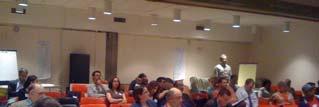
1 MBTA Key Bus Route Improvement Program Community Meeting Route 66 - Brookline February 9, 2011 Brookline Town Hall, 333 Washington St., Brookline Agenda Welcome and introductions Safety briefing/accommodations Meeting announcement Key Bus Route Program overview Existing conditions Route 66 Preliminary recommendations Next Steps Discussion 2


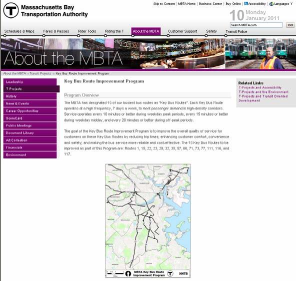
2 Introduction 15 Key Bus Routes $10 million funding 3 Project Schedule Bus Route 66 Develop Concept Jan/ Feb Mar Apr Jun Oct Finalize Plan Engineering Implementation Public Process Feb 9 4
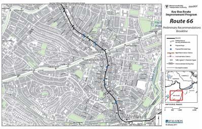
3 Key Bus Route Goals Reliability less bus bunching Faster service fewer delays, less stops, shorter trip times Improved accessibility for seniors and persons with disabilities Passenger amenities shelters, benches, signage, trash receptacles 5 Route 66: Overview Harvard Sq to Dudley Station Via Union Square, Coolidge Corner, Brookline Village, and Brigham Circle Harvard University, Brigham & Women s Hospital, Reggie Lewis Center Connects to: Red, Green, Orange & Silver Lines 26 bus routes, including: KBR 1, 15, 22, 23, 28, 71, 73, 77 6


 41 Outbound (to Harvard")
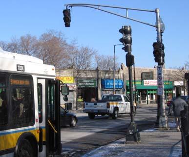
4 Route 66: Overview MBTA s 2 nd busiest route- Over 14,500 avg. daily boardings Peak hour headways Every 8-9 minutes On-time performance 66% Weekday Source: MBTA s 2008 Biennial Service Plan 6.2 miles long 84 Stops 43 Inbound (to Dudley Square) 41 Outbound (to Harvard Square) 7 Typical Conditions - Bus stop length too short 8
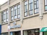
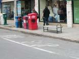
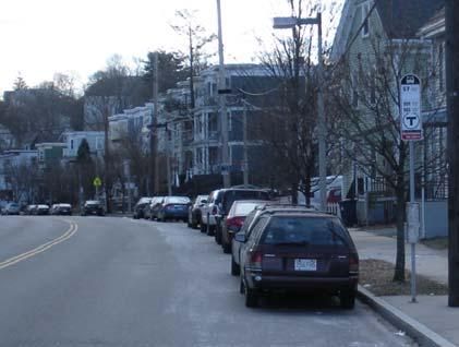
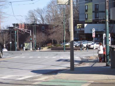
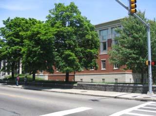
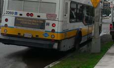
5 Typical Conditions - Poorly located boarding area 9 Typical Conditions - Proximity of bus stops 10


 Route")
6 Typical Conditions - Signage Issues 11 Bus Stop Spacing Ideal spacing is 4-7 stops per mile (every 750-1,320 ft) (4-6 minutes walking distance) Route 66 has stops as close as 310 ft 12
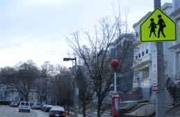
7 Factors for Improving Stop Locations Ridership customer boardings and alightings Proximity to schools, medical centers etc Distance to adjacent stops Reducing traffic congestion Parking impacts Potential to add amenities shelters, benches etc. 13 Bus Stop Consolidation Benefits Shortens bus trip times Improves service reliability Minimizes stop & go experience Provides additional parking spaces Ability to provide better stop amenities 14


8 Good bus stop locations: Sufficient length to pull to the curb Clear boarding/alighting area Not blocking crosswalks or driveways Proper Spacing Considerate of adjacent traffic 15 Improved Accessibility Legal Mandate All bus doors must open at curb Deter cars from parking in stops Providing accessible curb access requires longer bus stops Bus stops must meet Current Guidelines for 40 buses 16


9 Farside 60ft Nearside 80ft Required Bus Stop Lengths 40 bus 17 Midblock (or after left hand turn) 100ft Add Pavement Markings 18


10 Improved Passenger Comfort & Convenience Install shelters where possible Weather protection, seating, comfort New street furniture Shelters, benches, trash barrels 19 New Bus Shelters 20


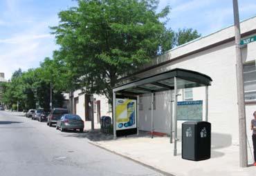
11 Rest on a New Bench 21 Example : Before & After Bus Stop Improvements Proposed Proposed with Amenities 22


12 Improving Customer Information 23 Clear Customer Information Sign upgrades Schedules at stops Maps on buses Neighborhood / bus route maps Next bus countdown 24


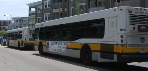
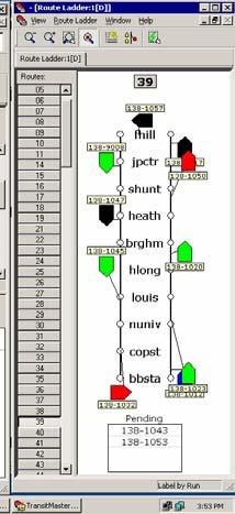
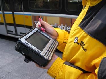
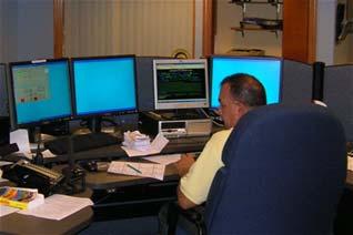
13 Reliability Issues 25 Improving Reliability 26

14 Traffic Signal Improvements 27 Preliminary Recommendations 28


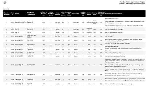
15 Harvard Verndale St Relocate inbound and outbound stops. Add shelter at inbound stop Proposed Proposed 29 2/11/2011 Harvard Beals St Consolidate with Babcock St to nearside of Stedman St 1374 Proposed 30 2/11/


16 Harvard St at Williams St Consolidate with Harvard St opp Babcock St to farside Shailer St 1306 Proposed 31 2/11/ Harvard Beacon St Relocate inbound and outbound stops to improve bus operations. Add amenities Proposed 1372 Proposed 32 2/11/2011 Leading the Nation in Transportation Excellence


17 Harvard Sewall Ave Add new stop to reduce distance between stops*. Add bench and trash receptacle. Proposed * Only if Beacon St stop moves to farside. 33 2/11/2011 Leading the Nation in Transportation Excellence Harvard Marion St Consolidate with Harris St to nearside Foster St, only if shelter can be accommodated at new location Proposed 34 2/11/


18 Harvard Auburn St Remove stop to improve bus stop spacing and due to low ridership /11/2011 Leading the Nation in Transportation Excellence Harvard Aspinwall St Rearrange furniture to improve accessibility and add shelter /11/2011 Leading the Nation in Transportation Excellence


19 ** Harvard School St Relocate to farside of School St Proposed 37 2/11/2011 Leading the Nation in Transportation Excellence Harvard Linden St/Pierce St Remove inbound and outbound stops to improve spacing and low ridership /11/

20 Harvard Washington St Lengthen stop. Add pavement markings, bench, and trash receptacle. Investigate signal improvements /11/2011 Leading the Nation in Transportation Excellence Summary of Preliminary Recommendations Add shelters, benches, trash receptacles Lengthen stops for accessibility Relocate stops Consolidate stops Current Stop Plan 43 IB/41 OB Proposed Stop Plan 33 IB/36 OB Investigate traffic signal improvements Sidewalk improvements/curb extensions 40


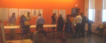
21 Public Outreach
22 Comments and Next Steps Project Updates at Mail to Operations and Service Development, 45 High St, Boston, MA to Next community meeting Discussion 43 2/11/2011 Leading the Nation in Transportation Excellence Discussion These are PRELIMINARY RECOMMENDATIONS We want to hear from you! 44
MBTA Key Bus Route. Community Meeting Route 66 - Boston
 MBTA Key Bus Route Improvement Program Community Meeting Route 66 - Boston Jackson Mann Community Center Agenda Welcome and introductions Safety briefing/accommodations Key Bus Route Program overview Existing
MBTA Key Bus Route Improvement Program. Community Meeting Route 1 - Boston
 MBTA Key Bus Route Improvement Program Community Meeting Route 1 - Boston January 24, 2011 USES, 566 Columbus Ave., Boston Agenda Welcome and introductions Safety briefing/accommodations Key Bus Route
MBTA Key Bus Route. Community Meeting Route 1 - Cambridge
 MBTA Key Bus Route Improvement Program Community Meeting Route 1 - Cambridge Cambridge Senior Center, Central Square Agenda Welcome and introductions Safety briefing/accommodations Key Bus Route Program
MBTA Key Bus Route Improvement Program. Community Meeting Route 28
 MBTA Key Bus Route Improvement Program Community Meeting Route 28 April 5, 2012 Boston Public Library Mattapan Branch Agenda Welcome and introductions Safety briefing/accommodations Key Bus Route Program
MBTA Route 39 Key Bus Route Improvement Program
 MBTA Route 39 Key Bus Route Improvement Program Presentation of Improvements Kennedy School 7 Bolster Street Jamaica Plain Agenda Welcome and Introductions Overview of Route 39 Improvement Program Final
TRANSPORT CHICAGO: STRATEGIC PUBLIC TRANSIT BUS RELIABILITY IMPROVEMENTS
 TRANSPORT CHICAGO: STRATEGIC PUBLIC TRANSIT BUS RELIABILITY IMPROVEMENTS Presented by David VanderZee and Jack Chalabian Monday, June 02, 2014 Overview of Strategic Route Management CTA Strategic Route
CURBSIDE ACTIVITY DESIGN
 5 CURBSIDE ACTIVITY DESIGN This chapter provides design guidance for separated bike lanes adjacent to curbside activities including parking, loading and bus stops. Typical configurations are presented
California Department of Transportation, District 4. Sloat Boulevard Project Skyline Blvd. to 19 th Ave. Community Update January 13, 2016
 California Department of Transportation, District 4 Sloat Boulevard Project Skyline Blvd. to 19 th Ave. Community Update January 13, 2016 Agenda Welcome and introductions Project overview, history and
Providence Downtown Transit Connector STAKEHOLDER MEETING #2. Stakeholder Meeting #1 October 24, 2016
 Providence Downtown Transit Connector STAKEHOLDER MEETING #2 Stakeholder Meeting #1 October 24, 2016 February 2017 1 AGENDA 1 DTC Goals and Expectations 2 Street Design Concepts 3 Potential Benefits and
ALTERNATIVES TO BE CONSIDERED
 ALTERNATIVES TO BE CONSIDERED EXISTING CONDITIONS (BASE CASE) In order to evaluate and understand the potential benefits and impacts of introducing downtown transit improvements in Providence, a Base Case
Everett Transit Action Plan. Community Open House November 16, 2015
 Everett Transit Action Plan Community Open House Everett has a great location, but getting around the city and into surrounding communities is a problem for all ages Many Voices, One Future: The Everett
9. TRANSIT ACCOMMODATIONS
 9. TRANSIT ACCOMMODATIONS INTRODUCTION... 1 FDOT District Four Facilities Guidelines... 1 ESSENTIAL PRINCIPLES OF DESIGNING STREETS FOR TRANSIT... 1 ACCESS TO TRANSIT... 2 BUS STOPS... 3 Layout... 3 -Specific
Chapter 3 BUS IMPROVEMENT CONCEPTS
 Chapter 3 BUS IMPROVEMENT CONCEPTS The purpose of this chapter is to describe potential bus improvement strategies and potential impacts or implications associated with BRT implementation within the existing
Welcome! Thank you for joining us today for a Geary Rapid project open house. Geary Rapid Project. SFMTA.com/GearyRapid
 Welcome! Thank you for joining us today for a Geary Rapid project open house. Get the most out of this event: 1. Sign in and get your feedback sheet 2. Visit project information stations hosted by project
September 20, 2016 L Taraval Rapid Project SFMTA Board of Directors Meeting
 September 20, 2016 L Taraval Rapid Project SFMTA Board of Directors Meeting WHY TARAVAL STREET L TARAVAL PROJECT GOALS 1. Improve state of good repair of our transit system Track and overhead replacement
Agenda. Overview PRINCE GEORGE S PLAZA METRO AREA PEDESTRIAN PLAN
 PRINCE GEORGE S PLAZA METRO AREA PEDESTRIAN PLAN May 28, 2008 Agenda Welcome and introductions Project overview and issue identification Planning context and strengths Design challenges and initial recommendations
Roadways. Roadways III.
 Introduction 97 Roadway Design Principles 98 Safe Speeds 99 Optimizing of Street Space 00 Minimum Lane Widths in the City of Boston 02 Design Features that Reduce Operating Speeds 05 Travel Lanes Transit
Wilshire Boulevard Bus Rapid Transit Project
 Los Angeles County Metropolitan Transportation Authority Wilshire Boulevard Bus Rapid Transit Project COMMUNITY MEETINGS November 2008 Agenda Introduction Proposed Project Overview Participating Agencies
Public Works Committee Meeting Richard E. Mastrangelo Council Chamber November 20, 2017
 Public Works Committee Meeting Richard E. Mastrangelo Council Chamber November 20, 2017 Purpose of Meeting Why are we here? Project Recap/Updates Project Limits/Segments Road Diet Concept Lessons Learned
Indiana University Campus Bus Service. Bus Stop Consolidation
 Indiana University Campus Bus Service Bus Stop Consolidation Logan Garrett 3/17/2011 1 Contents Overview... 3 Campus Core... 3 Third Street (Between Jordan Ave. and Indiana Ave.)... 3 Current Stop Spacing...
Caltrans Sloat Boulevard Pedestrian Safety Project Response to Community Questions, Comments & Concerns
 Caltrans Sloat Boulevard Pedestrian Safety Project Response to Community Questions, Comments & Concerns Revised: May 10, 2016 The California Department of Transportation (Caltrans) is planning various
Contents. Champaign-Urbana Mass Transit District Stop Placement Guidelines
 Contents Champaign-Urbana Mass Transit District Introduction... 1 Stop Spacing... 2 Rural... 2 Low Density Suburban... 2 General Urban... 2 Urban Core... 2 Operational Safety... 3 Stop Placement... 4 Nearside
Southside Pilot Proposal
 To improve bicycle access and mobility to UC Berkeley, Downtown Berkeley, and the Southside area, a pilot project could include a two-way parking-protected cycle track. Turn pockets and island bus stops
Community Meeting February 27, 2007 Dorchester Avenue Transportation & Streetscape Improvements Action Plan February 27, 2007
 Community Meeting Tonight s Agenda 6:00 Introductions South Boston/Dot Ave Improvement Study Background 6:15 Consultant Introductions Review of Scope and Schedule Review of Proposed Corridor Wide Guidelines
Eliminate on-street parking where it will allow for a dedicated bus only lane %
 Traffic Dashboard Priorities Survey Responses Introduction 1) Are you familiar with bus rapid transit (BRT)? a. No, BRT is new to me. 597 23.5% b. I ve heard of BRT, but I don t know much about it. 1,136
GENERAL. 1. Description
 GENERAL 1. Description This standard identifies minimum requirements that shall be met for all Bus Stops in the design and construction of elements for Arlington County Horizontal Design Standards. This
PURPOSE AND NEED SUMMARY 54% Corridor Need 1. Corridor Need 2. Corridor Need 3. Corridor Need 4. Corridor Need 5
 SUMMARY PURPOSE AND NEED Chapel Hill Transit ridership has increased Buses operate every 4 minutes and have standing room only Exceeding seated capacity by 12% Corridor Need 1 by more than 20 percent between
Arlington County 10-Year Transit Development Plan & Premium Transit Network Briefing. May 2016
 Arlington County 10-Year Transit Development Plan & Premium Transit Network Briefing May 2016 Overview 10-Year Transit Development Plan Premium Transit Network Columbia Pike service concept Premium amenities
C Line Rapid Bus Preliminary Station Design
 C Line Rapid Bus Preliminary Station Design C Terrence Anderson, Community Outreach Coordinator Shawn Walding, Senior Engineer Metro Transit TAAC February 1, 2016 1 C Line project overview Substantially
95 th Street Corridor Transportation Plan. Steering Committee Meeting #2
 95 th Street Corridor Transportation Plan Steering Committee Meeting #2 February 18, 2015 PURPOSE OF THE MEETING Update Steering Committee Present Community/Stakeholder Survey Results Present Transportation
Bicycle and Pedestrian Advisory Committee (BPAC) November 21, 2013
 November 21, 2013") Bicycle and Pedestrian Advisory Committee (BPAC) November 21, 2013 OVERALL LAND USE CONCEPT Overall Broadway Valdez District: 95.5 acres (35.1 acres right-of ways + 60.4 acres developable land) Plan Subareas:
Bicycle and Pedestrian Advisory Committee (BPAC) November 21, 2013 OVERALL LAND USE CONCEPT Overall Broadway Valdez District: 95.5 acres (35.1 acres right-of ways + 60.4 acres developable land) Plan Subareas:
9. TRANSIT ACCOMMODATIONS
 9. TRANSIT ACCOMMODATIONS INTRODUCTION...1 Broward County County-Wide Community Design Guidebook...1 FDOT District Four Transit Facilities Guidelines...2 ESSENTIAL PRINCIPLES OF DESIGNING STREETS FOR TRANSIT...3
Pocatello Regional Transit Master Transit Plan Draft Recommendations
 Pocatello Regional Transit Master Transit Plan Draft Recommendations Presentation Outline 1. 2. 3. 4. What is the Master Transit Plan? An overview of the study Where Are We Today? Key take-aways from existing
NJDOT Complete Streets Checklist
 Background The New Jersey Department of Transportation s Complete Streets Policy promotes a comprehensive, integrated, connected multi-modal network by providing connections to bicycling and walking trip
Service Analysis INTRODUCTION
 Service Analysis INTRODUCTION The Everett Transit Action Plan is an initiative to develop near and long-term solutions to improve transit for the residents and workers of Everett. As an initial step in
Better Market Street. Engineering, Maintenance & Safety Committee (EMSC) February 28, 2018
 February 28, 2018") Better Market Street Engineering, Maintenance & Safety Committee (EMSC) February 28, 2018 1 Market Street Market Street - San Francisco by rulenumberone2 2 Market Street is the... City s busiest pedestrian
Better Market Street Engineering, Maintenance & Safety Committee (EMSC) February 28, 2018 1 Market Street Market Street - San Francisco by rulenumberone2 2 Market Street is the... City s busiest pedestrian
M14A/D Select Bus Service
 M14A/D Select Bus Service Manhattan Community Board 6: April 1, 2019 New York City Transit 2 Background M14 Select Bus Service M14 was identified as a critical future SBS corridor in past BRT studies as
NY 5 BRT Conceptual Design Study: Study Advisory Committee Meeting 1. with Creighton Manning Engineering, LLP Logitrans Herb Levinson
 NY 5 BRT Conceptual Design Study: Study Advisory Committee Meeting 1 with Creighton Manning Engineering, LLP Logitrans Herb Levinson September 22, 2003 Overview Introduction to the consultant team Goals
Active Transportation Facility Glossary
 Active Transportation Facility Glossary This document defines different active transportation facilities and suggests appropriate corridor types. Click on a facility type to jump to its definition. Bike
Arterial Transitway Corridors Study. Ave
 Arterial Transitway Corridors Study Ave January 2012 Arterial Transitway Corridors Study Overview Corridor Features and Demographics 11 study corridors, 95 route miles 86,000 daily rides and half of existing
Mission-Geneva Transportation Study Community Workshop 2 July 8, 2006
 Community Workshop 2 July 8, 2006 Small Group Workbook 1 Basic Improvements on Mission Street Streetscape. Pedestrian-scale lighting; landscaping; community art on utility boxes; more (possibly unique)
Cheryl Thole CUTR/NBRTI, Senior Research Associate Tampa, Florida
 A Change in Accessibility and Convenience? Implementing BRT and the Impact on Transit Riders Cheryl Thole CUTR/NBRTI, Senior Research Associate Tampa, Florida Project Background Greater station spacing
Transportation Planning Division
 Transportation Planning Division Presentation Outline Study Tasks Recap of Previous Meetings Data Collected Focus Areas within Study Limits Design Principles Tool Box Recommended Concepts Schedule Moving
APPENDIX A: Complete Streets Checklist DRAFT NOVEMBER 2016
 APPENDIX A: Complete Streets Checklist DRAFT NOVEMBER 2016 Complete Streets Checklist MetroPlan Orlando s Complete Streets Checklist is an internal planning tool for staff to further implementation of
PROJECT OVERVIEW. Auburn Station Access Improvements Project
 ROJECT OVERVIEW Auburn Station Access Improvements roject Average daily ridership on the south Sounder line has been growing rapidly over the past few years and is expected to increase approximately 70
Tonight is for you. Learn everything you can. Share all your ideas.
 Strathcona Neighbourhood Renewal Draft Concept Design Tonight is for you. Learn everything you can. Share all your ideas. What is Neighbourhood Renewal? Creating a design with you for your neighbourhood.
S T A T I O N A R E A P L A N
 The Circulation and Access Plan describes vehicle, pedestrian, and transit improvements recommended within the Concept Plan. In order to create and sustain a vibrant business district that provides pedestrian-friendly
Transit Priority. Peter G Furth
 Transit Priority Peter G Furth Fourth in a series of Policy Briefings to Boston City Council s Committee on Parks, Recreation, & Transportation Feb 2, 2017 What Does Transit Priority Look Like? Zurich
February 2018 HIGHWAY 316 IMPROVEMENTS PROJECT
 February 2018 HIGHWAY 316 IMPROVEMENTS PROJECT Agenda 1 2 3 4 5 A Message from the City Project Area Traffic Conditions Pedestrian/Bicycle Comfort & Safety Next Steps Q&A City of Hastings Supports a study
SAN FRANCISCO MUNICIPAL TRANSPORTATION AGENCY
 THIS PRINT COVERS CALENDAR ITEM NO. : 11 DIVISION: Transit BRIEF DESCRIPTION: SAN FRANCISCO MUNICIPAL TRANSPORTATION AGENCY Approving parking and traffic modifications on San Bruno Avenue included in the
Southwest Bus Rapid Transit (SW BRT) Functional Planning Study - Executive Summary January 19 LPT ATTACHMENT 2.
 Functional Planning Study - Executive Summary January 19 LPT ATTACHMENT 2.") Southwest Bus Rapid Transit (SW BRT) Functional Planning Study - Executive Summary 2011 January 19 1 of 19 Introduction This executive summary presents the results of the Southwest Bus Rapid Transit (SW
Southwest Bus Rapid Transit (SW BRT) Functional Planning Study - Executive Summary 2011 January 19 1 of 19 Introduction This executive summary presents the results of the Southwest Bus Rapid Transit (SW
Sloat Blvd. Pedestrian Safety Improvement Project
 Sloat Blvd. Pedestrian Safety Improvement Project Department of Public Works Project team and background Budget Schedule Scope of work Sloat Blvd - Everglade Drive Sloat Blvd - Forest View Drive Sloat
Kennedy Plaza and Providence Downtown Transit Connector PUBLIC MEETING. Stakeholder Meeting #1 October 24, 2016
 Kennedy Plaza and Providence Downtown Transit Connector PUBLIC MEETING Stakeholder Meeting #1 October 24, 2016 May 2017 1 WHAT IS THE DTC? 1.5 mile corridor between Providence Station and the Hospital
Community Task Force November 15, 2017
 Community Task Force November 15, 2017 Welcome and Introductions Project Partners Regional Transportation District (RTD) Colorado Department of Transportation (CDOT) Denver Regional Council of Governments
Data Analysis February to March Identified safety needs from reported collisions and existing travel patterns.
 Welcome! Thank you for participating in today s Valencia Bikeway Improvements workshop. Data Analysis February to March Identified safety needs from reported collisions and existing travel patterns. Initial
Greater Cleveland Regional Transit Authority
 Greater Cleveland Regional Transit Authority Transit Priority Corridor Initiatives West 25 th Street /East 105 th /East 93 rd Streets June 20, 2017 Presented to: Planning & Development Committee Greater
Purpose + Need. Connect: Thrive: Develop: < Strengthen the spine of our regional transportation system
 Purpose + Need I-29 NW Barry Road 64/68/72 MAIN STREET Connect: < Strengthen the spine of our regional transportation system Leavenworth Road Parallel Parkway State Avenue 18th Street Expressway Shawnee
North Avenue Corridor Study
 North Avenue Corridor Study City Council October 6, 2014 Presentation Outline Project Initiation & Process Corridor Conditions & Issues Vision & Goals Concept Development - Development/Evaluation Implementation
Arterial Transitway Corridors Study
 Arterial Transitway Corridors Study February 2012 Arterial Transitway Corridors Study Overview Corridor Features and Demographics 11 study corridors, 95 route miles Routes: 86,000 daily rides and half
MASONIC AVENUE STREET DESIGN STUDY Community Workshop 2. Masonic Ave Street Design Study Community Workshop 2 August 10, 2010
 Masonic Ave Street Design Study Community Workshop 2 August 10, 2010 Introduction MASONIC AVENUE STREET DESIGN STUDY Community Workshop 2 SF Municipal Transportation Agency Javad Mirabdal, Project Manager
PROJECT OBJECTIVES. Improve vehicle capacity for the intersection. Improve pedestrian and bicycle access
 COMMUNITY MEETING Project Update March 15, 2010 Purcellville, Virginia OVERVIEW Project need / objectives Project recap Design elements Proposed improvements Summary of project benefits / next steps PROJECT
SAN FRANCISCO MUNICIPAL TRANSPORTATION AGENCY
 THIS PRINT COVERS CALENDAR ITEM NO. : 10.2 DIVISION: Sustainable Streets BRIEF DESCRIPTION: SAN FRANCISCO MUNICIPAL TRANSPORTATION AGENCY Adopting Conceptual Proposal for Streetscape Improvements to Broadway,
Station Plan: Penn & 43rd Avenue
 Station Plan: Penn & 43rd Avenue This station will serve the northern portion of the Penn Avenue corridor, including the commercial node at 44th Avenue. Ridership and roadway geometry support station siting
BOSTON REGION METROPOLITAN PLANNING ORGANIZATION
 PLANNING ORGANIZATIO BOSTON REGION MPO NMETROPOLITAN BOSTON REGION METROPOLITAN PLANNING ORGANIZATION Stephanie Pollack, MassDOT Secretary and CEO and MPO Chairman Karl H. Quackenbush, Executive Director,
WELCOME Mission-Geneva Transportation Study
 WELCOME Mission-Geneva Transportation Study Study Process and Schedule 2005 2006 Oct Nov Dec Jan Feb Mar Apr May Jun Jul Aug Sept Oct Task 2 Develop Outreach Plan Task 3 Document Existing Conditions/ Prioritize
Rhode Island Bus Stop Design Guide
 Rhode Island Bus Stop Design Guide In partnership with Community Meeting June 2016 Meeting Format Welcome! Presentation Q&A on presentation Break-up Review bus stop design typologies Opportunity to Post-it
CARTA East Cooper Transit Service Transportation Committee Town of Mount Pleasant. February 5, 2013
 CARTA East Cooper Transit Service Transportation Committee Town of Mount Pleasant February 5, 2013 Service Overview Study Overview East Cooper Service Analysis Provide additional analysis as a follow up
EL CAMINO REAL BUS RAPID TRANSIT PROJECT
 EL CAMINO REAL BUS RAPID TRANSIT PROJECT Would upgrade the current 522 Rapid Bus to BRT status by making changes to El Camino Real and The Alameda that make transit FAST, FREQUENT AND RELIABLE and make
Transportation Impact Assessment
 Transportation Impact Assessment 1) Goals Assess Traffic Impacts for Evaluation by School Building Committee Understand Current Conditions Provide Recommendation for: - Safety for Children - Adequate Drop-Off/
Improvements within the Route 107 study area were developed in accordance with the MassDOT Project Development and Design Guide of 2006.
 VI. RECOMMENDATIONS INTRODUCTION Improvements within the Route 107 study area were developed in accordance with the MassDOT Project Development and Design Guide of 2006. In selecting the recommended cross-sections
HARRISON STREET/OAKLAND AVENUE COMMUNITY TRANSPORTATION PLAN
 HARRISON STREET/OAKLAND AVENUE Community Workshop #4: Draft Plan Review December 3, 2009 D E S I G N, C O M M U N I T Y & E N V I R O N M E N T INTRODUCTIONS Key Project Staff: Alisa Shen, Project Manager,
Curbside Design Improvements for Eugene Area Bus Stops
 1 Curbside Design Improvements for Eugene Area Bus Stops Natalie Sandberg Background The foundation for creating safe and efficient community linkages is the transportation system. An efficient transportation
MOBILITY WORKSHOP. Joint City Council and Transportation Commission May 5, 2014
 MOBILITY WORKSHOP Joint City Council and Transportation Commission May 5, 2014 Review of General Plan M-1 Develop world-class transit system M-3 Maintain/enhance pedestrian-oriented City M-4 Create comprehensive
EL CAMINO REAL BUS RAPID TRANSIT (BRT) PROJECT
 PROJECT") Agenda Item #4.2 EL CAMINO REAL BUS RAPID TRANSIT (BRT) PROJECT VTA BOARD WORKSHOP MAY 1, 2015 ABOUT THIS PRESENTATION CONTEXT Existing conditions and planning for growth WHAT IS THE PROJECT? Project alternatives
Agenda Item #4.2 EL CAMINO REAL BUS RAPID TRANSIT (BRT) PROJECT VTA BOARD WORKSHOP MAY 1, 2015 ABOUT THIS PRESENTATION CONTEXT Existing conditions and planning for growth WHAT IS THE PROJECT? Project alternatives
Pine Hills Road Pedestrian/Bicycle Safety Study Board of County Commissioners Work Session
 Pine Hills Road Pedestrian/Bicycle Safety Study Board of County Commissioners Work Session February 20, 2018 Meeting Agenda Study Overview Existing Conditions Access Management Potential Gateway Features
Henderson Ave. Complete Streets Project
 Henderson Ave. Complete Streets Project Meeting Purpose To finalize conceptual components of project prior to proceeding with preliminary engineering www.dallascompletestreets.wordpress.com MeetingAgenda
Geary Corridor Bus Rapid Transit
 Geary Corridor Bus Rapid Transit Near-term Improvements Update SAN FRANCISCO COUNTY TRANSPORTATION AUTHORITY SAN FRANCISCO MUNICIPAL TRANSPORTATION AGENCY Phasing Packages Phase 1 Near-term: Delivers project
PROJECT SUMMARY ALBERTA STREETSCAPE PROJECT
 ALBERTA STREETSCAPE PROJECT Revitalizing a Street Rebuilding a Community Realizing a Dream PROJECT SUMMARY December 2001 Project Background In 1998 and 1999, the Alberta Street community was engaged in
SAN FRANCISCO MUNICIPAL TRANSPORTATION AGENCY
 THIS PRINT COVERS CALENDAR ITEM NO. : 8 DIVISION: Sustainable Streets BRIEF DESCRIPTION: SAN FRANCISCO MUNICIPAL TRANSPORTATION AGENCY Approving traffic and parking modifications to implement seven projects
SAN FRANCISCO MUNICIPAL TRANSPORTATION AGENCY
 THIS PRINT COVERS CALENDAR ITEM NO.: 11 DIVISION: Transit Services BRIEF DESCRIPTION: SAN FRANCISCO MUNICIPAL TRANSPORTATION AGENCY Approving the installation of traffic and parking modifications along
MASTER BICYCLE AND PEDESTRIAN PLAN
 VILLAGE OF NORTHBROOK MASTER BICYCLE AND PEDESTRIAN PLAN DRAFT PLAN OPEN HOUSE May 2, 2018 AGENDA 1. Community Engagement 2. Vision and Goals 3. General Structure of Plan 4. Recommendations Overview 5.
Project Goals Project Limits Boston Bikes Data Existing Conditions Proposed Options Discussion
 COMMERCIAL STREET/ ATLANTIC AVENUE BICYCLE FACILITIES Toole Design Group Nick Jackson Michelle Langone Danila, P.E., PTOE April 28, 2011 Presentation Outline Project Goals Project Limits Boston Bikes Data
MASSACHUSETTS AVENUE BRIDGE REPLACEMENT PROJECT APRIL 25, 2018
 MASSACHUSETTS AVENUE BRIDGE REPLACEMENT PROJECT APRIL 25, 2018 AGENDA Introductions Project Benefits Progress to Date Schedule for Remaining Work Phase 3 Activities, Impacts & Traffic Detours Phase 4 Activities
Semi-Annual DC Circulator Forum. February 25, 2014
 Semi-Annual DC Circulator Forum February 25, 2014 Overview DC Circulator service began in 2005. A major planning effort was undertaken in 2011 which established a long-range plan and goals for the system:
Queensboro Bridge Bus Priority Study: Summary of Recommendations. Presentation to Manhattan Community Board 8 May 4, 2011
 : Summary of Recommendations Presentation to Manhattan Community Board 8 May 4, 2011 1 Overview Study Goal: Identify cost-effective ways to improve bus speed and reliability for local and express buses
Downtown Naples Mobility and Connectivity Study. Naples City Council Presentation January 2017
 Downtown Naples Mobility and Connectivity Study Naples City Council Presentation January 2017 Agenda 1. Introduction 2. Scope Review 3. Project Schedule 4. Existing Conditions 5. Public Charrette 6. Mobility
Forest Hills Improvement Initiative
 Forest Hills Improvement Initiative Transportation Action Plan Short Term Recommendations ONLY Final Draft as of April 30, 2008 For Community Review and Feedback Prepared for: The City of Boston Boston
MEMORANDUM. TO: Transportation Planning and Programming Committee December 4, 2008 of the Boston Region Metropolitan Planning Organization
 MEMORANDUM TO: Transportation Planning and Programming Committee December 4, 2008 of the Boston Region Metropolitan Planning Organization FROM: Mark S. Abbott, PE Efi Pagitsas RE: MBTA Transit Signal Priority
14 TH STREET TRANSPORTATION & STREETSCAPE DESIGN STUDY PLAN B PLAN B TRANSPORTATION & STREETSCAPE RECOMMENDATIONS
 14 TH STREET TRANSPORTATION & STREETSCAPE DESIGN STUDY PLAN B PLAN B TRANSPORTATION & STREETSCAPE RECOMMENDATIONS 141 Symbols Recommendations - Southern End of 14th Street Study Area Streetscape Each icon
Chicago Safe Routes to School Safe Routes to High School (SRTS/SRTHS)
") Chicago Safe Routes to School Safe Routes to High School (SRTS/SRTHS) Marshall Community High School and Faraday Elementary School Recommended Improvements Agenda Goals Related Programs Project Location/Area
Chicago Safe Routes to School Safe Routes to High School (SRTS/SRTHS) Marshall Community High School and Faraday Elementary School Recommended Improvements Agenda Goals Related Programs Project Location/Area
MONTGOMERY COUNTY PLANNING DEPARTMENT
 MONTGOMERY COUNTY PLANNING DEPARTMENT THE MARYLAND-NATIONAL CAPITAL PARK AND PLANNING COMMISSION Veirs Mill Corridor Master Plan: Work Session #5 MCPB Item No. Date: 10/04/18 Jessica McVary, Planner Coordinator,
Kansas City Area Transportation Authority. Downtown Transit Improvement Vision 2/11/15
 Kansas City Area Transportation Authority Downtown Transit Improvement Vision 2/11/15 Today s Meetings Downtown Transit Vision Long Term Vision for Downtown Bus Service Priorities for Short Term Implementation
Citizen Advisory Group Meeting #8 May 5, Welcome. Today s meeting will focus on: Land Use & Transportation CHARLOTTEPLANNING.
 Citizen Advisory Group Meeting #8 May 5, 2010 Welcome. Today s meeting will focus on: Land Use & Transportation CHARLOTTEPLANNING.ORG Meeting Agenda Handouts: o Meeting Agenda o Summary of East Seventh
Technical Working Group November 15, 2017
 Technical Working Group November 15, 2017 Welcome and Introductions Project Partners Regional Transportation District (RTD) Colorado Department of Transportation (CDOT) Denver Regional Council of Governments
Item B1 November 19, 2009
 November 19, 2009 Planning and Development Department Land Use Planning Division DATE: November 19, 2009 STAFF REPORT TO: FROM: SUBJECT: Members of the Transportation Commission Elizabeth Greene Senior
Clyde Brown Elementary School Millis, MA
 Clyde Brown Elementary School Millis, MA Transportation Assessment August 8, 2017 Prepared for: Tappe Architects Six Edgerly Place Boston, MA 02116 Submitted by: Nitsch Engineering 2 Center Plaza, Suite
STADIUM DISTRICT CENTER PLATFORM TACOMA LINK EXPANSION. Existing bus stop remains. Existing parallel parking removed for bus access.
 STADIUM DISTRICT CENTER PLATFORM Inbound to Tacoma Dome Redevelopment increases parking on Division Ave Existing bus stop remains TULLY S Existing parallel parking removed for bus access Ped plaza or landscaping
41st Avenue B-Line Kerrisdale Village Street Improvements
 1. WELCOME! 41st Avenue B-Line Kerrisdale Village Improvements Public Open House Please sign in so we can provide updates and information on construction The City of Vancouver is working with TransLink
PRINCE GEORGE S PLAZA METRO AREA PEDESTRIAN PLAN
 PRINCE GEORGE S PLAZA METRO AREA PEDESTRIAN PLAN May 28, 2008 Agenda Welcome and introductions Project overview and issue identification Planning context and strengths Design challenges and initial recommendations
Morristown, NJ Complete Streets Policy
 Morristown, NJ Complete Streets Policy Introduction A Complete Street is defined as a means to provide safe access for all users by designing and operating a comprehensive, integrated, connected multi-modal