MASSACHUSETTS AVENUE BRIDGE REPLACEMENT PROJECT APRIL 25, 2018
|
|
|
- Dwight Snow
- 5 years ago
- Views:
Transcription

1 MASSACHUSETTS AVENUE BRIDGE REPLACEMENT PROJECT APRIL 25, 2018
2 AGENDA Introductions Project Benefits Progress to Date Schedule for Remaining Work Phase 3 Activities, Impacts & Traffic Detours Phase 4 Activities & Impacts Public Outreach & Contact Information 2


3 PROJECT TEAM Mayor Martin J. Walsh 3

4 PROJECT LOCATION 4

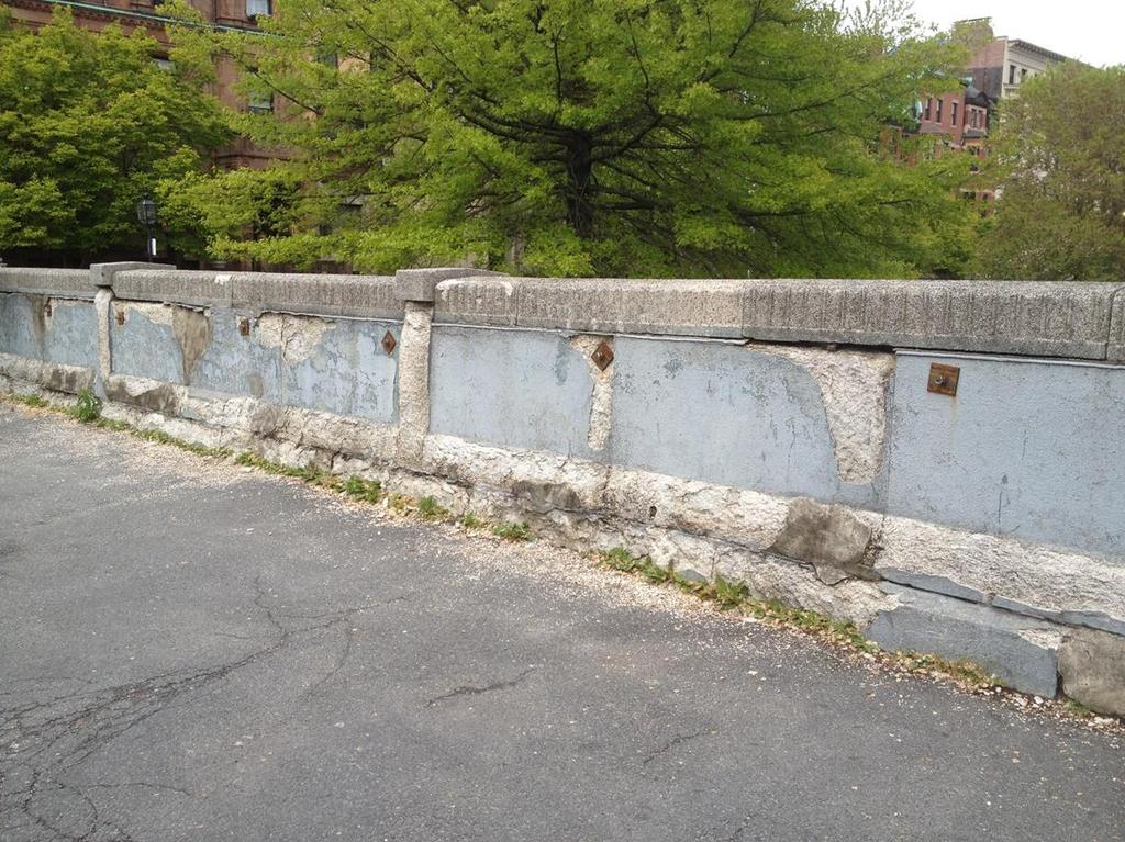
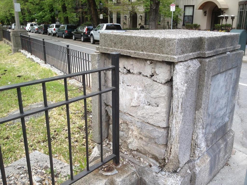
5 PROJECT BENEFITS Deteriorated elements are replaced 5

6 PROJECT PROGRESS 6

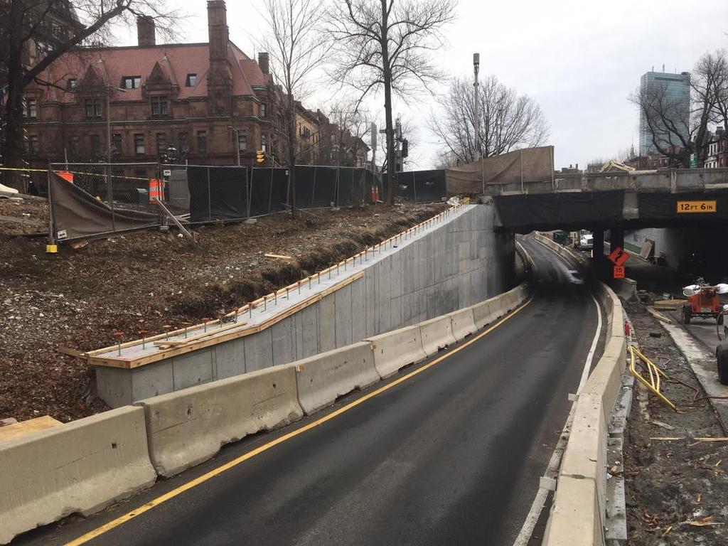
7 PROJECT PROGRESS 7
8 CONVENTIONAL BRIDGE CONSTRUCTION Conventional Construction Would Have Taken 3+ Years: Constant lane takings on both Mass Ave and Comm Ave At times only 1 lane of traffic in each direction on Mass Ave More night work over 3 years Reduced speed and detouring large trucks, buses, and bicyclists through the neighborhood 8
9 ACCELERATED BRIDGE CONSTRUCTION Schedule and Scope of Remaining Work with 4-Day Bridge Replacement: Phase 1: Early utility relocation Complete Phase 2: Substructure improvements by alternating closure of Comm Ave bypasses Ongoing Phase 3: Bridge replacement 4-day full closure of Mass Ave over Comm Ave bypasses between surface roads to replace bridge 10:00 PM, Thursday, May 10, to 5:00 AM, Tuesday, May day full closure of Comm Ave bypass roads under bridge Saturday, May 5, through Wednesday, May 23 Phase 4: Comm Ave bypass barrier completion, Mass Ave sidewalk and barrier work, Mass Ave surface work (new lighting, traffic signals, refurbished fence, new pavement, pavement markings, and bike lanes) May Fall
10 CONSTRUCTION IMPACTS Phase 3 (10:00 PM on Thursday, May 10, to 5:00 AM on Tuesday, May 15; 24 hours/day) prepare for and install new prefabricated bridge units Mass Ave between Comm Ave surface roads closed, with through traffic detours Access maintained for local traffic and to businesses Pedestrians and bicyclists use crossings at Charlesgate East and Hereford Street No parking spaces will be taken on Mass Ave 10
11 CONSTRUCTION IMPACTS (CONT.) Phase 3 (cont.) Comm Ave east and westbound bypass roads under Mass Ave closed for work required to prepare for and complete prefabricated bridge unit installation Access maintained for vehicles and bicyclists using surface roads No parking will be permitted on Comm Ave surface roads between Charlesgate East and Hereford Street because they are detour routes 11
 Detour Routes no parking permitted on detour route limits outlined below Maintain emergency response access and accommodate increased traffic volumes Commonwealth Avenue east and westbound from")
12 CONSTRUCTION IMPACTS (CONT.) Detour Routes no parking permitted on detour route limits outlined below Maintain emergency response access and accommodate increased traffic volumes Commonwealth Avenue east and westbound from Hereford St. to Charlesgate West Beacon Street even side from Hereford St. to Massachusetts Ave. Beacon Street odd side from Massachusetts Ave. to Charlesgate West Hereford Street both sides from Boylston St. to Beacon St. Boylston Street both sides from Massachusetts Ave. to Hereford St. No parking spaces will be taken on Mass Ave 12
13 CONSTRUCTION IMPACTS (CONT.) MBTA Bus Stops for Routes 1 and CT1 Inbound traveling south on Massachusetts Avenue at Marlborough Street Closed at Newbury Street Unaffected Outbound traveling north on Massachusetts Avenue at Beacon Street Relocated to opposite side of Beacon Street at Newbury Street Relocated to Boylston Street at St. Cecilia Street 13
14 CONSTRUCTION IMPACTS (CONT.) Phase 4 (May Fall 2018) Mass Ave surface work (new lighting, traffic signals, refurbished fence, new pavement, pavement markings, and bike lanes) and Comm Ave bypass median barrier completion Mass Ave alternating lane closures during off-peak hours (10:00 AM to 2:00 PM), one lane of travel in each direction maintained; one sidewalk maintained for pedestrian access at all times Comm Ave westbound bypass road closed for approximately three months following Phase 3 (westbound vehicles and bicyclists continue to use surface road, eastbound vehicles use eastbound bypass and eastbound bicyclists use surface road) Note: During Phase 4, noise will be limited to 7:00 AM 7:00 PM, except for nighttime paving operations 14
15 WORK HOURS Extended Work Shifts: Monday Friday 7:00 AM 7:00 PM During the Weekend Closure: 24 hours a day for 4 ¼ days Starting at 10:00 PM Thursday night and ending at 5:00 AM Tuesday morning 15

16 PREFABRICATED BRIDGE UNIT DELIVERY PBUs stored at Beacon Park Rail Yard in Allston & delivered via the route below to the project site. 16


17 PRECAST BRIDGE DELIVERY PBUs will be stored on the closed roadway in the Comm Ave bypass area. 17

18 WEEKEND CLOSURE SCHEDULE 18

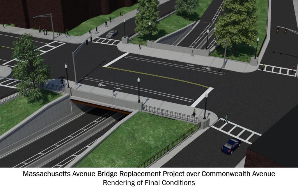
19 FINAL CONDITION 20
20 PUBLIC OUTREACH E-Blast updates and advisories Flyers hand delivered to abutters Press releases Social media Business coordination meeting - 4/18/2018 Public meetings 2/6/2017, 3/28/2018, 4/25/2018 BAA and City coordination for permitted events Signage advanced notification of traffic patterns and VMS boards 21
21 CONTACT US Donny Dailey, MassDOT Legislative Liaison: Website: 22
22 APPENDIX I: POLICE DETAIL LOCATIONS Police detail locations during Mass Ave. shutdown 23
23 APPENDIX II: RELOCATED BUS STOPS Relocated bus stops for Routes 1 and CT1 during Mass Ave. shutdown. 24
COMPLETE STREETS DURING CONSTRUCTION
 COMPLETE STREETS DURING CONSTRUCTION MAINTAINING ACCESSIBILITY FOR ALL Presented by Robbie Burgess, P.E., PTOE Associate Principal Construction Services Manager Howard Stein Hudson rburgess@hshassoc.com
Welcome! Fore River Bridge Reconstruction Project Quincy & Weymouth Project File No Public Information Meeting May 18, 2017
 Welcome! Quincy & Weymouth Project File No. 604382 Public Information Meeting May 18, 2017 Project Overview Work Completed to Date Upcoming Work and Mitigation Remaining Approach Span Work (May 14 -
Scarlett Road Bridge & Road Improvements Lambton Park Community School - Gymnasium Tuesday November 28 th, 2017
 Scarlett Road Bridge & Road Improvements Lambton Park Community School - Gymnasium Tuesday November 28 th, 2017 PROJECT LOCATION 2 SCARLETT ROAD BRIDGE Constructed in 1912, the bridge carries 4 active
Cincinnati Dayton Rd Widening
 Cincinnati Dayton Rd Widening Project Overview Widening of Cincinnati Dayton Rd to four lanes - providing a center turn lane and an additional northbound lane Realignment of Station Rd Widening of bridge
PROJECT FACT SHEET May 25, 2018
 SITE CHALLENGES & PROJECT BACKGROUND In 2014, the City of Aspen identified the Castle Creek Bridge and Hallam Street corridor as a deficient link in Aspen s bicycle and pedestrian network. Safe and efficient
PROJECT FACT SHEET March 21, 2018
 SITE CHALLENGES & PROJECT BACKGROUND In 2014, the City of Aspen identified the Castle Creek Bridge and Hallam Street corridor as a deficient link in Aspen s bicycle and pedestrian network. Safe and efficient
Weymouth - Abington Route 18 Widening and Reconstruction Project File No
 Weymouth - Abington Route 18 Widening and Reconstruction Project File No. 601630 PROJECT LOCATION Project Limit Previously Completed Signalized Intersections (Typical) Route 18 Widening Bridge No. W-32-013
U.S. HIGHWAY 50 IMPROVEMENT PROJECT
 U.S. HIGHWAY 50 IMPROVEMENT PROJECT in the City of South Lake Tahoe Project Purpose and Need Planned Improvements Project Cost and Delivery Schedule Proposed Construction Staging Project Partners: HIGHWAY
Clybourn Ave. Protected Bike Lane Study Halsted St. to Division St.
 Clybourn Ave. Protected Bike Lane Study Halsted St. to Division St. Nathan Roseberry, Senior Engineer Pam Broviak, Project Manager July 24, 2014 Agenda Project Goals Existing Roadway Conditions Traffic
Bicycle + Pedestrian Connectivity Gap Analysis
 Accelerated Bridge Program Bicycle + Pedestrian Connectivity Gap Analysis Tuesday, October 11 Shriners Hospital, Boston 6:30-8:00 PM Thursday, October 13 Community Rowing, Brighton 6:30-8:00 PM Tuesday,
City of Sammamish. Welcome. Issaquah-Fall City Road Improvements Project Phase I Design: 242nd Avenue SE to Klahanie Drive SE
 Welcome Welcome to the third community meeting for the Issaquah-Fall City Road Improvements Project. AGENDA 6:00 p.m. Welcome and sign-in 6:10 p.m. Presentation 6:50 p.m. Open house Learn about the roadway
Design Criteria. Design Criteria
 F Design Criteria Design Criteria Ministry of Transportation Ministère des Transports DESIGN CRITERIA Page: 1 of 13 WORK PROJECT NO. N/A GO Bloomington Station TYPE OF PROJECT LOCATION Bloomington Road
Replacement of N. Carlin Springs Road Bridge over George Mason Dr.
 Replacement of N. Carlin Springs Road Bridge over George Mason Dr. Approximate schedule with phases and proposed Maintenance of Travel (MOT) plans February 2017 Project Elements Removal of existing bridge
MBTA Key Bus Route. Community Meeting Route 1 - Cambridge
 MBTA Key Bus Route Improvement Program Community Meeting Route 1 - Cambridge Cambridge Senior Center, Central Square Agenda Welcome and introductions Safety briefing/accommodations Key Bus Route Program
Commonwealth Ave Bridge Replacement Project Community Meeting: Summary
 Commonwealth Ave Bridge Replacement Project Community Meeting: Summary June 2, 2016 6:00 PM Boston University, Jacob Sleeper Auditorium, 871 Commonwealth Avenue, Boston, MA Massachusetts Department of
The Van Ness Campus. Weekly Construction Bulletin #238
 The Van Ness Campus Weekly Construction Bulletin #238 Construction Update Week of April 23, 2018 The Van Ness Campus Weekly Bulletins are intended to help inform members of the community about upcoming
Trial Restriping Project. October 21, 2010
 Arastradero Road Trial Restriping Project P t C t ti C it O t hm ti N 1 Post Construction Community Outreach Meeting No. 1 October 21, 2010 Agenda Staff Introductions Project Background Project Status
IL Route 71 Construction Update
 100 Parkers Mill Oswego, IL. 60543 (630) 554-3618 4.20.16 IL 71 TRAFFIC ADVISORY: Tentatively scheduled for April 21st A new traffic pattern from Paradise to Wolf Crossing on IL 71 will be in use. The
UPTOWN REGIONAL BIKE CORRIDORS PROJECT SAN DIEGO ASSOCIATION OF GOVERNMENTS
 UPTOWN REGIONAL BIKE CORRIDORS PROJECT SAN DIEGO ASSOCIATION OF GOVERNMENTS SUMMARY REPORT: COMMUNITY UPDATE MEETING February 6, 2014 6 8:30 p.m. Roosevelt Middle School Library 3366 Park Blvd, San Diego
MEMORANDUM. Charlotte Fleetwood, Transportation Planner
 MEMORANDUM Date: Updated August 22, 2017 To: Organization: Charlotte Fleetwood, Transportation Planner Boston Transportation Department From: Jason DeGray, P.E., PTOE, Regional Director of Engineering
CITY OF WOODINVILLE ONGOING CAPITAL IMPROVEMENT PROJECT UPDATES
 CITY OF WOODINVILLE ONGOING CAPITAL IMPROVEMENT PROJECT UPDATES PROJECT LOCATION MAP (1) DEYOUNG PARK IMPROVEMENTS Project Description - DeYoung Park Improvements include treehouse deck, play area, new
Crystal City Potomac Yard Transitway. Enforcement Ordinance & Construction Update
 Enforcement Ordinance & Construction Update December 2015 Project Purpose Provide high-capacity, high-quality transit service Support redevelopment in Crystal City and in Potomac Yard in Alexandria and
Traffic Control Inspection Checklist Segment:
 Traffic Control Inspection Checklist Segment: Simon Contractors Simon Contractors Originator: Description Reviewed by: Initials Date Distribution: Traffic Quality Manager, Site Assistant Traffic Manager
CITY OF OTTAWA ROADWAY MODIFICATION APPROVAL UNDER DELEGATED AUTHORITY
 RMA-2015-ATM-038 CITY OF OTTAWA ROADWAY MODIFICATION APPROVAL UNDER DELEGATED AUTHORITY DATE: April 22, 2015 SUBJECT Approval of Roadway Modifications Recommended through an Area Traffic Management Study
Purple Line Extension Community Meeting
 Purple Line Extension Community Meeting August 22, 2016 Agenda Introductions Meeting Goals Project Overview and Schedules Proposed Memorandum of Agreement Overview Stay in Touch! Q & A Meeting Goals Provide
Public Works Committee Meeting Richard E. Mastrangelo Council Chamber November 20, 2017
 Public Works Committee Meeting Richard E. Mastrangelo Council Chamber November 20, 2017 Purpose of Meeting Why are we here? Project Recap/Updates Project Limits/Segments Road Diet Concept Lessons Learned
MBTA Key Bus Route Improvement Program. Community Meeting Route 1 - Boston
 MBTA Key Bus Route Improvement Program Community Meeting Route 1 - Boston January 24, 2011 USES, 566 Columbus Ave., Boston Agenda Welcome and introductions Safety briefing/accommodations Key Bus Route
Upper Market Street Bike Lane Project
 Upper Market Street Bike Lane Project 17th Street to Octavia Boulevard 6 30 2010 SAN FRANCISCO, CALIFORNIA Agenda San Francisco & Sustainable Transportation Project Goals Outreach & Coordination Project
CRESTON ROAD COMPLETE AND SUSTAINABLE STREETS CORRIDOR PLAN
 CRESTON ROAD COMPLETE AND SUSTAINABLE STREETS CORRIDOR PLAN Preferred Plan Community Presentation September 27, 2017 City of El Paso de Robles in partnership with: Local Government Commission, W-Trans,
Blair/Williamson Intersection Expressed Needs
 Blair/Williamson Intersection Expressed Needs NORTH Blair Street is a barrier for pedestrians and bicycles Relocate Capitol City Trail crossing from Blair Street and John Nolen Drive intersection to Williamson
Work Session. Agenda Item # 4. Meeting Date September 8, Daryl Braithwaite Public Works Director. Prepared By. Suzanne R. Ludlow City Manager
 Agenda Item # 4 Work Session Meeting Date September 8, 2015 Prepared By Approved By Daryl Braithwaite Public Works Director Suzanne R. Ludlow City Manager Discussion Item Background Temporary Neighborhood
Hospital Link Project Project Update September 2017
 Hospital Link Project Project Update September 2017 General The project provides a link from Riverside Drive and the Transitway to the Hospital Link Road. Construction is well underway. Read on for important
MASTER BICYCLE AND PEDESTRIAN PLAN
 VILLAGE OF NORTHBROOK MASTER BICYCLE AND PEDESTRIAN PLAN DRAFT PLAN OPEN HOUSE May 2, 2018 AGENDA 1. Community Engagement 2. Vision and Goals 3. General Structure of Plan 4. Recommendations Overview 5.
Everyone is a Pedestrian
 Everyone is a Pedestrian Improving Pedestrian Safety in Texas Transportation and Trinity River Project Committee 26 May 2015 Everyone is a Pedestrian Federal Highway Administration [ FHWA ] Programs to
GRANDFORKS MILSPURFEASIBILITYSTUDY. GrandForksandEastGrandForksMPO. FINALReport. August2010
 GRADFORKS MILSPURFEASIBILITYSTUDY GrandForksandEastGrandForksMPO FIALReport August2010 Table of Contents Chapter 1: Introduction and Background... 1 Chapter 2: Existing Conditions and Issues Identification...
2017 Temporary traffic control guidelines for pedestrians. v.2
 2017 Temporary traffic control guidelines for pedestrians v.2 Temporary Traffic Control Guidelines for Pedestrians (2017) The safety and mobility of pedestrians, cyclists and motorists must be considered
California Department of Transportation, District 4. Sloat Boulevard Project Skyline Blvd. to 19 th Ave. Community Update January 13, 2016
 California Department of Transportation, District 4 Sloat Boulevard Project Skyline Blvd. to 19 th Ave. Community Update January 13, 2016 Agenda Welcome and introductions Project overview, history and
Caltrans Sloat Boulevard Pedestrian Safety Project Response to Community Questions, Comments & Concerns
 Caltrans Sloat Boulevard Pedestrian Safety Project Response to Community Questions, Comments & Concerns Revised: May 10, 2016 The California Department of Transportation (Caltrans) is planning various
Welcome. 53 Avenue Overpass over Whitemud Drive Rehabilitation. Public Information Session. Wednesday, March 9, :30-8:00 p.m.
 BRIDGE REHABILITATION Welcome 53 Avenue Overpass over Whitemud Drive Rehabilitation Public Information Session Wednesday, March 9, 2016 4:30-8:00 p.m. Tonight you can: Learn about the 53 Avenue Overpass
Roadways. Roadways III.
 Introduction 97 Roadway Design Principles 98 Safe Speeds 99 Optimizing of Street Space 00 Minimum Lane Widths in the City of Boston 02 Design Features that Reduce Operating Speeds 05 Travel Lanes Transit
PCH/DEL PRADO STREET IMPROVEMENTS PUBLIC OUTREACH MEETING
 PCH/DEL PRADO STREET IMPROVEMENTS PUBLIC OUTREACH MEETING JANUARY 22, 2014 MEETING AGENDA 1. INTRODUCTION OF STAFF 2. PROJECT SCHEDULE 3. PROJECT SCOPE 4. GENERAL CONCERNS 5. COMMUNICATIONS 6. ODDS AND
April/May 2017 Public Meetings: Summary
 April/May 2017 Public Meetings: Summary Monday, April 24, 2017 Boston University Jacob Sleeper Auditorium 871 Commonwealth Ave, Boston, MA Thursday, April 27, 2017 Boston University Jacob Sleeper Auditorium
Drag and drop pic and stretch/crop to the limits of the blue rectangle (delete this text box) Maxey Elementary School
 Maxey Elementary School") Drag and drop pic and stretch/crop to the limits of the blue rectangle (delete this text box) Maxey Elementary School SCHOOL ROUTE PLAN For MAXEY ELEMENTARY SCHOOL LOCATION 33 ORANGE COUNTY Prepared for:
Drag and drop pic and stretch/crop to the limits of the blue rectangle (delete this text box) Maxey Elementary School SCHOOL ROUTE PLAN For MAXEY ELEMENTARY SCHOOL LOCATION 33 ORANGE COUNTY Prepared for:
I-215 / NEWPORT ROAD INTERCHANGE PROJECT PRESS KIT
 I-215 / NEWPORT ROAD INTERCHANGE PROJECT PRESS KIT March I-215 / NEWPORT ROAD INTERCHANGE PROJECT Fact Sheet Project Overview This project will reconstruct the existing interchange located on Interstate
5. RUNNINGWAY GUIDELINES
 5. RUNNINGWAY GUIDELINES These guidelines should be considered collectively when making runningway decisions. A runningway is the linear component of the transit system that forms the right-of-way reserved
Hospital Link Project Project Update November 2017
 Hospital Link Project Project Update November 2017 General The project provides a link from Riverside Drive and the Transitway to the Hospital Link Road. Construction is well underway. Read on for important
Marina Bay Trail Community Meeting #1
 Marina Bay Trail Community Meeting #1 AGENDA 1. Introductions: Meghan Tiernan, DPW Cristina Olea, DPW Jerry Robbins, SFMTA 2. Meeting Purpose:. 4. 5. 6. To introduce the project to the community and gather
ROAD SAFETY AUDIT. Granite Avenue at Interstate 93 Ramps. Town of Milton. May 22, Prepared for: MassDOT
 ROAD SAFETY AUDIT Granite Avenue at Interstate 93 Ramps Town of Milton May 22, 2017 Prepared for: MassDOT Prepared by: Toole Design Group 2 Oliver Street, Suite 305 Boston, MA 02109 Table of Contents Background...
FDOT Treasure Coast Traffic Impact Report
 January 20, 2017 Chuck McGinness, 954 777 4302 chuck.mcginness@dot.state.fl.us FDOT Treasure Coast Traffic Impact Report January 20 through January 27, 2017 TREASURE COAST Construction and maintenance
Tunnel Reconstruction Brooklyn CB 1 August 14, 2018
 Tunnel Reconstruction Brooklyn CB 1 August 14, 2018 Reconstructing the Tunnel 2 Service During Tunnel Reconstruction April 2019 through July 2020 3 Projected Cross River Travel Paths of Customers The Service
Tunnel Reconstruction South 5 th Street Association October 16, 2018
 Tunnel Reconstruction South 5 th Street Association October 16, 2018 Reconstructing the Tunnel 2 Service During Tunnel Reconstruction April 2019 through July 2020 3 Projected Cross River Travel Paths of
MUTCD Part 6G: Type of Temporary Traffic Control Zone Activities
 MUTCD Part 6G: Type of Temporary Traffic Control Zone Activities 6G.01 Typical Applications Each temporary traffic control (TTC) zone is different. Many variables, such as location of work, highway type,
Lee County Department of Transportation 1500 Monroe Street Fort Myers, FL (239) (239) Fax
 (239) Fax") Lee County Department of Transportation 1500 Monroe Street Fort Myers, FL 33901 (239) 533-8580 (239) 485-8520 Fax RoadWatch Update December 20, 2018 January 2, 2019 Alva Bridge & Big Carlos Pass Bridge:
Lee County Department of Transportation 1500 Monroe Street Fort Myers, FL 33901 (239) 533-8580 (239) 485-8520 Fax RoadWatch Update December 20, 2018 January 2, 2019 Alva Bridge & Big Carlos Pass Bridge:
APPENDIX A: Complete Streets Checklist DRAFT NOVEMBER 2016
 APPENDIX A: Complete Streets Checklist DRAFT NOVEMBER 2016 Complete Streets Checklist MetroPlan Orlando s Complete Streets Checklist is an internal planning tool for staff to further implementation of
Transportation Management Program Office Newsletter J U L Y
 I N S I D E T H I S I S S U E : Traffic Changes at Eads Street; Temporary Relocation of Slug Stations FSD Director s Message 1 1 Upcoming Events 2 Transportation Management Program Office Newsletter J
Public Involvement Meeting Tuesday, June 13, Albany Shaker Road Corridor Study
 Public Involvement Meeting Tuesday, June 13, 2017 Albany Shaker Road Corridor Study Agenda / Meeting Outline 1. Introduce the project 2. Complete Streets 3. Share/confirm our findings 4. Your Opinion 5.
NEWMARKET UPHAM S CORNER
 SOUTH STATION Planning Initiative NEWMARKET UPHAM S CORNER COLUMBIA ROAD (P) FOUR CORNERS/GENEVA Working Advisory Group (WAG) Meeting #5 TALBOT AVENUE MORTON STREET BLUE HILL AVE/CUMMINS HWY (P) RIVER
Glebe Neighbourhood Cycling Plan
 Glebe Neighbourhood Cycling Plan Summary of Public Comments received after June 5 th Public Information Session Comment STUDY NETWORK CS9, CS8, E, E0 CS4, E CS4 CS8 E Suggestions for alternate cycling
Route 79/Davol Street Corridor Study
 Route 79/Davol Street Corridor Study Fall River, MA Public Information Meeting #2 November 21, 2013 Fall River Heritage State Park Fall River, MA Agenda Welcome and Introductions Overview of Study Process
TOWN OF PALM BEACH FOR IMMEDIATE RELEASE. Patricia Strayer, P.E., Town Engineer Phone: ,
 TOWN OF PALM BEACH DATE: November 9, 2018 FOR IMMEDIATE RELEASE MEDIA CONTACT: Patricia Strayer, P.E., Town Engineer Phone: 561-838-5440, Email: pstrayer@townofpalmbeach.com Construction & Traffic Highlights
The Northern Avenue Bridge is being replaced, and the city is debating just who will be allowed to use it
 The Northern Avenue Bridge has been closed to vehicles since 1997 and to pedestrians since 2014. The Northern Avenue Bridge is being replaced, and the city is debating just who will be allowed to use it
FDOT Treasure Coast Traffic Report
 July 13, 2018 Barbara Kelleher, 954 777 4090 Barbara.Kelleher@dot.state.fl.us FDOT Treasure Coast Traffic Report July 13 through July 20, 2018 TREASURE COAST Construction and maintenance related lane closures
Meeting Date 10/18/2005 Type Internal Team Progress Other Date of Issuance 10/25/05. Coordination See attached sign-in sheet
 Meeting Date 10/18/2005 Type Internal Team Progress Other Date of Issuance 10/25/05 Coordination Attendees See attached sign-in sheet Location Great Hall, Holland Tunnel Route 139 Contract 2 PANYNJ Coordination
BOSTON REGION METROPOLITAN PLANNING ORGANIZATION
 PLANNING ORGANIZATIO BOSTON REGION MPO NMETROPOLITAN BOSTON REGION METROPOLITAN PLANNING ORGANIZATION Stephanie Pollack, MassDOT Secretary and CEO and MPO Chair Karl H. Quackenbush, Executive Director,
TRAFFIC IMPACT ANALYSIS
 TRAFFIC IMPACT ANALYSIS FOR THE CHAMPAIGN UNIT#4 SCHOOL DISTRICT PROPOSED HIGH SCHOOL (SPALDING PARK SITE) IN THE CITY OF CHAMPAIGN Final Report Champaign Urbana Urbanized Area Transportation Study 6/24/2014
ITEM # 29 DATE: COUNCIL ACTION FORM ROAD CLOSURES FOR RAGBRAI ROUTE BACKGROUND:
 ITEM # 29 DATE: 05-08-18 COUNCIL ACTION FORM SUBJECT: ROAD CLOSURES FOR RAGBRAI ROUTE BACKGROUND: Ames will be an overnight stop for RAGBRAI XLVI from Tuesday, July 24 th, through Wednesday, July 25 th.
Road Safety Evaluation ation A process to investigate traffic safety on tribal, county, or city roadways Roadway may be selected for evaluation if the
 Road Safety Evaluation Shoalwater Bay Roads WSDOT Highways & Local Programs Road Safety Evaluation ation A process to investigate traffic safety on tribal, county, or city roadways Roadway may be selected
RÉGION D OTTAWA-CARLETON
 8 REGION OF OTTAWA-CARLETON RÉGION D OTTAWA-CARLETON REPORT RAPPORT Our File/N/Réf. Your File/V/Réf. 50 23-00-R030-H DATE 14 July 2000 TO/DEST. FROM/EXP. SUBJECT/OBJET Co-ordinator Transportation Committee
Central Corridor. Light Rail Transit. Improving mobility Easing congestion Strengthening our communities. Committee of the Whole January 30, 2008
 - Committee of the Whole January 30, 2008 Improving mobility Easing congestion Strengthening our communities Today s Agenda Bridges 2 or 3-car trains/platforms Reconstruction of right-ofway Traffic signals
Gateway Transportation Study
 Gateway Transportation Study Amherst, Massachusetts SUBMITTED TO University of Massachusetts Amherst Town of Amherst SUBMITTED BY Vanasse Hangen Brustlin, Inc. Watertown, Massachusetts March 213 Back of
Chapter 17. Work Zone Management. 17 Work Zone Management
 Chapter 17 Work Zone Management 17 Work Zone Management Chapter 17 Work Zone Management 17.1 Introduction Construction always has some impact on the users of the facility. The various activities required
Date: April 4, Project #: Re: A Street/Binford Street Traffic/Intersection Assessment
 To: Peter Cavanaugh General Electric From: David Bohn, PE Ryan White, PE Date: April 4, 217 Project #: 13421. Re: / Traffic/Intersection Assessment Consistent with the Cooperation Agreement between the
Long Island Rail Road Expansion Project Floral Park to Hicksville
 Long Island Rail Road Expansion Project Floral Park to Hicksville Final Environmental Impact Statement Appendix 1-D Complete Streets Policy Checklist April 2017 0902ML PIN: Project Location: 18A-4 Floral
North Avenue Corridor Study
 North Avenue Corridor Study Transportation, Energy and Utilities Committee September 10, 2014 Presentation Outline Project Initiation: Why North Avenue? Existing Conditions + Issues Vision + Goals Improvement
Why invest in the 1 Street S.W. Corridor?
 Why invest in the 1 Street S.W. Corridor? This project is an investment in the Beltline Community and Calgary s economy. It is anticipated that The City s investment along this corridor will help with
MBTA Key Bus Route Improvement Program. Community Meeting Route 28
 MBTA Key Bus Route Improvement Program Community Meeting Route 28 April 5, 2012 Boston Public Library Mattapan Branch Agenda Welcome and introductions Safety briefing/accommodations Key Bus Route Program
MINERAL AVENUE CORRIDOR ASSESSMENT STUDY IMPLEMENTATION STRATEGY
 MINERAL AVENUE CORRIDOR ASSESSMENT STUDY IMPLEMENTATION STRATEGY INTRODUCTION City Personnel Sign-in Sheet Comment Forms Please Write Down Any Feedback INTRODUCTION List of Topics for Presentation Study
2. executing a legal agreement with respect to the above.
 2. MODIFICATIONS TO INNES ROAD AND BLAIR ROAD INTERSECTION TO ACCOMMODATE THE CONSTRUCTION OF THE INNES CENTRE - PUBLIC HEARING COMMITTEE RECOMMENDATION Having held a public hearing, that Council approve
Access Routes from US 101 to the Richmond San Rafael Bridge
 Access Routes from US 101 to the Richmond San Rafael Bridge TAM Board Meeting January 28, 2016 RSRB Project Elements Eastbound Third Lane: Sir Francis Drake Blvd. to Marine Street 10 ft Barrier Separated
Appendix C. NORTH METRO STATION AREA TRAFFIC IMPACT STATEMENT 88th Avenue Station
 Appendix C NORTH METRO STATION AREA TRAFFIC IMPACT STATEMENT 88th Avenue Station Prepared for: Regional Transportation Department and URS Corporation as part of the North Metro EIS David Evans and Associates,
CURBSIDE ACTIVITY DESIGN
 5 CURBSIDE ACTIVITY DESIGN This chapter provides design guidance for separated bike lanes adjacent to curbside activities including parking, loading and bus stops. Typical configurations are presented
M14A/D Select Bus Service
 M14A/D Select Bus Service Manhattan Community Board 6: April 1, 2019 New York City Transit 2 Background M14 Select Bus Service M14 was identified as a critical future SBS corridor in past BRT studies as
GRTC Bus Rapid Transit: Semi-Final Design Phase Public Meetings: October 26 & 27, 2015
 GRTC Bus Rapid Transit: Semi-Final Design Phase Public Meetings: October 26 & 27, 2015 Welcome! Meeting Agenda Project update presentation Up to 15 minutes for Pulse Q&A about project design. (Please reserve
Appendix C. TRAFFIC CALMING PROGRAM TOOLBOX
 Appendix C. TRAFFIC CALMING PROGRAM TOOLBOX PHASE I...2 Do Not Enter Sign...3 One-Way Sign...4 Turn Prohibition...5 Pavement Markings...6 Speed Monitoring Trailer...7 Neighborhood Speed Watch...8 Police
City of Seattle Edward B. Murray, Mayor
 City of Seattle Edward B. Murray, Mayor Department of Transportation Scott Kubly, Director Eastlake Community Council 117 E Louisa St. #1 Seattle, WA 98102-3278 January 28, 2016 RE: Roosevelt to Downtown
Forest Hills Improvement Initiative
 Forest Hills Improvement Initiative Transportation Action Plan Short Term Recommendations ONLY Final Draft as of April 30, 2008 For Community Review and Feedback Prepared for: The City of Boston Boston
7th Street Bridge Project. Public Presentation February 24, :30pm-8pm
 7th Street Bridge Project Public Presentation February 24, 2014 6:30pm-8pm Public Meeting Agenda Welcome and introductions Judith Buethe Opening remarks - David Leamon, PE/Hans Strandgaard, PE Project
Guidance. ATTACHMENT F: Draft Additional Pages for Bicycle Facility Design Toolkit Separated Bike Lanes: Two-Way to One-Way Transitions
 ATTACHMENT F: Draft Additional Pages for Bicycle Facility Design Toolkit Separated Bike Lanes: Two-Way to One-Way Transitions This treatment provides a transition from two-way separated bike lanes to one-way
Meadow Woods Elementary School
 Drag and drop pic and stretch/crop to the limits of the blue rectangle (delete this text box) Meadow Woods Elementary School Drag and drop pic and stretch/crop to the limits of the blue rectangle (delete
Joshua Saak, P.E., PTOE Traffic Design Engineer Ada County Highway District May 23, 2013
 Joshua Saak, P.E., PTOE Traffic Design Engineer Ada County Highway District May 23, 2013 Creating Great Streets Through Road Diets and Conversions The Charlotte Experience Topics to Discuss Charlotte s
University Avenue & Farley Avenue/University Bay Drive Area Scenario Base Conditions Multiple concerns
 ped at signalized East of U-Bay North of Campus on Farley Ave./ U-Bay & Westbound Campus North of on Farley Ave./ U-Bay Near VA on MB1: Dual Eastbound Left-Turn Lanes Generally compatible with BRT and
FDOT Treasure Coast Traffic Impact Report
 February 10, 2017 Chuck McGinness, 954 777 4302 chuck.mcginness@dot.state.fl.us FDOT Treasure Coast Traffic Impact Report February 10 through February 17, 2017 TREASURE COAST Construction and maintenance
North Avenue Corridor Study
 North Avenue Corridor Study City Council October 6, 2014 Presentation Outline Project Initiation & Process Corridor Conditions & Issues Vision & Goals Concept Development - Development/Evaluation Implementation
Public Involvement Outreach Requirements for Public Information Open House Meeting: C.N , HSIP-5003(12) 132 nd and West Center Road, Omaha
 132 nd and West Center Road, Omaha") To: NDOR Environmental From: Randy McCart, HDR Date: 4 April 2017 RE: Public Involvement Summary Report, HSIP-5003(12) 132 nd and West Center Road, Omaha; C.N. 22629 Public Involvement Outreach Requirements
To: NDOR Environmental From: Randy McCart, HDR Date: 4 April 2017 RE: Public Involvement Summary Report, HSIP-5003(12) 132 nd and West Center Road, Omaha; C.N. 22629 Public Involvement Outreach Requirements
HIGHBURY AVENUE/HAMILTON ROAD INTERSECTION IMPROVEMENTS PUBLIC INFORMATION CENTRE 1 MAY 14, 2015
 HIGHBURY AVENUE/HAMILTON ROAD INTERSECTION IMPROVEMENTS Municipal Class Environmental Assessment PUBLIC INFORMATION CENTRE 1 MAY 14, 2015 ACCESSIBILITY Under the Accessibility Standards 2015 for Customer
Orange Center Elementary School
 Drag and drop pic and stretch/crop to the limits of the blue rectangle (delete this text box) Orange Center Elementary School Drag and drop pic and stretch/crop to the limits of the blue rectangle (delete
Watertown Complete Streets Prioritization Plan. Public Meeting #1 December 14, 2017
 Watertown Complete Streets Prioritization Plan Public Meeting #1 December 14, 2017 Goals for Public Meeting Overview of MassDOT Complete Streets Funding Program Educate the community on Complete Streets
Information on display. Inside this handout. Triangle Area revisions. Project need displays. Preferred alternative on aerial maps
 Public information meeting #4 4 to 7 p.m., September 30, 2009 Hales Corners Welcome Thank you for attending this public information meeting for the WIS 100 Corridor Study. Your interest and comments are
Duwamish Way-finding and CTR Report
 V. North Tukwila When the North Tukwila Manufacturing and Industrial Center was designated in 1992 as part of the region s land use and transportation plan, the plan called for the area to set a light-rail
Memorandum. Sunday, July 13, Saturday, July 19, 2014
 Memorandum To: David Lowin, Brooklyn Bridge Park Corporation From: Daniel Schack, AICP, PTP Date: Re: Brooklyn Bridge Park Pier 5/6 Loop Road Traffic Study Project No: 14-01-2407 At the request of Brooklyn