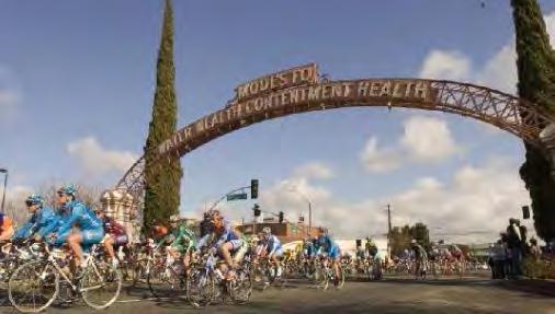
7th Street Bridge Project. Public Presentation February 24, :30pm-8pm
|
|
|
- Erin Morris
- 5 years ago
- Views:
Transcription
1 7th Street Bridge Project Public Presentation February 24, :30pm-8pm
2 Public Meeting Agenda Welcome and introductions Judith Buethe Opening remarks - David Leamon, PE/Hans Strandgaard, PE Project refresher Hans Strandgaard, PE Project alternatives Brent Lemon, PE Traffic conditions John Gard, PE Bridge alternatives Chris Serroels, PE Environmental update Matthew Franck Public outreach and schedule Judith Buethe and Hans Strandgaard, PE Open questions and discussion 2


3 Refresher The Problem: Last October we shared with you: history of the 7 th Street Bridge the problems with the existing bridge what we could fix and what we could not fix existing and anticipated future traffic conditions 3
4 Refresher Hopefully, it was clear that something needs to be done and soon. The Solutions: Today we will show you the alternatives that the Team has developed and the constraints that led us to those alternatives. We ll also start discussions about what the bridge might look like. 4
5 Refresher, contd. Input from the public is an important part of the alternative development process. We need your comments and thoughts to help lead us and the rest of the Modesto community to a solution that works and can be built. 5
6 Project Alternatives Brent Lemon, P.E. 6


7 Existing Facility 2-lane facility Crows Landing/7 th Intersection 7


8 UPRR Tracks Adjacent on east side Parcel between 7 th Street and tracks B Street at-grade crossing Future track accommodation 8

9 Existing Features - South End Industrial businesses & mini-market adjacent to Crows Landing Sunrise Village Mobile Home Community Zeff Road river access Utility poles on east side 9

10 Existing Features - North Side High skew B Street at-grade RR crossing Difficult truck turns Right of way impacts Sierra Drive access 10
")
11 Proposed Facility 4-lane facility Lane reductions where tie into existing roadways Design for 35 mph speed limit on 7th Street Accommodate trucks (both turning movements & weight) 11


12 Flood Criteria Floodway Criteria Central Valley Flood Protection Board Freeboard = 100-year flood elevation + 3 feet 12
 Impacts to business particularly on west")
13 All Alternatives - South End Relocate T-intersection to maintain major directional movements Reconfigure River Road connection to 7 th Street(Zeff) Impacts to business particularly on west side 13

14 All Alternatives - North End High skew Improve B Street at-grade RR crossing Design for truck turns Eastbound B Street will have free right Redirect Sierra Drive to C Street 14

15 Alternative 1 - Downstream Bridge 15
16 Alternative 1 - Downstream Bridge Maintains traffic along 7th Street corridor during construction Constructs entire bridge at one time Greater right of way impacts Lesser impacts to B Street at-grade RR crossing Traffic needs Current ADT 15,900 Design Year (2040) ADT 31,000 16
17 Alternative 1 - Bike/Pedestrian Access 17

18 Alternative 1 - B Street Intersection 18
19 Alternative 2 - Existing Alignment 19
20 Alternative 2 - Existing Alignment Diverts traffic to SR 99 and 9th Street during construction Constructs entire bridge at one time Lesser right of way impacts Widens B Street at-grade RR crossing for trucks 20
21 Alternative 3 - Existing Alignment (Staged) 21
22 Alternative 3 - Existing Alignment (Staged) Maintains traffic along 7th Street corridor during construction Constructs the bridge half at a time (2 stages) Lesser right of way impacts Widens B Street at-grade RR crossing for trucks 22

23 Alternative 2 & 3 - Bike/Pedestrian Access 23

24 Alternative 2 & 3 - B Street Intersection 24
25 Alternative 4 - Rehabilitate Existing Bridge 25
26 Alternative 4 - Rehabilitate Existing Bridge 26
27 Alternative 4 - Rehabilitate Existing Bridge Maintains traffic along 7th Street corridor during construction Construction occurs in two stages: 1. Build a new bridge to the west, then, after opening it to traffic, 2. Close the old bridge and perform repairs and retrofits Lesser right of way impacts Widens B Street at-grade RR crossing for trucks Pedestrians & bikes on new bridge only 27
28 Alternative 4 - Bike/Pedestrian Access 28

29 Alternative 4 - B Street Intersection 29

30 Project Area Access 30

31 Access South End Alts
32 Access Alternative A Access to Zeff/River Rd from northbound 7 th Street (one-way) Minimizes Sunrise Village Mobile Home Community impacts 32


33 Access Alternative B Access to Zeff Rd. on south side of Sunrise Village Mobile Home Community Additional impacts to adjacent commercial parcel 33
34 Traffic Conditions John Gard, P.E. 34

35 Level of Service (LOS) is a measure of driver comfort. At intersections, it is based on the average delay per vehicle. Level of Service F 35
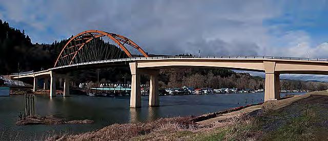
36 Intersection Traffic Control Intersection Operations Future Year Conditions Level of Service (LOS) 1 Existing Conditions Future Year Conditions No Build Build Alternatives 2 AM Peak Hour PM Peak Hour AM Peak Hour PM Peak Hour AM Peak Hour PM Peak Hour 7 th Street/B Street/ Tuolumne Blvd. 7 th Street/ Crows Landing Road Notes: Traffic Signal C D F F D E Stop-Control / Traffic Signal 3 B C F F C C 1 At signalized intersections, LOS is based on the average delay for all vehicles. At stop-control intersections, LOS is based on the stop-controlled movement with the greatest delay. LOS A = Free-Flow Conditions; LOS F = Over-flow, Saturated Conditions. 2 All alternatives include dual northbound left-turn lanes at the 7 th Street/B Street intersection. If a single left-turn lane was instead provided (for ROW or other reasons), operations would degrade to LOS F during the PM peak hour. 3 Intersection consists of stop-control under existing and future year no build conditions. Intersection is signalized under future year build alternatives. 36
37 Alternatives 1, 3, and 4: 7 th Street Bridge Open During Construction Alternative 2: 7 th Street Bridge Closed During Construction Majority of traffic would divert to Highway 99 (would temporarily worsen PM peak hour operations). Effects on bicycle/pedestrian circulation 37
38 Bridge Alternatives Chris Serroels, P.E. 38
39 Bridge Alternatives For the various alignment alternatives, a variety of bridge types may be feasible Bridge type is dictated by the physical features of the site, desired appearance, and cost effectiveness. Constraints include: Potential column locations Reasonable distance between columns Accommodate river flooding 39
40 Bridge Alternatives For this site, the following bridge types are under consideration for any new construction: Concrete box girder bridge Precast concrete girder bridge Arch bridge Combinations of the above types 40

41 Box Girder Bridge 41

42 Box Girder Bridge 42

43 Precast Girder Bridge 43

44 Precast Girder Bridge 44

45 Arch Bridge Photo: TripAdvisor 45

46 Arch Bridge 46
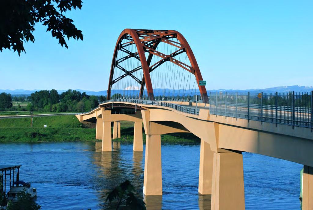
47 Combination Bridge 47
48 Bridge Alternatives Other types not considered optimal for this site: Concrete slab Steel girder Cable supported Truss 48
49 Bridge Alternatives Other ways to modify a bridge s appearance: Color Texture Lighting Architectural barrier rails Architectural column shapes Artwork (monuments, medallions, etc.) 49

50 Bridge Color and Texture 50

51 Bridge Color and Texture 51

52 Bridge Barrier Rails 52

53 Bridge Art 53

54 Bridge Alternative Bridge alternatives will be developed by the project team with our architect and then reviewed with a joint community workshop If you are interested in participating in the bridge alternative review, please sign up at the Bridge table 54
55 Environmental Process Matt Franck 55
56 Environmental Process Define range of alternatives nearing completion Conduct technical studies (historic properties, noise, wildlife, others) starting now Release comprehensive environmental impact studies for public review Winter 2014/2015 Environmental impact assessment process complete Summer
57 Public Involvement Opportunities Community Advisory Group Meeting Oct 3, 2013 Public Scoping Meeting Oct 14, 2013 Public Comment Period on the Notice of Preparation thru Oct 30, 2013 Community Advisory Group Meeting Jan 9, 2014 Public Outreach Meeting (Alternatives) Feb 24, 2014 Bridge Aesthetic Workshop date in 2014/2015 Public Comment Period on the Draft EIR in Jan-Feb,
58 Schedule Develop Alternatives Now Environmental Studies Draft Project Report Late 2014 Environmental Doc complete 2015 Bridge Aesthetic Workshop Type Select Bridge 2015 Final Design Right-of-Way 2016 Construction
59 Q and A That ends our formal presentation, the members of the Team will be available for questions at the four corners of the room for: 1. Traffic 2. Roadway 3. Bridge 4. Environmental Please provide us with your comments. Visit: 59
4. ENVIRONMENTAL IMPACT ANALYSIS 9. TRANSPORTATION AND TRAFFIC
 4. ENVIRONMENTAL IMPACT ANALYSIS 9. TRANSPORTATION AND TRAFFIC 4.9.1 INTRODUCTION The following section addresses the Proposed Project s impact on transportation and traffic based on the Traffic Study
Golden s Plan. For the Highway 6 & 93 Corridor
 Golden s Plan For the Highway 6 & 93 Corridor Purpose of the Study Accommodate regional traffic needs on Highways 6 and 93, as defined by the Northwest Quadrant Feasibility Study. Find a solution that
STANLEY STREET December 19, 2017
 STANLEY STREET December 19, 2017 Welcome Mike Wiza, Mayor Scott Beduhn, Director of Public Works Agenda 1. Introduction 2. Existing Roadway Conditions 3. Current Alternative Improvements 4. Summary of
Washington St. Corridor Study
 FIGURE 7.17 Bridge Alternatives - Cross Sections 86 Discarded Alternative: Short-Term Bridge Repair Short-term repairs and west bridge span replacement were considered during analysis. Short-term repairs
EL CAMINO REAL BUS RAPID TRANSIT (BRT) PROJECT
 PROJECT") Agenda Item #4.2 EL CAMINO REAL BUS RAPID TRANSIT (BRT) PROJECT VTA BOARD WORKSHOP MAY 1, 2015 ABOUT THIS PRESENTATION CONTEXT Existing conditions and planning for growth WHAT IS THE PROJECT? Project alternatives
Agenda Item #4.2 EL CAMINO REAL BUS RAPID TRANSIT (BRT) PROJECT VTA BOARD WORKSHOP MAY 1, 2015 ABOUT THIS PRESENTATION CONTEXT Existing conditions and planning for growth WHAT IS THE PROJECT? Project alternatives
Saskatchewan Drive Roadway Rehabilitation and Shared-Use Path Widening
 Saskatchewan Drive Roadway Rehabilitation and Shared-Use Path Widening We are here today to present the draft plan for the Saskatchewan Drive Roadway Rehabilitation and Shared-Use Path Widening project
Fairfax County Parkway Widening Fairfax County
 Get Involved VDOT representatives will review and evaluate information received as a result of this meeting. Please fill out the comment sheet provided in this brochure if you have any comments or questions.
Municipal Class EA To Address Traffic Congestion On The Ontario Street Corridor (Grand Bend) Public Information Meeting June 4, 2018
 Public Information Meeting June 4, 2018") Municipal Class EA To Address Traffic Congestion On The Ontario Street Corridor (Grand Bend) Public Information Meeting June 4, 2018 Background Agenda Traffic Study Update Class EA Alternatives Bridge
Municipal Class EA To Address Traffic Congestion On The Ontario Street Corridor (Grand Bend) Public Information Meeting June 4, 2018 Background Agenda Traffic Study Update Class EA Alternatives Bridge
WELCOME. Stakeholder Involvement Group Meeting #2 Round Lake Public Works October 24, 2018
 WELCOME Stakeholder Involvement Group Meeting #2 Round Lake Public Works October 24, 2018 MEETING AGENDA 1. Welcome and Introductions 2. Study Progress Update 3. Problem Statement 4. Technical Analysis
Clay Street Bridge Replacement Project
 Clay Street Bridge Replacement Project Frequently Asked Questions (FAQs) The project is located in downtown Placerville on Clay Street between US Highway 50 and Main Street and Cedar Ravine Road. The proposed
IH 20 RANGER HILL PUBLIC MEETING
 IH 20 RANGER HILL PUBLIC MEETING AUGUST 25, 2015 IH 20, Eastland County, TX CSJ 0007-06-084 IH 20 from 3.5 mi. East of LP 254 to SH 16 (Ranger Hill) August 25, 2015 Agenda Introductions Purpose of the
Public Information Meeting. Orange Camp Road. Dr. Martin Luther King Jr. Beltway to I-4. Presented by: Volusia County August 2, 2018
 Public Information Meeting Orange Camp Road Dr. Martin Luther King Jr. Beltway to I-4 Presented by: Volusia County August 2, 2018 1 Project Goals To improve the operations and safety for Orange Camp Road
TRANSPORTATION COMMISSION Agenda Staff Report
 TRANSPORTATION COMMISSION Agenda Staff Report Agenda Item No. 5.a DATE: JULY 31, 2014 TO: FROM: SUBJECT: TRANSPORTATION COMMISSION COMMUNITY DEVELOPMENT DEPARTMENT - PLANNING DRAFT OLYMPIC CORRIDOR PREFERRED
Giles Run Connector Road
 Giles Run Connector Road Laurel Hill Adaptive Reuse Area to Laurel Crest Drive South County Federation Meeting June 14, 2016 History Connector road included in the Laurel Hill Comprehensive Plan amendment
INNOVATIVE INTERSECTION SOLUTIONS. Jay Bockisch, PE, PTOE Senior Associate
 INNOVATIVE INTERSECTION SOLUTIONS Jay Bockisch, PE, PTOE Senior Associate INNOVATIVE INTERSECTION SOLUTIONS Innovative intersection overview Case studies Continuous flow intersection Modern roundabouts
Los Altos Hills Town Council - June 18, 2015 Palo Alto City Council June 22, AGENDA ITEM #2.B Presentation
 Los Altos Hills Town Council - June 18, 2015 Palo Alto City Council June 22, 2015 AGENDA ITEM #2.B Presentation Previous Presentations Los Altos Hills Town Council in May 2014 and February 2015 Palo Alto
Clinton Street Bridge over the Maumee River. ODOT Project DEF April 1, 2015 Stakeholder s Meeting
 Clinton Street Bridge over the Maumee River ODOT Project DEF-15-14.77 April 1, 2015 Stakeholder s Meeting Purpose of Stakeholder Meeting Review the project and why it s happening Share the results of the
Design Criteria. Design Criteria
 F Design Criteria Design Criteria Ministry of Transportation Ministère des Transports DESIGN CRITERIA Page: 1 of 13 WORK PROJECT NO. N/A GO Bloomington Station TYPE OF PROJECT LOCATION Bloomington Road
Boston Post Road Design Feasibility Study
 Boston Post Road Design Feasibility Study Prepared for the City of Rye Final Report July 18, 2007 Prepared by: Buckhurst Fish & Jacquemart (BFJ) 115 Fifth Avenue New York, NY 10003 www.bfjplanning.com
Access Management Benefits & Techniques. Access Management Workshop June 2, 2006
 Access Management Benefits & Techniques Access Management Workshop June 2, 2006 1 Benefits of Access Management Safety As access density increases, crash rates increase Increasing the density of access
Tonight is for you. Learn everything you can. Share all your ideas.
 Strathcona Neighbourhood Renewal Draft Concept Design Tonight is for you. Learn everything you can. Share all your ideas. What is Neighbourhood Renewal? Creating a design with you for your neighbourhood.
Business Access and Associated Benefits Provided by Roundabouts
 Business Access and Associated Benefits Provided by Roundabouts MTJ Roundabout Engineering Mark Johnson, PE 608.238.5000 www.mtjengineering.com ITE Rapid City July 1 st 2014 ROUNDABOUT ANALYSIS, PLANNING,
WYDOT DESIGN GUIDES. Guide for. NHS Arterial (Non-Interstate)
") WYDOT DESIGN GUIDES Guide for NHS Arterial (Non-Interstate) 2014 GUIDE FOR NATIONAL HIGHWAY SYSTEM (NHS) HIGHWAYS (NHS ARTERIALS, Non-Interstate) PRESERVATION REHABILITATION RECONSTRUCTION INTRODUCTION
WYDOT DESIGN GUIDES Guide for NHS Arterial (Non-Interstate) 2014 GUIDE FOR NATIONAL HIGHWAY SYSTEM (NHS) HIGHWAYS (NHS ARTERIALS, Non-Interstate) PRESERVATION REHABILITATION RECONSTRUCTION INTRODUCTION
I-395 Express Lanes Northern Extension Project Public Hearings
 I-395 Express Lanes Northern Extension Project Public Hearings Susan Shaw, PE, Megaprojects Director Virginia Department of Transportation Amanda Baxter, Special Projects Manager Virginia Department of
WYDOT DESIGN GUIDES. Guide for. Non-NHS State Highways
 WYDOT DESIGN GUIDES Guide for Non-NHS State Highways 2014 GUIDE FOR Non-NATIONAL HIGHWAY SYSTEM (Non-NHS) STATE HIGHWAYS PRESERVATION REHABILITATION RECONSTRUCTION INTRODUCTION This Guide is directed to
Welcome. Thank you for your interest in the Lewis & Clark Viaduct Concept Study
 Welcome Thank you for your interest in the Lewis & Clark Viaduct Concept Study Please use the arrows in the upper left hand corner to navigate through the presentation. Use the envelope icon to ask a question
Board of Supervisors February 27, 2017
 : Traffic Analysis Results & Draft Conceptual Plan Board of Supervisors February 27, 2017 Transportation Solutions Building Better Communities Presentation Overview Background Summary of Traffic Analysis
JANUARY 2017 STUDY UPDATE. Logan City, Cache Co., CMPO
 JANUARY 2017 STUDY UPDATE Logan City, Cache Co., CMPO Purpose of the presentation To provide an update on the status of the Study To present the Study Purpose and Need To present the results of Level 1
Route 79/Davol Street Corridor Study
 Route 79/Davol Street Corridor Study Fall River, MA Public Information Meeting #2 November 21, 2013 Fall River Heritage State Park Fall River, MA Agenda Welcome and Introductions Overview of Study Process
Financial Project ID No(s).: and ETDM No(s).: and 14181
.: and ETDM No(s).: and 14181") Palm Beach Metropolitan Planning Organization (MPO) Presentation I-95 at Boynton Beach Boulevard Interchange and I-95 at Gateway Boulevard Interchange Project Development and Environment Study Palm Beach
Palm Beach Metropolitan Planning Organization (MPO) Presentation I-95 at Boynton Beach Boulevard Interchange and I-95 at Gateway Boulevard Interchange Project Development and Environment Study Palm Beach
Colchester/Riverside/Barrett/ Mill Intersection Study. PAC Meeting #3 September 22, 2016
 Colchester/Riverside/Barrett/ Mill Intersection Study PAC Meeting #3 September 22, 2016 Tonight s Agenda Review Project Purpose and Need Describe short term and long improvements and changes since public
Terwillegar Drive Expressway Draft Concept Plan
 Terwillegar Drive Expressway Draft Concept Plan Anthony Henday Drive to Whitemud Drive November 28 5:00-8:00 p.m. December 1 10:00 a.m. - 3:00 p.m. Let s Talk Today you can: Learn about the new direction
INNOVATIVE INTERSECTION DESIGN
 INNOVATIVE INTERSECTION DESIGN J. Eddie Valtier, P.E. ELP TP&D Director Introduction Why Do We Need To Start Looking For Innovative Intersection Designs? Congestion is worsening and traffic volumes and
Foothill Expressway Improvements Between El Monte and San Antonio
 Foothill Expressway Improvements Between El Monte and San Antonio June 29, 2017 - Los Altos Community Meeting Introduction Project Background Agenda Visit Stations: Provide Input and Ask Questions Reconvene:
Scarlett Road Bridge & Road Improvements Lambton Park Community School - Gymnasium Tuesday November 28 th, 2017
 Scarlett Road Bridge & Road Improvements Lambton Park Community School - Gymnasium Tuesday November 28 th, 2017 PROJECT LOCATION 2 SCARLETT ROAD BRIDGE Constructed in 1912, the bridge carries 4 active
Appendix D: Concept Screening
 Concept Description Concept #1 Route 288 Roadway Widening This concept consists of constructing a third lane on northbound and southbound Route 288 between Powhite Parkway and US 360. This improvement
FY 2006 TRANSPORTATION CAPITAL PROGRAM
 Eden Lane Bridge over Whippany River NS9908 The existing structure was built in 1972 as a temporary single-span structure. The bridge consists of simply supported steel acrow panel trusses and is supported
Lyons Avenue/Dockweiler Road Extension Project Draft Environmental Impact Report. Appendix I Traffic Impact Study
 Lyons Avenue/Dockweiler Road Extension Project Draft Environmental Impact Report Appendix I Traffic Impact Study Street 0 80-1947 500.4501 RITA ld Court 0 91355-1096 400.7401 LA n Avenue 0 590-3745 300-9301
STUDY PROCESS & SCHEDULE
 STUDY PROCESS & SCHEDULE Route Centennial Bridge Study KDOT Project No. -52 KA-3229-01 STUDY OVERVIEW STUDY SCHEDULE The Kansas Department of Transportation (KDOT) has identified a future need to replace
VT15 / Allen Martin Drive Intersection Scoping Study
 VT15 / Allen Martin Drive Intersection Scoping Study ALTERNATIVES PRESENTATION MEETING DECEMBER 19, 2016 Agenda Study Area Project Background Existing Conditions Identified Issues Proposed Alternatives
FY STATEWIDE TRANSPORTATION IMPROVEMENT PROGRAM New Jersey Department of Transportation Projects
 Barclay Street Viaduct NS9807 NS9807 This project will provide for the rehabilitation of the Barclay Street Viaduct, from Route 19 to Marshall Street, in order to increase the weight load of the structure.
Project Goals and Objectives
 Project Goals and Objectives Goal 1: Goal 2: Goal 3: Transform Coast Highway into a Complete Street that accommodates all roadway users (pedestrians, bicyclists, and autos) Objectives: Improve the pedestrian
PROJECT NO. 093 MA 199 H C. FEDERAL NO. xxxx WIKIEUP-WICKENBURG-PHOENIX HIGHWAY TEGNER STREET, ALTERNATIVE 10 PROJECT IMPROVEMENT
 PROJECT NO. 093 MA 199 H 5807 01C FEDERAL NO. xxxx WIKIEUP-WICKENBURG-PHOENI HIGHWAY TEGNER STREET, ALTERNATIVE 10 PROJECT IMPROVEMENT (INTERSECTION IMPROVEMENT) US 93/US 60 FINAL PROJECT ASSESSMENT April
Diamond Springs Parkway Project
 Diamond Springs Parkway Project Public Information Meeting, Monday, March 18, 2013 330 Fair Lane, Building A, Placerville County Board of Supervisors Meeting Room, 6:30 8:00 p.m. PRESENTED BY: County of
State Road 54/56 Tampa Bay s Northern Loop. The Managed Lane Solution Linking I-75 to the Suncoast Parkway
 State Road 54/56 Tampa Bay s Northern Loop The Managed Lane Solution Linking I-75 to the Suncoast Parkway SUNCOAST PARKWAY Both I 75 and the Suncoast Parkway are planning, or in the process of constructing,
Route 47 (North Main Street) Reconstruction
 Reconstruction") TOWN OF SUNDERLAND Route 47 (North Main Street) Reconstruction Presented by Lou Rabito, P.E. Presented to Town of Sunderland June 11, 2018 Project Overview MassDOT Project No. 607245 Resurfacing and Related
TOWN OF SUNDERLAND Route 47 (North Main Street) Reconstruction Presented by Lou Rabito, P.E. Presented to Town of Sunderland June 11, 2018 Project Overview MassDOT Project No. 607245 Resurfacing and Related
US Route 4 Traffic and Pedestrian Improvement Project
 Welcome to the public meeting for US Route 4 Traffic and Pedestrian Improvement Project June 5, 2018 Introduction Project Team Town of North Greenbush, Tony Germano, Town Comptroller Lou Desso, Town Supervisor
NOTICE OF PREPARATION. Environmental Programs 3331 North First Street, Building B-2 San Jose, CA
 NOTICE OF PREPARATION May 29, 2018 To: Reviewing Agencies and Organizations From: Santa Clara Valley Transportation Authority Environmental Programs 3331 North First Street, Building B-2 San Jose, CA 95134-1927
Providing an Efficient and Multi-modal Transportation System
 Providing an Efficient and Multi-modal Transportation System Welcome and Introductions The Plan Process Transportation Overview Workshop Discussions Report Out and Next Steps AGENDA Comprehensive Plan
Managed Lanes. Steve Schilke, P.E. Major Projects Unit Head District 1. Illinois Traffic Engineering and Safety Conference October 2016
 Managed Lanes Steve Schilke, P.E. Major Projects Unit Head District 1 Illinois Traffic Engineering and Safety Conference October 2016 Agenda Managed Lanes Projects I-55 (Stevenson Expressway) Express Toll
TRAFFIC IMPACT STUDY CRITERIA
 Chapter 6 - TRAFFIC IMPACT STUDY CRITERIA 6.1 GENERAL PROVISIONS 6.1.1. Purpose: The purpose of this document is to outline a standard format for preparing a traffic impact study in the City of Steamboat
PROPOSED BICYCLE AND PEDESTRIAN FACILITY Vicinity of Route 123/I-495 Interchange Tysons, Fairfax County, Virginia
 PROPOSED BICYCLE AND PEDESTRIAN FACILITY Vicinity of Route 123/I-495 Interchange Tysons, Fairfax County, Virginia PRELIMINARY ENGINEERING REPORT Prepared for: Prepared by: July 2017 Table of Contents 1
Dr. M.L. King, Jr. Street North Complete Streets Resurfacing Opportunities HOUSING, LAND USE, AND TRANSPORTATION COMMITTEE MARCH 22, 2018
 Dr. M.L. King, Jr. Street North Complete Streets Resurfacing Opportunities HOUSING, LAND USE, AND TRANSPORTATION COMMITTEE MARCH 22, 2018 What s Happening The City plans to mill and resurface Dr. M.L.
Complete Street Analysis of a Road Diet: Orange Grove Boulevard, Pasadena, CA
 Complete Street Analysis of a Road Diet: Orange Grove Boulevard, Pasadena, CA Aaron Elias, Bill Cisco Abstract As part of evaluating the feasibility of a road diet on Orange Grove Boulevard in Pasadena,
APPENDIX G: INTERSECTION NEEDS AT OKEECHOBEE BOULEVARD
 APPENDIX G: INTERSECTION NEEDS AT OKEECHOBEE BOULEVARD INTERSECTION NEEDS AT SR 7 and OKEECHOBEE BOULEVARD SR 7 Extension Project Development and Environment (PD&E) Study From Okeechobee Boulevard (SR
1. What is the Doran Street and Broadway/Brazil Grade Separation Project (Project)?
?") 1. What is the Doran Street and Broadway/Brazil Grade Separation Project (Project)? The Los Angeles County Metropolitan Transportation Authority (Metro) is evaluating the development of a grade separation
1. What is the Doran Street and Broadway/Brazil Grade Separation Project (Project)? The Los Angeles County Metropolitan Transportation Authority (Metro) is evaluating the development of a grade separation
FY STATEWIDE TRANSPORTATION IMPROVEMENT PROGRAM New Jersey Department of Transportation Projects
 ROUTE/ Project ID No. TIP No. Electrical Load Center Replacement - North 04324 04324 This project will provide for the betterment of the existing highway lighting facilities located along Routes 3, 17
Presentation Outline. PD&E Study Process Project Overview Proposed Alternatives & Evaluation Schedule Contact Information
 Volusia Transportation Planning Organization CAC / TCC Project Update Tuesday, May 21, 2013 1 Presentation Outline PD&E Study Process Project Overview Proposed Alternatives & Evaluation Schedule Contact
M-58 HIGHWAY ACCESS MANAGEMENT STUDY Mullen Road to Bel-Ray Boulevard. Prepared for CITY OF BELTON. May 2016
 M-58 HIGHWAY ACCESS MANAGEMENT STUDY Prepared for CITY OF BELTON By May 2016 Introduction Missouri State Highway 58 (M-58 Highway) is a major commercial corridor in the City of Belton. As development has
Welcome to the Sellwood Bridge Project Open House!
 Welcome to the Sellwood Bridge Project Open House! 5:30 7:30 pm Please sign in here Information stations and project staff are located throughout the room. Goals for Tonight s Meeting: Learn how the Preferred
CITY OF OTTAWA ROADWAY MODIFICATION APPROVAL UNDER DELEGATED AUTHORITY
 RMA-2015-ATM-038 CITY OF OTTAWA ROADWAY MODIFICATION APPROVAL UNDER DELEGATED AUTHORITY DATE: April 22, 2015 SUBJECT Approval of Roadway Modifications Recommended through an Area Traffic Management Study
RM 620/RM 2222 CONNECTOR (BYPASS) STATUS REPORT RM 620/2222 STATUS
 STATUS REPORT RM 620/2222 STATUS") RM 620/RM 2222 CONNECTOR (BYPASS) STATUS REPORT January 25, 2017 RM 620/2222 BYPASS - INTRODUCTION Because of the enormous traffic demand at the RM 620/2222 intersection, TxDOT searched for a way to relieve
RM 620/RM 2222 CONNECTOR (BYPASS) STATUS REPORT January 25, 2017 RM 620/2222 BYPASS - INTRODUCTION Because of the enormous traffic demand at the RM 620/2222 intersection, TxDOT searched for a way to relieve
Clay Street Realignment Project Traffic Study
 Final Clay Street Realignment Project Traffic Study November 24, 2009 Prepared for: City of Placerville RS07-2466 2990 Lava Ridge Court, Suite 200 Roseville, CA 95661 (916) 773-1900 Fax (916) 773-2015
Appendix T CCMP TRAIL TRAFFIC & TRANSPORTATION DESIGN STANDARD
 Appendix T CCMP 3.3.4 TRAIL TRAFFIC & TRANSPORTATION DESIGN STANDARD 3.3.4 Trail Traffic and Transportation Design Multi-use trails have certain design standards, which vary depending on the agency that
MEMORANDUM. To: 1.0 PURPOSE
 MEMORANDUM To: Scott Holland, Elements Architecture From: Brian Grover, Dudek Date: July 16, 2014 1.0 PURPOSE In response to the November 4, 2013 request (RE: Incomplete Application Southern California
APPENDIX L: COST ESTIMATING TOOLS
 APPENDIX L: COST ESTIMATING TOOLS Rural Arterial From LRE MOT * Mobilization * Subtotal Scope Contingency (25%) Total PE Design (15%) CEI (15%) Total Project ** New (2-Lane Roadway) with 5' Paved Shoulders
CSAH 101 Preliminary Design
 CSAH 101 Preliminary Design Public Open House No. 2 January 29, 2013 CSAH 62 to Hutchins Drive Welcome / Introductions Hennepin County Craig Twinem, Transportation Maury Hooper, Transportation Nick Peterson,
section 4 Existing Conditions, Issues, and Options
 section 4 Existing Conditions, Issues, and Options 4.0 Existing Conditions, Issues, and Options This section analyzes each segment of the corridor on a street to street basis. Each segment is discussed
APPENDIX 2 LAKESHORE ROAD TRANSPORTATION REVIEW STUDY EXECUTIVE SUMMARY
 APPENDIX 2 LAKESHORE ROAD TRANSPORTATION REVIEW STUDY EXECUTIVE SUMMARY Appendix 2 City of Mississauga Lakeshore Road FINAL REPORT Transportation Review Study December 2010 EXECUTIVE SUMMARY Study Purpose
CHAPTER 3 STUDY AREA OPERATIONAL OVERVIEW
 HPTER 3 STUY RE OPERTIONL OVERVIEW This chapter describes the overall traffic operations within the study area under existing and future conditions and focuses on individual intersections not directly
LSC TRANSPORTATION CONSULTANTS, INC. 516 North Tejon Street Colorado Springs, CO (719) FAX (719)
 FAX (719)") LSC TRANSPORTATION CONSULTANTS, INC. 516 North Tejon Street Colorado Springs, CO 80903 (719) 633-2868 FAX (719) 633-5430 E-mail: lsc@lsccs.com May 15, 2009 Mr. Davis Farrar Western Slope Consulting, LLC
LSC TRANSPORTATION CONSULTANTS, INC. 516 North Tejon Street Colorado Springs, CO 80903 (719) 633-2868 FAX (719) 633-5430 E-mail: lsc@lsccs.com May 15, 2009 Mr. Davis Farrar Western Slope Consulting, LLC
TRAFFIC IMPACT STUDY And A TRAFFIC SIGNAL WARRANT ANALYSIS FOR A SENIOR LIVING AND APARTMENT DEVELOPMENT
 TRAFFIC IMPACT STUDY And A TRAFFIC SIGNAL WARRANT ANALYSIS FOR A SENIOR LIVING AND APARTMENT DEVELOPMENT DEERFIELD TOWNSHIP, WARREN COUNTY, OHIO Nantucket Circle and Montgomery Road () Prepared for: ODLE
3.16 TRANSPORTATION, CIRCULATION, AND PARKING Regulatory Setting Environmental Setting ROADWAY SYSTEM
 3.16 TRANSPORTATION, CIRCULATION, AND PARKING This section assesses the potential for implementation of the Orchard Park Redevelopment component of the 2018 LRDP to result in impacts related to transportation,
SECTION 2 ALTERNATIVES INCLUDING PROPOSED ACTION 2.0 ALTERNATIVES INCLUDING PROPOSED ACTION 2.1 INTRODUCTION 2.2 ALTERNATIVES CONSIDERED BUT REJECTED
 2.0 ALTERNATIVES INCLUDING PROPOSED ACTION 2.1 INTRODUCTION The City of Starke is currently a bottleneck for traffic traveling along U.S. 301 in Bradford County. Local urban traffic combined with increasing
133 rd Street and 132 nd /Hemlock Street 132 nd Street and Foster Street MINI ROUNDABOUTS. Overland Park, Kansas
 133 rd Street and 132 nd /Hemlock Street 132 nd Street and Foster Street MINI ROUNDABOUTS Overland Park, Kansas September 1, 2017 TABLE OF CONTENTS 1. INTRODUCTION... 1 2. LITERATURE REVIEW... 1 3. CONCEPT
Comparison of Turning Movement Count Data Collection Methods for a Signal Optimization Study. White Paper
 Comparison of Turning Movement Count Data Collection Methods for a Signal Optimization Study White Paper Grand Rapids Southfield Traverse City www.urscorp.com May 2011 Comparison of Turning Movement Count
APPENDIX D COST SUMMARY TABLES
 APPENDIX D COST SUMMARY TABLES Section 1 Between Route 50 and Evergreen Mills Road 3850 linear feet of one 12 foot wide additional lane in southbound direction of Rte 606; from north side of Rte 50 to
Progress Report on the Design and Planning of an Infrastructure Improvement Project for the Sunnyside TIF District (Phase II)
") Presentation to the CNRC Board of Directors Regular Meeting March 11, 2015 1 Agenda Preferred Alternate Refinement for University Avenue, 3rd Street, and Beverly Avenue Intersection Improvements validate
Presentation to the CNRC Board of Directors Regular Meeting March 11, 2015 1 Agenda Preferred Alternate Refinement for University Avenue, 3rd Street, and Beverly Avenue Intersection Improvements validate
Geometric Design Tables
 Design Manual Chapter 5 - Roadway Design 5C - Geometric Design Criteria 5C-1 Geometric Design Tables A. General The following sections present two sets of design criteria tables - Preferred Roadway Elements
Access Routes from US 101 to the Richmond San Rafael Bridge
 Access Routes from US 101 to the Richmond San Rafael Bridge TAM Board Meeting January 28, 2016 RSRB Project Elements Eastbound Third Lane: Sir Francis Drake Blvd. to Marine Street 10 ft Barrier Separated
City of Fairfax, Virginia City Council Work Session
 City of Fairfax, Virginia City Council Work Session Agenda Item # City Council Meeting 12a 9/8/2015 TO: FROM: SUBJECT: ISSUE(S): SUMMARY: FISCAL IMPACT: RECOMMENDATION: ALTERNATIVE COURSE OF ACTION: RESPONSIBLE
MASSACHUSETTS AVENUE BRIDGE REPLACEMENT PROJECT APRIL 25, 2018
 MASSACHUSETTS AVENUE BRIDGE REPLACEMENT PROJECT APRIL 25, 2018 AGENDA Introductions Project Benefits Progress to Date Schedule for Remaining Work Phase 3 Activities, Impacts & Traffic Detours Phase 4 Activities
Lee s Summit Road Improvement Study Public Open House June 7, 2007 Summary of Comment Card Responses
 Lee s Summit Road Improvement Study Public Open House June 7, 2007 Summary of Comment Card Responses Introduction At the Lee s Summit Road Improvement Study Public Open House held Thursday, June 7, 2007
City of Moorhead Committee of the Whole Meeting
 City of Moorhead Committee of the Whole Meeting Corridor Study Limits Center Avenue (Red River to 8th Street) TH 10 (Red River to TH 336) TH 75 (20th Ave S to Main Avenue) 2 Study Need: Project Overview
Atwood Avenue Fair Oaks Avenue Cottage Grove Road
 Atwood Avenue Fair Oaks Avenue Cottage Grove Road Agenda Purpose Review project scope & goals Present design alternatives Gather feedback Answer Questions Format Open House Presentation Q&A Open House
U.S. HIGHWAY 50 IMPROVEMENT PROJECT
 U.S. HIGHWAY 50 IMPROVEMENT PROJECT in the City of South Lake Tahoe Project Purpose and Need Planned Improvements Project Cost and Delivery Schedule Proposed Construction Staging Project Partners: HIGHWAY
Princeton Avenue and Spruce Street Transportation and Site Access Enhancements Project
 Princeton Avenue and Spruce Street Transportation and Site Access Enhancements Project Mercer County Planning Division AECOM Transportation (formerly DMJM Harris) January 29, 2009 Agenda Project Status
3.0 PROJECT DESCRIPTION
 The following section of the Draft EIR contains a description of the proposed Elk Grove Boulevard/SR 99 Interchange Modification project, consistent with the requirements of CEQA Guidelines Section 15124.
THE ALAMEDA CONCEPT DESIGN COMMUNITY MEETING 3. A Plan for The Beautiful Way JANUARY 28, 2010
 CONCEPT DESIGN COMMUNITY MEETING 3 JANUARY 28, 2010 AGENDA INTRODUCTION COMMUNITY INPUT ROADWAY STUDIES STREETSCAPE DESIGN STATIONS DISCUSSION SUMMARY AND DISCUSSION NEXT STEPS CLOSE INTRODUCTION SCHEDULE
US 1 Express Lanes Public Kick-Off Meeting
 US 1 Express Lanes Project Development & Environment (PD&E) Study Public Kick-Off Meeting September 7 & 8, 2011 Miami Dade County, Florida 1 Presentation Agenda Introduction to MDX Background to PD&E studies
Appendix C. NORTH METRO STATION AREA TRAFFIC IMPACT STATEMENT 88th Avenue Station
 Appendix C NORTH METRO STATION AREA TRAFFIC IMPACT STATEMENT 88th Avenue Station Prepared for: Regional Transportation Department and URS Corporation as part of the North Metro EIS David Evans and Associates,
Project Development & Environment (PD&E) Study Public Hearing January 12 th, 2006
 Study Public Hearing January 12 th, 2006") Project Development & Environment (PD&E) Study Public Hearing January 12 th, 2006 Public Hearing Regulations Chapter 23 of United States Code 128 Title 40 of the Code of Federal Regulations Parts 1500
Project Development & Environment (PD&E) Study Public Hearing January 12 th, 2006 Public Hearing Regulations Chapter 23 of United States Code 128 Title 40 of the Code of Federal Regulations Parts 1500
10 th STREET BRIDGE REPLACEMENT Schedule 'C' EA: Phase 3 Presentation to Council Recommended Design Alternatives City of Owen Sound August 27, 2018
 10 th STREET BRIDGE REPLACEMENT Schedule 'C' EA: Phase 3 Presentation to Council Recommended Design Alternatives City of Owen Sound August 27, 2018 May 2015 1 AGENDA 1. Overview of Municipal Class EA Process.
I-395 Express Lanes Northern Extension Project Crystal City Civic Association September 21, 2016
 I-395 Express Lanes Northern Extension Project Crystal City Civic Association September 21, 2016 Mike Snare, PE, Project Manager Virginia Department of Transportation GEC Michelle Holland, Megaprojects
SECTION 7 INVENTORY OF SELECTED INTERSECTIONS AND RECOMMENDATIONS FOR FURTHER STUDY
 SECTION 7 INVEY OF SELECTED INTERSECTIONS AND RECOMMENDATIONS FOR FURTHER STUDY The study corridor includes a total of 19 signalized intersections. Through consultation with Campbell County and the KYTC,
Albany Shaker Road Corridor Study Public Meeting # 2
 Albany Shaker Road Corridor Study Public Meeting # 2 Scope / Meeting Purpose This project is a CDTC Linkage Study. The Linkage Program is designed to implement the adopted planning and investment principles
PREFERRED ALTERNATIVE IMPLEMENTATION PLAN. Prepared for. Ohio Department of Transportation, District South SR 741 Lebanon, Ohio 45036
 HAM-32F-0.00 PID 86461 PREFERRED ALTERNATIVE IMPLEMENTATION PLAN Prepared for Ohio Department of Transportation, District 8 505 South SR 741 Lebanon, Ohio 45036 Prepared by URS Corporation 564 White Pond
DRAFT TRAFFIC STUDY BOULDER AVENUE BRIDGE REPLACEMENT CITY OF HIGHLAND SAN BERNARDINO COUNTY, CALIFORNIA
 DRAFT CITY OF HIGHLAND SAN BERNARDINO COUNTY, CALIFORNIA August 8, 2006 DRAFT CITY OF HIGHLAND SAN BERNARDINO COUNTY, CALIFORNIA Prepared for: City of Highland 27215 Baseline Highland, California 92346
Project Status Update
 Project Status Update : Novato Boulevard, 4th & 3rd Streets, Sir Francis Drake Boulevard (3), and Miller Avenue Major roads projects target the most heavily traveled roads in Marin County for repairs,
US Route 24 Eastbound (Quincy Memorial Bridge) Over the Mississippi River
 Over the Mississippi River") Purpose and Need March 2015 US Route 24 Eastbound (Quincy Memorial Bridge) Over the Mississippi River Adams County - Quincy, IL Marion County, MO Region 4 District 6 Table of Contents I. Purpose of the
Purpose and Need March 2015 US Route 24 Eastbound (Quincy Memorial Bridge) Over the Mississippi River Adams County - Quincy, IL Marion County, MO Region 4 District 6 Table of Contents I. Purpose of the