Review and Comment ACHD s FY Five Year Work Program Draft for Adoption
|
|
|
- Darlene Lyons
- 6 years ago
- Views:
Transcription
 on January 18, 2006. They have requested written comments by January 11, 2006.")
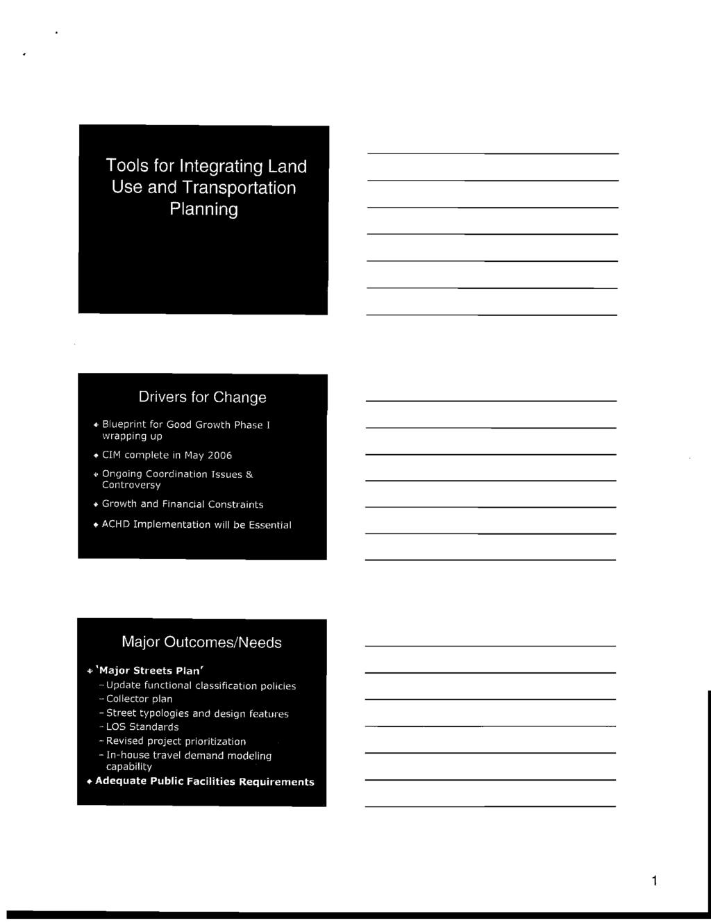
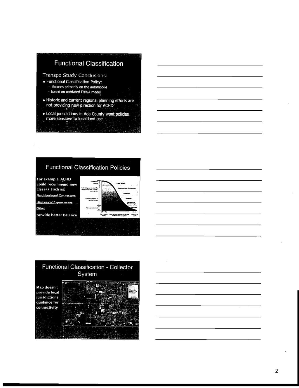
1 Date: January 5, 2006 To: From: Mayor and City Council Karen Gallagher Planning and Development Services Meeting: January 10, 2006 Re: Review and Comment ACHD s FY Five Year Work Program Draft for Adoption The ACHD Commission is scheduled to adopt their FY Five Year Work Program (FYWP) on January 18, They have requested written comments by January 11, Staff has reviewed the draft FYWP program against the current FY FYWP and the list of transportation projects recommended for inclusion by the Council in October of To accomplish this I have included three attachments. The first attachment is a spreadsheet that pulls out the transportation projects that pertain to Boise or Boise s impact area from the FYWP for ease of reviewing. If there is a proposed change in the construction year between last year s FYWP and this year s, it is noted a column labeled Change in Construction Year. If a project is proposed to be added or dropped, it is also noted in this column. Please note that the projects scheduled for construction in 2006 are not in the draft FYWP; these projects were moved from the FYWP and into the current budget for construction. If the project was included in Boise City s list of requests to ACHD, I have noted that in the comment column. On the last page of spreadsheet, I have included a list of projects that are not within Boise s area of impact. Many of the projects on this page are new projects that are the result of three studies completed by a joint effort between ACHD and the City of Meridian. The second attachment takes Boise City s October 2005 list of FYWP recommendations and explains if the project was included in the draft FYWP. Two of the projects (Street Typology Study and Southwest Corridor Study) were not included in the draft FYWP, but are proposed to be included in a separate study (currently referred to as Blueprint for Good Growth Implementation), which is included as the third attachment. This document goes beyond the two studies requested by the City and includes needed tools for transportation and land use planning by providing:
2 A Major Street Plan New Level of Service Standards Modeling Capacity that includes collector roads New Roadway Functional Classification and Street Typology Updates to ACHD Project Prioritization Process Future Facilities List that includes a medium range plan that includes collectors and a 20 year plus plan Points for Discussion: General point that the project descriptions do not include if the sidewalks are attached or detached or how wide a bike lane is. The segments on Fairview Avenue that are proposed to go to 7-lanes do not include bike lanes (note that this is also a study proposed to look at the lane configuration, cross section and design features). Community Programs: Why was Pennsylvania between Longmont and Leadville chosen over Leadville between Boise Avenue and Howe, when Leadville leads directly to Garfield Elementary School? 36 th Street Extension, Hill to Cartwright: Two golf cart tunnels are proposed and are expensive. Council could consider recommending deleting the tunnels, and the golfers could cross the road at-grade (with enhancements) similar to the way the pedestrians in Medicine Creek Subdivision will. Note Two New Studies: West Bench Land Configuration: This study will examine ultimate right-of-way and future lanes needs in the West Bench area (Eagle/Cole & Fairview/Chinden). Amity Roundabout Concept Study: 2008 concept study for roundabouts at section line intersections along Amity Road from the Canyon County Line to Locust Grove Road. The study will determine configurations, cross-section and project features. It will also include traffic and drainage studies. City of Nampa is constructing 3 roundabouts along Amity in Canyon County. Blueprint for Good Growth Implementation Study: The ACHD Commission is investigating their ability to fund this study. Staff is supportive of the study. If Council supports this study, staff recommends sending a letter of support to ACHD. Attachments: Attachment A: Comparison of Last Year s and Proposed FYWP Attachment B: Review of Boise City s List of Recommend Projects Attachment C: ACHD Staff s Memo on Blueprint for Good Growth Implementation
3 Attachement A ACHD Five Year Work Program Comparison FYWP Arterials # Lanes Prof. Service ROW Construct Change in Construction Year Comments 30th Street, Main/State changed plan, 3 to 5 ln Delay requested by Boise City 36th St Exten, Cartwright/Bogus Basin 2 lanes PD dropped 36th Street Extension, Hill/Cartwright 2-3 lanes Project included in Boise City's list to ACHD Cloverdale, Fairview/Ustick 5 lanes UF UF to 2011 (on track) Interim sidewalk included in Boise City's list to ACHD Cloverdale, Franklin/Fairview 5 lanes Interim sidewalk included in Boise City's list to ACHD Cloverdale, Ustick/McMillan 5 lanes PD - new Interim sidewalk included in Boise City's list to ACHD Fairview,pavemnt rehab, Cole/Milwaukee PD PD Fairview, Cloverdale/Five Mile 7 lanes UF No bike lane Fairview, Eagle/Cloverdale 7 lanes, 1/4 mi in Boise PD PD UF No bike lane Fairview, Five Mile/Maple Grove 7 lanes PD No bike lane Five Mile, Fairview/Ustick 5 lanes slipped 1 yr Five Mile, Franklin/Fairview 5 lanes slipped 1 yr Franklin, Touchmark/Five Mile 5 lanes, (< 2 miles) Maple Grove Exten., McMillan/Chinden 5 lanes 06* Maple Grove, Fairview/Ustick 3 lanes PD dropped Maple Grove, Fairview/Goddard 3 lanes, temp. ped 07 Maple Grove, Franklin/Fairview 5 lanes 06* Overland, Cloverdale/Five Mile 5 lanes, ROW 96 to 80' 06* Overland, Topaz/Cloverdale 5 lanes, 1/4 mi in Boise 06* Ustick, Five Mile/Cole 5 lanes & 08 Consistent with West Valley Plan, where feasible. Cross Ustick, Cloverdale/Five Mile 5 lanes 10 PD UF Section subject to change based on West Bench Study. Ustick, Duane to Cloverdale 5 lanes, 1/4 mi in Boise PD - new Cross section subject to change based on W. Bench Study. Collectors Highland, Broadway/Park Center rebuild 3/4 mile, c,g,s/w 06* Warm Springs Avenue, Phases 1-5 mesa improvemnts PD PD PD Draft FYWP * Construction scheduled in FY2006 UF=Unfunded PD=Preliminary Development Projects (funding proposed to start the project)
4 ACHD Five Year Work Program Comparison FYWP Draft FYWP Intersections Prof. Service ROW Construct Change in Construction Year Comments 36th St/Hill/Catalpa Roundabout Project included in Boise City's list to ACHD Cloverdale/Ustick new Fairview/Cloverdale Fairview/Cole PD PD Franklin/Allumbaugh 06* 08* 10 dropped Franklin/Phillipi PD- new Maple Grove/Franklin Maple Grove/Ustick programed with Ustick Orchard/Overland 06* State/Collister UF - new Add a 3rd lane to Collister Ustick/Milwaukee programed with Ustick Signalization Project 3rd St/Myrtle 08 Traffic $ ITD is lead agency. Project in Boise City's list to ACHD Amity/Maple Grove UF - new Farman/Gowen/Pleasant Valley PD Design per outcome of Gowen/Lake Hazel study Federal Way/Victory PD PD Franklin/Liberty , slipped 1 yr Front/5th "new" ITD is lead agency. Project in Boise City's list to ACHD Legend/McMillan PD Maple Grove/Desert UF - new Maple Grove/Hackamore , slipped 2 yrs State/Bogart PD PD PD Major Bridge Projects - new Park Center - East Crossing 06 & & PD moved up 2 yrs Acceleration in construction requested by Boise City Traffic Programs Vista Ave Traffic Signal System Update 06* Park & Ride, I-84, Cole/Broadway Area Orchard St Traffic Signal Upgrade 08 I-84 Automated Incident Management System 2008 ACHD and ITD Traffic Management Center Expansion Study 2007 PD * Construction scheduled in FY2006 UF=Unfunded PD=Preliminary Development Projects (funding proposed to start the project)
5 Corridor Studies draft FYWP Construction Year Comment Amity Roundabouts, Canyon Cty/Locust Grove new study 3 roundabouts planned in Nampa on Amity Cloverdale Concept Study, Franklin/McMillan new study Lane configuration, cross section, & project features Fairview Concept Study, Meridian/Maple Grove new study Lane configuration, cross section, & project features Three Cities River Crossing PD 07 UF Major Capital Studies Lake Hazel Exten/Gowan Relocation Pedestrian & Bicycle Transition Plan not specified State St Corridor Study, Phase 2 not specified Project included in Boise City's list to ACHD West Bench Lane Configuration not specified Study ultimate row & future lane needs Community Program Description 15th/Heron traffic calming with bulb outs nd, Grace/Dewey curb, gutter, sidewalk (east side) 2008 Catalpa, Collister/36th curb, gutter, sidewalk 2008 FTA funding requested Hill, 13th/15th curb, gutter, sidewalk & traffic calming analysis 2008 Malad, Kerr/Shoshone curb, gutter & sidewalk (south side) 2007 Pennsylvania, Longmont/Leadville curb, gutter & sidewalk 2008 Why this road instead of Leadville north of Boise Ave? Roosevelt, Bethel/Emerald extruded curb and asphalt path (east side) 2007 Partnership w/ Boise City Parks Taft, Inns/Sycamore curb, gutter, sidewalk (north side) 2008 Warm Springs/Granite/Penitentiary enhancement project 2007 Includes federal funds. Project in Boise City's list to ACHD Major Drainage 31St/Good Drainage Repair 2010 Brookhollow Strom Drain PD Near E. Boise & E. Iowa - persistent drainage problem Vista Regional Storm Drain System UF Will allow for curb, gutter & sidewalk * Construction scheduled in FY2006 UF=Unfunded PD=Preliminary Development Projects (funding proposed to start the project)
6 Other Added/Changed Roads - Non-Boise draft FYWP Construction Year Comment Deer Flat SH 69/Ten Mile (new or previous $) Floating Feather, Eagle/Edgewood moved up Franklin, McDermott/Black Cat UF- new 84 detour Franklin, Ten Mile/Linder slipped 1 yr Linder, Franklin/Ustick UF - slipped from 2009 McMillan, Locust Grove/SH 55 UF - new Meridian & Main, Franklin/Fairview PD - new Downtown Meridian Plan (2005) Meridian & Main, I-84/Franklin new Downtown Meridian Plan Ten Mile, Cherry/Ustick slipped 1 yr Ten Mile, Overland/Franklin UF - new w/ Ten Mile interchange Ten Mile, Victory/Overland UF - new Ustick, Locust Grove/Leslie UF - new N. Meridian Traffic Study (2002) & N. Meridian Area Plan (2003) Ustick, Meridian/Locust Grove UF - new N. Meridian Traffic Study (2002) & N. Meridian Area Plan (2003) Intersections, Non-Boise Main/Waltman & Meridain/Central moved from PD to 2009 Ustick/Locust Grove UF - new North Meridian Traffic Study Signalization Project, Non-Boise Amity/Ten Mile dropped Black Cat/Franklin PD - new McMillan/Linder PD - new North Meridian Traffic Study (2002) McMillan/Locust Grove new North Meridian Traffic Study (2002) McMillan/Meridain UF - new North Meridian Traffic Study (2002) Star/McMillan UF - new Ten Mile/Amity new Roundabout per study Ten Mile/Victory UF - new Ten Mile/McMillan UF - new North Meridian Traffic Study (2002) Ustick/Meridian new North Meridian Traffic Study (2002) Ustick/Ten Mile new North Meridian Traffic Study (2002) Victory/Eagle new w/ Ridenbaugh Canal project * Construction scheduled in FY2006 UF=Unfunded PD=Preliminary Development Projects (funding proposed to start the project)
7 Attachment B Review of Boise City s FYWP Recommendations to ACHD Boise City Council Priority Transportation Projects Recommended for Inclusion in the Ada County Highway District s Five Year Work Program. 1. East Park Center Bridge Move up the construction date for a new 4-lane bridge over the Boise River to connect the east end of Parkcenter Boulevard to Warm Springs Avenue. ACHD s Action: The construction date was moved up as requested from 2010 to begin in State Street Corridor Study, Implement Implement the State Street Corridor Study, which includes mass transit priorities. Fund the Intelligent Transportation Systems and other easy achievable recommendations from the Study, while proceeding with the next stage, a Rightof-Way Study. ACHD s Action: The second phase of this study is listed in draft FYWP under Major Capital Studies. 3. Adopt Alternative Design Typology for Arterials and Collectors with abutting Residential Uses. Examine and adopt context sensitive design alternatives for arterials and collectors roadways with abutting residential uses. ACHD s Action: This request is included in ACHD s Blueprint for Good Growth Implementation Plan that is under consideration by the ACHD Commission (see third attachment). 4. Interim Pedestrian Paving on Cloverdale Road Improvements Project is to install an interim paved pedestrian pathway for use while sewer is installed along Cloverdale Road, from Executive Drive to McMillan Road. The pathway would connect the existing segments of sidewalk. Portions of the pathway would be replaced when ACHD widens Cloverdale Road from Franklin Road to Ustick Road in the near future. ACHD s Action: A 2007 Cloverdale Concept Study is proposed to study the corridors lane configuration, cross section and project feature. Sidewalks would be included in this study. Additionally, three miles of Cloverdale Road are listed for construction: McMillan/Ustick, PD; Ustick to north of Fairview in 2001; south of Fairview to Cloverdale in Other: The residents in this area continue to work with ACHD on an interim pathway solution.
8 5. Study: Southwest Boise Corridor Study Study is to determine the prioritization of future construction projects for the north-south arterials in Southwest Boise from Eagle Road to Orchard Road and from I-84 to Columbia Road. This is an area where Boise is growing and a plan is needed for street improvements for pedestrians, particularly school children, and general vehicular circulation for work and shopping. Recommend that this study be a joint effort of Boise City and ACHD staffs. ACHD s Action: This request is covered in ACHD s Blueprint for Good Growth Implementation Plan that is under consideration by the ACHD Commission (see third attachment). 6. Bicycle Boulevard on 3 rd Street, Fort/Myrtle Construct enhancements on 3 rd Street to provide bicyclists a dedicated north-south route through downtown and past the Connector, connecting the North End with Julia Davis Park and the Boise State University campus. ACHD s Action: Not included in the draft FYWP. 7. Traffic signals at 3 rd /Myrtle and 5 th /Front Construction of two traffic signals in downtown to aid pedestrians and bicycles in crossing the Connector to access the Greenbelt and Boise State University. ACHD has funds for the 3 rd /Myrtle signal. The signals also require funding from the Idaho Transportation Department. ACHD s Action: Both signals are included in the draft FYWP. The greater concern is getting ITD s support, since they are the lead agency. This request was included in the City s list for the TIP th Street Extension, Main/Rose (State) This roadway was listed as a 3 lane street in the Five Year Work Program; however, it was increased to 5 lanes in the Five Year Work Program. The City has had no input into this lane increase or sidewalk design. Therefore, the City requests that this project be delayed until the City completes a Land Use Master Plan for this corridor. ACHD s Action: The project was delayed as requested from 2008 to Project description includes 5 lanes th Street Traffic Calming Construct traffic calming on 15 th Street, a north-south street in the North End. The need for this traffic calming is heightened, due to the change in the intersection configuration at Hill/36 th /Catalpa from a diverter that would discourage drivers from using Hill Road east of 36 th Street to a roundabout. ACHD s Action: Four traffic calming islands are currently under construction, and the draft FYWP includes the construction of traffic calming bulb-outs at the intersection with Heron in 2007.
9 10. Hill/36th/Catalpa Roundabout Intersection & Traffic Calming on Hill Road Reconstruction of the 5-legged intersection with a roundabout coupled with installment of traffic calming on Hill Road to slow drivers and to discourage the use of Hill Road east of 36 th Street, which is classified as collector street. The inclusion of traffic calming on Hill Road completes the goal of diverting traffic from heading east of 36 th Street on Hill Road. ACHD s Action: The roundabout remains in the draft FYWP for construction in Listed in ACHD s Community Program is the construction of curb, gutter, and sidewalk on both sides of Hill Road between 13 th and 15 th Streets. No specific traffic calming is included in the draft FYWP. Staff Comment: The ACHD Commission discussed the lack of specificity in the request for traffic calming on Hill Road. Staff recommends that a traffic calming plan is created for inclusion in next year s requests. 11. Warm Springs Roundabout Reconstruction of the intersection of Warm Springs Avenue, Granite Way, and Old Penitentiary Road with a roundabout. Other improvements include construction of arches to designate entry into historic area, plaques, and landscaping. ACHD s Action: The project remains in listed for construction in Pedestrian accommodations on Five Mile Road and on Maple Grove Road, Lake Hazel to Overland Construct paved pedestrian pathways or sidewalks, especially for school children, on Five Mile Road from Lake Hazel Road to Victory Road, and on Maple Grove Road from Lake Hazel Road to Overland Road, because these streets have rural cross sections and no accommodations for pedestrians. ACHD s Action: As a first step in incorporating the newly adopted Pedestrian and Bicycle Transition Plan, ACHD has listed 5 road segments for improvement through the existing School & Pedestrian Safety Program. Three of the five projects involve Five Mile Road and Maple Grove Road. Each road segment listed below is proposed to have the interim pedestrian improvements consisting of widening of shoulder with 5 foot asphalt pathway, an extruded curb and 6 foot safety shoulder/bike lane, and construction of pedestrian ramps where appropriate. - Five Mile Road, Victory/Amity: improvements on both sides - Maple Grove Road, Overland/Victory: improvements on both sides - Maple Grove Road, Bienapfl/Victory: improvements on east side 13. Pedestrian Enhancement at Intersection of Apple St./Boise Ave. and on Parkcenter Boulevard Project is for pedestrian enhancements at the intersection of Apple Street and
10 Boise Avenue (especially for school children) and on at key intersections Parkcenter Boulevard east of Apple Street. ACHD s Action: Not included in the draft FYWP th Street Extension, Hill/Cartwright Widen existing 36 th Street, north of Hill Road, and extend it to connect to Cartwright Road to alleviate foothills traffic from cutting through the North End to access downtown. Street will be 2-3 lanes with curb, gutter, sidewalks, and bike lanes. ACHD s Action: The road project remains in the draft FYWP for construction in Boulevard on Warm Springs Avenue in Barber Valley Design Warm Springs Avenue in the Barber Valley with a boulevard treatment (landscaped medians in the center of the street) to accommodate pedestrian crossings and to unify the north and south sides of the avenue. ACHD s Action: Not included in the draft FYWP. The ACHD Commission has discussed the need for landscaping responsibility to be determined prior to a project like this proceeding. Note: The City continues to support the construction of Highlands Street from Broadway to Parkcenter Boulevard, as listed in the Five Year Work Program. ACHD s Action: The project remains in the current budget for construction in 2006, even with the high costs of bids on this project.
11
12
13
14
15
16
17
18
19

20
21
22
Re: Boise s Annual Transportation Requests Reviewing the List of Projects and Listening to Public Input
 September 9, 2009 To: Mayor and City Council From: Karen Gallagher Transportation Planner Re: Boise s Annual Transportation Requests Reviewing the List of Projects and Listening to Public Input Requested
Committed to Service
 Committed to Service Sherry R. Huber, President Rebecca W. Arnold, Vice President John S. Franden, Commissioner Carol A. McKee, Commissioner Sara M. Baker, Commissioner To: From: ACHD Commissioners, Director,
FY Regional Transportation Improvement Program
 FY2014-2018 Regional Transportation Improvement Program Basic Project List (All Values in Thousands of Dollars) All costs in current dollars Project Name Key # Year Project Cost 10th Avenue Bridge, Caldwell
State Highway 16 Kuna-Mora Road to Ada/Gem County Line
 Background State Highway 16 is the main commuter route from Gem County to the Treasure Valley. An increase in traffic and accidents on this highway have been a concern for several years, and the Idaho
State Highway 16/McDermott Road Kuna-Mora Road to Ada/Gem County Line
 Background State Highway 16 is the main commuter route from Gem County to the Treasure Valley. An increase in traffic and accidents on this highway have been a concern for several years, and the Idaho
State Highway 16 Kuna-Mora Road to Ada/Gem County Line
 Background Update! (February 2018): This project has been partially funded; see below. State Highway 16 is the main commuter route from Gem County to the Treasure Valley. An increase in traffic and accidents
5.0 Roadway System Plan
 Southwest Boise Transportation Study Page 16 5.0 Roadway System Plan The Roadway System Plan outlines roadway improvements in the Initial Study Area. It forecasts future deficiencies on the arterial system,
Committed to Service
 Development Services Department Committed to Service January 19, 2016 TO: FROM: SUBJECT: ACHD Board of Commissioners Mindy Wallace, AICP Planner III Kirsten Subdivision/BPP15-0023 Executive Summary: The
State Highway 44/State Street High Capacity Corridor
 Background State Highway 44/State Street runs from I-84 in Canyon County through parts of the cities of Middleton, Star, Eagle, and Garden City to downtown Boise. It is a commuter route from several communities
What is the Congestion Management Process? What is Congestion? Growth in the Treasure Valley Development and Congestion
 Treasure Valley Annual Congestion Management System Report, 2017 07-2019 February 2019 Table of Contents Background and Introduction... 2 What is the Congestion Management Process?... 2 What is Congestion?...
Coming soon: big changes to Eagle Road Many say it's about time, too
 Coming soon: big changes to Eagle Road Many say it's about time, too By Cynthia Sewell The Idaho Statesman Edition Date: 06-12-2005 The state's busiest non-interstate road is about to get a makeover. Eagle
Final Report. Southwest Boise Transportation Study. Prepared For: Ada County Highway District
 Final Report Southwest Boise Transportation Study Ada County, Idaho September 2009 Prepared by: 101 S Capitol Boulevard, Suite 301 Boise, ID 83702 (208) 338-2683 Southwest Boise Transportation Study Final
Northwest Foothills Transportation Study Update
 DRAFT Northwest Foothills Transportation Study Update Ada County, Idaho Study Area Parks Schools Prepared For Ada County Highway District 3775 Adams Street Garden City, Idaho 83714 (208) 387-6100 Prepared
Table 1: Recommended Interim Improvement and Long Term Improvement/ROW Preservation Proposed Improvements. Recommended Interim Improvement
 Rebecca W. Arnold, President Sara M. Baker, Vice President John S. Franden, Commissioner Carol A. McKee, Commissioner Mitchell Jaurena, Commissioner June 19, 2012 Planning & Programming Department TO:
5 CIRCULATION AND STREET DESIGN
 5 CIRCULATION AND STREET DESIGN This chapter describes circulation and streetscape improvements proposed for the Northwest Chico Specific Plan Area. It includes detailed design specifications for existing
Chapter 6 1 Future Transportation System Priorities and Needs
 Chapter 6 1 Future Transportation System Priorities and Needs The Treasure Valley s population is expected to almost double from 600,000 in 2013 to 1,022,000 by the year. That growth will impact future
The Leadville Bikeway Design Recommendations DRAFT January 2018
 The Leadville Bikeway Design Recommendations DRAFT January 2018 Overview The Leadville Bikeway project aims to create a bikeway that is compatible with and adds value to the neighborhood and surrounding
Safe Routes to School Action Plan Aberdeen, Idaho
 Background Aberdeen, Idaho is a largely agricultural community of nearly 2,000 people and is located in the southeast portion of the state on the western edge of American Falls Reservoir. The community
BPP / SUB
 Development Services Department Project/File: Lead Agency: Site address: Millwell Place Subdivision/ BPP15-0031/ SUB15-0064 This is a preliminary plat application to allow for the development of 68 building
Peer Review of Highlands Neighborhood Traffic and Pedestrian Safety Plan
 FINAL REPORT March 14, 2017 Prepared for: Ada County Highway District Prepared by: SIX MILE ENGINEERING, PA Executive Summary The (Highlands Safety Plan) developed by the Ada County Highway District (ACHD)
Committed to Service
 Committed to Service Paul Woods, President Rebecca W. Arnold, Vice President Sara M. Baker, Commissioner Jim D. Hansen, Commissioner Kent Goldthorpe, Commissioner September 19, 2017 Development Services
West Dimond Blvd Upgrade Jodhpur Street to Sand Lake Road
 West Dimond Blvd Jodhpur St to Sand Lake CSS Transportation Project Summary Municipality of Anchorage Project # 05 005 Project Manager: John Smith, P.E. (MOA PM&E) Project Administrator: Julie Makela,
Committed to Service. Development Services. February 21, ACHD Commission. Mindy Wallace, AICP
 Committed to Service Sara M. Baker, President Rebecca W. Arnold, Vice President Jim D. Hansen, Commissioner Kent Goldthorpe, Commissioner Paul Woods, Commissioner February 21, 2018 Development Services
Committed to Service
 Development Services Department Committed to Service TO: FROM: Ada County Highway District Commissioners Mindy Wallace, AICP Planner III COMISSION HEARING: January 27, 2016 SUBJECT: Syringa Valley Specific
State Street and Pierce Park Lane Intersection Concept Report
 State Street and Pierce Park Lane Intersection Prepared for September 2017 Prepared by CITATION Parametrix. 2017. State Street & Pierce Park Lane Intersection. Prepared by Parametrix, Boise, ID. September
A copy of the draft plan is available at:
 To: From: Re: Mayor and City Council Patricia Nilsson, AICP, Comprehensive Planning Manager Boise Central Bench Neighborhood Pedestrian and Bicycle Plan Date: August 24, 2012 Requested Action Provide comments
This page intentionally left blank.
 This page intentionally left blank. COMMUNITY Coweta Community Overview Coweta Coweta, a residential community located in Wagoner County, is a suburb of Tulsa situated southeast of the metropolitan area
Item No. 14 Town of Atherton
 Item No. 14 Town of Atherton CITY COUNCIL STAFF REPORT CONSENT AGENDA TO: THROUGH: FROM: HONORABLE MAYOR AND CITY COUNCIL GEORGE RODERICKS, CITY MANAGER MICHAEL KASHIWAGI, COMMUNITY SERVICES DIRECTOR MARTY
Northwest Foothills Transportation Study Update
 DRAFT Northwest Foothills Transportation Study Update Ada County, Idaho Study Area Parks Schools Prepared For Ada County Highway District 3775 Adams Street Garden City, Idaho 83714 (28) 387-61 Prepared
Bluffdale/ UDOT South High-T Intersection Project Type Operations
 Bluffdale/ UDOT 14600 South High-T Intersection Project Type Operations 14600 South and Redwood Road $ 600,000 $ 550,000 This project is to install a new High-T intersection at Redwood Road and 14600 South
City of Gainesville Transportation/Roadway Needs PROJECT SUMMARY
 A1 Roadway Resurfacing $23,846,000 TYPE: Preservation of existing system Roadway resurfacing A2 Signal Replacement $6,000,000 TYPE: Preservation of existing system Replace traffic signals. B1 W 6th St
January 22, /13/2017 2/6/2018 Boise Road Closure & Pedestrian Restrictions AVOID AREA
 Road in the Area Ada County Highway District Information Contact: Craig Quintana 208-387-6107 January 22, 2018 3775 Adams reet Garden City, ID ph 208.387.6100 fax 208.387.6391 Current Projects START FINISH
Development Services Department
 Development Services Department Project/File: Lead Agency: Site address: Harris Ranch Specific Area Plan Text Amendments/ZOA14-00001 The applicant is requesting approval of a text amendment application
APPENDIX G: INTERSECTION NEEDS AT OKEECHOBEE BOULEVARD
 APPENDIX G: INTERSECTION NEEDS AT OKEECHOBEE BOULEVARD INTERSECTION NEEDS AT SR 7 and OKEECHOBEE BOULEVARD SR 7 Extension Project Development and Environment (PD&E) Study From Okeechobee Boulevard (SR
Committed to Service
 Committed to Service Jim D. Hansen, President Sara M. Baker, Vice President Rebecca W. Arnold, Commissioner Kent Goldthorpe, Commissioner Paul Woods, Commissioner October 6, 2015 Planning & Programming
ACHD COMMISSION DECISION
 DRAFT ACHD COMMISSION DECISION On January 22, 2014, the ACHD Commission voted to delay the decision on the adoption of this study until January 2015. The decision to the delay the adoption was a result
State Street Transit and Traffic Operational Plan June Æa «44 «55. Installation of Bus Bays. Land Use Activities
 State Street Transit and Traffic Operational Plan June 2011 FLOATING FEATHER RD $+ «16 PALMER LN Intersection Expansions SH 16 Extension Roadway Improvements èé Signalized Intersection $+ Intersection
Application of a Complete Street
 Application of a Complete Street Southbend to Prima Vista Update May 14, 2018 Meeting Agenda Perspective and History Public input received Typical sections being considered Presentation of the 2-lane master
ACHD Board of Commissioners Stacey Yarrington, Planner III Tandem Ridge/ EPP / PP-07-16/ RZ-12-16/ CPA-01-16/ A-07-16
 Development Services Department DATE: December 14, 2016 TO: FROM: SUBJECT: ACHD Board of Commissioners Stacey Yarrington, Planner III Tandem Ridge/ EPP16-0012/ PP-07-16/ Executive Summary: This is an annexation,
To: ACHD Commissioners and Director 3/14/2017. Peer Review of Highlands Neighborhood Traffic and Pedestrian Safety Plan Information Briefing
 Paul Woods, President Rebecca W. Arnold, Vice President Kent Goldthorpe, Commissioner Sara M. Baker, Commissioner Jim D. Hansen, Commissioner MEMORANDUM Engineering To: ACHD Commissioners and Director
Committed to Service
 Committed to Service Kent Goldthorpe, President Paul Woods, Vice President Rebecca W. Arnold, Commissioner Sara M. Baker, Commissioner Jim D. Hansen, Commissioner May 24, 2017 Development Services TO:
Roadway Classification Design Standards and Policies. Pueblo, Colorado November, 2004
 Roadway Classification Design Standards and Policies Pueblo, Colorado November, 2004 Table of Contents Page Chapter 1. General Provisions 1.1 Jurisdiction 3 1.2 Purpose and Intent 3 1.3 Modification 3
2011 Capital Projects University Area - Community Council Priority List Municipality of Anchorage
 2011 Capital Projects University Area - Community Council Priority List Municipality of Anchorage 2 Project Management and Engineering Projects on 40th Ave Extension - Lake Otis Pkwy to Dale St $18,103,000
Committed to Service
 Committed to Service Paul Woods, President Rebecca W. Arnold, Vice President Sara M. Baker, Commissioner Jim D. Hansen, Commissioner Kent Goldthorpe, Commissioner December 5, 2017 Planning & Programming
WELCOME. Thank you for joining us at the Second Public Workshop for the Carlsbad Pedestrian Master Plan. We look forward to receiving your feedback.
 City of Carlsbad Pedestrian Master Plan: WELCOME WELCOME Please Sign In Provide Input at Flip Charts Review Boards Presentation of Draft Plan Thank you for joining us at the Second Public Workshop for
TULSA CITY COUNCIL CAPITAL IMPROVEMENT PROGRAM TASK FORCE MEETING JANUARY
 CITY OF TULSA BICYCLE & PEDESTRIAN INFRASTRUCTURE TULSA CITY COUNCIL CAPITAL IMPROVEMENT PROGRAM TASK FORCE MEETING JANUARY 31, 2013 CITY OF TULSA ENGINEERING SERVICES DEPARTMENT CITY OF TULSA ADA TRANSITION
Tonight is for you. Learn everything you can. Share all your ideas.
 Strathcona Neighbourhood Renewal Draft Concept Design Tonight is for you. Learn everything you can. Share all your ideas. What is Neighbourhood Renewal? Creating a design with you for your neighbourhood.
Complete Streets Policy DAVID CRONIN, P.E., CITY ENGINEER
 Complete Streets Policy DAVID CRONIN, P.E., CITY ENGINEER Complete Streets City Commission adopted a Complete Streets policy in 2012 Complete Streets are road networks that are designed for all users:
Giles Run Connector Road
 Giles Run Connector Road Laurel Hill Adaptive Reuse Area to Laurel Crest Drive South County Federation Meeting June 14, 2016 History Connector road included in the Laurel Hill Comprehensive Plan amendment
DRAFT - CITY OF MEDFORD TRANSPORTATION SYSTEM PLAN Roadway Cross-Sections
 Roadway Cross-Sections Medford s roadway cross-section standards apply to new and reconstructed roads. The crosssections take into consideration roadway function and operational characteristics, including
ARTINSVILLE ENRY OUNTY REA RANSPORTATION TUDY
 ARTINSVILLE ENRY OUNTY REA RANSPORTATION TUDY DEVELOPED BY THE TRANSPORTATION AND MOBILITY PLANNING DIVISION OF THE VIRGINIA DEPARTMENT OF TRANSPORTATION IN COOPERATION WITH THE U.S. DEPARTMENT OF TRANSPORTATION,
MEASURE B AND MEASURE BB Annual Program Compliance Report Reporting Fiscal Year AGENCY CONTACT INFORMATION
 MEASURE B AND MEASURE BB Annual Program Compliance Report Reporting Fiscal Year 2016-2017 AGENCY CONTACT INFORMATION Agency Name: City of Livermore Date: 12/4/2017 Primary Point of Contact Name: Debbie
CITY MANUALS AND STANDARDS REVIEW
 GEORGETOWN SIDEWALK MASTER PLAN CITY MANUALS AND STANDARDS REVIEW RESOURCES AND STANDARDS As part of the Master Plan process, a review and evaluation of current City documents and policies relevant to
Houma-Thibodaux Metropolitan Planning Organization STP<200K Funding Application APPLICATION
 APPLICATION HOUMA-THIBODAUX METROPOLITAN PLANNING ORGANIZATION (HTMPO) FOR SURFACE TRANSPORTATION PROGRAM (STP
Executive Summary Route 30 Corridor Master Plan
 Route Corridor Master Plan Project Overview The Route Corridor Master Plan is a coordinated multimodal transportation and land use plan for the entire stretch of Route through East Whiteland Township,
Clackamas County Comprehensive Plan
 ROADWAYS The County s road system permits the movement of goods and people between communities and regions, using any of a variety of modes of travel. Roads provide access to virtually all property. They
Chapter 3 DESIGN SPECIFICATIONS
 Brampton PathWays Planning and Design Guidelines 27 Chapter 3 DESIGN SPECIFICATIONS 3.1 CLASS 1 MULTI-USE PATH Off-road multi-use trails are the backbone of the Brampton PathWays Network. They are typically
Omaha s Complete Streets Policy
 Omaha s Complete Streets Policy (Adopted August 2015) VISION To create great places and enhance our quality of life, the City of Omaha will provide safe, accessible streets for all users. Complete Streets
CONNECTIVITY PLAN. Adopted December 5, 2017 City of Virginia Beach
 CONNECTIVITY PLAN Adopted December 5, 2017 City of Virginia Beach CONTENTS 1.0 Background & Purpose... 2 2.0 Existing Inventory & Analysis... 3 ViBe District Existing Walking Conditions... 4 3.0 ViBe District
Recommended Roadway Plan Section 2 - Land Development and Roadway Access
 Recommended Roadway Plan Section 2 - Land Development and Roadway Access SECTION 2 Land Development and Roadway Access 2.1 Land Use and Access Management The Federal Highway Administration (FHWA) defines
Corpus Christi Metropolitan Transportation Plan Fiscal Year Introduction:
 Introduction: The Safe, Accountable, Flexible, Efficient Transportation Equity Act: A Legacy for Users (SAFETEA-LU) has continued the efforts started through the Intermodal Surface Transportation Efficiency
Citywide Sidewalk and Crosswalk Programs
 Citywide Sidewalk and Crosswalk Programs Council Meeting October 20, 2015 Presented by Rita Hu and Jamal Mahmoud Program Goals Implement the City s comprehensive plan. Provide pedestrian with safe walking
This page intentionally left blank.
 This page intentionally left blank. COMMUNITY Glenpool Community Overview Glenpool Glenpool is a city of nearly 12,000 residents located in Tulsa County southwest of Tulsa and Jenks. The city is growing
HARRISON STREET/OAKLAND AVENUE COMMUNITY TRANSPORTATION PLAN
 HARRISON STREET/OAKLAND AVENUE Community Workshop #4: Draft Plan Review December 3, 2009 D E S I G N, C O M M U N I T Y & E N V I R O N M E N T INTRODUCTIONS Key Project Staff: Alisa Shen, Project Manager,
COWETA HIGH SCHOOL AND EAST HIGHWAY 51
 COWETA HIGH SCHOOL AND EAST HIGHWAY 51 Lack of sidewalks along Ben Lumpkin Rd. Lack of crosswalks and ramps at intersection. Hwy 51 is wide to cross as a pedestrian. No ADA compliance or connection to
TRAFFIC CALMING GUIDE FOR TORONTO CITY OF TORONTO TRANSPORTATION SERVICES DIVISION
 TRAFFIC CALMING GUIDE FOR TORONTO CITY OF TORONTO TRANSPORTATION SERVICES DIVISION CITY OF TORONTO TRANSPORTATION SERVICES DIVISION 2016 TRAFFIC CALMING GUIDE FOR TORONTO TABLE OF CONTENTS Introduction
Basalt Creek Transportation Refinement Plan Recommendations
 Basalt Creek Transportation Refinement Plan Recommendations Introduction The Basalt Creek transportation planning effort analyzed future transportation conditions and evaluated alternative strategies for
CITY OF COCOA BEACH 2025 COMPREHENSIVE PLAN. Section VIII Mobility Element Goals, Objectives, and Policies
 CITY OF COCOA BEACH 2025 COMPREHENSIVE PLAN Section VIII Mobility Element Goals, Objectives, and Policies Adopted August 6, 2015 by Ordinance No. 1591 VIII MOBILITY ELEMENT Table of Contents Page Number
MAG Town of Cave Creek Bike Study Task 6 Executive Summary and Regional Significance Report
 Page 1 MAG Town of Cave Creek Bike Study Task 6 Executive Summary and Regional Significance Report August 1, 2012 MAG Project #481 Page 2 Task 6 Executive Summary and Regional Significance Report Introduction
Appendix T CCMP TRAIL TRAFFIC & TRANSPORTATION DESIGN STANDARD
 Appendix T CCMP 3.3.4 TRAIL TRAFFIC & TRANSPORTATION DESIGN STANDARD 3.3.4 Trail Traffic and Transportation Design Multi-use trails have certain design standards, which vary depending on the agency that
C C C
 C-012-001 Thank you for your support for the creation of new public space and nonmotorized access between downtown and the waterfront through the Overlook Walk, the East-West Connections, and the Promenade.
Southbend to Prima Vista. October 30, Floresta Corridor Master Plan
 Application of a Complete Street initiative and how it might function operationally 8 8 Southbend to Prima Vista October 30, 2017 Presentation Agenda 2 Perspective and History Traffic projections, Levels
Living Streets Policy
 Living Streets Policy Introduction Living streets balance the needs of motorists, bicyclists, pedestrians and transit riders in ways that promote safety and convenience, enhance community identity, create
STATUS OF 2009 PEDESTRIAN MASTER PLAN (AS OF DECEMBER 2013)
") Appendix P.1 STATUS OF 2009 PEDESTRIAN MASTER PLAN (AS OF DECEMBER 2013) The 2009 Pedestrian Master Plan establishes 21 core recommendations in three goal areas to improve pedestrian transportation in
Appendix P.1 STATUS OF 2009 PEDESTRIAN MASTER PLAN (AS OF DECEMBER 2013) The 2009 Pedestrian Master Plan establishes 21 core recommendations in three goal areas to improve pedestrian transportation in
Terwillegar Drive Expressway Draft Concept Plan
 Terwillegar Drive Expressway Draft Concept Plan Anthony Henday Drive to Whitemud Drive November 28 5:00-8:00 p.m. December 1 10:00 a.m. - 3:00 p.m. Let s Talk Today you can: Learn about the new direction
CITY OF LANCASTER PROPOSED NEW PROJECTS
 CITY OF LANCASTER 2013-2014 PROPOSED NEW PROJECTS Project Code 11 Facilities and Fixtures Project Title 1 11BS018 Main. Yard Storage Bldg, Phase 2 2 11GS007 Parks Improvements 3 11GS008 Dog Park AHP 4
DRAFT BUENA VISTA 2020 TRANSPORTATION PLAN
 DRAFT BUENA VISTA 2020 TRANSPORTATION PLAN DEVELOPED BY THE TRANSPORTATION PLANNING DIVISION OF THE VIRGINIA DEPARTMENT OF TRANSPORTATION IN COOPERATION WITH THE U.S. DEPARTMENT OF TRANSPORTATION, FEDERAL
FM 1092/Murphy Road Access Management Study Pulic Meeting #1. Wednesday, August 31, :00 p.m. 8:00 p.m.
 FM 1092/Murphy Road Access Management Study Pulic Meeting #1 Wednesday, August 31, 2011 6:00 p.m. 8:00 p.m. Introductions Agency Partners H-GAC Missouri City TxDOT Introductions Consulting Team In Association
Road Diets FDOT Process
 Florida Department of TRANSPORTATION Road Diets FDOT Process Humberto Castillero, PE, PTOE Roadway Design Office Purpose of Guide Develop a statewide lane elimination review process Balance state & local
Third Street Bridge & Corridor Project
 Third Street Bridge & Corridor Project Preparation for the FY2018 budget to commence October 1, 2017, includes funding to address a project that has been considered since 1994. The Third Street bridge
CITY OF KASSON TRANSPORTATION ALTERNATIVES KASSON SAFE ROUTES TO SCHOOL
 ve ha 8t G B A Mantorville Ave N 240th Ave 16th St NE 11th Ave NE K-M HIGH SCHOOL SUNRISE TRAIL TO MANTORVILLE MNTH 57 SUNSET TRAIL TO MANTORVILLE NE PARK 16TH ST NE TRAIL K-M ELEMENTARY SCHOOL K-M MIDDLE
February 20, /13/2017 3/6/2018 Boise Road Closure & Pedestrian Restrictions AVOID AREA
 Road in the Area Ada County Highway District Information Contact: Craig Quintana 208-387-6107 February 20, 2018 3775 Adams reet Garden City, ID ph 208.387.6100 fax 208.387.6391 Current Projects START FINISH
TRANSPORTATION COMMISSION Agenda Staff Report
 TRANSPORTATION COMMISSION Agenda Staff Report Agenda Item No. 5.a DATE: JULY 31, 2014 TO: FROM: SUBJECT: TRANSPORTATION COMMISSION COMMUNITY DEVELOPMENT DEPARTMENT - PLANNING DRAFT OLYMPIC CORRIDOR PREFERRED
Pavement Management Report. City Council Meeting of May 21, 2013
 Pavement Management Report City Council Meeting of May 21, 2013 Previous Meetings Summary In February, we presented the 2012 pavement survey and our consultant presented general pavement management strategies
12/4/2016 VIA . RE: Grocery Outlet Del Paso (DR16-328)
") 12/4/2016 VIA EMAIL Ethan Meltzer, Assistant Planner City of Sacramento Community Development Department 300 Richards Blvd, 3 rd Floor Sacramento, CA 95811 RE: Grocery Outlet Del Paso (DR16-328) Dear Mr.
12/4/2016 VIA EMAIL Ethan Meltzer, Assistant Planner City of Sacramento Community Development Department 300 Richards Blvd, 3 rd Floor Sacramento, CA 95811 RE: Grocery Outlet Del Paso (DR16-328) Dear Mr.
Safe Streets. City of Lake Forest Park. March 21, 2017
 Safe Streets City of Lake Forest Park March 21, 2017 1 01 WELCOME 2 Agenda WELCOME WHAT IS THIS PROJECT? CONTEXT DRAFT CITYWIDE PROJECTS EXERCISE INTRODUCTION 3 02 WHAT IS THIS PROJECT? 4 WHAT IS THIS
Hennepin County Transportation Department
 Hennepin County Transportation Department Complete Streets Design and Implementation Prepared for the Complete Streets Task Force Craig Twinem, P.E. Design Division Manager Tom Johnson, P.E. Transportation
Appendix 3 Roadway and Bike/Ped Design Standards
 Appendix 3 Roadway and Bike/Ped Design Standards OTO Transportation Plan 2040 4/20/2017 Page A3-1 Adopted Standards The adopted OTO Design Standards and Major Thoroughfare Plan are contained herein.
Broadway Complete Streets Project
 Broadway Complete Streets Project Megan Johnson, P.E. Associate Civil Engineer James Pangburn, P.E. Consultant Project Manager After the construction of the highway system, Broadway was cut off
Solana Beach Comprehensive Active Transportation Strategy (CATS)
") Solana Beach Comprehensive Active Transportation Strategy (CATS) 3.0 Goals & Policies The Solana Beach CATS goals and objectives outlined below were largely drawn from the Solana Beach Circulation Element
Solana Beach Comprehensive Active Transportation Strategy (CATS) 3.0 Goals & Policies The Solana Beach CATS goals and objectives outlined below were largely drawn from the Solana Beach Circulation Element
CITY OF SAINT JOHN TRAFFIC CALMING POLICY
 CITY OF SAINT JOHN TRAFFIC CALMING POLICY VERSION: 1.0 April 10, 2012 Pedestrians, Cyclists and Motorists Sharing Street Spaces CONTENTS INTRODUCTION... 3 POLICY GOAL... 3 POLICY OBJECTIVES... 3 GUIDING
4. ENVIRONMENTAL IMPACT ANALYSIS 9. TRANSPORTATION AND TRAFFIC
 4. ENVIRONMENTAL IMPACT ANALYSIS 9. TRANSPORTATION AND TRAFFIC 4.9.1 INTRODUCTION The following section addresses the Proposed Project s impact on transportation and traffic based on the Traffic Study
Ocean Park Boulevard Green Street Project Alternatives & Trade Offs
 Planning Commission March 4, 2009 Ocean Park Boulevard Green Street Project Alternatives & Trade Offs Purpose of Tonight s Meeting Review concept plans and options Provide input on alternatives and trade-offs
SAFE SCHOOL WALK ROUTES (SSWR) TASKFORCE ADVISORY COMMITTEE 7 TH MEETING MEETING AGENDA
 TASKFORCE ADVISORY COMMITTEE 7 TH MEETING MEETING AGENDA") SAFE SCHOOL WALK ROUTES (SSWR) TASKFORCE ADVISORY COMMITTEE 7 TH MEETING MEETING AGENDA DATE: MONDAY, 5/22/2017 TIME: 6:00 8:00 P.M. LOCATION: CITY HALL, CONFERENCE ROOM #107 Call to Order/Approval of
SAFE SCHOOL WALK ROUTES (SSWR) TASKFORCE ADVISORY COMMITTEE 7 TH MEETING MEETING AGENDA DATE: MONDAY, 5/22/2017 TIME: 6:00 8:00 P.M. LOCATION: CITY HALL, CONFERENCE ROOM #107 Call to Order/Approval of
Building Great Neighbourhoods BELLEVUE AND VIRGINIA PARK
 Building Great Neighbourhoods BELLEVUE AND VIRGINIA PARK This is Meeting 2 Unfortunately, some residents in Bellevue and Virginia Park received the wrong information for this public open house (Meeting
4APNOIPF Vh, YII PTC CITY COUNCIL AGENDA REPORT. Honorable Mayor and City Council Members. 8K TH 63 River Crossing Bridge Replacement Project
 City of RE 4APNOIPF Vh, X` W\ YII PTC ING, CITY COUNCIL AGENDA REPORT Council Meeting Date: September 26, 2016 To: From: Agenda Item: Honorable Mayor and City Council Members Ron Rosenthal, Engineering
122 Avenue: 107 Street to Fort Road
 : 107 Street to Fort Road November 24, 2015 4:30 8:00 p.m. Meeting Purpose Summarize project work completed to date Share results of public input from Phase 1 Share the draft concept plan and proposed
Planning & Programming
 Kent Goldthorpe, President Paul Woods, Vice President Rebecca W. Arnold, Commissioner Sara M. Baker, Commissioner Jim D. Hansen, Commissioner September 14, 2016 Planning & Programming TO: ACHD Commissioners,
Lynchburg District Update
 Lynchburg District Update Virginia Statewide Bicycle and Pedestrian Advisory Committee Spring Meeting May 16 th, 2017 David Cook Transportation Planner, VDOT Lynchburg District Table of Contents Active
Transportation Corridor Studies: Summary of Recommendations
 Transportation Corridor Studies: Summary of Recommendations Route 4 Corridor Study: Route 10 Corridor Study: Route 44 Corridor Study: Route 175 Corridor Study: Route 5/15 Corridor Study: Rentschler Field