TRANSPORTATION AND COMMUNITY AND SYSTEMS PRESERVATION STUDY AMHERST, NEW HAMPSHIRE
|
|
|
- Alexina Wells
- 5 years ago
- Views:
Transcription


1 TRANSPORTATION AND COMMUNITY AND SYSTEMS PRESERVATION STUDY AMHERST, NEW HAMPSHIRE Prepared by the Nashua Regional Planning Commission
2
3 TABLE OF CONTENTS CHAPTER I: EXECUTIVE SUMMARY...I-1 A. THE ISSUES... I-1 B. STRATEGIES... I-1 C. NEXT STEPS... I-2 CHAPTER II: INTRODUCTION...II-1 A. ORIGIN OF THE TCSP STUDY... II-1 B. NRPC ROLE... II-2 C. STUDY PROCESS... II-2 D. REPORT OVERVIEW... II-2 CHAPTER III: TRAFFIC PLAN...II-1 A. INTRODUCTION... III-1 B. TRAFFIC ANALYSIS... III-2 1. EXISTING TRAFFIC CONDITIONS... III HOUR TRAFFIC COUNTS:... III-2 a. 24-Hour Traffic Volumes (average daily traffic):... III-2 3. PEAK HOUR TURNING MOVEMENT COUNTS... III-4 a. Turning Movement Count Locations:... III-5 4. INTERSECTION PEAK HOUR LEVEL OF SERVICE ANALYSIS... III-5 a. Existing Level of Service:... III-6 5. FUTURE (2025) TRAFFIC CONDITIONS... III-6 6. FUTURE TRAFFIC VOLUMES... III-7 7. FUTURE LEVEL OF SERVICE... III-12 C. KEY ISSUES... III INTERSECTIONS... III NEW HAMPSHIRE ROUTE 101 CORRIDOR PLAN RECOMMENDATIONS... III NEW HAMPSHIRE ROUTE 101A MASTER PLAN AND IMPROVEMENTS PROGRAM... III BICYCLE AND PEDESTRIAN FACILITIES... III ROADWAY SAFETY NEAR TOWN HALL... III GATEWAYS... III-15 D. STRATEGY FOR IMPROVING TRAFFIC CONDITIONS IN THE STUDY AREA... III INTERSECTIONS... III ROADWAY SAFETY NEAR TOWN HALL... III GATEWAYS... III-18 E. ACTION ITEMS... III-20 CHAPTER IV: LAND USE REDUCING CONFLICTS BETWEEN LAND USE AND THE TRANSPORTATION SYSTEM... IV-1 A. INTRODUCTION... IV-1 B. DEVELOPMENT OF LAND USE STRATEGIES... IV-1 1. INFILL DEVELOPMENT... IV-1 2. LIVABLE/WALKABLE DEVELOPMENT DESIGN... IV-2 3. LOCATION OF PUBLIC BUILDINGS... IV-2 4. NODAL DEVELOPMENT... IV-2 5. TRANSIT ORIENTED DEVELOPMENT... IV-2 6. URBAN GROWTH BOUNDARIES WITH MUNICIPAL SERVICE DISTRICTS... IV-3 7. VILLAGE PLAN ALTERNATIVE... IV-3 a. Other Suggestions... IV-3 C. EVALUATION OF ZONING, SUBDIVISION AND SITE PLAN REVIEW REGULATIONS... IV-4 D. LAND USE STRATEGY RECOMMENDATIONS... IV-8 1. MASTER PLAN RECOMMENDATIONS... IV-8 a. Future Land Use... IV-8 b. Policy for siting public facilities... IV-8 Page i
4 TABLE OF CONTENTS (CONT) 2. ZONING RECOMMENDATIONS... IV-8 3. SUBDIVISION AND SITE PLAN REVIEW REGULATIONS... IV-8 a. Incorporate livable / walkable elements into Street Design Standards:... IV-8 4. OTHER ISSUES... IV-9 E. ACCESS MANAGEMENT STRATEGIES... IV-9 1. ACCESS MANAGEMENT ISSUE AREAS... IV ACCESS MANAGEMENT STRATEGIES... IV ACCESS MANAGEMENT STRATEGIES RECOMMENDATIONS FOR LAND USE REGULATIONS... IV-17 a. Zoning Ordinance... IV SUBDIVISION/ SITE PLAN REVIEW REGULATIONS... IV-17 a. Driveway Alignment... IV-17 b. Driveway Design... IV ACCESS MANAGEMENT PLAN... IV-22 F. DESIGN STRATEGIES... IV IDENTIFICATION OF ROADWAY CORRIDORS... IV DESIRED DESIGN CHARACTERISTICS... IV DESIGN RECOMMENDATIONS... IV-31 a. Recommended Design Guidelines That Address Community Desires... IV-32 CHAPTER V: BICYCLE AND PEDESTRIAN PLAN... V-1 A. INTRODUCTION... V-1 B. PHYSICAL IMPROVEMENT... V-1 1. POLICIES... V-1 2. PROGRAMS... V-3 3. RECOMMENDED BICYCLE NETWORK... V-5 a Major Bicycle Design Groups... V-5 b Types of Bicycle Facilities... V-6 c Route Hierarchy... V-7 d Designated Bicycle Routes... V-7 4. SIDEWALK INVENTORY... V-12 a. Inventory Parameters... V-12 b. Field Observations... V-13 c. Sidewalk System and Condition Assessment... V-15 d. Future Pedestrian Goals... V-18 C. BEHAVIORAL CHANGE... V EDUCATION AND SAFETY... V-24 a. Strategy for Improving Education and Safety... V ENCOURAGEMENT AND PROMOTION... V-24 a. Strategy for Encouraging and Promoting Bicycling and Walking... V ENFORCEMENT... V-25 a. Strategy for Improving Enforcement Methods... V-25 D. IMPLEMENTATION... V ACTION PLAN... V MANAGEMENT, COORDINATION AND EVALUATION OF PROGRESS... V FUNDING... V-26 E. ACTION ITEMS... V-27 CHAPTER VI: TRANSIT PLAN... VI-1 A. INTRODUCTION... VI-1 1. TRANSIT SERVICES IN THE REGION... VI-1 2. TRANSIT SERVICES OUTSIDE THE REGION... VI-1 Page ii
5 LIST OF MAPS Transportation and Community and Systems Preservation Study for Amherst, New Hampshire TABLE OF CONTENTS (CONT) 3. HISTORICAL TRANSIT RIDERSHIP... VI-1 B. ANALYSIS OF TRANSIT NEED... VI-2 1. POPULATION DENSITY... VI-3 2. YOUTH POPULATION... VI-4 3. ELDERLY POPULATION... VI-5 4. DISABLED STATUS... VI-6 5. MEDIAN HOUSEHOLD INCOME... VI-7 6. POVERTY... VI-9 7. AUTOMOBILE AVAILABILITY... VI KEY ORIGINS AND DESTINATIONS... VI SERVICE OPTION DEFINITIONS... VI COMMUNITY ANALYSIS... VI FISCAL ANALYSIS... VI RIDERSHIP FORECAST... VI FUNDING SOURCES... VI-21 C. KEY RECOMMENDATION... VI-23 Map III-1: Study Area Road Network... III-1 Map III-2: 24-Hour Traffic Volumes... III-3 Map III-3: Turning Movement Count Locations... III-4 Map III-4: 2025 Forecast Volume-No Build... III-8 Map III-5: 2025 Forecast Changes in Volume-No-Build... III-9 Map III-6: 2025 Forecast Volume-Build... III-10 Map III-7: 2025 Forecast Changes in Volume-Build... III-11 Map III-8: Key Issues... III-16 Map III-9: Recommended Improvements... III-19 Map IV-1: Access Management Recommendations... IV-22 Map V-1: Regional Bike Routes... V-9 Map V-2: Nashua-Wilton Corridor... V-10 Map V-3: Amherst Local Bike Routes... V-11 Map V-4: Amherst Sidewalk Condition Assessment... V-17 Map V-5: Proposed Bicycle and Pedestrian Improvements to School Complex... V-19 Map V-6: Proposed Bike Path Between Amherst Center and School Complex... V-20 Map V-7: Existing Conditions Near Town Hall... V-22 Map V-8: Proposed Configuration Near Town Hall... V-23 Map VI-1: Study Area and Block Group Guide... VI-2 Map VI-2: Population Density... VI-3 Map VI-3: Youth Population... VI-4 Map VI-4: Elderly Population... VI-6 Map VI-5: Disabled Population... VI-7 Map VI-6: Median Household Income... VI-8 Map VI-7: Poverty by Block Group... VI-10 Map VI-8: Percentage of Households With Less Than 2 Vehicles... VI-11 Map VI-9 : Milford Origins and Destinations... VI-14 Map VI-10: Wilton Origins and Destinations... VI-15 Map VI-11: Transit Route, Amherst... VI-17 Map VI-12: Transit Route, Milford... VI-18 Map VI-13: Transit Route, Wilton... VI-19 Page iii
6 LIST OF TABLES Transportation and Community and Systems Preservation Study for Amherst, New Hampshire Table III-1: Level of Service Definitions... III-5 Table III-2: Level of Service Criteria/Non-Signalized... III-5 Table III-3: Existing (2004) Level of Surface... III-6 Table III-4: Future ( 2025) Traffic Forecasts... III-7 Table III-5: Future (2025) Level of Service... III-12 Table IV-1: LAND USE STRATEGIES - COMMUNITY AUDIT... IV-4 Table IV-2: ACCESS MANAGEMENT STRATEGIES COMMUNITY AUDIT... IV-14 Table IV-3: Examples of Desirable Design Characteristics... IV-31 Table V-1: Sight Distance... V-13 Table V-2: Sidewalks Good Condition... V-16 Table V-3: Sidewalks Fair Condition... V-16 Table VI-1: Population Density... VI-3 Table VI-2: Youth Population... VI-4 Table VI-3: Elderly Population... VI-5 Table VI-4: Disabled Population... VI-6 Table VI-5: Median Income... VI-8 Table VI-6: Poverty... VI-9 Table VI-7: Availible Vehicles... VI-11 Table VI-8: Option 1... VI-20 Table VI-9: Option 2... VI-20 Table VI-10: Option 3... VI-20 Table VI-11: Option 4... VI-21 Table VI-12 Local Government Costs... VI-23 APPENDICES Appendix A Bicycle Network Development... A-1 Appendix B Amherst Sidewalk Assessment Database... B-1 Page iv
 study is designed to expand upon the recent NH 101 Corridor study by examining transportation issues town-wide in Amherst,")

7 Executive Summary CHAPTER I: EXECUTIVE SUMMARY A. THE ISSUES The Transportation and Community and Systems Preservation (TCSP) study is designed to expand upon the recent NH 101 Corridor study by examining transportation issues town-wide in Amherst, Milford and Wilton. The results of the corridor study have shown that anticipated growth in through-traffic during the next 20 years will necessitate improving NH 101 from a two-lane non-divided cross section to a four-lane, median divided cross section throughout the length of the study area. Development of alternatives, preliminary design and environmental analysis for that improvement to NH 101 will take place as part of the regular MPO and state transportation planning and development process. During the corridor study process the NRPC and local governments recognized that in addition to the narrow focus of issues along the NH 101 corridor there is a need to address three types of issues on a community-wide basis to improve long term community sustainability. The first issue is traffic operations. Although these communities are all relatively small they are among the fastest growing in the state and there are growing needs with regard to traffic and congestion. The second issue is coordination of land use and transportation. Each of the three communities is experiencing pressure for rapid land development. One of the consequences of development pressure has been the lack of planning and coordination between land uses and transportation infrastructure. The third issue that has been identified is the need for planning for the development of alternative transportation modes that are coordinated with land use planning. The location of the three communities on the urban fringe of the Nashua region provides opportunities at this point to integrate planning for alternative modes in the communities planning process. B. STRATEGIES The TCSP study aims to improve the interface between land use and the transportation system through strategies that reduce dependence upon the automobile for meeting transportation needs, access management techniques that preserve roadway capacity and reduce safety problems, and design guidelines that decrease visual clutter along local transportation corridors. The benefits of this strategy include decreased wear and tear on the local road system which will lessen the need for future local roadway expansion. Other benefits will include less diversion of traffic from State routes into residential areas which will lead to safer local roads, and development of alternative modes of transportation including bicycle, pedestrian and transit, which will improve air quality and overall quality of life by reducing the number of single occupancy vehicles on the roadways. This policy has several key components in Amherst: There are several intersections in Amherst that exhibit poor Level of Service (LOS) or safety issues. Davis Witty Road is the entry into the Souhegan High School from Boston Post Road. This intersection exhibits a level of service of F during the morning peak period. A signal warrant analysis should be done and, if warranted, a signal should be installed. Voters at the annual town meeting in the past have rejected the appropriation of funding for a signal. TCSP implementation funding would require no local match. This intersection also needs an eastbound left turn pocket onto Davis Witty Road. The intersection of NH122 and Merrimack road operates at LOS F during the afternoon peak period. An east bound left turn pocket onto NH122 north bound and a westbound right turn pocket onto NH122 northbound would improve the LOS at this intersection. Page I-1
8 Executive Summary The intersection of NH101 and Horace Greeley Road is dangerous. Future NH101 improvements will include an overpass at this location. This is a long term solution. The feasibility of temporary short-term safety improvements should also be explored. The entrance to the Amherst landfill is dangerous because of left turns in front of oncoming traffic. The Amherst DPW has proposed limiting the existing access to entry-only and moving the exit further east on NH101, though this proposal has been turned down twice at Town Meeting. The existing configuration of the intersection of Main Street, Church Street and Manchester Road is skewed and dangerous. Town Hall and related traffic adds to the traffic volume at this location. Manchester Road should be realigned to form a Tee intersection with Main and Church Streets. The Town successfully applied for TE funding ( round) for this project. The transition from the highway system to the local street system could be greatly enhanced by landscaped gateways at key entries into town. Gateway landscaping and associated signage help to signal the transition from the highway system to the local street system and welcomes visitors to town. An effort should be made to enhance the perception that Amherst is a bicycle and pedestrian friendly town. This could be accomplished by developing programs that help maintain pavement, policies that encourage increased biking and walking and designated bicycle and pedestrian routes. The location of Amherst on the urban fringe of the Nashua region provides an opportunity to integrate public transit into the planning process. Full day fixed route service would assist Amherst in best meeting the needs of households with limited incomes, limited vehicle availability and the disabled population. C. NEXT STEPS The NH 101 Corridor Study was the first step towards improving roadway safety and efficiency in Amherst, Milford and Wilton. The TCSP study is the next step towards further action. The Town of Amherst should move forward with the recommendations that have been put forward in this document. Some of the suggested improvements are along State routes (NH 122 and NH 101A) and are therefore eligible for federal funding at an 80% level. Since both of these routes are regional in nature and the recommendations are part of a coordinated strategy to improve safety and traffic operations, at least a portion of the remaining 20% of project costs could be born by the state. Also, TCSP implementation funding could be available for the projects that have been recommended in this document. TCSP funds require no local match. NRPC adopted its regional bicycle and pedestrian policy in June 2005 and is in the process of assembling a regional steering committee. The Town should appoint a representative to this committee because many of the recommendations in the regional plan have a direct impact on bicycle and pedestrian issues in Amherst. The Town should also develop a local steering committee that will deal with specific local issues as well as coordinate with the regional committee. Adopting access management and design guidelines is a town action that can be undertaken over the next year. These guidelines have already been developed by NRPC and are ready for study by the planning board. A public hearing would most likely be required for access management and design guidelines to be adopted as town policy. Page I-2
9 Introduction CHAPTER II: INTRODUCTION A. ORIGIN OF THE TCSP STUDY The federal Transportation and Community and Systems Preservation (TCSP) Program is a comprehensive initiative of research and grants to investigate the relationships between transportation, community and systems preservation plans and practices and identify ways to improve such relationships. The purpose of the program is to carry out eligible projects to integrate transportation, community and system preservation plans and practices that: Improve the efficiency of the transportation system in the United States, Reduce the environmental impacts of the transportation system Reduce the need for costly future public infrastructure investments, Ensure efficient access to jobs, services and centers of trade. The Amherst, Milford and Wilton TCSP study is designed to expand upon the recent NH 101 Corridor Plan by examining transportation issues town-wide in Amherst as well as in Milford and Wilton. NH 101 is the principal east-west corridor in southern New Hampshire. As New Hampshire developed over the years and grew in population, motor-vehicle miles traveled increased dramatically, resulting in reduced traffic flow at key intersections, increased numbers of accidents, conflicts between through-traffic and local access to side streets and commercial driveways, and impacts on the quality of life in the towns traversed by the highway. NRPC recognized the need to address current and future problems along the corridor. With the support of New Hampshire s congressional delegation and the New Hampshire Department of Transportation, NRPC obtained funding through NHDOT for the NH 101 Corridor Study in Amherst, Milford and Wilton. The NH 101 Corridor Study began with a series of public meetings and culminated with a set of recommendations that were presented at publicly attended meetings in the Fall of The Town of Bedford also completed a corridor plan for its portion of the NH 101 corridor. A corridor study steering committee comprised of members from all four towns and NRPC met regularly throughout the development of both planning documents to coordinate the work in all four towns and ensure that the recommendations for both documents are consistent and compatible. The NH Route 101 Corridor Plan was completed in 2002 and it suggests that anticipated growth in through-traffic in the next 20 years will necessitate improving NH 101 from a two-lane non-divided cross section to a four-lane, median divided cross section throughout the length of the study area. Development of alternatives, preliminary design and environmental analysis for NH 101 improvements will take place as part of the regular MPO and state transportation planning and development process. Transportation issues in Amherst, however, are not confined to the NH 101 corridor. Changes in the land development patterns and circulation needs of this community suggest the need for the development of a plan that offers solutions to existing and future traffic issues, emphasizes the connection between transportation and land use planning, and develops alternative modes of transportation. The TCSP study accommodates this need because it examines existing traffic conditions, forecasts future traffic using the NRPC traffic model, and identifies Page II-1


10 Introduction needed improvements to the local traffic circulation system. The project also seeks to improve the interface between land use and the transportation system. Strategies include reducing dependence upon the automobile for meeting transportation needs, access management techniques that preserve roadway capacity and reduce safety problems, and design guidelines that enhance the appearance and decrease the visual clutter along main local transportation corridors. B. NRPC ROLE NRPC conducted the TCSP study in Amherst, Milford and Wilton. NRPC maintains a database of information on transportation, land use and natural resources. This information is the basis for many of the maps in this report, with coordinated information provided by the NRPC Geographic Information Systems (GIS) staff. NRPC s transportation staff completed the field work that provided traffic counts at key intersections in the study area and analyzed the data. C. STUDY PROCESS The TCSP Study began with a series of planning board workshops in Amherst, Milford and Wilton. These initial workshops were designed to introduce the scope of the project to the planning boards and to seek input regarding access management and design issues along local transportation corridors. A steering committee was also formed and each town was represented by at least two committee members. The steering committee met numerous times over the course of the study and participated fully in the development of this report. Access management and design issues along specific transportation corridors were identified based on input from these groups. Strategies for improving conditions along the corridors were then developed. A draft report with specific recommendations was developed by NRPC staff. The steering committee was consulted during the development of the draft document and their comments were incorporated. Draft final recommendations were presented to town planning officials in July of 2006 at publicly attended (workshop) planning board meetings. Final revisions were made as a result of these meetings. D. REPORT OVERVIEW This Transportation, Community and Systems Preservation Final Report addresses specific transportation and land use issues in the Town of Amherst. This report documents the Amherst portion of the TCSP study and includes sections on motor vehicle traffic and analysis, land use, bicycle and pedestrian issues, and regional transit. Each section includes analysis of the issues, recommendations for improving conditions in the study area, and an action plan. The TCSP project also included the Towns of Milford and Wilton and it is important to keep in mind that, while separate final reports were also produced for those communities, the issue areas that were identified overlap between all of the communities in the study area. Page II-2
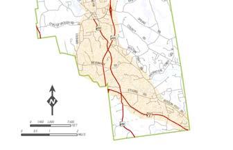
11 Traffic Plan CHAPTER III: TRAFFIC PLAN A. INTRODUCTION This section of the TCSP study examines and summarizes existing traffic conditions in Amherst, including traffic volume counts and intersection Level of Service (LOS). In addition, this section forecasts the future traffic volumes and intersection LOS using the NRPC traffic model. Finally, this section identifies needed improvements, both near and long-term to the local traffic circulation system. Map III-1 shows the study area road network. Map III-1: Study Area Road Network Page III-1

12 B. TRAFFIC ANALYSIS Transportation and Community and Systems Preservation Study for Amherst, New Hampshire Traffic Plan This study has been developed to provide the public, elected officials, appointed officials and town staff with information regarding the impacts on traffic, land use and the environment from future improvements to the traffic circulation system. 1. EXISTING TRAFFIC CONDITIONS The first section of this study identifies existing traffic conditions in Amherst. Roads and intersections that serve as town-wide travel corridors were identified by the TCSP Steering Committee. The corridors that were identified include Amherst Street (between Amherst Common and Milford town line), Boston Post Road and NH 122 (Map III- 1). Recent traffic volume counts conducted by NRPC in those corridors were reviewed. In addition, morning and afternoon peak hour turning movement counts were conducted at 3 intersections. A Level of Service analysis (LOS) was then conducted for these intersections to describe the current traffic operations in the study area HOUR TRAFFIC COUNTS: The study included data from 24-hour traffic volume counts that NRPC conducts on a regular basis for NHDOT as part of the Highway Performance Monitoring System (HPMS). Additional traffic counts were also conducted specifically for this study. The locations of the volume counts are shown on Map III-2 and summarized below. a. 24-Hour Traffic Volumes (average daily traffic): NH 101A: NH 101A carries the most traffic in the study area with the greatest volume being 36,360 vehicles per day (vpd) just east of Northern Boulevard. The volume is 26,253 vpd just east of the NH 101A/NH 122 intersection. NH 101: The volume of traffic on NH 101 varies from 17,387 vpd at the Amherst-Milford Town Line, to 21,856 vpd just north of Baboosic Lake Road interchange, to 19,746 vpd at the Amherst- Bedford Town Line. NH 122: The volume of traffic on NH 122 varies from 7,738 vpd just north of NH 101A to 4,183 vpd near the Corduroy Road intersection. Boston Post Road: Traffic counts along Boston Post Road range from 5,089 vpd at the Amherst-Merrimack Town Line, to 4,846 vpd just north of Main Street. The volume is 2,641 vpd just northwest of the split with New Boston Road. Stearns Road: Stearns Road provides an east-west connection between Boston Post Road and NH 122. This road carries 2,236 vpd. Merrimack Road: Merrimack Road provides an east-west connection between Corduroy Road and NH 122 and ultimately the Amherst-Milford Town Line. The volume of traffic varies from 1,990 vpd just east of NH 122, to 3,419 vpd just west of NH 122. Page III-2


13 Traffic Plan Amherst Street: The volume of traffic varies from 4,552 vpd just west of School Street to 7,773 vpd just west of the NH 101-Baboosic Lake Road interchange. Horace Greeley Road: The volume of traffic using Horace Greeley Road just west of the intersection with NH 101 is 3,669 vpd. Map III-2: 24-Hour Traffic Volumes Page III-3
14 Traffic Plan 3. PEAK HOUR TURNING MOVEMENT COUNTS NRPC conducted morning and afternoon (peak-period) manual turning movement counts at three critical intersections in Amherst. These counts helped to identify existing base line conditions. The counts were conducted in the field by NRPC staff on weekdays between the hours of 7:00am and 9:00am and 4:00pm and 6:00pm. The locations for the turning movement counts are shown on Map III-3 and summarized below. Map III-3: Turning Movement Count Locations Page III-4
15 Traffic Plan a. Turning Movement Count Locations: Non-Signalized Intersections Boston Post Road/Davis Witty Road (Souhegan High School driveway): This intersection (#1 on Map III-3) is a three-way, stop sign controlled, T intersection. Boston Post Road is the major approach and runs northwest-southeast. Davis Witty Road is the driveway for Souhegan High School and is stop sign controlled. Boston Post Road/Main Street: This intersection (#2 on Map III-3) is a four-way stop sign controlled intersection within the Village of Amherst. NH 122/Merrimack Street: This intersection (# 3 on Map III-3) is a four-way stop sign controlled intersection. NH 122 is the major approach and runs north-south. Merrimack Road runs eastwest and is stop-sign controlled. 4. INTERSECTION PEAK HOUR LEVEL OF SERVICE ANALYSIS NRPC performed level-of-service analysis (LOS) for the morning and afternoon peak hour conditions for the study area intersections. Level-of-service analysis was performed based on the industry standards as described in the Highway Capacity Manual 2000 (HCM), published by the Transportation Research Board. The HCM defines the quality of traffic operations at specific highway facilities (roads, lanes, intersections, and intersection approaches) under specific conditions (peak hour) by a means of "level-ofservice." The LOS characterizes the operating conditions on a facility in terms of traffic performance measures related to speed and travel time, freedom to maneuver, traffic interruptions, and comfort and convenience. The levels-of-service range from "A" (least congested) to "F" (most congested). The following table shows the general definitions of LOS. Table III-1: Level of Service Definitions Level of Service General Operating Conditions A Free flow B Reasonably free flow C Stable flow D Approaching unstable flow E Unstable flow F Forced or breakdown flow Source: "A Policy on Geometric Design of Highways and Streets", AASHTO Operational analysis at non-signalized (two-way and four-way stop controlled) depends upon the understanding of the interaction of drivers on the minor or stop-controlled approach with the drivers on the major street. The LOS for a stop controlled intersection is determined by the computed or measured control delay and is defined for each minor movement. The LOS is not defined for the intersection as a whole. The LOS criteria for non-signalized intersections are shown in the following table: Table III-2: Level of Service Criteria/Non-Signalized Level of Service Control Delay per Vehicle (sec./veh.) A 0-10 B C D E F > 50 Source: "Highway Capacity Manual 2000", TRB. Page III-5
16 Traffic Plan The existing peak hour LOS is described below and summarized in Table III-3. a. Existing Level of Service: Boston Post Road /Davis Witty Road The westbound approach on Davis Witty operates under LOS "F" and "B" conditions during the existing AM and PM peak hours respectively. Boston Post Road /Main Street - The overall LOS for this intersection is A during the morning peak period and B during the afternoon peak period. NH 122/Merrimack Street - The eastbound approach on Merrimack Street operates at LOS D and F conditions during the existing AM and PM peak hours respectively. The westbound approach on Merrimack Street operates at LOS E and F conditions during the existing AM and PM peak hours respectively. Table III-3: Existing (2004) Level of Surface Study Area Non-signalized Intersections: AM Peak Delay (sec.) AM Peak LOS PM Peak Delay (sec.) PM Peak LOS BOSTON POST ROAD/DAVIS WITTY ROAD (Souhegan High School Driveway) Boston Post Rd EB Left Turn 10.7 B 8.7 A Davis Witty Rd WB Right Turn 11.1 B 12.4 B Davis Witty Rd WB Left Turn F 18.9 C Davis Witty/WB Left/Right/Approach F B BOSTON POST ROAD/MAIN STREET Main St EB Left & Right Turns 8.9 A 8.9 A Main St WB Left & Right Turns 9.1 A 8.8 A Boston Post Rd NB Left & Right Turns 9.0 A 11 B Boston Post Rd SB Left & Right Turns 10.9 B 8.9 A NH 122/MERRIMACK STREET Merrimack St EB Left, Right &Through 31 D 54.1 F Merrimack St WB Left, Right & Through 35.1 E F NH 122 NB Left Turn 8.1 A 8.1 A NH 122 SB Left Turn 7.6 A 8.3 A Merrimack St EB approach LOS & delay D 54.1 F Merrimack St WB approach LOS & delay E F 5. FUTURE (2025) TRAFFIC CONDITIONS The future traffic conditions for this study are based on traffic projections derived from the NRPC regional traffic model. Two future model scenarios were developed. The "No-Build" scenario estimates future traffic conditions based on the currently existing transportation network and expected growth in population and employment. The "Build" scenario estimates future traffic conditions based on the existing transportation network plus all projects called for in the current NH DOT Ten Year Transportation Plan and NRPC Long Range Transportation Plan. Two of the larger projects involve NH 101 and NH 101A. The NH 101 project includes widening to a 4-lane, median-divided roadway between the west end of the Milford bypass and the Amherst/Bedford town line and creating several gradeseparated interchanges. The NH 101A project includes widening the roadway to a consistent 7 lanes (3 in each direction and center turning lane) from Somerset Parkway to the Merrimack town line, coordinating all 22 existing traffic signals, consolidation of curb cuts, expanding inter site connections and other improvements. In both the Build and No-Build scenarios the expected morning and evening peak hour traffic and turning movements were estimated for the study area intersections. Based on that data, Page III-6
17 Traffic Plan the level-of-service analysis was conducted for both No-Build and Build conditions and compared in order to distinguish the potential impacts of the recommendations in this study. 6. FUTURE TRAFFIC VOLUMES Future traffic volumes were projected to a 20-year horizon, utilizing the NRPC regional traffic model. The traffic model converts land use inputs, specifically the number of housing units, employment and school enrollment, into vehicle trips based on trip generation equations for each specific land use. The trips are then distributed throughout the regional study area and beyond utilizing a gravity model. The future scenario has been developed in consultation with local communities and based on existing land use patterns, local land use policies and zoning, the availability of vacant land and the presence of environmental constraints. Table III-4 records traffic count locations, the most recent recorded volume (ADT) and the year that traffic was counted at that location. The table also lists the projected future (2025) volume for both Build and No-Build conditions, and the percent change in average daily traffic between present and future volumes. It can be seen that in most cases the increase in traffic is projected to be significant. For example, average daily traffic on NH 122 just north of NH 101A is projected to increase approximately 50% and on Boston Post Road at the Merrimack town line traffic is projected to double. Map III-4 displays projected future traffic volumes and Map III-5 displays the percent change in volume for specific roadway segments for the No-Build scenario. Map III-6 displays projected future traffic volumes and Map III-7 displays the percent change in volume for specific roadway segments for the Build scenario. Table III-4: Future ( 2025) Traffic Forecasts Most Recent Traffic Count 2025 Forecast Volume Location Vehicles Per Day Year No Build % Change Present/future Build % Change Present/future Boston Post Merrimack T/L 5, , % 10, % Boston Post Road over Souhegan River 4, , % 7, % Boston Post Road over Beaver Brook 4, , % 7, % Boston Post Road n. of Main Street 4, , % 9, % Boston Post Rd n. of New Boston Rd 2, , % 7, % NH122 n. of NH101A 7, , % 15, % NH122 s. of Amherst Street 5, , % 9, % NH101A e. of NH122 26, , % 30, % NH101A e. of Northern Blvd. 36, , % 43, % Amherst Street n. of Baboosic Lake Rd 7, , % 12, % Amherst Street w. of Main Street 4, , % 5, % Mack Hill Road n. of Manchester Road 2, , % 3, % Manchester Road e. of Mack Hill Road 1, , % 3, % Horace Greeley Road north of NH101 3, , % 4, % Stearns Road East of NH 122 2, , % 5, % Milford T/L 17, , % 20, % NH101 North of Baboosic Lake Road 21, , % 21,856 No Change NH Bedford T/L 19, , % 25, % Page III-7
18 Traffic Plan Map III-4: 2025 Forecast Volume-No Build Page III-8

19 Traffic Plan Map III-5: 2025 Forecast Changes in Volume-No-Build Page III-9
20 Traffic Plan Map III-6: 2025 Forecast Volume-Build Page III-10
21 Traffic Plan Map III-7: 2025 Forecast Changes in Volume-Build Page III-11


22 Traffic Plan 7. FUTURE LEVEL OF SERVICE As described previously, the No Build scenario represents the traffic conditions that can be expected in Amherst in 2025 based on the currently existing transportation network and expected growth in population and employment. Based on that analysis, there is one non- signalized intersection in town that will operate at Level of Service F in 2025 (Table III-5). The other intersections that were analyzed will operate at LOS D or better. NH 122/Merrimack Street: The eastbound and westbound approaches to this intersection will operate at LOS F in Boston Post Road/Souhegan High School: The Davis Witty Road approach will operate a LOS D in the morning and C in the afternoon. Boston Post Road/Main Street: LOS C in the morning and D in the afternoon. The Build scenario represents the traffic conditions that can be expected in Amherst in 2025 based on NH DOT s Ten-year Transportation Plan as well as expected growth in population and employment. Based on that analysis there is one non- signalized intersection in town that will operate at Level of Service F in 2025 (Table III-5). The other intersections that were analyzed will operate at LOS D or better. NH 122/Merrimack Street: The eastbound and westbound approaches to this intersection will operate at LOS F in Boston Post Road/Souhegan High School: The Davis Witty Road approach will operate a LOS D in the morning and C in the afternoon. Boston Post Road/Main Street: LOS C in the morning and C in the afternoon. Study Area Non-signalized Intersections Table III-5: Future (2025) Level of Service No-Build Scenario AM Peak LOS AM Peak Delay (sec.) PM Peak LOS PM Peak Delay (sec.) AM Peak LOS Build Scenario AM PM Peak Peak Delay LOS (sec.) BOSTON POST ROAD/DAVIS WITTY ROAD (Souhegan High School Driveway) Boston Post Rd EB Left Turn A 9.0 A 9.9 A 8.8 A 9.0 Davis Witty Rd SB Right Turn A 9.5 C 17.1 A 9.8 B 13.4 Davis Witty Rd SB Left Turn E 44.8 D 28.8 E 44.8 C 20.4 Davis Witty/SB Approach D 30.7 C 21.3 D 31.8 C 16.0 BOSTON POST ROAD/MAIN STREET Main St EB Left & Right Turns B B B B Main St WB Left & Right Turns B B B B Boston Post Rd NB Left & Right Turns B E B D Boston Post Rd SB Left & Right Turns D B D B Overall Intersection LOS & Delay C D 28.7 C C NH 122/MERRIMACK STREET Merrimack St EB Left, Right &Through F F F F PM Peak Delay (sec.) Page III-12
23 Traffic Plan No-Build Scenario Build Scenario AM Peak LOS AM Peak Delay PM Peak LOS PM Peak Delay AM Peak LOS AM Peak Delay PM Peak LOS PM Peak Delay Study Area Non-signalized Intersections (sec.) (sec.) (sec.) (sec.) Merrimack St WB Left, Right & Through F F F F NH 122 NB Left Turn A 8.5 A 8.4 A 8.7 A 8.3 NH 122 SB Left Turn A 7.5 A 8.2 A 7.6 A 8.3 Merrimack St EB approach LOS & delay F F F F Merrimack St WB approach LOS & delay F F F F C. KEY ISSUES The TCSP steering committee met on numerous occasions to assess available data as well as to evaluate input from work sessions that were held with the Amherst Planning Board. Special attention has been focused on addressing issues resulting from increased future traffic on NH 101 which will result in more traffic congestion, cut-throughs to avoid NH 101 and a continued need for traffic management efforts. As a result of the steering committee meetings and planning board work sessions a series of issues and opportunities has been developed. The key issues are described below and shown on Map III-8. Future capacity improvements on NH 101 and NH 101A were considered as well. The NH 101 project includes widening to a 4-lane, median-divided roadway between the west end of the Milford bypass and the Amherst/Bedford town line and creating several grade-separated interchanges. The NH 101A project includes widening the roadway to a consistent 7 lanes (3 in each direction and center turning lane) from Somerset Parkway to the Merrimack town line, coordinating all 22 existing traffic signals, consolidation of curb cuts, expanding inter site connections and other improvements. 1. INTERSECTIONS There are several intersections in Amherst that exhibit poor level of service or safety issues. One is the intersection of Boston Post Road and Davis Witty Road, which is the driveway to Souhegan High School. Boston Post Road is a popular commuting route towards the Nashua area which puts commuter traffic in direct conflict with traffic entering and exiting the school. The result is an existing LOS is F for the AM peak period. The intersection of NH 122 and Merrimack Road is also problematic. Merrimack Road is a popular cutthrough between Milford and points east. The existing LOS is F for both the eastbound and westbound approaches to NH 122. The steering committee and Planning Board raised concerns about two other intersections in Amherst that are somewhat removed from the study area. One of these is the intersection of Horace Greeley Rd and NH101. This is a dangerous intersection with numerous traffic accidents. The other is the entrance to the Amherst land fill off of NH 101. This intersection is also dangerous because eastbound traffic on NH 101 must turn in front of oncoming westbound traffic to enter the driveway to the landfill. Both of these intersections are addressed in the NH 101 Corridor study. The section below summarizes the recommendations that appear in that study. 2. NEW HAMPSHIRE ROUTE 101 CORRIDOR PLAN RECOMMENDATIONS The NH 101 Corridor Plan is a strategy to reduce problems and realize benefits. It has several key parts: Access to the highway must be managed for safety. Hazardous left turns must be reduced, and turning traffic should be directed to appropriately designed intersections to enter and leave the highway safely. Page III-13
24 Traffic Plan Intersections and then roadway segments must be improved to make them safer, accommodate traffic and reduce traffic diverting through residential neighborhoods. Ultimately, NH 101 should have 4 travel lanes (2 in each direction) from NH 114 in Bedford to western Milford, with a landscaped median to control left turns. In Amherst, local overpasses at Horace Greeley Road and Walnut Hill Road would provide connections between neighborhoods and permit traffic to reverse direction, access businesses, and make right turns to enter and leave side streets and driveways instead of left turns. 3. NEW HAMPSHIRE ROUTE 101A MASTER PLAN AND IMPROVEMENTS PROGRAM The NH 101A Master Plan is a transportation improvements program for the NH 101ACorridor. General recommendations for the corridor include: Where possible, create four-way intersections with existing roads and the entrances to interconnected sites, which will minimize the need to access NH 101A to reverse direction or access abutting properties. Provide and expand upon intersite connections. Consolidate curb cuts wherever possible. Specific recommendations in Amherst include: Provide new sidewalk on both sides of NH 101A between North Hollis Street an Airline Drive. Provide connections among abutting properties on both sides of NH 101A in the vicinity of seasonal Square and Jaspers Farm 4. BICYCLE AND PEDESTRIAN FACILITIES The steering committee identified several corridors that could be enhanced to accommodate travel by bicycle. The NRPC Regional Bicycle and Pedestrian Plan was also considered during this study. The routes that were identified are discussed briefly here and more thoroughly in the bicycle and pedestrian section of the TCSP study. Amherst Street from downtown Amherst to downtown Milford. This route is identified in NRPC Regional Bicycle and Pedestrian Plan as a key connector. The steering committee also identified this as a prime bicycle corridor that could be made more bicycle friendly with proper signage and pavement markings. Boston Post Road from Souhegan High School west towards downtown Amherst. The steering committee and Planning Board expressed interest in making this segment of Boston Post Road safer for bicyclists and pedestrians. Boston Post Road east to Stearns Road. Stearns Road would connect Boston Post Road with NH 122, NH 101A and the Town of Milford. The old RR line from Thornton s Ferry Road, south along old ROW to Boston Post Road. This route would avoid a narrow, high-volume segment of NH ROADWAY SAFETY NEAR TOWN HALL The corner steps to the Town Hall are just three feet off the edge of Main Street and very near the intersection of Main Street, Church Street and Manchester Road. The intersection itself is skewed which allows motor vehicles from Manchester Road to enter Main Street directly in front of the Town Hall at a dangerously high rate of speed. The entry onto Manchester Road from Church Street is also undefined and confusing. This intersection should be re-configured to allow Manchester Road to intersect Main Street at a safer Tee style intersection. This alignment will allow for more green space in front of Town Hall, which will make entering and exiting the building safer. Page III-14
25 6. GATEWAYS Transportation and Community and Systems Preservation Study for Amherst, New Hampshire Traffic Plan The transition from NH 101 and NH 122 to the local street system could be greatly enhanced by landscaped gateways at key entries into town. Gateways signal the transition from the highway system to the local street system and welcome visitors to town. A good example of gateway landscaping can be seen at the NH 101-Amherst Street intersection in Amherst. Gateways can also be effective in signaling the transition into town along secondary roads such as Boston Post Road (between Merrimack and Amherst) and Amherst Street (between Milford and Amherst) Page III-15


26 Traffic Plan Map III-8: Key Issues Page III-16
27 Traffic Plan D. STRATEGY FOR IMPROVING TRAFFIC CONDITIONS IN THE STUDY AREA Based on the analysis of existing traffic conditions, anticipated future traffic conditions, and input from the steering committee and planning board, a strategy has been developed to realize the vision for the future of the study area. 1. INTERSECTIONS BOSTON POST ROAD-DAVIS WITTY ROAD The intersection of Boston Post Road and Davis Witty Road is the driveway to Souhegan High School. As noted earlier in this document, Boston Post Road is a popular commuting route towards the Nashua area. This puts commuter traffic in direct conflict with traffic entering and exiting the school. The result is an existing LOS is F for the AM peak period. RECOMMENDATIONS SHORT TERM ( ) Analysis to determine if a traffic signal is warranted, An eastbound left turn pocket could be developed that would allow eastbound through traffic to continue unimpeded while providing a safe haven for eastbound left turning traffic. MID TERM ( ) The Amherst Department of Public Works has advocated for a traffic signal at this location but it has been difficult identifying a funding source. It is recommended that TCSP implementation funds be used to install a traffic signal at this location. NH 122-MERRIMACK ROAD The level of service at this intersection is F for both the eastbound and westbound approaches during the afternoon peak periods. RECOMMENDATIONS SHORT TERM ( ) A westbound right turn lane on Merrimack Road (onto NH 122 north). An eastbound left turn pocket on Merrimack Road (onto NH 122 north) NH 101-HORACE GREELEY ROAD This intersection is outside of the study area, and will eventually be improved when NH 101 is expanded to a 4-lane median divided highway. That project, however, is many years in the future. In the meantime, the steering committee has noted with concern that this is a dangerous intersection and that short or mid-term improvements should be made. RECOMMENDATIONS: SHORT TERM ( ) Investigate the feasibility of installing traffic safety devices at this intersection. This will be an interim measure that will improve safety during the intervening years between now and when NH 101 is expanded. LONG TERM ( ) The recommendations from the NH 101 Corridor Study should be implemented. This will include widening of this section of roadway to 4-lane, median divided, with grade separated interchange at Horace Greeley road. Page III-17
28 Traffic Plan NH 101-AMHERST LANDFILL DRIVEWAY This driveway provides entry and exit from the landfill. Eastbound axis to the landfill driveway requires a left hand turn in front of oncoming westbound traffic. Exiting traffic that wishes to head east must turn in front of both eastbound and westbound through traffic. RECOMMENDATION: SHORT TERM ( ) Limit existing driveway to enter-only and move exit further east on NH ROADWAY SAFETY NEAR TOWN HALL The existing configuration of the intersection of Main Street, Church Street and Manchester Road is skewed and dangerous which results in a confusing and dangerous traffic pattern. The town of Amherst has considered this and identified a plan of action. The plan includes re-aligning Manchester Road to form a Tee intersection with Main and Church Streets. This new alignment will define traffic flow which will result in a safer situation for pedestrians and motorists alike. More green space in front of Town Hall will also be created. The town has applied for funding for this project through the current ( ) Transportation Enhancements (TE) funding cycle. RECOMMENDATIONS: SHORT TERM ( ) It is recommended that TCSP implementation funds be used for this project if the Town s TE application is unsuccessful. 3. GATEWAYS It is recommended that more intensive gateway landscaping and signage should be installed at key locations throughout the study area, signaling the transition from NH 101 and NH 122 to the local street system and welcoming visitors to the town. Gateways are also effective in signaling the transition between towns along secondary roads. RECOMMENDATIONS SHORT TERM ( ) Amherst Street near the Amherst-Milford town line NH 122 near the eastbound exit from NH 101 Boston Post Road near the intersection with NH 122 Combinations of a canopy tree and an under story tree or shrub are suggested, such as white pine with paper birch (used in Amherst Street interchange example) or red oak and witch hazel. Native flowering trees and shrubs can also be used. Milford granite can be used to provide interest to the design in the form of low stone walls or bollards, which may be used for mounting welcoming signage. The design must maintain clear sight lines and provide adequate setback of trees and granite elements to meet safety criteria. Page III-18


29 Traffic Plan Map III-9: Recommended Improvements Page III-19
30 E. ACTION ITEMS Transportation and Community and Systems Preservation Study for Amherst, New Hampshire Traffic Plan Key Issue Recommendation Target Date INTERSECTIONS: There are several intersections in Amherst that exhibit poor level of service or safety issues. - Boston Post Rd/Davis Witty Rd (Souhegan High School driveway) LOS F during AM peak. - NH122/Merrimack Rd. LOS F during PM peak. - NH101/Horace Greeley Rd. Dangerous intersection with numerous accidents - NH101/Amherst landfill driveway. Dangerous intersection w/left turns in front of oncoming traffic Recommendation: Eastbound left turn pocket into driveway Recommendation: Install west bound right turn lane on Merrimack Rd (onto NH 122 north). Recommendation: Install east bound left turn pocket on Merrimack Rd (onto NH 122 north). Recommendation: Implement interim safety including warning signs and flashing light. Recommendation: Implement recommendations from NH101 corridor study which include a gradeseparated interchange at this location. Recommendation: Limit existing access to enter-only and move exit further east on NH101 Short Term ( ) Mid Term ( ) Mid Term ( ) Short Term ( ) Long Term ( ) Short Term ( ) ROADWAY SAFETY NEAR TOWN HALL - The existing configuration of the intersection of Main Street, Church Street and Manchester Road is skewed and dangerous. GATEWAYS Transitions from state highways to local roads need to be better defined. The transition between towns along local roads should also be better defined. Gateways can accomplish this. Recommendation: Re-align Manchester Rd. to form Tee intersection with Main St. and Church St. The Town has applied for TE funding ( round) for this project. If unsuccessful, TCSP implementation funding should be pursued. Recommendation: Install intensive gateway landscaping at key locations throughout the study area Mid Term ( ) Short Term ( ) Page III-20
31 Land Use CHAPTER IV: LAND USE REDUCING CONFLICTS BETWEEN LAND USE AND THE TRANSPORTATION SYSTEM A. INTRODUCTION The link between transportation and land use is an important consideration in the development of any new transportation facility because land use regulations can actually encourage one mode of transportation over another. For example, bicycling and walking trips cover short distances and these trips are discouraged when barriers force a one or two mile detour. Barriers include the lack of pedestrian connections between cul-de-sacs and housing developments and these barriers can easily be overcome by requiring connections between these land uses that are reserved for non-motorized travel only. A growing body of research suggests that the cost associated with automobile transportation infrastructure and energy use in conventional suburban development is becoming increasingly unsustainable. 1 Conventional suburban development requires more land and road infrastructure per capita than does more compact development, increasing the per capita cost of land development. As development expands outward, more roads are needed, which in turn require more public expenditure for serving new development. Added to those costs are the ecological and social costs from reduced water and air quality as a result of increased automobile use. It is suggested that modifications made to land use patterns and changes to the built environment can significantly reduce travel demand which results in reduced road infrastructure requirements and lower per capita energy use related to automobiles. Therefore, an objective of the TCSP study is to improve this link between transportation and land use in three specific issue areas: Land use strategies that reduce dependence on motor vehicles for meeting transportation needs, Access management guidelines that preserve roadway capacity and improve safety, and Design guidelines that enhance the appearance and decrease visual clutter along main local transportation corridors. B. DEVELOPMENT OF LAND USE STRATEGIES The first objective of this section of the TCSP report is to identify approaches to land use regulation that enable bicycle and pedestrian modes of travel by decreasing dependence on private motor vehicles. Each of the following approaches has been evaluated for its appropriateness for Amherst given the limitations of New Hampshire land use law and community acceptance. The land use strategies described below best fit into the category of innovative zoning authorized in New Hampshire under RSA 674:21, Innovative land use controls. 1. INFILL DEVELOPMENT Infill development is the development of vacant or undeveloped land that has been bypassed and surrounded by existing development. Generally the sites are not of prime quality. However, they are usually served by existing infrastructure. Use of such land for new housing or other development is a desirable alternative to continually extending infrastructure to new greenfields development. Infill development can be accomplished by relaxing requirements for setback, frontage and, as well as lot size requirements within the zoning ordinance for lots that meet certain criteria. Examples of the criteria are: 1 University of British Columbia, James Taylor Chair in Landscape & Livable Environments, Technical Bulletin No. 11 November Page IV-1
32 Land Use The parcel is within a certain radius of a village or downtown zone The parcel has been a non-conforming lot more than 15 years 80% of the land within a 300 radius of the parcel has been developed and where water, sewer, streets and fire protection have already been developed and are provided 2. LIVABLE/WALKABLE DEVELOPMENT DESIGN Livable, Walkable Communities are places where people of all ages and abilities can easily enjoy walking, bicycling and other forms of recreation. They are areas that support and promote physical activity; have sidewalks, on-street bicycle facilities, multi-use paths and trails, parks, open space and recreational facilities; and promote mixed use development and a connected grid of streets, allowing homes, work, schools and stores to be close together and accessible by walking and bicycling. Designing communities as Livable/Walkable places means creating a balance between the economic, human, environmental, and social health of a community. Such development considers community planning and zoning practices at a human scale through the implementation of tools such as traffic calming devices, street and intersection design, bicycle and pedestrian facility design, ADA requirements, and community beautification programs. Livable/Walkable development practices protect natural resources by reducing the use of personal automobiles, support business by enabling people to access services locally, promote social capital by encouraging casual interaction, enhance personal physical fitness through increased activity, and diminish crime and other social problems by increasing the number of people on local streets. 3. LOCATION OF PUBLIC BUILDINGS This policy can play a key role in sprawl reduction. If these structures are located within villages, downtowns, or higher density districts, then more people will be able to walk to these facilities instead of driving to them. The State of New Hampshire encourages state agencies to establish priorities for grant programs that strengthen village centers and downtown areas, and to prioritize any investments to locally designated growth areas. 4. NODAL DEVELOPMENT Nodal development usually relates to the development of village districts, while encouraging bicycle or pedestrian modes, with lands in between being used for low density, low traffic uses. Nodal zoning encourages development within these villages rather than along the roadway, which typically creates sprawl. A more rural, open countryside character is encouraged along the corridor frontage. Key policies that encourage nodal development include the following: Decreased street widths that play a role not only in reducing the speed of traffic, but also in reducing non-point storm water runoff and stream pollution; Parking lot design that enhances internal traffic movement, thereby expediting travel from the street into the parking lot; Shared driveways that limit the number of access points along busy streets thereby reducing turning movement and other traffic conflicts; A mix of residences, certain businesses (banks, service establishments, antiques and craft stores), home occupations and cluster developments. 5. TRANSIT ORIENTED DEVELOPMENT Transit oriented development (TOD) encourages a mixture of residential, commercial, and employment opportunities within identified areas that have access to transit centers. The TOD promotes development that supports transit by ensuring access to transit, and attempts to limit conflicts between vehicles and pedestrians and transit operations. The TOD allows for more intense and efficient use of land at Page IV-2
33 Land Use increased densities for the mutual reinforcement of public investments and private development. Uses are regulated for a more intense built-up environment, oriented to pedestrian amenities, creating a more pleasant pedestrian environment without excluding the automobile. TOD is usually located within walking distance to the transit station and can be new construction or redevelopment. TODs are usually within a ¼ mile radius of either public streets identified as having the location, mix of densities and uses, and development patterns that can generate sufficient ridership to support a frequent and consistent level of transit service, or is near existing transit stations. The most likely future opportunities for TOD in Amherst will be along the NH 101A corridor. Action items should include installation of bus stop turn-outs equipped with freestanding bus shelters. The turn-outs/shelters should be located throughout the corridor in Amherst especially near areas with higher density residential land uses. 6. URBAN GROWTH BOUNDARIES WITH MUNICIPAL SERVICE DISTRICTS The Urban Growth Boundary (UGB) technique has been at the center of debate for a number of years, and has been implemented as a key part of growth management legislation in several states. While the jury is still out on how effective growth boundaries have been in the other states, the law has usually mandated that communities work with counties to determine the size of their growth area. A few communities in the state of New Hampshire, including Concord and Keene, have de-facto growth boundaries, essentially limiting growth to those areas with city water and sewer service. The urban growth boundary would be identified in the Master Plan as the area where the community is expected to grow. Inside the boundary, density is higher and municipal services are provided. Outside the boundary, zoning is less dense, characterized by fewer developments and where, through utility agreements, municipal services are not extended. The advantage to UGB s is that they concentrate population growth which leads to the higher population densities that are necessary to support transit. Increased transit ridership leads to less motor vehicle miles traveled and more opportunities for other forms of transportation. UGB s also decrease the per capita cost of public utilities by concentrating the area in which they are provided. 7. VILLAGE PLAN ALTERNATIVE A Village Plan Alternative Subdivision promotes redevelopment of town centers, new development at major crossroads, and mixed-use development adjacent to existing town centers. This zoning and regulatory technique encourages the preservation of open space and the efficient use of land and public and private infrastructure. RSA 674:21 requires that the entire density permitted by existing land use regulations must be located in 20 percent or less of the entire parcel available for development. The remaining 80 percent is to be used for conservation, recreation, or agricultural uses. This type of subdivision is best used with the concept of nodal development. a. Other Suggestions Create a pedestrian (sidewalk) and bicycle path master plan to connect activity centers with neighborhoods Design commercial and residential developments with connections to road and sidewalk networks Encourage safe pedestrian routes to transit Situate parking to enhance pedestrian environment and facilitate access between destinations Safe routes to schools Page IV-3
34 Land Use C. EVALUATION OF ZONING, SUBDIVISION AND SITE PLAN REVIEW REGULATIONS Using the land use strategies developed for the TCSP project, a Land Use Strategy Audit Checklist was developed to complete evaluations of each community s Zoning Ordinance, Subdivision and Site Plan Review Regulations. The Audit Checklist and results are included below. Table IV-1: LAND USE STRATEGIES - COMMUNITY AUDIT DOCUMENT ZONING ORDINANCE LAND USE STRATEGY Infill Development Livable / Walkable Community FEATURE Y N Comments/Notes Ordinance expressly addresses infill lots N Reduced setbacks Y Reduced frontage Y Reduced land area Y Increased density to encourage development Miscellaneous Provisions Allow for more compact development Y Y 8-5 Affordable Housing provisions have no specific setback requirements 3-9 Building on reduced frontage lots permitted if it complies with driveway regulations 8-5 Affordable Housing Provisions have reduced density and lot size provisions 8-5 Affordable Housing Provisions have reduced density and lot size provisions 4-2 Any lot of record may be occupied by any use permitted in its zoning district, provided zoning, setback, building and water pollution control regulations and have access on a public or private road Section 8-5 Affordable Housing may be located in any zoning district with a conditional use permit, Planning Board approves lot size, density and other dimensional requirements for each project. Page IV-4
35 Land Use Table IV-1: LAND USE STRATEGIES - COMMUNITY AUDIT DOCUMENT LAND USE STRATEGY FEATURE Y N Comments/Notes Allow for more compact development Y Allow for mixed uses Y Design commercial destinations for pedestrian access and scale N Planned Residential Developments are permitted by Conditional Use in the R/R, NR, NT, and Commercial zones. Needs a minimum of 20 + buildable acres 4-7 A. 6. Mixed Use Developments are permitted in the Commercial and Limited Commercial Zones and General Office Zone, up to 25% of the gross sf of the commercial development. No specific design guidelines Nodal Development Transit Oriented Development Creates low density, low access districts between nodes of mixed use development Decreased street widths for speed reduction and reduction of non-point water runoff and stream pollution Connections through bicycle and pedestrian trail ways Ordinance Mixed uses Higher density Transit stop locations N N N This development is probably not appropriate for Amherst unless transit becomes available Page IV-5
36 Land Use Table IV-1: LAND USE STRATEGIES - COMMUNITY AUDIT DOCUMENT LAND USE STRATEGY FEATURE Y N Comments/Notes SUBDIVISION OR SITE PLAN REVIEW REGULATIONS Urban Growth Boundary with Municipal Service Districts Livable / Walkable Community Identified in the Master Plan as the areas where the town is expected to grow; where growth is concentrated through higher density and where municipal services are located. The area outside of the boundary is characterized by lower density, agricultural/forestry or conservation zoning to contain development and where municipal services will not be extended. Require sidewalks and sidewalk connections that comply with the ADA Standards for Accessible Design for new development N N Sub. 5-4 Pedestrian Walks: Where necessary, in the judgment of the Board, rights of way for pedestrian travel and access may be required between subdivisions or its parts, or between a subdivision and public property. Page IV-6
37 Land Use Table IV-1: LAND USE STRATEGIES - COMMUNITY AUDIT DOCUMENT LAND USE STRATEGY FEATURE Y N Comments/Notes Require bike lanes to be constructed in new public or private streets N COMMUNITY POLICIES Location of Public Buildings Require that streets and sidewalks be interconnected. Require cross walks to be clearly delineated through brick, paint or alternative methods Require open space and trails as part of subdivisions Require pocket parks to be part of new subdivisions Require that they be located in or adjacent to already developed areas or in the town center Y N Sub. Section 5-1 Street design requires extension of street pattern to abutting undeveloped land. Y Sub. Section 4-8 Design for Open Space Y N Sub. Section 4-8 a & b requires subdivisions to show areas suitable to be used as community open space or parks Page IV-7
38 Land Use D. LAND USE STRATEGY RECOMMENDATIONS 1. MASTER PLAN RECOMMENDATIONS a. Future Land Use Review future land use plans to identify areas in town that are suitable for more compact development either through new or infill/redevelopment projects. Reexamine the nature of the Northern Transitional Zone to see if other areas in Town could benefit from these regulations, or if the existing area is appropriate for mixed uses and walkable elements. b. Policy for siting public facilities Review RSA 9-B, State Economic Growth, Resource Protection, and Planning Policy and consider adopting a Smart Growth policy for the Town of Amherst that incorporates the principles set forth in 9-B:3. 2. ZONING RECOMMENDATIONS Consider adopting an infill ordinance or overlay zone for a walkable radius extending out from the Amherst Center Village that would capitalize on the historic land use patterns established in the area. Incorporate livable/walkable features such as pedestrian ways and bike paths into the ordinance. Investigate other nodes in town that may be appropriate for more compact or denser redevelopment through infill and that offer opportunities to be connected to other nodes. Review the minimum requirements of the Affordable Housing and PRD regulations and evaluate whether it would be beneficial to reduce the lot size from acres to acres in some areas of Town (for example, within the walkable radius of the village) to encourage growth where it can be interconnected with other more compact development. 3. SUBDIVISION AND SITE PLAN REVIEW REGULATIONS a. Incorporate livable / walkable elements into Street Design Standards: (See Appendix for sample language) Sidewalks and sidewalk connections that meet ADA standards for all developments or, as an alternative, within certain radius of schools Bike lanes that meet FHWA standards Designate corridors such as NH Route 122, NH Route 101A, Merrimack Street and Milford Road as pedestrian/bicycle friendly corridors and develop requirements for applicants to accommodate pedestrian pathways or bike lanes in site plan or subdivision plans. Require interconnection between neighborhoods/developments by pathways or trails Require interconnection between sidewalks and streets Page IV-8

39 Land Use 4. OTHER ISSUES When considering developments proposed under the Affordable Housing or Planned Residential Development regulations: Consider increasing the density and reducing the lot sizes in relation to how well the proposed development can integrate into the existing street network and neighborhoods Require developments to design pedestrian and bicycle connections to existing roadway networks or other neighboring developments Ensure pedestrian scale features and amenities such as benches, directional signs, crosswalks and other streetscape options E. ACCESS MANAGEMENT STRATEGIES Access Management is the practice of coordinating the location, number, spacing and design of access points to minimize site access conflicts and maximize traffic capacity of a roadway. Access management is an important component of both land and transportation planning. Implementation of access management techniques may accomplish a number of goals. Some of these include improving access to adjacent land uses, decreasing interruption in traffic flow, minimizing traffic congestion and delays, helping to extend the useful life of roads, improving air quality and improving overall roadway safety. Enhancing pedestrian and bicycle facilities, encouraging compact development, reducing the total number of vehicle trips through good planning are additional potential benefits. Page IV-9

40 Land Use Typical access management techniques include: Corner clearance is the distance between a driveway and an intersection. Provideing adequate corner clearance improves traffic flow and roadway safety by ensuring that the traffic turning into the driveway does not interfere wit the function of the intersection; Controlling the width, spacing and alignment of access points to limit the number of distractions and limit conflicts and congestion; Page IV-10
41 Land Use Providing proper turning radius, turning lanes, sight distance, corner clearance and throat lengths to allow adequate turning and stacking lane width and spacing for vehicles entering and exiting roadways safely from commercial properties and secondary roads; Turning Radii. Providing shared access and parking between sites to allow for more compact design and reduce roadway congestion; Shared Access Page IV-11


42 Land Use Utilizing frontage and backage (Service) roads to filter traffic from highways to commercial centers without impeding through traffic; Use of medians, roundabouts and other traffic calming methods to limit conflicts and manage speeds at busy intersections; and Providing bicycle and pedestrian friendly development by designing connections between residential and commercial activity. In more rural areas, a side path made of asphalt or crushed stone, may be suitable. These techniques may be determined through corridor studies such as this, encouraged in master plans and implemented through zoning ordinance, subdivision and site plan regulations. Uncoordinated commercial growth along some of Amherst s travel corridors has resulted in strip development and/or a proliferation of access points. In most instances, each individual development along those corridors has its own access driveway and in a number of instances, individual developments have multiple access points. This results in numerous access points along the corridors that create conflicts between turning and through traffic which can lead to delays and accidents. The NH 101 and NH101A Corridor Studies dealt with any access management issues directly related to those corridors. The TCSP Study identified segments of other roadways in Amherst where access management issues exist and developed recommendations for improving those segments. Page IV-12
43 Land Use 1. ACCESS MANAGEMENT ISSUE AREAS In addition to preserving capacity, access management techniques can be coordinated with design guidelines to significantly enhance the aesthetics of a roadway corridor. Currently many of the congested roadway corridors are highly diverse, auto-oriented environments that reflect a lack of vision. A common vision that includes guidelines for access in addition to a unified design for signage, landscaping and pedestrian facilities can significantly improve the function and aesthetics of a roadway corridor. The steering committee identified where multiple curb cuts or land uses are or may create access management issues. NRPC staff worked with the steering committee and Planning Board to identify appropriate access management measures. NH Route 101 north of Baboosic Lake Road Area around the schools o Davis Lane & Christian Hill Road o Boston Post Road between Church Street and New Boston Road o Boston Post Road south of Thornton s Ferry Road NH 122 south of NH Route 101A NH Route 101A (see NH Route 101A Corridor Master Plan) Northern Boulevard/Bon Terrain property area Hertzka Drive and Bon Terrain Drive, both leading to NH 101A. 2. ACCESS MANAGEMENT STRATEGIES NRPC staff worked with the steering committee and Planning Board to identify appropriate access management measures. These measures are based on the Access Management Guidelines that were developed by NRPC in Page IV-13
44 Land Use Table IV-2: ACCESS MANAGEMENT STRATEGIES COMMUNITY AUDIT DOCUMENT FEATURE Y N Comments/Notes Zoning Ordinance Limit number of access points per parcel or frontage Y Section 4-7 C.7. No more than one access per lot in the Commercial Zone. Subdivision and Site Plan Review Regulations Require use of side roads or shared driveways Y Section 4-7 C.7. Consideration shall be given to combining access points where two or more lots are being currently developed. Allow reduced frontage requirements along N arterials and collectors when a frontage/backage road is used instead of a driveway Other alternative Zoning Requirements Y Section 4-9 E. Access to any lot on Route 101 A shall be by such other streets as are available and not by Route 101 A unless no other access is available Required Shared parking for commercial establishments N Require cross access between adjacent parcels?? Minimum driveway spacing standards to control N space between curb cuts Minimum and maximum driveway width standards Y Sub. Section 5-2d 3. Driveway Regulations: shall not exceed 18 for residential driveways. No limits for Industrial/commercial driveways Minimum and maximum turning radius standards for access points based on land use Minimum distance between driveways and intersections. N Sub. Section 5-1 Street Design: The intersection of any street shall have a corner rounding at the property line with a radius of ½ the width of the right of way. Y Sub. Section 5-2d 1. Driveways shall not intersect a public road within 50 of the nearest sideline of Page IV-14
45 Land Use Table IV-2: ACCESS MANAGEMENT STRATEGIES COMMUNITY AUDIT DOCUMENT FEATURE Y N Comments/Notes another public road Require consolidation of driveways or corner N clearance during redevelopment of sites. Adopt minimum throat length standards for new or N redeveloped sites Require interconnections between existing and future subdivisions Y Sub. 5-1 Street Design where required by the Board, provisions shall be made for the extension of the street pattern to abutting undeveloped land to provide future potential access. Require rights of way be provided to adjacent undeveloped land Y Sub. 5-1 Street Design where required by the Board, provisions shall be made for the extension of the street pattern to abutting undeveloped land to provide future potential access. Establish standards for shared driveways Y Sub 5-2b Subdivisions containing reduced frontage lots, Class B frontage requires covenants and easements if serving two lots; Require commercial developments to establish cross easements and interconnections between developments Define standards for intersections, street and driveway alignments Establish safe sight distance requirements based on the design speed of the road. Require traffic impact studies to identify needed roadway improvements resulting from proposed development. N Sub 5-2 d, Driveway Regulations General Requirements 2: Wherever practicable, one common driveway shall be constructed to serve adjacent lots Is only required when common driveways are required Y Sub. Section 5-2d 3. Y Sub. Section 5-2d 6. (Posted speed x 10) Y Sub. Section 4-5b Final Review Phase Page IV-15
46 Land Use Table IV-2: ACCESS MANAGEMENT STRATEGIES COMMUNITY AUDIT DOCUMENT FEATURE Y N Comments/Notes Provide safe pedestrian and bicycle access within and between developments N Is a general Site plan review standard, but not specific regulations regarding the issue. Require parking areas to address pedestrian access and circulation within the site Site Reg. General Standards: 1 & 2 Traffic Circulation, Pedestrian and bicycle safety access. Require bus turnouts and shelters for large retail or N Appropriate in NH101A corridor only employment centers where existing or proposed transit services are provided Require construction of frontage/backage roads to N service parcels adjacent to arterials or collectors Provide for the use of roundabouts in the N community, referencing FHWA design criteria Develop preliminary review process for applications to receive input into the design of new Y Sub. Section 4-5 a Design Review Phase (voluntary) developments at the outset of a project Require overall access and development plans for large sites N COMMUNITY POLICIES Promote an interconnected road network for municipal and private roadways N Page IV-16
47 Land Use 3. ACCESS MANAGEMENT STRATEGIES RECOMMENDATIONS FOR LAND USE REGULATIONS a. Zoning Ordinance Amherst s Zoning Ordinance addresses access management in general terms in an attempt to control separation and overall volume of traffic. As detailed below, additional steps may help in an overall access management strategy coupled with complimentary regulations. A combination of limited access policies for roadways and requirements for interconnected parking lots should be considered for new commercial and redevelopment projects on all collector and arterial roadways. Incentives can be: reduced frontage requirements along arterials and collectors identified above when a frontage/backage road is used instead of a driveway cut. Every effort should be made to require construction of the frontage /backage roads in anticipation of future connections. Require commercial establishments to provide for shared and interconnected parking areas. Require each development to provide connections to adjacent lots and limit access to adjoining collector and arterial roadways. 4. SUBDIVISION/ SITE PLAN REVIEW REGULATIONS Overall, Amherst s Subdivision and Site Plan Regulation include many features of good access management. There are some additional requirements that the Town may want to consider incorporating into its regulations or in individual application review. a. Driveway Alignment Street and driveway intersections represent points of conflict for vehicles, bicycles and pedestrians. All modes of travel should be able to clearly identify intersections and assess the travel patterns of vehicles and pedestrians through the intersection to minimize the potential conflicts and improve safety, centerlines of all new driveways should be aligned with existing driveways and road intersections on the opposite side of the highway. In redevelopment of sites, require that driveway entrances be repositioned to facilitate better access. Minimum distance between access points reduces the number of points a driver has to observe and reduces the opportunity for conflicts. Spacing requirements should be based on the classification and design speed of the road, the existing and projected volume of traffic, and the physical conditions of the site. Minimum spacing standards should be applied to both residential and commercial/industrial developments. Page IV-17
48 Land Use Access Separation Distances (feet) based on Spill back Rate* Posted Spillback Rate* Speed (mph) 5% 10% 15% 20% (a) 210(b) 175(c) (a) 210(b) 175(c) (a) Based on 20 driveways per mile. (b) Based on 25 driveways per mile. (c) Based on 30 driveways per mile. *Based on an average of right turns per driveway. **Spillback occurs when a right-lane through vehicle is influenced by rightturn-in to or beyond a driveway upstream of the analysis driveway. The spillback rate represents the percentage of right-lane through vehicles experiencing this occurrence. Source: Gluck, J.S., Haas, G., Levinson, H.S., and Jamal Mahmood, Driveway Spacing and Traffic Operations, TRB Circular E-C019, Dec b. Driveway Design Consider maximum driveway widths for commercial/industrial development. The pink area in the figure above indicates the previous unrestricted frontage access. This site could be redesigned to restrict the width of the access points. Page IV-18
49 Land Use Consider turning radius standards for access points based on land use rather than a uniform standard. Minimum Inside Turning Radii Minimum inside turning radius: 14.4 feet Maximum inside turning radius: 28.3 feet The minimum turning radius should be used in areas with heavy pedestrian traffic such as downtowns and near schools, and on low speed roadways providing access to residential streets and driveways. Commercial areas will require a wider turning radius based on the proposed use, type/volume of traffic and roadway speed. Adapted from: Policy on Geometric Design of Highways and Streets, AASHTO, 2001, and Kulash, Residential Streets, Throat length is the length of the driveway that is controlled internally from turning traffic, measured from the intersection with the road. Driveways should be designed with adequate throat length to accommodate queuing of the maximum number of vehicles as defined by the peak period traffic study. The NH DOT recommends a minimum throat length of 150 for major driveway entrance with 300 desirable for new or redeveloped sites. Adequate throat length: vehicles entering the parking lot have room to maneuver without conflict. Page IV-19


50 Land Use Good example of adequate throat length Develop guidelines for safe pedestrian and bicycle access within and between developments, and for parking areas. Require a pedestrian circulation plan be submitted as part of the development application. Important provisions of such a plan include: - Connectivity: The pedestrian circulation system should be designed so that it connects to where people want ot go; - Accessability: The system should incorporate the needs of all potential users; - Variety/appearance: the system should be attractive and provide a variety of design; - Environmental protection/enhancement: The system should protect and enhance the environment; - Safety: the system should feel safe; - Cost efficiency: The system should be designed, developed and maintained ina cost efficient manner; - Promotion: Pedestrian activities should be promoted by the Town; - Maintenance: the system should be well maintained and managed. Good pedestrian access through parking lot Page IV-20

51 Land Use Require vehicles to be separated from pedestrians by pathways or sidewalks and that crosswalks are clearly marked and accessible. Good separation of vehicles and pedestrians Require the construction of frontage/backage roads to service parcels adjacent to arterials or collectors through new or redevelopment projects. Consider the use of roundabouts in key locations Require large sites to provide schematics for possible future development and develop proposed access and interconnection plans. Clearly specify that an interconnected road network is highly desired by the community. Review dead end and cul-de-sac proposals with great care to ensure that important interconnections are not lost for future development of the transportation network. Page IV-21


52 Land Use 5. ACCESS MANAGEMENT PLAN Map IV-1: Access Management Recommendations Page IV-22

 while allowing for creative and innovative ideas.")

53 Land Use F. DESIGN STRATEGIES Community character/design guidelines are often an overlooked tool in assisting communities in accommodating non-residential growth while, being sensitive to natural resources, maintaining appropriate orientation and scale, being compatible with community character and encouraging efficient and coherent development patterns in harmony with local and regional transportation networks. Design guidelines should identify acceptable site and architectural design principals that promote the community and regional characteristic (e.g. Rural New England ) while allowing for creative and innovative ideas. In general, aesthetics, compatibility, functionality and environmental sensitivity are traits of good design. Community design issues often addressed in design guidelines are: Site design, which includes the relationship and orientation of all on-site features and their physical and visual impact on the area around the site: Building facades parallel to street with consistent street edge Building design, which has significant impact on functionality and community acceptance: The two photographs below are of the same franchise. The property at left did not receive site plan review for building orientation and design. Page IV-23


54 Land Use Parking, which should be optimally sized and orientated in an attractive and efficient manner: Parking to Side and Rear of Principal Structure A parking lot pedestrian path provides a safe and attractive route to a commercial development. Page IV-24

55 Land Use Public/open space, which provide habitat for wildlife, screen development and provide opportunity for interconnected greenways and common areas for various uses, should be maintained and incorporated into site design through the use of commons and squares and tree-lined streetscapes linking open spaces: Existing mature landscaping should be retained when possible: Landscaping/buffers, which are important because they provide separation, screening and enhance site aesthetics: Setback Planting, Plan and Elevation Views. Page IV-25


56 Land Use Tree Clustering, Elevation View. Lighting, which provides security, enhances safety, and sometimes used to highlight architectural features: Example of shielding a traditional street light Before After Source: Signs, which should be designed and scaled to compliment a site by attracting attention without being obtrusive: Page IV-26
57 Land Use Delivery and service facilities, which should be located in a logical and functional manner and screened from public: One-way circulation preferred to avoid backing up in the parking lot. Backing up requires 30 foot maneuvering areas. Roll-off containers require a 40 foot maneuvering area. Page IV-27


58 Land Use Drainage/stormwater management, that is designed for effectiveness and either inconspicuous or in harmony with environmental characteristics of a site and surrounding area: Detention Basins Can Be Used To Manage Stormwater On Site. 1. IDENTIFICATION OF ROADWAY CORRIDORS NRPC and the steering committee, along with assistance from local officials and the public, identified the design issues in each community. The main corridors where design guidelines might be appropriate were identified: NH Route 101 North of Baboosic / Spring Road up to Old Manchester Road Amherst Street from the Milford Town line to Lyndeborough Road Merrimack Road west of NH Route 101 where multi-family and institutional uses are developing Boston Post Road south of Simeon Wilson Road NH Route 101A (see 101A Corridor Master Plan for recommendations) Other opportunities for influencing site design were also identified: Redevelopment of existing non-residential properties Development of Northern Boulevard/Bon Terrain Area Creation of Gateways at the Town lines: - Bedford - Hollis (Route 122) - North Hollis Road (Route 101A) - Milford Town Line Characteristics that were identified as desirable to incorporate into the design guidelines included: Rural/Agricultural Heritage Buffers along roads Buffers between development Preserved Open Space Cluster/Open Space Development Stone walls/fences Page IV-28


59 Land Use Low Density Development Well detailed structures: Brick, Clapboard, Replicating Residential Forms Landscaped parking areas Well landscaped business properties Structures in proportion to lot size Colonial style Appropriate roof lines New construction well integrated within historic structures Contemporary structures that reflect classic elements Organized, understated signs of proper scale Good relationship between buildings 2. DESIRED DESIGN CHARACTERISTICS Table IV-3 lists examples of attractive and desirable development that were identified throughout the Town of Amherst. Each of the following pictures is associated with a desired community characteristic. Table IV-3-Location #24: NH 101A (New Table IV-3-Location #16: NH 101 (Baboosic Lake) Table IV-3-Location #6: NH Airline Drive Page IV-29


60 Land Use Table IV-3-Location #12: NH 101 Salzburg Square Table IV-3- Location #27: Town Common Table IV-3- Location #28: Gateway Page IV-30
61 Land Use Location Table IV-3: Examples of Desirable Design Characteristics Characteristics 1. Boston Post Douglas Drive 2. Boston Post Maple drive 3. Boston Post Meadow Lane 4. Merrimack Valley Church & School Boston Seaverns Bridge Road 5. Eastern Ave. (Amherst Animal Hospital) 6. Airline Drive west of 101A 8. Merrimack Bellview Drive 9. Merrimack Rd. (Fox Run) 10. Amherst St./ Josiah Bartlett Road (Meeting Place) (Salzburg Square) West of Schoolhouse Road from Town Line 15. Camp Rd. (American K-9) (Baboosic Lake Farm) 17. Mont Vernon town line 18. Green Road 19. Christian Hill Road 20. Hammond Pond - Mack Hill Road 21. Gowing Woods off Dodge Road 22. Chestnut Hill Road 23. Thornton's Ferry Road A - (New Bank) A (Columbia) 26. Howe Drive 27. Amherst Common 28. NH 101/entry to Village 1. House size in proportion to lot; adequate setback 2. Treed buffer between developments 3. Open space, agricultural heritage 4. New construction well integrated into historic structure 5. Attractive colonial construction & sign - well landscaped 6. Attractive contemporary building 7. Good transition from commercial to residential 8. New construction: good scale & design 9. Good layout, construction, adequate buffer 10. Good landscape buffer 11. Attractive construction and sign 12. Attractive, distinctive construction 13. Agricultural heritage to be preserved 14. Bragdon Upper Hill - Open space preserved 15. New construction reflects agricultural heritage, attractive sign 16. Unique barn worth preserving 17. Country Road - Entry/Gateway to Town 18. Attractive low density development 19. Agricultural heritage 20. Agricultural heritage 21. Great example of open space development - compact structures w/ preserved open space 22. Attractive low density residential 23. Attractive open space development 24. Attractive new building 25. Attractive new industrial building w/ excellent landscaping 26. Well executed new manufacturing building 27. Great example of downtown common area 28. Gateway landscaping 3. DESIGN RECOMMENDATIONS NRPC Community Character Guidelines for Non-residential Development (August 2000) describes a series of tools that Amherst can use to address the design characteristics identified above in conjunction with land use and transportation planning. Amherst Zoning Ordinance Section 3-11 Scenic Setbacks: setback from ROW on certain corridors Section 4-7 Commercial Zone & 4-8 Limited Commercial Zone & Industrial Zone - 50 or 100 setback from NH Route 101A - 30% of the lot = landscaped open space Page IV-31

62 Land Use Section 4-14 General Office Zone - D Architectural Review to ensure harmony with neighborhood and surrounding environment Section 4-15 Historic District - Design guidelines Secretary of Interior s Standards for Rehabilitation - Section VI Matters to consider a. Recommended Design Guidelines That Address Community Desires The following are some possible specific site design criteria that may help achieve the desired community character expressed through the Planning Board work group and subsequent multiple TCSP Steering Committee meetings. General: Site plans shall portray the design of all buildings and the relationship of the development to surrounding properties, buildings, natural features and built features. The Planning Board may require that developments proposed in areas of special sensitivity or significance be designed by a professional Land Planner or Architect. Natural Features: Buildings, lots, impervious surfaces and accessory structures shall be sited in those portions of the site that have the most suitable conditions for development. Environmentally sensitive areas shall be maintained and preserved to the maximum extent. Natural drainage areas shall be preserved to the maximum extent. Protection of site resources includes but is not limited to, modification of the proposed design of the site, timing of construction, and limiting the extent of excavation. Building Orientation: Building facades shall be oriented parallel to the street and maintain a consistent street edge in relationship to adjacent structures. Buildings shall be sited so that buildings create pedestrian plazas and gathering places. Buildings shall be sited so that entrances are clearly identifiable and directly accessible from a sidewalk. Buildings shall be accessible for pedestrians, bicyclists and future public transit users. Building Height: The applicant shall ensure that building heights are compatible with and transition from the height of adjacent development. The building height and number of floors shall comply with the dimensional requirements of the zoning ordinance. Building Massing and Pedestrian Scale: In cases of facades 50 feet or more in length, the applicant shall incorporate architectural features and treatments to diminish the building mass. These features may include but are not limited to: - Variations in color and/or texture. - Variations in roof forms and height of roof elements. - Emphasis on the rhythm and pattern of windows, columns and other architectural features. Page IV-32

63 Land Use - Enhanced definition of each floor of the building through terracing, articulated structural elements, changes in materials, belt courses and horizontal trim bands. - Avoidance of blank walls at ground-floor levels through the use of windows, trellises, wall articulation, arcades, materials changes, awnings or other features. - Use of materials manufactured in units and measurable in human proportions, including but not limited to brick, tile, modular stone, glass and decorative tiles. - Use of significant architectural features, including but not limited to columns, pilasters, canopies, porticos, awnings, brackets or arches. - Use of windows that reveal indoor amenities, activities and displays. Roof Forms and Materials: Rooflines shall not run in continuous planes of more than fifty (50) feet. Flat roofs are discouraged. All roofs shall provide adequate overhangs for pedestrian activity. Roof materials shall be composed of high quality, durable and architecturally consistent materials, including but not limited to concrete tile, asphalt shingles and standing seam metal. Roll roofing, tar and gravel, plastic or fiberglass materials shall not be used for roofing. Windows: Windows and entry areas shall cover a minimum of sixty (60) percent of the entire façade length. Large plate glass windows shall be broken up with mullions or muttons. Windows and doorways shall be encased with trim. Walls facing streets and pedestrian approaches shall have display windows, recessed windows, detailed entry areas, awnings or prominent sills. Windows shall reflect a vertical scale with height to width ratio of at least 3:2. Building Entrances: All building entrances shall be clearly defined and highly visible with a minimum of three of the following details: - Porticos - Canopies - Overhangs - Arcades - Recesses or projections - Raised cornice parapets over door - Arches with detail (tile work or moldings) integrated with building - Outdoor patios - Display windows - Integral planters - Wing walls with planters or seating Page IV-33
64 Land Use Building Screening: All rooftop air conditioning, heating equipment and other large mechanical equipment shall be screened from public view. The screening may be part of the articulation of the building. Access Management: Parking, pedestrian and vehicular access, including possible transit stops, shall be in accordance with standard access management practices as outlined in the previous section. Page IV-34
65 Bicycle and Pedestrian Plan CHAPTER V: BICYCLE AND PEDESTRIAN PLAN A. INTRODUCTION The bicycle and pedestrian section of the TCSP plan has been developed to provide a blueprint that will serve as a guide for the town to plan, develop and implement safe, usable facilities for non-motorized transportation. This plan will integrate bicycle and pedestrian travel into the local and regional transportation system, and it will serve as the bicycle and pedestrian element of the Amherst TCSP Study. This integrated system will benefit drivers because it will encourage bicycling and walking, which will result in less competition for limited roadway and parking space. Bicyclists, pedestrians and other nonmotorized travelers will benefit from a safer and more enjoyable biking and walking environment. Additionally, all users of this integrated system will benefit from increased transportation options for both local and regional travel. Finally, improved bicycle and pedestrian facilities will increase awareness of the economic, environmental and social benefits of bicycling and walking. This plan has three components. The physical improvement component addresses policies, programs and engineering elements that impact the physical biking and walking environment. The behavioral change component addresses the behavioral aspect of the biking and walking environment. The implementation component provides a comprehensive implementation strategy that addresses priorities, phasing, funding sources, monitoring and evaluation. Technical appendices provide details of the methodology used to develop the recommended bicycle and pedestrian facilities, as well as details of the designated routes. B. PHYSICAL IMPROVEMENT With the exception of the NH 101 and NH 101A, bicyclists and pedestrians use most of the roadways in Amherst, including arterial, collector and local roads. This doesn t mean that every roadway in the town should be part of a designated bicycle and pedestrian network. It makes sense, though, to enhance the perception that the town is a comfortable and safe place to ride a bicycle or walk. This section provides recommendations for enhancing the perception that Amherst is bicycle and pedestrian friendly. The phrase bicycle and pedestrian friendly suggests an area where it is easy and pleasant to ride a bicycle or walk. Bicycle and pedestrian friendliness are in turn affected in a significant way by transportation policies and programs. Every street and highway on which bicycles are permitted to operate is a bicycle street and should be designed and maintained to accommodate shared use by bicycles and motorists. Bicycles are unique vehicles because their small size makes them and their operators vulnerable to road conditions that would not affect motor vehicles. Drainage grates, potholes, cracks, crumbled shoulders and other imperfections in the road surface are significant hazards to bicyclists. Roadside parking spaces and the width of the outside curb lane are also of concern. In order to encourage increased bicycling, it will be necessary to minimize these hazards and increase the perception that the town is a safe and comfortable place to operate a bicycle. Pedestrian travel will also be enhanced because any effort to improve bicycling conditions will also improve conditions that effect pedestrians. The policy and program recommendations that will be described in the remainder of this section will support this plan s goal of increasing the perception that Amherst is a bicycle and pedestrian friendly town, which will in turn encourage increased bicycling and walking for everyday transportation. 1. POLICIES Policies should be developed that will help to enhance bicycle and pedestrian friendliness in Amherst. The policies that should be considered include: Page V-1


66 Bicycle and Pedestrian Plan PAVEMENT MARKING POLICY: Motorists, pedestrians and bicyclists benefit from pavement markings that clearly define travel lanes, crosswalks, shoulders and other roadway characteristics. When a travel corridor is well defined with the proper pavement markings, the users of that corridor have a clear understanding of their responsibilities. The example on the right is similar to NH101A in Amherst and shows how well defined pavement markings can help organize traffic and pedestrian flow. RECOMMENDATION: The Amherst DPW pavement marking policy should be reviewed and updated as necessary. The typical policy should include special attention to practices that clearly define the responsibilities of all users as well as aggressive maintenance of all pavement markings. SHOULDER STRIPING POLICY FOR RURAL ROADS: The white stripe on the rural roadway shoulder that marks the edge of the travel lane offers the opportunity to provide added space for bicyclists and pedestrians to operate. Over the years travel lanes have tended to expand with each resurfacing and the white stripe that marks the edge of the pavement has followed right along resulting in travel lanes that are unnecessarily wide. Limiting travel lanes to 11 feet can end up providing 2-3 feet of pavement to the outside of the edge stripe. This is a significant amount of space that can be used by bicyclists and pedestrians. The State of New Hampshire Department of Transportation (NHDOT) has a policy that when numbered routes are re-striped the travel lane will be 11 feet wide where practical. RECOMMENDATION: Monitor re-striping projects and encourage NHDOT to limit width of travel lanes on State (numbered) routes to 11 feet. The town should also develop a policy similar to NHDOT s that limits the travel lane on town roads to 11 feet where practical. Candidates for re-striping in Amherst are listed below. State maintained roadways in Amherst: NH 122 from (and including) Amherst Street to NH 101 Municipally maintained roadways in Amherst: Spring Road Thornton Ferry II Boston Post Road/Corduroy Road to Merrimack T/L Milford Road Merrimack Road TRAFFIC CALMING (LOCAL ROADS): The objective of traffic calming is to achieve slower motor vehicle speeds, reduce motor vehicle collision frequency and severity, create safer and more attractive Page V-2


67 Bicycle and Pedestrian Plan streets and improve the real and perceived safety for non-motorized users of the street. 2 Traffic calming projects can enhance safety and maintain access for bicyclists and pedestrians. Bicyclist and pedestrian safety is enhanced because the goal of these projects is to slow motor vehicles down. This decreases the speed differential between cars, bicycles and pedestrians which enhances the comfort level of all users of the roadway. Access for bicycles is maintained and the neighborhood environment is improved when roadways are restored to their intended function. On the other hand, traffic calming measures such as road narrowing can place bicyclists, pedestrians and motor vehicles in closer proximity than is comfortable. Care must therefore be taken in advance to ensure that the projected benefits of a traffic calming projects are not offset by the creation of another hazard. Examples of traffic calming include streetscaping, enhanced speed zone enforcement, pavement markings, raised crosswalks and many other options. The type of traffic calming will vary on a case by case basis. RECOMMENDATION: All roadway projects in Amherst should include carefully considered and implemented traffic calming measures. Each project will have unique considerations and require input from various stakeholders in the community. EXEMPT BIKES FROM SOME TRAFFIC REGULATIONS: Cyclists share the same responsibilities as motorists. In some cases, though, it does not make sense to apply the same rules to bicycles. For example, turn and entry restrictions at intersections are generally put in place as a traffic calming measure to discourage non-local traffic from travelling through residential neighborhoods. Since the overall objective is to reduce the negative effects of motor vehicles on the neighborhood, these restrictions should not apply to bicycles because it is important to maintain bicycle access to local quiet streets. 3 RECOMMENDATION: Existing turn and entry restrictions should be reviewed and amended to exclude bicycles where it is safe enough to do so. DESIGN PHASE OF NEW OR UPGRADES TO ROADWAYS: The bicycle and pedestrian amenities of roads that have not been built and those of roadways about to be rehabbed are easiest to get changed during the earliest stages of the design phase. This is obvious, but the practice of including these amenities in roadway construction has not yet become institutionalized into the planning process. RECOMMENDATION: Develop guidelines that encourage the consideration of the needs of bicycles and pedestrians during the roadway planning process. Guidelines should be developed that can be applied to new commercial and residential development, as well as parcels that will be undergoing redevelopment. 2. PROGRAMS Bicycle and pedestrian friendly roadway programs should be developed (or maintained) that focus on enhancing safety and improving access for bikers and walkers. These programs need to pay special attention to providing bicycle and pedestrian access to intersections and bridges, as well as to roadways. STREET SWEEPING PROGRAM: Debris that ends up on roads tends to accumulate on the shoulders, where bicycles are typically operated. Roadway shoulders should be kept free of debris through regular street sweeping. 2 NRPC Regional Bicycle and Pedestrian Plan, NRPC Regional Bicycle and Pedestrian Plan, Page V-3

68 Bicycle and Pedestrian Plan RECOMMENDATION: The Amherst DPW street sweeping policy should be reviewed to include practices that recognize and respond to the needs of cyclists. SHOULDER REPAIR PROGRAM: The roadway shoulder is where bicycles are generally ridden and it is also where roadway pavement typically begins to deteriorate first. Hazards such as cracks, potholes and crumbling pavement, that a motorist might not even notice, can have a devastating impact on cyclists. By the time a roadway is resurfaced, the shoulders have long since become dangerous to cyclists. It is therefore critical that roadway shoulders be repaired more frequently than travel lanes when necessary. RECOMMENDATION: Procedures should be developed for reporting areas of pavement that are in need of repair. The concerns of bicyclists should be given priority because of vulnerability to damaged pavement. BICYCLE FRIENDLY GRATES PROGRAM: Catch basin grates are usually located in the shoulder where bicycles travel. Older grates are unsafe for bicycles because they can easily catch a wheel and cause a crash. Bicycle friendly grates are now available. RECOMMENDATION: The Amherst DPW should develop a program to replace old style grates with bicycle friendly grates where practical. BREAK BARRIERS TO BICYCLE AND PEDESTRIAN TRAVEL: Bicycling and walking tend to be short distance modes of travel which means barriers that force a one or two mile detour can discourage many non-motorized trips. Major barriers include the Souhegan River as well as NH 101 and NH 101A. Other barriers include the lack of road connections between housing developments or cul-de-sacs. This can be easily remedied by requiring connections between these land uses that are reserved for non-motorized travel only. RECOMMENDATION: Require connections, reserved for nonmotorized travel, between housing developments, cul-de-sacs and commercial properties. PROVIDE END-OF-TRIP FACILITIES: People will be more willing to ride a bike to work if there are bicycle parking facilities at their destination. RECOMMENDATION: An inventory should be done in order to determine if bike racks or other bicycle parking facilities exist at strategic locations such as places of employment, as well as at parks and other recreational facilities. A bicycle parking plan should be developed. This plan will identify ways to provide appropriate parking facilities for bicycles. BRIDGE AND UNDERPASS IMPROVEMENT PROGRAM: Bridges and underpasses are important because they provide crossing points of major barriers such as rivers and highways. 4 Underpasses are not particularly bicycle or pedestrian friendly because of abutment walls that are close to the travel lanes, as well as poor lighting and drainage and other factors. Overpasses and bridges can be narrow, with no accommodation for non-motorized travel. An example is the bridge just west of Souhegan High School. The general policy should be to provide bike lanes and sidewalks on 4 NRPC Regional Bicycle and Pedestrian Plan, Page V-4
69 Bicycle and Pedestrian Plan bridges and in underpasses even if they are not part of the designated bicycle network. If this isn t possible then travel lanes should be striped as narrowly as possible to provide more room for cyclists and walkers. Improved lighting and drainage should be included in any underpass reconstruction project. RECOMMENDATION: An inventory of bridge and underpass conditions should be undertaken to determine where improvements should be made. In addition to the programs and recommendations listed above, Amherst can play the principle role in shaping land use and development patterns through zoning and subdivision regulations. Density controls, building setback requirements, parking requirements, site plan review requirements and provisions for mixing or segregating land uses all effect bicycling and walking conditions. 5 NRPC has developed a methodology for identifying land use, access management and design strategies that will help to increase bicycling and walking while at the same time decrease dependency on the motor vehicle. This methodology can be adapted for use by the planning board and is examined in greater detail in the Land Use section of the Transportation and Community Systems Preservation Program. 3. RECOMMENDED BICYCLE NETWORK The recommendations for improving overall bicycle and pedestrian friendliness have been discussed. This section identifies a bicycle network that will further enhance the environment for bicycling and walking in the town. Surveys have shown the importance of designated bicycle routes in successfully encouraging more bicycle trips. 6 The proposed network that appears later in this section will provide bicycle facilities that are clearly visible through pavement markings, signage and overall design. These priority routes will add an additional level of comfort, beyond general bicycle friendliness, that will further encourage potential cyclists and pedestrians. This section also explains the major bicycle design groups, types of bicycle facilities and the route hierarchy that has been developed by NRPC. a Major Bicycle Design Groups The major bicycle design groups must be considered during the network development process. The American Association of State Highway and Transportation Officials (AASHTO) notes that even though the dimensions of a typical cyclist are relatively consistent, their skill level, confidence and preferences vary dramatically. Some riders are confident riding anywhere they are legally allowed to operate and can negotiate busy and high speed roads that have few, if any, special accommodations for bicyclists. Most adult riders are less confident and prefer to use roadways with a more comfortable amount of operating space. Children may be confident riders and have excellent bike handling skills, but have yet to develop the traffic sense and experience of an everyday adult rider. 7 The major bicycle design groups, as defined by AASHTO, are as follows: Group A Advanced Bicyclist: These are experienced riders who can operate under most traffic conditions. Group A riders should be anticipated and provided for on all roadways where bicycles are not excluded by statute or regulation, regardless of functional classification. Experienced bicyclists are best served by: Direct access to destinations via the existing street systems Ability to operate at maximum speed with minimum delays Sufficient operating space on the roadway or shoulder to reduce the need to change position when passing 5 Massachusetts Pedestrian Transportation Plan, Toronto (Canada) Cycling Survey. 7 American Association of State Highway and Transportation Officials; Guide for the Development of Bicycle Facilities, 1999 Page V-5


70 Bicycle and Pedestrian Plan Group B Basic Bicyclist: These are casual or new adult and teenage riders who are less confident of their ability to operate in traffic without provisions for bicyclists. Some will develop greater skills and progress to the advanced level, but there will always be millions of basic bicyclists. The basic bicyclist prefers: Comfortable and direct access to destinations Low-speed and low traffic-volume streets Designated bicycle facilities or separated bike paths Minimal incline routes Well-defined separation of bicycles and motor vehicles on arterial and collector streets Group C-Children: : These are pre-teen riders whose roadway use is initially monitored by parents. Eventually they are allowed independent access to the roadway system. They and their parents prefer: Access to key destinations surrounding residential areas Residential streets with low motor vehicle speed limits and volumes Well-defined separation of bicycles and motor vehicles on arterial and collector streets or separated bike paths RECOMMENDATION: The designated bicycle network should be designed to accommodate and encourage Group B & C riders in particular. This will, by default, provide Group A riders with more than adequate facilities. b Types of Bicycle Facilities The design of the bicycle network will affect the level of use and the types of cyclists that will be attracted. The network will consist of the following types of AASHTO facilities: SHARED ROADWAY (no official bikeway designation): Most bicycle travel in Amherst now occurs on streets and highways without bikeway designations. In some cases, the existing street system is fully adequate for bicycle travel and no signing or striping is necessary. In other cases, the roadway could be completely inadequate for biking and it would be inappropriate to encourage bicycle travel by adding such a designation. In most cases, bicycle facilities in rural areas should only be designated with signs or striping where there is a need to indicate a connection with other designated routes. However, the development and maintenance of 4-foot paved shoulders and 4-inch wide edge stripes can significantly improve the comfort level of bicyclists along such routes. SIGNED SHARED ROADWAY: Signed shared roadways are designated by bike route signs, but do not have pavement markings. They serve to provide continuity to other facilities or to indicate preferred routes through high-demand corridors. Signing of shared roadways should indicate to bicyclists that particular advantages exist to using these routes compared to alternatives. They mean that action has been taken to ensure that these routes are suitable as shared routes and will be Page V-6

71 Bicycle and Pedestrian Plan maintained in a manner consistent with the needs of bicyclists. Signing also serves to alert motorists that bicycles are present. Signed routes are typically installed on quiet, residential, local/collector streets. Such streets have a single lane in each direction, and daily traffic volumes in the range of 8,000 vehicles. Apart from bicycle route signs, there are no physical changes made to the roadway. BIKE LANE: Bike lanes are established with appropriate pavement markings and signing along streets in corridors where there is significant demand and where there are distinct needs that can be served by them. The purpose should be to improve conditions for bicyclists on the streets. Bike lanes are intended to delineate the right of way assigned to bicyclists and motorists and to provide for more predictable movements by each. They are approximately 4 feet wide. Motor vehicles are not allowed to drive, park or stand in a bike lane, but right turning vehicles can enter the lane at intersections to complete their turn. SHARED USE PATH: Shared use paths are bicycle and pedestrian facilities that are physically separated from the traffic flow of motorized vehicles. They should be used to serve corridors not served by streets or where wide utility or former railroad right-ofway exists. RECOMMENDATION: The bicycle network will be designed to AASHTO standards. c Route Hierarchy NRPC staff has applied the methodology described in Appendix A to identify recommended bicycle routes. A route hierarchy was developed in order to characterize regional, key connector (sub-regional) and local routes: Major Travel Corridors enable bicyclists to travel north-south or east-west through the region. These routes are suitable for Group A (expert) riders in general, but there are many segments that can be comfortably used by Group B and C riders (in fact, travel corridors and local routes frequently overlap). Major travel corridors can be used for commuting the somewhat longer distances between municipalities, as well as for longer recreational rides. Segments of these corridors will also be used for shorter, utilitarian trips. Major travel corridors in Amherst include NH 101 and NH 101A. Key Connectors function as sub-regional travel corridors that connect areas of high trip production to desired destinations throughout the region. These routes are also most suitable for expert riders because they are generally used for somewhat longer commuting or recreational trips. Many segments of these routes are suitable for all levels of riders. Local Routes are located within municipalities that connect areas of high trip production (generally residential areas) to desired destinations within the municipality such as the Central Business District, commercial and retail areas, schools and parks. Local routes also connect downtown areas with Key Connector routes and Major Travel Corridors. Local routes should be designed to accommodate all levels of riders. d Designated Bicycle Routes The NRPC Regional Bicycle and Pedestrian Plan identified Regional, Connector and Local bicycle routes throughout the region and in Amherst. The TCSP steering committee also worked with local planning boards and the public to further identify local routes. The routes that have been identified below will Page V-7
72 Bicycle and Pedestrian Plan most likely need further refinement as the Town moves towards implementing these recommended routes. REGIONAL ROUTES IN AMHERST The Nashua-Wilton Corridor is an east-west regional route that passes through a portion of Amherst. The NRPC Regional Bicycle and Pedestrian plan identified this as a major bicycle and pedestrian route. The NH101A Corridor Master Plan and Improvements Program calls for numerous additions to the sidewalk system along NH101A as well as bicycle and pedestrian crossings at Caldwell Drive, Airline Drive and Old Nashua Road. The Regional Bicycle Plan and the NH101A Master Plan also call for a feasibility study of bicycle/pedestrian trail adjacent to the railroad right of way that parallels NH101A. The Hollis-Amherst Corridor is a north-south regional route that passes through Amherst. The segments of this route that are outside of the Village of Amherst will continue to be a shared roadway. These segments include portions of NH122, Boston Post Road, Dodge Road Austin Road and Horace Greeley Road. The segments of this corridor that pass through the village should have designated bike lanes. These segments include portions of Amherst Street, Courthouse Street and Mack Hill Road. A portion of the Brookline-Mont Vernon north-south corridor passes through the western corner of Amherst. This route should be designated as a shared roadway. KEY CONNECTOR (SUB-REGIONAL) ROUTES IN AMHERST The Milford-Amherst Village Key Connector Route is identified in the regional bicycle and pedestrian plan and extends along Amherst Street from the Amherst Village Center to the NH13/Amherst Street intersection in Milford. This route was also identified by the steering committee in discussions with local authorities. There should be designated bike lanes on each side of the road along the entire length of Amherst Street between the Amherst Village Center and Milford. This route should also continue with designated bike lanes east along Amherst Street to the NH 101 interchange. LOCAL ROUTES IN AMHERST - Amherst Street: This route is noted above as a key connector. It has also been identified by the steering committee, Department of Public Works Director and Town Planner as a prime local route that could be made more bicycle and pedestrian friendly with proper signage and pavement markings. - Boston Post Road: This route would extend from the Souhegan High School westerly towards Amherst Village. The safety of bicyclists and pedestrians would be greatly enhanced if this segment of roadway were to include designated bike lanes as well as a sidewalk on one side of the road. - Stearns Road: This route would run the length of Stearns and would connect Boston Post Road (near Souhegan High School) with NH122, NH101A and the Lorden Plaza retail area of Milford. Designated bike lanes with proper signage would be most appropriate for this route. - Town Hall Loop: This route would begin at the Town Hal and head north to Mack Hill Road, west on Jones Road to New Boston Road, south to Boston Post Rd and back to the village. Sections of this route would be signed only and sections would have designated bike lanes. - B&M Railroad Line: This route would run along the Old B&M rail road line from Thornton s Ferry Road south along old right of way to Corduroy Rd. This route would avoid a narrow, high-volume segment of NH 122 and would involve acquiring an easement. Page V-8

73 Bicycle and Pedestrian Plan Map V-1: Regional Bike Routes Page V-9
74 Bicycle and Pedestrian Plan Map V-2: Nashua-Wilton Corridor Page V-10


75 Bicycle and Pedestrian Plan Map V-3: Amherst Local Bike Routes Page V-11
76 4. SIDEWALK INVENTORY Transportation and Community and Systems Preservation Study for Amherst, New Hampshire Bicycle and Pedestrian Plan Sidewalks tie a neighborhood together and serve other purposes such as recreation space for children and informal meeting places for neighbors. They also encourage people to walk to a destination rather than drive. NRPC used Global Positioning System (GPS) equipment to measure and map the existing sidewalk system. Each street was broken down into segments by intersections or by a change in the overall condition of the sidewalk. One field observer was used to keep sidewalk evaluation consistent. The five parameters and their individual components listed below were used to make an overall segment evaluation of good, fair or poor. Mapping the condition data also enabled the staff to identify gaps and assess the need for new sidewalks. The sidewalk inventory will provide planning benefits to various departments within the town. The information from the inventory can be used for the following tasks: Prioritizing sidewalk maintenance projects; Determining if town sidewalks meet intended design specifications and guidelines; Determining the extent of needed maintenance so that work schedules can be developed; Budgeting for sidewalk projects and justification of maintenance funding; Identifying portions of sidewalks in need of accessibility improvement; Revising and updating Americans with Disabilities Act (ADA) transition plans; Sharing data and project plans with disability focus groups; and, Creating objective sidewalk information that can be provided to users in various formats such as signage, maps and Websites. a. Inventory Parameters A field database was designed to assess sidewalk conditions for each road or segment of road for the longer streets. The complete database is in Appendix B. The parameters were each assigned a point value with 1 representing poor condition, 2 fair condition, and 3 good condition. The overall condition of the sidewalk segment was determined using the following parameters: Width of the sidewalk (wheelchair friendly at 5 feet or greater) Obstructions (utility poles, vegetation, signs, walls) Sidewalk surface (surface type, cracking, pitting, heaving, roots) Drainage (depressions, presence of water, sheet flow) Curb cuts Crosswalks In addition, curb cuts at intersections were documented for the number or lack of cuts and their ability to allow smooth wheelchair transition from sidewalk to road pavement. The presence/location of crosswalks, the condition of the paint and signage was also noted. All parameters are discussed in the field observation section. The type of curb and separated sidewalk parameters normally used for sidewalk inventory were left out due to the consistent conditions in the town. Field observations were done during the summer of Particular problem locations and their severity were noted to help the Amherst Highway Department prioritize repairs. Page V-12

77 b. Field Observations Transportation and Community and Systems Preservation Study for Amherst, New Hampshire Bicycle and Pedestrian Plan WIDTH The American with Disabilities Act (ADA) requires that sidewalks be at least 5 feet in width and be handicapped accessible at intersections. Sidewalks received a score of three points if they were five or more feet in width. A score of one point was given to all sidewalks that were not ADA compliant. It would be impossible to expand the width of many streets in town due to property lines, utility poles and on street parking. The streets that are ADA compliant for width include: Boston Post Road from Sunset Avenue to the elementary school Boston Post Road from Carriage Lane to 109 Boston Post Road Church Street from Middle Street to the Congregational Church property Carriage Lane from the Boston Post Road to the Brick Schoolhouse The Common from Middle Street to Courthouse Road OBSTRUCTIONS The majority of the sidewalks would be compatible for wheelchairs with snow removal but all can be negotiated by watchful pedestrians. Objects such as fire hydrants and utility poles are generally not a practical option for relocation but are usually confined to one side of the street. The town has identified burying utilities as a long range goal in the Historic District. Comparatively, signage, vegetation and snow can be relocated or removed at a much lower cost. Uncontrolled vegetation will hide bicyclists and pedestrians from drivers, and vice versa. Trimming vegetation will allow for better visibility of oncoming traffic, signage, bicyclists and pedestrians in crosswalks. An unobstructed line of sight allows adequate distance for drivers to read and react to a sign within 3-5 seconds. 8 The figures in Table V-1 may serve as guidelines to establish ordinances for both the street and sidewalk. Table V-1: Sight Distance Speed Limit - MPH Non-critical Signs - Feet Critical Signs - Feet Source: University of New Hampshire Technology and Transfer Center, Road Business, Winter The graphics represent the recommended vegetation trimming clearances for sight distance. The trimming also allows sunlight penetration to increase melting and drying of sidewalk and road surfaces. Source: University of New Hampshire Technology and Transfer Center, Road Business, Winter West Virginia Transportation Technology Transfer Center, Country Road & City Streets, March Page V-13
 requiring that sidewalks be at least 5 feet in width, all intersections must be handicapped accessible.")
78 Bicycle and Pedestrian Plan CURB CUTS All intersections were observed for curb cuts. In addition to the American with Disabilities Act (ADA) requiring that sidewalks be at least 5 feet in width, all intersections must be handicapped accessible. Curb cuts allow handicapped persons smooth access between the sidewalk and the road. This would include vision impairment, wheel chairs and walkers. Intersection observations included the following: Distance to the curb ramp Number of curb ramps (0, 1, 2) at every corner. Type of curb ramp (parallel, perpendicular, diagonal, combination, built-up) Street approach slope (generally the gutter and part of the street) over 24-inch distance and the slope of the ramp in the upward direction Ramp length if the ramp slope exceeds 8.3 percent Source: University of New Hampshire Technology and Transfer Center, Road Business, summer, The American with Disabilities Act Accessibility Guidelines (ADAAG) applies to new construction and alterations. Alterations include roadway or sidewalk rehabilitation, reconstruction and resurfacing beyond normal maintenance. ADAAG considers repainting markings, patching potholes and similar spot repairs to be normal maintenance. The recent ADAAG does not allow grooves as a detectable warning. Municipalities shall provide a 24-inch wide strip of raised truncated domes at the bottom of all curb ramps. They should install 24-inch detectable warning strips at the following locations: 9 At the edge of depressed corners, transit platforms and where railroad tracks cross the sidewalk. At the border of medians and islands, raised crosswalks and raised intersections if the ramp slope exceeds 8.3 percent The dimensions, spacing and alignment of truncated domes are illustrated in the graphic. Domes shall contrast visually with adjoining surfaces, either light-on-dark, or dark-on-light. Intersections were rated good if curb cuts were ADA compliant in both directions, fair if there was one compliant curve and poor if the intersection lacked curb cuts or they were inadequate. All of the streets were rated good and met ADA standards with the exception of the intersection of Amherst Street (NH 122) and Middle Street. Source: University of New Hampshire Technology and Transfer Center, Road Business, summer, ADAAG Requirements for Detectable Warnings, March Page V-14
79 Bicycle and Pedestrian Plan SIDEWALK SURFACE The type of material and the width of any space between the road and sidewalk (buffer) were noted on the field sheets. The overall condition of the sidewalk surface was rated good, fair or poor. Four criteria were used; cracking (amount, severity), roughness (bumps, depressions), drainage and loose aggregate (sand, stones, trash). A good surface is smooth and has no or very few cracks, bumps or debris. A fair surface may be somewhat bumpy in some areas and may have a certain amount of deterioration and breakage; however, the surface is walkable with a normal degree of awareness. A poor surface exhibits significant deterioration, cracks, debris, and an uneven walking surface, which may pose a danger to pedestrians. CROSSWALKS The purpose of crosswalks is to concentrate pedestrian movement to selected areas for safety purposes. The Federal Highway Administration (FHWA) provides the broad standard for the placement of sidewalks: Crosswalks should be marked at all intersections where there is substantial conflict between vehicle and pedestrian movements. Marked sidewalks should also be provided at other appropriate points of pedestrian concentration, such as loading islands, midblock pedestrian crossing or where pedestrians could not otherwise recognize the proper place to cross. Numerous authorities such as the FHWA stress the point that crosswalk markings should not be used indiscriminately: For marked crosswalks to provide their maximum pedestrian safety potential, it is important that they be installed only where needed. The motorist may lose respect for all pedestrian regulations and traffic controls if marked crosswalks occur at a large number of intersections where the motorist rarely encounter pedestrians. All streets had at least one painted crosswalk as illustrated on Map V-1. c. Sidewalk System and Condition Assessment The map on the following page illustrates that the majority of the streets surrounding the Town Common have sidewalks on at least one side of the street. The elementary school properties are adequately served by the sidewalk system. In addition, all municipal facilities are tied into the sidewalk network with the exception of the Police/Fire Station on Amherst Street (NH 122), the Department of Public Works on Dodge Road, the Post Office on NH 101 and the Middle/High Schools on the Boston Post Road. Off street parking entrances were not problematic due to the limited quantity and overall condition. The maintenance is the responsibility of the property owner. The importance assigned to sidewalks was determined by the proximity to destinations such as schools, businesses and municipal facilities and the population density. Sidewalks ranked high are illustrated in yellow, medium in grey and low in blue. The sidewalk parameters (width, obstructions, surface condition, and drainage) were tallied and are listed in the condition index on Map V-1. Sidewalks with a score of are rated in good condition overall, those with a score of 7-9 are rated in fair condition and those with a score below 7 are rated in poor condition. Sidewalks that were ranked good are listed in Table V-2. Sidewalks that were ranked fair are listed in Table V-3. There were no sidewalks in poor condition. The complete sidewalk database is in Appendix B. Page V-15
80 Bicycle and Pedestrian Plan Table V-2: Sidewalks Good Condition Road Name From To Width Score Surface Score Drainage Score Obstruct Score Sum Score Main St Amherst St Knight St Main St Knight St Library Main St Library Boston Post Rd Main St Middle St 4 Main 1 10 Cutthrough Main St Carriage Ln Boston Post Rd Sunset Ave Elementary School Boston Post Rd Cross St Amherst St Middle St Amherst St Thornton Ferry Rd Middle St Cross St Main St Middle St Church St End Thornton Ferry I Rd Middle St Courthouse Rd Church St Boston Post Rd Middle St Church St Middle St Church Church St Congr. Church Church Town Common#1 Middle St Courthouse Rd Town Common#2 Courthouse Rd Town Common # Source: NRPC, 2005 Table V-3: Sidewalks Fair Condition Road Name From To Width Score Surface Score Drainage Score Obstruct Score Sum Score Boston Post Rd Carriage Ln 109 Boston Post Boston Post Rd Carriage Ln End Boston Post Rd Moulton's Store Cross St Boston Post Rd Church St Sunset Ave Foundry St Boston Post Rd Clark School Carriage Ln Church St Middle St Carriage Ln Boston Post Rd Brick School Carriage Ln Boston Post Rd 3 Carriage Church St Congregational Old Jailhouse Rd Church Town Common#1 Middle St Courthouse Rd Middle St Amherst St Cross St Page V-16


81 Bicycle and Pedestrian Plan Map V-4: Amherst Sidewalk Condition Assessment Page V-17
82 d. Future Pedestrian Goals Transportation and Community and Systems Preservation Study for Amherst, New Hampshire Bicycle and Pedestrian Plan Future goals identified by the town are ambitious but as the population of Amherst grows, continued improvement of the Historic District and connections to schools and other recreational facilities will be essential. In 2001, the town contracted with CLD Engineering to do conceptual plans for a pedestrian/bikeway to connect the Historic District with the school complexes on Boston Post and Cross Roads. The path dimensions are illustrated in the graphic below. Page V-18


83 Bicycle and Pedestrian Plan There has been some discussion of acquiring easements on the old Boston & Maine Railroad, Milford to Manchester line. The railbed runs from Thornton Ferry I, south along the ROW to Corduroy Road. This route would avoid a narrow, high volume segment of NH 122. The conceptual plans identify improvements within the high school and middle school complexes and the surrounding residential neighborhoods. The school complex upgrades are illustrated in Map V-2 and the proposed bikeway from the Common to the schools is on Map V-3. Map V-5: Proposed Bicycle and Pedestrian Improvements to School Complex Page V-19
84 Bicycle and Pedestrian Plan Map V-6: Proposed Bike Path Between Amherst Center and School Complex Page V-20


85 Bicycle and Pedestrian Plan In the summer of 2005, the town applied for Transportation Enhancement (TE) funding to improve access and safety in front of the historic town hall. The project will add green space in front of town hall and the old burial grounds. This cemetery is believed to be the oldest in New Hampshire. The improved landscaping will provide space between vehicular traffic and the building and improve traffic flow around the historic 1910 grange horse trough (both have been hit by vehicles). The project has the overwhelming support of the Board of Selectmen, Historic District Commission and the Heritage Commission. Other attributes of the project include the following: The project is part of a Landscaping Plan for the Town Common within the Historic District. Town Common upgrades include soil sampling, lawn aeration/fertilization, over seeding, tree aeration and installation of underground utilities for events. The number of events has doubled on the Town Common and is continuously used by pedestrians and bicyclists. Sidewalks and crosswalks have been upgraded throughout the Historic District. Historic preservation and landscaping of the Brick School on the west side of the Common was completed in Existing conditions are shown on Map V-4. The proposed improvements are shown on map V-5 also include the burial of all utilities, improved lighting and traffic calming on Courthouse Road. Page V-21
86 Bicycle and Pedestrian Plan Map V-7: Existing Conditions Near Town Hall Page V-22
87 Bicycle and Pedestrian Plan Map V-8: Proposed Configuration Near Town Hall Page V-23
88 Bicycle and Pedestrian Plan C. BEHAVIORAL CHANGE 1. EDUCATION AND SAFETY A balanced bicycle and pedestrian program should contain a strong educational component. Bicyclists need to develop a thorough understanding of the laws governing motorized vehicles. They also need to develop good cycling skills to co-exist safely with pedestrians and motorists. Educational programs should provide bicyclists with skills and knowledge, emphasize the safety value of helmets, and feature other protective techniques. In designing educational programs, consideration should be devoted to bicyclists of all ages and skill levels. Additionally, a balanced bicycling education program should include special training for motorists. The best way to ensure that education, safety and training become part of everyday life is through effective educational programs. A strategy should be developed for educating the public about bicycle and pedestrian safety issues and for identifying safety education programs that have been successful in other regions, states or countries. Innovative ways to fund and sustain safety education programs should be developed. a. Strategy for Improving Education and Safety Educate key target groups in lawful and responsible bicycling, walking and driving. Recommendations: Teach youngsters important bicycling skills. Bicycling is a lifelong skill that can enhance a person s well being and contribute to good health if done safely. Studies have shown that children s mistakes tend to involve a limited set of basic errors and that these errors can be addressed through education. The City of Toronto, for example, has developed a Kids Can Bike program that teaches basic bicycle skills to 9-13 year olds. Teach adults important bicycling skills. Adults also make errors while cycling and given that adults tend to ride in more demanding situations the ramifications of those mistakes can be serious. Teaching advanced traffic skills to adults may reduce their chances of crashes and injuries while encouraging increased bicycle use. Teach drivers how to interact safely and courteously with bicyclists and pedestrians. Many crashes between motor vehicles and bicycles result from mistakes made by motor vehicle drivers. Drivers need a better understanding of how to safely share the roads with the growing number of people who walk and ride bicycles. The City of Toronto has developed a Can Bike defensive bicycling course that teaches all ages how to ride defensively. 2. ENCOURAGEMENT AND PROMOTION There are many ways to promote and market bicycling and walking as modes of transportation. Many people enjoy bicycling and walking for fitness but may not realize their potential for accomplishing errands, visiting friends and making short trips. Encouragement efforts can change people s perceptions by emphasizing the personal financial benefits as well as the environmental benefits of bicycling and walking. For example, by pointing out air quality and energy conservation benefits of substituting a bicycle trip for a driving trip, and demonstrating that many of their routine destinations are within walking distance, more people may bicycle and walk more often. Encouragement efforts can take the form of events, promotions and programs. These efforts can serve to re-inspire people who are already committed to bicycling and walking, as well as encourage new participants. Promotion efforts can also encourage recreational riders to consider commuting to work as well as change people s attitudes towards bicycles as an everyday mode of transportation. Page V-24
89 Bicycle and Pedestrian Plan a. Strategy for Encouraging and Promoting Bicycling and Walking Encourage the increased use of bicycling for transportation and recreation Recommendations: Promote bicycle and walk to school programs such as the Safe-Routes-to-School (SRS) pilot program being developed by the NRPC. The purpose of the SRS program is to encourage and enable children to walk and bicycle to school through a combination of educational measures, programs and physical improvements to the transportation infrastructure. Promote events, such as a Bike Week or a Bike-to-Work Day. The New Hampshire Department of Transportation (NHDOT) sponsors a bike to work day once a year that takes place on the same day as national bike to work day. These efforts should be continued and expanded. Support New Hampshire Celebrates Wellness, which has developed a Livable, Walkable Communities (LWC) program. The LWC program provides a foundation to support human, environmental, economic and community health. The program supports and promotes physical activity, increased safety for children and adults, open space, mixed-use development, trails, paths and on-street bicycle facilities. 3. ENFORCEMENT Law enforcement promotes a safe bicycle and pedestrian environment. A lack of enforcement contributes to a general disregard for the laws pertaining to bicyclists and pedestrians. Bicycle and pedestrianrelated traffic rules and regulations in the region would benefit from increased awareness and enforcement. Increased awareness of these rules and regulations will lead to better compliance among bicyclists and pedestrians as well as motorists. This will lead to increased mutual respect between the users of different transportation modes and ultimately a better environment for bikers, walkers and motorists. Opportunities for improvement include better compliance by motorized and non-motorized roadway users with regard to vehicular speed limits and yielding to those within the right of way. Increased awareness of applicable rules and mutual respect between bicyclists and all roadway users are among the means to secure better compliance. Furthermore, it is essential that police and community enforcement programs be developed. a. Strategy for Improving Enforcement Methods Improve traffic laws that affect bicyclists and pedestrians Recommendations: Compare the existing traffic rules with the bicycle sections of the Uniform Vehicle Code. City or town codes may contain outdated laws that unnecessarily restrict bicycle and pedestrian travel. For consistency s sake, traffic law should follow or improve upon the nation s models. Enforce laws affecting bicycle safety and security. Review and modify youthful violator procedures. For youngsters, crashes between bicycles and motor vehicles most often result from their violating some basic traffic laws. But since they have not taken driver training, they seldom know how the traffic system works. As a result, ticketing young children is an unnecessarily tough approach to handling their violations. Review and, if necessary, modify procedures for handling bicycle theft and assault on bicyclists. Bicyclists fall prey to certain characteristic types of crimes. They often complain about being insulted or assaulted while traveling. Bike theft is common in some communities. Consider fines as an enforcement tool. They can be phased in over time to progressively raise the public s awareness of their responsibilities as both motorized and non-motorized roadway users. Page V-25
90 D. IMPLEMENTATION Transportation and Community and Systems Preservation Study for Amherst, New Hampshire Bicycle and Pedestrian Plan 1. ACTION PLAN The TCSP Bicycle and Pedestrian Plan is a comprehensive set of recommendations that will combine to create a system of policies, programs and physical improvements to encourage increased bicycling and walking for everyday transportation over short distances. In order for the goals of this plan to be achieved, an action plan is necessary. The implementation strategy for this plan was developed based on the assumption that the proposed recommendations can be achieved in three phases; short-term (<5 years), mid-term (6-10 years) and long-term (10+ years). The Action Plan lists the recommendations as they appear in the text of this plan, and assigns each recommendation to a particular phase in the implementation strategy. The recommendations build on each other to bring about the physical improvements and behavioral changes that will lead to an increase in bicycling and walking in Amherst. The recommendations are intended to compliment each other. For example, the physical bicycle and pedestrian network will provide comfortable conditions and therefore an incentive to bicycle and walk throughout the region. The education and enforcement efforts will reinforce the perception that bicycling and walking are enjoyable ways to travel short distances. The order and timing of the implementation strategy are intended as a guide and it is understood that as time passes priorities will evolve and the order and timing of implementation will change. Proposed leading roles are shown in bold type in the agency role column. Coordinating roles are shown in underlined type in the same column. The Action Plan appears at the end of this chapter. Recommendation: Use the Action Plan as a guide to begin implementation of the plan. 2. MANAGEMENT, COORDINATION AND EVALUATION OF PROGRESS The overriding purpose of this plan is to increase the incidence of bicycling and walking in Amherst for destination-oriented trips. This goal will only be reached when the recommendations laid out in the plan are implemented. A steering committee should be formed and it should work with key local officials, business representatives and private citizens to translate the goals and policies of this plan into reality. An assessment of progress made towards achieving the goals of this plan should be conducted once per year. The assessment effort must be given serious consideration in order to assure the progress of the improvements made in accordance with the recommendations in this plan. Accomplishments and setbacks will be noted, and goals and strategies will be revised accordingly. Recommendation: A town bicycle and pedestrian steering committee should be formed to oversee the implementation of the regional plan. The steering committee should include a representative cross section of interested members of the public, bicycle advocates and professionals. 3. FUNDING The recommendations contained in this plan require funding and program support. Some improvements can be part of regular roadway maintenance. For example, making sure that travel corridors are well defined with the proper pavement markings can be part of the annual DPW maintenance schedule. Other improvements are more community oriented. For example, employers could provide showers and changing areas for employees who choose to commute via bicycle or on foot. Large regional projects, such as construction of the Nashua to Amherst rail with trail, will require funding through a variety of municipal, state and federal programs. Page V-26
91 Bicycle and Pedestrian Plan The goals of funding efforts are: Provide consistent funding for the bicycle and pedestrian transportation projects and programs; Provide adequate funding so that bicycle and pedestrian facilities can be included in all new roadway development; Acquire maximum available funding from municipal, state, federal and private sources. Sources of funding include: Transportation Enhancement (TE), Congestion Mitigation and Air Quality (CMAQ). Surface Transportation Program (STP), Bridge & Betterment, Federal Transit Authority. E. ACTION ITEMS Opportunity/Need ENHANCE BICYCLE & PEDESTRIAN FRIENDLINESS Pavement Marking Policy Purpose: Motorists, pedestrians and bicyclists benefit from pavement markings that clearly define traffic lanes, crosswalks, shoulder and other roadway characteristics Shoulder Striping Policy for Rural Roads Purpose: The white stripe on the roadway shoulder that marks the edge of the travel lane offers the opportunity to provide added space for bicyclist and pedestrians to operate. Traffic Calming (local roads) Purpose: The overall objective of traffic calming is to reduce the negative effects of motor vehicles while improving conditions for other modes of travel. Exempt Bicycles From Some Traffic Regulations Purpose: Bicyclists share the same responsibilities as motorists. In some cases, though, it does not make sense to apply all motor vehicle rules to bicyclists. Design Phase of New or Upgraded Roadways Purpose: Bicycle and pedestrian amenities on new or rehabbed roadways should be planned for during the earliest stages of the design phase. Street Sweeping Program Purpose: Debris in the roadway tends to accumulate on the shoulders where bicycles are typically operated. Roadway shoulders should be kept free of debris through regular street sweeping Shoulder Repair Program Purpose: Shoulder hazards such as cracks, Recommendation Recommendation: The Amherst DPW pavement marking policy should be reviewed and updated as necessary. The policy should include special attention to practices that clearly define the responsibilities of all users as well as aggressive maintenance of all pavement markings. Recommendation: Monitor re-striping projects and encourage NHDOT to limit width of travel lanes on State (numbered) routes to 11 feet. The town should also develop a policy similar to NHDOT s that limits the travel lane on town roads to 11 feet where practical. Recommendation: All roadway projects in Amherst should include carefully considered and implemented traffic calming measures where practical. Recommendation: Existing turn and entry restrictions as well as other regulations should be reviewed and amended to exclude bicycles where it is safe enough to do so. Recommendation: Develop guidelines that encourage the consideration of the needs of bicycles and pedestrians during the roadway planning process. Recommendation: The Amherst DPW street sweeping policy should be reviewed to include practices that recognize and respond to the needs of bicyclists and pedestrians. Recommendation: Procedures should be developed for reporting areas of pavement that are Target Date Short Term ( ) Short Term ( ) Short/mid term ( ) Short Term ( ) Short Term ( ) Short Term ( ) Short Term ( ) Page V-27
92 Bicycle and Pedestrian Plan Opportunity/Need potholes and crumbling pavement can have a devastating impact on cyclists. Bicycle Friendly Grates Program Purpose: Catch basin grates are usually located in the shoulder where bicycles operate. Old style grates can cause a bicycle crash. Break Barriers to Bicycle & Pedestrian Travel Purpose: Barriers that force a one or two mile detour can discourage many non-motorized trips. Provide end-of-trip Bicycle Parking Facilities Purpose: People will be more willing to ride a bike to work (or walk) if there are bicycle parking facilities and showers at their destination Bridge and Underpass Improvement Program Purpose: Bridges and underpasses are key because they provide crossing points of major barriers such as rivers and highways. Designated Bike Routes Purpose: Develop a continuous, coordinated local and regional bicycle network EDUCATION AND SAFETY ENCOURAGEMENT AND PROMOTION ENFORCEMENT IMPLEMENTATION Recommendation in need of repair. The concerns of bicyclists and pedestrians should be given priority because of vulnerability to damaged pavement. Recommendation: The Amherst DPW should develop a program to replace old style grates with bicycle friendly grates where practical. Recommendation: Require connections, reserved for non-motorized travel, between housing developments, cul-de-sacs and commercial properties. Recommendation: Conduct an inventory of existing bicycle parking facilities and develop a parking plan. Recommendation: An inventory of bridge and underpass conditions should be undertaken in Amherst to determine where improvements should be made. Recommendation: Develop the local bicycle network that was described earlier in this plan Recommendation: Work with NRPC to identify and construct segments of the regional bicycle network. Recommendation: Work with NRPC develop Nashua/Milford rail-with-trail corridor Recommendation: Develop the Milford to Amherst key connector route Recommendation: Teach youngsters important bicycle skills Recommendation: Teach adults important bicycle skills Recommendation: Educate motorists how to interact safely and courteously with bicyclists and pedestrians Recommendation: Promote bicycle and walk to school programs Recommendation: Promote events, such as a Bike Week or a Bike-to-Work Day Recommendation: Improve traffic laws that affect bicyclists and pedestrians Recommendation: Consider adding bicycle enforcement options to routine police department procedures Recommendation: Develop a town bicycle and pedestrian steering committee Recommendation: Use Action Plan as a guide to implementation Target Date Short Term ( ) Short/mid term ( ) Short Term ( ) Mid Term ( ) Short Term ( ) Short/mid term ( ) Short/mid term ( ) Short Term ( ) Mid Term ( ) Mid Term ( ) Mid Term ( ) Mid Term ( ) Mid Term ( ) Mid Term ( ) Mid Term ( ) Page V-28
93 Transit Plan CHAPTER VI: TRANSIT PLAN A. INTRODUCTION One issue identified as part of the TCSP project is the need for plans for the development of alternative transportation modes that are coordinated with land use planning. The location of the three communities on the urban fringe of the Nashua region provide opportunities at this point to integrate planning for transit in the community s planning process. For transit purposes, this section of the TCSP project will analyze the: demographics of the study area; identify the most viable transit services; identify a proposed route; identify funding sources; and, develop ridership forecasts. 1. TRANSIT SERVICES IN THE REGION Currently, there are no fixed route transit services in the study area. However, transit needs do exist as evidenced by the one service that has been established to provide local transportation on a limited basis. This service is called Friends in Service Helping (FISH) and provides community members with transportation services to and from medical appointments. FISH is staffed by volunteers, who provide curb to curb service to and from medical appointments, with their own vehicles. Services are available between the hours of 9:00 am and 4:30 pm, Monday through Friday, to the residents of Amherst, Milford, Wilton, Lyndeborough, and Mont Vernon. Although FISH does not place any age restrictions upon its transportation services, the majority of riders are elderly. Volunteers take residents to appointments in the five member communities listed above as well as in Bedford, Manchester, Merrimack, Nashua, and Peterborough. Riders must provide at least 4 days notice and are limited to a maximum of two rides per week, or three rides for dialysis appointments. 2. TRANSIT SERVICES OUTSIDE THE REGION The Transit Plan for the Nashua Region indicates that riders have a strong desire to travel outside of the study area. The first priority based on a survey on the former Milford commuter service is providing access to employment, shopping and medical destinations in the City of Nashua. This will eventually provide a key regional connection to Boston, as the commuter rail extension from Lowell, MA to Nashua is developed. Connections to Nashua may also provide future access to Manchester and Lowell. Potential also exists for service to the Manchester area with connections between Nashua Transit System (NTS) and Manchester Transit Authority along the Bedford and Merrimack border. Likewise a connection between NTS and Lowell Regional Transit Authority could be made at the Pheasant Lane Mall. Other possible connections include service with Peter Pan/Greyhound and Concord Trailways. 3. HISTORICAL TRANSIT RIDERSHIP A commuter service between Westside Plaza in Nashua and the Milford Oval was operational between January of 2001 and May of Service was limited to three runs in the morning and three runs in the afternoon. One of the reasons this type of service was selected was due to its cost effectiveness. Traditional fixed route transit service requires accompanying demand response service. Deviated fixed route service provides curb to curb service within ¾ miles of a fixed route to people with qualifying disabilities. This can be a very costly type of transit service; however, it generally provides the highest level of service. Page VI-1
94 Transit Plan The Milford commuter service aimed to serve the greatest number of riders at the lowest cost and was funded through a Job Access and Reverse Commute (JARC) grant. JARC funds provide public transportation for people to access job sites who would otherwise have no access to transportation. This enables workers in urban areas to access suburban jobs and vice versa. Commuter services cater to peak commuting hours and the Milford service operated between approximately 6:00 9:00 am and 3:00 6:00 pm. The commuter van connected to Nashua buses at Westside plaza, providing continuing service to the transit station in downtown Nashua. A primary criticism of the service was the inconvenience of service hours. Many people wanted to use this service for shopping and errands, however, the hours were not conducive to these activities. For instance, if people wanted to go shopping they had to leave the Milford Oval before 9:00 am and would not return again until after 3:00 pm. This time frame was unreasonably long and inconvenient for routine shopping or medical trips. However, this was not the purpose of the commuter service and this does tell us that a transit market existed which was underserved. B. ANALYSIS OF TRANSIT NEED United States Census data is collected once every decade with the most recent collection year in The smallest unit of geography for which the demographic data used in the study is the block group. This data can be combined to present data at the larger census tract level and town level. The Transit Plan for the Nashua Region (NRPC December 2003) was used to determine the areas of greatest transit need. This report includes an extensive analysis of transit needs at the Census Tract level. Seven factors were identified to determine the areas of greatest need including; population density, youth population, elderly population, disabled status, median household income, poverty and automobile availability. Map VI-1 illustrates the census tracts in the study area. Map VI-1: Study Area and Block Group Guide Page VI-2
95 Transit Plan 1. POPULATION DENSITY As can be seen in table VI-1 the greatest population density is located in the center of the study area, specifically in the downtown area of Milford. Block group in Milford is the densest while block group in Wilton has the lowest density. Block group is the densest block group in Amherst with a density of 448 people per square mile. As can be seen in Map VI-2, the block groups with the lowest density are located in the western and northeastern portions of the study area. Table VI-1: Population Density Block Group ID Community Density / Sq. Mi. Square Miles Amherst Amherst Amherst Amherst Amherst Amherst Amherst Milford 3, Milford Milford 2, Milford 1, Milford 1, Milford Milford Wilton Wilton Map VI-2: Population Density Page VI-3
96 2. YOUTH POPULATION Transportation and Community and Systems Preservation Study for Amherst, New Hampshire Transit Plan Table VI-2 compares the 1990 and 2000 populations for youth, ages 19 and below, by census tract. Wilton had the lowest percent increase of 13.8 % while Amherst had the highest at 21.3%. The combined area had an average percent increase of 18 %. These are quite substantial increases in the youth population when compared statewide and regionally. Table VI-2 also shows that youth population in the study area is growing over twice the rate as is occurring statewide. Table VI-2: Youth Population 1990 Ages 19 and 2000 Ages 19 and Net % Annual % % of 2000 Pop 19 Municipality Tract below below Increase Increase Increase and below Amherst 151 1,344 1, % 2.1% 33% 152 1,535 2, % 2.7% 35% Amherst Total % 2.4% 34% Milford % 2.3% 31% *162 2,738 3, % 1.6% 30% Milford Total 3,403 4, % 1.8% 30% Wilton Total , % 1.5% 29% Study Area Total 7,219 8,799 1, % 2.0% 31% Region Total 49,802 57,737 7, % 1.5% 29% State Total 313, ,165 30, % 0.9% 28% *Census tract boundaries split between 1990 and Data combined for purposes of comparability. Map VI-3: Youth Population Page VI-4
97 3. ELDERLY POPULATION Transportation and Community and Systems Preservation Study for Amherst, New Hampshire Transit Plan Table VI-3, compares the 1990 and 2000 populations for elderly persons, ages 65 and above, by census tract. The state s elderly population increased at a rate of 18.3% and the study area surpassed this at a rate of 20.1%. Amherst and Wilton experienced the most significant increases at 47.1% and 25% respectively. Milford experienced the lowest increase with a net increase of only 84 persons representing a 6.9% increase. The elderly population of New Hampshire comprises 12% of the total state population, while the region is slightly below the state rate with 9% of the population over age 65. Map VI-3 represents the percentage of the total population ages 65 and above by block group. Block groups in Wilton had the highest percentage of elderly in the study area. The elderly population in these block groups experienced a 25% increase since the 1990 census. The growth in these block groups is located in downtown Wilton and downtown Milford and is likely due to the elderly housing developments located in these block groups. Amherst experienced the greatest percent increase (47.1%) of the 65+ population in the study area Ages 65 and above Table VI-3: Elderly Population 2000 Ages 65 and above Net Annual % % of 2000 Municipality Tract Increase % Increase Increase Pop 65+ Amherst % 2.9% 9% % 5.4% 6% Amherst Total % 3.9% 7% Milford % 0.3% 10% * , % 0.8% 9% Milford Total 1,213 1, % 0.7% 10% Wilton Total % 2.3% 11% Study Area Total 2,070 2, % 1.8% 9% Region Total 14,141 18,136 3, % 2.5% 9% State Total 125, ,970 22, % 1.7% 12% *Census tract boundaries split between 1990 and Data combined for purposes of comparability. Page VI-5

98 Transit Plan Map VI-4: Elderly Population 4. DISABLED STATUS According to the 2000 Census of Housing and Population, a person was considered disabled if one of the following was applicable: 5 years old and over with a sensory, physical, mental or self-care disability or 16 years old and over with a going outside the home disability or between 16 and 64 years of age with an employment disability Source: Table VI-4: Disabled Population The Nashua Transit Plan estimates that 14% of all riders using transit on NTS were disabled. Table VI-4 identifies the number of disabled persons as a percentage of the total population, at the census tract level. At the state level, 16.7% of the total population was considered disabled, while the study area was slightly below that at 13.8%. At the town level, Milford and Wilton had the highest Municipality Amherst Amherst Total Milford Milford Total Wilton Total Study Area Total Region Total State Total Tract * Disabled Population ,698 2, ,599 27, ,893 Disabled Population Ages 5 + 4,734 5,351 10,085 2,488 9,970 12,458 3,489 26, ,430 1,160,101 Percent of Population 10.2% 8.9% 9.5% 14.5% 17.0% 16.5% 16.6% 13.8% 15.1% 16.7% percentage of disabled persons with rates over 16%, while Amherst had the lowest rate at 9.5%. Map VI-5 Page VI-6
99 Transit Plan illustrates the block groups with the highest concentrations of disabled individuals located in the downtowns of the study area. Map VI-5: Disabled Population 5. MEDIAN HOUSEHOLD INCOME The following definition of Income is from the glossary section of the United States Census Bureau American Fact Finder; Total income is the sum of the amounts reported separately for wages, salary, commissions, bonuses, or tips; selfemployment income from own nonfarm or farm business, including proprietorships and partnerships; interest, dividends, net rental income, royalty income, or income from estates and trusts; Social Security or Railroad Retirement income; Supplemental Security Income (SSI); any public assistance or welfare payments from the state or local welfare office; retirement, survivor, or disability pensions; and any other sources of income received regularly such as Veterans (VA) payments, unemployment compensation, child support, or alimony. Source: According to the United States Census 2000 information, the median income has an equal number of incomes above and below the median figure. The median income for each tract is listed in Table VI-5 and shown at the block group level in Map VI-5. The 1999 lowest median incomes were in Milford while the highest was in Amherst. Page VI-7

100 Transit Plan Table VI-5: Median Income Municipality Tract Median Household Income (1989) Median Household Income (1999) % Increase Amherst 151 $64,988 $95, % 152 $60,782 $80, % Amherst Median Income $62,885 $88, % Milford 161 $35,273 $55, % NA $46, $39,284 $63, % Milford Median Income - $63,712 - Wilton Median Income 190 $36,098 $54, % Study Area Median Income $39,284 $63, % State $36,329 $49, % *Census tract boundaries split between 1990 and Data combined for purposes of comparability. Map VI-6: Median Household Income Page VI-8
101 Transit Plan 6. POVERTY Poverty Status is determined by the United States Census Bureau as follows:... the Census Bureau uses a set of money income thresholds that vary by family size and composition to detect who is poor. If the total income for a family or unrelated individual falls below the relevant poverty threshold, then the family or unrelated individual is classified as being "below the poverty level". Source: According to the Nashua Transit Plan for the Nashua Region at least 60% of riders were considered low income and the highest proportion of these riders had an annual household income of less than $20,000. People in these low-income groups typically do not have access to a vehicle due to the costs associated with vehicle ownership. According to the American Automobile Association, the annual cost of owning and operating an automobile in 2000 was $7,654. (This figure was based on 15,000 annual miles and included insurance, license, registration, taxes, depreciation, and finance charges). It is likely that many of these residents had financial difficulty maintaining personal automobiles. It is also likely that households with incomes less than $15,000 were solely dependent upon public transit due to the expense of owning and operating an automobile. Household income is a key factor to be used in identifying areas in the region that need transit service but are not receiving it at this time. Table VI-6 shows the number of people living in poverty as a percentage of the total population, for the general population, elderly population and female householders with no husband present. 4% of the overall study area population is living in a state of poverty. Milford has 7% of its overall population living in poverty and is the highest percentage of the study area. Amherst with only 2% of its population living in poverty had the least. Overall, the study area is well below the state poverty level. Table VI-6: Poverty Poverty Status for Female Municipality Tract Poverty Status All Individuals (2000) Poverty Status Individuals 65+ (2000) Householders with no Husband Present (2000) Amherst % 5 1% 0 0% % 15 4% 7 8% Amherst Total 201 2% 20 3% 7 6% Milford % 17 6% 16 17% * % 75 10% 25 9% Milford Total 698 7% 92 9% 41 11% Wilton Total % 37 13% 13 13% Study Area Total 1,056 4% 149 7% 61 10% Region 8,815 5% 988 5% % State 78,350 7% 9,992 7% 23,186 31% *Census tract boundaries split between 1990 and Data combined for purposes of comparability. Page VI-9
102 Transit Plan Map VI-7: Poverty by Block Group 7. AUTOMOBILE AVAILABILITY On May 7 th, 2002, an on-board transit survey was conducted on all NTS routes for the Nashua Transit Plan. According to the survey, one of the most common reasons people chose to ride public transportation was lack of access to a motor vehicle. The vast majority, 71% of respondents, used transit because they did not own a personal vehicle. Vehicle availability was a significant issue among transit riders. Forty six percent of riders did not have a vehicle in their household. A marked difference existed between vehicle availability per household compared with vehicle availability for a specific trip. Forty six percent of all households did not own a vehicle; however 79% of riders did not have access to a vehicle for that particular trip. Although more than half of all riders had at least one vehicle in their household, these were often shared with family members, increasing the need for public transit. Once again the cost of annual automobile ownership is significant enough that many Nashua residents do not own vehicles or have limited access due to sharing with other family members. Vehicle availability is also a key factor that should be used to identify populations needing transit service. Table VI-8 and Figure VI-7 show the percentage of households with no vehicle or one vehicle available in the study area. Milford had the highest households with no vehicles available at 236 or 5% of total households. Wilton has the least number of households with no vehicles available while Amherst has the least total percentage of households without vehicles available. Page VI-10
103 Transit Plan Areas with high percentages on this map indicate that populations in those areas may have significant transportation needs. Downtown Milford has a significant portion of the population with zero or one vehicle available. It should be noted that it is not possible using census data to distinguish one person households with one vehicle from multi-person households with one vehicle available. As a result, this map somewhat over-represents the absolute number of households needing transit service because there is only one vehicle available. Municipality Tract Table VI-7: Availible Vehicles Total Households (2000) Households with no vehicle available (2000) Households with 1 vehicle available (2000 Number Percent Number Percent Amherst 151 1, % % 152 1, % % Amherst Total 3, % % Milford 161 1, % % *162 4, % 1,275 31% Milford Total 5, % 1,517 29% Wilton Total 1, % % Study Area Total 10, % 2,303 23% State Total 474,606 27,360 6% 147,377 31% *Census tract boundaries split between 1990 and Data combined for purposes of comparability. Map VI-8: Percentage of Households With Less Than 2 Vehicles Page VI-11
104 Transit Plan 8. KEY ORIGINS AND DESTINATIONS According to the Nashua Transit Plan origin and destination comparisons for Nashua indicated that 36% (119) of riders traveled from home to work, and 9% (28) of riders traveled from work to home, for a total of 45% of riders traveling to and from employment. A few riders traveled from work to a destination other than home, however almost all riders traveled from home directly to a destination or from a destination directly home. This is likely due to riders who utilized public transit for their highest priority, such as work trips, and waited for access to a vehicle to carry out other necessary trips, such as grocery shopping and errands. In addition, the on-board transit survey also obtained information on the actual place each rider was traveling to and from. For example, a rider may live in a housing development, which would be considered the place, but may walk to a different location to access the bus. Riders typically originated at points within a large area and walked to central bus stop locations. In December of 2003, The Town of Milford inquired about the number of Milford residents using the commuter service. In response to this request for ridership information, NRPC staff conducted an onboard rider survey for five days on January 12, 14, 20, 22 and 23, The commuter service was intended to provide transportation to access job sites for people who otherwise would not have transportation. The results of the survey indicated: A total of 45 distinct riders traveled on the commuter service; Riders made a total of 138 one way trips; An average of 27.6 trips were made per day (This is 100% higher than the average in January of 2003, one year earlier); Ridership has steadily increased since the spring of 2003; A large number of people utilized the bus for one or two one-way trips; A total of 6 passengers traveled eight or more times during the survey period; The commuter service provided less frequent transportation to a large number of people and daily transportation to a small group of people; and, 65% of riders used the bus to reach employment sites, 22% for shopping and 7% for social destinations. The following are the most probable origins and destinations for the study area: Amherst origins and destinations include: Wal-Mart Adult Living Centers Meeting House Square Salzburg Square Milford origins and destinations include (Figure VI-9): Oval Milford Family Practice Dartmouth Hitchcock/Armory Road Hampshire Hills Lorden s Plaza County Store Plaza Granite Town Plaza Locations along NH 101A High School/Middle School St. Joseph Medical Center Page VI-12
105 Transit Plan Wilton origins and destinations include (Figure VI-10): Business District Goss Park Locations along NH 101A Study Area origins and destinations include: Large Employers Retail Centers Day Car Centers Social Service Offices Government Facilities Apartment Complexes Adult Living/Care Centers Schools Outdoor/Recreation Sites Restaurants Medical Facilities Outside the study area origins and destinations include: Connections to Nashua Connections to Greyhound/Peter Pan Connections to Manchester Airport Connections to Logan Airport Connections to Boston Connections to Lowell commuter Rail Line Page VI-13

106 Transit Plan Map VI-9 : Milford Origins and Destinations Page VI-14
107 Transit Plan Map VI-10: Wilton Origins and Destinations Page VI-15
108 Transit Plan 9. SERVICE OPTION DEFINITIONS ADA Complimentary Demand Response This type of service conforms to the requirements of transit service under the 1990 Americans with Disabilities Act. The act requires transit service providers to assure accessibility of the disabled to the transit vehicle. The demand response service provides door to door service to the disabled within ¾ miles of the fixed route. Deviated Fixed Route Is a type of service which combines demand-response with a fixed route service. The service vehicle travels its normal route until such time that a request is made for the driver to deviate from the regular route to a destination nearby usually within ¾ miles of the route. Although this type of service can accommodate everyone, it is usually only reserved for the disabled. Commuter bus to Nashua This type of service typically runs during peak commuting hours with a limited number of stops. The most likely stops would be park and ride lots or other areas where commuters can gather. This service would connect the study area service to the West side of Nashua. Commuter bus to Manchester - This type of service typically runs during peak commuting hours with a limited number of stops. The most likely stops would be park and ride lots or other areas where commuters can gather. This service would connect the study area service to Manchester. Fixed Route - Transit - This type of service runs along a fixed route with a fixed schedule. Although it has designated bus stops, passengers can usually board or depart anywhere along the route. In-town Circulator Is a type of service which usually runs in a limited area and often only stops at large employers, major transportation facilities, major institutions, etc. 10. COMMUNITY ANALYSIS Amherst Amherst grew by over 18% over the past decade with the youth population comprising 34% of the total population, which is the highest in the study area. However, Amherst also has a low percentage of residents with disabilities, or in poverty and the town does have a high automobile availability and high median incomes. Amherst residents do depend on Milford to some extent as a sub-regional center for shopping and services. Therefore, the transit needs that exist in the Town on the basis of the demographic analysis are primarily senior citizens needing regular transit service to access Milford and Nashua for personal needs and medical trips. Milford Milford has a relatively large population and serves as an urban core of the study area with a diverse population facing a variety of transit needs. The area east of the Oval (tract 161 and ) has a high concentration of apartments and rental properties and has a correspondingly high population density, disabled population, and persons in poverty status. Median household income is very low at $19,000- $39,000 annually, poverty rates are high, and most notably 39% 53% of total households have zero or one vehicle available. Transit needs also exist to a lesser degree west of the Oval. Full day fixed route service would assist this community in best meeting the needs of households with limited incomes, limited vehicle availability and the disabled population. Wilton Downtown Wilton shows a need for public transit services. Wilton has the second highest elderly population as a percentage of the total population, and the highest percentage of elderly residents in poverty at 13%. Median incomes are low in the downtown and at a moderate level town wide, 16.6% of residents are disabled, the highest rate in the study area, and 31%-38% of residents have 0-1 available Page VI-16


109 Transit Plan vehicle. Public transit needs exist in Wilton. A deviated fixed route between Wilton, Amherst and Milford would be most cost effective and provide connections in Milford with continuing service to Nashua. Study Area Based on the demographic factors and origins and destinations of the study area, the study area does exhibit a need for transit service. The most likely and sustainable route would run along NH 101A near Wal-Mart in Amherst and travel through Milford to downtown Wilton. The bus stops would be determined by each town after assessing the conditions of their proposed locations and upgrading to the appropriate ADA specifications (see figures VI-11, VI-12, and VI-13). Map VI-11: Transit Route, Amherst Page VI-17


110 Transit Plan Map VI-12: Transit Route, Milford Page VI-18


111 Transit Plan Map VI-13: Transit Route, Wilton Page VI-19
TRANSPORTATION AND COMMUNITY AND SYSTEMS PRESERVATION STUDY WILTON, NEW HAMPSHIRE
 TRANSPORTATION AND COMMUNITY AND SYSTEMS PRESERVATION STUDY WILTON, NEW HAMPSHIRE July, 2006 Prepared by the Nashua Regional Planning Commission CHAPTER I: CHAPTER II: Transportation and Community and
4. ENVIRONMENTAL IMPACT ANALYSIS 9. TRANSPORTATION AND TRAFFIC
 4. ENVIRONMENTAL IMPACT ANALYSIS 9. TRANSPORTATION AND TRAFFIC 4.9.1 INTRODUCTION The following section addresses the Proposed Project s impact on transportation and traffic based on the Traffic Study
Highway 49, Highway 351 and Highway 91 Improvements Feasibility Study Craighead County
 Highway 49, Highway 351 and Highway 91 Improvements Feasibility Study Craighead County Executive Summary March 2015 Highway 49, Highway 351 and Highway 91 Improvements Feasibility Study Craighead County
Chapter 4 Traffic Analysis
 Chapter 4 Traffic Analysis PURPOSE The traffic analysis component of the K-68 Corridor Management Plan incorporates information on the existing transportation network, such as traffic volumes and intersection
JONESBORO HIGHWAY 63 HIGHWAY 18 CONNECTOR STUDY
 JONESBORO HIGHWAY 63 HIGHWAY 18 CONNECTOR STUDY Craighead County May 2007 JONESBORO HIGHWAY 63 HIGHWAY 18 CONNECTOR STUDY Craighead County May 2007 Prepared by Planning and Research Division Arkansas State
Traffic Impact Analysis Walton Acres at Riverwood Athletic Club Clayton, NC
 Traffic Impact Analysis Walton Acres at Riverwood Athletic Club Clayton, NC 1. TABLE OF CONTENTS INTRODUCTION...1 1.1. Site Location and Study Area...1 1.2. Proposed Land Use and Site Access...2 1.3.
Traffic Impact Analysis Chatham County Grocery Chatham County, NC
 Chatham County Grocery Chatham County, NC TABLE OF CONTENTS 1. INTRODUCTION... 1 1.1. Location and Study Area... 1 1.2. Proposed Land Use and Access... 2 1.3. Adjacent Land Uses... 2 1.4. Existing ways...
METHODOLOGY. Signalized Intersection Average Control Delay (sec/veh)
") Chapter 5 Traffic Analysis 5.1 SUMMARY US /West 6 th Street assumes a unique role in the Lawrence Douglas County transportation system. This principal arterial street currently conveys commuter traffic
Chapter 5 Traffic Analysis 5.1 SUMMARY US /West 6 th Street assumes a unique role in the Lawrence Douglas County transportation system. This principal arterial street currently conveys commuter traffic
Mont Vernon - NH 13 Access Management Study
 Mont Vernon - NH 13 Access Management Study April 2006 Prepared by the Nashua Regional Planning Commission TABLE OF CONTENTS MONT VERNON - NH 13 ACCESS MANAGEMENT STUDY...1 A. Introduction...1 B. Study
DUNBOW ROAD FUNCTIONAL PLANNING
 DUNBOW ROAD FUNCTIONAL PLANNING Final Report August 3, 216 #31, 316 5th Avenue NE Calgary, AB T2A 6K4 Phone: 43.273.91 Fax: 43.273.344 wattconsultinggroup.com Dunbow Road Functional Planning Final Report
Exhibit 1 PLANNING COMMISSION AGENDA ITEM
 Exhibit 1 PLANNING COMMISSION AGENDA ITEM Project Name: Grand Junction Circulation Plan Grand Junction Complete Streets Policy Applicant: City of Grand Junction Representative: David Thornton Address:
Recommended Roadway Plan Section 2 - Land Development and Roadway Access
 Recommended Roadway Plan Section 2 - Land Development and Roadway Access SECTION 2 Land Development and Roadway Access 2.1 Land Use and Access Management The Federal Highway Administration (FHWA) defines
Lee s Summit Road Improvement Study Public Open House June 7, 2007 Summary of Comment Card Responses
 Lee s Summit Road Improvement Study Public Open House June 7, 2007 Summary of Comment Card Responses Introduction At the Lee s Summit Road Improvement Study Public Open House held Thursday, June 7, 2007
Corpus Christi Metropolitan Transportation Plan Fiscal Year Introduction:
 Introduction: The Safe, Accountable, Flexible, Efficient Transportation Equity Act: A Legacy for Users (SAFETEA-LU) has continued the efforts started through the Intermodal Surface Transportation Efficiency
TRAFFIC IMPACT ANALYSIS
 TRAFFIC IMPACT ANALYSIS FOR THE CHAMPAIGN UNIT#4 SCHOOL DISTRICT PROPOSED HIGH SCHOOL (SPALDING PARK SITE) IN THE CITY OF CHAMPAIGN Final Report Champaign Urbana Urbanized Area Transportation Study 6/24/2014
THIS PAGE LEFT BLANK INTENTIONALLY
 GA SR 25 Spur at Canal Road Transportation Impact Analysis PREPARED FOR GLYNN COUNTY, GEORGIA 1725 Reynolds Street, Suite 300 Brunswick, Georgia 31520 PREPARED BY 217 Arrowhead Boulevard Suite 26 Jonesboro,
3.9 - Transportation and Traffic
 Transportation and Traffic 3.9 - Transportation and Traffic This section describes the potential transportation and traffic effects of project implementation on the project site and its surrounding area.
Proposed. City of Grand Junction Complete Streets Policy. Exhibit 10
 Proposed City of Grand Junction Complete Streets Policy Exhibit 10 1 City of Grand Junction Complete Streets Policy Vision: The Complete Streets Vision is to develop a safe, efficient, and reliable travel
Highway 111 Corridor Study
 Highway 111 Corridor Study June, 2009 LINCOLN CO. HWY 111 CORRIDOR STUDY Draft Study Tea, South Dakota Prepared for City of Tea Sioux Falls Metropolitan Planning Organization Prepared by HDR Engineering,
TRAFFIC IMPACT STUDY CRITERIA
 Chapter 6 - TRAFFIC IMPACT STUDY CRITERIA 6.1 GENERAL PROVISIONS 6.1.1. Purpose: The purpose of this document is to outline a standard format for preparing a traffic impact study in the City of Steamboat
Chapter 5 Future Transportation
 Chapter 5 Future Transportation The Future Land Use Plan identifies the desired land use designations. The land uses desired for Crozet depend, in large part, on the success of the transportation system,
TRANSPORTATION ANALYSIS REPORT US Route 6 Huron, Erie County, Ohio
 TRANSPORTATION ANALYSIS REPORT US Route 6 Huron, Erie County, Ohio December 12, 2012 Prepared for: The City of Huron 417 Main Huron, OH 44839 Providing Practical Experience Technical Excellence and Client
Chapter 6 Transportation Plan
 Chapter 6 Transportation Plan Transportation Plan Introduction Chapter 6 Transportation Plan Transportation Plan Introduction This chapter describes the components of Arvada s transportation system, comprised
ALLEY 24 TRAFFIC STUDY
 ALLEY 24 TRAFFIC STUDY in City of Frostburg, Maryland January 2013 3566 Teays Valley Road Hurricane, WV Office: (304) 397-5508 www.denniscorporation.com Alley 24 Traffic Study January 2013 Frostburg, Maryland
Complete Street Analysis of a Road Diet: Orange Grove Boulevard, Pasadena, CA
 Complete Street Analysis of a Road Diet: Orange Grove Boulevard, Pasadena, CA Aaron Elias, Bill Cisco Abstract As part of evaluating the feasibility of a road diet on Orange Grove Boulevard in Pasadena,
Chapter 2: Standards for Access, Non-Motorized, and Transit
 Standards for Access, Non-Motorized, and Transit Chapter 2: Standards for Access, Non-Motorized, and Transit The Washtenaw County Access Management Plan was developed based on the analysis of existing
APPENDIX G: INTERSECTION NEEDS AT OKEECHOBEE BOULEVARD
 APPENDIX G: INTERSECTION NEEDS AT OKEECHOBEE BOULEVARD INTERSECTION NEEDS AT SR 7 and OKEECHOBEE BOULEVARD SR 7 Extension Project Development and Environment (PD&E) Study From Okeechobee Boulevard (SR
TRAFFIC STUDY GUIDELINES Clarksville Street Department
 TRAFFIC STUDY GUIDELINES Clarksville Street Department 9/1/2009 Introduction Traffic studies are used to help the city determine potential impacts to the operation of the surrounding roadway network. Two
City of Elizabeth City Neighborhood Traffic Calming Policy and Guidelines
 City of Elizabeth City Neighborhood Traffic Calming Policy and Guidelines I. Purpose: The City of Elizabeth City is committed to ensure the overall safety and livability of residential neighborhoods. One
Overview. Existing Conditions. Corridor Description. Assessment
 Overview A study of the 23 rd Street corridor was undertaken to document the existing conditions, analyze traffic operations, and recommend remedies for deficient situations Although 23 rd Street is frequently
Executive Summary Route 30 Corridor Master Plan
 Route Corridor Master Plan Project Overview The Route Corridor Master Plan is a coordinated multimodal transportation and land use plan for the entire stretch of Route through East Whiteland Township,
Route 7 Corridor Study
 Route 7 Corridor Study Executive Summary Study Area The following report analyzes a segment of the Virginia State Route 7 corridor. The corridor study area, spanning over 5 miles in length, is a multi
Glenn Avenue Corridor Traffic Operational Evaluation
 Glenn Avenue Corridor Traffic Operational Evaluation PREPARED FOR: THE CITY OF AUBURN PREPARED BY: DECEMBER 2007 Glenn Avenue Corridor Study--Auburn, Alabama TABLE OF CONTENTS Introduction... 1 Background
Evaluation of M-99 (Broad Street) Road Diet and Intersection Operational Investigation
 Road Diet and Intersection Operational Investigation") Evaluation of M-99 (Broad Street) Road Diet and Intersection Operational Investigation City of Hillsdale, Hillsdale County, Michigan June 16, 2016 Final Report Prepared for City of Hillsdale 97 North Broad
Evaluation of M-99 (Broad Street) Road Diet and Intersection Operational Investigation City of Hillsdale, Hillsdale County, Michigan June 16, 2016 Final Report Prepared for City of Hillsdale 97 North Broad
CITY OF COCOA BEACH 2025 COMPREHENSIVE PLAN. Section VIII Mobility Element Goals, Objectives, and Policies
 CITY OF COCOA BEACH 2025 COMPREHENSIVE PLAN Section VIII Mobility Element Goals, Objectives, and Policies Adopted August 6, 2015 by Ordinance No. 1591 VIII MOBILITY ELEMENT Table of Contents Page Number
Solana Beach Comprehensive Active Transportation Strategy (CATS)
") Solana Beach Comprehensive Active Transportation Strategy (CATS) 3.0 Goals & Policies The Solana Beach CATS goals and objectives outlined below were largely drawn from the Solana Beach Circulation Element
Solana Beach Comprehensive Active Transportation Strategy (CATS) 3.0 Goals & Policies The Solana Beach CATS goals and objectives outlined below were largely drawn from the Solana Beach Circulation Element
City of Novi Non-Motorized Master Plan 2011 Executive Summary
 City of Novi Non-Motorized Master Plan 2011 Executive Summary Prepared by: February 28, 2011 Why Plan? Encouraging healthy, active lifestyles through pathway and sidewalk connectivity has been a focus
2.0 Existing Conditions
 20 2.0 Existing Conditions 2.1 Land Use, Future Growth Patterns, Physical Barriers Geographic Overview Sutter County s land use pattern is characterized by extensive agricultural areas, significant natural
City of Wayzata Comprehensive Plan 2030 Transportation Chapter: Appendix A
 A1. Functional Classification Table A-1 illustrates the Metropolitan Council s detailed criteria established for the functional classification of roadways within the Twin Cities Metropolitan Area. Table
Traffic Impact Study. Westlake Elementary School Westlake, Ohio. TMS Engineers, Inc. June 5, 2017
 TMS Engineers, Inc. Traffic Impact Study Westlake Elementary School Westlake, Ohio June 5, 2017 Prepared for: Westlake City Schools - Board of Education 27200 Hilliard Boulevard Westlake, OH 44145 TRAFFIC
5.0 Roadway System Plan
 Southwest Boise Transportation Study Page 16 5.0 Roadway System Plan The Roadway System Plan outlines roadway improvements in the Initial Study Area. It forecasts future deficiencies on the arterial system,
Bikeway action plan. Bicycle Friendly Community Workshop March 5, 2007 Rochester, MN
 Bikeway action plan Summary The was held on March 5, 2007 at the Rochester Mayo Civic Center. The workshop was hosted by Rochester-Olmsted County Planning Department in collaboration with the League of
Congestion Management Report
 Congestion Management Report DANIEL WEBSTER HIGHWAY, MERRIMACK Segment Length: 9.9 miles Daily Traffic Volumes: 13,000-21,000 Analysis Period: July August 2015 Number of Traffic Signals: 14 Number of travel
Living Streets Policy
 Living Streets Policy Introduction Living streets balance the needs of motorists, bicyclists, pedestrians and transit riders in ways that promote safety and convenience, enhance community identity, create
Shockoe Bottom Preliminary Traffic and Parking Analysis
 Shockoe Bottom Preliminary Traffic and Parking Analysis Richmond, Virginia August 14, 2013 Prepared For City of Richmond Department of Public Works Prepared By 1001 Boulders Pkwy Suite 300, Richmond, VA
East Burke Transportation, Safety and Capacity Improvements
 East Burke Transportation, Safety and Capacity Improvements The purpose of this project is to increase mobility and improve safety for pedestrians, cyclists, and motor vehicles along VT Route 114 in the
Sixth Line Development - Transit Facilities Plan
 Memorandum Date: November 13, 2012 To: From: c.c. Subject: Rob Freeman (Freeman Planning) Kevin Phillips Sixth Line Development - Transit Facilities Plan 33016631 This memo was prepared to review the transit
Moving Cambridge. City of Cambridge Transportation Master Plan Public Consultation Centre. March 7, :00 8:00 PM.
 City of Cambridge Transportation Master Plan Public Consultation Centre March 7, 2018 5:00 8:00 PM Region of Waterloo City of Cambridge Transportation Master Plan Public Consultation Centre March 7, 2018
o n - m o t o r i z e d transportation is an overlooked element that can greatly enhance the overall quality of life for the community s residents.
 N o n - m o t o r i z e d transportation is an overlooked element that can greatly enhance the overall quality of life for the community s residents. 84 Transportation CHAPTER 11 INTRODUCTION Transportation
ACTIVE TRANSPORTATION
 ACTIVE TRANSPORTATION Mobility 2040 Supported Goals Improve the availability of transportation options for people and goods. Support travel efficiency measures and system enhancements targeted at congestion
NEIGHBORHOOD TRAFFIC CALMING POLICY
 NEIGHBORHOOD TRAFFIC CALMING POLICY I. PURPOSE The City of Kent continually strives to strengthen and protect its neighborhoods by improving the quality of life in residential areas. Traffic conditions
Los Altos Hills Town Council - June 18, 2015 Palo Alto City Council June 22, AGENDA ITEM #2.B Presentation
 Los Altos Hills Town Council - June 18, 2015 Palo Alto City Council June 22, 2015 AGENDA ITEM #2.B Presentation Previous Presentations Los Altos Hills Town Council in May 2014 and February 2015 Palo Alto
In station areas, new pedestrian links can increase network connectivity and provide direct access to stations.
 The Last Mile Planning for Pedestrians Planning around stations will put pedestrians first. Making walking to stations safe and easy is important; walking will be a part of every rapid transit Accessible
Clackamas County Comprehensive Plan
 ROADWAYS The County s road system permits the movement of goods and people between communities and regions, using any of a variety of modes of travel. Roads provide access to virtually all property. They
APPENDIX A: Complete Streets Checklist DRAFT NOVEMBER 2016
 APPENDIX A: Complete Streets Checklist DRAFT NOVEMBER 2016 Complete Streets Checklist MetroPlan Orlando s Complete Streets Checklist is an internal planning tool for staff to further implementation of
INTRODUCTION THOROUGHFARE SYSTEM CLASSIFICATIONS
 INTRODUCTION The thoroughfare plan will assist public officials in the development of a specialized system for efficient and safe movement of vehicular traffic while minimizing potential conflicts with
Executive Summary June 2015
 Executive Summary June 2015 Highway 112 Corridor Study Benton and Washington Counties Executive Summary June 2015 Prepared by Transportation Planning and Policy Division Arkansas State Highway and Transportation
2045 Long Range Transportation Plan. Summary of Draft
 2045 Long Range Transportation Plan Summary of Draft Fredericksburg Area Metropolitan Planning Organization The George Washington Region includes the City of Fredericksburg and the counties of Caroline,
Vision: Traditional hamlet with an attractive business/pedestrian friendly main street connected to adjacent walkable neighborhoods
 N D. Focus Area II Vision: Traditional hamlet with an attractive business/pedestrian friendly main street connected to adjacent walkable neighborhoods Transit Road Focus Area II is located in the Hamlet
University of Victoria Campus Cycling Plan Terms of Reference. 1.0 Project Description
 University of Victoria Campus Cycling Plan Terms of Reference 1.0 Project Description The Campus Cycling Plan, a first for the University, will provide a comprehensive and coordinated approach to support
INDUSTRIAL BUILDING 3009 HAWTHORNE ROAD CITY OF OTTAWA TRANSPORTATION OVERVIEW REVISED. Prepared for: Canada Inc.
 INDUSTRIAL BUILDING 3009 HAWTHORNE ROAD CITY OF OTTAWA TRANSPORTATION OVERVIEW REVISED Prepared for: 7849648 Canada Inc. Octiober 1, 2015 114-598 Overview_2.doc D. J. Halpenny & Associates Ltd. Consulting
City of Homewood Transportation Plan
 City of Homewood Transportation Plan Prepared for: City of Homewood, Alabama Prepared by: Skipper Consulting, Inc. May 2007 TABLE OF CONTENTS INTRODUCTION... 1 BACKGROUND INFORMATION... 1 EXISTING TRANSPORTATION
APPENDIX 2 LAKESHORE ROAD TRANSPORTATION REVIEW STUDY EXECUTIVE SUMMARY
 APPENDIX 2 LAKESHORE ROAD TRANSPORTATION REVIEW STUDY EXECUTIVE SUMMARY Appendix 2 City of Mississauga Lakeshore Road FINAL REPORT Transportation Review Study December 2010 EXECUTIVE SUMMARY Study Purpose
City of Davis East Covell Corridor Plan
 Community Open House #2 January 22, 2014 6:00 8:00 p.m. Veterans Memorial Center, Club Room City of Davis Introduction The (ECCP) is a taking a comprehensive look at the existing transportation systems
J Street and Folsom Boulevard Lane Conversion Project (T ) Before and After Traffic Evaluation
 Before and After Traffic Evaluation") J Street and Folsom Boulevard Lane Conversion Project (T15125400) Before and After Traffic Evaluation Prepared by Transportation Division June 2014 Executive Summary On February 12, 2013, the City of Sacramento
J Street and Folsom Boulevard Lane Conversion Project (T15125400) Before and After Traffic Evaluation Prepared by Transportation Division June 2014 Executive Summary On February 12, 2013, the City of Sacramento
Traffic Impact Study WestBranch Residential Development Davidson, NC March 2016
 Traffic Impact Study WestBranch Residential Development Davidson, NC March 216 TRAFFIC IMPACT STUDY FOR THE WestBranch Residential Development LOCATED IN DAVIDSON, NC Prepared For: Lennar Carolinas, LLC
Intersection Traffic Control Feasibility Study
 Intersection Traffic Control Feasibility Study CSAH 9 at CSAH 60 (185th Avenue) Prepared For: Dakota County Transportation Department Western Service Center 14955 Galaxie Avenue, 3rd Floor Apple Valley,
Circulation in Elk Grove includes: Motor vehicles, including cars and trucks
 Circulation, as it is used in this General Plan, refers to the many ways people and goods move from place to place in Elk Grove and the region. Circulation in Elk Grove includes: Motor vehicles, including
TOWN OF PORTLAND, CONNECTICUT COMPLETE STREETS POLICY
 TOWN OF PORTLAND, CONNECTICUT COMPLETE STREETS POLICY I. VISION, GOALS & PRINCIPLES VISION To improve the streets of Portland making them safer and more accessible for all users including pedestrians,
TRANSPORTATION NEEDS ASSESSMENT
 TRANSPORTATION NEEDS ASSESSMENT A travel demand analysis was carried out to determine the operational issues and the potential benefit that adding traffic capacity would have on the road network. All the
Magnolia Place. Traffic Impact Analysis. Prepared for: City of San Mateo. Prepared by: Hexagon Transportation Consultants, Inc.
 Magnolia Place Traffic Impact Analysis Prepared for: City of San Mateo Prepared by: Hexagon Transportation Consultants, Inc. Updated January 4, 2010 Table of Contents 1. Introduction...1 2. Existing Conditions...6
HENDERSON DEVELOPMENT 213, 217, 221, 221 ½, 223 HENDERSON AVENUE and 65 TEMPLETON STREET OTTAWA, ONTARIO TRANSPORTATION OVERVIEW.
 HENDERSON DEVELOPMENT 213, 217, 221, 221 ½, 223 HENDERSON AVENUE and 65 TEMPLETON STREET OTTAWA, ONTARIO TRANSPORTATION OVERVIEW Prepared for: 2294170 Ontario Inc. February 2, 2017 117-652 Report_1.doc
Capital Region Council of Governments
 March 23, 2018 Capital Region Council of Governments PROJECT CONCEPT REPORT Realignment of Swamp and Northfield Road s approaches to Route 44 (Boston Turnpike) Town of Coventry SUMMARY: The Town of Coventry
Proposed Action, Purpose and Need Technical Memorandum
 Proposed Action, Purpose and Need Technical Memorandum MoPac (State Loop 1) Intersections, Austin District From North of Slaughter Lane to South of La Crosse Avenue CSJ: 3136-01-015 Travis County, Texas
TRAFFIC IMPACT STUDY COMPREHENSIVE UPDATE TOWN OF THOMPSON S STATION, TENNESSEE PREPARED FOR: THE TOWN OF THOMPSON S STATION
 TRAFFIC IMPACT STUDY COMPREHENSIVE UPDATE TOWN OF THOMPSON S STATION, TENNESSEE PREPARED FOR: THE TOWN OF THOMPSON S STATION Transportation Consultants, LLC 1101 17 TH AVENUE SOUTH NASHVILLE, TN 37212
Date: September 7, Project #: Re: Spaulding Youth Center Northfield, NH Property. Traffic Impact Study
 To: Ms. Susan C. Ryan Spaulding Youth Center 72 Spaulding Road Northfield, NH 03276 Date: September 7, 2017 Project #: 52455.00 From: Robin Bousa Director of Transportation Systems Re: Spaulding Youth
City of Charlottesville Bicycle and Pedestrian Master Plan Update
 City of Charlottesville Bicycle and Pedestrian Master Plan Update September 17, 2014 I. Welcome and meeting overview II. Project status update III. Network overview IV. Break-out groups Pedestrian Network
TRAFFIC IMPACT STUDY And A TRAFFIC SIGNAL WARRANT ANALYSIS FOR A SENIOR LIVING AND APARTMENT DEVELOPMENT
 TRAFFIC IMPACT STUDY And A TRAFFIC SIGNAL WARRANT ANALYSIS FOR A SENIOR LIVING AND APARTMENT DEVELOPMENT DEERFIELD TOWNSHIP, WARREN COUNTY, OHIO Nantucket Circle and Montgomery Road () Prepared for: ODLE
Lyons Avenue/Dockweiler Road Extension Project Draft Environmental Impact Report. Appendix I Traffic Impact Study
 Lyons Avenue/Dockweiler Road Extension Project Draft Environmental Impact Report Appendix I Traffic Impact Study Street 0 80-1947 500.4501 RITA ld Court 0 91355-1096 400.7401 LA n Avenue 0 590-3745 300-9301
WELCOME. Stakeholder Involvement Group Meeting #2 Round Lake Public Works October 24, 2018
 WELCOME Stakeholder Involvement Group Meeting #2 Round Lake Public Works October 24, 2018 MEETING AGENDA 1. Welcome and Introductions 2. Study Progress Update 3. Problem Statement 4. Technical Analysis
6.0 PEDESTRIAN AND BICYCLE FACILITIES 6.1 INTRODUCTION 6.2 BICYCLE DEMAND AND SUITABILITY Bicycle Demand
 6.0 PEDESTRIAN AND BICYCLE FACILITIES 6.1 INTRODUCTION Bicycle and pedestrian travel along and in the vicinity of the corridor is part of the vision of Somerset and Hunterdon counties and the integrated
5858 N COLLEGE, LLC N College Avenue Traffic Impact Study
 5858 N COLLEGE, LLC nue Traffic Impact Study August 22, 2016 Contents Traffic Impact Study Page Preparer Qualifications... 1 Introduction... 2 Existing Roadway Conditions... 5 Existing Traffic Conditions...
CITY OF WEST LAKE HILLS. Forest View Neighborhood Traffic Calming Study
 CITY OF WEST LAKE HILLS 901 South Mopac Expressway Building V, Suite 220 Austin, Texas 78746 Texas P.E. Firm Registration No. F-929 Klotz Associates Final Report Submittal: March 20, 2015 Revised Final
NASHUA REGIONAL PLANNING COMMISSION REGIONAL BICYCLE AND PEDESTRIAN PLAN
 NASHUA REGIONAL PLANNING COMMISSION REGIONAL BICYCLE AND PEDESTRIAN PLAN June, 2005 Prepared by the Nashua Regional Planning Commission 2005 NRPC Regional Bicycle and Pedestrian Plan- JUNE 2005 ACKNOWLEDGEMENTS
STREET AND HIGHWAY PLAN
 STREET AND HIGHWAY PLAN Introduction The street and highway system in the Winston-Salem Urban Area consists of thousands of miles of traffic carrying facilities, ranging from short local residential streets
Traffic Impact Memorandum. May 22, 2018
 BISHOP PROFESSIONAL DEVELOPMENT BUILDING Proposed Land-use Change & Parking Modification 3601 SW 31st Street Topeka, Kansas 66614 CFS Project No. 185077 Traffic Impact Memorandum May 22, 2018 Prepared
Classification Criteria
 SCHEDULE D TO RECOMMENDED OFFICIAL PLAN AMENDMENT NO. 40 SCHEDULE C-4 Road Criteria Criteria Traffic Service Objective Land Service/Access Typical Daily Traffic Volume Flow characteristics Travel Speed
QUICKIE C STORE AND GAS BAR 1780 HERON ROAD OTTAWA, ONTARIO TRANSPORTATION BRIEF. Prepared for:
 QUICKIE C STORE AND GAS BAR 1780 HERON ROAD OTTAWA, ONTARIO TRANSPORTATION BRIEF Prepared for: Quickie Convenience Stores Larny Holdings Ltd. c/o PBC Group April 15, 2015 115-615 Report_1.doc D. J. Halpenny
CITY OF LUCAS 2014 MASTER THOROUGHFARE PLAN
 INTRODUCTION CITY OF LUCAS 2014 MASTER THOROUGHFARE PLAN A thoroughfare system is intended to provide an effective means of moving vehicles within and through a city. The thoroughfare plan will assist
Draft North Industrial Area-Wide Traffic Plan
 Summary of North Industrial and Hudson Bay Industrial Recommended Improvements Table 1. Summary of s Item Location 1 2 3 4 5 6 7 8 9 10 11 12 Millar Ave north of 51st St Super 8 Motel back lane 400 Block
M-58 HIGHWAY ACCESS MANAGEMENT STUDY Mullen Road to Bel-Ray Boulevard. Prepared for CITY OF BELTON. May 2016
 M-58 HIGHWAY ACCESS MANAGEMENT STUDY Prepared for CITY OF BELTON By May 2016 Introduction Missouri State Highway 58 (M-58 Highway) is a major commercial corridor in the City of Belton. As development has
Donahue Drive Corridor Traffic Operational Evaluation
 Donahue Drive Corridor Traffic Operational Evaluation PREPARED FOR: THE CITY OF AUBURN PREPARED BY: JANUARY 2007 Donahue Drive Corridor Study--Auburn, Alabama TABLE OF CONTENTS Introduction... 1 Background
AMATS Complete Streets Policy
 AMATS Complete Streets Policy Table of Contents: Section 1. Definition of Complete Streets Section 2. Principles of Complete Streets Section 3. Complete Streets Policy Section 4. Consistency Section 5.
Chapter 7. Transportation. Transportation Road Network Plan Transit Cyclists Pedestrians Multi-Use and Equestrian Trails
 Chapter 7 Transportation Transportation Road Network Plan Transit Cyclists Pedestrians Multi-Use and Equestrian Trails 7.1 TRANSPORTATION BACKGROUND The District of Maple Ridge faces a number of unique
West Dimond Blvd Upgrade Jodhpur Street to Sand Lake Road
 West Dimond Blvd Jodhpur St to Sand Lake CSS Transportation Project Summary Municipality of Anchorage Project # 05 005 Project Manager: John Smith, P.E. (MOA PM&E) Project Administrator: Julie Makela,
SELECTED ROADWAY CAPACITY ANALYSIS
 CHAPTERFOUR SELECTED ROADWAY CAPACITY ANALYSIS 4.1 SELECTED ROADWAY CAPACITY ANALYSIS Introduction Capacity analysis was performed on six selected roadways within the Dearborn County study area using the
Bridgewater Complete Streets Prioritization Plan and Pedestrian Safety Assessment
 Bridgewater Complete Streets Prioritization Plan and Pedestrian Safety Assessment Presented by Luciano Rabito Manager of Complete Streets Presented to Bridgewater, MA Wednesday, April 26, 2017 6:30 P.M.
Access Location, Spacing, Turn Lanes, and Medians
 Design Manual Chapter 5 - Roadway Design 5L - Access Management 5L-3 Access Location, Spacing, Turn Lanes, and Medians This section addresses access location, spacing, turn lane and median needs, including
Toronto and East York Community Council. Director, Transportation Services, Toronto and East York District
 No Turn on Red Regulations STAFF REPORT ACTION REQUIRED Date: June 1, 2010 To: From: Toronto and East York Community Council Director, Transportation Services, Toronto and East York District Wards: Trinity
TRAFFIC ACTION PLAN. North Central Neighborhood CITY OF SAN MATEO
 TRAFFIC ACTION PLAN North Central Neighborhood CITY OF SAN MATEO Draft February 2017 Table of Contents Introduction... 1 The Traffic Forum Process... 4 Neighborhood Traffic Issues... 6 Neighborhood Recommendations