UNIVERSITY OF WASHINGTON TO SOUND TRANSIT U-LINK PEDESTRIAN CONNECTION PROJECT EIS ADDENDUM
|
|
|
- Virgil McDowell
- 5 years ago
- Views:
Transcription

1 UNIVERSITY OF WASHINGTON TO SOUND TRANSIT U-LINK PEDESTRIAN CONNECTION PROJECT EIS ADDENDUM UNIVERSITY OF WASHINGTON SOUND TRANSIT January 2011
2 EIS Addendum for the University of Washington to Sound Transit U-Link Pedestrian Connection Project University of Washington Sound Transit The EIS Addendum for the University of Washington to Sound Transit U-Link Pedestrian Connection Project has been prepared in compliance with the State Environmental Policy Act of 1971 (Chapter 43.21C, Revised Code of Washington); the SEPA Rules, effective April 4, 1984, as amended (Chapter , Washington Administrative Code); and rules adopted by the University of Washington implementing SEPA ( WAC). Preparation of this EIS Addendum is the responsibility of the University s Capital Projects Office. The Capital Projects Office has determined that this document has been prepared in a responsible manner using appropriate methodology and it has directed the areas of research and analysis that were undertaken in preparation of this EIS Addendum. This document is not an authorization for an action, nor does it constitute a decision or a recommendation for an action; in its final form, it will accompany the Proposed Action and will be considered in making the final decisions on the proposal. Date of EIS Addendum Issuance... January 14, 2011
3 FACT SHEET PROJECT TITLE PROPOSED ACTION University of Washington to Sound Transit U-Link Pedestrian Connection Project In April 2006, the Sound Transit North Link Final Supplemental Environmental Impact Statement (referred to herein as 2006 FSEIS) was issued by Sound Transit and the Federal Transit Administration (FTA) pursuant to the National Environmental Policy Act (NEPA) and the State Environmental Policy Act (SEPA). Sound Transit selected the final route, profile, and station locations to be built in April 2006 (referred to herein as the 2006 Alternative). FTA issued a NEPA Record of Decision (ROD) for the project in June The Sound Transit 2006 Alternative included a station at University of Washington, on the east side of Montlake Boulevard, near Husky Stadium. As required by the mitigation commitments contained in the ROD, Sound Transit designed a grade-separated pedestrian bridge over Montlake Boulevard NE, NE Pacific Place, and the Burke-Gilman Trail. The pedestrian bridge connected the light rail station to the Montlake Triangle and to the eastern edge of Lower Rainier Vista (see the Environmental Review/Alternatives section below for additional discussion on the 2006 Alternative). Subsequent to design of the pedestrian bridge, Sound Transit, the University of Washington and the Seattle Department of Transportation (SDOT) evaluated various options for alternative pedestrian connections between the University of Washington Station (near Husky Stadium) and Central Campus. In addition, the Washington State Legislature, through ESSB 6392, directed the Washington State Department of Transportation (WSDOT) to work with stakeholder agencies to develop transit connections in the SR-520 corridor, including improvements at the Montlake Triangle as a multimodal transit hub. Accordingly, the 2010 Proposed Action was developed jointly by Sound Transit, the University of Washington, King County Metro, WSDOT, and SDOT. These agencies worked together to evaluate various options for improving pedestrian connections between the University of Washington Station and the Central Campus area; and improvements to bus and bicycle/trail facilities at the Montlake Triangle. The 2010 Proposed Action (also referred to as the Montlake Triangle Project ) is the result of this collaboration, which revised the original project design to include an updated pedestrian and bicycle access plan and other landscape improvements to connect the University of Washington UW to Sound Transit U-Link Pedestrian Connection Project EIS Addendum i Fact Sheet
4 Light Rail Station with Rainier Vista and Central Campus while also improving light rail to bus transit connections and regional multi-purpose trail connections. The proposed pedestrian and bicycle facilities (referred to herein as 2010 Proposed Action) would connect the University of Washington Station with Rainier Vista and Central Campus and would consist of a grade-separated pedestrian and bicycle access bridge over Montlake Boulevard NE, establishment of a Rainier Vista land bridge spanning a lowered NE Pacific Place, a modified Burke- Gilman Trail, and improved bus stop and transfer facilities. This SEPA Addendum evaluates the impacts of the 2010 Proposed Action focusing on the differences from the pedestrian connection(s) identified and analyzed in the 2006 FSEIS and subsequent final design efforts. ENVIRONMENTAL REVIEW / ALTERNATIVES Consistent with the SEPA Rules, WAC , -625, and -706, this EIS Addendum adds analysis and information to the Sound Transit, North Link Light Rail Transit Project Final Supplemental EIS, April The 2010 Proposed Action analyzed in this EIS Addendum reflects modifications to the 2006 Alternative described and analyzed in the 2006 FSEIS and in the final design implementing the mitigation measures identified in the 2006 NEPA ROD Alternative 2006 FSEIS The 2006 Alternative analyzed in the 2006 FSEIS included an underground University of Washington Station located at the southwest corner of Husky Stadium, east of Montlake Boulevard NE and NE Pacific Street. The 2006 Alternative included a grade-separated pedestrian access (via a tunnel or bridge) across Montlake Boulevard NE. The project mitigation measures included in the 2006 NEPA ROD included a provision of grade-separated pedestrian access across (either under or over) NE Pacific Place, and the Burke-Gilman Trail to connect with the Rainier Vista corridor on the campus. Initial phases of construction of the University of Washington Station began in Proposed Action (Subject of this EIS Addendum) Under the 2010 Proposed Action, the majority of the University of Washington Station design elements would remain the same as those analyzed for the 2006 Alternative. The 2010 Proposed Action would implement UW to Sound Transit U-Link Pedestrian Connection Project EIS Addendum ii Fact Sheet
5 the grade-separated crossing of Montlake Boulevard NE, NE Pacific Place and the Burke-Gilman Trail evaluated in the 2006 FSEIS and ROD with the following: An approximately 30- to 34-foot wide, 95-foot long pedestrian and bicycle access bridge over Montlake Boulevard NE that would connect the University of Washington Station to the Montlake Triangle. Stairs and an elevator would connect the bridge to the Montlake Triangle on the west side of Montlake Boulevard NE. A bicycle ramp would provide access to the bridge from the University of Washington Station and side-by-side at-grade paths would also be provided for bicycles and pedestrians. Improvements to the Montlake Triangle including: new landscaping and pedestrian and bicycle facilities to connect the University of Washington Station with Rainier Vista and Central Campus; provisions to enhance the Montlake Triangle as an entry to campus; and, new pathways to bus transfers on the Montlake Triangle. Bus stops along the Montlake Triangle would also be improved, including an existing west-bound bus stop along NE Pacific Street, a south-bound bus stop along Montlake Boulevard NE and, an east-bound bus stop on NE Pacific Place. An approximately 35- to 100-foot wide landscaped land bridge over a lowered NE Pacific Place and a modified Burke-Gilman Trail. NE Pacific Place would be lowered approximately 20 feet. The Burke-Gilman Trail in the vicinity of the land bridge would be improved to grade-separate the Burke-Gilman Trail from Rainier Vista (the trail would travel under the proposed land bridge). Through the project area, the Burke-Gilman Trail would be widened to provide a 14-foot wide pedestrian and bicycle path. Two-foot wide gravel shoulders would be provided at the edges of the path. Design of the trail would not preclude future widening by the University for a total trail width of 30 feet. Two connecting paths would be provided linking the Burke-Gilman Trail with Rainier Vista to provide access to Central Campus. Filling of the existing depressed roadway area within Lower Rainier Vista with construction spoils associated with the 2010 Proposed Action (if spoils meet suitable criteria). UW to Sound Transit U-Link Pedestrian Connection Project EIS Addendum iii Fact Sheet
6 Provision of new ADA accessible pathways to accommodate pedestrians along the Montlake Triangle and Rainier Vista to Central Campus. Construction of the 2010 Proposed Action is anticipated to be completed in two year-long phases, the first beginning in mid-2012 and the second beginning in the 1 st quarter of LOCATION PROPONENT/SEPA LEAD AGENCY RESPONSIBLE OFFICIAL LEAD AGENCY CONTACT PERSON PERMITS AND APPROVALS The 2010 Proposed Action site is located in the south central portion of the University of Washington campus and is directly west of the Sound Transit University of Washington Station site (across Montlake Boulevard NE). The site is generally bounded by Montlake Boulevard NE to the east, NE Pacific Street to the south and west, and Stevens Way to the north. The University of Washington and Sound Transit are colead agencies for the State Environmental Policy Act (SEPA) review process. The University of Washington is the nominal lead agency under the SEPA Rules per WAC Richard Chapman Associated Vice President for Capital Projects Capital Projects Office University of Washington University Facilities Building Box Seattle, WA Jan Arntz Environmental and Land Use Compliance Officer University of Washington Capital Projects Office University of Washington University Facilities Building Box Seattle, WA Federal Agencies Federal Transit Administration Approvals State of Washington WSDOT Approval Construction Stormwater General Permit UW to Sound Transit U-Link Pedestrian Connection Project EIS Addendum iv Fact Sheet
7 University of Washington Project approval, design approval, authorization to prepare contract documents, and authorization to Callfor-Bids. City of Seattle Master Use Permit Grading Permit Building Permit Comprehensive Drainage Control Plan and Construction Stormwater Control Plan Approval Right-of-Way Permit Street Vacation Approval Street Use Permit EIS ADDENDUM AUTHORS AND PRINCIPAL CONTRIBUTORS EIS Addendum Project Manager, Primary Author, Visual Resources and Aesthetics, Geology and Soils, Parklands, Construction Impacts, and Cumulative Impacts EA Blumen 720 Sixth St. S, Suite 100 Kirkland, WA Transportation Heffron Transportation, Inc NE 61 st Street Seattle, WA PREVIOUS ENVIRONMENTAL DOCUMENTS This EIS Addendum builds upon and adds analysis and information to the following environmental documents which supplement the Central Link Light Rail Transit Project Final Environmental Impact Statement (Sound Transit, November 1999): North Link Draft Supplemental EIS (Sound Transit/FTA, November 2003); Modified Montlake Route Addendum to the North Link Draft Supplemental EIS (Sound Transit, February 2004); North Link Draft Supplemental EIS (Sound Transit/FTA, October 2005); and North Link Final Supplemental EIS (Sound Transit/FTA, April, 2006). UW to Sound Transit U-Link Pedestrian Connection Project EIS Addendum v Fact Sheet
8 Other related environmental documents include: Sound Transit, Final Supplemental EIS on the Regional Transit Long-Range Plan, October 2005; FTA, Amended Record of Decision on Initial Segment, May 2002; Sound Transit/FTA, Initial Segment Environmental Assessment, March 2002; Sound Transit, SEPA Addendum for the Initial Segment, October 2001; PSRC, Destination 2030: Metropolitan Transportation Plan for the Central Puget Sound Region EIS, 2001; Sound Transit, LOCATION OF BACKGROUND INFORMATION Background material and supporting documents are available online at or at the Sound Transit offices: Union Station, 401 South Jackson Street, Seattle, Washington DATE OF EIS ADDENDUM ISSUANCE January 14, 2011 AVAILABILITY OF THE EIS ADDENDUM Copies of the EIS Addendum have been distributed to agencies, organizations and individuals consistent with WAC Copies of the EIS Addendum are also available for review at the following locations: Libraries King County Library System Seattle Libraries University of Washington Libraries WSDOT Library Washington State Library City of Seattle Community Centers Montlake City of Seattle Neighborhood Service Centers University District and Northeast Seattle CD copies of this EIS Addendum are available to the general public at no charge. Persons interested in receiving a copy of the EIS Addendum on CD should contact Jan Arntz of the University of Washington Capital Projects Office at (206) UW to Sound Transit U-Link Pedestrian Connection Project EIS Addendum vi Fact Sheet
9 The EIS Addendum can be reviewed and downloaded at the University of Washington s website at: or at Sound Transit s web site at: A limited number of printed copies may be purchased from the University of Washington. The purchase price is $19 per copy to cover printing costs. Persons interested in purchasing a printed copy of the EIS Addendum should contact Jan Arntz of the University of Washington Capital Projects Office at (206) UW to Sound Transit U-Link Pedestrian Connection Project EIS Addendum vii Fact Sheet
10 UNIVERSITY OF WASHINGTON TO SOUND TRANSIT U-LINK PEDESTRIAN CONNECTION PROJECT EIS ADDENDUM TABLE OF CONTENTS Page FACT SHEET... i TABLE OF CONTENTS... vii CHAPTER DESCRIPTION OF 2010 PROPOSED ACTION AND COMPARISION TO 2006 ALTERNATIVE CHAPTER COMPARISON OF ENVIRONMENTAL IMPACTS 2.1 Transportation Affected Environment Impacts Potential Mitigation Measures Conclusions Visual Resources and Aesthetics Affected Environment Impacts Potential Mitigation Measures Conclusions Parklands Affected Environment Impacts Potential Mitigation Measures Conclusions Construction Impacts Affected Environment Impacts Potential Mitigation Measures Conclusions Cumulative Impacts Affected Environment Impacts Conclusions UW to Sound Transit U-Link Pedestrian Connection Project EIS Addendum viii Table of Contents
11 LIST OF FIGURES... Page 1-1 Campus Map Aerial Site Map Proposed Action Site Plan Proposed Action Land Bridge Proposed Action Land Bridge Section Montlake Boulevard Pedestrian and Bicycle Bridge Plan and Elevation APPENDICES A. Current Sound Transit Pedestrian Access Design B. Tree Inventory and Assessment C. Transportation Technical Memorandum UW to Sound Transit U-Link Pedestrian Connection Project EIS Addendum ix Table of Contents
12 Chapter 1 Description of 2010 Proposed Action and Comparison to 2006 Alternative
13 CHAPTER 1 DESCRIPTION OF 2010 PROPOSED ACTION AND COMPARISON TO 2006 ALTERNATIVE Introduction The Sound Transit North Link Final Supplemental Environmental Impact Statement was issued in April 2006 (referred to herein as 2006 FSEIS). The FSEIS was issued by Sound Transit and the Federal Transit Administration (FTA) pursuant to the National Environmental Policy Act (NEPA) and the State Environmental Policy Act (SEPA). Sound Transit selected the final North Link light rail route, profile, and station locations to be built in April 2006 (referred to herein as the 2006 Alternative). FTA issued a NEPA Record of Decision (ROD) 1 for the project in June The 2006 Alternative included a station at University of Washington, on the east side of Montlake Boulevard NE, near Husky Stadium. The University of Washington Station included a grade-separated pedestrian crossing of Montlake Boulevard NE, via a tunnel or bridge, with an option for an extended tunnel or bridge across NE Pacific Place and the Burke-Gilman Trail to provide access to the Rainier Vista corridor and Central Campus. Due to concerns about increased volumes of pedestrians crossing the Burke-Gilman Trail, Sound Transit and FTA committed to developing a grade-separated crossing of the trail and NE Pacific Place, via either a tunnel or bridge, to maintain connectivity between the University of Washington Station and the campus. This mitigation measure is contained in the NEPA ROD issued in June The ROD also commits to improvements at existing crosswalks where Montlake Boulevard NE intersects with NE Pacific Place and NE Pacific Street. Consistent with this requirement, Sound Transit, the University of Washington and the Seattle Department of Transportation (SDOT) evaluated various options for pedestrian connections between the University of Washington Station (near Husky Stadium) and Central Campus as part of the University of Washington Station Final Design. This evaluation sought to identify pedestrian access between the station and Central Campus that would be more consistent with the University of Washington Rainier Vista Concept Plan (June 2008) goal for uniting operations of the station with the Rainier Vista Corridor in a way that is legible, functional and welcoming, and establishing an enhanced pedestrian experience and pedestrian sense of arrival. In addition, the Washington State Legislature, through ESSB 6392, directed the Washington State Department of Transportation (WSDOT) to work with stakeholder agencies to develop transit connections in the SR-520 corridor, including improvements at the Montlake Triangle as a multi-modal transit hub. Accordingly, the 2010 Proposed Action was developed jointly by the University of Washington, Sound Transit, King County Metro, WSDOT, and SDOT. These agencies worked together to evaluate various options for improving pedestrian connections between the University of 1 The ROD is a document that states what the agencies decision is; identifies the alternatives considered, including the environmentally preferred alternative; and discusses mitigation plans. (CEQ NEPA Regulations, 40 C.F.R., Section ). UW to Sound Transit U-Link Pedestrian Connection Project EIS Addendum 1-1 Chapter 1
14 Washington Station and the Central Campus area; and improvements to bus and bicycle/trail facilities at the Montlake Triangle. The 2010 Proposed Action is the result of this collaboration, which revised the original project design to include an updated pedestrian and bicycle access plan and other landscape improvements to connect the University of Washington Station with Rainier Vista and Central Campus, while also improving regional multi-purpose trail connections. The proposed pedestrian and bicycle facilities that would connect the University of Washington Station with Rainier Vista and Central Campus consist of a pedestrian and bicycle access bridge over Montlake Boulevard NE to the Montlake Triangle, establishment of a Rainier Vista land bridge spanning a lowered NE Pacific Place, a modified Burke-Gilman Trail, and improved bus stop/transfer facilities. This EIS Addendum evaluates the environmental impacts of the 2010 Proposed Action, focusing on differences from the pedestrian facilities identified and analyzed in the 2006 FSEIS. The overall level of development under the 2010 Proposed Action would be similar to that under the 2006 Alternative, and the potential for environmental impacts would be similar in level and type to those identified in the 2006 FSEIS. Therefore, the 2010 Proposed Action does not substantially change the analysis of significant impacts or alternatives in the 2006 FSEIS and the 2006 FSEIS provides the basis for comparing environmental conditions. This document is an Addendum to the Sound Transit 2006 FSEIS. Under the applicable SEPA Rules 2, an Addendum is an environmental document used to provide additional information or analysis that does not substantially change the analysis of significant impacts and alternatives in the existing environmental documents. This chapter of the Addendum summarizes the University of Washington Station pedestrian connections described and analyzed in the 2006 FSEIS and subsequent final design efforts; describes the currently proposed pedestrian connections between the University of Washington Station and Central Campus (2010 Proposed Action); and, summarizes the scope of this EIS Addendum. Previous Environmental Review The North Link Final SEIS (2006 FSEIS) was issued by Sound Transit and FTA in April It supplements the Final EIS for the Central Link Light Rail Transit Project issued by Sound Transit and FTA in The 2006 FSEIS evaluated a No-Build Alternative and several build alternatives for a 7- to 8-mile light rail extension from downtown Seattle to Northgate, including the 2006 Alternative identified by the Sound Transit Board. The North Link project, which is a segment of the Central Link Project, would extend from the north terminus of the Initial Segment of Central Link, located at the north end of the Downtown Seattle Transit Tunnel, through Capitol Hill to the University District and on to Northgate. University Link is a segment of North Link, extending from Downtown Seattle to the University of Washington Station. The Sound Transit Board selected the final North Link light rail route, profile, and station locations to be built in April 2006 (referred to herein as the 2006 Alternative). FTA issued a NEPA Record of Decision (ROD) for the project in June 2006, including mitigation measures, and final design followed (see Appendix A for an illustration of the current Sound Transit pedestrian access design). 2 WAC (4)(c), -625, and -706 UW to Sound Transit U-Link Pedestrian Connection Project EIS Addendum 1-2 Chapter 1
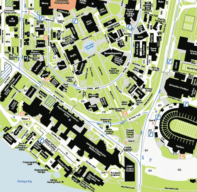
15 University of Washington Station 2006 Alternative The 2006 Alternative analyzed in the 2006 FSEIS included an underground University of Washington Station located at the southwest corner of Husky Stadium, east of Montlake Boulevard NE and NE Pacific Street. The 2006 Alternative included a grade-separated pedestrian access (via a tunnel or bridge) across Montlake Boulevard NE. The project mitigation measures contained in the ROD included a provision of grade-separated pedestrian access either over or below NE Pacific Place, and the Burke-Gilman Trail to connect with the Rainier Vista corridor on the campus. Sound Transit s eventual design for pedestrian access between the University of Washington Station and Central Campus included a grade-separated pedestrian access bridge over Montlake Boulevard NE, NE Pacific Place and the Burke-Gilman Trail. The pedestrian bridge is designed to connect with the Montlake Triangle and with the eastern end of the Lower Rainier Vista at grade. This design implements the 2006 Alternative and mitigation commitments for providing pedestrian access to campus while avoiding impacts to the Burke-Gilman Trail (see Appendix A for an illustration of the grade-separated pedestrian access design). Initial phases of construction of the University of Washington Station began in Proposed Action As described above, subsequent to the issuance of the 2006 FSEIS, a modified design for pedestrian access between the University of Washington Station and the Central Campus was developed (i.e., the 2010 Proposed Action). Under the 2010 Proposed Action, the majority of the University of Washington Station design elements would remain the same as those analyzed for the 2006 Alternative in the 2006 FSEIS, including the following: Location immediately west of Husky Stadium. Depth of station at approximately 110 feet below ground surface. Inclusion of stairs, elevators and escalators connecting the entry to the underground station. Provisions for crossover and storage tracks. Provisions for grade-separated pedestrian connections to Central Campus and to the Montlake Triangle for local transit transfers. Improvements to existing crosswalks and pedestrian facilities at intersections. Provisions for bike storage. Construction staging at parking lots south of Husky Stadium The 2010 Proposed Action refines and incorporates certain modifications to the 2006 Alternative, primarily related to the pedestrian and bicycle connections between the University of Washington Station, Rainier Vista and Central Campus. For descriptive purposes, the site of the 2010 Proposed Action consists of three areas: Lower Rainier Vista; NE Pacific Place/Burke- Gilman Trail; and, Montlake Triangle/Montlake Boulevard NE (see Figure 1-1 for a campus map of the area and Figure 1-2 for an aerial photo illustrating the site area). UW to Sound Transit U-Link Pedestrian Connection Project EIS Addendum 1-3 Chapter 1
16

17 Lower Rainier Vista ace NE l ic P f i c a P Montlake Triangle Source: Blumen Consulting Group, Project Site UW to Sound Transit U-Link Pedestrian Connection Project EIS Addendum Figure 1-2 Aerial Photo
18 The 2010 Proposed Action would implement the grade-separated crossing of Montlake Boulevard NE, NE Pacific Place, and the Burke-Gilman Trail identified in the 2006 FSEIS and ROD with the following (See Figures 1-3, 1-4, 1-5 and 1-6 for illustrations of the 2010 Proposed Action): A pedestrian and bicycle access bridge over Montlake Boulevard NE that would connect the University of Washington Station to the Montlake Triangle, including: - An approximately 30- to 34-foot wide, 95-foot long bridge from the University of Washington Station over Montlake Boulevard NE to the Montlake Triangle; - Stairs and an elevator from the proposed bridge to the Montlake Triangle on the west side of Montlake Boulevard NE to facilitate transfers to local King County Metro bus service; - A bicycle ramp located between the University of Washington Station and Montlake Boulevard NE that would provide access to the bridge; and, - Side-by-side at-grade paths for bicycles and pedestrians located between the University of Washington Station and Montlake Boulevard NE. The Montlake Triangle would be improved with the following: - New landscaping and pedestrian/bicycle facilities to connect the University of Washington Station with Rainier Vista and Central Campus; enhance the Montlake Triangle as an entry to campus; and, provide pathways to bus transfers on the Montlake Triangle; - A relocated and improved west-bound bus stop on the Montlake Triangle along NE Pacific Street with an extended bus zone for transit coaches and shelters for riders; - An improved south-bound bus stop on the west side of Montlake Boulevard NE just south of NE Pacific Place; and, - An improved east-bound bus stop on the south side of NE Pacific Place. A landscaped land bridge over a lowered NE Pacific Place and a modified Burke-Gilman Trail. - NE Pacific Place would be lowered approximately 20 feet to allow vehicles to pass under the land bridge. All existing vehicle lanes and King County Metro transit facilities would be accommodated; and the unsignalized mid-block crosswalks eliminated. Metro transit facilities to be provided within the lowered NE Pacific Place include: expanded bus layover area, bus shelters with lighting, 35 trolley poles with overhead wires, 12 street lights, sidewalk improvements, and way-finding signage. UW to Sound Transit U-Link Pedestrian Connection Project EIS Addendum 1-6 Chapter 1
19
20
21
22
23 - The Burke-Gilman Trail in the vicinity of the land bridge would be improved to grade-separate the Burke-Gilman Trail from Rainier Vista. Through the project area, the Burke-Gilman Trail would be widened to provide a 14-foot wide pedestrian and bicycle path. Two-foot wide gravel shoulders would be provided at the edges of the path. Design of the trail would not preclude future widening by the University for a total trail width of 30 feet. The new trail would be constructed parallel to the lowered NE Pacific Place under the land bridge, although the elevation of the trail would be above the roadway to minimize the grades on the trail. Two connecting paths would be provided linking the Burke-Gilman Trail with Rainier Vista to provide access to Central Campus. The new trail section would transition both in grade and alignment to meet the existing trail section east and west of the Montlake Triangle (near the NE Pacific Place/NE Pacific Street intersection on the west and the NE Pacific Place/Montlake Boulevard NE intersection on the east) (see Figure 1-4). - The land bridge would be hour glass shaped to minimize the width of the land bridge over NE Pacific Place and the Burke-Gilman Trail, with the width of the land bridge ranging from approximately 35 feet in the center to approximately 100 feet at the north and south ends (see Figure 1-4). Improvements to the Lower Rainier Vista to enhance pedestrian connections between the University of Washington Station and the Central Campus. - Filling of the existing Rainier Vista depression located immediately north of NE Pacific Place with construction spoils associated with the lowering of NE Pacific Place and/or construction of the University of Washington Station. The filling of this depression is intended to provide a larger and more welcoming pedestrian environment. - Removal of the existing cherry trees 3 in the Lower Rainier Vista to eliminate the confinement and partial view blockage they produce. - Provision of new landscaping and pedestrian paths. Provision of new ADA accessible pathways to accommodate pedestrians along the Montlake Triangle and Rainier Vista to Central Campus. With the pedestrian improvements under the 2010 Proposed Action, a pedestrian exiting the University of Washington Station wishing to walk to Central Campus would cross Montlake Boulevard NE via the pedestrian bridge to the Montlake Triangle, travel north along the pedestrian paths within the Triangle, cross NE Pacific Place via the landscaped land bridge, and travel along the Rainier Vista pedestrian paths to Central Campus. Major construction elements of the 2010 Proposed Action (i.e. pedestrian/bicycle access bridge and ramp; lowering of NE Pacific Place; and land bridge) would be managed by Sound Transit 3 These cherry trees were damaged by December 2008 storms. See Appendix B for further details on the tree inventory and assessment. UW to Sound Transit U-Link Pedestrian Connection Project EIS Addendum 1-11 Chapter 1
24 so that all development and construction-related activities can be coordinated with the on-going construction of the University of Washington Station. The proposed pedestrian improvements would be compatible with, and would not preclude, future development projects in the area, including improvements to SR-520 and Husky Stadium. Scope of EIS Addendum As described above, the majority of the University of Washington Station elements under the 2010 Proposed Action are similar to those described and analyzed for the University of Washington Station in the 2006 FSEIS. Similar to the 2006 FSEIS, the 2010 Proposed Action includes the same overall station design, station location, station depth, above grade entrances and stairs/elevators/escalators, crossover tracks, bike storage and construction staging areas. The 2010 Proposed Action refines the grade-separated pedestrian connection between the University of Washington Station and Central Campus described in the 2006 FSEIS (refer to Appendix A for an illustration of the current Sound Transit pedestrian access design) and implements relevant ROD mitigation requirements. Based on these design refinements, the 2010 Proposed Action would not change the following environmental analyses in the 2006 North LINK Final SEIS: Acquisitions/Displacements/Relocation Hazardous Materials Air Quality Electromagnetic Fields Noise and Vibration Public Services Land Use/Economic Activity Utilities Ecosystems Neighborhoods and Populations Water Resources Historic and Archaeological Resources 4 Energy Geology and Soils This EIS Addendum provides an updated environmental analysis for those environmental elements that have potential to change as a result of the 2010 Proposed Action. The following environmental elements are addressed in this EIS Addendum: Transportation Construction Impacts Visual Resources/Aesthetics Cumulative Effects Parklands For each of the elements of the environment listed above, the following is provided in Chapter 2 of this Addendum: a description of existing conditions; a brief summary of environmental impacts indentified in the 2006 FSEIS; a description of the potential for environmental impacts that could occur under the 2010 Proposed Action; any new or refined mitigation measures for the 2010 Proposed Action beyond those identified for the 2006 Alternative. 4 Please note that in February 2003, the Washington State Office of Archaeology and Historic Preservation concurred that the Rainier Vista is NOT ELIGIBLE individually for the National Register of Historic Places due to its low level of integrity. Additionally, it appears that Rainier Vista is also NOT ELIGIBLE for the National Register as part of an historic district due to the lack of concentration of significant historic resources within the defined Area of Potential Effect (APE). UW to Sound Transit U-Link Pedestrian Connection Project EIS Addendum 1-12 Chapter 1
25 Chapter 2 Comparison of Environmental Impacts
26 2.1 TRANSPORTATION This section of the EIS Addendum is based on the Technical Memorandum prepared by Heffron Transportation. Refer to Appendix C for detailed traffic and pedestrian analyses of the 2010 Proposed Action Affected Environment The 2006 FSEIS evaluated transportation conditions and impacts, and proposed mitigation in the vicinity of the University of Washington Station near Husky Stadium. Analysis for the 2010 Proposed Action relied on most of the same background assumptions that were applied in the 2006 FSEIS. However, some changes in the future background conditions have been assumed, primarily related to changes in the proposed configuration of the SR 520 Bridge Replacement Project and access to the Husky Stadium parking lot on the east side of Montlake Boulevard. The following table summarizes the key background transportation assumptions used for this analysis and notes how conditions have changed since the 2006 FSEIS was prepared FSEIS 2010 Proposed Action Sound Transit boardings at the University of Washington Station assumed to be 13,000 per day in 2015 and 21,500 per day in If the UW Station is the interim terminus for University Link, then the daily boardings for year 2030 could be 27,000 per day. The net increase in PM peak hour vehicle trips generated by the University of Washington Station was assumed to be 242 trips, which includes 150 dropoff/pick-up trips plus 92 additional bus trips. Intersections that were evaluated in the vicinity of the University of Washington Station include: 1. Montlake Boulevard NE/NE Pacific Street 2. Montlake Boulevard NE/NE Pacific Place 3. NE Pacific Street/NE Pacific Place No change from 2006 FSEIS. No change from 2006 FSEIS. No change from 2006 FSEIS. UW to Sound Transit U-Link Pedestrian Connection Project EIS Addendum Transportation
27 2006 FSEIS 2010 Proposed Action Year 2030 traffic volume forecasts assumed that no changes would occur to the SR 520 Bridge, and it would remain in its existing configuration. The prior long-range forecasts did not include other major regional projects such as East Link (light rail to Bellevue via I-90). The 2006 FSEIS had assumed a substantial increase in traffic entering and exiting the parking lot driveway at Pacific Place (serving the E-11/E-12 lots near Husky Stadium). A 66% increase in traffic had been assumed between the 2002 and 2030 No Action condition. Intersection operations analysis assumed no changes to the existing roadway network in the vicinity of the University of Washington station. Year 2030 traffic volume forecasts are from the new SR 520 Bridge Replacement Project SDEIS (WSDOT, January 2010), and assume the No Build Condition and Alternative A configuration, which includes the SR 520 interchange at Montlake Boulevard and a second bascule bridge across the Ship Canal. The WSDOT forecasts also account for the East Link project to extend light rail service to Bellevue via I- 90. The University of Washington has no plans to increase the number of parking spaces in these parking lots, and traffic entering and exiting the parking lots would not change in the future compared to existing conditions. Year 2030 forecasts from the SR 520 SDEIS were used for the through traffic on Montlake Boulevard and NE Pacific Place. Changes to the existing roadway network were assumed to account for changes in the Husky Stadium parking lot driveway, which will become the east leg of the Montlake Boulevard/Pacific Street intersection. Changes associated with SR 520 Option A were also evaluated Impacts This transportation analysis presents detailed information on the 2010 Proposed Action which would refine and incorporate certain modifications to the 2006 Alternative. The proposed pedestrian and bicycle facilities that would connect the University of Washington Station and Central Campus consist of a pedestrian and bicycle access bridge over Montlake Boulevard NE that would connect the University of Washington Station with the Montlake Triangle, establishment of a Rainier Vista land bridge spanning a lowered NE Pacific Place, a modified Burke-Gilman Trail, and improved bus stop/transfer facilities. Traffic Operations The 2006 FSEIS had determined that the Montlake Boulevard NE/NE Pacific Place intersection would operate at LOS F in the future, and had recommended adding a second left turn lane to UW to Sound Transit U-Link Pedestrian Connection Project EIS Addendum Transportation
28 the intersection to mitigate this condition. However, that poor level of service was related to the fact that the analysis had assumed traffic exiting the Husky Stadium parking lots would increase by 66% by the year The University of Washington has no plans to increase the number of parking spaces in its E-11 or E-12 lots served by this driveway. Therefore, traffic volumes are not likely to increase in the future. The proposed mitigation measure would not be needed for the 2006 Alternative or the 2010 Proposed Action. The development of the 2010 Proposed Action would not affect the number of trips or passengers generated by the University of Washington Station, nor would it affect traffic patterns in the site vicinity. The 2010 Proposed Action would not create any additional traffic operational impacts and no new or additional mitigation would be needed to accommodate the 2010 Proposed Action. Refer to Appendix C for further details on traffic operations under the 2010 Proposed Action. Non-Motorized Access Pedestrian Bridge The 2006 Alternative proposed a 16-foot wide pedestrian bridge that would extend approximately 670 feet between the University of Washington station and Rainier Vista, with elevator and stairway access from the bridge deck to the Montlake Triangle. The 2010 Proposed Action would replace that bridge with a 30- to 34-foot wide bridge that spans 95-feet from the station to the Montlake Triangle. The peak one-minute surge volumes exiting and entering the University of Washington station during the morning commute were evaluated. The station would generate a peak surge of 218 passengers per minute exiting the station and 21 passengers per minute entering the station during this period. Under the 2006 Alternative, an estimated 66 percent of these passengers (158 per minute) were expected to use the pedestrian bridge to Rainier Vista. Under the 2010 Proposed Action, an estimated 70 percent (168 per minute) are expected to use the pedestrian bridge to the Montlake Triangle. Based on level of service (LOS) criteria, the 2006 Alternative bridge would operate at LOS D and the 2010 Proposed Action bridge would operate at LOS B. However, the 2010 Proposed Action bridge would also be connected to a bicycle ramp that would add traffic to the bridge. It is assumed that a separate bicycle path would be striped on the bridge.. The bicycle area could be 10- to 12-feet wide and the remaining bridge area that is reserved for pedestrians (18- to 20- feet) would operate at LOS C. Based on this analysis, the bridge in the 2010 Proposed Action would operate at a better level of service and provide a better facility for bicycles than the 2006 Alternative. Refer to Appendix C for further details on the pedestrian bridge. Pedestrian Travel Times Pedestrian travel times from the University of Washington station were evaluated for the 2006 Alternative bridge and the 2010 Proposed Action bridge. Walking times under the 2010 Proposed Action would be similar to those under the 2006 Alternative (refer to Appendix C for detail on pedestrian travel times). UW to Sound Transit U-Link Pedestrian Connection Project EIS Addendum Transportation
29 Burke-Gilman Trail Detailed analysis was also performed to determine potential impacts to the Burke-Gilman Trail. Under the 2010 Proposed Action, the Burke-Gilman Trail in the vicinity of the land bridge would be improved to grade-separate the Burke-Gilman Trail from Rainier Vista. Through the project area, the Burke-Gilman Trail would be widened to provide a 14-foot wide pedestrian and bicycle path and two-foot wide gravel shoulders would be provided at the edges of the path. The design of the trail would not preclude future widening of the trail by the University of Washington to a total trail width of 30-feet. A new trail would be constructed parallel to the new NE Pacific Place under the land bridge, although the elevation of the trail would be above the roadway to minimize the grades on the trail. Two connecting paths would be provided that would link the Burke-Gilman Trail with Rainier Vista. The University of Washington is analyzing further Burke- Gilman Trail improvements beyond this area. Until then, the new trail section would need to transition both in grade and alignment to meet the existing trail section (refer to Appendix C for additional detail on trail design). The point on the Burke-Gilman Trail where the potential intersecting volumes would be the highest would be located southwest of the land bridge, along the route to Southwest campus. The volume is anticipated to be lower for the 2010 Proposed Action than for the 2006 Alternative due to the fact that the 2010 Proposed Action provides additional routes to NE Pacific Street from the Montlake Triangle. The same treatments are proposed for both the 2006 Alternative and the 2010 Proposed Action where connecting paths intersect the Burke-Gilman Trail. This includes stop signs and bicyclist lean rails at the paths that intersect the Burke- Gilman Trail; through traffic on the trail would not stop. No additional mitigation measures would be required under the 2010 Proposed Action. The 2010 Proposed Action would address all of the project s Record of Decision 1 requirements. It would reduce the potential for bicycle/pedestrian collisions by grade-separating the Link pedestrian flows from the Burke-Gilman Trail. In addition, the 2010 Proposed Action would implement additional improvements, including increased width on the Burke-Gilman Trail to accommodate future demand, and elimination of the mid-block crossings on NE Pacific Place. Refer to Appendix C for further details on the Burke-Gilman Trail. Parking The 2010 Proposed Action would not change parking conditions compared to the 2006 Alternative. Transit Facilities The 2010 Proposed Action would improve transit facilities compared to the 2006 Alternative by increasing the amount of bus layover space that can be provided on NE Pacific Place (390 to 420 feet under the 2010 Proposed Action compared to 220 feet under the 2006 Alternative). This layover area would be located along the lowered NE Pacific Place and extend under the Rainier Vista land bridge. Buses parked in this space would be out of the Rainier Vista View corridor. Increased layover capacity was not provided in the 2006 Alternative since an extension 1 Record of Decision for Central Puget Sound Regional Transit Authority s (Sound Transit) North Link Segment of the Central Link Light Rail Transit Project, June Mitigation requirements detailed in Appendix C of the ROD. UW to Sound Transit U-Link Pedestrian Connection Project EIS Addendum Transportation
30 of the existing layover space would have located buses too close to the mid-block pedestrian crosswalks on NE Pacific Place and/or within the Rainier Vista view corridor. The SR 520 High Capacity Transit (HCT) Plan 2 identified the need for more layover space in the vicinity of the Montlake Triangle, which the 2010 Proposed Action would provide. Refer to Appendix C for further details on transit facilities. Safety Both the 2010 Proposed Action and the 2006 Alternative would grade-separate University of Washington Station patrons from Montlake Boulevard NE, NE Pacific Place, and the Burke- Gilman Trail. However, the 2010 Proposed Action, would also grade-separate non-station pedestrian and bicycle traffic from both NE Pacific Place and the Burke-Gilman Trail. Existing unsignalized crossings of NE Pacific Place and the Burke-Gilman Trail at Rainier Vista would be eliminated by the 2010 Proposed Action. Therefore, the 2010 Proposed Action would provide enhanced safety compared to the 2006 Alternative Potential Mitigation Measures Mitigation measures for potential transportation-related impacts were identified in the 2006 FSEIS and in the 2006 NEPA ROD. Mitigation measures that relate to the 2010 Proposed Action and/or are in the vicinity of the University of Washington Station are listed in the table below. The 2010 Proposed Action would satisfy all of the transportation requirements as detailed in the table below. Mitigation Measures in North Link Record of Decision for the 2006 Alternative The NE Pacific Place/Montlake Boulevard NE intersection would operate at LOS F in the years 2015 and Adding a second westbound leftturn lane would improve operations to better than No-build conditions. Sound Transit will contribute a proportionate share of costs to improve this intersection. How the 2010 Proposed Action would satisfy ROD requirements Intersection is not degraded based on current traffic growth forecasts; mitigation is not required for the 2006 Alternative or 2010 Proposed Action. However, adding the second westbound lane with split phasing would reduce conflicts with pedestrians in the crosswalks and have other benefits. This intersection is expected to operate at LOS D or better with either lane configuration or signal phasing option. 2 WSDOT, Sound Transit, King County Metro and the University of Washington, SR 520 High Capacity Transit Plan, December UW to Sound Transit U-Link Pedestrian Connection Project EIS Addendum Transportation
31 Mitigation Measures in North Link Record of Decision for the 2006 Alternative In the vicinity of the south station entrance, Sound Transit will provide sufficient facilities for pedestrian storage and capacity by improving and widening the crosswalks across Montlake Boulevard NE and NE Pacific Street, and providing sufficient pedestrian storage capacity on either the existing refuge/traffic island or the south end of the Montlake Triangle. At the University of Washington Station, Sound Transit will continue to work with local agencies (KCM, WSDOT, SDOT, and the University of Washington) to identify University of Washington Station design features to accommodate the increase in pedestrians associated with North Link. Design improvements such as reduced speed limit signs for bicycles, distinctive paving, or other improvements to enhance visibility and slow bicycle travel speeds along the Burke-Gilman Trail in this area will be implemented as necessary to reduce the likelihood of bicycle/pedestrian collisions. How the 2010 Proposed Action would satisfy ROD requirements Crosswalk widths proposed for the 2006 Alternative are sufficient for the 2010 Proposed Action. No further mitigation would be required. The proposed Rainier Vista land bridge would grade-separate the Burke-Gilman Trail from station pedestrian crossings and includes features to prioritize through traffic at the new trail intersections. It would also eliminate the mid-block crosswalks on NE Pacific Place. No further mitigation would be needed. An unsignalized or signalized midblock crossing of NE Pacific Place will be provided to help balance transportation needs. An unsignalized or signalized midblock crossing of NE Pacific Place will be provided to help balance transportation needs. A station entrance or access point will be located to the north of NE Pacific Place and the Burke- Gilman Trail with an extended pedestrian passageway under or over NE Pacific Place and the Burke-Gilman Trail. Source: Record of Decision for Central Puget Sound Regional Transit Authority s (Sound Transit) North Link Segment of the Central Link Light Rail Transit Project, June Mitigation requirements detailed in Appendix C of the ROD. UW to Sound Transit U-Link Pedestrian Connection Project EIS Addendum Transportation
32 Refer to Section 2.4, Construction Impacts, of this EIS Addendum for a list of temporary construction-related mitigation measures associated with roadways and the Burke-Gilman Trail Conclusions The potential transportation impacts associated with the 2010 Proposed Action would be similar to those identified in the 2006 FSEIS and the 2006 NEPA Record of Decision (ROD); no additional significant impacts have been identified for the 2010 Proposed Action. UW to Sound Transit U-Link Pedestrian Connection Project EIS Addendum Transportation
33 2.2 VISUAL RESOURCES AND AESTHETICS Affected Environment The 2006 FSEIS generally described the regional visual characteristics of the 7.2-mile North Link light rail project area from downtown Seattle north to the Northgate Urban Center. Visual simulations of selected station and route alternatives were prepared, including views along Rainier Vista (see Appendix P4.4 of the 2006 FSEIS for these simulations). Existing visual resources (i.e. landforms, waterbodies, vegetation and urban structures) and visual character along the route alternatives were described. Standards and policies from the University of Washington s Seattle Campus Master Plan (2003) concerning aesthetics, and the City of Seattle s environmental policies regarding views were discussed relative to the light rail project. Under the 2006 Alternative evaluated in the 2006 FSEIS, the University of Washington Station would be located in the East Campus area near Husky Stadium (refer to Figure 1-2 for an aerial photo of the site vicinity). This station location was identified in the 2006 NEPA Record of Decision (ROD) and construction of the station is underway. As described in the 2006 FSEIS, the terrain in vicinity of the University of Washington Station generally slopes to the south, toward Portage Bay. Moderately large buildings at the University of Washington are located in the area. Scenic views toward Mount Rainier and Central Campus are possible along Rainier Vista. Project Site Under the 2010 Proposed Action, pedestrian access and landscape improvements associated with the University of Washington Station at Husky Stadium would be provided in the south portion of Rainier Vista, between Stevens Way and NE Pacific Place (including the Montlake Triangle) as well as within Montlake Boulevard NE. Rainier Vista is considered a unique and important landscape on the University of Washington Campus. The Vista consists of open space and landscaped areas and provides a view corridor toward Mount Rainier and Central Campus. For descriptive purposes, the project site is comprised of three areas: Lower Rainier Vista; NE Pacific Place and Burke-Gilman Trail; and, Montlake Triangle/Montlake Boulevard NE, as described below (refer to Figure 1-2 for an aerial photo of the site). Lower Rainier Vista is an open space area to the south of Stevens Way containing landscaping and gravel pedestrian paths. Limited views toward Mount Rainier are possible from the pedestrian paths on either side of the Lower Vista. Two bands of lawn and rows of cherry trees frame the Lower Vista. The 29 cherry trees in this area confine the visual width of Rainier Vista and partially block views. A paved depression occupies the central portion of the area. This depression creates a visual interruption to the larger sweep of Rainier Vista. NE Pacific Place and Burke-Gilman Trail are paved vehicular and pedestrian/bicycle facilities, respectively, that cross and interrupt the north/south axis of Rainier Vista. The Burke-Gilman Trail serves as a linear recreational open space on the University of Washington campus. In the vicinity of Rainier Vista, the Trail provides views north towards Central Campus and south toward Portage Bay. UW to Sound Transit U-Link Pedestrian Connection Project EIS Addendum Visual Resources and Aesthetics
34 Montlake Triangle/Montlake Boulevard NE the Montlake Triangle is a paved and landscaped open space area located at the terminus of Rainier Vista that serves as a visual entry point to campus. The southwest portion of the triangle is occupied by a grove of Leyland cypress trees (these trees have been declining slowly and the University has been phasing the removal of these trees) and the northwest portion by a grassy area. Several smaller buildings (a Metro pump station and pedestrian entries to the garage below), as well as the vehicular access point to the garage, are located along the perimeter of the Triangle. Pedestrian paths are present on the Triangle. Views from these paths are generally of the immediate vicinity and Central Campus. Montlake Boulevard NE is a four- to six-lane urban arterial roadway. The visual character of Montlake Boulevard NE is defined by vehicle lanes, sidewalks, street lighting, traffic signals, crosswalks and transit facilities (including overhead trolley wires) Impacts This section summarizes visual resource and aesthetic impacts evaluated under the 2006 Alternative in the 2006 FSEIS and it provides a description and comparison of visual resource and aesthetic impacts that could occur under the 2010 Proposed Action Alternative The 2006 FSEIS included visual simulations that illustrated the future appearance of the North Link light rail project, as seen from key view locations along the approximately 7.2-mile route (see Appendix P4.4 of the 2006 FSEIS for these simulations). Under the 2006 Alternative, light rail would pass beneath the University of Washington s campus, which would minimize the potential for large-scale visual change, and would result in low to moderate visual impacts overall. The 2006 FSEIS concluded that visual impacts would be localized and would result from the removal of features, like buildings and trees, to build stations and associated facilities. Design treatments would be used to help visually integrate the stations and facilities into the surrounding landscape. As indicated in the 2006 FSEIS, development of the University of Washington Station under the 2006 Alternative would avoid or reduce impacts to parks and open spaces, such as Rainier Vista. No scenic views of either Mount Rainier or the University of Washington campus would be obstructed and no scenic routes would be impacted with implementation of the project (note: no scenic routes, as defined in the City of Seattle s SEPA ordinance, are located in the vicinity of the University Station at Husky Stadium). Pedestrian connections between the University of Washington Station and Central Campus, across Montlake Boulevard NE, were proposed as underground tunnels or alternatively as bridges. Under the 2006 Alternative, entrances from the University of Washington Station at Husky Stadium would be located on both the east and west sides of Montlake Boulevard. The potential entrances would require removal of mature trees. New landscaping would be provided to offset the loss of these trees. The 2006 FSEIS concluded that the 2006 Alternative would have the lowest levels of aesthetic/visual impacts of the alternatives that were evaluated, and that no significant impacts would be anticipated with implementation of the proposed mitigation measures. UW to Sound Transit U-Link Pedestrian Connection Project EIS Addendum Visual Resources and Aesthetics
35 Subsequent to the issuance of the 2006 FSEIS and ROD, Sound Transit approved the design for pedestrian access between the University of Washington Station and Central Campus that included a grade-separated pedestrian access bridge over Montlake Boulevard NE, NE Pacific Place, and the Burke-Gilman Trail 2010 Proposed Action Similar to the 2006 Alternative evaluated in the 2006 FSEIS, development of the 2010 Proposed Action would result in visual changes in the vicinity of the University of Washington Station at Husky Stadium (i.e. in the south portion of Rainier Vista). Under the 2010 Proposed Action, visual impacts would be localized and would result from the removal of landscape features, like trees. New landscaping is proposed to minimize these impacts. The provision of a land bridge over a lowered NE Pacific Place would also introduce a new visual element to the area. As under the 2006 Alternative for the University of Washington Station, no buildings would be eliminated for the 2010 Proposed Action (refer to Figure 1-3 for the Overall Plan for the 2010 Proposed Action). The 2010 Proposed Action is intended to enhance the character of Rainier Vista as a visual and pedestrian entrance to campus, and avoid or reduce visual impacts to Rainier Vista. No scenic views of either Mount Rainier or the University of Washington campus would be obstructed. The continuity of the open space in Rainier Visa would be enhanced, particularly in the Lower Rainier Vista and NE Pacific Place/Burke-Gilman Trail areas (see below for details). Under the 2010 Proposed Action, entrances to the University of Washington Station at Husky Stadium would be located on the east side of Montlake Boulevard NE (as under the 2006 Alternative). The station entrances would connect to a pedestrian and bicycle access bridge over Montlake Boulevard NE that would connect the station with the Montlake Triangle. The potential for changes in aesthetic/visual conditions in the three areas that comprise the project site under the 2010 Proposed Action are further described below. Lower Rainier Vista The paved depression in this area would be filled and a sloped lawn area, pedestrian paths and landscaping would be created (refer to Figure 1-3). These improvements are intended to enhance the visual and pedestrian connection between Upper and Lower Rainier Vista and increase the usable open space in this area. The existing 29 cherry trees in the Lower Vista would be removed and replaced with new lawn area. Removal of these trees is intended to eliminate the confinement and partial blockage of views they produce along the Lower Vista (refer to Appendix B for further details on the tree inventory and assessment). NE Pacific Place and Burke-Gilman Trail A land bridge would be provided over a lowered NE Pacific Place and Burke-Gilman Trail. The trail would pass beneath the land bridge with two connecting paths linking the Burke-Gilman Trail with Rainier Vista and Central Campus (see Figure 1-3). The existing interruption of the north/south axis of Rainier Vista by NE Pacific Place and the Burke-Gilman Trail would be eliminated by creation of the land bridge and grade-separated trail. The land bridge would introduce a new visual element at NE Pacific Place, but would not block views. The existing views from the Burke-Gilman Trail north to Central Campus and south towards Portage Bay would be retained from the upper portion of the Trail connecting with Rainier Vista. UW to Sound Transit U-Link Pedestrian Connection Project EIS Addendum Visual Resources and Aesthetics
36 Montlake Triangle/Montlake Boulevard NE New landscaping and pedestrian facilities would be provided in the Montlake Triangle area to connect the University of Washington Station at Husky Stadium and Rainier Vista, and enhance the Triangle as an entry to campus (see Figure 1-3). The remaining Leyland cypress trees would be removed as a continuation of the University s phased removal of these trees. Some re-grading within the Triangle would be required. No existing buildings would be affected and no views in the area would be impacted with the proposed improvements in this area. A grade-separated pedestrian and bicycle access bridge would be constructed over Montlake Boulevard NE that would connect the University of Washington Station to the Montlake Triangle. The bridge over Montlake Boulevard NE would add a new visual element to the area; however, due to its location (connecting with the northeast corner of the Montlake Triangle) and proposed height, the bridge is not anticipated to impact views from Rainier Vista towards Mount Rainier or the University of Washington campus. Visually, the proposed pedestrian and bicycle access bridge would be generally consistent with other pedestrian bridges in the vicinity over Montlake Boulevard NE and NE Pacific Street Potential Mitigation Measures Mitigation measures for potential visual/aesthetic-related impacts were identified in the 2006 FSEIS and in the 2006 NEPA ROD, and are applicable to the 2010 Proposed Action. The following additional mitigation measures related to landscaping have been identified for this EIS Addendum New landscaping would be provided within the Lower Rainier Vista and Montlake Triangle areas to enhance the visual environment Conclusions The potential for visual/aesthetic impacts under the 2010 Proposed Action would be similar to those identified in the 2006 FSEIS for the 2006 Alternative; no additional significant impacts have been identified for the 2010 Proposed Action UW to Sound Transit U-Link Pedestrian Connection Project EIS Addendum Visual Resources and Aesthetics
37 2.3 PARKLANDS Affected Environment The 2006 FSEIS identified parks and other recreational areas (including parks, playfields, boulevards and trails) in the North Link light rail project area. Parks and recreational facilities in the proximity (within approximately 0.25 mile) of possible light rail stations were inventoried. The Burke-Gilman Trail was identified as a recreational facility in the vicinity of the University of Washington Station at Husky Stadium. The Burke-Gilman Trail is one of the most heavily used regional trails in the Seattle area and has high volumes of bicycle and pedestrian use, particularly in the University area (see Section 2.1, Transportation, for details). Some locations along the trail currently experience conflicts where pedestrians, vehicles and bicycles cross the trail, including at NE Pacific Place. Project Site Under the 2010 Proposed Action, pedestrian access and landscape improvements associated with the University of Washington Station at Husky Stadium would be provided in the south portion of Rainier Vista, between Stevens Way and Montlake Boulevard NE (including the Montlake Triangle), as well as within Montlake Boulevard NE. For descriptive purposes, the project site is comprised of three areas: Lower Rainier Vista; NE Pacific Place and Burke- Gilman Trail; and, Montlake Triangle/Montlake Boulevard, as described below (refer to Figure 1-2 for an aerial photo of the site). Lower Rainier Vista is an open space area to the south of Stevens Way. This area contains landscaping and gravel pedestrian paths. A paved, largely unused depression occupies the central portion of this area 1. NE Pacific Place and Burke-Gilman Trail are paved vehicular and pedestrian/bicycle facilities, respectively, that cross and interrupt the north/south axis of the Rainier Vista open space. The Burke-Gilman Trail serves as a linear recreational open space on the University of Washington campus. At the project site, the trail is approximately 13 feet wide with one 2-foot gravel shoulder, and narrows to approximately 11 feet wide at the bridge over the depression area in Lower Rainier Vista (see Section 2.1, Transportation for details). As mentioned above, there are currently conflicts where pedestrians, bicycles and vehicles cross the trail, including at NE Pacific Place. Montlake Triangle/Montlake Boulevard NE Montlake Triangle is a paved and landscaped open space area located at the terminus of Rainier Vista that serves as an entry point to campus. Pedestrian paths are present on the Triangle. Montlake Boulevard NE in the vicinity of the site contains no dedicated parks or recreational facilities. 1 The paved depression in Rainier Vista was originally constructed as a vehicular entrance to campus. It is currently used as one of several pedestrian access points to the Triangle Parking Garage. UW to Sound Transit U-Link Pedestrian Connection Project EIS Addendum Parklands
38 2.3.2 Impacts This section summarizes the parks and recreational facility impacts evaluated under the 2006 Alternative in the 2006 FSEIS and provides a description and comparison of parks and recreational facility impacts that could occur under the 2010 Proposed Action Alternative The 2006 FSEIS assessed probable impacts to parks and recreational facilities along the North Link alternative routes in terms of direct effects (primarily from acquisition of property or obtaining easements for use of property) or indirect/proximity effects (i.e. due to increased traffic, noise, degradation of the visual or aesthetic setting and/or station area activity). It was noted that most project impacts would be due to proximity effects. Under the 2006 Alternative, the University of Washington Station at Husky Stadium would include a pedestrian entrance on the Montlake Triangle, directly across NE Pacific Place from the Burke-Gilman Trail. The trail would likely experience increased use as some transit riders may use the trail to access the station. Potential conflicts could arise between transit riders who use or cross the trail and recreational users on the trail. To address this concern, Sound Transit and FTA committed to developing a grade-separated crossing of the trail and NE Pacific Place, via either a tunnel or bridge, to maintain connectivity between the University of Washington Station and the campus while avoiding impacts to the trail and its users. This mitigation measure is documented in the NEPA ROD issued in June Proposed Action The 2010 Proposed Action is intended to enhance the character of Rainier Vista as a visual and pedestrian entrance to campus. The continuity of the open space in Rainier Visa would also be improved, particularly in the Lower Rainier Vista and NE Pacific Place/Burke-Gilman Trail areas. The potential for parks and recreational facility impacts in the three areas that comprise the project site under the 2010 Proposed Action are further described below. Lower Rainier Vista The paved depression in this area would be filled and a sloped lawn area, pedestrian paths and landscaping would be created (refer to Figure 1-3). These improvements are intended to enhance the visual and pedestrian connection between Upper and Lower Rainier Vista and increase the usable open space in this area. NE Pacific Place and Burke-Gilman Trail A land bridge would be provided over a lowered NE Pacific Place and Burke-Gilman Trail. The Burke-Gilman Trail in the vicinity of the land bridge would be improved to grade-separate the trail from Rainier Vista. Through the project area, the Burke-Gilman Trail would be widened from the existing foot width to 14 feet with two-foot wide gravel shoulders. Design of the trail would not preclude future widening of the trail by the University of Washington for a total trail width of 30 feet. Two connecting paths would also be provided to link the Burke-Gilman Trail to Rainier Vista and Central Campus (see Figures 1-3 and 1-4). The existing interruption of the Rainier Vista open space by NE Pacific Place and the Burke-Gilman Trail would be eliminated by creation of the land bridge and grade-separated trail. Existing conflicts where pedestrians, vehicles and bicycles cross the trail at NE Pacific Place would also UW to Sound Transit U-Link Pedestrian Connection Project EIS Addendum Parklands
39 be eliminated. In addition, the 2010 Proposed Action would reduce the potential for bicycle/pedestrian conflicts by separating north/south pedestrian travel along the Rainier Vista from crossing the Burke-Gilman Trail (see Section 2.1, Transportation, for details on Burke-Gilman Trail conditions). Montlake Triangle/Montlake Boulevard NE New landscaping and pedestrian facilities would be provided in the Montlake Triangle area to connect the University of Washington Station at Husky Stadium and Rainier Vista, and enhance the Triangle as an entry to campus (see Figure 1-3). Montlake Boulevard NE in the vicinity of the site contains no parkland or dedicated recreational facilities; therefore, no impacts to such facilities would result. No significant parks and recreational facility impacts would be anticipated under the 2010 Proposed Action. The 2010 Proposed Action would implement the mitigation measures identified in the 2006 FSEIS and ROD related to provision of a pedestrian grade-separated crossing of the Burke-Gilman Trail. Other proposed improvements to the Burke-Gilman Trail would further reduce the potential for pedestrian/bicycle conflicts on the trail near the UW Station and Montlake Triangle. Additionally, proposed pedestrian/bicycle facilities (including a bicycle ramp to the proposed bridge over Montlake Boulevard NE, side-by-side at grade pedestrian/bicycle paths located between the University Station and Montlake Boulevard NE, and stairs and elevator on the west side of Montlake Boulevard NE connecting the proposed bridge to the Montlake Triangle) would provide new pedestrian and bicycle route options in the area Conclusions The potential impacts to parks and recreational facilities under the 2010 Proposed Action would be similar to those identified for the 2006 Alternative; no additional significant impacts have been identified for the 2010 Proposed Action and no new or additional mitigation measures are proposed. UW to Sound Transit U-Link Pedestrian Connection Project EIS Addendum Parklands
40 2.4 CONSTRUCTION IMPACTS Affected Environment The University of Washington Station site was identified in the 2006 FSEIS as being primarily comprised of surface parking areas and open space areas southwest of Husky Stadium and open space areas associated with the Montlake Triangle. Land uses in the vicinity of the site that could potentially be affected by the proposed construction of pedestrian and landscape improvements are varied and primarily include University athletic facilities (Husky Stadium and Hec Edmundson Pavilion), surface parking areas, University of Washington Medical Center (UWMC) uses, open space areas (including the Burke-Gilman Trail) and academic uses Impacts This section summarizes construction-related impacts evaluated under the 2006 Alternative (in the 2006 FSEIS) and provides a description and comparison of construction-related impacts that could occur under the 2010 Proposed Action Alternative Construction impacts under the 2006 Alternative included noise, vibration, dust, and traffic from construction activities. Partial lane closures would be required during construction that would affect traffic operation on Montlake Boulevard NE and on other streets in the vicinity of the site. Traffic rerouting and delays could affect emergency vehicles and could require additional police services. Construction activities would also require a temporary detour of the Burke-Gilman Trail. During construction, trees and other landscaping would be removed on the site that could affect the visual landscape of the area. The use of cranes could be required during construction and could affect views from Rainier Vista. Construction activities would generate large amounts of excavation spoils and could produce vibration and settlement. Construction impacts under the 2006 Alternative would be temporary and with the implementation of mitigation measures identified in the 2006 FSEIS, no significant impacts were anticipated Proposed Action Construction impacts under the 2010 Proposed Action would generally be similar to those described for the 2006 Alternative and would include noise, vibration, dust, and traffic from construction activities. A Traffic Management Plan (TMP) and Maintenance of Traffic (MOT) Plan would be required prior to construction (refer to the Mitigation Measures section for further details). Construction for the 2010 Proposed Action is anticipated to coincide with construction of the University of Washington Station and would be completed in two year-long phases, the first beginning in mid-2012 and the second beginning in the 1 st quarter of Construction traffic associated with both projects would increase the potential for increased delays and congestion in the vicinity of the site. The construction Traffic Management Plan (TMP) and Maintenance of Traffic (MOT) plan developed for this project would include the consideration of UW to Sound Transit U-Link Pedestrian Connection Project EIS Addendum Construction Impacts
41 traffic associated with the construction of the University of Washington Station to minimize the potential for concurrent construction to impact traffic flow (see the Potential Mitigation Measures section for further details on the TMP and MOT plan). Partial lane closures of NE Pacific Place would be required during construction that could affect traffic in the vicinity. Traffic flow around the Montlake Triangle would likely require that the northeast bound lane on NE Pacific Place remain open during daytime hours. The southwest bound lane on NE Pacific Place could be closed during daytime hours provided that a detour and other appropriate mitigation measures are implemented (refer to Appendix C for further information on construction lane closures). See the Potential Mitigation Measures section below for further details on construction mitigation. Temporary full closures of NE Pacific Place could also occur during nighttime hours. The closure of all lanes during the evening would also require additional mitigation measures, including detour routes and police-officer traffic control (refer to Appendix C for further information on construction lane closures). Construction of the pedestrian and bicycle access bridge over Montlake Boulevard NE could temporarily affect through traffic lanes on Montlake Boulevard NE. While the method of construction has not been determined for the bridge at this time, a Maintenance of Traffic (MOT) plan would be required during construction of the bridge and two through lanes in each direction on Montlake Boulevard NE would be maintained during peak traffic hours. Additional lane restrictions could be considered at night (i.e. one lane in each direction and/or alternating flow with flagger control) if it is determined that traffic flow needs could be accommodated. See the Potential Mitigation Measures section below for further details on construction mitigation measures for Montlake Boulevard NE (refer to Appendix C for further detail on construction lane closures). Traffic rerouting and delays could affect emergency vehicles and could require additional police services. Construction activities would also require a temporary detour of the Burke-Gilman Trail. Trees and other landscaping would be removed on the site which could affect the visual landscape of the area. Approximately 29 Cherry trees would be removed in Lower Rainier Vista (several of these were poorly pruned following a previous storm). The existing Leyland cypress grove located on the west side of the Montlake Triangle is also in poor health and would be removed (refer to Appendix B for further details regarding the tree inventory and assessment). Construction activities would generate excavation spoils, including approximately 16,000 cubic yards of material from the excavation and lowering of NE Pacific Place 1. Provided that the excavation spoils meet the required criteria, a portion of the material (approximately 7,700 cubic yards) could be used to fill the depressed roadway in the Lower Rainier Vista area. The Montlake Triangle area would also be excavated to within 12 inches of the existing Triangle Parking Garage roof. Geofoam or a similar lightweight fill material would be used as fill for a majority of the Montlake Triangle area in order to comply with the load requirements of the Triangle Parking Garage. Existing truck haul routes approved for the construction of the 1 Excavation activities would require approximately 830 truck trips to transport excavation spoils to an offsite location. Truck trips are based on a calculation of 10 cubic yards/truck and the use of approximately 7,700 cubic yards of spoils within Lower Rainier Vista. UW to Sound Transit U-Link Pedestrian Connection Project EIS Addendum Construction Impacts
42 University of Washington Station would be utilized for soil export associated with the lowering of NE Pacific Place. The existing Burke-Gilman Trail bridge would be abandoned in place or demolished during construction. The existing NE Pacific Place bridge would also be demolished. The Burke-Gilman Trail would remain open during construction, with a temporary trail detour route provided as close to the existing alignment as possible. Similar to the 2006 Alternative, construction impacts under the 2010 Proposed Action would be temporary in nature and with the implementation of mitigations measures identified in the 2006 FSEIS and in this section, no significant impacts would be anticipated Potential Mitigation Measures Mitigation measures for potential construction-related impacts were identified in the 2006 FSEIS and in the 2006 NEPA ROD. These measures would apply to the 2010 Proposed Action. Additional mitigation measures that would be implemented as part of the 2010 Proposed Action include the following: Transportation The contractor would submit two traffic-related plans in advance of construction, including a Traffic Management Plan (TMP) and a Maintenance of Traffic (MOT) plan. Existing truck haul routes approved for the construction of the University of Washington Station would be utilized for soil export associated with the lowering of NE Pacific Place. The TMP and MOT plans would be approved by Sound Transit, the University of Washington and if a street use permit is required, the Seattle Department of Transportation (SDOT). These plans would address the following: Maintenance of vehicular traffic when there are changes made to any existing lane configurations, traffic flow, or traffic control. Maintenance of pedestrian and bicycle traffic that uses the Burke-Gilman Trail, sidewalks along NE Pacific Place, and connections to these facilities. Maintenance of transit routes, transit stops, and layover facilities, particularly the electric trolley routes that use NE Pacific Place. Emergency vehicle access to the UWMC. Access to the Triangle Parking Garage. Two-way access on NE Pacific Place between NE Pacific Street and the garage driveway must be maintained at all times. Replacement of bus staging locations if NE Pacific Place is not available during Husky Football games. UW to Sound Transit U-Link Pedestrian Connection Project EIS Addendum Construction Impacts
43 Coordination with construction for the University of Washington Link Light Rail Station adjacent to Husky Stadium. Details on channelization and signage that would be used to route traffic around construction on Montlake Boulevard NE. Maintenance of two through lanes in each direction on Montlake Boulevard NE during peak traffic hours (7:00 AM to 10:00 PM). At night, additional lane restrictions (i.e. one lane in each direction and/or alternating flow with flagger control) could be considered if traffic flow needs could be accommodated. Maintenance of a pedestrian and bicycle path on the east side of Montlake Boulevard NE. The following additional mitigation measures would be implemented to close the southwest bound lane of NE Pacific Place: Obtain approval from SDOT to close the street, which may require a street use permit. Include proposed detour routes, signage, and coning in the contractor s required TMP and MOT plans. Work with SDOT and King County Metro to extend the general-purpose vehicle access into the southbound curb lane on Montlake Boulevard NE approaching NE Pacific Street. Most of this lane is now restricted to transit only, and general-purpose traffic is allowed to enter the lane at the far south end. During construction only, an extension of the general-purpose lane would be considered. The following additional mitigation measures would be required to implement a full closure of NE Pacific Place during the nighttime hours: Obtain approval from King County Metro to alter nighttime service that currently uses NE Pacific Place. Depending on the closure times, King County Metro may need to alert riders, alter routes, and/or change equipment from electric trolleys to diesel buses. Obtain approval from SDOT to close the street, which may require a street use permit. Secure police-officer control for the Montlake Boulevard NE/NE Pacific Street intersection. The Seattle Police Department would determine if one or two officers are needed. Include proposed detour routes, signage, and coning in the contractor s required TMP and MOT plans. Coning on NE Pacific Street would be needed to channelize an eastbound left-turn lane. This lane would be converted from one of the two generalpurpose right-turn lanes. Use police-officer control for the Montlake Boulevard NE/NE Pacific Street intersection with the following phasing: Northbound and southbound thru movements. UW to Sound Transit U-Link Pedestrian Connection Project EIS Addendum Construction Impacts
44 Eastbound left-turn and westbound left-turn (dump trucks exiting the Sound Transit portal are allowed to turn left at night only). Northbound left-turn and eastbound right-turn only plus the pedestrian crossing of Montlake Boulevard NE. Ecosystems Existing trees and landscaping removed during construction would be replaced with new landscaping, including lawn area and other vegetation. Tree protection measures for trees located near construction areas would be provided. Geology and Soils All temporary and/or permanent shoring would be designed in accordance with applicable standards and regulations and would be approved by the University of Washington. Dewatering would be provided as needed during the construction process to prevent the accumulation of water in excavations. Parklands The Burke-Gilman Trail would remain open during construction and a trail detour route would be provided as close to the existing alignment as possible Conclusions In general, the potential for construction-related impacts under the 2010 Proposed Action would be similar to those identified for the 2006 Alternative in the 2006 FSEIS; no additional significant impacts have been identified for the 2010 Proposed Action. UW to Sound Transit U-Link Pedestrian Connection Project EIS Addendum Construction Impacts
45 2.5 CUMULATIVE IMPACTS Affected Environment Cumulative impacts are defined as the impacts on the environment which results from the incremental impact of the action when added to other past, present and reasonably foreseeable future actions regardless of what agency or person undertakes such action. The 2006 FSEIS indentified several regional transportation projects by Sound Transit and the Washington State Department of Transportation (WSDOT) that could be implemented in the future and contribute to cumulative impacts. Potential future projects that would be located in the vicinity of the site would primarily include the SR-520 Bridge Replacement Project and development associated with the University of Washington Impacts 2010 Proposed Action Cumulative short-term construction impacts would be similar to the 2006 Alternative. The temporary closure of a portion of NE Pacific Place, temporary lane modifications on Montlake Boulevard NE, and additional haul trucks associated with the 2010 Proposed Action would increase the potential for cumulative construction impacts (refer to Section 2.4, Construction Impacts, for further details). Cumulative temporary construction impacts could include increased construction noise and vibration; increased traffic congestion and delays; increased dust and vehicle emissions, temporary impacts to wildlife and ecosystems; and, increased fire and police response times. Mitigation measures identified in the 2006 FSEIS sections and in this EIS Addendum would also apply to cumulative impacts and no significant adverse cumulative construction impacts would be anticipated. Long-term operational conditions would be similar to the 2006 Alternative and no significant adverse cumulative operational impacts would be anticipated Conclusions In general, the potential for cumulative impacts under the 2010 Proposed Action would be similar to those identified for the 2006 Alternative in the 2006 FSEIS; no additional significant impacts have been identified for the 2010 Proposed Action. UW to Sound Transit U-Link Pedestrian Connection Project EIS Addendum Cumulative Impacts
46 Appendices Appendix A Current Sound Transit Pedestrian Access Design Appendix B Tree Inventory and Assessment Appendix C Transportation Technical Memorandum
47 Appendix A Current Sound Transit Pedestrian Access Design
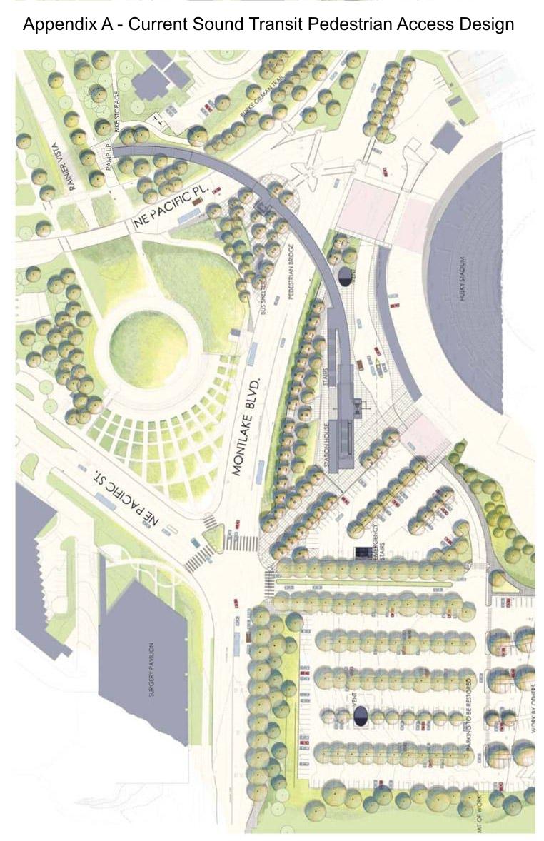
48
49 Appendix B Tree Inventory and Assessment

50 C o n s u l t i n g A r b o r i s t s TO: JOB SITE: SUBJECT: Kristine Kenney, University of Washington University of Washington Rainier Vista Pedestrian Bridge Project No Tree Inventory and Assessment DATE: January 25, 2010 PREPARED BY: Holly Iosso, ISA Certified Arborist #6298 Sean Dugan, ASCA Registered Consulting Arborist #457 Contents Summary Assignment & Scope of Report Observations Discussion Recommendations Glossary References Appendices Appendix A - Assumptions & Limiting Conditions Appendix B - University of Washington s Tree Rating Criteria Appendix C - Aerial Photograph of Site with Tree Locations Appendix D - Aerial Photograph marking Exceptional Tree Groves Attachments: Table of Trees Summary Four hundred and twelve (412) trees were measured and assessed for condition. One hundred seventy-nine (179) of the 412 trees have a condition rating of 80% or greater. One hundred twenty-three (123) were given a condition rating between 70% and 79%. Seventy (70) trees have a condition rating between 60% and 69%. Forty (40) trees have a condition rating below 60%. We recommend the removal of one tree along Rainier Vista due to poor form and uncorrected leaning growth over a pedestrian path. Of the other trees assessed, branch failure is the most probable part to fail, and there is a low risk from these trees. Twenty-eight (28) trees meet the City of Seattle s definition of an Exceptional tree. Three additional trees may also qualify as Exceptional but further identification of the species is required once the trees leaf out. Six tree groves meet the City of Seattle s definition of Exceptional. V a l u a b l e K n o w l e d g e o f T r e e s Tree Solutions Inc North 39 th St. Seattle, WA Phone Fax
51 UW Rainier Vista Pedestrian Bridge Project No January 25, 2009 p.2 of 11 Assignment & Scope of Report This report is a summary of the site visit by Sean Dugan, Registered Consulting Arborist, and Holly Iosso, Certified Arborist, of Tree Solutions Inc. made on January 11, We were provided an aerial photograph showing the areas over the Triangle Garage and Rainer Vista, along the Burke-Gilman Trail, and Stevens Way. We were asked to assess all trees within the buffers along the east and west sides of the vista, all trees between the Burke Gilman trail and adjacent roadway up to the Hec/Ed overpass, and all trees within 20 ft of the Burke Gilman trail to the north for health and structural condition. We were asked to provide a formal report with our findings and recommendations. We were asked to provide a Table of Trees listing the common and botanical names, diameter at standard height, and condition ratings. Kristine Kenney, Landscape Architect with the University of Washington, requested these services. Limits of Assignment Unless stated otherwise: 1) information contained in this report covers only those trees that were examined and reflects the condition of those trees at the time of inspection; and 2) the inspection is limited to visual examination of the subject trees without dissection, excavation, probing, climbing, or coring unless explicitly specified. There is no warranty or guarantee, expressed or implied, that problems or deficiencies of the subject trees may not arise in the future. The assessment does not include the trees on the south side of Pacific Ave or the trees within the parking lot around Bloedel and Winkenwerder Halls. Additional assumptions and limiting conditions can be found in Appendix A. Methods We evaluated tree health and structure utilizing visual tree assessment (VTA) methods. The basis behind VTA is the identification of symptoms, which the tree produces in reaction to a weak spot or area of mechanical stress. A tree reacts to mechanical and physiological stresses by growing more vigorously to re-enforce weak areas, while depriving less stressed parts (Mattheck & Breloer, 1994). An understanding of the uniform stress allows us to make informed judgments about the condition of a tree. Using the information gathered during the VTA analysis, we assigned a condition rating to the tree using the University of Washington s Tree Rating Criteria as seen in Appendix B. The University of Washington has criteria for designating trees as having Extraordinary, Exemplary & Significant status. These are defined in relation to other trees on campus a database to which we do not have access. Criteria for these designations includes rarity, specimen value, aesthetic and cultural contributions to the campus. Someone from the University should be able to provide designation status for any of these trees, if any designations exist. The City of Seattle Director s Rule establishes additional criteria that can be used to determine if a tree or grove of trees is designated as an Exceptional tree within the City as pursuant to the Seattle Municipal Code (SMC) Chapter Trees and groves of trees that meet the City s definition of Exceptional are indicated in the attached Table of Trees. For trees that have multiple stems, a single diameter at standard height (DSH) was estimated using an adjusted trunk area as described in the Guide for Plant Appraisal, 9 th Edition published by the International Society of Arboriculture in cooperation with the Council of Tree and Landscape Appraisers. DSH approximations were needed to determine exceptional status for trees as defined by the City of Seattle. V a l u a b l e K n o w l e d g e o f T r e e s Tree Solutions Inc North 39 th St. Seattle, WA Phone Fax
52 UW Rainier Vista Pedestrian Bridge Project No January 25, 2009 p.3 of 11 Observations The Site The site is located west of the University s Husky Stadium and can be seen in Appendix C Aerial Photograph with Tree Locations. The areas around the trees are well developed with multiple institutional structures, roadways, and paths. One area, just south of the Hec/Ed overpass and along the Burke- Gilman trail, was recently under construction. Excavation occurred near a few trees and materials were stored in the critical root zones of several trees. The Trees The four hundred and twelve (412) trees we were asked to assess can be located by number in Appendix C - Aerial Photograph of Site with Tree Locations. Observations specific to each tree can be found by tree number in the attached Table of Trees. Notable observations include: Discussion The Leyland cypress (x Cuppressus leylandii) trees in the area over the Triangle Garage have been declining slowly and the University has been phasing the removals. Two trees have failed but are being supported by adjacent trees. The University has re-planted with several small-diameter Douglas-fir (Pseudotsuga menziesii) trees on the east side of the Triangle. We were not asked to make an in-depth assessment of these trees. The areas flanking the central Rainer Vista Roadway contain a contiguous planting of Kwanzan cherry (Prunus serrulata Kwanzan ) trees. Many of these trees have been improperly pruned with heading cuts. A large number of mature canopy trees stand as groves along the perimeters of the Rainer Vista Roadway, between the Kwanzan cherry trees and the adjacent structures. One Douglas-fir tree #5977 has grown at a considerable lean over the pedestrian path along Rainier Vista. There is no apparent phototrophic growth correcting the lean once the stem reaches light. Flowering dogwoods (Cornus florida) and Hawthorns (Crataegus sp.) lining the south side of the Burke-Gilman Trail have severe injuries at the base. Several hawthorn, pear and apple trees grow along the Burke Gilman Trail. Specific epithet for these trees was unable to be determined at this time; more extensive identification can be continued after the trees leaf out in the Spring and Summer season. Risk & Condition Rating Four hundred and twelve (412) trees were evaluated for health and structural condition. None of the trees presents a high level of risk with an imminent probability of failure into the surrounding targets. However, one tree #5977, has a moderate level of risk and should be considered for removal. The Douglas-fir tree has grown in a dense stand of conifers and originally grew with a lean, presumably growing towards the light. However, the stem is now in the light and does not exhibit signs of corrective phototropic growth. We recommend removing this tree, as it grows out over a pedestrian path that is used in all seasons. The removal of this tree should not affect the adjacent trees in the stand. V a l u a b l e K n o w l e d g e o f T r e e s Tree Solutions Inc North 39 th St. Seattle, WA Phone Fax
53 UW Rainier Vista Pedestrian Bridge Project No January 25, 2009 p.4 of 11 Small and moderate-diameter branches are the most likely parts to fail in almost all of the other trees observed. Dead, damaged, diseased, and branches with poor structure are more probable to fail than normal healthy branches. The two lines of Kwanzan cherry trees along Rainier Vista have had recent pruning cuts. Although we are unsure we speculate that this could have been in response to storm or ice damage from the December 2008 when heavy snow lasted in Seattle for two weeks. Cherry trees do not respond well to excessive pruning, and we recommend only removing dead limbs as needed for the next three years. This will allow the tree suckers that follow the pruning cuts to re-establish a typical habit without causing additional suckering. Adding mulch circles around the base of each tree will also be beneficial and keep lawn mowers away from each tree base. Flowering dogwoods and Hawthorns lining the south side of the Burke-Gilman Trail have been repeatedly injured at the base. This is most likely caused by lawn-mowers and weed eaters. Currently there is grass mixed with moss that grows up to the base of the tree. The moss indicates that there is a high moisture holding properties of the soil likely due to compaction and not enough sunlight to grow turf in this area. A mulch circle around the base of the trees can help keep lawnmowers away from the trunks, as well as improve the soil and aeration within the critical root zone and mitigate some of the negative effects of compaction from the high foot traffic areas. Several hawthorn, pear, and apple trees grow along the Burke Gilman Trail. Specific epithet for these trees was unable to be determined at this time; more extensive identification can be continued after the trees leaf out in the summer season. Trees 6081 Giant redwood (Sequoiadendron gigantium), 6086 Red maple (Acer rubra), 7287 Willow oak (Quercus phellos), and 7288 Deodar cedar (Cedrus deodara) were all adjacent to ongoing construction at the time of our assessment. None of the trees appeared to have any significant tree protection measures. Fortunately, each tree of these trees are tolerant of contractor pressures and no major negative impacts are likely to result. Exceptional Trees and Groves Twenty-eight trees meet the City of Seattle s definition of an Exceptional tree. Tree species include Bigleaf maple (Acer macrophyllum) Horse chestnut (Aesculus hippocastanum) Pacific madrone (Arbutus menziesii) Deodar cedar (Cedrus deodara) Downy hawthorn (Crataegus mollis) Knobcone pine (Pinus attenuata) Lombardy poplar (Populus nigra) Douglas-fir (Pseudotsuga menziesii) Black locust (Robinia pseudoacacia) Giant redwood (Sequoiadendron giganteum) English elm (Ulmus procera) The Seattle Municipal Code does not allow for the removal or topping of Exceptional Trees unless it is required for the construction of a new structure, retaining wall, rockery or other similar improvement that is approved as part of an issued building or grading permit as provided in Sections (SMC ) If the SMC Exceptional trees are to be preserved, they should be protected to maintain their current health and appearance. V a l u a b l e K n o w l e d g e o f T r e e s Tree Solutions Inc North 39 th St. Seattle, WA Phone Fax
54 UW Rainier Vista Pedestrian Bridge Project No January 25, 2009 p.5 of 11 There are six groves of trees that are considered Exceptional according to the City of Seattle. Exceptional groves have eight or more trees measuring 12 inches DSH or greater with a continuous canopy. Our interpretation is that these groves are masses of trees in which the tree canopies are intertwined and the growth of one tree has been influenced by the presence of adjacent tree canopies. The six groves are designated A to F and are shown in Appendix D: Aerial Photograph marking Exceptional Tree Groves. Tree grove designations are also noted in the Table of Trees. These groves are: Grove Location Description # of trees in Grove A B C D E F Burke Gilman Trail east of Rainier Vista Burke Gilman Trail east of Rainier Vista Along east side of Rainier Vista Along east side of Rainier Vista Along west side of Rainier Vista Along west side of Rainier Vista Row of Cedar trees Row of Cedar trees Mixed tree canopy Mixed tree canopy Coniferous tree canopy Coniferous tree canopy # of trees 12 DSH or greater Treatments The Pacific madrone trees 7217, 7275, 7281 and 7335 are in normal health condition and meet the City s definition of Exceptional. In particular, trees 7217, 7281 and 7335 have excellent vigor and no significant symptoms of the three diseases that often affect this species: Phytophthora, Nattrassia, and Fusicoccum. Recent studies indicate that trees treated with Phosphorus, by basal injection or spray, have a significant reduction in the probability of contracting these diseases. English elm trees are susceptible to Dutch Elm Disease (DED). It is difficult to determine if a tree is infected when not in leaf. Often, the structure of the branches in the top of the tree canopy can provide an indication of infection. Currently, none of the trees in this survey show signs or symptoms of the disease. Seven of the elm trees: 5718, 6027, 6080, 7213, 7283, 7273, and 7285 are greater than 18 inches and should be considered for DED protection. Trees that become stressed are more susceptible to being attacked by beetles which act as a vector for the fungal pathogen. Trees that will be near any construction need to be sufficiently protected to avoid becoming compromised and risking infection. Preventative treatment of the trees against the DED is possible, for elm trees that are not currently being treated. However, this only treats infection from the beetle vector and not from root grafting. An issue to consider for future management of the elm trees in Grove A and the stand to the North is the high density of sprouts. Many small diameter size sprouts are developing in these areas. The sprouts become susceptible to the attack from pathogen carrying beetles once they have branches between two and four years of age. The numerous sprouts and likelihood for root grafting could make the control of a DED outbreak very difficult to manage. Thinning these areas of the non essential trees sprouts will be an appropriate management action. V a l u a b l e K n o w l e d g e o f T r e e s Tree Solutions Inc North 39 th St. Seattle, WA Phone Fax
55 UW Rainier Vista Pedestrian Bridge Project No January 25, 2009 p.6 of 11 Recommendations Hold off on any additional pruning of the Kwanzaan Cherry trees to allow for regrowth to reestablish typical forms. Remove tree #5977. Establish mulch circles around Flowering Dogwood and Hawthorn trees along the Burke Gilman Trail. Establish tree protection for trees that may be near construction, especially City of Seattle designated Exceptional Trees and Tree Groves. If any significant Elm trees are going to be preserved, they should be treated against Dutch Elm Disease. Sprouts surrounding these trees should be thinned to avoid potential issues that can develop with DED and root grafts. If any Madrone trees are going to be preserved, they should be treated with a Phosphorous injection or spray to fight against potential pathogens V a l u a b l e K n o w l e d g e o f T r e e s Tree Solutions Inc North 39 th St. Seattle, WA Phone Fax
56 UW Rainier Vista Pedestrian Bridge Project No January 25, 2009 p.7 of 11 Glossary CD = codominant trunks: stems or branches of nearly equal diameter, often weakly attached (Matheny et al. 1998) critical root zone: the area containing the roots necessary for the tree s health and stability in which no grading or construction activity should occur (adapted from Harris 2004) DSH: diameter at standard height; the diameter of the trunk measured 54 inches (4.5 feet) above grade (Matheny et al. 1998) Dutch Elm Disease: A plant disease affecting American and English Elm species caused by the fungus Ophiostoma ulmi. This quick- spreading disease can cause wilting and entire plant death Exceptional tree: a tree or group of trees that because of its unique historical, ecological, or aesthetic value constitutes an important community resource, and is determined as such by the Director according to the standards and procedures promulgated by the Department of Planning and Development (DPD). (Seattle Municipal Code, 2009) References The Council of Tree and Landscape Appraisers, Guide for Plant Appraisal, 9 th Edition. Champaign, IL: The International Society of Arboriculture, Harris, Richard W., James R. Clark, and Nelda P Matheny. Arboriculture: Integrated Management of Landscape Trees, Shrubs, and Vines, 4 rd Ed. New Jersey: Prentice Hall, Matheny, Nelda and James R. Clark. Trees and Development: A Technical Guide to Preservation of Trees During Land Development. Champaign, IL: International Society of Arboriculture, Mattheck, Claus and Helge Breloer, The Body Language of Trees.: A Handbook for Failure Analysis. London: HMSO, Pacific Northwest Chapter of the International Society of Arboriculture. Species Ratings for Landscape Tree Appraisal, 2 nd Edition. Silverton, OR: Pacific Northwest ISA, Seattle Department of Planning and Development. Director s Rule Designation of Exceptional Trees. Effective April 1, Washington State University Cooperative Extension. Publication EB0983 Verticillium Wilt of Maples. Pullman, WA: Appendix A - Assumptions & Limiting Conditions 1. Consultant assumes that any legal description provided to Consultant is correct and that title to property is good and marketable. Consultant assumes no responsibility for legal matters. Consultant assumes all property appraised or evaluated is free and clear, and is under responsible ownership and competent management. 2. Consultant assumes that the property and its use do not violate applicable codes, ordinances, statutes or regulations. V a l u a b l e K n o w l e d g e o f T r e e s Tree Solutions Inc North 39 th St. Seattle, WA Phone Fax
57 UW Rainier Vista Pedestrian Bridge Project No January 25, 2009 p.8 of Although Consultant has taken care to obtain all information from reliable sources and to verify the data insofar as possible, Consultant does not guarantee and is not responsible for the accuracy of information provided by others. 4. Client may not require Consultant to testify or attend court by reason of any report unless mutually satisfactory contractual arrangements are made, including payment of an additional fee for such Services as described in the Consulting Arborist Agreement. 5. Unless otherwise required by law, possession of this report does not imply right of publication or use for any purpose by any person other than the person to whom it is addressed, without the prior express written consent of the Consultant. 6. Unless otherwise required by law, no part of this report shall be conveyed by any person, including the Client, the public through advertising, public relations, news, sales or other media without the Consultant s prior express written consent. 7. This report and any values expressed herein represent the opinion of the Consultant, and the Consultant s fee is in no way contingent upon the reporting of a specific value, a stipulated result, the occurrence of a subsequent event or upon any finding to be reported. 8. Sketches, drawings and photographs in this report, being intended as visual aids, are not necessarily to scale and should not be construed as engineering or architectural reports or surveys. The reproduction of any information generated by architects, engineers or other consultants and any sketches, drawings or photographs is for the express purpose of coordination and ease of reference only. Inclusion of such information on any drawings or other documents does not constitute a representation by Consultant as to the sufficiency or accuracy of the information. 9. Unless otherwise agreed, (1) information contained in this report covers only the items examined and reflects the condition of the those items at the time of inspection; and (2) the inspection is limited to visual examination of accessible items without dissection, excavation, probing, climbing, or coring. Consultant makes no warranty or guarantee, express or implied, that the problems or deficiencies of the plans or property in question may not arise in the future. 10. Loss or alteration of any part of this Agreement invalidates the entire report. V a l u a b l e K n o w l e d g e o f T r e e s Tree Solutions Inc North 39 th St. Seattle, WA Phone Fax
58 UW Rainier Vista Pedestrian Bridge Project No January 25, 2009 p.9 of 11 Appendix B - University of Washington s Tree Rating Criteria V a l u a b l e K n o w l e d g e o f T r e e s Tree Solutions Inc North 39 th St. Seattle, WA Phone Fax

59 UW Rainier Vista Pedestrian Bridge Project No January 25, 2009 p.10 of 11 Appendix C Aerial Photograph of Site with Tree Locations North Aerial Photograph Provided by University of Washington. V a l u a b l e K n o w l e d g e o f T r e e s Tree Solutions Inc North 39 th St. Seattle, WA Phone Fax

60 UW Rainier Vista Pedestrian Bridge Project No January 25, 2009 p.11 of 11 Appendix D Aerial Photograph of Exceptional Tree Groves North Aerial Photograph Provided by University of Washington. Valuable Knowledge of Trees Tree Solutions Inc North 39th St. Seattle, WA Phone Fax
61 Tree Solutions Inc N. 39th St. Seattle, WA UW Rainier Vista Pedestrian Bridge Project Table of Trees January 22, 2010 Page 1 of 11 Crown Trunk Branch Twig Foliage Insects/ Diseases Roots Condition Rating Exceptional per City of Seattle DSH* Multi-Stem DSH Tree # Grove Species Common Name Notes 140 Acer macrophyllum Bigleaf maple Exceptional % measured below junction 141 Populus nigra Lombardy poplar Exceptional % hangers in canopy 142 Populus nigra Lombardy poplar % 143 Populus nigra Lombardy poplar Exceptional % close to road 144 Acer macrophyllum Bigleaf maple % stump sprout 145 Populus nigra Lombardy poplar % 146 Acer macrophyllum Bigleaf maple % surpressed 147 Acer macrophyllum Bigleaf maple % 148 Acer macrophyllum Bigleaf maple % 149 Crataegus mollis Downy hawthorn Exceptional % Forked at 3 feet above grade 5668 Ailanthus altissima Tree of Heaven % 5669 Fraxinus latifolia Oregon ash % 5670 Pinus densiflora Japanese red pine % 5675 Sequoiadendron giganteum Giant redwood % 5676 Betula pendula European white birch % 5677 Prunus emarginata Bird cherry % 5678 Acer macrophyllum Bigleaf maple % 5679 Crataegus spp. Hawthorn % Unable to determine specific epithet ** 5681 Crataegus spp. Hawthorn % Unable to determine specific epithet ** 5682 Crataegus spp. Hawthorn % Unable to determine specific epithet ** 5683 Pseudotsuga menziesii Douglas fir % 5684 Crataegus mollis Downy hawthorn % 5685 Crataegus mollis Downy hawthorn % 5686 Pinus ponderosa Ponderosa pine % 5699 Malus domestica Apple % 5700 Pinus attenuata Knobcone pine Exceptional % 5701 Pinus attenuata Knobcone pine Exceptional % Girdling root 5704 Carya lacinosa Shellbark hickory % 5705 Eucalyptus spp Eucalyptus % Cut down, suckers sprouting from base 5706 Abies cephalonica Greek fir % 5709 Pinus thunbergii Japanese black pine % Wound in Bark 5710 Pseudotsuga menziesii Douglas fir % In decline 5711 Pseudotsuga menziesii Douglas fir % 5712 Pinus attenuata Knobcone pine Exceptional % 5714 Pinus attenuata Knobcone pine % 5715 Acer macrophyllum Bigleaf maple % 5716 Ulmus procera English elm % 5717 Ulmus procera English elm % 5718 Ulmus procera English elm Exceptional % 5719 Calocedrus decurrens Incense cedar % Wound in bark 5720 Calocedrus decurrens Incense cedar %
62 Tree Solutions Inc N. 39th St. Seattle, WA UW Rainier Vista Pedestrian Bridge Project Table of Trees January 22, 2010 Page 2 of 11 Crown Trunk Branch Twig Foliage Insects/ Diseases Roots Condition Rating Exceptional per City of Seattle DSH* Multi-Stem DSH Tree # Grove Species Common Name 5721 Thuja plicata 'zebri Zebra western red cedar % Suppressed 5722 Pinus attenuata Knobcone pine Exceptional % Low dead limbs 5724 Malus domestica Apple % 5765 Calocedrus decurrens Incense cedar % 5766 Calocedrus decurrens Incense cedar % 5767 Calocedrus decurrens Incense cedar % 5768 Calocedrus decurrens Incense cedar % 5769 Calocedrus decurrens Incense cedar % 5770 Calocedrus decurrens Incense cedar % 5771 Eucalyptus gunnii Cider gum % 1 stem cut 5772 Pinus sylvestris Scots pine % 5775 Thuja plicata Western red cedar % 5776 Paulownia tomentosa Princess tree % 5777 Abies bracteata Bristlecone fir % 5778 Carya lacinosa Shellbark hickory % 5780 Sequoiadendron giganteum Giant redwood Exceptional % Ivy present Aesculus hippocastanum Horse chestnut Exceptional % Butt rot 5782 F Pinus nigra Austrian pine % 5783 F Pinus nigra Austrian pine % 5784 F Pinus nigra Austrian pine % 5785 F Aesculus hippocastanum Horse chestnut % 5786 F Chamaecyparis lawsoniana Port Orford Cedar % 5787 F Chamaecyparis lawsoniana Port Orford Cedar % 5788 F Cedrus deodara Deodar cedar % 5789 F Chamaecyparis lawsoniana Port Orford Cedar % 5790 F Chamaecyparis lawsoniana Port Orford Cedar % Homeless camp at base 5819 F Chamaecyparis lawsoniana Port Orford Cedar % 5820 F Chamaecyparis lawsoniana Port Orford Cedar % 5821 F Chamaecyparis lawsoniana Port Orford Cedar % 5822 F Cedrus deodara Deodar cedar % 5823 F Chamaecyparis lawsoniana Port Orford Cedar % 5824 E Cedrus deodara Deodar cedar % 5825 E Chamaecyparis lawsoniana Port Orford Cedar % 5826 E Chamaecyparis lawsoniana Port Orford Cedar % 5922 Sequoiadendron giganteum Giant redwood Exceptional % 5923 E Chamaecyparis lawsoniana Port Orford Cedar % Tightly planted grove 5924 E Chamaecyparis lawsoniana Port Orford Cedar % Tightly planted grove 5925 E Chamaecyparis lawsoniana Port Orford Cedar % Tightly planted grove 5926 E Chamaecyparis lawsoniana Port Orford Cedar % Tightly planted grove 5927 E Chamaecyparis lawsoniana Port Orford Cedar % Tightly planted grove, rubbing of branches Notes
63 Tree Solutions Inc N. 39th St. Seattle, WA UW Rainier Vista Pedestrian Bridge Project Table of Trees Exceptional per City of Seattle DSH* Multi-Stem DSH Tree # Grove Species Common Name 5928 E Chamaecyparis lawsoniana Port Orford Cedar % Tightly planted grove 5929 E Chamaecyparis lawsoniana Port Orford Cedar % Tightly planted grove 5930 E Chamaecyparis lawsoniana Port Orford Cedar % Tightly planted grove 5931 E Chamaecyparis lawsoniana Port Orford Cedar % Tightly planted grove 5932 E Chamaecyparis lawsoniana Port Orford Cedar % Tightly planted grove 5933 E Chamaecyparis lawsoniana Port Orford Cedar % Tightly planted grove 5934 E Pseudotsuga menziesii Douglas fir % 5935 E Chamaecyparis lawsoniana Port Orford Cedar % 5936 E Chamaecyparis lawsoniana Port Orford Cedar % 5937 E Chamaecyparis lawsoniana Port Orford Cedar % 5938 E Chamaecyparis lawsoniana Port Orford Cedar % 5939 E Chamaecyparis lawsoniana Port Orford Cedar % 5940 E Chamaecyparis lawsoniana Port Orford Cedar % 5941 E Chamaecyparis lawsoniana Port Orford Cedar % 5942 E Chamaecyparis lawsoniana Port Orford Cedar % 5943 E Chamaecyparis lawsoniana Port Orford Cedar % 5944 E Cedrus deodara Deodar cedar % January 22, 2010 Page 3 of 11 Crown Trunk Branch Twig Foliage Insects/ Diseases Roots Condition Rating E Chamaecyparis lawsoniana Port Orford Cedar % multi-stem 5954 E Chamaecyparis lawsoniana Port Orford Cedar % lateral growth 5955 E Pseudotsuga menziesii Douglas fir % 5956 E Chamaecyparis lawsoniana Port Orford Cedar % 5957 E Pseudotsuga menziesii Douglas fir % dominant 5958 E Chamaecyparis lawsoniana Port Orford Cedar % 5959 E Chamaecyparis lawsoniana Port Orford Cedar % 5961 E Taxus baccata English yew % suppressed 5962 E Chamaecyparis lawsoniana Port Orford Cedar % 5963 E Chamaecyparis lawsoniana Port Orford Cedar % 5964 E Chamaecyparis lawsoniana Port Orford Cedar % suppressed 5965 E Chamaecyparis lawsoniana Port Orford Cedar % 5966 E Pseudotsuga menziesii Douglas fir % topped 5967 E Chamaecyparis lawsoniana Port Orford Cedar % 5968 E Chamaecyparis lawsoniana Port Orford Cedar % co-dominant 5969 E Chamaecyparis lawsoniana Port Orford Cedar % 5970 E Pseudotsuga menziesii Douglas fir Exceptional % 5971 E Fraxinus latifolia Oregon ash % 5972 E Chamaecyparis lawsoniana Port Orford Cedar % 5973 E Ilex aquifolium English holly % 5974 E Chamaecyparis lawsoniana Port Orford Cedar % 5975 E Chamaecyparis lawsoniana Port Orford Cedar % 5976 E Chamaecyparis lawsoniana Port Orford Cedar % Notes
64 Tree Solutions Inc N. 39th St. Seattle, WA UW Rainier Vista Pedestrian Bridge Project Table of Trees January 22, 2010 Page 4 of 11 Crown Trunk Branch Twig Foliage Insects/ Diseases Roots Condition Rating Tree # Grove Species Common Name Exceptional per City of Seattle DSH* Multi-Stem DSH 5977 E Pseudotsuga menziesii Douglas fir % 5978 E Chamaecyparis lawsoniana Port Orford Cedar % 5979 E Pseudotsuga menziesii Douglas fir % 5980 E Chamaecyparis lawsoniana Port Orford Cedar % 5981 E Chamaecyparis lawsoniana Port Orford Cedar % 5982 E Pseudotsuga menziesii Douglas fir % 5983 E Chamaecyparis lawsoniana Port Orford Cedar % 5984 E Chamaecyparis lawsoniana Port Orford Cedar % 5985 E Pseudotsuga menziesii Douglas fir % 5986 E Chamaecyparis lawsoniana Port Orford Cedar % 5987 E Chamaecyparis lawsoniana Port Orford Cedar % 5988 E Chamaecyparis lawsoniana Port Orford Cedar % 5989 E Pseudotsuga menziesii Douglas fir % 5990 E Pseudotsuga menziesii Douglas fir Exceptional % 5991 E Chamaecyparis lawsoniana Port Orford Cedar % 5992 E Chamaecyparis lawsoniana Port Orford Cedar % 5993 E Chamaecyparis lawsoniana Port Orford Cedar % 5994 E Pseudotsuga menziesii Douglas fir % Laurel roots girdling base 5995 E Acer macrophyllum Bigleaf maple Exceptional % Limbed up with seam at co-dominance 5996 Prunus serrulata 'kwanzan' Kwanzan cherry % 5997 Prunus serrulata 'kwanzan' Kwanzan cherry % 5998 Prunus serrulata 'kwanzan' Kwanzan cherry % 5999 Prunus serrulata 'kwanzan' Kwanzan cherry % Heading cuts of branches, storm damage? 6000 Prunus serrulata 'kwanzan' Kwanzan cherry % Heading cuts of branches, storm damage? 6001 Prunus serrulata 'kwanzan' Kwanzan cherry % 6002 Prunus serrulata 'kwanzan' Kwanzan cherry % Heading cuts of branches, storm damage? 6003 Prunus serrulata 'kwanzan' Kwanzan cherry % 6004 Prunus serrulata 'kwanzan' Kwanzan cherry % Heading cuts of branches, storm damage? 6005 Prunus serrulata 'kwanzan' Kwanzan cherry % 6006 Prunus serrulata 'kwanzan' Kwanzan cherry % Heading cuts of branches, storm damage? 6007 Prunus serrulata 'kwanzan' Kwanzan cherry % 6008 Prunus serrulata 'kwanzan' Kwanzan cherry % suppressed 6009 Prunus serrulata 'kwanzan' Kwanzan cherry % Heading cuts of branches, storm damage? Notes Low live crown; poor stucture; Remove to thin stand 6010 Prunus serrulata 'kwanzan' Kwanzan cherry % Heading cuts of branches, storm damage? 6011 Prunus serrulata 'Kwanzan' Kwanzan cherry % 6012 Prunus serrulata 'Kwanzan' Kwanzan cherry % 6013 Prunus serrulata 'Kwanzan' Kwanzan cherry % 6014 Prunus serrulata 'Kwanzan' Kwanzan cherry % 6015 Prunus serrulata 'Kwanzan' Kwanzan cherry % 6016 Prunus serrulata 'Kwanzan' Kwanzan cherry % 6017 Prunus serrulata 'kwanzan' Kwanzan cherry %
65 Tree Solutions Inc N. 39th St. Seattle, WA UW Rainier Vista Pedestrian Bridge Project Table of Trees Exceptional per City of Seattle DSH* Multi-Stem DSH Tree # Grove Species Common Name 6018 Prunus serrulata 'kwanzan' Kwanzan cherry % 6019 Prunus serrulata 'kwanzan' Kwanzan cherry % 6020 Prunus serrulata 'kwanzan' Kwanzan cherry % 6021 Prunus serrulata 'kwanzan' Kwanzan cherry % 6022 Prunus serrulata 'kwanzan' Kwanzan cherry % 6023 Prunus serrulata 'kwanzan' Kwanzan cherry % 6024 Prunus serrulata 'kwanzan' Kwanzan cherry % 6025 Pseudotsuga menziesii Douglas fir % 6026 D Calocedrus decurrens Incense cedar % 6027 D Ulmus procera English elm Exceptional % 6028 D Cedrus deodara Deodar cedar % 6029 D Pseudotsuga menziesii Douglas fir % 6030 D Cedrus deodara Deodar cedar % 6031 D Cedrus deodara Deodar cedar % 6032 D Picea engelmannii Engellman spruce % 6033 D Cedrus deodara Deodar cedar % ivy present 6034 D Cedrus deodara Deodar cedar % ivy present 6035 D Picea engelmannii Engellman spruce % ivy present 6036 D Pseudotsuga menziesii Douglas fir % ivy present 6037 D Pseudotsuga menziesii Douglas fir % ivy present 6038 D Cedrus deodara Deodar cedar % ivy present 6039 D Cedrus deodara Deodar cedar % ivy present 6040 D Cedrus deodara Deodar cedar % ivy present 6041 Abies lasiocarpa Subalpine fir % ivy present 6042 Cedrus deodara Deodar cedar % ivy present January 22, 2010 Page 5 of 11 Crown Trunk Branch Twig Foliage Insects/ Diseases Roots Condition Rating Acer circinatum Vine maple % allow natural regeneration at base 6044 Cedrus deodara Deodar cedar % 6045 Picea abies Norway spruce % 6046 Cedrus deodara Deodar cedar Exceptional % 6047 Picea abies Norway spruce % 6048 Abies grandis Grand fir % 6049 Robinia pseudoacacia Black locust Exceptional % co-dominant; split at junction 6050 Cedrus deodara Deodar cedar % 6051 Robinia pseudoacacia Black locust % 6052 Robinia pseudoacacia Black locust Exceptional % burled 6053 C Cedrus deodara Deodar cedar Exceptional % co-dominant at base 6054 C Cedrus deodara Deodar cedar % 6055 C Abies grandis Grand fir % 6056 C Pinus nigra Austrian pine % 6057 C Pinus nigra Austrian pine % phototropic Notes
66 Tree Solutions Inc N. 39th St. Seattle, WA UW Rainier Vista Pedestrian Bridge Project Table of Trees January 22, 2010 Page 6 of 11 Crown Trunk Branch Twig Foliage Insects/ Diseases Roots Condition Rating Tree # Grove Species Common Name Exceptional per City of Seattle DSH* Multi-Stem DSH 6058 C Cedrus deodara Deodar cedar % 6059 C Pinus nigra Austrian pine % 6060 C Pinus nigra Austrian pine % 6061 C Pinus nigra Austrian pine % 6062 C Pinus nigra Austrian pine % phototropic 6063 C Cedrus deodara Deodar cedar % 6064 C Pinus nigra Austrian pine % phototropic 6065 C Picea omorika Serbian spruce % TP-- small 6066 C Cedrus atlantica Atlas cedar % 6080 C Ulmus procera English elm Exceptional % leaf miner construction storage at base, not properly 6081 Sequoiadendron giganteum Giant redwood Exceptional % protected from damage during construction 6082 Crataegus mollis Downy hawthorn % 6083 Crataegus mollis Downy hawthorn % 6084 Crataegus spp. Hawthorn % unable to identify specific epithet ** 6085 Crataegus spp. Hawthorn % unable to identify specific epithet ** 6086 Acer rubrum Red maple % construction adjacent 7212 Ulmus procera English elm % 7213 Ulmus procera English elm % 7214 Ulmus procera English elm % 7215 Ulmus procera English elm % 7216 Ulmus procera English elm % 7217 Arbutus menziesii Pacific madrone Exceptional % 7218 Ulmus procera English elm % 7219 Arbutus menziesii Madrone % 7220 Ulmus procera English elm % 7221 Acer macrophyllum Bigleaf maple % Ivy 7222 Ulmus procera English Elm % Notes Tall Elm, base buried in groundcover, Ivy, Blackberry; could be managed Tall Elm, base buried in groundcover, Ivy, Blackberry; could be managed Grove of young trees with low live crown ratios, tall and skinny trunks, seeded in, ivy & daphne climbing, leaf minor, could be selected and managed Grove of young trees with low live crown ratios, tall and skinny trunks, seeded in, ivy & daphne climbing, leaf minor, could be selected and managed Grove of young trees with low live crown ratios, tall and skinny trunks, seeded in, ivy & daphne climbing, leaf minor, could be selected and managed Grove of young trees with low live crown ratios, tall and skinny trunks, seeded in, ivy & daphne climbing, leaf minor, could be selected and managed
67 Tree Solutions Inc N. 39th St. Seattle, WA UW Rainier Vista Pedestrian Bridge Project Table of Trees January 22, 2010 Page 7 of 11 Crown Trunk Branch Twig Foliage Insects/ Diseases Roots Condition Rating Tree # Grove Species Common Name Exceptional per City of Seattle DSH* Multi-Stem DSH 7223 Ulmus procera English Elm % 7224 Ulmus procera English Elm % 7225 Ulmus procera English Elm % 7226 Ulmus procera English Elm % 7227 Ulmus procera English Elm % Notes Grove of young trees with low live crown ratios, tall and skinny trunks, seeded in, ivy & daphne climbing, leaf minor, could be selected and managed Grove of young trees with low live crown ratios, tall and skinny trunks, seeded in, ivy & daphne climbing, leaf minor, could be selected and managed Grove of young trees with low live crown ratios, tall and skinny trunks, seeded in, ivy & daphne climbing, leaf minor, could be selected and managed Grove of young trees with low live crown ratios, tall and skinny trunks, seeded in, ivy & daphne climbing, leaf minor, could be selected and managed Grove of young trees with low live crown ratios, tall and skinny trunks, seeded in, ivy & daphne climbing, leaf minor, could be selected and managed 7228 Populus nigra Lombardy poplar % Low live crown ratio 7229 Ulmus procera English Elm % 7233 Cedrus deodara Deodar cedar % 7234 Cedrus deodara Deodar cedar % 7235 Thuja plicata Western red cedar % 7236 Cedrus deodara Deodar cedar % 7237 Tilia cordata Littleleaf Linden % Co-Dom trunk, large branches 7238 Populus nigra Lombardy poplar % In decline, RISK of falling parts 7239 Populus nigra Lombardy poplar % In decline, RISK of falling parts 7240 Populus nigra Lombardy poplar Exceptional % In decline, RISK of falling parts 7241 Populus nigra Lombardy poplar % 7242 Populus nigra Lombardy poplar % 7243 Populus nigra Lombardy poplar 17 13, % 7244 Tilia cordata Littleleaf Linden 15 10, 8, % 7245 Ulmus procera English Elm % 7248 Laburnum anagyroides Golden chain tree 5 3, % 7249 Ulmus procera English Elm % 7250 Ulmus procera English Elm % 7251 Ulmus procera English Elm % 7254 Ulmus procera English Elm % 7255 Ulmus procera English Elm 8 5,5, % 7256 Ulmus procera English Elm % 7257 Ulmus procera English Elm % 7258 Laburnum anagyroides Golden chain tree % 7259 Ulmus procera English Elm % Muli-trunked at base 7260 Ulmus procera English Elm 13 10, 5, %
68 Tree Solutions Inc N. 39th St. Seattle, WA UW Rainier Vista Pedestrian Bridge Project Table of Trees January 22, 2010 Page 8 of 11 Crown Trunk Branch Twig Foliage Insects/ Diseases Roots Condition Rating Exceptional per City of Seattle DSH* Multi-Stem DSH Tree # Grove Species Common Name 7261 Prunus emarginata Bitter Cherry % 7262 Ulmus procera English Elm 13 8, 6, % 7263 Ulmus procera English Elm 7 5, % 7264 Fraxinus latifolia Oregon ash , % 7265 Ulmus procera English Elm 9 8, % 7266 Ulmus procera English Elm % 7267 Ulmus procera English Elm % 7268 Ulmus procera English Elm % 7269 Ulmus procera English Elm % 7270 Ulmus procera English Elm % 7271 Ulmus procera English Elm % 7272 Ulmus procera English Elm % 7273 Ulmus procera English Elm , 11.25, % 7274 Ulmus procera English Elm % 7275 Arbutus menziesii Pacific madrone Exceptional % Multi-trunked at base 7276 Ulmus procera English Elm % Notes Multi-trunked at base, roots in blackberry and ivy Multi-trunked at base, roots in blackberry and ivy Multi-trunked at base, roots in blackberry and ivy Multi-trunked at base, roots in blackberry and ivy 7277 Cedrus deodara Deodar cedar % 7278 Ulmus procera English Elm % 7279 Ulmus procera English Elm % 7280 Ulmus procera English Elm % 7281 Arbutus menziesii Pacific madrone Exceptional % 7282 Ulmus procera English Elm % 7283 Ulmus procera English Elm % 7284 Ulmus procera English Elm % suppressed 7285 Ulmus procera English Elm % 7286 Malus domestica Apple % suppressed 7287 Quercus phellos Willow oak % construction adjacent 7288 Cedrus deodara Deodar cedar % construction 4 feet away 7289 Acer macrophyllum Bigleaf maple % In decline; mostly stump sprouts 7290 Acer macrophyllum Bigleaf maple % 7291 Acer macrophyllum Bigleaf maple % 7292 A Cedrus deodara Deodar cedar % 7293 A Cedrus deodara Deodar cedar % 7294 A Cedrus deodara Deodar cedar % 7295 A Cedrus deodara Deodar cedar % chlorotic 7296 Acer macrophyllum Bigleaf maple , % 7297 Populus nigra Lombardy poplar % 7298 A Cedrus deodara Deodar cedar % 7299 A Cedrus deodara Deodar cedar % 7300 A Cedrus deodara Deodar cedar % Phototropic lean on steep slope, good young specimen
69 Tree Solutions Inc N. 39th St. Seattle, WA UW Rainier Vista Pedestrian Bridge Project Table of Trees January 22, 2010 Page 9 of 11 Crown Trunk Branch Twig Foliage Insects/ Diseases Roots Condition Rating Exceptional per City of Seattle DSH* Multi-Stem DSH Tree # Grove Species Common Name 7301 A Cedrus deodara Deodar cedar % 7302 Acer macrophyllum Bigleaf maple % 7303 Populus nigra Lombardy poplar Exceptional % 7304 A Cedrus deodara Deodar cedar % 7305 A Cedrus deodara Deodar cedar % 7306 A Cedrus deodara Deodar cedar % 7307 Populus nigra Lombardy poplar % 7308 Thuja plicata Western red cedar % 7309 A Cedrus deodara Deodar cedar % 7310 A Cedrus deodara Deodar cedar % 7311 A Cedrus deodara Deodar cedar % 7312 Populus nigra Lombardy poplar % 7313 A Cedrus deodara Deodar cedar % 7314 A Cedrus deodara Deodar cedar % 7315 A Cedrus deodara Deodar cedar % 7316 Populus nigra Lombardy poplar % 7317 Populus nigra Lombardy poplar % 7318 B Cedrus deodara Deodar cedar % 7319 B Cedrus deodara Deodar cedar % 7320 Acer macrophyllum Bigleaf maple % 7321 Ulmus procera English Elm % 7322 Ulmus procera English Elm % 7323 B Cedrus deodara Deodar cedar % 7324 B Cedrus deodara Deodar cedar % 7325 Acer macrophyllum Bigleaf maple % 7326 B Cedrus deodara Deodar cedar % 7327 B Cedrus deodara Deodar cedar % 7328 B Cedrus deodara Deodar cedar % 7329 B Cedrus deodara Deodar cedar % trunk wounds 7330 B Cedrus deodara Deodar cedar % 7331 B Cedrus deodara Deodar cedar % 7332 B Cedrus deodara Deodar cedar % 7333 Crataegus spp Hawthorn % Notes Sucker emerging from base with new growth. Unable to determine specific epithet. ** 7334 Populus trichocarpa Black cottonwood % 7335 Arbutus menziesii Pacific madrone Exceptional % typical of species, good specimen 7336 Populus trichocarpa Black cottonwood % 7337 Crataegus spp. Hawthorn % Unable to identify specific epithet. ** 7338 Crataegus spp. Hawthorn % Poor specimen 7339 Crataegus spp. Hawthorn % Poor specimen- damaged 7340 Crataegus spp. Hawthorn % 7341 Acer macrophyllum Bigleaf maple %
70 Tree Solutions Inc N. 39th St. Seattle, WA UW Rainier Vista Pedestrian Bridge Project Table of Trees January 22, 2010 Page 10 of 11 Crown Trunk Branch Twig Foliage Insects/ Diseases Roots Condition Rating Tree # Grove Species Common Name Exceptional per City of Seattle DSH* Multi-Stem DSH % 7342 Rhus typhina Staghorn sumac Crataegus mollis Downy hawthorn % 7344 Crataegus mollis Downy hawthorn % 7345 Crategus azarolus Azarole hawthorn % 7346 Crataegus punctata Dotted hawthorn % 7347 Crataegus mollis Downy hawthorn % cracked limb 7348 Populus trichocarpa Black cottonwood % 7349 Acer macrophyllum Bigleaf maple % girdling root 7350 Quercus coccinea Scarlet oak % 7351 Quercus coccinea Scarlet oak % 7352 Quercus palustris Pin oak % 7353 Quercus palustris Pin oak % 7354 Quercus palustris Pin oak % 7355 Quercus palustris Pin oak % 7356 Acer macrophyllum Bigleaf maple % central leader gone 7357 Acer macrophyllum Bigleaf maple % dead limbs 7358 Cornus florida Flowering dogwood % mower damage 7359 Sorbus aucuparia Mountain ash % mower damage 7360 Cornus florida Flowering dogwood % mower damage 7361 Sorbus aucuparia Mountain ash % mower damage 7362 Cornus florida Flowering dogwood % mower damage 7363 Sorbus aucuparia Mountain ash % basal injury by lawn mower 7364 Cornus kousa Kousa dogwood % 7365 Cornus florida Flowering dogwood % mower damage 7366 Quercus rubra Red oak % 7367 Quercus rubra Red oak % 7368 Cornus florida Flowering dogwood % mower damage 7369 Cornus florida Flowering dogwood % mower damage 7370 Cornus florida Flowering dogwood % mower damage 7371 Cornus florida Flowering dogwood % mower damage 7372 Cornus florida Flowering dogwood % mower damage Notes 7373 Pyrus spp. Flowering pear ** % Unable to identify specific epithet. ** Pyrus spp. Flowering pear ** % unable to identify specific epithet. ** 7375 Quercus rubra Red oak % 7376 Quercus rubra Red oak % 7377 Quercus rubra Red oak % 7378 Acer circinatum Vine maple % 7379 Pyrus spp. Flowering Pear ** % Unable to identify specific epithet. **
71 Tree Solutions Inc N. 39th St. Seattle, WA UW Rainier Vista Pedestrian Bridge Project Table of Trees January 22, 2010 Page 11 of 11 Crown Trunk Branch Twig Foliage Insects/ Diseases Roots Condition Rating Exceptional per City of Seattle DSH* Multi-Stem DSH Tree # Grove Species Common Name 7380 Cornus florida Flowering dogwood % 7381 Cornus florida Flowering dogwood % 7382 Cornus florida Flowering dogwood % 7383 Cornus florida Flowering dogwood % 7384 Corylus cornuta Beaked hazelnut 8 15 x 2" % 7385 Cornus florida Flowering dogwood % 7386 Cornus florida Flowering dogwood % 7387 Cornus florida Flowering dogwood % 7388 Cornus florida Flowering dogwood % 7389 Cornus florida Flowering dogwood % 7390 Cornus florida Flowering dogwood % 7391 Populus nigra Lombardy poplar % 7392 Quercus rubra Red oak % 7393 Quercus rubra Red oak % 7394 Quercus rubra Red oak % 7395 Quercus rubra Red oak % 7396 Quercus rubra Red oak % 7397 Acer macrophyllum Bigleaf maple % 7398 Acer macrophyllum Bigleaf maple % limb conflicts 9274 Pseudotsuga menziesii Douglas fir % New planting 9275 Pseudotsuga menziesii Douglas fir % New planting 9276 Pseudotsuga menziesii Douglas fir % New planting 9277 Pseudotsuga menziesii Douglas fir % New planting 9278 Pseudotsuga menziesii Douglas fir % New planting 9279 Pseudotsuga menziesii Douglas fir % New planting 9280 Pseudotsuga menziesii Douglas fir % New planting 9281 Pseudotsuga menziesii Douglas fir % New planting 9282 Pseudotsuga menziesii Douglas fir % New planting 9283 Pseudotsuga menziesii Douglas fir % New planting 9284 Pseudotsuga menziesii Douglas fir % New planting 9285 Pseudotsuga menziesii Douglas fir % New planting 9286 Pseudotsuga menziesii Douglas fir % New planting 9287 Pseudotsuga menziesii Douglas fir % New planting 5 large multi-stemed beaked hazelnuts not marked between trees #7254 & #7275 ** Further review needed when tree is in leaf. Notes ** Further review needed when tree is in leaf.
72 Appendix C Transportation Technical Memorandum
73 TECHNICAL MEMORANDUM Project: North Link FSEIS Addendum 2010 Proposed Action for University of Washington Station Montlake Triangle Project Subject: Traffic Operations Analysis and Construction Transportation Analysis Date: December 1, 2010 Author: Marni C. Heffron, P.E., P.T.O.E. This Technical Memorandum presents detailed traffic analysis to determine the effect of changing the proposed pedestrian access to the University of Washington s Link Light Rail Station. In addition, it evaluates potential construction-related impacts of building the proposed project. 1. Project Description The Sound Transit North Link Final Supplemental Environmental Impact Statement was issued in April 2006 (referred to herein as 2006 FSEIS). The 2006 FSEIS identified a Preferred Alternative (referred to herein as 2006 Alternative) for the North Linkk of Sound Transit s route through Seattle that included a station at University of Washington, on thee east side of Montlake Boulevard, near Husky Stadium. The University of Washington Station identified in the 2006 FSEISS included a gradean separated pedestrian crossing of Montlake Boulevard, via a a tunnel or bridge, with an option for extended tunnel or bridge across NE Pacific Place and thee Burke-Gilman Trail to provide access to the Rainier Vista corridor and central campus. Due to concerns about increased volumes of pedestrians crossing the Burke-Gilman Trail, Sound Transit and FTA committed to developing a grade-separated crossing of the trail and NE Pacific Place, via either a tunnel or bridge, to maintain connectivity between the University of Washington Station and the campus. This mitigation measure is documented in the NEPA Record of Decision (ROD) issued in June Subsequent to issuance of the FSEIS and ROD in 2006, Sound Transit, the University of Washington and the Seattle Department of Transportation n evaluated various options for pedestrian connections between the University of Washington Station (near Husky Stadium) and central campus as part of the University of Washington Station Final Design. The current design, referred to herein as the 2006 Alternative, proposes a 670-foot long 1 grade separated pedestrian bridge across Montlake Boulevard, NE Pacific Place, and the Burke-Gilman Trail. The bridge would extend from the top of the escalator at 1 Length of pedestrian bridge was measured from the 100% Submittal of the Sound Transit Link Contractt U250/ /UW Station Finishes (1/15/10). The bridge length was measured from the top of the escalator to the at grade landing near Rainier Vista
74 Sound Transit North Linkk FSEIS Addendum, Montlake Triangle Project Traffic Operations Analysis and Construction Transportation Analysis the University of Washington Link Light Rail Station to central campus near the Rainier Vista corridor. The bridge would also include stairs and elevator access from the bridge to the northeast portion of the Montlake Triangle (see Figure 1). The 2010 Proposed Action refines and incorporates certain modifications to the 2006 Alternative, primarily related to the pedestrian connections between the University of Washington Station, Rainier Vista and central campus. In general, the 2010 Proposed Action would implement the pedestrian bridge crossing of Montlake Boulevard NE, NE Pacific Place and the Burke-Gilman Trail evaluated in the 2006 SFEIS with a grade-separated pedestrian access consisting of the following: A pedestrian and bicycle access bridge over Montlakee Boulevard NE that would connect the University of Washington Station to the Montlake Triangle, including: - An approximately 30- to 34-foot wide, 95-foot long bridge from the University of Washington Station over Montlake Boulevard NE to the Montlake Triangle; - Stairs and an elevator from the proposed bridge to the Montlake Triangle on the west side of Montlake Boulevard NE to facilitate transfers to local King County Metro bus service; - A bicycle ramp located between the University of Washingtonn Station and Montlake Boulevard NE that would provide access to the bridge; and, - Side-by-side at-grade paths for bicycles and pedestrians located between the University of Washington Station and Montlake Boulevard NE. The Montlake Triangle would be improved with the following: - New landscaping and pedestrian/bic cycle facilities to connect the University of Washington Station with Rainier Vista and central campus; enhance the Montlake Triangle as an entry to campus; and provide pathways to bus transfers on the Montlake Triangle; - A relocated and improved west-bound bus stop on the Montlake Triangle along NE Pacific Street with an extended bus zone for transit coaches and shelters for riders; - An improved south-bound bus stop on the west side of Montlake Boulevard NE just south of NE Pacific Place; and, - An improved east-bound bus stop on the south side of NE Pacific Place. A landscaped land bridge over a lowered NE Pacific Place and a modified Burke-Gilman Trail. - NE Pacific Place would be lowered approximately 20 feet to allow vehicles to pass under the land bridge. All existing vehiclee lanes and King County Metro transit facilities would be accommodated, and the unsignalized mid-block crosswalks eliminated. Existing Metro transit facilities would be improved within the lowered NE Pacific Place to include: expandedd bus layover area, bus shelters with lighting, trolley poles with overhead wires, street lights, sidewalk improvements, and way-finding signage. - The Burke-Gilman Trail in the vicinity of the land bridge would be improved to gradearea, the Burke- Gilman Trail would be widened to provide a 14-foot wide pedestrian and bicycle path. Two- separate the Burke-Gilman Trail from Rainier Vista. Throughh the project foot wide gravel shoulders would be provided att the edges of the path. Design of the trail would not preclude future widening by the University for a total trail width of 30-feet. The new trail would be constructed parallel to the lowered NE Pacific Place under the land bridge, although the elevation of the trail would be above the roadway to minimize the grades on the trail. Two connecting paths would be provided linking the Burke-Gilman Trail December 1, 2010
75 Sound Transit North Linkk FSEIS Addendum, Montlake Triangle Project Traffic Operations Analysis and Construction Transportation Analysis with Rainier Vista to provide accesss to central campus. The new trail section would transitionn both in grade and alignment to meet the existing trail section east and west of the Montlake Triangle intersections (NE Pacific Place/NE Pacificc Street; NE Pacific Place/Montlake Boulevard NE). - The land bridge would be an hour glass shape too minimize the width of the land bridge over NE Pacific Place and the Burke-Gilman Trail. The width of the bridge would range from approximately 35 feet in the center to approximately 100 feett at the north and south ends. Improvements to the Lower Rainier Vista to enhance pedestrian connections between the University of Washington Station and the central campus. - Filling of the existing Rainier Vista depression located immediately north of NE Pacificc Place with constructionn spoils associated with the lowering off NE Pacific Place and/or construction of the University of Washington Station. The filling of this depression is intended to provide a larger and more welcomingg pedestrian environment. - Removal of the existing cherry trees2 in the Lower Rainier Vista to eliminate the confinement and partial view blockage they produce. - Provision of new landscaping and pedestrian paths. Provision of new ADA accessible pathways to accommodate pedestrians along the Montlake Triangle and Rainier Vista to central campus. Figures 1 and 2 illustrate the two conditions evaluated. The 2010 Proposed Action would be designed to be compatible with other future transportation projects in the area. A bicycle ramp would be constructedd on the west side of the light rail station connecting to the new pedestrian bridge. In the future, thiss bicycle ramp would be connected to the new bicycle/pedest trian path on the east side of the secondd Montlake Boulevard Bascule Bridge that is proposed as part of the SR 520 Preferred Alternative 3. In addition, new pedestrian paths would be constructed linking Rainier Vista and the Montlake Triangle to NE Pacific Street. The City of Seattle is considering changes to the existing traffic signal on NEE Pacific Street at the UW Medical Center s East Driveway so that pedestrians could cross the street att this signal. These future projects are not a part of the 2010 Proposed Action. 3 Washington State Department of Transportation, April 29, See SR520PreferredAlternative.htm December 1, 2010


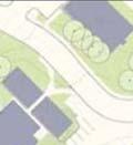
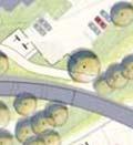
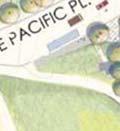
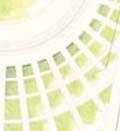
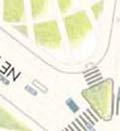
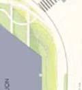
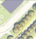
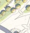
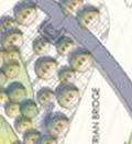
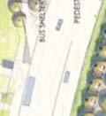
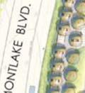
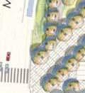
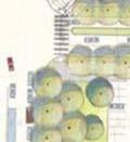
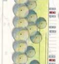
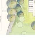
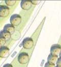
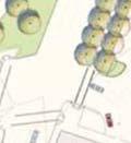
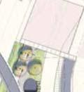
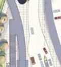
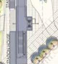
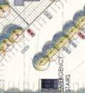
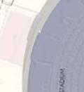
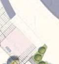
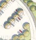
76 Sound Transit North Linkk FSEIS Addendum, Montlake Triangle Project Traffic Operations Analysis and Construction Transportation Analysis Figure Alternative Source: Sound Transit December 1, 2010


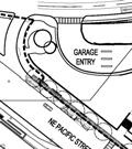
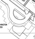
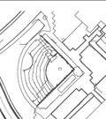
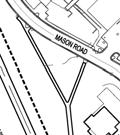
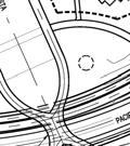
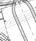
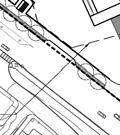
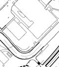
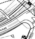
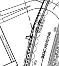
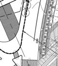
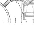
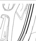
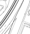
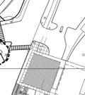
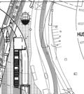
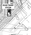
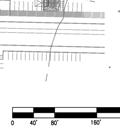
77 Sound Transit North Linkk FSEIS Addendum, Montlake Triangle Project Traffic Operations Analysis and Construction Transportation Analysis Figure Proposed Action Source: Gustafson Guthrie Nichol Ltd, November December 1, 2010
78 Sound Transit North Linkk FSEIS Addendum, Montlake Triangle Project Traffic Operations Analysis and Construction Transportation Analysis 2. Pedestrian Operations This section describes how the 2010 Proposed Action would change pedestrian operations compared to the 2006 Alternative. It also presents information related to Sound Transit passenger volumes and how those passengers will disperse to the University of Washington campus and/or transfer to local King County Metro bus service. Background Pedestrian Volumes Existing pedestrian and bicycle counts were performed in n the vicinity of the University of Washington Station on September 30, These volumes were then projected to year 2030 assuming a compound annual growth rate of 1% per year.. These are the background pedestrian volumes that would use the crosswalk locations for the Noo Build Alternative (if Link were not built), and are summarized in Table 1. Sound Transit Passenger Volumes The number of Link passengerss that could cross at variouss locations was derived from information in the University of Washington Station Pedestrian and Bicycle Evaluation (Grijalva Engineering, December 2008). 4 This report was prepared for Sound Transit and evaluated pedestrian needs associated with the bridge proposed to implement the 2006 Alternative. The pedestrian volumes were based on the projected number of passenger boardings at the University of Washington station and estimates about the potential destinations of those passengers. This analysis uses the 2030 passenger boarding projections with the Link light rail line completed between S 200 th Street and Northgate 5,950 passenger peak hour boardings at the University of Washington Station. 5 As described in the next section of this report, all pedestrian analyses were performed for the peak passenger volumes that can exit the station in a one-minute period. This volume is constrained by the station s escalator and elevator capacity. Therefore, even if passenger volumes were to increase in the future (e.g., with future extensions of the light rail line to Lynnwood), the maximum passenger flow to the station above ground plaza cannot increase. The pedestrian volumes were distributed to various walking routes based on the trip distribution pattern originally prepared for the University of Washington Station Pedestrian and Bicycle Evaluation. The end destinations are the same for all of the alternativess evaluated; however, some of the pedestrian volume is expected to change to follow the most convenient path. The peak period distribution pattern for the Proposed Action is shownn on Figure 3. Table 1 compares the commuter peak hour pedestrian volumes for various routes and facilities for the 2006 Alternativee and the 2010 Proposed Action. 4 5 Updated volumes were presented in a separate spreadsheet from Sound Transit (January 11, 2009). When the University of Washington Station first opens in 2016, it would bee the interim end of the line. At that time, the station is expected to have 4,730 peak hour boardings. Therefore, the 5,950 boardings projected once the line is extended represent the worst-case condition December 1, 2010


79 Sound Transit North Linkk FSEIS Addendum, Montlake Triangle Project Traffic Operations Analysis and Construction Transportation Analysis Figure 3. Peak Distribution Pattern for Link Passengers UW Station Terminus, 2010 Proposed Action 8% 3% 6% 24% 2% 5% 5% T 6% T 5% T 18% 16% 1% T X% = Distribution of Passengers to Campus T X% = Link Passengers who Transfer to Bus 1% Source: Sound Transit Link Ridership Forecast and Distribution, January Reassigned to routes by Heffron Transportation December 1, 2010
80 Sound Transit North Linkk FSEIS Addendum, Montlake Triangle Project Traffic Operations Analysis and Construction Transportation Analysis Table 1. Peak Hour Pedestrian Crossing Volumes - Year 2030 with 200th to Northgate Origin & Destinationn of Pedestrianss Station Platform Pedestrian Bridge (Station to Rainier Vista) Pedestrian Bridge West-side Stair/ /Elevator (to Northeast cornerr of Triangle) Montlake Blvd/Pacific Street Intersection North Leg (Montlake Blvd) West Leg (Pacificc Street) Northwest Cornerr (Island to Triangle) East Leg (Parking Lot Driveway) Montlake Blvd/Pacific Place Intersection South Leg (Montlake Blvd) West Leg (Pacificc Place) East Leg (Husky Stadium Driveway) Future Mid-Block Crossing of Pacific Street d Pacific Street/Pacificc Place Intersection East Leg (Pacific Street to Med Center) North Leg (Pacificc Place) Year 2030 No Build Alt. Peds & Bikes b Pacific Place Mid-Block Crossings a. Source: Sound Transit, derived from University of Washington Station Pedestrian and Bicycle Evaluation ( Grijalva Engineering, December 2008). Volumes in the Sound Transit spreadsheet dated January 11, 2009 were used except as noted. It assumes the complete Link lightt rail corridor from S 200 th Street to Northgate. Year 2030 volumes at the station plaza are higher than the 2016 condition with the University Station as the interim terminus. b. Projected from existing pedestrian and bicycle counts performed on September 30, for the above referenced study. c. Pedestrian volumes were reassigned to different routes by Heffron Transportation, Inc. based on information about the on-campus origins and destinations of Link commuters. d. Future pedestrian crossing would be added to existing signal. This is not a part of the 2010 Proposed Action Unknown Additional Peds per Hour to/from Link Station 2006 Alternative Original Pedestrian Bridge a 5, 950 3, , 250 1, Not Applicable Proposed Action c New Bridge + Rainier Vista 5,950 3, , December 1, 2010
81 Sound Transit North Linkk FSEIS Addendum, Montlake Triangle Project Traffic Operations Analysis and Construction Transportation Analysis Passenger Surges Passengers who arrive at the University of Washington Station by Link light rail train will exit the station in surges. 6 Sound Transit had estimated the hourlyy number of passengers during the peak commute hours as well as the number of passengers expected on the peak train. These estimates are summarized in Table 2 for the year 2016 condition, when the University of Washington Station would be the north terminus of the Link line, and the yearr 2030, when the line would be extended to Northgate. This shows that in the year 2030, the station would generatee 5,950 passenger trips per hour with 384 passengers on the peak train. In the morning, 278 of these passengers would arrive by train and exit the station and 106 would enter the station to takee the train elsewhere. In the afternoon, these peak directions would be reversed, but the volumes are assumed to be identical. Trains are expected to operate with five-minute headwayss (time between consecutive arrivals) in both directions, which provides passengers the luxury of not having to use a schedule. Passengers who take the train elsewheree from the University of Washington would likely walk to the station in a steady flow with the peak train s volume spread evenly over the five minutes between trains. However, passengers who arrive on the peak train would exit the station in a surge. It is expected that it could take three minutes for all of a train s passengers to reach the station plaza from the platforms. It is possible that higher passenger volumes or a faster exit ratee could occur; therefore, the maximum surge volume was evaluated. The maximum volume that can exit the station in a one-minute period will be constrained by the capacity of the station s escalators and elevators. Sound Transit has conservatively estimated that the escalators could accommodate up to 198 passengers per minute, and the elevator could accommodate 20 passengers per minutee for a total of 218 passengers. 7 No similar surge in the number of passengers that enter the station is expected except immediately following special events such as a Husky football or basketball games. The average number of passengers per minute and the peak passengers per minute are summarized in Table 2. Pedestrian analyses performed for sidewalks and bridges assumed the peak passengers per minute. 6 Sound Transit refers to arrivals and departures for the train portion of the trip. Arrivals are those who have arrived at the station by train, and then exit the station to reach the UW campus. Departures are the reverse trip. For clarity, this analysis will use the terms Enter Station and Exit Station to refer to the pedestrian direction at the station plaza. 7 Source: Sound Transit, Calculations in UWS - Elevator Escalator Passenger Metering xls Escalator rate based on mezzanine and escalator walking speed of 3 feet/sec Patrons were assumed to stand 2 abreast on one tread followed by 1 person on the next tread followed by 2 abreast then 1 person, in a continuing pattern. Elevator was assumed to operate at two-thirds of its theoretical capacity December 1, 2010
82 Sound Transit North Linkk FSEIS Addendum, Montlake Triangle Project Traffic Operations Analysis and Construction Transportation Analysis Table 2. Peak Passenger Volumes at University of Washington Station Condition Year 2016 with UW Station as North Terminus a Year 2030 With Northgate as Terminus a Passengers per Hour 4,730 5,950 Peak Morningg Train Peak Afternoon Train Enter Station Exit Station Enter Station Exit Station Average Passengers per Minute Year 2030 b Peak Passengers per Minute Year 2030 c a. Source: University of Washington Station Pedestrian and Bicycle Evaluation (Grijalva Engineering, December 2008). Updated volumes were presented in a separate spreadsheet from Sound Transitt (January 11, 2009). b. Assumes passengers who enter the station would arrive steadily over the 5-minute periodd between trains, and that passengers who exit the station would depart within 3 minutes. c. Assumes that volumes are constrained in practice to an estimated 218 passengers per-minute (198 passengers per minute on the two escalators and 20 passengers per minute in the elevator) delivered d by the station s vertical transportation system. On Street Pedestrian Facility Needs (Crossings and Sidewalks) The 2010 Proposed Action is expected to decrease the number of pedestrians who cross Montlake Boulevard at-grade compared to the 2006 Alternative (seee Table 1). However, the facilities serving these pedestrians including the crosswalks, sidewalks, and pedestrian queuing islands will be the same as previously designed. Therefore, no additional impacts to the intersection crossing are expected. Bridge Width and Level of Service The 2006 Alternative proposed a 16-foot wide pedestrian bridge 8 that would have extended about 670 feet between the station and Rainier Vista northwest of the Burke Gilman Trail. The 2010 Proposed Action would replace that bridge with a 30- to 34-foot wide bridge thatt spans 95-feet from the station to the Montlake Triangle. Pedestrian level of service on each bridge option was rated using Equation 18-2 in the Highway Capacity Manual ( TRB, 2000) and assuming the flow ratee thresholds in Exhibit 18-3 Average Flow LOS Criteria for Walkways and Sidewalks. The peak one-minute evaluated. As previously shown in Table 2, the station would generate a peak surge of 218 passengers per minutee exiting the station and 21 passengers per surge volumes exiting and entering the station during the morning commuter were minute entering the station during this period. For the 2006 Alternative, an estimated 66% of these passengers (or 158 per minute) were expected to use the long pedestrian bridge; for the 2010 Proposed Action, an estimated 70% of the passengers (or 168 per minute) are expected to use the short bridge to the Montlake Triangle. Based on the LOS Criteria, the bridge in the 2006 Alternative would operate at LOS D; the bridge in the 2010 Proposed Action would operate at LOS B. However, the new bridge would be connected to a bicycle ramp thatt would add traffic to the bridge. It is assumed that a separate bicycle path would be 8 Per the Link Contract U250, UW Station Finishes, General Bridge Plan & Elevations, Sheet 1, Approved Plan, January 15, December 1, 2010
83 Sound Transit North Linkk FSEIS Addendum, Montlake Triangle Project Traffic Operations Analysis and Construction Transportation Analysis striped on the bridge, so even if bicycle volumes are relatively low during peak passenger surges, the bicycle area on the bridge may not be used by pedestrians. The bicycle area could be 10 to 12-feet wide, and the remaining area reserved for pedestrians (18 to 20 feet) would operate at LOS C. Based on this analysis, the bridge in the 2010 Proposed Action would operatee at a better level of servicee and provide a better facility for bicycles than the 2006 Alternative. 3. Traffic Operation ns Impacts Changes proposed as part of the 2010 Proposed Action would not affect the number of trips or passengers generated by the University of Washington Station, nor would it affect traffic patterns in the site vicinity. The number of pedestrians who would cross Montlake Boulevard at-grade is expected to be lesss than previously assumed for the 2006 Alternative. Therefore, it would not create any additional traffic operational impacts. Future background conditions in the area are expected to be different than those evaluated in the 2006 FSEISS because of potential changes to the SR 520 Bridge Replacement project. Those potential changes are addressed herein to account for cumulative impacts. Year 2030 Traffic Volumes Year 2030 traffic volumes used for this analysis are from the SR 520, I-5 to Medina: Bridge Replacement and HOV Project Supplemental l Draft Environmental Impact Statement (WSDOT, January 2010) ). For this analysis, two future alternatives were evaluated for SR 520: No Build and Alternative A, which reflects the condition similar to WSDOT s Preferred Alternative. Changes to Husky Stadium Driveway at Montlake Boulevard/NE Pacific Street Intersection Sound Transit s 2006 Alternative for the University of Washington Station, which is already under construction on the east side of Montlake Boulevard, will permanently change the east leg of the Montlake Boulevard/NE Pacificc Street intersection. The Husky Stadium Parking Lot (also knownn as the E-11 and E-12 parking lots) was previously accessed from the east leg of this intersection with a northbound right turn or a southbound left turn. Vehicles could also exit the parking lot with a right- be turn only onto Montlake Boulevard. This was the configuration assumed in the SR 520 SDEIS. However, when the University of Washington Station is complete, there will be extensive enhancements around the station plaza, and the driveway to the Husky Stadium Parking lot will reconfigured to square up the corner wheree pedestrians wait to cross Montlake Boulevard. The driveway will be located within the intersection, and movements at the driveway will be signalized to reduce conflicts with pedestrians. Some of these changes have already been made as part of the construction traffic changes near the station. When construction is complete, the signal phase for the exiting movement was assumed to coincide with the eastbound-to-southbound transit-only priority phase. During this phase, it was assumed that westbound vehicles exiting the parking lot could proceed straight across to NE Pacific Street or turn right onto Montlake Boulevard. Per the request of Seattle Department of Transportation (SDOT), the southbound left turn movement to the driveway was assumed to be a protected movement. These changes in intersection configuration and signal operations are approved for use during Sound Transit s construction and were assumed to remain in place for all future conditions December 1, 2010
84 Sound Transit North Linkk FSEIS Addendum, Montlake Triangle Project Traffic Operations Analysis and Construction Transportation Analysis Changes to the Montlake Boulevard/N NE Pacific Place Traffic Volume Assumptions The 2006 FSEIS had assumed a substantial increase in traffic entering and exiting the parking lot driveway at Pacificc Place (serving the E-11/E-12 lots nearr Husky Stadium). A 66% increase in traffic had been assumed between the 2002 and 2030 No Action condition. The University of Washington has no plans to increase the number of parking spaces in these parking lots, and traffic entering and exiting the parking lots would not change in the future compared to pre-constructionn conditions. Changes to the Montlake Boulevard/N NE Pacific Place Intersection Signal Phasing The existing Montlake Boulevard/NE Pacificc Place intersection, for which the east leg serves as a driveway to the Husky Stadium parking lots, has unconventional signal phasing. Currently, east-west traffic is processed concurrently; however, westbound traffic exiting the parking lot must yield to oncoming eastbound traffic, even the left turns. This is not a standard yield condition for concurrent signal phasing. In addition, the east-west pedestrian crossing occurs with this phase, and the westbound motorists must also yield to pedestrians in the crosswalk. The Record of Decision 9 for the project states that, The NE Pacific Place/Montlakee Boulevard NE intersection would operate at LOS F in the years 2015 and Adding a second westbound left- a proportionate share of costs to improve this intersection. Adding a second westbound left turn lane turn lane would improve operations to better than No-build conditions. Sound Transit will contribute to this intersection would require that the signal phasing be split for east and west movements since otherwise left turn movements would conflict in the center of the intersection. In addition, splitting the signal phasing would eliminate the conflicts between pedestrians in the Montlake Boulevard crosswalk and the westbound left turn movement. It is assumed that the pedestrian crossing of Montlake Boulevard would occur with the eastbound traffic phase. The intersectionn operations were tested with both the existing signal phasing (and no additional left turn lane) and a split-signal phasing with a dual westbound left turn as recommended in the Record of Decision. As described above and demonstrated later in this report, less growth inn traffic is expected than previously forecast at this intersection and no mitigation is required to maintain operations. However, the signal phasing could be changed without reducing the north-south progression along Montlake Boulevard and without degrading operations at this intersection to below a LOS D. The split phasing would improve pedestrian safety as well as reduce queues for vehicles exiting the Husky Stadium parking lot. Levels of Service Level of service analysis was performed using Synchro 7. 0 models of the Montlake Boulevard corridor. These models were initially created by WSDOT for the SR 520 SDEIS. The models were adapted by Heffron Transportation, Inc. to include changes in features described in this report. These include changes to the Husky Stadium driveway, increased pedestrian volume, and changes in signal phasing. Two conditions were evaluated: the SR 520 No Build, which assumes existing infrastructure at SR 520 would not change, and SR 520 Option A, whichh would retain the Montlake Boulevard interchange and add a second bascule bridge (draw bridge) on Montlake Boulevard across the Ship Canal. WSDOT s Preferred Alternative for SR 520 incorporates the Option A features. 9 Record of Decision for Central Puget Sound Regional Transit Authority s (Sound Transit) North Link Segment of the Central Link Light Rail Transit Project, June Mitigation requirements detailed in Appendix C of the ROD December 1, 2010
85 Sound Transit North Linkk FSEIS Addendum, Montlake Triangle Project Traffic Operations Analysis and Construction Transportation Analysis Table 3 summarize the level of service results for the SR 520 No Build and SR 520 Option A conditions. Table 3. Year 2030 Level of Service with Link Light Rail Station AM Peak Hour Montlake Blvd/Pacificc Street Montlake Blvd/Pacificc Place 1 PM Peak Hour Montlake Blvd/Pacificc Street Montlake Blvd/Pacificc Place With Existing Phasing Without SR 5200 Project LOS Delay C A F B With Dual WB Left and Split Phasing D 52.1 D 51.2 Source: : All levels of service performed using Synchro The model was originally developed by WSDOT for the SR 520 Year 2030 No Building condition. All signal timings were optimized, which is consistent with WSDOT s analysis for the SR 520 project Assumes a change in the signal phasing to split the east and west phases. n/a = not applicable With SR 520 Project LOS D A F B Delay The 2010 Proposed Action would not change how traffic operates in the site vicinity. It would not increase traffic volumes nor increase pedestrian crossingss at intersections. Therefore, no mitigation would be needed to accommodate the project change. The 2006 FSEIS had determined that the Montlake Boulevard/NE Pacific Place intersection would operate at LOS F in the future, and had recommended adding a second left turn lane to the intersection to mitigate this condition. However, that poorr level of service was related to the fact that the analysis had assumed traffic exiting the Husky Stadium parking lots would increase by 66% by the year The University of Washingtonn has no planss to increase the number of parking spaces in its E-11 or E-12 lots served by this driveway. Therefore, traffic volumes are not likely to increase in the future. The proposed mitigation measure would nott be needed for the 2006 Alternative or the 2010 Proposed Action. 4. Pedestrian Travel Time Impacts This section evaluates the walking times associated with the two alternatives: the original pedestrian bridge in the 2006 Alternative, and the new pedestrian bridge in the 2010 Proposed Action. As previously shown on Figure 3, there are threee key destinations that would be used by an estimated 92% of the station patrons: Central campus, which represents areas north and west off the Burke-Gilman Trail. An estimated 38% of the Link passengers would be destined areas in the Central Campus (33% towards Drumheller Fountain and the Burke-Gilman trail, and 5% to the Hec Edmundson Bridge). The travel time for thesee patrons wass estimated for routes between the station and Drumheller Fountain December 1, 2010
86 Sound Transit North Linkk FSEIS Addendum, Montlake Triangle Project Traffic Operations Analysis and Construction Transportation Analysis UW Medical Center and southern Health Sciences, which representss the large complex of buildings south of NE Pacific Street. An estimated 29% of the Link passengers would be destined to this complex. The travel time for thesee passengers was estimated for two routes: 1) between the station and the main entrance of the UW Medical Center, and 2) to the Health Sciencess entrance at the T-Wing Pedestrian Bridge. Those walking to the Health Sciences building could choose to walk along NE Pacific Street or walk towards main campus and use the Burke-Gilman Trail to the T-Wing Overpass. Those walking to the UW Medical Center could also opt to take the stairs into the Triangle Garage and take the tunnel underr NE Pacific Street. Transit transfers on the Montlake Triangle. An estimated 30% of the Link passengers are expected to transfer to or from buses in the Montlake Triangle area 25% at stops on the inside of the Montlake Triangle and 5% on the south side of NE Pacific Street. This is a conservatively high estimate based on the University of Washington station as interim end-of-line, when about one quarter of the bus transfer activity would be to transportt riders to the University District commercial area or other nearby neighborhoods. Once Link is extended north, these passengers would continue on the train to the Brooklyn Station or other station further north. Most of f the regional and local buses have stopss on NE Pacific Street. Two frequent local bus routes serve passengers on NE Pacific Place and lay over at the end of their route. Walking times were calculated between the station and the key destinations on campus. The methodology to determine the walking times is documented below. Walking Time Methodology Walking time between the station plaza and the end destination includes the following components: Time to walk the distance between the two end points For this analysis, a moderate walking speed of 5 feet per second was used (equivalent to about an 18-minute mile and less than 3.5 mph). 10 This speed is higher thann the 3.5 to 4-feet-per-second speed that is used to set minimumm signal times at intersections, and reflects the fact that many students will walk faster. The distances between the street-level station access and the end points were measured from detailed drawings of the three alternatives as well as campus maps. Time on the escalator For walking routes that use the pedestrian bridge, patrons would need to ascend or descend between the pedestrian bridge and street level. (The travel time to the platform was not includedd since that would be the same for all walking routes..) Sound Transit s station design specifies an escalator speed of 100 feet per minute; and the 10 Slower walking speeds of 3.5 to 4.0 feet per second (fps) are used to determine the minimum crossing times at signalized crosswalks. However, these speeds are below average, and reflect the needs of slower pedestrians such as senior citizens. Two studies that have reported the walking speeds of younger pedestrians were used to determine the average walking speed appropriate for the University of Washington campus population: 1) Field Studies of Pedestrian Walking Speed and Start-Up Time (Knoblauch, Pietrucha, and Nitzburg, Transportation Research Record 1538, 1996; and 2) Transportation Research Record #1678 (Milazzo, Rouphail, Hummer, and Allen, The 1996 study determined that for younger pedestrians, the mean speed was 4.95 feet per second. The 1999 study cited that the average walking speeds was 5.7 fps for young pedestrians, 4.9 fps for middle-aged pedestrians, and 3.8 fps for elderly pedestrians December 1, 2010
87 Sound Transit North Linkk FSEIS Addendum, Montlake Triangle Project Traffic Operations Analysis and Construction Transportation Analysis length of the escalator is designed to be 44 linear feet. Therefore, the travel time on the escalator is estimated to be about 26 seconds.. Time to cross Montlake Boulevard For travel routes that would cross Montlake Boulevard at-grade, pedestrians would need to wait for the pedestrian signal to crosss the street. The average wait time was calculated using Equation 18-5 from the Highway Capacity Manual (Transportation Research Board, 2000). The equation relates the average pedestrian delay to the cycle length and the amount of green time provided for the pedestrian crossing. The calculation determines the average wait time for a pedestrian who has arrived at the signal when the Don tt Walk phase is in effect. This includes pedestrians who arrive just when the light changes to Don t Walk as well as those who might arrive when the signal shows Walk and they have no delay. The cycle lengths and pedestrian walk phase times were determined from existing signal operations. Currently, the corridor operates with a 110 second cycle length in the morning and a 120 second cycle length in the afternoon. Pedestrians crossing Montlake Boulevard are provided with 27 seconds of crossing time. With these signal timing parameters, the average delay per pedestrian is 31 seconds in the morning and 36 seconds in the afternoon. WSDOT s analysis for year 2030 conditions with the SR 520 Preferred Alternative (including the second Bascule Bridge on Montlake Boulevard) optimized the signal timings. That analysis found that overall cycle lengths could decrease in the future with SR 520, and could range from 90 to 100 seconds, while maintaining or extending the pedestrian green time. Under this future scenario, the average delay per pedestrian would be less. Therefore, to be conservative, the existing pedestrian delays at these signalss were assumed for this analysis. Time to cross Pacific Street Some of the routes would require passengers to cross NE Pacificc Street at one of three locations: 1) at the Montlake Boulevard intersection, 2) at the Pacific Place intersection, or 3) at a futuree pedestrian crossing at the UW Medical Center driveway, which is part of a separate action. Crossing delay for both was determined using the same methodology as described above. At Montlake Boulevard, the time allotted to north-south movements is long, and the time that a pedestrian would need to wait to cross Pacific Street is shorter than to cross Montlake Boulevard. It is estimated that the average delay for pedestrians would be 10 seconds. Further west, the Pacificc Street/ /Pacific Place intersection operates withh a cycle length that is half the time of cycle lengths on Montlake Boulevard. Delay to cross Pacific Street at this location is estimated to be 9 seconds. Delays for a potential future signal were assumed to be 10 seconds. Pedestrian Travel Times Figures 4 through 6 summarize the pedestrian travel timess associated with the various routes described above. Detailed calculations showing the delay for various segments of each trip are provided in Appendix A December 1, 2010


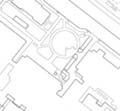
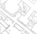
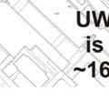
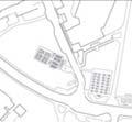
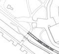
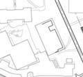
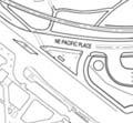
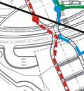
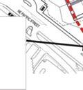
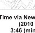
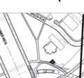
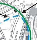
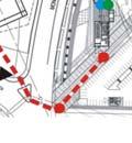
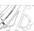

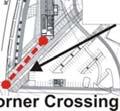

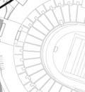
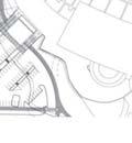
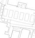

88 Sound Transit North Linkk FSEIS Addendum, Montlake Triangle Project Traffic Operations Analysis and Construction Transportation Analysis Figure 4. Walking Routes and Travel Times betweenn Station Plaza and Drumheller Fountain Figure 5. Walking Routes and Travel Times between Station Plaza and UW Medical Center December 1, 2010


 being the fastest.")


89 Sound Transit North Linkk FSEIS Addendum, Montlake Triangle Project Traffic Operations Analysis and Construction Transportation Analysis Figure 6. Walking Routes and Travel Times between Station Plaza and Health Sciences The pedestrian travel time analysis shows that the 2006 Alternative would have the fastest walking times to the fountain, about 11 seconds faster than the 2010 Proposed Action. However, for passengers destined to the Health Sciences complex, the 2010 Proposed Action would provide a faster route, about 26 seconds faster than the route via the original pedestrian bridge proposed as part of the 2006 Alternative and 19 seconds faster than the surface route via NE Pacific Street. Travel times to the UW Medical Center would be the same for both options with the surface route (crossing at the corner of the Montlake Boulevard/NE Pacific Street intersection) being the fastest. The new pedestrian bridge with the Proposed Action would offer a reasonable alternative route across Rainier Vista to a future mid-block crossing of NE Pacificc Street. Walking time between the Light Rail Station and bus transfer points would be identical forr the two options. 5. Safety Both the 2010 Proposed Action and the 2006 Alternative would grade-separate Trail. However, the 2010 Proposed Action, with Rainier Vista, would also grade separate non-station pedestrian and bicycle traffic from station patrons from Montlake Boulevard, NE Pacific Place, and the Burke-Gilman both NE Pacific Place and the Burke-Gilman Trail. Existing unsignalized crossings of NE Pacific Place and the Burke-Gilman Trail at Rainer Vista would be eliminated by the 2010 Proposed Action. Therefore, the 2010 Proposed Action would enhance safety compared to the 2006 Alternative. 6. Burke-Gilman Trail Impacts The 2006 Alternative included a grade-separated pedestrian crossing of Montlake Boulevard, via a tunnel or bridge, with an option for an extended tunnel or bridge acrosss NE Pacific Place and the Burke- about Gilman Trail to provide access to the Rainier Vista corridor and central campus. Due to concerns increased volumes of pedestrians arriving by Link light rail and then crossing the Burke-Gilman Trail to access campus, Sound Transit and FTA committed to developing a grade-separated crossing of the trail and NE Pacific Place, via either a tunnel or bridge, to maintain connectivity between the University of Washington Station and the campus. This mitigation measure is documented in the project s Record of Decision. It stated, December 1, 2010
September 2010 Review Project Concepts SCHEMATIC DESIGN NEGOTIATION CONSTRUCTION
 VII. STANDING COMMITTEES F 10 B. Finance, Audit and Facilities Committee Montlake Triangle Project (formerly Rainier Vista Pedestrian Land Bridge) Adopt Project Budget, Approve UW Funding Commitment, Approve
C C C
 C-012-001 Thank you for your support for the creation of new public space and nonmotorized access between downtown and the waterfront through the Overlook Walk, the East-West Connections, and the Promenade.
CITY OF SEATTLE RESOLUTION. WHEREAS, the Washington State Department of Transportation (WSDOT) led the Seattle
 led the Seattle") SDOT SR0 Design Refinements RES August, 0 Version #D 0 CITY OF SEATTLE RESOLUTION..title A RESOLUTION relating to the State Route 0, Interstate to Medina Bridge Replacement and High Occupancy Vehicle Project;
SDOT SR0 Design Refinements RES August, 0 Version #D 0 CITY OF SEATTLE RESOLUTION..title A RESOLUTION relating to the State Route 0, Interstate to Medina Bridge Replacement and High Occupancy Vehicle Project;
Existing Transportation System
 < Open for Additional Text Transportation System Existing Transportation System This section describes vehicular transportation associated with Children s. transportation are described in a separate section
South King County High-Capacity Transit Corridor Study
 HIGH-CAPACITY TRANSIT CORRIDOR STUDY South King County Corridor South King County High-Capacity Transit Corridor Study Corridor Report August 2014 South King County High Capacity Transit Corridor Report
4. ENVIRONMENTAL IMPACT ANALYSIS 9. TRANSPORTATION AND TRAFFIC
 4. ENVIRONMENTAL IMPACT ANALYSIS 9. TRANSPORTATION AND TRAFFIC 4.9.1 INTRODUCTION The following section addresses the Proposed Project s impact on transportation and traffic based on the Traffic Study
5. RUNNINGWAY GUIDELINES
 5. RUNNINGWAY GUIDELINES These guidelines should be considered collectively when making runningway decisions. A runningway is the linear component of the transit system that forms the right-of-way reserved
Appendix C. NORTH METRO STATION AREA TRAFFIC IMPACT STATEMENT 88th Avenue Station
 Appendix C NORTH METRO STATION AREA TRAFFIC IMPACT STATEMENT 88th Avenue Station Prepared for: Regional Transportation Department and URS Corporation as part of the North Metro EIS David Evans and Associates,
APPENDIX G: INTERSECTION NEEDS AT OKEECHOBEE BOULEVARD
 APPENDIX G: INTERSECTION NEEDS AT OKEECHOBEE BOULEVARD INTERSECTION NEEDS AT SR 7 and OKEECHOBEE BOULEVARD SR 7 Extension Project Development and Environment (PD&E) Study From Okeechobee Boulevard (SR
See Figure 38, Existing Nonmotorized Connections.
 Nonmotorized Connections Existing Nonmotorized Connections Pedestrian, vehicle and bike traffic access and movements are confined primarily to Penny Drive on campus. Due to the steep slope along the length
Chapter 7 Nonmotorized Facilities
 Chapter 7 Nonmotorized Facilities What is in this chapter? This chapter discusses existing and proposed pedestrian and bicycle facilities referred to as nonmotorized facilities along the SR 520 corridor.
Interim Transit Ridership Forecast Results Technical Memorandum
 Interim Transit Ridership 401 South Jackson Street Seattle, WA 98104-2826 September 2012 Table of Contents 1 INTRODUCTION... 1-1 1.1 Project Background... 1-1 2 RIDERSHIP FORECASTS... 2-1 2.1 System Ridership
Highway 111 Corridor Study
 Highway 111 Corridor Study June, 2009 LINCOLN CO. HWY 111 CORRIDOR STUDY Draft Study Tea, South Dakota Prepared for City of Tea Sioux Falls Metropolitan Planning Organization Prepared by HDR Engineering,
Environmental Assessment Findings & Recommendations. Public Hearing November 13, 2014
 Environmental Assessment Findings & Recommendations Public Hearing November 13, 2014 Welcome! Welcome and Introductions Project and Environmental Assessment Overview Public Comments Adjourn Purpose of
1.0 INTRODUCTION 1.1 PURPOSE OF THIS REPORT
 1.0 INTRODUCTION This chapter provides an overview of the purpose, authorization and focus of this Recirculated Draft Environmental Impact Report (EIR), an identification of the Lead Agency, an outline
Corpus Christi Metropolitan Transportation Plan Fiscal Year Introduction:
 Introduction: The Safe, Accountable, Flexible, Efficient Transportation Equity Act: A Legacy for Users (SAFETEA-LU) has continued the efforts started through the Intermodal Surface Transportation Efficiency
BUDGET FOR RESEDA BOULEVARD, STREET RECONSTRUCTION / VISION ZERO PROGRAM, REPORT BACK, COUNCIL FILE
 FORM GEN. 160 (Rev. 11-02) CITY OF LOS ANGELES INTERDEPARTMENTAL CORRESPONDENCE Date: To: Honorable City Council From: Gary Lee Moore, City Engineer Bureau of Engineering 7%mt /Electronically signed by
Addendum to Mitigated Negative Declaration
 Addendum Date: Case No.: 2014.1499E Project Title: (MDSP) - Mission Valencia Green Gateway Streetscape Project Original: 2008.1075, MDSP Mitigated Negative Declaration Project Sponsor: Charlie Ream, San
TRANSPORTATION NEEDS ASSESSMENT
 TRANSPORTATION NEEDS ASSESSMENT A travel demand analysis was carried out to determine the operational issues and the potential benefit that adding traffic capacity would have on the road network. All the
BETHEL ROAD AND SEDGWICK ROAD CORRIDOR STUDY
 DRAFT PLAN City Council Meeting August 14, 2017 STUDY AREA Sedgwick Corridor State Route 160, principal arterial with Class 3 access management designation, commuter and freight route, connection to SR
ARLINGTON COUNTY, VIRGINIA
 ARLINGTON COUNTY, VIRGINIA County Board Agenda Item Meeting of October 15, 2016 DATE: October 7, 2016 SUBJECT: Adoption of amendments to the Master Transportation Plan (MTP) to create a new Pedestrian
Omaha s Complete Streets Policy
 Omaha s Complete Streets Policy (Adopted August 2015) VISION To create great places and enhance our quality of life, the City of Omaha will provide safe, accessible streets for all users. Complete Streets
TRAFFIC IMPACT STUDY CRITERIA
 Chapter 6 - TRAFFIC IMPACT STUDY CRITERIA 6.1 GENERAL PROVISIONS 6.1.1. Purpose: The purpose of this document is to outline a standard format for preparing a traffic impact study in the City of Steamboat
Existing Transportation System
 < Please Open Page for Additional Text Transportation System Existing Transportation System This section describes vehicular transportation associated with Children s. Pedestrian and other nonmotorized
APPENDIX A: Complete Streets Checklist DRAFT NOVEMBER 2016
 APPENDIX A: Complete Streets Checklist DRAFT NOVEMBER 2016 Complete Streets Checklist MetroPlan Orlando s Complete Streets Checklist is an internal planning tool for staff to further implementation of
ACTIVE TRANSPORTATION/NONMOTORIZED TRANSPORTATION
 ACTIVE TRANSPORTATION/NONMOTORIZED TRANSPORTATION BACKGROUND Active transportation, also known as nonmotorized transportation, is increasingly recognized as an important consideration when planning and
Figure 1: East West Connector Alignment Alternatives Concept Drawing
 Page 2 of 9 Figure 1: East West Connector Alignment Alternatives Concept Drawing The Montebello Drive extension will run north south and connect Wilsonville Road to the Boones Ferry Road to Brown Road
Gordon Proctor Director Policy on Accommodating Bicycle and Pedestrian Travel on ODOT Owned or Maintained Facilities
 Approved: Policy: 20-004(P) Responsible Office: Planning Gordon Proctor Director Policy on Accommodating Bicycle and Pedestrian Travel on ODOT Owned or Maintained Facilities I. POLICY STATEMENT: This policy
3.9 Recreational Trails and Natural Areas
 3.9 Recreational Trails and Natural Areas 3.9.1 Introduction Parks and other recreational facilities such as trails, bicycle routes, and open space are important community resources. This section discusses
FLORIDA DEPARTMENT OF TRANSPORTATION DISTRICT 7 DISTRICT WIDE BICYCLE/PEDESTRIAN ACCESS TO TRANSIT SAFETY ASSESSMENT AND IMPROVEMENT PLAN
 FLORIDA DEPARTMENT OF TRANSPORTATION DISTRICT 7 DISTRICT WIDE BICYCLE/PEDESTRIAN ACCESS TO TRANSIT SAFETY ASSESSMENT AND IMPROVEMENT PLAN TRANSIT SAFETY ASSESSMENT SR 55/US 19 AT 80 TH AVE N DRAFT JUNE
Basalt Creek Transportation Refinement Plan Recommendations
 Basalt Creek Transportation Refinement Plan Recommendations Introduction The Basalt Creek transportation planning effort analyzed future transportation conditions and evaluated alternative strategies for
IV. Environmental Impact Analysis B.3 Pedestrian Circulation and Bicycle and Pedestrian Safety
 IV. Environmental Impact Analysis B.3 Pedestrian Circulation and Bicycle and Pedestrian Safety 1. Introduction This section analyzes the potential impacts of the Project on pedestrian circulation and bicycle
Comments EXECUTIVE SUMMARY
 Comments 1. Under any Alternatives, MCDOT should provide better at-grade pedestrian crossing of Georgia Avenue and Forest Glen Road, including improved crosswalks with wider medians and adequate signal
Chapter 2: Standards for Access, Non-Motorized, and Transit
 Standards for Access, Non-Motorized, and Transit Chapter 2: Standards for Access, Non-Motorized, and Transit The Washtenaw County Access Management Plan was developed based on the analysis of existing
City of Seattle Edward B. Murray, Mayor
 City of Seattle Edward B. Murray, Mayor Department of Transportation Scott Kubly, Director Eastlake Community Council 117 E Louisa St. #1 Seattle, WA 98102-3278 January 28, 2016 RE: Roosevelt to Downtown
Lee s Summit Road Improvement Study Public Open House June 7, 2007 Summary of Comment Card Responses
 Lee s Summit Road Improvement Study Public Open House June 7, 2007 Summary of Comment Card Responses Introduction At the Lee s Summit Road Improvement Study Public Open House held Thursday, June 7, 2007
Off-road Trails. Guidance
 Off-road Trails Off-road trails are shared use paths located on an independent alignment that provide two-way travel for people walking, bicycling, and other non-motorized users. Trails specifically along
Clackamas County Comprehensive Plan
 ROADWAYS The County s road system permits the movement of goods and people between communities and regions, using any of a variety of modes of travel. Roads provide access to virtually all property. They
CITY OF COCOA BEACH 2025 COMPREHENSIVE PLAN. Section VIII Mobility Element Goals, Objectives, and Policies
 CITY OF COCOA BEACH 2025 COMPREHENSIVE PLAN Section VIII Mobility Element Goals, Objectives, and Policies Adopted August 6, 2015 by Ordinance No. 1591 VIII MOBILITY ELEMENT Table of Contents Page Number
St. Francis Drive through the City of Santa Fe Corridor Study
 VII. ENGINEERING AND ENVIRONMENTAL EVALUATION TRAIL CONNECTIVITY In the southern portion of the Corridor there is a lack of a sidewalk, trail or bicycle facility within the right-ofway. However, the City
Hospital Link Project Project Update September 2017
 Hospital Link Project Project Update September 2017 General The project provides a link from Riverside Drive and the Transitway to the Hospital Link Road. Construction is well underway. Read on for important
Multi-Modal Traffic Analysis. Parisi and Associates
 Mill Valley to Corte Madera Bicycle and Pedestrian Corridor Study Appendix D: Multi-Modal Traffic Analysis Prepared by Parisi and Associates August 2009 Appendix D - Multi-Modal Traffic Analysis Table
General Plan Circulation Element Update Scoping Meeting April 16, 2014 Santa Ana Senior Center, 424 W. 3rd Street, Santa Ana, CA 92701
 General Plan Circulation Element Update Scoping Meeting April 16, 2014 Santa Ana Senior Center, 424 W. 3rd Street, Santa Ana, CA 92701 Meeting Agenda 1. Purpose of Scoping Meeting 2. Project Overview 3.
NJDOT Complete Streets Checklist
 Background The New Jersey Department of Transportation s Complete Streets Policy promotes a comprehensive, integrated, connected multi-modal network by providing connections to bicycling and walking trip
Duwamish Way-finding and CTR Report
 V. North Tukwila When the North Tukwila Manufacturing and Industrial Center was designated in 1992 as part of the region s land use and transportation plan, the plan called for the area to set a light-rail
Figure 4-10: Pedestrian Improvements Types of Potential Station Area Improvements - Place-Making Improvements
 INCORPORATE FEATURE PAVIN IN CROSSWALK AND INTERSECTION FIELDS Identifies high-priority pedestrian areas and create a station identity through colorful and interesting patterns ADD CURB EXTENSIONS Extending
Main-McVay Transit Study: Phase 2 Options Definition and High Level Constraints Evaluation
 Main-McVay Transit Study: Phase 2 Options Definition and High Level Constraints Evaluation APRIL 2016 A collaborative study between: For Additional Information or to Comment If you would like additional
Dear Mayor Murray, Top SR-520 Design Innovations and Remaining Opportunities
 Dear Mayor Murray, Thank you for your leadership building a transportation system that moves people efficiently throughout the region, and creates healthy places to live, work, and play. We are glad you
Los Altos Hills Town Council - June 18, 2015 Palo Alto City Council June 22, AGENDA ITEM #2.B Presentation
 Los Altos Hills Town Council - June 18, 2015 Palo Alto City Council June 22, 2015 AGENDA ITEM #2.B Presentation Previous Presentations Los Altos Hills Town Council in May 2014 and February 2015 Palo Alto
Fitting Light Rail through Well-established Communities
 Fitting Light Rail through Well-established Communities San Francisco 2008 Michael D. Madden Chief, Project Development, Maryland Transit Administration Project Setting Located inside the Capital Beltway
SANTA CLARA COUNTYWIDE BICYCLE PLAN August 2008
 SANTA CLARA COUNTYWIDE BICYCLE PLAN August 2008 To assist VTA and Member Agencies in the planning, development and programming of bicycle improvements in Santa Clara County. Vision Statement To establish,
Improving Cyclist Safety at the Dundas Street West and Sterling Road Intersection
 STAFF REPORT ACTION REQUIRED Improving Cyclist Safety at the Dundas Street West and Sterling Road Intersection Date: August 17, 2012 To: From: Wards: Reference Number: Public Works and Infrastructure Committee
City of Charlottesville Bicycle and Pedestrian Master Plan Update
 City of Charlottesville Bicycle and Pedestrian Master Plan Update September 17, 2014 I. Welcome and meeting overview II. Project status update III. Network overview IV. Break-out groups Pedestrian Network
Traffic Impact Study. Westlake Elementary School Westlake, Ohio. TMS Engineers, Inc. June 5, 2017
 TMS Engineers, Inc. Traffic Impact Study Westlake Elementary School Westlake, Ohio June 5, 2017 Prepared for: Westlake City Schools - Board of Education 27200 Hilliard Boulevard Westlake, OH 44145 TRAFFIC
Welcome to the Sellwood Bridge Project Open House!
 Welcome to the Sellwood Bridge Project Open House! 5:30 7:30 pm Please sign in here Information stations and project staff are located throughout the room. Goals for Tonight s Meeting: Learn how the Preferred
Alaskan Way, Promenade, and Overlook Walk Final EIS
 I-065-001 As described in Section 3.7.2 of the Draft EIS, the loss of on-street and off-street parking may require drivers to park off-street or travel farther to find available on-street or off-street
Route 7 Corridor Study
 Route 7 Corridor Study Executive Summary Study Area The following report analyzes a segment of the Virginia State Route 7 corridor. The corridor study area, spanning over 5 miles in length, is a multi
10.0 CURB EXTENSIONS GUIDELINE
 10.0 CURB EXTENSIONS GUIDELINE Road Engineering Design Guidelines Version 1.0 March 2017 City of Toronto, Transportation Services City of Toronto Page 0 Background In early 2014, Transportation Services
Exhibit 1 PLANNING COMMISSION AGENDA ITEM
 Exhibit 1 PLANNING COMMISSION AGENDA ITEM Project Name: Grand Junction Circulation Plan Grand Junction Complete Streets Policy Applicant: City of Grand Junction Representative: David Thornton Address:
HARRISON STREET/OAKLAND AVENUE COMMUNITY TRANSPORTATION PLAN
 HARRISON STREET/OAKLAND AVENUE Community Workshop #4: Draft Plan Review December 3, 2009 D E S I G N, C O M M U N I T Y & E N V I R O N M E N T INTRODUCTIONS Key Project Staff: Alisa Shen, Project Manager,
Magnolia Place. Traffic Impact Analysis. Prepared for: City of San Mateo. Prepared by: Hexagon Transportation Consultants, Inc.
 Magnolia Place Traffic Impact Analysis Prepared for: City of San Mateo Prepared by: Hexagon Transportation Consultants, Inc. Updated January 4, 2010 Table of Contents 1. Introduction...1 2. Existing Conditions...6
Welcome. Thank you for your interest in the Lewis & Clark Viaduct Concept Study
 Welcome Thank you for your interest in the Lewis & Clark Viaduct Concept Study Please use the arrows in the upper left hand corner to navigate through the presentation. Use the envelope icon to ask a question
Transportation Planning Division
 Transportation Planning Division Presentation Outline Study Tasks Recap of Previous Meetings Data Collected Focus Areas within Study Limits Design Principles Tool Box Recommended Concepts Schedule Moving
NOTICE OF AVAILABILITY/NOTICE OF COMMENT PERIOD OF A DRAFT EIR/EIS/EIS FOR PUBLIC REVIEW AND HEARINGS
 Tahoe Transportation District 128 Market Street, Suite 3F Stateline, NV 89449 Phone: (775) 589-5500 www.tahoetransportation.org Federal Highway Administration 650 Capitol Mall, Suite 4-100 Sacramento,
CITY OF SPOKANE VALLEY Request for Council Action
 CITY OF SPOKANE VALLEY Request for Council Action Meeting Date: December 16, 2014 Department Director Approval: Check all that apply: consent old business new business public hearing information admin.
PROJECT OBJECTIVES. Improve vehicle capacity for the intersection. Improve pedestrian and bicycle access
 COMMUNITY MEETING Project Update March 15, 2010 Purcellville, Virginia OVERVIEW Project need / objectives Project recap Design elements Proposed improvements Summary of project benefits / next steps PROJECT
Appendix B. Environmental Resource Technical Memorandum. Assessment on Travel Pattern and Access Impacts
 Appendix B Environmental Resource Technical Memorandum Assessment on Travel Pattern and Access Impacts TECHNICAL MEMORANDUM ENVIRONMENTAL RE-EVALUATION FOR UNION STATION TO OAK CLIFF DALLAS STREETCAR To:
Establishment of Triggers. Second Montlake Bridge Workgroup
 Establishment of Triggers June 2012 Table of Contents Page 1 Executive Summary -- The Condtions and Triggers...1-2 2 Background and History...2-1 3 Assessment of A Bicycle and Pedestrian Trigger...3-1
VDOT I-66 Inside the Beltway Eastbound Widening Environmental Assessment. Staff Recommendations
 VDOT I-66 Inside the Beltway Eastbound Widening Environmental Assessment Staff Recommendations Department of Environmental Services Transportation January 28, 2017 Timeline of Transform66 June 2012: I-66
Executive Summary Route 30 Corridor Master Plan
 Route Corridor Master Plan Project Overview The Route Corridor Master Plan is a coordinated multimodal transportation and land use plan for the entire stretch of Route through East Whiteland Township,
Appendix T CCMP TRAIL TRAFFIC & TRANSPORTATION DESIGN STANDARD
 Appendix T CCMP 3.3.4 TRAIL TRAFFIC & TRANSPORTATION DESIGN STANDARD 3.3.4 Trail Traffic and Transportation Design Multi-use trails have certain design standards, which vary depending on the agency that
Chapter 3: Multi-Modal Circulation and Streetscapes
 CHAPTER 3: MULTI-MODAL CIRCULATION AND STREETSCAPES Chapter 3: Multi-Modal Circulation and Streetscapes Overview Streetscape improvements have already been completed for Depot Street between Main Avenue
Lyons Avenue/Dockweiler Road Extension Project Draft Environmental Impact Report. Appendix I Traffic Impact Study
 Lyons Avenue/Dockweiler Road Extension Project Draft Environmental Impact Report Appendix I Traffic Impact Study Street 0 80-1947 500.4501 RITA ld Court 0 91355-1096 400.7401 LA n Avenue 0 590-3745 300-9301
City of Wilsonville 5 th Street to Kinsman Road Extension Project
 City of Wilsonville 5 th Street to Kinsman Road Walking Tour & Neighborhood Workshop Summary Report Public Outreach Overview On July 18 th, 2017, the City of Wilsonville hosted a neighborhood walking tour
Americans with Disabilities Act Transition Plan for Public Right-of-Way Improvements
 Americans with Disabilities Act Transition Plan for Public Right-of-Way Improvements Prepared by: Public Works Department Engineering Division October 2015 Table of Contents Section I Introduction.. 3
/ ARLINGTON COUNTY, VIRGINIA
 / ARLINGTON COUNTY, VIRGINIA County Board Agenda Item Meeting of September 24, 2016 DATE: August 11, 2016 SUBJECT: Amendment of the Master Transportation Plan (MTP) Streets Element to include new local
Item No. 14 Town of Atherton
 Item No. 14 Town of Atherton CITY COUNCIL STAFF REPORT CONSENT AGENDA TO: THROUGH: FROM: HONORABLE MAYOR AND CITY COUNCIL GEORGE RODERICKS, CITY MANAGER MICHAEL KASHIWAGI, COMMUNITY SERVICES DIRECTOR MARTY
Appendix A: Crosswalk Policy
 Appendix A: Crosswalk Policy Appendix A: Crosswalk Policy Introduction This citywide Crosswalk Policy is aimed at improving pedestrian safety and enhancing pedestrian mobility by providing a framework
Errata to Railyards Specific Plan Update Subsequent EIR
 Errata to Railyards Specific Plan Update Subsequent EIR P15-040 SCH No. 2006032058 November 2, 2016 The Draft and Final Subsequent Environmental Impact Reports for the Railyards Specific Plan Update, KP
Southwest Bus Rapid Transit (SW BRT) Functional Planning Study - Executive Summary January 19 LPT ATTACHMENT 2.
 Functional Planning Study - Executive Summary January 19 LPT ATTACHMENT 2.") Southwest Bus Rapid Transit (SW BRT) Functional Planning Study - Executive Summary 2011 January 19 1 of 19 Introduction This executive summary presents the results of the Southwest Bus Rapid Transit (SW
Southwest Bus Rapid Transit (SW BRT) Functional Planning Study - Executive Summary 2011 January 19 1 of 19 Introduction This executive summary presents the results of the Southwest Bus Rapid Transit (SW
5.0 Roadway System Plan
 Southwest Boise Transportation Study Page 16 5.0 Roadway System Plan The Roadway System Plan outlines roadway improvements in the Initial Study Area. It forecasts future deficiencies on the arterial system,
I-90 ALLSTON INTERCHANGE A MULTIMODAL TRANSPORTATION PROJECT MEPA CONSULTATION MEETING NOVEMBER 20, 2014 BRIGHTON HIGH SCHOOL
 I-90 ALLSTON INTERCHANGE A MULTIMODAL TRANSPORTATION PROJECT MEPA CONSULTATION MEETING NOVEMBER 20, 2014 BRIGHTON HIGH SCHOOL Today s Agenda 1. 2. 3. 4. 5. Overview of the MEPA Process Project Overview
Summary: Mercer County Princeton Avenue & Spruce Street Study January 2009
 Summary: Several recent studies have assessed potential development and redevelopment opportunities in the Mercer Crossing area of Trenton, Ewing, and Lawrence. This Princeton Avenue and Spruce Street
TRAFFIC STUDY GUIDELINES Clarksville Street Department
 TRAFFIC STUDY GUIDELINES Clarksville Street Department 9/1/2009 Introduction Traffic studies are used to help the city determine potential impacts to the operation of the surrounding roadway network. Two
Giles Run Connector Road
 Giles Run Connector Road Laurel Hill Adaptive Reuse Area to Laurel Crest Drive South County Federation Meeting June 14, 2016 History Connector road included in the Laurel Hill Comprehensive Plan amendment
Item to be Addressed Checklist Consideration YES NO N/A Required Description Complete Streets Guidelines
 Passaic County Complete Streets Checklist - Concept Development Project Name Item to be Addressed Checklist Consideration YES NO N/A Required Description Complete Streets Guidelines Existing Plans Have
1.0 EXECUTIVE SUMMARY
 1.0 EXECUTIVE SUMMARY The Active Transportation Plan is a guide to accomplish the Town s vision for developing a network of sidewalks, on-road bicycle facilities, and trails that allow for safe and convenient
Broad Street Bicycle Boulevard Design Guidelines
 Broad Street Bicycle Boulevard Design Guidelines Building from the strategies introduced in the 2013 Bicycle Transportation Plan and community input received thus far, City Transportation Staff have identified
Memorandum. Exhibit 60 SSDP To: Jenny Bailey, Senior Planner. From: Bill Schultheiss, P.E. (WA. P.E. #46108) Date: June 20, 2017
 Date: June 20, 2017") Memorandum To: Jenny Bailey, Senior Planner From: Bill Schultheiss, P.E. (WA. P.E. #46108) Date: June 20, 2017 Re: East Lake Sammamish Trail, Segment 2B Review King County has asked Toole Design Group
Memorandum To: Jenny Bailey, Senior Planner From: Bill Schultheiss, P.E. (WA. P.E. #46108) Date: June 20, 2017 Re: East Lake Sammamish Trail, Segment 2B Review King County has asked Toole Design Group
Feasibility Study. Expo-Downtown Bicycle Connector
 Feasibility Study Expo-Downtown Bicycle Connector May 2017 Table of Contents Introduction... 2 Project Goals... 2 Study Scope... 2 Community Engagement... 3 Project Description... 6 Considerations... 6
Approximately 360 trail users cross during a typical summer weekday and 420 cross during a typical summer
 5. PARKR ROAD AT MISSISSIPPI AVN CROSSIN xisting Conditions The High ine Canal trail crosses Parker Road near the Mississippi Avenue intersection (crossing location #3 on Figure 1). South of Parker, the
City of Elizabeth City Neighborhood Traffic Calming Policy and Guidelines
 City of Elizabeth City Neighborhood Traffic Calming Policy and Guidelines I. Purpose: The City of Elizabeth City is committed to ensure the overall safety and livability of residential neighborhoods. One
CONNECTIVITY PLAN. Adopted December 5, 2017 City of Virginia Beach
 CONNECTIVITY PLAN Adopted December 5, 2017 City of Virginia Beach CONTENTS 1.0 Background & Purpose... 2 2.0 Existing Inventory & Analysis... 3 ViBe District Existing Walking Conditions... 4 3.0 ViBe District
Interstate 66 Tier 1 Environmental Impact Statement (EIS)
") WELCOME Welcome to the second Citizen Information Meeting for the Tier 1 Environmental Impact Statement (EIS). As an integral part in the environmental study process, the study team is seeking your comments
WELCOME Welcome to the second Citizen Information Meeting for the Tier 1 Environmental Impact Statement (EIS). As an integral part in the environmental study process, the study team is seeking your comments
TRANSPORTATION MANAGEMENT PLAN MAY 2018 DRAFT
 TRANSPORTATION MANAGEMENT PLAN MAY 2018 DRAFT TABLE OF CONTENTS Introduction... 1 History/Context... 4 Performance Goals... 6 TMP Framework... 7 Transit... 8 Pedestrian...10 Bicycle...12 General Purpose
Table of Contents FIGURES TABLES APPENDICES. Traffic Impact Study Hudson Street Parking Garage MC Project No.: A Table of Contents
 Traffic Impact Study Hudson Street Parking Garage MC Project No.: 151714A Table of Contents Table of Contents I. INTRODUCTION... 2 II. EXISTING CONDITIONS... 5 III. 215 EXISTING TRAFFIC CONDITIONS... 6
University of Victoria Campus Cycling Plan Terms of Reference. 1.0 Project Description
 University of Victoria Campus Cycling Plan Terms of Reference 1.0 Project Description The Campus Cycling Plan, a first for the University, will provide a comprehensive and coordinated approach to support
Appendix A-2: Screen 1 Alternatives Report
 Appendix A-2: Screen 1 Alternatives Report SCREEN 1 ALTERNATIVES REPORT Western & Ashland Corridors Bus Rapid Transit (BRT) Project Prepared for Chicago Transit Authority 567 West Lake Street Chicago,
Complete Street Analysis of a Road Diet: Orange Grove Boulevard, Pasadena, CA
 Complete Street Analysis of a Road Diet: Orange Grove Boulevard, Pasadena, CA Aaron Elias, Bill Cisco Abstract As part of evaluating the feasibility of a road diet on Orange Grove Boulevard in Pasadena,
Final Sidewalk Feasibility Study
 Garfield Drive From Anastasia Drive to Elizabeth Place City of South Daytona July 23, 2009 Final Sidewalk Feasibility Study Prepared for: Prepared by: Final Sidewalk Feasibility Study Garfield Drive 2