RECREATIONAL BOAT TRAFFIC SURVEYS OF ST JOHNS, FLAGLER, AND BREVARD COUNTIES, FLORIDA
|
|
|
- Molly Bates
- 5 years ago
- Views:
Transcription


1 RECREATIONAL BOAT TRAFFIC SURVEYS OF ST JOHNS, FLAGLER, AND BREVARD COUNTIES, FLORIDA FLORIDA FISH AND WILDLIFE CONSERVATION COMMISSION CONTRACT FINAL REPORT M.YE MARINE LABORATORY Submitted to: Leslie Ward Florida Fish and Wildlife Conservation Commission Fish and Wildlife Research Institute (FWRl) th A venue Southeast St. Petersburg, FL Submitted by: Mote Marine Laboratory Center for Marine Mammal and Sea Turtle Research 1600 Ken Thompson Parkway Sarasota, (941) (941) FAX Jay F. Gorzelany 30 April 2008 Mote Marine Laboratory Technical Report Number 127 '1 28
2 Title of Project: Recreational Boat Traffic Surveys of St. Johns, Flagler, Brevard County Principal Investigator: Mote Marine Laboratory, 1600 Ken Thompson Parkway, Sarasota, Goal of the Project: The goal of this study was to design and implement a series of countywide aerial surveys of recreational boat traffic in St Johns, Flagler, and Brevard Counties. These data will provide new information on recreational boat traffic patterns in these areas, along with assisting in the development and enhancement of established methods for assessing speed zone effectiveness and risk assessment Background and Rationale: As the number of recreational vessels in Florida coastal waters increases, so does the need for enhanced public access, maintenance of waterway infrastructure, boater safety and education, and environmental protection (Sidman et al., 2006). Assessments of human activity, particularly recreational boating activity, have been identified as an important resource tool for both waterways management and resource protection (Gorzelany, 2006). In Brevard County, the Florida Fish and Wildlife Conservation Commission () received a request to provide additional high speed corridors within existing slow speed zones. This request provided an opportunity to develop and refine the established methods for assessing speed zone effectiveness and risk assessment. Along with both statewide synoptic surveys ( ) and power plant surveys (Reynolds and Wilcox, 1994), several manatee aerial survey projects have been conducted in Brevard County (FDNR, 1987; Provancha and Provancha, 1988, 1989; Ackerman, 1992); 29
3 however, no county-wide aerial surveys of recreational boat traffic had been conducted until Aerial surveys of boat traffic were initiated by Florida Wildlife Research Institute (FWRI) and Mote Marine Laboratory (MML) in 2006; however, due to delays in the project start date (primarily due to wildfires in northeastern Florida), the targeted number of survey dates weas not completed during the fiscal year. Discussions with research staff also concluded that a larger sample size (n=20), focusing in particular on weekends, may be more effective in assessing use patterns and conducting risk assessment in this area. Therefore, additional aerial surveys of Brevard County were conducted during FY in order to provide an adequate survey sample size for risk assessment testing. In response to emerging issues related to future management actions in other Florida counties, a series of aerial surveys was initiated in two additional areas of interest: St. Johns and Flagler Counties. These areas are among the fastest growing counties in the United States, and are expected to be the focus of resource management activities in the near future. By initiating the collection of baseline data on recreational boat use in these areas, changes in boating patterns resulting from various management actions can be more accurately evaluated and determined. Surveys in St. Johns and Flagler Counties were planned to begin in spring 2007; however delays in the start of Brevard County surveys resulted in the inability to initiate St Johns / Flagler surveys during the state contract period. As a result, surveys of St Johns / Flagler Counties were initiated during summer 2007, and extended though spring This report summarizes boat traffic studies conducted during FY involving the completion of aerial surveys of recreational boat traffic in Brevard County, and the initiation of a similar aerial survey project in St. Johns and Flagler Counties. 30
4 Methods: County-wide, low-level aerial surveys of Brevard, St Johns, and Flagler Counties were performed using a Cessna 172 or 182 fixed-wing aircraft. The single observer/videographer method, used successfully during similar boating surveys (Gorzelany, 1998, 2002, 2005) was employed. For this method, a single observer/videographer was seated in the right or left front seat of the survey aircraft. In Brevard County, a standard survey route was flown over the entire county with the exception of the Federal No Motor and NASA No Entry Zones established within the northern portion of the Banana River. The aerial survey track was approximately 223 nautical miles in length (Figure 1). All coastal waters in both St. Johns and Flagler Counties (excluding the St. Johns River) were surveyed. Surveys also extended northward into Duval County along the Intracoastal Waterway to the convergence with the St. Johns River (Figure 2). The aerial survey track was approximately 127 nautical miles in length. Surveys were conducted at an altitude of approximately 750 feet; but the altitude varied occasionally in order to avoid conflicts with other air traffic. An image-stabilizing Sony Digital 8 camcorder with date and time imprint was used to record all vessels in use. A vessel "in use" was defined as either 1) a vessel underway, or 2) a stationary vessel in the process of being used. The latter category (i.e., "being used") included fishing, picnicking, sightseeing, or similar recreational activities, along with vessels at short-term dockage or anchorage sites such as waterside restaurants, fuel docks, waterside bait and tackle shops, fishing piers, boat ramps, beaches, spoil islands, or sand bars. "In use" did not include stationary vessels located at long-term storage facilities such as anchorages, wet and dry storage marinas, or yacht clubs. Stationary (moored) vessels located at single family or multi-family residential docks also were not considered "in use". When possible, the aerial observer also provided voice-over audio recording of both location information and vessel information through a remote microphone attached to an aircraft headset. 31
5 Once a survey was completed, original aerial survey footage was transferred to DVD-R format for review and GIS mapping. Each recorded vessel in use was hand plotted onto a series of digital orthophotos ( 1999 or 2004) using ArcGIS 8.3. Once GIS mapping was completed, a quality assurance (QA) check was performed on each survey plot for accuracy and completeness. The QA check included a review of all survey para including vessel type, size, activity, speed, and location from a random subset of plotted boats for each survey flight. With input from research staff and Law Enforcement, a revised set of data codes developed. These data codes were designed to be more consistent and compatible with State of Florida boat registration data. The revised data dictionary, including new boat data codes, is provided in Table 1. Along with vessel attribute data, environmental conditions including weather conditions, wind speed and direction, air and water temperature, surface conditions, were also recorded and maintained in a separate database. Boating conditions were also qualitatively evaluated as Poor, Fair, Good, or Excellent. All GIS data, including.shp,.shx,.dbf files, attribute tables, associated metadata and dictionary files were provided as the final project deliverable to IFWRI. All original video footage (in both Digital 8 and DVD R format) was retained and archived. Results: Aerial surveys of Brevard County were initiated by FWRI in April 2006, with survey flights conducted during April, June and July In August 2006, Mote Marine Laboratory assumed coordination of the remainder of the flights, along with data transfer, GIS mapping, and quality assurance (QA) of all survey data. A total of 20 Brevard County surveys have been completed, digitized, and QNQC checked. Final shapefiles were submitted to IFWRI in 32
6 November A final summary matrix for the Brevard County work is provided in Table 2. Metadata for all Brevard County survey flights are provided in Appendix A. A total of 14 aerial surveys of St lohns / Flagler Counties have been completed to date. Of these, 11 flights have been digitized. Video footage from duplicate flights conducted on September 22, October 10, and December 1 have been archived. Two additional survey flights (May 2 and June 8) are scheduled under the current FY 2008 contract period. The remaining survey flights are planned during the FY 2009 contract period. A summary of work completed to date is provided in Table 3. Metadata for St lohns / Flagler County survey flights completed to date are provided in Appendix B. Discussion: While this report represents a final project report for fiscal year , it is actually a progress report because the St lohns / Flagler project is ongoing and continuing into FY All deliverables for the Brevard County portion of the FY contract have already been completed and provided to both FWRI (R. Flamm) and ISM (S. Calleson) for analysis. dictionary. These de1iverables included all final shapefiles and associated metadata and data Survey flights of S1. lohns and Flagler counties are ongoing, with 7 additional surveys planned during FY (20 surveys total). During FY 2007/08 there were 4 instances where 2 complete surveys were flown on the same day. Based on discussions among FWRI and ISM staff, it was concluded that only 1 survey should be flown on a single day and that the entire study should have 5 surveys per quarter for a total of 20 flights. To correct for the days of 2 surveys each, 4 flights will occur during the next fiscal year. 33
7 Literature Cited: Ackemlan, B.B Aerial surveys of manatees: a summary and progress report. In T.J. O ' Shea, B.B. Ackennan, and H.F. Percival, eds. Population biology of the Florida manatee. National Biological Service Tnfol111 ation and Technology RepOJi TO. 1. Pp Pp F IOJida DepaJiment of Tatural Resources (FDNR) Brevard County Manatee Aerial Surveys. Florida Depaliment of latural Resources / FIOJida Fish and Wildli fe Conservation Commission Results of statewide synoptic surveys. State of Florida technical mem oranda; Gorzelany, l.f Evaluation of boat traffic pattems and boater compliance in Lee County, Florida. Final report submitted to the Florida Dept. of Environmental Protection, 109 pp + app. Gorze1any,l.F., A characterization of boat traffic in Terra Ceia Bay, Florida. Final report submitted to the Florida Fish and Wildlife Conservation Commission. 42 pp. Gorzelany, l.f Boat traffic surveys of Broward County, Florida. Final report submitted to the Florida Fish and Wildlife Conservation Commission. 87 pp + app. 34
8 Gorzelany, J.F., Recreational boat traffi c surveys of Sarasota County, Florida. Pmi 2: Aeri al surveys. Final report submitted to Sarasota County Natural Resources. March pp. Provancha, l.a., and MJ. Provancha Long-tenTI trends in abundance and distribution of manatees (Trichechus manatus) in the noli hern Banana River, Brevard County, Florida. Maline Mammal Science 4 (4): Provancha, J.A., and M.J. Provancha Summary of 1987 and 1988 manatee aerial surveys at Kennedy Space Center. TASA Technical Memorand um No Reynolds III, J.E., and J.R. Wilcox Observations of Florida Manatees (Trichechus manatus latirostris) around selected power plants in winter. Marine Mammal Science, 10(2): Sidman, c., R. Swett, T. Fik, S. Fann, and B Sargent A recreational boating characterization for Sarasota County. January Florida Sea Grant Publication TP
9 Table 1. Revised data dictionary used for recent aerial surveys. DATA DATA FIELD CODE DESCRIPTION FID 1... numeric starting at 1 SHAPE ID 0 MONTH MM month of the flight DAY DD day of the month YEAR yyyy year of the flight WINDOW AM morning start PM afternoon start TIME XXXX military time BOAT ID XXXXx time plus sequential letter TYPE AR airboat OM CB CF SA IN IN HB PT PW HP KC TG BG open motorboat cabin motorboat commercial fisherman sailboat jonboat inflatable houseboat pontoon boat personal watercraft high performance / racer kayak / canoe commercial tug / tender commercial barge TR commercial transport EN enforcement SIZE 15 < 16 feet in length feet in length feet in length feet in length feet in length 110 > 109 feet in length COMMENTS internal numeric assigned by arcmap. Numbers start at 0 and increment by 1 until last boat is entered. parameter assigned intemally by ArcMap parameter assigned internally by ArcMap 2-digit numeric, added after GIS mapping completed 2-digit numeric, added after GIS mapping completed 2-digit numeric, added after GIS mapping completed 2-letter character string, added after GIS mapping completed 4 digit numeric character string (ex; 1000a, 1000b, 1000c.... ) 2-digit character string includes open fisherman, jonboats, flats boats, deck boats, sport/runabout/ski boats includes all closed-cabin boats, including yachts, cruisers, trawlers, cuddy cabin-type, etc. crab boat, net boat, trawler, etc. includes both sail and auxiliary sailboats includes all tiller-steered power boats zodiac or other inflatable-type vessel scarab / cigarette-type boat inc. construction barges, dock & davit, etc. Note - includes barges that are being moved by other types of vessels. water taxi, ferry, sightseeing includes local, state, federal (USCGS), etc. Numeric Numeric Numeric Numeric Numeric Numeric 36
10 Table 1 (Continued). DATA DATA FIELD CODE DESCRIPTION COMMENTS ACTIVITY T travel movement in one prevailing direction M milling movement but no prevailing direction A drift / anchor a vessel being used, but not underway U under sail self explanatory S ski includes skiing, tubing and wakeboarding R recreation other watersports-type activity, typically associated with PWC's (thrill-riding). SPEED 0 anchor/drift vessel in use, stationary 1 under sail sailboat with sails up 2 idle / slow includes sailboats under power 3 plowing planing hull vessels - only 4 cruising non-planing hull vessels-only 5 planing planing hull vessels - only DIRECTION 0 stationary anchored or drifting degrees compass heading degrees compass heading degrees compass heading degrees compass heading degrees compass heading degrees compass heading degrees compass heading degrees compass heading degrees compass heading degrees compass heading degrees compass heading degrees compass heading degrees compass heading degrees compass heading degrees compass heading degrees compass heading 365 milling no consistent direction COMMENTS text string additional information, as needed X COORDINATE X.XXXXX calculated value calculated by ArcMap after plotting is completed Y COORDINATE X.XXXXX calculated value calculated by ArcMap after plotting is completed 37


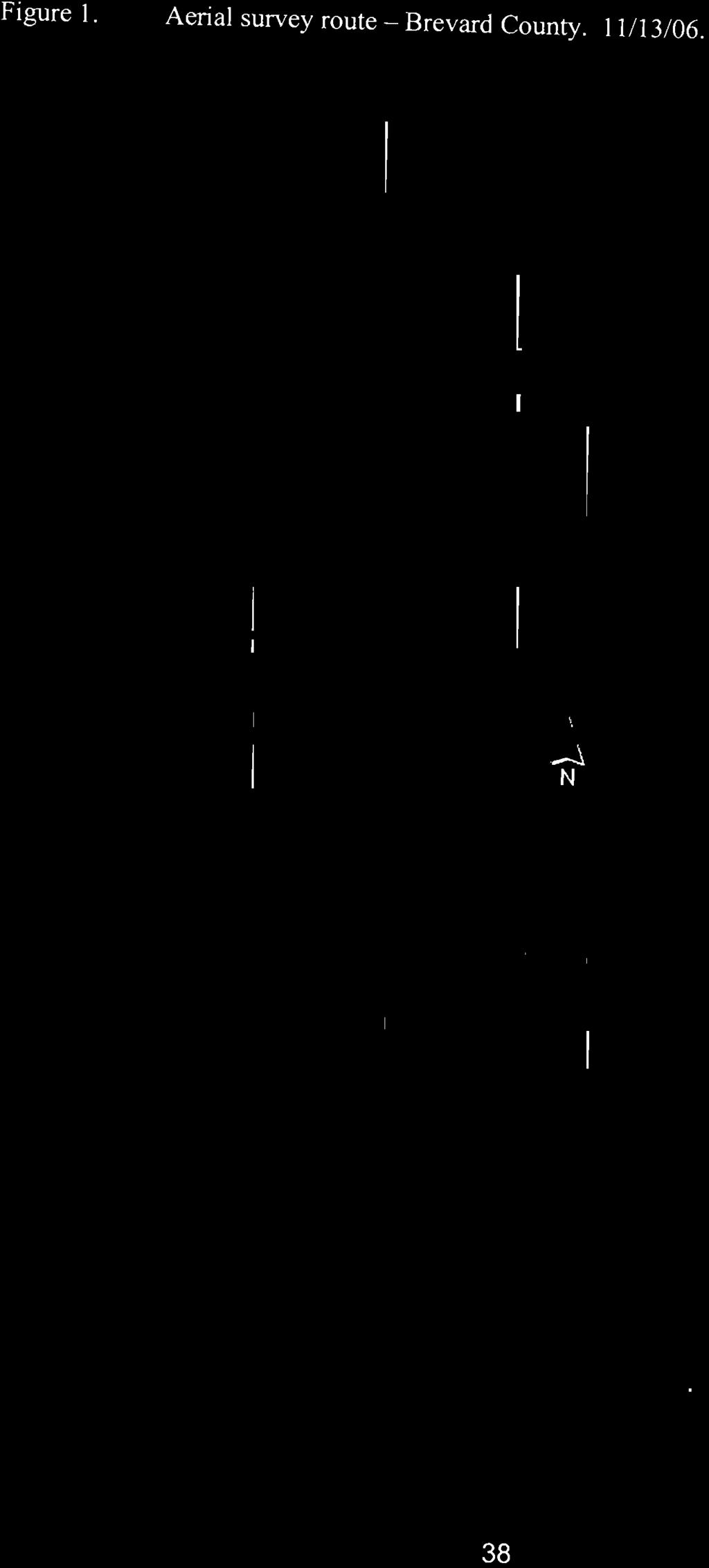
11 Figure 1. Aerial survey route - Brevard County /06. 38


12 Figure 1. Aerial survey route - Duval, St. Johns, and Flagler Counties. 8/14/07. Flagler Beach 39
13 - Table 2. Brevard County Boat Traffic Study project matrix. BREVARD COUNTY S w_ Dat --- 4/1/06 4/2/06 6/3/06 7/30/06 9/21/06 10/14/06 11/13/06 12/ /07 2/11/07 3/7107 Weekday I Weekend WE WE WE WE WD WE WD WE WD WE WD Survey Start Time Data Collection X X X X X X X X X X X Data Transfer X X X X X X X X X X X GIS Mapping X X X X X X X X X X X Quality Assurance X X X X X X X X X Number Of Boats S - ~-- Dat - 3/31/07 ~--- 4/26/07 5/12/07 5/22/07 5/27/07 6/11/07 7/14/07 8/12/07 8/14/07 8/28/07 9/8107 Weekday I Weekend WE WD WE WD WE WD WE WE WD WD WE Survey Start Time Data Collection X X X X X X X X X X X Data Transfer X X X X X X X X X X X GIS Mapping X X X X X X X X X X X Quality Assurance X X X X X X X X X X X Number Of Boats X - completed 40


14 -- 3/22/08 Table 3. SUohns / Flagler County Study project matrix ST JOHNS I FLAGLER COUNTY /12/07 8/14/07 9/22/07 9/22/07 10/10/07 10/10/07 12/ /1/ /08 1/ /2/ Weekday t Weekend WE WD WE WE WD WD WE WE WD WD WE Survey Start Time Data Collection X X X X X X X X X X X Data Transfer X X X X X X X X X X X GIS Mapping X X X X X X X X QAtQC Number Of Boats TBD TBD 293 TBD S Oat - ~ 4/1108 4/12/08 5/212008* 6/8/2008* FY 09 FY09 FY09 FY09 FY09 FY09 Weekday t Weekend WE WD WE WD WE Survey Start Time TBD TBD Data Collection X X X Data Transfer X X X GIS Mapping X X QAtQC Number Of Boats TBD TBD TBD * - scheduled survey date note - vessel counts are subject to change pending final QA t QC checks. 41
15 Appendix A. Metadata for Brevard County boat traffic aerial surveys /1106 j gorzy@mote.org GIS mapping complete; QA verification pending Jessica Atwell observer 1 videographer method 750 ft 501 This survey is considered reconnaissance and not part of the [mal dataset /2/06 i gorzy@mote.org GIS mapping complete; QA verification pending Jessica Atwell observer 1 videographer method 750 ft 435 This survey is considered reconnaissance and not part of the final dataset. 42
16 Appendix A (Continued) /3/06 j gorzy@mote.org GIS mapping complete; QA verification complete Jessica Atwell observer / videographer method 750 ft /30/06 j gorzy@mote.org GIS mapping complete; QA verification pending Jessica Atwell observer / videographer method 750 ft
17 Appendix A (Continued) /30106 j gorzv@mote.org GIS mapping complete; QA verification pending observer 1 videographer method 750 ft /14/06 j gorzv@mote.org GIS mapping complete; QA verification pending Jessica Atwell observer 1 videographer method 750 ft
18 Appendix A (Continued) /06 i gorzy@mote.org GIS mapping complete; QA verification complete observer 1 videographer method 750 ft /17/06 i gorzy@mote.org GIS mapping complete; QA verification complete Jessica Atwell observer 1 videographer method 750 ft
19 Appendix A (Continued) /26/07 jgorzy@mote.org GIS mapping complete; QA verification complete observer 1 videographer method 750 ft /11/07 Jay Gorze1any j gorzy@mote.org GIS mapping complete; QA verification complete Jessica Atwell observer 1 videographer method 750 ft
20 Appendix A (Continued) /07/07 j gorzy@mote.org GIS mapping complete; QA verification pending observer 1 videographer method 750 ft /31107 jgorzv@mote.org GIS mapping in progress, QA verification pending Jessica Atwell observer 1 videographer method 750 ft
21 Appendix A (Continued) /26/07 jgorzy@mote.org GIS mapping pending observer / videographer method 750 ft /13/07 j gorzy@mote.org GIS mapping in progress, QA verification complete observer / videographer method
22 Appendix A (Continued) /22/07 jgorzy@mote.org GIS mapping in progress, QA verification complete observer 1 videographer method /27/07 jgorzy@mote.org GIS mapping in progress, QA verification complete observer 1 videographer method
23 Appendix A (Continued) /11/07 i gorzy@mote.org GIS mapping in progress, QA verification complete observer 1 videographer method /14/07 i gorzv@mote.org GIS mapping in progress, QA verification complete observer 1 videographer method 644 survey route modified near MLB (weather issues) but all areas successfully surveyed 50
24 Appendix A (Continued) /12/07 j gorzy@mote.org GIS mapping in progress, QA verification complete observer 1 videographer method /14/07 jgorzy@mote.org GIS mapping in progress, QA verification complete observer 1 videographer method
25 Appendix A (Continued) /28/07 j gorzy@mote.org GIS mapping in progress, QA verification complete observer / videographer method 162 survey route modified near Patrick AFB (skydiving), but all areas successfully surveyed /8/07 j gorzy@mote.org GIS mapping in progress, QA verification complete observer / videographer method
26 Appendix B. Metadata for St Johns / Flagler County boat traffic aerial surveys. SURVEY START: St Johns 1 Flagler County Boat Traffic Aerial Survey 811 2/07 i gorzy@mote.org GIS mapping complete, QA verification pending 1332hrs observer 1 videographer method 497 south > north survey route SURVEY START: St Johns 1 Flagler County Boat Traffic Aerial Survey 8114/07 i gorzy@mote.org GIS mapping complete, QA verification pending 0955hrs observer 1 videographer method 142 north > south; area near Mayport could not be surveyed due to flight restrictions 53
27 Appendix B (Continued). SURVEY START: St Johns 1 Flagler County Boat Traffic Aerial Survey 9/22/07 j gorzy@mote.org archive - only 0957hrs observer 1 videographer method TBD south > north; archive-only - not digitized SURVEY START: St Johns 1 Flagler County Boat Traffic Aerial Survey 9/22/07 jgorzy@mote.org GIS mapping complete, QA verification pending 1244hrs observer 1 videographer method 305 north > south survey route 54
28 Appendix B (Continued). SURVEY START: St Johns I Flagler County Boat Traffic Aerial Survey 10/10107 j gorzy@mote.org GIS mapping complete, QA verification pending 1014hrs observer I videographer method 107 south > north survey route SURVEY START: St Johns I Flagler County Boat Traffic Aerial Survey 10/ j gorzv@mote.org archive only 1244hrs observer I videographer method TBD north > south: archive-only - not digitized 55
29 Appendix B (Continued). SURVEY START: St Johns 1 Flagler County Boat Traffic Aerial Survey 12/01 /07 j gorzv@mote.org GIS mapping complete, QA verification pending 1056hrs observer 1 videographer method 293 south > north survey route SURVEY START: St Johns 1 Flagler County Boat Traffic Aerial Survey 12/01107 j gorzy@mote.org archive only 1244hrs observer 1 videographer method TBD north > south: archive-only - not digitized 56
30 Appendix B (Continued). SURVEY START: St Johns 1 Flagler County Boat Traffic Aerial Survey j gorzv@mote.org GIS mapping complete, QA verification pending 0957hrs observer 1 videographer method 106 south > north survey route SURVEY START: St Johns 1 Flagler County Boat Traffic Aerial Survey 01 /31108 Jay Gorze1any j gorzv@mote.org GIS mapping complete, QA verification pending 1242hrs observer / videographer method 94 south > north survey route 57
31 Appendix B (Continued). SURVEY START: St Johns 1 Flagler County Boat Traffic Aerial Survey 03/02/08 j gorzy@mote.org GIS mapping complete, QA verification pending 1039hrs observer 1 videographer method 371 south> north survey route SURVEY START: St Johns 1 Flagler County Boat Traffic Aerial Survey 03/22/08 j gorzy@mote.org GIS mapping complete, QA verification pending 0952hrs observer 1 videographer method 339 north> south survey route 58
32 Appendix B (Continued). SURVEY START: St Johns 1 Flagler County Boat Traffic Aerial Survey 04/01108 j gorzv@mote.org GIS mapping complete, QA verification pending 1039hrs observer 1 videographer method 194 south > north survey route SURVEY START: St Johns 1 Flagler County Boat Traffic Aerial Survey 04/12/08 j gorzy@mote.org GIS mapping underway, QA verification pending 0952hrs observer 1 videographer method TBD south > north survey route 59
Aerial Surveys Of Recreational Boating Activity In Collier County
 Aerial Surveys Of Recreational Boating Activity In Collier County Final Report Submitted To: Collier County Environmental Services Department 2800 North Horseshoe Drive Naples, FL 34104 Submitted By: Jay
A CHARACTERIZATION OF BOAT TRAFFIC IN TERRA CEIA BAY, FLORIDA
 A CHARACTERIZATION OF BOAT TRAFFIC IN TERRA CEIA BAY, FLORIDA FLORIDA FISH AND WILDLIFE CONSERVATION COMMISSION CONTRACT FINAL REPORT Submitted to: Dr. Elsa M. Haubold Florida Fish and Wildlife Conservation
A Characterization of Recreational Boating Activity And Boater Compliance with Posted Speed Zones in Palm Beach County
 A Characterization of Recreational Boating Activity And Boater Compliance with Posted Speed Zones in Palm Beach County Final Report Submitted To: Paul Davis Palm Beach County Department of Environmental
BOATING ACCIDENTS STATISTICAL REPORT
 BOATING ACCIDENTS STATISTICAL REPORT Cover Photos: (Courtesy of FWC) Officers working on boating accident investigations. BOATING ACCIDENTS STATISTICAL REPORT Violation Summary photo detail Top picture
Enhanced Manatee Protection Study
 Enhanced Manatee Protection Study Florida Fish & Wildlife Conservation Commission Final Report February 1, 2007 FLORIDA FISH AND WILDLIFE CONSERVATION COMMISSION 1-888-404-FWCC (3922) To report fish and
Violation Summary photo detail Top picture
 Violation Summary photo detail Top picture On April,, a single vessel crash occurred on Lake Maitland. The vessel, a jet boat was occupied by eight people. The group boarded the vessel at a lake front
Survey of Recreational Boater Safety in Ohio During 1999
 Survey of Recreational Boater Safety in Ohio During 1999 Leroy J. Hushak The Ohio State University Ohio Sea Grant College Program Technical Summary Series Publication OSHU-TS-030 2000 Ohio Sea Grant College
RESEARCH Massachusetts Recreational Boater Survey. Project Summary
 Coastal and Marine Spatial Planning RESEARCH Project Summary 2010 Massachusetts Recreational Boater Survey The 2010 Massachusetts Recreational Boater Survey gathered spatial and economic data relating
Archival copy: for current recommendations see or your local extension office.
 This is a publication of the Florida Sea Grant College Program, supported by the National Sea Grant College Program of the United States Department of Commerce, National Oceanic and Atmospheric Administration
Inlet Specific and Seasonal Variation in Vessel Use Patterns: The case of the Northeast Florida Region
 Inlet Specific and Seasonal Variation in Vessel Use Patterns: The case of the Northeast Florida Region Nancy Montes Robert Swett University of Florida Automatic Identification System (AIS) Ships 300 or
A publication of the University of Florida Sea Grant Program (project numbers and ). The project was funded by Bay County through
. The project was funded by Bay County through") A publication of the University of Florida Sea Grant Program (project numbers 00067209 and 00069999). The project was funded by Bay County through the University of Florida Bay County Extension Program;
A publication of the University of Florida Sea Grant Program (project numbers 00067209 and 00069999). The project was funded by Bay County through the University of Florida Bay County Extension Program;
Susitna-Watana Hydroelectric Project Document ARLIS Uniform Cover Page
 Alaska Resources Library & Information Services Document ARLIS Uniform Cover Page Title: Wildlife harvest analysis study, Study plan Section 10.20 : Final study plan SuWa 200 Author(s) Personal: Author(s)
Twin Cities Life-Jacket Wear-Rate Observational Study, 2007
 Twin Cities Life-Jacket Wear-Rate Observational Study, 2007 Minnesota Department of Natural Resources July 2008 Twin Cities Life-Jacket Wear-Rate Observational Study, 2007 Twin Cities Metro Lake Region
Inflatable Pontoons Listing ID:
 Australia - Great Britain - Indonesia - New Zealand - Philippines - Thailand - USA E: sales@seaboats.net (sales) - E: admin@seaboats.net (accounts) Inflatable Pontoons Listing ID: 427303 DESCRIPTION: AiroDock
Recreational Fishing License Sales in Florida:
 Recreational Fishing License Sales in Florida: 1990-2000 1 Kristina Stephan and Chuck Adams 2 Introduction The recreational fishing industry is an important natural resource-based industry in Florida.
FILED 11/28/ :27 AM ARCHIVES DIVISION SECRETARY OF STATE
 OFFICE OF THE SECRETARY OF STATE DENNIS RICHARDSON SECRETARY OF STATE LESLIE CUMMINGS DEPUTY SECRETARY OF STATE ARCHIVES DIVISION MARY BETH HERKERT DIRECTOR 800 SUMMER STREET NE SALEM, OR 97310 503-373-0701
Palm Beach County Vessel Traffic Study
 Palm Beach County Vessel Traffic Study Prepared for: Florida Fish and Wildlife Conservation Commission Division of Law Enforcement, Boating and Waterways Section Prepared by: 7406 Fullerton Street Suite
Reportable Boating Accidents photo detail
 Reportable Boating Accidents photo detail Cover Photo: (Courtesy of FWC) On January 0, 2016, at approximately 7:15 am, a 7 open motorboat was travelling east cruising at approximately 25 mph with a total
SARASOTA BAY ESTUARY PROGRAM OYSTER HABITAT MONITORING RESULTS: YEAR 1. Jay R. Leverone
 SARASOTA BAY ESTUARY PROGRAM OYSTER HABITAT MONITORING RESULTS: YEAR 1 by Jay R. Leverone Mote Marine Laboratory 1600 Ken Thompson Parkway Sarasota, Fl 34236 to Gary Raulerson Sarasota Bay Estuary Program
Lake Lure and the Town of Lake
 Lake Safety Boating Safety at Lake Lure Barbara Wiggins, Ken Wagner and Clint Calhoun Lake Lure Lake Management and Boating Regulations to Protect Community Enjoyment of the Lake Safety Issues at Lake
ICOMIA Global Conformity Guideline for ISO and ABYC Standards. Guideline Number 7 ISO Builder s Plate/US Boat capacity labels
 ICOMIA Global Conformity Guideline for ISO and ABYC Standards sponsored by ABYC, BMF, ICOMIA, IMCI, and NMMA Guideline Number 7 ISO Builder s Plate/US Boat capacity labels 1. PURPOSE These documents were
VESSEL REGISTRATION # P.O. BOX Rev. 09/10 BATON ROUGE, LA OPERATOR BOATING INCIDENT REPORT PAGE 1 of
 LOUISIANA DEPARTMENT OF WILDLIFE AND FISHERIES LAW ENFORCEMENT DIVISION DWF-BIR-010-OP VESSEL REGISTRATION # P.O. BOX 98000 Rev. 09/10 BATON ROUGE, LA 70898-9000 OPERATOR BOATING INCIDENT REPORT PAGE 1
CUSTOMS TARIFF - SCHEDULE 89 - i
 CUSTOMS TARIFF - SCHEDULE 89 - i Chapter 89 SHIPS, BOATS AND FLOATING STRUCTURES Note. 1. A hull, an unfinished or incomplete vessel, assembled, unassembled or disassembled, or a complete vessel unassembled
RESIDENTS AND USERS SPEAK
 Planning for Waterway Access in Taylor County, Florida: RESIDENTS AND USERS SPEAK TP - 177 Science Serving Florida s Coast Florida Sea Grant College Program PO Box 110409 University of Florida Gainseville,
EVALUATION OF BOATER COMPLIANCE WITH SPEED REGULATIONS IN SARASOTA COUNTY, FLORIDA. Final Report
 EVALUATION OF BOATER COMPLIANCE WITH SPEED REGULATIONS IN SARASOTA COUNTY, FLORIDA Final Report Submitted To: The Florida Department of Environmental Protection Bureau of Protected Species The West Coast
NAUTICAL TERMINOLOGY
 It s important to have a basic understanding of common nautical terms associated with the parts, positions and directions of your vessel. Knowing these terms will make it easier to communicate with people
Distribution of the Atlantic Bottlenose Dolphin (Tursiops truncatus) in the Chesapeake Bay Drainage in Virginia
 in the Chesapeake Bay Drainage in Virginia") Banisteria, Number 11, 1998 33 1998 by the Virginia Natural History Society Distribution of the Atlantic Bottlenose Dolphin (Tursiops truncatus) in the Chesapeake Bay Drainage in Virginia Thomas F. Wilcox
Banisteria, Number 11, 1998 33 1998 by the Virginia Natural History Society Distribution of the Atlantic Bottlenose Dolphin (Tursiops truncatus) in the Chesapeake Bay Drainage in Virginia Thomas F. Wilcox
Assessment of participation and resource impact of shrimp baiting in coastal South Caroling during Dale Theiling SEDAR-PW6-RD36.
 Assessment of participation and resource impact of shrimp baiting in coastal South Caroling during 1987 Dale Theiling SEDAR-PW6-RD36 6 June 2014 interviewer was assigned to the County-Colleton
MEMORANDUM. Existing Operations. City of Clearwater. Michael Herrman. Date: January 26, Seminole Boat Launch Overview. M&N Job No.
 1509 W. Swann Avenue, Suite 225 Tampa, FL 33606 (813) 258-8818 Fax (813) 258-8525 www.moffattnichol.com MEMORANDUM To: From: City of Clearwater Michael Herrman Date: Subject: Seminole Boat Launch Overview
NOTICE OF REGATTA 2015 U.S.
 NOTICE OF REGATTA 2015 U.S. Corsair Trimaran Rendezvous and National Championship April 28 - May 3, 2015 Organizing Authority and Host: Pensacola Yacht Club, Pensacola, Florida 1. RULES 1.1 The regatta
Economic Impact of the Recreational Marine Industry Broward, Miami-Dade, and Palm Beach Counties, Florida
 Economic Impact of the Recreational Marine Industry Broward, Miami-Dade, and Palm Beach Counties, Florida - 2018 Completed by THOMAS J. MURRAY & ASSOCIATES, INC. For MARINE INDUSTRIES ASSOCIATION OF SOUTH
This publication was supported by the National Sea Grant College Program of the U.S. Department of Commerce s National Oceanic and Atmospheric
 This publication was supported by the National Sea Grant College Program of the U.S. Department of Commerce s National Oceanic and Atmospheric Administration (NOAA), Grant No. NA16RG-2195; the Florida
Survey of New Jersey s Recreational Blue Crab Fishery in Delaware Bay
 Survey of New Jersey s Recreational Blue Crab Fishery in Delaware Bay By Brandon W. Muffley* New Jersey Division of Fish & Wildlife Marine Fisheries Administration & Lynette Lurig New Jersey Division of
America s Cup 36, Auckland 2021 Marine Traffic Survey
 Report America s Cup 36, Auckland 2021 Marine Traffic Survey for Resource Consent Application, Wynyard Basin Prepared for Panuku Development Auckland (Client) Prepared by Beca Ltd (Beca) January 2018 Revision
CUSTOMS TARIFF - SCHEDULE 89 - i
 CUSTOMS TARIFF - SCHEDULE 89 - i Chapter 89 SHIPS, BOATS AND FLOATING STRUCTURES Note. 1. A hull, an unfinished or incomplete vessel, assembled, unassembled or disassembled, or a complete vessel unassembled
Helicopter Safety Recommendation Summary for Small Operators
 Helicopter Safety Recommendation Summary for Small Operators Prepared by the International Helicopter Safety Team September 2009 Introduction This document is intended to provide a summary of the initial
Marine Recreational and Commercial Industries and Activities in Lee and Charlotte Counties: Economic Consequences and Impacts
 Marine Recreational and Commercial Industries and Activities in Lee and Charlotte Counties: Economic Consequences and Impacts Betty Staugler Florida Sea Grant Extension Marine Agent & Chuck Adams Florida
New Requirements for Commercial Fishing Industry Vessels Section 604 Coast Guard Authorization Act of 2010 (Public Law )
") New Requirements for Commercial Fishing Industry Vessels Section 604 Coast Guard Authorization Act of 2010 (Public Law 111-281) On October 15, 2010, the President signed the law that included provisions
New Requirements for Commercial Fishing Industry Vessels Section 604 Coast Guard Authorization Act of 2010 (Public Law 111-281) On October 15, 2010, the President signed the law that included provisions
2002 National Recreational Boating Survey Technical Report
 2002 Technical Report November 30, 2003 995 Goodale Blvd. Columbus, OH 43212 Voice: (614) 220-8860 Fax: (614) 220-8845 Toll Free Number: (800) 341-3660 Website: www.strategicresearchgroup.com TABLE OF
Page 1. CALL MEETING TO ORDER 2. DISCUSSION ITEMS
 1. CALL MEETING TO ORDER 2. DISCUSSION ITEMS CAROLINA BEACH Town Council Workshop Meeting Agenda Tuesday, July 25, 2017 @ 9:00 AM Council Chambers 1121 N. Lake Park Boulevard Carolina Beach, NC 28428 a.
Determining coral reef impacts associated with boat anchoring and user activity
 Determining coral reef impacts associated with boat anchoring and user activity Protect Our Reefs Grant Interim Report October 1, 2008 March 31, 2009 Donald C. Behringer 1, Thomas K. Frazer 1, Robert A.
Ryan Roche. Mossaline Madkins. Josh Young. Christopher Cervantes. Andrew Anstaett. Monica Ng TECM 2700
 Boating Ryan Roche Mossaline Madkins Josh Young Christopher Cervantes Andrew Anstaett Monica Ng TECM 2700 November 28, 2012 Table of Contents Table of Contents... 3 Types of Boats... 5 Inboard Boats...
2014 Life Jacket Wear Rate Observation Study featuring National Wear Rate Data from 1999 to 2014
 2014 Life Jacket Wear Rate Observation Study featuring National Wear Rate Data from 1999 to 2014 Produced under a grant from the Sport Fish Restoration and Boating Trust Fund, administered by the U.S.
Thomas W. Mangione Heather E. Lisinski Molly Higgins-Biddle Wendy Chow Mihaly Imre
 2008 Life Jacket Wear Rate Observation Study featuring ational Wear Rate Data from 1998 to 2008 & An Evaluation of the California Delta s Wear It! Campaign from 2006 to 2008 Thomas W. Mangione Heather
HARBOR INFRASTRUCTURE INVENTORIES Lexington Harbor, Michigan
 HARBOR INFRASTRUCTURE INVENTORIES Lexington Harbor, Michigan Harbor Location: Lexington Harbor is located on the west shore of Lake Huron about 20 miles north of Port Huron, MI. Authority: Rivers & Harbors
Overview of Florida s Cooperative East Coast Red Snapper Tagging Program, SEDAR41-DW10. Submitted: 1 August 2014
 Overview of Florida s Cooperative East Coast Red Snapper Tagging Program, 2011-2013 Russell B. Brodie, Justin J. Solomon, Richard Paperno, Theodore S. Switzer, Cameron B. Guenther, and Beverly Sauls SEDAR41-DW10
Boating Safety Account Continuation Review
 Boating Safety Account Continuation Review House Appropriations Committee on Agriculture and Natural and Economic Resources May 3rd, 2016 Ashton Godwin Legislative Liaison Mission The conserves North Carolina
PINECREST LAKE SHORELINE MANAGEMENT PLAN Draft April 3, 2012
 !"#$%&'()!(*#%$+"$', TALKING POINTS PINECREST LAKE SHORELINE MANAGEMENT PLAN Draft April 3, 2012 Friends of Pinecrest has reviewed the Shoreline Management Plan developed by PG&E for the Forest Service,
Beautiful Cruising Ketch - Oceans 71 Listing ID:
 Australia - Great Britain - Indonesia - New Zealand - Philippines - Thailand - USA E: sales@seaboats.net (sales) - E: admin@seaboats.net (accounts) Beautiful Cruising Ketch - Oceans 71 Listing ID: 678776
Phase II Final Report Port Canaveral Lionfish Project
 Phase II Final Report Port Canaveral Lionfish Project Contract PO # P14685 Report prepared for Carol Noble Director, Environmental Plans and Programs Canaveral Port Authority Suite 301 445 Challenger Road
Transpacific Corsican 46
 Australia - Chile - Indonesia - Great Britain - New Zealand - Panama - Philippines - South Korea - Thailand - USA E: sales@seaboats.net (sales) - E: admin@seaboats.net (accounts) 1991 Transpacific Corsican
2 Boating Rules and Regulations... 73
 Contents at a Glance Chapter 1 Boat Design and Construction Chapter 2 Boating Rules and Regulations Chapter 3 Navigation Rules (ColRegs) Chapter 4 Boat Operating and Seamanship Chapter 5 Piloting and Navigation
AUSTRALIAN BUILDERS PLATE Frequently Asked Questions General Public
 AUSTRALIAN BUILDERS PLATE Frequently Asked Questions General Public The ABP and the law 1. Is the ABP required by law? All Australian States apply the National Standard for the Australian Builders Plate
Issues facing this region include the status of the Sluice Creek tide gates, various tidal wetlands, and locations of public access:
 5.6 Guilford Point to Madison Town Line Existing Resources This region extends from Guilford Point to the Madison town line. Named places include Grass Island and the East River. Residential, commercial,
FWC DEER HARVEST SURVEY: FINAL REPORT
 FWC 2010-2011 DEER HARVEST SURVEY: FINAL REPORT Prepared for: FLORIDA FISH AND WILDLIFE CONSERVATION COMMISSION Prepared by: THE RESEARCH STAFF DRAFT REPORT 1.1 October 11, 2011 TABLE OF CONTENTS INTRODUCTION...
TESTIMONY OF THOMAS O KEEFE, PhD PACIFIC NORTHWEST STEWARDSHIP DIRECTOR ON BEHALF OF AMERICAN WHITEWATER
 TESTIMONY OF THOMAS O KEEFE, PhD PACIFIC NORTHWEST STEWARDSHIP DIRECTOR ON BEHALF OF AMERICAN WHITEWATER OREGON STATE HOUSE House Committee on Transportation Policy Representative Caddy McKeown, Chair
CITY MANUALS AND STANDARDS REVIEW
 GEORGETOWN SIDEWALK MASTER PLAN CITY MANUALS AND STANDARDS REVIEW RESOURCES AND STANDARDS As part of the Master Plan process, a review and evaluation of current City documents and policies relevant to
Enhanced Discussion of Requirements for Commercial Fishing Vessels
 Update on U.S. Commercial Fishing Industry Vessel Requirements Based On Section 604 of the Coast Guard Authorization Act of 2010 (Public Law 111-281) And Section 305 of the Coast Guard and Maritime Transportation
Investigation of Submarine Springs and other Karst Features in Coastal Regions of the SWFWMD
 Investigation of Submarine Springs and other Karst Features in Coastal Regions of the SWFWMD by David J. DeWitt, P.G. Southwest Florida Water Management District January 2004 FDEP Q- Meeting Clearwater
Appendix H Recreation and Tourism (Chapter 8) Contents. List of Tables
 Contents. List of Tables") Appendix H Recreation and Tourism (Chapter 8) Contents Trends Data... H-2 CA DMV records... H-2 CA DFG Hunting/Fishing Licenses... H-2 USDA Agricultural Tourism... H-4 United States Forest Service... H-6
Appendix H Recreation and Tourism (Chapter 8) Contents Trends Data... H-2 CA DMV records... H-2 CA DFG Hunting/Fishing Licenses... H-2 USDA Agricultural Tourism... H-4 United States Forest Service... H-6
REPORT SUBMISSION ACCIDENT SUMMARY
 Arizona Boating Accident and Casualty Report NOTE: The operator or owner of every watercraft involved in a collision, accident or other casualty involving property damage exceeding $500 shall submit a
2010 Wildlife Management Unit 501 moose and deer
 2010 Wildlife Management Unit 501 moose and deer Section Authors: Barb Maile and Velma Hudson Suggested Citation: Maile, B., and V. Hudson. 2010. Wildlife Management Unit 501 moose and deer. Pages 73 77.
OFFSHORE PATROL VESSEL OPERATIONS
 Florida Fish and Wildlife Conservation Commission Division of Law Enforcement OFFSHORE PTROL VESSEL OPERTIONS GENERL ORDER EFFECTIVE DTE RESCINDS/MENDS PPLICBILITY 30 May 7, 2018 July 21, 2008 ll Sworn
Nancy Montes Robert Swett Charles Sidman Tim Fik
 Nancy Montes Robert Swett Charles Sidman Tim Fik A publication of the University of Florida Sea Grant Program. The project was funded by the Southeast Regional Office NOAA Fisheries Services pursuant to
Socioeconomic Profile and Spatial Analysis of Fisheries in the three central California National Marine Sanctuaries
 Socioeconomic Profile and Spatial Analysis of Fisheries in the three central California National Marine Sanctuaries Overview and Assessment of CDFG Fisheries Data for use in the Joint Management Plan Review
Hidden Lake Rules. e) Open Water Zone: the entire water surface of Hidden Lake, except the No-Wake Zone and the Sail/Ski Zone.
 Open Water Zone: the entire water surface of Hidden Lake, except the No-Wake Zone and the Sail/Ski Zone.") Hidden Lake Rules Definitions: a) Hidden Lake: the water surface of Mayham Reservoir as defined in that certain Cross License Agreement, dated January 9, 2004, among North Hidden Lake Owners Association,
Hidden Lake Rules Definitions: a) Hidden Lake: the water surface of Mayham Reservoir as defined in that certain Cross License Agreement, dated January 9, 2004, among North Hidden Lake Owners Association,
ARTICLE III. CERTAIN PUBLIC PLACES* DIVISION 1. GENERALLY DIVISION 2. MUNICIPAL YACHT BASIN DIVISION 3. MANAGED MOORING FIELD
 ARTICLE III. CERTAIN PUBLIC PLACES* *Cross References: Parks and recreation, Ch. 14. Secs. 17-56--17-65. Reserved. DIVISION 1. GENERALLY DIVISION 2. MUNICIPAL YACHT BASIN Sec. 17-66. Mooring. It shall
ALMA Status Update. October ALMA Doc 1.17, ver. 1.1 October 02, 2013
 ALMA Doc 1.17, ver. 1.1 October 02, 2013 ALMA Status Update October 2013 ALMA, an international astronomy facility, is a partnership of Europe, North America and East Asia in cooperation with the Republic
HARBOR INFRASTRUCTURE INVENTORIES Marquette Harbor, Michigan
 HARBOR INFRASTRUCTURE INVENTORIES Marquette Harbor, Michigan Harbor Location: Marquette Harbor is located in Marquette Bay on the south shore of Lake Superior, 160 miles west of Sault Ste. Marie, MI and
Task 16: Impact on Lummi Cultural Properties
 Gateway Pacific Terminal Vessel Traffic and Risk Assessment Study Task 16: Impact on Lummi Cultural Properties Prepared for Pacific International Terminals, Inc. Prepared by The Glosten Associates, Inc.
The LA/LB Harbors handle more than 5,500 commercial vessel arrivals per year (excluding local coastwise and Catalina Island traffic).
.") X. SMALL CRAFT For the purpose of the Los Angeles and Long Beach Harbor Safety Plan, pleasure vessels, commercial fishing vessels and sportfishing boats are designated as small craft. A. BACKGROUND: The
X. SMALL CRAFT For the purpose of the Los Angeles and Long Beach Harbor Safety Plan, pleasure vessels, commercial fishing vessels and sportfishing boats are designated as small craft. A. BACKGROUND: The
Marine Debris from Land to Sea: Holistic Characterization, Reduction and Education Efforts in New Hampshire
 Marine Debris from Land to Sea: Holistic Characterization, Reduction and Education Efforts in New Hampshire ABSTRACT Over time, the focus of marine debris research and work has shifted away from simply
Fifty Point Conservation Area 1479 Baseline Road Winona, Ontario L8E 5G4 Phone: Fax:
 Fifty Point Conservation Area 1479 Baseline Road Winona, Ontario L8E 5G4 Phone: 905-525-2187 Fax: 905-643-1668 Email: fiftypt@conservationhamilton.ca Entrance Before HST After HST Vehicle & Driver $8.85
Personal Watercraft Required Onboard Equipment, etc. for Virginia & North Carolina
 Personal Watercraft Required Onboard Equipment, etc. for Virginia & North Carolina February 19, 2013 ITEM VA PWCs NC PWCs REQUIRED Vessel Registration Req'd 1 Req'd 21 Registration Decal Req'd 2 Req'd
Long Beach Island Holgate Spit Little Egg Inlet Historical Evolution Introduction Longshore Transport Map, Survey and Photo Historic Sequence
 Appendix B Long Beach Island Holgate Spit Little Egg Inlet Historical Evolution Introduction The undeveloped southern end of Long Beach Island (LBI) is referred to as the Holgate spit as it adjoins the
10/20/2010 Version 3. Guidelines for Developing Non-motorized Boat Launches in Florida
 Guidelines for Developing Non-motorized Boat Launches in Florida 1 These guidelines were prepared by the Florida Fish and Wildlife Conservation Commission with input from a Non-motorized Boating (NMB)
SOUTH CAROLINA ELECTRIC & GAS COMPANY COLUMBIA, SOUTH CAROLINA
 SOUTH CAROLINA ELECTRIC & GAS COMPANY COLUMBIA, SOUTH CAROLINA SALUDA HYDROELECTRIC PROJECT (FERC NO. 516) BOATING DENSITY STUDY PLAN FINAL SEPTEMBER 2006 Prepared by: SOUTH CAROLINA ELECTRIC & GAS COMPANY
PWC CO OP AND KEY WEST ANGLERS USER CONFLICT RELIEF REQUEST
 PWC CO OP AND KEY WEST ANGLERS USER CONFLICT RELIEF REQUEST KEY WEST FISHING GUIDES, FISHERMEN AND LOWER KEYS PWC CO-OP TOUR OPERATORS The PWC CO-OP has reached out to work together with the Key West area
Good Mooring to You! Jensen Beach Mooring Field. Kathy Fitzpatrick, P.E. Coastal Engineer, Martin County
 Good Mooring to You! Kathy Fitzpatrick, P.E. Coastal Engineer, Martin County Penny Cutt Regional Manager, Coastal Systems International Mooring Field Advantages Provide a safe and secure anchorage at a
2017 Life Jacket Wear Rate Observation Study featuring National Wear Rate Data from 1999 to 2017
 2017 Life Jacket Wear Rate Observation Study featuring National Wear Rate Data from 1999 to 2017 Produced under a grant from the Sport Fish Restoration and Boating Trust Fund, administered by the U.S.
2008 WMU 106 mule deer
 2008 WMU 106 mule deer Section Authors: Mike Grue and Kim Morton Suggested citation: Grue, M. and K. Morton. 2009. WMU 106 mule deer. Pages 50 54. In: N. Webb and R. Anderson. Delegated aerial ungulate
VESSEL INCIDENT REPORT (Reporting procedures required by NSW Marine Legislation)
") VESSEL INCIDENT REPORT (Reporting procedures required by NSW Marine Legislation) To assist in completing this form, please refer to the Explanatory Notes at the end of this document. For further information
VESSEL INCIDENT REPORT (Reporting procedures required by NSW Marine Legislation) To assist in completing this form, please refer to the Explanatory Notes at the end of this document. For further information
SouthEast Alaska Sailing P. O. Box Douglas, Alaska
 2015 Spirit of Admiralty Specific Sailing Instruction These Specific Sailing Instructions are to be read together with the General Sailing Instructions for (SEAS). In case of conflict, these Specific Sailing
Unless otherwise noted, images throughout the presentation are by FWC.
 This presentation provides a summary of a series of proposed final rules intended to address management of the shore-based shark fishery and shark-related cleanup of existing Florida Fish and Wildlife
Budget Presentation Joint Committee on Ways and Means. Scott Brewen Director
 2015-2017 Budget Presentation Joint Committee on Ways and Means Scott Brewen Director Mission To serve the recreational boating public through education, enforcement, access and environmental stewardship
2016 Boating Officer of the Year Boating Educator of the Year
 2016 Boating Officer of the Year Officer Jarrod Molnar was selected as the Florida Boating Officer of the Year. He has worked with the FWC for five years and is assigned to Okaloosa County. In 2015, Officer
Appendix G Whitewater Recreation Flow Study Plan
 Appendix G Whitewater Recreation Flow Study Plan Study Plan Whitewater Recreation Flow Study Grandfather Falls Hydroelectric Project FERC Project No. 1966 March 2013 An Integrys Energy Group Company Section
GLEN COVE YACHT CLUB, INC. RULES & REGULATIONS
 GLEN COVE YACHT CLUB, INC. RULES & REGULATIONS GLEN COVE YACHT CLUB, INC. RULES & REGULATIONS The Club Officers, and Trustees, and Officers of the Day have been empowered to enforce these Rules and Regulations.
HARBOR INFRASTRUCTURE INVENTORIES Fairport Harbor, OH
 HARBOR INFRASTRUCTURE INVENTORIES Fairport Harbor, OH Harbor Location: Fairport Harbor is located at the mouth of the Grand River on the southern shore of Lake Erie in the city of Fairport, OH, approximately
Nome Harbor Page 2 of 12
 Nome Harbor Nome Harbor Page 2 of 12 Condition of Improvements 30 December 2015 Nome Harbor, Alaska (CWIS No. 010422, 012270, 072742, 087755) Authorization (1) Rivers and Harbors Act, 8 August 1917 (House
Order Adopting Amendments. Title 58. Recreation Part II. Fish and Boat Commission Chapters 97, 109, 111 and 115 Boating. Preamble
 Order Adopting Amendments COMMONWEALTH OF PENNSYLVANIA PENNSYLVANIA FISH AND BOAT COMMISSION Title 58. Recreation Part II. Fish and Boat Commission Chapters 97, 109, 111 and 115 Boating Preamble The Fish
North Carolina Wildlife Resources Commission. Gordon Myers Executive Director North Carolina Wildlife Resources Commission
 Gordon Myers Executive Director North Carolina Wildlife Resources Commission Federal Funding Board Overview Areas of Focus Organizational Review Efforts Economic Impacts Federal Funds: Sport Fish & Wildlife
Fastest in the Forest Regatta Sunday, October 1, 2017 EFYCC Marina. Notice of Race
 1.0 RULES Fastest in the Forest Regatta Sunday, October 1, 2017 EFYCC Marina Epping Forest Yacht and Country Club 1830 Epping Forest Drive Jacksonville, Fl. 32217 Notice of Race The Regatta will be governed
Presented By: Cape Fear Commercial 1051 Military Cutoff Rd Suite 200 Wilmington, NC (p) (f)
 (f)") Presented By: Cape Fear Commercial 1051 Military Cutoff Rd Suite 200 Wilmington, NC 28405 (p) 910.344.1000 (f) 910.344.1020 PROPERTY OVERVIEW LOCATION: LEASE RATE 203 Alston Blvd. 28443 l Pender County
Presented By: Cape Fear Commercial 1051 Military Cutoff Rd Suite 200 Wilmington, NC 28405 (p) 910.344.1000 (f) 910.344.1020 PROPERTY OVERVIEW LOCATION: LEASE RATE 203 Alston Blvd. 28443 l Pender County
ICOMIA Global Conformity Guideline for ISO and ABYC Standards. Guideline Number 5 Powering
 ICOMIA Global Conformity Guideline for ISO and ABYC Standards sponsored by ABYC, BMF, ICOMIA, IMCI, and NMMA Guideline Number 5 Powering 1. PURPOSE These documents were created by an international working
Eelgrass Survey Reporting Form 2222 Channel Road Newport Beach, CA Eelgrass (Zostera marina) Survey
 Survey") Eelgrass Survey Reporting Form 2222 Channel Road Newport Beach, CA 92660 Eelgrass (Zostera marina) Survey Survey Date: July 19th, 2013 Report Date: July 26 th, 2013 Prepared by: Coastal Resources Management,
Eelgrass Survey Reporting Form 2222 Channel Road Newport Beach, CA 92660 Eelgrass (Zostera marina) Survey Survey Date: July 19th, 2013 Report Date: July 26 th, 2013 Prepared by: Coastal Resources Management,
Land Use Change on Non-Federal Land in Oregon and Washington
 Land Use Change on Non-Federal Land in Oregon and Washington 1974-2014 Presented at: Forest Inventory and Analysis Client Meeting Mt. Hood Community College, October 11, 2017 Background The Development
SAFETY OF NAVIGATION STANDARDS IN THE PORTS OF NAUTICAL TOURISM WITH A SPECIAL FOCUS ON THE MAINTENANCE OF THE PORT ORDER
 SAFETY OF NAVIGATION STANDARDS IN THE PORTS OF NAUTICAL TOURISM WITH A SPECIAL FOCUS ON THE MAINTENANCE OF THE PORT ORDER Ranka Petrinović, Ph. D, Full Professor Nikola Mandić, Ph. D, Assistant Professor
National Maritime Center
 National Maritime Center Providing Credentials to Mariners Q301 Rules of the Road-Inland (Sample Examination) Page 1 of 19 Choose the best answer to the following Multiple Choice Questions. NO reference
Recreational Boating Feasibility and Capacity Study
 TOURISTICS + Shoreplan Engineering Limited were retained by: Town of Oakville; City of Burlington; and Regional Municipality of Halton. Note: Throughout the presentation boat lengths are identified in