Chesapeake Bay. Sea - Seek. Ebook Sailing guide / Guide nautique. Chesapeake Bay. NW Atlantic Ocean - US - East coast
|
|
|
- Beatrice Hardy
- 5 years ago
- Views:
Transcription
1 Sea - Seek Ebook Sailing guide / Guide nautique NW Atlantic Ocean - US - East coast
2
3 Table of contents Anchorage Marina (Baltimore) Fairlee Creek Craighill Channel Craighill Channel Red Chester River Ent Queenstown Bay Bridge Annapolis Naval Academy Annapolis Gangplank Marina Alexandria City Marina National Harbor Marina (Potomac River) Belle Haven Marina Chesapeake-Bay-Herrington-Harbot Herrington Harbour South R Drum Point Lighthouse Solomons Island Windmill Point Marina Entrance Fishing bay Cape Charles Harbor Newport News Norfolk... 13
4 N W NW Atlantic Ocean - US - East coast - A Belle Haven Marina B Alexandria City Marina C Gangplank Marina D National Harbor Marina (Potomac River) E Anchorage Marina (Baltimore) F Chesapeake-Bay-Herrington-Harbot G Herrington Harbour South R2 H Annapolis Naval Academy J Annapolis K Drum Point Lighthouse L Solomons Island M Newport News N Craighill Channel O Craighill Channel Red P Bay Bridge Q Fishing bay Page:1


5 R Norfolk S Windmill Point Marina Entrance T Chester River Ent U Fairlee Creek V Queenstown W Cape Charles Harbor The is the largest estuary in the United States. It lies off the Atlantic Ocean, surrounded by Maryland and Virginia. The bay was once known for its great seafood production, especially blue crabs, clams and oysters. 1 - Anchorage Marina (Baltimore) N W NW Atlantic Ocean - US - East coast - Location Slips: 565 floating slips Entrance Navigation Provide details or delete N W 2 - Fairlee Creek NW Atlantic Ocean - US - East coast - Page:2

 and run close along the beach,")

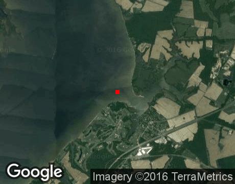
6 2009:09:05 21:39:16 Have called at Fairlee Creek often over 14 years in 5' draft sailboat, s/v Lastdance. It is well marked but can be intimidating as you enter the very narrow cut between the spit of land to starboard and the beach to port, especially if a boat is outbound and/or there are people swimming; be prepared for both. At Red marker "2F" steer southerly and follow the channel buoys almost right up to the shore then turn left (southwesterly) and run close along the beach, then turn sharply right (south-southwesterly) into the cut, minding what can be a very strong current that often sets boats aground in sand. Once inside, you'll find a well protected harbor with a lot of anchoring room and a marina with many deep draft sailboats etc. Photo was taken from marina tiki-bar on east side of the cut, looking north through the cut out onto N W 3 - Craighill Channel NW Atlantic Ocean - US - East coast - Page:3


7 - Your comments are welcome - If you would like to add your own report on a marina, harbour, beach or anchorage please click on the "Edit" tab above, delete this text and type your comments. Digital photos are also very welcome using the "photo" link in the left menu. - Regards - The Webmaster N W 4 - Craighill Channel Red NW Atlantic Ocean - US - East coast - - Your comments are welcome - If you would like to add your own report on a marina, harbour, beach or anchorage please click on the "Edit" tab above, delete this text and type your comments. Digital photos are also very welcome using the "photo" link in the left menu. - Regards - The Webmaster N W 5 - Chester River Ent NW Atlantic Ocean - US - East coast - Page:4


8 - Your comments are welcome - If you would like to add your own report on a marina, harbour, beach or anchorage please click on the "Edit" tab above, delete this text and type your comments. Digital photos are also very welcome using the "photo" link in the left menu. - Regards - The Webmaster N W 6 - Queenstown NW Atlantic Ocean - US - East coast - - Your comments are welcome - If you would like to add your own report on a marina, harbour, beach or anchorage please click on the "Edit" tab above, delete this text and type your comments. Digital photos are also very welcome using the "photo" link in the left menu. - Regards - The Webmaster N W 7 - Bay Bridge NW Atlantic Ocean - US - East coast - Page:5


9 - Your comments are welcome - If you would like to add your own report on a marina, harbour, beach or anchorage please click on the "Edit" tab above, delete this text and type your comments. Digital photos are also very welcome using the "photo" link in the left menu. - Regards - The Webmaster 8 - Annapolis Naval Academy N W NW Atlantic Ocean - US - East coast - Miami United States Naval Academy N W 9 - Annapolis NW Atlantic Ocean - US - East coast - Page:6


10 - Your comments are welcome - If you would like to add your own report on a marina, harbour, beach or anchorage please click on the "Edit" tab above, delete this text and type your comments. Digital photos are also very welcome using the "photo" link in the left menu. - Regards - The Webmaster N W 10 - Gangplank Marina NW Atlantic Ocean - US - East coast N W 11 - Alexandria City Marina NW Atlantic Ocean - US - East coast - Page:7


")

11 2014:04:09 17:32: :04:09 16:13:28 Small and nice harbor on the west side of the Potomac river National Harbor Marina (Potomac River) N W NW Atlantic Ocean - US - East coast - Page:8


12 Powwer Supply and water tap. 2014:04:06 10:05: :04:09 15:54:56 Small harbor close to the major Gaylord National Resort. 2014:04:09 18:04: :04:06 10:26: N W 13 - Belle Haven Marina NW Atlantic Ocean - US - East coast - Page:9


13 2014:04:06 09:58:35 Sailing school. Canoe / Kayak rental Chesapeake-Bay-Herrington-Harbot N W NW Atlantic Ocean - US - East coast Herrington Harbour South R N W NW Atlantic Ocean - US - East coast Drum Point Lighthouse N W NW Atlantic Ocean - US - East coast - Page:10


14 N W 17 - Solomons Island NW Atlantic Ocean - US - East coast - Small port. Petit port Windmill Point Marina Entrance N W NW Atlantic Ocean - US - East coast - Page:11


15 N W 19 - Fishing bay NW Atlantic Ocean - US - East coast :07:05 12:42:07 Fishing bay est un excellent mouillage par 5 mètres de fond. Il est possible de mettre le bateau au sec à Chesapeake boat works marina à un prix particulièrement intéressant N W 20 - Cape Charles Harbor NW Atlantic Ocean - US - East coast - Page:12


16 Small port. Petit port côtier N W 21 - Newport News NW Atlantic Ocean - US - East coast - Harbor. Port de commerce côtier N W 22 - Norfolk NW Atlantic Ocean - US - East coast - Page:13


17 Large harbor. Grand port de commerce. Page:14
18 Responsability Responsabilité Sea-Seek is a collection of sailing logbooks covering harbours, anchorages, diving spots... any subject regarding sport or pleasure at sea. Sea-Seek is an online open-content collaborative pilot guide, that is, a voluntary association of individuals and groups working to develop a common resource of human knowledge. The structure of the project allows anyone with an Internet connection to alter its content. Please be advised that nothing found here has necessarily been reviewed by people with the expertise required to provide you with complete, accurate or reliable information. In particular, don't use any map presented in Sea-Seek for the navigation. Note that informations in sea-seek are compiled from a variety of freely available and non controlable sources and therefore Sea-Seek webmaster cannot be held responsible for incorrect or outdated data. Sea-Seek est un guide du nautisme ou pilote côtier en ligne. Fruit de la contribution de chacun, il décrit les sites de mouillage, les ports, les spots de plongée, les plages par et pour les amoureux de la mer. Sea-Seek est un guide nautique libre, c'est-à-dire une association volontaire d'individus et de groupes qui développent ensemble une source de la connaissance humaine. Sa structure permet à tout individu avec un accès Internet et un navigateur Web de modifier le contenu disponible ici. En conséquence, sachez que rien de ce que vous pouvez trouver ici n'a été nécessairement vérifié par un professionnel compétent dans le domaine en question et ceci sur tous les sujets de Sea-Seek. En particulier, n'utiliser aucune carte de Sea-Seek pour la navigation. L'ensemble des données présentées sur Sea-Seek sont d'origines diverses et non contrôlées et ne sauraient engager la responsabilité du responsable du site Page:15
Nederland - Holland. Sea - Seek. Ebook Sailing guide / Guide nautique. Nederland - Holland. NE Atlantic Ocean - North sea
 Sea - Seek Ebook Sailing guide / Guide nautique NE Atlantic Ocean - North sea Table of contents... 1 1 - Eemshaven... 1 2 - Terschelling... 3 3 - Delfzijl... 4 4 - Lighthouse Den Helder... 4 5 - Ijsselmeer...
Boat Name. Hailing Port. Registration # MMSI # Misc:
 NSHSA USEFUL INFORMATION Boat Name Hailing Port Length Beam Draft Mast Height Electric Fuel Burn Rate Fuel Tank Capacity Water Tank Capacity Registration # MMSI # Misc: PASSPORT TO ADVENTURE THE PASSPORT
LES CAHIERS D APPRENTISSAGE MARITIME AIDS TO NAVIGATION AIDS TO NAVIGATION IALA MARITIME BUOYAGE SYSTEM. Page 1 sur 22
 IALA MARITIME BUOYAGE SYSTEM LES CAHIERS D APPRENTISSAGE MARITIME Page 1 sur 22 GENERAL PRINCIPLES OF THE SYSTEM The responsibility for safe navigation resides with the mariner, through the appropriate
National Maritime Center
 National Maritime Center Providing Credentials to Mariners (Sample Examination) Page 1 of 5 Choose the best answer to the following Multiple Choice Questions. 1. (The following questions are based on Chart
catamarans un art de vivre Espace Culturel E.Leclerc Toutes nos rfrences propos de catamarans un art de vivre Retrait gratuit en magasin ou livraison
 catamarans un art de vivre Espace Culturel E.Leclerc Toutes nos rfrences propos de catamarans un art de vivre Retrait gratuit en magasin ou livraison domicile HH Catamarans HH Catamarans builds state of
REVISED MAY U.S. Coast Guard Abandoned Vessel Program SECTOR MARYLAND - NATIONAL CAPITAL REGION HANDBOOK FOR AUXILIARY COXSWAINS
 REVISED MAY 2017 U.S. Coast Guard Abandoned Vessel Program SECTOR MARYLAND - NATIONAL CAPITAL REGION HANDBOOK FOR AUXILIARY COXSWAINS To all Auxiliary Coxswains in Sector Maryland - NCR: The Sector Commander
Sea Kayaking Maryland'S Chesapeake Bay
 Sea Kayaking Maryland'S Chesapeake Bay If you are searching for a book Sea Kayaking Maryland'S Chesapeake Bay in pdf format, then you have come on to faithful site. We presented the complete variant of
Code of Practise for Deployment and Marking of Fishing Gear
 INTRODUCTION Falmouth Harbour is used for a diverse range of activities including commercial shipping, leisure boating, diving and fishing. The Commissioners aim to accommodate all activities without imposing
Oil Tanker - VLCC. Yosu Inward Transit Monitoring (Entering into the Port of Yosu on a Loaded VLCC) LEG 1: APPROACHING ANCHORAGE AND PILOT STATION
 LEG 1: APPROACHING ANCHORAGE AND PILOT STATION") Yosu Inward Transit Monitoring (Entering into the Port of Yosu on a Loaded VLCC) Vessel VLCC Date 11/05/2016 Draft Fwd 21.0 D Draft Midship 21.0 Draft Aft 21.0 Max Allowed arrival draft by the port: 21.0
Yosu Inward Transit Monitoring (Entering into the Port of Yosu on a Loaded VLCC) Vessel VLCC Date 11/05/2016 Draft Fwd 21.0 D Draft Midship 21.0 Draft Aft 21.0 Max Allowed arrival draft by the port: 21.0
BookletChart. Chesapeake Bay Tangier Sound, Northern Part NOAA Chart A reduced-scale NOAA nautical chart for small boaters
 BookletChart Chesapeake Bay Tangier Sound, Northern Part NOAA Chart 12231 A reduced-scale NOAA nautical chart for small boaters When possible, use the full-size NOAA chart for navigation. Published by
 Page 1 of 6 Nav-Aid Basics Unlike the roads and highways that we drive on, the waterways we go boating on do not have road signs that tell us our location, the route or distance to a destination, or of
DOWNLOAD OR READ : WATERWAY GUIDE SOUTHERN 2018 FLORIDA THE KEYS AND THE GULF COAST PDF EBOOK EPUB MOBI
 DOWNLOAD OR READ : WATERWAY GUIDE SOUTHERN 2018 FLORIDA THE KEYS AND THE GULF COAST PDF EBOOK EPUB MOBI Page 1 Page 2 waterway guide southern 2018 florida the keys and the gulf coast waterway guide southern
A buoy, for example is an aid to navigation. Aids to navigation include many types of buoys as well as day beacons, range markers, and lighthouses.
 This online study guide has been approved by Transport Canada strictly on the basis that it meets the requirements of the Standard for Pleasure Craft Operator Testing over the Internet (TP 15080E) and
Port of Port Elizabeth Information
 LOCATION Latitude 34º 01 S Longitude 25º 42 E PILOTAGE Pilotage is compulsory. Rendezvous point is 2.2 nautical miles NE of the port entrance on the leading lights. Pilot transfer is by pilot boat, unless
Aids to navigation can include buoys, day beacons, range markers, and lighthouses.
 This boating safety course manual has been approved by Transport Canada strictly on the basis that it meets the minimum requirements of basic boating safety knowledge set out in Transport Canada s Boating
Rules Practice Exam 11
 1 BOTH INTERNATIONAL & INLAND While underway in fog, you hear a vessel sound one prolonged blast followed by two short blasts on the whistle. What does this signal indicate? A. A vessel towing B. A vessel
COMBINED OCEAN POINTSCORE SAILING INSTRUCTIONS 2018 / 2019
 COMBINED OCEAN POINTSCORE NEWCASTLE CRUISING YACHT CLUB LAKE MACQUARIE YACHT CLUB SAILING INSTRUCTIONS 2018 / 2019 1 1 RULES 1.1 The event will be governed by the rules as defined in The Racing Rules of
Jules Classic Adventure (Laos) Sole Ltd.
 Sole Ltd.") PROJET D ASSISTANCE DE l ECOLE DE BAN THADEUA TAMAN ASSISTANCE PROJECT TO THE BAN THADEUA TAMAN SCHOOL Province de Champassak, Laos Le village de Ban Thadeua Taman est situé sur les berges du Mékhong dans
PROJET D ASSISTANCE DE l ECOLE DE BAN THADEUA TAMAN ASSISTANCE PROJECT TO THE BAN THADEUA TAMAN SCHOOL Province de Champassak, Laos Le village de Ban Thadeua Taman est situé sur les berges du Mékhong dans
Wexford Harbour. Yachting Guide. Navigation
 Wexford Harbour Yachting Guide Navigation This document supersedes all previous editions. Approvals: Yacht Club Committee April, 2015 Wexford Board of Directors April, 2015 # Date Section Revision 1 6.5.2015
Peloton Console Model No.: PLTN-RB1V1 User Manual
 Peloton Console Model No.: PLTN-RB1V1 User Manual Revision: Draft 2016/04/20 Peloton Console Setting The equipment is used as below: Peloton console will be setting on bike, our engineer will assembly
RECOMMANDATION GÉNÉRALE D UTILISATION PORTE-CLIPS PORTE-LANGUETTES 16 VOIES HYBRIDE
 GENERAL UTILIZATION RECOMMENDATION RECEPTACLE HOUSING 03 Juillet 07 Rév. C 1. INTRODUCTION 1. INTRODUCTION 1.1. Présentation du produit 1.1 Product description HOUSING SLIDE "DL" Figure 1 Le Porte-clips
Rules Practice Exam 14
 1 BOTH INTERNATIONAL & INLAND Additional light signals are provided in the Annexes to the Rules for vessels. A. engaged in fishing B. not under command C. engaged in towing D. under sail 2 BOTH INTERNATIONAL
DESTINATIONS BRISTOL, RI. Wickford, RI
 Bluenose Yacht Charter suggested destinations and itineraries Welcome to some of the most beautiful cruising grounds in the world. Historic, picturesque, easy sailing, reliable winds, excellent weather.
Summer Kick-Off Party
 EXCITING ANNOUNCEMENTS Summer Kick-Off Party Saturday, June 16th, 11am - 3pm Page 1 Tickets to the event are FREE but please RSVP for head count. To RSVP, call the Front Office at 301-261-9500 or email
INTER CLUB SERIES SAILING INSTRUCTIONS
 INTER CLUB SERIES - 2011 SAILING INSTRUCTIONS 1. RULES The regatta will be governed by the Racing Rules of Sailing (RRS), 2009-2012 including the January 2010 amendments, the prescriptions of U.S. Sailing
BookletChart. Chesapeake Bay Severn and Magothy Rivers NOAA Chart A reduced-scale NOAA nautical chart for small boaters
 BookletChart Chesapeake Bay Severn and Magothy Rivers NOAA Chart 12282 A reduced-scale NOAA nautical chart for small boaters When possible, use the full-size NOAA chart for navigation. Published by the
Belmont Yacht Club THERE AND BACK CHICAGO, IL AUGUST 4, 2018 SAILING INSTRUCTIONS
 Belmont Yacht Club THERE AND BACK CHICAGO, IL AUGUST 4, 2018 SAILING INSTRUCTIONS 1. ORGANIZING AUTHORITY The Belmont Yacht Club Race Committee (BYCRC) shall represent the Belmont Yacht Club as the Organizing
Good first day even if you did have to motor keep me posted I enjoy them
 Left HPYC at 12X12 this afternoon. Due to lack of wind we motored to Meredith Creek off of Whitehall bay just north of the Severn River. Anchored off of Carlton Mitchell's mansion. The entrance is fairly
*Sandy Point State Park Paddling Routes
 *Sandy Point State Park Paddling Routes *Paddleboards are crazy popular in Anne Arundel County creeks and rivers. The life guards on this park s beaches have paddleboards to use in recusing swimmers. Not
NOTICES TO MARINERS 1 to 46 ANNUAL EDITION 2018
 NOTICES TO MARINERS 1 to 46 CANADIAN COAST GUARD www.notmar.gc.ca Notices to Mariners 1 to 46 Annual Edition 2018 Published under the authority of: Canadian Coast Guard Programs Aids to Navigation and
SAILING INSTRUCTIONS BILLY RUN. Saturday 28 April The organising authority (OA) is the South of Perth Yacht Club
 is the South of Perth Yacht Club") SAILING INSTRUCTIONS BILLY RUN Saturday 28 April 2018 The organising authority (OA) is the South of Perth Yacht Club 1. RULES 1.1. The regatta will be governed by the rules as defined in The Racing Rules
SAILING INSTRUCTIONS BILLY RUN Saturday 28 April 2018 The organising authority (OA) is the South of Perth Yacht Club 1. RULES 1.1. The regatta will be governed by the rules as defined in The Racing Rules
National Maritime Center
 National Maritime Center Providing Credentials to Mariners (Sample Examination) Page 1 of 19 Choose the best answer to the following multiple choice questions. NO reference materials are authorized for
PLAY SAFE, PLAY SMART
 PLAY SAFE, PLAY SMART LEARN MORE ABOUT THE HEAD CONTACT RULE We all have a responsibility - lets work together to keep hockey safe! hockeycanada.ca/headcontactrule Resources to understand the head contact
POT OF GOLD SUPPLEMENTARY SAILING INSTRUCTIONS YWA OFFSHORE. The Pot of Gold is proudly sponsored by: CLICK HERE TO ENTER
 POT OF GOLD 2016 SUPPLEMENTARY SAILING INSTRUCTIONS YWA OFFSHORE CLICK HERE TO ENTER The Pot of Gold is proudly sponsored by: COMMODORE Simon Davenport VICE COMMODORES Neil Harrison Barry Jewson SAILING
August April 18,2008 First Revision
 August 15 2011 Slide 01 April 18,2008 First Revision August 15, 2011 Text converted to Tables for ease of formatting instructor guide. Slide 23 Sound Signals Corrected Danger Signal 5 or More Short Blasts
An Introduction To Marine Charts
 An Introduction To Marine Charts //captnmike.com Revised August 29, 2011 An Illustrated introduction to U. S. Aids to Navigation in the Shilshole Bay area of Puget Sound, Washington. The chart symbols
and welcome to the world of Life Fitness and the Life Fitness 9500HR / 9100 / 8500 Recumbent Exercise Bikes.
 ([HUFLVH%LNH $66(0%/
BookletChart. Intracoastal Waterway Matecumbe to Grassy Key NOAA Chart A reduced-scale NOAA nautical chart for small boaters
 BookletChart Intracoastal Waterway Matecumbe to Grassy Key NOAA Chart 11449 A reduced-scale NOAA nautical chart for small boaters When possible, use the full-size NOAA chart for navigation. Published by
Pointe-des-Monts Cap Whittle
 This is the gateway to that veritable inland sea known as the Gulf of St Lawrence. It is also the door through which the Easterly wind surges into the estuary, forced into the funnel formed by the orth
Delaware River Vessel Reporting System Mariners Advisory Committee For
 Delaware River Vessel Reporting System Mariners Advisory Committee For the Bay and River Delaware The Mariner's Advisory Committee is comprised of Master Mariners, River Pilots, and concerns itself with
Terrestrial Observations Chart Plot - Chesapeake Bay Entrance - Operational Level
 USCG 00326-NP-5 The following questions are based on chart 12221TR, Chesapeake Bay Entrance, and the supporting publications. The draft of your tow is 27 feet (8.2 meters). Use 10 W variation where required.
Great Lakes Fleet CanDependence Cruise June 28 July 6, 2003
 Great Lakes Fleet CanDependence Cruise June 28 July 6, 2003 The images below are of various magnification and characteristics and should not be used in navigation. They are solely to be used in finding
Berkeley Island Marine Pre-Rental Instructions. If you do not have a
 Berkeley Island Marine Pre-Rental Instructions. If you do not have a safe boating certificate or a boat license in the state of NJ, or an equivalent in another state, you must take this instruction. Approximate
Archived Content. Contenu archivé
 ARCHIVED - Archiving Content ARCHIVÉE - Contenu archivé Archived Content Contenu archivé Information identified as archived is provided for reference, research or recordkeeping purposes. It is not subject
Anchoring Is Important
 BCC Sailing Classes - Third Theory Anchoring Anchoring Is Important 1 The Anchor is your last resort. Anchoring Keep off a lee shore. Needs to be shaped (type of anchor) to bury in the type of bottom for
REGION B ONLY. Figure Figure Figure Figure Figure Figure Figure Figure 10.60
 221 REGION B ONLY 10.5 LATERAL MARKS 10.5.1 Description of Lateral marks Port hand marks Shape: pillar buoy (Figures 10.53 and 10.54), can lighted buoy (Figures 10.55 and 10.56) or not lighted (Figures
Warm-up # 7 A day 5/17 - B day 5/18 UPDATE YOUR TABLE OF CONTENTS
 Warm-up # 7 A day 5/17 - B day 5/18 UPDATE YOUR TABLE OF CONTENTS Question: List all examples of surface water on Earth. Answer: Rivers and streams, lakes and reservoirs, (ponds) wetlands, estuaries and
COMBINED OCEAN POINTSCORE SAILING INSTRUCTIONS 2017 / 2018
 COMBINED OCEAN POINTSCORE NEWCASTLE CRUISING YACHT CLUB LAKE MACQUARIE YACHT CLUB SAILING INSTRUCTIONS 2017 / 2018 1 1 RULES 1.1 The event will be governed by the rules as defined in The Racing Rules of
HARBOR INFRASTRUCTURE INVENTORIES Fairport Harbor, OH
 HARBOR INFRASTRUCTURE INVENTORIES Fairport Harbor, OH Harbor Location: Fairport Harbor is located at the mouth of the Grand River on the southern shore of Lake Erie in the city of Fairport, OH, approximately
LEGENDARY DESIGN. C o n c e n t r at i o n of innovat i o n s. U n concentré d innovat i o n s
 350 Cruising Escape LEGENDARY DESIGN U n concentré d innovat i o n s Concentré d innovations, génie de l ergonomie et du confort, ce voilier emprunte à ses grands frères toutes les finesses de style qui
Dodger Channel. Chart 3671 Map 92C/ N W The southern section is the favoured anchoring area. Good holding. Settled weather only.
 Vancouver Island. West Coast. South to North Burlo Island Cove. Chart 3646. Map 92C/14 48 49N 125 08W At the head of Bamfield Inlet. Anchor on the west or east of Burlo Island. Drying flats. Good holding
National Maritime Center
 National Maritime Center Providing Credentials to Mariners Q301 Rules of the Road-Inland (Sample Examination) Page 1 of 19 Choose the best answer to the following Multiple Choice Questions. NO reference
SECTION II NM 11/13 NAVIGATION PUBLICATIONS COAST PILOT CORRECTIONS. Chapter 4 Paragraphs 85 to 86; read: (85)
") NAVIGATION PUBLICATIONS COAST PILOT CORRECTIONS COAST PILOT 1 42 Ed 2012 Change No. 13 LAST NM 9/13 Chapter 4 Paragraph 9; read: (9) Round Rock, which uncovers, and The Boring Stone, 3 feet high and bare,
NAVIGATION PUBLICATIONS COAST PILOT CORRECTIONS COAST PILOT 1 42 Ed 2012 Change No. 13 LAST NM 9/13 Chapter 4 Paragraph 9; read: (9) Round Rock, which uncovers, and The Boring Stone, 3 feet high and bare,
INSTALLATION INSTRUCTIONS
 INSTALLATION INSTRUCTIONS For Burner Kit replacement of 553010021 Burners in GUI, GDI & GNI Gas Furnaces Using Natural Gas Please read these instructions completely before attempting installation. SAFETY
2015 Harbor 20 East-West Challenge October 22-25, 2015 Hilton Head Island, South Carolina Notice of Race Rules
 2015 Harbor 20 East-West Challenge October 22-25, 2015 Hilton Head Island, South Carolina The Organizing Authority is South Carolina Yacht Club 10 Yacht Club Drive, Hilton Head Island, SC 29926 Notice
2014 Advantage Boating Sail Canada Basic Cruising Standard. Section III: Part B Safety Safety Guidelines and Avoiding Hazards
 Section III: Part B Safety Safety Guidelines and Avoiding Hazards Lesson Outline Lesson Objectives Introduction Navigation lights Distress signals Hazards Radar reflector Summary Quiz 2 Lesson Objectives
Introduction of the term Traffic Control Zone and formalization of Fraser River Traffic Control Zone procedures
 Consideration Report Introduction of the term Traffic Control Zone and formalization of Fraser River Traffic Control Zone procedures Background Under the Canada Marine Act, all Canada Port Authorities
MARINE NOTICE PORT OF DAMPIER
 Number: D9/2016 Date: 1/04/2016 Date of Effect: 1/04/2016 Details: Recommended Routes in Dampier Former Notice: Nil Charts & Publications: AUS 57, AUS58, AUS 59, AUS 60 and AUS 741 Further Notice: Attachments:
The Blessing of the Fleet Regatta
 THE BARNACLE CUP SAILORS AND THE ST MARY S RYKEN & LEONARDTOWN HIGH SCHOOL SAILING TEAMS PRESENT: The Blessing of the Fleet Regatta October 5 th, 2013 www.barnaclecup.com For more information, contact
Comparative study of the work environments of fishermen between France and Japan
 Comparative study of the work environments of fishermen between France and Japan comparisons of statistics and some fishing boat images Hideyuki TAKAHASHI 1 Yvon LE ROY 2 1 Fisheries Research and Education
NavRule Practice Exam, 70 Series Practice April 24, Labeled F (I received a reply from the testing service that all these answers were
 1. INTERNATIONAL & INLAND An all-round flashing yellow light may be exhibited by a(n)? a. vessel laying cable b. vessel towing a submerged object c. vessel not under command d. air cushion vessel 2. INTERNATIONAL
Fort Hancock Sailing Center
 Response to the National Parks Service Request for Expressions of Interest to Redevelop Historic Structures at Fort Hancock in the Sandy Hook Unit of Gateway National Recreation Area Fort Hancock Sailing
Rules Practice Exam 7
 1 INTERNATIONAL ONLY The light which may be used with a vessel's whistle is to be. A. used when the whistle is broken B. used prior to sounding the whistle C. used only at night D. a white light 2 INTERNATIONAL
Course 1 (18.0 NM) From the start,
 From the start,") CORINTHIAN YACHT CLUB OF PHILADELPHIA 2016 Fall Cruise RACE COURSES Start 10:45 Friday, September 16th, 2016 The start will be in the Tred Avon River off the Tred Avon Yacht Club between the Race Committee
CORINTHIAN YACHT CLUB OF PHILADELPHIA 2016 Fall Cruise RACE COURSES Start 10:45 Friday, September 16th, 2016 The start will be in the Tred Avon River off the Tred Avon Yacht Club between the Race Committee
Story Headline: Ethiopian refugee Yonas Kinde selected for Refugee Olympic Team for Olympic Games Rio 2016
 The International Olympic Committee (IOC) OFFERS THE FOLLOWING VIDEO NEWS RELEASE TO ALL NEWS AGENCIES, BROADCASTERS AND ALL ONLINE PLATFORMS FREE OF CHARGE. Story Headline: Ethiopian refugee Yonas Kinde
SAILING INSTRUCTIONS
 July 2, 2017, Sandy Hook Bay Catamaran Club, Atlantic Highlands, NJ Organizing Authority: Sandy Hook Bay Catamaran Club SAILING INSTRUCTIONS 1. REGISTRATION All items on the registration form must be filled
2015 Hampton Yacht Club Cruising Sail Schedule
 2015 Hampton Yacht Club Cruising Sail Schedule Power yachts welcome Fleet Captain Sail (Cruising) John Moore (757 406 1626) Sailin1@verizon.net Please contact the designated Cruise Captain no later than
rules as prescribed in the Procedural Rules as modified by the MASSA Procedural Rules. may be an advisor, coach, or parent recognized by the school.
 The High School Sailing Championship at Fort Monroe MASSA Fall Fleet District Championship II Hosted by Youth Sailing Virginia at 100 Stillwell Drive, Hampton, VA 23663 October 17-18 Notice of Race 1.
FAX Cédule / Schedule Nunavik / Nunavut
 514-597-0186 1-877-225-6327 FAX 514-523-7875 www.neas.ca Cédule / Schedule Nunavik / Nunavut Cédule de Transport pour 2018 / Sealift Schedule for 2018 Subject to weather and ice conditions / Sujet aux
SUPPLEMENTARY REGULATIONS / REGLEMENT PARTICULIER. Name of the Meeting : Monster Energy AMA Supercross,
 SUPPLEMENTARY REGULATIONS / REGLEMENT PARTICULIER Name of the Meeting : Monster Energy AMA Supercross, Nom de la Manifestation an FIM World Championship Class / Classe : Supercross International Meeting
MAC Transit Advisories as of April 30, 2018
 MAC Transit Advisories as of April 30, 2018 The Mariners Advisory Committee for the Bay and River Delaware was established in October 1964. Its members and associate members are mainly comprised of master
Rules Practice Exam 5
 1 BOTH INTERNATIONAL & INLAND Vessel "A" (towing) and vessel "B" are meeting as shown. In this situation, which statement is TRUE? Diagram 12 A. Both vessels should alter course to starboard and pass port
LIST OF NOTICES TO MARINERS 2013 ATL 110 ST. LAWRENCE RIVER CAP WHITTLE/CAP GASPÉ TO LES ESCOUMINS AND ANTICOSTI ISLAND, THIRD EDITION, 2011
 1 Chapter 1 After paragraph 10 Insert: 10.1 The hourly surface currents forecasts for the Estuary and the Gulf of St. Lawrence are available on the St. Lawrence Global Observatory Web site at www.ogsl.ca
EXCITING ANNOUNCEMENTS Harbour Cove wishes you a Happy 4th of July!
 EXCITING ANNOUNCEMENTS Harbour Cove wishes you a Happy 4th of July! Page 1 Local Firework Schedule Inside this issue: Crab Feast 2 HCM Events 3 Fishing Report 4 Chesapeake Beach, June 30th St. Michaels,
How To Enter Kushiro Port and Things To Be Aware of When Entering
 How To Enter Kushiro Port and Things To Be Aware of When Entering 1.How to enter Kushiro Port (1)How to enter the East Area When entering the port from Nemuro, navigate while maintaining a safe distance
South Florida Algal Bloom Sampling Results July
 South Florida Algal Bloom Sampling Results July Sample Date Samples Collected By Samples Analyzed By Sampling Location (Latitude and Longitude) Depth (Meters) Algae ID (Type of Blue Green Algae) Microcystin
INTERVAL RUNNING V2.65 FOR: Vivoactive and HR, Tactic Bravo, FR230/235/630 (V2.4: FR20XT)
") INTERVAL RUNNING V2.65 FOR: Vivoactive and HR, Tactic Bravo, FR230/235/630 (V2.4: FR20T) Interval Running App is the only one App allowing to manage your interval running session by vibration way. Without
INTERVAL RUNNING V2.65 FOR: Vivoactive and HR, Tactic Bravo, FR230/235/630 (V2.4: FR20T) Interval Running App is the only one App allowing to manage your interval running session by vibration way. Without
Visiting Lake Macquarie
 Visiting Lake Macquarie Lake Macquarie is the largest coastal salt water lake in Australia and is a prime boating destination for both small and large vessels. Many sailing regattas and fishing activities
Astrolabe Reef Access Plan Stakeholder Presentation
 Astrolabe Reef Access Plan Stakeholder Presentation *Rena s bow thruster approx 18m Agenda Overview Access Plan Introduction State of the Reef & Wreck Site What to Expect Timetable & Activity Questions
Cruising Lake Michigan By Skipper Bob
 Cruising Lake Michigan By Skipper Bob Ports by Boat Cruising Logs and Sailing - View Cruising Logs recorded by boaters captain your own yacht or take a skipper and enjoy your vacation! We will see Adventure
Rising Tide Oyster Company 2.0 Acre Bellamy Site Marine Aquaculture License Application
 Rising Tide Oyster Company 2.0 Acre Bellamy Site Marine Aquaculture License Application Joshua and Jessica Carloni 264 Swain Road Barrington, N.H. 03825 Summary This is an amendment to our existing license
CHAPTER 260. (House Bill 964) Atlantic Coastal Bays Dredging for Oysters and Clams Prohibition
 Atlantic Coastal Bays Dredging for Oysters and Clams Prohibition") MARTIN O MALLEY, Governor Ch. 260 CHAPTER 260 (House Bill 964) AN ACT concerning Atlantic Coastal Bays Dredging for Oysters and Clams Prohibition FOR the purpose of prohibiting the use of dredging to catch
MARTIN O MALLEY, Governor Ch. 260 CHAPTER 260 (House Bill 964) AN ACT concerning Atlantic Coastal Bays Dredging for Oysters and Clams Prohibition FOR the purpose of prohibiting the use of dredging to catch
ANB 2016 PERFORMANCE HAUTE PERFORMANCE 2016 ANB HIGH. DATE Les 9 et 10 juillet DATE July 9th and 10th, LOCATION Moncton, NB
 2016 ANB HIGH PERFORMANCE HAUTE PERFORMANCE ANB 2016 DATE July 9th and 10th, 2016 LOCATION Moncton, NB SANCTIONED AND HOSTED BY Athletics New Brunswick MEET DIRECTOR Gabriel LeBlanc anb@anb.ca or (506)
YOUR BOATING HEADQUARTERS. e GUIDE TO... TOURIST AND CONVENTION BUREAU. Jacksonville and surrounding area... docking facilities,
 YOUR BOATING HEADQUARTERS e GUIDE TO... Jacksonville and surrounding area... docking facilities, navigable waters and vacation entertainment. TOURIST AND CONVENTION BUREAU 307 Hogan Street Jacksonville,
Rules Practice Exam 12
 1 INLAND ONLY You are on vessel "A", and vessel "B" desires to overtake you on your starboard side as shown. After the vessels have exchanged one blast signals, you should. Diagram 31 A. alter course to
Pacific Pilotage Authority Canada West Pender Street Vancouver, B.C. V6E 4A4. Effective April 1, 2018
 Short Title Interpretation Bridge Watch Calculation of Time Charges Pilotage Charges for an Assignment Time Charges for Bridge Watches Minimum Charges Cancellation Charges Out-of-Region Charges Transportation
U. S. Coast Guard Sector Boston Merrimack River Approach and Entrance, MA. Waterways Management Survey
 U. S. Coast Guard Sector Boston Merrimack River Approach and Entrance, MA. Waterways Management Survey The Waterways Analysis and Management Survey (WAMS) process is an essential component of both the
You must stop your. pass with caution on the port side of vessel "B" The vessel moving upstream against the current
 BK NUM ANS QUESTION ANSWER A ANSWER B ANSWER C ANSWER D ILLUST 1 1 C 1 2 B INLAND ONLY You are navigating in a narrow channel and must remain in the channel for safe operation. Another vessel is crossing
MIAMI-DADE COUNTY MANATEE PROTECTION AREAS AND BOATING RESTRICTED AREAS
 MANATEE PROTECTION AREAS AND BOATING RESTRICTED AREAS For description of zone boundaries see: 68C-22.025 F.A.C for State Manatee Protection Zones last amended 2/25/99 68D-24.03 F.A.C. for State Boating
Chapter 8. Port hand buoy. Starboard hand buoy. Canadian Aids to Navigation System (CANS) 8.1 Introduction. 8.2 Lateral Buoys
 8.1 Introduction. 8.2 Lateral Buoys") Chapter 8 Canadian Aids to Navigation System (CANS) 8.1 Introduction Various buoys, beacons and signs are known as "Aids to Navigation" or "Navigation Aids". They are devices or systems external to the
Chapter 8 Canadian Aids to Navigation System (CANS) 8.1 Introduction Various buoys, beacons and signs are known as "Aids to Navigation" or "Navigation Aids". They are devices or systems external to the
blog You Want Adventure? You ll Find It at These 5 Beach Towns
 blog U You Want Adventure? You ll Find It at These 5 Beach Towns June 4, 2018 Road Trip It s summertime! You know what that means? All responsibilities and inhibitions immediately go out the window of
CALL FOR OFFERS - MONDAY, AUG. 31 st Redevelopment Opportunity PRIME ATLANTIC BEACH CORNER 3 BLOCKS TO THE OCEAN
 CALL FOR OFFERS - MONDAY, AUG. 31 st Redevelopment Opportunity PRIME ATLANTIC BEACH CORNER 3 BLOCKS TO THE OCEAN 104 ATLANTIC BEACH CAUSEWAY ATLANTIC BEACH, NORTH CAROLINA, 28512 Morehead City Atlantic
SAILING INSTRUCTIONS Saturday, May 19, 2018
 8 TH ANNUAL SCC/GIYS SPRING REGATTA SAILING INSTRUCTIONS Saturday, May 19, 2018 CBYRA Sanction No 315 The event will be a distance race using marks in CBYRA Regions 2 and 3. The social activities will
In Search of The Fountain of Ute. River Run
 In Search of The Fountain of Ute River Run Welcome to the Fountain of Ute River Run. This float trip starts you at the Brad's Bait & BBQ located on the peninsula in the Europa Reach. Your mooring point
Mercury Outboard Dealer!
 EXCITING UPDATES & ANNOUNCEMENTS Page 1 Harbour Cove is now an official Mercury Outboard Dealer! Inside this issue: Announcements 2 Event Calendar 3 Oyster Fest 4 Fishing News 5 Pool Hours 6 New Slip Renters
UNOFFICIAL COPY OF HOUSE BILL 853 CHAPTER
 UNOFFICIAL COPY OF HOUSE BILL 853 M2 6lr1662 By: Delegates Bozman, Cane, V. Clagett, Conway, and Hixson Introduced and read first time: February 8, 2006 Assigned to: Environmental Matters Committee Report:
PCN Avis de Modification Produit / Process Product / Process Change Notification. Référence / Reference. Date de Diffusion / Issue Date
 IMP 041 ind Référence / Reference Avis de Modification Produit / Process Product / Process hange Notification PN 115736 Nb de pages / Nb of pages 1/9 Date de Diffusion / Issue Date 01/10/2016 Familles
WELCOME TO THE. Pleasure Craft Operator Training (PCOC)
") WELCOME TO THE Pleasure Craft Operator Training (PCOC) REGULATIONS The Competency of Operators of Pleasure Craft Regulations require operators of pleasure craft fitted with a motor and used for recreational
WELCOME TO THE Pleasure Craft Operator Training (PCOC) REGULATIONS The Competency of Operators of Pleasure Craft Regulations require operators of pleasure craft fitted with a motor and used for recreational
22èmes. Atlantic Games. Saint-Nazaire. Loire-Atlantique / Pays de la Loire. l évènement nautique des jeunes européens
 22èmes Atlantic Games l évènement nautique des jeunes européens Saint-Nazaire Loire-Atlantique / Pays de la Loire du 26 au 31 août 2018 Toutes les infos : www.atlanticgames.eu 22 nd ATLANTIC GAMES PAYS
ENABLING OBJECTIVE AND TEACHING POINTS. DRILL: TIME Two 30 minute periods. 6. METHOD/APPROACH: a. demonstration; and. b. performance.
 CHAPTER 4: LESSON SPECIFICATIONS COURSE TITLE: RED STAR COURSE ENABLING OBJECTIVE AND TEACHING POINTS CTS NUMBER: A-CR-CCP-116/PC-001 TRAINING DETAILS DRILL: 401.18 5. TIME Two 30 minute periods. 4-7-4-8